estuarine communities descriptions
TRANSCRIPT
Classification of the Natural Communities of Massachusetts Estuarine Communities Descriptions
Estuarine Communities Descriptions
These are tidal wetlands with fresh to salt water, in which the vegetation and substrate is flooded twice daily by fresh, brackish, or saltwater tides. These wetland communities have some direct hydrological connection to the open ocean.
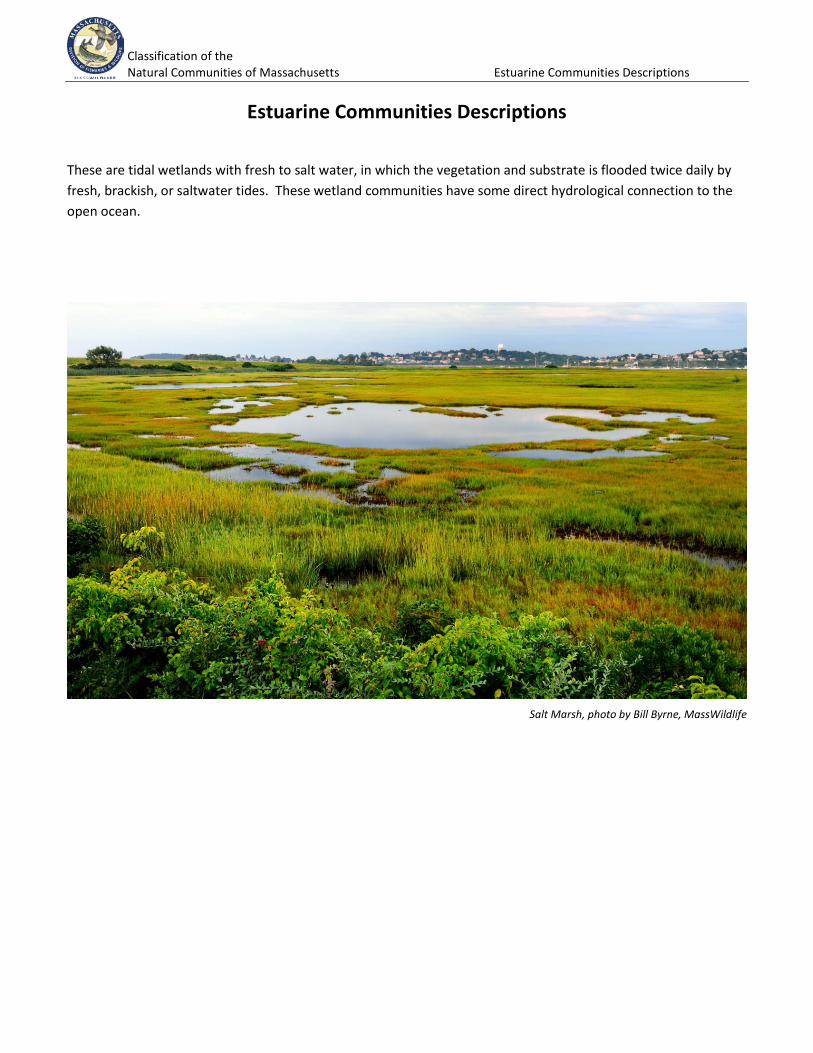
Salt Marsh, photo by Bill Byrne, MassWildlife
Classification of the Natural Communities of Massachusetts Estuarine Communities Descriptions
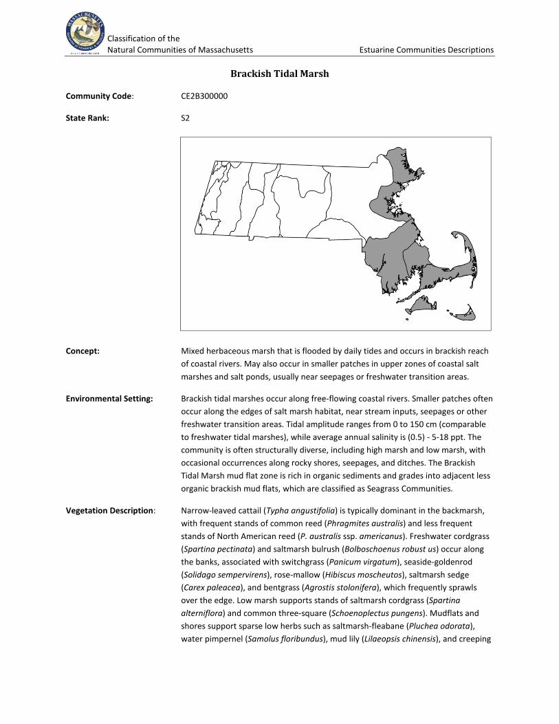
Brackish Tidal Marsh
Community Code: CE2B300000
State Rank: S2
Concept: Mixed herbaceous marsh that is flooded by daily tides and occurs in brackish reach of coastal rivers. May also occur in smaller patches in upper zones of coastal salt marshes and salt ponds, usually near seepages or freshwater transition areas.
Environmental Setting: Brackish tidal marshes occur along free-flowing coastal rivers. Smaller patches often occur along the edges of salt marsh habitat, near stream inputs, seepages or other freshwater transition areas. Tidal amplitude ranges from 0 to 150 cm (comparable to freshwater tidal marshes), while average annual salinity is (0.5) - 5-18 ppt. The community is often structurally diverse, including high marsh and low marsh, with occasional occurrences along rocky shores, seepages, and ditches. The Brackish Tidal Marsh mud flat zone is rich in organic sediments and grades into adjacent less organic brackish mud flats, which are classified as Seagrass Communities.
Vegetation Description: Narrow-leaved cattail (Typha angustifolia) is typically dominant in the backmarsh, with frequent stands of common reed (Phragmites australis) and less frequent stands of North American reed (P. australis ssp. americanus). Freshwater cordgrass (Spartina pectinata) and saltmarsh bulrush (Bolboschoenus robust us) occur along the banks, associated with switchgrass (Panicum virgatum), seaside-goldenrod (Solidago sempervirens), rose-mallow (Hibiscus moscheutos), saltmarsh sedge (Carex paleacea), and bentgrass (Agrostis stolonifera), which frequently sprawls over the edge. Low marsh supports stands of saltmarsh cordgrass (Spartina alterniflora) and common three-square (Schoenoplectus pungens). Mudflats and shores support sparse low herbs such as saltmarsh-fleabane (Pluchea odorata), water pimpernel (Samolus floribundus), mud lily (Lilaeopsis chinensis), and creeping
Classification of the Natural Communities of Massachusetts Estuarine Communities Descriptions
spearwort (Ranunculus reptans). Plants of freshwater tidal marshes occasionally occur in the higher zones of brackish marshes.
Differentiating Occurrences: Brackish Tidal Marshes occur along free-flowing coastal rivers. Smaller patches often occur along the edges of salt marsh habitat, near stream inputs, seepages or other freshwater transition areas. Brackish Tidal Marshes are geographically limited to short stretches of tidal rivers where salinity is between fresh- and salt water levels and along the upper edges of Salt Marshes where freshwater enters from uplands. Saltmarsh bulrush and salt reedgrass occur in brackish conditions. In Salt Marshes, saltmarsh hay and saltmarsh cordgrass are dense and dominate in saline conditions. Salt Marshes have less diverse vascular plants than do Brackish Tidal Marshes. Freshwater Tidal Marshes are in coastal streams; the presence of sweet flag and wild rice indicate fresh water, not brackish or salt. Freshwater Tidal Marshes lack salt-tolerant plants. Long’s bittercress, estuary arrowhead, and estuary beggar-ticks, although shared with Brackish Tidal Marshes, most commonly occur in freshwater situations. Lilaeopsis, Atlantic mudwort, water-pimpernel, Parker’s pipewort, and Eaton’s beggar-ticks grow in both Brackish and Freshwater Tidal Marshes, but are more likely in brackish marshes.
Associated Fauna: This community provides outstanding general wildlife habitat, with abundant food sources for migratory and wintering waterfowl, and is generally associated with river reaches with spawning habitat for anadromous fisheries. Amphibian and reptile diversity is lower than in freshwater tidal communities.
Public Access: West Newbury Conservation Area, West Newbury; Willow Brook Farm Preserve (Wildlands Trust), Pembroke; Stetson Meadows, Norwell; Mounces Meadow, Marshfield.
Threats: Invasive species appear to be the primary threat to this natural community. Brackish tidal marshes in several rivers are dominated by common reed (Phragmites australis). Rising sea levels.
Management Needs:
USNVC/NatureServe: Includes Schoenoplectus pungens Tidal Herbaceous Vegetation [CEGL004188]; Spartina alterniflora - Lilaeopsis chinensis Herbaceous Vegetation [CEGL004193]; Spartina cynosuroides Herbaceous Vegetation [CEGL004195]; Typha angustifolia - Hibiscus moscheutos Herbaceous Vegetation [CEGL004201]; Schoenoplectus robustus- Spartina alterniflora Herbaceous Vegetation [CEGL006416]; Spartina patens - Agrostis stolonifera Herbaceous Vegetation [CEGL006365]; Spartina patens - Festuca rubra - (Spartina pectinata) Herbaceous Vegetation [CEGL006368]; Panicum virgatum - Spartina patens - Carex silicea Herbaceous Vegetation [CEGL006150]; Eleocharis rostellata - Spartina patens Herbaceous Vegetation Spikerush Lawn Tidal Marsh [CEGL006611]; Schoenoplectus americanus - Spartina patens Herbaceous Vegetation [CEGL006612]; Phragmites australis Tidal Ruderal Herbaceous Vegetation [CEGL004187].
Classification of the Natural Communities of Massachusetts Estuarine Communities Descriptions
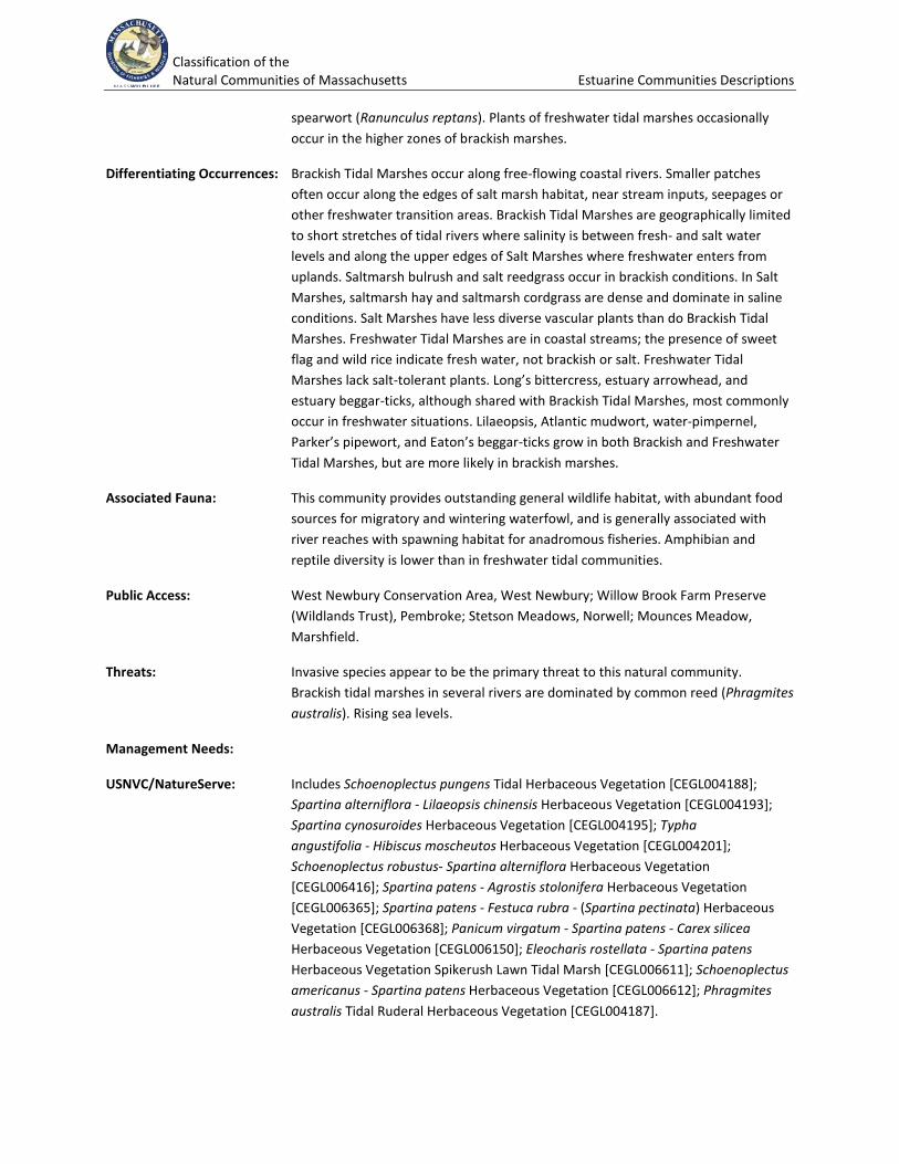
Coastal Salt Pond Community
Community Code: CE3B000000
State Rank: S2
Concept: The vegetation in and surrounding coastal saline to brackish ponds with shallow water. The inland ends tend to be fresher, with denser, taller vegetation developing.
Environmental Setting: Salt ponds are found on the south and east sides of Cape Cod, Martha's Vineyard, Nantucket, and along Buzzards Bay. The critical process causing great variability in salt ponds is the irregular or periodic creation of sandspits that separate the pond waters from direct tidal ocean influence, often for prolonged periods. Formed by drifting sand, the sandspits allow formation of brackish ponds with little tidal action. Water levels fluctuate when the ponds are closed to the ocean, with evaporation reducing water level and freshwater inflow from streams, groundwater, and rain raising water levels. Sandspits may be breached in storms or by human action, allowing water exchange with the ocean and renewed exposure to tidal and wave action. Shoreline marshes may be fresh to brackish to salt. Sea-level Fens may occur in very restricted areas along the shores.
Vegetation Description: Coastal salt pond vegetation is quite variable both spatially and temporally. Eelgrass (Zostera marina) beds are often dominant communities of subtidal mud flats. Other areas may have various macroalgae such as sea lettuce or not be vegetated. Towards the ocean, salt marsh usually occurs just above the shore. Mud or sand shores appear during dry spells that support mudflat species such as Atlantic mudwort (Limosella australis), saltpond spikerush (Eleocharis parvula), saltpond flatsedge (Cyperus filicinus), seaside crowfoot (Ranunculus cymbalaria), false pimpernel (Lindernia dubia), lesser waterwort (Elatine minima), water pygmyweed (Crassula aquatica), and saltpond pennywort (Hydrocotyle verticillata). The
Classification of the Natural Communities of Massachusetts Estuarine Communities Descriptions
vegetation of inland ends is similar to the landward, brackish portions of salt marshes, with beds of narrow-leaved cattail (Typha angustifolia), common reed (Phragmites australis), freshwater cordgrass (Spartina pectinata), switchgrass (Panicum virgatum), bulrushes (Schoenoplectus spp., particularly S. pungens), and mock bishop's-weed (Ptilimnium capillaceum). During fresh periods, extensive beds of pondweeds (Potamogeton spp.) may form.
Differentiating Occurrences: The Coastal Salt Pond Community is the only estuarine community represented by a body of water with a narrow opening to the sea, generally formed between the mainland and a barrier beach. Sites contain variable vegetation including seagrasses and the vegetation of many saline and brackish mud flats. Seagrass Communities on marine and estuarine subtidal and intertidal flats have some similar species but are in open, shallow, saline or brackish water.
Associated Fauna: Within the salt pond, fishes are those typically found in estuaries. Eel (Anguilla rostrata), alewife (Alosa pseudoharengus), and white perch (Bairdiella chrysura) are typical fish species. Bird species would be typical of estuaries and near shore areas. A large number of small to large invertebrates live in or on the sediments. Their distribution is influenced by sediment composition and oxygen levels. Some, such as clams, oysters, and other bivalves, filter water for nutrients. Other species such as segmented worms, amphipods, shrimp, clams, and snails extract organic matter from sediments and churn the sediments as they feed, making material available to other organisms. Eastern oysters (Crassostrea virginica) extract material from the water column. In some cases, oysters or mussels (including blue mussels (Mytilus edulis)), having attached to the substrate, may attach to one another, forming oyster or mussel beds. Many nematodes, sponges, mollusks and barnacles hold on to submerged plants, such as eelgrass or macroalgae.
Public Access: Sesachacha Pond, Nantucket; Allen's Pond, Dartmouth; Tisbury Great Pond and coves off of it, West Tisbury; Salt Pond, Falmouth.
Threats: Artificially maintaining ponds open or closed. The increasingly invasive Mute Swan (Cygnus olor) is becoming more abundant and displacing native species. Eutrophication and other forms of coastal pollution, dock and pier construction. Nutrient input and changes in water flow from development along shore lines. Phragmites is a major problem.
Management Needs: Changes in the flow of freshwater can alter the salinity of these systems: below impoundments and areas of water withdrawal, salt tides extend further upstream, affecting species composition and abundance, particularly during drought periods when river flows are low.
USNVC/NatureServe: Includes parts of: Zostera marina Permanently Flooded - Tidal Herbaceous Alliance --Zostera marina Atlantic Herbaceous Vegetation [CEGL004336]; Includes part of Spartina patens High Tidal Marsh Alliance -Schoenoplectus pungens - Eleocharis parvula Herbaceous Vegetation [CEGL006398].
Classification of the Natural Communities of Massachusetts Estuarine Communities Descriptions
Fresh/Brackish Tidal Shrubland
Community Code: CE2C000000
State Rank: S1
Concept: Dense to open shrubland flooded by daily tides, occurring along the freshwater to brackish reach of coastal rivers and along the upland edges of salt marshes.
Environmental Setting: Normally located as a transition between Freshwater Tidal Marsh and Fresh/Brackish Tidal Swamp, there may also be patches of tidal shrublands throughout the Freshwater Tidal Marshes. Additional brackish occurrences are along the upland fringes of Salt Marshes. There is a great deal of micro-relief (tussocks and furrows) leading to high species diversity. Floodwaters are typically slightly acid (pH less than 5) and soils are usually mineral without significant peat deposits. Average annual salinity values of less than 0.5 ppt would be expected in Fresh/Brackish Tidal Shrublands, and (0.5) -5 -18 ppt in Fresh/Brackish Tidal Swamps.
Vegetation Description: Tidal freshwater or slightly brackish shrublands dominated by sweet gale (Myrica gale) and smooth alder (Alnus serrulata) with some speckled alder (Alnus incana ssp. rugosa). Some examples may have a mixed canopy with other shrubs such as silky dogwood (Swida amomum), swamp-rose (Rosa palustris), winterberry (Ilex verticillata), common elderberry (Sambucus nigra ssp. canadensis), willow (Salix spp.), buttonbush (Cephalanthus occidentalis), and poison ivy (Toxicodendron radicans). More northern examples may contain northern arrow-wood (Viburnum dentatum var. lucidum) and meadowsweet (Spiraea alba var. latifolia). Tussock-sedge (Carex stricta) may also be present. Some herbaceous associates are royal fern (Osmunda regalis var. spectabilis), marsh-fern (Thelypteris palustris var. pubescens), bedstraws (Galium spp.), common cattail (Typha latifolia), arrow-arum (Peltandra virginica), New York aster (Symphyotrichum novi-belgii), false nettle
Classification of the Natural Communities of Massachusetts Estuarine Communities Descriptions
(Boehmeria cylindrica), touch-me-not (Impatiens capensis), and swamp milkweed (Asclepias incarnata).
Differentiating Occurrences: Tidal swamps are forested, dominated by trees. Tidal shrublands have less than 25% tree canopy. The key difference from other types of Shrub Swamp is that Fresh/Brackish Tidal Shrublands are restricted to the area of freshwater/ brackish water tidal action on coastal rivers, or where there is freshwater seepage along the edges of salt marshes just above the zone of regular saltwater incursion. An additional difference is the presence of salt marsh plants mixed with the more usual freshwater species. Maritime Shrublands are upland communities. Shrubby areas within and at the upland edges of Salt Marshes would be mappable as Fresh/Brackish Tidal Shrubland if large enough; otherwise, they are considered to be part of the expected variation of Salt Marshes.
Associated Fauna: Because the size and structure of the shrubland present are more important to most animals that would use such a habitat than are the slight fluctuations in water levels on a daily basis, the species present are often those of maritime and coastal shrublands. Coastal shrublands are particularly important to migrating flocks of songbirds.
Public Access: There are no examples on public land in the NHESP database.
Threats: Disruption of tidal influence on the rivers, clearing for boat landings. Invasion by expanding populations of the non-native Phragmites australis.
Management Needs:
USNVC/NatureServe: Alnus (incana, serrulata) Tidal Shrubland Alliance -- Alnus (incana ssp. rugosa, serrulata) - Cornus amomum Shrubland [CEGL006337]; Baccharis halimifolia - Iva frutescens Tidal Shrubland Alliance: Baccharis halimifolia - Iva frutescens/Panicum virgatum [CEGL003921]; Iva frutescens/Spartina patens Shrubland [CEGL006848].
Classification of the Natural Communities of Massachusetts Estuarine Communities Descriptions
Fresh/Brackish Tidal Swamp
Community Code: CE1A000000
State Rank: S1
Concept: Low-stature forested wetland located along coastal rivers, at the upper limit of tidal influence, and flooded by daily tides. Dense shrub understory and unusually rich herbaceous layer.
Environmental Setting: Tidal swamps occur along free-flowing coastal rivers, occurring upstream of Freshwater Tidal Marshes, within the upper limits of tidal influence. The community represents an ecotone from tidal marsh to more typical non-tidal forested wetlands. Another variation of this community occurs along smaller streams at the upper limit of tidal influence. Tidal amplitude may range from 0 to 40 cm or more (estimated), and average annual salinity is less than 0.5 ppt in freshwater areas, with gradients to 5 ppt. Brackish occurrences (average annual salinity (0.5) 5 - 18 ppt) may also occur.
Vegetation Description: Red maple (Acer rubrum), swamp white oak (Quercus bicolor), Atlantic white cedar (Chamaecyparis thyoides), and occasionally green ash (Fraxinus pennsylvanica) and/or American elm (Ulmus americana) occur on elevated hummocks and form an open forest canopy. The shrub layer is often very dense, and typically includes northern arrow-wood (Viburnum dentatum var. lucidum), winterberry holly (Ilex verticillata), hornbeam (Carpinus caroliniana), and silky dogwood (Swida amomum). Common greenbrier (Smilax rotundifolia), poison ivy (Toxicodendron radicans), and grapes (Vitis sp.) weave through the shrub layer. Large mucky hollows flooded by daily tides support a diverse assemblage of herbs and graminoids. Most of these are typical of the nearby freshwater tidal marsh habitat, and include jewelweed (Impatiens capensis), sensitive fern (Onoclea sensibilis) and wild rice (Zizania aquatica).
Classification of the Natural Communities of Massachusetts Estuarine Communities Descriptions
Differentiating Occurrences: The key difference from other types of forested wetlands, particularly Red Maple Swamp, Alluvial Red Maple Swamp, and Alluvial Atlantic White Cedar Swamp, is that Fresh/Brackish Tidal Swamps are restricted to the area of freshwater tidal action on coastal rivers, above the zone of regular saltwater incursion. Being associated with freshwater and brackish tidal marshes, the presence of species from those communities in the openings between trees would be indicative of freshwater tidal conditions; however, the best indicators, estuary beggar-ticks and Eaton's beggar-ticks, are very uncommon. Tidal swamps are forested, dominated by trees, which differentiates them from tidal shrublands, which are dominated by shrubs (<5m, generally multi-stemmed), with <25% trees in the canopy.
Associated Fauna: The size of the swamp and structure produced by the forest and shrubs present are more important to most animals that would use a tidal swamp than are the slight daily fluctuations in water levels from the tides. Fresh/Brackish Tidal Swamps and Shrublands provide habitat for nesting Gray Catbird (Dumetella carolinensis), Common Yellowthroat (Geothlypis trichas), Swamp Sparrow (Melospiza georgiana), Wood Duck (Aix sponsa), Marsh Wren (Cistothorus palustris), and Veery (Catharus fuscescens). The habitat is also used as roosting areas by resident Great Blue Heron (Ardea herodias), Green Heron (Butorides striatus ), Red-tailed Hawk (Buteo jamaicensis ), and other raptors.
Public Access: Willow Brook Farm Preserve (Wildlands Trust), Pembroke.
Threats: Alteration of river hydrology from excessive water withdrawal may have significant effect on plant communities. Exotic shrubs including honeysuckles can become dense.
Management Needs: Determine hydrologic requirements, and develop system for monitoring hydrologic stress. Investigate occurrences along small streams and in brackish wetlands.
USNVC/NatureServe: Acer rubrum - Fraxinus pennsylvanica Tidal Woodland Alliance -- Acer rubrum - Fraxinus pennsylvanica/Polygonum spp. Woodland [CEGL006165].
Classification of the Natural Communities of Massachusetts Estuarine Communities Descriptions
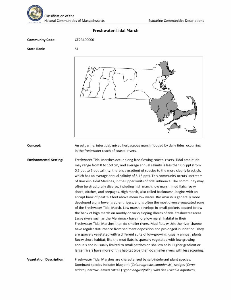
Freshwater Tidal Marsh
Community Code: CE2B400000
State Rank: S1
Concept: An estuarine, intertidal, mixed herbaceous marsh flooded by daily tides, occurring in the freshwater reach of coastal rivers.
Environmental Setting: Freshwater Tidal Marshes occur along free-flowing coastal rivers. Tidal amplitude may range from 0 to 150 cm, and average annual salinity is less than 0.5 ppt (from 0.5 ppt to 5 ppt salinity; there is a gradient of species to the more clearly brackish, which has an average annual salinity of 5-18 ppt). This community occurs upstream of Brackish Tidal Marshes, in the upper limits of tidal influence. The community may often be structurally diverse, including high marsh, low marsh, mud flats, rocky shore, ditches, and seepages. High marsh, also called backmarsh, begins with an abrupt bank of peat 1-3 feet above mean low water. Backmarsh is generally more developed along lower gradient rivers, and is often the most diverse vegetated zone of the Freshwater Tidal Marsh. Low marsh develops in small pockets located below the bank of high marsh on muddy or rocky sloping shores of tidal freshwater areas. Large rivers such as the Merrimack have more low marsh habitat in their Freshwater Tidal Marshes than do smaller rivers. Mud flats within the river channel have regular disturbance from sediment deposition and prolonged inundation. They are sparsely vegetated with a different suite of low-growing, usually annual, plants. Rocky shore habitat, like the mud flats, is sparsely vegetated with low growing annuals and is usually limited to small patches on shallow soils. Higher gradient or larger rivers have more of this habitat type than do smaller rivers with less scouring.
Vegetation Description: Freshwater Tidal Marshes are characterized by salt-intolerant plant species. Dominant species include: bluejoint (Calamagrostis canadensis), sedges (Carex stricta), narrow-leaved cattail (Typha angustifolia), wild rice (Zizania aquatica),
Classification of the Natural Communities of Massachusetts Estuarine Communities Descriptions
smartweeds and tearthumbs (Persicaria punctata, P. arifolia), false pimpernel (Lindernia dubia), jewelweed (Impatiens capensis), climbing hempweed (Mikania scandens), and sweet flag (Acorus calamus). Shrubs such as buttonbush (Cephalanthus occidentalis) and silky dogwood (Swida amomum) may occasionally be present on the upper edges of the backmarsh. Low marsh typically supports stand-forming emergent plants, often with tough mat-forming rhizomes that resist erosion, although some annuals may also dominate large sections of marsh. Large stands of wild rice (Zizania aquatica) usually dominate the muddy areas; however, stands of sweet flag (Acorus calamus), soft-stem bulrush (Schoenoplectus tabernaemontani), grass-leaf arrowhead (Sagittaria graminea), pickerel-weed (Pontederia cordata), and water dock (Rumex orbiculatus) frequently occur in freshwater tidal low marshes. Freshwater cord-grass (Spartina pectinata), three-square (Scirpus pungens), and water hemp (Amaranthus cannabinus) are typical of rockier substrates. Typical species of the more sparsely vegetated mud flats include spike sedges (Eleocharis spp.), water purslane (Ludwigia palustris), water starwort (Callitriche palustris), and bittercresses (Cardamine spp.). Rocky shore habitat supports creeping spearwort (Ranunculus flammula var. reptans) and estuary beggar-ticks (Bidens hyperborea), which although shared with brackish tidal marshes, most commonly occur in the freshwater situation.
Differentiating Occurrences: Freshwater Tidal Marshes represent the upstream end of a gradient, ranging from coastal Salt Marsh to Brackish Tidal Marsh to Freshwater Tidal Marsh. Wet Meadows are in wetlands unaffected by tides. Freshwater Tidal Marshes are characterized by salt-intolerant plant species, although some species of Brackish Tidal Marshes also occur in freshwater tidal conditions. Salt Marsh plants such as saltmarsh hay (Spartina patens), saltmarsh cordgrass (S. alterniflora), and saltmarsh bulrush (Bolboschoenus robustus) are not present. Long’s bittercress (C. longii), along with estuary arrowhead (Sagittaria montevidensis ssp. spongiosa) and estuary beggar-ticks (Bidens hyperborea), although shared with Brackish Tidal Marshes, most commonly occur in the freshwater situation. Some other species that co-occur in Freshwater and Brackish Tidal Marshes are more likely to be found in the brackish to salt condition: lilaeopsis or eastern grasswort (Lilaeopsis chinensis), Atlantic mudwort (Limosella australis), water-pimpernel (Samolus valerandi), Parker’s pipewort (Eriocaulon parkeri), and Eaton’s beggar-ticks (Bidens eatonii).
Associated Fauna: This community provides outstanding general wildlife habitat, with abundant food sources for migratory and wintering waterfowl, and is generally associated with river reaches with spawning habitat for anadromous fisheries such as shad or herring (Alosa spp.). It tends to have more vertebrate species than do the Brackish Tidal Marshes, including freshwater snakes and muskrats. Freshwater Tidal Marshes provide habitat for nesting marsh birds. Wild rice is a very important food source for migrating Sora (Porzana carolina) and other rails. Freshwater mussels are locally abundant along the tidal channel. Associated rare animals include the New England siltsnail (Floridobia winkleyi) and the coastal marsh snail (Littoridinops tenuipes), which are both known to occur in drainage ditches and seepages in Freshwater and Brackish Tidal Marshes.
Classification of the Natural Communities of Massachusetts Estuarine Communities Descriptions
Public Access: West Newbury Conservation Area, West Newbury; Willow Brook Farm Preserve (Wildlands Trust), Pembroke; Stetson Meadows, Norwell; Mounces Meadow, Marshfield.
Threats: Rising sea level may change the occurrences to brackish or salt marsh. Water withdrawal upstream may reduce freshwater flow and allow saltwater further upstream. Development associated with recreational activity (docks, landings) may threaten tidal shore habitat. Invasive species may displace native species or change habitat structure. Invasive plants, including common reed (Phragmites australis), purple loosestrife (Lythrum salicaria), and yellow flag (Iris pseudacorus), are established in some systems, although long-term threat is unknown.
Management Needs: Monitor invasive plant populations. Prevent alteration of tidal shores. Maintain stream flow and allow tidal flow. Freshwater Tidal Marshes are geographically limited to short, upstream stretches of tidal rivers in coastal areas; in the past, dams were often placed in rivers below the upper reaches of the tidal influence and so reduced the areas with tidal influence. Historic filling and channelization also reduced the shoreline occurrences of tidal marshes. The recent trend of dam removals allows for natural and assisted restoration of freshwater tidal habitat. Alteration of river hydrology from excessive water withdrawal may have significant effects on plant communities; the extent of tidal influence and the upstream range of the salt front depend in part on the amount of water flowing downstream. Other management often needed in Freshwater Tidal Marshes is control of invasive species.
USNVC/NatureServe: A1485 Zizania aquatica - Zizaniopsis miliacea Tidal Freshwater Marsh Alliance -- Zizania aquatica Tidal Herbaceous Vegetation [CEGL004202]. A1708 Nuphar advena - Nuphar sagittifolia Tidal Freshwater Marsh Alliance -- Nuphar lutea ssp. advena Tidal Herbaceous Vegetation [CEGL004472]; A3579 Isoetes riparia - Eriocaulon parkeri Intertidal Freshwater Marsh Alliance -- Isoetes riparia Tidal Herbaceous Vegetation [CEGL006058]; and Eriocaulon parkeri - Polygonum punctatum Herbaceous Vegetation [CEGL006352]; A3581 Stuckenia pectinata - Zannichellia palustris - Ceratophyllum demersum Freshwater Subtidal Herbaceous Alliance -- Stuckenia pectinata - Potamogeton perfoliatus- (Zannichellia palustris) Tidal Herbaceous Vegetation [CEGL006027]; A3664 Schoenoplectus acutus - Schoenoplectus fluviatilis- Schoenoplectus tabernaemontani Deep Marsh Herbaceous Alliance - Schoenoplectus fluviatilis Herbaceous Vegetation [CEGL006366]; A4017 Peltandra virginica - Pontederia cordata - Sagittaria spp. Oligohaline Tidal Marsh Alliance -- Sagittaria subulata - Limosella australis Tidal Herbaceous Vegetation [CEGL004473;] Peltandra virginica - Pontederia cordata Tidal Herbaceous Vegetation [CEGL004706]; Impatiens capensis - Peltandra virginica - Polygonum arifolium - Schoenoplectus fluviatilis- Typha angustifolia Tidal Herbaceous Vegetation; Amaranthus cannabinus Tidal Herbaceous Vegetation [CEGL006080]; Impatiens capensis - Peltandra virginica - Polygonum arifolium - Schoenoplectus fluviatilis- Typha angustifolia Tidal Herbaceous Vegetation [CEGL006325]; Acorus calamus Tidal Herbaceous Vegetation [CEGL006833].

Classification of the Natural Communities of Massachusetts Estuarine Communities Descriptions
Classification of the Natural Communities of Massachusetts Estuarine Communities Descriptions
Marine Intertidal Gravel/Sand Beach Community
Community Code: CM2B000000
State Rank: S4
Map: No Marine Intertidal Gravel/Sand Beach Communities are documented in the NHESP database.
Concept: Invertebrates and nonvascular plants dominate this highly stressed community in the intertidal (wave action) zone of beaches.
Environmental Setting: Marine beaches are exposed between high tides: they occur below the wrack line and above permanent water, and are often interspersed with low areas that contain intertidal pools. These are high-energy habitats. Marine beaches are between Maritime Beach Strand Communities above the high tide line and marine subtidal communities below the low tide line.
Vegetation Description: Sparse non-vascular plants. Invertebrates are the most abundant resident group, with shorebirds among the most visible animals in the habitat.
Differentiating Occurrences: Marine Intertidal Gravel/Sand Beach Communities are below the wrack line and submerged twice daily by tides. Any vegetation in the Marine Intertidal Gravel/Sand Beach Community is non-vascular. Maritime Beach Strand Communities are above the daily high tides, between the wrack line and the dunes, and support scattered vascular plants. Seagrass Communities tend to be subtidal communities, occurring below the low tide line.
Associated Fauna: Many shorebirds such as Sanderlings (Calidris alba), Least Sandpipers (C. minutilla), Semipalmated Sandpipers (C. pusilla), Semipalmated Plover (Charadrius semipalmatus) and Red Knot (Calidris canutus) forage along shorelines during migrations. When exposed, the sites are part of important resting areas for shorebirds. Piping Plovers (Charadrius melodus) nest on the beach strand and forage in the wrack line. Gulls (Larus spp.) are ubiquitous in all shore and shallow water environments. Tiger beetles also forage on exposed portions of the intertidal beach. Few mammals use this portion of the beach for more than passing through. Horseshoe crabs spawn in intertidal beaches.
Public Access: Cape Cod National Seashore; Monomoy National Wildlife Refuge, Orleans and Chatham; Horseneck Beach State Reservation, Westport; Parker River National Wildlife Refuge, Newbury; Boston Harbor Islands, Boston area.
Threats: Disturbance of foraging and resting birds by domestic animals and people, off-road vehicles, and recreational boaters.
Management Needs:
USNVC/NatureServe: Sand, non-vegetated.
Classification of the Natural Communities of Massachusetts Estuarine Communities Descriptions
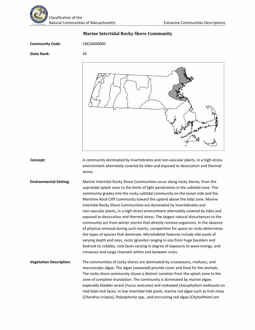
Marine Intertidal Rocky Shore Community
Community Code: CM2A000000
State Rank: S4
Concept: A community dominated by invertebrates and non-vascular plants, in a high-stress environment alternately covered by tides and exposed to desiccation and thermal stress.
Environmental Setting: Marine Intertidal Rocky Shore Communities occur along rocky shores, from the supratidal splash zone to the limits of light penetration in the subtidal zone. This community grades into the rocky subtidal community on the ocean side and the Maritime Rock Cliff Community toward the upland above the tidal zone. Marine Intertidal Rocky Shore Communities are dominated by invertebrates and non-vascular plants, in a high-stress environment alternately covered by tides and exposed to desiccation and thermal stress. The largest natural disturbances to the community are from winter storms that directly remove organisms. In the absence of physical removal during such events, competition for space on rocks determines the types of species that dominate. Microhabitat features include tide pools of varying depth and sizes, rocks (granite) ranging in size from huge boulders and bedrock to cobbles, rock faces varying in degree of exposure to wave energy, and crevasses and surge channels within and between rocks.
Vegetation Description: The communities of rocky shores are dominated by crustaceans, molluscs, and macroscopic algae. The algae (seaweed) provide cover and food for the animals. The rocky shore community shows a distinct zonation from the splash zone to the zone of complete inundation. The community is dominated by marine algae, especially bladder wrack (Fucus vesiculos) and rockweed (Ascophyllum nodosum) on mid-tidal rock faces. In low intertidal tide pools, marine red algae such as Irish moss (Chondrus crispus), Polysiphonia spp., and encrusting red algae (Chytolithion) are
Classification of the Natural Communities of Massachusetts Estuarine Communities Descriptions
common. Common green algae include sea-lettuce (Ulva lactuca), which is common throughout.
Differentiating Occurrences: This is the only marine rock community covered in saltwater twice daily and fully exposed to the waves. Marine Intertidal Gravel/Sand Beach Communities have smaller substrates, but may share some of the species, are also inundated by twice daily tides, and receive the full force of waves.
Associated Fauna: This was probably the habitat of the extinct sea mink (Mustela vison macrodon). Wintering sea birds such as Harlequin Duck (Histrionicus histrionicus) and Great Cormorants (Phalacrocorax carbo) feed among submerged rocks close to shore. Wintering Purple Sandpipers (Calidris maritima) forage among exposed rocks in low tide. This is a foraging area for marine fish such as striped bass (Morone saxatilis) during high tide. Rocky shores provide habitat, including tidal pools, for many marine invertebrates that are important to community structure, including blue mussels (Mytilus edulis - a competitive dominant for space); several species of herbivorous gastropods, especially periwinkle snails (Littorina littorea, an exotic marine species); a predatory snail, dog whelk, (Nucella lapillus); and sea stars (Asterias forbesi and A. vulgaris).
Public Access: Halibut Point State Park, Rockport; East Point/Lodge Park, Nahant. The Marine Intertidal Rocky Shore Community occurs where bedrock is at the surface, particularly from Cape Ann south to Marshfield. There are scattered occurrences along Buzzards Bay and the Elizabeth Islands.
Threats: Invasive species.
Management Needs:
USNVC/NatureServe: Tidal temperate or subpolar alga vegetation: A4133 North Atlantic Tidal Rocky Shoreline Alliance; Ascophyllum nodosum - Fucus vesiculosus Tidal Algal Nonvascular Vegetation (CEGL006341); Laminaria agardhii Tidal Algal Nonvascular Vegetation (CEGL006344).
Classification of the Natural Communities of Massachusetts Estuarine Communities Descriptions
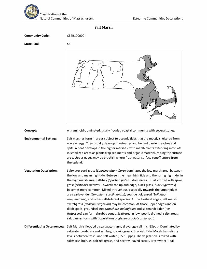
Salt Marsh
Community Code: CE2B100000
State Rank: S3
Concept: A graminoid-dominated, tidally flooded coastal community with several zones.
Environmental Setting: Salt marshes form in areas subject to oceanic tides that are mostly sheltered from wave energy. They usually develop in estuaries and behind barrier beaches and spits. A peat develops in the higher marshes, with marsh plants extending into flats in stabilized areas as plants trap sediments and organic material, raising the surface area. Upper edges may be brackish where freshwater surface runoff enters from the upland.
Vegetation Description: Saltwater cord-grass (Spartina alterniflora) dominates the low marsh area, between the low and mean high tide. Between the mean high tide and the spring high tide, in the high marsh area, salt-hay (Spartina patens) dominates, usually mixed with spike grass (Distichlis spicata). Towards the upland edge, black grass (Juncus gerardii) becomes more common. Mixed throughout, especially towards the upper edges, are sea-lavender (Limonium carolinianum), seaside goldenrod (Solidago sempervirens), and other salt-tolerant species. At the freshest edges, salt marsh switchgrass (Panicum virgatum) may be common. At those upper edges and on ditch spoils, groundsel-tree (Baccharis halimifolia) and saltmarsh elder (Iva frutescens) can form shrubby zones. Scattered in low, poorly drained, salty areas, salt pannes form with populations of glasswort (Salicornia spp.).
Differentiating Occurrences: Salt Marsh is flooded by saltwater (annual average salinity >18ppt). Dominated by saltwater cordgrass and salt hay, it looks grassy. Brackish Tidal Marsh has salinity levels between fresh- and salt water (0.5-18 ppt,). The vegetation is mixed with saltmarsh bulrush, salt reedgrass, and narrow-leaved cattail. Freshwater Tidal
Classification of the Natural Communities of Massachusetts Estuarine Communities Descriptions
Marsh lacks saltwater cordgrass and salt hay, and has sweet flag, wild rice, climbing hempweed, and other broad-leaved herbaceous plants. It is flooded by freshwater (salinity <0.5 ppt).
Associated Fauna: Many species of birds forage in salt marshes. A few, such as Seaside Sparrow (Ammodramus maritimus) and the Saltmarsh Sharptailed Sparrow (A. caudacutus), nest there as well. In fall and winter, Short-eared Owls (Asio flammeus), Snowy Owls (Nyctea scandiaca), and Northern Harrier (Circus cyaneus) hunt in salt marshes. In summer, Snowy Egrets (Egretta thula), American Black Ducks (Anas rubripes), and a number of shorebirds forage in pools at low tide. Few mammals are resident in salt marshes, but meadow voles (Microtus pensylvanicus) use them, retreating to dryer areas during high tides. Fiddler crabs (Uca spp.) are identified with saltmarsh creeks on Cape Cod and to the south. Native sesarma crabs (Sesarma reticulatum), which graze on cordgrass, appear to be increasing, and possibly expanding northward into saltmarshes in the Gulf of Maine.
Public Access: Parker River National Wildlife Refuge, Newbury; Salisbury Marsh, Salisbury; Great Marshes, Barnstable; Nauset Marsh, Eastham; Great Sippewissett Marsh, Falmouth.
Threats: Invasive species, coastal erosion, sea-level rise, coastal development, tidal restrictions, stormwater flows and land source impacts, filling, dredging, and ditching.
Management Needs:
USNVC/NatureServe: Salt Marsh System, includes: Spartina alterniflora Tidal Herbaceous Alliance -- Spartina alterniflora/(Ascophyllum nodosum) Acadian, Virginian Zone Herbaceous Vegetation [CEGL004192]; Spartina patens - (Distichlis spicata) Tidal Herbaceous Alliance -- Spartina patens - Distichlis spicata - Plantago maritima Herbaceous Vegetation [CEGL006006] and Spartina patens - Agrostis stolonifera Herbaceous Vegetation [CEGL006365]; Panicum virgatum Tidal Herbaceous Alliance -- Panicum virgatum Tidal Herbaceous Vegetation [Provisional] [CEGL006150]; Baccharis halimifolia - Iva frutescens Tidal shrubland Alliance - Baccharis halimifolia - Iva frutescens/Panicum virgatum Shrubland [CEGL006063]; Sarcocornia perennis- (Distichlis spicata, Salicornia spp.) Tidal Herbaceous Alliance - Sarcocornia perennis - Salicornia spp. - Spartina alterniflora Herbaceous Vegetation [CEGL004308].
Classification of the Natural Communities of Massachusetts Estuarine Communities Descriptions
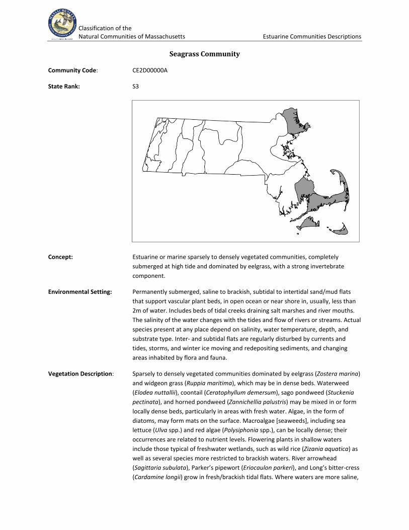
Seagrass Community
Community Code: CE2D00000A
State Rank: S3
Concept: Estuarine or marine sparsely to densely vegetated communities, completely submerged at high tide and dominated by eelgrass, with a strong invertebrate component.
Environmental Setting: Permanently submerged, saline to brackish, subtidal to intertidal sand/mud flats that support vascular plant beds, in open ocean or near shore in, usually, less than 2m of water. Includes beds of tidal creeks draining salt marshes and river mouths. The salinity of the water changes with the tides and flow of rivers or streams. Actual species present at any place depend on salinity, water temperature, depth, and substrate type. Inter- and subtidal flats are regularly disturbed by currents and tides, storms, and winter ice moving and redepositing sediments, and changing areas inhabited by flora and fauna.
Vegetation Description: Sparsely to densely vegetated communities dominated by eelgrass (Zostera marina) and widgeon grass (Ruppia maritima), which may be in dense beds. Waterweed (Elodea nuttallii), coontail (Ceratophyllum demersum), sago pondweed (Stuckenia pectinata), and horned pondweed (Zannichellia palustris) may be mixed in or form locally dense beds, particularly in areas with fresh water. Algae, in the form of diatoms, may form mats on the surface. Macroalgae [seaweeds], including sea lettuce (Ulva spp.) and red algae (Polysiphonia spp.), can be locally dense; their occurrences are related to nutrient levels. Flowering plants in shallow waters include those typical of freshwater wetlands, such as wild rice (Zizania aquatica) as well as several species more restricted to brackish waters. River arrowhead (Sagittaria subulata), Parker’s pipewort (Eriocaulon parkeri), and Long’s bitter-cress (Cardamine longii) grow in fresh/brackish tidal flats. Where waters are more saline,
Classification of the Natural Communities of Massachusetts Estuarine Communities Descriptions
species such as quillwort (Isoetes riparia) and saltpond spike-rush (Eleocharis parvula) become more common. Invertebrates vary with substrate and depth, and may control the vegetation.
Differentiating Occurrences: All seagrass beds are included in this community type. Estuarine and marine sand/mud flats often support eelgrass beds. Submerged rocky habitats are often dominated by kelp and other algae. Occurrences in Coastal Salt Ponds are included with that community type. Inter- and sub-tidal flats occur all along the Atlantic coast and have many variants. A national classification of marine and estuarine communities is in the early stages of development.
Associated Fauna: Submerged vegetation provides winter feeding sites for waterfowl, including Brant (Branta bernicla), American Black Duck (Anas rubripes), and sea birds. Vascular plant beds are key nursery habitat for larval and juvenile fishes; the plants also provide surfaces for attachment of invertebrates including shellfish. Fish such as alewife (Alosa pseudoharengus), American shad (Alosa sapidissima), and striped bass (Morone saxitilis) are characteristic of estuarine subtidal habitats which also provide habitat for horseshoe crabs (Limulus polyphemus). Marine subtidal flats are spawning areas for winter flounder (Pseudopleuronectes americanus) and other fish.
Public Access: Billingsgate Shoals Wildlife Sanctuary, Wellfleet; Joppa Flats, Newbury.
Threats: Coastal pollution. Overfishing, benthic alteration by fishing gear, coastal pollution, dock and pier construction, and dredging all change and degrade the character of seagrass beds.
Management Needs:
USNVC/NatureServe: NatureServe system: CES203.246 Northern Atlantic Coastal Plain Seagrass Bed Membership: Ruppia maritima Acadian/Virginian Zone Temperate Herbaceous Vegetation (CEGL006167, GNR); Zostera marina Herbaceous Vegetation (CEGL004336, G4G5). Or NVC Group 383 Widgeongrass; Ruppia maritima Permanently Flooded - Tidal Temperate Herbaceous Alliance.