d eepwater h orizon i ncident & n ational w eather s ervice d ecision s upport s ervices wfo new...
Post on 19-Dec-2015
218 views
TRANSCRIPT
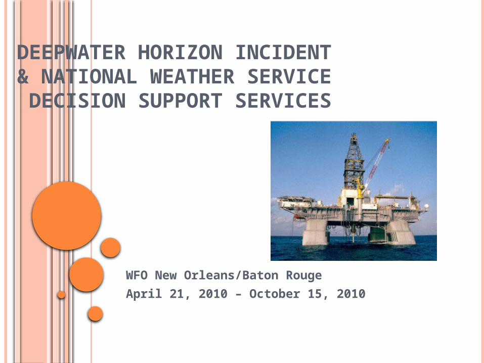
DEEPWATER HORIZON INCIDENT& NATIONAL WEATHER SERVICE DECISION SUPPORT SERVICES
WFO New Orleans/Baton Rouge
April 21, 2010 – October 15, 2010
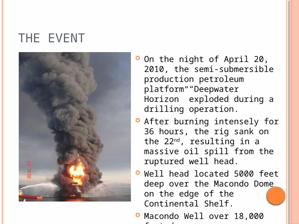
THE EVENT On the night of April 20, 2010,
the semi-submersible production petroleum platform “Deepwater Horizon” exploded during a drilling operation.
After burning intensely for 36 hours, the rig sank on the 22nd, resulting in a massive oil spill from the ruptured well head.
Well head located 5000 feet deep over the Macondo Dome on the edge of the Continental Shelf.
Macondo Well over 18,000 feet deep.

WFO NEW ORLEANS/BATON ROUGE (LIX) ENGAGEMENT
The office received a call from the U.S. Coast Guard, notifying us of the incident shortly after the initial explosion.
USCG requested a detailed weather forecast for the location – Mississippi Canyon 252 oil lease area, Lat 28.74N and Lon 88.44W.
The NOAA Office of Response and Restoration (OR&R) requested the initial spot forecast on April 21st.
The Spot Forecast would be produced twice a day for much of the entire incident response.
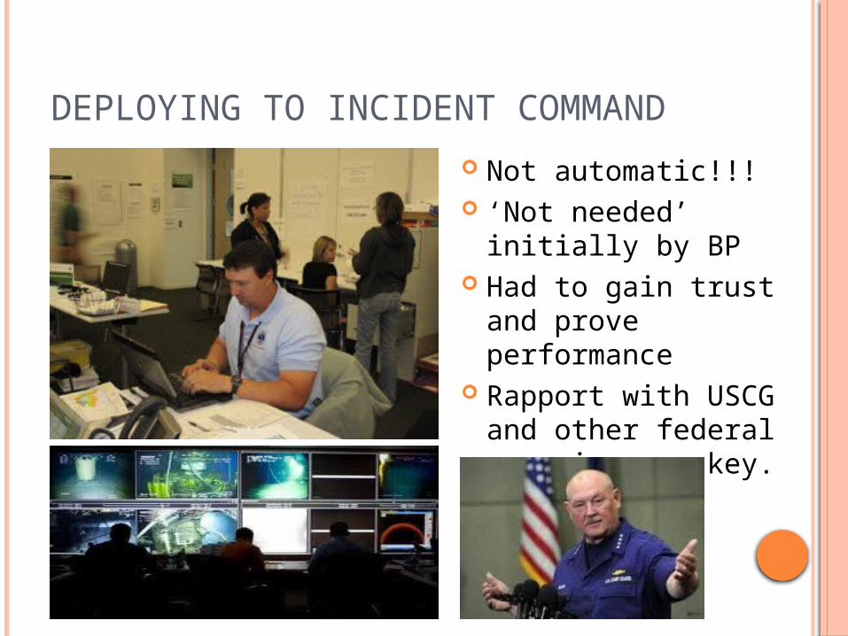
DEPLOYING TO INCIDENT COMMAND
Not automatic!!! ‘Not needed’
initially by BP Had to gain trust
and prove performance
Rapport with USCG and other federal agencies was key.
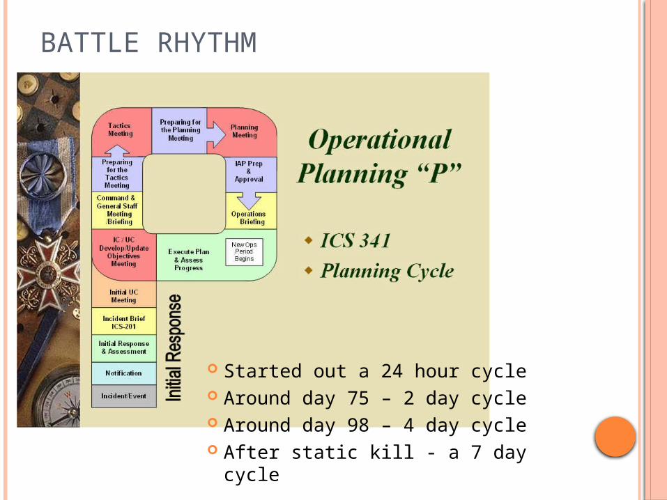
BATTLE RHYTHM
Started out a 24 hour cycle Around day 75 – 2 day cycle Around day 98 – 4 day cycle After static kill - a 7 day cycle

ORGANIZATIONAL CHART (AN EXAMPLE)
NWS and NOAA

MULTIPLE ASPECTS OF FORECASTING Aviation
Low level dispersion flights 2nd level spotter flights Mid-level reconnaissance flights Terminal forecasts for non-TAF locations
Hancock County-Stennis Airport (MS) Terrebonne-Houma Regional Airport (LA)
Marine Near shore in protected and unprotected waters Offshore spill location (62nm from mouth of the MS River) Wave steepness, swells, period, source regions
Fire Weather In-situ burning of oil on water (able to smell at WFO)
Heat Stress Oil clean-up in Tyvek protective covering during summer Outsider assistance not accustomed to Gulf humidity

MULTI-LAYERED AVIATION
Over flights Reconnaissance Dispersant Flights
Use of tstm outflow boundaries
VIP over flights Animal/Wildlife
search and rescue
DECISION SUPPORT MODIFICATIONS
Emergency TAFs for staging airfields Terrebonne-Houma Regional Airport, Houma, LA
Incident Command Center location Overflight and surveillance flight operations
Hancock County – Stennis Airport, Stennis, MS Military dispersant flight staging Government VIP staging
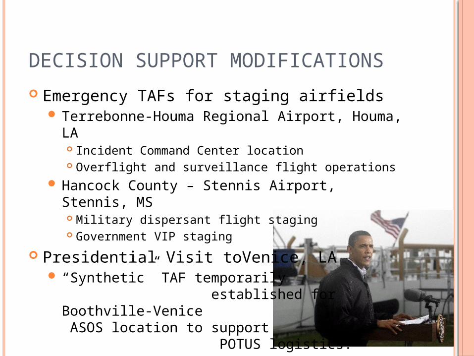
Presidential Visit toVenice, LA “Synthetic” TAF temporarily
established for Boothville-Venice ASOS location to support POTUS logistics.
Other direct support

MULTI-NATIONAL EFFORT
Canadian Coast Guard and Icelandic Coast Guard
SLAR over flights for intelligence gathering on daily spill footprint.
Weather sensitive for winds and seas

IN-SITU BURNS
Not your typical wildfire or prescribed burn
Critical operating levels based on wind direction and sea state
Main motivation for the hourly spot forecasts issued every day by WFO LIX
AVIATION WEATHER BRIEFINGS
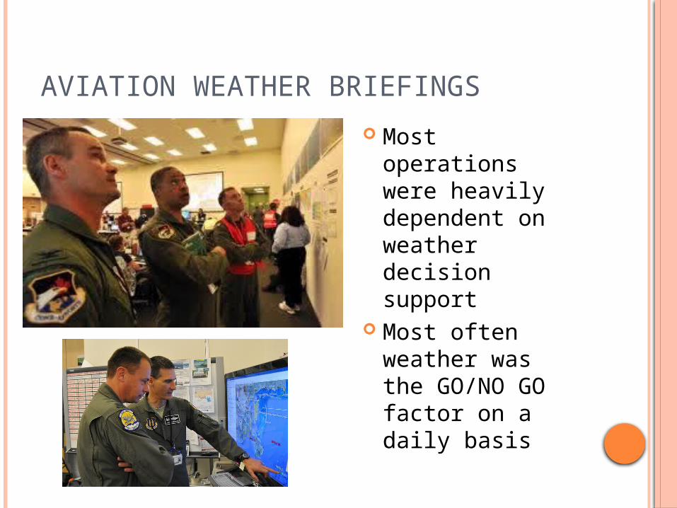
Most operations were heavily dependent on weather decision support
Most often weather was the GO/NO GO factor on a daily basis

MARINE SUPPORT
Vessels of Opportunity (VOO) Fleet
Boom Deployment near shore
Deepwater fleet – many vessels in tight operations area
INTELLIGENCE GATHERING
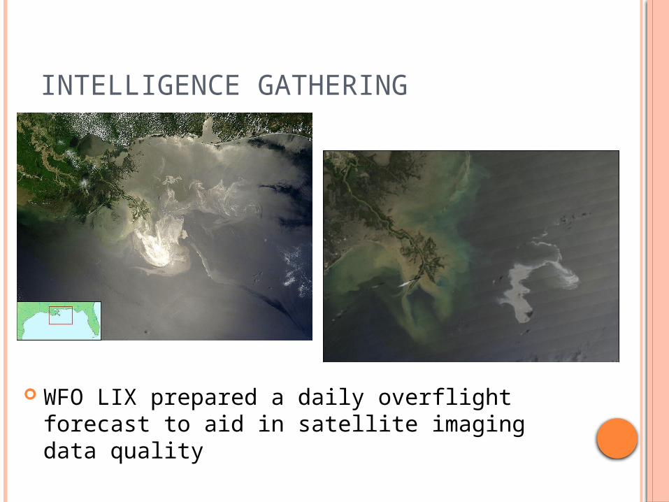
WFO LIX prepared a daily overflight forecast to aid in satellite imaging data quality
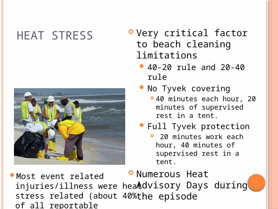
HEAT STRESS Very critical factor to beach cleaning limitations 40-20 rule and 20-40 rule No Tyvek covering
40 minutes each hour, 20 minutes of supervised rest in a tent.
Full Tyvek protection 20 minutes work each hour,
40 minutes of supervised rest in a tent.
Numerous Heat Advisory Days during the episode
Most event related injuries/illness were heat stress related (about 40% of all reportable injuries).

TROPICAL THREATS Tropical Storm Bonnie July 23-25 A direct threat to the
area of operations Weakened before
moving over operations area
Prompted a 3 day shut-down of operations at the source
A 1 day Shelter-in-place stand down at Houma ICC.

TROPICAL THREATS Tropical Depression Five August 10-11 A direct threat to the
area of operations Dissipated before
making landfall Still prompted a 3 day
shut-down of operations at the source
A 1 day stand-down, shelter in place at Houma ICC.
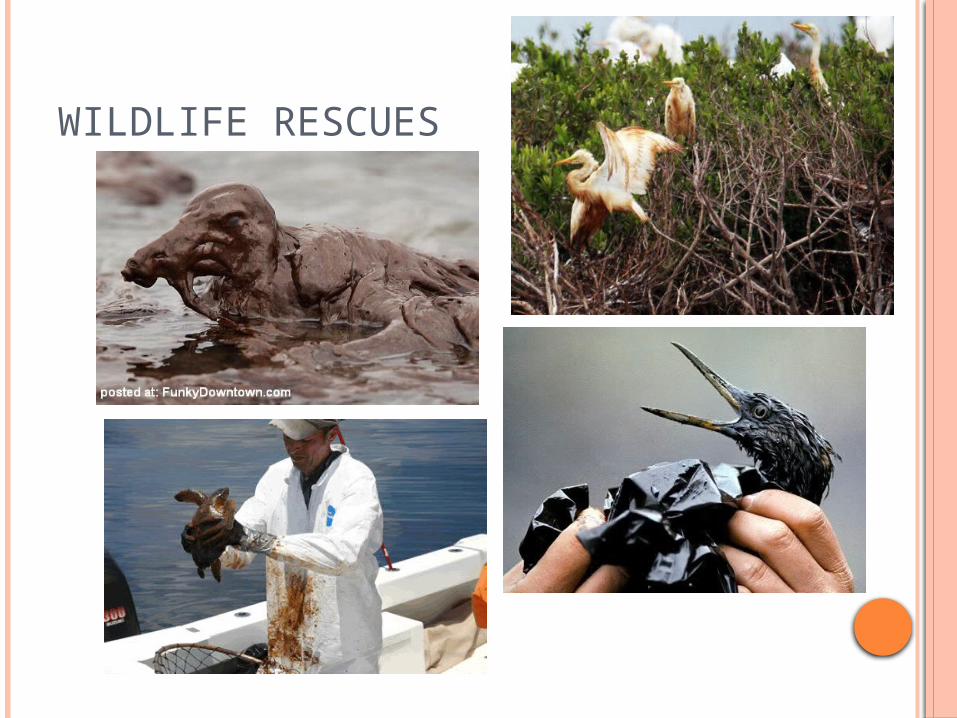
WILDLIFE RESCUES
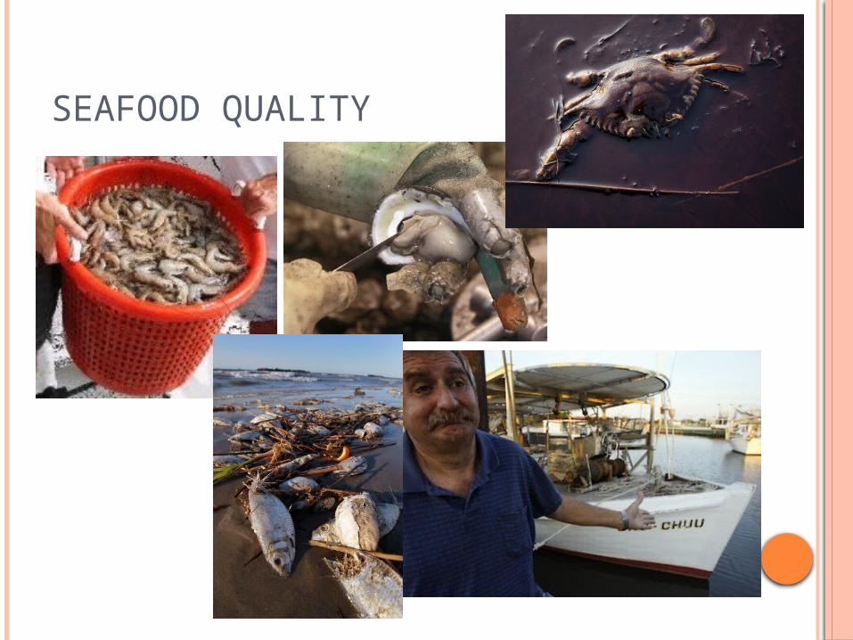
SEAFOOD QUALITY
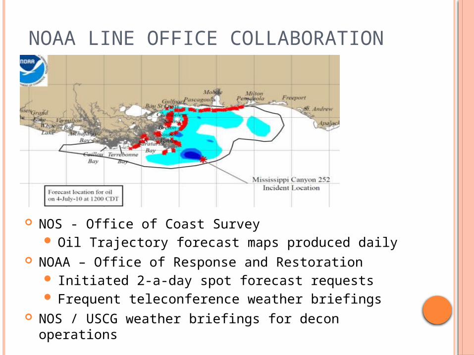
NOAA LINE OFFICE COLLABORATION
NOS - Office of Coast Survey Oil Trajectory forecast maps produced daily
NOAA – Office of Response and Restoration Initiated 2-a-day spot forecast requests Frequent teleconference weather briefings
NOS / USCG weather briefings for decon operations
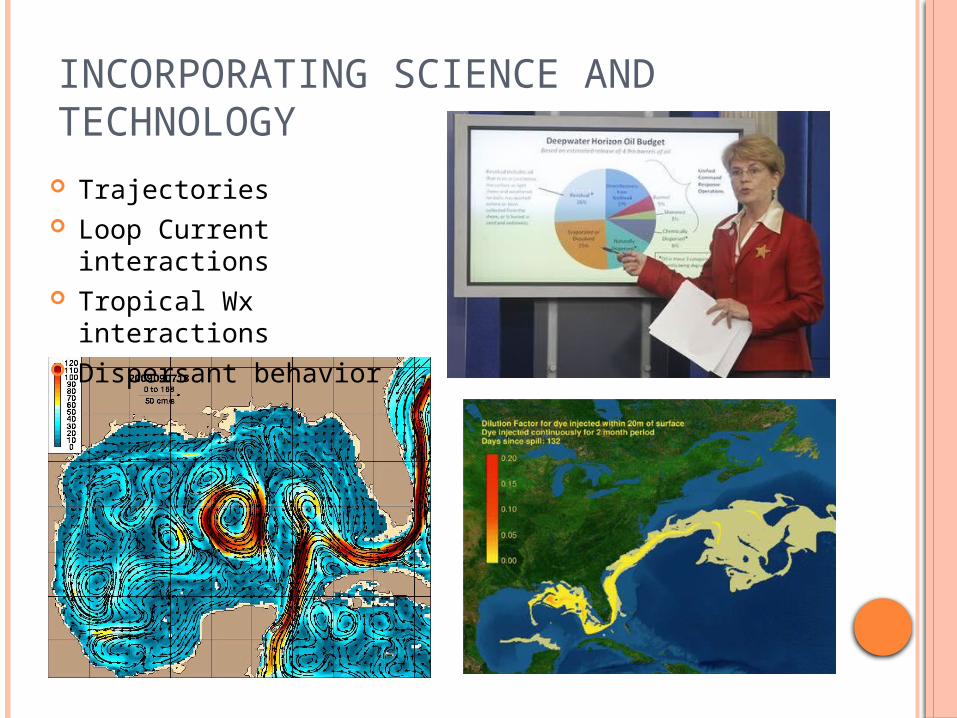
INCORPORATING SCIENCE AND TECHNOLOGY
Trajectories Loop Current interactions Tropical Wx interactions Dispersant behavior
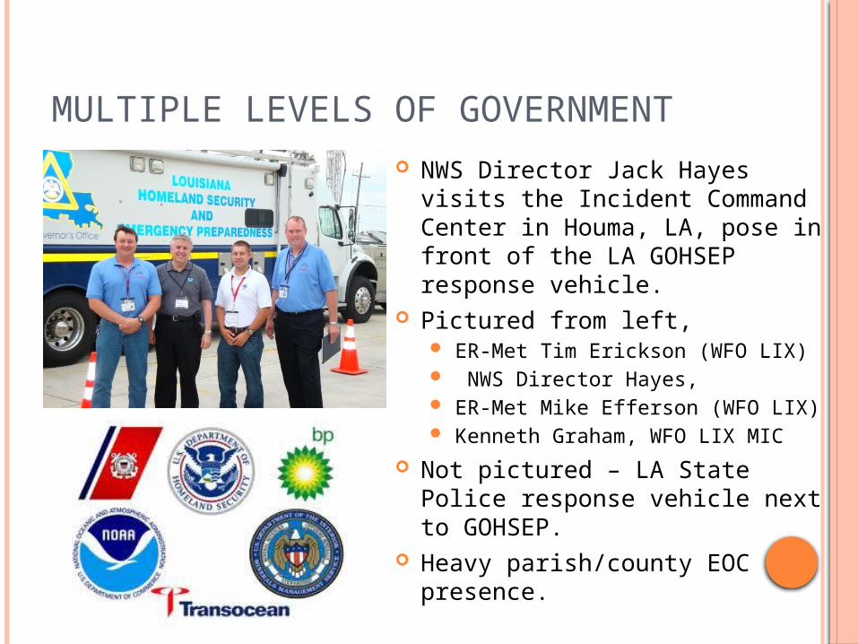
MULTIPLE LEVELS OF GOVERNMENT NWS Director Jack Hayes visits
the Incident Command Center in Houma, LA, pose in front of the LA GOHSEP response vehicle.
Pictured from left, ER-Met Tim Erickson (WFO LIX) NWS Director Hayes, ER-Met Mike Efferson (WFO LIX) Kenneth Graham, WFO LIX MIC
Not pictured – LA State Police response vehicle next to GOHSEP.
Heavy parish/county EOC presence.

MEDIA INTERVIEWS AND BRIEFINGS
Oil vs Hurricanes; Hurricanes and oil Talking points generated by WFO
LIX/NHC/WSH/NOAA. Formal briefings: approximately
1200 Informal briefings:
approximately 5000 International, national and local
media interviews: 150 Often became overwhelming
from a workload standpoint. Recommend bringing in a Public
Affairs or HQ person to handle interviews.
MIC spoke at press conference with Alabama governor.
MIC on panel at 4 NOAA town hall meetings.
MEANWHILE, BACK AT THE OFFICE
Initiated the ER-Met Desk Two event coordinators appointed by MIC 24 hr coverage – 2 twelve hour shifts
Fire Weather Spot Forecast formatter modified In addition to traditional grid based parameters… TAFs for aviation ops staging terminals 3 day Areal Aviation Outlook Sounding data to support in-situ burning ops Tide information Radar summary Watch/Warning/Advisory Summary Issued hourly from 0500 to 1900
MAKING IT WORK
Enacted an emergency schedule to account for 4 forecasters out of the regular rotation
National and regional assistance with back fill staffing All product templates were developed ‘on-the-fly’ to
meet specific forecast needs Back-fill staff contributed greatly to the success of this
undertaking by bringing skills and best practices into the local operations!
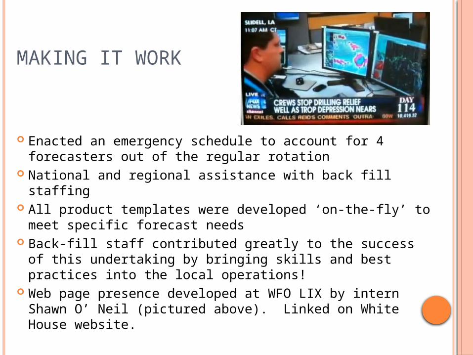
Web page presence developed at WFO LIX by intern Shawn O’ Neil (pictured above). Linked on White House website.

HOURLY SPOTS Originally generated for the
spill location NOS – OCS requested two
shore-based spot forecasts for shoreline clean up and harbor boom deployment Port Fourchon spot for
waters west of the MS River Hopedale spot for the LA
sounds east of the MS River Issued from 0400 through
sunset each day Sensitivities with LOOP facilities
serviced out of Port Fourchon, LA
Last hourly spot issued Aug 24th
3,920 hourly spots issued for entire event.
ACROSS THE BOARD CONTRIBUTIONS
Virgil Middendorf – WFO Boise, ID Assisted greatly with Spot Forecast formatter
modifications Angel Montenez – WFO Birmingham, AL
Added and modified grid fields and AWIPS workfiles to facilitate Spot Forecast generation
WSH Office of Hydrology Provided scripting to parse tide data from
RiverPro hydro database SRH – brought in team to make local Active
Directory work more efficiently.

BACK FILL CONTRIBUTIONS
44 forecasters TDY to WFO LIX; others to MOB.
IMETs deployed to Forward Operations Base (FOB) in Venice, LA
IMET briefly deployed to Houma ICC ICS role not well suited to typical Fire IMET
functions Lack of familiarization with local environment
and government landscape Different weather regime - heavily marine
oriented Tide tables developed by back fill (HGX) GIS based gridded data developed by LCH
back fill (also assisted in emergency relief at ICC)

GIS GENERATED GRAPHICS
o Expedited GIS programming provided by WFO LCH Service Hydrologist – Jonathan Brazzell and LMRFC DOH – David WelchInitial hardware challengeso Produced automatically by cron on local GIS box; posted to
web

WEB PAGE DEVELOPMENT Originally posted basic
information and forecasts to existing EM briefing page.
Intern with web design skills added thumbnails and Google maps capabilities.
Page was posted on Whitehouse.gov site
Became the ‘go-to’ page for NWS spill response
Hit count: 102,838 thru 10/7/10.
Seen on EOC screens
www.srh.noaa.gov/lix/?n=embriefing
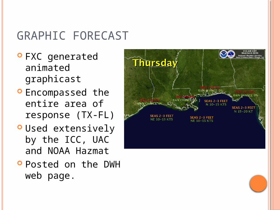
GRAPHIC FORECAST
FXC generated animated graphicast
Encompassed the entire area of response (TX-FL)
Used extensively by the ICC, UAC and NOAA Hazmat
Posted on the DWH web page.
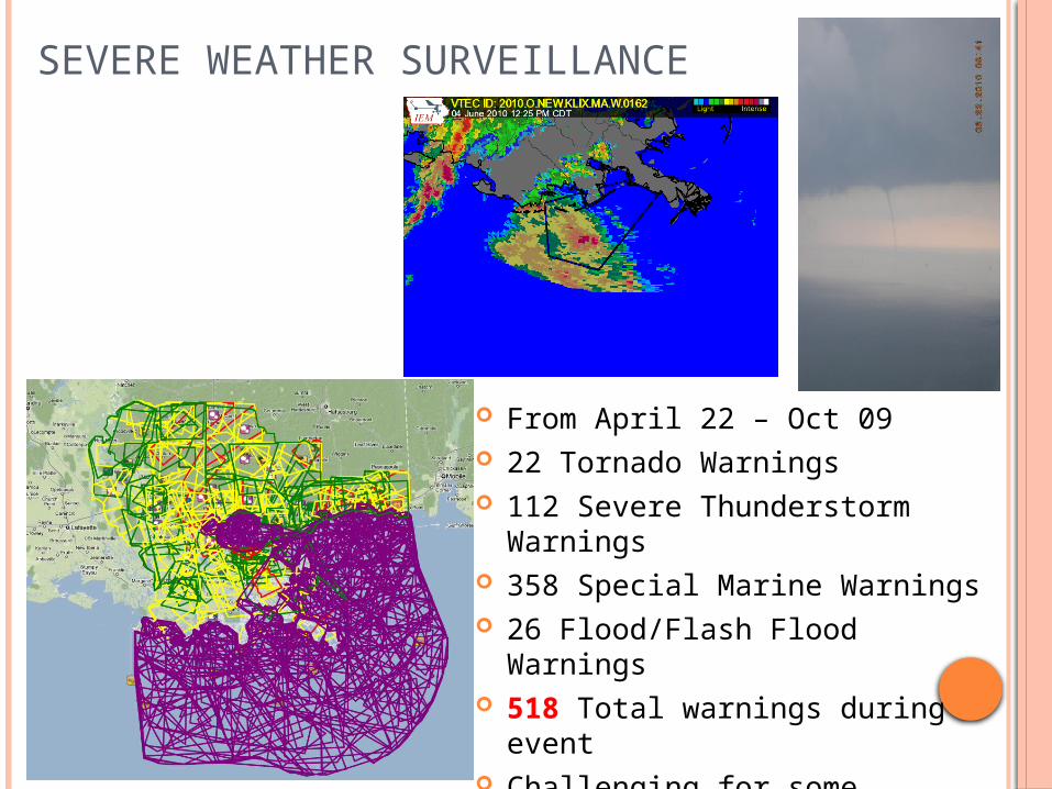
SEVERE WEATHER SURVEILLANCE
From April 22 – Oct 09 22 Tornado Warnings 112 Severe Thunderstorm
Warnings 358 Special Marine Warnings 26 Flood/Flash Flood Warnings 518 Total warnings during
event Challenging for some visitors

NWSEO ROLE
LOT efforts to implement emergency schedule
Some concessions to accommodate deployed and back-fill transitions
NWSEO President visited the WFO LIX and toured Houma ICC on August 12th.

SIMULTANEOUS INCIDENT RESPONSES
Mar 30 (pre-spill): Denham Springs Petroleum Warehouse Fire July 30: Mud Lake in Barataria Bay
pipeline leak
Sep 2: Another Rig explosion south of Cameron, LA
Aug 12: Paincourtville, Assumption Parish, LA gas leak (108 spots issued)
Aug 10: Norco Motiva Sulfuric Acid leak
Aug 9: New Orleans East train derailment – 19 cars involved
CONTINUITY OF OPERATIONS (COOP)
Instructions and templates posted to SRH Sharepoint
NWSChat used extensively Deepwateroilchat room established early on and
exclusively for Gulf NWS offices only and ICC/ICP. NDBC was added to NWSChat and utilized for
buoy data quality collaboration. Cross training with office visits from WFO
MOB personnel. Back fill mets exposed to ICS activities
Most visited the Houma ICC (brief security hault)
MISCELLANEOUS FACTORS
Fatigue (awards, food, quotes, visits helped) Long days (12-15 hours, some longer 4/10 –
6/10) Fast paced Not the typical NWS routine Many consecutive days without a break Areal familiarity crucial Ability to be flexible Readiness for other responses Tropical Weather Staff training/drills/outreach Other “routine” operations

FUTURE CONSIDERATIONS Decision Support Services need…
Turnkey approach to forecast product formatters Portability for ICC or UAC deployment Flexibility in policies and protocols to best fit the situation
DSS should have robust GIS capabilities and fully integrated data sources.
ER-Mets not equivalent to IMET in skill sets for all situations
Staffing Area Command FOB – IMETs ICC – local WFO UAC – RH or WSHQ
Equipment should be prepared and ready prior to deployment (Active Directory and security issues)
SUMMARY
Largest emergency Response in U.S. History Deepwater Horizon Rig Explosion and ensuing
massive oil spill. NWS was a key component of federal
response, along with other NOAA line offices. Local WFOs provided critical and
unprecedented Decision Support Services for their respective AOR.

NOTABLE QUOTES
NOTABLE QUOTES

CONTACT INFORMATION
Kenneth Graham, MIC [email protected] 985-645-0565, extension 222
Robert J. Ricks, Jr. [email protected] 985-645-0565, ext 4
www.weather.gov/neworleans
Thank You!