create conference, kisumu, february 2015 pre … conference, kisumu, february 2015 pre-meeting...
TRANSCRIPT
CREATE Conference, Kisumu, February 2015
Pre-Meeting Excursion, January 30 – February 2, 2015
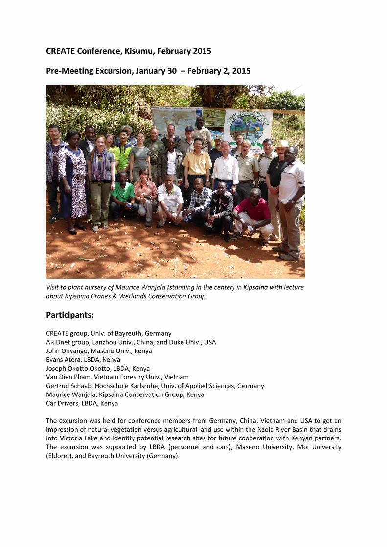
Visit to plant nursery of Maurice Wanjala (standing in the center) in Kipsaina with lecture about Kipsaina Cranes & Wetlands Conservation Group
Participants: CREATE group, Univ. of Bayreuth, Germany ARIDnet group, Lanzhou Univ., China, and Duke Univ., USA John Onyango, Maseno Univ., Kenya Evans Atera, LBDA, Kenya Joseph Okotto Okotto, LBDA, Kenya Van Dien Pham, Vietnam Forestry Univ., Vietnam Gertrud Schaab, Hochschule Karlsruhe, Univ. of Applied Sciences, Germany Maurice Wanjala, Kipsaina Conservation Group, Kenya Car Drivers, LBDA, Kenya The excursion was held for conference members from Germany, China, Vietnam and USA to get an impression of natural vegetation versus agricultural land use within the Nzoia River Basin that drains into Victoria Lake and identify potential research sites for future cooperation with Kenyan partners. The excursion was supported by LBDA (personnel and cars), Maseno University, Moi University (Eldoret), and Bayreuth University (Germany).
Program: Thursday, Jan. 29, 2015
Arrival of participants at Kisumu Hotel Friday, Jan. 30, 2015
Kisumu to Kakamega Forest Kakamega to Kitale Saturday, Jan. 31, 2015
Mt. Elgon Sunday, Feb. 1, 2015
Kitale to Cherangani Hills Kapenguria Museum Kipsaina Crane and Wetlands Conservation Group (KCWCG), Plant Nursery back to Kisumu Monday, Feb. 2, 2015
Kisumu to Ruma NP via Homa Bay back to Kisumu via Ferry Boat
Excursion Journal – Itinerary (for more background information see: Pre-Excursion Guide on http://www.bayceer.uni-bayreuth.de/CREATE/en/conference5/gru/html.php?id_obj=126323) Friday, January 30: To Kitale via Kakamega Forest
8:30 a.m.: The group starts from Kisumu hotel. Four pick-up trucks from LBDA (driven by professional drivers) and two private rental cars are fully loaded with luggage and 23 people for a
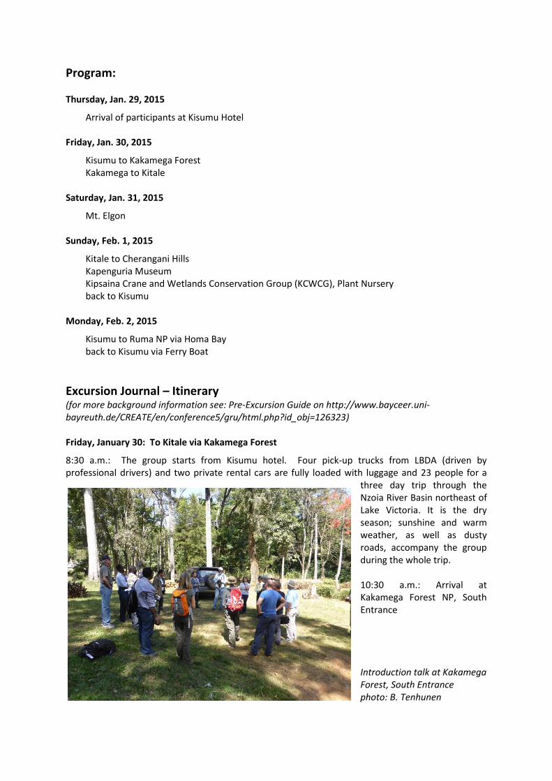
three day trip through the Nzoia River Basin northeast of Lake Victoria. It is the dry season; sunshine and warm weather, as well as dusty roads, accompany the group during the whole trip. 10:30 a.m.: Arrival at Kakamega Forest NP, South Entrance Introduction talk at Kakamega Forest, South Entrance photo: B. Tenhunen
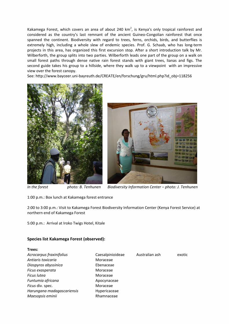
Kakamega Forest, which covers an area of about 240 km2, is Kenya’s only tropical rainforest and considered as the country’s last remnant of the ancient Guineo-Congolian rainforest that once spanned the continent. Biodiversity with regard to trees, ferns, orchids, birds, and butterflies is extremely high, including a whole slew of endemic species. Prof. G. Schaab, who has long-term projects in this area, has organized this first excursion stop. After a short introduction talk by Mr. Wilberforth, the group splits into two parties. Wilberforth leads one part of the group on a walk on small forest paths through dense native rain forest stands with giant trees, lianas and figs. The second guide takes his group to a hillside, where they walk up to a viewpoint with an impressive view over the forest canopy. See: http://www.bayceer.uni-bayreuth.de/CREATE/en/forschung/gru/html.php?id_obj=118256
In the forest photo: B. Tenhunen Biodiversity Information Center – photo: J. Tenhunen 1:00 p.m.: Box lunch at Kakamega forest entrance 2:00 to 3:00 p.m.: Visit to Kakamega Forest Biodiversity Information Center (Kenya Forest Service) at northern end of Kakamega Forest 5:00 p.m.: Arrival at Iroko Twigs Hotel, Kitale
Species list Kakamega Forest (observed): Trees: Acrocarpus fraxinifolius Caesalpinioideae Australian ash exotic Antiaris toxicaria Moraceae Diospyros abyssinica Ebenaceae Ficus exasperata Moraceae Ficus lutea Moraceae Funtumia africana Apocynaceae Ficus div. spec. Moraceae Harungana madagascariensis Hypericaceae Maesopsis eminii Rhamnaceae

Olea capensis Oleaceae Polyscias fulva Araliaceae Parasol tree Prunus africana Rosaceae Trichilia emetica Meliaceae Zanthoxylum gilletii Rutaceae Shrubs: Acanthus pubescens Acanthaceae Bequaertiodendron oblanceolatum Sapotaceae Dracaena fragrans Asparagaceae Piper capense Piperaceae Mammals: Black-and-white Colobus Vervet Monkey Birds: Black-and-white-casqued Hornbill Literature: Dalitz, C., Dalitz, H., Musila, W., and Masinde S. (2011), Illustrated Field Guide to the Common Woody Plants of Kakamega Forest, Beriche des Inst. f. Landschafts- und Pflanzenökologie der Univ. Hohenheim, Beiheft 24, 615 S. Saturday, January 31: Mt. Elgon
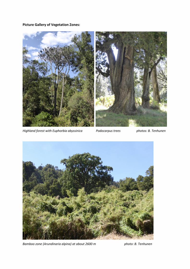
8:10 a.m.: Departure from hotel in Kitale Through the busy city center which is starting to get ready for the rush of farmers and inhabitants going to market on a Saturday, the crew takes its way north, passing the poorer outskirts of Kitale, and then west through a rural area with farmers‘ settlements. Only small remnants of wetland vegetation and acacia groves give an idea of what the natural vegetation was like only some decades ago. The road passes an old coffee plantation before arriving at Chorlim Gate, Mt. Elgon National Park. The destination of the second day of excursion is Mt. Elgon, the oldest (15 Mio. years) and largest solitary volcano in East Africa. The extended shield volcano is located at the Kenya/Uganda border and shows one oft he largest intact calderas in the world (8 km in diameter). It consists of 5 major peaks towering on the edge of the caldera, the highest, Wagagai (4321 m) being located in Uganda. Kenya’s highest peak is Koitoboss (4222 m), which can be spotted from Kitale and its surrounding countryside on clear days. Mt. Elgon National Park covers an area of about 1280 km2, and is split into two parts by the Kenya/Uganda border, the Kenyan portion encompassing only about 170 km2. The slopes of Mt. Elgon are covered by a lush and highly diverse vegetation, which shows a clear zonation with altitude, reaching from dry highland evergreen forest below 2500 m to high open moorland above 4000 m. Typical for the afro-alpine vegetation are tree giants as well as giant groundsels near the caldera. It is a fortunate at this mountain that the visitor can experience the vegetation zonation within a two hour drive up the winding forest road that leads all the way to the „end of the road“ at 3500 m altitude. From there, it is a several hours hike through the heath and moorland vegetation above tree line to Koitoboss peak at the edge of the caldera. Mt. Elgon is also known for its fauna, esp. the herds of buffalos and elephants, that are mostly hiding in the dense forest, but their presence is evident by the many tracks found in some of the vast Mt. Elgon caves, where they search for salt crusts.
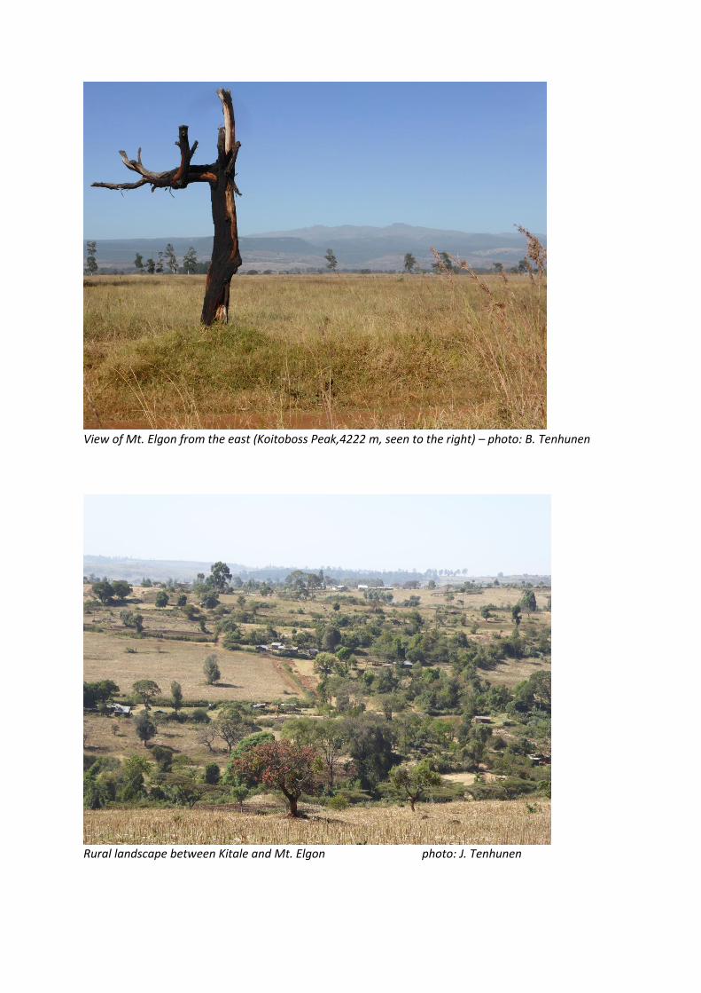
View of Mt. Elgon from the east (Koitoboss Peak,4222 m, seen to the right) – photo: B. Tenhunen
Rural landscape between Kitale and Mt. Elgon photo: J. Tenhunen
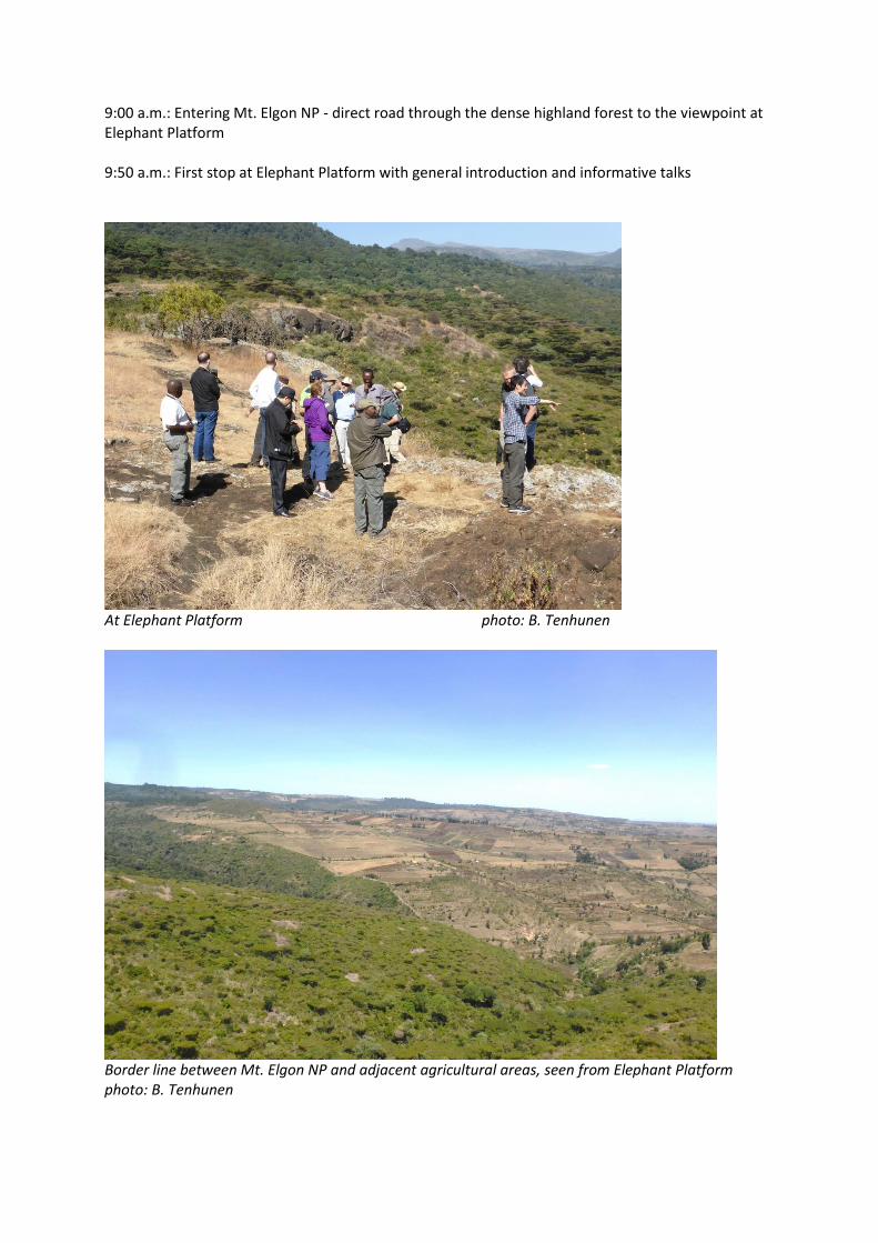
9:00 a.m.: Entering Mt. Elgon NP - direct road through the dense highland forest to the viewpoint at Elephant Platform 9:50 a.m.: First stop at Elephant Platform with general introduction and informative talks
At Elephant Platform photo: B. Tenhunen
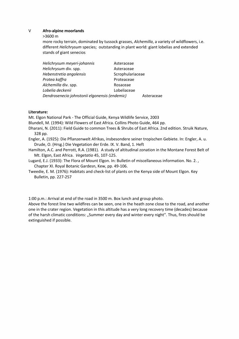
Border line between Mt. Elgon NP and adjacent agricultural areas, seen from Elephant Platform photo: B. Tenhunen

The organizing group has planned several stops in different vegetation zones where people get out of the cars and are shown typical plant species besides having the chance to take photos of the scenic and impressive landscape. Vegetation zonation along road throug Mt. Elgon NP: I highland forest lower slopes up to 2500 m (around Elephant Plantform) rainforest, dry, >100 tree species, epiphytic orchids, ferns, lianas Ficus div. spp. Moraceae Diospyros abyssinica Ebenaceae Croton macrostachys Euphorbiaceae Ekebergia capensis Meliaceae Acacia div. ssp. (at lower edge) Leguminosae II Bamboo – Podocarpus zone 2400 – 3000 m drier, dense stands of mountain bamboo, tall Podocarpus trees with massive trunks Arundinaria alpina Poaceae Podocarpus gracilior / milanjianus Podocarpaceae Euphorbia abyssinica (=obovalifolia) Euphorbiaceae Impatiens tinctoria elegantissima Balsaminaceae III Olea zone 2800 – 3000 m more open forest dominated by Olea africana with Sambucus africana in the understory (esp. where Bamboo has died), forest ground covered by grass, single Podocarpus trees Olea africana Oleaceae Sambucus africana Caprifoliaceae Podocarpus sp. Podocarpaceae Juniperus procera Cupressaceae Lobelia gibberoa Lobeliaceae IV Heath zone 3000 – 3600 m above dense forest zone, microphyllus thicket and open grassland (tussock grasses) with many species of the Ericaceae family, giant heathers, rich in wildflowers, dispersed trees (park-like), typical tree: Rosewood (Hagenia abyssinica) Hagenia abyssinica Rosaceae Erica arborea Ericaceae Philippia excelsa Ericaceae Stoebe kilimandscharica Asteraceae Hypericum revolutum Hypericaceae Dombeya goetzenii Sterculiaceae Helichrysum div. spp. Asteraceae Above end of the road towards the crater rim and Koitoboss peak:
V Afro-alpine moorlands >3600 m more rocky terrain, dominated by tussock grasses, Alchemilla, a variety of wildflowers, i.e. different Helichrysum species; outstanding in plant world: giant lobelias and extended stands of giant senecios Helichrysum meyeri-johannis Asteraceae Helichrysum div. spp. Asteraceae Hebenstretia angolensis Scrophulariaceae Protea kaffra Proteaceae Alchemilla div. spp. Rosaceae Lobelia deckenii Lobeliaceae Dendrosenecio johnstonii elgonensis (endemic) Asteraceae Literature: Mt. Elgon National Park - The Official Guide, Kenya Wildlife Service, 2003 Blundell, M. (1994): Wild Flowers of East Africa. Collins Photo Guide, 464 pp. Dharani, N. (2011): Field Guide to common Trees & Shrubs of East Africa. 2nd edition. Struik Nature,
328 pp. Engler, A. (1925): Die Pflanzenwelt Afrikas, insbesondere seiner tropischen Gebiete. In: Engler, A. u.
Drude, O. (Hrsg.) Die Vegetation der Erde. IX. V. Band, 1. Heft Hamilton, A.C. and Perrott, R.A. (1981). A study of altitudinal zonation in the Montane Forest Belt of
Mt. Elgon, East Africa. Vegetatio 45, 107-125. Lugard, E.J. (1933): The Flora of Mount Elgon. In: Bulletin of miscellaneous information. No. 2. ,
Chapter XI. Royal Botanic Gardesn, Kew, pp. 49-106. Tweedie, E. M. (1976): Habitats and check-list of plants on the Kenya side of Mount Elgon. Key
Bulletin, pp. 227-257 1:00 p.m.: Arrival at end of the road in 3500 m. Box lunch and group photo. Above the forest line two wildfires can be seen, one in the heath zone close to the road, and another one in the crater region. Vegetation in this altitude has a very long recovery time (decades) because of the harsh climatic conditions: „Summer every day and winter every night“. Thus, fires should be extinguished if possible.
Picture Gallery of Vegetation Zones:
Highland forest with Euphorbia abyssinica Podocarpus trees photos: B. Tenhunen
Bamboo zone (Arundinaria alpina) at about 2600 m photo: B. Tenhunen

Olea africana grove with Sambucus africana in the understory (ca. 2900 m) photo: B. Tenhunen
Lobelia gibberoa with flower stalk Hypericum revolutum
photos: J. Tenhunen

Heath zone with Rosewood tree (Hagenia abyssinica,in the center) photo: J. Tenhunen
Wildfire at Mt. Elgon at about 3200 m photo: J. Tenhunen
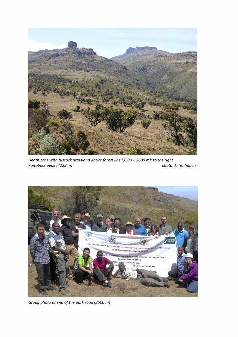
Heath zone with tussock grassland above forest line (3300 – 3600 m); to the right Koitoboss peak (4222 m) photo: J. Tenhunen
Group photo at end of the park road (3500 m)

Protea caffra at 3500 m Helichrysum sp. photos: B. Tenhunen
Afro-alpine moorlands with tussock grass and Helichrysum spp. (at about 3700 m) together with boulders of volcanic origin with a rich lichen flora. photo: J. Tenhunen
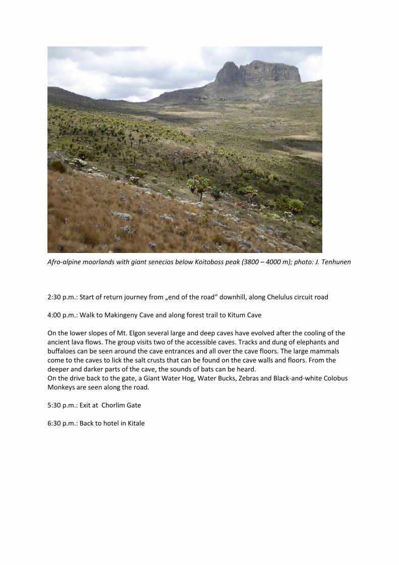
Afro-alpine moorlands with giant senecios below Koitoboss peak (3800 – 4000 m); photo: J. Tenhunen
2:30 p.m.: Start of return journey from „end of the road“ downhill, along Chelulus circuit road 4:00 p.m.: Walk to Makingeny Cave and along forest trail to Kitum Cave On the lower slopes of Mt. Elgon several large and deep caves have evolved after the cooling of the ancient lava flows. The group visits two of the accessible caves. Tracks and dung of elephants and buffaloes can be seen around the cave entrances and all over the cave floors. The large mammals come to the caves to lick the salt crusts that can be found on the cave walls and floors. From the deeper and darker parts of the cave, the sounds of bats can be heard. On the drive back to the gate, a Giant Water Hog, Water Bucks, Zebras and Black-and-white Colobus Monkeys are seen along the road. 5:30 p.m.: Exit at Chorlim Gate 6:30 p.m.: Back to hotel in Kitale

The entrance of Makengeny Cave is a spectacular amphitheatre. photos: B. Tenhunen

Sunday, February 1: Cherangani Hills and back to Kisumu
8:15 a.m.: Departure from Kitale The first half of the day is scheduled for different activities in the Cherangani Hills. The mountain range northeast of Kitale reaches elevations of 3500 m above sea level and is one of Kenya's five main forests. The Cherangani Hills are monitored by the United Nations Environmental Programme as one of the five most important water catchment areas in Kenya (Wikipedia). Nevertheless, during the last decade, severe deforestation can be observed. 9:40 a.m.: Visit to Kapenguria Museum in West Pokot District The small museum, opened in 1993, is located inside the prison where prominent leaders of the Kenyan independence movement (the „Kapenguria Six“, among them Jomo Kenyatta, the first president of Kenya) were held and put on trial in 1952/3. The museum features galleries in the former cells of the prison, including displays on these leaders and the struggle against colonialism. It also features ethnographic galleries about the Pokot people (Wikipedia). 11:00 a.m.: Short drive through the hillsides with tea plantations and other agricultural uses to the Cherangani Hills Water Management Headquarters.
Cherangani Hills Water Management Headquarters photo: B. Tenhunen
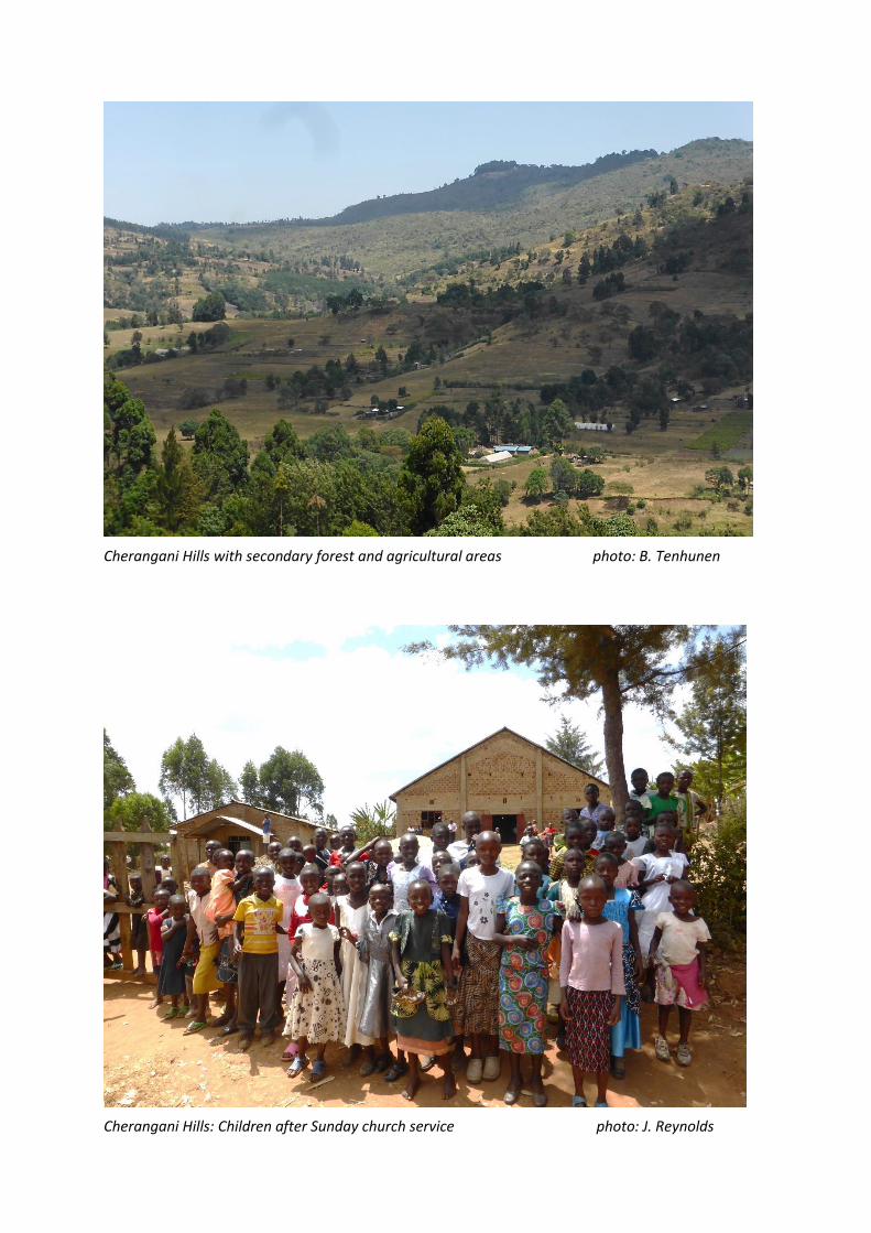
Cherangani Hills with secondary forest and agricultural areas photo: B. Tenhunen
Cherangani Hills: Children after Sunday church service photo: J. Reynolds
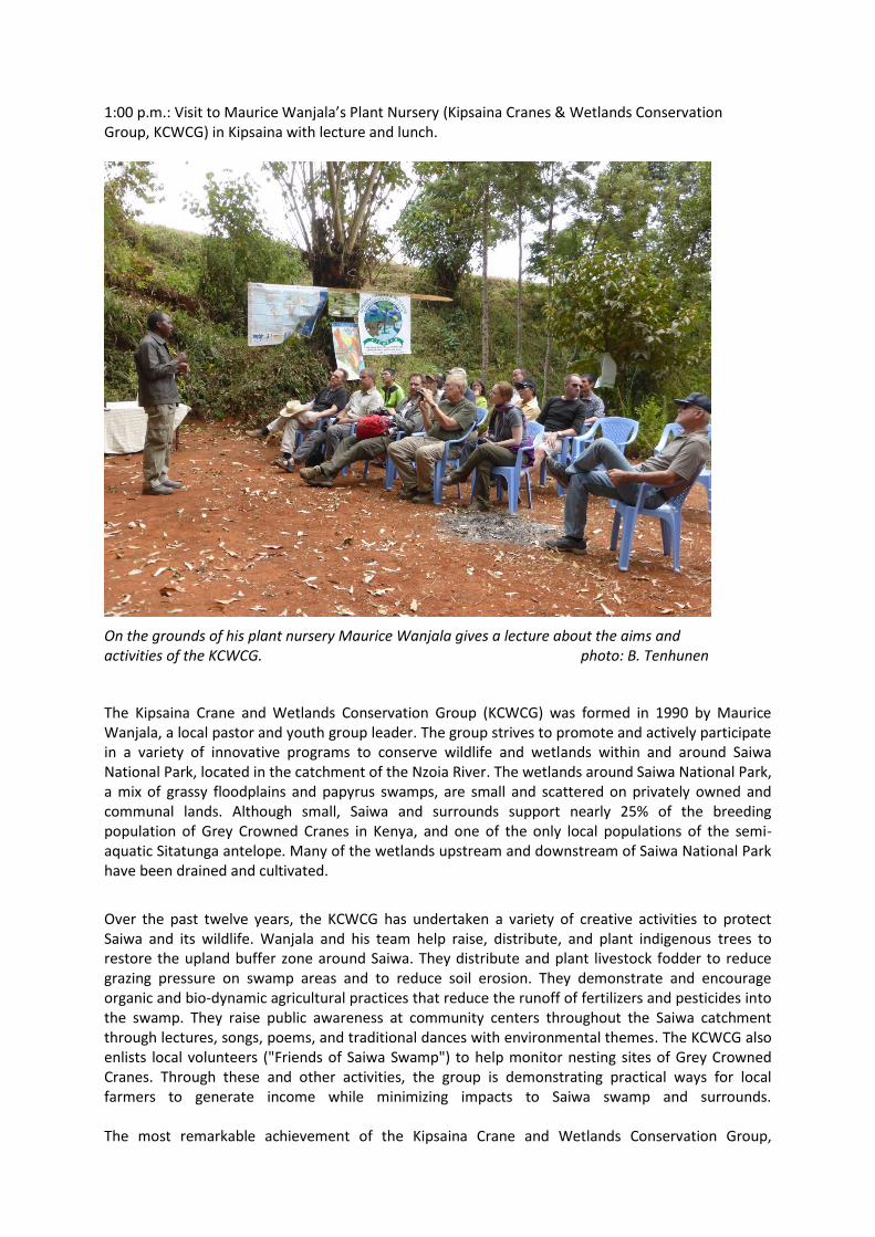
1:00 p.m.: Visit to Maurice Wanjala’s Plant Nursery (Kipsaina Cranes & Wetlands Conservation Group, KCWCG) in Kipsaina with lecture and lunch.
On the grounds of his plant nursery Maurice Wanjala gives a lecture about the aims and activities of the KCWCG. photo: B. Tenhunen
The Kipsaina Crane and Wetlands Conservation Group (KCWCG) was formed in 1990 by Maurice Wanjala, a local pastor and youth group leader. The group strives to promote and actively participate in a variety of innovative programs to conserve wildlife and wetlands within and around Saiwa National Park, located in the catchment of the Nzoia River. The wetlands around Saiwa National Park, a mix of grassy floodplains and papyrus swamps, are small and scattered on privately owned and communal lands. Although small, Saiwa and surrounds support nearly 25% of the breeding population of Grey Crowned Cranes in Kenya, and one of the only local populations of the semi-aquatic Sitatunga antelope. Many of the wetlands upstream and downstream of Saiwa National Park have been drained and cultivated.
Over the past twelve years, the KCWCG has undertaken a variety of creative activities to protect Saiwa and its wildlife. Wanjala and his team help raise, distribute, and plant indigenous trees to restore the upland buffer zone around Saiwa. They distribute and plant livestock fodder to reduce grazing pressure on swamp areas and to reduce soil erosion. They demonstrate and encourage organic and bio-dynamic agricultural practices that reduce the runoff of fertilizers and pesticides into the swamp. They raise public awareness at community centers throughout the Saiwa catchment through lectures, songs, poems, and traditional dances with environmental themes. The KCWCG also enlists local volunteers ("Friends of Saiwa Swamp") to help monitor nesting sites of Grey Crowned Cranes. Through these and other activities, the group is demonstrating practical ways for local farmers to generate income while minimizing impacts to Saiwa swamp and surrounds. The most remarkable achievement of the Kipsaina Crane and Wetlands Conservation Group,
however, has been the restoration of more than 1.5 km of contiguous wetlands along the Kipsaina River immediately downstream of Saiwa National Park on formerly cultivated land by offering local farmers viable economic alternatives to wetland destruction - a model for wetland stewardship in the region.
Source: www.savingcranes.org
After the talk and tour, the whole group enjoyed a warm lunch with grilled chicken, ugali, rice, and salads prepared by Wanjala’s family and KCWCG members, before heading back to Kisumu.
3 p.m.: Return journey to Kisumu
7 p.m.: Arrival at Kisumu Hotel, Kisumu
Monday, February 2: Ruma National Park
8:00 a.m.: Departure from Kisumu Hotel
10:00 a.m.: Arrival at Kenya Wildlife Service (KWS) offices at Ruma National Park
11:00 a.m.: Talk by Mr. Luke Lukaria on the Status of Ruma National Park and Management
Strategies
12:00 a.m.: Lunch break at the KWS offices
1:00 p.m.: A Ride in Ruma National Park
2:00 p.m.: Visit to the Kenya National Youth (NYS) field research station
3:00 p.m.: Drive to Mbita
5:00 p.m.: Crossing Lake Victoria with Mbita ferry
6:00 p.m.: Arrival of ferry
7:00 p.m.: Back at Kisumu Hotel
The day trip leads through Homa Bay to Ruma National Park south of Kisumu. The small park with predominant savanna vegetation in the valley of the Lambwe River was founded in 1983 to protect the rare Roan Antelope. Also black rhinocerus have been brought into the park and are monitored by staff of the Kenya Wildlife Service in order to save them from poaching. Well-developed riparian vegetation occurs along the Olambwe River which is seasonal. Larger areas are occupied by Combretum and Acacia savanna. The Lambwe Valley Youth Camp, located outside the western border of the park at the transition from savanna to woodland hills, provides a secure location for a variety of research activities, as well as opportunities for cooperating on youth training related to environmental sciences. The camp is currently used in studies of carbon balances of savanna grassland, water use by savanna trees, and the influence of land use on dynamics of soil resource availabilty see also: http://www.bayceer.uni-bayreuth.de/CREATE/en/forschung/gru/html.php?id_obj=118253
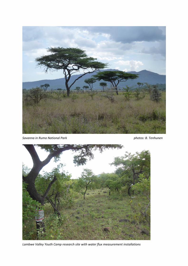
Savanna in Ruma National Park photos: B. Tenhunen
Lambwe Valley Youth Camp research site with water flux measurement installations