comparative study on practices and lessons in land … study on practices and lessons in land use...
TRANSCRIPT
Working Paper 05
Comparative Study on Practices and Lessons in Land Use Planning and
Land Allocation in Cambodia, Lao PDR, Thailand and
Viet Nam
Consultancy Report prepared by
Florian Rock
Plascassier, May 2004
MRC-GTZ Cooperation Programme Agriculture, Irrigation and Forestry Programme
Watershed Management Component

Table of Content Page Abbreviations and Acronyms 3 1 Introduction 5 2 Description of LUP/LA Practices and Achievements in the
4 Countries 7
2.1 Cambodia 7 2.2 Lao PDR 13 2.3 Thailand 20
2.4 Viet Nam 28 3 Comparative Assessment of Experiences and Lessons Learned 36
3.1 Cambodia 36
3.2 Lao PDR 37 3.3 Thailand 39
3.4 Viet Nam 40 3.5 Comparative Analysis 41 4 Conclusions and Recommendations 43
4.1 Cambodia 43 4.2 Lao PDR 43 4.3 Thailand 43 4.4 Viet Nam 44 4.5 Conclusions for the Sub-Region 44 4.6 Recommendations to the AIFP/WSM Programme 46
4.7 Recommendations concerning Exchange and Training Opportunities within the Sub-Region 47
List of Publications 48 Annexes 52 Annex 1: Legal Framework for LUP/LA in the 4 countries 52 Annex 2: Selected Project Examples 56
2

Abbreviations and Acronyms ADB Asian Development Bank AIFP Agriculture, Irrigation and Forestry Programme of the Mekong River Commission ALA Agricultural Land Allocation (Viet Nam) ALRO Agricultural Land Reform Office (Thailand) CB-NRM Community-based Natural Resources Management CC Commune Council (Cambodia) CDP Commune Development Plan (Cambodia) CFDO Community Fisheries Development Office (Cambodia) CNRMLC Commune Natural Resource Management and Land Committee (Cambodia) CIP Commune Investment Plan (Cambodia) CPC Commune People’s Committee (Viet Nam) DAFO District Agriculture and Forestry Office (Lao PDR) DANCED Danish Cooperation for Environment and Development DARD Department of Agriculture and Rural Development (Viet Nam) DCP Department of Cooperative Promotion (Thailand) DFP Department of Forest Protection (Viet Nam) DLMUPC Department of Land Management, Urban Planning and Construction (Cambodia) DoL Department of Lands (Thailand) DoNLUPAD Department of National Land Use Planning and Development (Lao PDR) DPC District People’s Committee (Viet Nam) DPW Department of Public Welfare (Thailand) DSE Deutsche Stiftung fuer Internationale Entwicklung EU European Union FAO Food and Agriculture Organisation of the United Nations FCRDP Forest Conservation and Rural Development Project (funded by EU) (Lao PDR) FIPD Forest Inventory and Planning Department (Lao PDR) FIPI Forest Inventory and Planning Institute (Viet Nam) FLA Forest Land Allocation (Viet Nam) FREC Forest Resources and Environmental Center (Viet Nam) FSP Forest Sector Programme (funded by ADB) (Viet Nam) GIS Geographic Information System GPS Global Positioning System GTZ Gesellschaft fuer Technische Zusammenarbeit, German Technical Assistance IO International Organisation KfW Kreditanstalt fuer Wiederaufbau LA Land Allocation LDD Land Development Department (Thailand) LMAP Land Management and Administration Programme (Cambodia) LR Land Reform (Thailand) LSFP Lao-Swedish Forestry Programme LUC Land Use Certificate (Viet Nam) LUP Land Use Planning LSUAFRP Lao-Swedish Upland Agriculture and Forestry Research Programme MAF Ministry of Agriculture and Forestry (Lao PDR) MAFF Ministry of Agriculture, Forestry and Fisheries (Cambodia) MARD Ministry of Agriculture and Rural Development (Viet Nam) MLMUPC Ministry of Land Management, Urban Planning and Construction (Cambodia) MoNRE Ministry of Natural Resources and Environment (Viet Nam) MRC Mekong River Commission
3

MRD Ministry of Rural Development (Cambodia) NAFES National Agriculture and Forestry Extension Service (Lao PDR) NAFRI National Agriculture and Forestry Research Institute (Lao PDR) NESDP National Economic and Social Development Plan (Thailand) NGD National Geographic Department (Lao PDR) NGO Non Governmental Organisation NIAPP National Institute of Agricultural Planning and Projection (Viet Nam) NPEP National Poverty Eradication Programme (Lao PDR) NRM Natural Resources Management NTFP Non Timber Forest Project (Cambodia) ONCB Office for the Narcotics Control Board (Thailand) ONREPP Office of Natural Resources and Environmental Policy and Planning (Thailand) PAFO Provincial Agriculture and Forestry Office (Lao PDR) PC People’s Committee (Viet Nam) PLG Project on Local Government (Cambodia) PLUP Participatory Land Use Planning PLT Permanent Land Title (Lao PDR) PPC Provincial People’s Committee (Viet Nam) PRA Participatory Rural Appraisal RCG Royal Cambodian Government RECOFTC Regional Community Forestry Training Center RFD Royal Forestry Department (Thailand) SEILA Governmental Programme to alleviate poverty in rural areas and to promote local
governance (khmer: foundation stone) (Cambodia) SFDP Social Forestry Development Project Song Da (Viet Nam) SFNC Social Forestry and Nature Conservation in Nghe An Province (Viet Nam) SMRP Sustainable Management of Resources in the Lower Mekong Basin SPK Sor Por Kor (Land Title issued by ALRO) (Thailand) TAO Tambon Administration Offices (Thailand) THB Thai Baht TLUC Temporary Land Use Certificate (Lao PDR) UNDCP United Nations Drug Control Programme UNEP United Nations Environmental Programme VFMA Village Forest Management Agreement (Lao PDR) VNRMLC Village Natural Resource Management and Land Committee (Cambodia) WB World Bank WSC Watershed Class (Thailand) WSM Watershed Management ZEL Fachzentrum fuer Ernaehrung, Laendliche Entwicklung und Umwelt (Centre for
Food, Rural Development and Environment)
4

1 Introduction This study is the result of a short-term assignment by a NRM and Land Use Planning Consultant in the four riparian countries of the Lower Mekong Basin. The assignment was carried out in two stages, between 4 and 30 January and between 14 March and 9 April 2004. The overall objectives of the study were to collect and analyse LUP methodologies in the 4 countries and to assess the experiences and lessons learned during implementation. The comparative assessment would include land use planning approaches at various levels, ranging from participatory village level LUP activities to the elaboration of land use master plans at provincial or even regional level. Finally, recommendations were to be formulated for the countries as well as for the sub-region as a whole. This study also tries to give some indications on how the AIFP/WSM component of the MRC could enhance land use planning practices in the countries of the sub-region. Due to the general concept of the component this would mainly involve support to training courses and events of regional exchange and some limited application of refined LUP approaches in selected pilot areas. As there are many different interpretations of what is understood by “land use planning” and “land allocation”, two definitions have been selected to further clarify the subject of this comparative study: Definition of Land Use Planning: Land-use planning is the systematic assessment of the potential of land and water areas, the evaluation of alternatives for land use aiming at sustainability, improved land management and improved economic and social conditions. Its purpose is to select and put into practice those land uses that will best meet the needs of the national economy and the people while safeguarding resources for the future. LUP is carried out in a series of steps and is based on dialogue and a balance of interests among all parties involved. Definition of Land Allocation: Land allocation is the process of assigning land use and property rights to individuals, groups, communities, private or public entities for improved land management. Land use planning activities are conducted at various levels and with varying objectives. Depending on the working level the following main types of land use planning can be distinguished: a) Macro Land Use Planning – Elaboration of “master plans” which set the economic
priorities, standards and guidelines for land use and land development at the national, provincial and district level
b) Local (Participatory) Land Use Planning – LUP at commune or village level with strong participation by villagers, community-based organisations and the local administration
c) Farm or field level Land Use Planning – Planning of specific cropping patterns and rotations for each farm, down to the individual plot level
With the exception of Cambodia, land use planning methodologies have been applied in all countries of the sub-region at different levels and for more than one decade. Yet, the political and socio-economic framework conditions for this application of LUP differ widely between countries such as Thailand on the one hand and Viet Nam on the other. It is therefore of particular interest to assess whether the specific experiences in the countries differ substantially or whether similar lessons have been learned in the sub-region as a
5

whole. Only if the fundamental issues the various countries are struggling with in the implementation of LUP or the existence of “best practices” has been assessed, the Mekong sub-region can progress in the development of adapted LUP/LA solutions. One way of enhancing this development is through increased learning from each other and strengthening of cross-boundary cooperation. Land use planning and land allocation procedures are applied in all 4 countries within the general context of improved and sustainable natural resources management on the one hand and as a tool in land management on the other. In Lao PDR and Viet Nam, local level LUP directly leads to land allocation to households and communities in view of strengthening management responsibilities and increasing land tenure security. But, there are numerous other objectives for applying LUP/LA procedures, e.g.: - To define development priorities for a certain land area from a national or Government
perspective - To analyse present use of the resources and identify needs for changes - To clarify present tenure of land resources - To clarify administrative boundaries - To differentiate protected areas, buffer zones and use areas - To create a basis for allocation or re-allocation of land and natural resources use - To set the orientation for sustainable land use and management of natural resources - To balance land requirements based on actual availability of land - To reduce land conflicts - To strengthen the involved institutions and conduct capacity building at all levels - To increase the dialogue and cooperation between public institutions, the private
sector and local communities - To improve living conditions of the rural population and alleviate poverty There are particular situations where land use planning approaches are potentially the most useful, such as in areas with high incidences of present land use conflicts or where these could emerge in the foreseeable future. This is also true for areas with a particularly high level of natural resources degradation by conflicting or ill-adapted resource use practices and areas with high in-migration. Land conflicts are often the result of an unclear land tenure situation and the mismanagement of land resources. Land use planning is commonly applied in areas with high or conflicting development potentials such as peri-urban areas, large irrigation schemes and hydropower dams. The preliminary results of this study were presented at the MRC-Secretariat in Phnom Penh on 8 April 2004 and are also available as a PowerPoint presentation from the AIFP/WSM Component.
6

2 Description of LUP/LA Practices and Achievements in the 4 Countries
2.1 Cambodia
2.1.1 Background Participatory land use planning (PLUP) in Cambodia started in 1997 as a pilot initiative within the framework of a SEILA project on Community-based Natural Resources Management (CB-NRM) and a NGO funded Non-Timber Forestry Project (NTFP) in the province of Ratanakiri. Some elements of the more comprehensive PLUP approach were also tested in various projects focussing on community forestry, community fishery or CB-NRM (see list of projects in Annex 2). Between 1999 and 2001 a series of workshops brought together facilitators and government officials involved in natural resources management activities in Cambodia. Based on field experiences, the deliberations during the workshops, and other relevant experiences with land use planning in the region, a PLUP Manual for Cambodia was compiled and published in December 2001. The manual combines resource management approaches with land tenure issues. It presents the basic PLUP concepts, along with tools to implement the PLUP procedures. Based on the PLUP Manual, 14 standard training modules were elaborated by a small team of local experts. These training modules were then first applied in 2 training courses for trainers (ToT) forming 25 national-level PLUP trainers. Until early 2004, these PLUP trainers, working together in groups of 4-5, have conducted 13 PLUP courses with participants from a total of 19 provinces and municipalities. The training courses are designed to create inter-disciplinary District PLUP facilitation teams, consisting of technical staff seconded by the relevant line agencies (forestry, fishery, environment and land management). Until today, all these courses were funded by donor supported projects and NGO. In Cambodia no public funds are yet invested in land use planning activities and PLUP is not yet recognised as a national programme, nor are there agreed national guidelines for PLUP. Meanwhile, a PLUP Focal Point (PLUP Unit) has been created within the Ministry of Land Management, Urban Planning and Construction (MLMUPC) to coordinate and monitor PLUP activities in the country and to create a national PLUP network with financial and technical support by a number of area-based projects and programmes operating in various provinces of the country. Currently, MLMUPC is working with PLG Ratanakiri to pilot PLUP for indigenous community areas. In late 2003, a first update of the original PLUP Manual was compiled, based on further contributions by practitioners and advisors. One main focus of the update was to clarify the role of the Commune Councils in the PLUP procedures and to interpret the implications of the latest laws and regulations. Despite these recent developments at the national level, PLUP implementation and all methodological fine-tuning takes place exclusively in foreign donor funded projects (IO and NGO). So far the focus has been on local or participatory land use planning at village and commune level. This approach has been mainly introduced with the objective of working towards more sustainable management of natural resources, conflict resolution and, more recently, preparing the ground for social land concessions and land allocation. Administratively, the country is organised in provinces or municipalities, districts and communes or Sangkats. Cambodia has no experience in Macro Land Use Planning, with the exception of “Physical Framework Plans” for the coastal provinces elaborated with DANIDA support. Nevertheless, a new EU-funded project planned to start in 2004, aims to build up the regional planning capacities of the MLMUPC.
7

2.1.2 Legal Framework/Policy Statements The most important legal documents governing the management and protection of natural resources as well as land management in Cambodia are:
• The Law on Commune Administration (2001) • The Land Law (2001) • Statement on Land Policy (2001) • Forestry Law (2003) • Sub-decree on Community Forestry (2003) • Draft Law on Fisheries (not yet passed by the Council of Ministers, probably in
2004) • Draft Sub-decree on Community Fishery (not yet passed by the Council of
Ministers, probably in 2004) • Law on Environmental Protection and Natural Resources Management • Draft Sub-decree on the Management of Protected Areas and National Parks
For more details see Annex 1. The legal framework with regard to natural resources and land management in Cambodia has evolved rapidly over the past years. Yet, there are still numerous uncertainties and ambiguities remaining, e.g. when it comes to clearly defining the responsibilities of the new Commune Councils and government departments in areas such as access to and management of forests and fish resources. The National Council to Support Communes (NCSC) at the Ministry of Interior (MoI) is in the process of drafting a “Prakas on the Powers and Functions of the Commune Council” which will be crucial for the clarification of these roles and duties.
2.1.3 Main Institutions involved and Stakeholders In Cambodia the MLMUPC has the official mandate to promote land use planning and land allocation activities. In PLUP implementation this ministry has to rely on the close cooperation with the departments and offices in charge of natural resources, such as the newly re-organised Forestry Administration, the Department of Environment, the Offices of Fisheries under Department of Agriculture and Fisheries at the provincial level. Table 1: Institutions involved in PLUP in Cambodia Institution Mandate/responsibilities with relevance to LUP/LA Ministry of Land Management, Urban Planning and Construction (MLMUPC)
Responsible for land use planning, land adjudication (land allocation), land management
National Council on Land Policy Overlooks all land policy issues Ministry of Agriculture, Fishery and Forestry (MAFF)
Responsible for agricultural development and all fishery activities in the fishery domain
Forestry Administration Responsible for all forestry activities in the forest domain Ministry of Environment (MoE) Responsible for all protected areas and sanctuaries, wildlife,
environmental protection Ministry of Rural Development (MRD)
Responsible for community development and rural infrastructure
Ministry of Interior (MoI) and the National Council to Support Communes (NCSC)
In charge of decentralisation and supervising the Commune Councils
8
The ministries mentioned above maintain subordinate structures at province and district levels. These departments and offices officially fall under the authority of the Provincial Governor in the province, but still maintain very strong vertical ties to their national headquarters. The local administrative structures at the commune level, the Commune Councils, are supposed to supervise the entire PLUP procedures and villagers and their leaders play a crucial role. The District Governor’s Office usually is involved in the introduction of PLUP to new areas and in the final endorsement of the main outputs of the planning process. Other stakeholders in PLUP, such as private companies, the armed forces, concessionaires etc. are rarely available to participate in the procedures.
2.1.4 PLUP Approach/Methodology The Participatory Land Use Planning approach devised for Cambodia has the following main characteristics:
• It focuses at the commune and village level. PLUP is systematically conducted in every village of a commune, sometimes in clusters. Village land use plans are then combined to a commune land use plan, which becomes part of the commune planning framework (Commune Development Plan and annual Commune Investment Plans).
• The Commune Council is supported during the PLUP process by a multi-disciplinary team of trained district and provincial PLUP facilitators. These teams usually consist of 4-5 technicians originating from the forestry, fishery, agronomy, land management and environment services.
• A Provincial Management Team or Steering Committee usually supervises the field teams.
• At an early stage, the administrative boundaries between villages and communes are either retraced or newly delineated.
• PLUP procedures cover all resources and all land categories of a village or commune area, e.g. all agricultural land, forestland, grazing land, settlement areas, all water bodies, infrastructures etc..
• Present land use and land tenure for all land categories is assessed, options for future use and allocation are developed and final decisions are taken regarding future land use and tenure status.
• PLUP is presently at a piloting stage in a few communes and provinces, as there is still limited implementation experience with PLUP in Cambodia.
• The PLUP process provides very important outputs in terms of land tenure analysis, land use maps and future land use plans, village and commune regulations and NRM committees which could be used as a basis for subsequent activities such as: a) systematic land allocation and registration (by DLMUPC), b) state land classification (by DLMUPC), c) social land concession schemes (Commune Councils and DLMUPC), d) economic land concessions e) and the continued process of CB-NRM e.g. with community forestry and
community fishery • PLUP has contributed to the resolution of several minor land conflicts, while major
conflicts are submitted to the newly created Cadastral Commissions at district and provincial level.
• PLUP in Cambodia is hindered by the lack of an official and standardized land and forest classification system.
9

• The links between PLUP and the systematic land registration activities by MLMUPC (supported by LMAP) are still weak.
2.1.5 Working Steps Table 2: Working Steps in PLUP in Cambodia Working Steps in PLUP Milestones
Main Outputs 1. Introductory Meeting at Commune and Village Level
2. Situation Analysis (PRA tools) Report on Village Profile 3. Election of a Village NRM and Land Committee(VNRMLC)
VNRMLC represents village interests in NRM and Land Management
4. Village Boundary Demarcation and Present Land Use and Land Tenure Mapping
Present Land Use and Tenure Map and village boundaries; Identification of potential Social Land Concession Areas and report to Commune Council, DLMUPC
5. Analysis of options for future land use and Future Land Use and Tenure Mapping
Future Land Use and Tenure Map
6. Drafting of Village Regulations Village Regulations approved and signed by local authorities and line departments/offices
7. Preparation and implementation of Village NRM Activity Plans
Village NRM Activity Plans available and updated annually
8. Development of Community Forestry Management Plans
Com. For. Management Plans and Agreements signed by VNRMC, Commune and Forest Administration
9. Development of Community Fishery Management Plans
Com. Fishery Management Plans and Agreements signed by VNRMLC, Commune and Fishery Office/CFDO
10. Monitoring the enforcement of Village Regulations and Management Plans
11. Establishment of a Commune NRM and Land Committee
CNRMLC in all target communes
12. Drafting of Commune Regulations and inclusion of NRM and Land Management activities in CDP/CIP
Approved Commune Regulations; mainstreaming of NRM activities in CDP/CIP
13. Preparation of a Commune Future Land Use and Land Tenure Map
Approved Commune Land Use and Land Tenure Plan
14. Cooperation and Coordination (Networking) between Communes (CNRMLC and VNRMLC)
2.1.6 Mapping Procedures PLUP requires increased and improved mapping activities, e.g. the elaboration of present land use and land tenure maps and future land use and tenure maps. Currently enlarged topographic maps (e.g. enlarged to 1:10,000) and scanned black and white aerial photos (at 1:25,000 scale) from 1992/93 are used in most provinces as the main base for mapping activities. More recent aerial photos (2003 and 2004) are now made available for the entire country. In the near future, Ortho-photoplans will be elaborated for the entire country by the MLMUPC GIS Unit. Some projects and programmes have opted for the creation of their own GIS-facilities in the provinces. Others are making use of the GIS units at LMAP and at the Department of Geography under the MLMUPC. Private GIS service providers are also increasingly available in Phnom Penh.
10

Map 1: Present Land Use Map of Koh Krisna Village in Kampot Province
2.1.7 Land and Forest Classification Systems Until now, Cambodia does not have a standardised land or forest classification system. Recently, a working group has been established to prepare a state land classification and delineation methodology. This working group is also charged with defining a forest classification system. PLUP has strong links to community forestry and community fishery activities in Cambodia, as the land use planning procedures help to identify suitable areas for community-based management of natural resources and strengthen the level of community organisation. More specialised community forestry and fishery projects make use of similar tools and facilitation techniques as applied during PLUP.
2.1.8 Land Allocation Land allocation (land adjudication and registration) in Cambodia is conducted by the MLMUPC with financial and technical support by LMAP (Land Management and Administration Programme – WB/GTZ/Finnida). In 2004, systematic land adjudication activities are conducted in 8 provinces and municipalities, but none of these are related to land use planning activities. On the other hand, it has been recently agreed by MLMUPC that during future expansions of land allocation activities, priority will be given to communes, which have already established their own land use plans.
11

2.1.9 Macro LUP/Regional Planning Master Land Use Plans and regional planning are new concepts for Cambodia, but will be introduced in the near future with support by an EU-funded project.
2.1.10 Training Opportunities A total of 25 national-level PLUP trainers are available and have been used by a number of IO and NGO projects for PLUP training courses. This group of trainers is coordinated and assigned by the PLUP Unit at MLMUPC.
2.1.11 Coverage By April 2004, pilot PLUP activities have been conducted in 4 provinces, with the process completed in 11 communes and on-going in 9 communes. For the year 2005 it is intended to expand the activities to at least 20 additional communes. At least 7 different donor-funded projects and programmes directly support PLUP activities in Cambodia (see Annex 2).
2.1.12 Costs of PLUP As PLUP activities are still at a piloting stage in Cambodia, costs for implementing the approach can only be estimated. PLUP is estimated to cost between US$ 350 and US$ 450 per village or on average about US$ 3000 per commune. These costs include all transport costs, field staff allowances and materials, but not the subsequent land allocation activities. The required funds are calculated to cover the intensive phase of LUP working steps, which stretch over a period of approximately 6 months and the follow up and monitoring work thereafter.
12

2.2 Lao PDR
2.2.1 Background First pilot land use planning activities in Lao PDR started in 1989. Land use planning at village level was identified as a tool to improve the protection and management of natural resources, to clarify boundaries between villages and to differentiate agricultural production and forest use areas from those areas in need of protection and conservation. Furthermore, land use planning was seen as a precondition and a step leading to land allocation of residential areas and agricultural plots and would become a part of the poverty alleviation efforts conducted by the Lao Government. In 1993, the Lao Government created a National Land Use Planning and Land Allocation (LUP/LA) Programme. It was mainly the Lao-Swedish Forestry Programme (LSFP) with its Sub-Component on “Participatory Village Development and Sustainable Land Use”, which assisted the Lao Government to develop and institutionalise the LUP/LA approach and conducted extensive capacity building measures. Various other donor-funded projects also supported the LUP/LA programme financially and technically (see Annex 2). Based on the experiences gained in the LSFP target provinces, a national LUP/LA Manual was published in 1997 and revised in 2001. LSFP also produced numerous technical guidelines, working papers and brochures further describing the proposed LUP/LA approach. Administratively, Lao PDR is organised in 17 provinces and 1 municipality, districts and approximately 10.500 villages. National funds were made available to the provincial authorities in support of the LUP/LA programme. Provincial and District LUP/LA Steering Committees under the chairmanship of the Vice-Governor supervised the training activities, selected priority areas and coordinated implementation. While the Provincial and District Agriculture and Forestry Offices (PAFO and DAFO) were responsible for the overall organisation of LUP/LA activities, it was mainly the forestry staff, which took a leading role in the implementation of the programme. In numerous cases, and due to the lack of staff at DAFO, other institutions such as the Office of Finance, the Army and sometimes the Police were requested to second additional staff to the LUP/LA teams. In recent years the LUP/LA programme was continuously reduced due to the lack of funds, but the general target of reaching all villages by 2005 is still being maintained. In most districts the teams conduct LUP/LA activities quite systematically village by village depending on the financial resources made available. Usually activities start in more accessible villages and are implemented during a period of 3 to 5 working days by a team of 4-6 people. Sometimes this time period is not sufficient to finish all 6 working stages. Generally, LUP/LA is seen as a one time exercise, with very ambitious targets which have to be fulfilled. At the end of these intensive periods of land use planning, which saw a varying degree of participation by the local population, follows the land allocation and the issuing of Temporary Land Use Certificates (TLUC) to households. The LUP/LA programme is used by the Lao Government as a tool to enforce policy issues, such as the eradication or stabilisation of shifting cultivation, the elimination of poppy cultivation and the relocation of settlements or village consolidation. Other objectives are the promotion of decentralized and community-based management of natural resources, the increase of investment in land and the general improvement of living conditions. Since 1999, Lao PDR receives technical and financial assistance from Viet Nam in the development of macro land use plans for a number of provinces and districts. These master plans focus on the development opportunities in irrigation, agriculture and road infrastructure in the floodplain provinces of Central and Southern Lao PDR. Furthermore, the Ministry of Agriculture and Forestry has experience in drafting small and medium-scale watershed management plans.
13

2.2.2 Legal Framework/Policy Statements The following legal documents govern the implementation of the LUP/LA programme in Lao PDR: - The Land Law (1997) - The Decree No. 236 on the Implementation of the Land Law (1999) - The Forest Law (1996) - The Decree No. 169/PM on the Management and Use of Forests (1993) - The Decree No. 186/PM on Forest Land Allocation (1994) - Directive No. 822/MAF on Land and Forest Allocation for Management and Use
(1996) - The Decree No. 150/PM on Land Taxation For further details see Annex 1. An official revision process of the Land Law has been started recently and could lead to an adaptation of the Law later in 2004 or 2005.
2.2.3 Main Institutions involved In the Lao PDR the Ministry of Agriculture and Forestry (MAF) is the lead agency in land use planning and land allocation. In particular the new Extension Center for the Reduction of Shifting Cultivation under NAFES (formerly the Shifting Cultivation Stabilization Programme), parts of NAFRI and the Forest Inventory and Planning Department (FIPD) deal with LUP/LA at the national level. The Lao Government has recently created a National Committee on Land Policy to review and strengthen the land management sector. This committee currently evaluates the options of creating one central new department or national office dealing exclusively with cadastral issues and all aspects of land management including land use planning for urban and rural areas. This department would combine parts of the mandate of the current Department of Lands under the Ministry of Finance with those of the Department of National Land Use Planning and Development (DoNLUPAD) under the Prime Minister’s Office. DoNLUPAD has recently also established Offices of Land Use Planning and Development at provincial level under the Provincial Governor.
Table 3: Institutions involved in LUP/LA in Lao PDR Institution Mandate/responsibilities with relevance to LUP/LA Ministry of Agriculture and Forestry (MAF) Province: PAFO District: DAFO
Responsible for land use planning and land allocation in rural areas Prepares TLUC for signing by the District Authorities
Ministry of Finance, Department of Lands Province: Office of Lands under Finance District: Office of Lands
Issues permanent Land Titles Collects land and property tax
Department of National Land Use Planning and Development under the Prime Minister’s Office
Review of land policy and legal framework Review of Land Law; e.g. land sales could be allowed in future
14
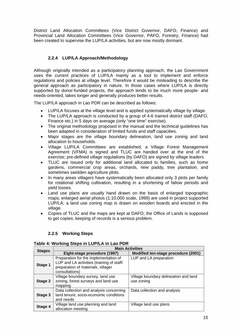
District Land Allocation Committees (Vice District Governor, DAFO, Finance) and Provincial Land Allocation Committees (Vice Governor, PAFO, Forestry, Finance) had been created to supervise the LUP/LA activities, but are now mostly dormant.
2.2.4 LUP/LA Approach/Methodology Although originally intended as a participatory planning approach, the Lao Government uses the current practices of LUP/LA mainly as a tool to implement and enforce regulations and policies at village level. Therefore it would be misleading to describe the general approach as participatory in nature. In those cases where LUP/LA is directly supported by donor-funded projects, the approach tends to be much more people- and needs-oriented, takes longer and generally produces better results. The LUP/LA approach in Lao PDR can be described as follows:
• LUP/LA focuses at the village level and is applied systematically village by village. • The LUP/LA approach is conducted by a group of 4-6 trained district staff (DAFO,
Finance etc.) in 5 days on average (only “one time” exercise). • The original methodology proposed in the manual and the technical guidelines has
been adapted in consideration of limited funds and staff capacities. • Major stages are the village boundary delineation, land use zoning and land
allocation to households. • Village LUP/LA Committees are established, a Village Forest Management
Agreement (VFMA) is signed and TLUC are handed over at the end of the exercise; pre-defined village regulations (by DAFO) are signed by village leaders.
• TLUC are issued only for additional land allocated to families, such as home gardens, commercial crop areas, orchards, new paddy, tree plantation, and sometimes swidden agriculture plots.
• In many areas villagers have systematically been allocated only 3 plots per family for rotational shifting cultivation, resulting in a shortening of fallow periods and yield losses.
• Land use plans are usually hand drawn on the basis of enlarged topographic maps; enlarged aerial photos (1:10,000 scale, 1999) are used in project supported LUP/LA; a land use zoning map is drawn on wooden boards and erected in the village.
• Copies of TLUC and the maps are kept at DAFO; the Office of Lands is supposed to get copies; keeping of records is a serious problem.
2.2.5 Working Steps Table 4: Working Steps in LUP/LA in Lao PDR
Main Activities Stages Eight-stage procedure (1997) Modified ten-stage procedure (2001)
Stage 1 Preparation for the implementation of LUP and LA activities (training of staff/ preparation of materials, villager consultations)
LUP and LA preparation
Stage 2 Village boundary survey, land use zoning, forest surveys and land use mapping
Village boundary delineation and land use zoning
Stage 3 Data collection and analysis concerning land tenure, socio-economic conditions and needs
Data collection and analysis
Stage 4 Village land use planning and land allocation meeting
Village land use plans
15

Stage 5 Agricultural field measurements Forest and agricultural land allocation decisions
Stage 6 Preparation of forest and agricultural agreements and transferring rights to villagers
Field measurements of agricultural lands
Stage 7 Land use management extension Forestry land agreements and transfer of rights to villagers
Stage 8 Monitoring and evaluation LUP and LA information storage Stage 9 - Agricultural land allocation records Stage
10 - Monitoring and evaluation
Slightly modified stages and working steps are applied in certain project areas. The ADB-funded Shifting Cultivation Stabilisation Pilot Project in Huaphan Province, the EU-funded Forest Conservation and Rural Development Project in Phongsaly Province and the GTZ-supported Rural Development Programme in Mountainous Areas in Bokeo and Luang Namtha Province are currently the most active in the review and further development of the LUP/LA methodology. The Land Management Component of the Lao Swedish Upland Agriculture and Forest Research Programme conducted by NAFRI with SIDA support focuses on the research of procedures and effects of land use planning in 2 districts. Photo 1: A village land use zoning map painted on wooden boards
16

2.2.6 Mapping Procedures Village land use maps in Lao PDR are usually hand-drawn and very inaccurate. Several projects have identified the need to upgrade the mapping practices (e.g. EU FCRDP Phongsaly) and to improve the base maps. In some cases village maps have been digitised, but this is rather the exception. Enlarged topographic maps and sometimes aerial photos (1999; 1:50,000, enlarged to 1:10,000 scale) are used in projects and programmes. Very few DAFO staff members are currently trained to use and interpret
better quality land use maps. The National Geographic epartment (NGD) in Vientiane provides enlarged scanned aerial photos and ortho-hotoplans against payment.
The ta ificatio y distinguis s
these support tools for mapping. GPS equipment is used in projects for village boundary delineation and definition of land use zones. Most projects or programmes dealing with LUP/LA have invested in their own GIS facilities in order to produceDp
2.2.7 Land and Forest Classification Systems
s ndard land class n s stem in Lao PDR he :
• Agricultural land • Construction land • Cultural land • Forest land • Industrial land • Land for national defence • Residential land • Communication land • Water-area
Forests are classified during LUP/LA into:
• Regeneration Forest e classification)
sing need for soil
45% - 60% Agro-forestry with soil conservation methods 60%
n integral part of the land use
• Conservation Forest • Protection Forest • Production Forest (sometimes Village Use Forest)
• Degraded Forest (only for present land us The following slope classes have been defined:
Suitable for rainfed or ir0 - 10% rigated paddy >10% - 45% Suitable for agricultural production with increa
conservation methods >> Forest area
2.2.8 Land Allocation In the Lao PDR land allocation to villagers in rural areas is aplanning procedures (stage 5 and 6). The objective of land allocation is to “reduce unsustainable use of land to increase the living standards”. Under the provisions of the Land Law, a total of up to 25 hectares can be allocated for agricultural and forest activities for each labour unit available in a family. In reality, the amount of agricultural land allocated to a family depends on the availability of suitable land areas (under 45% slope etc.), which is very often the limiting factor in the mountainous areas of Northern Lao RDP. As a rule, a family receives use certificates for the land areas already claimed by the family, provided village leaders agree. In villages
17

with a high dependency on shifting cultivation usually only 3 plots per family are allocated for rotational swidden cultivation in addition to areas for orchard establishment and
e
ervation forest, these areas are placed under the collective anagement responsibility of the village (but not fully allocated). To this regard, the UP/LA team and the village leaders sign a “Village Forest and Agricultural Land anag A
ls and land suitability are mainly for
ed by
een elaborated for sub-watersheds in ientiane and Bokeo province. Furthermore, ADB has funded a comprehensive atershed Management and Development Study for the Nam Ngum Watershed (2001)
nd is c n.
district and rovincial staff by trainers from FIPD, NAFRI and the Extension Center for the Reduction f Shifting Cultivation under NAFES. The Faculty of Forestry of the National University in ong D prepare specialised training courses on LUP/LA.
y the end of 2003, parts or the entire LUP/LA procedures had been conducted in 6510 illages ll 18 provinces/municipalities. The official target is to inish” 2005.
horticulture. Thus, an attempt is made to limit the extent of swidden agriculture by reducing the area available for these practices, in most cases without offering alternatives for agricultural production. After field measurements Temporary Land Use Certificates (TLUC) and a specific Land Use Contract for each plot are issued to the villagers. The TLUC are signed by DAFO and the District Governor. Copies of the TLUC are kept at DAFO and the Office of Lands. After 3 years of using the land in agreement with the stipulations of the Land Use Contract, thland user can request a Permanent Land Title (PLT) at the Office of Lands. Despite the official prohibition to sell land, this has meanwhile become common practice, sometimes based on verbal agreements, sometimes including the transfer of the TLUC or the PLT. In view of formalizing the results of the forest land zonation into production forest, protection forest and consmLM ement greement”.
2.2.9 Macro LUP/Regional Planning Since 1999, Lao PDR receives technical and financial support from Vietnam in preparing provincial agricultural land use master plans, consisting of 10 maps and one report. Such master plans have meanwhile been prepared for 7 provinces (Vientiane, Bolikhamxay, Savannakhet, Khammouane, Salavane, Attapeu, Champassak) and 6 selected districts in 3 other provinces (Northern Region); present land use, soiassessed, potential development priorities and investment costs are defined irrigation schemes and floodplain development. The technical work is conductNIAPP/Hanoi and other specialized institutions from Vietnam. Under the supervision of the Dept. of Planning/MAF two Integrated Watershed Management and Development Plans have bVWa urrently starting the implementatio
2.2.10 Training Opportunities Training opportunities for the standard LUP/LA approach are provided topoD ok is in a position to
2.2.11 Coverage Bv (out of 10,500) across a
all villages until the end of “f
18

2.2.12 Costs of LUP/LA As a general rule, public funds for LUP/LA are allocated at a rate of 500,000-1,000,000 Kip/village (US$ 47 to US$ 94, March 2004). This amount will cover the costs for 3-5
the 2003 national budget an average of 10 million Kip per province was allocated for UP/LA activities. In cases when a more participatory approach to LUP/LA is funded or
co-funded by projects, the real costs per village for a 10 day process including all maps and land allocation are estimated at around US$ 400-600.
working days in a village for a team of 4-5 district staff. Very often the villagers are expected to contribute to the costs by providing free meals and accommodation. No special budget is made available for follow up and monitoring tasks after the initial LUP/LA exercise. InL
19

2.3 Thailand
2.3.1 Background Participatory LUP was initiated in Thailand by the Sam Mun Highland Development Project (funded by UNDCP and GTZ in the late 1980s. Until today PLUP is restricted to project areas, including the Royal Project Centers. The implementation of land use planning activities is hindered by the fact that there is no systematic or standardised LUP approach nor are there official regulations or laws to support LUP. More recently, the focus of land use planning application has been in protected areas. LUP is used to stabilise or reduce forest encroachment in national parks, wildlife sanctuaries and protected upper watersheds. During the applied procedures an attempt is made to identify whether the local land users occupied the land before the gazetting of the protected area or moved to the area afterwards. A zonation exercise tries to distinguish the core protected areas from community land and agricultural use zones. Finally, it is intended to allocate residential and agricultural land areas to the families living in the protected areas in accordance with the provisions of the law. One of the biggest challenges is to limit land speculation and exclude major land development projects within the boundaries of the protected areas. Numerous Government institutions conduct land zonation and land allocation activities side by side. Sometimes there are overlaps and institutional rivalries. In some cases LUP follows watershed boundaries, in others administrative boundaries. The Land Development Department (LDD) has for many years followed a more technocratic approach to land use planning, based on soil maps, land suitability assessments and soil conservation aspects. Numerous land use maps at various scales have been produced by the mapping centers of LDD, but the actual implementation based on these plans has been disappointing. The Royal Forestry Department (RFD) also has substantial experience with LUP approaches, mainly within the framework of donor-funded projects. Yet, LUP activities conducted by RFD at the local level often face fierce opposition by local NGO and lack people’s participation. In the past, no direct links existed between LUP activities and land allocation to households. Numerous institutions share the mandate to issue various types of land use certificates and land titles. Lately, the Thai Government has launched a review of the various kinds of land certificates and titles in view of standardising the documents, simplifying the institutional responsibilities and providing all land users and owners with the opportunity to use their papers as loan collaterals. Generally speaking, most mapping activities related to LUP make use of existing GIS facilities and are performed to a high technical standard. In the past, sophisticated Provincial Master Plans have been elaborated, but are now discontinued as their implementation was lacking. Administratively, Thailand is divided into 76 provinces, districts and Tambons (sub-districts).
2.3.2 Legal Framework/Policy Statements In recent years, the Thai Government has regulated issues of land and forest management more by passing cabinet resolutions than by new laws or bills. One of the most important recent Cabinet Resolution passed in June 1998 concerns the surveying and land verification within protected areas in order to resolve the long-standing problem of people living in those areas. This verification has now started in several national parks and other protected areas and is assisted by the use of Landsat images and aerial photos.
20

The most relevant Thai legal documents with regard to land and forest management are: - Land Code (= basic land law) (1954) - Land Allocation Act (1978) - Land Development Act (1983) - Land Reform Act (1992) - Forest Act (1941, amended 1948, 1982 and 1989) - National Forest Reserve Act (1982) - First National Forestry Policy (1985) - Act on Tambon Administration (1994, reviewed 1999) - Thai Constitution (1997) Further details are given in Annex 1. The Thai legal system only recognizes 3 basic types of land ownership and use: private ownership, state property and various forms of usufruct certificates granted to farmers and smallholders. In terms of policy development the most important statements are to be found in the 5-year National Economic and Social Development Plans (currently the 9th NESDP, 2002-2006). The latest NESDP is very critical of past strategies for natural resources and environmental management and in particular of the forestry sector. The NESDP postulates a major shift towards more balanced national development. The Office of Natural Resources and Environmental Policy and Planning (ONREPP) also deals with policy issues on land and natural resources management. The ONREPP has recently made a few suggestions to the Thai Government to reform the overall sector, such as to select only one committee or organisation in charge of land management in order to establish one policy on land, to issue only one type of land title, to conduct more coherent land zoning and land suitability assessments, to create a fair system of land taxes and to formulate enforceable laws. In various policy documents it is postulated that “before land allocation is undertaken, it is necessary to practice Land Use Planning based on the official land classification system”.
2.3.3 Main Institutions involved In Thailand there is no lead agency responsible for land use planning and there are up to 14 Government agencies dealing with land allocation programmes. Overlaps of jurisdiction, administrative conflicts and lack of coordination are therefore unavoidable. The Land Development Department (LDD) has substantial experience in macro land use planning, but also promotes local land use planning e.g. within the framework of Royal Projects and in cooperation with the Highland Agricultural Development Project. The Royal Forestry Department and in particular the new Department of National Park, Wildlife and Plant Conservation at the Ministry of Natural Resources and Environment support local LUP within protected areas and also in connection with Royal Project Centers. Table 5: Institutions involved in LUP and LA in Thailand Institution Mandate/responsibilities with relevance to LUP/LA Land Development Department/Ministry of Agriculture and Cooperatives
Responsible for macro and local land use planning (outside the forest reserves and protected areas) and in zones with less than 35% slope Soil surveys, Land suitability classification Soil conservation and improvement
Department of National Park, Wildlife and Plant Conservation/Ministry of NR and Environment
Land Use Planning in Protected Areas In zones with more than 35% slope or upland areas
21

Royal Forestry Department/Ministry of NR and Environment
Land Use Planning in the gazetted forest reserves (lowland areas) Land allocation for settlers in the national forest reserve area
Agricultural Land Reform Office (ALRO)
Responsible for land reform activities in LR areas (113 districts): distribution of land purchased from absentee landowners or state land to tenants, smallholders and landless families
Department of Public Welfare (DPW)/Ministry of Interior
Allocates public land to farmers and poor families under self-help land settlement projects (as part of the social welfare programme)
Department of Lands (DoL)
Registers land holdings, issues land titles and land use certificates, conducts cadastral surveys
Department of Cooperative Promotion (DCP)
Land allocation of state land to landless people and tenants organised in cooperatives
Office of Natural Resources and Environmental Policy and Planning (OREPP)
Policy development on natural resources and environmental management
In addition to these line agencies there are numerous commissions, committees and boards dealing with land and NR issues, such as the National Land Allocation Commission (supervises land allocation of state land, but not national forest reserve), the National Forest Policy Board (chair: RFD), the Land Consolidation Commission, the Agricultural Land Reform Committee (under the Ministry of Agriculture and Cooperatives), the Land Development Committee (in charge of land use and land classification), the Land Sub-committee, the Property Valuation Committee and the National Economic and Social Development Board. At the Tambon and village level the very diverse group of local NGO play a crucial role in all land use planning activities. Many of them have adopted a strong advocacy role in favour of the local population and their relationship e.g. with the RFD is marked by fierce opposition. Tambon Administration Offices (TAO) are now advised by so-called “Local Technology Centers”, which include an agricultural officer in charge of extension. The TAO is the executive agency for the elected Tambon Council. The Tambon level develops its own budget, annual work plans and 3-year development plan, which are submitted for endorsement to the provincial level. In terms of natural resources management the Tambon is supported by RFD staff and Watershed Management Units, NGO and sometimes the private sector. TAO have been instructed by the Ministry of Interior to use about 20% of their annual budget for NRM activities, which could include some funding for land use planning activities.
2.3.4 LUP Approach/Methodology The local land use planning approach in Thailand is usually carried out within watershed boundaries and primarily within protected areas. The main procedures are to survey the national park areas, critical watersheds, and some wildlife sanctuaries in order to identify agricultural use areas and settlements within the zone. It is then attempted to identify the duration of land occupation, in particular whether the land use and settlement dates from before the gazetting of the protected area. Eventually, use, buffer and protection zones are identified and jointly approved by a “working group” consisting of villagers and their representatives, line agencies (e.g. Watershed Management units, National Parks offices, LDD representatives), Royal Project staff, local NGO and local authorities (Tambon and district). The occupied land is registered and conditions for using the area are compiled.
22

The survey phase is ideally supported by aerial photo interpretation, but this meets with scepticism and opposition by local NGO and villagers. Therefore the approach requires a lot of ground truthing and analysis of other evidence, which is extremely time consuming. 3D-models built from cardboard or styrofoam are widely used. The zoning activities mainly involve technical staff from RFD stationed in the WM Units, staff from the Highland Agriculture Development Office and for the survey of the agricultural plots, staff from ALRO in Bangkok. The involvement of ALRO, despite the Government decision that there should not be any land reform in protected areas, has led to renewed inter-institutional rivalry and duplication of work. According to the latest policy, people found to have legal rights to land areas within the protected areas will receive a land title for their residential area and their agricultural plots in due time. In some rare cases, squatters found in the protected areas have been relocated to buffer zones. The LUP approach has been developed within the framework of the Royal Projects and its application in six protected areas in a uniform way has started recently. Nevertheless, the approach itself is not yet fully legalised. The Land Development Department (LDD) practices a slightly different approach to LUP. LDD Bangkok originally prepared provincial level master plans under the supervision of a sub-committee at provincial level. These master plans were subsequently converted into more detailed LUP action plans. A number of sub-catchments have been selected to conduct detailed surveys and land use planning, starting in one pilot village and then expanding from there. Currently this type of LUP is carried out in approximately 3-5 villages per province per year. The work procedures includes the preparation of a 1:10.000 detailed base map, soil surveys, socio-economic surveys, land holding surveys and the drafting of a vision and regulations for the area. The summary of this information is presented in the land use plan. A forum of about 20 to 30 people is created to overlook the entire process and has the task to negotiate agreements concerning the future conversion of land use (e.g. reforestation measures). Finally, state land and present or future forest areas are demarcated by the use of cement poles. 18 sub-catchments, most of them located in Royal Project areas, are presently undergoing the land use planning process under coordination by LDD. The overall process takes about 3 years to be completed and implementation is then supervised by the extension station of the Royal Project. Lately, His Majesty the King has proposed the issuing of group land titles in these sub-catchments, which are mainly inhabited by ethnic minority population.
2.3.5 Working Steps Table 6: Working Steps in LUP in Thailand Working Steps in Local LUP by RFD, WM Units
Working Steps in LUP by LDD (3-5 villages per province)
1. Preparation 1. 1:10.000 detailed base map 2. Survey 2. Soil survey 3. Land use patterns and tenure status 3. Socio-economic survey 4. Present land use map and identification of community forestry areas
4. Land holding survey
5. Land use design (depending on Government policy)
5. Vision, policy and regulations
6. Community design and negotiation 6. Land use plan 7. Implementation 7. Set up negotiation forum (20-30 people)
23

Map 2: Village Land Use Map from Thailand
2.3.6 Mapping Procedures In Thailand GPS and GIS based technologies are widely applied in land use planning procedures. Both, LDD and RFD maintain GIS centers at provincial levels. LDD has recently started using the latest available aerial photos from 2002. The originals of these colour photos are at 1:25,000 scale, but can easily be enlarged up to 1:4,000 scale. These enlarged photos constitute a perfect tool for local level planning. Final village land use maps are usually produced at 1:10,000 scale. In the latest developments, private companies try to sell GIS based planning software and tools to Tambon Administration Offices and offer to provide training. In another support to the Tambon level, LDD has started to distribute soil maps for lowland areas to Tambon administrations.
2.3.7 Land and Forest Classification Systems 45.9% (23.6 million ha) of Thailand has been officially declared as “National Forest Reserve Area”. The watershed classification system distinguishes 5 classes: WSC 1 (protection forest), WSC 2 (commercial forest), WSC 3 - WSC 5 (agricultural and other purposes with appropriate conservation and mitigation measures). The classification scheme employed five parameters: slope, elevation, landform, soil and geology.
24

LDD uses a land suitability classification differentiating a total of 8 classes. Forest zones: conservation forest (zone C), economic forest (production forests, community forests, agro-forestry) (zone E) and agricultural use zone (zone A); the national target is to achieve a 40% forest area, with 15% conservation forest area, and 25% economic forest area Slope classes: 0 - 12% Agricultural Land >12 - 35% Agricultural use with conservation measures >35% Forest land, but also orchards with conservation measures >50% Protected Forest
2.3.8 Land Allocation Several Government institutions in Thailand have the right to issue land documents. The various land certificates and titles provide different levels of land tenure security and land rights. Until now, a coherent land policy framework is still missing. Currently a review of all types of land titles is conducted by the newly created “Assets Capitalization Office”. The land reform programme in Thailand aims at distributing farmland to tenants and small and landless farmers. Land is purchased from absentee land owners and is allocated to former tenants (e.g. 3-5 rai per smallholder). The land plots are sold to the future owners on a long-term instalment basis with repayment periods of 5-15 years and 6% interest per year. Upon completion, land ownership is transferred by the issuing of SPK 4 titles (Sor Por Kor 4-01). Nevertheless, any transfer thereafter must be approved by ALRO, a rule which has not been strictly enforced, leading to frequent misuse and land speculation in land reform areas. ALRO also conducts redistribution of state land (e.g. land provided by RFD in the National Forest Reserve Area). The maximum area to be allocated per family is 50 Rai or 8 ha. In the past, ALRO has allocated more than 7 million ha of degraded forest area within the national forest reserve (zone A and E) to farmers. Until January 2004, the titles issued (Sor Por Kor 4-01) by ALRO could not be used as collateral, but are now accepted by at least one national bank. SPK 4 titles cannot be sold or transferred except to legal descendants, but this rule is generally not adhered to. In the years 1981 to 1994, the RFD issued STK (Sor Tor Kor) certificates for areas of up to 15 Rai (2.4 ha) per family in the lowland parts of the national forest reserve. STK certificates provide usufruct rights for farming purposes only and do not entail full ownership. There are 2-3 different types of STK, but none of them can be used as collateral or transferred except to descendants. Once again, in the past STK certificates were often purchased by outsiders opening the doors for misuse and land speculation. This was one of the reasons why the RFD was ordered by the Government to stop the STK programme and to hand over the right to allocate degraded forest areas to ALRO. Today there are still huge areas of illegally occupied land remaining in the national forest reserve and particularly in the protected areas. The Department of Lands (DoL) issues the vast majority of land titles for residential and agricultural land. 4 types of land documents are provided by DoL:
- Title Deed (Nor Sor 4 or Chanode) - Certificate of Utilization (Nor Sor 3) - Per-emptive Certificate (Nor Sor 2 or Baichong) - Claim Certificate (Sor Kor)
Nor Sor 3 and 4 are accepted as collateral or guarantee. Only about 20% of the overall agricultural land area have been issued the full title deeds.
25

In addition, the DPW and the DCP have also issued different types of land certificates (the Nor Kor and Kor Sor Nor respectively). Both institutions are now inactive in land allocation as there is little public land outside the forest reserve available for distribution.
2.3.9 Macro LUP/Regional Planning Since 1973, LDD has prepared macro land use plans for several provinces, using data from soil surveys as well as land and suitability classifications. Such plans had been completed for over 30 provinces by 1990, but hardly any of them saw any kind of implementation. In other cases the areas proved unsuitable for the designated purpose. LDD Bangkok prepared the following master plans:
• Regional Land Use Plans 1:500,000
• Provincial Land Use Plans 1:250,000 The elaboration of these master plans proved to be very time consuming and costly, while the continuous changes in land use rendered them obsolete in a relative short time period. In 1997 a decision was taken to stop the preparation of regional and provincial land use plans. Based on a recent Cabinet Resolution, the formulation of integrated development plans for 25 major river basins is now started at pilot level (Nam Cheun Watershed).
2.3.10 Training Opportunities Training on land use planning in Thailand is provided by the Forestry Faculty at Kasetsart University and RECOFTC for the entire sub-region.
2.3.11 Coverage The involvement of so many institutions, the absence of a standardised approach and therefore the lack of a consistent monitoring of land use planning and land allocation achievements makes it very difficult to estimate the coverage in Thailand. Based mainly on the information available from previous natural resources and rural development projects, as well as some data from RFD and LDD, it is estimated that by the end of 2003 local level land use planning had been conducted in 150 villages mainly in the Northern Region of Thailand. Furthermore, LDD has prepared soil and land use maps for some 120 sub-watersheds. Despite the fact that the contentious “Community Forestry Bill” has not been passed by the Government for several years, there are currently approximately 9000 villages with community forestry schemes approved by RFD. All of these are obviously located outside the protected areas.
26

2.3.12 Costs of LUP/LA There are no figures available on the costs of land use planning or land allocation in Thailand. After land titling the incentive scheme to encourage private reforestation by farmers provides a grant of 18,750 THB/ha in 5 instalments (over 5 years) for successful indigenous tree plantation.
27

2.4 Viet Nam
2.4.1 Background The national land use planning framework in Vietnam is still essentially following a top-down orientation. Vietnam is the only of the 4 countries in the sub-region where land use planning is prescribed by law, namely the Land Law. In line with these legal provisions all provinces have provincial land use master plans, most districts have land use plans and in some cases these top-down plans have been broken down to the commune level. Since 1994/95, a methodology for participatory land use planning (PLUP) has been developed in a number of area-based projects. The PLUP approach focuses at the commune level, but starts from the village and sometimes even household level. Two slightly different procedures of PLUP and (forest) land allocation have been widely tested and applied in projects and are sometimes referred to as the FAO methodology and the SFDP methodology. Based on the generally very positive experience of allocating agricultural land to individuals and households (de-collectivisation of agriculture in the 1990s), the Vietnamese Government has embarked on a similarly ambitious programme of Forest Land Allocation (FLA) to individuals, households and organisations. Very often FLA is carried out without a preceding PLUP exercise, which can lead to conflicts and complications. Despite numerous laws, decrees and instructions from the central level, the actual implementation of LUP and FLA varies quite substantially from one province to the other. Some Provincial People’s Committees have compiled separate guidelines on LUP/FLA. In general the implementation of LUP/FLA has been slow and is mainly restricted by budget constraints and limited staff capacities. This is somewhat in contrast to the high priority allocated especially to FLA in virtually all policy and strategy papers. In areas where close links have been established between LUP/FLA and the major National Programmes (e.g. 5 Million Hectares Reforestation Programme) land allocation including the issuance of land use certificates has been accelerated and improved. Main objective of PLUP/FLA in Vietnam is to improve the management and protection of land and natural resources through a sense of ownership and responsibility. The Vietnamese Government follows the principle that for all land areas, a clear ownership structure and responsibility needs to be defined and legally acknowledged.
2.4.2 Legal Framework/Policy Statements The most important legal documents pertaining to land use planning and land allocation in Viet Nam are:
- the Land Law (2003) - Decree No. 01/CP (1995) - Decree No. 64/CP (1993) - Decree No. 163/CP (1999) - Decision No. 245/1998 - Decision No. 178/2001
Further details are presented in Annex 1. In November 2003, the revised Land Law has been passed by the National Assembly and will take effect as from July 2004. Implementation guidelines are currently under elaboration. The main changes of the revised law compared to the Land Law of 1993 are: land can now be allocated to entire communities and religious organisations and state
28

land ownership is further clarified. The Land Law prescribes the general procedures of land use planning, at provincial, district and commune level (details are presented in chapter 2.4.9). It also stipulates that commune land use plans must be detailed down to the individual land plot level and that for detailed land use planning, the agencies involved need to gather the comments of the local population. In various forest policy documents a forest cover of 43% is mentioned as the national goal. Based on this figure, each province has developed separate targets for their forest cover.
2.4.3 Main Institutions involved and LUP/LA Committees Since 1999, and based on Decision 245 and Circular 62, the overall technical responsibility for land use planning lies with the Ministry of Natural Resources and Environment (MoNRE) and its subordinate structures at provincial and district level. In mountainous areas with remaining forest cover, staff from the Department of Forest Protection (DFP) and the forest staff at the Department of Agriculture and Rural Development (DARD) cooperate on the implementation of LUP/FLA with the land administration and cadastral staff. This cooperation has not always been smooth, especially as the DFP was previously the sole responsible agency for forest allocation, but has recently improved. For the elaboration of all macro land use plans a Steering Committee, headed by the Provincial People’s Committee (PPC) and with the membership of all relevant line agencies, is created to coordinate the overall process. LUP/FLA Steering Committees also exist at District level. In almost all cases of provincial and district LUP, the PPC or DPC sign contracts with specialised institutions from Hanoi to support them in the procedures of macro-level LUP. At the commune level, the Commune People’s Committee is either supported in LUP/LA by an implementation team (also referred to as a “working group”) consisting of district cadastral staff and forestry staff or they also sign contracts with specialised institutions. The commune cadastral officer is in charge to overlook and follow up the LUP/LA procedures. The specialised institutions involved in the technical support of the provinces, districts and sometimes the communes in land use planning and land allocation activities are:
- the Forest Inventory and Planning Institute (FIPI) in Hanoi and the 6 sub-FIPIs in the regions; in particular: Forest Resources and Environmental Center (FREC) in Hanoi
- Several Departments of MoNRE, which have specialised teams to assist on LUP - the National Institute for Agricultural Planning and Projection (NIAPP) and 2 sub-
NIAPPs, which supported approximately 30 provinces and many districts in their macro-level land use planning
- the National and Forestry Universities (e.g. Agricultural University I, Xuan Mai University), which mainly support communes with training events and send teams of lecturers and post-graduate students to participate in LUP/FLA exercises; some university faculties are also involved in the design of land use planning approaches
29

Table 7: Institutions involved in LUP and LA in Viet Nam Institution Mandate/responsibilities with relevance to
LUP/LA Documents specifying these responsibilities
Provincial People’s Committees (Province, District, Commune)
Are responsible for the preparation of land use plans, planning of 3 forest types (special use forest, protection forest and production forest), implementation arrangements for land allocation, land leasing, issuance of land use right certificates; LUP results always need to be approved by the next higher level (e.g. province approves district LUP, district approves commune LUP)
Circular No. 62, Decree No. 163/CP
Ministry of Natural Resources and Environment (MoNRE) Province: Department of NRE (former Dept. of Land Administration) District: Cadastral Office Commune: Cadastral Agent
Responsible for the allocation and registration of agricultural and forestry land; issuing of Red Books Coordinates and supervises land use planning activities at all levels
Decision 245/1998; Decree No. 163/CP
Ministry of Agriculture and Rural Development (MARD) Department of Forestry (DoF) Department of Forest Protection (DFP) Province: DARD Sub-department of Forest Development (S-DFD) Sub-Department of Forest Protection (S-DFP)
Forest and agricultural land classification Forest management Agriculture and forest extension
Decree No. 64/CP Decision 245/1998; Decree No. 163/CP
Other main stakeholders in LUP/LA are: the State Forest Enterprises (SFE), State Farms, Forestry and Agriculture Enterprises belonging to the People’s Armed Forces, Forest Protection Boards, Special-Use Management Boards etc.
2.4.4 LUP Approaches/Methodologies In Viet Nam two main LUP approaches coexist:
a) the top-down procedures, starting from the macro level at the province, district and sometimes broken down to the commune level (approximately 30% of the communes have such land use plans, which must be submitted to the higher levels simultaneously with the socio-economic development plans of the commune)
b) the truly participatory LUP approach developed in a number of projects, which focuses at the commune level, but starts from the villages
The combination of PLUP and FLA is mainly conducted in project areas of donor-funded projects by multi-disciplinary/multi-institutional working groups with training and advisory support being provided by project staff or qualified trainers. The PLUP approach starts from the collection of information and secondary data, the identification of the present land use situation, the land use planning and mapping, the preparation of land allocation and the final approval of the plans and issuance of land certificates. In general, commune boundaries are already defined before the LUP procedures start. Village boundaries are
30

usually clarified during the PLUP process. As a part of the PLUP procedures, villagers themselves prepare their own regulations (“regulations for protection and forest management”), e.g. in the provinces of Son La and Lai Chau. Ideally, PLUP directly leads to the allocation of agricultural and forest land to households, groups, communities and organisations. The full PLUP/FLA procedures require approximately one full year per commune including the issuance of land use certificates and final approval by district authorities. This is based on experiences in Lai Chau Province. There are numerous different guidelines on top-down as well as on participatory LUP in Viet Nam, some prepared by Government institutions, such as MoNRE, Dept. of Forest Protection and FIPI (“Guidelines on Commune Forest Land Use Planning), some by Provincial People’s Committees (Son La and Lai Chau), others by Universities (Xuan Mai Forest University) and various projects (SFDP, FAO). The various methodologies presented in the guidelines differ quite substantially from each other and implementation is again handled differently from one province to the other.
2.4.5 Working Steps Table 8: Working Steps in PLUP in Viet Nam Working Steps in PLUP FAO/MARD Methodology
Working Steps in PLUP/FLA SFDP/MARD Methodology
1. Establish working group 1. Preparation 2. Prepare current land use map 2. Field survey for data collection and
development of present land use map 3. Prepare soil map 3. Land use planning and proposed allocation
plan 4. Prepare land use planning map 4. Allocation in the field Followed by 12 steps of FLA: 5. Assessment, approval of documents and
granting of LUC at district level Meetings, applications, measuring, mapping, registration and issuing of LUC
6. Compilation of cadastral documents ad handing over of LUC to households
2.4.6 Mapping Procedures The following maps are usually produced during the LUP procedures: a) Present Land Use Maps, b) Future (or “proposed”) Land Use Maps and c) Land Allocation Maps. In some cases there is a lack of clear differentiation between present and future land use maps, as any map represents an ideal situation or rather the goal than the present reality. The suggested mapping scales are 1:10.000 for smaller communes and 1:25.000 for larger communes. Aerial photos of 1999/2000 are available for all provinces of Vietnam and the process of rectification and elaboration of ortho-photos is ongoing at MoNRE. The use of large scale aerial photos as a mapping base is still limited and mostly restricted to project areas, due to the prohibitive costs involved. 3D terrain models are often used in the PLUP process. Most Departments of Natural Resources at the provincial level have at least elementary GIS facilities. Major mapping activities with GIS software, e.g. for macro land use planning, are still performed by the specialised institutions in Hanoi.
31

2.4.7 Land and Forest Classification Systems Land classification (according to the Land Law): 1. Agricultural land including land for annual crops, rice land, pasture land; perennial tree crops; production forest land; protection forest land; special use forest and others 2. Non-agricultural land, e.g. residential land and others 3. Unused land MoNRE and NIAPP use a more detailed land classification system for provincial and district land use master plans distinguishing a total of 46 different classes. Classification of Forest Land: Economic classification system:
• Special-use Forest land (national parks, nature reserves, landscape protection etc.)
• Protection forest land (Watershed protection zone – very critical, critical and less critical protection areas, protection against wind erosion, environmental and ecological protection)
• Production forest land (for production of forest trees, other forest products, forest special products, wildlife and combination with ecological and environmental protection)
Descriptive forest classes according to forest condition:
• Area without forest (IA with shrubs, IB grassland with shrubs, IC bare land with some scattered trees); IC is used for natural regeneration, while IA and IB need to be replanted
• Forest after shifting cultivation (fallow) (IIA, IIB) • Poor forest (IIIA1) • Medium well-stocked forest (IIIA2, IIIA3) • Rich well-stocked forest (IIIB, IV)
There have been some problems to apply the forest classification systems in the field.
2.4.8 Land Allocation In the lowland areas of Viet Nam virtually all agricultural land has been allocated since the early 1990s based on Decree No. 64. In the mountainous parts of the country the vast majority of the paddy plots have also been allocated and registered, but upland plots and swidden fields are in most cases not yet covered by valid land use certificates. While the procedures and responsibilities for agricultural land allocation have basically remained unchanged, there have been numerous alterations with regard to FLA. In the vast majority of communes land allocation is conducted without a previous land use planning exercise. Everywhere, agricultural land allocation is further advanced compared to forest land allocation. In communes with more recent PLUP activities, agricultural and forest land allocation are done together wherever possible. The official target is to complete all forest land allocation until 2005.
32

In Viet Nam forest land can be allocated e.g. to organisations, households and individuals and more recently to communities with the issuance of land use certificates (Red Books). Furthermore, forest land can be contracted by communes, by management boards and by organisations to households or individuals e.g. for protection or regeneration purposes. Finally, forest land can also be leased from district authorities, but this system is not widely applied. Forest land allocation started in 1994. The maximum allocated forest area with a LUC is 30 ha per household. In Son La province the standard rule is to allocate 0.5 – 30 ha per household or group of households, 30 – 500 ha per community and 500 – 15,000 ha per State agency. Until 1998 temporary use certificates or Green Books were issued to forest users, which had a period of validity of 50 years. Since 1999 forest land can be allocated by using the standard land use certificates or Red Books. Scattered forests and forests along the village boundaries, areas near settlements, sacred forest and watershed protection forests are nowadays mostly allocated to the entire community instead of individual households. Nevertheless, forest land allocation to households and organisations still constitutes the vast majority of cases. Land use certificates provide 5 basic rights: use, transfer, heritage, mortgage and lease. 6 steps or documents mark the procedure of FLA: an application, a feasibility study or development plan, a map at 1:5,000 – 1:25,000 scale, a decision on FLA by the DPC and the forest protection staff, minutes of FLA and final registration (archives). The final decision on all land allocation issues and the signing of the Red Books is the responsibility of the District People’s Committee (based on proposal by the Commune People’s Committee). Depending on the future use and the type of user, land allocation is conducted with or without charging annual land use fees. Initially forest land allocation to households consisted mainly of bare land handed over for reforestation and regeneration purposes. Since 1999 allocation of natural forest area is piloted in 5 provinces (Son La, Lai Chau, Dak Lak, Cao Bang, Hoa Binh) which represents a major shift in policy. As an example, 60% of the forest land (stocked or unstocked) of Lai Chau province is classified as critical area, and has been allocated to organisations, communities or management boards. The remaining 40% have been allocated to households, individuals and local organisations with Red Books. The second option for delegating management responsibilities to the local level is the system of contracting forest areas. Under this scheme, for example management boards responsible for special use forest in national parks (more than 20 in Viet Nam) or nature reserves (more than 100) can contract parts of the area (e.g. in the buffer zones) for protection and plantation of forests. The same applies to protection forests in critical and very critical watershed areas. In this case no land use certificates are provided, but contracts for shorter time periods are signed with local households and individuals to manage the area. In other instances, state forest enterprises have contracted parts of their forest areas to their employees or villagers living in the area. Today, the emphasis is shifting from contracting of forest land to allocation of forest land with red books. In addition, private organisations and public enterprises can lease forest areas e.g. for tourism and commercial purposes from district authorities or management boards. Furthermore, protected forest can be leased to households or organisations, while production forest areas can be leased to foreign organisations for management. Based on Decision 178/2001 and Circular No. 80/2003 the Vietnamese Government has recently re-defined and harmonised a general “Benefit Sharing” policy for allocated or contracted forest land:
- Benefits for households with allocated forest land: timber for house construction, firewood, products of thinning operations, non-timber forest products, main
33

exploited forest products, maximum of 20% of the area within a protection forest can be used for agricultural and fishery production.
- Benefits for households with contracts for protection forest areas: 50,000 Dong/ha/a (approx. US $ 3.5), but no share in the value of forest products; e.g. no extraction rights for firewood or construction wood without applying for a permission from the “owner” of the forest. No construction of permanent houses is permitted in the area.
2.4.9 Macro LUP/Regional Planning In Viet Nam prescribes that all provinces, districts and communes have to prepare land use master plans and land use planning maps. These plans are to be drafted every 10 years and updated every 5 years. The current plans and maps are valid until 2010. The prescribed contents of the macro level land use planning (according to the Land Law) are:
a) Survey, studies, analysis and summary of the natural, economic and social conditions and the present land use; evaluation of land potentials
b) Identification of land use orientations and objectives in the planning period c) Determination of land distribution for socio-economic development, defence and
security demands d) Determination of land areas to be recovered for the implementation of works and
projects e) Determination of measures for land use, protection and improvement and
environmental protection f) Suggestion of ways to implement the LUP
The basic procedures for the preparation of provincial land use plans exist since 1995. First examples were finalized in 1998-99. The overall planning process at provincial level, which is supervised and coordinated by the LUP steering committee can take up to 2 years and consists of 9 working steps. The final outputs are 9 thematic maps, a land use planning map (1: 100,000 or 1:50,000 scale) and a report per province and the same per district at 1:50,000 or 1:25,000 scale. The plans normally do not include any cost estimations for implementation. It is the provincial administration that provides the budget for all LUP activities, including the district LUP exercises. Particularly poor provinces can request support from the central level. It is rare for communes to pay for their own LUP. Virtually all province and district administrations request the technical support of specialised institutions such as NIAPP (cooperating with 20-30 provinces), FIPI, MoNRE (Land Inventory and Planning Center) for the preparation of their land use master plans.
2.4.10 Training Opportunities The Department of Land Use Management of the Xuan Mai Forestry University offer courses for graduate students on land use planning with a focus on macro level LUP. Short courses in PLUP at commune level can be provided on demand. Most specialists dealing with land use planning have graduated from the Land Management Faculty at the National University in Hanoi. Within the framework of area-based projects, such as SFDP in Son La and Lai Chau, training courses for PLUP trainers have been organised in the past. For the two provinces there are now 12 qualified PLUP trainers available.
34

2.4.11 Coverage Administratively, Viet Nam is organised in 64 provinces, 648 districts and 10745 communes. As LUP is a rather decentralised procedure in Viet Nam, there is only limited information available on the overall coverage. All 64 provinces have valid macro-level land use plans or are in the process of updating them. MoNRE Hanoi estimates that about 30% of all communes have concluded LUP, while another 20% have at least started the procedures. Nevertheless, the quality of many of the resulting land use plans is described as poor with the exception of urban areas. All communes are supposed to finish their land use plans until end of 2005. With support by donor-funded projects at least 150 communes have established land use plans and conducted land allocation based on a more participatory approach until April 2004. The latest official figures on land allocation show that until May 2002 a total of 8.9 million ha agricultural land have been allocated to 11.1 million households and an additional 1.5 million ha of forest land (out of a total of 11.5 million ha forest land) to 0.51 million households (Aug. 2002). It is estimated that agricultural land allocation is completed to over 95% and FLA should to be completed by the end of 2005.
2.4.12 Costs of LUP/LA The standard rate for a commune LUP is 30 million Dong (US$ 1,900) per commune. For a more participatory approach an average rate of between 23,000 Dong/ha and 26,000 Dong/ha (approximately US$ 1.4 to 1.8) is charged by the relevant institutions. This rate is calculated on the basis of 20 days of field work for 6 people per commune (if maps/aerial photos are available). The costs for the reforestation of 1 ha bare land are calculated at 4-5 million Dong/ha (US$ 270-330) (according to the National Programme 661).
35

3 Comparative Assessment of Experiences and Lessons Learned
3.1 Cambodia
The application of PLUP as a tool in land and natural resources management in Cambodia is a fairly recent development. Experiences are therefore still limited. On the other hand this has permitted those involved in the methodological development of PLUP in Cambodia to make use of lessons learned in the neighbouring countries and to avoid some of their former mistakes. The overall approach to PLUP in Cambodia is well defined and documented. A standardised training approach has been set up and implemented. Several donor-funded projects and programmes are coordinating their support to PLUP in the provinces. An attempt has been made to establish and maintain networks among those involved in PLUP, involving mainly the projects, the provincial line agencies and the MLMUPC as the lead agency. The MLMUPC has also started to monitor the implementation results of PLUP and coverage from a central level. If continued, this could provide good opportunities for coordination and monitoring of all aspects of PLUP implementation in the country. On the other hand, numerous challenges and difficulties persist in the application of PLUP at commune level. The general coordination and management of a multi-disciplinary and multi-institutional approach and the supervision of multi-disciplinary field teams creates major challenges under Cambodian conditions. Most provincial steering or management committees are not yet working efficiently. Field technicians, if taking their PLUP tasks seriously, do not get the support they would need from their superiors and the local administration. The technical staff seconded by line agencies and trained to perform PLUP activities still face numerous difficulties in taking up a “facilitating” role. Their main previous experience has been to transmit instructions and regulations created by central Government to the communities and in some cases to enforce them. It takes a substantial amount of on-the-job training and coaching for the PLUP team members to turn into facilitators capable of negotiating with villagers and Commune Council members. Furthermore, provincial or district staff capacities are still very limited in general, also on technical aspects. Cambodia has a particularly high rate of land conflicts. There are numerous cases of illegal land appropriation and misuse of land and natural resources involving e.g. foreign and national companies, local businessmen and powerful individuals in general. The resulting land conflicts between these “outsiders” and the local population are a particular challenge to PLUP teams in Cambodia. As there are only limited alternatives, the exploitation of natural resources (mainly forests and fish) is the main source of livelihood for the rural population as well as the obvious source of income generation for the Government and business organisations. It is obvious that this leads to major conflicts with potentially devastating effects for the poorer segments of the population. The PLUP approach, although theoretically well adapted to sort out the issues, and to negotiate compromises for future land and resources use, in some cases might be too complex and demanding in view of the present staff capacities. Furthermore, despite the recent efforts by the Cambodian Government, many legal aspects on land and natural resources remain unclear. The exact role and responsibilities of the elected Commune Councils with regard to their area of jurisdiction have not yet been fully clarified. It is intended to further develop the present pilot PLUP activities to become a national programme. For this to happen, the links to the land allocation programme by MLMUPC
36

need to be improved and better GIS support structures and mapping facilities will be needed, among many other things. 3.2 Lao PDR Village level land use planning and land allocation started in Lao PDR approximately 10 years ago. The Lao Government created a national LUP/LA programme and eventually adopted a methodology developed and refined in the framework of a major donor-funded programme (LSFP). This methodology included a logical sequence of working steps, numerous participatory elements and as a whole could be considered as “state of the art”. The main advantages of having these procedures turned into a national programme were that a standardised approach of LUP/LA would be applied in all villages, that provincial and district staff received identical training from qualified national LUP/LA trainers and that the overall procedures included land use planning but also the allocation of plots to individual households immediately thereafter. Unfortunately, implementation of the LUP/LA programme took a different orientation. In view of the limited budget available for LUP/LA the original procedures had to be cut down and rushed, as only 3-5 days of fieldwork per village could be funded from the national budget made available to PAFO and DAFO. Furthermore, the LUP/LA programme was linked to the enforcement of a number of policy issues, such as the reduction or stabilization of shifting cultivation. These adaptations of the original methodology had numerous detrimental effects in the longer run. First and foremost, it basically annihilated any dialogue with and participation by the local population. The important element of identifying and discussing suitable options and alternative strategies for future land use and negotiating compromises between the facilitators and the villagers was made impossible. The overall focus of the LUP/LA exercises as understood by the field staff was more on increasing forest protection than on securing the livelihood of the rural population. The initial step of data collection and land use situation analysis was kept far to short and in remote villages the total time spent was insufficient to finish all working steps. In most areas, the mapping work was of very low quality. Possibly the worst overall effect was that LUP/LA was conducted in one single visit to the villages with no follow up, no link to subsequent extension work or monitoring activities thereafter. The zonation of village forest areas into conservation, protection, production and regeneration forest has been generally understood and appreciated by the villagers, with the exception that protected areas were generally over-dimensioned. The demarcation of a clear village boundary during the LUP/LA procedures and the signing of a boundary agreement with neighbouring villages are regarded by many village leaders as the most important single outcome of the entire process. On the other hand, land measurements and land allocation for agricultural plots has been generally conducted in a very haphazard way. In most villages only a small proportion of the land used and claimed by villagers has been allocated. This is at least partly due to the fact that villagers often tried to conceal their plots and made false or misleading statements for fear of land tax issues and in order to have more land to pass on to their children. In the case of shifting cultivation plots, either villagers were forced to restrict themselves to only 3 plots (mostly not measured) or they received some additional land for home gardens and orchards. It has become obvious that despite the initial training provided, most district staff felt left alone and overburdened with the LUP/LA tasks. It also remains questionable whether their general education level is sufficient to perform the role of facilitators in land use planning. Today, there is a risk that some of the essential outputs of the LUP/LA work will
37

be lost due to improper storage of information and in several cases land use certificates already got lost. There is a discrepancy between the ambitious national targets for LUP/LA and the available funds, which have decreased even further over the past years. It is now generally understood that the LUP/LA approach in Lao PDR needs to undergo a fundamental review and change.
38

3.3 Thailand In Thailand participatory land use planning procedures were successfully applied in a number of area-based projects. Unfortunately these project activities have been discontinued and were not spread to other areas, mainly because of unavailable Government funds and a lack of institutionalisation of PLUP. The PLUP tool has therefore never been used in a systematic way and has never been recognised as an official procedure in land and natural resources management at local level. On the other hand, the Land Development Department (LDD) has substantial experience with land use planning based on soil maps, land suitability assessments and particularly in macro-level planning. Yet, very often these macro-level land use plans are stacked in the bookshelves of administrative offices and experiences have shown that even when it comes to implementation, these plans do not fulfil the expectations. In 1997, the Thai Government has therefore decided to discontinue the regional and provincial land use planning and to focus instead on more detailed river basin master plans. Overall, the implementation of LUP at the local level is handicapped by institutional rivalry and lack of coordination. In recent years, land use planning has been revived as an important tool for improved management of protected areas and the integration of the local population inhabiting these areas. LUP has also been applied successfully in the Royal Project areas in view of improving the livelihood of ethnic minority groups and delineating private from state land areas. Nevertheless there is still no officially recognised and standardised LUP methodology, nor is its application supported by national implementation guidelines or laws. A coherent land policy framework is still missing. Past land use planning activities in projects have not been monitored systematically, which makes it difficult to assess their longer-term impact. It is in the Northern Region and in Chiang Mai Province in particular that village land use planning has been the most widely tested. As in other countries, the process of decentralisation is continuing in Thailand. In the latest developments, Tambon administrations have been requested to prepare separate natural resources management plans and to invest approximately 20% of their budget in the management of land and natural resources. This is a major opportunity to introduce and spread more systematic land use planning approaches at Tambon level. Government institutions, and in particular RFD, face enormous difficulties in working in some communities with strong NGO influence. Some local NGO denounce PLUP and the use of aerial photos as being oriented against the interests of the people. In general, well-equipped GIS facilities can provide good mapping support for LUP, but new aerial photos are still difficult to access. In Thailand land use planning activities have never had a direct link to land allocation. Land titling and registration is the responsibility of several line institutions and there is limited cooperation or coordination among them. Furthermore, even where land allocation is practiced, coherent land management is still missing. This deficiency is tried to be overcome in the latest approach of applying LUP techniques in national parks and upstream watershed areas, where the survey of the presently used agricultural land areas could lead to a legalisation by the issuance of formal land titles. The entire policy on land allocation and the issuing of land titles is currently under review by the newly created “assets capitalization office”. Probably this will also lead to a re-assessment of the land reform programme, which has so far failed to produce the wanted effects on combating poverty and landlessness. A standardised system of land titles will be a first important step, as several studies have shown that usufruct certificates will neither affect farm productivity, nor reduce the rate of forest encroachment.
39

3.4 Viet Nam The main focus of land use planning in Vietnam is still on a top-down planning approach, but the need for more public participation is increasingly recognised. Numerous, but sometimes conflicting, laws, decrees, instructions and regulations prescribe procedures and outputs in land use planning. Based on this national legal framework, the provinces have the freedom to adapt LUP/LA procedures according to their own conditions. Nevertheless, the approach of establishing land use master plans has proven to be of limited effectiveness in view of the change from a centralised to a market economy. The data base is often obsolete, cooperation between sector agencies is complicated and the very demanding procedures make it a very time-consuming effort. Implementation of the plans has been limited. At the commune level a more participatory approach to LUP has been developed and demonstrated in a number of projects. Relatively large scale implementation of PLUP and FLA in two provinces (Son La and Lai Chau) has resulted in a robust and proven methodology and a major breakthrough was reached when provincial administration started to invest their own funds in PLUP. Forest land allocation after PLUP has yielded much better results than without previous land use planning. Yet, PLUP/FLA takes time and cannot keep up with the demanded pace set by over-ambitious national targets. In general, the forestry sector has been quite slow to pick up LUP/FLA. In many areas the emphasis of the Government and some donors has been more on systematic land allocation (ALA and FLA) and less on LUP. Meanwhile it has been recognised that the combination of LUP and LA must precede any kind of district forestry planning and village forest management planning. Ideally FLA must be combined with ALA to be sustainable and equitable. A very pragmatic approach of establishing Village Forest Management Plans based on simple forest inventories has been developed by SFDP. The recent formal authorization to legally allocate forestland to entire communities was a major step and could solve many problems. Current land classification during LUP is often not based on real present land use but on the purpose for which the land should be used in the opinion of the government administration. This is one of the many reasons why land use maps are often of poor quality and practical value. Furthermore, it has proven to be difficult to apply the forest classification system in the field as “objective” and standard criteria are missing. The issue of how to classify shifting cultivation areas (as agricultural or as forest land) has also not yet been fully resolved. The overwhelming amount of national and provincial laws and regulations make it very difficult for the field staff and the commune level to fully understand the required procedures. This often leads to a situation where regulations are simply not applied in the field. Another serious issue are the long delays observed between the LA in the field and the issuing of land use certificates by the district authorities. Very often insufficient funds are allocated for follow up and monitoring activities. M&E as a whole is mostly understood as a purely quantitative exercise. As there is no extension work conducted after LUP/LA, the allocated forest land is often not replanted or protected, but used for agricultural production and settlement. The financial support to households for reforestation purposes is still insufficient. If land is not used as assigned, it could be retracted, but this is not done in practice. In some provinces agricultural and forest red books are widely used as collaterals for bank loans. Frequent land sales are mostly done unofficially and are based on the transfer of the Red Books. Nevertheless, the Commune PC generally knows about these transactions.
40

3.5 Comparative Analysis Viet Nam and Thailand have the most extensive experience with macro-level land use plans in the sub-region, but both also face similar problems in transforming these plans into practice and using them for implementation. The need for widespread application of land use planning approaches as a tool to improve land and natural resources is possibly the most widely recognised in Viet Nam. The Vietnamese Land Law defines a system of top-down land use planning procedures, but also opens up some opportunities for people’s participation in the planning process. Lao PDR is the only country in the sub-region with a national programme for village level land use planning and land allocation. Unfortunately this programme, although started with good intentions, has had numerous negative effects on the livelihood of the rural population and has come under serious criticism nowadays. This LUP/LA programme needs to undergo fundamental changes to become more effective in a positive sense. Cambodia has adopted a well-devised methodology and has set up some framework for its implementation, but this is still at its very initial stage. A lot more experience needs to be gained before PLUP could become a standard procedure, fully endorsed by the national government. Thailand has to offer a lot of experience in local-level land use planning, particularly within sub-watersheds and is in a position to make use of well-equipped and efficient GIS facilities. Unfortunately, Thai line agencies have not maintained the initial momentum in PLUP created by some rural development and watershed management projects in the 1990s and the central Government has so far failed to create the frame conditions required for widespread application of LUP procedures. In terms of procedures followed and main working steps of LUP, it is remarkable that only minor differences exist between the four countries. Some of the common issues related to LUP/LA that all 4 countries have been struggling to find solutions for are:
• How to deal with shifting cultivation areas and how to classify them. One of the contentious issues is whether a limited number of plots used for swidden agriculture should be allocated to households or whether it is preferable to designate separate shifting cultivation zones and let villagers decide on their use year by year.
• Land tenure in upland areas is not necessarily insecure, with land access being de facto managed by traditional community mechanisms. Therefore it is sometimes questionable whether individual land titling is required everywhere and whether community or group titles wouldn’t be a better option. For example, studies have shown that investment in land does not necessarily increase after titling, but only if there is a reasonable market access. Given a positive environment, investment in land is also forthcoming without formal land titles. The main need for land titling is certainly in urban and peri-urban areas. Farmers usually consider the biggest incentive of land titles their use as collateral for bank loans.
• Provincial and district authorities generally lack the manpower and resources to enforce and follow up a systematic and consistent land use policy. Consistent local-level land use planning is not cheap and in virtually all four countries the budget made available is not consistent with the formulated targets or expectations.
• Staff in LUP/LA implementation teams have to strike a balance between state interests and interests of the local population. Despite introductory training courses, the local staff often lacks the capacity and experience to put the PLUP approach into practice. Technical staff will normally feel more familiar with technical matters than with a new role as facilitators in a demanding process. The
41

legal framework, their implementation guidelines and PLUP procedures are often too complex to be fully understood by field staff.
• For institutional reasons and with high implementation pressure, it seems often difficult to combine LUP with LA into one consistent process and to follow the basic sequence of first PLUP, then LA and then natural resources management planning by communities.
• LUP/LA field activities involve the risk of misuse and corruption. In some cases land allocation activities have lead to an increase in the disparities of wealth.
• Some forest areas, buffer zones or even core zones of protected areas are subject to strong encroachment by outsiders and often they belong to the poorer segments of the society. In these cases LUP/LA activities are particularly important, but rapid immigration also makes the LUP/LA process very complicated and challenging. Balanced models of combining the protection of local resources with the ever increasing demand for land are hard to find in the sub-region. One important aspect in LUP is to set aside sufficient land for future generations and future allocation to new households. Even in less densely populated parts of Lao PDR and Cambodia there is often simply not enough suitable land available for agricultural production.
• In virtually all 4 countries the links between LUP/LA and the subsequent extension activities are missing. Cost effective ways to strengthen extension and broaden farmers’ access to credit are still rare.
Examples of Impacts and Benefits of LUP/LA (Mainly based on experiences from Viet Nam and Lao PDR) Positive effects:
• Clarification of administrative boundaries and solving of boundary conflicts at the local level • Identification of additional paddy land and increase in permanent upland cultivation • More tenure security • Increased awareness and feeling of responsibility for land and NR management within the
village boundaries and attempt to focus use and production in this area • Zonation of forest areas is generally accepted • Sometimes decrease of forest conversion and destruction • Enforcement of village regulations, if these have been established by the villagers
themselves Negative effects:
• Reduction of agricultural production area and the subsequent reduction of fallow periods have in some cases resulted in increased poverty; villagers start to open new plots outside the allocated areas
• Land delineation creates numerous restrictions and old customs and traditions may be interrupted
• Relocation of entire villages and resettlement of villagers as a result of LUP • LUP/LA in the rural areas has not necessarily led to an increased investment in land • Capacities of staff to analyse and understand villagers’ needs in terms of production land
and use of natural resources are still limited
42

4 Conclusions and Recommendations
4.1 Cambodia The main conclusions for the future of PLUP in Cambodia are:
• The PLUP methodology requires further refinement with increased implementation experience
• The links between PLUP and state land and forest classification, social land concession and land allocation programmes need to be further defined
• The creation of a national PLUP programme including the necessary standard guidelines should be the common goal
4.2 Lao PDR The main conclusions for the future of the LUP/LA programme in Lao PDR are:
• The review and adaptation of the LUP/LA approach needs to be pursued, based on the on-going impact assessments; the LUP/LA approach needs to be simplified as much as possible; LUP/LA activities should be expanded in clusters and conducted in phases over longer periods of time; overall, at least 10 working days should be realistic per village with a team of 3-4 people
• The overall land use planning process needs to be revived and continued • LUP/LA needs to be adapted to the specific situation of remote ethnic minority
villages, compared to lowland paddy based villages and more flexibility needs to be introduced
• The stages of zonation and land allocation have to be adapted to the real needs of households in villages with high dependence on swidden agriculture
• The revision of the Land Law e.g. to legalise land sales and the drafting of a long-term land policy would benefit land management in general
4.3 Thailand The main conclusions for the future of PLUP in Thailand are:
• Increase cooperation among line institutions in the implementation of PLUP • Revise and standardise the PLUP methodology applied • Continue the piloting of PLUP activities in order to find realistic solutions for the
local population currently living in protected areas • Harmonise and standardise the land titles issued and establish one central land
agency • Provide increased support to the Tambon level and define a simplified PLUP
approach to be practiced in the framework of the Tambon planning for natural resources management
43
4.4 Viet Nam The main conclusions for the future of the LUP/FLA programme in Viet Nam are:
• Attempt the harmonisation between the top-down LUP approach and PLUP at the local level
• Institutionalise PLUP and FLA procedures, including funding mechanisms and prepare for further scaling up
• Prepare common guidelines on the implementation of PLUP/FLA at various levels and with clearly defined working steps and methods
• Realistically assess the needs to complement PLUP/FLA by the provision of resources (capital, inputs, labour), services (extension, land administration and legal protection) and market outlets to achieve better land management
• Revise the land classification according to the new Land Law • Address the issue of shifting cultivation land in mountainous areas • Elaborate further on the issue of benefit-sharing from allocated forest land • Further strengthen the monitoring and evaluation of past PLUP/FLA activities
4.5 Conclusions for the Sub-Region General conclusions are:
• In all countries land use planning involves the NRM sector and the Land Management sector, but with varying responsibilities and commitments. This required cooperation across institutional lines is one of the crucial elements of LUP/LA, but in practice there are still numerous problems to overcome.
• Very often there is a conflict of interest between the long-term Government objectives of sustainable resources management and protection and the short-term objectives of the local population to sustain their livelihoods.
• LUP/LA is not seen as a process, but rather as a one-time effort. There is insufficient monitoring of changes or impacts after LUP/LA.
• In cases where LUP/LA has followed a suitable methodology and approach, numerous positive effects with regard to boundary demarcation, zonation of forest and agricultural land use areas, increased tenure security and reduction of conflicts have been observed.
• Participatory LUP is still mainly restricted to donor-funded projects with limited scaling up of activities, but there are several examples in virtually all countries where the model-development conducted in projects has helped to promote the idea of adopting more participatory approaches with Government staff and policy makers.
• In remote areas with ethnic minority populations and a prevalence of customary land use rights, traditional land tenure security is still sufficient. In these cases the land use zonation is more important than land allocation to households. If LA is conducted, communal titles are the best option.
• Community-based management of natural resources after LUP/LA only works in areas with stable socio-economic situations, strong leadership and social cohesion.
• One of the main difficulties in the process is to clearly delineate state from private land, due to sometimes massive and on-going encroachment of forest areas and to differentiate agricultural land use from forest areas in areas with shifting cultivation.
44

• Mapping support is crucial for LUP/LA activities, but the building up of GIS capacities at district or provincial level has been slow.
45

4.6 Recommendations to the AIFP/WSM Programme For Cambodia
• Select a relatively small pilot watershed area • Build up one PLUP team and support PLUP implementation • Focus on the integration of watershed management principles in the PLUP
process • Focus on the delineation of state land (forest and protected areas) and private land
use areas • Support forest classification and identify areas suitable for community forestry
(community protection forests and community production forests) • If possible, select an area which contain parts of a protected area (national park,
wildlife sanctuary, provincial protected area) and parts of concession areas (economic concessions, forest concessions) and introduce watershed management concept to concessionaires
For Lao PDR
• Preferably select a pilot area which has a combination of paddy land, cash crop production in upland areas and shifting cultivation
• Include a hydropower scheme if possible • Compile and investigate results of previous LUP/LA activities • Conduct a LUP/LA impact assessment • Review land zonation and support re-planning where necessary • Update local regulations • Contribute to the on-going review of LUP/LA procedures in coordination with
responsible institutions and other projects • Prepare overall watershed zonation based on existing and re-viewed zonation in
each village • Promote watershed networks in sub-catchments with irrigated paddy areas
For Thailand
• Select a pilot watershed area which contains large parts of protected area (national park, wildlife sanctuary, and watershed classes I and II) and villagers/settlers living within these areas
• If possible, area should be part of the Royal Project or the Highland Development Project
• Review and complete local LUP • Contribute methodologically to the on-going land use surveys and zonation in the
protected areas • Focus on supporting negotiation and facilitation among upstream – downstream
water users and building up of watershed networks • Focus on water quality standards (but also quantity), as chemical pollution of
downstream waters starts to become a crucial issue • Introduce concept of compensation payments in upstream-downstream
relationships • Contribute to the re-classification of the overall watershed and to watershed
management planning
46
For Vietnam
• Select a pilot watershed with at least some previous implementation of PLUP and FLA
• Select a pilot watershed with economically important downstream water use within Vietnam, e.g. hydropower and/or intensive irrigation schemes
• Review and complete PLUP, contribute to forest classification and FLA, also to communities
• Collect detailed data and information on downstream water use and water user associations
• Identify hotspots for watershed management activities in the upstream areas • Introduce upstream – downstream negotiations and idea of compensation
payments • Create institutional framework for watershed management activities
4.7 Recommendations concerning Exchange and Training Opportunities within the Sub-Region
• Land Use Planning and Land Allocation is carried out under very different
framework conditions in the individual countries, e.g. legal situation, institutions, Government strategies, projects; most methodologies applied are sound and do not differ too much, but the implementation is the problem
• In terms of macro land use planning and regional planning, the specialised institutions in Vietnam (NIAPP, FIPI) have accumulated extensive experiences and proven methodologies which could be of value for Lao PDR and Cambodia
• Suggestions for exchange topics concerning local land use planning/land allocation:
- scaling up of participatory LUP approaches; - impacts of LUP/LA on natural resources management and livelihoods of
people - innovative funding mechanisms for LUP; - mapping standards and procedures in PLUP; - the integration of watershed management principles in LUP procedures; - dealing with shifting cultivation areas in the LUP process; - use of forest classification systems in LUP procedures; - establishment and enforcement of local forest and land use regulations; - the issuing of communal land use certificates for forest areas
• Thailand has some valuable experience on building up local watershed management networks
• In none of the countries the issue of upstream – downstream relationships in terms of water provision and water consumption has been approached systematically in a watershed context and compensation mechanisms are still a new field; with time, this could become the most important topic of exchange and joint learning
47

List of Publications Cambodia: Butterfield, R. (1998): Land Use Allocation in Cambodia and Mechanisms for National and Provincial Level Coordination; Forest Policy Reform Project Council of Land Policy, Royal Government (2002): Strategy of Land Policy Framework Kirk, M. (2000): Land Policy, Land Legislation and Land Management in Cambodia; Land Management Project (LMP) Monie, Chan (2000): Report on the land rights of indigenous communities in Cambodia Rock, F. (Ed.) (2001): Participatory Land Use Planning (PLUP) in Rural Cambodia; a Manual for Government Staff and Development Workers Seidel, K. (2000): Indigenous Land and Resource Tenure Rights of selected Communities in Cambodia’s Northeastern Provinces Sik, Boreak (2000): Land Ownership, Sales and Concentration in Cambodia; CDRI Lao PDR: Braeutigam, D. (2003): Analysis of the Policy, Legislative and Institutional Framework, and Selected Examples for Natural Resource Management in Laos, Lao-German Technical Cooperation RDMA Chanthirath, Khampha (1997): Instruction of Profit Sharing System; The Forest Conservation and Afforestation Project (FORCAP) Ducourtieux, O. (2000): Land Allocation in Laos: a technocratic approach, dangerous for the environment and scorning the farmers Ducourtieux, O.; Laffort, J.-R. and Sacklokham S. (2003): Land Policy in Laos: is it compatible with farming practices? DSE/ZEL (1999): Methods and Instruments of Community-based Land Use Planning in Vietnam and Lao P.D.R.; Training Course Documentation Eggertz, D. (1996): Tenure and Sustainable Use of the Forest Land in Lao PDR Funke, I. (2001): Analysis of Land Allocation and Implications on Land Management – A Case Study of Two Villages in Sang Thong District, Vientiane Municipality, Lao PDR Hatten, C. and Varelides, Y. (2003): Participatory Land Use Planning – A Step by Step Methodology; Phongsaly Forest Conservation and Rural Development Project LSFP (2000): Technical Documents on Participatory Village Development and Sustainable Land Use, CD-ROM on Experiences from the Lao-Swedish Forestry Programme MAF (2002): Village Land Use and Forest Management for Poverty Alleviation; Main Report and Recommendations; Donor Consultation on Forestry Strategy to the Year 2020
48

MAF (2003): Forestry Strategy to the Year 2020 (2nd Draft) MAF/DoF (2001): Summary Report – Evaluation of Forest Management and Conservation Programme FOMACOP Village Forestry Pilot Model (1995-2000) MAF/DoF (2001): Forest Management and Conservation Project (FOMACOP) - Village Forestry Training Manual (Vol. 1 + 2) NAFRI/LSUAFRP (2002): Land Use Planning and Socio Economic Issues in Phonesay and Nam Mo Districts NAFRI/LSUAFRP (2002): Land Use Planning and Land Management Issues in Phonesay District NAFRI/LSUAFRP (2003): Land Use Planning and Land Management Research Activities in Nam Mo District Rural Development in Mountainous Areas (RDMA) (2004): Land Use Planning – A Study about the Impacts and Effects of LUP on the Livelihood of the People in the Uplands of Lao PDR Rock, F. (2003): Technical Appraisal Report on the Spatial Planning and Natural Resources Management (NRM) Component within the Integrated Rural Development Program in Mountainous Areas (RDMA)/ Lao P.D.R. Rock, F. (2003): Improvement and Adaptation of the Land Use Planning/Land Allocation Process in the RDMA Program Areas of Luang Namtha and Bokeo Shifting Cultivation Stabilisation Pilot Project Huaphan (2002): Land Use Planning and Land Allocation – A Description of Land Use Planning Approaches + 7 Technical Guides Thailand: Borsy, P. and van Eckert, M. (Eds.) (1995): Community Based Land Use Planning and Local Watershed Management (CLM) Guidelines in Brief Dept. of National Parks, Wildlife and Plant Conservation (2004): Handbook for Participatory Management of National Parks and Wildlife Sanctuaries (in Thai language) Jantakad, P.: Experiences with Land Use Planning in Thai-German-Highland Development Project Areas Onchan, T. (1990): A Land Policy Study, Technology Development Research Institute (TDRI) Onchan, T.: Access to Natural Resources in Southeast Asia: A Note on the Concept and Issue of Land Rights Puginier, O.: Can Participatory Land Use Planning at Community Level in the Highlands of Northern Thailand use GIS as a Communication Tool? Royal Government of Thailand (2002): 9th National Socio-Economic Development Plan; 2002-2006
49

Southeast Asian Minister of Education Organisation (SEAMEO) (2000): Problems in Land Reform Tangtham, N. (1996): Watershed Classification: The Macro Land Use Planning for the Sustainable Development of Water Resources Thongmee, U. (2002): Country based Watershed Management Information in Thailand; RFD Vijamsorn, P.: The Rural Property Management in Thailand; LDD Viet Nam: ADB Forestry Sector Project TA No. 2852-VIE (2003): Final Report of the Forestry Expert. By Ulrich Apel Christ, H. (1998): Land Use Planning and Land Allocation in Vietnam DSE/ZEL (1999): Methods and Instruments of Community-based Land Use Planning in Vietnam and Lao P.D.R.; Training Course Documentation EU-Vietnam Social Forestry and Nature Conservation in Nghe An Province (SFNC) (2002): Review of Allocation and Contracting of Forest Land in the SFNC Project Area. By Vu Hoai Minh & Hans Warfvinge Kloss, D. (1998): Report on Village Land Use Planning, Training and Extension and Monitoring & Evaluation; Afforestation Project in Ha Tinh, Quang Binh and Quang Tri Provinces MARD/EU Son La – Lai Chau Rural Development Project (2003): Guideline on Participatory Land Use Planning and Forest Land Allocation at Commune Level; By Nguyen Ba Ngai and Nguyen Thanh Thuy, Xuan Mai University MARD/FAO (1998): Proceedings of the National Workshop on Participatory Land Use Planning and Forest Land Allocation, Hanoi 12/1997 MARD/FIPI (2003): Guidelines for Commune Forest Land Use Planning MARD (2003): Proceedings of the National Workshop on Allocation and Management of Natural Forest in Community Forestry, Hanoi 05/2003 Palmkvist, S. (1992): National and Provincial Land Use Planning in Vietnam; Vietnam-Sweden Forestry Cooperation Programme Ravallion M., van de Walle, D. (2003): Land Allocation in Vietnam’s Agrarian Transition, WB Policy Research Working Paper 2951 SFDP – Social Forestry Development Project Song Da (1997): Land Allocation in the Song Da Watershed SFDP/ADB FSP (1998): Land Use Planning and Land Allocation in Vietnam with particular Reference to Improvement of its Process in the Social Forestry Development Project Song Da (SFDP). By Herbert Christ & Dirk Kloss SFDP – Social Forestry Development Project Song Da (1999): Training Manual for Participatory Land Use Planning and Land Allocation
50

SFDP – Social Forestry Development Project Song Da (2000): Gender Issues in the Participatory Land Use Planning and Land Allocation Methodology of the SFDP, Nat. Consultancy Report No. 11. By Nguyen Duc Truyen and Nguyen Thi Nguyet Minh SFDP – Social Forestry Development Project Song Da (2002): Implementation of Land Allocation and Benefit Sharing Policies in Son La Province, Nat. Consultancy Report No. 14. By Ngo Dinh Tho & Pham Xuan Phuong SFDP – Social Forestry Development Project Song Da (2003): Improvement of the Participatory Land Use Planning and Land Allocation Methodology, Intl. Consultant Report No. 32. By Carola Wehr SMRP – Sustainable Management of Resources in the Lower Mekong Basin (1997): Report on Land Allocation and Forest Assignment and Recommendations on Assistance to facilitate the effective Process of Land Allocation and Forest Assignment at Commune Level, Lak District, Dak Lak Province, By Pham Quoc Tuan Son La Provincial People’s Committee (1999): Guideline on Participatory Land Use Planning and Land Allocation applied at Commune Level in Son La Province Son La Provincial People’s Committee (2003): Report on the Result of Forestland and Forest Allocation in 2001-2003 General on Land Use Planning: FAO (1993): Guidelines for Land – Use Planning, FAO Development Series 1 FAO/UNEP/GTZ (1999): The Future of Our Land – Facing the Challenge GTZ (1996): Experiences of Land Use Planning in Asian Projects – Selected Insights GTZ (1999): Land Use Planning: Methods, Strategies, Tools
51

Annex 1: Legal Framework for LUP/LA in the 4 countries Cambodia: Legal Document Date of
Approval Relevance for LUP/LA and Main Contents
The Law on Commune Administration
2001 - Legally enforces the policy of decentralization by the RCG - Elected Commune Councils (CC) constitute the lowest administrative level - CC are responsible for land use planning in the area of jurisdiction - CC prepare 3-yearly Commune Development Plans and annual Investment Plans, which need to be linked to LUP - CC is responsible for the protection of the natural resources and the environment in its area
The Land Law 08/2001 - Differentiates between private property (mostly residential land, rice fields and home gardens), state public property and state private property - Private plots can be sold, exchanged, leased, donated and inherited - People occupying land before enactment of the law in 2001 are entitled to full ownership - Provides for collective ownership of indigenous community property - Introduces concept of Social Land Concessions (for residential and subsistence use; full ownership after 5 years) and Economic Land Concessions (for industrial agricultural use, max. 10,000 ha for 99 years) - Aside from State public land, monastery properties, and indigenous community properties, there are no restrictions on what type of land can be privately owned nor on the amount of land
Forestry Law 2003 - Clarifies the tasks and responsibilities of the new Forest Administration - Sets the framework for forest classification
Sub-decree on Community Forestry
11/2003 - Differentiates Community Protection Forests and Community Production Forests - Provides for the allocation of forest land to organised communities for renewable periods of 15 years
Draft Law on Fisheries
(not yet passed by the Council of Ministers, probably in 2004)
Draft Sub-decree on Community Fishery
(not yet passed by the Council of Ministers, probably in 2004)
Law on Environmental Protection and Natural Resources Management
- Describes the system of National Parks, Wildlife Sanctuaries and other Protected Areas
Draft Sub-decree on the Management of Protected Areas and National Parks
Not yet approved
52

Main Policy and Strategy Documents:
• Statement on Land Policy (2001) • Strategy of Land Policy Framework (2002) • National Poverty Reduction Strategy (2003)
Lao PDR: Legal Document Date of
Approval Relevance for LUP/LA and Main Contents
Constitution of the Lao PDR
1991 - Sets the overall frame
Land Law
1997 - Land is under the ownership of the national community and managed by the State - Lao citizens can lease land for 30 years - Allocation: up to 1 ha paddy, 3 ha commercial crop area, 3 ha orchards, 15 ha grazing land per labour force in a family, up to 3 ha of degraded forest land - Issuing of Temporary Land Use Certificates (TLUC) and Use Contracts to individuals and organisations for 3 years by District Authorities - TLUC can be inherited, but not transferred, shared, pledged as collateral or for lease - Villagers have to pay land tax - After 3 years possibility to apply for a permanent Land Title (PLT); PLT secures long-term rights to use, transfer, inheritance, usufruct and can be leased or pledged as collateral
Decree 236 on Implementation of the Land Law
1999 - Explains how the articles in the Land Law are to be put in practice
Forest Law 1996 - Introduces the standard forest classification - MAF is responsible for surveying and zoning of forests and forest land
Decree 169/PM 1993 - Provides basic rules on the management and use of forestsDecree 186/PM 1994 - Allocation of land and forest land for tree plantation and
forest protection Decree 150/PM 2000 - Regulations on land tax collection MAF Instruction No.822
1996 - Land and forest allocation for management and use - Officially introduces the LUP/LA approach
Main Policy and Strategy Documents:
• National Poverty Eradication Programme (NPEP) (2003) • Interim Poverty Reduction Strategy Paper (2001) • The Decentralisation Policy (2000) • The Focal Site Strategy (1994/5, further elaborated in 1998) • National Socio-Economic Development Plan 2001-2005 • Strategic Vision for Agricultural Sector Development to the year 2020 (1999) • Strategic Vision for Integrated Watershed Management 2002 • National Forestry Strategy 2020 (under elaboration)
53
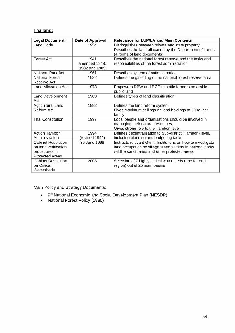
Thailand: Legal Document Date of Approval Relevance for LUP/LA and Main Contents Land Code 1954 Distinguishes between private and state property
Describes the land allocation by the Department of Lands (4 forms of land documents)
Forest Act 1941 amended 1948, 1982 and 1989
Describes the national forest reserve and the tasks and responsibilities of the forest administration
National Park Act 1961 Describes system of national parks National Forest Reserve Act
1982 Defines the gazetting of the national forest reserve area
Land Allocation Act 1978 Empowers DPW and DCP to settle farmers on arable public land
Land Development Act
1983 Defines types of land classification
Agricultural Land Reform Act
1992 Defines the land reform system Fixes maximum ceilings on land holdings at 50 rai per family
Thai Constitution 1997 Local people and organisations should be involved in managing their natural resources Gives strong role to the Tambon level
Act on Tambon Administration
1994 (revised 1999)
Defines decentralisation to Sub-district (Tambon) level, including planning and budgeting tasks
Cabinet Resolution on land verification procedures in Protected Areas
30 June 1998 Instructs relevant Gvmt. Institutions on how to investigate land occupation by villagers and settlers in national parks, wildlife sanctuaries and other protected areas
Cabinet Resolution on Critical Watersheds
2003 Selection of 7 highly critical watersheds (one for each region) out of 25 main basins
Main Policy and Strategy Documents:
• 9th National Economic and Social Development Plan (NESDP) • National Forest Policy (1985)
54

Viet Nam: Legal Document Date of Approval Relevance for LUP/LA and Main Contents Constitution 04/1992
previous: 1980
Land falls under the ownership of the entire population; the State allocates land to organizations, households and individuals for long term and sustainable use (land use rights)
Land Law 11/ 2003 (to become effective in 7/2004) previous: 1993 with revisions in 1998 and 2001
Land use entities: organisations, households and individuals, and (for the first time) communities 5 rights: exchange, transfer, lease, inherit and mortgage Land use must follow zoning and detailed land use plans; land use plans are elaborated from top to bottom, from the overview to the detail Land use plans must always be investigated and approved by the next higher administrative level Exempted from land use levies: households/individuals involved in agriculture or forestry; communities using agricultural land
Decree No. 64/CP 09/1993 Agricultural Land Allocation Decree No. 01/CP 01/1995 State enterprises have the right to contract land for
which they have a LUC to households, and other organisations for protection, regeneration and plantation.
Decree No. 02/CP 01/1994 Forest Land Allocation to organizations, households and individuals (after 1998 and in view of revision of land law replaced by Decree No.163)
Decree No. 163/CP Implementation guidelines contained in inter-ministerial circular No. 62
11/1999 06/2000
Land allocation and forest land leasing to organizations, households and individuals for long-term and sustainable forest purposes; change of institutional responsibilities for forest land allocation from forest protection agencies to land administration agencies to make arrangements for issuing land use right certificates (Red Books)
Decision 245/1998 12/1998 Implementation of State management responsibilities on forest and forest land at various levels
Decree No. 38/CP Implementation guidelines contained in circular No. 115 by the Ministry of Finance
23/08/2000 11/12/2000
Collection of land use fees
Decision 178/2001 Implementation guidelines are provided in Circular No. 80/2003
11/2001 09/2003
Possibilities of the poor to use products and services of the forest to improve their livelihoods (benefit sharing); Benefits and obligations of households and individuals assigned leased or contracted forest and forest land
Many, many others Legal documents in Vietnam always try to keep up with socio-economic developments in the country; therefore there are frequent amendments and changes. Main Policy and Strategy Documents:
• National Forest Policy • Forestry Development Strategy 2001-2010 • Five Million Hectares Reforestation Programme
55

Annex 2: Selected Project Examples Cambodia: Rural Development Programme (RDP) MRD-GTZ – supports PLUP activities in Kampot Province and CB-NRM activities in Kampong Thom Province Participatory NRM Project (PNRM) FAO – supports community fishery and community forestry activities in Siem Reap Province Commune and Community Based Natural Resources and Environment Management (CCB-NREM) DANIDA – is currently starting to support PLUP activities in up to 7 provinces/municipalities (Kep, Kampot, Sihanoukville, Koh Kong, Pursat, Siem Reap and Kratie) CB-NRM Ratanakiri SIDA/PLG – supports PLUP and CB-NRM activities in Ratanakiri Province since 1997 Non Timber Forestry Project (NTFP) NGO – supports PLUP in Ratanakiri Province Land Management and Administration Programme (LMAP) MLMUPC and WB/GTZ/Finnida – supports MLMUPC on PLUP, Land Management, Land adjudication Cardamon International (CI) NGO – start the implementation of PLUP activities in Koh Kong Province Norwegian People’s Aid (NPA) NGO – support PLUP in Banthey Meanchey Province Handicap International Belgium (HIB) NGO - support PLUP in Banthey Meanchey Province PRASAC MRD/EU/GTZ – supported PLUP in Takeo and Kampong Speu Provinces (now phased out) Lao PDR: Rural Development in Mountainous Areas (RDMA) CPC/GTZ – supports impact assessments and improvement of present approach to LUP/LA in Bokeo and Luang Namtha Provinces Shifting Cultivation Stabilization Project Huaphan MAF/ADB – supports improved LUP/LA procedures in Huaphan Province Phongsaly Forest Conservation and Rural Development Project (MAF/EU) - supports improved LUP/LA procedures in Phongsaly Province Lao-Swedish Upland Agriculture and Forestry Research Programme (LSUAFRP) (NAFRI/SIDA) – conducts research on LUP/LA in upland areas and resettlement issues in Luang Prabang (Phonexay District) and Oudomxay (Nam Mo District) National University of Laos (NUoL) (Faculty of Forestry) – conducts research on LUP/LA impact on livelihood and forest management Planned: WB Land Policy Development – 2 studies on land allocation and land markets in rural areas of Lao PDR
56

Former projects: Lao-Swedish Forestry Project (LSFP), Forest Management and Conservation Project (FOMACOP), Nam Ngum Watershed Management and Conservation Project (NAWACOP) Thailand: Sam Mun Highland Development Project, UNDP - until 1997, introduced use of 3D-models and establishment of base maps; attempted to resolve the issue of shifting cultivation in 7 sub-WS near Chiang Mai; project area: 60 villages Thai-German-Highland Development Project (TG-HDP) ONCB/GTZ – until 1998, supported PLUP in several Tambons in the provinces of Chiang Mai and Mae Hong Son Nan Rural Development Project RFD/DANCED – until 2002, supported LUP in upland communities in Nan Province Highland Agricultural Development Project (under the Under-Secretary of State in the Ministry of Agriculture and Cooperatives) – widespread activities in support of NRM and LUP in the Northern Region Royal Projects (37 stations in 6 provinces in total); Objectives: improve national security, integrate minority population into mainstream development; focus on improvement of living conditions of ethnic minorities; started as a personal project of His Majesty the King using royal funds, now also supported by the Government budget Asia Forestry Network: “Forestry Support Project” conducts training and supports PLUP in 19 villages in Chiang Mai Province Vietnam: Social Forestry Development Project Song Da (SFDP) MARD/GTZ/GFA – supports PLUP/FLA in Son La and Lai Chau Provinces Son La – Lai Chau Rural Development Project MARD/EU - supports PLUP/FLA in Son La and Lai Chau Provinces Afforestation Projects 1-6 (KfW) – supports FLA in 3 provinces in the Northern Region, 3 in the Central Region and 3 in the Southern Region Forestry Sector Project ADB – supports FLA in 4 provinces Country Capacity Strengthening for NFAP Implementation in Vietnam, MARD/FAO/ITA – supported LUP/FLA in 4 provinces (Quang Ninh,Thua Thien Hue, Gia Lai, Binh Phuoc) in the past Mountain Rural Development Programme (MRDP) MARD/SIDA – supported LUP/FLA in 5 provinces in the Northern Region in the past SNV Hue – supports PLUP/FLA in Thua Thien Hue Province Helvetas – supports PLUP/FLA
57