common questions - global positioning system devices discussion of gps use in air, water, land &...
TRANSCRIPT

Common Questions - Global Positioning System Devices
Discussion of GPS use in Air, Water,
Land & Vehicle Tracking
Overview of GPS Technology
• GPS stands for Global Positioning System
• The system is an orbiting constellation of 24 satellites
• Allows a public or government user to fix their position anywhere in the world with a high level of accuracy

GPS Software Packages
• GIS Software– GIS – Geographic Information Systems– Use in surveying, construction, civil
engineering, marketing and biology research fields, among others
– Allows for precise organization of data by geographic location
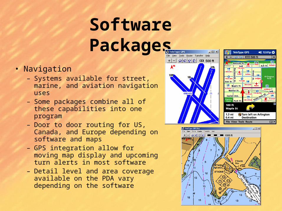
Software Packages
• Navigation– Systems available for street, marine,
and aviation navigation uses– Some packages combine all of these
capabilities into one program– Door to door routing for US, Canada,
and Europe depending on software and maps
– GPS integration allow for moving map display and upcoming turn alerts in most software
– Detail level and area coverage available on the PDA vary depending on the software

Dedicated GPS Units
• Pro– Longer battery life
– More rugged design• Waterproof
• Buoyant
• Impact Resistant
• Con– Limited storage for maps and other data
– Limited or no software upgrade capability
– Software generally not as capable
PC/PDA Based GPS Systems
• Pro– Software and Maps can be updated– Greater storage capabilities– Software has greater capabilities
• Con– Will not work without PC or PDA– Shorter battery life
Differential GPS Systems
• Allows for much greater position accuracy– Down to the inch in some cases
• Requires additional hardware to receive differential signal
• Differential signal broadcast from accurately surveyed positions around the country
• Differential signal available for free in many areas
Differential: WAAS and LAAS
• WAAS vs. LAAS– WAAS stands for Wide Area Augmentation
System
– Two satellites in Geostationary orbit broadcast correction information for the GPS system
– Improves accuracy to 3 meters for users in the continental US
– LAAS stands for Local Area Augmentation System
– Provides greater than 1-meter accuracy near many major airports

Competing GPS Systems
• Galileo GPS System– Proposed GPS system from Europe– Total of 30 satellites in Earth orbit– Scheduled to be ready in 2008
• GLONASS– Russian GPS system– Accurate to only 57 meters at best– Total of 24 satellites in orbit
Future of Triangulation Systems
• E911 Cellular System– By Dec 31, 2005, cellular operators must be
able to locate 95% of 911 calls placed from cellphones
– A variety of methods will be used to accomplish this, depending on the cellular vendor
• GPS• Multipath Fingerprint• Enhanced Observed Time Difference
Future of Triangulation Systems
• GPS-enabled phones– Not just for emergency purposes, these
phones will allow you to send your location directly to friends and family
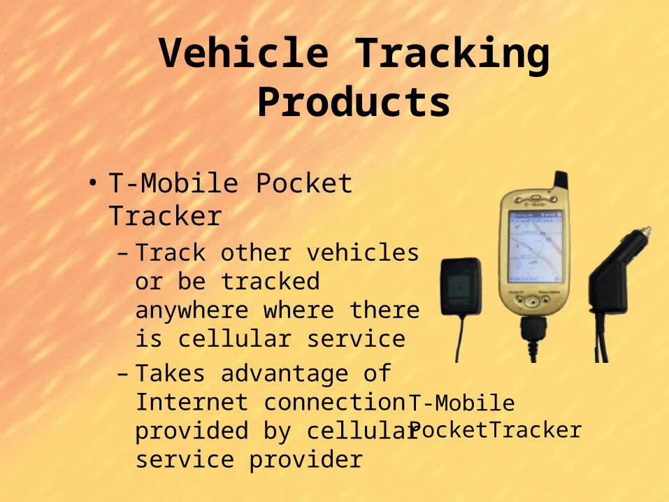
Vehicle Tracking Products
• T-Mobile Pocket Tracker– Track other vehicles or be
tracked anywhere where there is cellular service
– Takes advantage of Internet connection provided by cellular service provider
T-Mobile PocketTracker

• Pocket Tracker– Add tracking
capabilities to any PDA with an internet connection and GPS receiver
– Uses GPS Receiver and wireless communications card
Vehicle Tracking Products
iPaq Pocket Tracker

• Satellite Tracker– Track a container or
vehicle anywhere on the planet
– Uses satellite communication along with GPS technology to report its position to the tracking station
Satellite Tracker
Vehicle Tracking Products

Thank You
Reminder:
• Please be sure to complete your session evaluation forms and place them in the box outside the room. We appreciate your feedback.