ceos action di-09-01a 4 - inpe · geohazards supersites a partnership for the reduction of...
TRANSCRIPT

Geohazards Supersites
A partnership for the reduction of geological disasters through fundamental research
(1)University of Miami (2)ESA
CEOS action DI-09-01a_4
GEO task leader: Falk AMELUNG(1) and Wolfgang LENGERT(2)
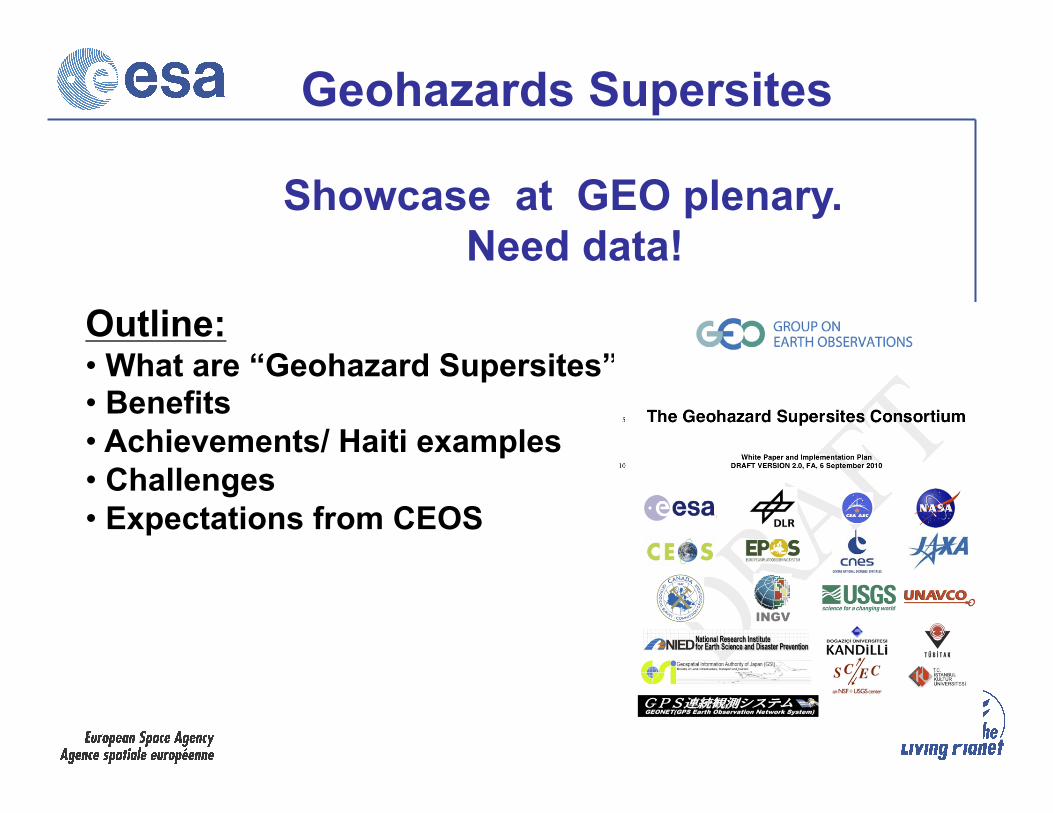
Showcase at GEO plenary. Need data!
Outline: • What are “Geohazard Supersites”” • Benefits • Achievements/ Haiti examples • Challenges • Expectations from CEOS
Geohazards Supersites
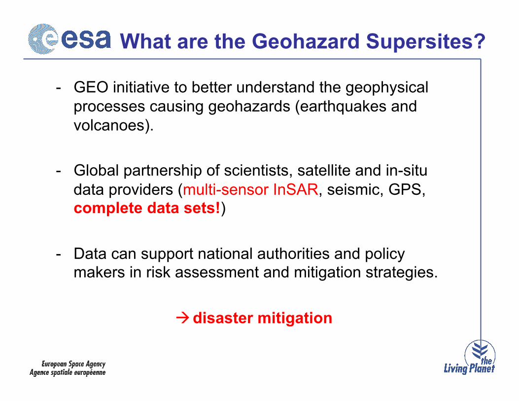
What are the Geohazard Supersites? - GEO initiative to better understand the geophysical
processes causing geohazards (earthquakes and volcanoes).
- Global partnership of scientists, satellite and in-situ data providers (multi-sensor InSAR, seismic, GPS, complete data sets!)
- Data can support national authorities and policy makers in risk assessment and mitigation strategies.
disaster mitigation
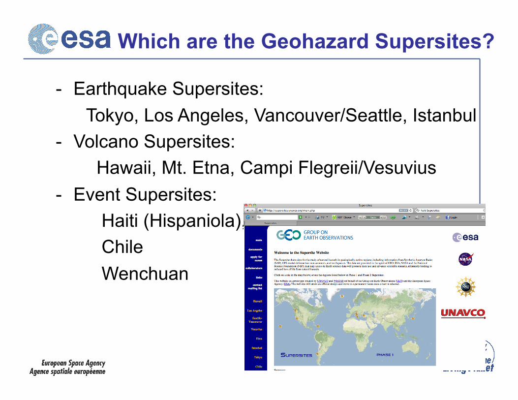
Which are the Geohazard Supersites? - Earthquake Supersites: Tokyo, Los Angeles, Vancouver/Seattle, Istanbul - Volcano Supersites: Hawaii, Mt. Etna, Campi Flegreii/Vesuvius - Event Supersites: Haiti (Hispaniola), Chile Wenchuan
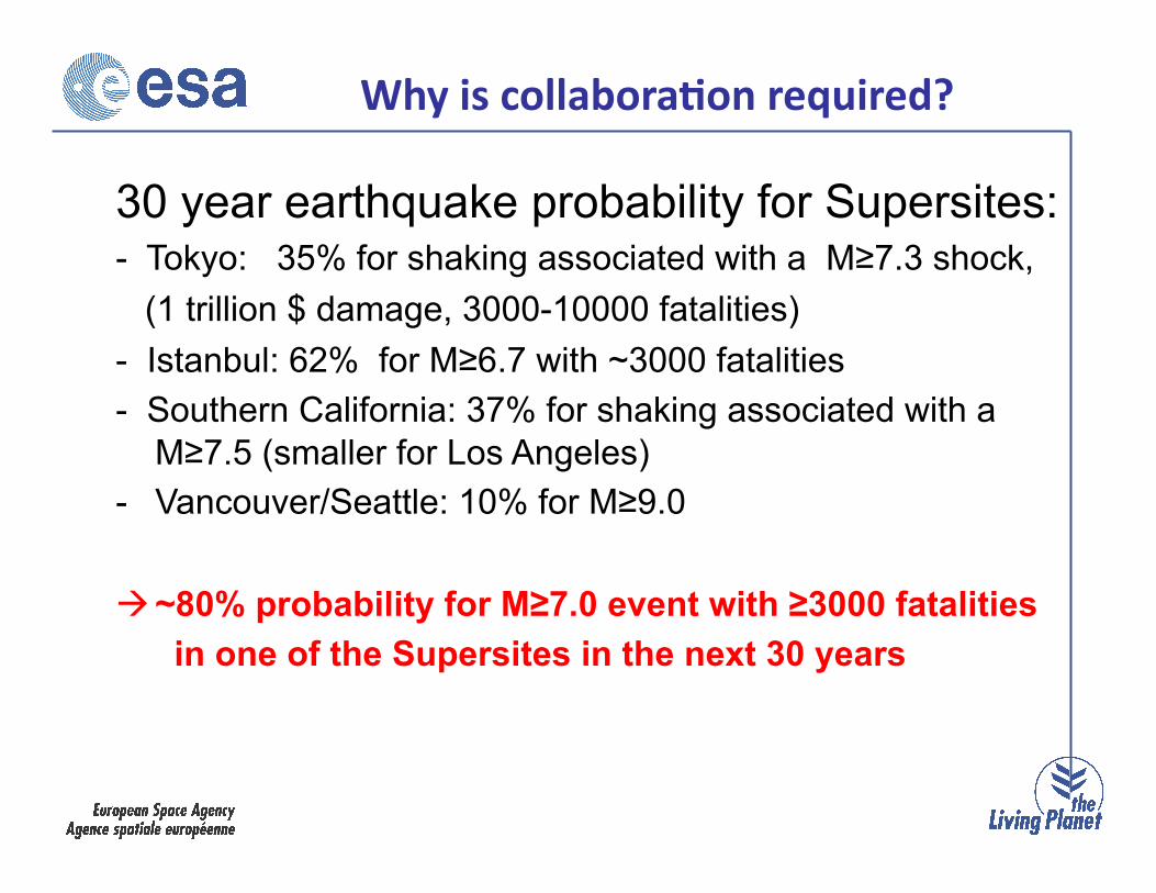
30 year earthquake probability for Supersites: - Tokyo: 35% for shaking associated with a M≥7.3 shock, (1 trillion $ damage, 3000-10000 fatalities) - Istanbul: 62% for M≥6.7 with ~3000 fatalities - Southern California: 37% for shaking associated with a
M≥7.5 (smaller for Los Angeles) - Vancouver/Seattle: 10% for M≥9.0
~80% probability for M≥7.0 event with ≥3000 fatalities in one of the Supersites in the next 30 years
Why is collabora-on required?
Benefits
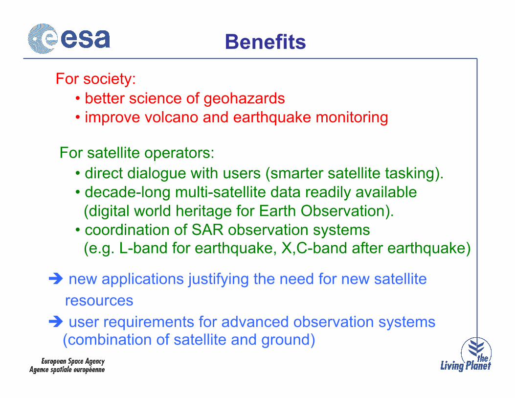
new applications justifying the need for new satellite resources user requirements for advanced observation systems
(combination of satellite and ground)
• better science of geohazards • improve volcano and earthquake monitoring
• direct dialogue with users (smarter satellite tasking). • decade-long multi-satellite data readily available (digital world heritage for Earth Observation). • coordination of SAR observation systems (e.g. L-band for earthquake, X,C-band after earthquake)
For society:
For satellite operators:

Space Agencies (CEOS)
In-situ data providers
JAXA CSA ESA DLR …
Steering Group (Data Provider members)
Research Institutions (Data User members)
Supersite Office
(Unavco)
Science Community (Geohazard
CoP) - - - - -- - - - -
Governance Structure of Consortium
Point of contact (1 per Supersite)
Scientific Advisory Committee
Chair
Vice Chair
GEO task leadership
Legend: Election Day to day business
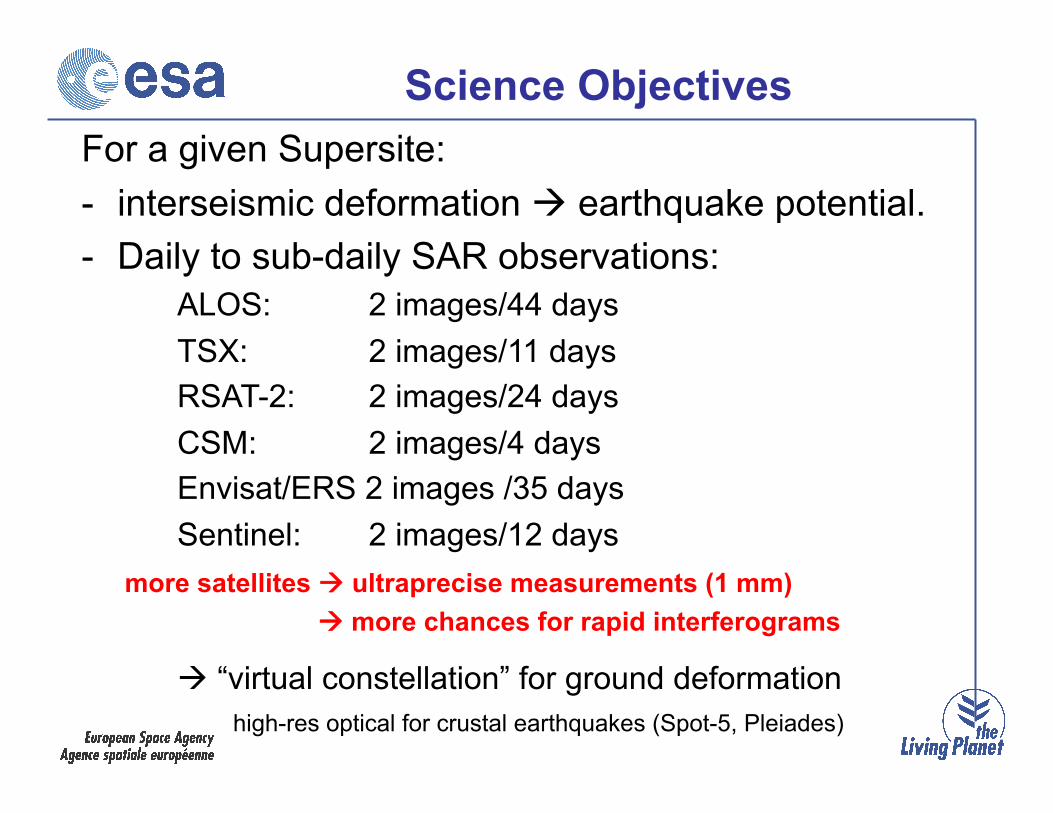
Science Objectives For a given Supersite: - interseismic deformation earthquake potential. - Daily to sub-daily SAR observations: ALOS: 2 images/44 days TSX: 2 images/11 days RSAT-2: 2 images/24 days CSM: 2 images/4 days Envisat/ERS 2 images /35 days Sentinel: 2 images/12 days more satellites ultraprecise measurements (1 mm) more chances for rapid interferograms
“virtual constellation” for ground deformation high-res optical for crustal earthquakes (Spot-5, Pleiades)
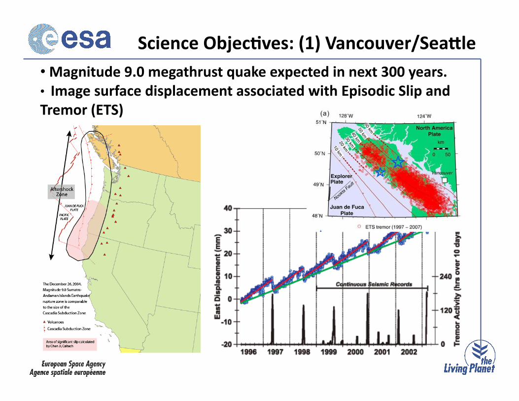
• Magnitude 9.0 megathrust quake expected in next 300 years. • Image surface displacement associated with Episodic Slip and Tremor (ETS)
Science Objec-ves: (1) Vancouver/SeaNle

1923 Great Kanto earthquake
Interseismic deformation fault slip rates, earthquake potential
Envisat, processing by IREA, Naples
30 year earthquake probability: 35% for shaking associated with a M≥7.3 shock, (1 trillion $ damage, 3000-10000 fatalities)
Science Objec-ves: (2) Tokyo
M7.9, 140,000 fatalities
RSAT-2 interferogram the day after Tokyo earthquake?
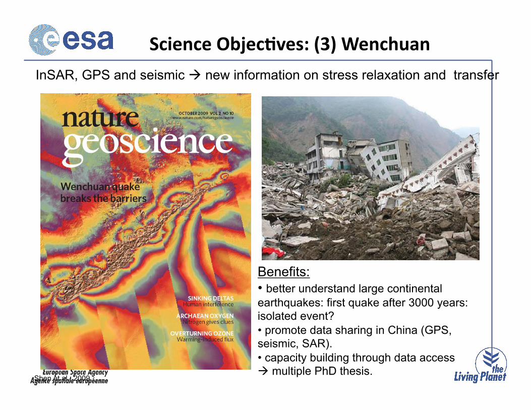
InSAR, GPS and seismic new information on stress relaxation and transfer
Benefits: • better understand large continental earthquakes: first quake after 3000 years: isolated event? • promote data sharing in China (GPS, seismic, SAR). • capacity building through data access multiple PhD thesis.
Shen et al., 2009
Science Objec-ves: (3) Wenchuan
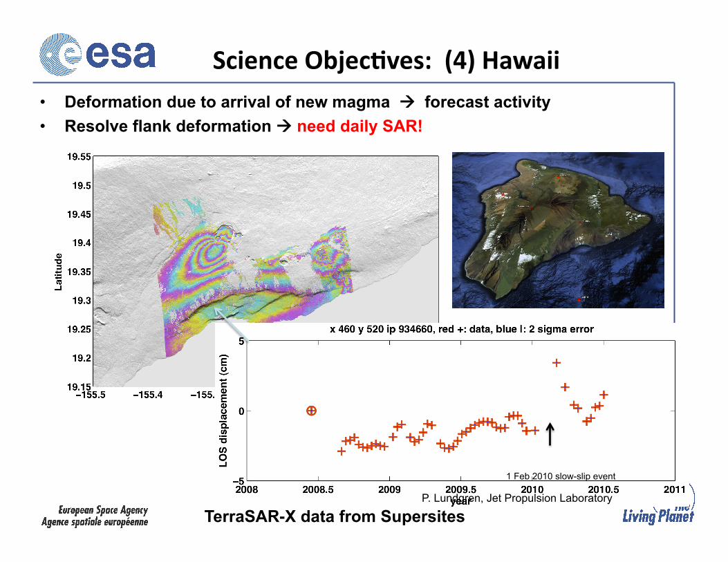
Science Objec-ves: (4) Hawaii
SE flank time series
• Deformation due to arrival of new magma forecast activity • Resolve flank deformation need daily SAR!
TerraSAR-X data from Supersites
1 Feb 2010 slow-slip event
P. Lundgren, Jet Propulsion Laboratory

• Cyberinfrastructure developed: single entry 'one-stop shop' supporting simultaneous large-scale data access
• White Paper version 2 (3 splinter sessions geohazards CoP ) • Support from in-situ data provider • ESA data available for all Supersites (> 10,000 scenes,
natural laboratories initiated: complete ESA data sets for Japan, Western US)
• DLR data arriving • Radarsat-2 tasked • 12 Alos-PalSAR images for Haiti, Chile • Geological Surveys start using data (USGS, INGV) • Haiti earthquake: global scientific collaboration
Achievements
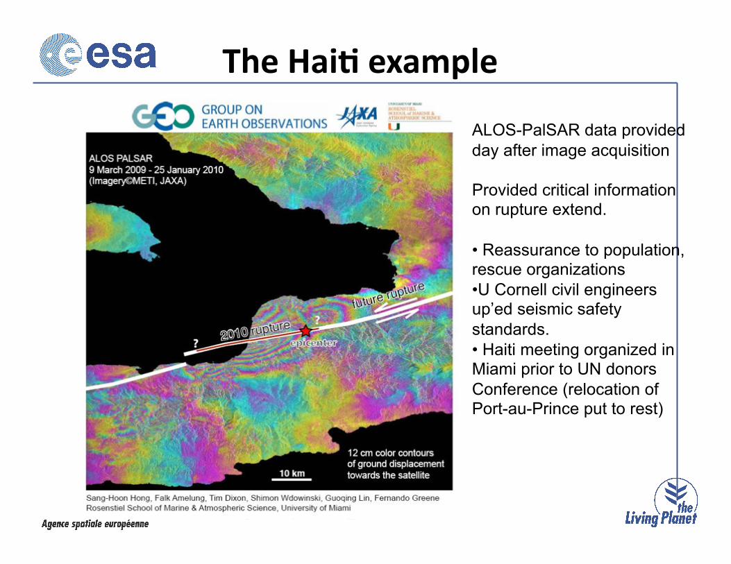
ALOS-PalSAR data provided day after image acquisition
Provided critical information on rupture extend.
• Reassurance to population, rescue organizations • U Cornell civil engineers up’ed seismic safety standards. • Haiti meeting organized in Miami prior to UN donors Conference (relocation of Port-au-Prince put to rest)
The Hai- example
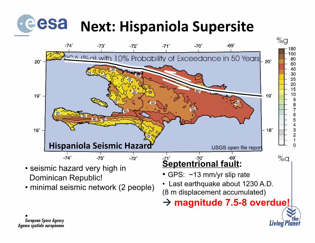
Septentrional fault: • GPS: ~13 mm/yr slip rate • Last earthquake about 1230 A.D. (8 m displacement accumulated) magnitude 7.5-8 overdue!
• seismic hazard very high in Dominican Republic! • minimal seismic network (2 people)
•
USGS open file report
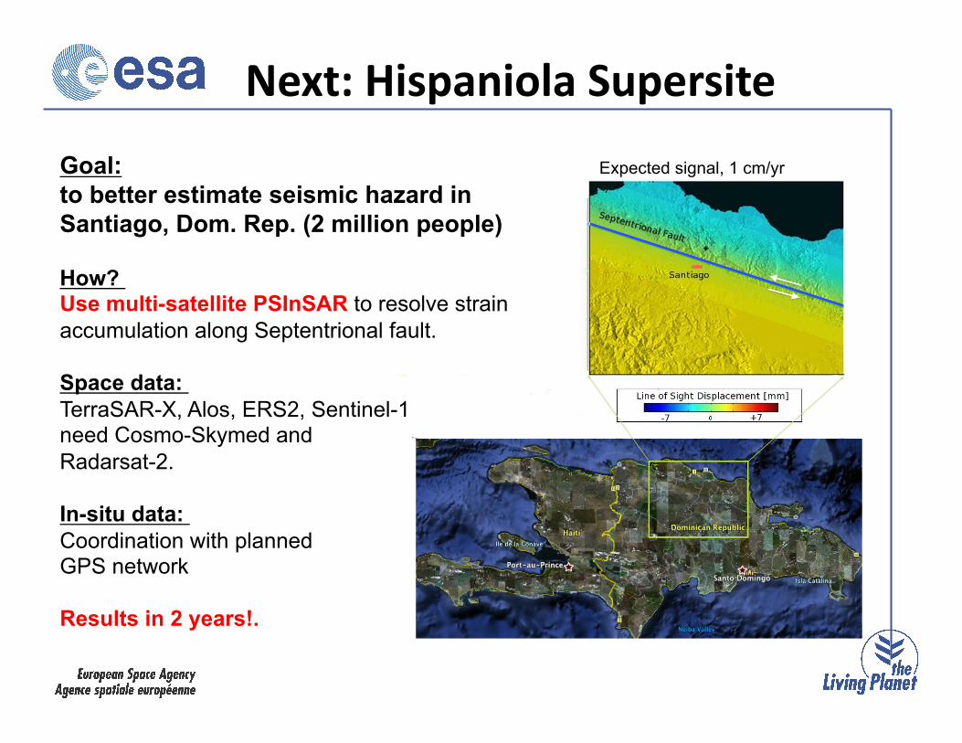
Next: Hispaniola Supersite
Hispaniola Seismic Hazard
USGS open file report
Goal: to better estimate seismic hazard in Santiago, Dom. Rep. (2 million people)
How? Use multi-satellite PSInSAR to resolve strain accumulation along Septentrional fault.
Space data: TerraSAR-X, Alos, ERS2, Sentinel-1 need Cosmo-Skymed and Radarsat-2.
In-situ data: Coordination with planned GPS network
Results in 2 years!.
Expected signal, 1 cm/yr
Next: Hispaniola Supersite
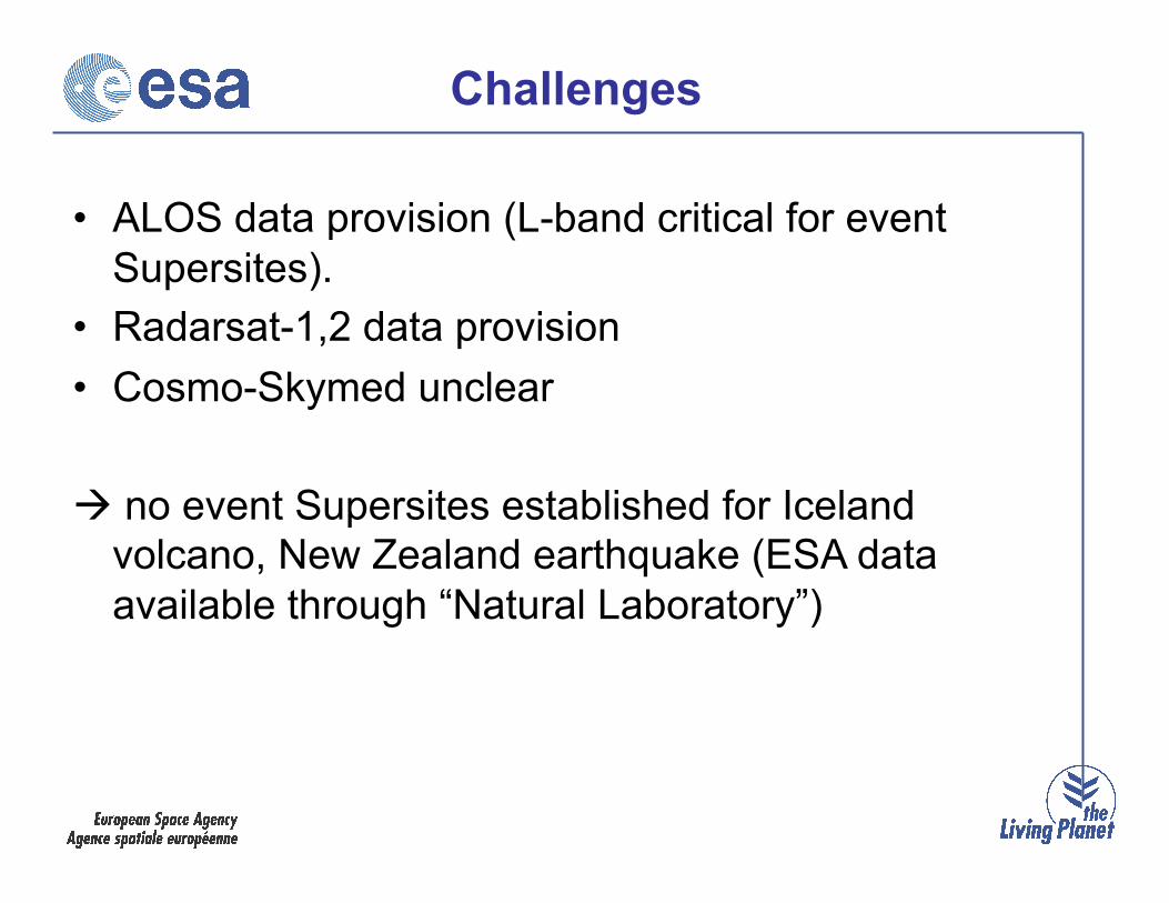
• ALOS data provision (L-band critical for event Supersites).
• Radarsat-1,2 data provision • Cosmo-Skymed unclear
no event Supersites established for Iceland volcano, New Zealand earthquake (ESA data available through “Natural Laboratory”)
Challenges
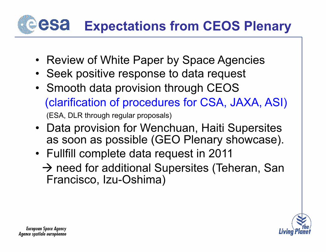
Expectations from CEOS Plenary
• Review of White Paper by Space Agencies • Seek positive response to data request • Smooth data provision through CEOS (clarification of procedures for CSA, JAXA, ASI)
(ESA, DLR through regular proposals) • Data provision for Wenchuan, Haiti Supersites
as soon as possible (GEO Plenary showcase). • Fullfill complete data request in 2011 need for additional Supersites (Teheran, San
Francisco, Izu-Oshima)

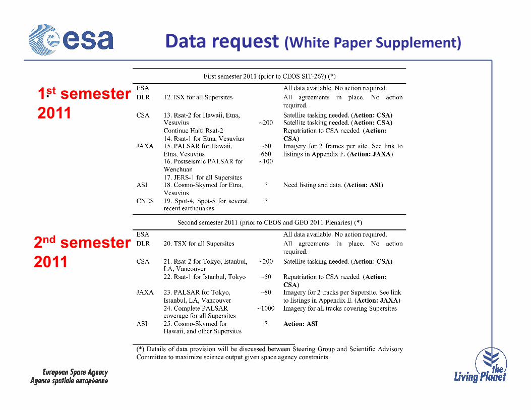
Data request (White Paper Supplement)
As soon as possible
.
Data request (White Paper Supplement)
1st semester 2011
2nd semester 2011

Expectations from CEOS Plenary
• Review of White Paper by Space Agencies • Seek positive response to data request • Smooth data provision through CEOS (clarification of procedures for CSA, JAXA, ASI)
(ESA, DLR through regular proposals) • Data provision for Wenchuan, Haiti Supersites
as soon as possible (GEO Plenary showcase). • Fullfill complete data request in 2011 need for additional Supersites (Teheran, San
Francisco, Izu-Oshima)