briefingsheetkelud 23022014 english - unocha filekelud eruption in 2014 was explosive (vei 4)....
TRANSCRIPT
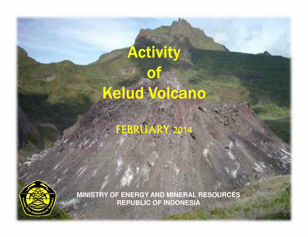
ActivityActivityActivityActivity
ofofofof
KeludKeludKeludKelud VolcanoVolcanoVolcanoVolcano
FEBRUARY 2014
MINISTRY OF ENERGY AND MINERAL RESOURCESREPUBLIC OF INDONESIA
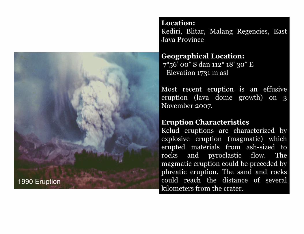
Location:Kediri, Blitar, Malang Regencies, EastJava Province
Geographical Location:7°56’ 00″ S dan 112° 18’ 30″ EElevation 1731 m asl
Most recent eruption is an effusiveeruption (lava dome growth) on 3November 2007.
Eruption CharacteristicsKelud eruptions are characterized byexplosive eruption (magmatic) whicherupted materials from ash-sized torocks and pyroclastic flow. Themagmatic eruption could be preceded byphreatic eruption. The sand and rockscould reach the distance of severalkilometers from the crater.
1990 Eruption
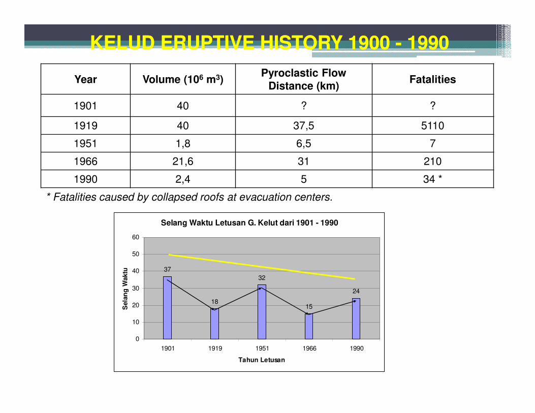
KELUD ERUPTIVE HISTORY 1900 - 1990KELUD ERUPTIVE HISTORY 1900 - 1990
Year Volume (106 m3)Pyroclastic Flow
Distance (km)Fatalities
1901 40 ? ?
1919 40 37,5 5110
1951 1,8 6,5 7
1966 21,6 31 210
1990 2,4 5 34 *
* Fatalities caused by collapsed roofs at evacuation centers.
Selang Waktu Letusan G. Kelut dari 1901 - 1990
37
18
32
15
24
0
10
20
30
40
50
60
1901 1919 1951 1966 1990
Tahun Letusan
Sela
ng
Waktu
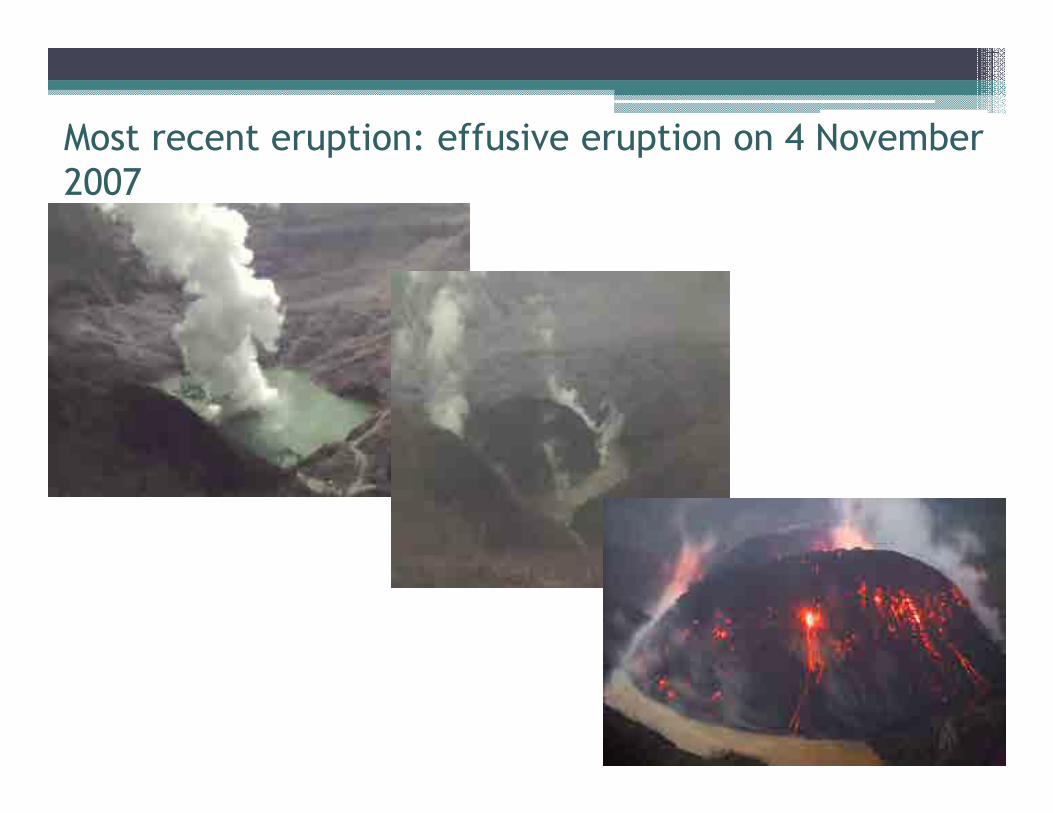
Most recent eruption: effusive eruption on 4 November
2007
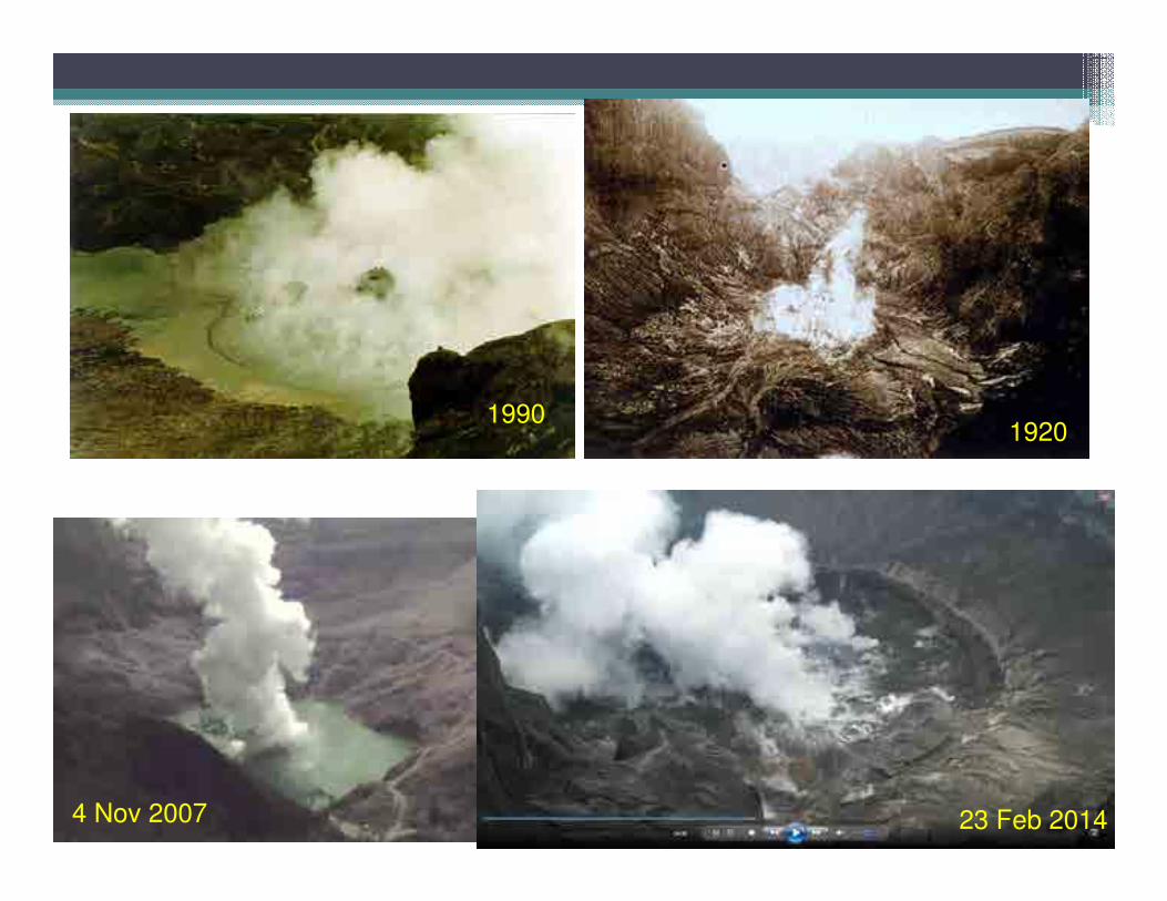
19901920
4 Nov 2007 23 Feb 2014
Latest Activity of Latest Activity of Latest Activity of Latest Activity of KeludKeludKeludKelud
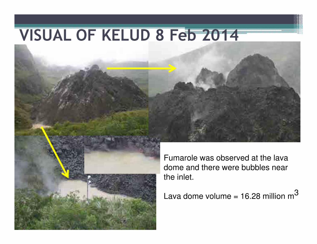
VISUAL OF KELUD 8 Feb 2014
Fumarole was observed at the lava dome and there were bubbles near the inlet.
Lava dome volume = 16.28 million m3
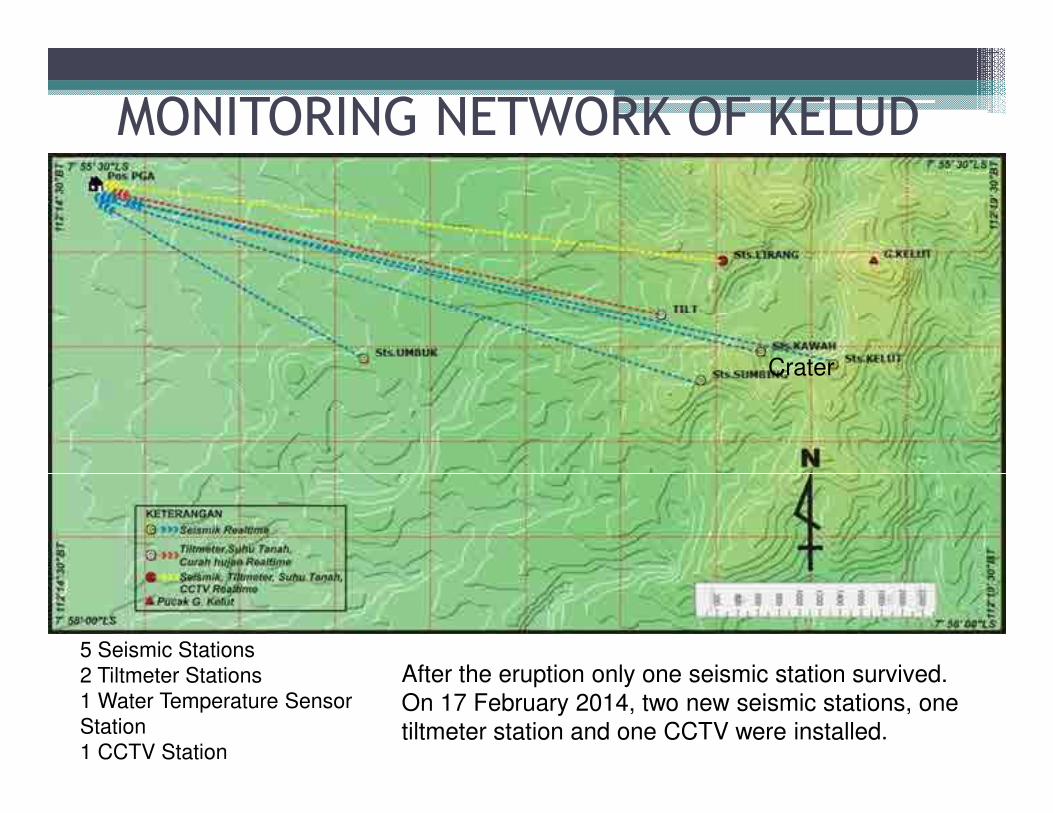
MONITORING NETWORK OF KELUD
Crater
5 Seismic Stations
2 Tiltmeter Stations
1 Water Temperature Sensor
Station
1 CCTV Station
After the eruption only one seismic station survived.
On 17 February 2014, two new seismic stations, one
tiltmeter station and one CCTV were installed.
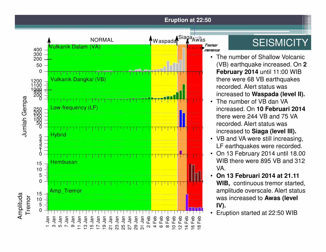
• The number of Shallow Volcanic
(VB) earthquake increased. On 2 February 2014 until 11:00 WIB
there were 68 VB earthquakes
recorded. Alert status was
increased to Waspada (level II).• The number of VB dan VA
increased. On 10 Februari 2014 there were 244 VB and 75 VA
recorded. Alert status was
increased to Siaga (level III).• VB and VA were still increasing,
LF earthquakes were recorded.
• On 13 February 2014 until 18.00
WIB there were 895 VB and 312
VA.
• On 13 Februari 2014 at 21.11 WIB, continuous tremor started,
amplitude overscale. Alert status
was increased to Awas (level IV).
• Eruption started at 22:50 WIB
SEISMICITY
Eruption at 22:50
050
200300400
AwasSiaga
WaspadaNORMAL
Vulkanik Dalam (VA)
02004001000
11001200 Vulkanik Dangkal (VB)
050
100150200250
Am
plit
uda
Tre
mor
Ju
mla
h G
em
pa
Low-frequency (LF)
012345 Hybrid
05
10
15
Hembusan
Tremor
menerus1 J
an
3 J
an
5 J
an
7 J
an
9 J
an
11 J
an
13 J
an
15 J
an
17 J
an
19 J
an
21 J
an
23 J
an
25 J
an
27 J
an
29 J
an
31 J
an
2 F
eb
4 F
eb
6 F
eb
8 F
eb
10 F
eb
12 F
eb
14 F
eb
16 F
eb
18 F
eb
05
1015
Amp_Tremor
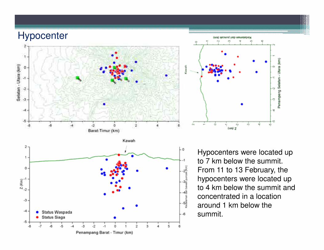
Hypocenter
Hypocenters were located up
to 7 km below the summit.
From 11 to 13 February, the
hypocenters were located up
to 4 km below the summit and
concentrated in a location
around 1 km below the
summit.
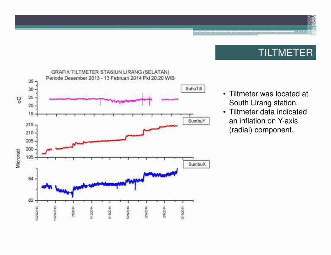
• Tiltmeter was located at
South Lirang station.
• Tiltmeter data indicated
an inflation on Y-axis
(radial) component.
TILTMETER
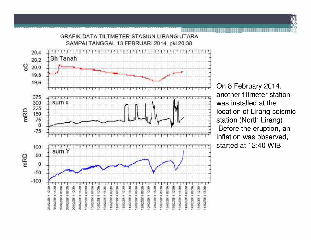
•On 8 February 2014,
another tiltmeter station
was installed at the
location of Lirang seismic
station (North Lirang)
• Before the eruption, an
inflation was observed,
started at 12:40 WIB
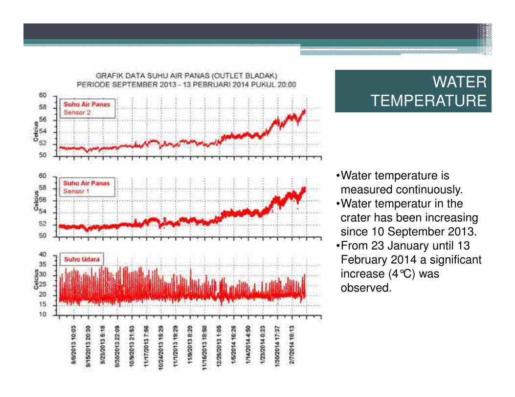
•Water temperature is
measured continuously.
•Water temperatur in the
crater has been increasing
since 10 September 2013.
•From 23 January until 13
February 2014 a significant
increase (4°C) was
observed.
WATER
TEMPERATURE
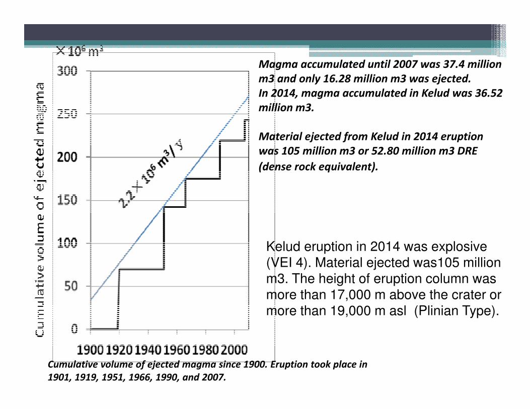
Magma accumulated until 2007 was 37.4 million
m3 and only 16.28 million m3 was ejected.
In 2014, magma accumulated in Kelud was 36.52
million m3.
Material ejected from Kelud in 2014 eruption
was 105 million m3 or 52.80 million m3 DRE
(dense rock equivalent).
Kelud eruption in 2014 was explosive (VEI 4). Material ejected was105 million m3. The height of eruption column was more than 17,000 m above the crater or more than 19,000 m asl (Plinian Type).
Cumulative volume of ejected magma since 1900. Eruption took place in
1901, 1919, 1951, 1966, 1990, and 2007.
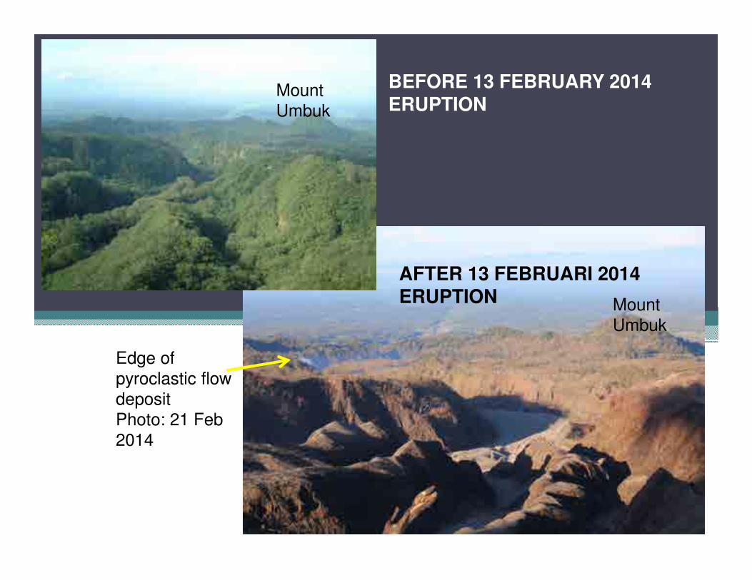
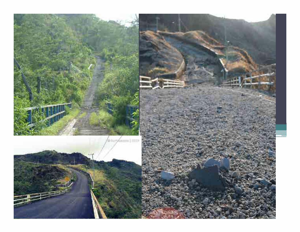
BEFORE 13 FEBRUARY 2014ERUPTION
AFTER 13 FEBRUARI 2014ERUPTION
Mount
Umbuk
Mount
Umbuk
Edge of
pyroclastic flow
deposit
Photo: 21 Feb
2014
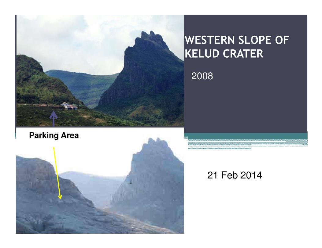
WESTERN SLOPE OF KELUD CRATER
21 Feb 2014
2008
Parking Area
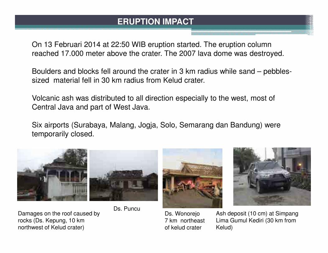
ERUPTION IMPACT
On 13 Februari 2014 at 22:50 WIB eruption started. The eruption column
reached 17.000 meter above the crater. The 2007 lava dome was destroyed.
Boulders and blocks fell around the crater in 3 km radius while sand – pebbles-
sized material fell in 30 km radius from Kelud crater.
Volcanic ash was distributed to all direction especially to the west, most of
Central Java and part of West Java.
Six airports (Surabaya, Malang, Jogja, Solo, Semarang dan Bandung) were
temporarily closed.
Damages on the roof caused by rocks (Ds. Kepung, 10 kmnorthwest of Kelud crater)
Ash deposit (10 cm) at Simpang Lima Gumul Kediri (30 km fromKelud)
Ds. PuncuDs. Wonorejo7 km northeast of kelud crater
ERUPTION IMPACT
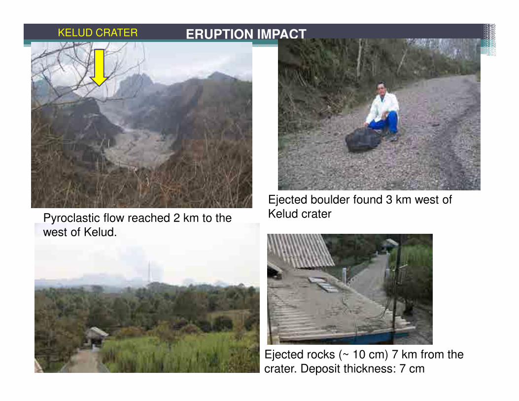
Pyroclastic flow reached 2 km to the
west of Kelud.
Ejected boulder found 3 km west of
Kelud crater
Ejected rocks (~ 10 cm) 7 km from the
crater. Deposit thickness: 7 cm
KELUD CRATER
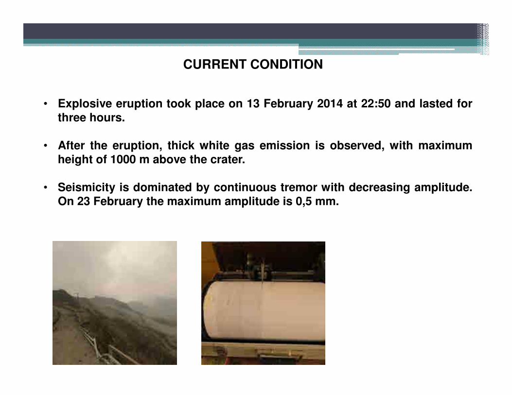
CURRENT CONDITION
• Explosive eruption took place on 13 February 2014 at 22:50 and lasted forthree hours.
• After the eruption, thick white gas emission is observed, with maximum
height of 1000 m above the crater.
• Seismicity is dominated by continuous tremor with decreasing amplitude.
On 23 February the maximum amplitude is 0,5 mm.
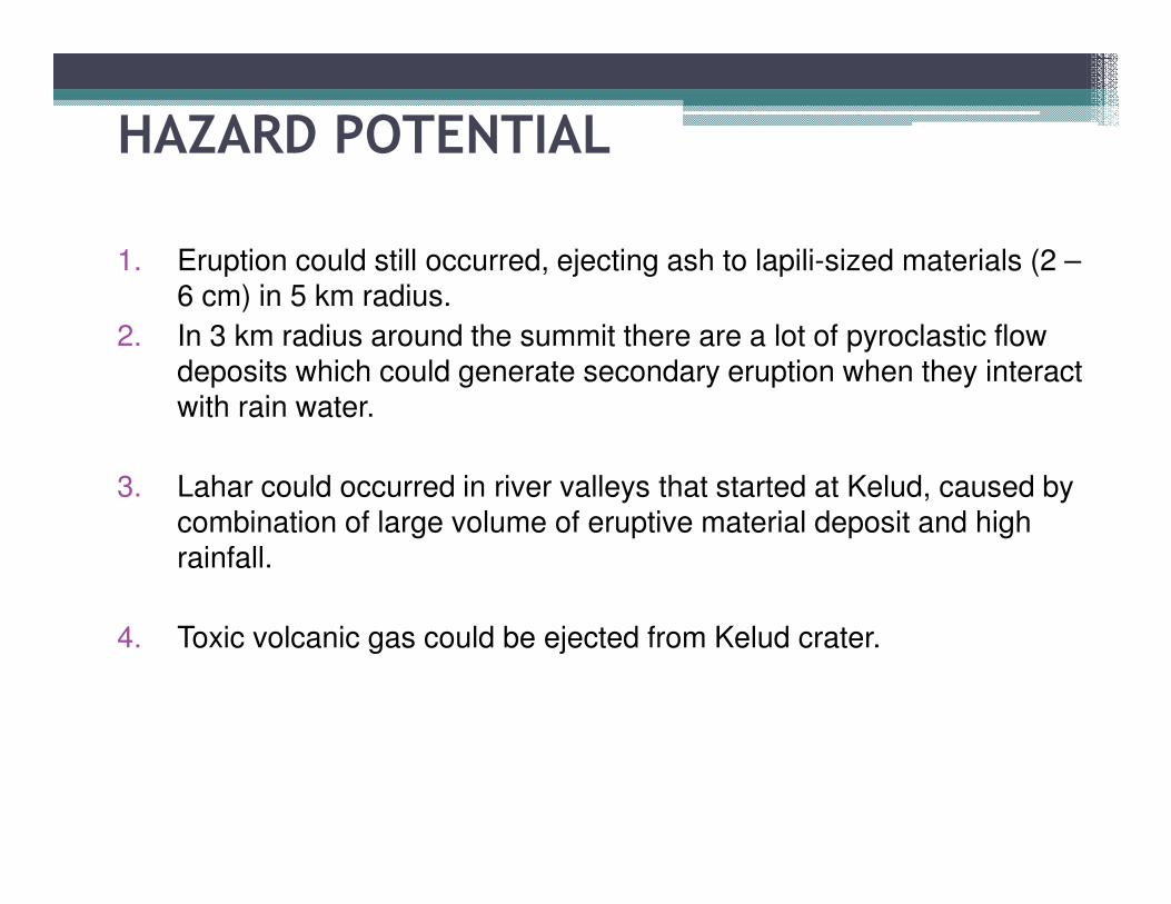
HAZARD POTENTIAL
1. Eruption could still occurred, ejecting ash to lapili-sized materials (2 –6 cm) in 5 km radius.
2. In 3 km radius around the summit there are a lot of pyroclastic flow deposits which could generate secondary eruption when they interact with rain water.
3. Lahar could occurred in river valleys that started at Kelud, caused by combination of large volume of eruptive material deposit and high rainfall.
4. Toxic volcanic gas could be ejected from Kelud crater.
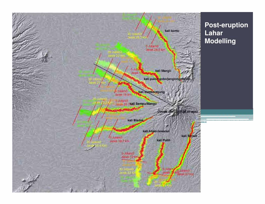
Post-eruption LaharModelling
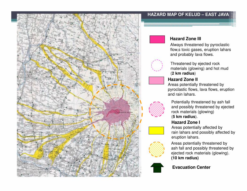
HAZARD MAP OF KELUD – EAST JAVA
Hazard Zone III
Always threatened by pyroclastic
flow,s toxic gases, eruption lahars
and probably lava flows.
Threatened by ejected rock
materials (glowing) and hot mud
(2 km radius)
Hazard Zone IIAreas potentially threatened by
pyroclastic flows, lava flows, eruption
and rain lahars.
Potentially threatened by ash fall
and possibly threatened by ejected
rock materials (glowing)
(5 km radius).
Hazard Zone IAreas potentially affected by
rain lahars and possibly affected by
eruption lahars.
Areas potentially threatened by
ash fall and possibly threatened by
ejected rock materials (glowing).
(10 km radius)
Evacuation Center
CONCLUSION� Visually there is still continuous gas emission from Kelud crater.
� Seismicity is dominated by continuous tremor with decreasing amplitude.
� Deep volcanic (VA) earthquake which indicates magma supply from depth is not recorded.
• Based on visual and instrumental monitoring results and its hazard threat potential, since 20 February 2014 at 11:00 WIB Kelud alert level was lowered from AWAS (level IV) to SIAGA (level III).
If there is a decrease or increase in Kelud volcanic activity, the alert level can be lowered or raised according to its level of activity and threat.
RECOMMENDATION (Alert Level: SIAGA)
1) People must not enter the 5 km (from the crater) exclusion zone.
2) People should remain calm and only listen to directives from local BPBD/SATLAK.
3) People who lives outside 10 km radius and is currently in the evacuation centers may return to their homes while maintaining their alertness.
4) People who lives in Hazard Zone II (KRB II) must stay alert and always be aware of notice on Kelud issued by local BPBD/SATLAK.
5) Center for Volcanology and Geological Hazard Mitigation always coordinates with BNPB, East Java provincial government (provincial BPBD) and SATLAK PBP of Kediri Regency, BPBD of Blitar Regency and BPBD of Malang Regency on Kelud activity. People should always listen to directives from provincial BPBD and regency BPBD/ SATLAK PBP
http://www.vsi.esdm.go.id/