brevard county - florida department of transportation … format/brevard/bre2014.pdf · ab 518 lllk...
TRANSCRIPT
860,000 ft.740,000 ft.620,000 ft. 660,000 ft. 700,000 ft. 780,000 ft. 820,000 ft.
1,320,000 ft.
1,360,000 ft.
1,400,000 ft.
1,440,000 ft.
1,480,000 ft.
1,520,000 ft.
1,560,000 ft.
1,600,000 ft.
1,280,000 ft.
860,000 ft.
1,320,000 ft.
1,360,000 ft.
1,400,000 ft.
620,000 ft. 660,000 ft. 700,000 ft. 740,000 ft. 780,000 ft. 820,000 ft.
1,440,000 ft.
1,480,000 ft.
1,520,000 ft.
1,560,000 ft.
1,600,000 ft.
1,280,000 ft.30 29
3231
28
33
2627
3534
25 30
3136
29
32
2728
33 34
26
35 3332 34
18
35
Flemin
g Gran
t
1718
19 20
16
21
1415
2223
13 18
24 19
17
20
16
21 22 23
18 17
21
28
16
29
15
22
27
14
23 24
25
26
15
23
14
22
6
7
5
8
34
9
2
10 11
1
12
6
7
5
8
4
9 7 98
3
10
13
11 12
17
7
16
98 10
6
7
1718
19
30
31
20
29
32
21 22
28
33
23
2627
34 35
24
25
36
19
30
31
20
29
32
21
28
33
26
25
36
7
18
8
17
9 10
1516
11
14
12
13
7
18
8
17 16
9
10
1415
23
2930
31 32
6 5
2728
33 34
34 2
35 36 31
1 6 5 3
18 17
2019
1516
21 22
14
23
26
13
24
25
18
19
30
17 1516 14
24 202128
33
6
7
5
8
34
9 10
2
117
12
6
8
5
34
9 10
2
1112
1318
17
29
32
19 20
30
31
28
33
21
2627
3435
22 23
25
36
31
24
30
19
28
33
20 21
29
32
27
34
22
1
25
8
17
7
18
9
16
10 11
1415
12
13
7
18 16
10
1511 12
1314
13
31
56
32
4
33 34
23
35 36
1 6
31
4
9
32 33
3
34
1
35 36
19
30
17
20
29
21
2728
1516
22
1314
23 24
2526
18
19
30
17
20
29
16
21
28
15
22
27
23 24
2526
18
19
30
14
22 23
27
8
18
8
534
9 10
12
11 12
56
7
4
8 9
10
1
1112
1314
6
7
8
17
2
1011
15
31
19
30
32
21
29
33
2728
34
2526
35 36
30
31
29
32
2833
3
2627
34235
30
31
3
7
18
8 9
1617
20
10
15
22
11
14
12
13
23 24
17
7
18
19
12
13
24
22
6
31 3233
5
34
3
2
35 36
1
35
2
3631
1 6
7
2318
30
24
1925
1617
2829
20 21
15
27
22
14
25 30 2932
2223
2627
2419
2530
11
14
6
7
12
13
45
8 9
3 12
11
567
8 10 11
1415
1
12
13
7
18
11 12
2526
35
23
36
1
30
31
2829
32 33
27
34
2526
35 36
30
31
26
27
34 35
23
25
36
30
31
6
29
32
35
2 1
25
36
30
31
2829
32
12
2423
18
19
1316
17
2021
10
15
22
1113
14
2324
19
1516
22
14
23
13
24
18
19
16
17
2023
24
26
13 18
19
1617
2021
3433
3
35
2 1
3136
76
8
4
5
23
12 10
34
11
2
12 7
1 6 5
89
4
3
12 7
1
6
8
5
21
22
2728 26
24 19
3025
2829
3233
28
33
22 23
2627
34 35
24
25
36
19
2930
31 32
20 22
27
21
28
33
24
25
36
31
8
17
9 10
1516
11
14
23
13
7
18
9
16
10 11
1415 13
12
18
78
17 15
9
16
11
14
23
12
13
30
31
61
29
32
5
27
33
34
28
34
12
26
3635
6
25
3536 31
61 45
32 33
35
3
34
12
36
5
6
3132
33 34
4
23
18
19
20
17
2122
1516
23
25
24
30
19
16
20 21
29
14
23 24
26
18
19
30
1617
20 21
2829
15
22 23
2627
1413
24
25
18
19
20
2930
28
6
7
45
8
343
910
352
11
14
1
12
13
6
7
18
45
89
17
12
11 12
13
56
7
4
9
3
8 10 11
6
17
78
Bernardo Segui G
rant
72
36 31 32
29
32
1930
31 33
26
1
7
18
19
8 9
20 21
1617
54
14 1316 15
6 5 4
Heirs of Joseph
DelespineGrant
755
8
645
10 1123 1
129
4
!(
!(
!(
!(
!(
!(!
!(
!(
!(
!(
!(
!(
!(
!(
!(
!(
!(
WhitehouseCove
Futch Point
Magnolia Point
Rock Point
Cactus Point
Long Point
Klondike Beach
PepperCove
CastawayPoint
AddisonPoint
GrassyPoint
TitusvilleBeach
Brock Flats
Gibbs Point
Middle Point
MangrovePoint
Sand Pt.
Billy Joe Pt.
Eddy Point
DuckroostPoint
Cape Cod
Bairs Cove
PepperFlats
Futch Cove
Carters Cut
SprigPoint
North Rocky Pt.
CanaveralPeninsula
GrannyCove
WellsPoint
False CapeGreen Bush
Point
Quarterman Cove
CapeCanaveral
HortiPoint
MathersCove
CapeMalabar
DuckPoint
Sand Point
Hog PointCove
Crab Point
Home Point
The Point
Broadaxe Ridge
DragonPoint
TurningBasin
Gallinipper Point
GeorgeFlats
CoconutPoint
BluefishPoint
HogPoint
Gallinipper Basin
Turtlepen Point
Milford Point
Pepper Pt.
ShellPoint
ShortysBanks
PossumBluff
Black Point
Long Point
WashburnCove
PetersonPoint
PullmanPoint
Ballard CoveShell PitPt.
CartersBulkhead
DuckroostCove
Long SandyPoint
JonesPoint
MiddleBanks
WhitesPoint
Eau GallieBeach
PloverPoint
De Soto Beach
Buck Point
Dummit Cove
Pams Cove
Playalinda Beach
Boathouse Point
Fisherman Point
TO ORLANDO
TO EDGEWATER
TO FELLSMERE
TO OAK HILL
TO ST CLOUD TO KISSIMMEE
TO SEBASTIAN
TO VERO BEACH
TO SANFORD
TO ORLANDO
TO ORLANDO
TO INDIANRIVER
SHORES
TO FELLSMERE
Marsh Bay
Moore Pond
Indian River Lagoon
Lake WashingtonDuck Pond
Challenger Lake
Florence Lake
M
LakeHarney
WidgeonBay
LakeWinder
Lake Hellen Blazes
Little Sawgrass
Lake
Port Canaveral
Halfway Lake
Freshwater Lake
Campbell Pocket
Peacocks Pocket
M
Mud Hole
Sharpes Lake
Indian River
Sawgrass Lake
Roach Hole
Silver Lake
Chester Shoal
Snag Harbor
Loughman Lake
BuckLake
Griffis Bay
Ellis Lake
MiddleBasin
South Lake
Indian River
Honeymoon Lake
Newfound Harbor
Shortys Pocket
Banana River
Workman Pond
ValkariaLake
EastBasin
Atl an t i cO
c e a n
Lake Poinsett
Salt Lake
Fox Lake
Boggy Pond
M
WestBasin
Exit 201
Exit 205
Exit 37
Exit 188
Exit 215
Exit 49
Exit 191
Exit 52
Exit 202
Exit 180
Exit 45
Exit 183
Exit 220
Exit 231
Exit 173
Exit 208
Exit 195
Exit 46
Exit 176
Exit 212
Exit 223
Exit 53
¹£¤1
AB501
ABA1A
AB518
LLLK516
LLLK406
¹£¤1
LLLK509
¹£¤1
LLLK511
§̈¦95
LLLK402
AB507
RQ9
RQ5
AB46
§̈¦95
LLLK507
RQ5
RQ9
§̈¦95
AB406
AB3
RQ500
¹£¤1
AB524
RQ5
AB528
AB513
LLLK507
¹£¤1
AB514
¹£¤1
RQ9
RQ5
AB405
AB3
LLLK507
LLLK5A
§̈¦95
LLLK3
AB508
RQ5
AB404
ABA1A
LLLK509
LLLK509
§̈¦95
RQ9
LLLK511
§̈¦95
AB507
AB405
AB519
AB528
AB407
LLLK515
LLLK509
¹£¤1
RQ500
ABA1A
LLLK502
LLLK405
RQ9
AB520
§̈¦95
AB520
AB50
RQ9
AB50
RQ5
¹£¤192
LLLK515
LLLK503
AB405
RQ5
LLLK3
RQ9
§̈¦95
¹£¤192
RQ5
32528
ABA1A
AB401
RQ9
¹£¤1
Melbourne
Palm Bay
Malabar
Grant
Micco
Pineda
Bonaventure
CocoaRockledge
City Point
Sharpes
Williams
Titusville
Scottsmoor
Wilson
Florida East Coast Railway
USAF NASA Railway
USAF NASA Railway
Fl East Coast Railway
Fl East Coast Railway
Fl East Coast Railway
Williams Point
Allenhurst
AngelCity
Bonaventure
MerrittIsland
Courtenay
EvansPines
SouthCocoaBeach
CanaveralAcres
Audubon
Orsino
East Mims
Rockwell
SouthPatrickShores
Mims
CityPoint
JunePark
Port Saint John
Shiloh
Footman
DummitGrove
Aurantia
Tropic
Mayacas(Historical)
Scottsmoor
MelbourneShores
Frontenac
SouthPatrick
Turnbull
Bellwood
Indianola
Georgiana
Jay Jay
Pineda
Viera
Canaveral(Historical)
FloridanaBeach
Southmere
BallardPines
Wilson
Sharpes
Lotus
Micco
Delespine
Aurora
Wiley
TitusvillePop. 40670
RockledgePop. 20170
Cocoa BeachPop. 12482
Indian HarbourBeachPop. 8152
IndialanticPop. 2944
MelbourneBeachPop. 3335
MalabarPop. 2622
Palm ShoresPop. 794
Palm BayPop. 79413
MelbournePop. 71382
WestMelbourne
Pop. 9824
CocoaPop.
16412
Satellite BeachPop. 9577
CapeCanaveral
Pop. 8829
MelbourneVillage
Pop. 706
Grant-ValkariaPop. 3850
Pine Island
Conservation Area
River Lakes Conservation Area
Seminole RanchConservation Area
Mosquito Lagoon Aquatic Preserve
Three Forks MarshConservation Area
KingsPark
Salt Lake Wildlife Management Area
Pelican IslandNational
Wildlife Refuge
Archie Carr National
Wildlife Refuge
Indian River Aquatic Preserve
Hatbill Park
Kars Park
St. Johns National
Wildlife Refuge
Upper St JohnsRiver Marsh WMA
Cape CanaveralAir Station
T. M. Goodwin Waterfowl
Management Area
St. SebastianRiver Preserve
State Park
Merritt Island National Wildlife RefugeSouth Lake
ConservationArea
Canaveral Marshes Conservation
Area
Grant FlatwoodsSanctuary
Indian River Lagoon Preserve State Park
Sebastian InletState Park
Buck Lake Conservation Area
FarmtonWMA
Banana River Aquatic Preserve
Bird LakeMarsh
Fox Lake Sanctuary
VanderbiltBeach
Canaveral National Seashore
William BeardallTosohatchee
State ReserveKelly Park
Micco ScrubSanctuary
St. JohnsNationalWildlifeRefuge
Tropical Trl N
Static
TestR
d
Dairy Rd
HuntingtonAve
Wiley Ave
Cheney Hwy
Blackp
ointW
il dli fe
D r
Titan Iii Rd
Grantline Rd
Port StJohn Pky
Tomato Farm Rd
South St
Palm Bay Rd
Jo hn Rod esB lvd
I nd ian R ive rLagoonSc en ic Hwy
Challen
ger Mem
orial P
ky
Fiske Blvd
Burkholm Rd
Irwin Ave
WindoverWay
Dixie Way
Babcock St
Garden St
Kings Hwy
IndianRiverLagoon Sce n icH wy
Max Brewer Memorial Pky
Rector Rd
Dairy RdS Tropical Trl
Clearlake Rd
N Wickham Rd
Lake Washington Rd
Columbia Blvd
SingletonAve
HarrisonRd
Courtenay Pky N
Indian River Lagoon Scenic Hwy
Pi ne St
W NewHaven Ave
Lake Washington Rd
Main St
Courtenay Pky N
GrissomPky
Pluckebaum Rd
Adamson Rd
Six Mile Rd
Minton Rd
Range Rd
S Cou rtenay Pky
N Tropical Trl
Micco Rd
Hatbi
ll Rd
Coral Ave
Smith Rd
LakePoinsettRd
TitusvilleRd
Schwartz Rd
Tm Goodwin Rd
Plantation Dr
Indian River Lagoon Scenic Hwy
Aurora Rd
Burnett Rd
Sarno Rd
Beachline Expy
Griss om P ky
Eber Blvd
Playalinda Beach Rd
King St
ParkAve
Lionel Rd
Murrell Rd
Old Bear BluffRd
Babcock St
Washington Ave
Pineda St
SamuelCPhillipsPky
ParkwayDr
Eber Rd
Indian River Dr
NASA Pky West
NWickhamRd
BarnaAve
Dixie Hwy
E Main St
Hall Rd
Ellis Rd
Orlando Ave
WEau GallieBlvd
GrissomPky
Willowbrook St
NASA Pky East
Lake Dr
Cox Rd
Kennedy Pky N
BrockettRd
HammockRd
Rockledge Dr
Viera Blvd
S Patrick Dr
Cheney Hwy
Max Brewer Memorial Pky
Fox Lake Rd
Camp Rd
W Eau Gallie Blvd
Rayburn Rd
Wickham Rd
Samuel C Phillips Pky
Carter Rd
Parrish Rd
Lake Winder Rd
Fay Blvd
Aurantia Rd
Stadiu
m Pk
yIndian River LagoonScenicHwy
Audu
bon R
d
Old S harpes Rd
OldDixieHwy
N Cocoa Blvd
Pineda Cswy
Malabar Rd
SCarp
ente r
Rd
Turtle Mound Rd
NASA CswyE
TropicalTrl S
Patrick AirForce Base
Air ForceMalabar
TransmitterAnnex
Saint Johns Marsh
Jane Green Swamp
Merritt Island
Pelican Island
Pardon Island
Hamper Hammock
NorthIndianField
PicnicIsland
HailIsland
South Indian Field
Little Snag
Stony Island
ThousandIslands
Camp Island
MerrittIsland
Mulbery Mound
Three Cabbage
Island
Cedar Hammock
Big Island
Middle Indian Field
MerittIsland
Onion FarmIsland
Happy Hammock
Grant Farm Island
Cucumber Island
TeaHammock
Jug Island
Harrison Island
Jack Davis Island
BigIsland
BigSnag
Pepper Hammock
SkunkIsland
Pine Island
VeteransMemorialMuseum
Challenger 7Elementary
SuntreeMontessori
Holy SpiritCatholicChurch
SaintLukes
Church
UnitedMethodist
Grace LutheranChurch
Teen MissionsInternational
TabernacleBaptist
June ParkBaptist
Prince of PeaceAnglican
SuntreeElementary
Mims Houseof Prayer
ManateeElementary
FairglenElementary
SaturnElementary
BrevardMemorial
Park
Lighthouse Christian
Coastal Community
ChurchUnited
MethodistSpaceCoast Middle
Space CoastMarine Institute
Embry RiddleAeronautical University
Shorin-Ryu Karate
USA Museum
PinewoodElementary
Space CoastStadium
First Churchof the Bible
WebsterUniversity
AudubonElementary
Church ofGod
Ralph M.Williams, Jr.,Elementary
BethelCemetery
HerbertHooverMiddle
Superintendent'sOffice
Pine CrestCemetery
John F. KennedySpace Center
GraceBrethren
First BaptistChurch
QuestElementary
VieraHigh
DiscoveryChristian
EnterpriseElementary
BrevardBaptist
WebsterUniv.
Holy CrossCommunity
Cape Rd Cemetery (Historic)
Air Mobile Ministries
V o l u s i a C o u n t y
O r a n g eC o u nty
I n d i a n R i v e r C o u n t y
O r a n g e C o u n t y
Osceola C o u n t y
O r a n g e C o u n t y
S e m i n o l e C o u n t y
O s c e o l a C o u n t y
Volus i a C o u n t y
Os c e o l a C o u n t y
Melborne Causeway
Pineda Expressway
Eau Gallie Causeway
E MerrittIsland Causeway
Cocoa BeachCauseway
Bennett Causeway
MerrittIsland
Valkaria
Viera Hospital
SpaceCoast
Regional
Gezik
MelbourneInternational
PatrickAFB
Nasa ShuttleLandingFacility
TradewindsAerodrome
Fulton
Cape CanaveralAFS Skid Strip
Clark Slough
St. Johns River
Trout Creek
St. Johns River
Little FlounderCreek
Brock Creek
Atlantic Intracoa stalWaterway
Sixmile Creek
West Pr ong
East PeperCreek
Goat Creek
Cochran Cove
St. Johns R
iver
JaneGreenCreek
MarshBa y Creek
Gator Hole
StSe
basti
a nRi
v er
E au Gallie River
MooreC
reek
Max Hoeck Creek
Turkey Creek
St.JohnsRiver
Pintail Creek
PineIslandCreek
BlackPo int
C reek
Sykes Creek
St.J oh
n sRiv
er
South Prong Saint Sebastian
River
OysterPro ng
Gator
Creek
Happy Creek
Pardon
Slough
Six MileCreek
CucumberSlough
Kid Cr.
Addison Cr.
Broadaxe
Creek
Bald Pate Creek
Hor se Cr.
Melbourne Tillman Canal
Haulover C
anal
Atlantic IntracoastalWaterway
Jones Cree
k
W Creek
Elbow Cr.
East Max Hoeck Creek
Wolf Creek
Crane Cr.
Big Flounder Creek
Buck Creek
AtlanticIntracoastal W
aterway
Banana Creek
SevenPines
Creek
Ten mile C reek
Flatbo
at Cr
eek
Catfis
h Cree
k
Goat Creek
Faulk Canal
St.J oh
nsRi v
er
D ummit C r eek
North Prong
Saint Sebastian
River
Conra dCreek
Tea Creek
Cedar HammockC
reek
Mullet Creek
CowPe
n C
reek
Max Hoeck Back Creek
St. Johns River
Puckett Cr.
Canaveral Barge Canal
Atlantic IntracoastalWaterway
E Creek
Sixmile Creek
Mi dd lePr o ng
AB520
AB520
AB50
AB46
AB50
32528
ABA1A
80°20'0"W
80°25'0"W
80°25'0"W
80°30'0"W
80°30'0"W
80°35'0"W
80°35'0"W
80°40'0"W
80°40'0"W
80°45'0"W
80°45'0"W
80°50'0"W
80°50'0"W
80°55'0"W
80°55'0"W
81°0'0"W
81°0'0"W
81°5'0"W
81°5'0"W
28°45'0"N
28°45'0"N
28°40'0"N
28°40'0"N
28°35'0"N
28°35'0"N
28°30'0"N
28°30'0"N
28°25'0"N
28°25'0"N
28°20'0"N
28°20'0"N
28°15'0"N
28°15'0"N
28°10'0"N
28°10'0"N
28°5'0"N
28°5'0"N
28°0'0"N
28°0'0"N
27°55'0"N
27°55'0"N
27°50'0"N
27°50'0"N
R 32 E
R 32 E
R 33 E
R 33 E
R 34 E
R 34 E
R 35 E
R 35 E
R 36 E
R 36 E R 37 E R 38 E R 39 E
T 19 S
T 31 S
T 20 S
T 20 S
T 21 S
T 21 S
T 25 S
T 25 S
T 26 S
T 26 S
T 27 S
T 27 S
T 28 S
T 28 S
T 29 S
T 29 S
T 22 S
T 22 S
T 30 S
T 30 S
T 23 S
T 23 S
T 24 S
T 24 S
Prepared by theSurveying and Mapping Office
State of FloridaDepartment of Transportation
Copyright Florida Department of Transportation 2014May 2014
0 1 2 3 4Miles
0 1 2 3 4Kilometers
Brevard CountyFlorida
General Highway Map The Florida Department of Transportation (FDOT) is providing this data "as is," and FDOT disclaims any and allwarranties, whether expressed or implied, including (withoutlimitation) any implied warranties of merchantability or fitness for a particular purpose. In no event will FDOT be liable to you or any third party for any direct, indirect, incidental, consequential, special, or exemplary damagesor lost profits resulting from any use or misuse of this data. Maps of this series are in the public domain. The mapsare compiled and published using public tax monies and arecopyrighted to prevent reproduction and resale for profit. For the price and availability of this map, contact Mapsand Publications, Florida Department of Transportation, Tallahassee, FL 32399-0450. Phone (850) 414-4050.
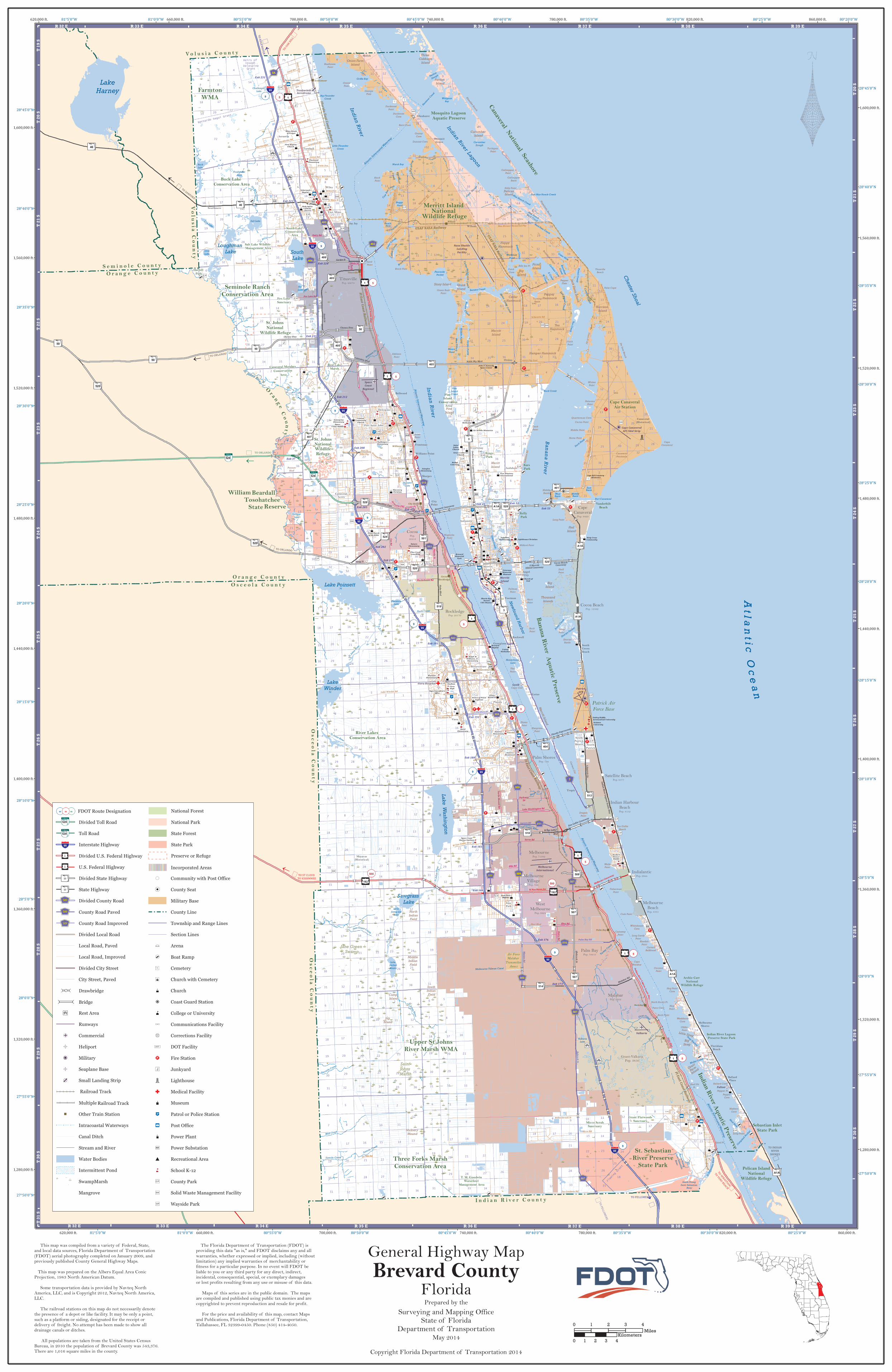
This map was compiled from a variety of Federal, State,and local data sources, Florida Department of Transportation(FDOT) aerial photography completed on January 2009, and previously published County General Highway Maps. This map was prepared on the Albers Equal Area ConicProjection, 1983 North American Datum. Some transportation data is provided by Navteq North America, LLC, and is Copyright 2012, Navteq North America, LLC. The railroad stations on this map do not necessarily denotethe presence of a depot or like facility. It may be only a point,such as a platform or siding, designated for the receipt or delivery of freight. No attempt has been made to show all drainage canals or ditches. All populations are taken from the United States CensusBureau, in 2010 the population of Brevard County was 543,376.There are 1,016 square miles in the county.
Divided Toll RoadToll RoadInterstate HighwayDivided U.S. Federal HighwayU.S. Federal HighwayDivided State HighwayState HighwayDivided County RoadCounty Road PavedCounty Road ImprovedDivided Local RoadLocal Road, PavedLocal Road, ImprovedDivided City StreetCity Street, Paved
FDOT Route DesignationRQ00 RQ00RQ00
Rest AreaRunwaysCommercialHeliportMilitarySeaplane BaseSmall Landing StripSingleMultipleOther Train Station
! ! ! Intracoastal WaterwaysCanal DitchStream and RiverWater BodiesIntermittent Pond
É
É
É É
SwampMarshMangrove
!( Community with Post Office!(! County Seat
Military BaseCounty LineTownship and Range LinesSection LinesArenaBoat RampCemeteryChurch with CemeteryChurchCoast Guard StationCollege or UniversityCommunications FacilityCorrections FacilityDOT FacilityFire StationJunkyardLighthouseMedical FacilityMuseumPatrol or Police StationPost OfficePower PlantPower SubstationRecreational AreaSchool K-12County ParkSolid Waste Management FacilityWayside Park
National ForestNational ParkState ForestState ParkPreserve or Refuge
Incorporated Areas
BridgeDrawbridge
Railroad TrackRailroad Track
"¡1
"¡1
32528
32528
§̈¦95
AB50
LLLK509
AB50
LLLK509
LLLK509
R 35 E R 36 E R 37 E R 38 E R 39 E
R 35 E R 36 E R 37 E R 38 E R 39 E