acid sulfate soil investigation...acid sulfate soil investigation lake way demonstration plant salt...
TRANSCRIPT
Acid Sulfate Soil InvestigationAcid Sulfate Soil Investigation
Lake
Acid Sulfate Soil Investigation
Lake Way
Acid Sulfate Soil Investigation
Way Demonstration PlantSalt Lake Potash
Leaders in
Acid Sulfate Soil Investigation
Demonstration PlantSalt Lake Potash
ABN: 92 147 485 416
Leaders in Environmental Practice
Acid Sulfate Soil Investigation
Demonstration PlantSalt Lake Potash
Revision 1March 2019
ABN: 92 147 485 416
Environmental Practice
Acid Sulfate Soil Investigation
Demonstration Plant
Salt Lake Potash Ltd
Revision 1 March 2019
Environmental Practice
Reference: PES14017 Page 2 of 34 Date: March 2019 Site: Lake Way Demonstration Plant Title: Acid Sulfate Soil Investigation Revision No: 1
Pendragon Environmental Solutions Pty Ltd ABN: 92 147 485 416 Address and Contact Details Suite 2 Level 1 464 Murray Street
Perth WA 6000
Tel: +61 (8) 9382-8286
Email: [email protected]
Website: www.pendragonenvironmental.com
Limitations, Uses and Reliance This document, once read in its entirety, may be relied upon for the purposes stated within the limits of:
Environmental investigations and assessments are undertaken in accordance with an agreed term of reference and timeframe and may involve intrusive investigations of subsurface conditions, generally at a few selected locations. Although due care, skill and professional judgement are applied in the interpretation and extrapolation of environmental conditions and factors to elsewhere, the potential for variances cannot be discounted. Therefore, the results, analyses and interpretations presented herein cannot be considered absolute or conclusive. Pendragon Environmental Solutions does not accept any responsibility for variances between the interpreted and extrapolated and those that are revealed by any means. Specific warning is given that many factors, natural or artificial, may render conditions different from those that prevailed at the time of investigation and should they be revealed at any time subsequently, they should be brought to our attention so that their significance may be assessed and appropriate advice may be offered. Users are also cautioned that fundamental assumptions made in this document may change with time and it is the responsibility of any user to ensure that assumptions made, remain valid.
The comments, findings, conclusions and recommendations contained in this document represent professional estimates and opinions and are not to be read as facts unless expressly stated to the contrary. In general, statements of fact are confined to statements as to what was done and/or what was observed; others have been based on professional judgement. The conclusions are based upon information and data, visual observations and the results of field and laboratory investigations and are therefore merely indicative of the environmental conditions at the time, including the presence or otherwise of contaminants or emissions. In addition, presentations in this document are based upon the extent of the terms of reference and/or on information supplied by the client, agents and third parties outside our control. To the extent that the statements, opinions, facts, conclusions and/or recommendations in this document are based in whole or part on this information, those are contingent upon the accuracy and completeness of the information which has not been verified unless stated otherwise. Pendragon Environmental Solutions does not accept responsibility for omissions and errors due to incorrect information or information not available at the time of preparation of this document and will not be liable in relation to incorrect conclusions should any information be incorrect or have been concealed, withheld, misrepresented or otherwise not fully disclosed. Neither will we be liable to update or revise the document to take into account any events, emergent circumstances or facts occurring or becoming apparent after the date of this document.
Within the limitations imposed by the terms of reference, the assessment of the study area and preparation of this document have been undertaken and performed in a professional manner, by suitably qualified and experienced personnel, in accordance with generally accepted practices and using a degree of skill and care ordinarily exercised by environmental consultants under similar circumstances. No other warranty, expressed or implied, is made.
This document has been prepared for the purposes stated herein. Every care was taken in the interpretation of environmental conditions and the nature and extent of impacts, presentation of findings and recommendations which are provided in good faith in the general belief that none of these are misleading. No responsibility or liability for the consequences of use and/or inference by others is accepted.
Intellectual and copyright in the information, data and representations such as drawings, figures, tabulations and text, included in this document remain the property of Pendragon Environmental Solutions. This document is for the exclusive use of the authorised recipient(s) and may not be used, copied or re-produced in whole, or in part, for any purpose(s) other than that for which it was prepared for. No responsibility or liability to any other party is accepted for any consequences and/or damages arising out of the use of this document without express and written consent.
The above conditions must be read as part of the document and must be reproduced where permitted. Acceptance of this document indicates acceptance of these terms and conditions.
-------------~~!!!~~fil!l~ -
Reference: PES14017 Page 3 of 34 Date: March 2019 Site: Lake Way Demonstration Plant Title: Acid Sulfate Soil Investigation Revision No: 1
Report
Title: Acid Sulfate Soil Investigation
Lake Way Demonstration Plant
File: PES18020
Author(s): Carel van der Westhuizen and Ryan Lawrence
Client: Salt Lake Potash Ltd
Contact: Ken Wilyman
Synopsis: This document details the acid sulfate soils investigation for the Lake Way Demonstration Plant.
Document Control
Revision No Date Author(s) Reviewer(s)
1 11 March 2019 Carel van der Westhuizen and Ryan Lawrence Taryn Wren
Distribution
Revision No Date Approved Recipient(s) No of Copies
1 11 March 2019 Taryn Wren Salt Lake Potash Ltd 1 Electronic
Revision
Revision No Date Description Approved
1 11 March 2019 Issued for EPA Referral Ryan Lawrence
Recipients are responsible for eliminating all superseded documents in their possession
© Pendragon Environmental Solutions 2019
----~~~~ -
Reference: PES14017 Page 4 of 34 Date: March 2019 Site: Lake Way Demonstration Plant Title: Acid Sulfate Soil Investigation Revision No: 1
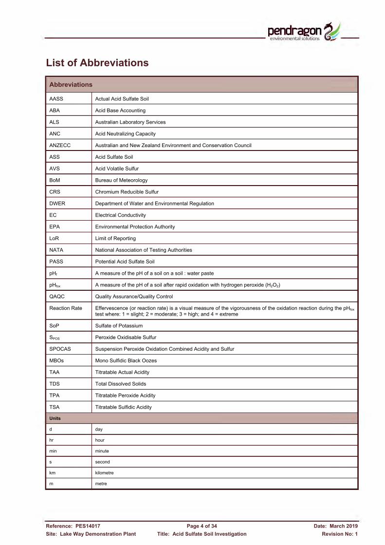
List of Abbreviations
Abbreviations
AASS Actual Acid Sulfate Soil
ABA Acid Base Accounting
ALS Australian Laboratory Services
ANC Acid Neutralizing Capacity
ANZECC Australian and New Zealand Environment and Conservation Council
ASS Acid Sulfate Soil
AVS Acid Volatile Sulfur
BoM Bureau of Meteorology
CRS Chromium Reducible Sulfur
DWER Department of Water and Environmental Regulation
EC Electrical Conductivity
EPA Environmental Protection Authority
LoR Limit of Reporting
NATA National Association of Testing Authorities
PASS Potential Acid Sulfate Soil
pHf A measure of the pH of a soil on a soil : water paste
pHfox A measure of the pH of a soil after rapid oxidation with hydrogen peroxide (H2O2)
QAQC Quality Assurance/Quality Control
Reaction Rate Effervescence (or reaction rate) is a visual measure of the vigorousness of the oxidation reaction during the pHfox test where: 1 = slight; 2 = moderate; 3 = high; and 4 = extreme
SoP Sulfate of Potassium
SPOS Peroxide Oxidisable Sulfur
SPOCAS Suspension Peroxide Oxidation Combined Acidity and Sulfur
MBOs Mono Sulfidic Black Oozes
TAA Titratable Actual Acidity
TDS Total Dissolved Solids
TPA Titratable Peroxide Acidity
TSA Titratable Sulfidic Acidity
Units
d day
hr hour
min minute
s second
km kilometre
m metre
-------------~~!!!~~fil!l~ -

Reference: PES14017 Page 5 of 34 Date: March 2019 Site: Lake Way Demonstration Plant Title: Acid Sulfate Soil Investigation Revision No: 1
Table of Contents Abbreviations ..................................................................................................................... 4
Executive Summary .......................................................................................................... 7
1. Introduction ................................................................................................................. 9
1.1 Background ....................................................................................................................... 9
1.2 Objectives ......................................................................................................................... 9
1.3 Scope of Work ................................................................................................................. 10
1.4 Sources of Data .............................................................................................................. 11
2. Site Identification ...................................................................................................... 12
2.1 Geology and Hydrogeology ............................................................................................. 12
2.1.1 Climate ................................................................................................................................. 12
2.1.2 Topography .......................................................................................................................... 12
2.1.3 Geology ................................................................................................................................ 12
2.1.4 Hydrology ............................................................................................................................. 13
2.1.5 Hydrogeology ....................................................................................................................... 13
2.1.6 ASS Risk Map ...................................................................................................................... 16
2.2 Data Gaps ....................................................................................................................... 16
3. Sampling and Analysis Plan .................................................................................... 18
3.1 Objective ......................................................................................................................... 18
3.2 Sampling Rationale ......................................................................................................... 18
3.3 Sampling Methodology .................................................................................................... 18
3.4 Laboratory Testing .......................................................................................................... 20
4. Quality Assurance and Quality Control ................................................................... 22
4.1 Field QA/QC .................................................................................................................... 22
4.2 Laboratory QA/QC .......................................................................................................... 22
4.3 QA/QC Data Evaluation .................................................................................................. 23
5. Results ....................................................................................................................... 24
5.1 Assessment Criteria ........................................................................................................ 24
5.2 Sediment Description and pH Tests ................................................................................ 25
5.3 CRS and SPOCAS Testing ............................................................................................. 26
5.3.1 Chromium Reducible Sulfur (CRS) ...................................................................................... 26
5.3.2 Acidity and Sulfur Trails........................................................................................................ 26
5.3.3 Acid Neutralizing Capacity (ANC) ........................................................................................ 28
5.3.4 Metal Leachability ................................................................................................................. 28
-------------~~!!!~~fil!l~ -
Reference: PES18020 Page 6 of 34 Date: March 2019 Site: Lake Way Demonstration Plant Title: Acid Sulfate Soil Investigation Revision No: 1
5.4 ASS Assessment Summary ............................................................................................ 31
6. Conclusion and Recommendations ........................................................................ 33
6.1 Conclusion ...................................................................................................................... 33
6.2 Recommendations .......................................................................................................... 33
References ....................................................................................................................... 34
Tables Table 2.1: Brine Quality.
Table 3.1: Time Line of Acid Sulfate Soil Sampling and Analyses.
Table 3.2: Sampling and Analysis.
Table 4.1: Field QA/QC.
Table 4.2: Laboratory QA/QC.
Table 5.1: Field Acid Sulfate Soil Indicators.
Table 5.2: Acid Sulfate Soil Action Criteria.
Table 5.3: Sample Descriptions, pH and AVS.
Table 5.4: CRS and SPOCAS Laboratory Analytical Data.
Table 5.5: Leachable Metals.
Table 5.6: Metal Concentrations in Laboratory Leachates.
Figures
Figure 1.1: Site Location.
Figure 2.1: Lithological Log Locations.
Figure 2.2: Acid Sulfate Soils Risk.
Figure 3.1: ASS Sampling Locations. Appendices Appendix A: Laboratory Data and Certificates.
-------------~~!!!~~fil!l~ -
Reference: PES14017 Page 7 of 34 Date: March 2019 Site: Lake Way Demonstration Plant Title: Acid Sulfate Soil Investigation Revision No: 1
Executive Summary Background Pendragon Environmental Solutions Pty Ltd was engaged by Salt Lake Potash Ltd to undertake preliminary acid sulfate soil (ASS) investigations at Lake Way, located in the Mid West Region of Western Australia, approximately 15km south-east of Wiluna. The purpose of this study was to ascertain whether ASS are present, and if present, to assess the potential risk for acidification of soils and surface and ground water during the proposed abstraction of brines from the lake. It is the intention of Salt Lake Potash to abstract hyper-saline brines by trenches discharging into large ponds where the Sulfate of Potash (SoP) will be concentrated by means of evaporation. The potassium-rich salts precipitated in the final ponds will be harvested and processed in a demonstration crystallisation plant to produce saleable SoP. Objectives and Scope of Work The objectives of this study are to:
Ascertain the presence/absence of acid sulfate soils.
Assess the leachability of heavy metals.
Ascertain the significance of potential impacts during excavation of the trenches and abstraction of the brines.
Make recommendations and detail management options (if required).
The scope of works entailed:
Review available pertinent documentation and conduct preliminary desk studies.
Formulate a Sampling and Analysis Quality Plan.
Field inspections and investigations.
Sample collection and laboratory analysis.
Interpret data against relevant standards/guidelines and undertake QA/QC data validation.
Compile an acid sulfate soils investigation report. Methodology Owing to the consistency and homogeneity of the sediment profile at Lake Way, determined in 36 test pits to a depth of at least 4m, a total of 25 samples of lake sediment, including what appear to be monosulfidic black oozes (MBOs), were obtained from 7 locations. These samples were analysed for field pHf and pHfox. A subset of samples was analysed for Acid Volatile Sulfur (AVS). Subsequent to assessing the field screen analytical data, further laboratory testing for Suspension Peroxide Oxidation Combined Acidity and Sulfur (SPOCAS) and Chromium Reducible Sulfur (CRS) was undertaken, with a limited number of samples analysed for heavy metals (total concentrations) and leachable metals. It should be noted that whilst the MBO’s [the term used to describe black, oily in appearance, gel-like substances with a moisture content greater than 70%, enriched in monosulfides (up to 27%), high in organic matter (usually 10% organic carbon) and can form thick (>1.0m) accumulations in waterways; DWER, 2015] were targeted, the materials encountered at Lake Way are considered to rather represent organic silts and clays primarily due to their visual characteristics and thickness (generally less than 8mm).
-------------~~!!!~~fil!l~ -
Reference: PES18020 Page 8 of 34 Date: March 2019 Site: Lake Way Demonstration Plant Title: Acid Sulfate Soil Investigation Revision No: 1
Summary of Analytical Results The salient findings to date include:
The lake sediments occur in a fairly consistent and homogenous profile comprising brown and red brown fine grained silty sandy clay and clay overlying weathered basement/basalt varying between 1m along the western shore to deeper than 30m in the east where the paleochannel prevails.
A visual inspection of the Williamson Pit (mined between 2005 and 2006) and trenches within the footprint of the trenches for the demonstration plant exhibited no evidence of acidification in the sediments and soils in the sidewalls and brine in the pit lake. The brine in the pit lake has a pH of 7.0 with very large concentrations of sodium, chloride, potassium and sulfate.
The sediments have pHf above 7.3, well above the assessment (trigger) level indicative of brine-logged alkaline un-oxidised conditions and absence of AASS. pHfox exceeds 5.8 well above the assessment level of 3.
From current laboratory analytical data the sediments within the footprint of the trenches for the demonstration plant cannot be classified as either Sulfidic or Sulfuric. AVS as a proxy for MBOs were found in two samples at 0.002%S and 0.008%S respectively well below the assessment level of 0.010%S. Consequently, the sediments cannot be classified as MBO’s either.
Chromium Reducible Sulfur (CRS) as a measure of potential sulfidic acidity and inorganic sulfur vary between <0.005%S and 0.018%S with only one sample (0.057%S) exceeding the Assessment Level of 0.030%S.
pHKCl in all samples exceeds 7.5 and pHox exceeds 7.1 indicating that there is no actual acidity and/or retained acidity in any of the samples.
Peroxide Oxidisable Sulfur (SPOS) corroborates the CRS determinations (low sulfur). The samples contain large concentrations of Peroxide Sulfur (SP) which reflects the presence of particularly sulfate from gypsum and sulfur released by the breakdown of organic matter. In all samples except one SP exceeds SKCl resulting in negative SPOS (SPOS = SP – SKCl) values.
Acid Neutralising Capacity (ANC) is only effective when pHKCl ≥ 6.5 which is the case in all the samples. Sediments contain ANC between 0.2%S and 1.0%S with an average of 0.5%S which exceeds any potential acidity from oxidation of sulfides (if any are present).
As the assessment endpoints are for ecosystem protection, leachable (total) metal concentrations were determined and except for a few marginal exceedances, the sediments contain heavy metals in concentrations well below the Interim Sediment Quality Guidelines (ISQG) Low Level indicating the probable effects concentrations are below levels where biological effects would rarely occur.
Dissolved metal concentrations in laboratory prepared leachates at a pH around 7 reflect concentrations currently measured in the brine; this scenario is likely to prevail due to the characteristics of the sediments and brines. Few metals leach under alkaline (pH > 9) conditions whilst more metals leach at larger concentrations under acidic (pH 4) conditions. It is highly unlikely that the environment at Lake Way will become acidic.
Conclusions and Recommendations There are no acid sulfate soils within the footprint of the trenches for the proposed demonstration plant. Consequently there is no risk of acidification and acid sulfate soil management will not be required. No further investigation and assessment will be necessary.
-------------~~!!!~~fil!l~ -
Reference:Site: Lake Way Demonstration Plant
1. In
1.1 Background Pendragon Environmental Solutions Pty Ltd was engaged by acidapproximately
The lake is underlain by sedimentsgypsumSulfate of Potash (SoP) will be conceprecipitated in the final ponds will be harvested and processed in a crystallisation plant to produce saleable SoP.
1.2 Objectives The
Reference: PES14017 Site: Lake Way Demonstration Plant
ntroductionBackgroundPendragon Environmental Solutions Pty Ltd was engaged by acid sulfate soilapproximately
The lake is underlain by sedimentsgypsum. HyperSulfate of Potash (SoP) will be conceprecipitated in the final ponds will be harvested and processed in a crystallisation plant to produce saleable SoP.
ObjectivesThe objectives
Ascertain the presence/absence of
Assess the
Ascertain the significance of potential impacts during excavation of the trenches and abstraction of the brines.
Site: Lake Way Demonstration Plant
troductionBackground Pendragon Environmental Solutions Pty Ltd was engaged by
sulfate soil investigationapproximately 15km south
The lake is underlain by sediments. Hyper-saline brines
Sulfate of Potash (SoP) will be conceprecipitated in the final ponds will be harvested and processed in a crystallisation plant to produce
Objectives objectives of this study are
the presence/absence of
Assess the leachability
Ascertain the significance of potential impacts during excavation of the trenches and abstraction of
Title: Acid Sulfate Soil Investigation
troduction
Pendragon Environmental Solutions Pty Ltd was engaged by investigation (ASSI)
south-east of Wiluna
Figure
The lake is underlain by sediments, predominantly redsaline brines will be abstracted by trenches discharging into large ponds where the
Sulfate of Potash (SoP) will be conceprecipitated in the final ponds will be harvested and processed in a crystallisation plant to produce
of this study are to:
the presence/absence of
of heavy metals.
Ascertain the significance of potential impacts during excavation of the trenches and abstraction of
Page 9 of Acid Sulfate Soil Investigation
Pendragon Environmental Solutions Pty Ltd was engaged by at Lake Way
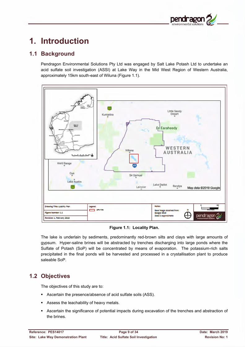
Wiluna (Figure 1
Figure 1.1: Locality Plan.
, predominantly redwill be abstracted by trenches discharging into large ponds where the
Sulfate of Potash (SoP) will be concentrated by means of evaporation. The potassiumprecipitated in the final ponds will be harvested and processed in a crystallisation plant to produce
the presence/absence of acid sulfate soils
of heavy metals.
Ascertain the significance of potential impacts during excavation of the trenches and abstraction of
of 34 Acid Sulfate Soil Investigation
Pendragon Environmental Solutions Pty Ltd was engaged by Way in the Mid West
(Figure 1.1).
1.1: Locality Plan.
, predominantly red-brown will be abstracted by trenches discharging into large ponds where the
ntrated by means of evaporation. The potassiumprecipitated in the final ponds will be harvested and processed in a crystallisation plant to produce
acid sulfate soils (ASS).
Ascertain the significance of potential impacts during excavation of the trenches and abstraction of
Acid Sulfate Soil Investigation
Pendragon Environmental Solutions Pty Ltd was engaged by Salt Lake PotashMid West Region of
1.1: Locality Plan.
brown silts and clayswill be abstracted by trenches discharging into large ponds where the
ntrated by means of evaporation. The potassiumprecipitated in the final ponds will be harvested and processed in a crystallisation plant to produce
Ascertain the significance of potential impacts during excavation of the trenches and abstraction of
Salt Lake Potash Ltd to undertake egion of Western Australia,
silts and clays with large amounts of will be abstracted by trenches discharging into large ponds where the
ntrated by means of evaporation. The potassiumprecipitated in the final ponds will be harvested and processed in a crystallisation plant to produce
Ascertain the significance of potential impacts during excavation of the trenches and abstraction of
Date: March 2019 Revision No: 1
Ltd to undertake Western Australia,
with large amounts of will be abstracted by trenches discharging into large ponds where the
ntrated by means of evaporation. The potassium-rich salts precipitated in the final ponds will be harvested and processed in a crystallisation plant to produce
Ascertain the significance of potential impacts during excavation of the trenches and abstraction of
Date: March 2019 Revision No: 1
Ltd to undertake an Western Australia,
with large amounts of will be abstracted by trenches discharging into large ponds where the
rich salts precipitated in the final ponds will be harvested and processed in a crystallisation plant to produce
Ascertain the significance of potential impacts during excavation of the trenches and abstraction of
--------- ~~!!!~~~~ aJ'_
'I Id Rang 0
Cue 0
0
LakeAU$ltn
II
• Kumanna 0
v .• ,
Wiluna 0
□ Ci>
S,rSamuel 0
Le1n$ter 0
Little Sandy Oe$ert
Lake Dario 0
-£.:.:.e . •~eco:£ Gcos~2019
0
Bandya 0 Map data 02019 Google
E9
Reference: PES18020 Page 10 of 34 Date: March 2019 Site: Lake Way Demonstration Plant Title: Acid Sulfate Soil Investigation Revision No: 1
Make recommendations and detail management options (if required).
1.3 Scope of Work This investigation was undertaken taking cognisance of:
Shand, P, Appleyard, S, Simpson, SL, Degens, B, 2018: National Acid Sulfate Soils Guidance: Guidance for the Dewatering of Acid Sulfate Soils in Shallow Groundwater Environments, Department of Agriculture and Water Resources, Canberra, ACT.
Sullivan, L, Ward, N, Toppler, N and Lancaster, G, 2018: National Acid Sulfate Soils Guidance: National Acid Sulfate Soils Identification and Laboratory Methods Manual, Department of Agriculture and Water Resources, Canberra, ACT.
Sullivan, LA, Ward, NJ, Bush, RT, Toppler, NR, Choppala, G, 2018: National Acid Sulfate Soils Guidance: Overview and Management of Monosulfidic Black Ooze (MBO) accumulations in Waterways and Wetlands, Department of Agriculture and Water Resources, Canberra, ACT.
Sullivan, L, Ward, N, Toppler, N and Lancaster, G, 2018: National Acid Sulfate Soils Guidance: National Acid Sulfate Soils Sampling and Identification Methods Manual, Department of Agriculture and Water Resources, Canberra ACT.
Sullivan, L.A., Burton, E., Bush, R., Watling, K., Bush, M.D. (2008). Acid, metal and nutrient mobilisation dynamics of some MBOs and sulfuric soil materials in the Lower Murray region. Southern Cross GeoScience Report Number 108 (v.2).
Department of Water and Environment Regulation (DWER, 2015a): Identification and Investigation of Acid Sulfate Soils and Acidic Landscapes.
Department of Water and Environment Regulation (DWER, 2015b): Treatment and Management of Soil and Water in Acid Sulfate Soil Landscapes.
Queensland Acid Sulfate Soils Investigation Team Acid Sulfate Soils (QASSIT, 2004): Laboratory Methods Guidelines.
The following tasks were undertaken to achieve the above mentioned objectives:
1) Desk study assessment of the likelihood of ASS occurring at Lake Way:
Identify climate, topography, geology, hydrology and hydrogeology at the site.
Review ASS risk (ASRIS).
Obtain and assess aerial imagery.
Evaluate existing sediment and ground water (brine) qualities.
2) Field investigation and site assessment:
Develop a sampling and analysis plan.
Inspect the site and validate desk study.
Obtain samples of sediment from various depths at different locations.
3) Laboratory analysis:
pHf and pHfox on all samples.
Acid Volatile Sulfur (AVS) on selected samples predominantly based upon observations during sampling.
-------------~~!!!~~fil!l~ -
Reference: PES18020 Page 11 of 34 Date: March 2019 Site: Lake Way Demonstration Plant Title: Acid Sulfate Soil Investigation Revision No: 1
Suspension Peroxide Oxidation Combined Acidity and Sulfur (SPOCAS) and Chromium Reducible Sulfur (CRS) on selected samples.
Concentrations of heavy metals in sediment and laboratory prepared leachates (at pH 4, 7 and 9) on selected samples.
Quality Assurance (QA) and Quality Control (QC) data validation.
4) Assessment of ASS characteristics:
Compare laboratory results against assessment criteria.
Identify significance and locations of potential acid generating sediments.
Classify sediments.
Evaluate potential impacts and risks.
5) Compile a report with conclusions and recommendations on the ASS investigation.
1.4 Sources of Data Data and relevant information was obtained from:
Published sources, including geological maps, reports and publications.
Historic and current aerial photos from Google Earth.
Climatic data from the Bureau of Meteorology (http://www.bom.gov.au/climate/data/).
Acid sulfate soil risk map from Australian Soil Resource Information System (ASRIS) (http://www.asris.csiro.au/themes/AcidSulfateSoils.html).
Regional elevation contours from MapConnect of Geoscience Australia (http://mapconnect.ga.gov.au/MapConnect/250K/).
Several relevant reports (referenced where required) and data from the Salt Lake Potash database.
-------------~~!!!~~fil!l~ -
Reference: PES18020 Page 12 of 34 Date: March 2019 Site: Lake Way Demonstration Plant Title: Acid Sulfate Soil Investigation Revision No: 1
2. Site Identification
2.1 Geology and Hydrogeology
2.1.1 Climate Lake Way is located in an arid climate. The nearest weather station is Wiluna (Bureau of Meteorology, BoM, Site No 013012 with data since 1898), approximately 15km north-west. The average annual rainfall at Wiluna is 262mm with average monthly rain varying between 5mm in September and 39mm in February. The annual evaporation at the Meekatharra weather station is considered more accurate due to data inconsistencies at the old Wiluna weather station (advice by BoM); a new automated station was opened in 2017 (Salt Lake Potash Ltd, 2019). The average daily pan evaporation at Meekatharra is 10mm and annual evaporation amounts to approximately 3,504mm. The playa has thus a marked water balance deficit: evaporation exceeds rainfall by more than thirteen times.
2.1.2 Topography Lake Way has a surface area of 205km2, it is 38.5km long, averages 9.0km in width, and is a terminal feature in the regional drainage pattern. Topographic data including the regional contour map SG51 Wiluna, obtained from Geoscience Australia, indicates that elevations across the region fall from the north to the south and from the west towards the east; however, elevations across the lake bed decreases slightly from the south-east (497mAHD) to the north-west (491mAHD).
2.1.3 Geology Lake Way is located in the Northern Goldfields Province on the Archaean Yilgarn Craton characterised by granite-greenstone rocks that exhibit a prominent north-west tectonic trend and low to medium-grade metamorphism intruded by east-west striking dykes of dolerite (Salt Lake Potash Ltd, 2019). The basement rocks are generally poorly exposed owing to low relief, extensive superficial cover and widespread deep weathering. The lake is associated with arid zone paleo-valleys (Magee, 2009) indicating a long-term absence of down-valley throughflow, and consequently, development of a large, hyper-saline reflux brine reservoir due to prolonged concentration by evaporation. The Lake Way system developed on the Carey Paleochannel in the Western Eucla Basin incised into the Archean basement and in-filled with a mixed Tertiary and Quaternary sedimentary sequence comprising sand, silts and clays of lacustrine, aeolian, fluvial and colluvial depositional origins. The paleochannel itself prevails along the eastern margin of the lake with the central, western and much of the northern portions of the playa residing on basement mafic, felsic and meta-sedimentary rocks at depths less than 5m. The playa sediments are dominated by alternating sequences of red-brown evaporitic sands, silts and clays with gypsum often with dark brown to black organic materials. Sedimentation appears to have occurred in two distinct phases: sediments deeper than approximately 1.1m are firm to hard and notably competent whilst those from surface to 1.1m depth are soft, puggy and unstable suggesting that the lower sediments are distinctly older than the upper sediments. The nature of sedimentation conforms to a model of geologically recent (Pleistocene to Holocene) phased tectonic uplift that has progressively dammed the Carey Paleochannel thereby creating the expanding lacustrine environment observed in the excavated pits today (as indicated by the multiple paleo surfaces and
-------------~~!!!~~fil!l~ -
Reference: PES18020 Page 13 of 34 Date: March 2019 Site: Lake Way Demonstration Plant Title: Acid Sulfate Soil Investigation Revision No: 1
evidence of a receding, vegetated shoreline).
2.1.4 Hydrology There are no permanent surface water bodies anywhere in the development envelope for the demonstration plant other than the pit lake at Williamson Pit. The lake is dry except during wet summers and/or when cyclones, having a very low frequency, cause extensive rainfall-runoff such as in 1900, 1942, 1963, 1973 (Cyclone Kerry), repeatedly between 1992 and 2001, 2005 (Cyclone Bobby) and in 2006. In January and February 1995 (Cyclone Bobby), 294mm fell over 9 rain days including a 124mm event on 20 February resulting in inundation of the playa until at least December when the flooded lake surface was captured by satellite imagery. Lake Way receives episodic surface water inflows from West and East Creeks in the north and smaller creeks along the western and south-western perimeter of the lake and consequently surface water recharge is a significant part of the water balance for brine abstraction (Groundwater Science, 2018). The northern part of the playa exhibits morphology typical of significant surface water influence and periodic inundation (smooth playa edges). The southern part of the playa exhibits morphology consistent with a groundwater dominated playa with rare inundation (irregular shoreline, numerous islands; Groundwater Science, 2018). The frequency of inundation across the lake may be influenced by prevailing south-easterly winds driving water to the north eastern end of the lake. The Lake Way catchment is 3,767km2 (including the total West Creek sub-catchment, the extent of the catchment extent increases to some 11,000km2; KP, 2018 and 2019). Run-off modelling estimated that on average 3.9% of rainfall runs off to the lake (Groundwater Science, 2018). Most heavy rainfall occurs between December and March and as such 71% of significant runoff events (runoff depth >5mm) occur during this period. The average annual modelled run-off to the playa is 38GL/year but this is highly variable and ranges from 0 (years 1910 and 1936) up to a maximum of 314GL in 1936 and more recently 283GL in 1995. Since there are no drainage lines leaving the playa runoff onto the playa is eventually lost to evaporation (Groundwater Science, 2018). The quality of water ponding on the playa is influenced by the salt crust that covers the playa. Except for brief periods after large rainfall events, water ponded on the playa is typically hyper saline (>200g/L TDS). Groundwater beneath Lake Way is also hyper saline with a median TDS concentration of approximately 326g/L. The playa groundwater has no noticeable enrichment in trace metals, including uranium and thorium (Groundwater Science, 2018).
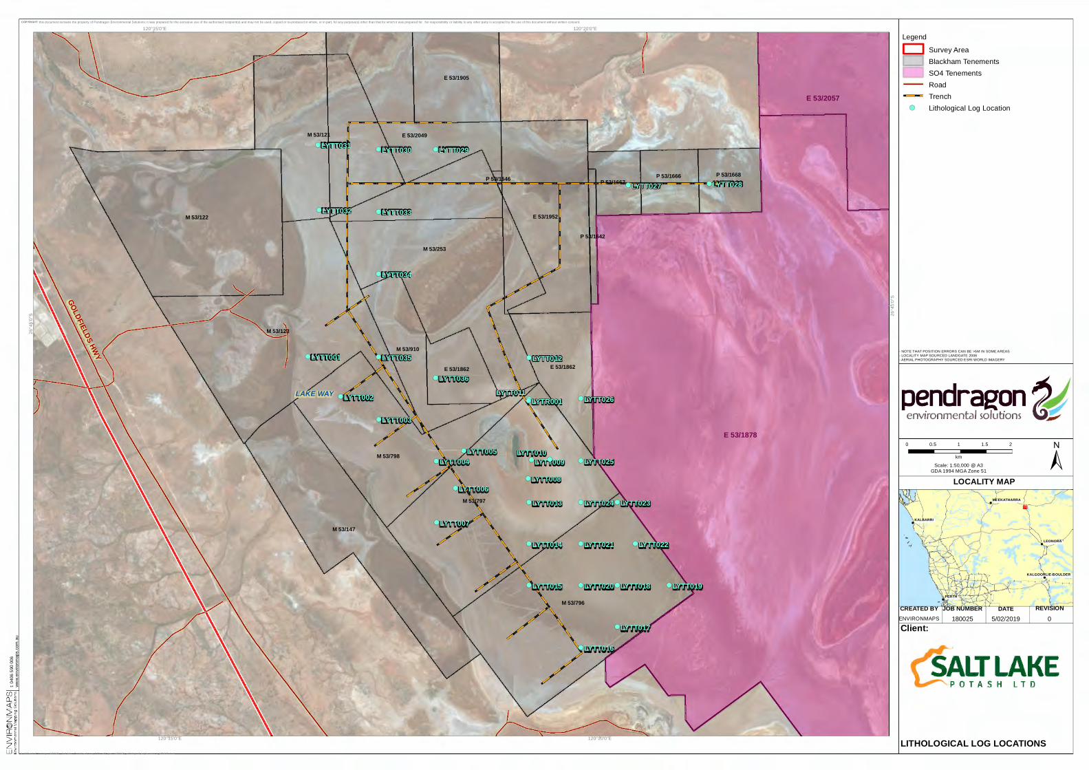
2.1.5 Hydrogeology Detailed geological and hydrogeological investigations (36 test pits and bores and 5 trenches) across the lake (Figure 2.1) indicated that:
Materials at the site comprise a consistent, homogenous profile of evaporite salts blanketing upper lakebed sand, silt and clay sequences underlain by weathered basement/basalt:
SaC/CS Brown Sand Clay or Clayey Sand, fine to medium, dry to moist, soft to firm; on average 1m thick, present across the entire lake.
SiC Brown and red brown Silty Clay, dry to moist, soft to firm with gypsum crystals locally; only present locally but attains thicknesses of up to 1.5m.
Cl Orange, purple, white, green or red brown Clay, saprolite, porous, soft to stiff; generally directly underlying the brown Sand Clay; between 0.4m and more than 4m thick, present across the entire lake.
B Weathered Basement/Basalt; between 1m (western part of the lake) and deeper than 30m (eastern and central parts of the lake.
-------------~~!!!~~fil!l~ -
CREATED BY DATE REVISIONJOB NUMBER
!
!
!
!
!
!
PERTH
LEONORA
KALBARRI
MEEKATHARRA
KALGOORLIE-BOULDER
LOCALITY MAP
180025 5/02/2019 0
COPYRIGHT: this document remains the property of Pendragon Environmental Solutions; it was prepared for the exclusive use of the authorised recipient(s) and may not be used, copied or re-produced in whole, or in part, for any purpose(s) other than that for which it was prepared for. No responsibility or liability to any other party is accepted by the use of this document without written consent.
ENVIRONMAPS
0 0.5 1 1.5 2
km
LegendSurvey AreaBlackham TenementsSO4 TenementsRoad
! ! Trench!( Lithological Log Location
!
!
!
!
!
!
!
!
!
!
!
!
!
!
!
!
!
!
!
!
!
!
!
!
!
!
!
!
!
!
!
!
!
!
!
!
!
!
!
!
!
!
!
!
!
!
!
!
!
!
!
!
!
!
!
!
!
!
!
!
!
!
!
!
!
!
!
!
!
!
!
!
!
!!
!!
!!
! ! ! ! ! ! ! ! ! ! ! ! ! ! ! ! ! ! ! ! ! ! ! ! ! ! ! !
! ! ! ! ! ! ! !
!!
!!
!!
!!
!!
!!
!!
!
!
!
!
!
!
!
!
!(
!(
!(
!(
!(
!(
!(
!(
!( !(
!(
!(
!(
!(
!(
!(
!(
!(
!( !(!(
!( !(
!(!(
!(
!(
!( !(
!(!(!(
!( !(
!(
!(
!(LYTT036
LYTT035
LYTT034
LYTT033LYTT032
LYTT031 LYTT030 LYTT029
LYTT028LYTT027
LYTT026
LYTT025
LYTT024 LYTT023
LYTT022LYTT021
LYTT020 LYTT019LYTT018
LYTT017
LYTT016
LYTT015
LYTT014
LYTT013
LYTR001
LYTT012
LYTT011
LYTT010LYTT009
LYTT008
LYTT007
LYTT006
LYTT005LYTT004
LYTT003
LYTT002
LYTT001
LAKE WAY
E 53/1878
E 53/2057
M 53/253
M 53/796
M 53/797
M 53/123
M 53/122
E 53/2049M 53/121
M 53/147
M 53/798
E 53/1952
E 53/1905
E 53/1862
M 53/910
E 53/1862
P 53/1668P 53/1666P 53/1667
P 53/1642
P 53/1646
GOLDFIELDS HWY
120°20'0"E
120°20'0"E
120°15'0"E
120°15'0"E26
°45'0
"S 26°4
5'0"S
C:\GIS\Jobs\Pendragon\180025 - Salt Lake Potash Lakeway Referral\Figures\180025_Lithological Log Locations_190205.mxd
Client:
LITHOLOGICAL LOG LOCATIONS
±Scale: 1:50,000 @ A3GDA 1994 MGA Zone 51
- NOTE THAT POSITION ERRORS CAN BE >5M IN SOME AREAS- LOCALITY MAP SOURCED LANDGATE 2006- AERIAL PHOTOGRAPHY SOURCED ESRI WORLD IMAGERY
t: 040
6 590
006
www.e
nviro
nmap
s.com
.au
(j) 0... <(
:::::: z @) [[
> z w
Reference: PES18020 Page 15 of 34 Date: March 2019 Site: Lake Way Demonstration Plant Title: Acid Sulfate Soil Investigation Revision No: 1
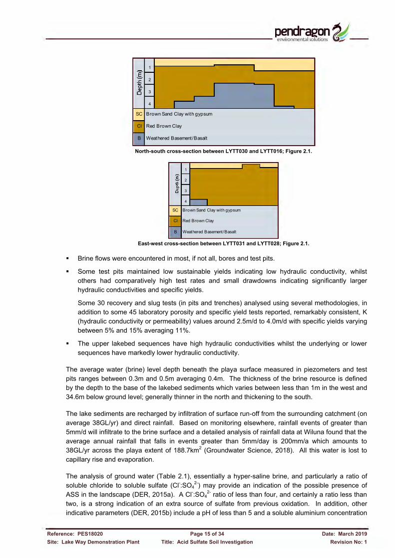
North-south cross-section between LYTT030 and LYTT016; Figure 2.1.
East-west cross-section between LYTT031 and LYTT028; Figure 2.1.
Brine flows were encountered in most, if not all, bores and test pits.
Some test pits maintained low sustainable yields indicating low hydraulic conductivity, whilst others had comparatively high test rates and small drawdowns indicating significantly larger hydraulic conductivities and specific yields.
Some 30 recovery and slug tests (in pits and trenches) analysed using several methodologies, in addition to some 45 laboratory porosity and specific yield tests reported, remarkably consistent, K (hydraulic conductivity or permeability) values around 2.5m/d to 4.0m/d with specific yields varying between 5% and 15% averaging 11%.
The upper lakebed sequences have high hydraulic conductivities whilst the underlying or lower sequences have markedly lower hydraulic conductivity.
The average water (brine) level depth beneath the playa surface measured in piezometers and test pits ranges between 0.3m and 0.5m averaging 0.4m. The thickness of the brine resource is defined by the depth to the base of the lakebed sediments which varies between less than 1m in the west and 34.6m below ground level; generally thinner in the north and thickening to the south. The lake sediments are recharged by infiltration of surface run-off from the surrounding catchment (on average 38GL/yr) and direct rainfall. Based on monitoring elsewhere, rainfall events of greater than 5mm/d will infiltrate to the brine surface and a detailed analysis of rainfall data at Wiluna found that the average annual rainfall that falls in events greater than 5mm/day is 200mm/a which amounts to 38GL/yr across the playa extent of 188.7km2 (Groundwater Science, 2018). All this water is lost to capillary rise and evaporation. The analysis of ground water (Table 2.1), essentially a hyper-saline brine, and particularly a ratio of soluble chloride to soluble sulfate (Cl-:SO4
2-) may provide an indication of the possible presence of ASS in the landscape (DER, 2015a). A Cl-:SO4
2- ratio of less than four, and certainly a ratio less than two, is a strong indication of an extra source of sulfate from previous oxidation. In addition, other indicative parameters (DER, 2015b) include a pH of less than 5 and a soluble aluminium concentration
SC Brown Sand Clay with gypsum
Cl Red Brown Clay
B Weathered Basement/Basalt
1
2
3
4
SC Brown Sand Clay with gypsum
Cl Red Brown Clay
B Weathered Basement/Basalt
4
1
2
3
-------------~~!!!~~K2~ ~ -I
E -~ a ,__
I ~
0 - I
I
--