2015 slocan white eagle gold silver slocan british columbia mls mining
TRANSCRIPT

___________________________________________________________________________________
Eagle 1023615 Claim Group John Nick Bakus Event 5538445
___________________________________________________________________________________
___________________________________________________________________________________
April 14, 2015 Sookochoff Consultants Inc. Page 1 of 30
___________________________________________________________________________________
JOHN NICK BAKUS
(Owner & Operator)
GEOLOGICAL ASSESSMENT REPORT (Event 5538445)
on a
STRUCTURAL ANALYSIS
on Tenures
1023615,1023616,1029331,1033413,1032039,1033412,1033414,1032035,1033411
of the nine claim
Eagle 1023615 Claim Group Slocan Mining Division
BCGS Maps 082K.025/.035
Centre of Work
UTM 5,537,363N 488,388E (NAD 83 Zone 11U)
work done from
December 5, 2014 to December8, 2014
Author & Consultant
Laurence Sookochoff, PEng Sookochoff Consultants Inc.
Submitted
May 6, 2015

___________________________________________________________________________________
Eagle 1023615 Claim Group John Nick Bakus Event 5538445
___________________________________________________________________________________
___________________________________________________________________________________
April 14, 2015 Sookochoff Consultants Inc. Page 2 of 30
___________________________________________________________________________________
TABLE OF CONTENTS
page
Summary ------------------------------------------------------------------------- 4.
Introduction ---------------------------------------------------------------------- 5.
Property Location and Description ------------------------------------------- 5.
Accessibility, Climate, Local Resources,
Infrastructure and Physiography ------------------------------------ 6.
Water and Power ---------------------------------------------------------------- 7.
History: Property Area --------------------------------------------------------- 7.
082KSW059 – ISLE -------------------------------------------------------- 8.
082KSW084 – UPPER COMSTOCK ------------------------------------ 9.
082KSW088 – SWEDE ---------------------------------------------------- 9.
082KSW089 – MOTHER LODE ----------------------------------------- 9.
082KSW125 – JUNO ------------------------------------------------------- 9.
082KSW127 – NOONDAY ----------------------------------------------- 9.
082KSW149 – NORTH STAR AMBER -------------------------------- 10.
082KSW164 – MAGGIE --------------------------------------------------- 10.
History: Property ---------------------------------------------------------------- 10.
082KSW086 – SNOWSTORM ------------------------------------------- 10.
082KSW126 – WHITE EAGLE ------------------------------------------ 10.
082KSW143 – SILVER SPARROW ------------------------------------- 11.
082KSW197 – WEST RIDGE -------------------------------------------- 11.
082KSW198 – LAKEVIEW ----------------------------------------------- 11.
Geology: Regional -------------------------------------------------------------- 12.
Geology: Property Area -------------------------------------------------------- 13.
082KSW059 – ISLE -------------------------------------------------------- 13.
082KSW084 – UPPER COMSTOCK ------------------------------------ 15.
082KSW088 – SWEDE ---------------------------------------------------- 15.
082KSW089 – MOTHER LODE ----------------------------------------- 15.
082KSW125 – JUNO ------------------------------------------------------- 16.
082KSW127 – NOONDAY ----------------------------------------------- 16.
082KSW149 – NORTH STAR AMBER -------------------------------- 16.
082KSW164 – MAGGIE --------------------------------------------------- 17.
Geology: Property --------------------------------------------------------------- 17.
082KSW086 – SNOWSTORM ------------------------------------------- 17.
082KSW126 – WHITE EAGLE ------------------------------------------ 18.
082KSW126 – SILVER SPARROW ------------------------------------- 18.
082KSW197 – WEST RIDGE -------------------------------------------- 18.
082KSW198 – LAKEVIEW ----------------------------------------------- 19.

___________________________________________________________________________________
Eagle 1023615 Claim Group John Nick Bakus Event 5538445
___________________________________________________________________________________
___________________________________________________________________________________
April 14, 2015 Sookochoff Consultants Inc. Page 3 of 30
___________________________________________________________________________________
Table of Contents (cont’d)
Mineralization: Property Area ------------------------------------------------- 19.
082KSW059 – ISLE -------------------------------------------------------- 19.
082KSW084 – UPPER COMSTOCK ------------------------------------ 19.
082KSW088 – SWEDE ---------------------------------------------------- 20.
082KSW089 – MOTHER LODE ----------------------------------------- 20.
082KSW125 – JUNO ------------------------------------------------------- 20.
082KSW127 – NOONDAY ----------------------------------------------- 20.
082KSW149 – NORTH STAR AMBER -------------------------------- 21.
082KSW164 – MAGGIE --------------------------------------------------- 21.
Mineralization: Property ------------------------------------------------------- 21.
082KSW086 – SNOWSTORM ------------------------------------------- 21.
082KSW126 – WHITE EAGLE ------------------------------------------ 21.
082KSW126 – SILVER SPARROW ------------------------------------- 22.
082KSW197 – WEST RIDGE -------------------------------------------- 22.
082KSW198 – LAKEVIEW ----------------------------------------------- 22.
Structural Analysis -------------------------------------------------------------- 23.
Interpretation and Conclusions ------------------------------------------------- 26.
Selected References ------------------------------------------------------------- 28.
Statement of Costs -------------------------------------------------------------- 29.
Certificate ------------------------------------------------------------------------ 30.
TABLES
Table I Eagle 1023615 Claim Group Tenure --------------------------- 6.
Table II Approximate UTM Location of Figures 5 & 7
Cross-Structures & Minfiles ------------------------------------ 25.
ILLUSTRATIONS
Figure 1. Location Map ---------------------------------------------------- 5.
Figure 2. Property Location from Castlegar ---------------------------- 6.
Figure 2a Property Location from Kaslo --------------------------------- 6.
Figure 3. Claim Map ------------------------------------------------------- 7.
Figure 4. Geology, Claim, Minfile & Index Map ---------------------- 14.
Figure 5. Lineaments as Indicated Structures on
Eagle 1023615 Claim Group --------------------------------- 23.
Figure 6. Rose Diagram from Lineaments of
Eagle 1023615 Claim Group --------------------------------- 24.
Figure 7. Locations of Structural Intersections and Minfiles --------- 25.
Figure 8. Eagle Property Vein Location in a porphyry-
Epithermal geological model -------------------------------- 26.

___________________________________________________________________________________
Eagle 1023615 Claim Group John Nick Bakus Event 5538445
___________________________________________________________________________________
___________________________________________________________________________________
April 14, 2015 Sookochoff Consultants Inc. Page 4 of 30
___________________________________________________________________________________
SUMMARY
The nine claim Eagle 1023615 Claim Group (“Property”) is located within the covering an area of 227
hectares, is located 440 kilometres east-northeast of Vancouver and 114 kilometres north-northeast of
Castlegar.
The Property is also located within the historic Slocan Mining Camp where active exploration began
around 1865, became one of the most productive mining camps in the province, and achieved peak
production in 1918. The Camp and surrounding areas includes 175 documented mineral deposits of
which more than half are mineral producers. Thirteen mines have produced more than one million grams
of silver.
An indication of the potential mineral zones to be located in the Property area is from the Rambler Mine
32 kilometres south which is reported as a polymetallic vein deposit hosting silver-lead-zinc with or
without gold deposit type (Minfile 082KSW018) The Rambler mine was one of the largest past
producers in the area where three ore shoots were explored by 14 levels to an approximate depth of 400
metres below the surface and developed by workings over a horizontal distance of 610 metres. During
its mine life a total of 189,421 tonnes of ore was mined from which 108,959,934 grams (3,503,143
ounces) silver, 839 grams (27 ounces) gold, and significant quantities of cadmium, lead, and zinc were
recovered.
The Rambler ore reportedly appears closely related to nearly east-west dilation jogs and cross fractures.
The structural analysis of the Eagle 1023615 Claim Group resulted in the delineation of three cross-
structures on an indicated major northwesterly trending structure extending the entire three kilometre
length of the Property with three of the five Minfile deposits, Snowstorm, Lakeview, and Silver
Sparrow, directly correlating with the structure or an en echelon structure. The Snowstorm and the
Lakeview having a near direct correlation with cross-structures A and C where there should be greater
indication of a resource potential. However, the weaker mineralization at these cross structural/deposit
locations may indicate less than optimum surficial geological features, such as fracture density, for a
resource development.
Nevertheless, the White Eagle past producer, where 42 channel samples from the main vein yielded 298
grams silver per tonne and 6.5 grams per tonne gold, and located some 200 metres from cross-structure
B, may be indicative of significant geological features at cross-structure B that would enhance mineral
resource development and provide valuable geological information as to the proximity of a potential
depth related porphyry mineral resource (Figure 8).
Thus, the White Eagle/cross-structure B location is the prime area to explore for surficial geological
indicators of a potential polymetallic vein or a depth related porphyry mineral resource. These
geological indicators could be indicated as primary or secondary minerals or alteration patterns which
would be subject to interpretation as to follow-up exploration.
Excluding other variable geological conditions, the structures are essential as mineral controls to both
deposit types and the cross-structures of greater importance to enhance the mineralogical and economic
aspects of the mineral deposit.

___________________________________________________________________________________
Eagle 1023615 Claim Group John Nick Bakus Event 5538445
___________________________________________________________________________________
___________________________________________________________________________________
April 14, 2015 Sookochoff Consultants Inc. Page 5 of 30
___________________________________________________________________________________
INTRODUCTION
In December 2014 a structural analysis was completed on the nine claims of the Eagle 1023615 Claim
Group. The purpose of the structural analysis was to delineate potential structures which may be integral
in geological controls to potentially economic mineral zones on the Eagle 1023615 Claim Group.
Information for this report was obtained from sources as cited under Selected References, and from
previous work the writer has done in the general area.
PROPERTY LOCATION and DESCRIPTION
Location
The Eagle 1023615 Claim Group is located in the Slocan Range of the Selkirk Mountains in
southeastern British Columbia 475 kilometres east-northeast of Vancouver. 113 kilometres north-
northeast of Castlegar, 47 kilometres of Nakusp, and 47 kilometres north-northwest of Kaslo, within
BCGS Maps 082K.025 and 082K.035 of the Slocan Mining Division.
Figure 1. Location Map (Base Map from MapPlace)
Description
The Eagle 1023615 Claim Group is comprised of nine contiguous claims covering an area of 227.07
hectares. Particulars are as follows:

___________________________________________________________________________________
Eagle 1023615 Claim Group John Nick Bakus Event 5538445
___________________________________________________________________________________
___________________________________________________________________________________
April 14, 2015 Sookochoff Consultants Inc. Page 6 of 30
___________________________________________________________________________________
Table I. Tenures of the Eagle 1023615 Claim Group D
Tenure Number
Type Claim Name Good Until Area (ha)
1023615 Mineral White Eagle 1 20220113 20.6426
1023616 Mineral White Eagle 3 20220113 20.6462
1029331 Mineral W EAGLE W RIDGE 1540 GTAG 20220101 20.6462
1032035 Mineral WHITE EAGLE LAKEVIEW N 20161105 20.6444
1032039 Mineral
20171101 20.6443
1033411 Mineral Slocan WEagle Snowstorm 20220101 20.639
1033412 Mineral Slocan Snowstorm E 20150702 41.2798
1033413 Mineral Slocan WEagle Sparrow 20220101 41.2832
1033414 Mineral Slocan WEagle SparrowS 20150717 20.6443
Total Area: 227.07 ha
*Upon the approval of the assessment work filing Event Number 5538445.
ACCESSIBILITY, CLIMATE, LOCAL RESOURCES, INFRASTRUCTURE AND PHYSIOGRAPHY
Road access to the Eagle 1023615 Claim Group from the Castlegar airport is as follows:
From To km Direction via
Castlegar Junction with Hwy 3A
and 6 14 N Hwy 3A
Junction Nelson 21 ENE Hwy 3A
Nelson Kaslo 87 N Hwy 31
Kaslo Property 45 NNW Helicopter
Climate
The climate of the area is of relatively warm summers and moderately cold winters with heavy snowfall.
Snowfall within the lower elevations of the Property by mid-November and snow free by May.
Local Resources
Sufficient accommodation and supplies for a preliminary exploration program would be available at
Castlegar or Kaslo.. Contracts for required technical exploration and development programs would
probably be made with companies based in Vancouver with some supporting personnel from local
communities.
Infrastructure
Provisions for all telecommunication and public transportation services are available at Kaslo. Castlegar,
where helicopter services are available, is also serviced daily by a commercial airline from Vancouver
and Calgary. An airport for small aircraft is located at Kaslo.
Physiography
The Property covers an area of forested steep slopes in the southwestern portions with an elevation of
1,800 metres near a creek valley rising to a barren mountainous alpine area in the northwest where
elevations reach 2,577 metres on a mountain ridge.

___________________________________________________________________________________
Eagle 1023615 Claim Group John Nick Bakus Event 5538445
___________________________________________________________________________________
___________________________________________________________________________________
April 14, 2015 Sookochoff Consultants Inc. Page 7 of 30
___________________________________________________________________________________
Figure 2. Property Location from Castlegar (Base Map from MapPlace & Google)
Figure 2a. Property Location from Kaslo (Base Map from MapPlace & Google)

___________________________________________________________________________________
Eagle 1023615 Claim Group John Nick Bakus Event 5538445
___________________________________________________________________________________
___________________________________________________________________________________
April 14, 2015 Sookochoff Consultants Inc. Page 8 of 30
___________________________________________________________________________________
Figure 3. Claim Map (Base Map from MapPlace)
WATER AND POWER
Sufficient water for a summer diamond drill program should be available from water courses or lakes on
or adjacent to the Eagle 1023615 Claim Group
Property generated power would be required in the initial pre-production stages of a exploration and
development program.
HISTORY: PROPERTY AREA
The history on some MINFILE reported showings, prospects, and past producers peripheral to the Eagle
1023615 Claim Group as blocked out on Figure 4 is reported as follows. The descriptions are copied
from Minfile.
The distance is relative to the Eagle 1023615 Claim Group.
ISLE past producer (Polymetallic veins Ag-Pb-Zn+/-Au; Stibnite veins and disseminations)
Minfile 082KSW059
Four kilometres south-southeast
The Isle occurrence is located on the west side of Meadow Mountain at 2256 metres elevation above sea level, near the headwaters of John Creek in the Slocan Mining Division.
A short adit was excavated to evaluate a quartz vein within the shear zone
In 1970, two tonnes were mined form the vein to produce 31 grams of silver, 12 kilograms of lead and 8 kilograms of zinc.

___________________________________________________________________________________
Eagle 1023615 Claim Group John Nick Bakus Event 5538445
___________________________________________________________________________________
___________________________________________________________________________________
April 14, 2015 Sookochoff Consultants Inc. Page 9 of 30
___________________________________________________________________________________
History: Property Area (cont’d)
UPPER COMSTOCK prospect (Polymetallic veins Ag-Pb-Zn+/-Au)
Minfile 082KSW084
Three kilometres northeast
The Upper Comstock occurrence is located at the head of Cascade Creek at 2635 metres elevation above sea level in the Slocan Mining Division. The property is on the ridge between Cascade and Mat creeks.
SWEDE past producer (Polymetallic veins Ag-Pb-Zn+/-Au; Au quartz veins)
Minfile 082KSW088
Eleven kilometres north
The Swede property is situated at 1160 metres elevation above sea level on the south bank of Poplar Creek in the Slocan Mining Division. The property consists of two Reverted Crown grants (Lots 4738 and 4739).
In 1904, Great Northern Mines mined 8 tonnes of high-grade ore from the occurrence to produce 778 grams of gold.
MOTHER LODE past producer (Polymetallic veins Ag-Pb-Zn+/-Au;
Polymetallic manto Ag-Pb-Zn)
Minfile 082KSW089
Ten kilometres north
The Mother Lode prospect is located at 1035 metres elevation above sea level between Poplar and Cascade creeks, in the Slocan Mining Division.
One tonne of ore was mined from the adits in 1924 to produce 1649 grams of silver and 396 kilograms of lead.
JUNO prospect (Polymetallic veins Ag-Pb-Zn+/-Au)
Minfile 082KSW125
Two kilometres north
The Juno occurrence is located at the head of Cascade Creek at 1524 metres elevation above sea level in the Slocan Mining Division.
During 1987 and 1988 Ambergate Explorations conducted an exploration program which consisted of 1:10000 scale mapping, a soil survey, and trenching on their Amber 1-4 claims in which the Juno showing is located. A follow-up to the 87-88 exploration program was done in 1994 by Lumby Resources Corporation, an optionee of Kenrich Mining Corporation, formerly Ambergate Explorations. This program extended the soil survey in the Juno, West Ridge (082KSW197), and White Eagle (082KSW126) showing areas (Assessment Report 23669).
NOONDAY prospect (Polymetallic veins Ag-Pb-Zn+/-Au)
Minfile 082KSW127
Three kilometres north
The Noonday occurrence is located at the head of Cascade Creek at 2200 metres elevation above sea level in the Slocan Mining Division. The prospect is on the ridge between Cascade and Mat creeks on the old Comstock claims.

___________________________________________________________________________________
Eagle 1023615 Claim Group John Nick Bakus Event 5538445
___________________________________________________________________________________
___________________________________________________________________________________
April 14, 2015 Sookochoff Consultants Inc. Page 10 of 30
___________________________________________________________________________________
History: Property Area (cont’d)
NORTH STAR AMBER prospect (Polymetallic veins Ag-Pb-Zn+/-Au; Stibnite veins)
and disseminations)
Minfile 082KSW149
Three kilometres south-southeast
The North Star Amber occurrence is located at the head of Meadow Creek at 2360 metres elevation above sea level in the Slocan Mining Division.
During 1987 and 1988 Ambergate Explorations conducted an exploration program which consisted of 1:10000 scale mapping, a soil survey, and trenching on their Amber 1-4 claims in which the North Star showing is located. A follow-up to the 87-88 exploration program was done in 1994 by Lumby Resources Corporation, an optionee of Kenrich Mining Corporation, formerly Ambergate Explorations. This program extended the soil survey in the Juno (082KSW125), West Ridge (082KSW197), and White Eagle (082KSW126) showing areas (Assessment Report 23669).
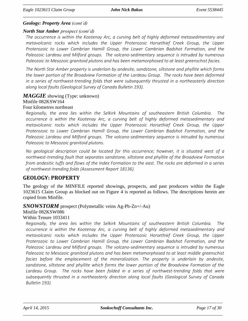
MAGGIE showing (Type: unknown)
Minfile 082KSW164
Four kilometres northeast
The Maggie occurrence is located at the head of Mat Creek at 2375 metres elevation above sea level in the Slocan Mining Division.
HISTORY: PROPERTY
The history on some MINFILE reported showings, prospects, and past producers on the Property as
blocked out on Figure 4 is reported as follows. The descriptions are copied from Minfile.
SNOWSTORM prospect (Polymetallic veins Ag-Pb-Zn+/-Au)
Minfile 082KSW086
Within Tenure 1033411
The Snowstorm occurrence is located at the head of Cascade Creek at 2255 metres elevation above sea level in the Slocan Mining Division.
During 1987 and 1988 Ambergate Explorations conducted an exploration program which consisted of 1:10000 scale mapping, a soil survey, and trenching on their Amber 1-4 claims in which the Snowstorm showing is located. A follow-up to the 87-88 exploration program was done in 1994 by Lumby Resources Corporation, an optionee of Kenrich Mining Corporation, formerly Ambergate Explorations. This program extended the soil survey in the Juno, West Ridge (082KSW197), and White Eagle (082KSW126) showing areas (Assessment Report 23669).
WHITE EAGLE past producer (Polymetallic veins Ag-Pb-Zn+/-Au;
Sedimentary exhalative Zn-Pb-Ag)
Minfile 082KSW126
Within Tenure 1023615
The White Eagle occurrence is located at the head of Cascade Creek at 2175 metres elevation above sea level in the Slocan Mining Division. The occurrence is about 500 metres north of Blue Lake.
In 1928, eight tonnes of ore were mined from the property to produce 6158 grams of silver, 2667 kilograms of lead, 1809 kilograms of zinc and 93 grams of gold.

___________________________________________________________________________________
Eagle 1023615 Claim Group John Nick Bakus Event 5538445
___________________________________________________________________________________
___________________________________________________________________________________
April 14, 2015 Sookochoff Consultants Inc. Page 11 of 30
___________________________________________________________________________________
History: Property (cont’d)
White Eagle (cont’d)
During 1987 and 1988 Ambergate Explorations conducted an exploration program which consisted of 1:10000 scale mapping, a soil survey, and trenching on their Amber 1-4 claims in which the White Eagle showing is located. A follow-up to the 87-88 exploration program was done in 1994 by Lumby Resources Corporation, an optionee of Kenrich Mining Corporation, formerly Ambergate Explorations. This program extended the soil survey in the White Eagle, West Ridge (082KSW197), and Juno (082KSW125) showing areas (Assessment Report 23669).
SILVER SPARROW prospect (Polymetallic veins Ag-Pb-Zn+/-Au)
Minfile 082KSW143
Within Tenure 1023615
The Silver Sparrow occurrence is located at the head of Cascade Creek at 2285 metres elevation above sea level in the Slocan Mining Division.
During 1987 and 1988 Ambergate Explorations conducted an exploration program which consisted of 1:10000 scale mapping, a soil survey, and trenching on their Amber 1-4 claims in which the Silver Sparrow showing is located. A follow-up to the 87-88 exploration program was done in 1994 by Lumby Resources Corporation, an optionee of Kenrich Mining Corporation, formerly Ambergate Explorations. This program extended the soil survey in the Juno (082KSW125), West Ridge (082KSW197), and White Eagle (082KSW126) showing areas (Assessment Report 23669).
WEST RIDGE showing (Polymetallic veins Ag-Pb-Zn+/-Au)
Minfile 082KSW197
Within Tenure 1029311
The West Ridge occurrence is located at the head of Cascade Creek at 2225 metres elevation above sea level in the Slocan Mining Division.
During 1987 and 1988 Ambergate Explorations conducted an exploration program which consisted of 1:10000 scale mapping, a soil survey, and trenching on their Amber 1-4 claims in which the West Ridge showing is located. A follow-up to the 87-88 exploration program was done in 1994 by Lumby Resources Corporation, an optionee of Kenrich Mining Corporation, formerly Ambergate Explorations. This program extended the soil survey in the West Ridge, Juno (082KSW125), and White Eagle (082KSW126) showing areas (Assessment Report 23669).
LAKEVIEW showing (Polymetallic veins Ag-Pb-Zn+/-Au; Irish-type carbonate-hosted Zn-Pb)
Minfile 082KSW198
Within Tenure 1023616
The Lakeview occurrence is located at the head of Cascade Creek at 2100 metres elevation above sea level in the Slocan Mining Division.
During 1987 and 1988 Ambergate Explorations conducted an exploration program which consisted of 1:10000 scale mapping, a soil survey, and trenching on their Amber 1-4 claims in which the Lakeview showing is located. A follow-up to the 87-88 exploration program was done in 1994 by Lumby Resources Corporation, an optionee of Kenrich Mining Corporation, formerly Ambergate Explorations. This program extended the soil survey in the Juno, West Ridge (082KSW197), and White Eagle (082KSW126) showing areas (Assessment Report 23669).

___________________________________________________________________________________
Eagle 1023615 Claim Group John Nick Bakus Event 5538445
___________________________________________________________________________________
___________________________________________________________________________________
April 14, 2015 Sookochoff Consultants Inc. Page 12 of 30
___________________________________________________________________________________
GEOLOGY: REGIONAL (from Ostler, 1994)
The area around Cascade Creek and the Amber Property is underlain by rocks that range in age from Early Palaeozoic to Jurassic. These rocks can be divided into two provenancal groups: the Lardeau Group, a eugeosynclinal assemblage and the Milford Group, a miogeosynclinal assemblage. Both assemblages are intruded by Mesozoic-age granitic rocks.
This stratigraphy forms part of the Kootenay Arc, which extends in southwestern British ' Columbia from the U.S. border to northeast of Revelstoke (Douglas et al; 1970).
Kootenay Arc sediments and volcanics were deposited at the western margin of proto-North America in the Cordilleran Geosyncline. Kootenay Arc deposition from Late Proterozoic until Middle Palaeozoic time was in a large eugeosyncline that segregated into smaller sub-basins during the Late Palaeozoic Era. The rocks underlying the Amber Property were deposited in one of those eugeosynclinal sub-basins. Mesozoic deposition was mostly miogeosynclinal.
Lithological mapping conducted by Read (1973) around the Amber Property reveals that this region is underlain by a succession of rocks that record the gradual filling of a basin (Figure 3). He later interpreted that stratigraphy within a regional context (Figure 4) (Read and Wheeler, 1976).
Northeast of the claims is a thick sequence of mafic to intermediate volcanics comprising the Index Formation (Figures 3 and 4). In the Cascade Creek area, these volcanics are accompanied by a minor amount of shale and phyllite. Farther north near Trout Lake, the Index Formation volcanics are accompanied by far more sediments. There, the volcanics are interpreted to have been deposited from basin-floor vents in deep water (Fyles and Eastwood, 1962).
Read (1973) mapped a contact between the Index Formation volcanics and the overlying sediments of
the Broadview Formation northeast of the Comstock showings about 2 km north of the Amber claims (Ostler, 1988) (Figure 6). This location is about 1 km southwest of where Read (1973) mapped the contact (Figure 3).
Northeast of the Comstock showings, Ostler (1988) interpreted the contact between Index Formation volcanics and Broadview Formation sediments to have been originally conformable and gradational, defined by a facies change on the flank and top of a basin-floor volcanic pile. The main mass of the Index Formation volcanics then seems to have been decoupled from the overlying Broadview Formation sediments. Both thrusting and transverse movement probably took place along the Index- Broadview boundary fault.
The Milford Group-Broadview Formation contact was also mapped by Read (1973) southwest of the Amber Property (Figure 3).
Read (1973) mapped across the Broadview Formation northwest of Cascade Creek; about 10 km northwest of the Amber Property. There, he found the Broadview Formation clastics to be overlain by a thin sequence of phyllites and phyllitic carbonates.
Two reconnaissance traverses into the Amber Property-area from the north and west (Figure 3) hinted that the area of distal basin sedimentation represented by phyllites and phyllitic carbonates increased significantly southeastward. This was confirmed by the writer's mapping (Spearing and Ostler, 1987). Later mapping revealed that the Broadview Formation was represented in the Cascade Creek area by a fining-upward sequence of turbidites beneath phyllitic carbonates and phyllites (Spearing and Ostler, 1988) (Figure 6).

___________________________________________________________________________________
Eagle 1023615 Claim Group John Nick Bakus Event 5538445
___________________________________________________________________________________
___________________________________________________________________________________
April 14, 2015 Sookochoff Consultants Inc. Page 13 of 30
___________________________________________________________________________________
Geology: Regional (cont’d)
The Broadview Formation clastics lie in fault contact with the sandstones of the Milford Group about 700 m southwest of the Amber 3 claim (Figures 3 and 4).
The Milford Group comprises a series of micaceous sandstones, phyllite and calcite-bearing quartzite that form a miogeosynclinal sequence above the Broadview Formation sediments (Read, 1973; Read and Wheeler, 1976) (Figures 3 and 4).
Rocks of the Milford Group and Broadview Formation were intruded during the Early Jurassic Period by leucoquartz monzonite and syenite of the Kuskanax Batholith. Batholithic intrusion was succeeded by the intrusion of small parasitic stocks of massive leucoquartz monzonite and syenite along the northeastern margin of the batholith (Read, 1973; Read and Wheeler, 1976). Some of these parasitic intrusions are exposed along the southwestern margin of the Amber 3 claim (Figures 3 and 4).
Read (1973) recorded three generations of coaxial folding in the rocks northwest of the Amber Property; and locally near intrusions, a fourth generation.
Regionally, the most important structures are second-generation folds that form northwest-southeast trending structures. First-generation folds are most commonly seen as isoclines within second-generation structures. Third-generation structures are most commonly large open warps or minor folds.
The area around Cascade Creek is regionally metamorphosed to the upper greenschist and lower amphibolite grades of metamorphism. Locally, near intrusive contacts, upper amphibolite and granulite grade metamorphism occurs.
The region is crossed by several long northwest-southeasterly trending faults. The Mount Emnens Fault southwest of the Amber Property and the Mobbs Fault which crosses the property are notable examples (Figures 3, 4 and 6).
GEOLOGY: PROPERTY AREA
The geology on some MINFILE reported showings, prospects, and past producers peripheral to the
Eagle 1023615 Claim Group as blocked out on Figure 4 is reported as follows. The descriptions are
copied from Minfile. The distance is relative to the Eagle 1023615 Claim Group.
ISLE past producer (Polymetallic veins Ag-Pb-Zn+/-Au; Stibnite veins and disseminations)
Minfile 082KSW059
Four kilometres south-southeast
Regionally, the area lies within the Selkirk Mountains of southeastern British Columbia. The occurrence is within the Kootenay Arc, a curving belt of highly deformed metasedimentary and metavolcanic rocks which includes the Upper Proterozoic Horsethief Creek Group, the Upper Proterozoic to Lower Cambrian Hamill Group, the Lower Cambrian Badshot Formation, and the Paleozoic Lardeau and Milford groups. The volcano-sedimentary sequence is intruded by numerous Paleozoic to Mesozoic granitoid plutons and has been metamorphosed to at least middle greenschist facies.
Rocks on the Isle property include phyllite, sandstone and grey limestone of the Broadview Formation (Lardeau Group). The strata strike northwest and dip east between 60 to 80 degrees. Mineralization is hosted within a 20 metre wide shear zone that strikes north and dips subparallel to bedding.
A short adit was excavated to evaluate a quartz vein within the shear zone. The rocks within the shear are altered to sericite schist.

___________________________________________________________________________________
Eagle 1023615 Claim Group John Nick Bakus Event 5538445
___________________________________________________________________________________
___________________________________________________________________________________
April 14, 2015 Sookochoff Consultants Inc. Page 14 of 30
___________________________________________________________________________________
Figure 4. Geology, Claim, Minfile, & Index Map (Base Map from MapPlace)
MJSe
Middle Jurassic
Selkirk Stocks
granodioritic intrusive rocks
MJKx
Middle Jurassic
Kuskanex batholith
monzonitic intrusive rocks
TrSlc
Triassic
Slocan Group
limestone, slate, siltstone, argillite
uMPm
upper Mississippian to Permean
Milford Group
limestone, slate, siltstone, argillite
CmDLB
Carboniferous to Permean
Lardeau Group-Broadview Formation
limestone, slate, siltstone, argillite
CmDLJ
Carboniferous to Permean
Jewett Formation
basaltic volcanic rocks
lCmB
Lower Cambrian
Badshot Formation
limestone, marble, calcareous sedimentary rocks
uPrVmH
Upper Proterozoic to Lower Cambrian
Hamill Group
quartzite, quartz arenite sedimentary rocks
uPrHsc
Upper Proterozoic
Horsethief Creek Group
clastic sedimentary rocks

__________________________________________________________________________________
Eagle 1023615 Claim Group John Nick Bakus Event 5538445
__________________________________________________________________________________
__________________________________________________________________________________
April 14, 2015 Sookochoff Consultants Inc. Page 15 of 30
__________________________________________________________________________________
Geology: Property Area (cont’d)
UPPER COMSTOCK prospect (Polymetallic veins Ag-Pb-Zn+/-Au)
Minfile 082KSW084
Three kilometres northeast
Regionally, the area lies within the Selkirk Mountains of southeastern British Columbia. The occurrence is within the Kootenay Arc, a curving belt of highly deformed metasedimentary and metavolcanic rocks which includes the Upper Proterozoic Horsethief Creek Group, the Upper Proterozoic to Lower Cambrian Hamill Group, the Lower Cambrian Badshot Formation, and the Paleozoic Lardeau and Milford groups. The volcano-sedimentary sequence is intruded by numerous Paleozoic to Mesozoic granitoid plutons and has been metamorphosed to at least middle greenschist facies before the emplacement of the mineralization.
The oldest rocks on the Comstock property are andesitic tuffs and flows of the Index Formation of the Lardeau Group. A northwest- trending fault which passes through the centre of the Comstock property separates the volcanic rocks of the Index Formation from sandstone, siltstone and phyllite of the Broadview Formation to the west. The rocks are deformed in a series of northwest-trending folds that are cut at oblique angles by faults.
SWEDE past producer (Polymetallic veins Ag-Pb-Zn+/-Au; Au quartz veins)
Minfile 082KSW088
Eleven kilometres north
Regionally, the area lies within the Selkirk Mountains of southeastern British Columbia. The occurrence is within the Kootenay Arc, a curving belt of highly deformed metasedimentary and metavolcanic rocks which includes the Upper Proterozoic Horsethief Creek Group, the Upper Proterozoic to Lower Cambrian Hamill Group, the Lower Cambrian Badshot Formation, and the Paleozoic Lardeau and Milford groups. The volcano-sedimentary sequence is intruded by numerous Paleozoic to Mesozoic granitoid plutons.
The Lardeau River area of the Selkirk Mountains is mainly underlain by massive pillow lavas, volcanic breccia and green phyllitic rocks of the Index Formation and by grey-green mica schist of the Broadview Formation. Grey phyllitic rocks and marble of the Milford Group are exposed near the edges of the Mesozoic Mobbs Creek, Rapid Creek and Poplar Creek stocks. All rocks have undergone regional metamorphism to middle or upper greenschist facies. Rocks of the Milford Group have also been affected by thermal metamorphism (Geological Survey of Canada Bulletin 193).
MOTHER LODE past producer (Polymetallic veins Ag-Pb-Zn+/-Au;
Polymetallic manto Ag-Pb-Zn)
Minfile 082KSW089
Ten kilometres north
Regionally, the area lies within the Selkirk Mountains of southeastern British Columbia. The occurrence is within the Kootenay Arc, a curving belt of highly deformed metasedimentary and metavolcanic rocks which includes the Upper Proterozoic Horsethief Creek Group, the Upper Proterozoic to Lower Cambrian Hamill Group, the Lower Cambrian Badshot Formation, and the Paleozoic Lardeau and Milford groups. The volcano-sedimentary sequence is intruded by numerous Paleozoic to Mesozoic granitoid plutons.

__________________________________________________________________________________
Eagle 1023615 Claim Group John Nick Bakus Event 5538445
__________________________________________________________________________________
__________________________________________________________________________________
April 14, 2015 Sookochoff Consultants Inc. Page 16 of 30
__________________________________________________________________________________
Geology: Property Area (cont’d)
Mother Lode past producer (cont’d)
The Lardeau River area of the Selkirk Mountains is mainly underlain by massive pillow lavas, volcanic breccia and green phyllitic rocks of the Index Formation and by grey-green mica schist of the Broadview Formation. Grey phyllitic rocks and marble of the Milford Group are exposed near the edges of the Mesozoic Mobbs Creek, Rapid Creek and Poplar Creek stocks. All rocks have undergone regional metamorphism to middle or upper greenschist facies. Rocks of the Milford Group have also been affected by thermal metamorphism (Geological Survey of Canada Bulletin 193).
JUNO prospect (Polymetallic veins Ag-Pb-Zn+/-Au)
Minfile 082KSW125
Two kilometres north
Regionally, the area lies within the Selkirk Mountains of southeastern British Columbia. The occurrence is within the Kootenay Arc, a curving belt of highly deformed metasedimentary and metavolcanic rocks which includes the Upper Proterozoic Horsethief Creek Group, the Upper Proterozoic to Lower Cambrian Hamill Group, the Lower Cambrian Badshot Formation, and the Paleozoic Lardeau and Milford groups. The volcano-sedimentary sequence is intruded by numerous Paleozoic to Mesozoic granitoid plutons and has been metamorphosed to at least middle greenschist facies before the emplacement of the mineralization.
The Juno property is underlain by andesite, sandstone, siltstone and phyllite which forms the lower portion of the Broadview Formation of the Lardeau Group. The rocks have been folded in a series of northwest-trending folds that were subsequently thrusted in a northeasterly direction along local faults (Geological Survey of Canada Bulletin 193).
NOONDAY prospect (Polymetallic veins Ag-Pb-Zn+/-Au)
Minfile 082KSW127
Three kilometres north
Regionally, the area lies within the Selkirk Mountains of southeastern British Columbia. The occurrence is within the Kootenay Arc, a curving belt of highly deformed metasedimentary and metavolcanic rocks which includes the Upper Proterozoic Horsethief Creek Group, the Upper Proterozoic to Lower Cambrian Hamill Group, the Lower Cambrian Badshot Formation, and the Paleozoic Lardeau and Milford groups. The volcano-sedimentary sequence is intruded by numerous Paleozoic to Mesozoic granitoid plutons and has been metamorphosed to at least middle greenschist facies before the emplacement of the mineralization.
The oldest rocks on the Comstock property are tuffaceous andesite and flows of the Index Formation of the Lardeau Group. A northwest-trending fault which passes through the centre of the Comstock property separates the volcanic rocks of the Index Formation from sandstone, siltstone and phyllite of the Broadview Formation to the west. The rocks are deformed in a series of northwest-trending folds that are cut at oblique angles by faults.
NORTH STAR AMBER prospect (Polymetallic veins Ag-Pb-Zn+/-Au; Stibnite veins
and disseminations)
Minfile 082KSW149
Three kilometres south-southeast
Regionally, the area lies within the Selkirk Mountains of southeastern British Columbia.
__________________________________________________________________________________
Eagle 1023615 Claim Group John Nick Bakus Event 5538445
__________________________________________________________________________________
__________________________________________________________________________________
April 14, 2015 Sookochoff Consultants Inc. Page 17 of 30
__________________________________________________________________________________
Geology: Property Area (cont’d)
North Star Amber prospect (cont’d)
The occurrence is within the Kootenay Arc, a curving belt of highly deformed metasedimentary and metavolcanic rocks which includes the Upper Proterozoic Horsethief Creek Group, the Upper Proterozoic to Lower Cambrian Hamill Group, the Lower Cambrian Badshot Formation, and the Paleozoic Lardeau and Milford groups. The volcano-sedimentary sequence is intruded by numerous Paleozoic to Mesozoic granitoid plutons and has been metamorphosed to at least greenschist facies.
The North Star Amber property is underlain by andesite, sandstone, siltstone and phyllite which forms the lower portion of the Broadview Formation of the Lardeau Group. The rocks have been deformed in a series of northwest-trending folds that were subsequently thrusted in a northeasterly direction along local faults (Geological Survey of Canada Bulletin 193).
MAGGIE showing (Type: unknown)
Minfile 082KSW164
Four kilometres northeast
Regionally, the area lies within the Selkirk Mountains of southeastern British Columbia. The occurrence is within the Kootenay Arc, a curving belt of highly deformed metasedimentary and metavolcanic rocks which includes the Upper Proterozoic Horsethief Creek Group, the Upper Proterozoic to Lower Cambrian Hamill Group, the Lower Cambrian Badshot Formation, and the Paleozoic Lardeau and Milford groups. The volcano-sedimentary sequence is intruded by numerous Paleozoic to Mesozoic granitoid plutons.
No geological description could be located for this occurrence; however, it is situated west of a northwest-trending fault that separates sandstone, siltstone and phyllite of the Broadview Formation from andesitic tuffs and flows of the Index Formation to the east. The rocks are deformed in a series of northwest-trending folds (Assessment Report 18136).
GEOLOGY: PROPERTY
The geology of the MINFILE reported showings, prospects, and past producers within the Eagle
1023615 Claim Group as blocked out on Figure 4 is reported as follows. The descriptions herein are
copied from Minfile.
SNOWSTORM prospect (Polymetallic veins Ag-Pb-Zn+/-Au)
Minfile 082KSW086
Within Tenure 1033411
Regionally, the area lies within the Selkirk Mountains of southeastern British Columbia. The occurrence is within the Kootenay Arc, a curving belt of highly deformed metasedimentary and metavolcanic rocks which includes the Upper Proterozoic Horsethief Creek Group, the Upper Proterozoic to Lower Cambrian Hamill Group, the Lower Cambrian Badshot Formation, and the Paleozoic Lardeau and Milford groups. The volcano-sedimentary sequence is intruded by numerous Paleozoic to Mesozoic granitoid plutons and has been metamorphosed to at least middle greenschist facies before the emplacement of the mineralization. The property is underlain by andesite, sandstone, siltstone and phyllite which forms the lower portion of the Broadview Formation of the Lardeau Group. The rocks have been folded in a series of northwest-trending folds that were subsequently thrusted in a northeasterly direction along local faults (Geological Survey of Canada Bulletin 193).

__________________________________________________________________________________
Eagle 1023615 Claim Group John Nick Bakus Event 5538445
__________________________________________________________________________________
__________________________________________________________________________________
April 14, 2015 Sookochoff Consultants Inc. Page 18 of 30
__________________________________________________________________________________
Geology: Property (cont’d)
WHITE EAGLE past producer (Polymetallic veins Ag-Pb-Zn+/-Au)
Sedimentary exhalative Zn-Pb-Ag)
Minfile 082KSW126
Within Tenure 1023615
Regionally, the area lies within the Selkirk Mountains of southeastern British Columbia. The occurrence is within the Kootenay Arc, a curving belt of highly deformed metasedimentary and metavolcanic rocks which includes the Upper Proterozoic Horsethief Creek Group, the Upper Proterozoic to Lower Cambrian Hamill Group, the Lower Cambrian Badshot Formation, and the Paleozoic Lardeau and Milford groups. The volcano-sedimentary sequence is intruded by numerous Paleozoic to Mesozoic granitoid plutons and has been metamorphosed to at least middle greenschist facies before the emplacement of the mineralization.
The White Eagle property is underlain by andesite, sandstone, siltstone and phyllite which forms the lower portion of the Broadview Formation of the Lardeau Group. The rocks have been folded in a series of northwest-trending folds that were subsequently thrusted in a northeasterly direction along local faults (Geological Survey of Canada Bulletin 193).
The White Eagle occurrence consists of quartz veins containing massive sulphide pods 0.6 metre wide and 5 metres long. The quartz veins have been exposed in two adits, an incline shaft and a winze in the upper adit.
SILVER SPARROW prospect (Polymetallic veins Ag-Pb-Zn+/-Au)
Minfile 082KSW143
Within Tenure 1023615
Regionally, the area lies within the Selkirk Mountains of southeastern British Columbia. The occurrence is within the Kootenay Arc, a curving belt of highly deformed metasedimentary and metavolcanic rocks which includes the Upper Proterozoic Horsethief Creek Group, the Upper Proterozoic to Lower Cambrian Hamill Group, the Lower Cambrian Badshot Formation, and the Paleozoic Lardeau and Milford groups. The volcano-sedimentary sequence is intruded by numerous Paleozoic to Mesozoic granitoid plutons and has been metamorphosed to at least middle greenschist facies before the emplacement of the mineralization.
The property is underlain by andesite, sandstone, siltstone and phyllite which forms the lower portion of the Broadview Formation of the Lardeau Group. The rocks have been folded in a series of northwest-trending folds that were subsequently thrusted in a northeasterly direction along local faults (Geological Survey of Canada Bulletin 193).
WEST RIDGE showing (Polymetallic veins Ag-Pb-Zn+/-Au)
Minfile 082KSW197
Within Tenure 1029311
Regionally, the area lies within the Selkirk Mountains of southeastern British Columbia. The occurrence is within the Kootenay Arc, a curving belt of highly deformed metasedimentary and metavolcanic rocks which includes the Upper Proterozoic Horsethief Creek Group, the Upper Proterozoic to Lower Cambrian Hamill Group, the Lower Cambrian Badshot Formation, and the Paleozoic Lardeau and Milford groups. The volcano-sedimentary sequence is intruded by numerous Paleozoic to Mesozoic granitoid plutons and has been metamorphosed to at least middle greenschist facies before the emplacement of the mineralization.

__________________________________________________________________________________
Eagle 1023615 Claim Group John Nick Bakus Event 5538445
__________________________________________________________________________________
__________________________________________________________________________________
April 14, 2015 Sookochoff Consultants Inc. Page 19 of 30
__________________________________________________________________________________
Geology: Property (cont’d)
West Ridge showing (cont’d) The West Ridge property is underlain by andesite, sandstone, siltstone and phyllite which forms the lower portion of the Broadview Formation of the Lardeau Group. The rocks have been folded in a series of northwest-trending folds that were subsequently thrusted in a northeasterly direction along local faults (Geological Survey of Canada Bulletin 193).
LAKEVIEW showing (Polymetallic veins Ag-Pb-Zn+/-Au; Irish-type carbonate-hosted Zn-Pb)
Minfile 082KSW198
Within Tenure 1023616
Regionally, the area lies within the Selkirk Mountains of southeastern British Columbia. The occurrence is within the Kootenay Arc, a curving belt of highly deformed metasedimentary and metavolcanic rocks which includes the Upper Proterozoic Horsethief Creek Group, the Upper Proterozoic to Lower Cambrian Hamill Group, the Lower Cambrian Badshot Formation, and the Paleozoic Lardeau and Milford groups. The volcano-sedimentary sequence is intruded by numerous Paleozoic to Mesozoic granitoid plutons and has been metamorphosed to at least middle greenschist facies before the emplacement of the mineralization.
The area is underlain by andesite, sandstone, siltstone and phyllite of the lower portion of the Broadview Formation of the Lardeau Group. The rocks have been folded in a series of northwest- trending folds that were subsequently thrusted in a northeasterly direction along local faults (Geological Survey of Canada Bulletin 193).
MINERALIZATION: PROPERTY AREA
The mineralization on some MINFILE reported showings, prospects, and past producers peripheral to
the Eagle 1023615 Claim Group as blocked out on Figure 4 is reported as follows. The descriptions
herein are copied from Minfile.
The distance is relative to the Eagle 1023615 Claim Group.
ISLE past producer (Polymetallic veins Ag-Pb-Zn+/-Au; Stibnite veins and disseminations)
Minfile 082KSW059
Four kilometres south-southeast
High silver, lead and antimony values occur with massive sulphides on the apex of drag folds within the shear. Mineralization consists of galena and tetrahedrite within quartz-calcite veins. A chip sample across 0.6 metre of vein material assayed 2358 grams per tonne silver, 29.9 per cent lead, 10.4 per cent antimony and 9.7 grams per tonne gold (Assessment Report 8532).
UPPER COMSTOCK prospect (Polymetallic veins Ag-Pb-Zn+/-Au)
Minfile 082KSW084
Three kilometres northeast
The Upper Comstock occurrence consists of two vertically dipping quartz veins striking 275 and 295 degrees respectively. The veins consist of white milky quartz sparsely mineralized with disseminated to massive galena with traces of sphalerite. The veins are exposed in a series of surface trenches. A selected grab sample from the mineralized portion of the vein assayed 800 grams per tonne silver and 26.7 per cent lead (Assessment Report 18149).

__________________________________________________________________________________
Eagle 1023615 Claim Group John Nick Bakus Event 5538445
__________________________________________________________________________________
__________________________________________________________________________________
April 14, 2015 Sookochoff Consultants Inc. Page 20 of 30
__________________________________________________________________________________
Mineralization: Property Area (cont’d)
SWEDE past producer (Polymetallic veins Ag-Pb-Zn+/-Au; Au quartz veins)
Minfile 082KSW088
Eleven kilometres north
On the Swede property carbonaceous phyllitic rocks of the Index Formation are cut by Mesozoic meta-andesite and metadiorite dikes. The dikes are fine grained, massive and usually contain disseminated pyrite. Quartz veins carrying pyrite, arsenopyrite and ankerite cut black carbonaceous phyllite. Some of the arsenopyrite is very coarse grained. A massive sulphide vein, 10 centimetre wide, is hosted within a meta-andesite dike. The vein consists of galena, sphalerite, chalcopyrite and pyrite. Free gold occurs in the vein with lead sulphate and carbonate where the sulphides have been leached (Geological Survey of Canada Memoir 161).
MOTHER LODE past producer (Polymetallic veins Ag-Pb-Zn+/-Au)
Polymetallic manto Ag-Pb-Zn)
Minfile 082KSW089
Ten kilometres north
The main showing consists of quartz with coarse-grained pyrite, galena and sphalerite as replacement of calcareous schist of the Index Formation. The mineralization has been exposed in two short adits driven 15 metres apart for a total length of 45 metres. Replacement has taken place parallel to the foliation for at least 12 metres along strike. The mineralization has an average thickness less than 45 centimetres. A grab sample of the replacement vein assayed 5.5 grams per tonne gold, 1190 grams per tonne silver, 15 per cent lead and 10 per cent zinc (Minister of Mines Annual Report 1919).
JUNO prospect (Polymetallic veins Ag-Pb-Zn+/-Au)
Minfile 082KSW125
Two kilometres north
The occurrence consists of a well-defined quartz vein 30 to 60 centimetres in width mineralized with pyrite, galena and sphalerite. The vein strikes east and dips 45 degrees north. A 60 centimetre chip sample from the vein assayed 1.4 grams per tonne gold, 600 grams per tonne silver, 29 per cent lead and 29.8 per cent zinc (Minister of Mines Annual Report 1925). The vein has been explored with several surface trenches and a 12-metre long adit.
NOONDAY prospect (Polymetallic veins Ag-Pb-Zn+/-Au)
Minfile 082KSW127
Three kilometres north
The Noonday occurrence consists of a quartz vein 1.5 metres wide that strikes 342 degrees and dips 25 degrees northeast. The vein is emplaced in fine-grained arenites of the Broadview Formation just below an aplite dike. The vein is composed of white milky quartz with smoky grey bands. Subhedral galena grains, 2 millimetres wide, are disseminated and concentrated in small patches with minor sphalerite crystals. Selected grab samples from the vein assayed up to 663 grams per tonne silver and 33.1 per cent lead (Assessment Report 18149). The vein has been explored by several surface trenches and at least two adits driven for a total length of 105 metres.

__________________________________________________________________________________
Eagle 1023615 Claim Group John Nick Bakus Event 5538445
__________________________________________________________________________________
__________________________________________________________________________________
April 14, 2015 Sookochoff Consultants Inc. Page 21 of 30
__________________________________________________________________________________
Mineralization: Property Area (cont’d)
NORTH STAR AMBER prospect (Polymetallic veins Ag-Pb-Zn+/-Au; Stibnite veins
and disseminations)
Minfile 082KSW149
Three kilometres south-southeast
The occurrence consists of a 10-centimetre wide brecciated quartz vein emplaced along a thrust plane that separates metasiltstone and carbonate rocks. The vein, which strikes 155 degrees and dips 60 degrees northeast, consists mainly of broken white quartz mixed in a black sulphide-rich gouge. A channel sample of the gouge material assayed 1978 grams per tonne silver, 1.17 per cent copper, 2.74 per cent lead and 1.14 per cent antimony (Assessment Report 18136). Narrow stringers of pyrite also extend through the metasiltstone. The vein is exposed in two trenches and a short, 9-metre long adit.
MAGGIE showing (Type: unknown)
Minfile 082KSW164
Four kilometres northeast
The occurrence is reported to contain gold and copper values (Assessment Report 18136).
MINERALIZATION: PROPERTY
The mineralization of the MINFILE reported showings, prospects, and past producers included in the
Eagle 1023615 Claim Group as blocked out on Figure 4 is reported as follows. The descriptions herein
are copied from Minfile.
SNOWSTORM prospect (Polymetallic veins Ag-Pb-Zn+/-Au)
Minfile 082KSW086
Within Tenure 1033411
The occurrence consists of quartz veins containing minor galena, sphalerite, and pyrite mineralization hosted within siltstone of the Broadview Formation. The veins are exposed in 26 trenches covering an area of about 7.5 hectares. The largest vein is about 1 metre wide, strikes 313 degrees and dips 39 degrees to the east. Grab samples have assayed 572 grams per tonne silver, 2.81 grams per tonne gold, 22.4 per cent lead, and 0.06 per cent zinc (Assessment Report 16433; 23669).
WHITE EAGLE past producer (Polymetallic veins Ag-Pb-Zn+/-Au)
Sedimentary exhalative Zn-Pb-Ag)
Minfile 082KSW126
Within Tenure 1023615
A weighted average of 42 channel samples taken from the main vein in the upper adit yielded 14.88 per cent lead, 7.58 per cent zinc, 298 grams per tonne silver and 6.5 grams per tonne gold. The main vein within the upper adit has an average width of 40 centimetres and dips 48 degrees northeast which is subparallel to the enclosing carbonaceous siltstone of the Broadview Formation. Mineralization is unevenly distributed throughout the vein with the higher grades being associated with pods of massive sulphides that appear to plunge to the north. Silver values are highest within the galena-sphalerite rich portions of the massive sulphide while gold is associated with pyrite in the lower portion of the massive sulphide ore shoot (see Noonday, 082KSW127 - Prospectus, Ambergate Exploration Inc., 1988).

__________________________________________________________________________________
Eagle 1023615 Claim Group John Nick Bakus Event 5538445
__________________________________________________________________________________
__________________________________________________________________________________
April 14, 2015 Sookochoff Consultants Inc. Page 22 of 30
__________________________________________________________________________________
Mineralization: Property (cont’d)
SILVER SPARROW prospect (Polymetallic veins Ag-Pb-Zn+/-Au)
Minfile 082KSW143
Within Tenure 1023615
The occurrence consists of two separate quartz veins some 90 metres apart. The Silver Sparrow vein consists of iron-stained quartz containing stringers of auriferous pyrite, argentiferous galena and minor sphalerite. The vein strikes 120 degrees, dips 30 degrees northeast and is about 1 metre thick where it is exposed in the trenches. The vein has also been exposed in a 6-metre deep inclined shaft. The best grab sample from the vein assayed 27.5 grams per tonne gold, 1083 grams per tonne silver, 56.2 per cent lead and 0.55 per cent zinc (Assessment Report 18136). The Pine Tree vein is situated 90 metres west of the Silver Sparrow and has similar mineralogy. The vein is exposed for about 20 metres in three trenches. The vein strikes 071 degrees, dips 30 degrees northwest and ranges in width from 7 to 50 centimetres. Both veins are hosted within siltstone of the Broadview Formation.
WEST RIDGE showing (Polymetallic veins Ag-Pb-Zn+/-Au)
Minfile 082KSW197
Within Tenure 1029311
The occurrence consists of a 30 centimetre wide milky quartz vein striking 119 degrees and dipping 45 degrees southwest. The vein is mineralized with disseminations and pods of argentiferous galena, tetrahedrite and stibnite. A selected grab sample of the mineralized vein assayed 1540 grams per tonne silver, 41.1 per cent lead, 16.1 per cent antimony and 1.58 per cent copper (Assessment Report 18136).
The vein has been explored with several trenches and a 15-metre deep shaft. Boulders of massive galena-stibnite mineralization up to 1 metre across are reported from a dispersion train below the workings for a distance of 137 metres (see Noonday, 082KSW127 - Prospectus, Ambergate Exploration Inc., 1988)
LAKEVIEW showing (Polymetallic veins Ag-Pb-Zn+/-Au; Irish-type carbonate-hosted Zn-Pb)
Minfile 082KSW198
Within Tenure 1023616
At the Lakeview showing two trenches expose sparsely mineralized metasandstone between two quartz veins. The quartz veins are mineralized with disseminated and massive galena, pyrite and sphalerite. Some of the mineralization resembles the massive mineralization at the White Eagle (082KSW126). The No. 1 vein strikes 128 degrees and dips steeply southwest. It is 20 centimetres wide in the trenches. A composite chip sample of about 10 blocks of vein material taken from the soil at the western end of the trench assayed 144 grams per tonne gold, 158 grams per tonne silver, 6.04 per cent lead and 3.47 per cent zinc (Assessment Report 18136). The No. 2 vein is exposed in a trench 4.6 metres above the No. 1 vein. This vein strikes 281 degrees and dips 81 degrees north. Mineralization in the sandstone between the veins comprises thin sheets of pyrite and minor galena with sphalerite along cleavage planes.

__________________________________________________________________________________
Eagle 1023615 Claim Group John Nick Bakus Event 5538445
__________________________________________________________________________________
__________________________________________________________________________________
April 14, 2015 Sookochoff Consultants Inc. Page 23 of 30
__________________________________________________________________________________
STRUCTURAL ANALYSIS
The Structural Analysis was accomplished marking the observed lineaments of all nine claims of the
Eagle 1023615 Claim Group on a DEM Hillside Shade Map downloaded from MapPlace. A total of 66
lineaments were indicated as shown on Figure 5. A Georient 32v9 software program was used to create
a Rose Diagram reflecting the grouping of the 66 lineaments into an individual 8 °class sector angle
interval as shown on Figure 6.
Figure 5. Lineaments as Indicated Structures on the Eagle 1023615 Claim Group
(Base Map from MapPlace)

__________________________________________________________________________________
Eagle 1023615 Claim Group John Nick Bakus Event 5538445
__________________________________________________________________________________
__________________________________________________________________________________
April 14, 2015 Sookochoff Consultants Inc. Page 24 of 30
__________________________________________________________________________________
Structural Analysis (cont’d)
Figure 6. Rose Diagram from lineaments on the Eagle 1023615 Claim Group
Rose Diagram Statistics
(Usage Reference: Holcombe, 2009)
Axial (non-polar) data
No. of Data = 66
Sector angle = 8°
Scale: tick interval = 2% [1.3 data]
Maximum = 16.7% [11 data]
Mean Resultant dir'n = 121-301
[Approx. 95% Confidence interval = ±58.2°]
(valid only for unimodal data)
_________________________
Mean Resultant dir'n = 120.8 - 300.8
Circ.Median = 115.0 - 295.0
Circ.Mean Dev.about median = 39.3°
Circ. Variance = 0.35
Circular Std.Dev. = 52.72°
Circ. Dispersion = 12.40
Circ.Std Error = 0.4335
Circ.Skewness = 0.50
Circ.Kurtosis = -2.60
kappa = 0.37
(von Mises concentration param. estimate)
Resultant length = 12.14
Mean Resultant length = 0.1839
'Mean' Moments: Cbar = -0.0876; Sbar = -0.1617
'Full' trig. sums: SumCos = -5.7791; Sbar = -
10.6709
Mean resultant of doubled angles = 0.1613
Mean direction of doubled angles = 132
(Usage references: Mardia & Jupp,
'Directional Statistics', 1999, Wiley;
Fisher, 'Statistical Analysis of Circular Data',
1993, Cambridge University Press)
Note: The 95% confidence calculation uses
Fisher's (1993) 'large-sample method'

__________________________________________________________________________________
Eagle 1023615 Claim Group John Nick Bakus Event 5538445
__________________________________________________________________________________
__________________________________________________________________________________
April 14, 2015 Sookochoff Consultants Inc. Page 25 of 30
__________________________________________________________________________________
Structural Analysis (cont’d)
Figure 7. Locations of structural intersections and Minfiles
Table II. Approximate UTM locations of Figure 5 & 7 cross-structures & Minfiles
(UTM-11 NAD 83)
Cross
Structures UTM East UTM North Elevation (m)
A 488,238 5,571,985 2,277
B 488,576 5,571,255 2,299
C 489,091 5,570,431 2,167
Minfiles
Lakeview 489,017 5,570,454 2,100
Silver Sparrow 488,366 5,571,475 2,285
Snowstorm 488,229 5,572,031 2,255
West Ridge 488,533 5,570,362 2,225
White Eagle 488,622 5,571,134 2,175

__________________________________________________________________________________
Eagle 1023615 Claim Group John Nick Bakus Event 5538445
__________________________________________________________________________________
__________________________________________________________________________________
April 14, 2015 Sookochoff Consultants Inc. Page 26 of 30
__________________________________________________________________________________
Figure 8. Eagle property polymetallic vein location in the porphyry-epithermal geological model showing potential for a deep-seated
porphyry Cu-Au resource (Map from Bisson, 2014)
INTERPRETATION & CONCLUSIONS
Three cross-structural locations have been mapped on all the nine claims of the Eagle 1023615 Claim
Group (“Property”). The significance of the structures within the Property Area are in the major
structures, and/or brecciation zones, shearing and cross fractures that provide a preferred conduit for the
transport and ultimate deposition of metals from rising volatiles.
Virtually all the herein reported five Minfile deposit types within the Property and the nine peripheral
are polymetallic veins hosting silver-lead-zinc with or without gold. These quartz hosting mineral types
commonly occur within structures peripheral to a mineralized intrusive (Figure 8) and more often than
not, mineralization within the veins is unevenly distributed with the “heavier” mineralization occurring
as pods or pockets of massive sulphides. These “heavier” pockets of mineralization were probably hand
sorted and shipped giving the “Past Productive” designation to many properties. Although the maximum
production from any one of the four Minfile past producers reported herein was only eight tonnes, the
reported assay values from the past productive properties (Isle) were as high as 2,358 grams per tonne
silver.
The mineral controls to the mineralization are structurally related with the “better” locations for
mineralization with volume occurring as extensive mineralized zones or “shoots” at cross-structures or
at warps in structures where open spaces were created for the quartz/mineral deposition.

__________________________________________________________________________________
Eagle 1023615 Claim Group John Nick Bakus Event 5538445
__________________________________________________________________________________
__________________________________________________________________________________
April 14, 2015 Sookochoff Consultants Inc. Page 27 of 30
__________________________________________________________________________________
Interpretation & Conclusions (cont’d)
An indication of the potential mineral zones to be located in the area is from the Rambler Mine which is
reported as a polymetallic veins hosting silver-lead-zinc with or without gold deposit type (Minfile
082KSW018) and was one of the largest past producers in the area. Three ore shoots were explored and
developed by workings over a horizontal distance of 610 metres and by 14 levels to an approximate
depth of 400 metres below the surface. During its mine life a total of 189,421 tonnes of ore was mined
from which 108,959,934 grams (3,503,143 ounces) silver, 839 grams (27 ounces) gold, and significant
quantities of cadmium, lead, and zinc recovered.
The Rambler ore reportedly appears closely related to nearly east-west dilation jogs and cross fractures.
On the Eagle Property, the northwesterly trending structure, AC, as indicated from the structure analysis,
appears as a major structure extending the entire three kilometre length of the Property with three of the
five Minfile deposits, Snowstorm, Lakeview, and Silver Sparrow, directly correlating with the structure
or an en echelon structure, with the Snowstorm and the Lakeview having a near direct correlation with
cross-structures A and C. The weaker mineralization at these cross structural/deposit locations may
indicate less than optimum surficial geological features, such as fracture density, for the development of
a mineral resource.
However, the White Eagle past producer, where 42 channel samples from the main vein yielded 298
grams silver per tonne and 6.5 grams per tonne gold, and located some 200 metres from cross-structure
B, may be indicative of significant geological features at cross-structure B that would enhance mineral
resource development and provide valuable geological information as to the proximity of a potential
depth related porphyry mineral resource (Figure 8).
Thus, the White Eagle/cross-structure B location is the prime area to explore for surficial geological
indicators of a potential polymetallic vein or a depth related porphyry mineral resource. These
geological indicators could be indicated as primary or secondary minerals or alteration patterns which
would be subject to interpretation as to follow-up exploration.
Excluding other variable geological conditions, the structures are essential as mineral controls to both
deposit types and the cross-structures of greater importance to enhance the mineralogical and economic
aspects of the mineral deposit.
Respectfully submitted
Sookochoff Consultants Inc.
Laurence Sookochoff, PEng

__________________________________________________________________________________
Eagle 1023615 Claim Group John Nick Bakus Event 5538445
__________________________________________________________________________________
__________________________________________________________________________________
April 14, 2015 Sookochoff Consultants Inc. Page 28 of 30
__________________________________________________________________________________
SELECTED REFERENCES
Church, B.N. – Metallogeny of the Slocan City Mining Camp. B.C.Geological Survey, Geological
Fieldwork 1997, Paper 1998-1.
Holcombe, R. – 2009: GEOrient, ver 9.4.4. Stereographic Projections and Rose Diagram Plots.
MapPlace – Map downloads
Marshak, S., Mitra, G. – 1988: Basic Methods of Structural Geology. pp 258-259, 264* .Prentice-Hall
Inc.
Moynihan, D.P. - Metamorphism and Deformation of the Central Kootenay Arc, Southeastern British
Columbia. University of Calgary Thesis, Department of Geoscience, Calgary, Alberta. May, 2012.
MtOnline - MINFILE downloads.
082KSW059 – ISLE
082KSW084 – UPPER COMSTOCK
082KSW086 – SNOWSTORM
082KSW088 – SWEDE
082KSW089 – MOTHER LODE
082KSW125 – JUNO
082KSW126 – WHITE EAGLE
082KSW127 – NOONDAY
082KSW143 – SILVER SPARROW
082KSW149 – NORTH STAR AMBER
082KSW164 – MAGGIE
082KSW197 – WEST RIDGE
082KSW198 – LAKEVIEW
Ostler, J. – Extension of Soil-Geochemical Survey on the Amber Property for Lumby Resources
Corporation. December 17, 1994. AR 23,669.
Ostler, J., Spearing, C. G. – Geological and Geochemical Report on the Amber Property for
Ambergate Explorations Inc. October 15, 1987 AR 16,433.
Ostler, J., Spearing, C. G. – Report on Geological and Geochemical Conducted on the Amber Property
for Ambergate Explorations Inc. November 1, 1988. AR 18,136.
Paradis, S. – Carbonate-hosted Zn-Pb deposits in southern British Columbia-Potential for Irish-type
deposits. Current Research 2007-A10. Geological Survey of Canada. 2007

__________________________________________________________________________________
Eagle 1023615 Claim Group John Nick Bakus Event 5538445
__________________________________________________________________________________
__________________________________________________________________________________
April 14, 2015 Sookochoff Consultants Inc. Page 29 of 30
__________________________________________________________________________________
STATEMENT OF COSTS
The Structural Analysis on the nine claim Eagle 1023615 Claim Group was done from December 5,
2014 to December 8, 2014 to the value as follows:
Laurence Sookochoff, PEng.
3 days @ $ 1,000.00 per day --------------------------------------------- $ 3,000.00
Maps ---------------------------------------------------------------------------- 1,000.00
Report --------------------------------------------------------------------------- 3,500.00
$ 7,500.00
=======

__________________________________________________________________________________
Eagle 1023615 Claim Group John Nick Bakus Event 5538445
__________________________________________________________________________________
__________________________________________________________________________________
April 14, 2015 Sookochoff Consultants Inc. Page 30 of 30
__________________________________________________________________________________
CERTIFICATE
I, Laurence Sookochoff, of the City of Vancouver, in the Province of British Columbia, do hereby
certify:
That I am a Consulting Geologist and principal of Sookochoff Consultants Inc. with an address at 120
125A-1030 Denman Street, Vancouver, BC V6G 2M6.
I, Laurence Sookochoff, further certify that:
1) I am a graduate of the University of British Columbia (1966) and hold a B.Sc. degree in Geology.
2) I have been practicing my profession for the past forty-nine years.
3) I am registered and in good standing with the Association of Professional Engineers and Geoscientists
of British Columbia.
4) The information for this report is based on information as itemized in the Selected Reference section
of this report, from exploration work done in the general area of the Slocan Mining Camp, and from the
Structural Analysis performed on the nine claim Eagle 1023615 Claim Group.
5) I have no interest in the Eagle 1023615 Claim Group as described herein.
Laurence Sookochoff, P. Eng.

AUTHOR(S): SIGNATURE(S):
STATEMENT OF WORK - CASH PAYMENTS EVENT NUMBER(S)/DATE(S):
NOTICE OF WORK PERMIT NUMBER(S)/DATE(S): YEAR OF WORK:
PROPERTY NAME:
CLAIM NAME(S) (on which the work was done):
COMMODITIES SOUGHT:
MINERAL INVENTORY MINFILE NUMBER(S), IF KNOWN:
NTS/BCGS:MINING DIVISION:
LATITUDE: o ' " LONGITUDE: o ' "
OWNER(S):1) 2)
OPERATOR(S) [who paid for the work]:1) 2)
MAILING ADDRESS:
TYPE OF REPORT [type of survey(s)]: TOTAL COST:
PROPERTY GEOLOGY KEYWORDS (lithology, age, stratigraphy, structure, alteration, mineralization, size and attitude):
REFERENCES TO PREVIOUS ASSESSMENT WORK AND ASSESSMENT REPORT NUMBERS:
Ministry of Energy, Mines & Petroleum ResourcesMining & Minerals DivisionBC Geological Survey
Assessment ReportTitle Page and Summary
(at centre of work)
MAILING ADDRESS:
Next Page

GEOLOGICAL (scale, area)
Ground, mapping
Photo interpretation
GEOPHYSICAL (line-kilometres)Ground
Magnetic
Electromagnetic
Induced Polarization
Radiometric
Seismic
Other
Airborne
GEOCHEMICAL(number of samples analysed for...)
Soil
Silt
Rock
Other
DRILLING(total metres; number of holes, size)
Core
Non-core
RELATED TECHNICAL
Sampling/assaying
Petrographic
Mineralographic
Metallurgic
PROSPECTING (scale, area)
PREPARATORY / PHYSICAL
Line/grid (kilometres)
(scale, area)
Legal surveys (scale, area)
Road, local access (kilometres)/trail
Topographic/Photogrammetric
Trench (metres)
Underground dev. (metres)
Other
TYPE OF WORK INTHIS REPORT
EXTENT OF WORK(IN METRIC UNITS)
ON WHICH CLAIMS PROJECT COSTSAPPORTIONED
(incl. support)
TOTAL COST:
(scale, area)
Line/grid (kilometres)
PROSPECTING (scale, area)
Metallurgic
Mineralographic
Petrographic
Sampling/assaying
Non-core
Core
Other
Rock
Silt
Soil
Airborne
Other
Seismic
Radiometric
Induced Polarization
Electromagnetic
Magnetic
Photo interpretation
Ground, mapping