{ weather fronts. polar air masses are going to be represented with a capital "p" ...
TRANSCRIPT

{Weather Fronts

Polar air masses are going to be represented with a capital "P" Tropical air masses are going to be represented with a capital
"T" "Maritime" will be represented with a lower case "m" in front of
the P or T "Continental" will be represented with a lower case "c" in front
of the P or T
Air Mass Labeling

cP: cold, dry cT: hot, dry mP: cool, humid mT: warm, humid
Air Mass Characteristics?

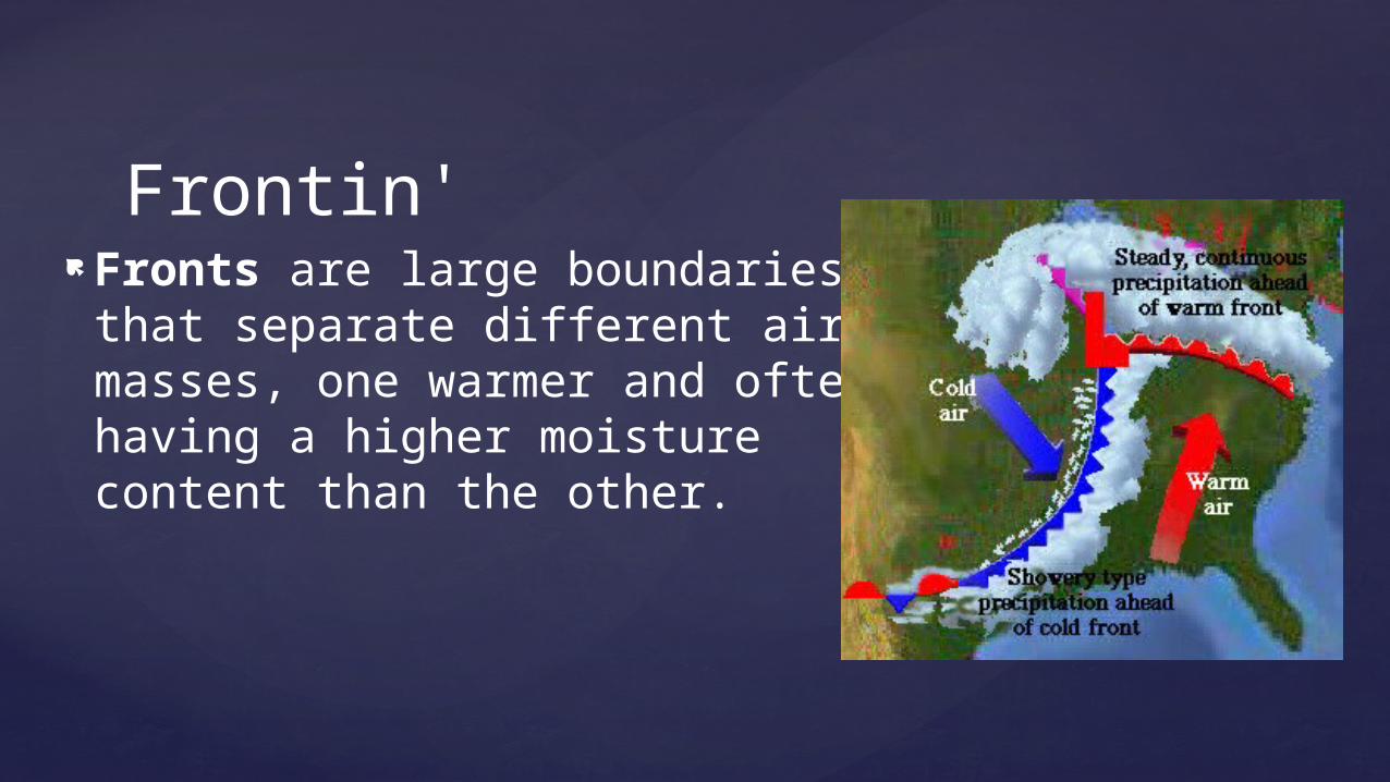
Fronts are large boundaries that separate different air masses, one warmer and often having a higher moisture content than the other.
Frontin'
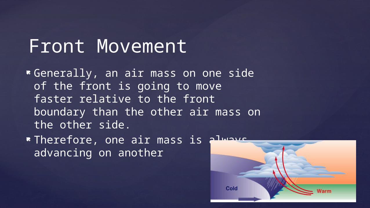
Generally, an air mass on one side of the front is going to move faster relative to the front boundary than the other air mass on the other side.
Therefore, one air mass is always advancing on another
Front Movement

Not that much mixing of the air masses
Basically retain their distinct identities as one goes over the other in a process called overrunning
The Front

No matter what, it is always warmer (LESS DENSE) air that is forced on top

Marked by red semi-circles with the rounded edge pointing in the direction of the front
When a front moves so that warm air is occupying a space that was formally occupied by cold air it is called a warm front
Advances slooooowwwwlyyyyy, 10-15 mph
Warm Fronts


The weather for a warm front can stretch out a 1000 miles ahead of it and can start appearing 36 to 48 hours ahead of it
Weather starts out as thin, wispy cirrus clouds (halo around sun/moon)
With time, these thin clouds get gradually lower and thicken
Eventually there's a steady light rain or drizzle Near the actual frontal boundary, precipitation
tends to become steadier and heavier and there could also be areas of fog as well
Could last for days
Warm Fronts

When cold, dense air is actively advancing into an area occupied by warmer air
These fronts are twice as steep and 50% faster than warm fronts, going at about 20-25 mph
Like an atmospheric plow Represented by blue triangles, like spikes,
in the direction that the front is moving
Cold Fronts


Weather along these fronts are much more violent
Creates: Towering cumulus clouds Hard showers Gusty thunderstorms
All of this is followed by a push of colder, drier air
Cold Fronts

When a cold front over takes a warm front forcing it up
Then this cold air bumps up against another cold front
2 Types: In a cold occlusion, the air mass
overtaking the warm front is cooler than the cool air ahead of the warm front, and plows under both air masses.
In a warm occlusion, the air mass overtaking the warm front is not as cool as the cold air ahead of the warm front, and rides over the colder air mass while lifting the warm air.
Occluded Front


INTENSE weather Storm systems reach their greatest
intensity when they become "occluded" (when the cold meets the cold and forces the warm up)
Brings heavy rain, gusty winds, and thunderstorms
Eventually dies down when air mixes Marked by purple alternating semi-circles
and triangles pointing in the direction of the front
Occluded Front Weather

No significant movement and neither air mass is overtaking the other
The resultant weather is usually low cloud cover and long duration precipitation. Not too much wind.
Marked by red semi-circles and blue triangles pointing in opposite directions
Stationary Front
