a topographic map is a special type of map that shows the “contour” of the land. for this...
TRANSCRIPT

TOPOGRAPHIC MAPS
What is a topographic map
A topographic map is a special type of map that shows the “contour” of the land. For this reason, they are sometimes referred to as a “contour map”.

What does a topographic map look like.

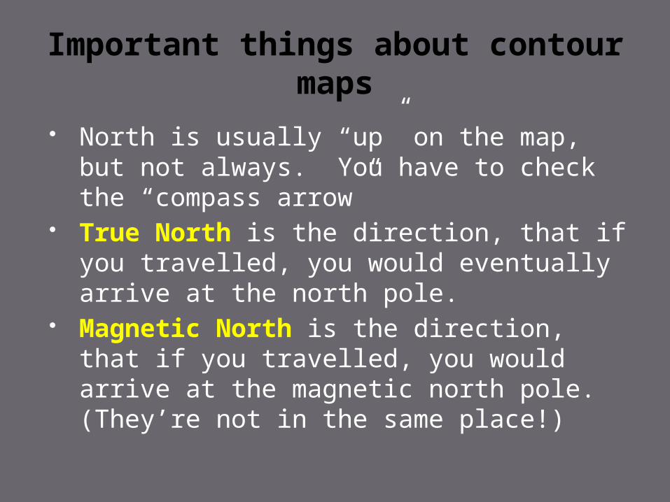
Important things about contour maps
Elevations are typically referenced to sea level.
A contour line connects points of the same elevation. A type of isoline.
A contour interval is the difference in elevation between two contour lines next to one another.
A hachure is a special type of contour line that shows a depression.

Elevations referenced to sea level!
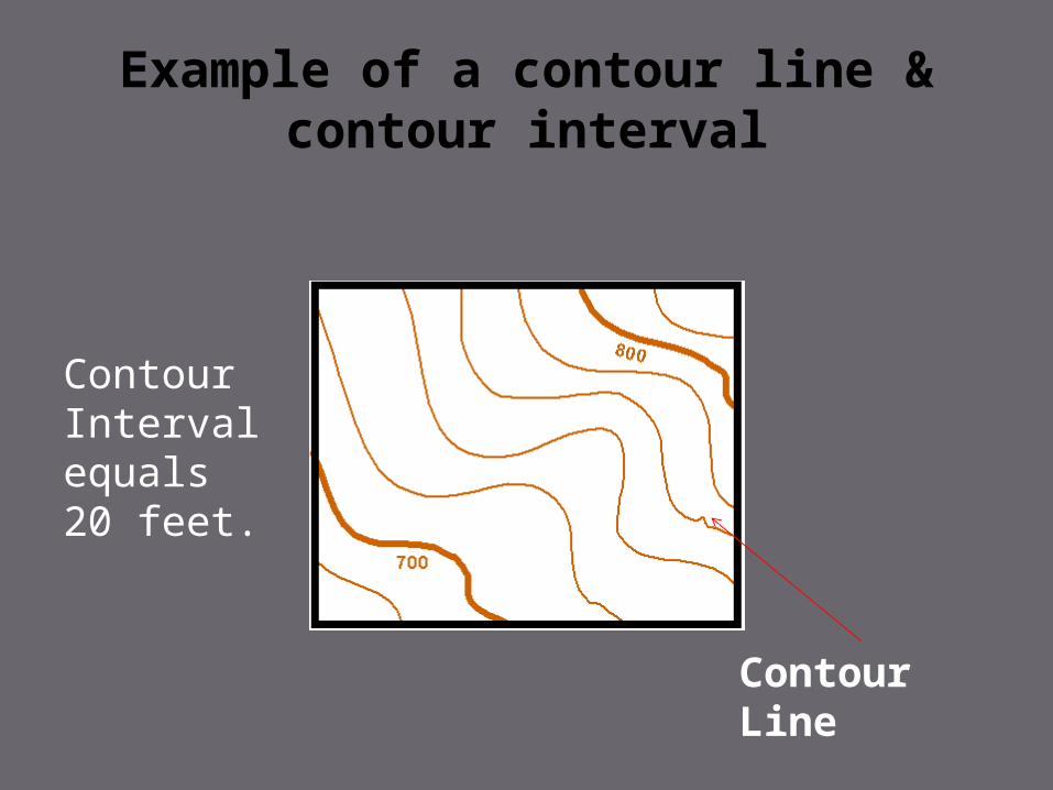
Example of a contour line & contour interval
Contour Line
Contour
Interval equals 20 feet.

Example of a hachured line.
Important things about contour maps
North is usually “up” on the map, but not always. You have to check the “compass arrow”
True North is the direction, that if you travelled, you would eventually arrive at the north pole.
Magnetic North is the direction, that if you travelled, you would arrive at the magnetic north pole. (They’re not in the same place!)

What does this look like

Important things about contour maps
Magnetic declination is the difference in angle between true north and magnetic north
Contour maps have a legend, which explains the symbols on the map.
Contour maps typically have a bar scale, that shows horizontal distance on the map

Important things about contour maps
Slope, which is a type of gradient, shows the “steepness” of an area. The closer the contour lines the steeper the slope!
Streams flow down gradient, from higher to lower elevation. Contour lines make a V or U, the closed end of which, points upstream.

Huh! . . What do you mean
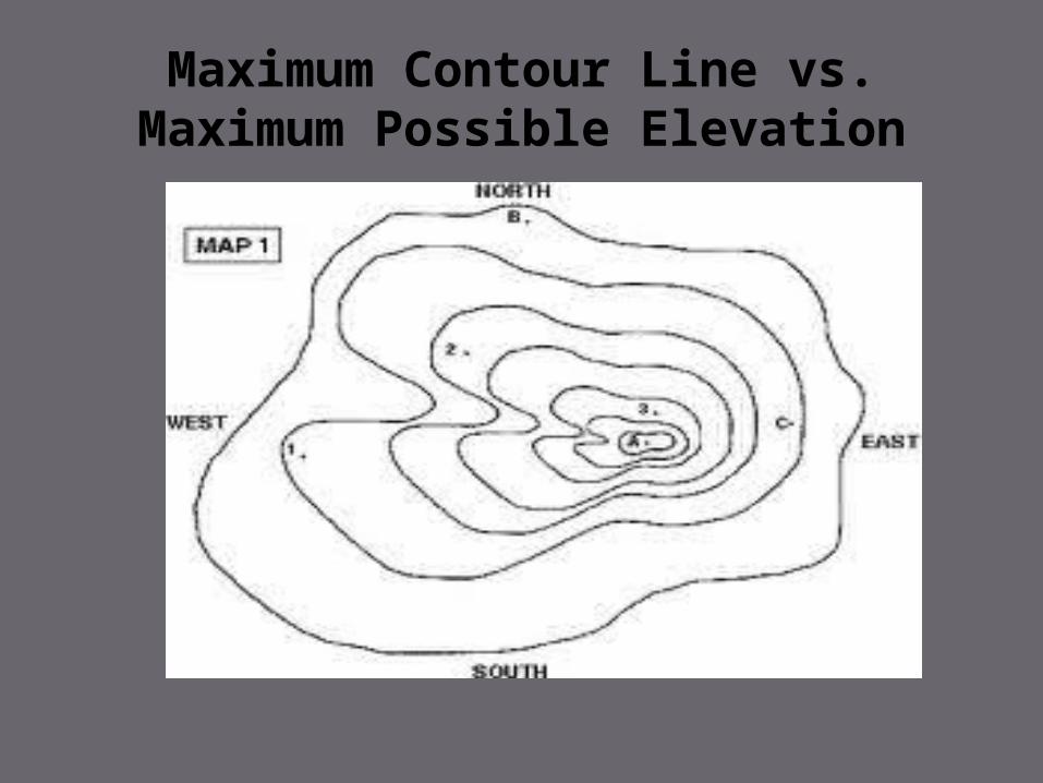
Maximum Contour Line vs.Maximum Possible Elevation