wildomar crossings project
TRANSCRIPT

Prepared by:
HELIX Environmental Planning, Inc.7578 El Cajon Boulevard
La Mesa, CA 91942
Prepared for:
Mann Property CompanyP.O. Box 77564
San Francisco, CA 94107
Wildomar Crossings Project
General Biological Resources Assessment
December 19, 2017

i
Report Date: December 19, 2017
Title: General Biological Resources Assessment for the Wildomar Crossings Project
Project Location: The approximately 4.4-acre project site is located the northwest corner of
Clinton Keith Road and Stable Lanes Road in the City of Wildomar, Riverside County, California. The project site is situated on the U.S. Geological Survey 7.5-minute Wildomar and Murrieta quadrangle maps in Section 1, Township 7 South, Range 4 West.
Assessor’s Parcel
Numbers: The project site comprises two Assessor Parcel Numbers: 380-120-003 and 380-120-004, as well as road rights-of-way.
Owner/Applicant: Mann Property Company P.O. Box 77564 San Francisco, CA 94107 Principal
Investigator: HELIX Environmental Planning, Inc. 7578 El Cajon Blvd. La Mesa, CA 91942 (619) 462-1515 Report Summary: The approximately 4.4-acre project site (including off-site components)
was surveyed for burrowing owl and jurisdictional features. The burrowing owl survey had negative results. The riparian/riverine areas on site were assessed and mapped.
Report Preparer: Rob Hogenauer (562) 537-2426 Benjamin Rosenbaum (619) 462-1515 Field Personnel: Rob Hogenauer (562) 537-2426 Benjamin Rosenbaum (619) 462-1515

ii
THIS PAGE INTENTIONALLY LEFT BLANK

i
Wildomar Crossings Project
General Biological Resources Assessment Report
TABLE OF CONTENTS
Section Title Page
1.0 INTRODUCTION ..................................................................................................... 1
1.1 Project Location .................................................................................................. 1
1.2 Project Description .............................................................................................. 1
2.0 METHODS ................................................................................................................ 1
2.1 Nomenclature and Literature Review ................................................................. 2
2.2 Field Surveys ...................................................................................................... 2
2.2.1 Vegetation Mapping ................................................................................. 2
2.2.2 Jurisdictional Delineation ......................................................................... 2
2.2.3 Riparian/Riverine and Vernal Pool Habitat Assessment
(MSHCP Section 6.2.1) ........................................................................... 3
2.2.4 Narrow Endemic Plant Species Survey Area ........................................... 5
2.2.5 Criteria Area Species Survey Area ........................................................... 5
2.2.6 Burrowing Owl Habitat Assessment and Survey ..................................... 5
3.0 RESULTS .................................................................................................................. 6
3.1 Topography and Soils ......................................................................................... 6
3.2 Vegetation Communities .................................................................................... 7
5.2.1 Southern Willow Scrub ............................................................................ 7
5.2.2 Coast Live Oak Woodland ....................................................................... 7
5.2.3 Riversidean Sage Scrub (including disturbed) ......................................... 8
5.2.4 Non-native Grassland (including Rumex dominated) .............................. 8
5.2.5 Eucalyptus Woodland ............................................................................... 8
5.2.6 Developed ................................................................................................. 9
3.4 Jurisdictional Waters and Wetlands .................................................................... 9
3.4.1 Potential USACE/RWQCB Jurisdiction .................................................. 9
3.4.2 Potential CDFW Jurisdiction .................................................................... 9
3.5 Riparian/Riverine and Vernal Pool Habitat Assessment .................................. 10
3.6 Narrow endemic plant species survey ............................................................... 13
3.7 Criteria Area Plant Species Survey ................................................................... 13
3.8 Burrowing Owl Habitat Assessment and Survey ............................................. 13
3.9 Other Sensitive Species..................................................................................... 13
3.9.1 Sensitive Plants ....................................................................................... 14
3.9.2 Sensitive Animals ................................................................................... 19
4.0 REGULATORY CONTEXT ................................................................................... 24
4.1 Federal............................................................................................................... 24
4.2 State................................................................................................................... 25

ii
TABLE OF CONTENTS (cont.)
Section Title Page
4.0 REGULATORY CONTEXT ................................................................................... 24
4.3 Western Riverside Multiple Species Habitat Conservation Plan ...................... 26
5.0 IMPACTS ................................................................................................................ 26
5.1 Vegetation Communities .................................................................................. 27
5.2 Jurisdictional Waters and Wetlands .................................................................. 28
5.2.1 Potential USACE/RWQCB Jurisdiction ................................................ 28
5.2.2 Potential CDFW Jurisdiction .................................................................. 28
5.3 MSHCP Consistency Analysis ......................................................................... 29
5.4.1 MSHCP Reserve Assembly Requirements ............................................ 29
5.4.2 MSHCP Section 6.1.2 Protection of Species Associated
with Riparian/Riverine Areas and Vernal Pools .................................. 29
5.4.3 MSHCP Section 6.1.3 Protection of Narrow Endemic Plant Species .... 30
5.4.4 MSHCP Section 6.1.4 Guidelines Pertaining to the Urban/Wildlands
Interface ................................................................................................. 30
5.4.5 MSHCP Section 6.3.2 Additional Survey Needs and Procedures ......... 31
5.4.6 MSHCP Section 6.4 Fuels Management ................................................ 31
5.5 Nesting Birds .................................................................................................... 32
6.0 AVOIDANCE, MINIMIZATION, AND MITIGATION MEASURES ................. 32
6.1 Sensitive Species ............................................................................................... 32
6.1.1. Burrowing Owl ...................................................................................... 32
6.1.2 Nesting Birds .......................................................................................... 32
6.2 Riparian/Riverine Areas .................................................................................... 33
6.3 Non-native Invasive Species Restrictions ......................................................... 34
6.4 MSHCP Mitigation Fee .................................................................................... 34
6.5 Stephens’ Kangaroo Rat HCP Fee .................................................................... 35
7.0 CERTIFICATION/QUALIFICATION ................................................................... 36
8.0 REFERENCES ........................................................................................................ 37
LIST OF APPENDICES
A Plant Species Observed
B Animal Species Observed or Detected
C Site Photographs
D Explanation of Status Codes for Plant and Animal Species

iii
TABLE OF CONTENTS (cont.)
LIST OF FIGURES
No. Title Follows Page No.
1 Regional Location ................................................................................................................2
2 Project Vicinity Map (USGS Topography) .........................................................................2
3 Project Vicinity Map (Aerial Photograph) ...........................................................................2
4 MSHCP Criteria Map ..........................................................................................................2
5 Vegetation Communities .....................................................................................................8
6 USACE/RWQCB Jurisdiction ...........................................................................................10
7 Vegetation Communities/Impacts ......................................................................................10
8 USACE/RWQCB Jurisdiction ...........................................................................................30
9 CDFW Jurisdiction and Riparian/Riverine Areas ..............................................................30
LIST OF TABLES
No. Title Page No.
1 Burrowing Owl Survey Information ....................................................................................6
2 Vegetation Communities .....................................................................................................7
3 USACE/RWQCB Jurisdictional Areas ................................................................................9
4 CDFW Jurisdictional Areas .................................................................................................9
5 Riparian/Riverine Areas .....................................................................................................11
6 Special-status Plant Species Potential to Occur .................................................................14
7 Special-status Animal Species Potential to Occur .............................................................17
8 Impacts to Vegetation Communities ..................................................................................27
9 Impacts to Waters of the U.S./State ...................................................................................28
10 Impacts to CDFW Jurisdiction ...........................................................................................28
11 Impacts to Riparian/Riverine Areas and Proposed Mitigation ..........................................33

iv
THIS PAGE INTENTIONALLY LEFT BLANK
General Biological Resources Assessment Report for the Wildomar Crossings Project / MNN-01 / December 19, 2017 1
1.0 INTRODUCTION
The Wildomar Crossings project is located in the City of Wildomar in Riverside County,
California. The purpose of this report is (1) to document field study findings and (2) to address
requirements of the Western Riverside County Multiple Species Habitat Conservation Plan
(MSHCP; Dudek and Associates [Dudek] 2003). This updated General Biological Resource
Assessment (GBRA) supersedes the previous GBRA.
1.1 PROJECT LOCATION
The approximately 4.4-acre project site is located at the northwest corner of Clinton Keith Road
and Stable Lanes Road in the City of Wildomar (City), Riverside County, California (figure 1).
The site is situated on the U.S. Geological survey (USGS) 7.5-minute Wildomar and Murrieta
quadrangle maps in Section 1, Township 7 South, Range 4 West (Figure 2). In addition, the
project site is within the Santa Margarita watershed.
The site comprises two parcels (Assessor’s Parcel Numbers 380-120-003 and -004), as well as
road right-of way on both Stable Lanes Road and Clinton Keith Road, and is bordered by a mix
of rural residential and undeveloped land, with a major road and commercial development
located nearby to the northeast (Figure 3).
The property is located within the Elsinore Area Plan of the MSHCP, but is not with a criteria
cell or cell group. The nearest criteria cell occurs approximately one mile to the northeast
(Figure 4). The area plan subunits each have specific planning species and biological
considerations. These items do not apply to the subject property as it is not within a subunit.
1.2 PROJECT DESCRIPTION
The proposed project design is for construction of a commercial retail shopping center consisting
of four buildings ranging from just over 3,000 square feet up to 10,000 square feet in size. The
project also includes parking facilities, off-site roadway and drainage improvements, and other
associated infrastructure.
2.0 METHODS
Project site evaluation involved literature review, a riparian/riverine and Vernal Pool habitat
assessment, a delineation of jurisdictional waters, a focused burrowing owl survey, and
vegetation mapping, along with a general habitat assessment of the potential for sensitive species
to occur on site. The methods used to evaluate the biological resources present on site are
discussed in this section. The plant and animal species detected on site are shown in Appendices
A and B, respectively. Appendix C contains site photographs. Appendix D contains definitions
of plant and animal species designations used throughout this document.

General Biological Resources Assessment Report for the Wildomar Crossings Project / MNN-01 / December 19, 2017 2
2.1 NOMENCLATURE AND LITERATURE REVIEW
Nomenclature used in this report generally follows MSHCP conventions. Vegetation community
classifications follow Holland (1986) and the MSHCP (Dudek 2003). Latin names of plants
follow Baldwin et al. (2012), and common names follow Hickman or the California Native Plant
Society (CNPS; 2016). Sensitive plant and animal status is taken from the California Natural
Diversity Database (CNDDB) of the California Department of Fish and Wildlife (CDFW; 2016a,
b, c, and d) and CNPS (2016). nomenclature follows Emmel and Emmel (1973) for butterflies
,Taggart (2014) for amphibians and reptiles, American Ornithologists’ Union (2015) for birds,
and Baker et al. (2003) for mammals.
2.2 FIELD SURVEYS
2.2.1 Vegetation Mapping
The vegetation on the project site was mapped by HELIX biologists W. Larry Sward and Rob
Hogenauer during field work conducted in 2009. The vegetation map was updated by Mr.
Hogenauer on August 29, 2016. Mapping unit size was 0.1 acre for uplands and 0.01 acre for
riparian habitat.
2.2.2 Jurisdictional Delineation
Prior to beginning fieldwork, aerial photographs (1"=100' scale), and topographic maps
(1"=100' scale) were reviewed to determine the location of potential jurisdictional areas that may
be affected by the proposed project. Data were collected in areas that were suspected to support
potential jurisdictional resources by Mr. Hogenauer on August 29, 2016. The 2016 survey
provided an update to the previous field work conducted by Mr. Hogenauer and HELIX biologist
W. Larry Sward in 2009. Sampling points were taken within representative uplands and
wetlands, and mapping of drainage features was performed in the field based on the presence of
a consistent ordinary high water mark (OHWM) and surface indications of hydrology.
Additional information was collected during a November 27, 2017 on site meeting with CDFW,
USFWS, and the City of Wildomar.
Potential U.S. Army Corps of Engineers (USACE) wetland boundaries were determined using
the three criteria (vegetation, hydrology, and soils) established for wetland delineations, as
described within the Wetlands Delineation Manual (Environmental Laboratory 1987) and since
updated in the Regional Supplement to the Corps of Engineers Wetland Delineation Manual:
Arid West Region (USACE 2008a). Potential USACE non-wetland boundaries were further
determined using methods suggested by the USACE in A Field Guide to the Identification of the
Ordinary High Water Mark in the Arid West Region of the Western United States (USACE
2008b). The same methods were used to determine potential Regional Water Quality Control
Board (RWQCB) jurisdiction in the form of waters of the State.
Potential California Department of Fish and Wildlife (CDFW) jurisdictional boundaries were
determined based on the presence of riparian vegetation or regular surface flow. Streambeds
within CDFW jurisdiction were delineated based on the definition of streambed as “a body of

?q
A»
!"a$
!"a$
%&h(
A¦
!"a$
!"a$ Aª
Aª%&h(
A¦
?q
Aª
AÀ
!"̀$
AÚ
?u
AÌ
A¦ A³
Aw
A³
AÌ
A¦
Aª
!
Project Site
Norco
Riverside
Corona
Moreno Valley
LakeElsinore
Murrieta
Temecula
Hemet
San Jacinto
Beaumont
BanningDesert Hot Springs
PerrisPalm Springs
Palm Desert
Coachella
Salton Sea
LakeCahuilla
HemetLake
DiamondValley Lake
Lake Perris
Lake Skinner
Vail Lake
LakeElsinore
LakeMathews
SAN BERNARDINO COUNTYRIVERSIDE COUNTY
SAN DIEGO COUNTYRIVERSIDE COUNTY
RIVER
SIDE C
OUNTY
ORANGE COUNTY
Figure 1
WILDOMAR CROSSINGSRegional LocationI:
\PR
OJE
CT
S\M
\MN
N\M
NN
-01_
Wil
dom
arC
ross
ings\
Map\G
BR
A\F
ig1_R
egio
nal.
mxd M
NN
-01 0
9/1
2/1
6 -
RK
0 10MilesN

Project Site
I:\P
RO
JEC
TS
\M\M
NN
\MN
N-0
1_W
ildom
arC
ross
ings\
Map\G
BR
A\F
ig2_U
SG
S_V
icin
ity.m
xd M
NN
-01 09
/12
/16
-R
K
Figure 2
WILDOMAR CROSSINGSProject Vicinity Map (USGS Topography)
0 2,000FeetN
Copyright:© 2011 National Geographic Society, i-cubed; USGS Wildomar and Murrieta 7.5' Quadrangles

Palomar Street Clinton Keith Road
Grand AvenueGe
orge
Ave
nue
Boylan Springs Road
Central
Stree
t
Catt Road
Baxter Road
Washington Avenue
Prielipp Road
!"a$
Project Site
I:\P
RO
JEC
TS
\M\M
NN
\MN
N-0
1_W
ildom
arC
ross
ings\
Map\G
BR
A\F
ig3_A
eria
l_V
icin
ity.m
xd
M
NN
-01 09/1
2/1
6 -
RK
Figure 3
WILDOMAR CROSSINGSProject Vicinity Map (Aerial Photograph)
0 2,000FeetN
; USGS Wildomar and Murrieta 7.5' Quadrangles

Palomar Street Clinton Keith Road
Grand AvenueGe
orge
Ave
nue
Boylan Springs Road
Central
Stree
t
Catt Road
Baxter Road
Washington Avenue
Prielipp Road
!"a$
Project Site
5988 5983
5558
5455
5350 5351
L'
K'
I:\P
RO
JEC
TS
\M\M
NN
\MN
N-0
1_W
ildom
arC
ross
ings\
Map\G
BR
A\F
ig4_M
SH
CP
.mxd
M
NN
-01 09/1
2/1
6 -
RK
Figure 4
WILDOMAR CROSSINGSMSHCP Criteria Map
0 2,000FeetN
; USGS Wildomar and Murrieta 7.5' Quadrangles
Project Boundary
MSHCP Cell Group
MSHCP Cell

General Biological Resources Assessment Report for the Wildomar Crossings Project / MNN-01 / December 19, 2017 3
water that flows at least periodically or intermittently through a bed or channel having banks and
supporting fish or other aquatic life. This includes watercourses having a surface or subsurface
flow that supports riparian vegetation” (Title 14, Section 1.72). Additional details are included in
the complete jurisdictional delineation report (HELIX 2016a).
2.2.3 Riparian/Riverine and Vernal Pool Habitat Assessment (MSHCP Section 6.2.1)
The MSHCP defines Riparian/Riverine habitat “as lands which contain Habitat dominated by
[trees], shrubs, persistent emergents, or emergent mosses and lichens, which occur close to or
which depend upon soil moisture from a nearby fresh water source; or areas with fresh water flow
during all or a portion of the year.” The MSHCP defines Vernal Pools as “seasonal wetlands that
occur in depression areas that have wetlands indicators of all three parameters (soils, vegetation,
and hydrology) during the wetter portion of the growing season but normally lack wetlands
indicators of hydrology and/or vegetation during the drier portion of the growing season”
(Dudek 2003).
In accordance with the MSHCP, a Riparian/Riverine and Vernal Pool habitat assessment was
conducted by Mr. Hogenauer on August 29, 2016. The assessment was conducted concurrently
with the jurisdictional water survey and vegetation mapping field effort. Topographic maps and
satellite photos were used to aid in the mapping. The on-site evaluation consisted of a directed
search for field characteristics indicative of Riparian/Riverine or Vernal Pool habitats. Field
indicators include certain plants, drainage courses, drainage patterns, ponded water, changes in
soil character, changes in vegetation character, and deposits of water-borne debris.
Riparian/Riverine and Vernal Pool habitats (if present) were mapped on an aerial photograph
(1"=200' scale).
The MSHCP also states that “areas demonstrating characteristics [of riparian/riverine habitat]
which are artificially created are not included in these definitions” of riparian/riverine habitat.
The identification of riparian/riverine habitats is based on potential for the habitat to support
Riparian/Riverine Covered Species, which are identified in MSHCP Section 6.1.2. These species
include least Bell’s vireo (LBV; Vireo bellii pusillus) and a suite of other animals and plants
outlined in Section 6.1.2 of the MSHCP.
Riparian/Riverine Plants
The MSHCP lists 23 sensitive plant species that have potential to occur in Riparian/Riverine and
Vernal Pool habitats. These species are:
• California black walnut (Juglans californica var. californica),
• Engelmann oak (Quercus engelmannii),
• Coulter’s matilija poppy (Romneya coulteri),
• San Miguel savory (Clinopodium chandleri),
• spreading navarretia (Navarretia fossalis),
• graceful tarplant (Holocarpha virgata ssp. elongata),
• California Orcutt grass (Orcuttia californica),
• prostrate navarretia (Navarretia prostrata),

General Biological Resources Assessment Report for the Wildomar Crossings Project / MNN-01 / December 19, 2017 4
• San Diego button-celery (Eryngium aristulatum var. parishii),
• Orcutt’s brodiaea (Brodiaea orcuttii),
• thread-leaved brodiaea (Brodiaea filifolia),
• Fish’s milkwort (Polygala cornuta var. fishiae),
• lemon lily (Lilium parryi),
• San Jacinto Valley crownscale (Atriplex coronata var. notatior),
• ocellated Humboldt lily (L. humboldtii ssp. ocellatum),
• Mojave tarplant (Deinandra mohavensis),
• vernal barley (Hordeum intercedens),
• Parish’s meadowfoam (Limnanthes gracilis var. parishii),
• slender-horned spineflower (Dodecahema leptoceras),
• Santa Ana River woolly-star (Eriastrum densifolium ssp. sanctorum),
• Brand’s phacelia (Phacelia stellaris),
• mud nama (Nama stenocarpum), and
• smooth tarplant (Centromadia pungens ssp. laevis)
Riparian Birds
The project site was assessed for habitat that could support the LBV, southwestern willow
flycatcher (WIFL; Empidonax traillii extimus), and western yellow-billed cuckoo (YBCU;
Coccyzus americanus occidentalis). Typical habitat for LBV consists of well-developed riparian
scrub, woodland, or forest dominated by willows (Salix spp.), mule fat (Baccharis salicifolia),
and western cottonwood (Populus fremontii). The LBV will also use small patches of trees
adjacent to dense riparian habitat. The WIFL and YBCU require mature riparian forest with a
stratified canopy and nearby water. The MSHCP requires surveys to be conducted for projects
that have impacts to suitable habitat for the aforementioned riparian birds. The 0.08-acre
southern willow scrub on the property was determined not to have size, density, or layering to
support LBV, WIFL, or YBCU. Surveys for LBV, WIFL, or YBCU are not required and were
not conducted.
Both the bald eagle (Haliaeetus leucocephalus) and peregrine falcon (Falco peregrinus) occur
primarily in and adjacent to open water habitats, with the peregrine falcon possibly occurring
adjacent to riparian areas. The peregrine falcon nests on large cliffs that are generally 200 to
300 feet in height. Habitat to support the bald eagle or peregrine falcon does not occur on
the property.
Fairy Shrimp
There are three species of sensitive fairy shrimp that occur in western Riverside County:
Riverside fairy shrimp (Streptocephalus woottoni), Santa Rosa Plateau fairy shrimp (Linderiella
santarosae), and vernal pool fairy shrimp (Branchinecta lynchi). The property was surveyed for
habitat, such as vernal pools or ephemeral ponds, which could support fairy shrimp. Indicators of
potential fairy shrimp habitat that were searched include basins, ruts, cracked mud, algal mats,
and drift lines.

General Biological Resources Assessment Report for the Wildomar Crossings Project / MNN-01 / December 19, 2017 5
Fish
The Santa Ana sucker (Catostomus santaanae) is the only fish shown in the list of MSHCP
Riparian/Riverine species. The property was searched for streams with potential to support
this species.
Amphibians
The MSHCP has three amphibians in the list of Riparian/Riverine species: arroyo toad (Anaxyrus
californicus), mountain yellow-legged frog (Rana muscosa), and the California red-legged frog
(Rana aurora draytonii). The property was searched for habitat with potential to support these
three species.
The Riparian/Riverine habitat assessment conducted on August 29, 2016 included a directed
search for the aforementioned species. The search focused on the riparian area (proposed for
avoidance) along with walking transects throughout the remainder of the property. If these
species occur, they are required to be mapped and avoided. If avoidance is not feasible, then a
Determination of Biologically Equivalent Superior Preservation (DBESP) is required to quantify
impacts and establish mitigation for the impacted species.
2.2.4 Narrow Endemic Plant Species Survey Area
The project site is not within a Narrow Endemic Plant Species Survey Area (NEPSSA) of the
MSHCP. No surveys for NEPSSA species are required.
2.2.5 Criteria Area Species Survey Area
The project site does not occur within a Criteria Area Species Survey Area (CASSA) of the
MSHCP. No surveys for CASSA species area required.
2.2.6 Burrowing Owl Habitat Assessment and Survey
The site occurs within an area that requires protocol surveys for the burrowing owl (BUOW;
Athene cunicularia) if suitable habitat is found to be present. The BUOW habitat assessment and
focused survey efforts completed for the project were conducted in accordance with the
Burrowing Owl Survey Instructions for the Western Riverside MSHCP (County of Riverside
2006) and meets applicable conditions under Section 6, Volume I of the Western Riverside
County MSHCP.
Mr. Hogenauer conducted the initial BUOW habitat assessment concurrent with the initial general
habitat assessment and plant survey. Suitable habitat was confirmed and focused BUOW surveys
were completed at the site in years 2009 and 2016. HELIX completed a total of four survey visits
from August 28 through 31, 2009, and a total of four survey visits from August 12 through 29,
2016 during the BUOW breeding season (Table 1). Mr. Hogenauer conducted both the 2009 and
2016 surveys, with help from HELIX biologist Benjamin Rosenbaum who conducted survey 1
in 2016.

General Biological Resources Assessment Report for the Wildomar Crossings Project / MNN-01 / December 19, 2017 6
HELIX biologists surveyed transects no greater than 30 yards apart through potential BUOW
habitat located on the property. The biologists walked slowly and methodically, closely checking
the areas that met the basic requirements of BUOW habitat:
• Open expanses of sparsely vegetated areas (less than 30 percent canopy cover for trees
and shrubs),
• Gently rolling or level terrain,
• An abundance of small mammal burrows, especially those of California ground squirrel
(Otospermophilus beecheyi), and
• Fence posts, rock, or other low perching locations.
The BUOW survey information is summarized below within Table 1.
Table 1
BURROWING OWL SURVEY INFORMATION
DATE TIME
(hours) WEATHER CONDITIONS
8/28/09 1740-1810 Clear, 96°F, wind 1-3 mph
8/29/09 1910-1930 Cloudy, 92-93°F, wind 2-4 mph
8/30/09 1800-1820 Clear, 96°F, wind 3-5 mph
8/31/09 1855-1915 Clear, 88-89°F, wind 1-3 mph
8/12/16 0630-0730 Clear, 63-67°F, wind 0-2 mph
8/16/16 0600-0630 Clear, 68°F, wind 0-1 mph
8/24/16 0605-0640 Clear, 64-65°F, wind 0-1 mph
8/29/16 0615-0745 Clear, 68-70°F, wind 1-2 mph
Potential owl burrow locations including fossorial animal burrows, rock outcrops, and debris
piles were checked for signs of recent owl occupation, which include:
• Pellets/Casting – regurgitated fur, bones, and insect parts,
• White wash – excrement, and
• Feathers.
3.0 RESULTS
This section addresses the results of research and fieldwork conducted as part of the biological
resources technical study, including discussions on the existing conditions and sensitive
biological resources that occur or have potential to occur on the project site.
3.1 TOPOGRAPHY AND SOILS
The MSHCP lists nine sensitive soil types as occurring within the Plan Area (Dudek 2003). None
of the MSHCP sensitive soils occurs on the project site. Three soil types are mapped within the
project site: Ramona and Buren loams (RnE3; 5 to 25 percent, slopes, severely eroded), San

General Biological Resources Assessment Report for the Wildomar Crossings Project / MNN-01 / December 19, 2017 7
Timoteo loam (SmE2; 8 to 25 percent slopes, eroded), and Hanford coarse sandy loam (HcC;
2 to 8 percent slopes; USDA 2013).
3.2 VEGETATION COMMUNITIES
The project site currently comprises six vegetation communities/land uses: southern willow
scrub, coast live oak woodland, Riversidean sage scrub, non-native grassland (including Rumex
dominated), Eucalyptus woodland, and developed (Table 2; Figure 5).
5.2.1 Southern Willow Scrub
Southern willow scrub consists of dense, broadleaved, winter-deciduous stands of trees
dominated by shrubby willows (Salix sp.) in association with mule fat (Baccharis salicifolia).
This habitat occurs on loose, sandy, or fine gravelly alluvium deposited near stream channels
during flood flows. Frequent flooding or limited hydrology maintains this early seral community,
preventing succession to a riparian woodland or forest (Holland 1986). The property supports
0.08 acre of this vegetation community in the southern corner (Figure 5). Species present include
red willow (Salix laevigata), arroyo willow (Salix lasiolepis), and Fremont cottonwood (Populus
fremontii ssp. fremontii).
Table 2
VEGETATION COMMUNITIES*
VEGETATION COMMUNITY ACRES
Riparian/Wetland Southern Willow Scrub 0.08 Coast live oak woodland 0.03 Eucalyptus woodland (associated with stream)
0.07
Developed-rip/rap (streambed) 0.02 Subtotal Riparian/Wetland 0.2
Upland Riversidean sage scrub 0.2 Riversidean sage scrub - disturbed 0.7 Eucalyptus Woodland 0.1 Non-native grassland (including Rumex-dominated)
2.0
Developed land 1.2 Subtotal Upland 4.2
TOTAL 4.4
* Upland habitats are rounded to the nearest 0.1 acre, while wetland habitats
are rounded to the nearest 0.01; thus, totals reflect rounding.
5.2.2 Coast Live Oak Woodland
Coast live oak woodland is an evergreen woodland community dominated by coast live oak
(Quercus agrifolia), which may reach a height of 35 to 80 feet. This vegetation community is
generally found on north-facing slopes and shaded ravines often with a poorly developed
shrub understory.

General Biological Resources Assessment Report for the Wildomar Crossings Project / MNN-01 / December 19, 2017 8
The site supports a single small area of this vegetation community in the southern corner.
Species present include coast live oak with an herbaceous understory.
5.2.3 Riversidean Sage Scrub (including disturbed)
Riversidean sage scrub (RSS) occupies xeric sites such as steep slopes, severely drained soils, or clays that slowly release stored soil moisture. It is dominated by sub-shrubs with leaves that are deciduous during drought, an adaptation that allows the habitat to withstand the prolonged drought period in the summer and fall. Sage scrub species have relatively shallow root systems and open canopies that allow for the occurrence of a substantial herbaceous (annual plant) component. Typical stands are fairly open and dominated by species such as California sagebrush (Artemisia californica), brittlebush (Encelia farinosa), and California buckwheat (Holland 1986). Undisturbed sage scrub occurs along the north, west, and southern edge of the property. Sage scrub disturbed from disking occurs on the central and southwestern slopes of the property.
5.2.4 Non-native Grassland (including Rumex dominated)
Non-native grassland is a dense to sparse cover of annual grasses often associated with numerous species of showy-flowered native annual forbs. This association occurs on gradual slopes with deep, fine-textured, usually clay soils. This vegetation community typically supports species such as oats (Avena spp.), foxtail chess (Bromus madritensis ssp. rubens), ripgut grass (B. diandrus), filaree (Erodium spp.), and mustard (Brassica nigra). Non-native grassland is the dominant habitat on the property. A small portion (0.07 acre) of the non-native grassland is dominated by curly dock. Although this patch of non-native grassland is different from the majority of the non-native grassland on the property, it is does not meet the definition of separate vegetation community description due to its landscape position and other plant species observed.
5.2.5 Eucalyptus Woodland
Eucalyptus woodland is dominated by eucalyptus (Eucalyptus sp.), an introduced species that produces a large amount of leaf and bark litter. The chemical and physical characteristics of this litter limit the ability of other species to grow in the understory, with a resultant decrease in floristic diversity. Eucalyptus trees have been planted historically for a variety of reasons, but they are particularly popular owing to their rapid growth rate. Given sufficient moisture, eucalyptus woodland has become naturalized and its range has expanded greatly, to the detriment of many riparian areas. There are two patches of eucalyptus woodland in the center of the property. The majority of this habitat occurs within or adjacent to the stream in the southern corner of the property. The portion of the habitat rooted within the streambed is considered Riparian/Riverine. The eucalyptus woodland along the streambed includes a couple sapling coast live oaks.

Clinton Keith Road
Stable Lanes Road
I:\P
RO
JEC
TS
\M\M
NN
\MN
N-0
1_W
ildom
arC
ross
ings\
Map\G
BR
A\F
ig5_V
eget
ati
on
.mx
d M
NN
-01 0
9/2
8/2
016 -
RK
Figure 5
WILDOMAR CROSSINGSVegetation Communities
0 100FeetN
Project Site
Riprap
Vegetation CommunitiesCoast Live Oak Woodland
Southern Willow Scrub
Riversidean Sage Scrub
Riversidean Sage Scrub Disturbed
Eucalyptus Woodland
Non-native Grassland
Non-native GrasslandRumex crispus Dominated
(Upland, Disked)
Developed

General Biological Resources Assessment Report for the Wildomar Crossings Project / MNN-01 / December 19, 2017 9
5.2.6 Developed
Developed land is where permanent structures and/or pavement have been placed, which
prevents the growth of vegetation, or where landscaping is clearly tended and maintained.
Developed land on the property consists of the recently improved Stable Lanes Road, a portion
of Clinton Keith Road, and the slope adjacent to the Clinton Keith Road that was recently
impacted from improvements to the road. The rip-rap that occurs at the storm drain outlets is
developed and is also considered to be an unvegetated jurisdictional habitat.
3.4 JURISDICTIONAL WATERS AND WETLANDS
The delineation of waters revealed that waters on the property include waters that are
jurisdictional to the USACE and the CDFW.
3.4.1 Potential USACE/RWQCB Jurisdiction
The delineation revealed that a total of 0.05 acre of waters of the U.S. occur on the property. It
consists of 0.01 acre of wetland waters of the U.S. (southern willow scrub) and 0.04 acre of
non-wetland waters of the U.S. (Table 3; Figure 6). All USACE/RWQCB jurisdictional areas
occur within the streambed that crosses the southern corner of the property.
Table 3
USACE/RWQCB JURISDICTIONAL AREAS
USACE/RWQCB JURISDICTION ACRE LINEAR FEET
Wetland Waters of the U.S./State
Southern willow scrub 0.01 64
Non-Wetland Waters of the U.S./State
Streambed (unnamed tributary to Murrieta Creek) 0.02 145
Sheet flow (Inconsistent OHWM) 0.02 248
TOTAL 0.05 457
3.4.2 Potential CDFW Jurisdiction
Potential CDFW jurisdiction on the site consists of 0.08 acre of southern willow scrub, 0.03 acre
of coast live oak woodland, 0.07 acre of eucalyptus woodland, 0.02-acre drainage pattern (sheet
flow), and 0.02 acre of developed/ rip-rap (Table 4, Figure 7). A total of 0.18 acre of riparian
habitat and 0.04 acre of unvegetated streambed/sheet flow occurs on site.
Table 4
CDFW JURISDICTIONAL AREAS
CDFW JURISDICTION ACRE* LINEAR FEET
Riparian Habitat
Southern willow scrub 0.08 64
Coast live oak woodland 0.03 26
Eucalyptus woodland 0.07 105

General Biological Resources Assessment Report for the Wildomar Crossings Project / MNN-01 / December 19, 2017 10
Table 4 (cont.)
CDFW JURISDICTIONAL AREAS
CDFW JURISDICTION ACRE* LINEAR FEET
Unvegetated Streambed
Developed/rip-rap 0.02 25
Drainage pattern, Sheet flow 0.02 248
TOTAL 0.22 468 *Acres rounded to nearest 0.01 acre.
Potential CDFW jurisdictional riparian habitat and streambed that are also Riparian/Riverine
areas are discussed below.
3.5 RIPARIAN/RIVERINE AND VERNAL POOL HABITAT ASSESSMENT
The identification of Riparian/Riverine Areas is based on the potential for the habitat to support
or contribute to downstream habitat that supports Species Associated with Riparian/Riverine
Areas, as identified in MSHCP Section 6.1.2.
The Riparian/Riverine habitat assessment identified a total of 0.22 acre of Riparian/Riverine
habitat on the property. The habitat comprises approximately 0.08 acre of southern willow scrub,
0.03 acre of coast live oak woodland, 0.07 acre of eucalyptus woodland (associated with stream),
0.02-acre drainage pattern/sheet flow, and 0.02 acre of unvegetated rip/rap streambed (Table 5).
The Riparian/Riverine habitats that meet the MSHCP definition mainly occur in the southern
corner of the site, and also include a streambed/sheet flow that crossing the site from north to
south. The rip-rap adjacent to Stable Lanes Road is a manufactured feature that is part of an
outfall structure. As a manufactured feature, it does not meet the MSHCP definition of a
Riparian/Riverine habitat. The rip-rap streambed is included with the Riparian/Riverine habitats
as it occurs within the limits of a natural riverine habitat. Southern willow scrub is typically
habitat for sensitive riparian birds but this habitat on site is small (0.08 acre), of low quality, and
lacks an understory, resulting in it not having potential to support LBV, WIFL, or YBCU (Dudek
2003). As such, surveys for these sensitive riparian birds are not required.
The drainage/sheet flow that crosses the site from north to south originates at the Stable Lanes
culvert and crosses the site primarily via sheet flow to connect to the streambed in the southern
corner of the property. This feature lacks a discernible bed and bank except at the north and
south ends.
The majority of the Riparian/Riverine habitats are at the southern end of the site where an
unnamed drainage/streambed crosses the corner of the property. The vegetation in and along this
drainage includes the aforementioned southern willow scrub, coast live oak woodland, and
eucalyptus woodland. The functions and services of the on-site reaches of the drainages are
minimal, consisting of conveying small amounts of water, sediment trapping and transport,
toxicant trapping, and nutrient trapping and transport. This drainage connects to downstream
resources (Murrieta Creek) approximately 2,000 feet to the south that have potential to support
species shown in Section 6.1.2 of the MSHCP.

!(
!(
!(!(
Clinton Keith Road
Stable Lanes Road
SP4SP3
SP2
SP1Culvert
Culvert
I:\P
RO
JEC
TS
\M\M
NN
\MN
N-0
1_W
ildom
arC
ross
ings\
Map\G
BR
A\F
ig6_U
SA
CE
.mxd M
NN
-01 0
9/2
8/2
016 -
RK
Figure 6
WILDOMAR CROSSINGSUSACE/RWQCB Jurisdiction
0 100FeetN
Project Site
!( Sampling Point
Riprap
Non-wetland Waters of the U.S./StateStreambed
Wetland Waters of the U.S./StateSouthern Willow Scrub

Clinton Keith Road
Stable Lanes Road
I:\P
RO
JEC
TS
\M\M
NN
\MN
N-0
1_W
ildom
arC
ross
ings\
Map\G
BR
A\F
ig7_V
eget
ati
on
Imp
acts
.mxd
M
NN
-01
10/2
4/2
016 -
RK
Figure 7
WILDOMAR CROSSINGSVegetation Communities/Impacts
0 100FeetN
Project Site
Impact Area
Riprap
Vegetation CommunitiesCoast Live Oak Woodland
Southern Willow Scrub
Riversidean Sage Scrub
Riversidean Sage Scrub Disturbed
Eucalyptus Woodland
Streambed
Non-native Grassland
Non-native GrasslandRumex crispus Dominated
(Upland, Disked)
Developed

General Biological Resources Assessment Report for the Wildomar Crossings Project / MNN-01 / December 19, 2017 11
Table 5
RIPARIAN/RIVERINE HABITATS
HABITAT ACRE LINEAR FEET
Riparian Habitat
Southern willow scrub 0.08 64
Coast live oak woodland 0.03 26
Eucalyptus woodland 0.07 105
Riverine/Unvegetated Streambed
Developed/rip-rap 0.02 25
Drainage Pattern, sheet flow 0.02 248
TOTAL 0.22 468 *Acres are rounded to nearest 0.01 acre.
Project impacts to this drainage will require a DBESP to be completed under a separate report.
The measures outlined in the DBESP report will demonstrate how the proposed project will
provide for biologically equivalent or superior mitigation for the unavoidable impacts in
accordance with the MSHCP.
Riparian/Riverine Plants
Twenty-three plant species are identified in the MSHCP as potentially occurring in
Riparian/Riverine and Vernal Pool habitats. None of the 23 species occur on the property.
The plant species associated with Riparian/Riverine and Vernal Pool areas were confirmed to be
absent from the site. A number of the species including California Orcutt grass, spreading
navarretia, thread-leaved brodiaea, San Miguel savory, graceful tarplant, prostrate navarretia,
San Diego button-celery, Orcutt’s brodiaea, Fish’s milkwort, lemon lily, San Jacinto Valley
crownscale, Mojave tarplant, Brand’s phacelia, Santa Ana River woolly-star, vernal barley, and
Parish’s meadowfoam, occur in habitats that do not occur on the property (e.g., vernal pools) or
have distributions well outside of the property. The remaining species have a distribution that
includes the property or occur in habitats found on the property and are discussed in greater
detail below.
Engelmann oak is a conspicuous tree species associated with alluvial fans and slopes with a
mesic aspect. Coast live oak trees occur on the property. No Engelmann oaks were observed; this
species is presumed to be absent from the property.
Mud nama is restricted to muddy embankments of marshes and swamps and within lake margins
and riverbanks (CNPS 2016). Three populations are known from Riverside County, with
two occurring along the San Jacinto River (Dudek 2003). This species was not observed and is
presumed to be absent from the property.
Smooth tarplant is found in southwestern California and northwestern Baja California, Mexico
(Baja), and occurs in San Bernardino, Riverside, and San Diego counties. This species occurs in
open spaces within a variety of habitats, including alkali scrub and playas, riparian woodland,
watercourses, and grasslands with alkaline affinities (Dudek 2003; CNPS 2016). This species
was not observed and is presumed to be absent from the property.

General Biological Resources Assessment Report for the Wildomar Crossings Project / MNN-01 / December 19, 2017 12
Coulter’s Matilija poppy occurs in dry washes and canyons below 3,600 feet. It often occurs
within sage scrub and chaparral habitats. Dense shrub cover may limit expansion of this species
(Dudek 2003). This species is easily detected when present. It was not observed and is presumed
absent from the property.
Ocellated Humboldt lily is associated with riparian corridors in coniferous forest and chaparral
habitats. Within Western Riverside County, ocellated Humboldt lily is restricted to canyons
along the east slope of the Santa Ana Mountains and the north slope of the Palomar Mountains.
The riparian habitat on site is not associated with coniferous forest. This species was not
observed and is presumed to be absent from the property.
Slender-horned spineflower is typically found in mature alluvial scrub with sandy soils but is
also found in rocky soils and open chamise chaparral. Ideal habitat is thought to be benches or
terraces that receive overbank flow every 50 to 100 years. Habitat for this species does not occur
on site. This species was not observed and is presumed to be absent from the property.
None of the 23 MSHCP Riparian/Riverine and Vernal pool plant species was observed on site
and none is expected to occur within the project site.
Riparian Birds
The LBV, WIFL, and YBCU are found in southern willow scrub, cottonwood forest, mule fat
scrub, sycamore alluvial woodland, and arroyo willow riparian forest habitats that typically
feature dense cover. The project site includes 0.08 acre of southern willow scrub that lacks
understory. This habitat is not a significant stand and is not expected to support LBV, WIFL, or
YBCU. No LBV, WIFL, or YBCU were heard or observed during the other surveys conducted
on the property.
Fairy Shrimp
Vernal pool fairy shrimp occurs throughout the Central Valley and in several disjunct
populations in Riverside County. This species exists in vernal pools and other ephemeral basins
often located in patches of grassland and agriculture interspersed in Diegan coastal sage scrub
and chaparral. Riverside fairy shrimp occurs in Riverside, Orange, and San Diego counties, as
well as in northern Baja California, Mexico. This species is typically found in deeper vernal
pools and other ephemeral basins that hold water for long periods (30 or more days). Santa Rosa
Plateau fairy shrimp are limited to the Santa Rosa Plateau.
The site was searched for the presence of vernal pools and vernal pool indicators. Clay soils
typically associated with vernal pools are not present on site. No vernal pool or vernal pool
indicator species was observed on site. The non-native grassland, Rumex dominated, may
occasional hold water following heavy rains, but the water does not remain for a duration long
enough to support fairy shrimp.

General Biological Resources Assessment Report for the Wildomar Crossings Project / MNN-01 / December 19, 2017 13
Fish
The Santa Ana sucker is restricted to the Santa Ana River watershed with year-round flows. This
species generally lives is small shallow streams less than seven meters wide with various current
strengths. They require permanent streams with a preferred gravel bottom. They prefer cool,
clear water but can tolerate turbid waters. The drainage feature on site is not suitable for this
species. This species is not expected to occur on the project site.
Amphibians
Arroyo toads occur in streams that have breeding pools that are shallow with minimal current.
Requirements also include sandy banks with area of minimal vegetative cover. Arroyo toad
habitat does not occur on the project site. Mountain yellow-legged frog and California red-legged
frog are not known to occur in the project vicinity. The mountain yellow-legged frog occurs in
mountain streams and is currently only known within Riverside County in the San Jacinto
Mountains. The California red-legged frog is only known within Riverside County on the Santa
Rosa Plateau. It required deep water with adjacent uplands to move between breeding sites.
Habitat for these species does not occur on the project site. The drainage feature is not suitable
for sensitive amphibians known to occur within the MSHCP planning area. None of the MSHCP
sensitive amphibian species are expected to occur on the project site.
3.6 NARROW ENDEMIC PLANT SPECIES SURVEY
The project site is not within a NEPSSA survey area.
3.7 CRITERIA AREA PLANT SPECIES SURVEY
The project site is not within a CASSA species survey area.
3.8 BURROWING OWL HABITAT ASSESSMENT AND SURVEY
As discussed above, the site was surveyed for BUOW as required by the MSHCP. Focused
BUOW surveys were conducted in 2009 and 2016. The property has approximately three acres
of habitat with low potential to support BUOW. Burrows with potential to support BUOW were
observed in a few scattered locations on site. No BUOW or sign of BUOW were observed during
the habitat assessment and focused BUOW surveys. The site has very low potential to support
BUOW. With surrounding development and current disturbed nature of the site, it is unlikely that
BUOW would occur on site.
3.9 OTHER SENSITIVE SPECIES
A nine-quadrangle search (Wildomar, Murrieta, Bachelor Mountain, Fallbrook, Lake Elsinore,
Pechanga, Romoland, Temecula, and Winchester) centered on the Murrieta quadrangle of the
California Natural Diversity Database and CNPS was conducted along with an in-house database
search for sensitive plants and animals that have potential to occur in the project vicinity. A list
of plant and animal species observed or detected in the study area is included as Appendix A

General Biological Resources Assessment Report for the Wildomar Crossings Project / MNN-01 / December 19, 2017 14
and B, respectively. Below is a discussion of the sensitive plants and animals from the database
search. Plant and animal species already discussed in the report above are not included here to
avoid duplicate discussions.
3.9.1 Sensitive Plants
A total of 54 sensitive plant species were analyzed for their potential to occur on the site, six of
which are federal and/or state listed (Table 6). The listed species are Munz’s Onion (Allium
munzii), Nevin’s barberry (Berberis nevinii), San Diego Ambrosia (Ambrosia pumila),
thread-leaved brodiaea (Brodiaea filifolia), Vail Lake ceanothus (Ceanothus ophiochilus), and
San Jacinto Valley crownscale (Atriplex coronata var. notatior). None of the listed species was
observed on the property. One of the listed species, Munz’s onion, has low potential to occur on
the property.
One of the 48 non-listed species was observed on the property. Paniculate tarplant was observed
in the grassland on the property. The exact number of individual plants was not able to be
determined due to the regular disking of the property.
Table 6
SPECIAL-STATUS PLANT SPECIES POTENTIAL TO OCCUR
SPECIES SENSITIVITY
STATUS* HABITAT
STATUS
ON SITE
Listed Species
Vail Lake ceanothus
(Ceanothus
ophiochilus)
FT/SE
CNPS
Rank 1B.1
Gabbroitic, chaparral. Not expected. Habitat is not present
on property. Species not observed
on property and is conspicuous
year-round.
Thread-leaved
brodiaea
(Brodiaea filifolia)
FT/SE
CNPS
Rank 1B.1
Semi alkaline mud
flats and vernal pools,
in clay soils.
Not expected. No vernal pools or
mud flats present.
San Jacinto Valley
crownscale
(Atriplex coronata var.
notatior)
FE/--
CNPS
Rank 1B.1
Occurs in playas,
chenopod scrub,
valley and foothill
grassland, and vernal
pools. From 1,250 to
1,805 feet in
elevation.
Not expected. Playa and vernal pool
habitat not present.
San Diego Ambrosia
(Ambrosia pumila)
FE/--
CNPS
Rank 1B.1
Floodplain terraces
and vernal pool
margins.
Not expected. Vernal pools not
present, property highly disturbed.
Nevin’s barberry
(Berberis nevinii)
FE/SE
CNPS
Rank 1B.1
Coarse soils, rocky
slopes, chaparral, and
gravelly wash banks.
Not expected. Species not observed
on property, and is conspicuous
year-round.
Munz’s Onion
(Allium munzii)
FE/ST
CNPS
Rank 1B.1
Clay soils, opening in
grassland, sage scrub.
Low. Openings occur on property,
possible clay inclusions, property
highly disturbed.

General Biological Resources Assessment Report for the Wildomar Crossings Project / MNN-01 / December 19, 2017 15
Table 6 (cont.)
SPECIAL-STATUS PLANT SPECIES POTENTIAL TO OCCUR
SPECIES SENSITIVITY
STATUS* HABITAT
STATUS
ON SITE
Non-Listed Species
Bottle liverwort
(Sphaerocarpos
drewei)
--/--
CNPS
Rank 1B.1
Chaparral or coastal
scrub below 2,000
feet amsl.
Low. Sage scrub present but is
sparse and mostly disturbed.
California ayenia
(Ayenia compacta)
--/--
CNPS
Rank 2B.3
Washes associated
with creosote bush
scrub.
Not expected. Habitat does not
occur on property.
California screw moss
(Tortula californica)
--/--
CNPS
Rank 1B.2
Sandy soils in
chenopod scrub or
native grasslands.
Not expected. Chenopod scrub and
native grasslands not present.
Campbell’s liverwort
(Geothallus tuberosus)
--/--
CNPS
Rank 1B.1
Mesic soil, in
wetlands, vernal
pools, grassland,
chaparral and coastal
scrub.
Not expected. No vernal pool
habitat present.
Chaparral nolina
(Nolina cismontana)
--/--
CNPS
Rank 1B.1
Chaparral and coastal
scrub.
Low. Sage scrub present but is
sparse and mostly disturbed.
Chaparral Sand
verbena
(Abronia villosa
aurita)
--/--
CNPS
Rank 1B.1
Sandy soils, requires
bare ground; not
tolerant of weeds.
Not expected. Loose sand no
present. High level of weeds on
property.
Coulter’s goldfields
(Lasthenia glabrata
ssp. coulteri)
--/--
CNPS
Rank 1B.1
Alkaline habitats
associated with
Travers soils.
Not expected. No Travers or
alkaline soils on property.
Davidson’s saltscale
(Atriplex serenana var.
davidsonii)
--/--
CNPS
Rank 1B.2
Alkaline lowlands
with saline soil.
Not expected. Habitat not present.
Delicate clarkia
(Clarkia delicata)
--/--
CNPS
Rank 1B.2
Chaparral and
woodland, often on
gabbroic soil.
Not expected. Habitat not present.
Felt-leaved monardella
(Monardella
hypoleuca spp. lanata)
--/--
CNPS
Rank 1B.2
Chaparral and
woodland.
Not expected. Native woodland and
chaparral not present.
Gander’s ragwort
(Senecio ganderi)
--/--
CNPS
Rank 1B.2
Chaparral, burn, and
gabbroic outcrops.
Not expected. Preferred habitat
does not occur on property.
Hall’s monardella
(Monardella
macrantha ssp. hallii)
--/--
CNPS
Rank 1B.3
Broad leaf forest,
coniferous forest,
chaparral, cismontane
woodland, and
grassland.
Not expected. Grassland is non-
native, other habitats not present.

General Biological Resources Assessment Report for the Wildomar Crossings Project / MNN-01 / December 19, 2017 16
Table 6 (cont.)
SPECIAL-STATUS PLANT SPECIES POTENTIAL TO OCCUR
SPECIES SENSITIVITY
STATUS* HABITAT
STATUS
ON SITE
Non-Listed Species
Hammitt’s clay cress
(Sibaropsis hammittii)
--/-- CNPS
Rank 1B.2
Clay soils. In
openings in chaparral
or grassland.
Low. Non-native grassland present,
but is highly disturbed.
Heart-leaved pitcher
sage
(Lepechinia
cardiophylla)
--/--
CNPS
Rank 1B.2
Perennial shrub found
in coniferous forests,
chaparral and
cismontane
woodland.
Not expected. Habitat not present.
Intermediate mariposa
lily
(Calochortus weedii
var. intermedius)
--/--
CNPS
Rank 1B.2
Rocky, chaparral,
scrub, and grassland.
Low. Limited amount of potential
habitat (scrub and grassland)
present.
Intermediate
monardella
(Monardella
hypoleuca ssp.
intermedia)
--/--
CNPS
Rank 1B.3
Chaparral,
cismontane
woodland, and
occasionally
coniferous forest.
Not expected. Habitat not present.
Jaeger’s milk-vetch
(Astragalus pachypus
var. jaegeri)
--/--
CNPS
Rank 1B.1
Open sandy or rocky
slopes, dry ridges,
sage scrub, chaparral,
grassland, and
woodland
Low. Limited amount of potential
habitat (scrub and grassland)
present.
Lakeside ceanothus
(Ceanothus cyaneus)
--/--
CNPS
Rank 1B.1
Inland mixed
chaparral.
Not expected. Habitat not present.
Latimer’s woodland-
gilia
(Saltugilia latimeri)
--/-- CNPS
Rank 1B.2
Chaparral, Mojavean
desert scrub, Pinyon
and juniper woodland
/rocky or sandy, often
granitic, sometimes
washes.
Not expected. Habitat not present.
Lewis evening
primrose
(Camissoniopsis
lewisii)
--/-- CNPS
Rank 3
Sandy or clay soils,
cismontane
woodland, coastal
dunes, coastal scrub,
grassland.
Low. Sage scrub and grassland
present, but property highly
disturbed.
Long-spined
spineflower
(Chorizanthe
polygonoides
longispina)
--/--
CNPS
Rank 1B.2
Chaparral, sage scrub,
grassland, often in
clay soils.
Low. Sage scrub and grasslands
present. Potential for clay
inclusions. Property highly
disturbed.
many-stemmed
dudleya
(Dudleya multicaulis)
--/--
CNPS
Rank 1B.2
Clay soils in barren,
rocky areas with
limited vegetation.
Not expected. Property not rocky
and is highly disturbed.

General Biological Resources Assessment Report for the Wildomar Crossings Project / MNN-01 / December 19, 2017 17
Table 6 (cont.)
SPECIAL-STATUS PLANT SPECIES POTENTIAL TO OCCUR
SPECIES SENSITIVITY
STATUS* HABITAT
STATUS
ON SITE
Non-Listed Species
Mesa horkelia
(Horkelia cuneata ssp.
puberula)
--/--
CNPS
Rank 1B.1
Chaparral, woodland,
and scrub, sandy, or
gravelly.
Low. Limited amount of potential
habitat present.
Orcutt’s brodiaea
(Brodiaea orcuttii)
--/--
CNPS
Rank 1B.1
Mesic clay woodland,
chaparral scrub, and
vernal pools.
Not expected. No vernal pool
habitat.
Orcutt’s pincushion
(Chaenactis
glabriuscula var.
orcuttiana)
--/--
CNPS
Rank 1B.1
Coastal scrub, dunes,
sandy soils.
Low. Limited amount of potential
habitat (scrub) present.
Palmer’s
grapplinghook
(Harpagonella
palmeri)
--/-- CNPS
Rank 4.2
Clay soil, chaparral,
sage scrub, and
grassland.
Low. Sage scrub and grassland
present. Potential for clay
inclusions, property highly
disturbed.
Paniculate tarplant
(Deinandra
paniculata)
--/-- CNPS
Rank 4.2
Usually found in
vernally mesic areas
and sometimes sandy
areas within coastal
scrub, grassland, and
vernal pools.
Present. Species observed in
grassland on property.
Parish’s brittlescale
(Atriplex parishii)
--/-- CNPS
Rank 1B.1
Alkaline lowlands
with saline soil.
Not expected. Alkaline/saline soils
not present.
Parry’s spineflower
(Chorizanthe parryi
parryi)
--/--
CNPS
Rank 1B.1
Openings in chaparral
and sage scrub, sandy
or rocky soil.
Low. Limited amount of potential
habitat (scrub) present.
Parry’s tetracoccus
(Tetracoccus dioicus)
--/--
CNPS
Rank 1B.2
Chaparral and coastal
scrub.
Low. Limited amount of potential
habitat (scrub) present.
Payson’s jewel-flower
(Caulanthus simulans)
--/-- CNPS
Rank 4.2
Pinyon-juniper
woodland, chaparral,
and sage scrub.
Typically, on slopes
and ridgelines with
sandy granitic soil.
Not expected. Preferred habitat not
present.
Plummer’s mariposa
lily
(Calochortus
plummerae)
--/--
CNPS
Rank 1B.2
Rocky, sandy,
alluvial or granite,
sage scrub, woodland,
and grassland.
Low. Minimal habitat for species
occurs on property.
Rainbow manzanita
(Arctostaphylos
rainbowensis)
--/--
CNPS
Rank 1B.1
Chaparral. Not expected. Not observed on
property, species is conspicuous
year-round. Suitable habitat does
not occur on property.

General Biological Resources Assessment Report for the Wildomar Crossings Project / MNN-01 / December 19, 2017 18
Table 6 (cont.)
SPECIAL-STATUS PLANT SPECIES POTENTIAL TO OCCUR
SPECIES SENSITIVITY
STATUS* HABITAT
STATUS
ON SITE
Non-Listed Species
Ramona horkelia
(Horkelia truncata)
--/-- CNPS
Rank 1B.3
Clay, woodland, and
chaparral.
Not expected. Habitat not present.
Robinson’s pepper-
grass
(Lepidium virginicum
var. robinsonii)
--/--
CNPS
Rank 4.3
Openings in chaparral
and sage scrub,
typically dry sites.
Low. Limited amount of potential
habitat (scrub) present.
Round-leaved filaree
(Erodium California
macrophylla)
--/--
CNPS
Rank 2
Clay soils, woodland,
and grassland.
Low. Potential for clay inclusions,
grassland present.
San Bernardino aster
(Symphyotrichum
defoliatum)
--/-- CNPS
Rank 1B.2
Near ditches, streams,
seeps, marshes in
grassland, scrub,
forest.
Not expected. Flowing streams,
seeps, and marshes not present.
Santa Lucia dwarf rush
(Juncus luciensis)
--/-- CNPS
Rank 1B.2
Meadows, seeps,
vernal pool in
chaparral, coniferous
forest, and great basin
scrub.
Not expected. Habitat not present
on property.
Santa Rosa basalt
brodiaea
(Brodiaea santarosae)
--/--
CNPS
Rank 1B.2
Valley and foothill
grasslands on basaltic
soils.
Not expected. Species typically
only found on Santa rosa plateau.
Shevock’s copper
moss
(Schizymenium
shevockii)
--/--
CNPS
Rank 1B.2
Cismontane
woodland, rocky,
mesic. Often on rocks
along roads.
Low. Rocks in wetlands present to
south, property highly disturbed.
South coast branching
phacelia (Phacelia
ramosissima var.
austrolitoralis)
--/--
CNPS
Rank 3.2
Sandy, and
sometimes rocky
soils. Chaparral,
coastal dunes, coastal
scrub, marshes, and
coastal salt swamps.
Not expected. Marsh and swamp
habitat not present. Minimal sage
scrub, property highly disturbed.
Southern mountains
skullcap
(Scutellaria bolanderi
spp. austromontana)
--/--
CNPS
Rank 1B.2
Woodland, chaparral,
mesic.
Not expected. Limited amount of
potential habitat (woodland)
present. Typically occurs at 1,800
feet AMSL or higher.
Sticky dudleya
(Dudleya viscida)
--/--
CNPS
Rank 1B.2
Chaparral, scrub,
coastal bluffs, rocky.
Not expected. Rocky bluffs not
present.
Tecate cypress
(Hesperocyparis
forbesii)
--/--
CNPS
Rank 1B.1
Clay, gabbroic or
metavolcanic soils in
coniferous forest or
chaparral.
Not expected. Habitat not present.
Species obvious when present.

General Biological Resources Assessment Report for the Wildomar Crossings Project / MNN-01 / December 19, 2017 19
Table 6 (cont.)
SPECIAL-STATUS PLANT SPECIES POTENTIAL TO OCCUR
SPECIES SENSITIVITY
STATUS* HABITAT
STATUS
ON SITE
Non-Listed Species
vernal barley
(Hordeum intercedens)
--/--
CNPS
Rank 3.2
Mesic grasslands,
vernal pools, and
large saline flats or
depressions.
Not expected. Habitat not present.
White rabbit-tobacco
(Pseudognaphalium
leucocephalum)
--/--
CNPS
Rank 2B.2
Riparian areas,
woodland, sandy or
gravelly areas.
Not expected. Species easily
detected and was not observed.
Wiggin’s cryptantha
(Cryptantha wigginsii)
--/--
CNPs
Rank 1B.2
Sage scrub habitat
often with clay soils.
Low. Minimal sage scrub present.
Potential for clay inclusions.
Property highly disturbed.
Woven spored lichen
(Texosporium sancti-
jacobi)
--/--
CNPS
Rank 3
Chaparral openings,
usually on animal
pellets, dead twigs, or
detritus rich soil.
Not expected. Habitat not present.
*Refer to Appendix D for an explanation of MSHCP designation and sensitivity status codes
3.9.2 Sensitive Animals
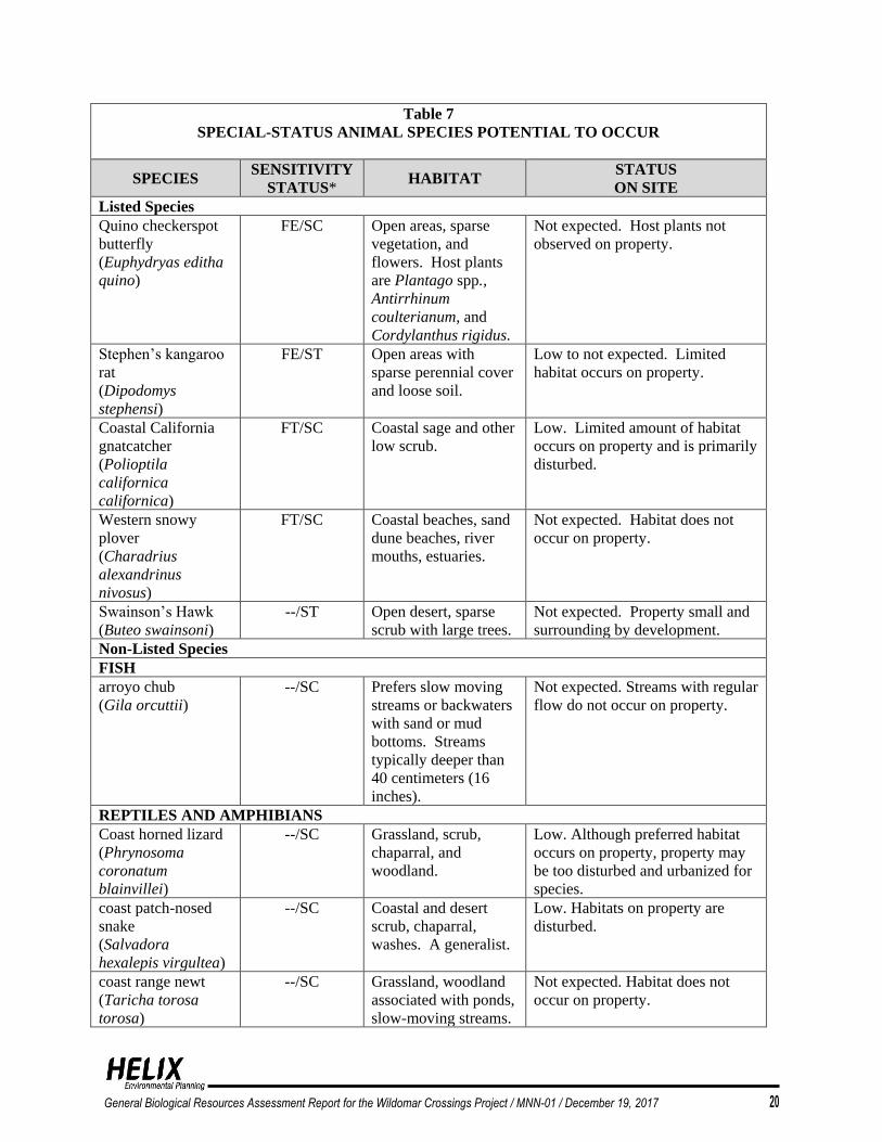
A total of 45 sensitive animal species, five of which are listed at the federal or state level, were
analyzed for their potential to occur (Table 7). The listed species are Quino checkerspot butterfly
(Euphydryas editha quino), Stephens’ kangaroo rat (Dipodomys stephensi), Coastal California
gnatcatcher (Polioptila californica californica), western snowy plover (Charadrius alexandrinus
nivosus), and Swainson’s Hawk (Buteo swainsoni). Two of the listed species have low potential
to occur on the property. The coastal California gnatcatcher is known to occur in Riversidean
sage scrub; however, the scrub on site is sparse, fragmented, disturbed, and too low quality to
support breeding gnatcatchers. Stephens’ kangaroo rat occurs on sparsely vegetated area with
loose soils similar to those on site, but the soils on site are disturbed from disking. Additionally,
the site is somewhat isolated from adjacent open lands due to development. Neither species was
observed, and both species are covered via compliance with the MSHCP and payment of
associated fees.
None of the remaining 40 non-listed species occurs on site. As with the listed species,
compliance with the MSHCP and payment of the associated fees mitigates potential impacts to
the species with potential to occur on site.
General Biological Resources Assessment Report for the Wildomar Crossings Project / MNN-01 / December 19, 2017 20
Table 7
SPECIAL-STATUS ANIMAL SPECIES POTENTIAL TO OCCUR
SPECIES SENSITIVITY
STATUS* HABITAT
STATUS
ON SITE
Listed Species
Quino checkerspot
butterfly
(Euphydryas editha
quino)
FE/SC
Open areas, sparse
vegetation, and
flowers. Host plants
are Plantago spp.,
Antirrhinum
coulterianum, and
Cordylanthus rigidus.
Not expected. Host plants not
observed on property.
Stephen’s kangaroo
rat
(Dipodomys
stephensi)
FE/ST
Open areas with
sparse perennial cover
and loose soil.
Low to not expected. Limited
habitat occurs on property.
Coastal California
gnatcatcher
(Polioptila
californica
californica)
FT/SC Coastal sage and other
low scrub.
Low. Limited amount of habitat
occurs on property and is primarily
disturbed.
Western snowy
plover
(Charadrius
alexandrinus
nivosus)
FT/SC Coastal beaches, sand
dune beaches, river
mouths, estuaries.
Not expected. Habitat does not
occur on property.
Swainson’s Hawk
(Buteo swainsoni)
--/ST Open desert, sparse
scrub with large trees.
Not expected. Property small and
surrounding by development.
Non-Listed Species
FISH
arroyo chub
(Gila orcuttii)
--/SC Prefers slow moving
streams or backwaters
with sand or mud
bottoms. Streams
typically deeper than
40 centimeters (16
inches).
Not expected. Streams with regular
flow do not occur on property.
REPTILES AND AMPHIBIANS
Coast horned lizard
(Phrynosoma
coronatum
blainvillei)
--/SC Grassland, scrub,
chaparral, and
woodland.
Low. Although preferred habitat
occurs on property, property may
be too disturbed and urbanized for
species.
coast patch-nosed
snake
(Salvadora
hexalepis virgultea)
--/SC Coastal and desert
scrub, chaparral,
washes. A generalist.
Low. Habitats on property are
disturbed.
coast range newt
(Taricha torosa
torosa)
--/SC Grassland, woodland
associated with ponds,
slow-moving streams.
Not expected. Habitat does not
occur on property.

General Biological Resources Assessment Report for the Wildomar Crossings Project / MNN-01 / December 19, 2017 21
Table 7 (cont.)
SPECIAL-STATUS ANIMAL SPECIES POTENTIAL TO OCCUR
SPECIES SENSITIVITY
STATUS* HABITAT
STATUS
ON SITE
Non-Listed Species
REPTILES AND AMPHIBIANS
Coastal western
whiptail
(Cnemidophorus
tigris stenjnegeri)
--/SC Open rocky areas with
sparse vegetation,
usually scrub or
grassland.
Low to moderate. Limited amount
of habitat occurs on property.
Bell’s sage sparrow
(Amphispiza belli
belli)
--/SC Evenly spaced sage
scrub.
Low. Limited habitat occurs on
property.
Black crowned night
heron
(Nycticorax
nycticorax)
--/--
State Rank S4
Marshes, ponds,
estuaries, and other
like habitats.
Not expected. Preferred habitat
does not occur on property.
California horned
lark
(Eremophila
alpestris actia)
--/SC Grassland, agriculture
fields, and disturbed
fields.
Moderate. Property contains
preferred habitat.
Northern red-
diamond rattlesnake
(Crotalus ruber)
--/SC Heavy brush,
boulders, can use a
variety of habitats;
prey density
determining factor.
Low. Limited amount of habitat
occurs on property.
Orange-throated
whiptail
(Cnemidophorus
hyperthrus)
--/WL Chaparral, sage scrub,
grassland, woodland,
and riparian areas.
Moderate. Habitat present on
property.
two-striped garter
snake
(Thanmophis
hammondii)
--/SC Stream course with
adjacent dense
vegetation.
Low. Habitat occur on south edge
of property, but stream has no flow
most of year.
Western spadefoot
(scaphiopus
hammondii)
--/SC Grassland, sage scrub,
or occasionally
chaparral; standing
water, puddles, vernal
pools, needed for
reproduction.
Not expected. No vernal pools
occur on property.
Rosy boa
(Lichanura
trivirgata)
--/-- Chaparral, desert
scrub, and sage scrub;
prefers rocky areas.
Low to not expected. Limited
habitat, no rock outcrops.
Coronado skink
(Eumeces
skiltonianus
interparietalis)
--/-- Mesic pockets in sage
scrub, chaparral, and
woodlands.
Low. Limited amount of habitat
occurs on property.

General Biological Resources Assessment Report for the Wildomar Crossings Project / MNN-01 / December 19, 2017 22
Table 7 (cont.)
SPECIAL-STATUS ANIMAL SPECIES POTENTIAL TO OCCUR
SPECIES SENSITIVITY
STATUS* HABITAT
STATUS
ON SITE
Non-Listed Species
REPTILES AND AMPHIBIANS
Western pond turtle
(Clemmys
marmorata pallida)
--/SC Slow moving stream,
ponds, reservoirs, and
other water bodies
deeper than 6 feet with
logs or other
submerged cover.
Not expected. No deep pools or
perennial streams occur on
property.
BIRDS
coastal cactus wren
(Campylorhynchus
brunneicapillus
sandiegensis)
--/SC Scrub, desert thickets,
and areas with large
branching cacti.
Not expected. Habitat does not
occur.
Cooper’s hawk
(Accipiter cooperii)
--/SC Forest and woodland
habitats; will forage in
grasslands.
Moderate. Property contains
preferred habitat.
Ferruginous hawk
(Buteo regalis)
--/SC Large areas of open
grassland or shrub
with elevated nest
sites.
Not expected. Property small and
surrounding by development.
Species uncommon.
Golden eagle
(Aquila chrysaetos)
--/SC Open country, prefers
mountains or hills.
Not expected. Habitat not present.
Species avoids populated areas.
loggerhead shrike
(Lanius
ludovicianus)
--/SC Open grassland or
shrubland with trees,
utility poles, fence
post, or other perch
sites.
Low. Habitat occurs on property,
but property is small and
surrounded by development.
Northern harrier
(Circus cyaneus)
--/SC Meadows, grassland,
scrub, rarely in
woodland; roosts on
ground.
Low. Foraging habitat occurs on
property. Species uncommon.
Southern California
rufous crowned
sparrow
(Aimophila ruficeps
canescens)
--/SC Hillsides, with
grassland, sage scrub,
or chaparral.
Moderate. Habitat present on
property.
Tricolored blackbird
(Agelaius tricolor)
--/SC Wetland with dense
cattails, tall grasses, or
thickets of willows.
Not expected. Riparian habitat
present not typical for species.
white-faced ibis
(Plegadis chihi)
--/SC Shallow marshes,
spoils banks,
meadows, marshes.
Not expected. Habitat not present.
White-tailed kite
(Elanus leucurus)
--/--
State Rank S3S4
Fully Protected
Grassland, agriculture
with nearby woodland
for nesting.
Moderate. Nesting and foraging
habitats present.

General Biological Resources Assessment Report for the Wildomar Crossings Project / MNN-01 / December 19, 2017 23
Table 7 (cont.)
SPECIAL-STATUS ANIMAL SPECIES POTENTIAL TO OCCUR
SPECIES SENSITIVITY
STATUS* HABITAT
STATUS
ON SITE
BIRDS
Yellow breasted
chat
(Icteria virens)
--/SC Wide riparian
woodland, dense
willow thickets, with
well-developed
understory.
Not expected. Riparian habitat not
dense or well developed.
MAMMALS
Dulzura pocket
mouse
(Chaetodipus
californicus
femoralis)
--/SC Grassland and
chaparral ecotone,
sage scrub.
Not expected. No ecotone on
property. Sage scrub disturbed and
property surrounding by
development.
Los Angeles pocket
mouse
(Perognathus
longimembris
brevinasus)
--/SC Fine sandy soils with
sparse vegetation.
Low. Habitat is present, but
disturbed.
Northwestern San
Diego pocket mouse
(Chaetodipus fallax
fallax)
--/SC Sage scrub, grassland,
and sandy soils.
Low. Some grassland and sandy
soils occur on property but are
disturbed from disking.
Pallid bat
(Antrozous pallidus)
--/SC Coniferous forests,
various woodlands,
deserts, and rocky
terrain.
Not expected. Habitat does not
occur on property.
San Diego black-
tailed jackrabbit
(Lepus
califonrinicus
bennettii)
--/SC Primarily open scrub
with short grasses.
Moderate. Habitat present on
property.
San Diego desert
woodrat
(Neotoma lepida)
--/SC Scrub and desert, rock
outcrops, or areas of
dense cover.
Low to not expected. Limited
amount of habitat occurs on
property.
western mastiff bat
(Eumops perotis
californicus)
--/SC Rocky areas, cliff
faces, known to roost
in buildings.
Not expected. Habitat not present.
western yellow bat
(Lasiurus xanthinus)
--/SC Desert grassland and
scrub with an
associated water
feature.
Not expected. Habitat not present.
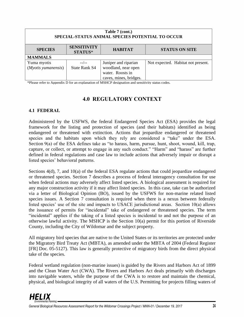
General Biological Resources Assessment Report for the Wildomar Crossings Project / MNN-01 / December 19, 2017 24
Table 7 (cont.)
SPECIAL-STATUS ANIMAL SPECIES POTENTIAL TO OCCUR
SPECIES SENSITIVITY
STATUS* HABITAT STATUS ON SITE
MAMMALS
Yuma myotis
(Myotis yumanensis)
--/--
State Rank S4
Juniper and riparian
woodland, near open
water. Roosts in
caves, mines, bridges.
Not expected. Habitat not present.
*Please refer to Appendix D for an explanation of MSHCP designation and sensitivity status codes.
4.0 REGULATORY CONTEXT
4.1 FEDERAL
Administered by the USFWS, the federal Endangered Species Act (ESA) provides the legal
framework for the listing and protection of species (and their habitats) identified as being
endangered or threatened with extinction. Actions that jeopardize endangered or threatened
species and the habitats upon which they rely are considered a “take” under the ESA.
Section 9(a) of the ESA defines take as “to harass, harm, pursue, hunt, shoot, wound, kill, trap,
capture, or collect, or attempt to engage in any such conduct.” “Harm” and “harass” are further
defined in federal regulations and case law to include actions that adversely impair or disrupt a
listed species’ behavioral patterns.
Sections 4(d), 7, and 10(a) of the federal ESA regulate actions that could jeopardize endangered
or threatened species. Section 7 describes a process of federal interagency consultation for use
when federal actions may adversely affect listed species. A biological assessment is required for
any major construction activity if it may affect listed species. In this case, take can be authorized
via a letter of Biological Opinion (BO), issued by the USFWS for non-marine related listed
species issues. A Section 7 consultation is required when there is a nexus between federally
listed species’ use of the site and impacts to USACE jurisdictional areas. Section 10(a) allows
the issuance of permits for “incidental” take of endangered or threatened species. The term
“incidental” applies if the taking of a listed species is incidental to and not the purpose of an
otherwise lawful activity. The MSHCP is the Section 10(a) permit for this portion of Riverside
County, including the City of Wildomar and the subject property.
All migratory bird species that are native to the United States or its territories are protected under
the Migratory Bird Treaty Act (MBTA), as amended under the MBTA of 2004 (Federal Register
[FR] Doc. 05-5127). This law is generally protective of migratory birds from the direct physical
take of the species.
Federal wetland regulation (non-marine issues) is guided by the Rivers and Harbors Act of 1899
and the Clean Water Act (CWA). The Rivers and Harbors Act deals primarily with discharges
into navigable waters, while the purpose of the CWA is to restore and maintain the chemical,
physical, and biological integrity of all waters of the U.S. Permitting for projects filling waters of

General Biological Resources Assessment Report for the Wildomar Crossings Project / MNN-01 / December 19, 2017 25
the U.S. (including wetlands and vernal pools) is overseen by the USACE under Section 404 of
the CWA. Projects may be permitted on an individual basis or may be covered under one of
several approved Nationwide Permits. Individual Permits are assessed individually based on the
type of action, amount of fill, etc. A CWA Section 401 Water Quality Certification, which is
administered by the RWQCB, must be issued prior to any 404 Permit. Impacts to waters of the
U.S. would result in a need for both a USACE 404 permit and a RWQCB 401 certification.
4.2 STATE
The California ESA is similar to the federal ESA in that it contains a process for listing of
species and regulating potential impacts to listed species. Section 2081 of the California ESA
authorizes the CDFW to enter into a memorandum of agreement for the take of listed species for
scientific, educational, or management purposes. The MSHCP is the regional 2081 for this
portion of Riverside County, including the subject property.
State Fully Protected species may not be taken or possessed at any time and no state licenses or
permits may be issued for their take except for collecting these species necessary for scientific
research and relocation of the bird species for the protection of livestock (CFG Code Sections
3511, 4700, 5050, and 5515).
The Native Plant Protection Act (NPPA) enacted a process by which plants are listed as rare or
endangered. The NPPA regulates the collection, transport, and commerce of listed plants.
The California ESA follows the NPPA and covers both plants and animals that are determined to
be endangered or threatened with extinction. Plants listed as rare under NPPA were designated
threatened under the California ESA.
CFG Code Sections 1600 et seq. requires an agreement with CDFW for projects affecting
riparian and wetland habitats through the issuance of a Streambed Alteration Agreement (SAA).
CFG Code Sections 3503, 3503.5, and 3800 prohibit the take or possession of birds, their nests,
or eggs. Disturbance that causes nest abandonment and/or loss of reproductive effort (killing or
abandonment of eggs or young) is considered a take. Such a take would also violate federal law
protecting migratory birds. Incidental Take Permits are required from the CDFW for projects that
may result in the incidental take of species listed by the state as endangered, threatened, or
candidate species. The wildlife agencies require that impacts to protected species be minimized
to the extent possible and mitigated to a level of insignificance.
The California Natural Community Conservation Planning Act of 1991 is designed to conserve
habitat-based natural communities at the ecosystem scale while accommodating compatible land
uses in coordination with California ESA. The CDFW is the principal state agency implementing
the Natural Community Conservation Planning (NCCP) program. The Act established a process
to allow for comprehensive, long-term, regional, multi-species, and habitat-based planning in a
manner that satisfies the requirements of the state and federal ESAs (through a companion
regional habitat conservation plan). The NCCP program has provided the framework for
innovative efforts by the state, local governments, and private interests to plan for the protection
of regional biodiversity and the ecosystems upon which they depend. The NCCP program seek

General Biological Resources Assessment Report for the Wildomar Crossings Project / MNN-01 / December 19, 2017 26
to ensure the long-term conservation of multiple species, while allowing for compatible and
appropriate economic activity to proceed. The MSHCP was prepared as part of regional planning
pursuant to the NCCP Act.
4.3 WESTERN RIVERSIDE MULTIPLE SPECIES HABITAT CONSERVATION PLAN
The MSHCP is a comprehensive multi-jurisdictional effort that includes Riverside County and
multiple cities, including the City of Corona in western Riverside County. Rather than address
sensitive species on an individual basis, the MSHCP focuses on the conservation of 146 species,
proposing a reserve system of approximately 500,000 acres and a mechanism to fund and
implement the reserve system (Dudek 2003). Most importantly, the MSHCP allows participating
entities to issue take permits for listed species so that individual applicants need not seek their
own permits from the USFWS and/or CDFW. The MSHCP was adopted on June 17, 2003, by
the Riverside County Board of Supervisors. The Incidental Take Permit was issued by both the
USFWS and CDFW on June 22, 2004. As this property is in the City of Corona, the City is the
lead agency/permittee.
As noted above, the project is located within the Elsinore Area Plan of the MSHCP. The
property is not within a criteria cell or cell group and, therefore, also not within a subunit of the
Elsinore Area Plan. The site is required to show MSHCP compliance through specific habitat
assessments, applicable biological surveys, and the provision of an MSHCP compliance analysis.
Additionally, the property is not within a cell and is, therefore, not targeted for conservation that
would contribute to the assembly of the MSHCP reserve.
5.0 IMPACTS
This section describes potential direct and indirect impacts associated with the proposed project.
Direct impacts immediately alter the affected biological resources such that those resources are
eliminated temporarily or permanently. Indirect impacts consist of secondary effects of a project
including noise, decreased water quality (e.g., through sedimentation, urban contaminants, or
fuel release), fugitive dust, colonization of non-native plant species, animal behavioral changes,
and night lighting. The magnitude of an indirect impact can be the same as a direct impact;
however, the effect usually takes a longer time to become apparent.
According to Appendix G of the California Environmental Quality Act (CEQA) Guidelines,
project impacts to biological resources would be considered significant if they would:
• Have a substantial adverse effect, either directly or through habitat modifications, on any
special status species in local or regional plans, policies, or regulations, or by the CDFW
and or USFWS.
• Have a substantial adverse effect on federally protected wetlands as defined by
Section 404 of the CWA (including, but not limited to, marsh, vernal pool, coastal, etc.)
through direct removal, filling, hydrological interruption, or other means.

General Biological Resources Assessment Report for the Wildomar Crossings Project / MNN-01 / December 19, 2017 27
• Interfere substantially with the movement of any native resident or migratory fish or
wildlife species or with established native resident or migratory wildlife corridors, or
impede the use of native wildlife nursery sites.
• Conflict with any local policies or ordinances protecting biological resources, such as a
tree preservation policy or ordinance.
• Conflict with the provisions of an adopted Habitat Conservation Plan, Natural
Community Conservation Plan, or other approved local, regional, or state habitat
conservation plan.
5.1 VEGETATION COMMUNITIES
The project proposes to impact approximately 3.6 acres that consist of 3.4 acres on site and
0.2 acre off site (Figure 7; Table 8). The impacts comprise 0.02 acre of southern willow scrub,
0.02 acre of rip-rap, 0.004-acre eucalyptus woodland (riparian-streambed) 0.2 acre of
Riversidean sage scrub, 0.7 acre of Riversidean sage scrub-disturbed, 0.06 acre of eucalyptus
woodland-upland, 1.8 acres of non-native grassland, 0.07 acre of non-native grassland-rumex
dominated, and 0.5 acre of developed. The developed impacts include 0.2 acre of
off-site impacts.
Table 8
IMPACTS TO VEGETATION COMMUNITIES
HABITAT EXISTING
ACRES
PROPOSED
IMPACTS1 AVOIDED
On-site Off-site
Riparian/Wetland
Southern Willow Scrub 0.08 0.02 0 0.06
Coast Live Oak Woodland 0.03 0 0 0.03
Eucalyptus Woodland-Riparian 0.07 <0.01 0 0.07
Developed-Rip/Rap 0.02 0.02 0 0.00
Subtotal 0.20 0.04 0 0.16
Upland
Riversidean sage scrub 0.2 0.2 0 0
Riversidean sage scrub-disturbed 0.7 0.7 0 0
Eucalyptus Woodland 0.1 0.06 0 0.04
Non-native Grassland
(including Rumex-dominated) 2.0 1.9 0 0.1
Developed 1.2 0.5 0.2 0.7
Subtotal 4.2 3.36 0.2 0.84
TOTAL 4.4 3.4 0.2 1.0 1Existing acres rounded to nearest 0.1 except for wetlands rounded to nearest 0.01. Impacts of less than 0.5 acre are all rounded
to 0.01 acre due to small size of impacts.
Under CEQA, impacts to certain sensitive natural communities (Riversidean sage scrub) and
riparian habitats (southern willow scrub, coast live oak woodland) are considered significant.

General Biological Resources Assessment Report for the Wildomar Crossings Project / MNN-01 / December 19, 2017 28
5.2 JURISDICTIONAL WATERS AND WETLANDS
5.2.1 Potential USACE/RWQCB Jurisdiction
As currently planned, the project proposes impacts to 0.001 acre of waters of the U.S./State
(Figure 8; Table 9). The impacts consist entirely of non-wetland waters of the U.S./State.
Table 9
IMPACTS TO WATERS OF THE U.S./STATE
USACE/RWQCB
JURISDICTION
EXISTING
ACRES*
PROPOSED
IMPACTS*
LINEAR
FEET OF
IMPACTS
AVOIDED*
Wetland Waters of the U.S./State
Southern Willow Scrub 0.01 0 0 0.01
Subtotal 0.01 0 0 0.01
Non Wetland Waters of the U.S./State
Streambed 0.02 0.002 39 0.018
Sheet flow 0.02 0.02 248 0
Subtotal 0.04 0.022 25 0.018
TOTAL 0.05 0.022 287 0.028 *Acreage for wetlands rounded to nearest 0.01. Impacts of less than 0.01 acre are all rounded to 0.001 acre due to small size
of impacts.
Impacts to waters of the U.S./State will require a Section 404 permit from the USACE and a
Section 401 water quality certification from the RWQCB.
5.2.2 Potential CDFW Jurisdiction
The project proposes impacts to 0.06-acre waters of the State: 0.02 acre of southern willow
scrub, 0.02-acre sheet flow, and 0.02 acre of developed-rip/rap streambed (Figure 9: Table 10).
Table 10
IMPACTS TO CDFW JURISDICTION1
CDFW JURISDICTION EXISTING
ACRES
PROPOSED
IMPACTS AVOIDED
Riparian
Southern willow scrub 0.08 0.02 0.06
Coast live oak woodland 0.03 0 0.03
Eucalyptus woodland 0.07 0.004 0.07
Subtotal 0.18 0.02 0.16
Unvegetated Streambed
Developed/rip-rap 0.02 0.02 0.0
Drainage pattern, Sheet flow 0.02 0.02 0
Subtotal 0.04 0.04 0.0
TOTAL 0.22 0.06 0.16 1Acreage rounded to nearest 0.01, except when item is less than 0.01

General Biological Resources Assessment Report for the Wildomar Crossings Project / MNN-01 / December 19, 2017 29
Impacts to areas determined to be under CDFW jurisdiction may require a CDFW SAA.
5.3 MSHCP CONSISTENCY ANALYSIS
The purpose of this section is to provide an analysis of the project with respect to compliance
with biological resources aspects of the MSHCP.
The project was evaluated for consistency with the following MSHCP issue areas:
• MSHCP Reserve Assembly requirements;
• Section 6.1.2 (Protection of Species Associated with Riparian/Riverine Areas and
Vernal Pools);
• Section 6.1.3 (Protection of Narrow Endemic Plant Species);
• Section 6.1.4 (Guidelines Pertaining to the Urban/Wildlands Interface);
• Section 6.3.2 (Additional Survey Needs and Procedures); and
• Section 6.4 (Fuels Management).
The discussions below provide a summary demonstrating how the project is consistent with
MSHCP requirements for each of the above-listed issue areas.
5.4.1 MSHCP Reserve Assembly Requirements
The project site is not located within a Cell or Cell Group and does not have target goals for
conservation. The project site does not include land conservation requirements to contribute to
the MSHCP reserve assembly. No sensitive species were determined to occupy the site that
would warrant conservation.
5.4.2 MSHCP Section 6.1.2 Protection of Species Associated with Riparian/Riverine
Areas and Vernal Pools
Section 6.1.2, Protection of Species Associated with Riparian/Riverine Areas and Vernal Pools,
states:
The purpose of the procedures described in this section is to ensure that the
biological functions and values of these areas throughout the MSHCP Plan Area
are maintained such that Habitat values for species inside the MSHCP
Conservation Area are maintained.
The project site supports 0.22 acre of Riparian/Riverine Areas consisting of 0.02-acre drainage
pattern (sheet flow) and 0.20 acre in the southern corner associated with an unnamed tributary to
Murrieta Creek (Figure 7). The habitat comprises 0.08 acre of low-quality southern willow scrub,
0.03 acre of coast live oak woodland, 0.07 acre of eucalyptus woodland, and 0.02-acre rip-rap
streambed. No Section 6.1.2 Riparian/Riverine Area species have potential to occur. As
discussed above, no sensitive species were determined to occupy the Riparian/Riverine Areas.
No vernal pools occur on the property.

General Biological Resources Assessment Report for the Wildomar Crossings Project / MNN-01 / December 19, 2017 30
5.4.3 MSHCP Section 6.1.3 Protection of Narrow Endemic Plant Species
The project is not within a survey area for NEPSSA species. No surveys are required.
5.4.4 MSHCP Section 6.1.4 Guidelines Pertaining to the Urban/Wildlands Interface
Section 6.1.4 of the MSHCP addresses potential indirect impacts to MSHCP Conservation Area
lands via the Urban/Wildlands Interface Guidelines (UWIG). The project site does not occur
adjacent to an MSHCP Conservation Area. The project is not within or adjacent to a MSHCP
criteria cell. The UWIG guidelines are discussed to show how the project will reduce/prevent
potential impacts to off-site conservation areas.
Drainage
Although the project does not directly drain into an MSHCP Conservation Area, flows from the
site could ultimately reach a Conservation Area. The project will incorporate measures, including
those required through the National Pollutant Discharge Elimination System (NPDES)
requirements, to ensure that the quantity and quality of runoff discharged to the MSHCP
Conservation Area (tributaries to Murrieta Creek) is not altered in an adverse way when
compared with existing conditions. In particular, measures will be put in place to avoid discharge
of untreated surface runoff from the project into the MSHCP Conservation Area. The project
shall be designed to prevent the release of toxins, chemicals, petroleum products, exotic plant
materials, or other elements that might degrade or harm biological resources or ecosystem
processes within the MSHCP Conservation Area. Specifically, the project proposes to include a
basin adjacent to the Stable Lanes culvert and a basin in the southeast (to the north of and outside
of the existing riparian habitat) adjacent to Clinton Keith Road. Regular maintenance shall occur
to ensure effective operations of runoff control systems. Adjustments may be made to these
measures in the final project design.
Toxics
Land uses proposed in proximity to the potential sensitive species’ habitat that use chemicals or
generate bio-products such as oil from roads and cars that are potentially toxic or may adversely
affect wildlife species, habitat, or water quality shall incorporate measures to ensure that the
application of such chemicals does not result in discharge to the potential sensitive species’
habitat. Measures such as those employed to address drainage issues shall be implemented to
ensure no indirect impacts from toxic substances occur to species or their habitat.
Lighting
The project does not occur close to a conservation area; therefore, this does not apply.

!(
!(
!(!(
Clinton Keith Road
Stable Lanes Road
SP4SP3
SP2
SP1Culvert
Culvert
I:\P
RO
JEC
TS
\M\M
NN
\MN
N-0
1_W
ildom
arC
ross
ings\
Map\G
BR
A\F
ig8_U
SA
CE
_Im
pact
s.m
xd M
NN
-01 1
0/2
4/2
016 -
RK
Figure 8
WILDOMAR CROSSINGSUSACE/RWQCB Jurisdiction
0 100FeetN
Project Site
Impact Area
!( Sampling Point
Riprap
Non-wetland Waters of the U.S./StateStreambed
Wetland Waters of the U.S./StateSouthern Willow Scrub

Clinton Keith Road
Stable Lanes Road
Culvert
Culvert
I:\P
RO
JEC
TS
\M\M
NN
\MN
N-0
1_W
ildom
arC
ross
ings\
Map\G
BR
A\F
ig9_C
DF
W_Im
pacts
.mxd M
NN
-01 1
0/2
4/2
016 -
RK
Figure 9
WILDOMAR CROSSINGSCDFW Jurisdiction and Riparian/Riverine Areas
0 100FeetN
Project Site
Impact Area
Riprap
Riparian-Vegetated StreambedSouthern Willow Scrub
Coast Live Oak Woodland
Eucalyptus Woodland

General Biological Resources Assessment Report for the Wildomar Crossings Project / MNN-01 / December 19, 2017 31
Invasives
The project shall not use invasive plants for erosion control, landscaping, wind rows, or other
purposes. The project will comply with the MSHCP and avoid the use of invasive, non-native
plants in accordance with MSHCP Table 6.2.
Barriers
The project site is not anticipated to directly abut MSHCP Conservation Area, therefore, this
does not apply. However, the project does propose to install a fence and signage around the
avoided Riparian/Riverine habitat located in the southern portion of the property.
Grading/Land Development
The project site is not anticipated to directly abut MSHCP Conservation Area, therefore, this
does not apply.
5.4.5 MSHCP Section 6.3.2 Additional Survey Needs and Procedures
Burrowing Owl
The MSHCP requires a habitat assessment and survey if burrowing habitat occurs on site. The
project site was determined to have low potential for BUOW. Focused protocol BUOW surveys
were conducted in 2009 and 2016 with negative results. No impacts are expected to occur to
BUOW. Pre-construction take avoidance surveys are proposed in accordance with
MSHCP requirements.
Least Bell’s Vireo
The MSHCP requires that LBV surveys be conducted on project sites that include riparian
habitat with potential to support the species. The project site does not support riparian habitat
with potential to support the species. The project also proposes only 0.01 acre of impacts and
0.17 acre of avoidance of Riparian/Riverine habitats on the property.
Based on the negative surveys for BUOW and LBV, the project is consistent with MSHCP
Section 6.3.2.
5.4.6 MSHCP Section 6.4 Fuels Management
The fuel modification zone is included within the project impact limits and will not extend into
undeveloped land adjacent to the project that has potential to support sensitive species. The
proposed project is consistent with Section 6.4 of the MSHCP.

General Biological Resources Assessment Report for the Wildomar Crossings Project / MNN-01 / December 19, 2017 32
5.5 NESTING BIRDS
Development of the proposed project could disturb or destroy active migratory bird nests
including eggs and young. Disturbance to or destruction of migratory bird eggs, young, or adults
is in violation of the MBTA and is, therefore, considered to be a potentially significant impact.
6.0 AVOIDANCE, MINIMIZATION, AND MITIGATION MEASURES
6.1 SENSITIVE SPECIES
6.1.1. Burrowing Owl
To ensure the project does not result in indirect impacts to BUOWs potentially occurring off site
within the 500-foot-wide buffer, pre-construction surveys should be conducted in accordance
with mitigation measure BIO 1.
BIO 1: Pre-Construction BUOW Survey and Avoidance. Within 30 days prior to
initiating ground-disturbance activities, the project applicant shall retain a
qualified biologist to complete a pre-construction take avoidance survey in
accordance with the MSHCP. If the take avoidance survey is negative and
BUOWs are confirmed to be absent, then ground-disturbing activities shall be
allowed to commence, and no further mitigation would be required.
If the survey is positive and BUOWs are confirmed to be present, the project
applicant shall consult with the CDFW and prepare and implement a
project-specific BUOW mitigation plan. The plan shall be reviewed and approved
by the CDFW. To avoid take, any impacted individuals shall be relocated outside
of the impact area by a qualified biologist using passive or active methodologies
approved by CDFW. The project applicant shall further mitigate BUOW-occupied
habitat in accordance with the MSHCP.
6.1.2 Nesting Birds
Implementation of mitigation measure BIO 2 would ensure that potential impacts to birds
protected under the MBTA and CFG Code are avoided during project construction.
BIO 2: Pre-Construction Nesting Bird Survey and Avoidance. Vegetation clearing
should be conducted outside the nesting season, which is generally defined as
January 15 to August 31. If vegetation clearing must take place during the nesting
season, a qualified biologist shall be retained to perform a pre-construction survey
for nesting birds. A pre-construction nesting bird survey would not be required
unless direct impacts to vegetation are proposed to occur. The nesting bird survey
shall occur no more than seven days prior to vegetation removal.
If active bird nests are confirmed to be present during the pre-construction survey,

General Biological Resources Assessment Report for the Wildomar Crossings Project / MNN-01 / December 19, 2017 33
temporary avoidance of the nests shall be required until a qualified biologist has
verified that the young have fledged, or the nest has otherwise become inactive.
6.2 RIPARIAN/RIVERINE AREAS
The project proposes impacts to 0.04 acre of Riparian/Riverine habitat in the form of 0.02-acre
sheet flow (streambed), and 0.02-acre low-quality southern willow scrub. The project also
proposes impacts to 0.02 acre of rip/rap streambed. These impacts are relatively minimal.
Impacts will require the completion of a DBESP. The DBESP will provide the details of the
impacts and mitigation, and will be completed under separate documentation. The conceptual
mitigation proposal is provided herein. Table 11 below provides a summary of the proposed
impacts and mitigation for Riparian/Riverine habitat.
Table 11
IMPACTS TO RIPARIAN/RIVERINE AREAS AND PROPOSED MITIGATION
HABITAT EXISTING
ACRES
PROPOSED
IMPACTS
ON-SITE AVOIDANCE
/ PRESERVATION
OFF-SITE
MITIGATION
CREDITS/RATIO
Riparian
Southern
willow scrub 0.08 0.02 0.06 0.06/3:1
Coast live oak
woodland 0.03 0 0.03 0
Eucalyptus
woodland 0.07 0.004 0.07 0.01/2:1
Riverine
(sheet flow) 0.02 0.02 0 0.04/2:1
Rip/Rap
Streambed 0.02 0.02 0 0
TOTAL 0.20 0.04 0.16 0.11
The mitigation proposed above for impacts to Riparian/Riverine habitat also is also proposed to
satisfy mitigation obligations for impacts to wetland waters of the U.S./State pending approval
during the permitting process.
Implementation of mitigation measure BIO 3 would reduce impacts on Riparian/Riverine habitat
to less than significant.
BIO 3: Compensatory Mitigation. A total of 0.16 acre of Riparian/Riverine habitat,
including 0.06 acre of southern willow scrub, shall be avoided and placed within
open space on site. The open space is proposed to be protected by a restrictive
covenant to be held with the land in perpetuity. Compliance monitoring and as
needed maintenance is to be conducted by Urban Corps. The property is
proposed to be divided into lots with the avoided habitat comprising one of the
lots. This lot is proposed to be protected by fencing, with signage in accordance
the MSHCP. The specific fencing to be used will be incorporated in the final
project plans/landscaping documents. The impacts to 0.02 acre rip/rap streambed
General Biological Resources Assessment Report for the Wildomar Crossings Project / MNN-01 / December 19, 2017 34
will be mitigation in kind on site at 1:1. To compensate for the loss of 0.02 acre
of southern willow scrub, 0.02 acre sheet flow and a 0.004 acre of eucalyptus
vegetated streambed, the project applicant shall purchase 0.11 acre of In-Lieu Fee
(ILF) rehabilitation credits from the Riverside Corona Resource Conservation
District (RCRCD), Riverpark Bank (approval anticipated in early 2018), or other
approved mitigation bank in consultation with the Regional Conservation
Authority (RCA), USACE, RWQCB, and CDFW.
Additional measures to be employed to prevent impacts to the avoided waters include:
• Standard Best Management Practices (BMPs) will be used to prevent the impacts
during construction.
• Construction-related equipment will be stored in upland areas, outside of drainages.
• Source control and treatment control BMPs will be implemented to minimize the
potential contaminants that are generated during the operation of the facility. Source
control BMPs include landscape planning, roof runoff controls, trash storage areas, and
education of future tenants. Treatment control BMPs include detention basins, vegetated
swales (bio-swales), and vegetated buffers. Water quality BMPs will be implemented
throughout the project to capture and treat contaminants (see also Section 5.6.1 above).
• To avoid attracting predators during construction, the project shall be kept clean of debris
to the extent possible. All food-related trash items shall be enclosed in sealed containers
and regularly removed from site.
• Employees shall strictly limit their activities, vehicles, equipment, and construction
material to the proposed project footprint, staging areas, and designated routes of travel.
• Project impact limits shall be fenced with orange snow screen and exclusion fencing
should be maintained until the completion of construction activities.
• A restrictive covenant shall be placed over the Riparian/Riverine areas and adjacent
upland buffers prior to initiating work on the site.
6.3 NON-NATIVE INVASIVE SPECIES RESTRICTIONS
In accordance with the MSHCP, no species on List 6.2 of the MSHCP shall be utilized on the
site (including any hydroseed mix used for interim erosion control) for consistency with
Section 6.1.4 of the MSHCP.
6.4 MSHCP MITIGATION FEE
As mentioned above, the project is subject to the MSHCP fee. The applicant shall pay MSHCP
Local Development Mitigation fees as determined by the City. The fee schedule is adjusted
annually by the Western Riverside County RCA and was recently adjusted. When multiple uses

General Biological Resources Assessment Report for the Wildomar Crossings Project / MNN-01 / December 19, 2017 35
are proposed, the commercial per acre fee is used. The current fee is $6,914 per acre for
industrial or commercial uses (RCA 2017). The residential development fee currently ranges
from $1,056 to $2,031 per dwelling unit depending on the density per acre.
6.5 STEPHENS’ KANGAROO RAT HCP FEE
The project is also within the Stephens’ kangaroo rat fee area and is subject to the Stephens’
kangaroo rat fee of $500 per acre (County 1996).

General Biological Resources Assessment Report for the Wildomar Crossings Project / MNN-01 / December 19, 2017 36
7.0 CERTIFICATION/QUALIFICATION
I hereby certify that the statements furnished above and in the attached exhibits present the data
and information required for this biological evaluation, and that the facts, statements, and
information presented are true and correct to the best of my knowledge and belief.
DATE: October 19, 2017 SIGNED:
Karl L. Osmundson
Biology Group Manager
HELIX Environmental Planning, Inc.
Fieldwork Performed By:
Robert Hogenauer
Biologist, HELIX Environmental Planning, Inc.
B.S., Biology, California State Polytechnic University, 2004
Benjamin Rosenbaum
Biologist, HELIX Environmental Planning, Inc.
B.S. Biology, Ecology Emphasis, San Diego State University, 2009
General Biological Resources Assessment Report for the Wildomar Crossings Project / MNN-01 / December 19, 2017 37
8.0 REFERENCES
American Ornithologists’ Union. 2015. AOU Checklist of North and Middle America Birds.
Online: http://checklist.aou.org.
Baker, R.J., et al. 2003. Natural Science Research Laboratory at the Museum of Texas Tech
University. Occasional papers Revised Checklist of North American Mammals North of
Mexico. December 1.
Baldwin, B.G., D.H. Goldman, D.J. Keil, R. Patterson, T.J. Rosatti, and D.H. Wilken, editors.
2012. The Jepson Manual: Vascular Plants of California, second edition. University of
California Press, Berkeley.
California Department of Fish and Wildlife (CDFW) California Natural Diversity Database
(CNDDB). 2016a. RareFind 5 [https://map.dfg.ca.gov/rarefind/view/RareFind.aspx#].
California Department of Fish and Wildlife Data updated April 1.
2016b. California Department of Fish and Wildlife (CDFW). State and Federally Listed
Endangered and Threatened Animals of California. State of California, The Resources
Agency, Department of Fish and Game Biogeographic Data Branch. Available at:
http://www.dfg.ca.gov/biogeodata/cnddb/pdfs/TEAnimals.pdf. April.
2016c. California Department of Fish and Wildlife (CDFW). Special Animals. State of
California, The Resources Agency, Department of Fish and Game Biogeographic Data
Branch. Available at: http://www.dfg.ca.gov/whdab/pdfs/SPanimals.pdf. April.
2016d. California Department of Fish and Wildlife (CDFW). State and Federally Listed
Endangered, Threatened, and Rare Plants of California. State of California, The
Resources Agency, Department of Fish and Game Habitat Conservation Division,
Wildlife & Habitat Data Analysis Branch. Available at:
http://www.dfg.ca.gov/whdab/pdfs/TEPlants.pdf. April.
California Native Plant Society (CNPS) Rare Plant Program. 2016. Inventory of Rare and
Endangered Plants. Online edition, v8-02. Available at: http://cnps.web.aplus.net/cgi-
bin/inv/inventory.cgi. Updated quarterly. Accessed 28 April 2016.
County of Riverside Environmental Programs Department. 2006. Burrowing Owl Survey
Instructions for the Western Riverside Multiple Species Habitat Conservation Plan Area.
URL: http://www.tlma.co.riverside.ca.us/epd/documents/Burrowing_Owl_Survey_
Instructions.pdf. March 29.
1996. Ordinance 663.10. An Ordinance of the County of Riverside Amending
Ordinance No. 663 Establishing the Riverside County Stephens’ Kangaroo Rat Habitat
Conservation Plan, Plan Fee Assessment Area and Setting Mitigation Fees.

General Biological Resources Assessment Report for the Wildomar Crossings Project / MNN-01 / December 19, 2017 38
Dudek and Associates. 2003. Western Riverside County Multiple Species Habitat Conservation
Plan (MSHCP). Final MSHCP, Volume I. Prepared for the County of Riverside
Transportation and Land Management Agency. Approved June 17.
Environmental Laboratory. 1987. USACE of Engineers Wetlands Delineation Manual. Technical
Report Y-87-1. U.S. Army Engineer Waterways Experiment Station, Vicksburg,
Mississippi. 100 pp. with Appendices.
Emmel, T.C. and J.F. Emmel. 1973. The Butterflies of Southern California. Natural History
Museum of Los Angeles County, Science Series 26: 1-148.
HELIX Environmental Planning Inc. 2016a. Jurisdictional Delineation conducted for the
Wildomar Crossings Project.
2016b. Focused Burrowing Owl Survey for the Wildomar Crossings Project.
Holland R.F. 1986. Preliminary Descriptions of the Terrestrial Natural Communities of
California. Nongame-Heritage Program, State of California, Department of Fish and
Game, Sacramento. 156 pp.
RCA. 2017. Regional Conservation Authority Permits and Fees. https://www.wrc-
rca.org/development-applications/permits-and-fees/ accessed October 5.
Travis W. Taggart. 2014. The Center for North American Herpetology (CNAH): The Academic
Portal to North American Herpetology. Available at: http://www.cnah.org/ November 11.
U.S. Army Corps of Engineers (USACE). 2008a. Regional Supplement to the Corps of
Engineers Wetland Delineation Manual: Arid West Region (Version 2.0). Eds. J.S.
Wakely, R.W. Lichvar, and C.V. Noble. ERDC/EL TR-06-16. Vicksburg, MS: U.S.
Army Engineer Research and Development Center. September.
2008b. Jurisdictional Delineations. RGL No. 08-02. 26 June. 11 pp.
U.S. Department of Agriculture. 2013. National Resource Conservation Service. Web Soil
Survey online. Access April 28, 2016. http://websoilsurvey.sc.egov.usda.gov/
App/HomePage.htm. December 6.

Appendix A
PLANT SPECIES OBSERVED

A-1
Appendix A
PLANT SPECIES OBSERVED
WILDOMAR CROSSINGS
FAMILY SCIENTIFIC NAME COMMON NAME HABITAT‡
MONOCOTS
Poaceae Avena barbata slender wild oat DCSS
Bromus madritensis ssp. rubens foxtail chess NNG
Distichlis spicata saltgrass
EUDICOTS
Amaranthaceae Chenopodium album pigweed NNG
Asteraceae Ambrosia psilostachya western ragweed NNG
Baccharis salicifolia mule fat SWS
Centaurea melitensis star thistle NNG
Conyza canadensis horseweed NNG
Corethrogyne filaginifolia California-aster NNG
Deinandra paniculata† paniculate tarplant NNG
Filago gallica narrow-leaf filago NNG
Helianthus annuus western sunflower NNG
Heterotheca grandiflora telegraph weed DCSS
Boraginaceae Amsinckia menziesii var. intermedia rancher's fiddleneck NNG
Brassicaceae Brassica nigra black mustard NNG
Euphorbiaceae Croton setigerus dove weed
Fabaceae Lotus scoparius deerweed DCSS
Geraniaceae Erodium moschatum green-stem filaree DCSS
Myrtaceae Eucalyptus sp. eucalyptus NNG
Phrymaceae Mimulus guttatus common monkey-flower SWS
Plantaginaceae Veronica peregrina ssp. xalapensis speedwell
Polygonaceae Eriogonum fasciculatum buckwheat DCSS
Polygonum arenastrum common knotweed
Rumex crispus curly dock NNG
Salicaceae Populus fremontii ssp. fremontii Fremont cottonwood SWS
Salix laevigata red willow SWS
Salix lasiolepis arroyo willow SWS
Solanaceae Datura wrightii jimson weed NNG
‡Habitats: DCSS=Diegan coastal sage scrub; NNG=non-native grassland; SWS=southern willow scrub
†=Sensitive species

A-2
THIS PAGE INTENTIONALLY LEFT BLANK

Appendix B
ANIMAL SPECIES OBSERVED OR DETECTED

B-1
Appendix B ANIMAL SPECIES OBSERVED OR DETECTED
WILDOMAR CROSSINGS FAMILY SCIENTIFIC NAME COMMON NAME INVERTEBRATES Apiidae Apis mellifera mellifera honey bee Formicidae Messor spp. harvester ant Pogonomyrex spp. harvester ant Theraphosidae Aphonopelma sp. tarantula VERTEBRATES Reptile Phrynosomatidae Uta stansburiana common side-blotched lizard Birds Accipitridae Buteo jamaicensis red-tailed hawk Aegithalidae Psaltriparus minimus bushtit Cathartidae Cathartes aura turkey vulture Columbidae Zenaida macroura mourning dove Corvidae Corvus brachyrhynchos American crow Emberizidae Chondestes grammacus lark sparrow Pipilo crissalis California towhee Falconidae Falco sparverius American kestrel Fringillidae Carduelis psaltria lesser goldfinch Carpodacus mexicanus house finch Icteridae Sturnella neglecta western meadowlark Passeridae Passer domesticus house sparrow Picidae Melanerpes formicivorus acorn woodpecker Picoides nuttallii Nuttall’s woodpecker Caloptes auratus northern flicker Trochilidae Calypte anna Anna’s hummingbird Tyrannidae Sayornis nigricans black phoebe Mammals Canidae Canis latrans coyote Geomyidae Thomomys bottae Botta’s pocket gopher Leporidae Sylvilagus audubonii desert cottontail Mephitidae Mephitis mephitis striped skunk Sciuridae Spermophilus beecheyi California ground squirrel

B-2
THIS PAGE INTENTIONALLY LEFT BLANK

Appendix C
SITE PHOTOGRAPHS

G:\PROJECTS\M\MNN-ALL\MNN-01_WildomarCrossingsRetailDev\_Photos\Photo page Site Photographs GENERAL BIOLOGICAL RESOURCES ASSESSMENT FOR THE
WILDOMAR/AUTOZONE SHOPPING CENTER PROJECTAppendix C
Concrete drainage on the east side of the project site.
The southwest corner of the project site. A drainage exists with riparian trees.

G:\PROJECTS\M\MNN-ALL\MNN-01_WildomarCrossingsRetailDev\_Photos\Photo page Site Photographs GENERAL BIOLOGICAL RESOURCES ASSESSMENT FOR THE
WILDOMAR/AUTOZONE SHOPPING CENTER PROJECTAppendix C
The north east corner of the project site, facing west.
The south east corner of the project site, facing north.

G:\PROJECTS\M\MNN-ALL\MNN-01_WildomarCrossingsRetailDev\_Photos\Photo page Site Photographs GENERAL BIOLOGICAL RESOURCES ASSESSMENT FOR THE
WILDOMAR/AUTOZONE SHOPPING CENTER PROJECTAppendix C
The south east corner of the project site, facing west.
The south west corner of the project site, facing northeast.

Appendix D
EXPLANATION OF STATUS CODES FOR PLANT AND ANIMAL SPECIES
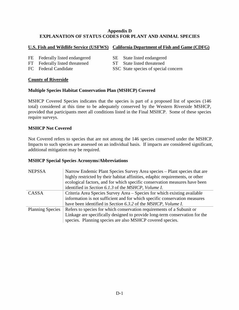
D-1
Appendix D EXPLANATION OF STATUS CODES FOR PLANT AND ANIMAL SPECIES
U.S. Fish and Wildlife Service (USFWS) California Department of Fish and Game (CDFG) FE Federally listed endangered SE State listed endangered FT Federally listed threatened ST State listed threatened FC Federal Candidate SSC State species of special concern County of Riverside Multiple Species Habitat Conservation Plan (MSHCP) Covered MSHCP Covered Species indicates that the species is part of a proposed list of species (146 total) considered at this time to be adequately conserved by the Western Riverside MSHCP, provided that participants meet all conditions listed in the Final MSHCP. Some of these species require surveys. MSHCP Not Covered Not Covered refers to species that are not among the 146 species conserved under the MSHCP. Impacts to such species are assessed on an individual basis. If impacts are considered significant, additional mitigation may be required. MSHCP Special Species Acronyms/Abbreviations NEPSSA Narrow Endemic Plant Species Survey Area species – Plant species that are
highly restricted by their habitat affinities, edaphic requirements, or other ecological factors, and for which specific conservation measures have been identified in Section 6.1.3 of the MSHCP, Volume I.
CASSA Criteria Area Species Survey Area – Species for which existing available information is not sufficient and for which specific conservation measures have been identified in Section 6.3.2 of the MSHCP, Volume I.
Planning Species Refers to species for which conservation requirements of a Subunit or Linkage are specifically designed to provide long-term conservation for the species. Planning species are also MSHCP covered species.

D-2
Appendix D (cont.) EXPLANATION OF STATUS CODES FOR PLANT AND ANIMAL SPECIES
California Native Plant Society (CNPS) Codes Lists List/Threat Code Extensions 1A = Presumed extinct. 1B = Rare, threatened, or endangered in California and elsewhere. Eligible for state listing. 2 = Rare, threatened, or endangered in California but more common elsewhere. Eligible for state listing. 3 = Distribution, endangerment, ecology, and/or taxonomic information needed. Some eligible for state listing. 4 = A watch list for species of limited distribution. Needs monitoring for changes in population status. Few (if any) eligible for state listing.
.1 = Seriously endangered in California (over 80 percent of occurrences threatened/high
degree and immediacy of threat) .2 = Fairly endangered in California (20 to 80 percent occurrences threatened) .3 = Not very endangered in California (less than 20 percent of occurrences threatened, or no current threats known) All List 1A (presumed extinct in California) and some List 3 (need more information; a review list) plants lacking threat information receive no threat code extension. Threat Code guidelines represent only a starting point in threat level assessment. Other factors, such as habitat vulnerability and specificity, distribution, and condition of occurrences are considered in setting the Threat Code.