weatherman walking devil’s bridge -...
TRANSCRIPT

EndStart
Weatherman Walking Devil’s Bridge
bbc.co.uk/weathermanwalking © 2015
1
Reproduced by permission of Ordnance Survey on behalf of HMSO. © Crown copyright and database right 2009.All rights reserved. Ordnance Survey Licence number 100019855
Approximate distance: 8 milesFor this walk we’ve included OS grid references should you wish to use them.
N
S
W E
12
3
4
The Weatherman Walking maps are intended as a guide to help you walk the route. We recommend using an OS map of the area in conjunction with this guide. Routes and conditions may have changed since this guide was written. The BBC takes no responsibility for any accident or injury that may occur while following the route. Always wear appropriate clothing and footwear and check weather conditions before heading out.

Weatherman Walking Devil’s Bridge
bbc.co.uk/weathermanwalking © 2015
2
Start: Waterfalls Car ParkStarting ref: SN 742 770Distance: 8mGrade: Hard Walk time : Allow 4hrs
This gorge walk is a great day out for those who like to mix their walks up with challenging sections and variety. The scenery and varied landscape make
up for all the ups and downs you meet along the way. But be prepared for the long haul as crossing a deep gorge means there are only a couple of safe
places to cross so there aren’t many options to shorten this walk.
If you don’t fancy the full 8m you could end the walk at Ysbyty Cynfyn, but as bus travel is limited you would need to make arrangements to get back to
Devil’s Bridge just over a mile away.
DirectionsPark at the Waterfalls car park, and head for the left corner and down the steps to the gate entrances of the waterfall walks. (These are not part of our walk, as they cross onto private land so there is a charge to pass through the turnstiles)
To view the three bridges in all their glory, it’s worth taking a quick detour through the turnstiles to the viewing platforms available.
1 Devil’s Bridge SN (SN 741 770)
Devil’s Bridge (Pontarfynach in Welsh) got its interesting name from an old Welsh legend explaining how the original bottom bridge came to be.
Legend has it that the devil built the bridge to help an old lady get her cow back from the side of the steep gorge. In return for his help, the devil asked for the fi rst living soul that crossed the bridge. But the old lady was cunning and sent her dog across fi rst. The devil was so angry at being tricked he left in a fi t of rage leaving the bridge behind.
You can fi nd devil’s bridges all over the world, all given to bridges deemed too diffi cult to be built by man. However this bridge was built by monks in the 11C.
To view the original ‘Devil’s Bridge’ you need to take one of the private paths available through the turnstiles on either side of the road next to the bridge. They off er great views of the three bridges stacked one on top of the other in a three tier formation, believed to be the only one of its kind in the world!
Weatherman Walking Devil’s Bridge
bbc.co.uk/weathermanwalking © 2015
3
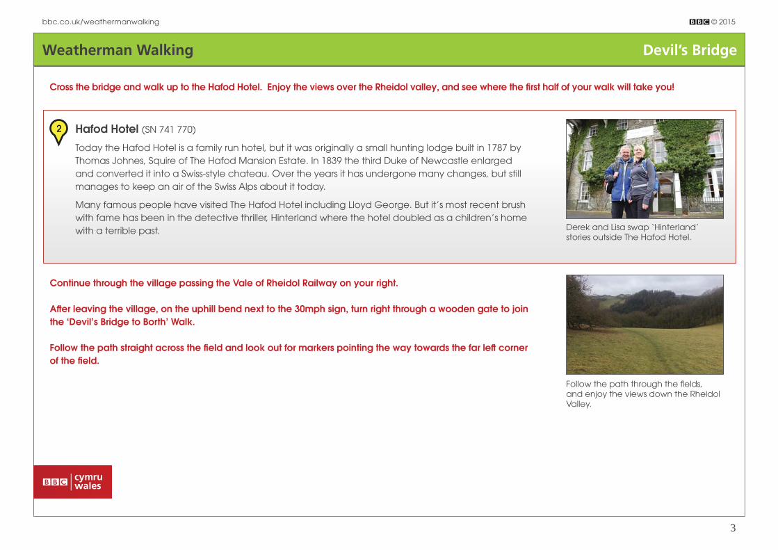
Cross the bridge and walk up to the Hafod Hotel. Enjoy the views over the Rheidol valley, and see where the fi rst half of your walk will take you!
Follow the path through the fi elds, and enjoy the views down the Rheidol Valley.
Derek and Lisa swap ‘Hinterland’ stories outside The Hafod Hotel.
2 Hafod Hotel (SN 741 770)
Today the Hafod Hotel is a family run hotel, but it was originally a small hunting lodge built in 1787 by
Thomas Johnes, Squire of The Hafod Mansion Estate. In 1839 the third Duke of Newcastle enlarged
and converted it into a Swiss-style chateau. Over the years it has undergone many changes, but still
manages to keep an air of the Swiss Alps about it today.
Many famous people have visited The Hafod Hotel including Lloyd George. But it’s most recent brush
with fame has been in the detective thriller, Hinterland where the hotel doubled as a children’s home
with a terrible past.
Continue through the village passing the Vale of Rheidol Railway on your right.
Aft er leaving the village, on the uphill bend next to the 30mph sign, turn right through a wooden gate to join the ‘Devil’s Bridge to Borth’ Walk.
Follow the path straight across the fi eld and look out for markers pointing the way towards the far left corner of the fi eld.

Weatherman Walking Devil’s Bridge
bbc.co.uk/weathermanwalking © 2015
4
Keep to the top path through the wood with the railway track on your right.
There are some short steep sections so take care as this can be very slippery when wet.
Enjoy a woodland walk all the way down to the Rheidol River.
Drop down to the kissing gate and walk alongside the railway track, and look out for the path marker ahead leading back into the wood.
Cross a small wooden bridge and continue until the valley opens up in front of you with stunning views over Cwm Rheidol, back towards the hotel.
A conveniently placed seat lets you rest, with a view that’s sure to impress.
Soon the path crosses the railway track, so listen out for the train when crossing and take care. Continue on the path downhill through Coed Rheidol and down to the valley fl oor.
Cross the bridge over the river Rheidol and turn right, continuing along the single lane for about one mile. It eventually turns into a grassy track, and then veers around sharply to the left with a large clearing opening up on your right.
Just before the clearing is a gate and a footpath running alongside the fi eld. Take this grassy track staying on the Borth to Devil’s Bridge walk, with trees on your left and the fi eld on your right.
Stay on this grassy track right to the end, until you’re faced with a steep path leading off to the left . Take a deep breath and begin climbing (this section was used by Lisa and her dad to train for their Everest trip!). Thankfully it’s fairly short and when you reach the top, go over a stile and carefully walk along the narrow path with a steep drop below.
You’ll reach another stile that crosses into open fi elds, and from here the landscape really opens up and you are safely on the other side of the gorge.

Weatherman Walking Devil’s Bridge
bbc.co.uk/weathermanwalking © 2015
5
Keep right following the fence line, and join a farmers’ track ahead on the right. Follow this track until you reach a gate, and continue straight ahead, staying on the ‘Borth’ walk.
Soon you’ll reach a farm, with a footpath sign pointing right and downhill into a fi eld. Here you leave the Borth to Devil’s Bridge walk and cross the fi eld heading for a small footbridge at the bottom.
Aft er the footbridge, join a single lane and turn right. Keep on this lane passing through a small holding, and soon aft er, look out for a metal gate on your right, with a grassy track leading off it.
Take this track following the yellow markers, and keeping left until you pass the remains of a stone house, just before a stile.
Aft er climbing out of the valley, the views from the other side are simply stunning.
Today’s bridge was dropped into place by a helicopter; and once you get here you’ll see why!
3 Parson’s Bridge (SN 748 790)
Parson’s Bridge sits in a dramatic location - high above a deep and narrow gorge.
It was originally used as a short cut for the parson walking from Llanbadarn Fawr (near Aberystwyth) to
the nearby Ysbyty Cynfyn. Until 1951, the bridge was just a single plank hung from the sides of the gorge
by chains, needing nerves of steel to cross. Danger money of 6p a day was also paid to the man who
maintained it.
Cross the stile and turn right, heading downhill. Then it’s over another stile and straight across the top of the fi eld, over another stile and then turn right heading for the bottom of the fi eld.
Aft er yet another stile, keep tight to the top fence on your left following a small narrow path at the top of a fairly steep bank. The path is not clear so just stick to the top near the fence and go directly across. You’ll reach another stile, with a path leading off downhill to your right.
Follow the path through another small wood and you’ll see Parson’s Bridge directly below you on your right. Follow the path down and cross the bridge.

Weatherman Walking Devil’s Bridge
bbc.co.uk/weathermanwalking © 2015
6
Aft er the bridge turn left and follow the path as it zig zags steeply (another Everest climb!) up the opposite bank and through the little wood. You are now climbing out of the gorge once again to emerge on the other side!
At the top of the bank, look for a gate where the woodland opens out on to a fi eld. Proceed through the gate and follow the path, keeping the stone wall to your right. You will soon appear above the churchyard of Ysbyty Cynfyn just over a mile from Devil’s Bridge.
Follow the path down to the church and enter the churchyard via the main entrance and head for the back left corner, across from the church entrance on the left . Look for three joining gravestones on the outer edges.
It’s another short, steep climb so prepare to puff your way out to Ysbyty Cynfyn.
Back in the open again, look up for some red kite spotting. With a feeding station nearby this area is a great place to see kites soaring high above.
A tragic tale – look out for the three graves joined together near the back of the graveyard.

Weatherman Walking Devil’s Bridge
bbc.co.uk/weathermanwalking © 2015
7
It’s not clear what tragedy befell this poor family, but clearly times were very tough.
4 Ysbyty Cynfyn & 1st Quads Grave (SN 752 790)
This is an incredibly sad tale of how tough times could be in the 1800s. Here are the graves of the fi rst
recorded quadruplet babies in Wales, buried here in 1856. They survived only a few days, tragically
followed by their two older siblings and father. The seven family members all died within a few weeks
of each other, yet the cause of death is not given. It’s presumed that diseases such as Typhoid may
have been the cause. Today the grave, with its typical white quartz cross, is a reminder of the hardships
faced from such diseases and the tragedies it brought with it.
Aft er 25m you will see another stile. Cross over this, turn right and follow the track passing through two gatesA short distance aft er the second gate, look out for the path veering off to the left through the bracken. DO NOT FOLLOW THE TRACK TO THE PRIVATE CARAVAN PARK.
Where the path ends at the top of a short slope, cross over the stile and continue across the fi eld, through a small stream to another stile on the edge of woodland.
Cross over this stile, turn right and follow the fence line.Make sure you stick to the designated footpath, and don’t stray down into the nearby caravan park.
Aft er visiting the church, continue to the main road and turn right heading back towards Devil’s Bridge, taking great care along this busy stretch of road.
Pass Erwbarfe Caravan Park on your right and continue to the second layby on your left . When safe, cross the road and over the stile near the middle of the layby.
Head across the fi eld picking up a line of telegraph poles and follow the direction of the poles until you see a stile. Cross over the stile and turn sharp left .
Weatherman Walking Devil’s Bridge
bbc.co.uk/weathermanwalking © 2015
8
At the end of this path, pass through a gate and turn left on to a track. Follow this track till you come to a gate. Climb over the gate (or follow the path to your left until it rejoins the track) and follow the track down through the fi eld to another stile.
Pass the Pontarfynach/Devil’s Bridge road sign and as the road curves to the right a second time, look for a footpath sign and stile on your left .
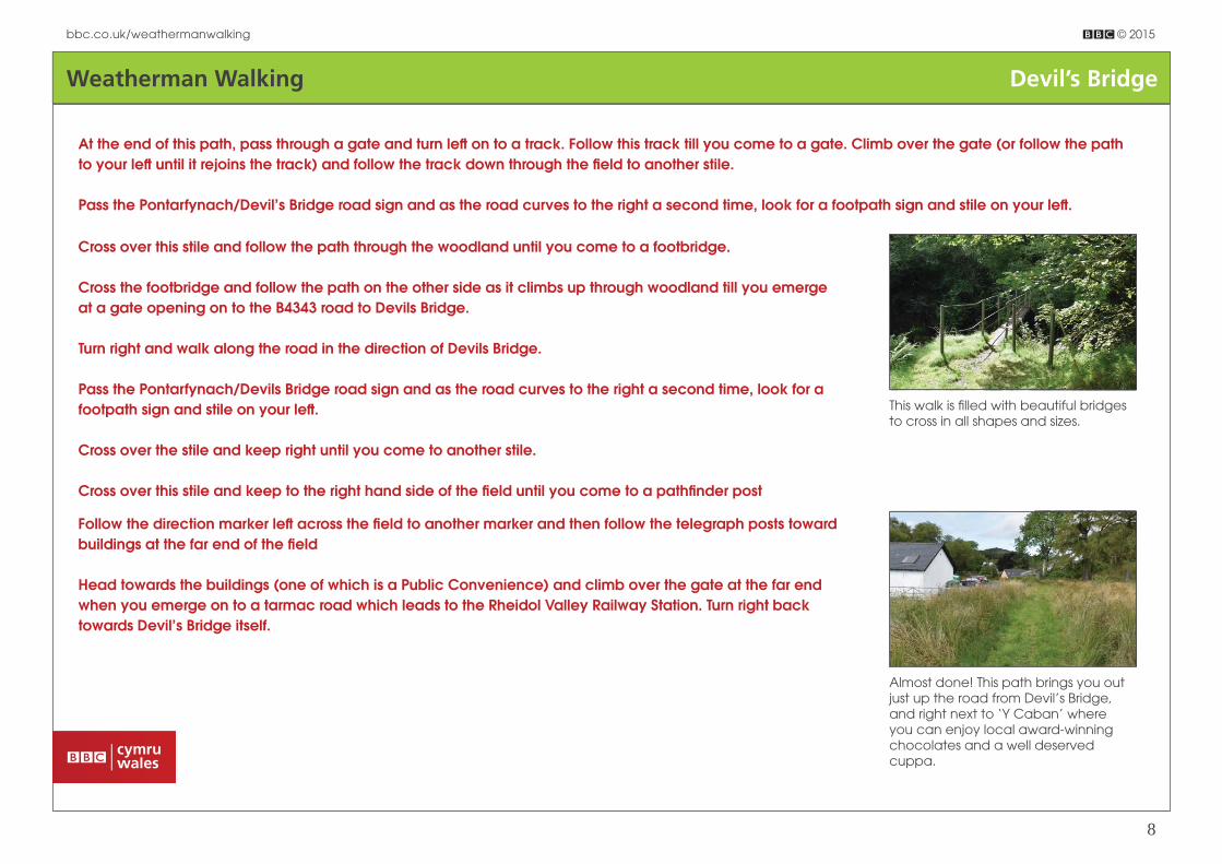
Cross over this stile and follow the path through the woodland until you come to a footbridge.
Cross the footbridge and follow the path on the other side as it climbs up through woodland till you emerge at a gate opening on to the B4343 road to Devils Bridge.
Turn right and walk along the road in the direction of Devils Bridge.
Pass the Pontarfynach/Devils Bridge road sign and as the road curves to the right a second time, look for a footpath sign and stile on your left .
Cross over the stile and keep right until you come to another stile.
Cross over this stile and keep to the right hand side of the fi eld until you come to a pathfi nder post
Follow the direction marker left across the fi eld to another marker and then follow the telegraph posts toward buildings at the far end of the fi eld
Head towards the buildings (one of which is a Public Convenience) and climb over the gate at the far end when you emerge on to a tarmac road which leads to the Rheidol Valley Railway Station. Turn right back towards Devil’s Bridge itself.
This walk is fi lled with beautiful bridges to cross in all shapes and sizes.
Almost done! This path brings you out just up the road from Devil’s Bridge, and right next to ‘Y Caban’ where you can enjoy local award-winning chocolates and a well deserved cuppa.