vehicular ferry project, - mornington …€¦ · whether it is listed on the heritage inventory or...
TRANSCRIPT


VEHICULAR FERRY PROJECT,STONY POINT TO COWES
HISTORICAL ARCHAEOLOGY ASSESSMENT
HV project number: 3754 and 3755
Prepared for: Bass Coast Shire Council
Prepared by: Sylvana Szydzik, Sarah Myers and Matthew Chamberlain,CHM Archaeologists and Heritage Advisors Pty Ltd
Completion Date: 28th June 2010
10A The Mall Wantirna 315203 9729 2900

ii | P a g e
EXECUTIVE SUMMARY
The Victorian Government proposes to establish vehicular ferry terminals at Cowes and StonyPoint. Bass Coast Shire Council and the Mornington Peninsula Shire Council commissionedCHM Archaeologists and Heritage Advisors to complete a historical archaeology assessmentfor both the Cowes and Stony Point Activity Areas.
The Cowes activity area comprises approximately 15 hectares within and around the existingjetty and foreshore, at the northern edge of Cowes Township. The Stony Point activity areacomprises approximately 7 hectares within and around the existing jetty, Port of HastingsDepot and foreshore.
This assessment has involved a desktop study and field survey. As a result of the assessmentno historical archaeological sites were found within the subject areas.
In the Cowes activity area, however, two historic places are listed on the Bass Coast ShireCouncil’s Heritage Overlay and several historic features were noted during the survey. Anumber of historical features were also noted in the Stony Point activity area.
As such the following recommendations are provided to help manage the values of the siteson the Heritage Overlay and the other noted features within the Cowes and Stony Pointactivity areas.
Recommendation 1a: Cowes Activity AreaThere are two sites listed on the Bass Coast Shire Heritage Overlay within the activity area,the presence and condition of which were verified during a field survey. In planning theredevelopment, the developer must consider the appropriate management of the valuescovered by the Heritage Overlay. In the case of the jetty shed (HO42) this considerationshould involve liaison with the National Trust, who have also listed the building.
Recommendation 1b: Cowes Activity AreaUnder the Heritage Act, 1995 it is an offence to disturb a historical archaeological site,whether it is listed on the Heritage Inventory or not. The desktop assessment identified thepossibility of archaeological remnants being present within the activity area, but these couldnot be verified during the survey. No further historical archaeological investigation istherefore required. However, if any historical archaeological sites or features are identifiedduring works, the developer is required to contact Heritage Victoria.
Recommendation 1c: Stony Point Activity AreaSeveral historical features were noted during the investigation; a general store building, amaritime marker, a stone seawall, the jetty; and an historic railway station building (nearby tothe activity area). Efforts should be made to avoid disturbing these features during theactivity. This assessment did not, however, identify any historical archaeological sites withinthe Stony Point activity area so no further archaeological investigation is therefore required.
If, however, any historical archaeological sites or features are identified during works, thedeveloper is required to contact Heritage Victoria.

iii | P a g e
CONTENTS
EXECUTIVE SUMMARY........................................................................................................................................II
LIST OF MAPS.................................................................................................................................................... IV
LIST OF TABLES ................................................................................................................................................. IV
LIST OF FIGURES................................................................................................................................................ IV
LIST OF PLATES.................................................................................................................................................. IV
INTRODUCTION ..................................................................................................................................................1
CONSULTATION WITH HERITAGE VICTORIA...................................................................................................................... 1COWES ACTIVITY AREA ............................................................................................................................................... 2STONY POINT ACTIVITY AREA ....................................................................................................................................... 2
HISTORICAL ARCHAEOLOGY ASSESSMENT ..........................................................................................................7
DESKTOP STUDY ........................................................................................................................................................ 7Review of Historic Sites within the Region ....................................................................................................... 7Review of Historic Reports within the Region .................................................................................................. 8Landforms and Geomorphology of the Activity area ....................................................................................... 9Land-use History of the Activity Area ............................................................................................................. 10Discussion....................................................................................................................................................... 16
FIELD SURVEY.......................................................................................................................................................... 17Methodology.................................................................................................................................................. 17Results - Cowes............................................................................................................................................... 17Results – Stony Point ...................................................................................................................................... 21
RECOMMENDATIONS .......................................................................................................................................24
REFERENCES......................................................................................................................................................25

iv | P a g e
List of Maps
Map 1: Stony Point and Cowes Activity Area Locations within the Region............................................................... 4Map 2: Cowes Activity Area....................................................................................................................................... 5Map 3: Stony Point Activity Area............................................................................................................................... 6Map 4: Map of the Geographic Region showing the location of the Activity Areas................................................ 10Map 5: Cowes Activity Area - Survey Coverage....................................................................................................... 19Map 6: Stony Point Activity Area - Survey Coverage ............................................................................................... 22
List of Tables
Table 1: Cowes Historic Sites ..................................................................................................................................... 7Table 2: Stony Point Historic Sites ............................................................................................................................. 8
List of Figures
Figure 1: 1930 Map of Western Port, showing Cowes ............................................................................................ 11Figure 2: 1939 Map of Western Port, showing Cowes ............................................................................................ 12Figure 3: Current map of Cowes .............................................................................................................................. 12Figure 4: 1930s Photograph of the pier at Cowes ................................................................................................... 13Figure 5: 1940s photograph of the pier at Cowes ................................................................................................... 13Figure 6: 1930 Map of Western Port, showing Stony Point .................................................................................... 14Figure 7: 1939 Map of Western Port, showing Stony Point .................................................................................... 15Figure 8: Current map of Stony Point ...................................................................................................................... 15Figure 9: 1940s-1954 photograph of the pier at Stony Point .................................................................................. 16Figure 10: 1940s-1954 photograph of the pier at Stony Point ................................................................................ 16
List of Plates
Plates 1-3: Photos taken during the survey of the Cowes Activity Area............................................................... 20Plates 4-6: Photos taken during the survey of the Stony Point Activity Area....................................................... 23

1 | P a g e
INTRODUCTION
The Victorian Government proposes to establish vehicular ferry terminals at Cowes and StonyPoint involving the construction of both marine and landside infrastructure. The Bass CoastShire Council and the Mornington Peninsula Shire Council commissioned CHM Archaeologistsand Heritage Advisors to undertake an assessment of the historical archaeology of both theCowes and Stony Point activity areas.
At Cowes, the redevelopment requires marine infrastructure including a new Jetty,approximately 125 metres long, a floating pontoon and link-span bridge andberthing/mooring dolphins. Cowes landside infrastructure requirements broadly comprise aticket office, car queuing area for a maximum of 50 vehicles, amenities (based on the existingkiosk and toilets), creation of separate vehicular and pedestrian zones in the area around thejetty, and vehicular access and egress to the jetty from the eastern side of town.
At Stony Point, the redevelopment requires marine infrastructure including a new access jetty(approximately 190 metres long), floating pontoon and link span bridge and berthing/mooringdolphins. Stony Point landside infrastructure requirements broadly comprise a ticket office,kiosk, amenities and terminus buildings (possibly incorporated in the existing buildings), roadworks and signage on the approach to the ferry terminal, car queuing area for a maximum of50 vehicles and car parking for pedestrian passengers and employees.
The complete detail of the above requirements is not determined at this stage, however, allactivity will involve some ground disturbance.
Consultation with Heritage VictoriaHeritage Victoria was consulted throughout the project. A notice of intent to conduct a surveywas lodged with them and due to the separate activity areas two project numbers wereprovided (3754 and 3755). The heritage inventory was inspected for sites listed within thesubject areas.

2 | P a g e
Cowes Activity Area
Cowes is located on the northern side of Phillip Island in Western Port and is within the BassCoast Shire. Cowes Township has a variety of retail/entertainment uses, accommodation forholidaymakers and residential properties used as both permanent homes and holiday homes.The Cowes activity area covers 15 hectares. The property address is; The Esplanade, Cowes3922. It is part of the property described as; Allotment 37D at Cowes, Parish of Phillip Island.This property has 5 parcels, but there are only four within the current activity area; Allotment21 section 4, Allotment 22 section 4, Allotment 2052 (the kiosk) and Allotment 2051 (thepier).
The Cowes jetty is located to the north of the Cowes Township and is accessed via TheEsplanade between Thompson Avenue and Bass Avenue. The jetty is approximately 120metres in length. Passenger ferry services to French Island and Stony Point, as well as a ferryservice to Seal Rocks, operate from the jetty. Recreation and charter vessels, small fishingcraft and other boating vessels also use the jetty area.
Between The Esplanade and the jetty/foreshore area is the foreshore park which has playequipment and BBQ facilities. There is also an off-street public car park located adjacent tothe jetty. On the southern side of The Esplanade are food outlets, retail shops and short termaccommodation.
The potential site for the establishment of the ferry infrastructure focuses on the existingCowes Jetty and adjoining foreshore, particularly the Jetty Triangle area, which is currentlyused as a car park.
Stony Point Activity AreaStony Point is located on the western side of Western Port, within the Mornington PeninsulaShire. Currently located at Stony Point is a small general store, three private residences, acaravan park, railway station, Port of Hastings Depot, jetty, boat ramp and associated carpark. The Stony Point activity area covers 7 hectares. The property addresses are all describedwithin the Township of Crib Point, Parish of Bittern and include all of:
allotment 7D section 11 (Port of Hastings);
allotment 7E section 11 (the pier);
allotment 7D1 section 11;
and parts of;
Allotment 4 section 11 (private residence);
Allotment 4a section 11 (private residence);
Allotment 5 section 11 (private residence);
Allotment 6 section 11 (general store);
Allotment 7 section 11 (caravan park);
Allotment 8 section 11 (railway); and
Allotment 19A section 10 (beach reserve).

3 | P a g e
The Stony Point pier is located on the north-eastern side of the point. The Pier isapproximately 150 metres in length. A passenger ferry service to French Island and Cowes(Phillip Island) operates from the pier.
Adjacent to the pier, on the northern side, is Port of Hastings Stony Point Depot. To the southof the pier is a boat ramp facility. To the south west of the pier is the Stony Point CaravanPark and Stony Point Railway Station.
At Stony Point, the proposal is for a new jetty to be constructed north of the existing jettywith the potential to use some of the Port of Hastings land to accommodate the landinfrastructure. The study area comprises Stony Point Road as it leads into the site and thePort of Hastings land. Although the private residences south of Stony Point Road are includedin the activity area extent there is no plan to conduct the activity within these properties.
4 | P a g e
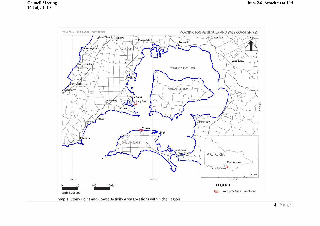
Map 1: Stony Point and Cowes Activity Area Locations within the Region

5 | P a g e
Map 2: Cowes Activity Area

6 | P a g e
Map 3: Stony Point Activity Area

7 | P a g e
HISTORICAL ARCHAEOLOGY ASSESSMENT
Desktop Study
Review of Historic Sites within the Region
Cowes activity areaTwo historic sites are listed on the Victorian Heritage Inventory within a 1km radius of theCowes activity area. These comprise 1 homestead/small farm complex and 1 chicory kiln.The National Trust and the Bass Coast Heritage Overlay also have historic registrationswithin the activity area, and also within a 1km radius. Discussion with Heritage Victoria staffindicates that there are no known shipwrecks near the activity area. Cowes sites are listed inTable 1.
Table 1: Cowes Historic Sites
Two of the above listed sites are found within the activity area – the jetty shed (HO42) andthe Cowes foreshore itself (HO43).
Heritage listing Name Description
HI 7921-0078 CE HS1 Remains of early twentieth century farmand house site
HI 7921-0079, NationalTrust B2616
CE Chicory Kiln Corrugated iron and weatherboardremains of Chicory Kiln
Bass Coast HeritageOverlay HO42, NationalTrust B6464
Jetty shed, Cowes Built in c.1868, shed features a bow roofand is a rare example of a nineteenthcentury industrial building type
Bass Coast HeritageOverlay HO43
Cowes Foreshore, TheEsplanade, Cowes
The foreshore is of local and historicsignificance as it displays the variousphases in the development of Cowes. Thejetty and jetty shed date to the first phaseof settlement at Cowes in the 1870s. Theboat landing and cypress trees date to thedevelopment of Cowes as a touristdestination in the late 19th century. Thewar memorial, toilets and sea wall date to20th century.

8 | P a g e
Stony Point activity areaOne historic site is listed on the Victorian Heritage Inventory within a 3km radius of theStony Point activity area. The Mornington Peninsula Heritage Overlay also has a historicregistration within a 2km radius of the activity area. Discussion with Heritage Victoria staffindicates that there are no known shipwrecks near the activity area. Stony Point sites arelisted in Table 2.
Table 2: Stony Point Historic Sites
None of the above listed sites are within the current activity area.
Review of Historic Reports within the Region
Cowes activity areaIn 2003 (Schell and Light 2003a & 2003b) conducted two archaeological surveys on freeholdproperties located south east and south west of the current activity area in Cowes. Bothproperties were located on a gently undulating plain, approximately 600 metres south ofthe Cowes shore. Site survey was limited by 99.5% grass cover on both properties, obscuringvisibility. No historic archaeological sites were identified, thought to be because thepredominant pastoral use of the area did not generally require any built structures apartfrom fences.
Schell and Light (2003c) conducted further archaeological investigation into anotherfreehold property to the south west of the current activity area in Cowes. No historical siteswere identified within the activity area, nor any areas of historical archaeological potential.
In 2004, an archaeological survey was conducted by Murphy (2004a) on a block bounded byCochlans Road, Settlement Road and Rhyll Road, Cowes. The block, located south east of thecurrent activity area, comprises gently undulating grazing land. The survey located twohistorical sites – one within the activity area (HI 7921-0078) and one immediately adjacentcomprising corrugated iron and weatherboard remains of a Chicory Kiln (HI 79251-0079).Site 7921-0078 comprises a former farm complex, including a dwelling, drive, exoticplantings, shed, stockyard and dairy, likely established in the early 1900s. Above groundarchaeological features include brick and concrete building footings, paths, water pipes andthe contents of the shed, stockyard and dairy. No major disturbance to the subsurfacefeatures is evident, and therefore the site is considered to have a significant archaeologicalcomponent. The lack of similar recorded sites on Phillip Island also renders this sitescientifically significant.
Heritage listing Name DescriptionHI 7921-0012 William (Bill) Woolley’s
Homestead, Crib PointBrick well and orchard remains ofhomestead
Mornington PeninsulaHeritage Overlay HO318
Crib Point Residential and CivicPrecinct
Fabric from or near the construction date offour houses located along Stony Point Road

9 | P a g e
Murphy (2004b) conducted further archaeological investigation into another block southeast of the current activity area, along Phillip Island Road, Cowes. No historic archaeologicalsites were identified during the survey.
Murphy and Thomson (2008) completed an archaeological survey and excavation on theShearwater residential estate located at 49 Settlement Road, Cowes, south east of thecurrent activity area at Cowes. No historic archaeological sites were identified during theinvestigation.
There have been a limited number of archaeological investigations into the region, however,it is likely many more historic sites exist in and around Cowes. It is likely such sites will beassociated with early pastoral settlement of Phillip Island and Cowes, the chicory industryand small scale farming.
Stony Point activity areaIn 2006, Long and Edmonds conducted sub-surface investigations into several areas inBalnarring and Somers, located to the south east of the current activity area at Stony Point.The investigation did not locate any areas of historical archaeological potential.
Tucker and Jacobs (2008) conducted an archaeological investigation into a parcel of landlocated at 5 Bray Street, Hastings, north of the current activity area at Stony Point. Theassessment did not identify any sites or areas of historical archaeological potential.
Landforms and Geomorphology of the Activity area
The Cowes activity area falls within the geomorphic region of the Mornington PeninsulaUplands; part of the broader South Victorian Uplands (Cochrane et al 1995:76). The SouthVictorian Uplands have been shaped by fault movements during the Tertiary to Recenttimes (65 million years ago – present) (Cochrane et al 1995:76). The surface geology of theCowes activity area is characterised by the ‘older volcanics’, which includes lava flowsdeposited during the Oligocene to Palaeocene (65 to 25 million years ago). These depositsreach up to 275 metres thick at the western tip of the Island.
The Stony Point activity area falls within the geomorphic region of the coastal sand barriersin the South Victorian Coastal Plains. This region is characterised by flat land which was oncebeneath the sea (Cochrane et al 1995:85). The coastal sand barrier which the Stony Pointactivity area forms part of was built by the action of waves across Western Port, andmodified by tides and winds (Cochrane et al 1995:88). The geology of the Stony Pointactivity area is characterised by fluvial and marine deposits including gravel, sandcalcarenite, silt and clay.

10 | P a g e
Map 4: Map of the Geographic Region showing the location of the Activity Areas
Land-use History of the Activity Area
This section seeks to provide a summary of the history of land-use of the MorningtonPeninsula and Western Port Bay, with particular focus on the Cowes and Stony Point areas.
Sealers frequented Western Port as early as 1812 (Gaughwin & Sullivan 1984:82), and sinceEuropean settlement, the Mornington Peninsula and Phillip Island have been subject toextensive clearing, ploughing and grazing.
Cowes activity areaPhillip Island was discovered by George Bass in 1798 (Spillane 1973:256). The Island wasleased to squatters as grazing land in 1842, and the township of Cowes was surveyed in1868 (Lovell 2004:51). The first land was sold the following year. Initially, transport to theIsland was by ferry, which ran between Stony Point and Cowes. The Cowes jetty was built in1870 (Lovell 2004:53). A bridge between San Remo and Newhaven was constructed in 1940(Lovell 2004:53), providing an alternate form of transport to the Island.

11 | P a g e
A 1930 topographic map of Western Port (Figure 1) shows a small settlement on theforeshore at Cowes, with the main development between The Esplanade and Chapel Street,Steele Street and Osbourne Avenue. A topographic map of Western Port, dated to 1939(Figure 2), shows further development of Cowes; roads were extended to the east, west andsouth of the main township, and more buildings constructed along the main streets.
Figure 1: 1930 Map of Western Port, showing Cowes

12 | P a g e
Figure 2: 1939 Map of Western Port, showing Cowes
Comparison between topographic maps of the 1930s (Figures 1 and 2) and a current Googleearth map (Figure 3) indicates the activity area has been subject to disturbance andalteration from natural and artificial activity. Sand has shifted around the three rocky pointswithin the Cowes activity area, resulting in minor alterations in the shape of the foreshore.
Figure 3: Current map of Cowes

13 | P a g e
A photograph from the State Library of Victoria, taken in the 1930s (Figure 4), shows twowooden structures on the foreshore at Cowes, near the start of the wooden pier. Aphotograph taken in the 1940s (Figure 5) shows the development of the foreshore, includinga road leading to the pier. One of the buildings in the earlier photograph has beendemolished.
Figure 4: 1930s Photograph of the pier at Cowes
Figure 5: 1940s photograph of the pier at Cowes

14 | P a g e
Stony Point activity area
A 1930 topographic map of Western Port (Figure 6) shows little development at Stony Point,the only structures being the pier and the railway and road leading to it. There is also atriangular mark possibly indicating the location of a maritime marker or beacon.
Figure 6: 1930 Map of Western Port, showing Stony Point
A topographic map of Western Port dated 1939 (Figure 7) shows five buildings at StonyPoint, four just to the south of the railway and one north of the railway, which could be thegeneral store building that now stands within the current activity area.

15 | P a g e
Figure 7: 1939 Map of Western Port, showing Stony Point
Comparison between topographic maps of the 1930s and a current Google earth map(Figure 8) show the coastline within the current activity area extends further into the sea,indicating that the large square shaped foreshore area is in fact reclaimed land. Currentimages of the activity area also show houses in the same location as the 1939 map, andfurther development to the south of the railway.
Figure 8: Current map of Stony Point

16 | P a g e
Photographs of Stony Point, taken between the 1940s and 1960s (Figures 9 and 10), showdevelopment along the foreshore including a large parking area, which appears to belocated on the reclaimed land discussed above. The photographs also show severalstructures on the shore behind the parking area. The pier is constructed out of stone, andchanges to timber halfway along.
Figure 9: 1940s-1954 photograph of the pier at Stony Point
Figure 10: 1940s-1954 photograph of the pier at Stony Point
Discussion
Within the Cowes activity area, the jetty shed, located on the western side of the Cowesjetty, and the Cowes Foreshore are both listed on the Bass Coast Heritage Overlay. Inaddition, historical photographs show that a structure has been removed from the easternside of the jetty at the very edge of the foreshore and a second structure has been replacedby the current rotunda. It is possible that some archaeological remnants of these structuresmay remain below ground.
Within the Stony Point activity area, there are no historic sites registered. None of thehistorical research undertaken for this study indicates any previous structures or featureswhich may have left archaeological remnants.

17 | P a g e
Field Survey
The survey of each activity area was conducted by Sarah Myers and Sylvana Szydzik (CHM)together with Richard Williams (Boon wurrung) and Iris Pepper (Bunurong) on the 13th April2010.
Methodology
During the survey, the survey crew spaced themselves approximately 3 metres apart (andhence surveyed a band of ground approximately 12 metres in width) and walked throughthe activity areas twice in order to obtain a systematic unaligned sample of each activityarea (following Burke and Smith 2004: 68). No obstacles were encountered during thesurvey.
A detailed photographic record of the survey was taken and notes were made aboutfeatures relevant to archaeological potential including disturbance, ground visibility, soiltypes, and landform.
Results - Cowes
Survey Coverage
The Cowes activity area comprises 15 hectares, but much of this is water. The landcomponent of the area is approximately 822 metres long, but is quite narrow, varyingbetween 30 to 100m and is therefore approximately 6 hectares. The four participants of thesurvey walked the length of the activity area twice and therefore walked approximately1650 metres. Map 6 shows the survey coverage.
Visibility
Ground surface visibility was generally poor throughout the activity area due to a cover ofbuffalo grass. In areas where there was no grass cover, in sandy patches under trees and inthe play grounds, visibility was 100%, but for the remainder where the grass was present,visibility was less than 10%. At the eastern and western ends of the activity area, howeverthere were remnant native trees and bushes and in these areas, no grass was growing. Andalthough visibility was reduced by the presence of leaves and organic debris, it was as muchas 70% in these areas.

18 | P a g e
Condition of Landforms
The Cowes activity area incorporates the whole of the foreshore area between TheEsplanade and the water of Western Port Bay. There are three rocky points across the areathat jut into the water, two form headlands at either end of the activity area and the third islow lying and is occupied by a jetty. The land between the headlands slopes moderatelyfrom The Esplanade, that forms the southern boundary, to the beach. A play ground hasbeen built on the eastern headland and a picnic area on the western headland. In the centreof the activity area near the jetty there is an historic cafe. There is a road and car parkforming a triangular area in front of the jetty and alongside this area on the west side is arotunda building. There is also a more recent toilet and change room building and twofenced revegetation areas to the west side of the entry road. To the east of the jetty there isa sea wall, foot path along the bottom edge of the slope, and also a viewing platform/stagewith seating and several paths. To the west of the jetty there is a storm water drain runningnorth-south from The Esplanade to the beach otherwise there is no formal paths or sea wall.Beyond the western headland there is dense scrub.
Historic Heritage
Two previously recorded heritage sites were inspected and the following notes were made;
Jetty shed, Cowes (HO42). The shed has been refurbished and functions as a cafe/kiosk. Itappears to be in good condition though it has been extended on the north side. There maybe underfloor deposits associated with the shed (Plate 1).
Cowes Foreshore, The Esplanade, Cowes (HO43). The foreshore is in good condition with allthe features mentioned in the citation still remaining, though the jetty has been rebuilt inconcrete. It is unlikely that there are any archaeological deposits associated with thefeatures of the foreshore.
Several additional features were noted during the survey, though none constitute anarchaeological site; a concrete footing and several jetty pylons (Plates 2-3). The footing islocated on the rocky point in the eastern part of the activity area and the jetty pylons arelocated on the beach near the western rocky point. It is not clear what the footing wasassociated with, but it may have been part of a lookout platform.

19 | P a g e
Map 5: Cowes Activity Area - Survey Coverage

20 | P a g e
Plates 1-3: Photos taken during the survey. Photo 1 shows the Jetty Shed (HO42), photo 2 shows thejetty pylons near the western rocky point and photo 3 shows the concrete foundation near theeastern rocky point.

21 | P a g e
Results – Stony Point
Survey Coverage
The Stony Point activity area comprises 7 hectares, but much of this is water and reclaimedland. The land component of the area is approximately 400 metres long, but is quite narrow,varying between 30 to 50m and is therefore approximately 3 hectares. The four participantsof the survey walked the length of the activity area twice and therefore walkedapproximately 800 metres. Due to the small size of the area, this meant that the actualsurvey coverage was 100%. Map 6 shows the survey coverage.
Visibility
Ground surface visibility was generally poor throughout the activity area due to thepresence of road surfaces, grass and dense vegetation. Alongside the road the vegetationcover was quite dense. On the narrow road verges visibility was 100%, but in those areaswhere there was thick vegetation, visibility was 50% due to organic debris over the groundsurface.
Condition of Landforms
The activity area incorporates the land along the coastline of Stony Point, part of which isreclaimed land. Evidence for this was found during the survey in the form of a sea wallbetween the Stony Point Road and the land where the Port of Hastings Depot is located.Obviously the water once lapped at this sea wall and was much closer than it is now. Thiswas further evidenced by the presence of a fill embankment along the western edge of thePort of Hastings where it meets the mangrove swamp. The activity area also comprisesStony Point Road which extends to the west and runs directly alongside the mangroveswamp. The edge of the road drops away into the swamp on the north side and has theappearance of having been built up above the swamp. On the southern side of Stony PointRoad there is a small treed slope and a plateau where there is a railway (outside theboundary of the activity area). There is a small rise or knoll in the centre of the area onwhich an old shop and sitting area and other houses and buildings are located. There is aretaining wall along the front of the knoll where it meets the footpath and street. Given theage of the shop this knoll is likely to be relatively undisturbed.
Historic Heritage
No archaeological sites were identified, but there were several historic features noted.There is a general store building probably dating between 1930 and 1939 as indicated onthe 1939 map (Figure7); a maritime marker indicated on the 1930 map (Figure 6), a stoneseawall, jetty and an historic railway station building nearby to the activity area probablydating to before 1930. Together these features form a precinct of social and historicimportance at a local level as they may point to the various stages of development of theStony Point area.

22 | P a g e
Map 6: Stony Point Activity Area - Survey Coverage

23 | P a g e
Plates 4-6: Photos taken during the survey. Plate 4 shows the historic railway station (outside theactivity area), Plate 5 shows the general store and Plate 6 shows the maritime marker.

24 | P a g e
RECOMMENDATIONS
This assessment has involved a desktop study and field survey. No historical archaeologicalsites were found within the Cowes or the Stony Point subject areas. However, in the Cowessubject area two historic places are listed on the councils heritage overlay and severalfeatures were also noted. In the Stony Point subject area, there were also a number ofhistorical features that were noted. The following recommendations are provided to helpmanage the heritage values of the sites on the heritage overlay and the other notedfeatures.
Recommendation 1a: Cowes Activity Area
There are two sites listed on the Bass Coast Shire Heritage Overlay within the activity area,the presence and condition of which were verified during a field survey. In planning theredevelopment, the developer must consider the appropriate management of the valuescovered by the Heritage Overlay. In the case of the jetty shed (HO42) this considerationshould involve liaison with the National Trust, who have also listed the building.
Recommendation 1b: Cowes Activity Area
Under the Heritage Act, 1995 it is an offence to disturb a historical archaeological site,whether it is listed on the Heritage Inventory or not. The desktop assessment identified thepossibility of archaeological remnants being present within the activity area, but these couldnot be verified during the survey. No further historical archaeological investigation istherefore required. However, if any historical archaeological sites or features are identifiedduring works, the developer is required to contact Heritage Victoria.
Recommendation 1c: Stony Point Activity Area
Several historical features were noted during the investigation; a general store building, amaritime marker, a stone seawall, the jetty and an historic railway station building (nearbyto the activity area). Efforts should be made to avoid disturbing these features during theactivity. This assessment did not, however, identify any historical archaeological sites withinthe Stony Point activity area so no further archaeological investigation is therefore required.
If, however, any historical archaeological sites or features are identified during works, thedeveloper is required to contact Heritage Victoria.

25 | P a g e
REFERENCES
Cochrane, G., G. Quick, & D. Spencer-Jones. 1995. Introducing Victorian Geology. GeologicalSociety of Australia (Victorian Division).
Foldout Postcard. c.1930-1940, Cowes (Phillip Island). State Library of Victoria, picturescollection.
Jenkin, J. 1974, Geological Survey Report 1974/3: The Geology of The Mornington Peninsulaand Western Port. Department of Minerals and Energy.
Murphy, A. 2004(a), Cowes East. A Report to Beveridge Williams Pty Ltd on behalf of WilbowCorporation Pty Ltd.
Murphy, A. 2004(b), Eco Resort Development, Cowes: Cultural Heritage Assessment. AReport to Beveridge Williams Pty Ltd on behalf Piecor Pty Ltd.
Murphy, A. & S. Thomson. 2008, Shearwater Residential Estate, Cowes East: CulturalHeritage Management Plan.
Rose Stereography Co. c.1920-1954, The Pier, Stony Point, VIC [postcard]. State Library ofVictoria, pictures collection.
Rose Stereography Co. c.1920-1954, View from pier, Stony Point, VIC [postcard]. StateLibrary of Victoria, pictures collection.
Schell, P. & A. Light. 2003(a), Land Southwest of Justice Road and Settlement Road, Cowes:Cultural Heritage Assessment. A Report to Westley Pty Ltd..
Schell, P. & A. Light. 2003(b), Land to the Southwest of McKenzie Road and Settlement Road,Cowes: Cultural Heritage Assessment. A Report to Beveridge Williams and Co Pty Ltd.
Valentine Publishing Co. 1940, Cowes, Phillip Island [Vic.], postcard. State Library of Victoria,pictures collection.