urban studies & planning abstracts - atiner · 3rd annual international conference on urban...
TRANSCRIPT
3rd Annual International Conference on Urban Studies & Planning, 10-13 June 2013, Athens, Greece:
Abstract Book
1
Urban Studies & Planning Abstracts Third Annual International Conference on Urban Studies & Planning 10-13 June 2013, Athens, Greece
Edited by Gregory T. Papanikos
2013
THE ATHENS INSTITUTE FOR EDUCATION AND RESEARCH

3rd Annual International Conference on Urban Studies & Planning, 10-13 June 2013, Athens, Greece:
Abstract Book
2

3rd Annual International Conference on Urban Studies & Planning, 10-13 June 2013, Athens, Greece:
Abstract Book
3
Urban Studies & Planning Abstracts
3rd Annual International Conference on
Urban Studies & Planning
Science, 10-13 June 2013, Athens, Greece
Edited by Gregory T. Papanikos

3rd Annual International Conference on Urban Studies & Planning, 10-13 June 2013, Athens, Greece:
Abstract Book
4
First Published in Athens, Greece by the Athens Institute for Education and
Research.
ISBN: 978-960-9549-59-2
All rights reserved. No part of this publication may be reproduced, stored,
retrieved system, or transmitted, in any form or by any means, without the
written permission of the publisher, nor be otherwise circulated in any form of
binding or cover.
8 Valaoritou Street
Kolonaki, 10671 Athens, Greece
www.atiner.gr
©Copyright 2012 by the Athens Institute for Education and Research. The individual essays remain the intellectual properties of the contributors.

3rd Annual International Conference on Urban Studies & Planning, 10-13 June 2013, Athens, Greece:
Abstract Book
5
TABLE OF CONTENTS
(In Alphabetical Order by Author's Family name)
Preface 7
Conference Program 8
1 Users’ Perceptions about Planning and Designing of Public Open Spaces: Case Study on Muscat Hana Aljabri & Harry Smith
12
2 Housing Experiences of Recent Immigrants to Canada's Small Cities: A Pilot Study Natalya Brown
13
3 Regeneration and Conservation of Historical Cities; Comparision between Yedikule and Baku Ozge Celik & Masud Hatami
14
4 Urbanisation Trends and Urban Planning in West Bengal, India Mahalaya Chatterjee
15
5 Did Compact Urban Form on Behalf of the Practice of Sustainable Development Tzu-Ling Chen & Hsung-Sheng Chang
17
6 Fragmentation of Land: Urban Transport Perspective Emilio Bravo Grajales
18
7
Technology Based Architectural Potentials In Future Sustainable Concrete Infrastructure Johannes Greisen, Lars Thrane, Thomas Andersen, Ulla Egebjerg & Dorthe Mathiesen
19
8 Design with Aging Problem --–Strategies for Chinese Open Spaces Xiaofei Han
21
9 Medium-sized Cities and Globalisation: The Example of Reims and Leicester 1980-2008 Ines Hassen
22
10
Assessing Locational Advantage of Industrial Sites using Spatial Margin of Profitability (SMoP) Method: A Case of Bread Manufacturing Abdul Hamid Hj. Mar Iman, Norlia Mazlin & Christopher Gan
23
11 Spatial Pioneers in Urban Districts in Transition – Findings from Empirical Neighborhood Research Petra Jahnke
24
12
Interrogating Challenges for Planners and Urban Designers in Territories Undergoing Transformation due to Contemporary Social and Economical Changes - Suggesting Adoptive Methods and Strategies for Analysing the Changes for Bhopal City Arti Jaiswal & Vishaka Khwathekar
25
13 Addressing Food, Water, Waste and Energy Yields in Urban Regenerative Environments Elena Katrini
27

3rd Annual International Conference on Urban Studies & Planning, 10-13 June 2013, Athens, Greece:
Abstract Book
6
14 Public Sector-led Exclusion in the Historical Centre of Istanbul: Talimhane, Beyoğlu Dicle Kizildere & Dilek Darby
28
15
The Research of Development of Conflicts between Agricultural Development and Water Resources Allocation by Spatial Analysis Method Jui-Ling Liang & Chang Huseg-Sheng
29
16 Eco-logics: The New Paradigm for the Design of Urban Environments Mark Mistur
30
17 Agglomeration Economies and Wellbeing: Evidence from India Arup Mitra
31
18 Migrant Entrepreneurs as Urban Health Angels − A Micro-Based Analysis Peter Nijkamp, Karima Kourtit, Peter Nijkamp & Daniel Arribas-Bel
32
19 Istanbul Revealed Urban Intervention and Modification in the Historical City Weldon Pries
33
20 Experiences in Participatory Design Processes: Assessing the Headland Park Design Gabriella Quintana Vigiola
34
21 Assessing the Naturalness Changes to Landscape by the Metropolitan Urban Planning in Concepción (Chile) Carolina Rojas, Einer Sepulveda & Joan Pino
35
22 Effect of Nature Protection on Urban Planning in Protected Landscape Areas Daniela Sovarova & Marek Janatka
36
23 Industrial Heritage as Qualifying Elements in Urban Landscapes Grete Swensen & Rikke Stenbro
37
24 The Measurement of the Multi-Actor Projects Success via Analytic Hierarchy Process Ahmet Yilmaz & Hulya Demir
38
25 An Evaluation Model of Floor Area Incentive for Urban Regeneration Projects from the Perspective of Carbon Emissions Hsu Kuo-Wei, Huei-Shin Hung & Jen-Chih Chao
39
26 The Evolving Role of State-Owned-Enterprises in China’s Housing Market during Reforms Miao Zhang & Rajah Rasiah
41
27
Factors flowing, Resources Reorganization and Rural Renaissance: A Case Study of Dashan Village, Gaochun Cittaslow in China Chen Zhao & Mingrui Shen
42
28 Playing Games and Concepts: China’s Urban Development Model-The Case of Beijing and Beijing Olympics Simon Xiaobin Zhao
43
3rd Annual International Conference on Urban Studies & Planning, 10-13 June 2013, Athens, Greece:
Abstract Book
7
Preface This abstract book includes all the abstracts of the papers presented
at the 3rd Annual International Conference on Urban Studies & Planning, 10-33 June 2013, organized by the Athens Institute for Education and Research. In total there were 28 papers and 34 presenters, coming from 18 different countries (Australia, Canada, Chile, China, Czech Republic, Denmark, Germany, Holland, India, Italy, Malaysia, Mexico, Norway, Saudi Arabia, Taiwan, Turkey, UK, USA). The conference was organized into VII sessions that included areas of Methodology I, Urbanisation and Preservation I, Processes, Systems and other related disciplines. As it is the publication policy of the Institute, the papers presented in this conference will be considered for publication in one of the books of ATINER.
The Institute was established in 1995 as an independent academic organization with the mission to become a forum where academics and researchers from all over the world could meet in Athens and exchange ideas on their research and consider the future developments of their fields of study. Our mission is to make ATHENS a place where academics and researchers from all over the world meet to discuss the developments of their discipline and present their work. To serve this purpose, conferences are organized along the lines of well established and well defined scientific disciplines. In addition, interdisciplinary conferences are also organized because they serve the mission statement of the Institute. Since 1995, ATINER has organized more than 150 international conferences and has published over 100 books. Academically, the Institute is organized into four research divisions and nineteen research units. Each research unit organizes at least one annual conference and undertakes various small and large research projects.
I would like to thank all the participants, the members of the organizing and academic committee and most importantly the administration staff of ATINER for putting this conference together.
Gregory T. Papanikos President

3rd Annual International Conference on Urban Studies & Planning, 10-13 June 2013, Athens, Greece:
Abstract Book
8
FINAL CONFERENCE PROGRAM 3rd Annual International Conference on Urban Studies & Planning,
10-13 June 2013, Athens, Greece PROGRAM
Conference Venue: Titania Hotel (52 Panepistimiou Avenue)
ORGANIZING AND SCIENTIFIC COMMITTEE
1. Dr. Gregory T. Papanikos, President, ATINER. 2. Dr. George Poulos, Vice-President of Research, ATINER & Emeritus Professor,
University of South Africa, South Africa. 3. Dr. Nicholas Pappas, Vice-President of Academics, ATINER & Professor, Sam
Houston University, USA. 4. Dr. Nicholas Patricios, Head, Architecture & Engineering Research Unit, ATINER
& Professor of Architecture, University of Miami, USA 5. Dr. Thomas Attard, Associate Research Professor, Arizona State University, USA. 6. Dr. Stavros Alifragkis, Academic Member, Architecture & Engineering Research
Unit, ATINER & Adjunct Lecturer, Hellenic Army Academy, Athens, Greece. 7. Dr. Howayda Al-Harithy, Professor, American University of Beirut, Lebanon. 8. Dr. Patrick Ashton, Associate Professor, Indiana University Purdue University
Fort Wayne, USA. 9. Dr. Debnath Bhattacharyya, Professor, MPCTM, Gwalior, India. 10. Dr. Stella B. Bondi, Associate Professor, Old Dominion University, USA. 11. Mr. Moamer Gashoot, Researcher, Bournemouth University, UK. 12. Dr. Matthew Kubik, Associate Professor, Indiana University Purdue University
Fort Wayne, USA. 13. Dr. Caterina Pizanias, Instructor, University of Calgary, Canada. 14. Dr. Virginia Sisiopiku, Associate Professor, The University of Alabama at
Birmingham, USA. 15. Ms. Lila Skountridaki, Researcher, ATINER & Ph.D. Student, University of
Strathclyde, U.K. 16. Mr. Vasilis Charalampopoulos, Researcher, ATINER & Ph.D. Student, University
of Stirling, U.K.
Administration
Fani Balaska, Stavroula Kiritsi, Eirini Lentzou, Konstantinos Manolidis, Katerina
Maraki & Celia Sakka

3rd Annual International Conference on Urban Studies & Planning, 10-13 June 2013, Athens, Greece:
Abstract Book
9
C O N F E R E N C E P R O G R A M (The time for each session includes at least 10 minutes coffee break) Monday 10 June 2013 09:00-09:30 Registration 09:30-10:00 Welcome and Opening Remarks
Dr. Gregory T. Papanikos, President, ATINER.
Dr. Nicholas Patricios, Head, Architecture & Engineering Research Unit, ATINER & Professor of Architecture, University of Miami, USA.
10:00-11:30 Session I: Methodology I Chair: Dr. Nicholas Patricios, Head, Architecture & Engineering Research Unit, ATINER & Professor of Architecture, University of Miami, USA.
1. Arti Jaiswal, Assistant Professor, Spa Bhopal, India & Vishaka Khwathekar, Conservation Architect, India. Interrogating Challenges for Planners and Urban Designers in Territories Undergoing Transformation due to Contemporary Social and Economical Changes - Suggesting Adoptive Methods and Strategies for Analysing the Changes for Bhopal City.
2. Hana Aljabri, PhD Student, Heriot-Watt University, UK & Harry Smith, Director of the Centre for Environment & Human Settlements, Heriot-Watt University, UK. Users’ Perceptions about Planning and Designing of Public Open Spaces: Case Study on Muscat.
3. Ahmet Yilmaz, Researcher, Yildiz Technical University, Turkey & Hulya Demir, Professor, Yildiz Technical University, Turkey. The Measurement of the Multi-Actor Projects Success via Analytic Hierarchy Process.
4. Carolina Rojas, Associate Professor, University of Concepcion, Chile, Einer Sepulveda, Master Student, University of Concepcion, Chile & Joan Pino, Assistant Professor, Autonomous University of Barcelona, Spain. Assessing the Naturalness Changes to Landscape by the Metropolitan Urban Planning in Concepción (Chile).
5. Peter Nijkamp, Professor, University of Amsterdam, the Netherlands, Karima Kourtit, Professor, University of Amsterdam, the Netherlands & Daniel Arribas-Bel, Professor, University of Amsterdam, the Netherlands. Migrant Entrepreneurs as Urban Health Angels − A Micro-Based Analysis.
11:30-13:00 Session II: Urbanisation and Preservation I Chair: *Gabriela Quintana Vigiola, Lecturer, University of Technology Sydney, Australia.
1. Arup Mitra, Professor, Institute of Economic Growth, India. Agglomeration Economies and Wellbeing: Evidence from India.
2. *Mahalaya Chatterjee, Associate Professor and Director, University of Calcutta, India. Urbanisation Trends and Urban Planning in West Bengal, India.
3. Ines Hassen, PhD Student, University of Leicester, UK. Medium-sized Cities and Globalisation: The Example of Reims and Leicester 1980-2008.
4. Weldon Pries, Professor, Wentworth Institute of Technology, USA. Istanbul Revealed Urban Intervention and Modification in the Historical City.
5. Ozge Celik, Research Assistant, Istanbul Technical University, Turkey & Masud Hatami, MA Student, Istanbul Technical University, Turkey. Regeneration and Conservation of Historical Cities; Comparison between Yedikule and Baku.
6. Hsu Kuo-Wei, Professor, Chaoyang University of Technology, Taiwan, Huei-Shin Hung, Graduate, Chaoyang University of Technology, Taiwan & Jen-Chih Chao, PhD Student, Chaoyang University of Technology, Taiwan. An Evaluation Model of Floor Area Incentive for Urban Regeneration Projects from the Perspective of Carbon Emissions. (Monday)
3rd Annual International Conference on Urban Studies & Planning, 10-13 June 2013, Athens, Greece:
Abstract Book
10
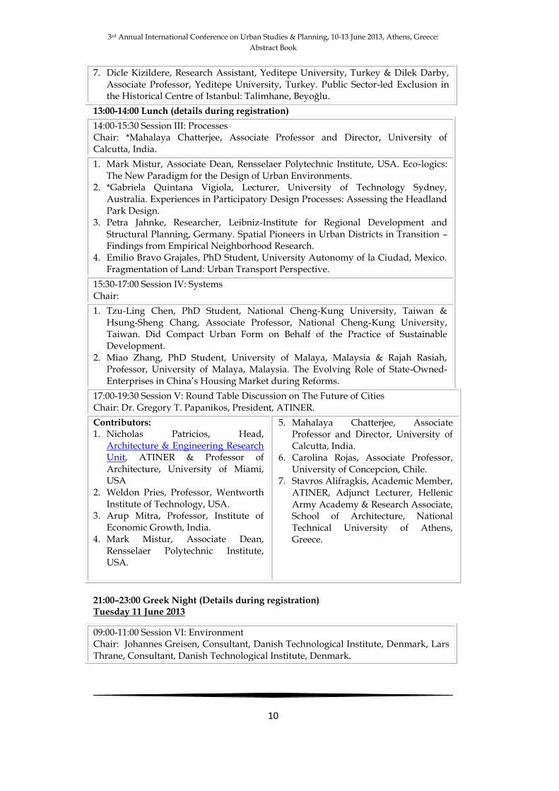
7. Dicle Kizildere, Research Assistant, Yeditepe University, Turkey & Dilek Darby, Associate Professor, Yeditepe University, Turkey. Public Sector-led Exclusion in the Historical Centre of Istanbul: Talimhane, Beyoğlu.
13:00-14:00 Lunch (details during registration)
14:00-15:30 Session III: Processes Chair: *Mahalaya Chatterjee, Associate Professor and Director, University of Calcutta, India.
1. Mark Mistur, Associate Dean, Rensselaer Polytechnic Institute, USA. Eco-logics: The New Paradigm for the Design of Urban Environments.
2. *Gabriela Quintana Vigiola, Lecturer, University of Technology Sydney, Australia. Experiences in Participatory Design Processes: Assessing the Headland Park Design.
3. Petra Jahnke, Researcher, Leibniz-Institute for Regional Development and Structural Planning, Germany. Spatial Pioneers in Urban Districts in Transition – Findings from Empirical Neighborhood Research.
4. Emilio Bravo Grajales, PhD Student, University Autonomy of la Ciudad, Mexico. Fragmentation of Land: Urban Transport Perspective.
15:30-17:00 Session IV: Systems Chair:
1. Tzu-Ling Chen, PhD Student, National Cheng-Kung University, Taiwan & Hsung-Sheng Chang, Associate Professor, National Cheng-Kung University, Taiwan. Did Compact Urban Form on Behalf of the Practice of Sustainable Development.
2. Miao Zhang, PhD Student, University of Malaya, Malaysia & Rajah Rasiah, Professor, University of Malaya, Malaysia. The Evolving Role of State-Owned-Enterprises in China’s Housing Market during Reforms.
17:00-19:30 Session V: Round Table Discussion on The Future of Cities Chair: Dr. Gregory T. Papanikos, President, ATINER.
Contributors: 1. Nicholas Patricios, Head,
Architecture & Engineering Research Unit, ATINER & Professor of Architecture, University of Miami, USA
2. Weldon Pries, Professor, Wentworth Institute of Technology, USA.
3. Arup Mitra, Professor, Institute of Economic Growth, India.
4. Mark Mistur, Associate Dean, Rensselaer Polytechnic Institute, USA.
5. Mahalaya Chatterjee, Associate Professor and Director, University of Calcutta, India.
6. Carolina Rojas, Associate Professor, University of Concepcion, Chile.
7. Stavros Alifragkis, Academic Member, ATINER, Adjunct Lecturer, Hellenic Army Academy & Research Associate, School of Architecture, National Technical University of Athens, Greece.
21:00–23:00 Greek Night (Details during registration) Tuesday 11 June 2013
09:00-11:00 Session VI: Environment Chair: Johannes Greisen, Consultant, Danish Technological Institute, Denmark, Lars Thrane, Consultant, Danish Technological Institute, Denmark.
3rd Annual International Conference on Urban Studies & Planning, 10-13 June 2013, Athens, Greece:
Abstract Book
11
12:30-13:30 Lunch (Details during registration)
17:30-20:30 Urban Walk (Details during registration) 21:00-22:00 Dinner (Details during registration)
Wednesday 12 June 2013 Cruise: (Details during registration) Thursday 13 June 2013
Delphi Visit: (Details during registration)
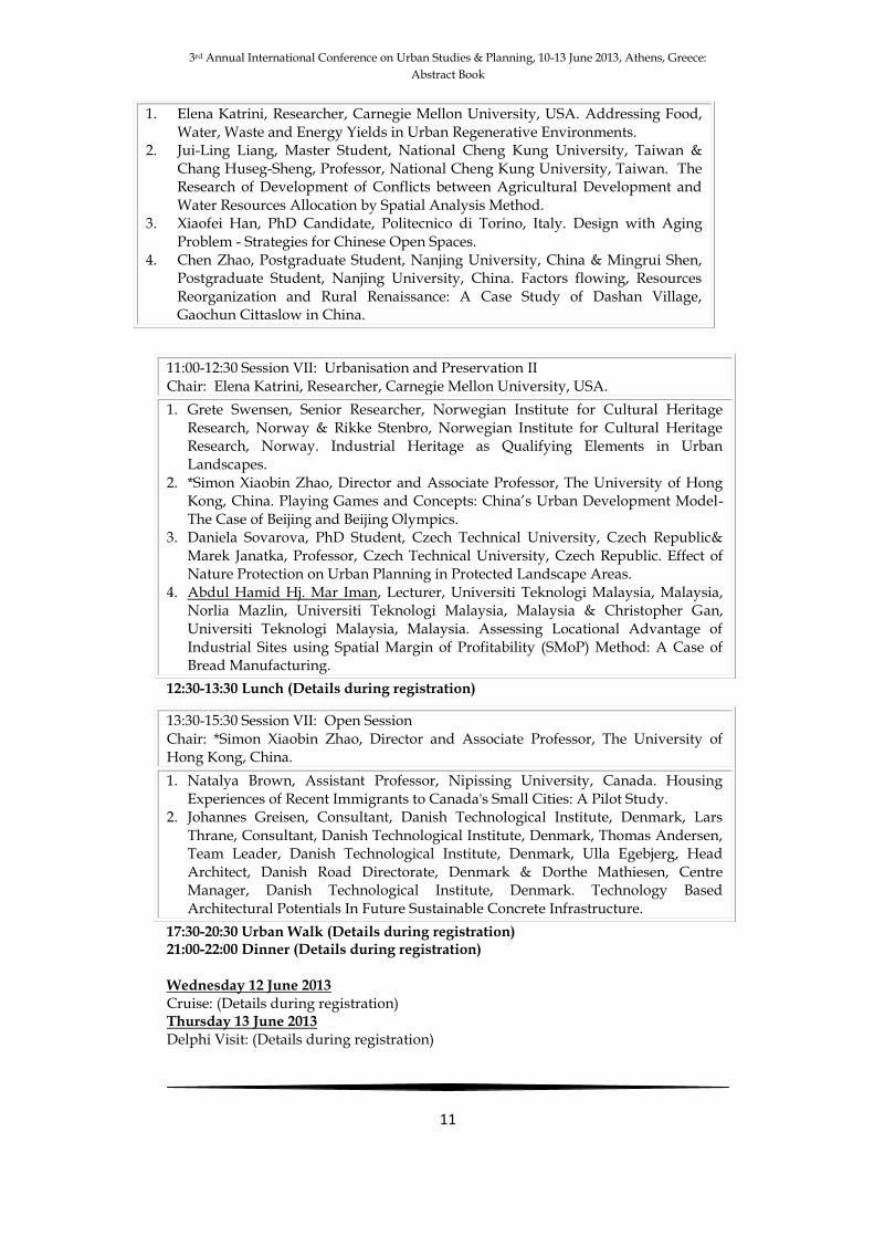
1. Elena Katrini, Researcher, Carnegie Mellon University, USA. Addressing Food, Water, Waste and Energy Yields in Urban Regenerative Environments.
2. Jui-Ling Liang, Master Student, National Cheng Kung University, Taiwan & Chang Huseg-Sheng, Professor, National Cheng Kung University, Taiwan. The Research of Development of Conflicts between Agricultural Development and Water Resources Allocation by Spatial Analysis Method.
3. Xiaofei Han, PhD Candidate, Politecnico di Torino, Italy. Design with Aging Problem - Strategies for Chinese Open Spaces.
4. Chen Zhao, Postgraduate Student, Nanjing University, China & Mingrui Shen, Postgraduate Student, Nanjing University, China. Factors flowing, Resources Reorganization and Rural Renaissance: A Case Study of Dashan Village, Gaochun Cittaslow in China.
11:00-12:30 Session VII: Urbanisation and Preservation II Chair: Elena Katrini, Researcher, Carnegie Mellon University, USA.
1. Grete Swensen, Senior Researcher, Norwegian Institute for Cultural Heritage Research, Norway & Rikke Stenbro, Norwegian Institute for Cultural Heritage Research, Norway. Industrial Heritage as Qualifying Elements in Urban Landscapes.
2. *Simon Xiaobin Zhao, Director and Associate Professor, The University of Hong Kong, China. Playing Games and Concepts: China’s Urban Development Model-The Case of Beijing and Beijing Olympics.
3. Daniela Sovarova, PhD Student, Czech Technical University, Czech Republic& Marek Janatka, Professor, Czech Technical University, Czech Republic. Effect of Nature Protection on Urban Planning in Protected Landscape Areas.
4. Abdul Hamid Hj. Mar Iman, Lecturer, Universiti Teknologi Malaysia, Malaysia, Norlia Mazlin, Universiti Teknologi Malaysia, Malaysia & Christopher Gan, Universiti Teknologi Malaysia, Malaysia. Assessing Locational Advantage of Industrial Sites using Spatial Margin of Profitability (SMoP) Method: A Case of Bread Manufacturing.
13:30-15:30 Session VII: Open Session Chair: *Simon Xiaobin Zhao, Director and Associate Professor, The University of Hong Kong, China.
1. Natalya Brown, Assistant Professor, Nipissing University, Canada. Housing Experiences of Recent Immigrants to Canada's Small Cities: A Pilot Study.
2. Johannes Greisen, Consultant, Danish Technological Institute, Denmark, Lars Thrane, Consultant, Danish Technological Institute, Denmark, Thomas Andersen, Team Leader, Danish Technological Institute, Denmark, Ulla Egebjerg, Head Architect, Danish Road Directorate, Denmark & Dorthe Mathiesen, Centre Manager, Danish Technological Institute, Denmark. Technology Based Architectural Potentials In Future Sustainable Concrete Infrastructure.

3rd Annual International Conference on Urban Studies & Planning, 10-13 June 2013, Athens, Greece:
Abstract Book
12
Hana Aljabri PhD Student, Heriot-Watt University, UK
& Harry Smith
Director of the Centre for Environment & Human Settlements, Heriot-Watt University, UK
Users’ Perceptions about Planning and Designing of Public Open Spaces: Case Study on Muscat
Public open spaces have played a significant role in the development
of society and cities. There are presently increasing concerns globally regarding the essential value of those spaces. The understanding of successful public open spaces has greatly grown as the most liveable and well-used by public. Although there already exists much research in this area, enough emphasis has not been placed in Middle-Eastern cities. This study brings fresh evidence into Muscat in comparison with international knowledge and contributes to the planning and urban design theories for other Middle-Eastern countries. The emerging of modern renascence era in 1970 has changed Muscat dramatically in very short period of time. Users’ perception has as well changed, meaning that in more respects the demand for good quality public open spaces is a necessary requirement. In this regard planning and urban design must have deeper understanding; especially when intending to create a successful public open space. This paper examines the effectiveness of urban design and planning practice in providing liveable public open space in Muscat by investigating users’ perceptions through four detailed case studies of selected squares and plazas. In order to explore users’ perceptions 120 face-to-face questionnaires were conducted in the four case studies. Structured interviews were conducted with community representatives to find out constraints that hold potential users from using the spaces. Data shows that spaces in Muscat required extra consideration of users needs in the planning and designing system to deliver spaces that allow the people in Muscat to more effectively engage with their environment.

3rd Annual International Conference on Urban Studies & Planning, 10-13 June 2013, Athens, Greece:
Abstract Book
13
Natalya Brown Assistant Professor, Nipissing University, Canada
Housing Experiences of Recent Immigrants to Canada's Small Cities: A Pilot Study
Canadian labour and housing market conditions, opportunity
structures and population and demographic spatial concentrations across smaller urban centres differ from that of large cities like Toronto, Vancouver, or Montreal. A geographical imbalance exists in the settlement of newcomers to Canada, with the vast majority settling in the urban centres of Toronto, Montreal and Vancouver. There is also an imbalance in terms of research as the bulk of Canadian studies on immigrant settlement focuses on urban immigration, emphasizing these three gateway cities. Many small- and medium-sized cities across Ontario face skill shortages and slow population decline and immigration can help to meet labour demands and drive population renewal. There is also the need to relieve the population pressures on the larger urban centres where they are experiencing the downside of agglomeration and high population densities.
Adequate, suitable and affordable housing is one of the basic needs that must be successfully attained in the process of immigrant integration into a community. This pilot study consisting of semi-structured interviews and focus groups with new immigrants centres particularly on their housing experiences in North Bay, a small city in North East Ontario, with a population of just over 50,000. I examine housing experiences in terms of suitability given household size and composition, affordability relative to the immigrants’ financial resources, as well as ownership and dwelling type and relationship between these housing experiences and perceptions of the city as a welcoming community. Depending on whether the individuals had significant financial resources prior to migration and access to support networks in North Bay (such as the Multicultural Centre or employer-related assistance), the recent immigrants who participated in the study experienced varying degrees of success in finding adequate, suitable and affordable housing. Generally, those interviewed were satisfied with their current housing situation. Several participants were surprised to find a limited housing stock and rental prices that were not significantly different from the larger cities they had left. Their housing experiences tended to either have a positive impact on their perceptions of the city or none at all.

3rd Annual International Conference on Urban Studies & Planning, 10-13 June 2013, Athens, Greece:
Abstract Book
14
Ozge Celik Research Assistant, Istanbul Technical University, Turkey
& Masud Hatami
MA Student, Istanbul Technical University, Turkey
Regeneration and Conservation of Historical Cities; Comparision between Yedikule and Baku
Due to rapid industrial development and socio-economic and
political factors migrations escalated and urban population increased quickly after the 1950s. In parallel with this, Istanbul was also exposed to accelerated migration process and population increased gradually and on a daily basis, which is still the case today. In the light of population increase, the city was in vital need of swift advancements, which, in turn, resulted in significant alterations with positive and negative consequences on the urban structure due to intense urbanisation. In this framework, a set of significant preservation attempts were made to protect and plan the historical buildings and historical tissues, as well as to develop policies in Istanbul and throughout Turkey as it was the case around the world.
Alterations in the socio-economic structure of Istanbul, and changed usage of urban space during the historical development process resulted in some regions’ becoming outmoded, which required good efforts to revive or restructure them. Plans that have been intended and laws that have been followed under such alterations are crucial. Preservation works that serve the purpose of conveying cultural and historical values and assets to next generations have involved the public ‘participation’ process as well, and this makes the plans even more ethical and down to earth.
Within the scope of all these works, the historical and cultural tissue of the city of Istanbul has been discussed, and Yedikule area, which located within the boundaries of historical peninsula, has been selected as the field of study. Objective of the work is to reveal historical values of Yedikule, and to demonstrate how it has progressed during the historical process and how it has been influenced by the rapid development of the city on a larger scale. In this context, the historical city of Baku in Azerbaijan, and Yedikule area of the historical peninsula has been compared and contrasted as the two areas bear similar geographical positions, historical essence and development. Revealing the tissue characteristics of the two areas, whether it has been lost or not, contents of the preservation works and effect(s), if applicable, have been discussed, and public satisfaction has been checked.

3rd Annual International Conference on Urban Studies & Planning, 10-13 June 2013, Athens, Greece:
Abstract Book
15
In conclusion, it has been intended that the study refers to and touches upon the planning problems, revealing the correlation with the preservation works. It has been further intended to demonstrate effects on the spatial area of the preservation works that are implemented on different scales by comparing two similar examples of historical sites in terms of location and structure.

3rd Annual International Conference on Urban Studies & Planning, 10-13 June 2013, Athens, Greece:
Abstract Book
16
Mahalaya Chatterjee Associate Professor and Director, University of Calcutta, India
Urbanisation Trends and Urban Planning in West Bengal, India
Urbanisation implies a shift of the population from the rural to urban
areas and the proportion of population living in urban areas indicates the level of urbanization of the country. According to the lates national Census of population, about one-third of the people of India, lives in urban areas, though the absolute number is high considering the huge population of the country. West Bengal, a constituent state in the eastern part of the country was one of the foremost states of the country in terms of level of urbanization in 1947 (at the time of Independence of the country from 200 years of colonial rule). Gradually, the state slided down with the rate of urbanization slowing down. Even the presence of Kolkata (erstwhile Calcutta) metropolis could not resist it over the last five decades. This was mainly due to unbalanced economic growth, spatial concentration of non-primary activities and inter-district disparity in development. The primacy of Kolkata, the settlement pattern (in favour of large densely-packed cities) and the rural-urban relationship is unique for this state. Not miss the result of government level policies as until recent past, the state was governed by a Left-oriented Coalition government of the last three decades and a half. Somehow, all the trends got reversed, as revealed in the preliminary results of the last population Census (2011)
Urban planning and local self-government was ushered in by the colonial government in the last part of the 19th century to satisfy their governmental needs. Modern urban planning with foreign experts was initiated in the sixties of the last century. Apart from building the necessary infrastructure, the planners also had to work for other aspects of urban living like the development of transport and betterment of the weaker section of the society. And all these were done without the Constitutional recognition of the third tier of the government. This recognition came in 1993 with the 74th Amendment of the Constitution.
This paper looks into the urbanization trends and process in the state, the settlement pattern and the urban development and planning experience for the last six decades in the state of West Bengal and often compared it with the all-India trend.

3rd Annual International Conference on Urban Studies & Planning, 10-13 June 2013, Athens, Greece:
Abstract Book
17
Tzu-Ling Chen PhD Student, National Cheng-Kung University, Taiwan
& Hsung-Sheng Chang
Associate Professor, National Cheng-Kung University, Taiwan
Did Compact Urban Form on Behalf of the Practice of Sustainable Development
Anthropogenic emission of GHGs result in global climate
destabilization and a link to urban GHGs emissions has been well articulated. Despite the relatively small area of land taken up by urbanized territories, these territories are responsible for 75 percent of global energy consumption and 80 percent of greenhouse gas emissions. Sustainable urban growth theory advocates high density and mixed land use patterns become a common strategy for compact city planning. Compact city is a useful concept in control land use, while uncertainty of how compact and especially higher compact can be best utilized to nurture sustainable urban environment. The concentration of urban activities in compact urban form is contributive to reducing trip amount and further decreasing energy demand, and which has been indicated a sustainable development pattern. Nevertheless, urban systems comprise a complex mix of natural elements and built environment. Urban form might have multiple influences on urban energy consumption, such as density, urbanized degree, public transportation linkage etc. Questions remain implicating the conflicts of sustainability and livability in compact environment. The identification of compact urban pattern on behalf of sustainable development might be essential while proposing corresponding compact urban planning strategies. The article attempts to measure the physical compactness in urban planning area in Taiwan according to land use patterns based on GIS method. Under the sustainable framework, this paper utilizes cluster analysis to sort out on the basis of three key aspects of sustainability: economic, environment and society. The ultimate purpose is to search out compact threshold while pursuing sustainable development in urban area.
3rd Annual International Conference on Urban Studies & Planning, 10-13 June 2013, Athens, Greece:
Abstract Book
18
Emilio Bravo Grajales PhD Student, University Autonomy of la Ciudad, Mexico
Fragmentation of Land:
Urban Transport Perspective The mobility in cities has been fueled by the technological advances, giving how to result big territorial changes, these phenomena have abruptly changed the old ways of conceiving the city, same as to materialize in the space fragmentation socio-environmental causes. This spatial restructuring tends toward a more dispersed and fragmented city that manifests itself in different ways. In this paper we present an approach of this fragmentation characterized by the urban structure and transport in a case study of the city of Hidalgo Ixmiquilpan in Mexico. The daily mobility corresponds to the ratio of transfer to the economic, productive and social and how to meet it must be planned with a sustainable perspective associating urban structure with the environment and society, in a way that integrates the city.

3rd Annual International Conference on Urban Studies & Planning, 10-13 June 2013, Athens, Greece:
Abstract Book
19
Johannes Greisen Consultant, Danish Technological Institute, Denmark
Lars Thrane Consultant, Danish Technological Institute, Denmark
Thomas Andersen Team Leader, Danish Technological Institute, Denmark
Ulla Egebjerg Head Architect, Danish Road Directorate, Denmark
& Dorthe Mathiesen
Centre Manager, Danish Technological Institute, Denmark
Technology Based Architectural Potentials In Future Sustainable Concrete Infrastructure
Driver experience and safety are two core parameters of daily
transport and travelling by car. Driver experience is important to maintain drivers focus on the traffic and provide information. The information can be directly relevant to driving such as road works, tailbacks etc. This is ‘need to know’-information which is traditionally communicated by signage. Infrastructure also communicates indirectly relevant ‘nice to know’ –information about e.g. weather conditions, surroundings and cultural heritage.
From an architectural point of view, concrete technology, as of today, offers a wide variety of options to produce very different expressions e.g. by using different formwork solutions (timber, steel, and plywood), finishing procedures, pigmentation etc. Solutions, which to some extent are thought into existing projects. However, recent developments in concrete manufacturing will increase the architectural potential of concrete structures even further. Solutions, which will improve safety and overall driver experience. This paper will focus on two specific developments; namely CAD-CAM manufacturing of free form concrete formwork, and embedment of light transmitters into concrete.
The technologies will be demonstrated through experimental mock ups where pros and cons will be studied and discussed. The results from these physical mock-ups will be used directly in CAD modelingto illustrate and discuss ideas for their implementation in concrete infrastructure. Ideas focusing on overall road aesthetics and integration into landscape surroundings, integrated road graphics (static and dynamic imaging), road acoustics, and road lightning and reflections. As an example, driving through tunnels, and in particular long ones, can be very uncomfortable to many people. The concrete structure will often be perceived as this repetitious structure going on and on, which

3rd Annual International Conference on Urban Studies & Planning, 10-13 June 2013, Athens, Greece:
Abstract Book
20
enhance the monotonicdriving experience. New integrated solutions to concrete surfaces for infrastructure may help to overcome this and enhance both our driver experience and safety.
3rd Annual International Conference on Urban Studies & Planning, 10-13 June 2013, Athens, Greece:
Abstract Book
21
Xiaofei Han PhD Candidate, Politecnico di Torino, Italy
Design with Aging Problem --–Strategies for Chinese Open Spaces
Caused by the aging problem and other social questions of China,
the using conditions of open spaces are presenting a special phenomenon——the elder constitute almost the whole users of open spaces, squares and parks turn out to be old clubs, especially in some big cities whose aging problem are relatively heavier. Although we can’t deny that those open spaces are lively and have different kind of activities, this ambience of “old club” excluded most potential users of other age group. In this context, what should architects do to change the proportion of users in open spaces? Taking this as the starting pointing, several design strategies will be proposed for improving
existing open spaces and designing the new open spaces, basing on the analyze of existing examples and theoretical research.
3rd Annual International Conference on Urban Studies & Planning, 10-13 June 2013, Athens, Greece:
Abstract Book
22
Ines Hassen PhD Student, University of Leicester, UK
Medium-sized Cities and Globalisation: The Example of Reims and Leicester 1980-2008
Globalisation implies new relation between time and space with the
emergence of new means of communication. Cities are in the heart of an interconnection and interdependence process. Recent debates on globalisation emphasise the fact that this process changes people’s way of life as it creates more proximity and cultural homogenisation. The notion of sameness, openness or wholeness is central in the definition of the term globalisation. However, when globalisation is concerned, one always talks about few global cities whereas the numerous medium-sized cities keep being forgotten. As a result, my research aims to analyse the role of provincial cities such as the English city “Leicester” and the French city “Reims” in globalisation by exploring the extent to which regional capitals have their chance in a global changing world since the 1980s.
The worldwide economic crisis of the mid 1970s corresponds to the end of the long post-war economic boom. As a result to this economic depression, the 1980s marked a turning point in both France and Britain as more effort had been set up by municipalities in order to improve the image of inner cities. My research will originally contribute to enhance our understanding on medium-sized cities by showing their advantages and their assets as well as on their specific particularities in terms of culture and identity in a globalised world.

3rd Annual International Conference on Urban Studies & Planning, 10-13 June 2013, Athens, Greece:
Abstract Book
23
Abdul Hamid Hj. Mar Iman Lecturer, Universiti Teknologi Malaysia, Malaysia
Norlia Mazlin Universiti Teknologi Malaysia, Malaysia
Christopher Gan Universiti Teknologi Malaysia, Malaysia
Assessing Locational Advantage of Industrial Sites
using Spatial Margin of Profitability (SMoP) Method: A Case of Bread Manufacturing
Unlike the physical and environmental criteria, economic criteria are seldom used in industrial site selection despite their apparent advantage of efficiency on the basis of maximization principle. This paper attempts to demonstrate the application of spatial margin of profitability (SMoP) based on such a principle. Using survey data and network analysis available in ArcView 3.3, industrial locations were ranked on the basis of per capita profit generated from bread manufacturing industry in the city of Johor Bahru, Malaysia. Profitability, which varied across geographic locations, was subsequently used to determine locational advantage for the said industry. This study proposes that future strategic industrial planning needs to integrate SMoP into the spatial decision-making process in
industrial site selection.
3rd Annual International Conference on Urban Studies & Planning, 10-13 June 2013, Athens, Greece:
Abstract Book
24
Petra Jahnke Researcher, Leibniz-Institute for Regional Development and Structural
Planning, Germany
Spatial Pioneers in Urban Districts in Transition – Findings from Empirical Neighborhood Research
This paper is concerned with the identification, characterisation and
categorisation of spatial pioneers in two urban districts in German cities that are in transition and exhibit social problems. It insiders actors referred to as spatial pioneers who are locally engaged, demonstrate an awareness of their socio-spatial surroundings and strive to initiate and realise local transformations and/or innovative ideas. Due to their specific (spatial) knowledge and distinctive communication and action strategies they develop and influence particular spatial interpretations and potentially motivate others to get engaged in local processes.
The study presents research into this hypothesis that was undertaken at the Leibniz Institute for Regional Development and Structural Planning (IRS) at Erkner near Berlin, Germany, over the course of three years. Our empirically established typology of spatial pioneers follows a social constructionist approach according to which the meaning of and attitude towards their socio-spatial geographies is crucial for their local engagement. As this involves both interpretation and mediation, communication plays a central role. The research design thus used a triangulation of problem-oriented interviews, qualitative network analysis, participatory observation and discourse analysis in order to enable a Grounded Theory approach combined with focused ethnography. Individual actors, networks and public discourse were studied individually and later aggregated so that their specific socio-spatial constructions could be reconstructed with regards to differences and commonalities on a number of levels.
The paper introduces the typology of spatial pioneers by looking at individual actors from Berlin-Moabit and Hamburg-Wilhelmsburg whose specific knowledges, means of communication and actual practices frame the complex interplay of (communicative) spatial construction. The findings not only offer a contribution to the empirical and conceptual foundation of understanding urban development processes overall; they also suggest ways to better identify both potentials for development and conflicts in particular urban districts.

3rd Annual International Conference on Urban Studies & Planning, 10-13 June 2013, Athens, Greece:
Abstract Book
25
Arti Jaiswal Assistant Professor, Spa Bhopal, India
& Vishaka Khwathekar
Conservation Architect, India
Interrogating Challenges for Planners and Urban Designers in Territories Undergoing
Transformation due to Contemporary Social and Economical Changes - Suggesting Adoptive
Methods and Strategies for Analysing the Changes for Bhopal City
Changes is inevitable and so are our cities that are transforming
rapidly with continuous state of population flux and has its bases from three domains of knowledge including that of natural sciences, values and art. All have their distinct importance, perhaps knowledge of art is very important and difficult of analyse as city design is concerned with human expectation, traditions, perceptions, memory, attachments and dependency of societies and people. Cities are not static form of art but it is a process of design evolves out of creating cities that heighten daily experiences preferably good but bad cannot be ignored. Recognising the fact any city was not built in a day, the inquiry emphasis the role of techniques and the process which can be employed to understand the dynamics and pattern of transformation.
A paper intends to make a contribution to the field of knowledge that is expanding because of growing need of the professionals equipped to deal with the challenge of growing urbanizing world. In most cases, transformations both at micro and macro level are guided by economic forces, but designing the quality of physical setting, the process of shaping environment requires knowledge that goes beyond understanding the market forces. In today’s world it is very important for city designers to learn how to balance development and monetary gains with social and ecological gains. Understanding urban transformation would always guide to achieve ways to promote socially and ecologically balanced urban fabric.
In order to tackle the complexities in understanding of transformation of urban complexes feasible means, techniques and methods are to be studied and applied to understand transform at all levels. The work is to be structured according to different scale of analysis and interpretation ranging from territory to building assembly.

3rd Annual International Conference on Urban Studies & Planning, 10-13 June 2013, Athens, Greece:
Abstract Book
26
Using case study of Bhopal city, various hypothesis and prepositions for its future development will be discussed in terms of territorial changes within City. These changes predominately seen after Bhopal Gas tragedy which was severe man made disaster. Bhopal is unique city in the state of Madhya Pradesh in India with physical features like hills and lakes. Rich in its natural heritage combined with a unique blend of vernacular, historic and modern architectural trends. Transformation and Transitions observed on all fronts of life, planning and architecture for a safe and secure future. Through the case study the focus will be on understanding urban structure through various transformations that took place within a city and gaining knowledge that is directed by employing typical design practises of analysis i.e. to compare, to measure, to define and to interpret.
The papers intend to talk about methods which can be used in understanding and interpreting transformation in urban structure at various levels in different territories by bridging the gaps between old and new by highlighting interface between built and nature through physiological demands and morphological consequences.

3rd Annual International Conference on Urban Studies & Planning, 10-13 June 2013, Athens, Greece:
Abstract Book
27
Elena Katrini Researcher, Carnegie Mellon University, USA
Addressing Food, Water, Waste and Energy Yields in Urban Regenerative Environments
Our cities are built dependent on centralized systems of water and
waste management, food and energy production. This practice has proven efficient for a while; nonetheless as our cities expand with immense speed and population increases, severe issues of food access, waste accumulation, floods, water contamination and increased energy demand reveal the obsolescence of those systems. The solution does not lie anymore only in conservation and precautionary measures but in a diverse way of thinking and redesigning existing infrastructures. Through this research, several systems of urban agriculture, decentralized water management and treatment, as well as energy production from waste were identified and studied through literature and actual case studies. The ultimate goal was to create a toolkit for urban regenerative environments, which will be used to introduce those systems to designers. The key component of the toolkit is the quantitative link between the spatial demands of each system and its efficiency.
The process of the work is defined by three phases. The first phase was to delineate the different systems through literature review and data collection of recent or ongoing case studies. The second phase was to analyze, classify and document the case studies for the Toolkit of Urban Regenerative Environments. Finally, as a proof of concept of the usability of the Toolkit as well as a way of investigation of the potentials of the systems presented, a design exercise was realized in a neighborhood in Philadelphia. Different systems were selected and applied in an area considered as a food desert in Northern Liberties, close to downtown Philadelphia. Through this exercise the applicability of the Toolkit was tested and the potentials of the systems were identified.
This paper presents the results of the proof of concept, highlighting the benefits and potentials of decentralized food, water, waste and energy systems.

3rd Annual International Conference on Urban Studies & Planning, 10-13 June 2013, Athens, Greece:
Abstract Book
28
Dicle Kizildere Research Assistant, Yeditepe University, Turkey
& Dilek Darby
Associate Professor, Yeditepe University, Turkey
Public Sector-led Exclusion in the Historical Centre of Istanbul: Talimhane, Beyoğlu
As a consequence of competition between cities and regions, along
with globalization, urban regeneration projects aiming to renovate, rehabilitate and integrate themselves within an emerging urban structure have become more widespread. However, these have not typically been formulated as projects which emphasize the social dimension, with the result that many low- and medium-income residents have been obliged to relocate. Examples of these developments have also been observed in Istanbul.
In the Turkish case, the idea of revitalizing areas of decline, via urban transformation projects, was placed high on the agenda of local governments following a series of legal initiatives in the 1990s. The first steps were taken in Beyoğlu in the early 1990s, with the pedestrianization of the Istiklal Avenue, as the adjacent Talimhane Area became one of these areas subject to transformation. The strategic location of Talimhane, close to the urban focus of Taksim and between the famous tourist and youth magnet of Istiklal Avenue and the Congress Valley, increased the importance of the area in the eyes of the local and central government. In 1994, the central government designated the area as a tourist and hotel zone. Car repair and cargo companies operating in Talimhane were already leaving the area because of the increase in rent levels and the pedestrianization project. Subsequently, an Urban Design Implementation Project was launched by the local government in 2004. The project responded to the problems of security and physical deterioration but failed to offer any solution to social problems in the area, characterized by low levels of income, and illiteracy. While the ‘cosmetic treatment’ of the urban design project contributed to the transformation of Talimhane into a touristic area, the housing area located to the west did not experience similar progress. On the contrary, deepened their exclusion.
In this paper, the initiatives of the local government, private sector and relevant public authorities to recreate Talimhane’s fate as a tourist quarter will be discussed and analysed, together with their social, economic and spatial consequences.

3rd Annual International Conference on Urban Studies & Planning, 10-13 June 2013, Athens, Greece:
Abstract Book
29
Jui-Ling Liang Master Student, National Cheng Kung University, Taiwan
& Chang Huseg-Sheng
Professor, National Cheng Kung University, Taiwan
The Research of Development of Conflicts between Agricultural Development and Water Resources
Allocation by Spatial Analysis Method
Three important issues of sustainable development are ecology, society and economics, which are all related to the land use. Rural area is now facing the challenges of industry transition and resource allocation. In the social point of view, although the agricultural profit does show as high efficiency as industrial or commercial does in the same water resources allocation, the right of high agriculture population still need to be assured. Yunlin County is a main agricultural county in Taiwan. With the changes in the industrial structure, the conflicts of water resources allocation occurred. The proportion of agriculture has dropped, since a significant expansion of industrial water consumption and the decreasing profit of agriculture in 1980’s. For the economics of view, this result forced farmers to leave the original tillage system and made the wells, for avoiding the water resource management from government, which caused the water usage out of control. The overuse of water resource without the well-planned strategy led to a worse environmental problem of land subsidence in Yunlin County.
As a result, this study discusses the conflicts between agriculture development and the usage of groundwater through spatial analysis method. By analyzing the subsidence space factors such as spatial pattern of farm, groundwater and land, conclude the possible adaptation strategies for local development.

3rd Annual International Conference on Urban Studies & Planning, 10-13 June 2013, Athens, Greece:
Abstract Book
30
Mark Mistur Associate Dean, Rensselaer Polytechnic Institute, USA
Eco-logics: The New Paradigm for the Design of Urban
Environments
The metaphorical understanding of urban environments as organisms has long been discussed with respect to employing patterns that assimilate biological models, but recent attention to the operational and metabolic performance of cities is driving a more comprehensive interdisciplinary understanding of their myriad interconnected and multi-scalar relationships when simultaneously considering social, cultural, infrastructural, environmental, climatological and economic concerns. In the 1970’s McArg’s expanded analytic approach considered diverse criteria at multiple scales to derive intelligence for what should be from what already exists. It proposed that things (designs - whether landscape, infrastructural, urban or regional) should be informed by other things and “belong” to them, but did not (at least explicitly) go as far as promoting the “being” (operation) of designs themselves. Built Ecologies is a discipline that acknowledges both “belonging” and “being”. The perspective that the synthetic (designed, built) can and should operate as a multi-dimensional diverse, integrated system is key, but so is the acknowledgement that no system is isolated. It will both take from and contribute to the systems with which it is nested. In the early 1990’s “Landscape Urbanism” (Corner, Waldheim, Connolly) shifted urban thinking toward the engagement of the ground (over architecture) as an organizational strategy. But it is “Ecological Urbanism” (Mostafavi, Mayne) through which an emerging understanding and ethic for an ecological approach focuses on engaging multi-dimensional reciprocities between the many intricately integrated components, aspects and outcomes of urban conditions designed as operational systems: built ecologies operating within natural ecologies. This paper tracks the evolution of urban design and planning with respect to “eco-logics” and proposes the need for more integrated multi-disciplinary academic and professional design models designed to address the wholly interconnected task of multi-scalar design. The scientific model does not apply: we can no longer afford to isolate the problem, or the design team.

3rd Annual International Conference on Urban Studies & Planning, 10-13 June 2013, Athens, Greece:
Abstract Book
31
Arup Mitra Professor, Institute of Economic Growth, India
Agglomeration Economies and Wellbeing: Evidence from India
Large cities seem to be more productive and industries in large
urban centers are more efficient than in smaller centers of human habitation. More demand-induced employment opportunities are available in large cities which possibly grow in response to large quantum of investment undertaken therein. In terms of several socio-economic characteristics large cities seem to be better off. However, this does not mean that poor are able to access an easy entry to these cities. Land scarcity, legal restrictions on land, the politician-builder nexus and networks-based migration tend to reduce the accessibility of the poor to the labour market in large cities. As a result, urbanization in India does not seem to be inclusive in spite of the fact that the large cities account for a very large percentage of the total investment in all-urban areas. Considerable overlaps exist between informal sector employment, poverty and slums which can be explained in excess-supply-limited-demand paradigm. However, large cities still tend to improve the well-being of the population. The well-being index even among the low income households seems to have a positive association with the city size and the nature of the city.
That several of the sample households correspond to the bottom size classes even in large cities points to the importance of urban employment programmes. The recent urban renewal mission largely emphasizes the importance of basic amenities to the urban poor and infrastructure need of the cities. However, safety-net for the low productivity urban informal sector workers is essential for reducing the intensity and the incidence of urban poverty. Besides, improvement in health and educational support will tend to have long lasting effect on poverty.
3rd Annual International Conference on Urban Studies & Planning, 10-13 June 2013, Athens, Greece:
Abstract Book
32
Peter Nijkamp Professor, University of Amsterdam, the Netherlands
Karima Kourtit Professor, University of Amsterdam, the Netherlands
& Daniel Arribas-Bel
Professor, University of Amsterdam, the Netherlands
Migrant Entrepreneurs as Urban Health Angels − A Micro-Based Analysis
This paper highlights the ‘risk behaviour of entrepreneurship’ – in particular, the younger generation of ethnic or migrant entrepreneurs (as a major driver of urban change and economic vitality). There is clearly a drastic transformation and re-positioning of ethnic entrepreneurs, in particular the second and third generation, towards innovative or creative industries in urban agglomerations (‘break-out approach’). Through their human capital, motivation and driving forces they have the ability to be involved in higher segment areas of business activities faced with a greater business environmental turbulence. They expand their market domain through break-out strategies to take a higher responsibility, a higher risk, and strive for more independence, by offering high quality products and services to a broader group of clients and markets, outside their own indigenous ethnic group, which are widely accepted prerequisites for successful entrepreneurial behavior. Given this new view on their business and geographic location orientation that is built around creativity, innovativeness, flexibility, and risk-taking, a better understanding of the relationship between environmental dynamism and complexity, and the proactiveness, innovative characteristics and risk-taking propensity of these entrepreneurs is needed. This paper draws from micro-data obtained through survey questionnaires and uses spatial microsimulation techiniques to arrive at a micropopulation. Further analysis of this synthetic set helps shed some light into the spatial distribution of ethnic entrepreneurs as well as their location and composition (clustering, ethnic mix/concentration, etc.) in relation to their risk behaviour. The aim is to analyze the spatial distribution and several location characteristics of these entrepreneurs. This will give us information on whether there are signs of risk-reduction based on particular patterns of spatial location of a various groups of high-skilled migrant entrepreneurs in four large cities in the Netherlands. The paper ends with some concluding remarks on urban business strategies and policy.
3rd Annual International Conference on Urban Studies & Planning, 10-13 June 2013, Athens, Greece:
Abstract Book
33
Weldon Pries Professor, Wentworth Institute of Technology, USA
Istanbul Revealed Urban Intervention and Modification in the Historical City
The physical and structural transformations of cities are layered in a
series of architectural interventions through history, revealing the importance of culture and the geography of the city in shaping the urban environment and in creating a contextual architecture. An architectural intervention evolves within the recognition of all inter-relationships of the environment and territory.
This paper is a presentation of Istanbul -- its evolution, and the architectural modification applicable to the urban design of the city. Explorations into the analysis and documentation of the physical, historical, cultural, and architectural characteristics of urban places in Istanbul are presented as a methodology for dialogue and design. Of special significance is the understanding of layering evident in the architecture of the city – from the sea to the topography of the hills, from streets to inner spaces, from ground to the sky, as well as the architectural transformations of building modules, massing, and open space. Drawings are included, as a methodology of analysis -- figure ground drawings, massing and spatial documentation, architecture of blocks and streets, and the architectural monuments of cultural importance. This graphic documentation illustrates the basis for understanding and analysis of Istanbul for education, urban design, and architectural practice. Drawings and models of documentation, analysis, and design projects are included in the presentation.
The intentions are to understand aspects of urban design theory evident in the architecture and urban places of Istanbul in the global context, and to visualize the city in its present form and evolution. The ultimate goal is to develop a methodology that will relate architecture to its urban context, without resorting to mimicry, while allowing for contextual modification, and to develop the understanding and use of urban concepts and urban symbols -- including the themes of historical city evolution, urban massing and spaces, and architectural design.

3rd Annual International Conference on Urban Studies & Planning, 10-13 June 2013, Athens, Greece:
Abstract Book
34
Gabriella Quintana Vigiola Lecturer, University of Technology, Australia
Experiences in Participatory Design Processes: Assessing the Headland Park Design
Participatory Design is a technique applied in Urban Design and
Planning to engage stakeholders in any stage of development of a project. One of its purposes is to gather stakeholder's opinions as users of space or as expects to design strategies, procedures or guidelines and /or to evaluate a design proposal. This process involves a strict methodology, a specific workshop design, a thorough application and a detailed final report.
In the present paper we present our experience as researchers and consultants involved in a Participatory Design process that assessed the masterplan design of the Headland Park for the Barangaroo precinct in Sydney, Australia. The methodological approach is action research, which allows the study to take place while the participatory process is ongoing, enabling the researchers, consultants and stakeholders to evaluate and re-shape the course of action.
Headland Park is a waterfront open space proposed along one of the newest and most controversial development projects in Sydney: Barangaroo. The park is envisioned to be used by locals and tourists on a day to day basis and on special events; thus any kind of situations can occur, including ones involving criminal behaviour. In order to evaluate the aforementioned a participatory design workshop with park managers, community liaison officers and safety and security experts was created to assess the park’s design and contribute to develop management and operations procedures.
The staging of the methodology, the design of the workshop, its application and the final report, involved a challenging back and forth process that goes beyond any methodological structure, which comprises a series of group meetings, continuous evaluation and self-evaluation, piloting, improving, writing and re-writing; all of this enhancing our experiences as researchers and consultants.

3rd Annual International Conference on Urban Studies & Planning, 10-13 June 2013, Athens, Greece:
Abstract Book
35
Carolina Rojas Associate Professor, University of Concepcion, Chile
Einer Sepulveda Master Student, University of Concepcion, Chile
& Joan Pino
Assistant Professor, Autonomous University of Barcelona, Spain
Assessing the Naturalness Changes to Landscape by the Metropolitan Urban Planning in Concepción
(Chile)
One of the most challenges of urban planning in Latin American region is to develop methodologies to assessment the sustainability of planning instruments with the perspective of biodiversity conservation. This work describes a methodology contribution and application of the Naturalness Index (NI) in the land-planning of Metropolitan Area of Concepción in Chile (MAC). The Naturalness Index was conceived as a proxy for the degree of human disturbance and urbanization in natural habitats.
The method based on the equation (Eq.1) and land cover map (GIS Layers) from 2000, 2009, 2010 (30m satellite images) and 2020 (30m planned map). The categories of land cover maps were scored in ten naturalness classes from 0 (very low) to 10 (very high) degree of disturbance produced by human intervention.Thus, native forests and wetland were considered as the most natural classes. In contrast, forests plantations were assigned to the low naturalness class, because they are anthropogenic and constitute one of the principal causes of landscape alteration that threatens the conservation of flora.
S
siniI
n
i
*
1
Eq. (1)
Where ni are the different ordinal categories of the corresponding index and si their area in the MAC; S corresponds to the MAC area.
The results were reclassificated in regressive and progressive naturalness changes, they showed that that between 2000-2010 the losses of naturalness of around 22%, between 2009-2010 was 12% and during 2010 -2020 overall the urban planned scenario will result in a loss of approximately of 7 %. These results have particularly negative effects on native forest and wetland areas. In contrast the positive effects were increased on the bush areas. We propose this methodology can be a valuable contribution as a tool for sustainable urban planning of metropolitan areas.
3rd Annual International Conference on Urban Studies & Planning, 10-13 June 2013, Athens, Greece:
Abstract Book
36
Daniela Sovarova PhD Student, Czech Technical University, Czech Republic
& Marek Janatka
Professor, Czech Technical University, Czech Republic
Effect of Nature Protection on Urban Planning in Protected Landscape Areas
Today there are 25 protected landscape areas declared in the Czech
Republic. These areas are defined as extensive areas with harmonic landscape, characteristically developed relief and significant proportion of natural ecosystems of forests and permanent grasslands, with abundant trees, or preserved historical settlements.
Oldest PLA was announced in the Czech Republic in 1956. The size of the PLAs is very different, ranging between 7,000 – 116,000 km2. The total area of the PLAs is now about 10,000 km2. It is about one eighth of the area of the Czech Republic. This is obviously an important part of the territory. The specific sets of limits, restrictions and requirements that are associated with specific protection of nature and landscape are applied in this territory.
Although the nature and landscape protection is primary in these areas, they contain not only precious natural territories but a large number of settlements as well. These settlements have different size, structure and importance. There are parts of large regional cities (NUTS 3) and district towns (NUTS 4) in the PLAs.
PLA administrations exprese their opinion on all building and urban planning documentation in their areas. Their decisions therefore directly and indirectly affect the images of the landscape and settlements (including technical and transport infrastructure).
Therefore the question is how the principles of nature and landscape protection affect the sociodemografic and socioeconomic characteristics of these settlements and the sustainable developent.

3rd Annual International Conference on Urban Studies & Planning, 10-13 June 2013, Athens, Greece:
Abstract Book
37
Grete Swensen Senior Researcher, Norwegian Institute for Cultural Heritage Research,
Norway &
Rikke Stenbro Norwegian Institute for Cultural Heritage Research, Norway
Industrial Heritage as Qualifying Elements in Urban Landscapes
In most cities today former industrial sites represent core location for
cultural and other recreational arenas. These robust cultural heritage sites require dialogue-based strategic planning to succeed in balancing the need between social, cultural, environmental and economic considerations. The paper is based on a comparative study of sites in three Norwegian cities and is based on examinations of a series of plans, site investigations and interviews. Although largely transformed, selected parts of the old industrial heritage are conserved as a result, and new architectural contexts with added quality have arisen. Although some of the structures might have lost part of their authenticity as pure historic sources, they have been supplied with new qualities. The discussion of the relationship old buildings - new urban contexts refers to some qualifying concepts in the rethinking and redesigning of urban landscapes: appropriation, cohabitation, connectivity, diversity and porosity (Clemmensen et al. 2010). The discussion in the paper is focused on two of the concepts; appropriation and porosity. Appropriation is a quality in urban landscapes where people can interact with their environments and its material qualities and refers to an ability to make use of and turn the surroundings into their own. In the projects examined in the study, the transformed urban contexts have gradually been appropriated by people for new purposes, partly planned functions, and partly spontaneous new purposes that are suited for integration in open spaces. The concept porosity refers to ‘a porosity of uses and activities’ and represents an alternative concept to the traditional planning strategy of zoning. The former industrial buildings have proved to be both porous and robust at the same time and their status as cultural heritage are emphasized rather than threatened by adaptation into new uses.

3rd Annual International Conference on Urban Studies & Planning, 10-13 June 2013, Athens, Greece:
Abstract Book
38
Ahmet Yilmaz Researcher, Yildiz Technical University, Turkey
& Hulya Demir
Professor, Yildiz Technical University, Turkey
The Measurement of the Multi-Actor Projects Success via Analytic Hierarchy Process
Multi-Actor projects (Urban Renewal, Land Management and Urban
Transformation) are discussed in terms of the level of realization of the aim targeted by the actors. Neglect of transparency in the project phases and the insufficient participation of all actors give rise to problems which cause resists of the actors, provoke social disturbances and hinder the implementation. In order to minimize these problems; this study proposed a method for the objective evaluation of multi-actor projects and encompasses questioning the achievement level of the initial project aims set by the project actors. For this process, the method and principle in this paper can provide a theoretical method for establishing some common criteria and calculating their weights; and an AHP approach for analyzing the results of the meetings to be made with the project actors at each stage of the project (planning, implementation and conclusion) to analyze the realization rate of the criteria and, in turn, the success rate of the project stages. At each stage of the project that shows a low success rate, the criteria that lower the success rate should be identified and addresses before implementing the subsequent stage. This approach will increase the general success of the projects. In this way, it will be possible to implement multi-actor projects in a way that more consistently realizes the transparency and accordance of the actors.
3rd Annual International Conference on Urban Studies & Planning, 10-13 June 2013, Athens, Greece:
Abstract Book
39
Hsu Kuo-Wei Professor, Chaoyang University of Technology, Taiwan
Huei-Shin Hung Graduate, Chaoyang University of Technology, Taiwan
Jen-Chih Chao PhD Student, Chaoyang University of Technology, Taiwan
An Evaluation Model of Floor Area Incentive for Urban Regeneration Projects from the Perspective
of Carbon Emissions
With the change of economic development and industrial structure, urban development has had a period of prosperity followed by decline that resulted in urban regeneration issues becoming widely discussed and focused on. However, in recent years, cultural performance facilities have become an important strategy to promote local economic development and urban regeneration, and a catalyst to stimulate local development and bring a new cultural atmosphere to a poor or declining city. The surrounding benefits from the injection of culture and arts and the attraction of tourists can help to revitalize the local economy. In order to promote the cultural capital and city marketing, Taichung City Government proposed from the end of 2001 to strive for the Guggenheim Museum to move in. The proposal sparked a wide range of social debates. Although ultimately it failed due to other factors, the idea of a cultural construction to drive the city’s economy left a deep impression in the minds of Taichung citizens. The city government successively carried out major projects of Taichung Metropolitan Opera House (new urban center), Taiwan Tower of Taichung Gateway District (Shueinan Economic and Trade Zone), and the Taichung City Museum (old City Hall), which formed the Golden Triangle that linked the cultural performance facilities of Taichung City. Thus, cultural construction has become an important factor affecting the urban development in Taichung City. Researches on the present cultural performance facilities mainly focused on exploring the development needs of cultural performance facilities, construction demand indicators, and service standards. There is a lack of exploration on the impact of cultural performance facilities on urban development, and the benefits generated by cultural performance facilities are often not the facilities themselves, resulting in the financial and management capacity of cultural performance facilities becoming the focus of discussion, while surrounding benefits derived are ignored. Therefore, this study uses the economic value

3rd Annual International Conference on Urban Studies & Planning, 10-13 June 2013, Athens, Greece:
Abstract Book
40
added perspective to explore the impact of cultural performance facilities on urban development. Through analysis of relevant literatures and case data, and collected influential orientation and factors, the indicator framework of cultural performance facilities affecting urban development were established. Findings indicate that assessing the input of cultural performance facilities through the economic value added perspective will promote the economic development of the city. Furthermore, the benefits generated by economic activities and tourists will create a catalyst to enhance the local cultural and social aspects. The impact is not only derived on the direct economic side, but also indirectly derived on the cultural and social sides.
3rd Annual International Conference on Urban Studies & Planning, 10-13 June 2013, Athens, Greece:
Abstract Book
41
Miao Zhang Ph.D. Student, University of Malaya, Malaysia
& Rajah Rasiah
Professor, University of Malaya, Malaysia
The Evolving Role of State-Owned-Enterprises in China’s Housing Market during Reforms
The construction and distribution of houses in China has undergone
significant changes since economic reforms began in 1978. Existing accounts of the transition have focused mainly on soaring house prices and the contradictions between marketization and the social wellbeing of the urban population. Identifying three distinct phases in the transition process, this paper provides evidence to show that the unleashing of market forces was gradual and unique in which land has continued to remain in the hands of the state, while privatization of land use has offered dwellers the right to own houses. Whereas state owned enterprises (SOEs) had the responsibility of constructing and delivering houses to their employees in the early phase, the dissolution of this responsibility, and the professionalization of the management of the housing business in the third phase enabled SOEs to not only avoid losses but also offer better quality housing in China. The state averted the potential of SOEs to over-focus on speculation and other profiteering practices by requiring them to deliver affordable housing to the needy. Hence, this paper shows that institutional changes that took place in the housing market in China over the period 1978-2012 helped coordinate effectively rapid economic growth with the construction and distribution of houses by SOEs.
3rd Annual International Conference on Urban Studies & Planning, 10-13 June 2013, Athens, Greece:
Abstract Book
42
Chen Zhao Postgraduate Student, Nanjing University, China
& Mingrui Shen
Postgraduate Student, Nanjing University, China
Factors flowing, Resources Reorganization and Rural Renaissance: A Case Study of Dashan Village,
Gaochun Cittaslow in China
Rural renaissance is an important part of healthy urbanization in China, which contains two aspects: the rural areas appear bloom as well they promote values outward. For traditional countryside in China, the key reason for the relative backwardness in economic development is the loss of production factors, including funds, talents and land. To realize rural renaissance, it is the key point that we should build an unobstructed system for factors flowing between city and country. In this system, the return of production factors will active the country, and by promoting these resources integrated and rationally allocated, rural areas get a chance to reorganize the internal structure and productivity layout. At the same time, the country outputs valued factors to cities, offering another kind of support for urban-rural interaction. As far as the Dashan Village case, this article mostly researches how it promotes the urban-rural production factors circulating after it was rewarded the name of Cittaslow, and finally achieving starshine and renaissance. With the incoming of funds, talents, technology and so on, Dashan has been reconstructed in industry developing, economy income, social organization and other fields, meanwhile providing high-standard experience in nature and traditional culture for urban residents. This rural-to-urban output is a kind of balance and complement to urban system, also is the unique meaning that country should keep in urban-rural harmonious development. Studying on this case may provide us some useful advices for country-devoloping in China.

3rd Annual International Conference on Urban Studies & Planning, 10-13 June 2013, Athens, Greece:
Abstract Book
43
Simon Xiaobin Zhao Director and Associate Professor, The University of Hong Kong, China
Playing Games and Concepts: China’s Urban Development Model-The Case of Beijing and
Beijing Olympics