urban studies & planning abstracts - atiner · urban studies & planning abstracts ... the...
TRANSCRIPT
6th Annual International Conference on Urban Studies & Planning
6-9 June 2016, Athens, Greece: Abstract Book
1
Urban Studies & Planning Abstracts Sixth Annual International Conference on Urban Studies & Planning, 6-9 June 2016, Athens, Greece
Edited by Gregory T. Papanikos
2016
THE ATHENS INSTITUTE FOR EDUCATION AND RESEARCH

6th Annual International Conference on Urban Studies & Planning
6-9 June 2016, Athens, Greece: Abstract Book
2
6th Annual International Conference on Urban Studies & Planning
6-9 June 2016, Athens, Greece: Abstract Book
3
Urban Studies & Planning Abstracts
6th Annual International Conference on Urban Studies
& Planning, 6-9 June 2016, Athens, Greece
Edited by Gregory T. Papanikos

6th Annual International Conference on Urban Studies & Planning
6-9 June 2016, Athens, Greece: Abstract Book
4
First Published in Athens, Greece by the Athens Institute for Education and
Research.
ISBN: 978-960-598-060-3
All rights reserved. No part of this publication may be reproduced, stored,
retrieved system, or transmitted, in any form or by any means, without the
written permission of the publisher, nor be otherwise circulated in any form of
binding or cover.
8 Valaoritou Street
Kolonaki, 10671 Athens, Greece
www.atiner.gr
©Copyright 2015 by the Athens Institute for Education and Research. The individual essays remain the intellectual properties of the contributors.
6th Annual International Conference on Urban Studies & Planning
6-9 June 2016, Athens, Greece: Abstract Book
5
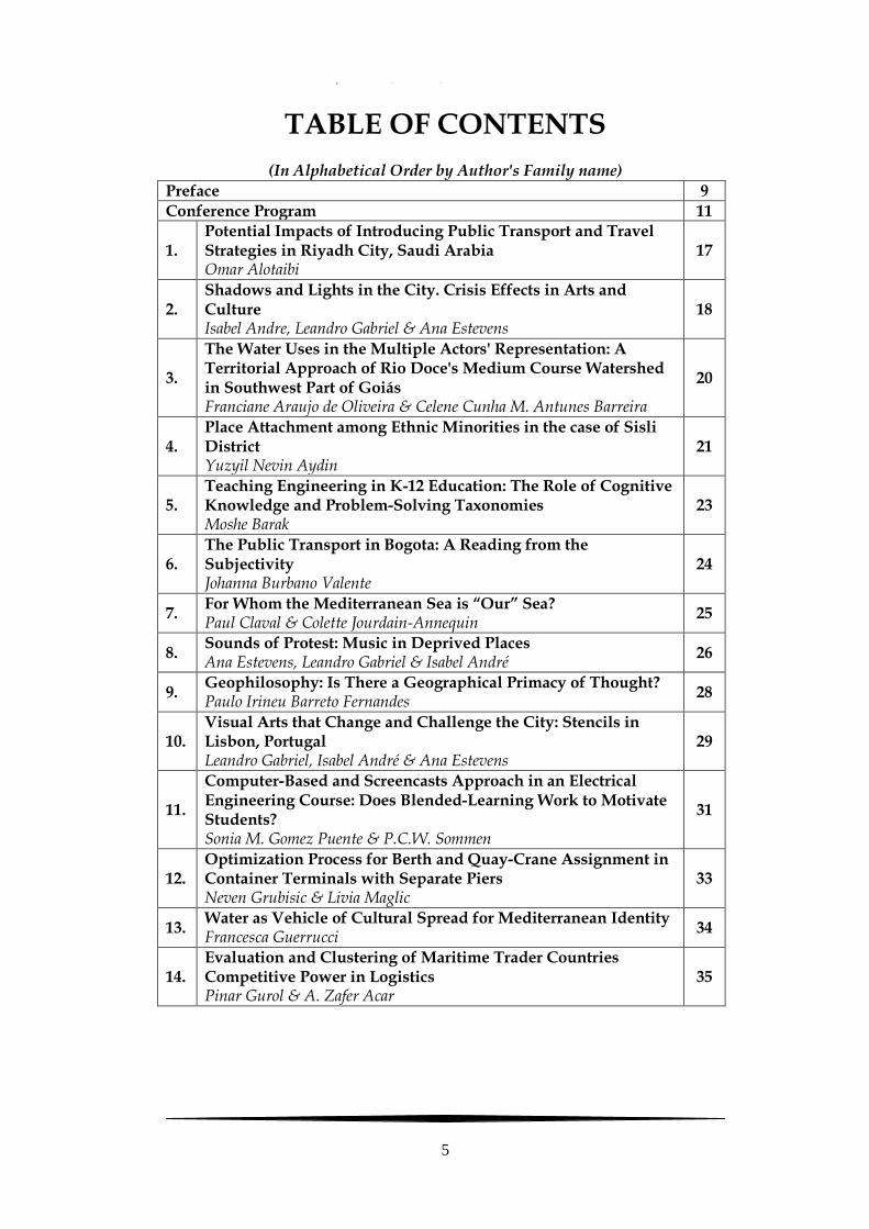
TABLE OF CONTENTS
(In Alphabetical Order by Author's Family name)
Preface 9
Conference Program 11
1. Potential Impacts of Introducing Public Transport and Travel Strategies in Riyadh City, Saudi Arabia Omar Alotaibi
17
2. Shadows and Lights in the City. Crisis Effects in Arts and Culture Isabel Andre, Leandro Gabriel & Ana Estevens
18
3.
The Water Uses in the Multiple Actors' Representation: A Territorial Approach of Rio Doce's Medium Course Watershed in Southwest Part of Goiás Franciane Araujo de Oliveira & Celene Cunha M. Antunes Barreira
20
4. Place Attachment among Ethnic Minorities in the case of Sisli District Yuzyil Nevin Aydin
21
5. Teaching Engineering in K-12 Education: The Role of Cognitive Knowledge and Problem-Solving Taxonomies Moshe Barak
23
6. The Public Transport in Bogota: A Reading from the Subjectivity Johanna Burbano Valente
24
7. For Whom the Mediterranean Sea is “Our” Sea? Paul Claval & Colette Jourdain-Annequin
25
8. Sounds of Protest: Music in Deprived Places Ana Estevens, Leandro Gabriel & Isabel André
26
9. Geophilosophy: Is There a Geographical Primacy of Thought? Paulo Irineu Barreto Fernandes
28
10. Visual Arts that Change and Challenge the City: Stencils in Lisbon, Portugal Leandro Gabriel, Isabel André & Ana Estevens
29
11.
Computer-Based and Screencasts Approach in an Electrical Engineering Course: Does Blended-Learning Work to Motivate Students? Sonia M. Gomez Puente & P.C.W. Sommen
31
12. Optimization Process for Berth and Quay-Crane Assignment in Container Terminals with Separate Piers Neven Grubisic & Livia Maglic
33
13. Water as Vehicle of Cultural Spread for Mediterranean Identity Francesca Guerrucci
34
14. Evaluation and Clustering of Maritime Trader Countries Competitive Power in Logistics Pinar Gurol & A. Zafer Acar
35
6th Annual International Conference on Urban Studies & Planning
6-9 June 2016, Athens, Greece: Abstract Book
6
15. Pigeons and People: Mortal Enemies or Lifelong Companions? A Case Study on Staff Perceptions of the Pigeons on the University of South Africa, Muckleneuk Campus Emma Harris, Engela De Crom & Ann Wilson
36
16.
Flood Inundation Mapping of Risk Zones and Identification of Consequences in the future Flood Events at the River Alfet – Oued Al Abid watershed– Using HEC-RAS and HEC-FIA Models Ismail Karaoui
37
17.
A Sustainable Development Analysis for a Market Penetration Scenario of Electric Vehicles with Range Extenders in the Stuttgart Metropolitan Area Roman Klementschitz & Juliane Stark
38
18. Redirection of the World Traffic Flow Far East - Europe via the Adriatic Sea Serdjo Kos, Sinisa Vilke & David Brcic
40
19.
The Urban Design Studio Pedagogic Approaches to Urban Sustainability: Problem-Based Solutions from the Classroom to the Community Jesus J. Lara
41
20. Crowdsourcing Public Participation in Urban Planning and Management for Small Towns Wenshu Li, Harry Timmermans & Ming Zhang
42
21. Post-Revolution Urban Landscape. Transformation of Public Spaces after 2011 Revolutions Ana Medina
43
22. The Supervisory Role of the Ministry of Finance in the Process of Awarding of Concessions in the Republic of Croatia Melita Milenkovic & Goran Vojkovic
44
23. Engineering Learning through Aerospace Engineering Laboratory Anne Nortcliffe, Sam Power & Karen Vernon-Parry
45
24. Desecration of Public Monuments and Places: The Causes and Solutions Johnie Nyametso
46
25. Understanding the Relation between Energy Consumption and Urban Form Characteristics Bruno Osorio, Nick McCullen, Ian Walker & David Coley
47
26.
Transnational Cooperation in Europe: The Example of Integrated Spatial and Transport Development along the Hamburg-Athens Corridor Ana Peric & Bernd Scholl
48
27. Waterscapes and Cities in the Amazonie of Peru Gustavo Rondon
49

6th Annual International Conference on Urban Studies & Planning
6-9 June 2016, Athens, Greece: Abstract Book
7
28. A Contribution of Advance Global Vessel Traffic Management System Dani Sabalja
50
29.
Predicting Soil Erosion and Sediment Yield in Oued El Abid Watershed, Morocco El Mouatassime Sabri, Ahmed Boukdir, Abdallah El Mahboul, Rachid El Meslouhi, Mustapha Mabrouki, Vivien Romaric, Ekouele Mbaki, Abdelhamid Zitouni, Wissal Baite & Zhour Echakraoui
52
30. Charge Detection in Al-Ain Region Sayed Sharaf & Pere Serra
53
31. Transformation of City Space and Housing Estates Associated with Changes in Lifestyle of Inhabitants Olga Skoczylas
54
32. Sustainable Community Development through the Lens of Urban Productivity Maria Spiliotopoulou & Mark Roseland
55
33. Simulation-Based Conflict Analysis for Left-Turn Phasing Choices Nikiforos Stamatiadis & Adam Kirk
56
34. The Tourism Potential of Lagoon Ecosystems along the Adriatic Coast Provide Mirela Tase
57
35. Why is America’s Marine Highway Program Failing to Thrive? Jeffrey Taub
58
36. Risk Assessment and Ranking of Small Arms Ranges (SAR) with Significant Environmental Impact on Military Bases Efrosyni-Maria Skordaki & Nicholas Vlachopoulos
60
37. Creative Tourism and Big Variation of Community Chen-Yi Wu, Chen-Jai Lee & Bo-xiu Jian
61
38. Reliability Design of Residential Sized Refrigerators Subjected to Repetitive Random Vibration Loads during Rail Transport Seong-Woo Woo
62
39. Housing Provision Systems and the Impact on Urban Development, the Case of Kayseri, Turkey Nese Yilmaz Bakir, Hikmet Eldek & Umut Doğan
63
40. Development of Population Mobility in Czechia in the Context of Transformation Processes at the End of the 20th Century Lenka Zajickova & Vit Vozenilek
65

6th Annual International Conference on Urban Studies & Planning
6-9 June 2016, Athens, Greece: Abstract Book
8
6th Annual International Conference on Urban Studies & Planning
6-9 June 2016, Athens, Greece: Abstract Book
9
Preface
This abstract book includes all the abstracts of the papers presented at the 6th Annual International Conference on Urban Studies & Planning, 6-9 June 2016, Athens, Greece, organized by the Athens Institute for Education and Research. In total, there were 40 papers and 45 presenters, coming from 24 different countries (Albania, Austria, Belgium, Brazil, Canada, Colombia, Croatia, Czech Republic, France, Ghana, Israel, Italy, Morroco, Poland, Portugal, South Africa, South Korea, Switzerland, Taiwan, The Netherlands, Turkey, U.K, UAE, USA). The conference was organized into nine sessions that included areas such as Geotechnology, Territorial Development, Geological Processes and other related fields. As it is the publication policy of the Institute, the papers presented in this conference will be considered for publication in one of the books of ATINER.
The Institute was established in 1995 as an independent academic organization with the mission to become a forum where academics and researchers from all over the world could meet in Athens and exchange ideas on their research and consider the future developments of their fields of study. Our mission is to make ATHENS a place where academics and researchers from all over the world meet to discuss the developments of their discipline and present their work. To serve this purpose, conferences are organized along the lines of well established and well defined scientific disciplines. In addition, interdisciplinary conferences are also organized because they serve the mission statement of the Institute. Since 1995, ATINER has organized more than 150 international conferences and has published over 100 books. Academically, the Institute is organized into six research divisions and twenty-seven research units. Each research unit organizes at least one annual conference and undertakes various small and large research projects.
I would like to thank all the participants, the members of the organizing and academic committee and most importantly the administration staff of ATINER for putting this conference together.
Gregory T. Papanikos President

6th Annual International Conference on Urban Studies & Planning
6-9 June 2016, Athens, Greece: Abstract Book
10

6th Annual International Conference on Urban Studies & Planning
6-9 June 2016, Athens, Greece: Abstract Book
11
FINAL CONFERENCE PROGRAM 6th Annual International Conference on Urban Studies & Planning,
6-9 June 2016, Athens, Greece
Conference Venue: Titania Hotel, 52 Panepistimiou Street, 10678 Athens, Greece
Monday 6 June 2016 (all sessions include 10 minutes break)
08:00-08:30 Registration and Refreshments
08:30-09:00 Welcome & Opening Address (ROOM C- Mezzanine Floor)
Gregory T. Papanikos, President, ATINER.
George Poulos, Vice-President of Research, ATINER & Emeritus Professor, University of South Africa, South Africa.
09:00-10:30 Session I (ROOM B- Mezzanine Floor): Transportation Planning I
Chair: Virginia Sisiopiku, Head, Transportation Engineering Research Unit, ATINER, & Associate Professor, The University of Alabama at Birmingham, USA.
1. *Johanna Burbano Valente, Director of Psychology Department, Associate Professor, Pontifificia Universidad Javeriana, Colombia. The Public Transport in Bogota: A Reading from the Subjectivity.
2. Roman Klementschitz, Senior Scientist, University of Natural Resources and Life Sciences (BOKU), Austria & Juliane Stark, Senior Scientist, University of Natural Resources and Life Sciences (BOKU), Austria. A Sustainable Development Analysis for a Market Penetration Scenario of Electric Vehicles with Range Extenders in the Stuttgart Metropolitan Area.
3. Omar Alotaibi, Ph.D. Candidate, Cardiff University, U.K. Potential Impacts of Introducing Public Transport and Travel Strategies in Riyadh City, Saudi Arabia.
4. Jeffrey Taub, Associate Professor, Maine Maritime Academy, USA. Why is America’s Marine Highway Program Failing to Thrive?
10:30-12:00 Session II (ROOM C- Mezzanine Floor): Urban Studies & Engineering Education
Chair: *Vladimir Haasz, Professor, Czech Technical University in Prague, Czech Republic.
1. *Anne Nortcliffe, Principal Lecturer, Sheffield Hallam University, U.K., Sam Power, Student, Sheffield Hallam University, U.K. & Karen Vernon-Parry, Principal Lecturer, Sheffield Hallam University, U.K. Engineering Learning through Aerospace Engineering Laboratory.
2. *Sonia M. Gomez Puente, Education Development Policy Advisor, Eindhoven University of Technology (TU/e), The Netherlands & P.C.W. Sommen, Associate Professor, Eindhoven University of Technology (TU/e), The Netherlands. Computer-Based and Screencasts Approach in an

6th Annual International Conference on Urban Studies & Planning
6-9 June 2016, Athens, Greece: Abstract Book
12
Electrical Engineering Course: Does Blended-Learning Work to Motivate Students?
3. *Maria Spiliotopoulou, Ph.D. Candidate and Researcher, Simon Fraser University, Canada & Mark Roseland, Director and Professor, Simon Fraser University, Canada. Sustainable Community Development through the Lens of Urban Productivity.
4. Bruno Osorio, Ph.D. Research Student, University of Bath, U.K., Nick McCullen, Lecturer, University of Bath, U.K., Ian Walker, Senior Lecturer, University of Bath, U.K. & David Coley, Professor, University of Bath, U.K. Understanding the Relation between Energy Consumption and Urban Form Characteristics.
12:00-13:30 Session III (ROOM B-
Mezzanine Floor): Urban Processes
12:00-13:30 Session IV (ROOM D-
Mezzanine Floor): Stress Factors and
Impact on Human Health and Social
Factors I
Chair: *Marjan Mahdavi, Ph.D. Student, Politecnico di Milano, Italy.
Chair: *Jorge Rocha, Auxiliary Professor, IGOT - University of Lisbon, Portugal.
1. Wenshu Li, Ph.D. Candidate, Wuhan Univeristy, China and Eindhoven University of Technology, The Netherlands, Harry Timmermans, Professor, Eindhoven University of Technology, The Netherlands & Ming Zhang, Associate Professor, University of Texas at Austin, USA. Crowdsourcing Public Participation in Urban Planning and Management for Small Towns.
1. Nicholas Vlachopoulos, Associate Professor, Royal Military College of Canada, Canada & Efrosyni-Maria Skordaki, Researcher, Royal Military College of Canada, Canada. Risk Assessment and Ranking of Small Arms Ranges (SAR) with Significant Environmental Impact on Military Bases.
2. Emma Harris, Lecturer, University of South Africa, South Africa, Engela De Crom, Senior Lecturer, Tshwane University of Technology, South Africa & Ann Wilson, Lecturer, University of South Africa, South Africa. Pigeons and People: Mortal Enemies or Lifelong Companions? A Case Study on Staff Perceptions of the Pigeons on the University of South Africa, Muckleneuk Campus.
3. El Mouatassime Sabri, Ph.D. Student, Sultan Moulay Slimane University, Morroco, Ahmed Boukdir, Professor , Sultan

6th Annual International Conference on Urban Studies & Planning
6-9 June 2016, Athens, Greece: Abstract Book
13
Moulay Slimane University, Morroco, Abdallah El Mahboul, Secretary, Minister of Energy, Mining, Water, Morocco, Rachid El Meslouhi, Chef of SIG Department, Hydrological Basin Agency, Morocco, Mustapha Mabrouki, Professor, Sultan Moulay Slimane University, Morroco, Vivien Romaric Ekouele Mbaki, Ph.D. Student, Sultan Moulay Slimane University, Morroco, Abdelhamid Zitouni, Ph.D. Student, Sultan Moulay Slimane University, Morroco, Wissal Baite, Ph.D. Student, Sultan Moulay Slimane University, Morroco & Zhour Echakraoui, Ph.D. Student, Sultan Moulay Slimane University, Morroco. Predicting Soil Erosion and Sediment Yield in Oued El Abid Watershed, Morocco.
4. Ismail Karaoui, Ph.D. Student, University Sultan Moulay Slimane, Morocco. Flood Inundation Mapping of Risk Zones and Identification of Consequences in the future Flood Events at the River Alfet – Oued Al Abid watershed– Using HEC-RAS and HEC-FIA Models.
13:30-14:30 Lunch
14:30-16:00 Session V (ROOM D- Mezzanine Floor): History, Application and Management in Spatial Planning – Water and Waste Management
Chair: *Jesus J. Lara, Associate Professor, The Ohio State University, USA.
1. Paul Claval, Emeritus Professor, University of Paris-IV (Paris-Sorbonne), France & Colette Jourdain-Annequin, Emeritus Professor, University of Grenoble, France. For Whom the Mediterranean Sea is “Our” Sea?
2. Franciane Araujo de Oliveira, Ph.D. Student, Universidade Federal de Goiás, Brazil & Celene Cunha M. Antunes Barreira, Professor, Universidade Federal de Goiás, Brazil. The Water Uses in the Multiple Actors' Representation: A Territorial Approach of Rio Doce's Medium Course Watershed in Southwest Part of Goiás.
3. *Mirela Tase, Lecturer, University of Durres, Albania. The Tourism Potential of Lagoon Ecosystems along the Adriatic Coast Provide.

6th Annual International Conference on Urban Studies & Planning
6-9 June 2016, Athens, Greece: Abstract Book
14
16:00-17:30 Session VI (ROOM B- Mezzanine Floor): Culture, the City and Education
Chair: *Maria Spiliotopoulou, Ph.D. Candidate and Researcher, Simon Fraser University, Canada.
1. Francesca Guerrucci, Architect, University G.D’Annunzio, Italy. Water as Vehicle of Cultural Spread for Mediterranean Identity.
2. Ana Estevens, Researcher, CEG-IGOT, University of Lisbon, Portugal, Leandro Gabriel, Ph.D. Student, CEG-IGOT, University of Lisbon, Portugal & Isabel André, Professor and Researcher, CEG-IGOT, University of Lisbon, Portugal. Sounds of Protest: Music in Deprived Places.
3. Ana Medina, Ph.D. Student, Universidad Politécnica de Madrid - Goldsmiths University of London, U.K. Post-Revolution Urban Landscape. Transformation of Public Spaces after 2011 Revolutions.
17:30-19:00 Session VII (ROOM B- Mezzanine Floor): History, Application and Management in Spatial Planning – Territorial Planning and Management
Chair: Paul Claval, Emeritus Professor, University of Paris-IV (Paris-Sorbonne), France.
1. *Sayed Sharaf, Researcher, Abu Dhabi Systems and Information Centre, UAE & Pere Serra, Lecturer, Universitat Autònoma de Barcelona, Spain. Charge Detection in Al-Ain Region.
2. *Ana Peric, Post-doc Fellow, Swiss Federal Institute of Technology, Switzerland & Bernd Scholl, Professor, Swiss Federal Institute of Technology, Switzerland. Transnational Cooperation in Europe: The Example of Integrated Spatial and Transport Development along the Hamburg-Athens Corridor.
3. Paulo Irineu Barreto Fernandes, Professor, Federal Institute Triângulo Mineiro (Campus Uberlândia, MG), Brazil. Geophilosophy: Is There a Geographical Primacy of Thought?
21:00-23:00 Greek Night and Dinner (Details during registration)
Tuesday 7 June 2016
08:00-09:30 Session VIII (ROOM B- Mezzanine Floor): Urban Places, Transformation and Art
Chair: *Ana Peric, Post-doc Fellow, Swiss Federal Institute of Technology, Switzerland.
1. Isabel Andre, Professor and Researcher, CEG-IGOT, University of Lisbon, Portugal, Leandro Gabriel, Ph.D. Student, CEG-IGOT, University of Lisbon, Portugal & Ana Estevens, Researcher, CEG-IGOT, University of Lisbon, Portugal. Shadows and Lights in the City. Crisis Effects in Arts and Culture.
2. Olga Skoczylas, Assistant, Lublin University of Technology, Poland. Transformation of City Space and Housing Estates Associated with Changes in Lifestyle of Inhabitants.
6th Annual International Conference on Urban Studies & Planning
6-9 June 2016, Athens, Greece: Abstract Book
15
3. Leandro Gabriel, Ph.D. Student, CEG-IGOT, University of Lisbon, Portugal, Isabel André, Professor and Researcher, CEG-IGOT, University of Lisbon, Portugal & Ana Estevens, Researcher, CEG-IGOT, University of Lisbon, Portugal. Visual Arts that Change and Challenge the City: Stencils in Lisbon, Portugal.
4. Lenka Zajickova, Ph.D. Candidate, Palacký University Olomouc (UPOL), Czech Republic & Vit Vozenilek, Professor and Head of Department of Geoinformatics, Palacký University Olomouc (UPOL), Czech Republic. Development of Population Mobility in Czechia in the Context of Transformation Processes at the End of the 20th Century.
09:30-11:00 Session IX (ROOM B- Mezzanine Floor): Freight and Logistics
Chair: Isabel Andre, Professor and Researcher, CEG-IGOT, University of Lisbon, Portugal.
1. Nikiforos Stamatiadis, Professor, University of Kentucky, USA & Adam Kirk, Research Engineer, University of Kentucky, USA. Simulation-Based Conflict Analysis for Left-Turn Phasing Choices. (Tuesday 7 June, 2016)
2. Serdjo Kos, Tenure Professor and Dean, Faculty of Maritime Studies, University of Rijeka, Croatia, Sinisa Vilke, Assistant Professor, University of Rijeka, Croatia & David Brcic, Research Fellow, University of Rijeka, Croatia. Redirection of the World Traffic Flow Far East - Europe via the Adriatic Sea.
3. Neven Grubisic, Assistant Professor, University of Rijeka, Croatia & Livia Maglic, Senior Research Assistant, University of Rijeka, Croatia. Optimization Process for Berth and Quay-Crane Assignment in Container Terminals with Separate Piers.
4. Dani Sabalja, Assistant Professor, University of Rijeka, Croatia. A Contribution of Advance Global Vessel Traffic Management System.
5. Pinar Gurol, Research Assistant, Piri Reis University, Turkey & A. Zafer Acar, Associate Professor, Piri Reis University, Turkey. Evaluation and Clustering of Maritime Trader Countries Competitive Power in Logistics.
11:00-14:00 Educational and Cultural Urban Walk Around Modern and
Ancient Athens (Details during registration)
14:00-15:00 Lunch
15:00-16:30 Session X (ROOM B- Mezzanine Floor): Urban Places
Chair: Nikiforos Stamatiadis, Professor, University of Kentucky, USA.
1. Nese Yilmaz Bakir, Assistant Professor, Erciyes University, Turkey, Hikmet Eldek, Assistant Professor, Erciyes University, Turkey & Umut Doğan, Assistant Professor, Erciyes University, Turkey. Housing Provision Systems and the Impact on Urban Development, the Case of Kayseri, Turkey.
2. Gustavo Rondon, Ph.D. Student, Université Catholique de Louvain, Belgium. Waterscapes and Cities in the Amazonie of Peru.
3. Yuzyil Nevin Aydin, MSc Student, Istanbul Technical University, Turkey. Place Attachment among Ethnic Minorities in the case of Sisli District.
6th Annual International Conference on Urban Studies & Planning
6-9 June 2016, Athens, Greece: Abstract Book
16
4. Johnie Nyametso, Lecturer, Central University College, Ghana. Desecration of Public Monuments and Places: The Causes and Solutions.
16:30-18:30 Session XI (ROOM B- Mezzanine Floor): Special Topics II
Chair: Serdjo Kos, Tenure Professor and Dean, Faculty of Maritime Studies, University of Rijeka, Croatia.
1. Moshe Barak, Professor, Ben-Gurion University of the Negev, Israel. Teaching Engineering in K-12 Education: The Role of Cognitive Knowledge and Problem-Solving Taxonomies.
2. Melita Milenkovic, Assistant – Chair of Transport Law and Economics, University of Zagreb, Croatia & Goran Vojkovic, Assstant Professor, University of Zagreb, Croatia. The Supervisory Role of the Ministry of Finance in the Process of Awarding of Concessions in the Republic of Croatia.
3. Chen-Yi Wu, Ph.D. Candidate, National Taipei University, Taiwan, Chen-Jai Lee, Professor, National Taipei University, Taiwan & Bo-xiu Jian, Associate Professor, Shih Hsin University Department of Tourism, Taiwan. Creative Tourism and Big Variation of Community.
4. Seong-Woo Woo, Director and Principal Researcher, Korea Testing Co., South Korea. Reliability Design of Residential Sized Refrigerators Subjected to Repetitive Random Vibration Loads during Rail Transport.
5. *Jesus J. Lara, Associate Professor, The Ohio State University, USA. The Urban Design Studio Pedagogic Approaches to Urban Sustainability: Problem-Based Solutions from the Classroom to the Community.
21:00-22:30 Dinner (Details during registration)
Wednesday 8 June 2016 Cruise: (Details during registration)
Thursday 9 June 2016 Delphi Visit: (Details during registration)

6th Annual International Conference on Urban Studies & Planning
6-9 June 2016, Athens, Greece: Abstract Book
17
Omar Alotaibi Ph.D. Candidate, Cardiff University, U.K
Potential Impacts of Introducing Public Transport and Travel Strategies in Riyadh City, Saudi Arabia
City authorities in developing countries now raise attention
onsustainable transport systemsby enhancing or introducing public transit services and related travel strategies. An example is Riyadh City, Saudi Arabia, which has witnessed a significant growth on car ownership and population.Current efforts to reduce the excess dependence on private cars involve the construction ofsix metro lines integrated with a bus network; the system will be in operation by 2018(ADA, 2013).
Against this background, this paper investigates the expected effects of the new public transport system and related interventions on Riyadh City including aspects of urban form, economic, environment, social norms and the Saudi culture.
The analysis is based on interviews conducted with transport experts and officials of corresponding authorities in Riyadh City. The results show that with the private car being the dominant travel mode, there exist no direct travel strategies to promote alternative means of transport. Also, results highlight that the city's urban form is perceived by interviewees as having the highest impact on the uptake of public transport. Interviewees also stated that there would be changes in travel demand and population density and more activities around public transport corridors and stations. Moreover, they feel that, the provision of public transport servicesin Riyadh will improve mobility, decrease travel time, andcreate more employment opportunities for Saudi society, so it would affect Riyadh City'seconomy positively and improve the environment. On the other hand, interviewees highlighted that these potential interventions will affect social norms and the Saudi culture in a long term. They added that there will be more social interaction with the introduction of public transport services since daily journeys is a part of the society's life and culture and will result in a qualitative move and closeness among the society culture.
6th Annual International Conference on Urban Studies & Planning
6-9 June 2016, Athens, Greece: Abstract Book
18
Isabel Andre
Professor and Researcher, CEG-IGOT, University of Lisbon, Portugal Leandro Gabriel
Ph.D. Student, CEG-IGOT, University of Lisbon, Portugal &
Ana Estevens Researcher, CEG-IGOT, University of Lisbon, Portugal
Shadows and Lights in the City. Crisis Effects in Arts and Culture
The present crisis in Southern European countries shows many
crossed effects related to cultural and artistic dynamics concerning the transformations of urban culture and arts scenes. Some spaces decline while others resist by changing their paths and profile.
In recent years austerity policies decreased significantly the support to culture and arts and at the same time they contributed to reduce individual and collective demand of cultural goods causing the lifeless of many organizations and institutions. Nevertheless, in adverse situations, a significant number of artistic and cultural entities found new ways to carry on their activities, developing new visions, projects and practices as well as new resources.
Harvey (2010 1) stated that neoliberalism ‘creative destruction’ generates resistance and the exploration of possible alternatives. The author affirmed that alternatives “sought thereby to accomplish something akin to a passive revolution within the territorial logic of state power”.
We argue that in Lisbon these apparently contradictory circumstances – crisis as a drawback and also as stimulus to newness – can produce new urbanities (Borja 20112) polarized not only by recognized institutions (as national museums), but also by the 3rd sector (as neighbourhood cultural associations) and the private sector (as arts galleries). Critical thinking supports the emergence of above mentioned new urbanities aiming to find alternatives and mobilizing imagination in order to recognize and implement novel forms of spatial transformation and appropriation. Nevertheless imagination it is not the only driving force of change. As referred by McDonnell and Tepper (20153) culture and arts recent dynamics combine different and often conflicting trends such as “competition from other forms of entertainment and media, technological change, shifting demographics, economic recession, decreased government funding, shifts in philanthropy, overbuilt facilities with high overhead costs, and the
6th Annual International Conference on Urban Studies & Planning
6-9 June 2016, Athens, Greece: Abstract Book
19
rising cost of artistic labour”. If those factors are not taken into account the process of spatial transformation and appropriation cannot be understood in its diversity.
Assuming those premises this paper mobilizes instrumental methodologies that put in evidence and discuss two categories of data: (i) the evolution of initiatives, publics and resources of museums and galleries from the public, private and non-profit sector; (ii) the programs of these entities during 2014. The analysis is focused in the metropolis of Lisbon. The main analytical goal is to find signs of change, namely the rise of new initiatives and their impacts. The exploratory work already done suggests a hypothesis to explore: the alternative side of culture and arts is becoming incorporated by cultural entities losing eventually their original significance but strengthen the attractiveness and democracy of institutions and organizations that some years ago were elitist spaces.

6th Annual International Conference on Urban Studies & Planning
6-9 June 2016, Athens, Greece: Abstract Book
20
Franciane Araujo de Oliveira Ph.D. Student, Universidade Federal de Goiás, Brazil
& Celene Cunha M. Antunes Barreira
Professor, Universidade Federal de Goiás, Brazil
The Water Uses in the Multiple Actors' Representation: A Territorial Approach of Rio Doce's Medium Course
Watershed in Southwest Part of Goiás
In this thesis are analyzed the water uses under multiple actors' representation in a territorial approach of Rio Doce's middle course watershed, in the southwest part of Goiás, Brazil. With the territory and subsistence agriculture and ranching's
“modernization" increases the capitalist farming and ranching, changing the pace of production and technologies employed in the production process, the space organization and also the water uses and senses. The Rio Doce’s basin and southwest part of Goiás are representative for the analysis of water uses and meanings because of the plurality of actors and activities involved in the production process. The research problem that is expected to answer is: how the territorialized actors in Rio Doce’s basin represent the uses and meanings of water according to its place in the world? Following a plural methodological conduct, primary and secondary quantative and specially qualitative data are used, which reveal the meanings gave by these actors to the spatial reality in discussion. In this research area, hegemonyed by agribusiness, both the export agriculture activity as well as the ranching one make the water enter in international economy device, having, in consequence, a geopolitical sense.

6th Annual International Conference on Urban Studies & Planning
6-9 June 2016, Athens, Greece: Abstract Book
21
Yuzyil Nevin Aydin
MSc Student, Istanbul Technical University, Turkey
Place Attachment among Ethnic Minorities in the case of Sisli District
Istanbul has been housing to various cultures and ethnic
communities as a result of dynamic social, geographic and geopolitical circumstances. These cultural and demographic layers have overlapped through ages and created a pluralist cultural identity. Sisli, an old district in Istanbul, is the place where its preliminary occupants are substantially ethnic minority communities who are originally Greek, Armenian and Jewish. Yet their new neighbors keep changing on a regular basis, these minority communities prefer to remain in the same region. According to Shumaker and Taylor (1983), attachment is individuals' unity to their residents. This research attempts to clarify the relationship between characteristics of the ethnic identity of these minorities and their place attachment variables in the case of Sisli district. To enable this, a survey is conducted with 85 respondents. The reasons behind their place attachment are evaluated with the questions that shaped around two main parts. First, through their lifecycle in which period they preferred living in Sisli and second, the major reasons of their choice to live in Sisli.
According to the responds, the respondents’ main locations are spotted with a route map. It is clear that the major tendencies and flowing parts in this route map is indicating Sisli as a focus point. The 90% of the Sisli residential feel belonged to Sisli and again %75 of them have never lived anywhere else but Sisli. Heidegger (1962) states that, settlements are the states occurred from individuals' exertion on gaining identity and after place attachment perception arises. Only %28 of the respondents who are living in Sisli is here for less than 10 years, and they state that the main reason is the tendency to living 'together with relatives'.
The district becomes the settlement of this overlapping demographic structure and exposed to this factor while growing. As it is understood from the responds, ethnic minorities prefer living in Sisli and hesitate on moving out. Social bonds among them lead to attachment. What is highlighted here is the districts historical background and high community commitment.

6th Annual International Conference on Urban Studies & Planning
6-9 June 2016, Athens, Greece: Abstract Book
22
6th Annual International Conference on Urban Studies & Planning
6-9 June 2016, Athens, Greece: Abstract Book
23
Moshe Barak Professor, Ben-Gurion University of the Negev, Israel
Teaching Engineering in K-12 Education: The Role of Cognitive Knowledge and Problem-Solving Taxonomies
This paper explores the content and methods of teaching engineering
in K-12 education through the lens of educational taxonomies such as Bloom's taxonomy in the cognitive domain, the types of knowledge taxonomy, and the engineering problem-solving taxonomy. The term engineering deals with using mathematics and science for the design of artefacts and systems that answer human needs and volitions. Engineering is also strongly associated with problem solving and creativity. However, teaching engineering is a relatively new area in K-12 education, and exploring this school subject from the perspective of educational taxonomies could help in clarifying the objectives, methods and difficulties in teaching this subject to children. For example, an analysis of the literature and research findings shows that fostering students’ higher-order capabilities such as design and problem solving in engineering and technology cannot take place in isolation from specific knowledge.Instruction should strive to develop a certain degree of factual, procedural, conceptual and meta-cognitive knowledge by engaging learners in assignments of increasing cognitive levels, from simple to complex ones. These conclusions could contribute to the efforts of making engineering and technology a core component in the overall curriculum.
6th Annual International Conference on Urban Studies & Planning
6-9 June 2016, Athens, Greece: Abstract Book
24
Johanna Burbano Valente Director of Psychology Department, Associate Professor, Pontifificia
Universidad Javeriana, Colombia
The Public Transport in Bogota: A Reading from the Subjectivity
In Bogota, Colombia, since 1995 a series of the public transport
interventions such us BRT systems and cycle-paths among others have been taken place. The main aim of these interventions has been related to the improvement of city´s mobility and the citizens´ quality of life. Several studies have been carried out analyzing changes in logics, perspectives and behavior as result of these interventions. An interdisciplinary research team composed by historians, psychologists, lawyers and engineers has developed a comprehensive approach to the problems that commuters confront in their daily life in a city in continuous transformation. As a result, a model, which comprises three levels of analysis, has been developed. This paper presents the model proposed and its characteristics. The macro level considers, for instance, the public policy as regards the transport sector and the features of the transport system adopted by the city planners. The meso-level is concerned with the organizational logics of transport companies that are part of the transport system. Finally the micro level analyses the interaction of particular social actors in organizational scenarios. Samples of the application of the model to the transport system in Bogota will be presented to illustrate the explanatory potential of the proposal.

6th Annual International Conference on Urban Studies & Planning
6-9 June 2016, Athens, Greece: Abstract Book
25
Paul Claval Emeritus Professor, University of Paris-IV (Paris-Sorbonne), France
& Colette Jourdain-Annequin
Emeritus Professor, University of Grenoble, France
For Whom the Mediterranean Sea is “Our” Sea?
In the book II of his Geography, Strabo precises the purpose of this discipline: "to describe the inhabited world in its known parts" (Strabo, II, 5, 5). In order to achieve such a result, the geographer learns from astronomy, physics (Strabo, II, 5, 1) and geometry (Strabo, II, 5. 4). He may then tackle with his specific task: "to define the inhabited world" (Strabo, II, 5, 4). In order to do it, he represents it through a map (Strabo, II, 5, 13). This one shows how the inhabited space is built: "It is first the sea that describes the land" (Strabo, II, 5, 17).
Several gulfs indent the inhabited space - more particularly "that we call the Inner sea or ’our’ sea" (Strabo, II, 5, 18): "from all these points of view [...]our sea owns a great superiority and thus it is from there that we have to start our World tour" (Strabo, II, 5, 18).
Strabo presents the approach of the geographer in a perfectly objective way: he is a man of science. His tone changes abruptly when dealing with the Inner sea: the narrator appropiates it saying : ‘our’ sea.
We would ponder here over the use of this possessive, which
supposes a global knowledge of the Mediterranean World by people who consider it as their home – a situation that seldom predominated.
1- If Strabo were a Roman, the expression mare nostrum would sound normal. But he was a Greek. Was it normal, for the Greeks, to appropriate themselves the Mediterranean sea? Yes, for three reasons : (i) From the first images (Achilles’ shield) to cartographic representations (the Ionian map), the Mediterranean sea was for the Greeks an inner sea. (ii) For them it was already a World space their gods and heroes travelled up and down. Very soon a dialectic game developed between reality (travels, trade, conquest) and mythic imagination. (iii) As many Greek intellectuals living in Rome, Strabo considered Rome as a full member of the civilized community formed by the Greek World and saw in it its legitimate heir.
2- The idea that the Mediterranean sea was "our sea" disappeared with the division of the Roman Empire and later, Islam. It reappeared in the 19th century. Science then underscored the unity of the Mediterranean environment. Artists got enthusiasic with its light. Controllingthe whole Mediterranean World, Western Imperialism gave it back its unit and appropriated it.
6th Annual International Conference on Urban Studies & Planning
6-9 June 2016, Athens, Greece: Abstract Book
26
Ana Estevens Researcher, CEG-IGOT, University of Lisbon, Portugal
Leandro Gabriel Ph.D. Student, CEG-IGOT, University of Lisbon, Portugal
& Isabel André
Professor and Researcher, CEG-IGOT, University of Lisbon, Portugal
Sounds of Protest: Music in Deprived Places
In the contemporary cities, arts play an important role in deepening processes of social cohesion, including dialogue enablement and the strengthen of bridging capital among diasporas. Furthermore it has been considered especially relevant for the promotion of individual and collective self-esteem, to the (re)construction of local and social identities and to strengthening the sense of place belonging. Artistic activities can become a means to counter or reverse the reproduction of inequality and disadvantage, constituting a stimulus to increasing personal and collective confidence, collective learning and critical thinking and contributing towards the elimination of the negative connotations associated with certain communities and places. In deprived areas of the city, where poor immigrants are overrepresented, the artistic production has the potential to help build bridges and to facilitate encounters between different populations sharing the same urban space.
Certain city neighbourhoods, like Cova da Moura in Amadora municipality, experience systematic disadvantages. Despite the social and cultural inequalities that beset this social domain, arts remains one of the main pathways to promoting social and urban cohesion, particularly via the development of competences related to creativity, citizenship and interculturality. In the context of Cova da Moura, the music, especially de migrant music from Cape Vert can also be looked at from a political significance point of view, as an expression of cultural activism, contestation and resistance. Departing from this framework, we will discuss and explore how music making, performance and consumption take shape within urban dynamics influenced. For that purpose, it will explore how Cova da Moura residents use diverse musical practices to express meaningful messages to the wider society and to contest the conditions of their inclusion (or lack thereof). Some key questions should be answered such as: what are the main messages of the musical pieces? Who are the authors? What kind of musical competencies do they have? And links with other musicians in the neighbourhood, in Portugal or abroad? What means

6th Annual International Conference on Urban Studies & Planning
6-9 June 2016, Athens, Greece: Abstract Book
27
this musical scene to the residents? Information for this purpose come from interviews and focus groups sessions.

6th Annual International Conference on Urban Studies & Planning
6-9 June 2016, Athens, Greece: Abstract Book
28
Paulo Irineu Barreto Fernandes
Professor, Federal Institute Triângulo Mineiro (Campus Uberlândia, MG), Brazil
Geophilosophy: Is There a Geographical Primacy of Thought?
This paper presents results of studies on the concept
“Geophilosophy” introduced by Deleuze and Guattari, in the text “geophilosophy”, in the book “What is Philosophy?”. With this term, the authors highlight the immanent character of philosophy, drawing attention to the geographical elements that have influenced and influence the construction of thought, as the relationship of humans with the territory, with the ground, with the place, and with Earth. Deleuze and Guattari say that the first philosophers created their own approach to nature, treating it by concepts and not by figures, as does, for example, the myth. The concept is a “bridge” between the relative and the absolute, and the thought is not a direct link between subject and object, but is done in relation with the territory, with the place. For Deleuze and Guattari the creator of the term “geophilosophy” was Nietzsche, when he sought to enumerate some common social aspects in different countries. Thus, philosophy would be, first of all, a geophilosophy, and the thought was born in the relationship between the thinking subject and the geographic features: the place, the territory, the landscape, and Earth. However, the term “geophilosophy” took on multiple meanings, among which are: the concept of valorization of the planet Earth, as highlighted by Caterina Resta (Italy), criticism of globalization, made by Milton Santos (Brazil) and the notion of geophilosophy as an investigative method, as presented in the “geo philosophical” notes of the prologue to poem “On Nature”, by Parmenides of Eleia, drafted by Gabriele Cornelli, which this study discusses more broadly.
6th Annual International Conference on Urban Studies & Planning
6-9 June 2016, Athens, Greece: Abstract Book
29
Leandro Gabriel Ph.D. Student, CEG-IGOT, University of Lisbon, Portugal
Isabel André Professor and Researcher, CEG-IGOT, University of Lisbon, Portugal
& Ana Estevens
Researcher, CEG-IGOT, University of Lisbon, Portugal
Visual Arts that Change and Challenge the City: Stencils in Lisbon, Portugal
Visual urban art have largely dominated western cities throughout
history. While these images express a certain idea of domination on the context in which they arise (evolving from prehistoric times to the Renaissance), today they combined new skills and knowledge of contemporary art movements with a more proactive attitude of social-political awareness and persistent challenge of city order. Thus, visual artists have been changing and transforming some public spaces in living canvases as they spray of an aerosol can using stencil templates. This artistic technique appears as an alternative, simple and direct form of communication, because it’s easy to replicate and have a global circulation, as an example of the real democratization of artistic expression, as noted by its acceptance within the art market and artistic institutions. Nowadays, in this process, the international mobility of artists continues to play an important role in the exchange of imaginary, techniques and experiences on how visual art can effectively change and challenge urbanity.
Like other cities affected by political austerity due to the recent global crisis, Lisbon (Portugal) has been collecting several examples of this visual urban art mainly related to social and political tensions. The city walls are filled with important messages that, on one hand, enhance the fight against the shrinking of the welfare state or decline of social rights and, on the other hand, point out important issues and flaws related to planning and urban regeneration, and also stands out as an important alternative medium of mass communication, for example related to the consumption of some public goods.
This research intends to provide insights of a collection of stencils urban art in Lisbon, using detailed content analysis applied to a large database we have prepared, based on photographic inventory. The topics for analysis includes location in the city and in the neighborhood, the image meaning, words, colors, size, etc. Based on this information, the main focus concerns its role in urban transformations in contemporary cities, namely the discussion of key questions as: What

6th Annual International Conference on Urban Studies & Planning
6-9 June 2016, Athens, Greece: Abstract Book
30
are the relationship between these street artists and most active social movements? How municipal authorities are dealing with this urban art? What are the most listed themes in these stencils and what is the impact that they have in real Lisbon transformation?
6th Annual International Conference on Urban Studies & Planning
6-9 June 2016, Athens, Greece: Abstract Book
31
Sonia M. Gomez Puente Education Development Policy Advisor, Eindhoven University of
Technology (TU/e), The Netherlands &
P.C.W. Sommen Associate Professor, Eindhoven University of Technology (TU/e), The
Netherlands
Computer-Based and Screencasts Approach in an Electrical Engineering Course: Does Blended-Learning Work to
Motivate Students?
Preparing electrical engineering students to take more control of their studies and to become more self-regulated learners has been the drive to re-design the Signal Processing Basics course. With the increasing growth in the number of students the electrical engineering faculty staff is integrating computer-based learning tools and blended-learning approaches into the teaching practices. The educational benefits of the use of computer-based and blended methods is that teachers’ working load is reduced and gain quickly an overview if students’ achievements. Likewise, students get individual feedback on progress, can identify lacunas in prior knowledge, and self-study time is maximized.
The objective of this study is to revise the effects of computer-based education on first-year electrical engineering students, and to present the design of an instructional technology model suitable for engineering education. This experience is based on a computer-based and screencast approach used in this freshman Signal Processing Basics course to motivate electrical engineering students to assess own knowledge and skills. The rationale behind is that through continuous online formative feedback on content progress students can make choices on the topics they still need to work on before taking the exam. The instructional design of the Signal Processing Basics course consists of lectures and instructions supported by computer education in the form of weekly online multiple-choice or randomize practice quizzes in a moodle platform, Oncourse, and online feedback and tutorials. In addition, screencasts are provided as a short video-clip summary of a basic building block or a small set of fundamental topics after each chapter with an outline of the main concepts addressed in the weekly lectures. Despite the educational value of this blended-learning approach students’ pass rates in this first experiment are slightly higher than in previous years, although students’ perceptions on the educational approach is positive.

6th Annual International Conference on Urban Studies & Planning
6-9 June 2016, Athens, Greece: Abstract Book
32
We evaluated this classroom experiment by comparing the pass rates and the students’ questionnaires. We compared the pass rate of the previous years with this last academic year. Results of this first experiment indicate a slightly increase in pass rate. Reasons for this may be encountered in students’ motivation to take and practice the content voluntary through the online quizzes is low as the quizzes are not part of the final score. Despite the results, students’ questionnaire on the computer-based learning tool Oncourse is very positive as students mention to gain sufficient feedback on progress that helps to understand and apply better the content learned in the lectures and instructions.
6th Annual International Conference on Urban Studies & Planning
6-9 June 2016, Athens, Greece: Abstract Book
33
Neven Grubisic Assistant Professor, University of Rijeka, Croatia
& Livia Maglic
Senior Research Assistant, University of Rijeka, Croatia
Optimization Process for Berth and Quay-Crane Assignment in Container Terminals with Separate Piers
The objective of research is container terminals with two separated
piers within the same port basin. The main problem is how to optimize the berth and crane allocation to minimize overall service time for vessels and to improve utilization of terminal assets.
Optimization of sea-side subsystem of container terminals combines three typical operational problems: ship-to-berth allocation, quay-crane to ship assignment and quay-crane scheduling. Due to their characteristics, they have high correlation and should be considered together. The problem become even more complex in Container terminals with different layout where quays and berths are not placed in the line or where berths are situated in different piers.
In this paper a specific methodology is presented with focus on optimization process. This process consist of tri stages namely: 1. initialization, 2. allocation, 3. harmonization. The core of the problem solutions in the stage 1 is execution of crane scheduling problem according to cargo volume and container distribution on the vessel. The result at the end of this stage are three operational scenarios that set out two key variables: duration of the handling process and the number of cranes required.
According to the results from stage 1, ship-to-berth assignment and allocation of cranes are executed. The practical approach implemented here, targets to high prediction, reliability and efficiency of the operational plans to satisfy the requirements of the shipping companies. This approach requires fixed number of quay-cranes during the handling operations and high utilization rate of the cranes. There is no preference involved in the berth or pier choice. Therefore, throughout the optimization process this philosophy is followed.
The results of the overall optimization has been shown on the few examples with different terminal layout and number of resources.

6th Annual International Conference on Urban Studies & Planning
6-9 June 2016, Athens, Greece: Abstract Book
34
Francesca Guerrucci Architect, University G.D’Annunzio, Italy
Water as Vehicle of Cultural Spread for Mediterranean Identity
In the Mediterranean, the barriers break down and the stories are
mixed. Instead of the land where the journey, migration, the passage is prevented by continuous borders, the sea shows that the notion of identity is a concept that does not understand the boundaries, but lets the differences and allows the meeting. The Mediterranean has historical, cultural and economic identity resulted from substantial and almost continuous contamination of all the countries bordering on its shores. In this large lake, in more than three thousand years of history, knowledge and cultures, techniques and traditions, trades and political arrangements met and clashed so much that the comparative reading of the territories that surround it leads to constant references. Ports and harbors were, for centuries, the witnesses of the birth, proliferation and vitality that the people of this area have always shown. The ports have been the point of contact land-sea, as well as the common denominator between the protection of the essential differences and promotion of identity factors unifying. Currently the tracks of the land have supplanted sea routes and the ports, places of exchange and contamination of mergers, were excluded from the fundamental role they had in the past. The earth and the water are removed. There should be a stable dialogue, constructive and planning among all countries bordering the Mediterranean and promote actions that call into play land and water, ports and cities of the Mediterranean to tackle the empty silence that currently imposes. The identity is not given once and for all, but is the subject of becoming: it builds in the meeting and may be able to exceed the purely economic logic of alliances. From the sea and the sea you can build a new future.
6th Annual International Conference on Urban Studies & Planning
6-9 June 2016, Athens, Greece: Abstract Book
35
Pinar Gurol Research Assistant, Piri Reis University, Turkey
& A. Zafer Acar
Associate Professor, Piri Reis University, Turkey
Evaluation and Clustering of Maritime Trader Countries Competitive Power in Logistics
International trade and logistics are two important factors that define
the counties economy’s growth rate and wealth. Continuous evolution of production processes at an international level, the globalization of markets and ever-greater competitiveness requires effective management of supply and distribution chains (Tsamboulas and Tatsi, 2010), and at that point logistics services become an important part for gaining strategic competitive power.
One of these logistics services is transportation, and maritime transport is most preferred transportation mode in global trade, which provides cheaper transport, and high volume cargo transportation. Approximately 55% of world trade (value based) is transferring through maritime transportation. According to literature, ports, which are an important complementary of international trade and global supply chain (Robinson, 2002), are integral part of maritime transport due to the services that they provide.
The World Bank evaluated countries quality of port infrastructure according to business executives' perception of their country's port facilities, and also World Bank evaluated countries logistics performance based on efficiency of customs clearance process, quality of trade- and transport-related infrastructure, ease of arranging competitively priced shipments, quality of logistics services, ability to track and trace consignments, and frequency with which shipments reach the consignee within the scheduled time.
At that point, gaining competitive power for countries in global trade requires the knowledge of which qualifications needed to become a global actor. Our aim is clustering countries according to logistics performance and international trade volumes within port infrastructure. In this paper, needed criteria to make difference in global trade with logistics power for a country determined with clustering analysis according to countries logistics performance index, quality of port infrastructures and international trade volumes. And competitiveness of the countries is evaluated according to that determined criteria.

6th Annual International Conference on Urban Studies & Planning
6-9 June 2016, Athens, Greece: Abstract Book
36
Emma Harris Lecturer, University of South Africa, South Africa
Engela De Crom Senior Lecturer, Tshwane University of Technology, South Africa
& Ann Wilson
Lecturer, University of South Africa, South Africa
Pigeons and People: Mortal Enemies or Lifelong Companions? A Case Study on Staff Perceptions of the Pigeons on the University of South Africa, Muckleneuk
Campus
Pigeons have been a part of our lives for as long as we can remember. Some people view them with joy, others disdain. Regardless of the perception, control measures are often implemented against the birds in a bid to reduce their presence in urban environments without considering the views of members of the public in the process. Complaints about pigeon activity are, typically, given more attention than praise for these birds. However, people who are pro-pigeons are often not provided with the forum to express their views of the birds. This study explored the perceptions of staff with regard to the pigeons inhabiting the University of South Africa’s Muckleneuk campus. Two hundred and forty-six participants provided their opinions on the pigeons, their related activities and the perceived impact on staff on the campus. Recognising that both people and urban wildlife play a role of cause-and-effect in human–wildlife conflicts can contribute to understanding peoples’ relationships and perceptions of animals which transgress the boundaries between urbanisation and nature. By considering peoples’ perceptions, attitudes and behaviours towards urban wildlife, management strategies can be significantly informed in the process of mitigating conflict. The study has shown that the negative perception of pigeons, which was assumed to be the position of all the people affected by the pigeons at the University of South Arica’s Muckleneuk campus, is in fact incorrect. Participants would rather encourage the nesting and breeding activities of the pigeons on campus, as they felt that the human–pigeon interactions and the viewing of squabs in nests contributed positively to their work environment. Pigeon control strategies should therefore not solely be on the biological aspect of a perceived pigeon problem, but should also include the human association.

6th Annual International Conference on Urban Studies & Planning
6-9 June 2016, Athens, Greece: Abstract Book
37
Ismail Karaoui Ph.D. Student, University Sultan Moulay Slimane, Morocco
Flood Inundation Mapping of Risk Zones and Identification of Consequences in the future Flood Events at the River Alfet – Oued Al Abid watershed– Using HEC-
RAS and HEC-FIA Models
Despite the semi-arid to arid nature of its climate, Morocco is submitted, like all the Mediterranean countries, to floods which can be very damaging for public and private infrastructure, and can cause many victims among the populations.
On Monday, August 10, 2015, following heavy rains, the water level of the Alfet river increase in a very remarkable way, which caused the flooding of the residents in Douar Iminwargue (Tillouguit town, Azilal province). This flood has caused human and very serious material damage, such as the death of 5 peoples, the destruction of 5 houses, and the cut of the regional road No. 302 connecting the study area and the center of Tillouguite, and the collapse of two bridges over the river Assif Ahansal.
This catastrophic event at a small Douar suffer already in very difficult living conditions, led us to make a detailed study of the river Alfet watershed to arrive at a better understanding of its hydrological characteristics and how he reacted during especially intense rain.
In this context, relying on a flow database and / or precipitation, an hydraulic simulation using the software HEC-RAS was conducted to determine the extensive flooding in various recurrences of 10, 20, 50 and 100 years.
The determination of flood levels served us to identify areas with a high risk to be affected by the 100 years flood recurrence, and thereafter estimate the impacts due to flooding by the use of the software Hec-Fia.
6th Annual International Conference on Urban Studies & Planning
6-9 June 2016, Athens, Greece: Abstract Book
38
Roman Klementschitz
Senior Scientist, University of Natural Resources and Life Sciences (BOKU), Austria
& Juliane Stark
Senior Scientist, University of Natural Resources and Life Sciences (BOKU), Austria
A Sustainable Development Analysis for a Market Penetration Scenario of Electric Vehicles with Range
Extenders in the Stuttgart Metropolitan Area
The EVREST project is a transnational European Project carried out in the framework of the ERA-NET Electromobility+ call, including partners from Germany, France and Austria and was finished in 2015. The main idea of this project is to study how Electric Vehicles with a Range Extender (EREV), a small internal combustion engine, could match the different usage patterns and what would be the impact of such a solution. Electric vehicles with range extender would not be limited to urban trips. Occasional long distance trips would be possible and people living in low density areas could also be concerned. Electric vehicles with range extender are expected to be an effective solution to cope with pollutant and noise emission in urban areas and the demanded vehicle range by the potential users. The approach in EVREST takes into account the users´ mobility needs collected in user surveys. A methodology to virtually design a set of possible EREVs that fulfil the requirements in terms of range and performance has been carried out. Concerning the environmental study, a Life Cycle Assessment that consider both the production and use phase of the proposed EREVs and of the reference vehicles - gasoline and Battery Electric Vehicles (BEV) - has been conducted. For a more global evaluation and market projection at horizon 2025, a set of indicators for the development of implementation scenarios was developed based on a car purchase decision model. Simulations of these scenarios to define the impacts on mobility and grid are conducted using a microscopic description (MobiTopp model) of cars and users in Stuttgart metropolitan area as well as a simulated grid with PERSEUSNET-TS model. The mobiTopp simulation results show EREVs are used rather similar to conventional vehicles and have a different use profile than BEVs. Technical, environmental, and social assessments were done within the project and results fed the Sustainable Development Analysis (SDA). Following the principle of a multi-criteria analysis,

6th Annual International Conference on Urban Studies & Planning
6-9 June 2016, Athens, Greece: Abstract Book
39
indicators and their contribution towards a sustainable development were determined. The sustainable development analysis includes indicators of economic (energy consumption, employment effects), social (traffic safety, mobility cost) and ecological aspects (noise, global warming, primary energy from non-renewable resources, acidification potential, eutrophication potential, photochemical ozone creation potential). Especially in the field of economic aspects (energy consumption, employment) there are significant differences between the reference scenario and the implementation scenario. The “green” reputation of electric mobility is not clearly reflected, as manufacturing BEVs and EREVs cause greater environmental pollution than producing conventional cars. In terms of social aspects there are hardly any noticeable differences between the scenarios and only small differences for the indicator mobility cost. However, the overall SDA indicator shows a positive contribution towards sustainability.
6th Annual International Conference on Urban Studies & Planning
6-9 June 2016, Athens, Greece: Abstract Book
40
Serdjo Kos
Tenure Professor and Dean, Faculty of Maritime Studies, University of Rijeka, Croatia Sinisa Vilke
Assistant Professor, University of Rijeka, Croatia &
David Brcic Research Fellow, University of Rijeka, Croatia
Redirection of the World Traffic Flow Far East - Europe via the Adriatic Sea
Natural geographic directions – cargo flows represent the shortest
natural traffic route connecting origins and destinations. When redirecting the world's traffic flow, these directions become the most important advantage only when preconditions of provision of competitive technical, technological, organizational and economical services on the specific traffic route are satisfied. The basic aim of the paper is the analytical elaboration and scientifically founded necessity for the redirection of the geotraffic flow from the Far East to Europe. Instead of destination in northern European ports (such as Antwerp, Rotterdam, Amsterdam and Hamburg) – the northern traffic flow, the flow should have to be redirected through the Adriatic sea to the ports of NAPA (North Adriatic Ports Association), that are Ravenna, Venice, Trieste, Koper and Rijeka. This route represents southern traffic flow. Specified redirection of above mentioned flows shortens the sea route between two continents for approximately 2130 nautical miles, while the land route is shortened for approximately 280 kilometers, relative to the reference destination in the center of Europe (e.g. Munich). Apart from shortening, emissions can be significantly reduced in all related transport branches, especially in maritime transportation; emission reduction for more than 10% per one TEU. The proposed redirection of elaborated route represents reasonable contribution to sustainable transportation improvements.

6th Annual International Conference on Urban Studies & Planning
6-9 June 2016, Athens, Greece: Abstract Book
41
Jesus J. Lara Associate Professor, The Ohio State University, USA
The Urban Design Studio Pedagogic Approaches to Urban Sustainability: Problem-Based Solutions from the
Classroom to the Community
The urban design studio and university-community engagements have multiple goals. They include increasing university responsiveness to local needs, stimulating real world change, and preparing students to effectively address complex social challenges (Bourner 2010, Forester 1999). However, such approaches are complicated by a variety of factors including stakeholder expectations, power imbalances, and conflicting goals between educators and community members (Mansuri and Rao 2004). While the benefits of service learning programs to universities are well-documented, the experiences and benefits of such higher education partnerships to community participants is not as well-known (Netshandama 2010). Successful engagements seem to require community involvement and decision-making authority at every phase, mutual accountability and trust (Winkler 2013).This paper presents a series of case studies of community engagement and neighborhood empowerment in the development of a collective sustainable urban design plan/vision for inner-city neighborhoods. These neighborhoodsare located in Columbus, Ohio and they have seen tremendous decline in population and economy over the past years.
The research team was challenged to ensure that the strategic vision was representative, and included the voices and perspectivesof previously marginalized residents. Accordingly, a comprehensive and multi-scale (house, block, neighborhood, city) approach to outreach andengagement was developed. Additionally, a series of educational workshops and outreach activities were conducted that involved different segments of the population and diverse community groups in the identification ofdevelopment priorities, aneighborhood health assessment, and education and assistance for green home rehabilitation.
The project findings show the value of mutual learning and education betweencommunity and higher education partners. Inner-city residentshave diverse interests, wants, and needs that span many generations. Some of the challenges are acute, but all are interconnected, making it difficult to prioritize. While the project activities and documents reflect a community vision, there is ongoing need for participatory approaches where knowledge and solutions are produced and shared among everyone involved to provide guidance for future development.

6th Annual International Conference on Urban Studies & Planning
6-9 June 2016, Athens, Greece: Abstract Book
42
Wenshu Li Ph.D. Candidate, Wuhan Univeristy, China and Eindhoven University
of Technology, The Netherlands Harry Timmermans
Professor, Eindhoven University of Technology, The Netherlands &
Ming Zhang Associate Professor, University of Texas at Austin, USA
Crowdsourcing Public Participation in Urban Planning and Management for Small Towns
With the rapid development of network and technology, information
and communication technology offers new opportunities and potentials of public participation in urban planning and management. However, in the stage of the all-round accelerated urbanization in China, construction level of small towns is far behind the big cities subject to economic, technology and infrastructure conditions.In order to narrow the gap, we need to develop suitable technology ofsmart planning and management for small towns,using relatively low-cost investment and maintenance modes.Crowdsourcing with the main superiorities of low-cost production and open innovation has attracted more and more attention, widely used in many fields. An increasing number of mobile applications aim to enable public participation by harnessing contributions from residents armed with mobile devices.This paper summarise the application model and the strategies behind crowdsourcing can heavily influence E-public participation, and then put forward the applications in urban planningand management. Our findings provides urban planners and managers with a better understanding of smart mobile crowdsourcing features, and explore a path ofsmart planning and management technology for small towns.

6th Annual International Conference on Urban Studies & Planning
6-9 June 2016, Athens, Greece: Abstract Book
43
Ana Medina Ph.D. Student, Universidad Politécnica de Madrid - Goldsmiths
University of London, U.K
Post-Revolution Urban Landscape. Transformation of Public Spaces after 2011 Revolutions
New York - Zuccotti Park, Cairo - Tahrir Square, Istanbul - Gezi
Park, London - St. Paul’ Cathedral, Madrid - Puerta del Sol; all these and more revolutions and places showed the world, the power that people and public spaces have in societies. Unlike previous revolutions, these were germinated in the digital sphere and spread with such intensity that the entire world was connected in its plazas, squares and streets simultaneously. This is the moment that changed the dynamics of the future city.
After these revolutions took place in both physical and virtual public space, local governments were conscious of the power these events can have. Soon, city councils started transforming the image of cities by selling public spaces to private investors. This is a strategy that already existed but has been pushed faster and wider since 2011. Planning departments from city councils became suspects and mediators, public assets have been quickly privatised and these cities face a rampant land speculation.
In cities like London, New York, Cairo, Rotterdam, etc., these privately owned public spaces share a common urban regulation scheme. This is a model that intends to be replicated in cities around the world focusing on aesthetics, safety, advertising, and shopping, besides a list of banned activities within these spaces. As a result, identity of local communities, traditions and image of the city have been replaced by a catalogue of homogeneous spaces.
Patterns of ownership and control based on values of private property are so inflexible that even public attention can do little to shift them. For spaces to be public, people who talk about it, use it, reimagine it must tie it to public life – law, speech, representation, policy, distribution, economics. These privately owned public spaces use design as a way of considering, representing, and constructing relationships between people and space in a way that they can control both of them by reforging these connections.
6th Annual International Conference on Urban Studies & Planning
6-9 June 2016, Athens, Greece: Abstract Book
44
Melita Milenkovic
Assistant – Chair of Transport Law and Economics, University of Zagreb, Croatia
& Goran Vojkovic
Assstant Professor, University of Zagreb, Croatia
The Supervisory Role of the Ministry of Finance in the Process of Awarding of Concessions in the Republic of
Croatia
According to the Croatian Concessions Act Ministry of Finance has a significant role in the process of awarding of concessions. This role can be classified into 3 groups. The 1st case takes into consideration when the Ministry of Finance has the right to appoint its officials in the commission in charge of awarding of concessions. The 2nd case refers to the situations where the Ministry of Finance receives regular reports from the concession provider and may intervene in case if it notices irregularities and the 3rd case refers to the situation when The Ministry of Finance plays an active role in giving approvals related to the concession. Croatian model of administrative contract is not drafted, therefore within concessions appear highly specific forms of control, which are unusual in current legal practice and not well described in the literature in the Republic of Croatia. Here are not taken into consideration any classic forms of inspection and administrative supervision, because those include monitoring of economic aspects of the concession relationship. Supervision of administrative contracts can not be viewed only under administrative procedures since it is neither administrative control nor inspection control
Therefore, we believe it is necessary to explain many roles of the Ministry of Finance in the process of awarding of concessions and supervision of concession agreements in the Republic of Croatia and possible changes in the legislation in order to be able to bring a new model for the establishment of the Committee based on external experts to carry out transparent work outside the supervision of the Ministry of Finance, which are less prone to corruption. One of the main principles of the EU, and that is the principle of transparency would then be satisfied with a new model in which the external experts would appraise the procedure of awarding of concessions in The Republic of Croatia.
6th Annual International Conference on Urban Studies & Planning
6-9 June 2016, Athens, Greece: Abstract Book
45
Anne Nortcliffe Principal Lecturer, Sheffield Hallam University, U.K.
Sam Power Student, Sheffield Hallam University, U.K
& Karen Vernon-Parry
Principal Lecturer, Sheffield Hallam University, U.K
Engineering Learning through Aerospace Engineering Laboratory
The proposed paper is the results of an investigation into identifying
what is good engineering laboratory practice for studentlearning. There is extensive literature on pedagogy of science laboratories, however the definitive literature for engineering typically cites Dewey (1910) on how learners construct knowledge from laboratories. However the engineering accreditation bodies, require all engineering degrees to have a significant amount of laboratory based learning.
The role of laboratory whether simulation or real experimentation is to develop students' learning and ability to apply the theory into practice, observing and analysing the experiment, reflect upon their learning from the experiment, and finally assimilating theory to construct and draw conclusions from the experimental learning experience essentially moving the learner through four quadrants of Kolb's learning theory, Kolb (1985). Feisel and Rosa (2005) identified that instructional laboratories should be designed to develop students' engineering knowledge, understanding and application abilities; they also identified the importance of the chronological relationship between laboratory and lecture for student knowledge synthesis.. The project aims to evaluates first year aerospace students' understanding of a theoretical topic from an aerospace dynamics lecture programme and associated practical learning opportunity to place the theory into practice. The planned research methodology is that of quantitative using MCQ to measure student learning post laboratory and qualitative using a Viva voce to assess the student learning. It should be noted neither of these methods will form the summative assessment of the student knowledge for the module. However the MCQ will provide formative assessment feedback for the formal student summative assessment; the laboratory write up. The results of the research will aid inform engineering laboratory design and timetabling to assist in maximising the learning opportunity for students.

6th Annual International Conference on Urban Studies & Planning
6-9 June 2016, Athens, Greece: Abstract Book
46
Johnie Nyametso Lecturer, Central University College, Ghana
Desecration of Public Monuments and Places: The Causes and Solutions
The monuments and public spaces of Accra have become the
platforms, or rather the notice boards of advertisement companies, churches and politicians to mention but few. This is gradually turning such national assets into monumental junkyards which leave visitors to the country with the first impression and memories of a country where the citizenry are indiscipline and lawless. This is because unlike in the developed countries where perpetrators of such acts use graffiti and artworks which are very difficult to trace to the culprits for fear of prosecution, the direct opposite is what happens in Ghana. The offenders here boldly display their faces, contact addresses, telephone and other personal information yet the police and city authorities look on as if it is alright to behave the way the wrongdoers do. In their desperation, the city authorities have resorted to painting some of the monuments with the national colours to deter people from using them as billboards. This research is intended to make a significant contribution to knowledge by unravelling the effects ignorance, blatant disrespect of city by-laws and the non-enforcement of those laws could have on the image of a country. This raises the question: “to what extent are the desecration of public monuments and places due to ignorance, obvious disrespect of laws governing such places and the non-enforcement of the laws attributable to the rapid rate of public assets’ vandalism?” In order to address the question, this study will use a mixed-methods research approach to collect and analyse data on the causes of the problem and make recommendations about how best to eradicate the predicament and restore such places to the glory they deserve.
6th Annual International Conference on Urban Studies & Planning
6-9 June 2016, Athens, Greece: Abstract Book
47
Bruno Osorio Ph.D. Research Student, University of Bath, U.K
Nick McCullen Lecturer, University of Bath, U.K
Ian Walker, Senior Lecturer, University of Bath, U.K
& David Coley
Professor, University of Bath, U.K
Understanding the Relation between Energy Consumption and Urban Form Characteristics
World energy consumption is predominantly based on fossil fuels,
the use of which has impacts on climate and air quality. A substantial fraction of this energy consumption comes from urban areas, mostly from the demand from buildings and transport.
The term Urban form refers to the socio-economic aspects and the physical characteristics of urban areas. Through influencing many features such as human behaviour and transport dynamics, these aspects and characteristics are expected to have a significant impact on energy consumption and be a key component to future urban sustainability.
The research in this paper investigates the relationship between urban form and energy consumption, in order to understand how one influences the other. The overall urban energy consumption is first obtained by combining that from both buildings and commuting transport at a unified and large geographic scale of analysis. Urban form indicators -- both landscape metrics and socio-economic measures -- are also obtained for the same land-parcels. Correlations between the two are then computed before being plotted and mapped using a Geographic Information Systems (GIS) environment.
The results demonstrate that a variety of urban form features influence transport energy consumption, such as car availability, total land area and built urban area. Additionally, outcomes also show the importance of density measures in trying to explain urban energy consumption, such as population and housing density.
It is shown that understanding the relationship between urban form and energy consumption and quantifying the effects of one on the other can provide new information to urban policy-makers and planners. Furthermore, the large scale used in this study offers a more detailed analysis of urban areas that will allow us to design strategies to cut carbon emissions and energy consumption.

6th Annual International Conference on Urban Studies & Planning
6-9 June 2016, Athens, Greece: Abstract Book
48
Ana Peric Post-doc Fellow, Swiss Federal Institute of Technology, Switzerland
& Bernd Scholl
Professor, Swiss Federal Institute of Technology, Switzerland
Transnational Cooperation in Europe: The Example of Integrated Spatial and Transport
Development along the Hamburg-Athens Corridor
As defined by the European Commission, the corridor Hamburg-Athens is one of the core European transportation axes. However, this corridor is not only of European importance – it coincides with the migration route and is one of the key areas for international, mainly Chinese, investments in transportation hubs and lines, such as Piraeus port and Balkan railway lines. Such global issues makes the Hamburg-Athens corridor a key strategic area in Europe. The paper poses the thesis that only transnational cooperation can improve the development of the corridor, particularly in terms of integrated spatial and transport development. Since the paper presents the results of the initial phase of the European project on transnational cooperation in the domain of integrated spatial and transport development along the Hamburg-Athens corridor, the overview of the results is given as follows. Firstly, the paper presents the main trade, economic and demographic statistic indicators in order to clarify the strategic position of Europe in transcontinental relations. Secondly, the major findings of the European documents on transnational cooperation are briefly given in addition to the overview of trade, economic and demographic parameters relevant for the countries along the Hamburg-Athens corridor. The overview of the current state and future development in the field of transport (rail, road and waterway) and spatial development (i.e. strategic areas) is particularly stressed. Finally, the close interaction between transport and spatial development in the cities along the corridor is presented. For this purpose, some of the positive examples of integrated spatial and transport development, such as Hamburg, Berlin and Vienna, as well as some less successful cases as Budapest, Belgrade and Athens are discussed. Such a multi-scalar perspective is believed to provide a better examination of the current situation. Moreover, it will briefly give a hint on the dynamics of transnational cooperation (in broader terms), as well as the cooperation process among many stakeholders from various domains, mainly transportation and spatial planning (in narrow terms).
6th Annual International Conference on Urban Studies & Planning
6-9 June 2016, Athens, Greece: Abstract Book
49
Gustavo Rondon Ph.D. Student, Université Catholique de Louvain, Belgium
Waterscapes and Cities in the Amazonie of Peru
In the last 50 years, the population growth of urban areas has increased significantly in Latin America. While this growth is mainly concentrated in coastal cities, places that were less populated before and even misperceived as uninhabited, as the Amazonia, also present an urban population increase.
The cities of Lamas and Santa Maria de Nieva belong to the network of Peruvian northern cities: they are located in a transverse axis connecting the coast (Piura, Chiclayo) with the lower Amazonia (Iquitos).
Taking into account the characteristics of land occupation, using cartographic sources (maps and satellite images) and gathering data from field research conducted during the month of August 2015, a first analysis of the urban water cycle was performed. It is based on the idea that this cycle is not only carry out in urban areas but rather has a close relationship with the territory (and resources) surrounding both locations.
The results show that both cities have a significant impact (negative and positive) in the water sources and wastewater discharges of the territory. It has also been found that inside the urban space, water is an element that configures or sets sub-zones.
6th Annual International Conference on Urban Studies & Planning
6-9 June 2016, Athens, Greece: Abstract Book
50
Dani Sabalja Assistant Professor, University of Rijeka, Croatia
A Contribution of Advance Global Vessel Traffic Management System
Continuous growth of maritime traffic in the last fifty years,
especially dangerous goods requires a need for more effective and comprehensive supervision and management of maritime navigation in the coastal and in oceanic navigation areas.
This paper presents a possible structure of the global organization of supervision and management of maritime navigation (GVTMS1) with a view to continuous monitoring of the world's shipping activities in all areas of sailing. This paper will analyze the basic characteristics and historical development of service monitoring and management of sea navigation. Will show the contribution of these services increases the safety of navigation and marine environmental protection in areas where these services are established and in which successful performing. Designate on the correlation of VTS service on the established areas and the proposed ocean area
Oceanic navigation routes are not clearly defined or explored until the end. No single system of navigation guidance or control system of navigation. As a result, a great freedom in the choice of waterways in certain directions of movement of the ship's crew. Select the desired route to ocean navigation is left to the will of the officers and commanders of ships, resulting in a multitude of different routes that can hybridize with each other and thereby cause a mutually avoiding boats that should be done in accordance with the Rules for Preventing Collisions at Sea (COLREG).
Sometimes avoidance is not performed timely or in accordance with these rules reducing the level of safety of navigation systems, therefore, would focus on navigation that would significantly reduce the number of crossing routes that also contributed to the mutual avoidance of ships to increase the degree of safety.
Misinterpretation received meteorological, oceanographic data crews can result in inappropriate selection of routes with adverse consequences. Analysis of the received data and continuous monitoring of the further development of the meteorological situation and the movement of ships from the established professional team and consequently the issuance of guidelines for action would certainly reduce the number of incorrectly selected routes. In order to
1 Global Vessel Traffic and Management System
6th Annual International Conference on Urban Studies & Planning
6-9 June 2016, Athens, Greece: Abstract Book
51
incorporate all the relevant factors, the paper will analyze all the essential features of oceanic navigation. In the paper will be presented in detail Hydro - Meteorological and Oceanographic conditions at ocean areas, and to analyze existing or proposed navigation routes. Taking into account all relevant factors and the definition of criteria to select the optimal navigation route will propose the establishment of separate zones for different types and speed of sailing ships.
The width of navigation paths each zone separated navigation area will be defined according to specified intervals approximate daily intensity of maritime traffic. This paper will analyze and modern technologies should be used when establishing GVTMS that on board and in the malls on the mainland in order to better and faster exchange of information and communication between ships and VTS-a.
Perceiving the survey collected data may be relevant to the proposal GVTMS structure and algorithm of a GVTMS.
This paper should set out the survey results indicate the validity of structuring GVTMS and thereby contribute to increased safety and marine environmental protection in all world areas of sailing, facilitating decision-making and management of navigating seafarers sailing in all areas of the world.

6th Annual International Conference on Urban Studies & Planning
6-9 June 2016, Athens, Greece: Abstract Book
52
El Mouatassime Sabri Ph.D. Student, Sultan Moulay Slimane University, Morroco
Ahmed Boukdir Professor , Sultan Moulay Slimane University, Morroco
Abdallah El Mahboul Secretary, Minister of Energy, Mining, Water, Morocco
Rachid El Meslouhi Chef of SIG Department, Hydrological Basin Agency, Morocco
Mustapha Mabrouki Professor, Sultan Moulay Slimane University, Morroco
Vivien Romaric Ekouele Mbaki Ph.D. Student, Sultan Moulay Slimane University, Morroco
Abdelhamid Zitouni Ph.D. Student, Sultan Moulay Slimane University, Morroco
Wissal Baite Ph.D. Student, Sultan Moulay Slimane University, Morroco
& Zhour Echakraoui
Ph.D. Student, Sultan Moulay Slimane University, Morroco
Predicting Soil Erosion and Sediment Yield in Oued El Abid Watershed, Morocco
This study was conducted in the Oued El Abid watershed upstream
of the Bin El Ouidane dam, in Tadla-Azilal province to quantify the dam siltation rates. To assess the annual soil erosion and the sediment yield the universal soil loss equation (USLE) was used. A geographic information system (GIS) was used to generate and integrate maps of the USLE factors. A spatial distribution of soil erosion in the Oued El Abid watershed was obtained. The soil erosion was determined for each rural commune in order to identify the soil erosion hotspot and estimate the amount of soil that has been transported downstream (Bin El Ouidane Dam).Soil erosion ranged from very limited values for flat and well covered areas to over 2100 t /ha/y in mountainous areas with sparse vegetation. The total annual soil loss within the watershed is estimated at 19.6 million tons per year. An equation of sediment delivery ratio (SDR) based on river gradient was calculated. It was found that the value of (SDR) at the outlet of the watershed Oued El Abid was 0.07 with a sediment yield of 1.37 million t /y which affect the durability of the dam.

6th Annual International Conference on Urban Studies & Planning
6-9 June 2016, Athens, Greece: Abstract Book
53
Sayed Sharaf Researcher, Abu Dhabi Systems and Information Centre, UAE
& Pere Serra
Lecturer, Universitat Autònoma de Barcelona, Spain
Charge Detection in Al-Ain Region
Al Ain city, also known as the garden city due to its greenery, is the second largest city in the Emirate of Abu Dhabi and the fourth largest city in the United Arab Emirates. The city development shows a fast growth of its urban boundaries during the last 40 years, with a population increase from 51,000 inhabitants (in 1975) to 560,214 (in 2010). Given the geophysical characteristics of the city (sand dunes, mountains and valleys) and the magnitude of recent changes, the objective of this research is to analyze the most recent land-use dynamics, from 2005 to 2014, at a new spatial scale of study, the district. Therefore, the 62 districts that conforms Al-Ain have been included and two general master plans considered (1986-2003 and 2003-2015). In order to develop this objective, a principal component analysis was applied to synthetize the spatial dynamics using population data extracted from censuses and land-use data derived from remote sensing images and a vector base map of Al Ain 2014. The results show the spatial changes, at district scale, from the six principal components that were retained. They were labeled as foreign workers associated to commercial services, local people associated to private and public housing, industry, rural activity, housing from big companies and, finally, religious and recreational facilities. According to them, the main urban expansion has been located to the north (Hili and Al Foah districts), with the exception of the large Al Fayda urban promotion placed in the south, and to the west (Remah district) around the main road network connecting Al Ain to Abu Dhabi. Similar expansion direction has been reported in the case of industry (north and west development) but different in the agriculture extension because the main direction has been to the west and south-west (around Abu Krayyah district).
6th Annual International Conference on Urban Studies & Planning
6-9 June 2016, Athens, Greece: Abstract Book
54
Olga Skoczylas Assistant, Lublin University of Technology, Poland
Transformation of City Space and Housing Estates Associated with Changes in Lifestyle of Inhabitants
The article presents difficulties of the city and its inhabitants related
to changes of lifestyle. It also provides examples of solutions for these problems. It is showed spontaneous solutions and those planned ones, foreign as well as from the Polish "backyard". Article touches also the problem of urban sprawling and encourages to prevent or to reduce this phenomenon through a comprehensive thoughtful transformation of existing prefabricated housing estates built during 70’s and 80’s. Limited area of neighborhood spaces between 30 meters height buildings causes struggles the inhabitants social, serviceable and resting needs. Especially parking cars places involve significant consumption of estates’ space. Particularly since these areas are an inseparable element of the Polish town landscapes and there is no perspective something will change. Underestimation this part of the city and pushing it to the sidelines of thought by urban planners, architects and scientists can start the process of social division which is very difficult to stop. It also has negative impact on reducing the competitiveness of apartments on cities. On the basis of carried out some social and architectural researches proposals are given.

6th Annual International Conference on Urban Studies & Planning
6-9 June 2016, Athens, Greece: Abstract Book
55
Maria Spiliotopoulou Ph.D. Candidate and Researcher, Simon Fraser University, Canada
& Mark Roseland
Director and Professor, Simon Fraser University, Canada
Sustainable Community Development through the Lens of Urban Productivity
In light of recent developments such as the COP21 Paris climate
agreement, UN adoption of the Sustainable Development Goals for 2030, and the Habitat III Conference, there is increasing recognition of the role of human settlements as key components of both global challenges and global solutions. Sustainable Community Development (SCD) or Urban Sustainability has matured over the last three decades not only in planning and related fields, but also in wider professional and popular discourse. Leading urban development strategies are moving toward net-zero and even net-positive approaches to local sustainability. Overall, sustainability has evolved from an effort to reduce the impact of human activity on the environment to the potential of regeneration and self-reliance based on strong sustainability principles. Similarly, urban performance assessment frameworks have evolved from those based on weak sustainability principles toward ones based on strong and regenerative sustainability models which assess performance and impact as well.
In this presentation we briefly trace the progression of SCD theory and practice, and explain why urban sustainability planning, implementation, and assessment currently face limited and inconsistent application. We introduce the conceptual framework of Community Capital as a way of understanding SCD, and then present our current research on operationalizing SCD through the concept of urban productivity and the application of productivity metrics. The concept of urban productivity is interdisciplinary and has the potential to offer a long-term and comparative perspective for SCD. Thus in our research we explore productive or regenerative urban sustainability as a theoretical and pragmatic approach to SCD planning and assessment, and aim to offer a well-grounded SCD theoretical foundation coupled with real-world applications and assessment tools. Focusing on community capital productivity and regeneration may be the key to advancing sustainable communities.

6th Annual International Conference on Urban Studies & Planning
6-9 June 2016, Athens, Greece: Abstract Book
56
Nikiforos Stamatiadis Professor, University of Kentucky, USA
& Adam Kirk
Research Engineer, University of Kentucky, USA
Simulation-Based Conflict Analysis for Left-Turn Phasing Choices
A fundamental objective of traffic signal operations is the
development of phasing plans that reduce delays while maintaining a high level of safety. One issue of concern is the treatment of left-turn phasing, which can operate as a protected movement, a permitted movement yielding to conflicting traffic, a combination protected-permitted movement or as a split-phase intersection. While protected-only movements can improve safety for the turning movement, they can also increase delays and congestion at the intersection. Most states maintain independent guidance for determining left-turn phasing; however, the most common identified guidance for protected left-turn phases is the use a threshold based on the cross product of the left-turn volume and opposing through movements. The use of the cross product has been questioned recently as an indicator for determining phase selection. Based on simulation analysis within this research, the cross product is shown to be a poor indicator of left-turn capacity and congestion at the intersection.
This research proposes a simplified single variable exponential model to determine left-turn capacity based on opposing volume and percent green time to determine left-turn capacity thresholds for protected left-turn phasing. The model is developed based on observed capacity from 450 VISSIM microsimulation scenarios which evaluated varying opposing volume, opposing number of lanes, cycle lengths and green time splits. Validation of the model based on complex Highway Capacity Manual procedures, indicates that the proposed model provides similar correlation to observed capacities. Finally, a nomograph is developed which presents the model in a simple form for interpretation and application by practicing traffic engineers, when required to determine left-turn phasing options. This procedure allows simple determination based on minimum input data needs similar to the cross product determination, without the need for complex hand calculations or computing requirements of the Highway Capacity Manual.
6th Annual International Conference on Urban Studies & Planning
6-9 June 2016, Athens, Greece: Abstract Book
57
Mirela Tase Lecturer, University of Durres, Albania
The Tourism Potential of Lagoon Ecosystems along the Adriatic Coast Provide
The Adriatic coast is characterized by the presence of a highly
diversified lagoon system. That is considered to be a high tourism potential and a basis for a more sustainable development of the economy of the area in which they are found. The study aims to identify the values of this wetland complex located in the coastline and is identified as a region in a critical condition and vulnerable to climate change. Here, we can successfully develop several types of tourism: the creative and the ecological .The chaotic urbanization and the problems that derive from it, have arisen massive violation of environmental balance, associated with environmental, social and demographic problems. In our paper, we are based on a multi-year work to show their biodiversity values, as well as the measures needed to be taken in order to build the tourism sector.

6th Annual International Conference on Urban Studies & Planning
6-9 June 2016, Athens, Greece: Abstract Book
58
Jeffrey Taub Associate Professor, Maine Maritime Academy, USA
Why is America’s Marine Highway Program Failing to Thrive?
This paper presents a synopsis of the establishment and structure of
America’s Marine Highway Program (the program) followed by an in-depth analysis of the program with a focus on possible reasons the program is not meeting initial expectations, not providing the country with the degree of benefits that the designers and planners of the program had envisioned, and not being utilized to its potential capacity. The paper presents possible solutions that might increase the use of short sea shipping in the United States such that America’s marine highways can become the program for which it was conceived.
Following an introduction and brief discussion of the importance of waterborne transportation throughout America’s history, the paper addresses the current situation of domestic landside transportation of cargo in the United States, specifically identifying the problems that have developed over time as the result of the increasing movement of container freight via landside highway routes, such as increasing levels of traffic congestion and noise, highway infrastructure deterioration, fuel consumption, carbon emissions, and highway accidents and fatalities. This section also describes the current situation of the use of marine highways in the United States, to include a discussion of the areas of the country where short sea shipping is being used effectively.
The second section of the paper discusses the establishment of America’s Marine Highway Program, the intent of the program, and its potential benefits. The paper addresses that the program would support America’s shipbuilding industry, supplement America’s strategic sealift assets, and create jobs in the maritime industry.
The third section of the paper provides analysis of some of the reasons America’s Marine Highway Program has not lived up to expectations. The reasons are many and varied, including unfortunate timing, old habits, current regulations, lack of awareness, reluctance of shippers to commit to a different mode of transportation, higherand additional costs, unreliable and slow service, shortage of container ships, and sufficient supply of trucks to handle the current demand.
The fourth section of the paper addresses the short sea shipping situation in Europe to include its history, successes, and programs designed to encourage shipping on waterways. This section includes comparisons between Europe's short sea shipping and America's Marine Highway Program.

6th Annual International Conference on Urban Studies & Planning
6-9 June 2016, Athens, Greece: Abstract Book
59
The paper concludes with some recommendations on actions and policy changes that may help reinvigorate America’s Marine Highway Program, such as additional government incentives, waivers of regulations, increased promotion and marketing, and changes to the structure of taxes assessed on goods moving via waterborne routes. With a concerted effort by public and private entities, it is not too late to save America’s Marine Highway Program.
6th Annual International Conference on Urban Studies & Planning
6-9 June 2016, Athens, Greece: Abstract Book
60
Efrosyni-Maria Skordaki Researcher, Royal Military College of Canada, Canada
& Nicholas Vlachopoulos
Associate Professor, Royal Military College of Canada, Canada
Risk Assessment and Ranking of Small Arms Ranges (SAR) with Significant Environmental Impact on Military
Bases
Spent ammunition at outdoor Small Arms Ranges (SAR) can have a damaging effect on the environment. Small Arms firing ranges may contain metals such as lead, copper and zinc that can leach from bullets and fragments. This may result in soil as well as surface and groundwater contamination. Risk assessments are often conducted for human and ecological receptors potentially exposed to contaminants introduced by associated activities at the firing ranges. This investigation encompassed the provision of a risk assessment and ranking of 65 Small Arms Ranges sites, using readily available information from military bases. The SAR sites were classified with respect to eight parameters: Frequency of use; metal concentrations; soil permeability; risk exposure due to: a) contaminated groundwater and/or surface water, b) contaminated soil, c) clean-up practices; and impact on ecologically sensitive areas. The results of this investigation include the major factors that influence the impact on the environment and human health of all 65 SAR sites considered within this study, as well as descriptions of the ranges that were determined to pose the highest risk to the environment and human health.

6th Annual International Conference on Urban Studies & Planning
6-9 June 2016, Athens, Greece: Abstract Book
61
Chen-Yi Wu Ph.D. Candidate, National Taipei University, Taiwan
Chen-Jai Lee Professor, National Taipei University, Taiwan
& Bo-xiu Jian
Associate Professor, Shih Hsin University Department of Tourism, Taiwan
Creative Tourism and Big Variation of Community This article explores creative of class how to produce community that
has different way of life, cultural diversity, and tolerant attitude. Through creativity provides activity that involve in creative tourism is also not limited to a single actor, such as the tourists themselves, but involved the creative interplay of producers, consumers, policy makers and landscapes to develop embedded creativity in tourism experiences. This integration has also led some to identify a specific form of creative tourism, which involves the co-creation of participative, ‘authentic’ experiences that allow people to develop their creative potential and skills through contact with local people and culture. At the same time, it gives many small-scale examples to identify authenticity in the city, pointing to community intimacy, original physical structures, and community belonging. This paper discusses big variation community of process as it has to reflect the cultural and creative fields, contains an important economic factor; and contains all kinds of work, and mutual penetration of new forms of work and lifestyle in a case study of Zhengxing Street of Tainan City, Taiwan.

6th Annual International Conference on Urban Studies & Planning
6-9 June 2016, Athens, Greece: Abstract Book
62
Seong-Woo Woo Director and Principal Researcher, Korea Testing Co., South Korea
Reliability Design of Residential Sized Refrigerators Subjected to Repetitive Random Vibration Loads during
Rail Transport
During railroad shipment of residential refrigerators, two failures due to the repetitive randomvibrations were occurring. These included the fracturing tubes between the compressorand condenser and the tearing compressor rubber mounts. Sample inspections,accelerated life tests and corrective action plans were used to identify the key controlparameters for the connecting tubes. The failure modes and mechanisms found experimentallywere identical to those of the failed samples in the field. The missing controllableparameters of the refrigerator system in the design phase included the shape of the compressorrubber and the connecting tube design. To correct these problems, the compressorrubber mounts and connecting tubes were redesigned. The refrigerators with the targetedB1 life were expected to survive without failure during rail transport.
6th Annual International Conference on Urban Studies & Planning
6-9 June 2016, Athens, Greece: Abstract Book
63
Nese Yilmaz Bakir Assistant Professor, Erciyes University, Turkey
Hikmet Eldek Assistant Professor, Erciyes University, Turkey
& Umut Doğan
Assistant Professor, Erciyes University, Turkey
Housing Provision Systems and the Impact on Urban Development, the Case of Kayseri, Turkey
Turkey has experienced a different urbanization process and housing
development. In Kayseri parallel with Turkey, housing provision and effective actors experienced many transformations beginning from the early 1930s and is still going on. Rate of urbanization, land ownership, development in land values, features of entrepreneurs in the housing sector, improvements in a building material industry, policies of the state to this sector are the factors determining the housing provision types and actors.
Kayseri is considered as a planned city in Turkey and reached its current spatial order as a result of five city plans (1933, 1945, 1975, 1986, 2006). The development of housing production sector in Kayseri started with housing cooperatives in 1930s. In the later period we have seen different housing provision and actor. These are; individual housing provision and building cooperatives (1930-1950) developers housing provision (build- sell and large-capital builders) (1950-1980), mass housing corporations production (mostly building cooperative associations) (1950-1980) and local administrations (1980-2000) housing provision, individual squatter housing provision, semi-organized squatter housing provision” (1980-2000).
The changes in the political atmosphere after the 2000s have created the appearance of new actors and changing roles in the housing sector. This time, the public (both national units and local governments) has entered into the housing sector as a leading producer. Although the private sector has played an important role in housing provision, the housing investments of public sector have increased considerably with the provision of TOKİ. Also, the middle-upper and upper income groups have started to settle in self-sufficient gated communities outside of the city
The aim of this study is to examine housing provision and effective actors and show their effects on Kayseri urban development. First step of study briefly examines the processes of rapid urbanization that occurred in turkey and Kayseri and how they have influenced the

6th Annual International Conference on Urban Studies & Planning
6-9 June 2016, Athens, Greece: Abstract Book
64
actors involved in housing production. Following this, the study then outlines the role of various development actors and the impact that these actors have had on housing production and servicing. Third, the case of Kayseri is presented, laying a foundation for the rest of the discussion. Finally, results of a detailed analysis of findings are presented with regard to the changing nature of housing production in Kayseri, the actors involved in the development process, and the impending implications on spatial segregation and social organization. The method of study is based on the preliminary findings of a Scientific Research Project (funded by Erciyes University, Council of Scientific Research Projects) being developed by the authors. As well as literature review, on-site observations, analysis of plans and documents examined and prepared by authors.
6th Annual International Conference on Urban Studies & Planning
6-9 June 2016, Athens, Greece: Abstract Book
65
Lenka Zajickova Ph.D. Candidate, Palacký University Olomouc (UPOL), Czech Republic
& Vit Vozenilek
Professor and Head of Department of Geoinformatics, Palacký University Olomouc (UPOL), Czech Republic
Development of Population Mobility in Czechia in the Context of Transformation Processes at the End of the 20th
Century
The transportation system of the Czech Republic was deformed by the disproportionate support of public transportation in the socialist period (1948-1989) the same as in other post-communist countries.
After 1989, there occurred fundamental changes in connection with transformation processes. The size of companies was reduced, working hours become more flexible, people stopped to bind work to the current operating regions, there has been a fragmentation of the settlement structure, the number of cars in households increased, socio-economic differences between people deepened. These processes led to changes in the modal split. The management of public transportation makes effort to create a stable, efficient and reliable transportation system that supports a social and economic development of regions with respect to occupancy and landscape sustainability. Nevertheless, the Czech Republic faces increasing share of individual car transport at the expense of public transport.
The paper presents the results of an analysis of developments settlement system of the Czech Republic, catchment regions and the strongest transportation links between catchment centres and their hinterlands. The paper highlights the strengthening position of cities and transportation links between cores and hinterlands caused by past transformation processes. In the context of spin processes for small and medium-sized cities and suburbanization processes, the proportion of urban population increased by more than 10% for the past 50 years. Consequently, the public transportation operates mainly in areas with strong demand for transportation and many commuting regions have a growing proportion of private transportation The paper points out the need to analyse the traffic changes to support the competitiveness of the public transportation against private transportation. The paper also presents an analysis of the selected regions of the adequacy of changes in transportation to changes in demand for transportation.