“updates of k factor, t factor, and hydrologic soil groups in the maryland soils database”
DESCRIPTION
“Updates of K factor, T factor, and Hydrologic Soil Groups in the Maryland Soils Database”. Webinar Thursday Feb. 23, 2012 1:00 -2:00 PM. Presented by James Brewer Resource Soil Scientist - Easton, MD. ANY QUESTIONS!!. Don’t hesitate to ask!. WEB INAR OBJECTIVES. - PowerPoint PPT PresentationTRANSCRIPT

“Updates of K factor, T factor, and Hydrologic Soil Groups
in the Maryland Soils Database”
Presented by James BrewerResource Soil Scientist - Easton, MD
WebinarThursday Feb. 23, 2012
1:00 -2:00 PM

ANY QUESTIONS!!
Don’t hesitate to ask!
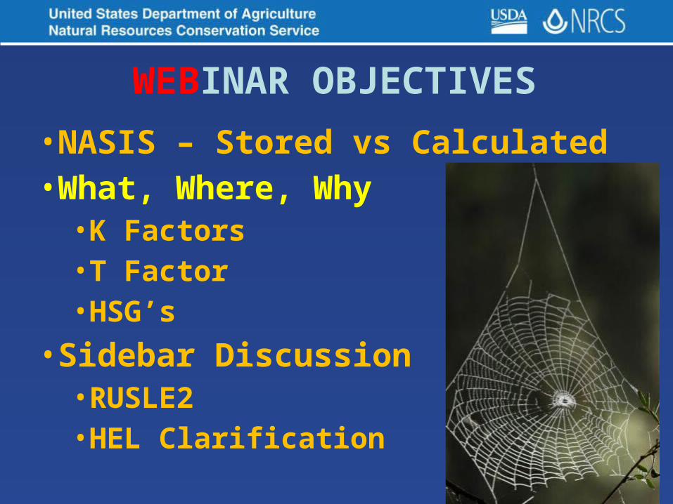
WEBINAR OBJECTIVES
•NASIS – Stored vs Calculated•What, Where, Why•K Factors•T Factor•HSG’s
•Sidebar Discussion•RUSLE2•HEL Clarification

SOILS DATABASE

SOIL PROPERTY DATA ELEMENTS•Over 150 individual entries populated
•Many have Low, RV, and High
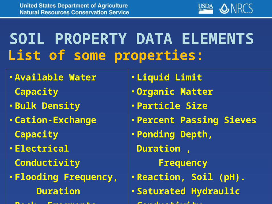
List of some properties:SOIL PROPERTY DATA ELEMENTS
• Available Water Capacity• Bulk Density• Cation-Exchange Capacity • Electrical Conductivity• Flooding Frequency,
Duration• Rock Fragments • Horizon Depth•Slope
• Liquid Limit• Organic Matter• Particle Size• Percent Passing Sieves• Ponding Depth, Duration ,
Frequency• Reaction, Soil (pH).• Saturated Hydraulic Conductivity
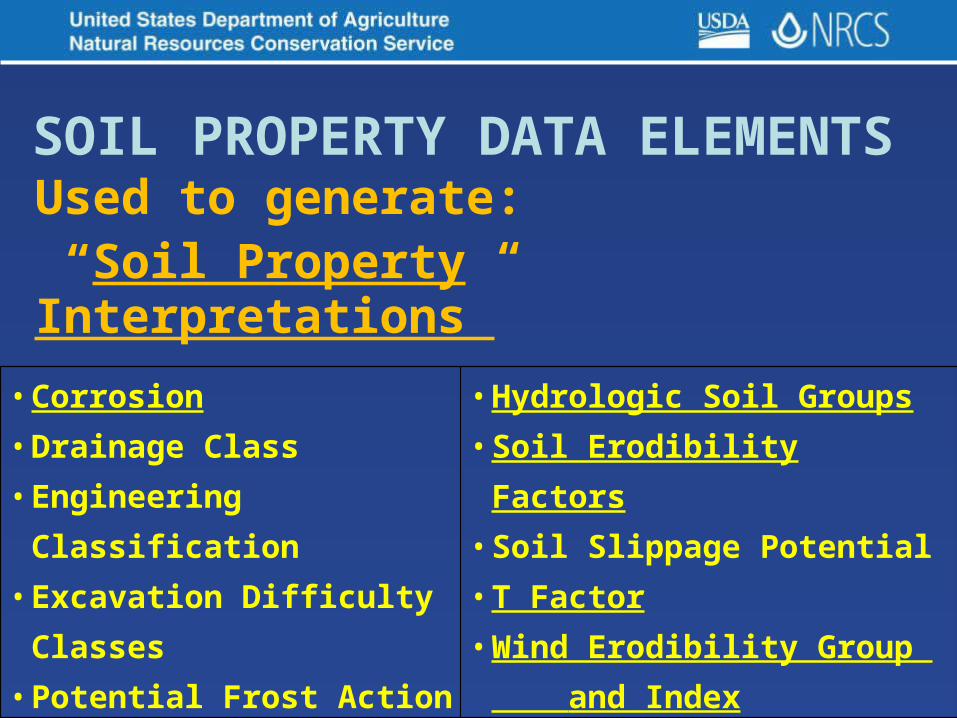
Used to generate: “Soil Property Interpretations”
SOIL PROPERTY DATA ELEMENTS
• Corrosion• Drainage Class• Engineering Classification• Excavation Difficulty Classes• Potential Frost Action
• Hydrologic Soil Groups• Soil Erodibility Factors• Soil Slippage Potential• T Factor• Wind Erodibility Group
and Index

NASIS – Stored vs Calculated Interpretations
• K Factor – Soil Erodibility• T Factor – Soil Loss Tolerance• HSG - Hydrology Soil Groups• WEG – Wind Erodiblity Group• WEI – Wind Erodibiltiy Index• Steel Corrosion• Concrete Corrosion.

NASIS Calculations – Based On?
• Better soil property data for most, if not all individual components. Both major and minor.(K factors, Corrosion Potentials)
• Change in criteria used to generate soil property interpretations(T factors, HSG, WEG, WEI)

WHY CALCULATE????
• Need to populate commonly used values (property interpretations)
• Can’t measure directly but can be consistently
derived from other date
• Over entire database

WHY CALCULATE????
• Increase internal consistency in the database
Within map units, components, horizons
In other words: The same “stuff” will have the same “values”

SPLASH EROSION
RAINDROPS FALLING ON EXPOSED SOIL CAN BREAK OFF SOIL PARTICLES TO BE LOST IN RUNOFF WATER
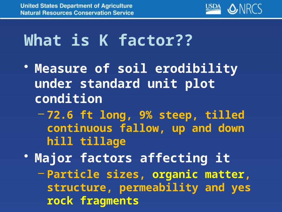
What is K factor??
• Measure of soil erodibility under standard unit plot condition– 72.6 ft long, 9% steep, tilled continuous
fallow, up and down hill tillage• Major factors affecting it
– Particle sizes, organic matter, structure, permeability and yes rock fragments

SOIL ERODIBILITY - K
• General effect of texture– Fine textures: (clays) resistant to
detachment because of aggregation– Coarse textures: (sands) easily
detached, but low runoff, large, dense particles not easily transported
– Medium textures: (loams) moderately detachable, moderate to high runoff
– Silts: easily detached, high runoff, small, easily transported sediment

Two Kinds of K Factors
• Kf applies only to the fine-earth (less than 2.0 mm) fraction
[Kf – free of rock fragments]
• Kw factor applies to the whole soil, includes rock fragments within the soil layer [Kw – with rock fragments]
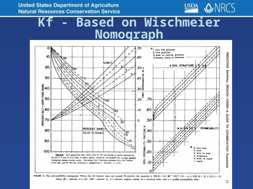
Kf - Based on Wischmeier Nomograph
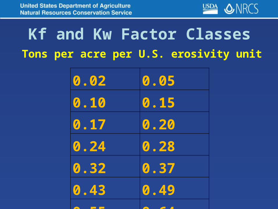
Kf and Kw Factor Classes
0.02 0.050.10 0.150.17 0.200.24 0.280.32 0.370.43 0.490.55 0.64
Tons per acre per U.S. erosivity unit

– Fine textures: (clays) 0.05-0.15
– Coarse textures: (sands) 0.05-0.20
– Medium textures: (loams) 0.25-0.45
– Silts: 0.45-0.65
Kf and Kw Factor Classes
Generalizations
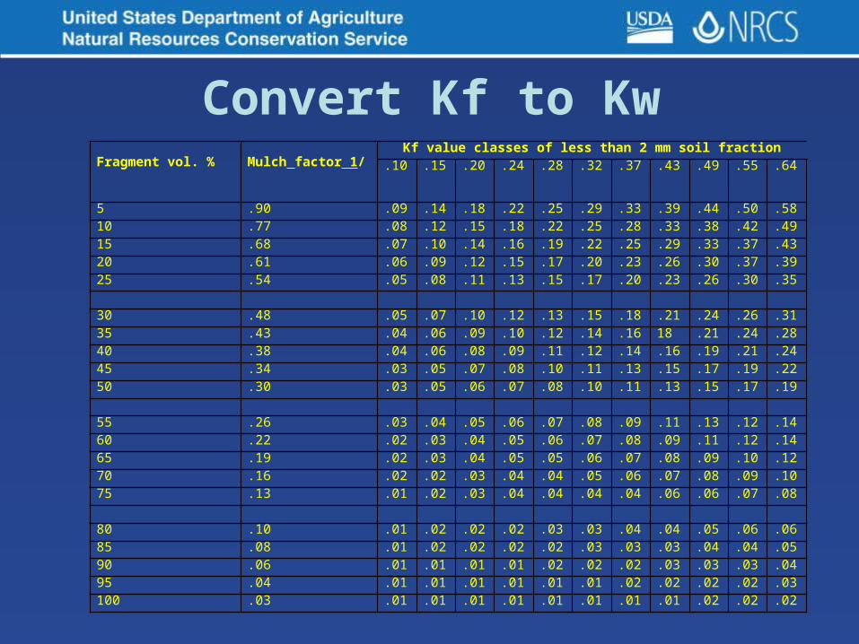
Convert Kf to KwFragment vol. % Mulch factor 1/
Kf value classes of less than 2 mm soil fraction.10 .15 .20 .24 .28 .32 .37 .43 .49 .55 .64
5 .90 .09 .14 .18 .22 .25 .29 .33 .39 .44 .50 .5810 .77 .08 .12 .15 .18 .22 .25 .28 .33 .38 .42 .4915 .68 .07 .10 .14 .16 .19 .22 .25 .29 .33 .37 .4320 .61 .06 .09 .12 .15 .17 .20 .23 .26 .30 .37 .3925 .54 .05 .08 .11 .13 .15 .17 .20 .23 .26 .30 .35
30 .48 .05 .07 .10 .12 .13 .15 .18 .21 .24 .26 .3135 .43 .04 .06 .09 .10 .12 .14 .16 18 .21 .24 .2840 .38 .04 .06 .08 .09 .11 .12 .14 .16 .19 .21 .2445 .34 .03 .05 .07 .08 .10 .11 .13 .15 .17 .19 .2250 .30 .03 .05 .06 .07 .08 .10 .11 .13 .15 .17 .19
55 .26 .03 .04 .05 .06 .07 .08 .09 .11 .13 .12 .1460 .22 .02 .03 .04 .05 .06 .07 .08 .09 .11 .12 .1465 .19 .02 .03 .04 .05 .05 .06 .07 .08 .09 .10 .1270 .16 .02 .02 .03 .04 .04 .05 .06 .07 .08 .09 .1075 .13 .01 .02 .03 .04 .04 .04 .04 .06 .06 .07 .08
80 .10 .01 .02 .02 .02 .03 .03 .04 .04 .05 .06 .0685 .08 .01 .02 .02 .02 .02 .03 .03 .03 .04 .04 .0590 .06 .01 .01 .01 .01 .02 .02 .02 .03 .03 .03 .0495 .04 .01 .01 .01 .01 .01 .01 .02 .02 .02 .02 .03100 .03 .01 .01 .01 .01 .01 .01 .01 .01 .02 .02 .02

Where is K factor used?
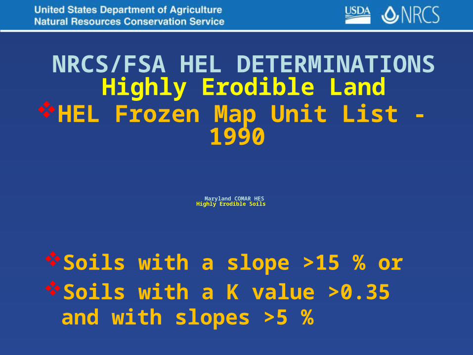
• Maryland’s COMAR - Highly Erodible Soils (HES)
• NRCS RUSLE2
• NRCS – Highly Erodible Land (HEL)
• MDA – Phosphorus Site Index

COMAR Highly Erodible Soils Found in:
• FOREST CONSERVATION - 08.19.03.00. • AGRICULTURAL LAND PRESERVATION -
15.15.07.00. • STORMWATER MANAGEMENT PLANS -
26.17.02.00. • NONTIDAL WETLANDS -26.23.01.00. • CRITICAL AREA - 27.01.01.00. • 2011 MD Stand. And Specs. Soil Erosion
and Sediment Control– Design and Construction Manual
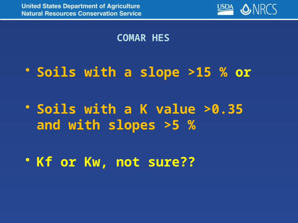
• Soils with a slope >15 % or
• Soils with a K value >0.35 and with slopes >5 %
• Kf or Kw, not sure??
COMAR HES

PICTURES SPEAK
LOUDER THAN WORDS

NRCS RUSLE2
• RUSLE2 uses the Kf (fine-earth, rock free) factor• Surface layer Kf from NASIS database via Soil Data Mart via Purdue Univ.

NRCS RUSLE2• Select County and Map Unit Component• Kf loaded into equation in “background”• Can’t be changed?

From MD RUSLE2 User's Guide 06/2008
• The soil object includes information on soil erodibility, soil texture, hydrologic soil group, and rock cover.
• Also, this object includes the soil erodibility to compute a value for the soil erodibility factor if one is not available. Maybe??

Adjusting Rock Cover in RUSLE2

Guidelines for Rock Cover in RUSLE2
• Rock cover on the soil surface affect
the Cover & Management factor in RUSLE2
• Rock cover (fragments) does not affect the
Soil Erodibility factor used in RUSLE2
• RUSLE2 uses the Kf (rock free) soil
erodibility factor.

Guidelines for Rock Cover in RUSLE2
• Using Kw would would “double account”
of the effect of cropping & management• Don’t use rock cover or rock content
values from soil survey data • Measure in field like you do plant litter • If present and not entered in RUSLE2,
erosion is over predicted

Guidelines for Rock Cover in RUSLE2
Or use table from MD RUSLE2 User's Guide 06/2008
• RUSLE2 Rock Fragments Defined as > 3/8 in size

Where to find Kf?
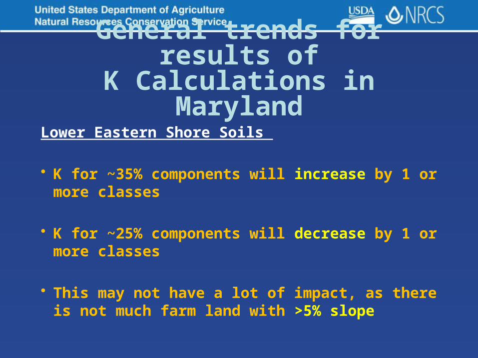
Lower Eastern Shore Soils
• K for ~35% components will increase by 1 or more classes
• K for ~25% components will decrease by 1 or
more classes
• This may not have a lot of impact, as there is
not much farm land with >5% slope
General trends for results ofK Calculations in Maryland

General trends for results ofK Calculations in Maryland
Western Coastal Plain and
Upper Eastern Shore Soils
• K for ~ 20% components will increase by 1 or more classes ~ 39% are C and D slope map units
• K for ~ 48% components will decrease by 1 or classes ~ 37% are C and D slope map units

Piedmont Soils
• K for ~ 35% components will increase by 1 or more classes ~ 46% are in C and D slope map units
• K for ~ 22% components will decrease by
1 or more classes ~ 37% are in C and D slope map units
General trends for results ofK Calculations in Maryland
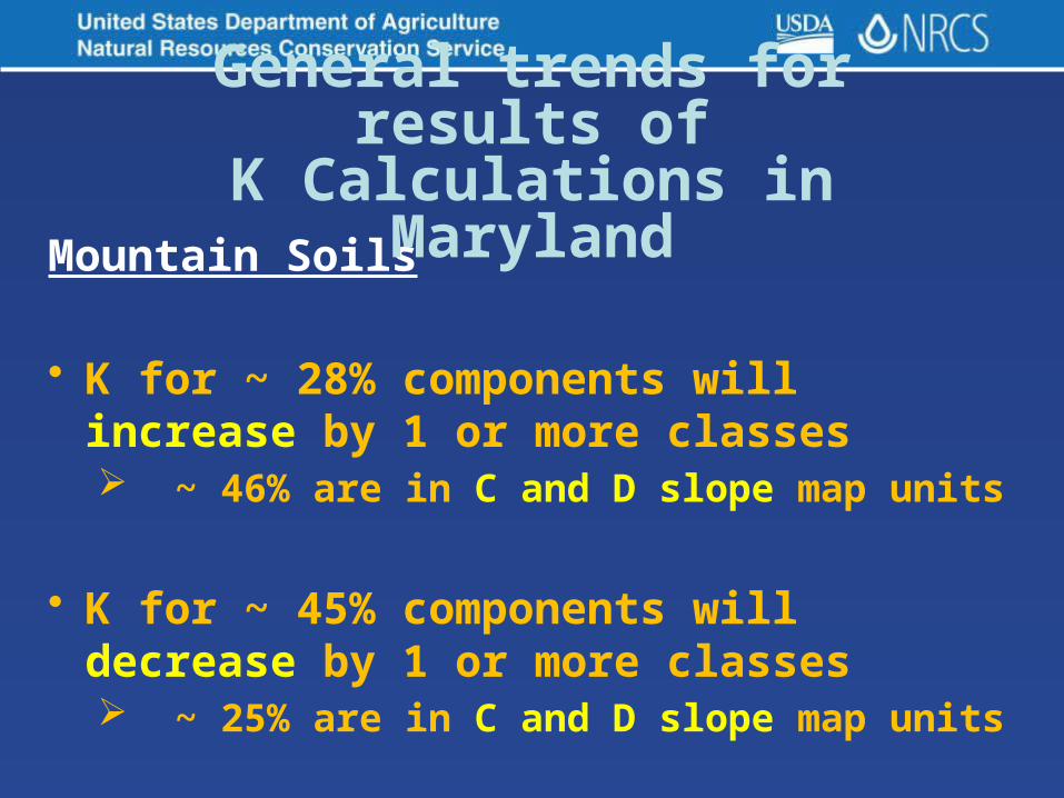
Mountain Soils
• K for ~ 28% components will increase by 1 or more classes ~ 46% are in C and D slope map units
• K for ~ 45% components will decrease by
1 or more classes ~ 25% are in C and D slope map units
General trends for results ofK Calculations in Maryland

Half Way
Through
Questionsso far?

Factors of Soil Formation: s = f' ( cl, o, r, p, t )
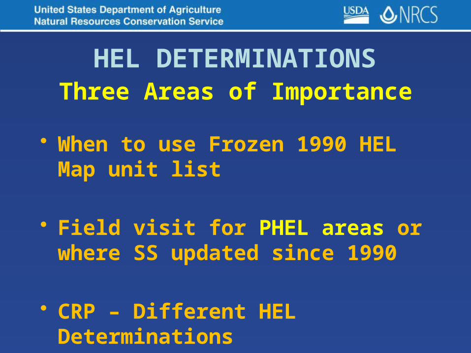
HEL DETERMINATIONSThree Areas of Importance
• When to use Frozen 1990 HEL Map unit list
• Field visit for PHEL areas or where SS updated since 1990
• CRP – Different HEL Determinations

HEL Frozen Map Unit List - 1990
• Used for HEL or NHEL
• PHEL - onsite required for determination
to verify HEL or NHEL

Field Visit Includes PHEL Map Units
• Verify HEL or NHEL to finialize. (maybe due to field boundary changes)
• New determination can be issued for specific crop field. (using Jan. 1990
K and T factor data)

Soil Survey Updated Since Jan. 1990
• Any new HEL map units can be appended to the Frozen List
• Crop fields with previous HELC determinations will not be changed by any additions of new map units to the list

CRP – HEL Determinations (Automated System)
• Doesn’t use Frozen Map Unit List -1990
• Doesn’t use specific soils mapping of original HEL
• Uses current soils data in Toolkit (SDM)
• Uses average of 3 major soils in acreage
Soils with a slope >15 % orSoils with a K value >0.35 and with
slopes >5 %
Maryland COMAR HESHighly Erodible Soils
NRCS/FSA HEL DETERMINATIONSHighly Erodible Land
HEL Frozen Map Unit List - 1990

NOT TIME TO RELAX YET!
Questions?

What is T Factor?? Soil Loss Tolerance
• Definition - maximum amount of erosion at which the quality of a soil as a medium for plant growth can be maintained
• Classes - 1, 2, 3, 4, and 5• T factors - represent the goal for
maximum annual soil loss

Calculated from the soil properties and qualities. Criteria from:
1. The severity of physical or
chemical properties of subsurface
layers; and
2. The economic feasibility of utilizing
management practices to overcome
limiting layers or conditions.
T Factor - Soil Loss Tolerance
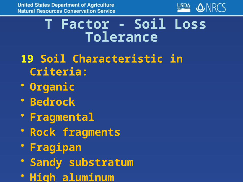
19 Soil Characteristic in Criteria:• Organic• Bedrock• Fragmental• Rock fragments• Fragipan • Sandy substratum• High aluminum
T Factor - Soil Loss Tolerance

Piedmont/Mountain Soils• Bedrock• Fragipan • Rock fragments
Coastal Plain Soils• Sandy substratum• High aluminum (may over ride)
T Factor CalculationsMaryland Soil Property Changes

Where is T factor used?
• NRCS RUSLE2
• NRCS – Highly Erodible Land (HEL)
• NRCS – Many Conservation Programs
• State Land Planning Programs
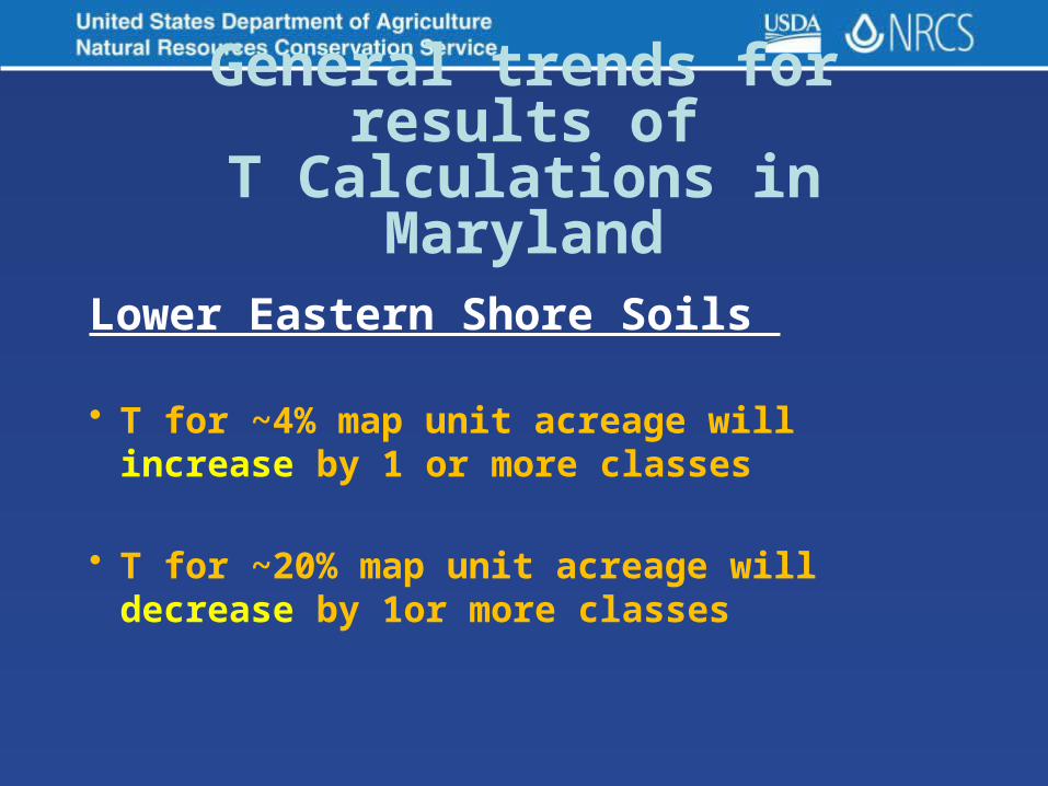
Lower Eastern Shore Soils
• T for ~4% map unit acreage will increase by 1 or more classes
• T for ~20% map unit acreage will decrease by
1or more classes
General trends for results ofT Calculations in Maryland
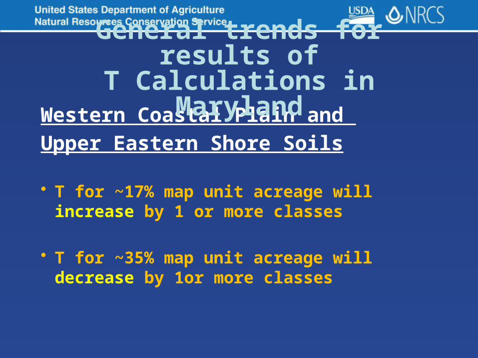
Western Coastal Plain and
Upper Eastern Shore Soils
• T for ~17% map unit acreage will increase by 1 or more classes
• T for ~35% map unit acreage will decrease by
1or more classes
General trends for results ofT Calculations in Maryland

Piedmont Soils
• T for ~8% map unit acreage will increase by 1 or more classes
• T for ~10% map unit acreage will
decrease by 1or more classes
General trends for results ofT Calculations in Maryland

Mountain Soils
• T for ~5% map unit acreage will increase by 1 or more classes
• T for ~12% map unit acreage will
decrease by 1or more classes
General trends for results ofT Calculations in Maryland
Questions?

What are Hydrology Soil Groups??
• Definition - group of soils having
similar runoff potential under similar storm and cover conditions
• Official - National Engineering Handbook, Chapter 7
• Classes - A, B, C, and D, and three dual classes, A/D, B/D, and C/D
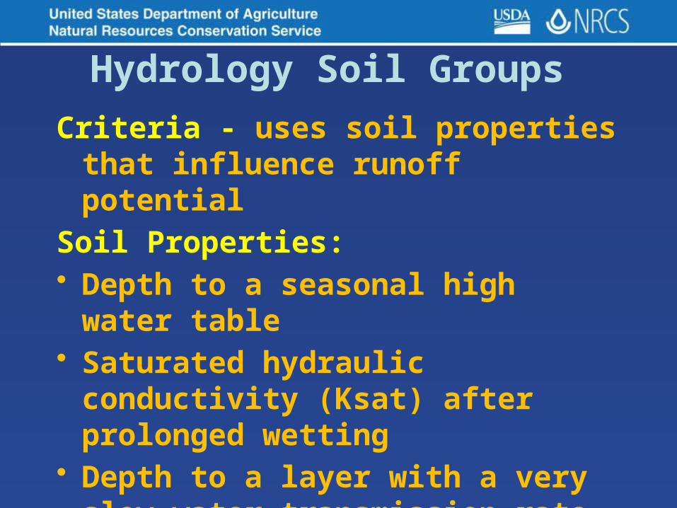
Criteria - uses soil properties that influence runoff potential
Soil Properties: • Depth to a seasonal high water table• Saturated hydraulic conductivity
(Ksat) after prolonged wetting • Depth to a layer with a very slow
water transmission rate.
Changes in soil properties caused by land management or climate changes also cause the hydrologic soil group to change.
Hydrology Soil Groups

General HSG Descriptions Based on all when thoroughly wet
• Group A Soils - low runoff potential
• Group B Soils - moderately low runoff potential
• Group C – Soils moderately high runoff potential
• Group D – Soils high runoff potential or high water table

General HSG Descriptions Based on all when thoroughly wet
• Duel Groups – used when D group soils can be adequately drained
• Assigned to dual hydrologic soil groups (A/D, B/D, and C/D) based on their saturated hydraulic conductivity and the water table depth when drained.
• The first letter applies to the drained condition and the second to the undrained condition.
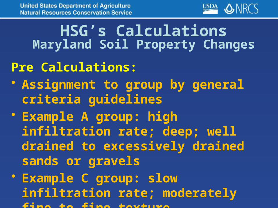
Pre Calculations: • Assignment to group by general criteria
guidelines• Example A group: high infiltration rate;
deep; well drained to excessively drained sands or gravels
• Example C group: slow infiltration rate; moderately fine to fine texture
HSG’s CalculationsMaryland Soil Property Changes

Present Calculations: • Assignment to group by detailed
calculation of very specific criteria• Example A group:
HSG’s CalculationsMaryland Soil Property Changes

Present Calculations: • Example A group:
HSG’s CalculationsMaryland Soil Property Changes

Present Calculations for Duel Classes: • Example A/D group: WT break is on 24”• Our Drainage class breaks at 20”• Now SWPD have duel classes
HSG’s CalculationsMaryland Soil Property Changes

• HSG’s used in equations that estimate runoff from rainfall.
• Solving hydrologic problems in planning watershed protection
• Flood prevention projects • Planning & designing structures for
the use, control, and disposal of water.
Hydrology Soil Groups Where used?

• Many Federal, State, and Local Engineering Land Use Management programs and practices and BMP’s
• RUSLE2 for use in Subsurface Drainage Systems
• NRCS Waste Management Soil Interpretations
• MDE - SWM and SEC Practices
Hydrology Soil Groups Where used?
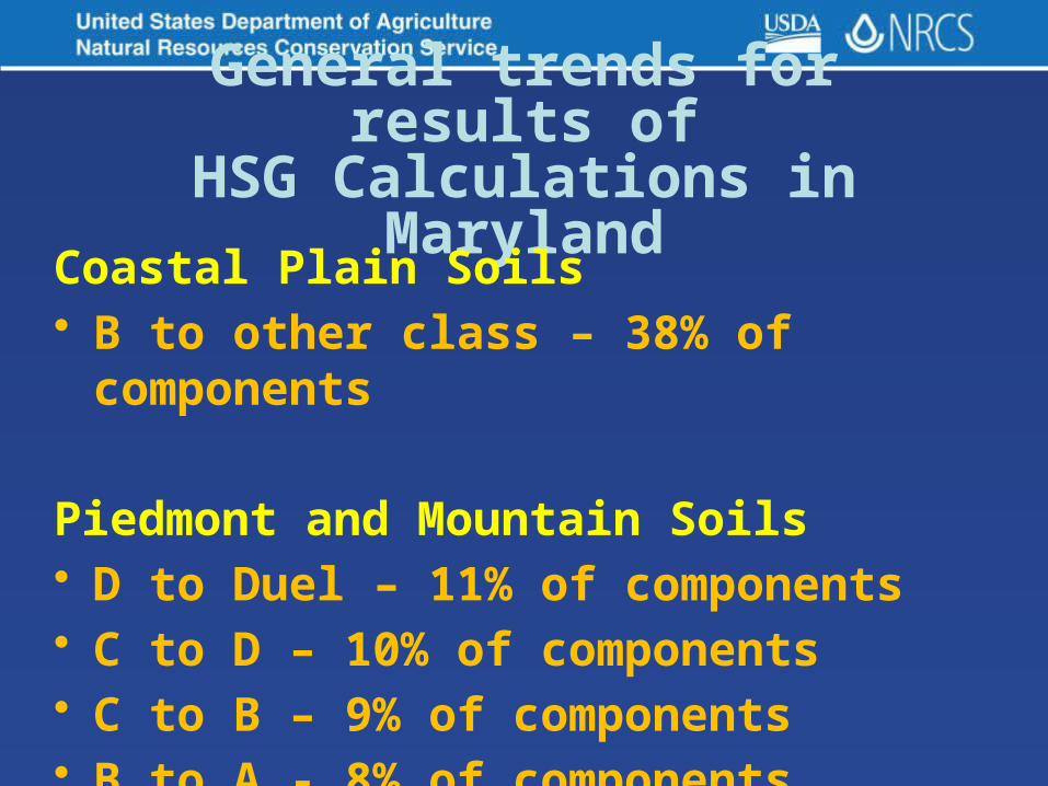
General trends for results ofHSG Calculations in Maryland
Coastal Plain Soils• B to other class – 38% of components
Piedmont and Mountain Soils• D to Duel – 11% of components• C to D – 10% of components• C to B – 9% of components• B to A - 8% of components