underwater ert survey for site investigation for a new
TRANSCRIPT

LUND UNIVERSITY
PO Box 117221 00 Lund+46 46-222 00 00
Underwater ERT Survey for Site Investigation for a New Line for Stockholm Metro
Dahlin, Torleif; Loke, Meng Heng; Siikanen, Jonas; Höök, Marcus
Published in:[Host publication title missing]
2014
Link to publication
Citation for published version (APA):Dahlin, T., Loke, M. H., Siikanen, J., & Höök, M. (2014). Underwater ERT Survey for Site Investigation for a NewLine for Stockholm Metro. In [Host publication title missing] EAGE.
Total number of authors:4
General rightsUnless other specific re-use rights are stated the following general rights apply:Copyright and moral rights for the publications made accessible in the public portal are retained by the authorsand/or other copyright owners and it is a condition of accessing publications that users recognise and abide by thelegal requirements associated with these rights. • Users may download and print one copy of any publication from the public portal for the purpose of private studyor research. • You may not further distribute the material or use it for any profit-making activity or commercial gain • You may freely distribute the URL identifying the publication in the public portal
Read more about Creative commons licenses: https://creativecommons.org/licenses/Take down policyIf you believe that this document breaches copyright please contact us providing details, and we will removeaccess to the work immediately and investigate your claim.
Download date: 12. Mar. 2022

20th European Meeting of Environmental and Engineering Geophysics Athens, Greece, 14-18 September 2014
We Olym 13Underwater ERT Survey for Site Investigation fora New Line for Stockholm MetroT. Dahlin* (Lund University), M.H. Loke (Geotomo Software), J. Siikanen(ÅF Infrastruktur AB) & M. Höök (Clinton Mätkonsult AB)
SUMMARYAn underwater ERT survey was carried out in central Stockholm as part of pre-investigations for a newline for the Stockholm metro (T-bana). The aim was to identify variations in depth of the bottomsediments, as well as variations in rock quality and the possible presence of weak zones in the rock.
The ERT survey was performed with pole-dipole configuration and an electrode cable with 64 electrodesat 7 meter intervals placed on the sea bottom. The water depth was mapped using sonar combined withrecording pressure transducers, and water resistivity as function of depth was integrated in the inversionmodel. The results show that the rather difficult survey conditions could be handled in a satisfactory waythanks to adequate equipment, careful planning and attention to details.
The measured data contains information that is relevant for creating coherent models of the variation indepth to rock together with data from drilling. The results also indicate that information in variation inrock quality that can be of critical importance for planning of underground construction can be derivedfrom the data. Further comparisons against reference data are required for a full evaluation of the results.
20th European Meeting of Environmental and Engineering Geophysics Athens, Greece, 14-18 September 2014
Introduction
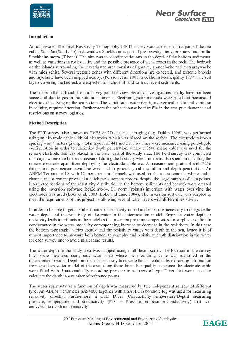
An underwater Electrical Resistivity Tomography (ERT) survey was carried out in a part of the sea called Saltsjön (Salt Lake) in downtown Stockholm as part of pre-investigations for a new line for the Stockholm metro (T-bana). The aim was to identify variations in the depth of the bottom sediments, as well as variations in rock quality and the possible presence of weak zones in the rock. The bedrock on the islands surrounding the investigated area consists of granite, granodiorite and metagreywacke with mica schist. Several tectonic zones with different directions are expected, and tectonic breccia and myolinite have been mapped nearby. (Persson et al. 2001; Stockholm Municipality 1997) The soil layers covering the bedrock are expected to include till and various recent sediments. The site is rather difficult from a survey point of view. Seismic investigations nearby have not been successful due to gas in the bottom sediments. Electromagnetic methods were ruled out because of electric cables lying on the sea bottom. The variation in water depth, and vertical and lateral variation in salinity, requires attention. Furthermore the rather intense boat traffic in the area puts demands and restrictions on survey logistics.
Method Description
The ERT survey, also known as CVES or 2D electrical imaging (e.g. Dahlin 1996), was performed using an electrode cable with 64 electrodes which was placed on the seabed. The electrode take-out spacing was 7 meters giving a total layout of 441 meters. Five lines were measured using pole-dipole configuration in order to maximize depth penetration, where a 3500 metre cable was used for the remote electrode that was placed in the water east of the study area. The field survey was completed in 3 days, where one line was measured during the first day when time was also spent on installing the remote electrode apart from deploying the electrode cable etc. A measurement protocol with 3256 data points per measurement line was used to provide good resolution and depth penetration. An ABEM Terrameter LS with 12 measurement channels was used for the measurements, where multi-channel measurement provided a quick measurement process despite the large number of data points. Interpreted sections of the resistivity distribution in the bottom sediments and bedrock were created using the inversion software Res2dinvx64. L1 norm (robust) inversion with water overlying the electrodes was used (Loke et al. 2003; Loke and Lane 2004). The inversion software was adapted to meet the requirements of this project by allowing several water layers with different resistivity. In order to be able to get useful estimates of resistivity in soil and rock, it is necessary to integrate the water depth and the resistivity of the water in the interpretation model. Errors in water depth or resistivity leads to artifacts in the model as the inversion program compensates for surplus or deficit in conductance in the water model by corresponding increase or decrease in the resistivity. In this case the bottom topography varies greatly and the resistivity varies with depth in the sea, hence it is of utmost importance to measure both bottom topography and resistivity depth distribution in the water for each survey line to avoid misleading results. The water depth in the study area was mapped using multi-beam sonar. The location of the survey lines were measured using side scan sonar where the measuring cable was identified in the measurement results. Depth profiles of the survey lines were then calculated by extracting information from the deep water model of the area along these lines. For quality assurance the electrode cable were fitted with 5 automatically recording pressure transducers of type Diver that were used to calculate the depth in a number of reference points. The water resistivity as a function of depth was measured by two independent sensors of different type. An ABEM Terrameter SAS4000 together with a SASLOG borehole log was used for measuring resistivity directly. Furthermore, a CTD Diver (Conductivity-Temperature-Depth) measuring pressure, temperature and conductivity (PTC = Pressure-Temperature-Conductivity) that was converted to depth and resistivity.

20th European Meeting of Environmental and Engineering Geophysics Athens, Greece, 14-18 September 2014
Water Depth and Resistivity
The water depths reached close to 30 metres at most, with just a few metres at the beginning of the lines. Depth determination from sonar shows very good agreement with the depth from pressure sensors in the central parts of the lines, while there are significant discrepancies in the ends of the measuring cable, see example in Figure 1. This may be due to poor data cover from the sonar towards the ends of the lines, but it is also possible that the end of the electrode cable was not lying on the bottom. The depth models were adjusted by hand in the ends of the measurement lines before they were used for the inversion of the resistivity data.
0 20 40 60 80 100 120 140 160 180 200 220 240 260 280 300 320 340 360 380 400 420 440Distance [m]
-35
-30
-25
-20
-15
-10
-5
0
Bottomelevation[m.a.s.l.]
Depth from SonarDepth from PT-sensors
Figure 1. Depth profile for Line B based on sonar and pressure sensors
1 10Resistivity[ m]
-30
-25
-20
-15
-10
-5
0
Level[m.a.s.l.]
-30
-25
-20
-15
-10
-5
0
Water Resistivity PointSASLOG1SASLOG2SASLOG3SASLOG4SASLOG5
Figure 2. Water resistivity as function of depth along line B.

20th European Meeting of Environmental and Engineering Geophysics Athens, Greece, 14-18 September 2014
The water resistivity varied from over 20 m at the surface to around 1.8 m at the bottom (Figure 2). There is also lateral variation in the upper part which is caused by the outflow from Lake Mälaren which is concentrated along one shore.
Results and Interpretation
Inspection of full waveform recordings done throughout the measurements reveal that there are high noise levels including 50 Hz, 16 Hz and strong variation in background levels within the measurement cycles. The 16 Hz noise is most likely caused by train traffic as it is the operating frequency of the Swedish rail system. The variation in background level may be caused by e.g. the underground train system (T-bana) which operates with DC power supply, or variation in the load in the commuter and national rail systems. Despite the noise resistivity data are of sufficiently good quality so that no culling of data points was needed before further processing, showing that the digital filtering of the instrument functions well. The bottom topography based on a combination of sonar surveying and pressure sensors was included as part of the models. The water resistivity distribution was simplified to a model of 5 layers with different resistivity. Each layer is assumed to be homogeneous in the horizontal direction; the variation in resistivity close to the surface was considered to be of limited importance. The inversion resulted in models showing vertical sections of resistivity variation (see example in Figure 3). The models have acceptable residuals (about 6-7%), which shows that there is relatively good agreement between model and data. The resistivity sections show fluctuations which can be interpreted as a superficial layer with lower resistivity, which probably can be associated with soil layers of varying thickness and composition. Below are generally higher but varying resistivities that can be interpreted as bedrock zones of weakness and possibly varying composition. The top of the inverted sections are characterized by resistivities substantially lower than 12 m with maximum thicknesses of up to about 20 m in the central parts of the lines. This can be interpreted as unconsolidated sediments.
Figure 3. Resistivity model for Line A, with water levels and interpreted depth to the
bedrock from the geotechnical drilling indicated. In the distance range of 220 to 440 m on Line A there is a zone with resistivities in the range of 12 to 36 m in the upper low-resistivity zone down to several tens of meters. A corresponding zone

20th European Meeting of Environmental and Engineering Geophysics Athens, Greece, 14-18 September 2014
appears on the other nearby lines, and without access to other data from the region, this could have been interpreted as a zone of anomalous composition of the rock or fractured and weathered rock. Alternatively, it could be interpreted as a sharp increase depth to bedrock, where the rock is overlain by sediments with different composition or salinity than in the upper parts of the sediments. At the beginning of each line low resistivities indicate that there may be a zone of weakness in the rock. Since the zone is located at the edge of the lines, the resolution is however poor. The low resistivity at the edge might also be caused by structural elements in quay construction, but because the survey lines are oriented perpendicular to the layout direction impact should be relatively limited. There are more or less vertical structures in the deeper parts of the sections that can be interpreted as tectonic zones, and separating more highly resistive zones (> 1000 m) from zones with intermediate resistivities (a few hundred m). The high-resistivity zones can be interpreted as crystalline rock with low degree of fracturing, while the zones of lower resistivity can be interpreted as rock with differing quality that is probably fractured and weathered rock. Interpreted depths to bedrock from geotechnical drilling have been superimposed in the resistivity section of Line A (Figure 3). Interpreted depth to rock is generally well consistent between methods. Local variations in the depths may be due for example to the rock surface topography varying in three dimensions while the ERT survey is based on a two-dimensional approximation of reality. Rock levels show that the zone of relatively low resistivity in the range 220 to 440 m on line A consists of low-resistivity rock, which may be the uppermost part of a larger zone of differing properties of the rock.
Conclusions
The results show that the rather difficult survey conditions could be handled in a satisfactory way thanks to adequate equipment, careful planning and attention to details. The measured data contains information that is relevant for creating coherent models of the variation in depth to rock together with data from drilling. The results also indicate that information in variation in rock quality that can be of critical importance for planning of underground construction can be derived from the data. Further comparisons against reference data are required for a full evaluation of the results. It would have been helpful if geophysical borehole logging was conducted as a supplement in some drill holes along the lines. Such data could provide an interpretative key of the connection between rock resistivity and rock quality.
Acknowledgements
We thank Stockholms Läns Landsting (SSL) who financed the survey for permission to publish the results. We also wish to thank Roberth Colliander at WSP and Thomas Sträng at SSL for the good cooperation throughout the project. Formas, The Swedish Research Council for Environment, Agricultural Sciences and Spatial Planning, provided funding for this presentation of the results (ref. 2012-1931) within the Geoinfra-TRUST framework which is gratefully acknowledged.
References
Dahlin, T. (1996) 2D resistivity surveying for environmental and engineering applications, First Break, 14(7), 275-283.
Loke M.H., Acworth I. and Dahlin, T. (2003) A comparison of smooth and blocky inversion methods in 2D electrical imaging surveys. Exploration Geophysics, 34, 182-187.
Loke M.H. and Lane J.W. (2004) Inversion of data from electrical resistivity imaging surveys in water-covered areas. Exploration Geophysics, 35, 266-271.
Persson L., Sträng M. & Antal I. (2001) Berggrundskartan 10I Stockholm (Bedrock Map 101 Stockholm), Scale 1:100 000, Series Ba, No 60, Swedish Geological Survey, Uppsala.
Stockholm Municipality (1997) Byggnadsgeologisk karta (Engineering Geological Map), https://iservice.stockholm.se/open/GeoArchive/Pages/Search.aspx (accessed 2014-04-15).