understanding seismic hazard as major threat to …
TRANSCRIPT

UNDERSTANDING SEISMIC
HAZARD AS MAJOR THREAT
TO METRO MANILA
Republic of the PhilippinesOffice of the President
METROPOLITAN MANILA DEVELOPMENT AUTHORITYEDSA Cor. Orense St., Guadalupe Nuevo, Makati City
Germaine Fay M. Ramirez, RN
MMDA – Public Safety Division
S001

2Why, Where and How Do Earthquakes Occur?
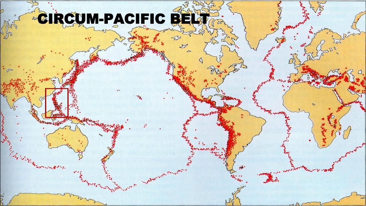
CIRCUM-PACIFIC BELT
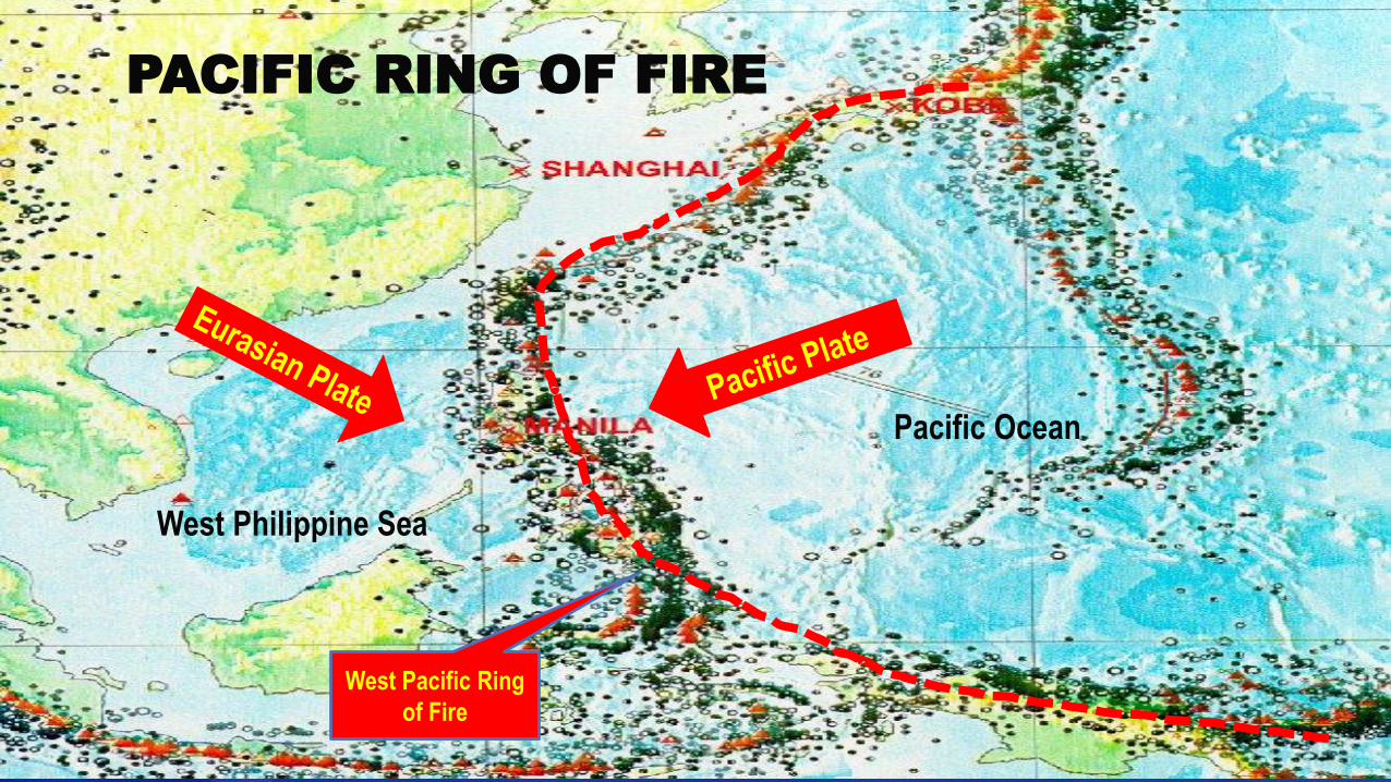
Pacific Ocean
West Philippine Sea
West Pacific Ring
of Fire
PACIFIC RING OF FIRE
5
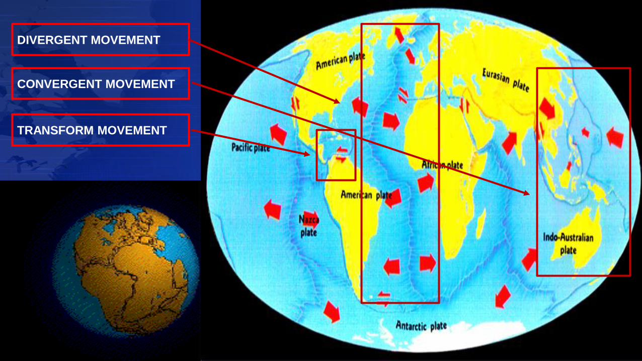
DIVERGENT MOVEMENT
CONVERGENT MOVEMENT
TRANSFORM MOVEMENT

PHILIPPINE GEOLOGIC SETTING
8
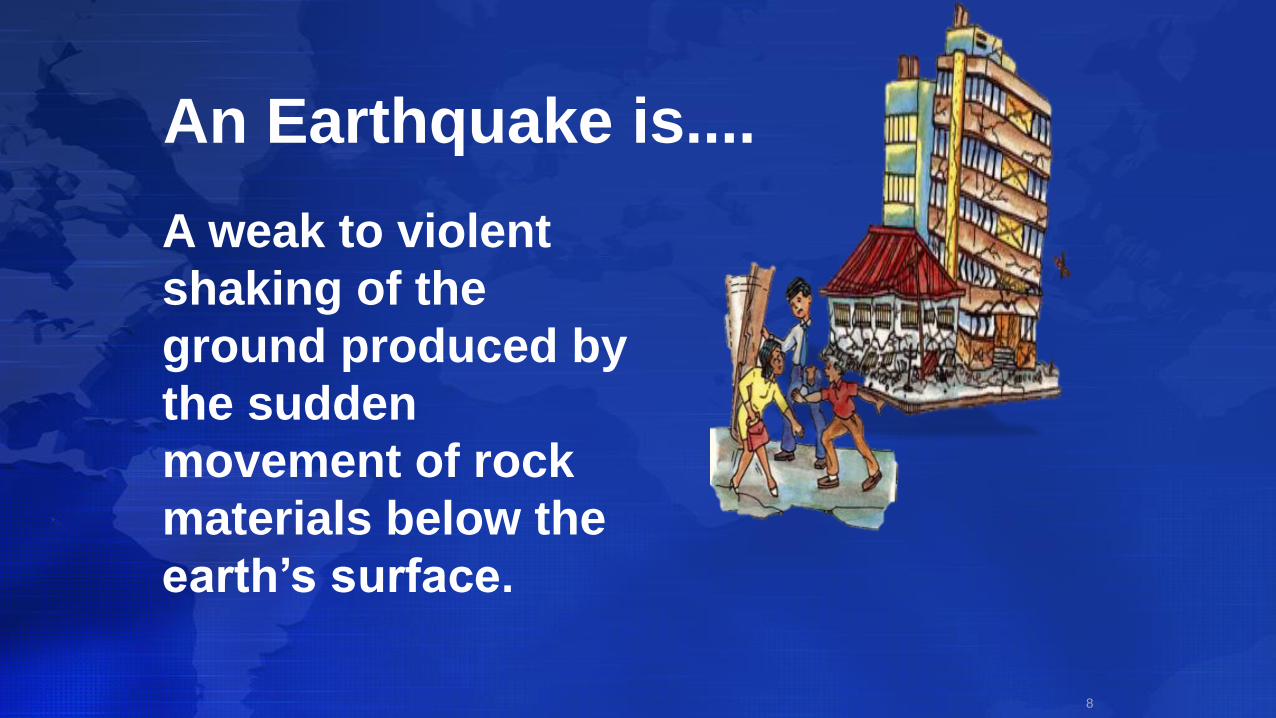
A weak to violent
shaking of the
ground produced by
the sudden
movement of rock
materials below the
earth’s surface.
An Earthquake is....
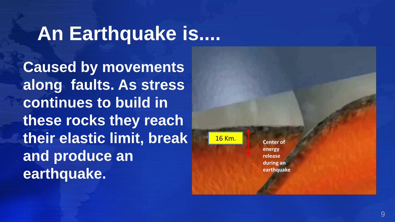
9
Center of energy release during an earthquake
16 Km.
An Earthquake is....
Caused by movements
along faults. As stress
continues to build in
these rocks they reach
their elastic limit, break
and produce an
earthquake.
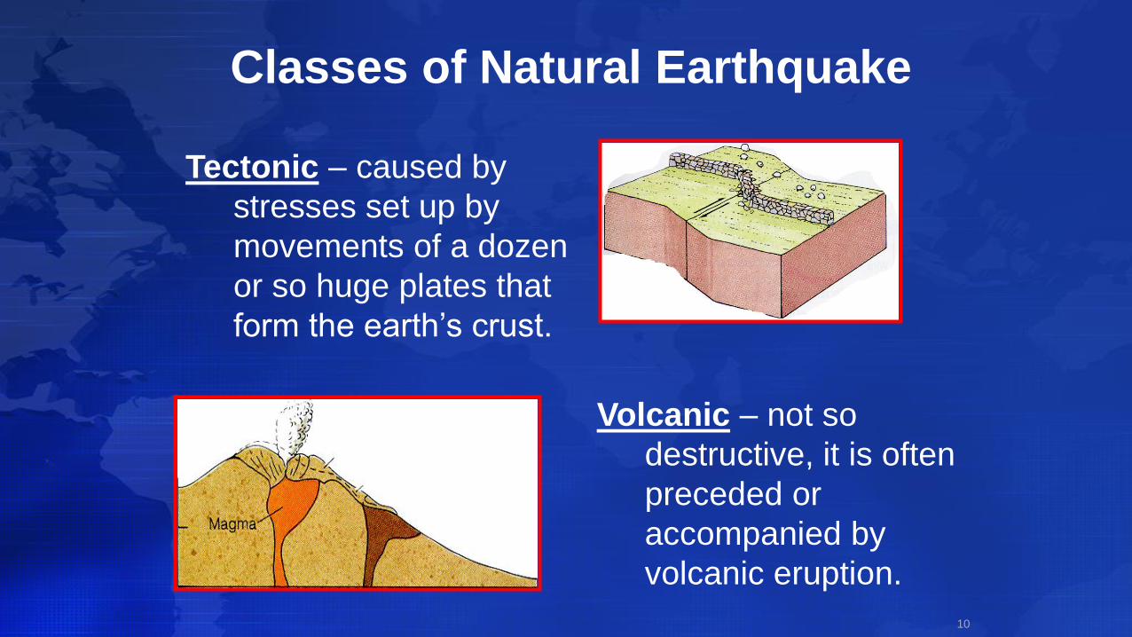
Classes of Natural Earthquake
10
Tectonic – caused by
stresses set up by
movements of a dozen
or so huge plates that
form the earth’s crust.
Volcanic – not so
destructive, it is often
preceded or
accompanied by
volcanic eruption.

FAULT- movement of the Earth’s crust
causing a fractures or system of
fructures.
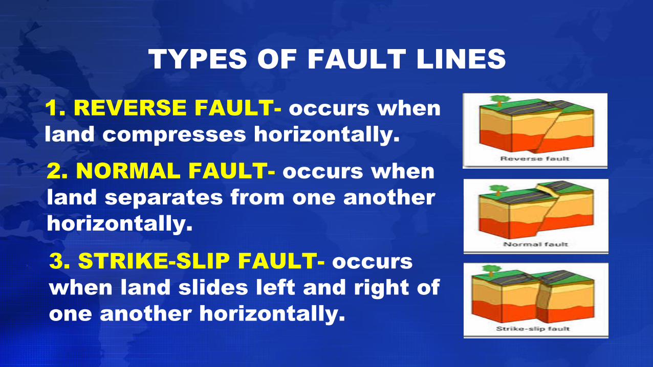
TYPES OF FAULT LINES
1. REVERSE FAULT- occurs when
land compresses horizontally.
2. NORMAL FAULT- occurs when
land separates from one another
horizontally.
3. STRIKE-SLIP FAULT- occurs
when land slides left and right of
one another horizontally.
13
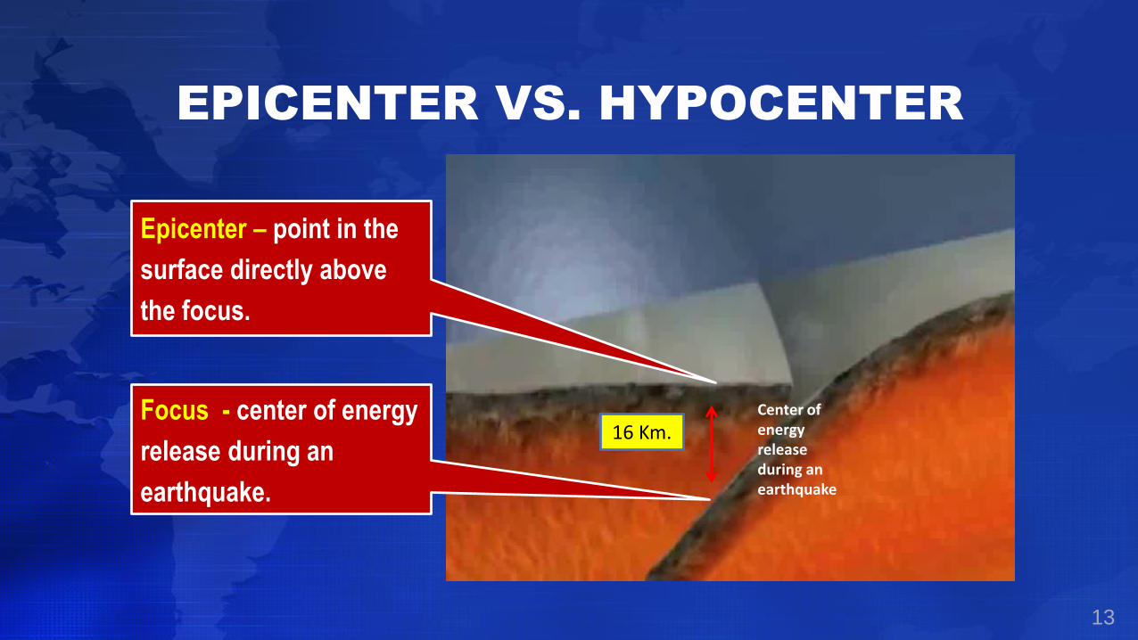
Center of energy release during an earthquake
Focus - center of energy
release during an
earthquake.
Epicenter – point in the
surface directly above
the focus.
16 Km.
EPICENTER VS. HYPOCENTER
14
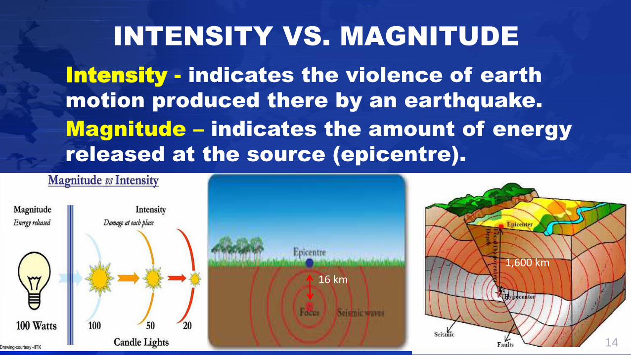
Magnitude – indicates the amount of energy
released at the source (epicentre).
Intensity - indicates the violence of earth
motion produced there by an earthquake.
INTENSITY VS. MAGNITUDE
16 km
1,600 km

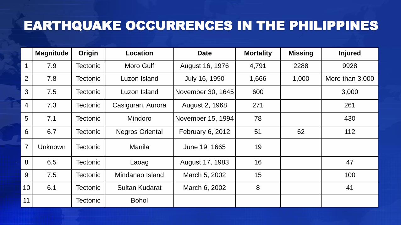
Magnitude Origin Location Date Mortality Missing Injured
1 7.9 Tectonic Moro Gulf August 16, 1976 4,791 2288 9928
2 7.8 Tectonic Luzon Island July 16, 1990 1,666 1,000 More than 3,000
3 7.5 Tectonic Luzon Island November 30, 1645 600 3,000
4 7.3 Tectonic Casiguran, Aurora August 2, 1968 271 261
5 7.1 Tectonic Mindoro November 15, 1994 78 430
6 6.7 Tectonic Negros Oriental February 6, 2012 51 62 112
7 Unknown Tectonic Manila June 19, 1665 19
8 6.5 Tectonic Laoag August 17, 1983 16 47
9 7.5 Tectonic Mindanao Island March 5, 2002 15 100
10 6.1 Tectonic Sultan Kudarat March 6, 2002 8 41
11 Tectonic Bohol
EARTHQUAKE OCCURRENCES IN THE PHILIPPINES

27
Ground Rupture
Strong Ground Shaking
Landslides
Liquefaction
Fire
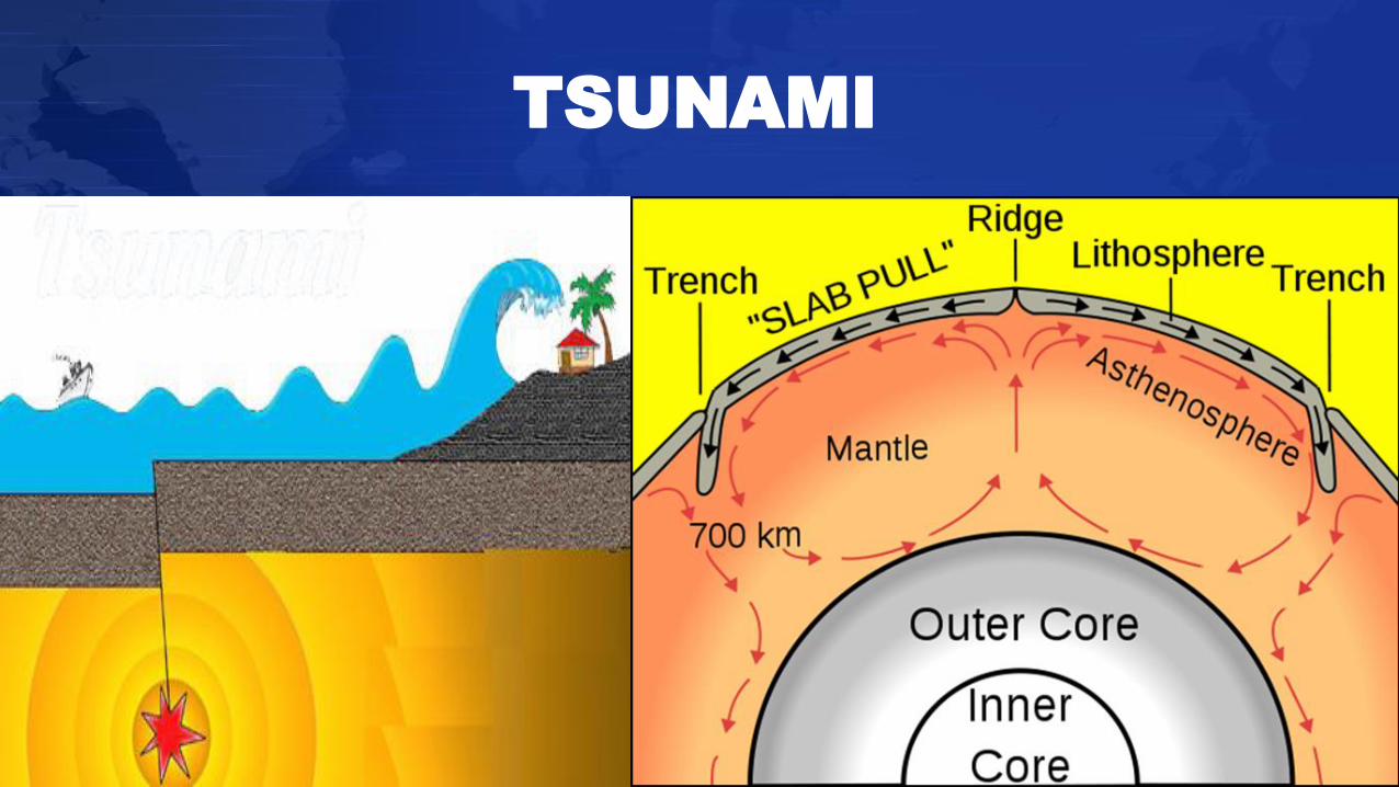
Tsunami
Epidemic (Possible)
SECONDARY CONSEQUENCES OF
EARTHQUAKES

GROUND RUPTURE
BEFORE FAULTING
REVERSE
29
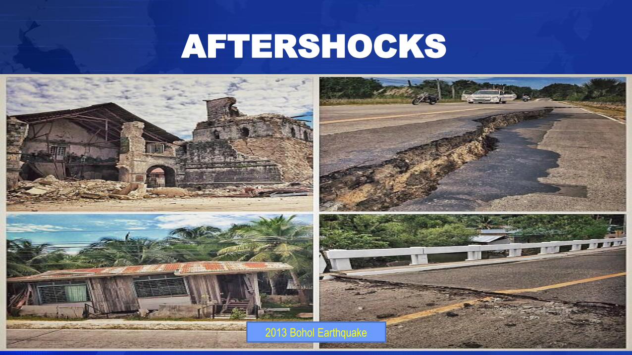
2013 Bohol Earthquake
AFTERSHOCKS

LANDSLIDES
“…the movement of rock, debris or earth down
a slope”.
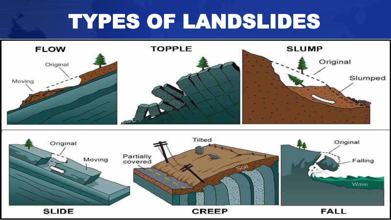
TYPES OF LANDSLIDES
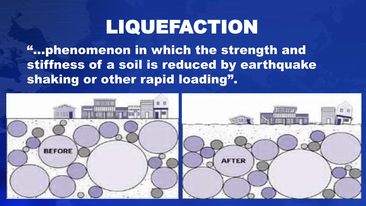
“…phenomenon in which the strength and
stiffness of a soil is reduced by earthquake
shaking or other rapid loading”.
LIQUEFACTION
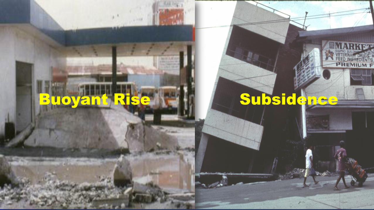
Buoyant Rise Subsidence
34
TSUNAMI

36
Epidemic
Fire
DISASTER PREPAREDNESS
AND MANAGEMENT:
Key to Building Disaster-Resilient Communities
Republic of the PhilippinesOffice of the President
METROPOLITAN MANILA DEVELOPMENT AUTHORITYEDSA Cor. Orense St., Guadalupe Nuevo, Makati City

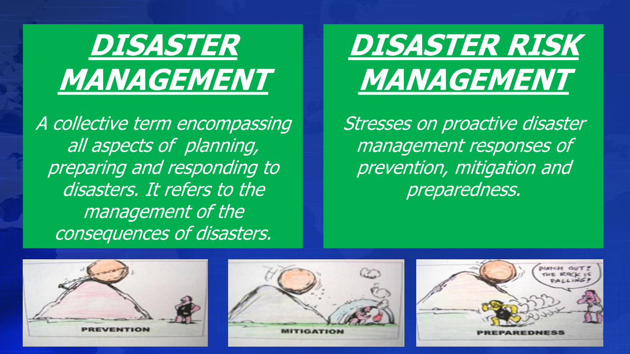
DISASTER MANAGEMENT
A collective term encompassing all aspects of planning,
preparing and responding to disasters. It refers to the
management of the consequences of disasters.
DISASTER RISK MANAGEMENT
Stresses on proactive disaster management responses of prevention, mitigation and
preparedness.
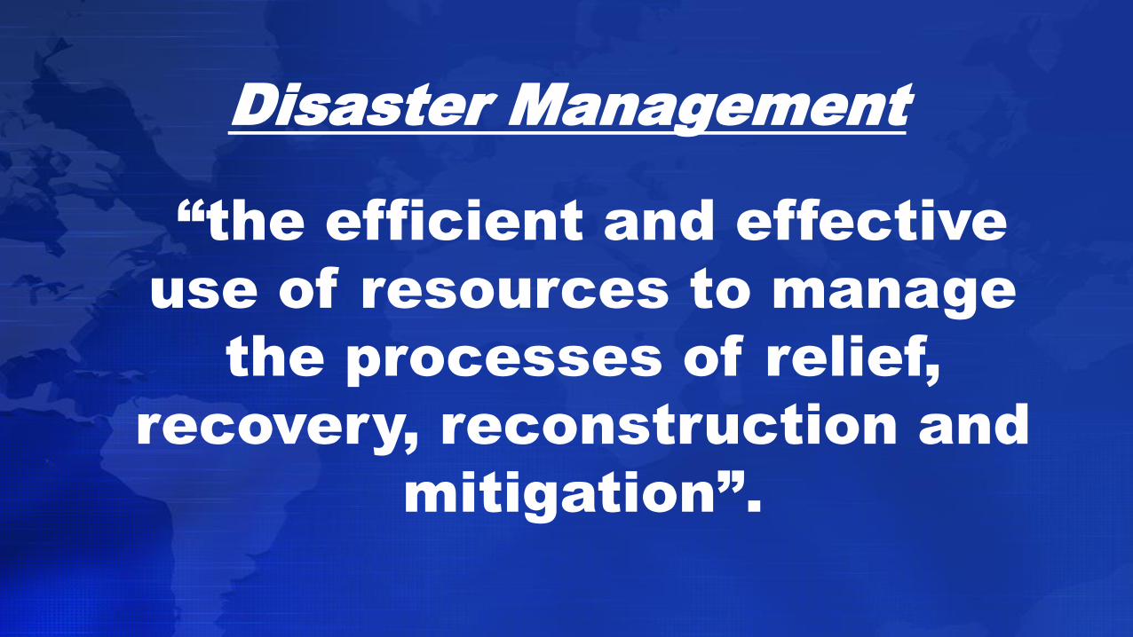
Disaster Management
“the efficient and effective
use of resources to manage
the processes of relief,
recovery, reconstruction and
mitigation”.
PRINCIPLES OF DISASTER MANAGEMENT
Disaster management is the responsibility of all
spheres of society.
Individuals are responsible for their own safety.
Disaster management should focus on large-
scale events.
Disaster management must recognize the
involvement and potential role of NGOs.

PHASES OF DISASTER MGT.
DISASTER PREPAREDNESS
DISASTER IMPACT
DISASTER RESPONSE
DISASTER RECOVERY
DISASTER MITIGATION
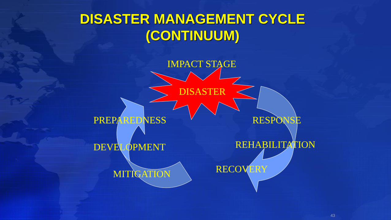
DISASTER MANAGEMENT CYCLE
(CONTINUUM)
43
DISASTER
PREPAREDNESS
MITIGATION
DEVELOPMENT
RECOVERY
REHABILITATION
RESPONSE
IMPACT STAGE

1. PREPAREDNESS…
“measures taken in anticipation of a disaster
to ensure that appropriate and effective
actions are taken in the aftermath”.
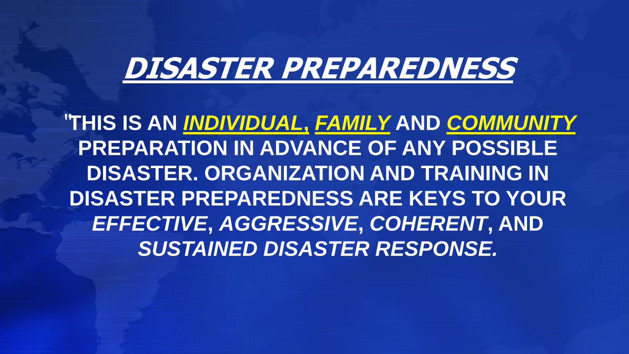
DISASTER PREPAREDNESS
“THIS IS AN INDIVIDUAL, FAMILY AND COMMUNITY
PREPARATION IN ADVANCE OF ANY POSSIBLE
DISASTER. ORGANIZATION AND TRAINING IN
DISASTER PREPAREDNESS ARE KEYS TO YOUR
EFFECTIVE, AGGRESSIVE, COHERENT, AND
SUSTAINED DISASTER RESPONSE.
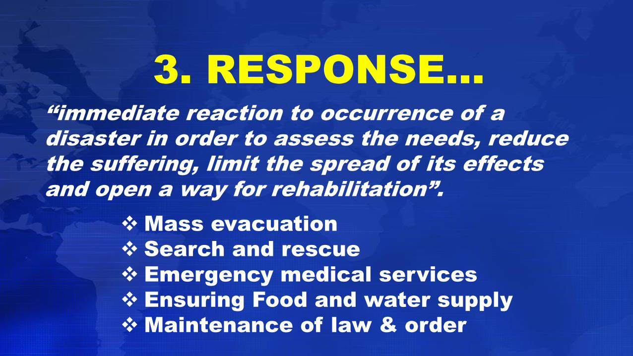
3. RESPONSE…
‘‘immediate reaction to occurrence of a
disaster in order to assess the needs, reduce
the suffering, limit the spread of its effects
and open a way for rehabilitation”.
Mass evacuation
Search and rescue
Emergency medical services
Ensuring Food and water supply
Maintenance of law & order
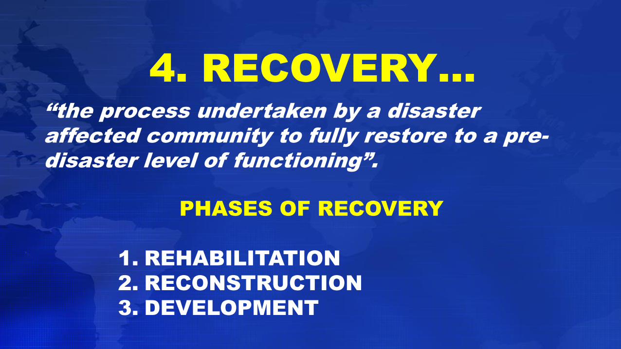
4. RECOVERY…
‘‘the process undertaken by a disaster
affected community to fully restore to a pre-
disaster level of functioning”.
PHASES OF RECOVERY
1. REHABILITATION
2. RECONSTRUCTION
3. DEVELOPMENT
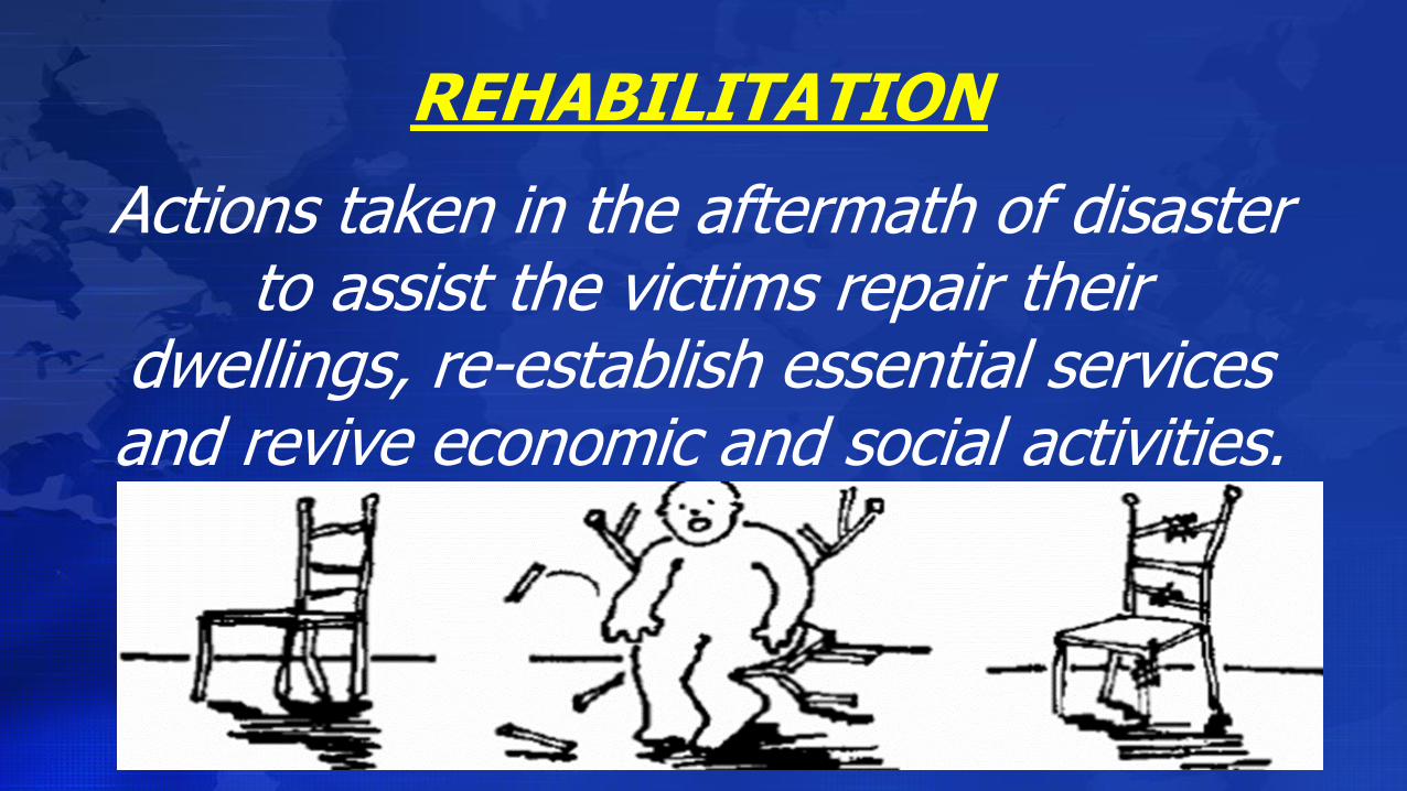
REHABILITATION
Actions taken in the aftermath of disaster to assist the victims repair their
dwellings, re-establish essential services and revive economic and social activities.
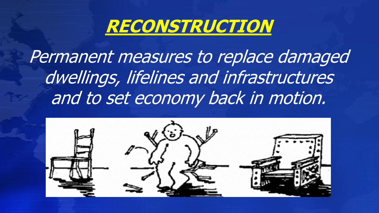
RECONSTRUCTION
Permanent measures to replace damaged dwellings, lifelines and infrastructures and to set economy back in motion.
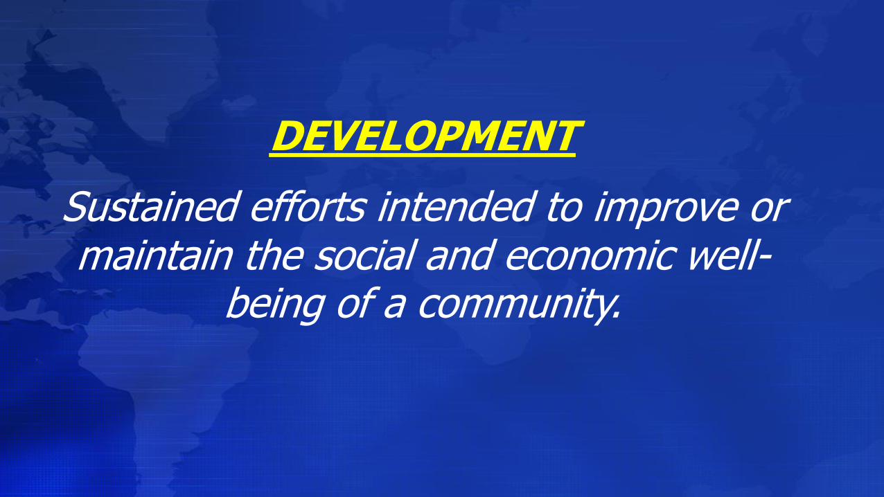
DEVELOPMENT
Sustained efforts intended to improve or maintain the social and economic well-
being of a community.
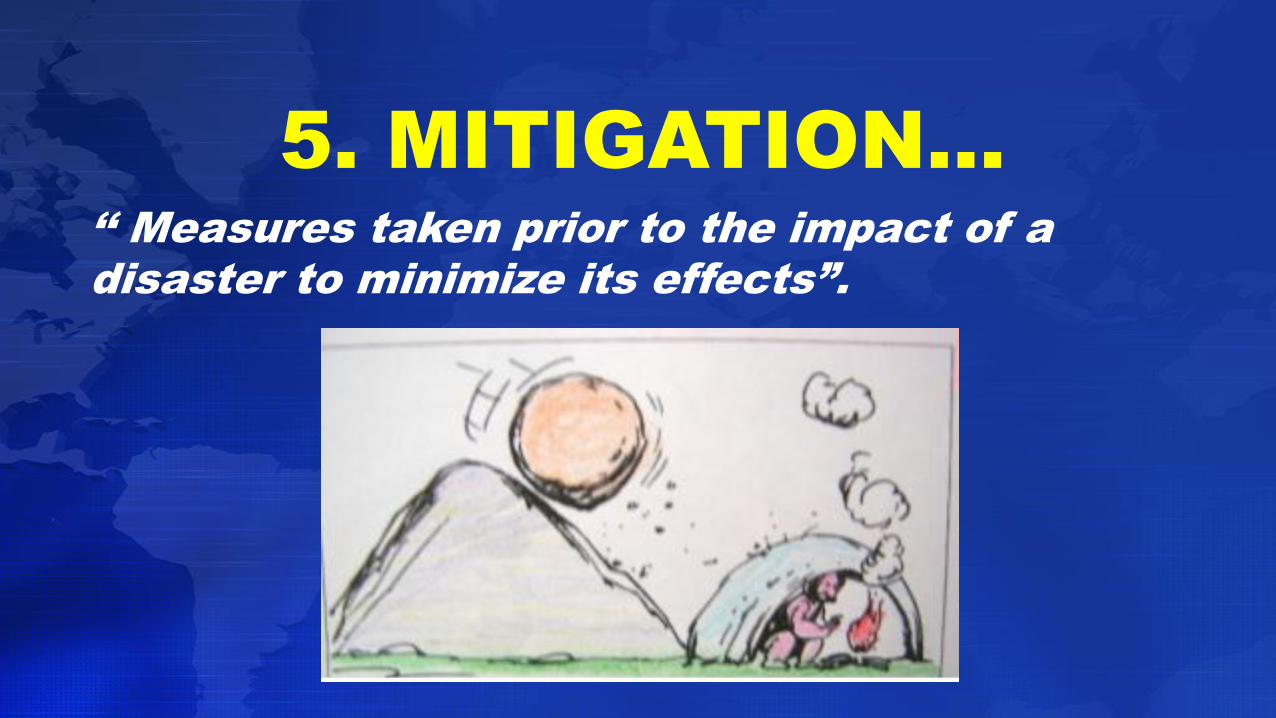
5. MITIGATION…
‘‘ Measures taken prior to the impact of a
disaster to minimize its effects”.
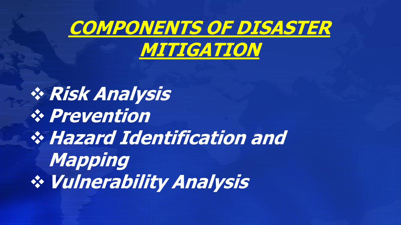
COMPONENTS OF DISASTER MITIGATION
Risk AnalysisPreventionHazard Identification and
MappingVulnerability Analysis
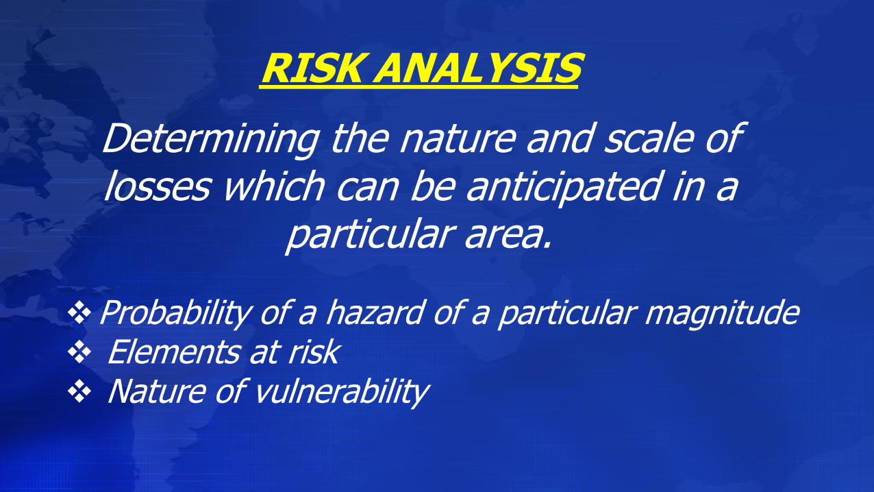
RISK ANALYSIS
Determining the nature and scale of losses which can be anticipated in a
particular area.
Probability of a hazard of a particular magnitude Elements at risk Nature of vulnerability

PREVENTION
Activities taken to prevent a natural phenomenon or potential hazard from
having harmful effects on either people or economic assets.

HAZARD IDENTIFICATION & MAPPING
Estimating probability of a damaging phenomenon of given magnitude in a given area.
Considerations: History Probability of various intensities Maximum threat Possible secondary hazards
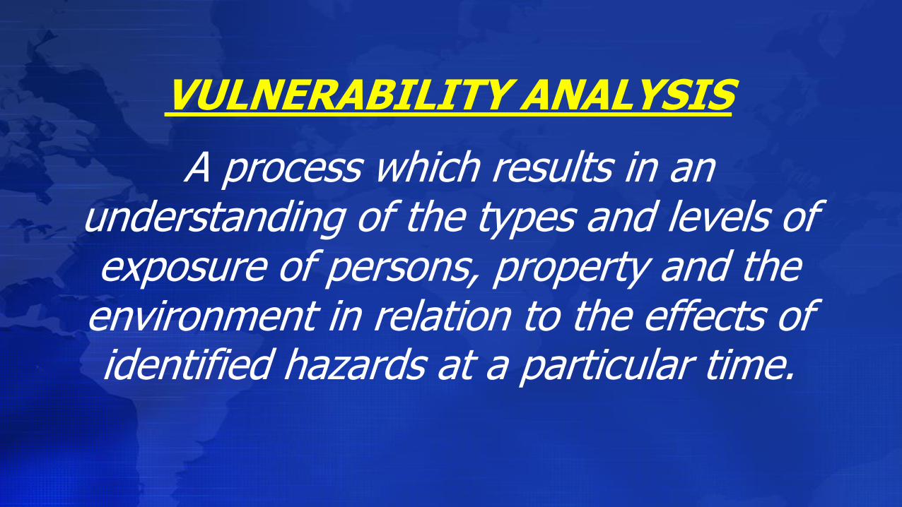
VULNERABILITY ANALYSIS
A process which results in an understanding of the types and levels of exposure of persons, property and the environment in relation to the effects of identified hazards at a particular time.
HIGHLIGHTS OF THE METRO
MANILA EARTHQUAKE
CONTINGENCY PLAN
“OPLAN YAKAL”
Republic of the PhilippinesOffice of the President
METROPOLITAN MANILA DEVELOPMENT AUTHORITYEDSA Cor. Orense St., Guadalupe Nuevo, Makati City
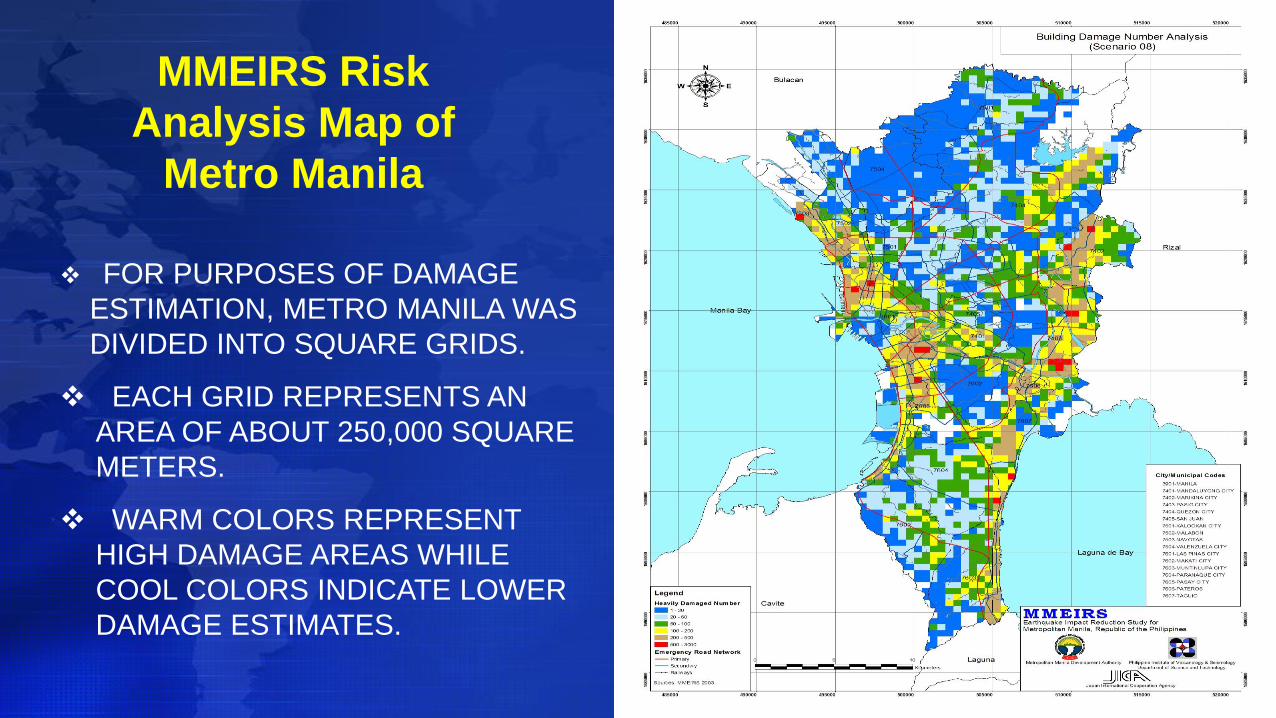
FOR PURPOSES OF DAMAGE
ESTIMATION, METRO MANILA WAS
DIVIDED INTO SQUARE GRIDS.
EACH GRID REPRESENTS AN
AREA OF ABOUT 250,000 SQUARE
METERS.
WARM COLORS REPRESENT
HIGH DAMAGE AREAS WHILE
COOL COLORS INDICATE LOWER
DAMAGE ESTIMATES.
MMEIRS Risk
Analysis Map of
Metro Manila
61
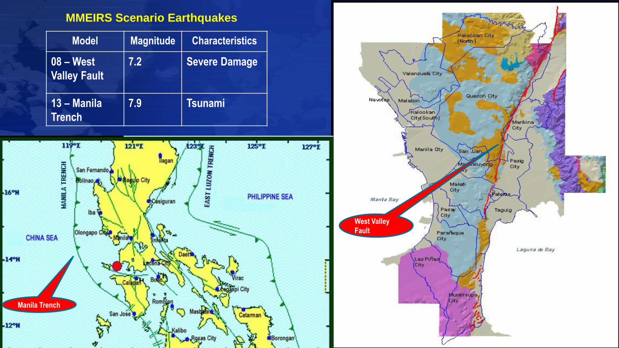
MMEIRS Scenario Earthquakes
Model Magnitude Characteristics
08 – West
Valley Fault
7.2 Severe Damage
13 – Manila
Trench
7.9 Tsunami
Manila Trench
West Valley
Fault
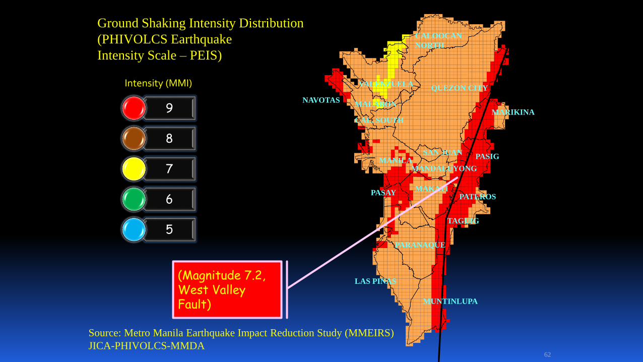
62
QUEZON CITYVALENZUELA
SAN JUAN
MARIKINA
MUNTINLUPA
TAGUIG
PATEROS
PASIGMANILA
PARANAQUE
LAS PINAS
PASAY
MANDALUYONG
CAL. SOUTH
NAVOTASMALABON
CALOOCAN
NORTH
MAKATI
Source: Metro Manila Earthquake Impact Reduction Study (MMEIRS)
JICA-PHIVOLCS-MMDA
Intensity (MMI)
Ground Shaking Intensity Distribution
(PHIVOLCS Earthquake
Intensity Scale – PEIS)
(Magnitude 7.2, West Valley Fault)
9
8
7
6
5
63
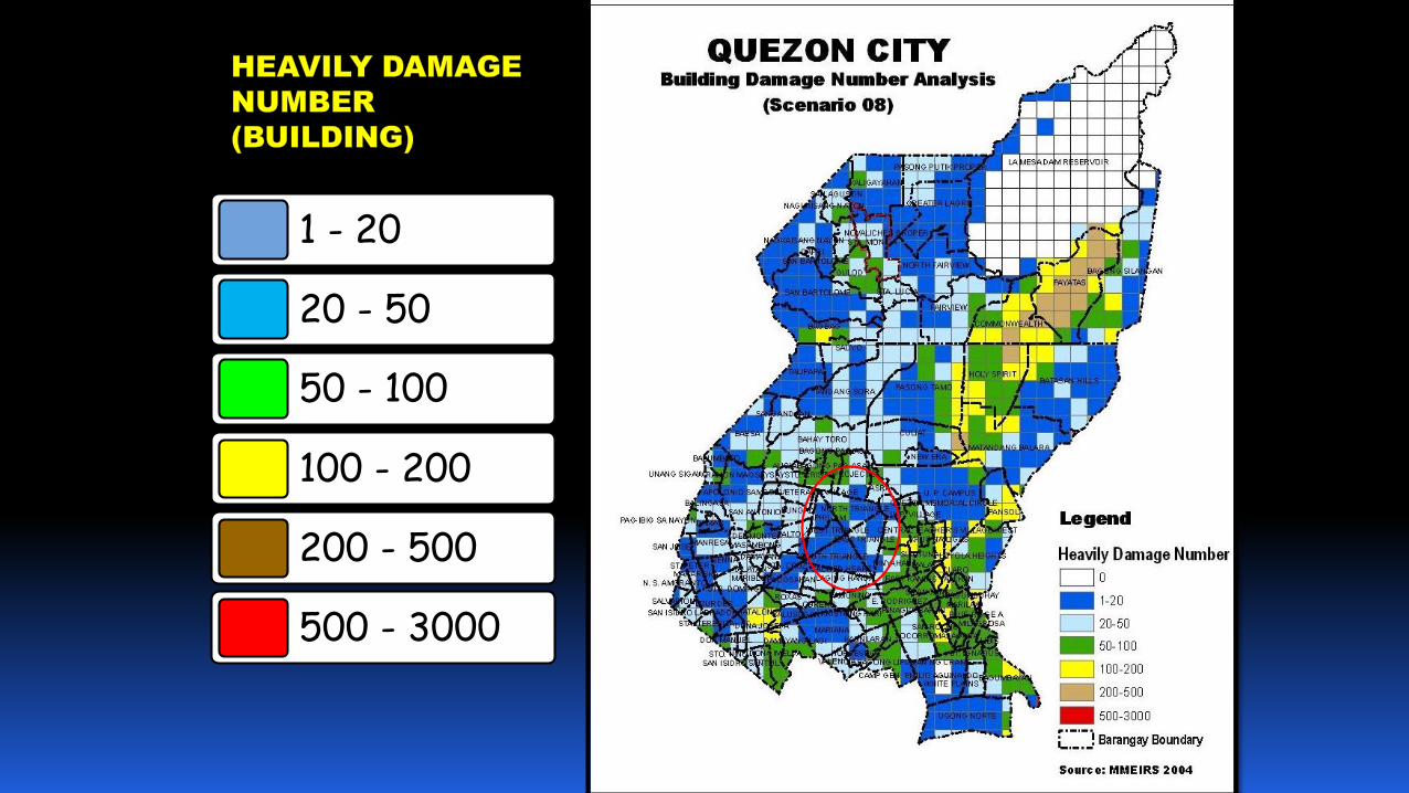
1 - 20
20 - 50
50 - 100
100 - 200
200 - 500
500 - 3000
64
QUEZON CITY
VALENZUELA
SAN JUAN
MARIKINA
MUNTINLUPA
TAGUIG
PATEROS
PASIGMANILA
PARANAQUE
LAS PINAS
PASAY
MANDALUYONG
CAL. SOUTH
NAVOTAS
MALABON
CALOOCAN NORTH
MAKATI
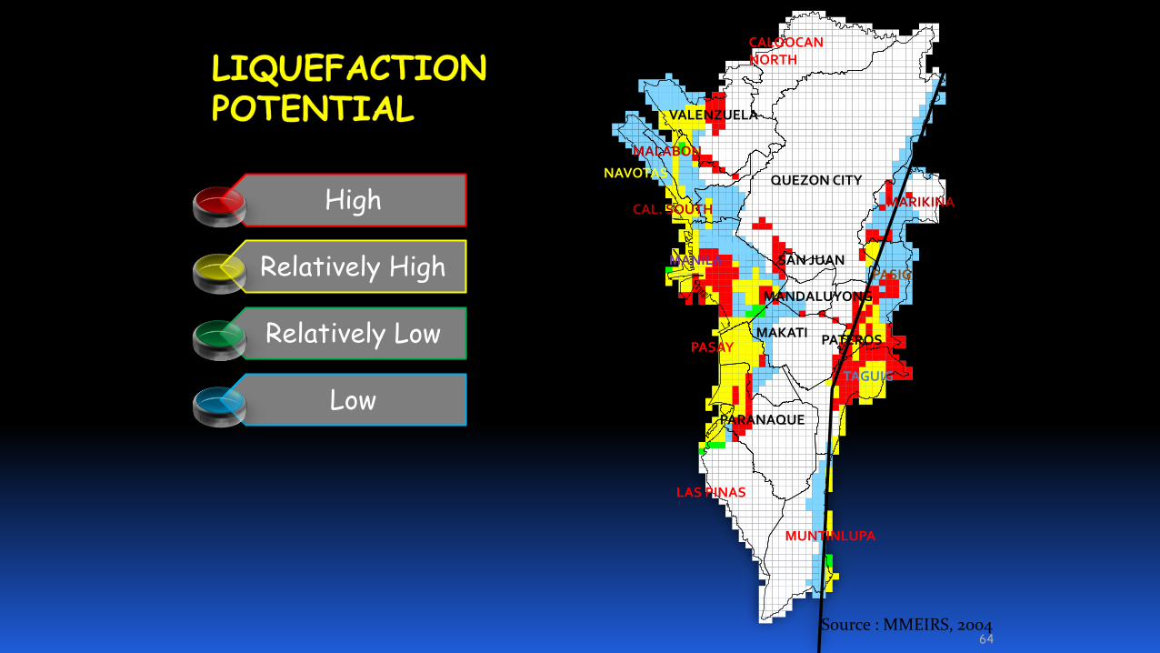
Source : MMEIRS, 2004
High
Relatively High
Relatively Low
Low
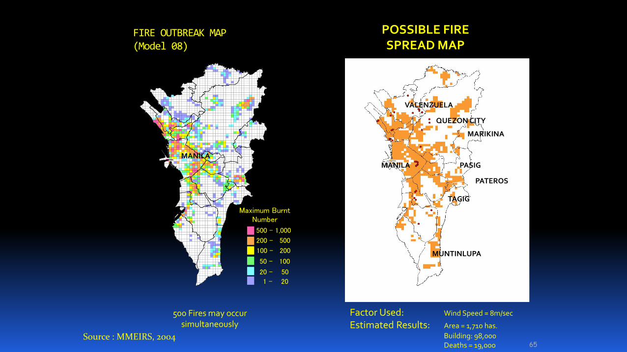
FIRE OUTBREAK MAP(Model 08)
65
Maximum BurntNumber
500 – 1,000
200 - 500
100 - 200
50 - 100
20 - 50
1 - 20
500 Fires may occur simultaneously
POSSIBLE FIRE SPREAD MAP
Factor Used: Wind Speed = 8m/sec
Estimated Results: Area = 1,710 has.
Building: 98,000 Deaths = 19,000
PASIG
TAGIG
MUNTINLUPA
MARIKINA
PATEROS
MANILA
VALENZUELA
QUEZON CITY
MANILA
Source : MMEIRS, 2004


ESTIMATED IMPACTS OF WORST CASE SCENARIO
EARTHQUAKE (Magnitude=7.2 West Valley Fault)
Public Purpose Buildings:
Schools 1412, Hospitals 177,
Fire Fighting 124, Police 43, MMDCC
Organizations and 17 LGU City and
Municipal Halls 53
Heavily Damaged 8 - 10 %
Partly Damaged 20 – 25 %
Residential buildings
(1,325,896)
Heavily damaged or
collapsed
13%
170,000
Moderately damaged 25.6% or
350,000
Human Loss
With population of 9,932,560
Dead 90% from pressure of
collapsed building
33,500
Injured 120,000
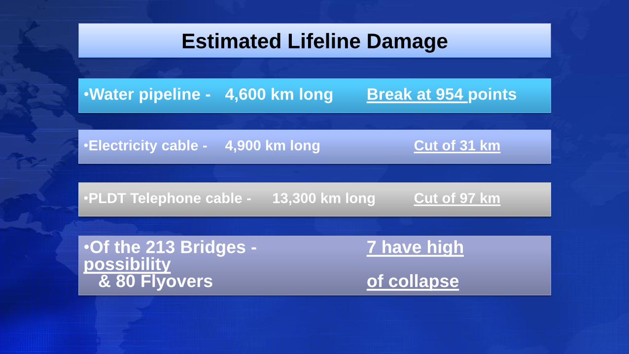
Estimated Lifeline Damage
•Water pipeline - 4,600 km long Break at 954 points
•Electricity cable - 4,900 km long Cut of 31 km
•PLDT Telephone cable - 13,300 km long Cut of 97 km
•Of the 213 Bridges - 7 have high possibility
& 80 Flyovers of collapse
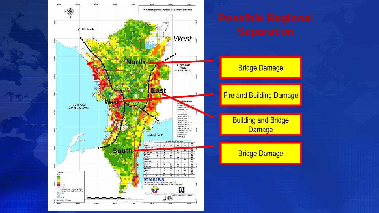
Possible Regional
SeparationWest
Fire and Building DamageWest
NorthBridge Damage
South Bridge Damage
Building and Bridge
Damage
East

Possible Regional
SeparationWest
Fire and Building DamageWest
NorthBridge Damage
South Bridge Damage
Building and Bridge
Damage
East
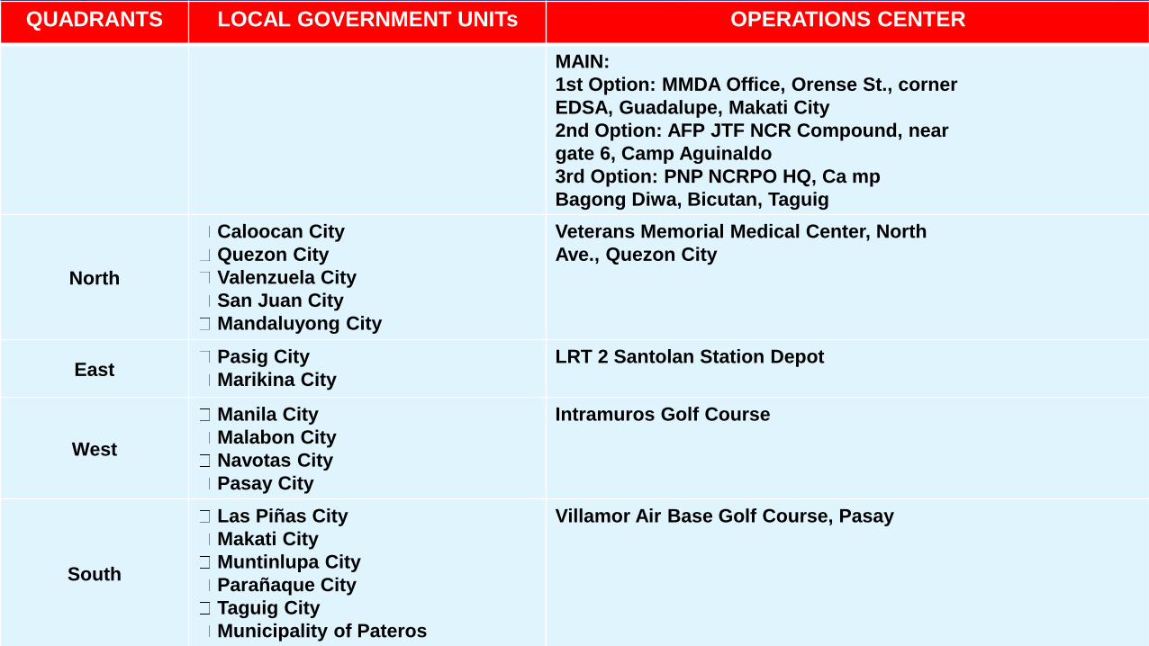
QUADRANTS LOCAL GOVERNMENT UNITs OPERATIONS CENTER
MAIN:
1st Option: MMDA Office, Orense St., corner
EDSA, Guadalupe, Makati City
2nd Option: AFP JTF NCR Compound, near
gate 6, Camp Aguinaldo
3rd Option: PNP NCRPO HQ, Ca mp
Bagong Diwa, Bicutan, Taguig
North
Caloocan City
Quezon City
Valenzuela City
San Juan City
Mandaluyong City
Veterans Memorial Medical Center, North
Ave., Quezon City
EastPasig City
Marikina City
LRT 2 Santolan Station Depot
West
Manila City
Malabon City
Navotas City
Pasay City
Intramuros Golf Course
South
Las Piñas City
Makati City
Muntinlupa City
Parañaque City
Taguig City
Municipality of Pateros
Villamor Air Base Golf Course, Pasay
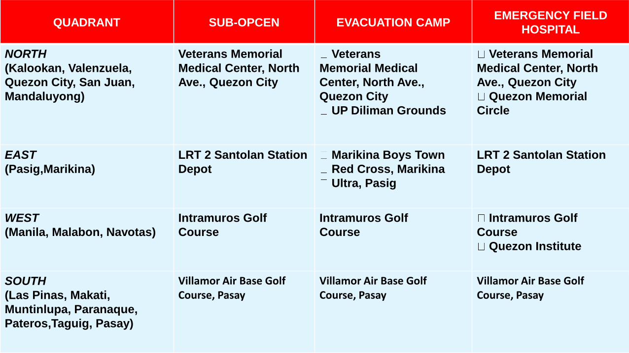
QUADRANT SUB-OPCEN EVACUATION CAMPEMERGENCY FIELD
HOSPITAL
NORTH
(Kalookan, Valenzuela,
Quezon City, San Juan,
Mandaluyong)
Veterans Memorial
Medical Center, North
Ave., Quezon City
Veterans
Memorial Medical
Center, North Ave.,
Quezon City
UP Diliman Grounds
Veterans Memorial
Medical Center, North
Ave., Quezon City
Quezon Memorial
Circle
EAST
(Pasig,Marikina)
LRT 2 Santolan Station
Depot
Marikina Boys Town
Red Cross, Marikina
Ultra, Pasig
LRT 2 Santolan Station
Depot
WEST
(Manila, Malabon, Navotas)
Intramuros Golf
Course
Intramuros Golf
Course
Intramuros Golf
Course
Quezon Institute
SOUTH
(Las Pinas, Makati,
Muntinlupa, Paranaque,
Pateros,Taguig, Pasay)
Villamor Air Base GolfCourse, Pasay
Villamor Air Base GolfCourse, Pasay
Villamor Air Base GolfCourse, Pasay

PRIORITY ROAD NETWORKS FOR
CLEARING OPERATIONS
- Osmeña Hi-way
- Quirino Avenue
- Araneta Avenue
- C-3 Road
- Shaw Boulevard
- R Magsaysay/Aurora Blvd/Marcos Hi-
way
- Ortigas Avenue
- Others as may be indentified in detail

City/Municipality Name of Cemetery/Memorial Park
Navotas Immaculate Memorial Park
Valenzuela Angelus Cemetery
St. John Cemetery
Caruhatan Public Cemetery
Tierra Santa
Arkong Bato Public Cemetery
Polo Catholic
Polo Memorial
Ever Memorial
Valenzuela Memorial
Caloocan South Area Cemetery
Sangandaan Cemetry
La Loma Cemetery
Eternal Cemetery
San Juan San Juan Cemetery
Pasig Pinaglaanan Shrine Pasig
Manila North Cemetery
South Cemetery
Marikina
City/Municipality Name of Cemetery/Memorial Park
Makati Makati Cemetery
Makati Catholic Cametery
Muntinlupa Catholic Cemetery
Aglipay Cemetery
Everest Memorial Park
Japanese Cemetery
NBP Compound
Taguig Camp Bagong Diwa, Brgy Lower
Bicutan
Pateros Pateros Public Cemetery
Paranaque Manila Memorial
Loyola Memorial
Paranaque Public Cemetery
Manila North Cemetery
South Cemetery
Quezon City La Loma Bagbag
Gulod Himlayan

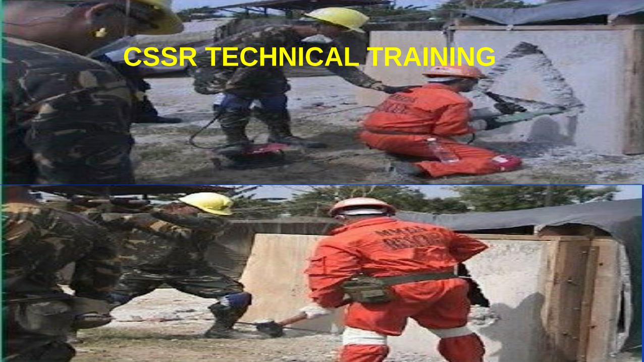
OUR RESOURCES &
CAPABILITY
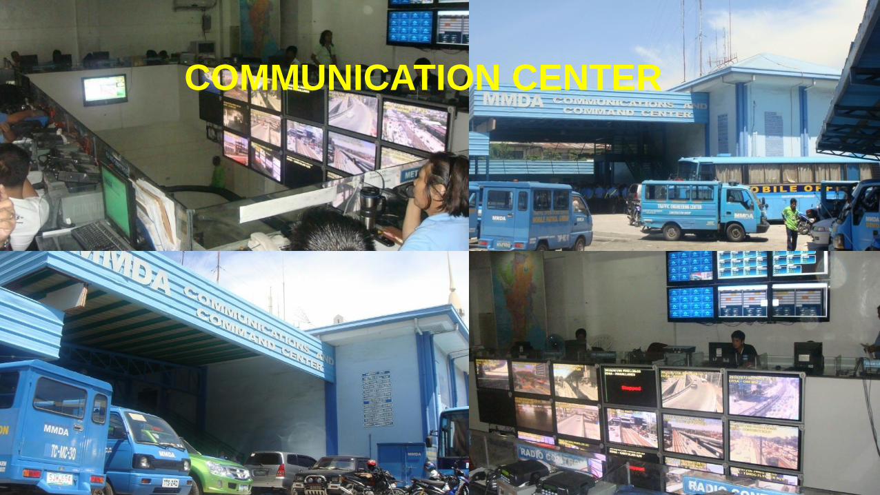
COMMUNICATION CENTER
81
CSSR TECHNICAL TRAINING
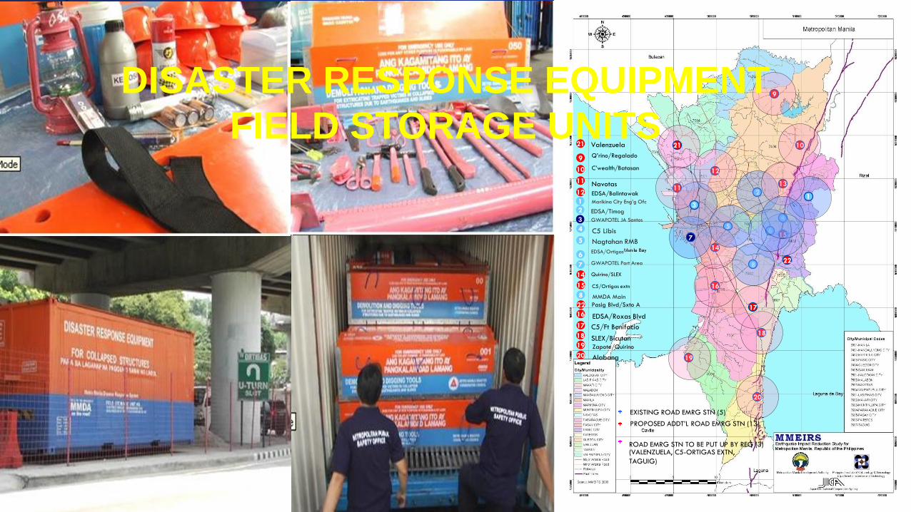
EXISTING ROAD EMRG STN (5)
10
112
14
4
56
8
16
19
20
10
11
1
2
3
4
5
6
7
14
8
16
17
19
20
EDSA/Timog
EDSA/Ortigas
Nagtahan RMB
MMDA Main
C’wealth/Batasan
Navotas
C5 Libis
GWAPOTEL Port Area
Quirino/SLEX
EDSA/Roxas Blvd
C5/Ft Bonifacio
Zapote/Quirino
Alabang
Marikina City Eng’g Ofc
GWAPOTEL JA Santos
15
9
13
12
18
15 C5/Ortigas extn
9 Q’rino/Regalado
18 SLEX/Bicutan
12 EDSA/Balintawak
22
21 Valenzuela
Pasig Blvd/Sxto A
22
21
17
PROPOSED ADDT’L ROAD EMRG STN (13)
ROAD EMRG STN TO BE PUT UP BY REG (3)(VALENZUELA, C5-ORTIGAS EXTN,
TAGUIG)
1
7
3
DISASTER RESPONSE EQUIPMENT
FIELD STORAGE UNITS
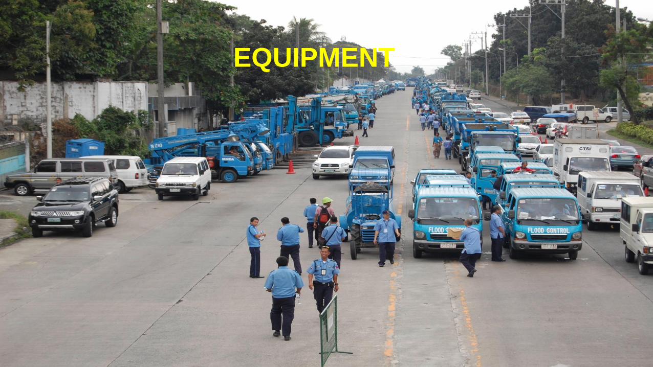
EQUIPMENT
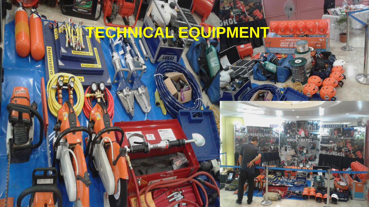
TECHNICAL EQUIPMENT
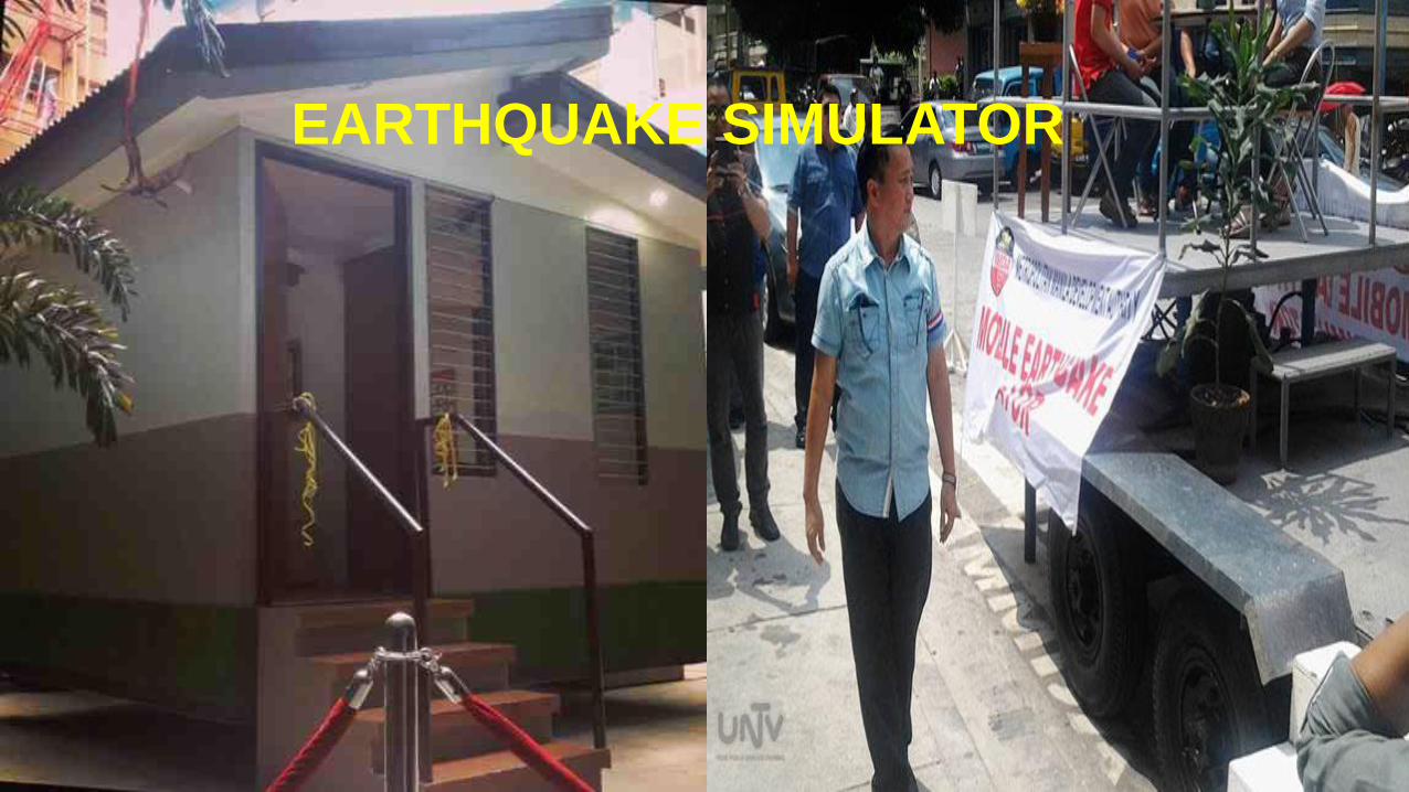
EARTHQUAKE SIMULATOR

PRECAUTIONARY MEASURES
BEFORE, DURING & AFTER AND
EARTHQUAKE
Republic of the PhilippinesOffice of the President
METROPOLITAN MANILA DEVELOPMENT AUTHORITYEDSA Cor. Orense St., Guadalupe Nuevo, Makati City

Identify safe spots at the house or building.
Secure shelves and cabinets.
Remove heavy objects or furniture
which may block your egress.
Stabilize LPG cylinders.
Keep a list of important emergency or hotline numbers.
Establish family earthquake plan.
Keep contact numbers or list of addresses of relatives and friends.
Learn on how to administer first aid.
Prepare earthquake emergency kit.
Propa
ne
Cylin
der

What contains earthquake emergency kit?
1 gallon of water/person/day
Foods (3 days consumption)
Pieces/pairs of clothes, blankets, rubber shoes
First aid kit
Portable radio, whistles, flashlights & batteries
Essential medications
Low Frequency Two-way Radio System
ABC Fire Extinguisher
Instructions on how to turn off gas, water and electricity
5 liters of water
Foods (biscuits, instant noodles etc.)
Piece of t-shirt & pants and pair of rubber shoes
First aid kit
Portable radio, whistles, flashlights & batteries
Essential medications
Low Frequency Two-way Radio System
Home Emergency Kit Office Emergency Kit
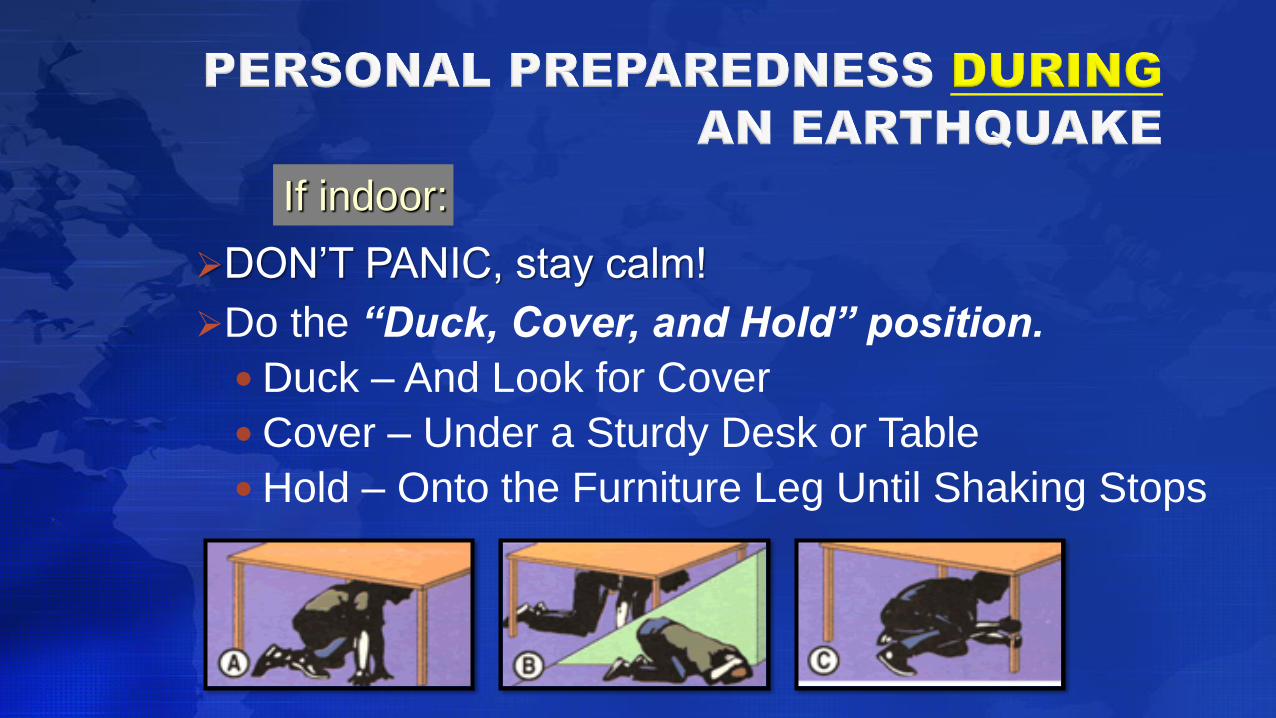
DON’T PANIC, stay calm!
Do the “Duck, Cover, and Hold” position.
Duck – And Look for Cover
Cover – Under a Sturdy Desk or Table
Hold – Onto the Furniture Leg Until Shaking Stops
If indoor:

SAMPLE OF DUCK, COVER AND HOLD VIDEO

• Stay inside until shaking stops; move only when it is safe to go out.
• Face away from windows.
• Stay clear of tall objects that may topple over.
• Watch for falling objects.
• Do not use elevator in going down.
If indoor:

• Get into the open areas.
• Stay clear of buildings & power lines.
• Do not smoke or light matches or lighters.
• If Driving:
o Stop as quickly as safety permits and stay inside the vehicle.
o Avoid stopping near or under the trees, light posts, power lines or buildings.
o Stay away from bridges, overpasses & tunnels.
If outdoor:
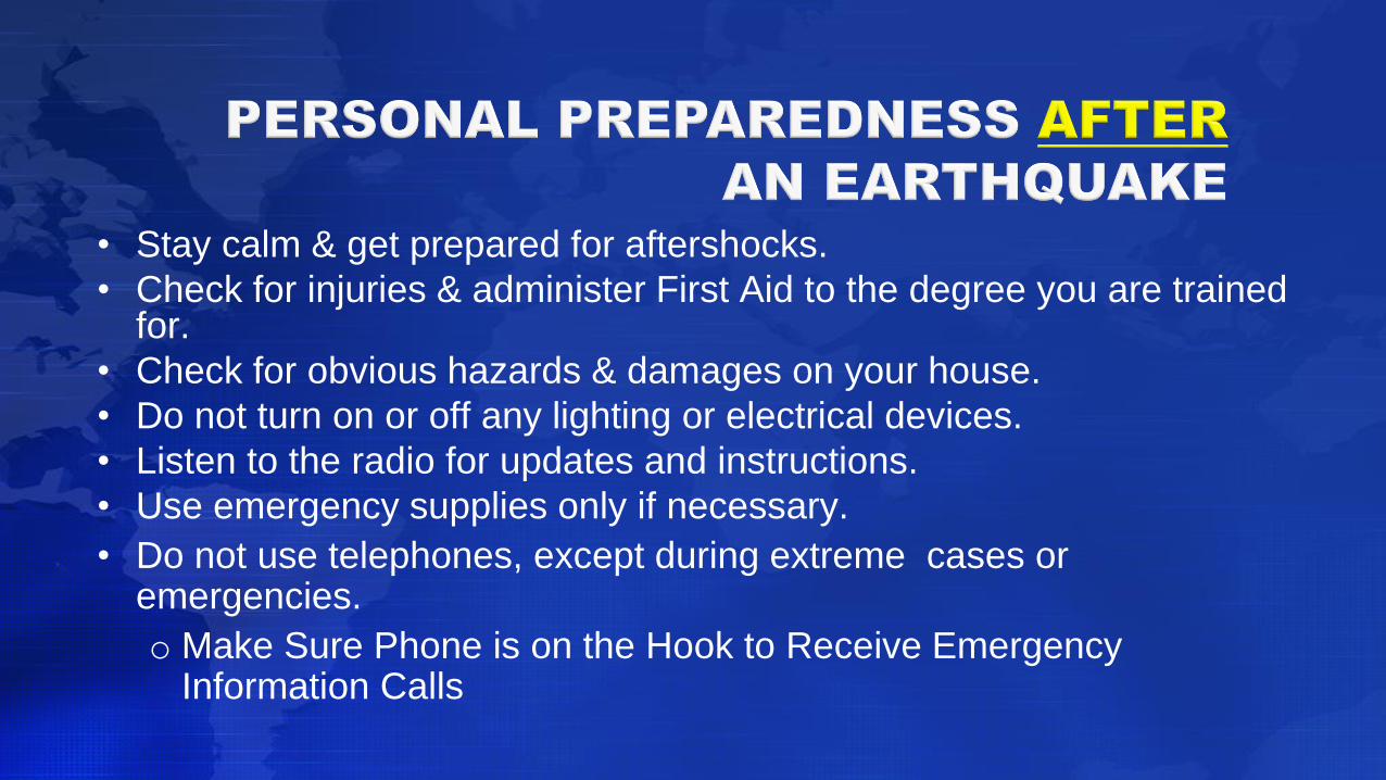
• Stay calm & get prepared for aftershocks.
• Check for injuries & administer First Aid to the degree you are trained for.
• Check for obvious hazards & damages on your house.
• Do not turn on or off any lighting or electrical devices.
• Listen to the radio for updates and instructions.
• Use emergency supplies only if necessary.
• Do not use telephones, except during extreme cases or emergencies.
o Make Sure Phone is on the Hook to Receive Emergency Information Calls
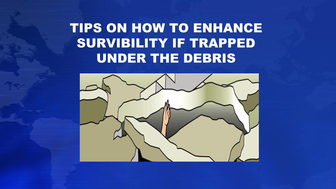
TIPS ON HOW TO ENHANCE
SURVIBILITY IF TRAPPED
UNDER THE DEBRIS
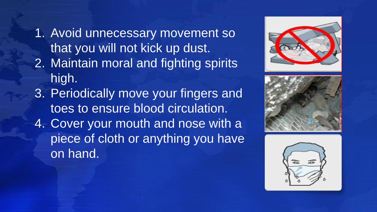
1. Avoid unnecessary movement so
that you will not kick up dust.
2. Maintain moral and fighting spirits
high.
3. Periodically move your fingers and
toes to ensure blood circulation.
4. Cover your mouth and nose with a
piece of cloth or anything you have
on hand.
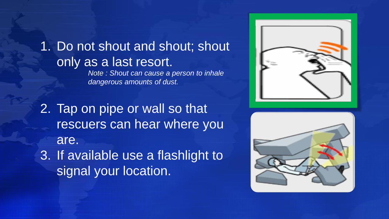
1. Do not shout and shout; shout
only as a last resort.
2. Tap on pipe or wall so that
rescuers can hear where you
are.
3. If available use a flashlight to
signal your location.
Note : Shout can cause a person to inhale
dangerous amounts of dust.

MARAMING SALAMAT……..