transportation mobility element establish a...
TRANSCRIPT

Transportation Mobility B-1
GoalsObjectives
Policies
TransportationMobility Element
OVERALL GOALESTABLISH A TRANSPORTATION SYSTEM THAT ENHANCES COMPACTDEVELOPMENT, REDEVELOPMENT, QUALITY OF LIFE, THAT IS SENSITIVETO THE CULTURAL AND ENVIRONMENTAL AMENITIES OF GAINESVILLE,AND IMPLEMENTS THE VISION OF THE “YEAR 2020 LIVABLE COMMUNITYREINVESTMENT PLAN” (GAINESVILLE 2020 TRANSPORTATION PLAN)WITHIN THE CITY OF GAINESVILLE. THE TRANSPORTATION SYSTEM SHALLPROVIDE EQUAL ATTENTION TO PEDESTRIAN, BICYCLE, AUTO AND PUB-LIC TRANSIT NEEDS. THE SYSTEM SHOULD PROVIDE VEHICULAR, PUBLICTRANSIT AND NON-MOTORIZED ACCESS TO ACTIVITY CENTERS, COMMU-NITY FACILITIES AND NEIGHBORHOOD COMMERCIAL AREAS. SAFETYAND EFFICIENCY SHALL BE ENHANCED BY LIMITATIONS AND CARE INTHE LOCATIONS OF DRIVEWAYS, PROVISION OF SIDEWALK CONNEC-TIONS WITHIN DEVELOPMENTSAND AN OVERALL EFFORT TO EN-HANCE PEDESTRIAN MOBILITYTHROUGHOUT THE COMMUNITY BYIMPROVEMENT AND PROVISION OFSAFE CROSSINGS, COMPLETESIDEWALK AND TRAIL SYSTEMSAND SIDEWALKS OF ADEQUATEWIDTHS TO ENCOURAGE PEDES-TRIAN ACTIVITY. BASIC TRANSPOR-TATION SHOULD BE PROVIDED FOR TRANSPORTATION- DISADVANTAGEDRESIDENTS TO EMPLOYMENT, EDUCATIONAL FACILITIES AND BASIC SER-VICES.
DEVELOP AND MAINTAIN A SAFE, CONVENIENT AND ENERGY EFFICIENTMOTORIZED AND NON-MOTORIZED TRANSPORTATION SYSTEM TO AC-COMMODATE THE SPECIAL NEEDS OF THE SERVICE POPULATION ANDTHE TRANSPORTATION DISADVANTAGED AND WHICH PROVIDES AC-CESS TO MAJOR TRIP GENERATORS AND ATTRACTORS.
Goals, Objectives &Policies
GOAL 1
Adopted by Ord. 000515, 8/12/02
Cafe
RTS

GoalsObjectivesPolicies
B-2 Transportation Mobility
Create an environment that promotes transportation choices, com-pact development, and a livable city.
1.1.1 By 2010, the City shall modify University Avenue between downtownand UF (University of Florida) to enhance the connection between thesetwo areas, and promote transportation choice and livability.
1.1.2 The City shall promote transportation choice, healthy residential andnon-residential development, safety, and convenience.
1.1.3 By 2004, the City shall explore with FDOT, enhancements to N.W.13th Street to increase the pedestrian and multi-modal character ofthat corridor.
1.1.4 The City shall coordinate with FDOT to reduce large truck traffic onstreets that are not designated truck routes, and direct such traffic todesignated truck routes. Improved signs and enforcement shalldirect non-local or through trucks to the designated truck route.
1.1.5 The City shall ensure that street modifications support land use,housing choice, and transportation choice objectives.
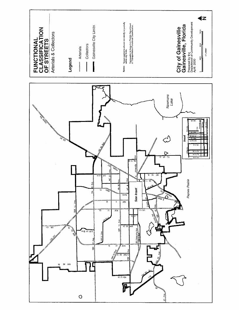
1.1.6 The City shall inventory and prioritize enhancements for “A”streets by 2005. An “A” street shall be defined as a street which isdesigned with, or otherwise characterized by, features that promotethe safety, comfort, and convenience of pedestrians.
1.1.7 The City shall coordinate with UF to ensure that the Campus MasterPlan is consistent with the goals, objectives and policies of theTransportation Element of the City Comprehensive Plan.
1.1.8 The City, in accordance with the policy adopted by the MTPO in1999, shall avoid using biased transportation terminology.
1.1.9 The City shall encourage the installation of parking garages andshared parking lots within neighborhood (activity) centers, employ-ment centers, and the area between downtown and the UF campus.The land development code shall be amended to ensure that suchparking meets performance objectives.
1.1.10 The City shall establish indicators, which track the trends inpromoting transportation choice on an annual basis. Such indicatorsmay include, among others, gasoline consumption, bus ridership,jobs/housing balance, vehicle miles traveled, percentage of travelby various forms of travel, and motor vehicle registration.
1.1.11 Site plans for new developments and redevelopment of non-residen-tial sites shall be required to show any existing and proposed bicycleand pedestrian access to adjacent properties and transit stops.
Objective 1.1
Policies

Transportation Mobility B-3
GoalsObjectives
Policies
1.1.12 New development will be encouraged to provide non-motorized vehicleand non-street connections to nearby land uses such as schools, parks,retail, office, and residential when feasible.
1.1.13 The City shall strive to implement transportation-related aspects ofPlan East Gainesville, including but not limited to:
a. Coordinating with the MTPO to establisih a Bus Rapid Transitsystem connecting east Gainesville with centers of employ-ment and commerce;
b. Coordinating with the MTPO and Alachua County to extendEast 27th Street from University Avenue to NE 39th Avenue;
c. Coordinating with the MTPO and FDOT to narrow and en-hance University Avenue between East 15th Street and East27th Street;
d. Coordinating with MTPO and FDOT to modify Waldo Roadfrom NE 16th Avenue to SE 4th Avenue so that this section ofroad becomes a low-speed, urban gateway boulevard; and
e. Include in the transporation network provisions for bicyclists,transit users, and pedestrians on NE 15th Street, East Univer-sity Avenue, Main Street, and NE 8th Avenue, where applicable.
Ensure that future land use map designations promote transportationobjectives by designating residential development of sufficient den-sity in appropriate locations to support transportation choice.
1.2.1 The City’s future land use map shall remain consistent withtransportation choice strategies such as: retaining higher residentialdensities and non-residential intensities near and within neighbor-hood (activity) centers and within transit route corridors; car-oriented land uses primarily outside of areas oriented towardtransportation choice; mixed use designations in appropriate loca-tions; and centrally located community-serving facilities.
1.2.2 The City shall coordinate with the MTPO to increase publicawareness of upcoming transportation projects in the approvedYear 2020 Livable Communities Reinvestment Cost Feasible Plan.
Ensure that the City coordinates with the Year 2020 Livable Commu-nities Reinvestment Plan and other plans of the MTPO for the Gaines-ville urbanized area, the Florida Transportation Plan and the FDOT’sAdopted Work Program.
1.3.1 The City shall coordinate with the MTPO in the Gainesvilleurbanized area, the FDOT, UF and other related state and regionaland local agencies to implement land use, transportation, andparking policies that promote transportation choice.
Objective 1.2
Policies
Objective 1.3
Policies
Revised 4/26/04, Ord. 030466

GoalsObjectivesPolicies
B-4 Transportation Mobility
1.3.2 The City shall coordinate with FDOT and Alachua County to implementAccess Management, Rule 14-97, F.A.C., and Sections 334.044 (2)and 335.188, F.S.
1.3.3 The City shall continue to propose transportation projects that affectthe City to the MTPO for consideration in the 5-Year TransportationImprovement Program.
1.3.4 The City shall continue to coordinate with FDOT, MTPO, theCommunity Traffic Safety Team, and Alachua County to improvetransportation system management and enhance safety by thecontinued expansion and upgrade of the traffic signal system andtiming, and by installing traffic signal pre-emption for emergencyvehicles and buses.
1.3.5 The City shall assist the MTPO in issuing a Level of Service Reporton all GUATS system roadways annually and shall coordinate withthe MTPO to designate backlogged and constrained facilities; thesedesignations shall be amended as appropriate to reflect updatedtraffic count information and system improvements.
Protect existing and future rights-of-way from building encroachmentto the extent that doing so promotes transportation choice.
1.4.1 By 2005, the City shall continue to work with FDOT, MTPO, andAlachua County to identify future transportation rights-of-way andto provide for development regulations and acquisition programswhich will protect such corridors for their intended future use. Suchprotection and long-range planning shall include pedestrian, bi-cycle, car, and transit facilities.
PEDESTRIANS
PROVIDE A SAFE, CONVENIENT, CONTINUOUS, COMFORTABLE, AND AES-THETICALLY PLEASING TRANSPORTATION ENVIRONMENT THAT PRO-MOTES WALKING. DEVELOP A “PARK ONCE” ENVIRONMENT AT EACHCITY NEIGHBORHOOD (ACTIVITY) CENTER.
Establish land use designations and encourage site plans whichreduce trip distances.
2.1.1 By 2002, the City shall inventory andprioritize street segments with sidewalkgaps. The following criteria shall beused in prioritizing sidewalk gap im-provements: (1) proximity to publicschools; (2) proximity to major publicparks or cultural facilities; (3) proximity to high density residential andcommercial areas, or any area exhibiting (or potentially exhibiting) a highvolume of walking; and (4) proximity to the Traditional City; (5) arterialand collector streets; (6) proximity to transit routes; and (7) proximity toareas of significant blight.
Objective 1.4
Policy
Objective 2.1
Policies
GOAL 2
Raised Median
Transportation Mobility B-5
GoalsObjectives
Policies
2.1.2 By 2003, the City shall prioritize and continue a retrofitting program sothat at least one linear mile of sidewalk is installed annually.
2.1.3 By 2002, the City shall complete an inventory of sidewalks on all arterial,collector and local streets, and place such an inventory on the cityGeographic Information System to assist in the identification of gaps andpriorities.
2.1.4 By 2002, the City shall identify arterial and collector segments thatshould be made more walkable. Raised medians, wider sidewalks,and on-street parking should be used, where feasible, on theseselected arterials and collector streets within the urban area—particularly in pedestrian-oriented areas, or adjacent to, such asdowntown, UF, and other neighborhood (activity) centers.
2.1.5 By 2002, all new streets within the City shall, where feasible,include sidewalks on both sides.
2.1.6 The City shall identify, prioritize, and retrofit needed bicycle/pedestrian links between adjacent land uses, where feasible.
2.1.7 Development and redevelopment projects shall be encouraged toprovide bicycle and pedestrian access to adjacent properties.
2.1.8 Street intersection modification, street construction, restriping,reconstruction, and resurfacing shall not increase the difficulty ofbicycle and pedestrian travel. Such changes shall include safetyfeatures for bicycles and pedestrians to offset any negative impactthe modification may otherwise create.
2.1.9 The City shall establish, as feasible and appropriate, pedestrianmid-block refuge areas at street mid-points, particularly for streetswith continuous left-turn lanes and areas where a large volume ofpedestrians and bicyclists are expected or are to be encouraged, oron 5- and 7-lane streets (or any street with a crossing distancegreater than 60 feet).
2.1.10 In new development or redevelopment, walking and bicycling shallbe promoted by establishing modest, human-scaled dimensionssuch as small street blocks, pedestrian-scaled street and buildingdesign, ample sidewalks to carry significant pedestrian traffic incommercial areas.
2.1.11 Drive-throughs shall be prohibited or restricted in areas where highpedestrian volumes are expected, or where walkable areas aredesignated or anticipated. Restrictions shall include number oflanes, width and turning radius of lanes, and entrance to and exitfrom the drive-through.

GoalsObjectivesPolicies
B-6 Transportation Mobility
2.1.12 Sidewalks shall be kept clear of signs, furniture, and other pedestrianobstacles that reduce the acceptable clear width of the sidewalk.
2.1.13 The City, by 2002, in coordination with the CRA, shall prepare a planthat inventories the need for pedestrian enhancements in the downtownCentral City District, including filling sidewalk gaps, installing streetfurniture, adding landscaped curb extensions and other pedestrianenhancements, and shall prepare an affordable and feasible schedule formaking such improvements.
2.1.14 The City shall work with FDOT and the CRA to enhance and widensidewalks and provide traffic control and design features to enhancepedestrian activity along University Avenue from W. 38th Street toWaldo Road.
2.1.15 The City shall amend the Land Development Code to require newdevelopment and redevelopment to provide safe and convenient on-site pedestrian circulation with features such as, but not limited tosidewalks, speed tables and crosswalks that connect buildings andparking areas at the development site.
2.1.16 At least 5 feet of unobstructed width shall be maintained on allsidewalks, except as necessitated by specific physical and/or natu-ral feature constraints that require a more narrow dimension for ashort length within a standard width sidewalk. Under no circum-stances shall the sidewalk be less than 36 inches in width.
TRANSIT
CREATE A PREMIERE COMMUNITY TRANSIT SYSTEM THAT PROVIDES AVARIETY OF FLEXIBLE TRANSPORTATION SERVICES THAT PROMOTEACCESSIBILITY AND COMFORT. THE CITY SHALL BECOME A NATIONALMODEL FOR EXPANDED AND ENHANCED TRANSIT SERVICE THROUGHAGGRESSIVE EFFORTS TO PROVIDE CONVENIENT SERVICE THROUGH-OUT THE CITY AND URBAN AREA. SERVICE SHALL BE PROVIDED WITHTHE CLEANEST, QUIETEST, MOST EFFICIENT EQUIPMENT FEASIBLE.
Design the City Regional Transit System (RTS) to strike a balancebetween the needs of those who are transit-dependent, and the needto become a viable service designed for the substantially largermarket of those who have a choice about using the bus. Viable serviceshall be supported by ensuring that the bus system serves major tripgenerators and attractors such as the UF campus and neighborhood(activity) centers, and that employment and housing are adequatelyserved by safe, pleasant and convenient transit stops, while alsoproviding for the transportation-disadvantaged.
3.1.1 The City shall strive to increase the amount of land designated formulti-family development, when appropriate, on the Future LandUse Map near important transit stops along arterials and collectors.
Policies
Objective 3.1
GOAL 3

Transportation Mobility B-7
GoalsObjectives
Policies
3.1.2 The City shall strive to link its land use and transportation planning byestablishing neighborhood (activity) centers as “transit-oriented devel-opments.” Ideally, transit hubs will evolve into having a sense of placeand community.
3.1.3 By 2005, the City shall evaluate the citywide bus stops to identify needsfor bus stop improvements such as well-designed shelters, bicycleparking, route information, benches, waste receptacles, or the need fora new bus stop.
3.1.4 The City shall acquire additional buses to accommodate expandedservices and increased ridership.
3.1.5 The City shall support expansion of the Bus Card Pass membership toinclude Shands employees, and consider establishing a program thatwould provide one to more city residents.
3.1.6 Upon completion of the Bus Rapid Transit (BRT) study, if a BRT routeis found to be feasible, the City shall implement the BRT route by FY2015 if sufficient funding for capital and operating costs from developersand other sources is available to support the route. In the interim period,the City shall explore express bus service on that route as a precursorto eventual BRT service, if funding is available.
Increase transit ridership. Strive to carry 8 million riders per year by2005 and 10 million riders per year by 2010.
3.2.1 The City shall strive for a residentialdensity of at least 8 units per acrefor developments in areas that areor will be served by frequent transit.
3.2.2 The City shall equip new RTS busstops with easy-to-understandtimetable and route information andan easily recognizable RTS logo.
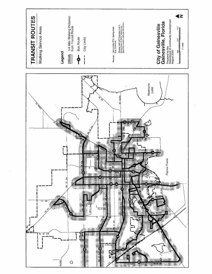
3.2.3 The City shall strive to provide main bus service within 1/4 mile of 80percent of all medium and high density residential areas identified on theFuture Land Use Map of the Comprehensive Plan, and within the RTSservice area.
3.2.4 The City bus service shall be expanded to serve a diverse cross-sectionof Gainesville residents.
3.2.5 The City bus service shall be enhanced to improve reliability and expandweekday evening and weekend service.
Objective 3.2
Policies
RTS
R TSB us
T imes8:00 a m
8:30 a m12: 00 pm
RTS
Revised 12/17/09, Ord. 090184

GoalsObjectivesPolicies
B-8 Transportation Mobility
3.2.6 In recognition of the value to the community of the many strong, stable,residential neighborhoods in the City, in no case shall Policies 3.1.1, 3.1.2,3.2.1 or 3.2.3 indicate a presumption that the City shall support a changeof designation of land use for any parcel. Any such action shall take intoaccount the full range of appropriate factors such as overall compatibility ofthe proposal, surrounding land uses, environmental constraints, and others,in addition to the factor of the City’s support of transit.
BICYCLING
PROVIDE A SAFE, CONVENIENT, EFFICIENT, CONTINUOUS, AND AESTHETI-CALLY PLEASING TRANSPORTATION ENVIRONMENT THAT IS CONDUCIVE TOBICYCLING.
Strive to increase the number of bicycle trips within city limits.
4.1.1 The City shall strive to provide an interconnected bicycle system with aroute to every major destination in the city.
4.1.2 The City, in cooperation with the County and FDOT, shall strive to ensurethat the installation of a turn lane will retain or include a continuous bike laneon the curb lane through the intersection.
4.1.3 The City, in cooperation with the County and FDOT, shall install orencourage the installation of bicycle detection devices at traffic-activatedsignals on arterial and collector streets.
4.1.4 By 2003, computerized traffic signalization in the Traditional City shall bedesigned to strike a balance between the needs of the pedestrian, bus,bicycle, and car, with particular consideration given to locations with highpedestrian volumes, bicycle volumes, or both. The crossing time providedat crosswalks shall take into account the speed of those non-motorizedusers with the slowest crossing speed.
4.1.5 By 2003, the City shall identify all arterials and collector segments which arenot currently designed for in-street bicycle transportation, and determinethe most appropriate design to accommodate such transportation, whereappropriate. The City’s Bicycle/Pedestrian Advisory Board shall be con-sulted to prioritize such modifications.
4.1.6 The following criteria shall be used in prioritizing bicycle facility improve-ments: (1) proximity to major public parks or cultural facilities, publicschools, high-density residential and commercial areas, or any area exhib-iting (or potentially exhibiting) a relatively high volume of bicycle traffic; (2)arterial and collector streets; (3) promotion of bicycle route continuity; (4)lack of alternative parallel routes; (5) streets serving important transit stopssuch as park-n-ride; (6) areas exhibiting a high incidence of car crashes withbicycles; and (7) proximity to the Traditional City.
Objective 4.1
Policies
GOAL 4

Transportation Mobility B-9
GoalsObjectives
Policies
4.1.7 By 2003, when sufficient right-of-way is available and when not an “A”street, all new construction, reconstruction, and resurfacing of arterialsand collectors shall be designed to accommodate in-street bicycletransportation as approved by state bicycle facility design standards.Designation as an “A” street does not preclude in-street bicycle lanes,nor do in-street bicycle lanes preclude designation as an “A” street.
4.1.8 The City shall continue routine maintenance programs for alldesignated bicycle and pedestrian facilities in city rights-of-way.Maintenance shall include sweeping of bicycle lanes, filling potholes,and confirming calibration of bicycle detection devices at signalizedintersections.
4.1.9 By 2003, the City shall conduct an inventory of the major streetsnetwork within city limits to identify bicycle hazards and barriers,and prepare a plan for removing or mitigating such impediments.
4.1.10 The City shall continue to equip each transit system bus to carrybicycles.
4.1.11 All new park-n-ride lots shall be designed to accommodate bicycleparking.
4.1.12 By 2005, the City shall strive to have bicycle parking facilitiesdesigned in conformance with City bicycle parking standards at allmajor transit stops and transfer points within city limits.
4.1.13 The City shall support continuation of provision of bicycle andpedestrian safety programs in Alachua County schools.
4.1.14 The City shall support implementation of the Alachua CountywideBicycle Master Plan adopted by the Metropolitan Planning Organi-zation in 2001 to the extent that it does not conflict with policies inthis plan.
Improve bicycle-related security.
4.2.1 The City’s bicycle parking design guidelines shall only allowbicycle racks which provide durability, security, ease of use,attractiveness, adaptability to different styles of bicycles and locktypes, and minimal hazard to pedestrians. Examples include bicyclelockers and the “inverted U” bicycle rack.
Policies
Objective 4.2

GoalsObjectivesPolicies
B-10 Transportation Mobility
TRAIL NETWORK
DEVELOP AN INTERCONNECTED TRAILS NETWORK THROUGHOUT THEURBAN AREA.
Develop, by 2006, an average of at least one mile of trail designed forbicycles, pedestrians, and wheelchairs annually.
5.1.1 The City shall fill gaps in the Trail Network, as identified in the Data andAnalysis Report and the Bicycle Master Plan, by 2010.
5.1.2 The City shall extend the Trail Network by cooperating with AlachuaCounty in County efforts to expand the Network—both for corridoracquisition and trail construction—particularly for extensions of theWaldo Rail-Trail, the Gainesville-Hawthorne Rail-Trail, and the ArcherRoad corridor.
5.1.3 The City shall amend the land development code to require newdevelopment and redevelopment to provide pedestrian and bicycleaccess to nearby trails, where feasible, or to enable a future retrofitconnection.
5.1.4 The City shall evaluate public lands for pedestrian and bicycle trailconnections that link various land use destinations by 2003. Utilityand stormwater management rights-of-way and easements will alsobe evaluated for such connections.
5.1.5 The City shall strive to make conversions of rail corridors to rail-trails permanent and not subject to revision, unless a “rails-with-trails” program is established.
5.1.6 The City shall encourage adaptive re-use of rarely used or out-of-service rail spurs into bicycle and pedestrian facilities.
5.1.7 Rail-banking shall be pursued as a way to promote additional trailopportunities, and to keep options open for future inter-city passen-ger rail corridors.
LIVABLE STREETS THAT PROMOTE SAFETY AND QUALITY OF LIFE
CREATE AND RETAIN STREETS THAT PROMOTE A MIX OF USES SUCH ASCAR TRAVEL, TRANSIT, AND BICYCLING BY DESIGNING STREETS: (1) FORSLOW MOTOR VEHICLE SPEEDS, (2) FOR QUIET NEIGHBORHOODS, (3)FOR SAFETY FOR CHILDREN, PEOPLE WITH DISABILITIES, AND SENIORSALONG RESIDENTIAL STREETS, (4) FOR A LIVABLE COMMUNITY FEATUR-ING NEIGHBORHOOD PRIDE, A SENSE OF PLACE, AND A PLEASANT TREECANOPY; AND (5) THAT SUPPORT A SIDEWALK SYSTEM SUPPORTIVE OFSOCIALIZING.
Policies
GOAL 6
Objective 5.1
GOAL 5

Transportation Mobility B-11
GoalsObjectives
Policies
Revise street design standards and continue installing street designfeatures so that construction of new streets and repair of existingstreets will create a safe, balanced, livable street that can be used forall forms of travel—to the benefit of neighborhoods, local busi-nesses, and the overall community.
6.1.1 In the Traditional City, University Heights, and College Park, the Cityshall use design features such as wide sidewalks, street trees, on-streetparking, narrow travel lanes, reduced use of turn lanes, bus stops, trafficcalming, prominent crosswalks, modest building setbacks, and signaltiming to achieve more modest average car speeds (no more than 25-30 mph) in order to create a more livable street system rich intransportation choice. The design of streets shall promote land uses thatare intended along streets in thisportion of the city, such ashealthy and walkable retail,residential, office, and civic uses.
6.1.2 Use traffic calming, where ap-propriate, to promote transpor-tation choice and to reduce thenegative impacts of car travel,alter driver behavior, and im-prove conditions for non-motor-ized street users.
6.1.3 The City shall make low-speed urban street design specifications andgeometrics the normal, default practice for street construction, modifica-tion, and reconstruction, and shall encourage the same policy be adoptedby FDOT and the County within city limits. Higher speed design shall onlybe used when specifically warranted.
6.1.4 The City shall use street resurfacing projects as an opportunity to installor enhance sidewalks, bicycle lanes, raised medians, and brick or brick-imprinted, paver, or painted crosswalks, where feasible. If not a Cityproject, the City shall recommend that the State or the County makesuch enhancements.
6.1.5 The City shall work with the State and the County to protect the linearcontinuity of raised medians as a strategy to promote safety, to providepedestrian refuge, traffic calming, space for landscaping, and discouragestrip commercial development.
6.1.6 The street layout of new developments shall be coordinated with thestreets and parking of surrounding areas. This shall be done by estab-lishing street connections to adjacent or potentially adjacent streets and
Objective 6.1
Fields of Vision
15 mph 20 mph
25 mph 30 mph
Policies

GoalsObjectivesPolicies
B-12 Transportation Mobility
parking lots, when feasible, unless natural features prevent such aconnection. When not feasible, the end of the street shall establish aright-of-way connection to adjacent, off-site property so that a futuremotorized or non-motorized connection to an adjacent street or prop-erty is not foreclosed.
6.1.7 The City should de-emphasize the hierarchical street system in termsof relying on a few large streets to carry the bulk of trips, and shallincrementally move toward a more balanced, connected systemwhereby trips are more dispersed throughout the entire street system.Additional connections should be added where needed and feasibleto make our overall street system more functional, with respect forexisting natural and man-made features.
6.1.8 The City shall set aside at least one day each year as a designated andpublicized sustainable transportation day to encourage citizens to switchfrom single-occupant car use to another commuting form of travel.
SOV TRAVEL
STRIVE TO MINIMIZE SINGLE-OCCUPANT VEHICLE TRIPS WITHIN THEGAINESVILLE METROPOLITAN AREA.
Strive, by 2010, to have at least 8 percent of all trips within the city bemade by a means other than single-occupant vehicle.
7.1.1 The maximum number of travel lanes for a new or widened street withincity limits shall not exceed 4 travel lanes.
7.1.2 The City shall review turn lanes on a case-by-case basis to ensure thatintersections are safe for all modes of travel.
7.1.3 The City shall amend its Land Development Code to ensure that parkingstandards are adequate to meet the needs of the community.
7.1.4 The City shall encourage new public and private schools to providebicycle and pedestrian connections to nearby residentially designatedlands.
7.1.5 The City shall use the Transportation Concurrency Exception Area asshown in the Transportation Mobility Element map series to encourageredevelopment within the city, and to promote transportation choices.
7.1.6 The City shall adopt LOS “C” for the Florida Intrastate Highway Systemand LOS “D” for State two-way arterials. Development within theGainesville Transportation Concurrency Exception Area (TCEA) shallbe regulated as shown in the Concurrency Management Element.
Objective 7.1
Policies
GOAL 7

Transportation Mobility B-13
GoalsObjectives
Policies
7.1.7 The City shall adopt LOS “E” for non-state streets (including Non-statestreets functioning as arterials) which are city-maintained facilities in thestreet network. Development within the Gainesville TCEA shall beregulated as shown in the Concurrency Management Element.
7.1.8 The City shall adopt LOS “D” for non-state streets which are AlachuaCounty-maintained facilities in the street network, as shown in the“Average Annual Daily Traffic Level of Service Report”. Developmentwithin the Gainesville TCEA shall be regulated as shown in theConcurrency Management Element.
7.1.9 Whenever redevelopment or reuse of a site would result in the combi-nation of one or more parcels of land that had previously operated asseparate uses, having separate driveways and parking, which are nowproposed to operate jointly or to share parking facilities, the total numberand location and width of driveways shall be reviewed. In order toreduce access points on the street system, driveways shall be eliminatedwhen the area served can be connected within the site.
7.1.10 The City shall coordinate the transportation network with theFuture Land Uses shown on the Future Land Use Map Series inorder to encourage compact development patterns and to providesafe and convenient access for work, school, shopping and service-related trips to protect the cultural and environmental amenities ofthe City, and to protect the integrity of the Florida IntrastateHighway System.
7.1.11 Transportation concurrency exceptions granted within the TCEAshall not relieve UF from meeting the requirements of 240.155 F.S.and the levels of service established for streets within the UFtransportation impact area.
7.1.12 The City shall work with and encourage large employers to developincentives to offer employees to reduce single-occupant vehicletrips to work, such as flex hours, subsidized transit passes orparking cash-out policies, for their employees.
Reduce car dependency to obtain environmental, financial, andsocial benefits.
7.2.1 Widening a street will not be used as a first response strategy to reducecar congestion. The City shall consider alternative solutions such asintersection modification, signal timing, round-abouts, and strategies thatpromote bus use, bicycling, and walking.
7.2.2 The City will encourage the use of more sustainable forms of travel, moretransportation choice, and a better retail environment to reduce the levelof traffic congestion in order to improve the city’s transportation level ofservice.
Objective 7.2
Policies
Revised 12/17/09, Ord. 090184

GoalsObjectivesPolicies
B-14 Transportation Mobility
7.2.3 Decision-makers will incorporate the impacts of induced traffic whenevaluating results of travel modeling.
ACCESSIBILITY FOR THE DISABLED
CREATE A TRANSPORTATION ENVIRONMENT THAT IS FREE OF BARRIERSFOR PEOPLE WITH DISABILITIES.
Eliminate existing barriers for people with disabilities.
8.1.1 Curb ramps and raised crosswalks shall be installed incrementally,in conjunction with other street modifications or in response tospecific problem locations.
8.1.2 The City shall continue to equip RTS buses to carry people withdisabilities.
8.1.3 Car parking spaces for persons who have disabilities shall conform tothe Florida Accessibility Code for Building Construction standards.
AVIATION
PROVIDE AN AVIATION FACILITY TO MEET THE NEEDS OF PASSENGERS,COMMERCIAL AIRLINES, AND GENERAL AVIATION IN A SAFE AND EFFI-CIENT MANNER.
Promote the Gainesville Regional Airport as the aviation facility forGainesville and its air service area, and support the implementation ofthe 1987 Gainesville Airport Master Plan as long as its improvementsand operations are consistent with the City’s Comprehensive Plan.
9.1.1 The City shall monitor the ridership potential for main bus service to theGainesville Regional Airport, and institute such service when the CityCommission determines that demand warrants transit service to theairport and the surrounding area.
9.1.2 The City shall use the 1987 Gainesville Regional Airport Master Plan asthe future land use guide for development in and around the airport.
9.1.3 The City shall ensure that airport improvements are in compliance withthe City’s Conservation, Open Space and Groundwater RechargeElement.
Objective 8.1
Policies
GOAL 8
Objective 9.1
Policies
GOAL 9

Transportation Mobility B-15
GoalsObjectives
Policies
Continue to eliminate incompatible land uses within airport noisecontours and hazardous obstructions affecting the landing, takeoff,or maneuvering of aircraft, and coordinating the siting of new (orexpansion of existing) airports, or related facilities with the FutureLand Use and Conservation, Open Space and Groundwater Re-charge Elements.
9.2.1 The City’s Future Land Use Element shall designate compatibleland uses within the vicinity of the airport.
9.2.2 The City shall continue to work with Alachua County to ensure thatincompatible land uses within the 65, 70 and 75 Ldn airport noisecontours are eliminated.
9.2.3 The City shall encourage the Gainesville-Alachua County Re-gional Airport Authority to acquire adjacent land which is notcompatible with the Airport as identified in the FAR Part 150 Study,and determined to be economically feasible by federal and stateland acquisition regulations.
Coordinate proposed airport expansions by the Gainesville-AlachuaCounty Regional Airport Authority with transportation plans by theFlorida Department of Transportation and the Metropolitan Transpor-tation Planning Organization.
9.3.1 The City shall continue to ensure that future aviation projects andthe Airport Industrial Park are integrated with the City’s trafficcirculation system and with other forms of transportation, such astransit and bicycling.
Continue to coordinate airport growth with appropriate aviation orother related organizations.
9.4.1 The City shall continue to work with the Gainesville-Alachua CountyRegional Airport Authority on all of its aviation projects.
9.4.2 The Gainesville-Alachua County Regional Airport Authority shall coor-dinate with the City, the Federal Aviation Administration, the FloridaDepartment of Transportation, North Central Florida Regional PlanningCouncil, the Continuing Florida Aviation System Planning Process andother appropriate agencies on all of its aviation projects.
Objective 9.2
Policies
Objective 9.3
Policies
Objective 9.4
Policy

GoalsObjectivesPolicies
B-16 Transportation Mobility
Transportation Mobility Element Map Series
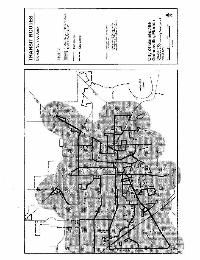
• Functional Classification of Streets• Limited and Controlled Access Facilities• Major Parking Facilities• Parking Garages• Transit Routes (Walking Service Area)• Transit Routes (Bicycle Service Area)• Existing & Potential Transit Hubs, Terminals, Transfer Stations• Transportation Concurrency Exception Area• Gainesville Trail Network• Bicycle Facility Types• Rail & Airport Facilities• Airport Clear Zones and Obstructions• Maintenance Responsibility• Number of Lanes• Major Trip Generators & Attractors• Existing Street LOS, 6/00• Natural Disaster Emergency Evacuation Routes
Policies


NW 3
9 Ave NW
31 Av
e
NW 34
NW 43 St
23 Blvd
NW 16
Blvd
NW 34 St
US 441
NW 2
3 Av
e
NW 55 St
NW 1
6 Av
e
SR 121SR
232
SW 2
Ave
SW20
Ave
Arch
er R
d16
SW
SW 34 St
24 A
ve
Tower Rd SW 75 St
41 Pl
Ave
I-75
NE 16
Ave
NE 2
3 Ave
NE 3
9 Av
e
NE
39 A
veNW 6 St
SR 26
SR 24
SE 15 St
441
Depo
t Ave
NE
8 A
ve
E U
nivers
ity A
ve
SE 11 St
SR 20
SE 27 St
SE 43 St
US
NW
53 Av
e NW 13 St
SE 4 St
Rd
SR S
329B
NE 15 St
NorthMainSt
SW 6
2
Blvd
St
I-75
NW 8
Ave
SR 33
1
Waldo Rd
W U
nivers
ity Av
e
Williston
US 4
41
CR 237
SR 121
CR 231
Gaine
sville
City
Limi
ts
TRA
NSP
OR
TATI
ON
MO
BIL
ITY
ELEM
ENT
MA
P SE
RIE
S
City
of G
aine
svill
leG
aine
svill
e, F
lorid
aPr
epare
d by t
he Pl
annin
g and
Deve
lopme
nt Se
rvice
s Dep
artme
ntAp
ril 20
11
Lege
nd
¯1
01
0.5Mi
les
Trans
porta
tion C
oncu
rrenc
yEx
cepti
on Ar
ea Rev
ised
11/
22/0
4, O
rd 0
3075
6R
evis
ed 1
1/15
/05,
Ord
031
252
Rev
ised
12/
17/0
9, O
rd 0
9018
5R
evis
ed 0
1/05
/12,
Ord
110
263
Zone
AZo
ne B
Zone
CZo
ne D
Zone
EZo
ne M
Trans
porta
tion C
oncu
rrenc
yEx
cepti
on Ar
ea Su
b-Zon
es