transport mapping: the osm route. an open data revolution data owners resisting politcal hot topic...
TRANSCRIPT

Transport mapping: the OSM route

An Open Data Revolution
Data owners resisting Politcal hot topic
Transparency & accountability Fuelling innovation

Innovations...
...which make our lives better
Data to build useful apps High value datasets. The good stuff. Transport!
51 billion passenger kilometres by train in 2009/10

Web apps, Mobile apps, Mobile web apps
Easy & cheap Going mobile
(& Location based) Demand for data

placr.mobi
Alpha!

End users
placr.co.uk
p l ā ç r
DevelopersOperators

Open Data Services
Help organisations releasing open data
Open data campaigning

Work with what's available
TfL tube departures data TfL and TravelLine bus timetables (TransXchange) TfL bus countdown displays (new!) NaPTAN bus stops Train times and delay information
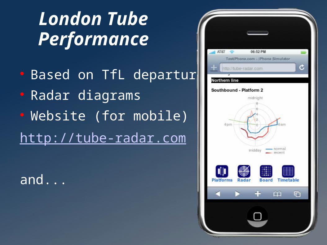
London Tube Performance
Based on TfL departures API Radar diagrams Website (for mobile) :
http://tube-radar.com
and...

'UK Travel Options' Free iPhone app

Tube Performance Overview Map

TransXchange

TransXchange
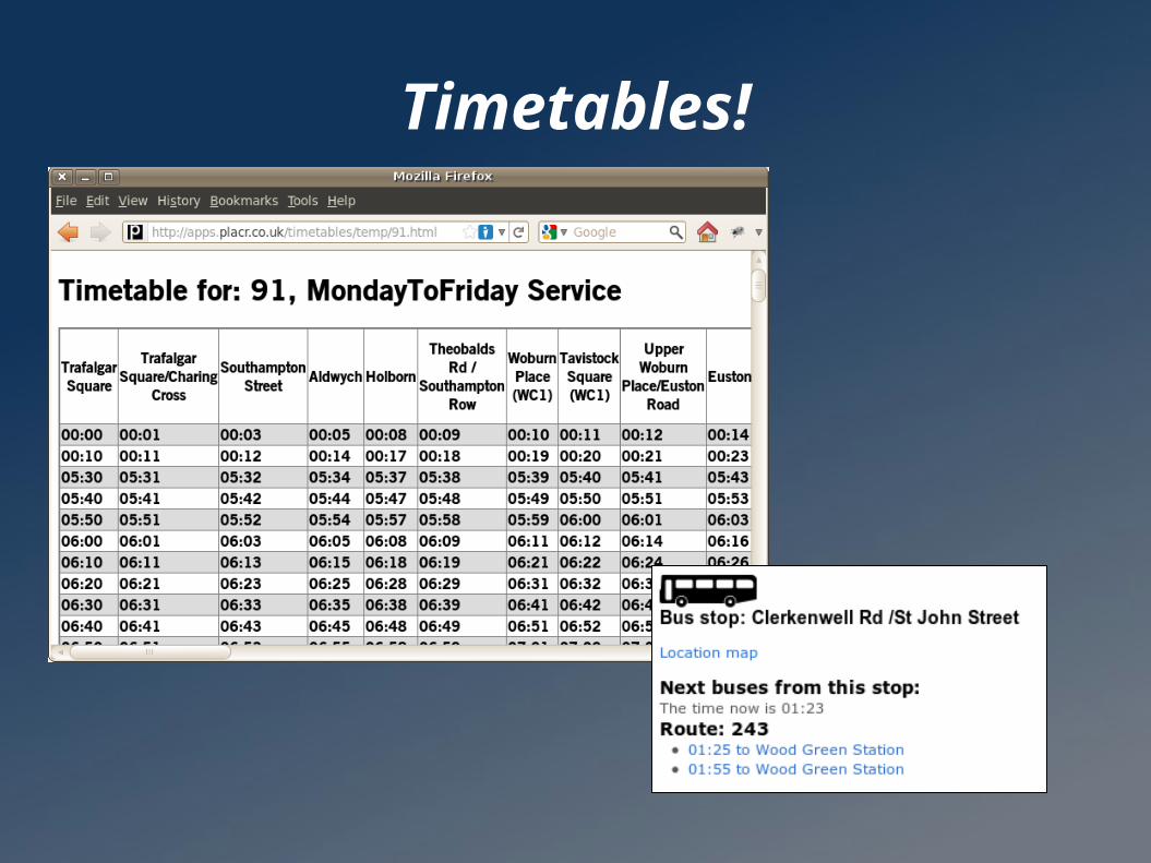
Timetables!

jQuery mobile

Location lookup

Location map
Link to osm.org?mlat=...&mlon=...

leaflet.cloudmade.com Free & Open Source Multitouch zooming

Static map image
http://wiki.openstreetmap.org/wiki/Static_map_images
<img>

APIs
placr.mobi
pla.crtransportapi.com
Formatted HTML
or JSON / XML
Activity streamsTimetables + tube stats

NaPTAN
Database of bus stop locations ATCOCODE Includes dead bus stops and other mess Locations sometimes inacurrate In OpenStreetMap (partly)

NaPTAN & OpenStreetMap

OpenStreetMap feedback
Editing OpenStreetMap “Authorise with OpenStreetMap” Alternative triage approach 'bugs' & OpenStreetBugs Simple data collection
Pitfalls: Not copying GPS not accurate

OpenStreetMap bus routes
Not just a set of stops Worldwide! (potentially)

Nodes Ways
Tagsamenity=pubname=Hare & Hounds
highway=residentialname=Court Street

Relations
Roles and memberships. Linking elements
Linking several ways to form a route Tags: type=route, route=bus

öpnvkarte.de (openbusmap.org)

My feeble attempt

Andy Alan's Transport Map

Dr Bartosz Fabianowski – dobini.com


Thank you
mail harrywood.co.uk
harrywood.co.uk
placr.co.uk
placr.mobi
openstreetmap.org
p l ā ç r