toptherm 02 - 2009 toptask toptask competition modern meteorological forecasting tools for gliding...
TRANSCRIPT
TOPTHERMTOPTHERM
02 - 2009
TopTaskTopTaskTopTask TopTask
CompetitionCompetition
Modern meteorological forecasting tools for gliding activities
TOPTHERM
The meteorological area forecastfor gliding activities
02 - 2009
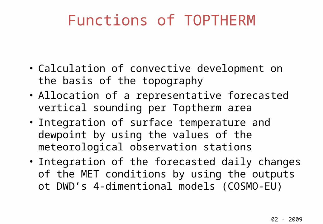
Functions of TOPTHERM
• Calculation of convective development on the basis of the topography
• Allocation of a representative forecasted vertical sounding per Toptherm area
• Integration of surface temperature and dewpoint by using the values of the meteorological observation stations
• Integration of the forecasted daily changes of the MET conditions by using the outputs ot DWD’s 4-dimentional models (COSMO-EU)
02 - 2009

Results of TOPTHERM
• Starting and ending of thermals• Mean climb rate of a glider in mps• Cloudiness (typ, coverage, extension)• Special elements (showers, turbulence, cloud streets,
wind)• Hourly potential flight distance for a standard class glider
02 - 2009
Proposalof the
functionalityof
TOPTHERM
02 - 2009
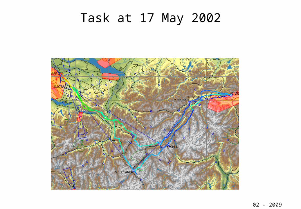
Task at 17 May 2002
02 - 2009
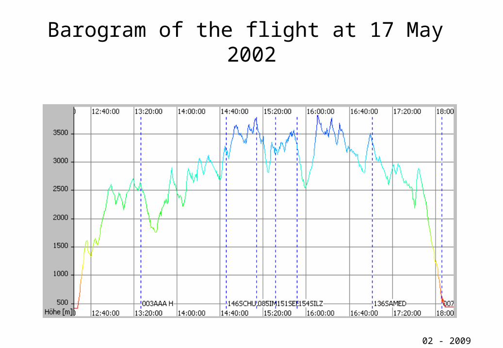
Barogram of the flight at 17 May 2002
02 - 2009

Analysisof the flight
at 17 May 2002
02 - 2009
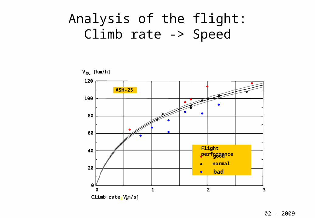
Analysis of the flight:Climb rate -> Speed
02 - 2009
0 1 2 30
20
40
60
80
100
120
Climb rate VzZ [m/s]
VXC [km/h]
ASH-25
Flight performancegood
normal
bad

02 - 2009
Till now there were only an analysis of the thermal conditions of a flight! But what we need is a forecast of these thermal conditions. We want to know, who and when which conditions can be expected and what will influence this thermals during the day!
This forecast delivers TOPTHERM !

Model TOPTHERM
–> VZ!
02 - 2009
TEMP TOPO
TREND
VZ

02 - 2009
Model Toptherm: Calculation of the development of the vertical structure of temperature and humidity during the day
TOPO: Area coupling by valley windsTOPO: Area coupling by valley winds
Reduktion 3D –> 2D !02 - 2009
1000 2000 3000
1000
2000
3000
1000 2000 3000
1000
2000
3000
1000 2000 3000
1000
2000
3000
Surface [km2]
[m M
SL
]
A
A
B
B
C
D D
1000 2000 3000
1000
2000
3000
[m M
SL
][m
MS
L]
[m M
SL
]
C

Model Toptherm: daily development of VVZZ
02 - 2009
02 - 2009
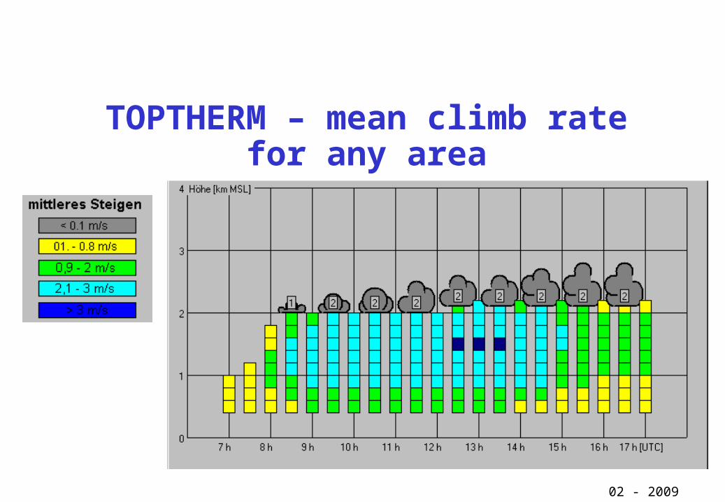
TOPTHERM – mean climb rate for any area

TOPTHERM:Input parameter for the calculation of the potential flight distance
• Mean climb rate >0,4 mps in the Alps >0,8 mps
• minimum altitude of flights above the median height:
Blue thermals: 900 mCloud thermals: 700 m
02 - 2009
02 - 2009
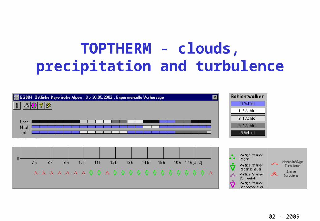
TOPTHERM - clouds, precipitation and turbulence
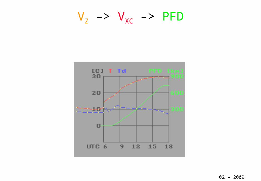
VZ –> VXC –> PFD
02 - 2009
TopTask The meteorological flight route planning tool
for soaring activities
02 - 2009
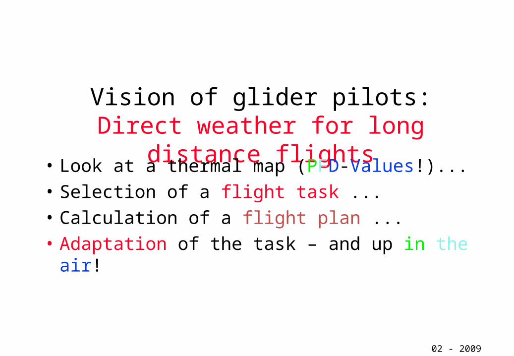
Vision of glider pilots:Direct weather for long distance flights
• Look at a thermal map (PFD-Values!)...• Selection of a flight task ... • Calculation of a flight plan ...• Adaptation of the task – and up in the air!
02 - 2009

All these features are included in the
TOPTHERMplannig tool TopTask
02 - 2009

TopTask – the route planning tool for glider pilots
Input parameter: start and end of thermals mean climb rate tops of thermals or basis of cumulus clouds wind in middle of the convective layer type of glider wing load
02 - 2009
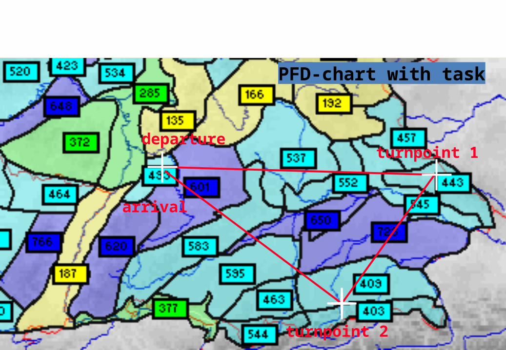
02 - 2009
departureturnpoint 1
turnpoint 2
arrival
PFD-chart with task
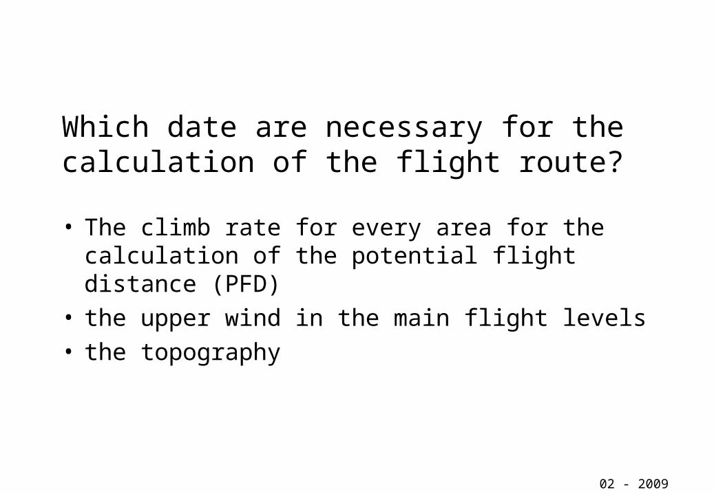
Which date are necessary for the calculation of the flight route?
• The climb rate for every area for the calculation of the potential flight distance (PFD)
• the upper wind in the main flight levels• the topography
02 - 2009

The Meteorology delivers:
• Regional climb rateRegional climb rate VVzz plus plus PFDPFD ... ...• Synoptic wind Synoptic wind ......
With these both basic data and the under layed topography the flight route plan for a distance flight can be calculated
02 - 2009
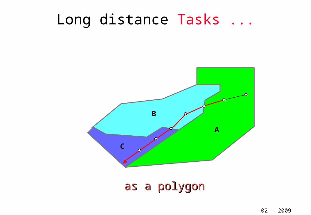
Long distance Tasks ...
02 - 2009
as a polygonas a polygon
A
B
C

Phases of flights:
• thermal flight with Cruising speed VXC(VZ)
• climbing with VZ for more operation height
• gliding to thermals (poss. outlanding)• final flight to destination
02 - 2009
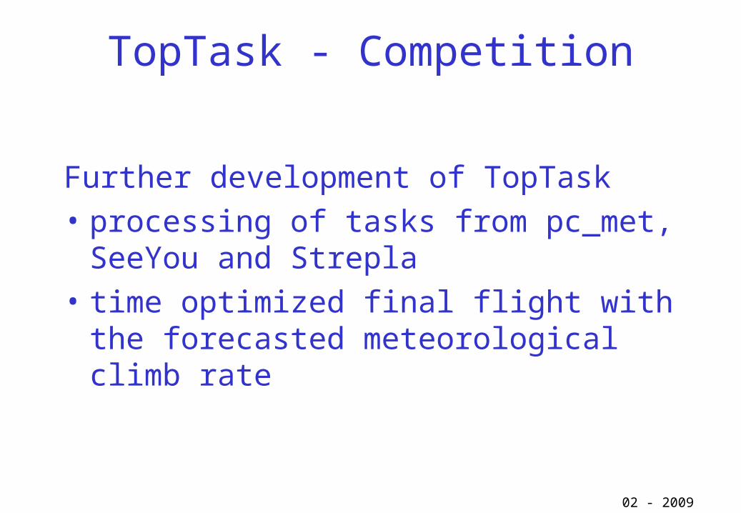
TopTask - Competition
Further development of TopTask• processing of tasks from pc_met, SeeYou and
Strepla• time optimized final flight with the forecasted
meteorological climb rate
02 - 2009
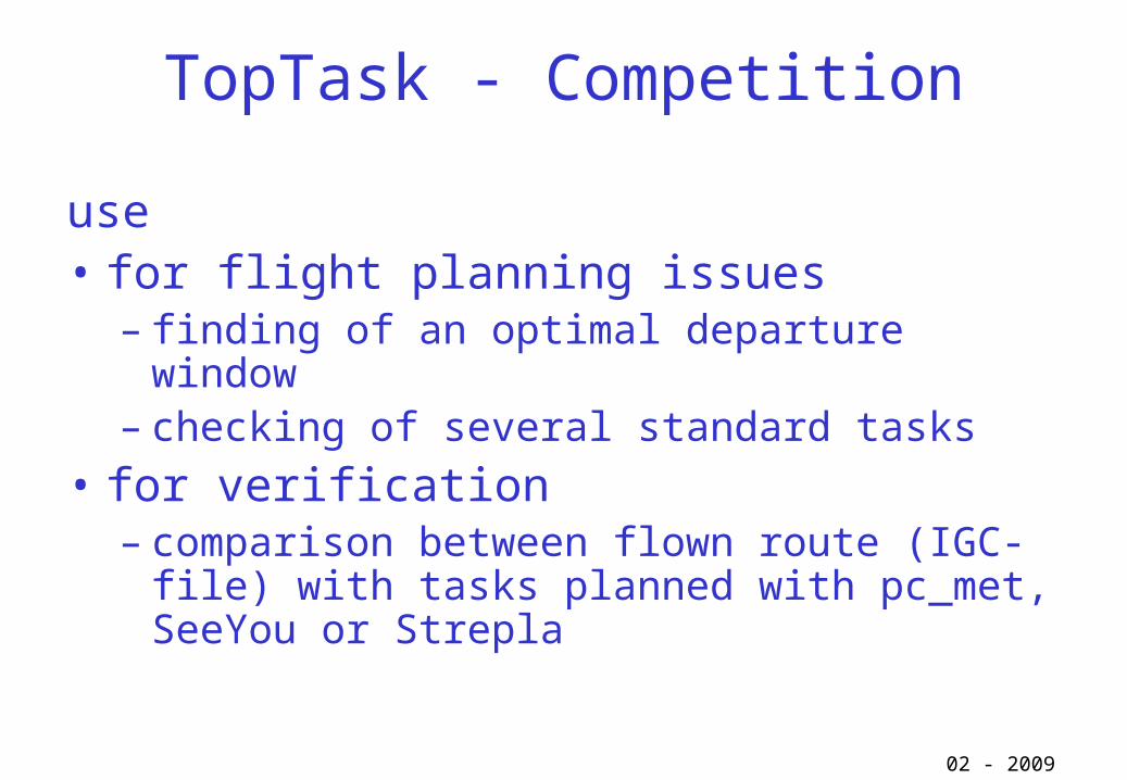
TopTask - Competition
use• for flight planning issues
– finding of an optimal departure window– checking of several standard tasks
• for verification– comparison between flown route (IGC-file) with tasks
planned with pc_met, SeeYou or Strepla
02 - 2009

TopTask - Competition
Program to support:• the task setter to find the right tasks• the pilots to find the best routes and the
optimal departure window• debriefings
02 - 2009
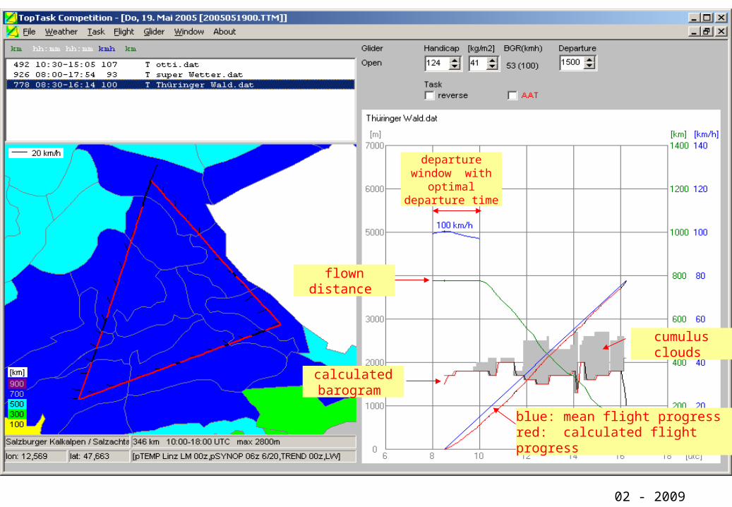
TopTask Competition
02 - 2009
departure window with optimal
departure time
calculated barogram
flown distance
blue: mean flight progress red: calculated flight progress
cumulus clouds
Comparison of TopTherm-results
with real flights
02 - 2009
02 - 2009
During the Switzerland championships (May 2004) the all tasks were for the first time exclusively set with TopTherm by the tasksetter. After the championship a verification take place between the planned and the real flown tasks.Additional a comparison was made between same extra ordinary long distance flights of Mathias Schunk and the TopTherm results.Both results should be presented in the following pransparencies.
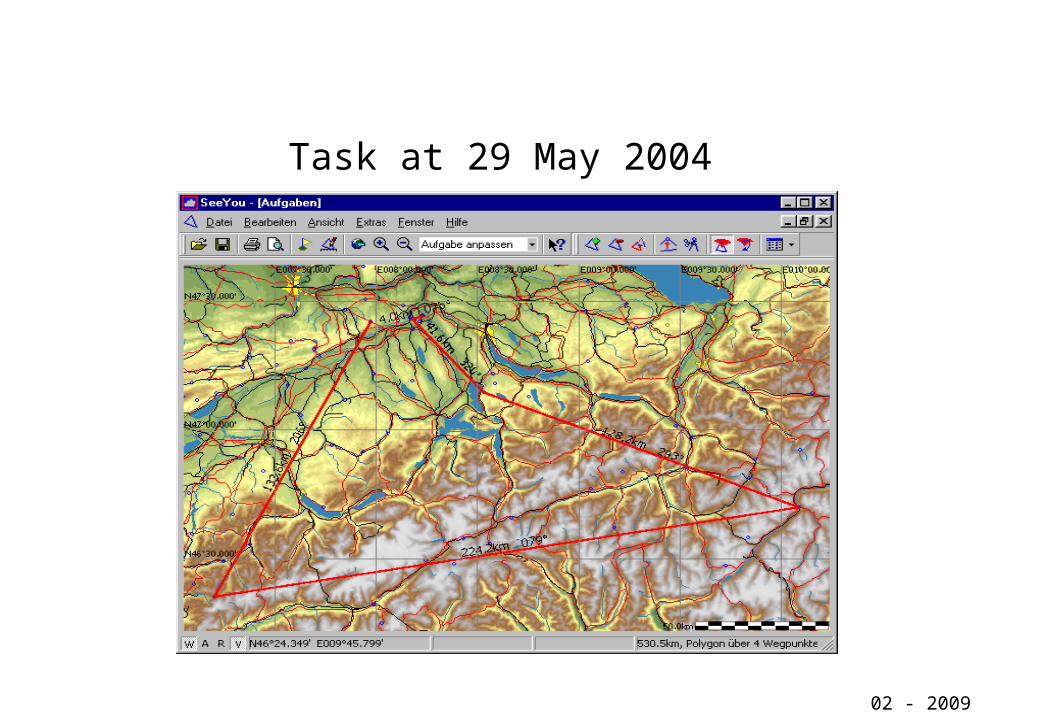
Task at 29 May 2004
02 - 2009
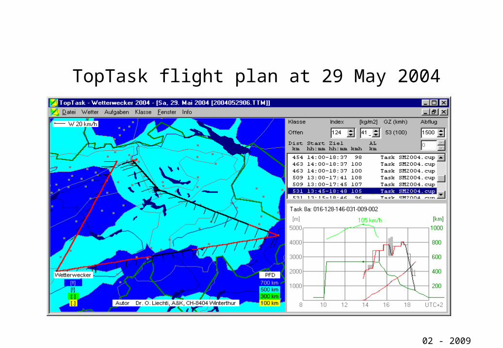
TopTask flight plan at 29 May 2004
02 - 2009

Course of flight at 29 May 2004
02 - 2009
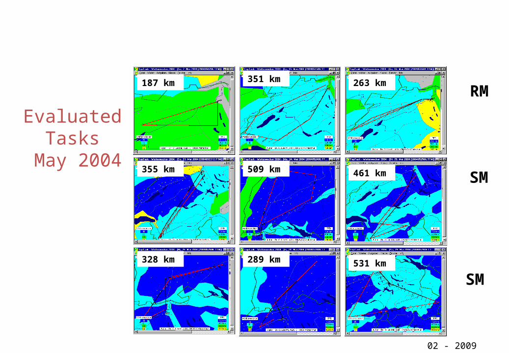
Evaluated Tasks
May 2004
02 - 2009
RM
SM
SM
187 km 351 km 263 km
355 km 509 km 461 km
328 km 289 km 531 km

Speed forecast with TopTask02 - 2009
TopTask Vorhersage [km/h]
Segelflug [km/h]
0 20 40 60 80 100 1200
20
40
60
80
100
120
Umwege…
Aufwindlinien…
Offene Klasse18m KlasseStandardklasse
54 Wettbewerbs-Flüge an RM/SM Birrfeld 2004
(9 Tage mit je 3 Flugaufgaben, 1. und 2. Tagesrang)
-40 -30 -20 -10 0 10 20 30 400
4
8
12
0
4
8
12
Abweichung [%]
Umwege … Aufwindlinien…
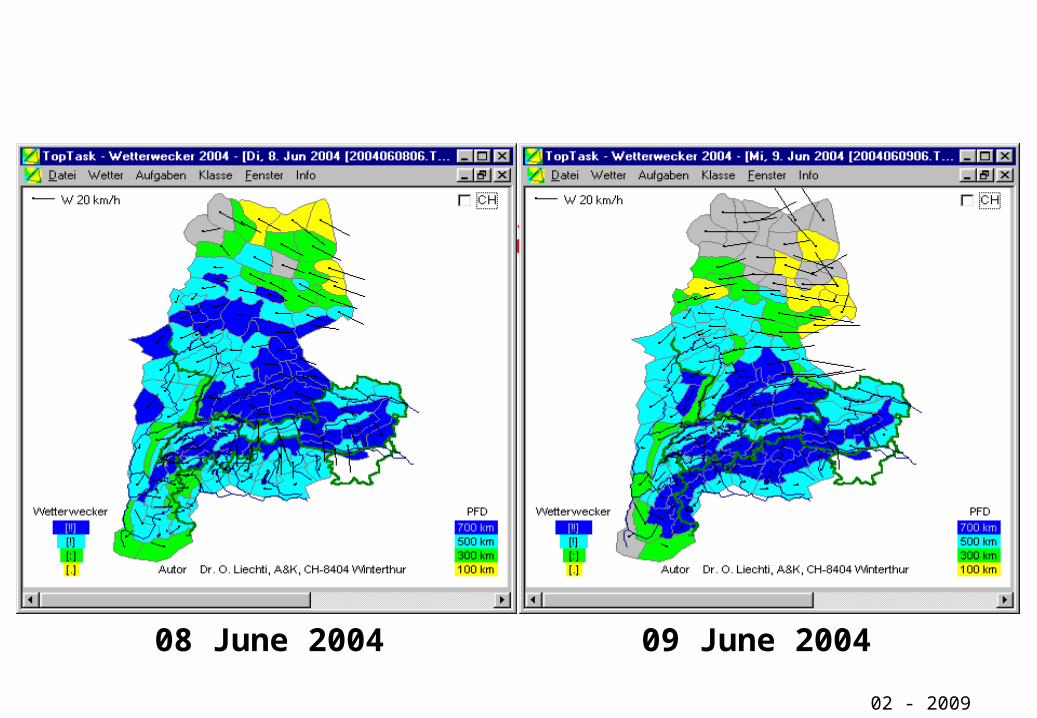
1000 km Weather [!!!]
02 - 2009
08 June 2004 09 June 2004
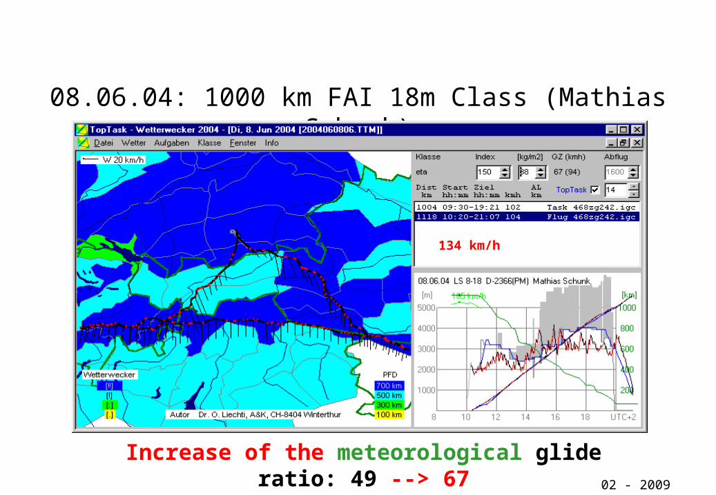
08.06.04: 1000 km FAI 18m Class (Mathias Schunk)
02 - 2009
Increase of the meteorological glide ratio: 49 --> 67
134 km/h
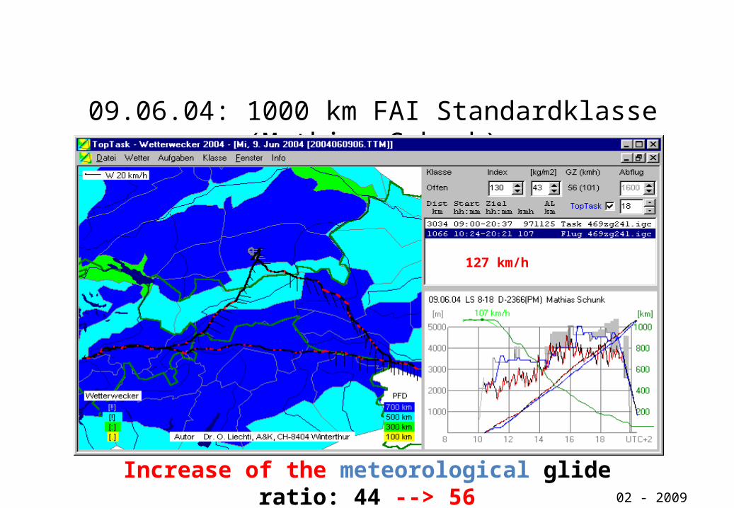
09.06.04: 1000 km FAI Standardklasse (Mathias Schunk)
02 - 2009
Increase of the meteorological glide ratio: 44 --> 56
127 km/h
Improvement of TOPTHERMin the years 2006 and 2007
• Changing in the involvement of radiation parameters• Correction in the involvement of the distribution of the vertical
temperature and humidity.• Adaptation of the areas, especially in the alps and the lower mountains
(Hochschwarzwald/ Oberer Neckar/ Obere Donau)• Changing of the boundary conditions
– Optimisation in the involvement of model grid points and synoptic stations to the regional areas
– Local reduction of the evaporation– Better correlation of minimum convection heights with the area conditions
02 - 2008
……..Improvement of TOPTHERM 2007 and 2008• For the first time area related quantitative consideration of dynamical
effects (cloud streets and hang winds) • Extension of Toptherm into the whole European French area including
the Pyrenees, into the western part of Poland (2007) and the whole Czech republic (2008)
• Further improvements of the forecast– Area optimisation (Austria and France)– Optimisation of heating and evaporation– Involvement of detour portion (8%)– Consideration of the “second day effect”
02 - 2008
…und 2009
Java-based internet version of TOPTHERM and TopTask
Start: AERO 2009
02 - 2009
Conclusion
• At gliding competitions and individual flights, the speed forecasted with TopTask is a very good first approximation for the estimation of the daily maximum speed
• GPS-based records of glider flights allow a detailed verification of the TOPTHERM-forecasts
• With TopTask a high quality tool is available which can be used for the planning of tasks for task setters and glider pilots.
02 - 2009