the study on water supply system for siem …open_jicareport.jica.go.jp/pdf/11582509_01.pdf · lake...
TRANSCRIPT

JAPAN INTERNATIONAL COOPERATION AGENCY
THE MINISTRY OF INDUSTRY, MINES AND ENERGYTHE ROYAL GOVERNMENT OF CAMBODIA
THE STUDY ON
WATER SUPPLY SYSTEM
FOR SIEM REAP REGION
IN CAMBODIA
FINAL REPORT
Vol. II MAIN REPORT
JUNE 2000
NIPPON KOEI CO., LTD.
NIHON SUIDO CONSULTANTS CO., LTD.

LIST OF REPORTS
Vol. I EXECUTIVE SUMMARY
Vol. II MAIN REPORT
Vol. III SUPPORTING REPORT
Vol. IV DATA BOOK
Exchange Rate Applied
1.00 US$= 3,800 Riels = 120.00 Yen
(as of June 1999)


0 20 40 60 80 100 kmScale
THAILAND
LAOS
VIET NAM
To Ho Chi Minh City
To Ho Chi Minh City
To Pakse
To Bangkok
GULF OF
THAILAND
Krong Koh Kong
Pursat
Sisophon
SihanoukvilleKampot
Svay Rieng
Takeo
Komong Speu
Kratie
Kompong Thom
Phnom Penh
Neak
Prok Tamak
Prey Veng
Kompong Cham
Lumphat
Senmonourom
Banteay Meanchey
Stung Treng
Battambang
Kompong
Chhnang
RN6A
Siem Reap
Location Map of Cambodia
LEGEND
Capital
Capital of Province
National Road
National BounderiesProvincial Bounderies
Railway
KEY MAP
Laos
Thailand
Cambodia
Viet Nam
N
The Study on Water Supply Systemfor Siem Reap Region in Cambodia
Japan International Cooperation Agency

Legend
PURSAT : Province Name: District NameSvay Leu
: Provincal Boundaries
: District Boundaries
: Siem Reap Town
Samrong
Chong Kal
Seri Snam
Angkor Chum
Kralanh
Puok
AngkorThom
PrasatBakong
SotnikumChi Kreng
Banteay Srei
Varin
Lake Tonle Sap
Svay Leu
PREAHVIHEAR
BATTAMBANG
PURSAT
KOMPONG THOM
BANTEAYMEANCHEY SIEM REAP PROVINCE
LLLLLLLLLLLLLLLLLLLLLLLLaaaaaaaaaaaaaaaaaaaaaaaakkkkkkkkkkkkkkkkkkkkkkkkeeeeeeeeeeeeeeeeeeeeeeee TTTTTTTTTTTTTTTTTTTTTTTToooooooooooooooooooooooonnnnnnnnnnnnnnnnnnnnnnnnlllllllllllllllllllllllleeeeeeeeeeeeeeeeeeeeeeee SSSSSSSSSSSSSSSSSSSSSSSSaaaaaaaaaaaaaaaaaaaaaaaapppppppppppppppppppppppp
SiemReapDistrict
KINGDOM OF THAILAND
300 60 kmScale
Location Map of Siem Reap Province
with District Names
N
Anlong Veaeng
The Study on Water Supply Systemfor Siem Reap Region in Cambodia
Japan International Cooperation Agency

SIEM REAP DISTRICT
NokorThum
KoukChak
Sla Kram
ChreavSiem Reap(Commune)
ChongKhnies
Srangae
SambuorSala Kamraeuk
SvayDangkum
ANGKORTHOM
BANTEAYSREI
PRASATBAKONG
PUOK
LAKE TONLE SAP
West BarayAngkorThom
N
Airport
Sla Kram
SIEM REAP : District Name
: Commune Name
: District Boundaries
Legend
: Commune Boundaries
: Social Survey Area
: Water Supply Service Area
The Study on Water Supply Systemfor Siem Reap Region in Cambodia
Japan International Cooperation Agency
Location Map of Study Areawith Commune Names
0 Scale 5 km

i
THE STUDY ON WATER SUPPLY SYSTEM
FOR SIEM REAP REGION IN CAMBODIA
FINAL REPORT
Vol. II MAIN REPORT
Table of Contents
PREFACE
LETTER OF TRANSMITTAL
LOCATION MAPS
Page
CHAPTER 1 INTRODUCTION............................................................................................1-1
1.1 Background of the Study........................................................................................1-1
1.2 Objectives of the Study ..........................................................................................1-2
1.3 Actual Execution of the Study ...............................................................................1-2
1.4 Organization of the Study.......................................................................................1-5
1.4.1 Japanese Organization..............................................................................1-5
1.4.2 Cambodian Organization .........................................................................1-6
CHAPTER 2 THE STUDY AREA........................................................................................2-1
2.1 Definition of the Study Area ..................................................................................2-1
2.2 Natural Conditions..................................................................................................2-1
2.3 Economic Conditions .............................................................................................2-1
2.4 Siem Reap Town .....................................................................................................2-2
2.5 Angkor Heritage ......................................................................................................2-2
2.6 Potential Water Sources..........................................................................................2-3
CHAPTER 3 SURVEYS AND INVESTIGATIONS............................................................3-1
3.1 Topographic Survey ................................................................................................3-1
3.1.1 Geography and Topography in the Vicinity of the Study Area .............3-1
3.1.2 Topographic Survey for the Study...........................................................3-4
ii
3.2 Hydrological Investigation......................................................................................3-5
3.2.1 Introduction ..............................................................................................3-5
3.2.2 Hydrological Condition of Siem Reap River ..........................................3-6
3.2.3 Hydrological Condition of West Baray .................................................3-10
3.2.4 Hydrological Condition of Lake Tonle Sap...........................................3-10
3.3 Geological and Geotechnical Investigation .........................................................3-11
3.3.1 Geophysical Prospecting........................................................................3-11
3.3.2 Geology ...................................................................................................3-12
3.4 Hydrogeological Investigation..............................................................................3-17
3.4.1 Simultaneous Groundwater Measurement ...........................................3-17
3.4.2 Pumping Test of Monitoring Well..........................................................3-19
3.4.3 Monitoring of Groundwater Level and Land Settlement.....................3-21
3.5 Water Quality.........................................................................................................3-23
3.5.1 West Baray ..............................................................................................3-24
3.5.2 Siem Reap River .....................................................................................3-26
3.5.3 Lake Tonle Sap........................................................................................3-27
3.5.4 Groundwater ...........................................................................................3-28
3.5.5 Organic Contents and Trihalomethane Formation Potential................3-31
3.5.6 Turbidity..................................................................................................3-32
3.5.7 Confirmation of Fe and As Contents ....................................................3-32
3.5.8 Conclusions ............................................................................................3-32
3.6 Social and Environmental Investigations.............................................................3-34
3.6.1 Urban Development and Tourism Plan .................................................3-34
3.6.2 Social Survey ..........................................................................................3-45
3.6.3 Environmental Investigation ..................................................................3-60
CHAPTER 4 WATER SUPPLY MASTER PLAN................................................................4-1
4.1 Population, Service Area and Water Demand .......................................................4-1
4.1.1 Future Population Forecast......................................................................4-1
4.1.2 Service Area ............................................................................................4-11
4.1.3 Water Demand ........................................................................................4-16

iii
4.2 Development Potential of Water Sources............................................................4-29
4.2.1 West Baray .............................................................................................4-29
4.2.2 Siem Reap River .....................................................................................4-30
4.2.3 Lake Tonle Sap........................................................................................4-30
4.2.4 Ground water ..........................................................................................4-31
4.3 Comparative Study on Alternative Water Sources .............................................4-59
4.3.1 Method of Comparison..........................................................................4-59
4.3.2 Alternatives .............................................................................................4-61
4.3.3 Cost Comparative Study........................................................................4-64
4.3.4 Comprehensive Comparison and Selection of the Best
Alternative...............................................................................................4-68
4.4 Past and Present Public Water Supply System ...................................................4-69
4.4.1 Introduction ............................................................................................4-69
4.4.2 Old French System.................................................................................4-69
4.4.3 Old American System ............................................................................4-71
4.4.4 New French System ...............................................................................4-72
4.4.5 Recent Inauguration of the New French System..................................4-75
4.4.6 Selection of Pipeline to be Replaced .....................................................4-78
4.5 System Expansion Program on Siem Reap Water Supply.................................4-83
4.5.1 Introduction ............................................................................................4-83
4.5.2 Stagewised Development Policy ...........................................................4-83
4.5.3 Future Water Supply System.................................................................4-84
4.5.4 Preliminary Cost Estimates....................................................................4-94
4.5.5 Implementation Schedule ......................................................................4-96
4.6 Institutional Development ....................................................................................4-98
4.6.1 Introduction ............................................................................................4-98
4.6.2 MIME and the Waterworks....................................................................4-98
4.6.3 Proposed Organization and Job Description ........................................4-99
4.6.4 Human Resource Development...........................................................4-109
4.6.5 Legislation System Required ...............................................................4-113
4.6.6 Operation and Management of the Waterworks .................................4-118

iv
4.7 Financial and Economic Analysis ......................................................................4-121
4.7.1 Introduction ..........................................................................................4-121
4.7.2 Financial Status of Waterworks ...........................................................4-121
4.7.3 Financial Analysis.................................................................................4-124
4.7.4 Economic Analysis...............................................................................4-126
4.7.5 Socioeconomic Impacts .......................................................................4-135
4.8 Environmental Considerations ..........................................................................4-137
4.8.1 Initial Environment Examinations (IEE).............................................4-137
4.8.2 Scope for Environmental Impact Assessment (EIA) .........................4-143
4.8.3 Future Wastewater Disposal Plan ........................................................4-145
4.9 Evaluation of the Master Plan ............................................................................4-153
4.9.1 Technical Evaluation.............................................................................4-153
4.9.2 Financial / Economic Evaluation .........................................................4-154
4.9.3 Environmental Evaluation....................................................................4-155
CHAPTER 5 FEASIBILITY STUDY ON PRIORITY PROJECT .....................................5-1
5.1 Definition of Priority Project for Feasibility Study ...............................................5-1
5.1.1 Priority Project for the Feasibility Study.................................................5-1
5.1.2 Target Year and Water Demand of the Priority Project: Stage 1 ............5-1
5.1.3 Scope of Priority Project, Stage 1, for Feasibility Study........................5-2
5.2 Additional Topographic Survey .............................................................................5-4
5.3 The Priority Project and Its Feasibility Study .......................................................5-9
5.3.1 Future Water Supply Facilities.................................................................5-9
5.3.2 Operation and Maintenance...................................................................5-26
5.3.2 Necessity of Monitoring.........................................................................5-29

v
5.4 Institution and Organization ................................................................................5-32
5.4.1 Institution and Legislation......................................................................5-32
5.4.2 Organization............................................................................................5-36
5.4.3 Training....................................................................................................5-47
5.5 Cost Estimates and Implementation Plan............................................................5-57
5.5.1 Cost Estimation ......................................................................................5-57
5.5.2 Implementation Plan ..............................................................................5-62
5.6 Financial and Economic Analysis ........................................................................5-64
5.6.1 Introduction ............................................................................................5-64
5.6.2 Financial Analysis...................................................................................5-64
5.6.3 Economic Analysis.................................................................................5-71
5.7 Environmental Considerations ............................................................................5-76
5.7.1 Introduction ............................................................................................5-76
5.7.2 IEE and Scope of EIA............................................................................5-76
5.7.3 Environmental Impact Assessment (EIA) ............................................5-78
5.8 Conclusions and Recommendations ...................................................................5-86
5.8.1 Conclusions ............................................................................................5-86
5.8.2 Recommendations..................................................................................5-87

vi
List of Tables
Page
Table 3.5.1 Results of Water Quality Analysis Tested in Japan in December 1999 ....3-25
Table 3.5.2 Analysis of Soluble Ferrite and Arsenic Ions.............................................3-33
Table 3.6.1 List of Major Plants in Angkor Region by the Bureau of Forestry
and Wildlife, Siem Reap , 1994 ...................................................................3-69
Table 3.6.2 Endangered Species in Whole of Cambodia by Ministry of
Agriculture, Forestry and Fisheries.............................................................3-71
Table 3.6.3 Effluent Standard for Pollution Sources Discharging Wastewater to
Public Water Areas or Sewer.......................................................................3-76
Table 3.6.4 Type of Pollution Sources Required Having a Permission from
Ministry of Environment before Discharging or Transporting their
Wastewater ...................................................................................................3-78
Table 3.6.5 Water Quality Standard in Public Water Areas for Bio-diversity
Conservation ................................................................................................3-80
Table 3.6.6 Water Quality Standard in Public Water Areas for Public Health
Protection......................................................................................................3-81
Table 4.1.1 Detailed Population Data in 1998..................................................................4-5
Table 4.1.2 Tourist Arrivals to Siem Reap........................................................................4-8
Table 4.1.3 Projection of Tourist Numbers ....................................................................4-10
Table 4.1.4 Population in Service Area ..........................................................................4-14
Table 4.1.5 Per Capita Consumptions in Other Towns of Cambodia ..........................4-17
Table 4.1.6 Potential Tourism Water Demand Projection .............................................4-19
Table 4.1.7 Daily Average Tourism Water Demand ......................................................4-21
Table 4.1.8 Water Demand for Special Uses..................................................................4-23
Table 4.1.9 Water Demand Projection ...........................................................................4-27
Table 4.3.1 Summary of Direct Construction Cost and Land Acquisition Cost.........4-65
Table 4.3.2 Operation and Maintenance Costs..............................................................4-66
Table 4.3.3 Comparison of Net Present Value...............................................................4-67
Table 4.3.4 Results of Evaluation ...................................................................................4-68
Table 4.4.1 Quality of Groundwater...............................................................................4-72
Table 4.4.2 Length of Existing Distribution Network ...................................................4-78
vii
Table 4.5.1 Increase of Supply Capacity........................................................................4-83
Table 4.5.2 Length of Distribution Pipeline by Diameter .............................................4-93
Table 4.5.3 Number of Connections ..............................................................................4-94
Table 4.5.4 Summary of Project Cost for Master Plan .................................................4-95
Table 4.5.5 Unit Operation and Maintenance Cost .......................................................4-96
Table 4.7.1 Water Tariff in 1999....................................................................................4-122
Table 4.7.2 Operation Losses of New Waterworks .....................................................4-123
Table 4.7.3 Net Operation Loss of New Waterworks..................................................4-124
Table 4.7.4 Average Water Consumption and Water Charge .....................................4-125
Table 4.7.5 Annual Revenue of Water Supply Services: 2002 and 2010 ...................4-125
Table 4.7.6 Benefits Accruing from Water Supply Project.........................................4-129
Table 4.7.7 Estimate of Economic Benefits .................................................................4-134
Table 4.8.1 Environmental Screening for the Selected Alternative ............................4-140
Table 4.8.2 Matrix for Scoping.....................................................................................4-144
Table 5.1.1 Population and Water Demand in Year 2006 : Stage 1.................................5-1
Table 5.2.1 List of Point Leveling (20 points)..................................................................5-6
Table 5.2.2 List of New Benchmarks ...............................................................................5-7
Table 5.3.1 Summary of Submergible Pumps Required under Stage 1.......................5-17
Table 5.3.2 List of Distribution Pumps ..........................................................................5-20
Table 5.3.3 List of Generators Required ........................................................................5-20
Table 5.3.4 Length of Distribution Pipeline by Diameter .............................................5-21
Table 5.3.5 Estimated Water Consumption in Each Meter District..............................5-24
Table 5.3.6 Length of Trunk Main Required Parallel Service Main..............................5-26
Table 5.3.7 Number of Connections ..............................................................................5-26
Table 5.5.1 Summary of Construction Cost Estimation for Stage 1 ............................5-58
Table 5.5.2 Estimated Project Cost ................................................................................5-60
Table 5.5.3 Estimated Annual Operation and Maintenance Costs...............................5-61
Table 5.5.4 Project Costs Disbursement for Stage 1 .....................................................5-62
Table 5.6.1 Management Indicators of Respective Financial Plans: 2006 ...................5-70
Table 5.6.2 Estimate of Economic Benefits ...................................................................5-73
Table 5.6.3 Results of Sensitivity Tests ..........................................................................5-75
Table 5.7.1 Benefits Accruing from the Water Supply Project.....................................5-82

viii
List of Figures
Page
Figure 1.3.1 The Study Schedule .......................................................................................1-4
Figure 3.2.1 Location of Hydrometry Points ....................................................................3-7
Figure 3.3.1 Location Map of Electric Sounding Spots and Geological Profiles
Showing Deepest Resistivities.....................................................................3-14
Figure 3.3.2 Pumping Test Results of WT4.....................................................................3-16
Figure 3.4.1 Location Map of Observation Wells and Hydrological Observation
Points ............................................................................................................3-20
Figure 3.4.2 GWL Fluctuation and Settlement in front of Angkor Wat ........................3-22
Figure 3.5.1 Contour Map of Fe ......................................................................................3-29
Figure 3.5.2 Results of VLF Electrical Prospecting........................................................3-30
Figure 3.6.1 Protected Zones in the Siem Reap / Angkor Region, close up..................3-40
Figure 3.6.2 Hotel Zone ....................................................................................................3-43
Figure 3.6.3 Major River Systems of the Angkor Plain..................................................3-63
Figure 3.6.4 Land Use Map (1991) By GIS Office, Min. of Env., Cambodia ...............3-67
Figure 3.6.5 Protected Areas ............................................................................................3-74
Figure 4.1.1 Location Map of Siem Reap District with Commune Names.....................4-4
Figure 4.1.2 Service Area..................................................................................................4-13
Figure 4.1.3 Population Projection in Service Area ........................................................4-15
Figure 4.1.4 Total Average Water Demand......................................................................4-25
Figure 4.1.5 Gross Demand..............................................................................................4-28
Figure 4.2.1 Comparison with Case-2 and the Present Condition.................................4-34
Figure 4.2.2 Drawdowns for Case-5 ................................................................................4-34
Figure 4.2.3 Location Map of Pilot Wells ........................................................................4-37
Figure 4.2.4 Drilling Log, Electrical Logging and Well Structure of PP-99-1................4-38
Figure 4.2.5 Drilling Log, Electrical Logging and Well Structure of PP-99-2................4-39
Figure 4.2.6 Pumping Test Result of PP-99-1 .................................................................4-40
Figure 4.2.7 Pumping Test Result of PP-99-2 .................................................................4-41
Figure 4.2.8 The Project Area and Model Discretization................................................4-43
Figure 4.2.9 Locations of Drain and River Cells .............................................................4-45

ix
Figure 4.2.10 Comparison of Simulated and Observed Monthly Groundwater
Levels (February 1998 to November 1999) ................................................4-47
Figure 4.2.11 Comparison of Simulated and Observed Groundwater Levels in
November 1999 ............................................................................................4-48
Figure 4.2.12 Locations of 15 Production Wells ...............................................................4-49
Figure 4.2.13 The Well Field Discretized into 10,000 Cells ..............................................4-50
Figure 4.2.14 The Simulated Monthly Groundwater Level Fluctuation under
Projected Pumping.......................................................................................4-52
Figure 4.2.15 The Simulated Drawdown Contours in 5 Years .........................................4-54
Figure 4.2.16 The Simulated Monthly Groundwater Level Fluctuation under the
Spatial Distribution of Higher Hydraulic Conductivity .............................4-56
Figure 4.2.17 The Simulated Drawdown Contours in 10 Years under the Spatial
Distribution of Higher Hydraulic Conductivity..........................................4-58
Figure 4.3.1 Net Present Value.........................................................................................4-60
Figure 4.3.2 Water Supply Facilities for Each Alternative..............................................4-62
Figure 4.3.3 Comparison of Construction Cost (Direct Cost Only)..............................4-65
Figure 4.3.4 Comparison of Annual Operation and Maintenance Costs ......................4-66
Figure 4.3.5 Comparison of Total Net Present Value......................................................4-67
Figure 4.4.1 Schematic Flow of Treatment System
(Old French System and Old American System).......................................4-70
Figure 4.4.2 Existing Distribution Network.....................................................................4-73
Figure 4.4.3 Schematic System Flow of New French System.......................................4-74
Figure 4.4.4 Modified Water Treatment Flow.................................................................4-77
Figure 4.4.5 Network Diagram of Existing Distribution Network .................................4-79
Figure 4.4.6 High Risk Pipeline (Proposed Pipeline to be Replaced)............................4-81
Figure 4.5.1 Stagewised Capacity Increase and Future Water Demand........................4-84
Figure 4.5.2 Water Supply System Flow.........................................................................4-84
Figure 4.5.3 Plan of Well Field .........................................................................................4-86
Figure 4.5.4 Well Design...................................................................................................4-87
Figure 4.5.5 Proposed Distribution Network ..................................................................4-91
Figure 4.5.6 Network Diagram of Proposed Distribution Network ...............................4-92
Figure 4.5.7 Implementation Schedule ............................................................................4-97
Figure 4.6.1 Organization Chart of MIME Headquarters .............................................4-100

x
Figure 4.6.2 Organization Chart of MIME Provincial Office .......................................4-101
Figure 4.6.3 Organization Chart of the Waterworks .....................................................4-102
Figure 4.6.4 Organization Chart of the Waterworks for Well Capacity
8,000 m3/day...............................................................................................4-105
Figure 4.6.5 Organization Chart of the Waterworks for Well Capacity
12,000 m3/day.............................................................................................4-106
Figure 4.7.1 Water Unit Cost of Domestic Use by Type...............................................4-131
Figure 4.7.2 Water Source Costs of Hotels ...................................................................4-133
Figure 4.8.1 Collection Pipe Network in Siem Reap Town ..........................................4-147
Figure 4.8.2 Drainage System for the Disposal of Rainwater in Siem Reap Town.....4-148
Figure 4.8.3 Direction of Natural Drainage around Siem Reap Town .........................4-149
Figure 4.8.4 Canal System around Siem Reap Town ...................................................4-152
Figure 5.1.1 Stage 1 Project................................................................................................5-2
Figure 5.2.1 Location Map of Additional Topographic Survey .......................................5-5
Figure 5.3.1 Water Supply System Flow.........................................................................5-10
Figure 5.3.2 Plan of Well Field .........................................................................................5-12
Figure 5.3.3 Well Design Type-A.....................................................................................5-14
Figure 5.3.4 Well Design Type-B .....................................................................................5-15
Figure 5.3.5 Well Design Type-C .....................................................................................5-16
Figure 5.3.6 Plan of Distribution Center..........................................................................5-18
Figure 5.3.7 Stage 1 Distribution Network ......................................................................5-22
Figure 5.3.8 Network Diagram of Stage 1 Distribution Network...................................5-23
Figure 5.3.9 Proposed Meter District in Stage 1..............................................................5-25
Figure 5.3.10 Location of Proposed Monitoring Wells.....................................................5-31
Figure 5.4.1 Organization Chart of the Waterworks for Stage 1, Year 2006..................5-43
Figure 5.5.1 Implementation Schedule for Stage 1.........................................................5-63
Figure 5.6.1 Effective Countermeasures for Making Proposed Project Viable .............5-66
Figure 5.6.2 Relation Between Domestic and Big Consumer’s Tariff ...........................5-67
Figure 5.6.3 Project Viable Range of Cost and Benefit Variation from Original
Estimate ........................................................................................................5-75

xi
ABBREVIATIONS
ACP Asbestos Cement Pipe
ADB Asian Development Bank
AFD French Agency for Development
AIDS Acquired Immune Deficiency Syndrome
APSARA Authority for the Protection of the Site and the Management of Angkor
Region
ASEAN Association of Southeast Asian Nations
B/C Benefit-Cost Ratio
BOD Biochemical Oxygen Demand
CARERE Cambodian Area Rehabilitation And Re-generation
CAD Computer Aided Design
CFD Caisse Francaise de Developpement (French Development Bank)
COD Chemical Oxygen Demand
CPA Complementary Package of Activities
CPI Consumer Price Index
CRF Capital Recovery Factor
D Depth
DDT Dichlorodiphenyl Trichloroethane
Dept. Department
DFID Department For International Development, UK
DIP Ductile cast Iron Pipe
Div. Division
DO Dissolved Oxygen
DSR Debt Service Ratio
DWL Dynamic Water Level
EC Electric Conductivity
EIA Environmental Impact Assessment
EIRR Economic Internal Rate of Return
EL Elevation Level
EU European Union
FAO Food and Agriculture Organization
FBC Feed Back Committee

xii
FIRR Financial Internal Rate of Return
F/S Feasibility Study
GAD Gender and Development
GAMS General Algebraic Modeling System
GDP Gross Domestic Product
GIS Geographic Information System
GL Ground Level
GOJ Government of Japan
GWL Ground Water Level
GVA Gross Value Added
H Height
HCMC Health Center Management Committee
HWL High Water Level
ICP Inductively Coupled Plasma
ID Inner Diameter
IDA International Development Association (The World Bank Group)
IEE Initial Environment Examinations
IO International Organizations
IPM Integrated Pest Management
ISO International Standards Organization
It/R Interim Report
IWDA International Women’s Development Agency
JICA Japan International Cooperation Agency
JIS Japanese Industrial Standard
JWWA Japan Waterwoks Association
L Length
LAN Local Area Network
LDC Least Developed Countries
LPG Liquefied Petroleum Gas
L.S. Lump Sum
LWL Low Water Level
M Meter
MDS Meter District System
MIME Ministry of Industry, Mines and Energy

xiii
MOA Ministry of Agriculture, Forest and Fisheries
MOEF Ministry of Economy and Finance
MOH Ministry of Health
MOP Ministry of Planning
MOT Ministry of Tourism
M/P Master Plan
MPA Minimum Package of Activities
MPN Most Probable Number
MSL Mean Sea Level
N.D Not Detected
NGO Non-government Organization
NPV Net Present Value
NTU Nephelometic Turbidity Unit
O&M Operation and Maintenance
OD Outer Diameter
ODA Official Development Assistance
PBML Provincial Budget Management Law
PDIME Provincial Department of Industry, Mines and Energy
PE Poly Ethylene pipe
PPWSA Phnom Penh Water Supply Authority
PSP Private Sector Participation
PVC Poly Vinyl Chloride (pipe)
Q Quantity, Flow
RC Reinforced Concrete
RGC Royal Government of Cambodia
SCNC Supreme Council for Natural Culture
S/O Simulation and Optimization
SP Steel Pipe
SS Suspended Solid
SWL Static Water Level
TCU True Color Unit
TDS Total Dissolved Solid
THM Trihalomethane
UFW Unaccounted For Water

xiv
UK United Kingdom
UNDP United Nations Development Program
UNESCO United Nations Educational, Scientific and Cultural Organization
UNFPA United Nations Population Fund
UNICEF United Nations Children Fund
UNO United Nations Organization
UNTAC United Nations Transition Authority for Cambodia
UNV United Nations Volunteer
USA United States of America
US$ US Dollar
VIP Ventilated Improved Pit
VLF Very Low Frequency
W Width
WAC Women’s Association of Cambodia
WB World Bank
WES Water and Environmental Sanitation
WFP World Food Program
WHO World Health Organization
WID Women In Development
ZEMP Zoning and Environment Management Plan (prepared by UNESCO)
φ Diameter

xv
MEASUREMENT UNITS
Extent Volumecm2 = Square centimeters
(1.0 cm x 1.0 cm)m2 = Square meters (1.0 m x 1.0 m)km2 = Square kilometers
(1.0 km x 1.0 km)ha = Hectares (10,000 m2)
cm3 = Cubic centimeters(1.0 cm x 1.0 cm x 1.0 cm)
m3 = Cubic meters(1.0 m x 1.0 m x 1.0 m)
m3/day = Cubic meters per daym3/h = Cubic meters per hourm3/min = Cubic meters per minutem3/s = Cubic meters per secondl or lit = Liter (1,000 cm3)lpcd = Liter per capita per day
Length Weightmm = Millimeterscm = Centimeters (cm = 10 mm)m = Meters (m= 100 cm)km = Kilometers (km = 1,000 m)
g = Gramsmg = Milligrams (1/1,000 g)mg/l = Milligrams per literμg/l = Micrograms per literkg = Kilograms (1,000 g)kg/cm2 = Kilograms per square
centimetert = Metric ton (1,000 kg)
Currency TimeUS$ = United State Dollars
US$1.0 = J¥120 = R 3,800J¥ = Japanese YenR = Cambodian Riels
s = Secondsmin. = Minutes (60 s)h = Hours (60 min.)
Energy OtherskVA = Kilovolt AmperekW = Kilowatt
per/km2 = Persons per square kilometerS/m = Siemens per meterμS/m = Micro siemens per meter

The Study on Water Supply System for Siem Reap Region in Cambodia Final ReportMain Report
Chapter 1
1-1
CHAPTER 1 INTRODUCTION
1.1 Background of the Study
The Kingdom of Cambodia occupies 181,035 km2 in the Indo-China Peninsularand is bordered by three countries, Thailand, Lao PDR, and Vietnam. The totalpopulation of the country was 11.43 million in 1998. Due to a long spell of civilunrest, the society and economy in the country have been damaged heavily. Whilethe situation has improved gradually in the last decade, GDP (Gross DomesticProduct) per capita of the country was only US$ 286 in 1998 (SocioeconomicDevelopment Requirements and Proposals, January 1999), which is still one of thelowest levels in the world. The restoration of deteriorated infrastructures isconsidered as the most urgent need in the country.
Siem Reap is one of Cambodia’s 24 provinces and is located in the northern partof the country. The total area of the province is 10,299 km2 with a population of695,485 in 1998. The total population of the Siem Reap District was 103,752 in1998. Out of which, female population comprises 53,563 (51.63% of the total).Over 90% of the population is ethnic Khmer, who are basically TheravedaBuddhists.
The Siem Reap Town is located 5 km south of the Angkor heritage that is wellknown as one of the important historical heritages in the world. These templeswere constructed by Khmer Imperials between the 7th and 15th centuries. TheAngkor heritage is also recognized as a big potential resource for the tourismdevelopment of this area. The Royal Government of Cambodia (RGC) encouragesrecovery and development of the town with the financial and technical help fromdonor countries. However, the infrastructure in the town area has not beensufficiently improved yet. In this regard, the RGC requested the Government ofJapan (GOJ) to carry out a study on ‘Integrated Plan for Angkor and Siem ReapRegion’ in February 1993. The GOJ decided to carry out the study, and the scopeof work was agreed between the Japanese and Cambodian sides in March 1994.However, the study was postponed in July 1995 due to unrest and securityconditions in the objective study area.
In January 1996, the GOJ dispatched a mission to determine what infrastructuresin the region most urgently needed to be developed. As a result, the missionconcluded that the development of water supply system is the most urgent need inSiem Reap Region.
In response to the official request of the RGC, the GOJ dispatched the JapanInternational Cooperation Agency (JICA) preparatory study team to Cambodia todiscuss the scope of work for a study on ‘Water Supply System for Siem ReapRegion in Cambodia’ (the Study). Both parties discussed the scope of work and

The Study on Water Supply System for Siem Reap Region in Cambodia Final ReportMain Report
Chapter 1
1-2
finally reached an agreement, and it was presented in the Minutes of Meetingsigned on September 26, 1996 in Phnom Penh, Cambodia.
On the basis of the scope of work concluded, JICA made a contract with the jointventure of Japanese consulting firms of Nippon Koei Co., Ltd. and Nihon SuidoConsultants Co., Ltd. in December 1996 to carry out the Study. The JICA StudyTeam, which is organized by experts of the joint venture consultants, wasdispatched to Cambodia on December 16, 1996 to commence the fieldwork.Subsequently, the JICA Study Team worked for the Study as follows:
• From December 7, 1996 to December 15, 1996 for the preparatory work inJapan,
• From December 17, 1996 to July 15, 1997 for the 1st fieldwork in Cambodia,• From July 16, 1997 to July 31, 1997 for the 1st homework in Japan,• From February 5, 1998 to March 21, 1998 for the 2nd fieldwork,• From December 1, 1998 to February 13, 1999 for the 3rd fieldwork,• From January to the end of March, 1999 for the 2nd homework,• From May 13, 1999 to August 31, 1999 for the 4th fieldwork,• From August to the end of September 1999 for the 3rd homework, and• From October to the end of November 1999 for the 5th fieldwork.• From January 2000 to the middle of February 2000 for the 4th homework.• From March 10, 2000 to March 24 2000 for the 6th fieldwork.• From the middle of May 2000 for 3 weeks for the 5th homework
1.2 Objectives of the Study
The objectives of the Study are categorized in the following four items:
1) To evaluate potential of water sources for the water supply system in SiemReap Region.
2) To formulate a Master Plan for the water supply system in the Siem ReapTown.
3) To conduct a Feasibility Study on priority project identified in the Master Plan.4) To pursue technology transfer to counterpart personnel in the course of the
Study.
1.3 Actual Execution of the Study
The Study is divided into three major phases. These are,
• Phase I : Study on Water Resources,• Phase II : Preparation of Master Plan, and• Phase III : Preparation of Feasibility Study.
Phase I consisted of thorough investigation of four probable alternative watersources, namely, groundwater, West Baray, Siem Reap River, and Lake Tonle Sap.

The Study on Water Supply System for Siem Reap Region in Cambodia Final ReportMain Report
Chapter 1
1-3
Starting with aerial photo interpretation and site reconnaissance, this phaseincluded extensive topographic survey, well inventory survey, water qualityanalysis, electrical sounding, core drilling and pumping tests for hydrogeologicalinvestigations, geophysical logging and soil tests, hydrological investigationsincluding water balance study, and computer simulation study for groundwaterdevelopment and land subsidence.
This Phase also included various social and environmental investigations. Thesecovered review of city planning and tourism planning, environmentalinvestigation in both dry and wet seasons, public awareness and water use survey,and study on social relations.
The target of Phase II was to prepare a Master Plan for water supply system inSiem Reap Region up to the year 2010. The work started with water demandprojection and preliminary plan for water resources development for four possiblealternative sources. The Study recommended the most suitable option for thetarget year 2010 based on various factors. The Master Plan also includedpreliminary plans for water supply system, operation and maintenance, institutionand organization, cost estimate and financial plan. With careful evaluation of allaspects, a priority project was selected. The Master Plan was rounded up withInitial Environmental Examination (IEE) and future wastewater disposal plan. TheMaster Plan was presented in the Interim IT/R.
The Study Team explained the Master Plan to the Steering Committee, which isrepresented by all concerning ministries and agencies of RGC. In that meeting, theSteering Committee agreed with the Master Plan as presented in the IT/R. TheSteering Committee confirmed that the water source up to the year 2010 would begroundwater. The Steering Committee also confirmed the priority project for thefirst stage development as defined in the IT/R.
Phase III concentrated on the priority project identified in the Master Plan. Withthe help of additional, a Feasibility Study was prepared for the priority project thatcovers preliminary facilities design, construction plan, financial plan andorganizational plan. An Environmental Impact Assessment (EIA) was also carriedout to assess any impacts due to project implementation. After making economic,financial, organizational, technical, social, and environmental evaluation, animplementation program for the priority project was prepared.
According to the original schedule, the Study was expected to be completed byJuly 1999. However, due to unforeseen political and social disorder that prevailedin Cambodia, the Study was suspended two times for a total period of 11 months.The schedule of the Study is shown in Figure 1.3.1.

Japan International Cooperation Agency
The Study on Water Supply Systemfor Siem Reap Region in Cambodia
Figure 1.3.1The Study Schedule
96 200012 1 2 3 4 5 6 7 8 9 10 11 12 1 2 3 4 5 6 7 8 9 10 11 12 1 2 3 4 5 6 7 8 9 10 11 12 1 2 3 4 5 6
1st PhaseStudy on Water Resources
Report No.1 Report No.2 Report No.3
2nd Phase Master Plan Study
Interim Report
Master Plan Report
3rd Phase Feasibility Study
Progress Report No. 4Draft Final Report
Final Report
Work in Cambodia Homework in Japan
1997 1998 1999
Inception Report Progress Progress Progress

The Study on Water Supply System for Siem Reap Region in Cambodia Final ReportMain Report
Chapter 1
1-5
1.4 Organization of the Study
1.4.1 Japanese Organization
The Japanese organization consists of the Study Team under JICA direction andthe Advisory Committee set up at the JICA Headquarters.
Study Team
1. Mr. Osamu TAKAHASHI / Team Leader / Water Supply Planner
Mr. Kiyohiro INOUE
2. Mr. Tadao SUZUMURA Hydrogeologist / Geotechnical Engineer
3. Mr. Yasuhiko KATO / Hydrologist / Water Quality Expert
Dr. John P. Jolly
4. Mr. Tadashi NAKAYU Geophysics Expert
5. Mr. Yoshinao MIURA Drilling Expert
6. Mr. Ryosuke ITO Topographic Survey Expert
7. Mr. Shu TAKAHASHI / Groundwater and Land Subsidence
Mr. Masahiro TAHAKASHI Simulation Expert
8. Mr. Takemasa MAMIYA Water Supply Facilities Planner
9. Mr. Hiroshi MACHIDA Water Supply Management Expert
10. Dr. Jun LIU / Construction Planner / Cost Estimator
Mr. Motoo YANAI
11. Mr. Tatsuo TASHINO Economic and Financial Expert
12. Dr. A.K.M. Nurul ISLAM Environment and Social Expert
13. Mr. Shigenobu HIBINO / Coordinator
Ms. Tomoshi ICHIKAWA
Duplicate names for some position indicate replacement.
JICA Advisory Committee
Ms. Keiko YAMAMOTO Chairperson
Mr. Masaki ITOH Member

The Study on Water Supply System for Siem Reap Region in Cambodia Final ReportMain Report
Chapter 1
1-6
1.4.2 Cambodian Organization
The Cambodian counterpart agency for the Study is the Ministry of Industry,Mines and Energy (MIME). The Cambodian organization for the Study consists ofcounterpart staffs from MIME and a Steering Committee formed by MIMEincorporating members from all concerned Ministries and Agencies.
Steering Committee1. H.E. Vann Molyvann President Director General of
APSARA Authority Advisor2. H.E. Phork Sovanrith Under Secretary of State, MIME Chairman3. H.E. Suy San Deputy Governor, Siem Reap Province Deputy Chairman4. Ms. Tep Vattho Chief of APSARA in Siem Reap Deputy Chairman5. Mr. Peng Navuth Director, Urban Water Supply Department,
MIME Member6. Mr. Son Suklin Chief of Service, Department of Public
Works and Transport, Siem Reap Member7. Mr. Phiv Phalkun Chief Officer, Ministry of Water
Resources and Meteorology Member8. Mr. Tat Bunchhoeun Dept. of Agriculture, Forestry and Fisheries Member9. Mr. Chiv Hur Director, MIME, Siem Reap Member10. Mr. Chan Sengla Deputy Director, Siem Reap Water Works Member11. Mr. Yin Sobin Officer, Urban Water Supply Dept., MIME Member12. Mr. Cheav Channy Officer, Urban Water Supply Dept., MIME Member
Counterpart Staff
A number of counterpart staffs worked in the Study for certain time in differentstages. Some of them are from MIME and some of them are from ProvincialDepartment of Industry, Mimes and Energy (PDIME) at Siem Reap.1. Mr. Ken Vath MIME, Phnom Penh2. Mr. Peng navuth MIME, Phnom Penh3. Mr. Ke Chhan PDIME, Siem Reap4. Mr. Chum Saren PDIME, Siem Reap5. Mr. Chiv Hur PDIME, Siem Reap6. Mr. Thlauk Sina PDIME, Siem Reap7. Mr. Chan Sengla PDIME, Siem Reap8. Mr. Moni Rath PDIME, Siem Reap9. Mr. Sam Sauy PDIME, Siem Reap10. Mr. Yin Sobin MIME, Phnom Penh11. Mr. Cheav Channy MIME, Phnom Penh

The Study on Water Supply System for Siem Reap Region in Cambodia Final ReportMain Report
Chapter 2
2-1
CHAPTER 2 THE STUDY AREA
2.1 Definition of the Study Area
The Study area covers the Siem Reap Town and parts of the Lake Tonle Sap, theWest Baray (Reservoir) and Siem Reap River Basin. All physical investigationscovered the entire Study area. ‘Public Awareness and Water Use Survey’conducted by the Study Team covered an area comprising the town center andsurroundings. The service area proposed in the Master Plan is, however, smallerthan the social survey area.
2.2 Natural Conditions
Cambodia has a vast central plain surrounded on three sides by highlands exceptthe southern side. This plain is divided by the Mekong and Bassac Rivers, both ofwhich flow in a southeast direction and enter into the South China Sea through theMekong Delta in Vietnam. The Tonle Sap River originating from the Lake TonleSap joins the Mekong River in Phnom Penh, the capital city of Cambodia. Thelake is located about 100 km northwest of Phnom Penh, and has a particularhydrological characteristic that the flow of the Mekong River reverses directionduring the wet season. The Siem Reap Town is located on a lake terrace formedby fan deposits about 15 km north from the shore of the lake. The town is 314 kmfrom Phnom Penh by road. However, direct distance is around 200 km.
The climate of Cambodia is classified as ‘Tropical Monsoon’ with definite wetand dry seasons affected by the direction of monsoon. The southwest monsoonprevails in the wet season from May to October. Air temperature is highest inApril and lowest in December. In Siem Reap Town, the average monthly airtemperature ranges from 31 ºC – 40 ºC for the maximum and 14 ºC – 24 ºC for theminimum. The annual rainfall is 1,400 mm on average and varied from 1,082 mmto 1,773 mm during the last 19 years (1979 - 1998).
2.3 Economic Conditions
The major economic activities in Siem Reap Province are reported as farming85%, fishing 5%, trading 7% and service 3%. The per capita annual income of afarmer in rural area, a fisherman in Tonle Sap area, and a trader in urban area areestimated by the Provincial Department of Planning as US$ 80, 120 and 150,respectively. The most important agricultural practice is rice cultivation. Anothermajor crop is sesame.
The Study on Water Supply System for Siem Reap Region in Cambodia Final ReportMain Report
Chapter 2
2-2
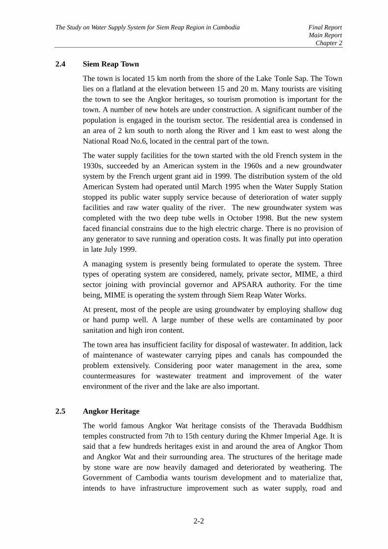
2.4 Siem Reap Town
The town is located 15 km north from the shore of the Lake Tonle Sap. The Townlies on a flatland at the elevation between 15 and 20 m. Many tourists are visitingthe town to see the Angkor heritages, so tourism promotion is important for thetown. A number of new hotels are under construction. A significant number of thepopulation is engaged in the tourism sector. The residential area is condensed inan area of 2 km south to north along the River and 1 km east to west along theNational Road No.6, located in the central part of the town.
The water supply facilities for the town started with the old French system in the1930s, succeeded by an American system in the 1960s and a new groundwatersystem by the French urgent grant aid in 1999. The distribution system of the oldAmerican System had operated until March 1995 when the Water Supply Stationstopped its public water supply service because of deterioration of water supplyfacilities and raw water quality of the river. The new groundwater system wascompleted with the two deep tube wells in October 1998. But the new systemfaced financial constrains due to the high electric charge. There is no provision ofany generator to save running and operation costs. It was finally put into operationin late July 1999.
A managing system is presently being formulated to operate the system. Threetypes of operating system are considered, namely, private sector, MIME, a thirdsector joining with provincial governor and APSARA authority. For the timebeing, MIME is operating the system through Siem Reap Water Works.
At present, most of the people are using groundwater by employing shallow dugor hand pump well. A large number of these wells are contaminated by poorsanitation and high iron content.
The town area has insufficient facility for disposal of wastewater. In addition, lackof maintenance of wastewater carrying pipes and canals has compounded theproblem extensively. Considering poor water management in the area, somecountermeasures for wastewater treatment and improvement of the waterenvironment of the river and the lake are also important.
2.5 Angkor Heritage
The world famous Angkor Wat heritage consists of the Theravada Buddhismtemples constructed from 7th to 15th century during the Khmer Imperial Age. It issaid that a few hundreds heritages exist in and around the area of Angkor Thomand Angkor Wat and their surrounding area. The structures of the heritage madeby stone ware are now heavily damaged and deteriorated by weathering. TheGovernment of Cambodia wants tourism development and to materialize that,intends to have infrastructure improvement such as water supply, road and

The Study on Water Supply System for Siem Reap Region in Cambodia Final ReportMain Report
Chapter 2
2-3
electricity. It is expected that the number of tourists visiting the heritage willrapidly increase. The infrastructure development for the Siem Reap Town istherefore an urgent requirement in order to accept increased tourists.
In the Khmer Imperial Age, it is believed that the Angkor area had a good waterenvironmental condition. These include the North, East, West and Bakong Barays,the moats of Angkor Wat and Angkor Thom, and the ponds of Surah Srang, PreahKhan, Neac Pean and so on. However, most of Barays and ponds are notfunctioning at present except West Baray and the moats of Angkor Wat andAngkor Thom.
2.6 Potential Water Sources
In the vicinity of the Siem Reap Town, there are four potential water sources.These are the Lake Tonle Sap, West Baray, Siem Reap River, and groundwater.
(1) Lake Tonle Sap
This is the largest lake in Southeast Asia. During the wet season, water flow of theTonle Sap River is reversed into the lake due to the flood of the Mekong River. Itacts as a natural retarding basin. The water surface area varies greatly from 3,000km2 in the dry season to 10,000 km2 in the rainy season. Water levels of the lakefluctuate annually from about EL.11 m in the rainy season and EL.1-2 m in thedry season.
Fishery is a major industry for the people living in boat on the lake. It is reportedthat more than 200 species of fish live in the lake. However, the fisheryproduction is decreasing from 10,000 tons in the 1970s to 6,000 tons at present.The reason is inferred as a change of environmental condition, water pollution,decrease of marsh and water forest, and excessive fishing by explosives andelectrical shocks. Turbidity of the lake is rather high.
(2) West Baray
The Baray was constructed in 11th century for irrigation of paddy fields extendingsouthwest of the Baray. In ancient Khmer Imperial Age, the East Baray(Yasodharatataka), the North Baray and Bakong Baray (Indratataka) had been alsoconstructed and used for irrigation, though the later three barays are notfunctioning at present.
The West Baray is located west of the Angkor heritage. It is 8 km long in east-west direction and 2.2 km wide in north-south direction. It was put back intoservice in 1937 and then enlarged in 1955. The water is diverted by French Weirfrom the Siem Reap River near Prasat Keo heritage, and conducted in rainy seasonthrough Takev Channel of approximately 5 km long (Canal A). A good water

The Study on Water Supply System for Siem Reap Region in Cambodia Final ReportMain Report
Chapter 2
2-4
management program of the baray for irrigation should be established formaximizing the efficiency. Also, the excavation of the land area in the eastern halfmight be necessary to obtain an additional storage volume for future requirement.
(3) Siem Reap River
The catchment of the river is about 600 km2 with a total length of 90 km.Approximate river width is 20 m in the upstream stretch near the Angkor heritage.It is said that the river course was artificially changed with the construction of theWest Baray, North Baray and the East Baray. There are two weirs in the river. Oneis ‘French Weir’ constructed at about 10 km upstream from the town center todivert the river water to the West Baray. The other is called ‘Crocodile Weir’constructed for irrigation intake, located downstream of the town.
It seems that the river improvement is important to keep a maintenance flowespecially in dry season from environmental aspect.
(4) Groundwater
Groundwater is used for domestic purposes in the Study area by shallow handpump wells or dug wells. Most of the hotels have their own deep tube wells withpurification system. The shallow groundwater in the vicinity of the town containshigh iron caused by subsurface laterite layer, and polluted by wastewater due topoor drainage.
The CFD (Caisse Francaise de Developpement) drilled 2 deep tube wells (40 mdeep) in 1997 for the urgent aid of the new water supply system. The new systemby CFD started operation in July 1999.