the late prehistoric of the east fork of the trinity river
TRANSCRIPT

The Late Prehistoric of the East Forkof the Trinity River
Wilson W. Crook, III and Mark Hughston
Houston Archeological Society and Brazos Gas CompanyEmail: [email protected]
Over the last 42 years, the authors have studied in detail the sites and archeologicalremains ascribed to the Late Prehistoric period of the East Fork of the TrinityRiver and its tributaries. This includes 20 major sites and a larger number ofsmaller campsites that occur within a 75 km by 15 km north-south corridor fromCollin County in the north to northwestern Kaufman County in the south. Aspart of this study, we have accessed and examined all known extant collectionsfrom previous investigations with a combined artifact assemblage of nearly 32,000specimens. In addition, we obtained access to the unpublished field notes andmaps from many previous researchers and combined them with our own field andlaboratory observations. The results of this study confirms the conclusion of bothBruseth and Martin and Prikryl that the Wylie Focus, as originally proposed byStephenson, is an outdated concept. A new chronological sequence consisting ofa Woodland period followed by two Late Prehistoric period phases is proposed.In detailing the proposed new sequences, extensive information on each majorsite, site features such as the distinctive rim-and-pit structures, burials, hearthsand caches, and the diagnostic artifacts that characterize each cultural phase areprovided. We also detail how the Late Prehistoric of the East Fork is a uniqueculture, similar but yet distinctly different from the surrounding sites includingBird Point Island (41FT201) and Adams Ranch (41NV177) in Freestone and
Navarro counties.
Keywords: East Fork; Trinity River; Late Prehistoric; Collin County; Rockwall County
Received October 2015; revised January 2016
INTRODUCTION
In May of 2015, we completed over 40 years of researchwith the publication of our monograph on the LatePrehistoric of the East Fork of the Trinity River TheEast Fork Late Prehistoric: A Redefinition of CulturalConcepts Along the East Fork of the Trinity River,North Central Texas . At the request of the Center forRegional Heritage Research, we have written this paperthat summarizes the key findings of our research andincludes numerous figures that illustrate the artifactsstudied.
It was never our intention to conduct a comprehensivere-evaluation of the Late Prehistoric period (ca. A.D.700-1600) of the East Fork and its tributaries. When weinitiated our research in the early 1970’s there had beenpublished excavations at the Hogge Bridge (41COL1),Campbell Hole (41COL10), Branch (41COL9), andUpper Farmersville (41COL34) sites in Collin County,and similar excavations completed at the UpperRockwall (41RW2), Lower Rockwall (41RW1) and GlenHill (41RW4) sites in Rockwall County. Moreover,members of the Dallas Archeological Society (DAS)had conducted excavations at all of the above sites
plus at the Randle (41RW10), Raglan (41KF4) andGilkey Hill (41KF42/41DL406) sites. Lastly, SouthernMethodist University (SMU) had agreed to undertakethe excavation of the Sister Grove Creek (41COL36)site, the last large site that had previously not beenexcavated. Most of this previous research had focusedon attempting to discover the purpose of the uniquerim-and-pit structures present at the larger sites alongthe East Fork; and while no definitive use had yetto be determined, a range of possible end-uses hadbeen postulated that seemed likely to encompass theirusage. As a result, our research intentions were tofill in the holes with regard to information about theLate Prehistoric period of the region. This includedthe investigation of a few of the area’s smaller sitesin Collin County, namely the Enloe (41COL65), 380Bridge (41COL66), and Mantooth (41COL167) sites,plus conduct a salvage excavation of some of theundisturbed parts of the Upper Farmersville site.
This would have likely signaled the end of ourinvolvement in the region had it not been for thepublication of Bruseth and Martin’s work at Bird PointIsland (41FT201) and Adams Ranch (41NV177), over
CRHR Research Reports, Vol. 2, Art. 1, 2016
Crook and Hughston
100 km to the south of the East Fork sites. Atthese two sites along Chambers and Richland Creeks,respectively, Bruseth and Martin [1] found rim-and-pit structures that appeared to be similar to thosedescribed from the East Fork. Their comprehensiveinvestigation discovered that the pit structures werenot an exclusive Late Prehistoric period feature, butinstead had been constructed in the Late Archaic period(ca. A.D. 200-700), and then more or less continuouslyused throughout the Late Prehistoric [1]. They alsodiscovered that pit use changed throughout time, firstfrom a cemetery in the Late Archaic, to a roastingarea, then to a trash pit during the Late Prehistoricperiod [1]. These conclusions were supported by theirexcavation evidence, and nothing more would havecome of it had they then extrapolated their results tothe Late Prehistoric of the East Fork. At the time, theEast Fork Late Prehistoric was still characterized underthe name, Wylie Focus, as originally described by R. L.Stephenson in 1952. Later researchers had wondered ifthe term Wylie Focus might be too broad and simplistica term, that it might in fact encompass several cultures[2, 3]. However, in 1988, Martin and Bruseth notonly discredited the use of the term Wylie Focusbased on their Richland/Chambers Creek findings, butthen failed to offer an alternative explanation for thecharacter of the archeology on the East Fork [4]. Prikryl[5] attempted to resolve the issue in his analysis of thearcheological constructs for North Central Texas, buthis study area focused more closely upon the Elm andWest Forks of the Trinity River and very little on theEast Fork. The lack of a cultural construct for the EastFork disturbed many of the original researchers of theLate Prehistoric of the East Fork [6] but with many ofthe sites now under the waters of Lake Lavon and LakeRay Hubbard, coupled with the age and/or passing ofmost of the area’s original researchers, no effort wasmade to rehabilitate the East Fork’s Late Prehistoricperiod.
As a result, the authors decided in 2003 to completelyre-evaluate the entire Late Prehistoric occupation alongthe East Fork of the Trinity River and its tributaries.This project has led us on a decade-plus search throughthe collections at the Texas Archeological ResearchLaboratory (TARL) in Austin, those present at SMU inDallas, and the R. K. Harris collection currently curatedat the Museum Support Center of the SmithsonianInstitution in Washington, D.C. We discovered thatmany of R. L. Stephenson and R. K. Harris’ field notesfrom the 1940’s and 1950’s were still available for studythat also included unpublished data and observations.As part of this study, we additionally let it be knownthat we would like the opportunity to study and recordany artifact collections that could be verified as comingfrom sites along the East Fork. This led us to thediscovery of the Rex Housewright-Lester Wilson-BobbyVance collection. These three Dallas ArcheologicalSociety members had made a pact to keep their East
Fork collections together for future research, so theHousewright collection passed upon his death to LesterWilson, who passed the collection on his death to BobbyVance [7]. With the passing of Mr. Vance, the entirecollection plus all its research maps and notes, werepurchased by authors in order to keep this valuable setof data intact. The study of these materials and theiraccompanying field notes and maps has been invaluableto our research on the East Fork Late Prehistoric.
Lastly, we approached the Heard Natural ScienceMuseum in McKinney, Texas about locating all of theexcavation materials (artifacts, maps, notes) from ourwork in the 1970’s. Amazingly, most of these werepreserved in the museum’s basement storage roomsand the Heard Museum graciously allowed us to takethe materials out on loan for study. Of particularsignificance were carbon matter collected and preservedfrom the Upper Farmersville site that allowed splits tobe made and radiocarbon dates obtained. We were alsoable to study the Puebloan artifacts from the Branch#2 (41COL259) site in Collin County [8] and performX-Ray Fluorescence (XRF) source analysis on both theobsidian and turquoise artifacts. We also made copiesof our field excavation notes that contained detailedstratigraphic information on the Upper Farmersville,Branch and Enloe sites.
Collectively, all of the above materials comprisearound 32,000 artifacts. In addition to East Forkmaterials, we made a concerted effort to study knownLate Prehistoric period artifact collections from theareas to the west (Elm and West Forks of the TrinityRiver), to the east (Caddo material from East Texas),and to the south (Ellis County and Chambers andRichland Creeks) of the East Fork area. This involvedstudies of collections at both TARL and at SMU, thelatter including an extensive review and study of all thepreserved material excavated by Bruseth and Martinfrom the Bird Point Island and Adams Ranch sites.
Our research also involved revisiting as many ofthe East Fork sites as possible for the purpose ofphotographing major features such as surviving rim-and-pit structures, hearths, etc. This was greatlyfacilitated by the recent extended drought thatsignificantly affected the lakes along the East Fork of theTrinity River, with both Lake Lavon (Collin County)and Lake Ray Hubbard (Rockwall and Dallas Counties)falling well below conservation levels. As a result, manyof the Late Prehistoric archeological sites that had beeninundated by the lakes in the 1960’s and 1970’s havebeen re-exposed. This includes the Sister Grove Creekand Branch sites in Collin County (Lake Lavon) andthe Upper Rockwall site in Rockwall County (Lake RayHubbard). Visits to these sites by the authors hasshown that 35-40 years of wave action has severelydeflated the stratigraphy, leaving a large number ofartifacts, notably large ground stone artifacts, exposedon the surface. As a result, a significant amount of newinformation has been added, and is summarized below.
CRHR Research Reports, Vol. 2, Art. 1, 2016
The Late Prehistoric of the East Fork of the Trinity River
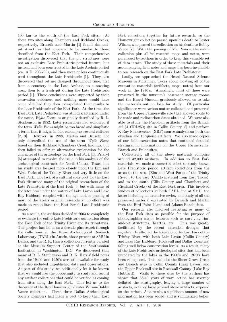
FIGURE 1. Distribution of the Late Prehistoric sites alongthe East Fork of the Trinity and its tributaries. Major sitesare identified by solid black triangles and identified by name;minor seasonal campsites are shown as unfilled triangles.(Figure by Lance Trask)
REGIONAL SETTING
Numerous sites of the Late Prehistoric period occuralong the East Fork of the Trinity and its tributariesin a roughly north-south corridor from Collin Countyin the north to northwestern Kaufman County, some70 km to the south. The study area encompasses theeastern two-thirds of Collin County, virtually all ofRockwall County, northwestern Kaufman County andextreme northeastern Dallas County. In all, the studyarea covers approximately 2,150 square miles. Over 50sites have been identified which share similar culturalmaterials (Figure 1). Of these, we have arbitrarilydesignated 20 as major sites based on their aerial size(>0.5Ha) and number of artifacts recovered (>100)with the others being smaller, seasonal campsites(see Figure 1; unfilled triangles). The observedartifact assemblages at these sites are homogeneousand consistent with the Late Prehistoric period alongthe East Fork; as initially characterized by Stephenson[9, 10], then subsequently refined by Lynott [11, 12],Crook [13, 14, 15] and Crook and Hughston [16, 17].Age of the Late Prehistoric along the East Fork hasbeen radiocarbon dated (calibrated) from ca. A.D. 700to A.D. 1600 [18, 19, 11, 20, 21, 22].
Sites along the East Fork and its tributaries differ interms of cultural material from Late Prehistoric sitesto the west along the Elm Fork of the Trinity, to theeast in the Sulphur River drainage, as well as farther
south along the main branch of the Trinity (Figure 2).Sites along the Elm Fork have a significantly higherpercentage of triangular arrow points (Fresno, Harrell,Washita) and a larger percentage of shell-temperedceramics, both of which are more characteristic of theHenrietta phase of the southern Great Plains [23, 5].Sites east of the East Fork are characterized by a higherpercentage of Caddo traits [24]. Likewise, sites tothe south along Richland Creek, such as Bird PointIsland (41FT201) and Adams Ranch (41NV177), arecharacterized by a number of traits which differ fromthose which characterize the East Fork Late Prehistoric.Chief among these are (1) different shaped housestructures; (2) extensive use of Psoralea, the PrairieTurnip, completely absent along the East Fork; (3) thevirtual absence of any shell-tempered ceramics whichmakes up nearly 50 percent of East Fork ceramics; (4)the occurrence of Hayes and Cuney points and the lackof Catahoula and Fresno points; (5) the occurrence ofdifferent utilitarian tools such as the Bristol biface andthe complete absence of sub-triangular scrapers such asthe East Fork Biface [25]; and (6) the absence of toolsmade from worked mussel shell. Moreover, while boththe Richland Creek and the larger East Fork sites havea distinctive rim-and-pit structure (the so-called WyliePits), their use appears to be very different. Brusethand Martin [1] found that pit structures at Bird PointIsland and Adams Ranch were created during Archaictimes and changed functions from a cemetery in theLate Archaic, to a roasting pit, then to trash pits in theLate Prehistoric. The Archaic burials always occur inthe center of the pits, and not in the rims. The rim-and-pit structures along the East Fork all date to theLate Prehistoric and demonstrate consistent usage asroasting pits with the rims being reserved for burial ofhigh status individuals [11, 16, 21]. Thus, while havinga culture that shares traits with their surroundingneighbors, the Late Prehistoric inhabitants of the EastFork appear to have possessed a unique set of culturaltraits that set them apart.
SYNTHESIS
Stephenson used the Midwestern Taxonomic Systemand proposed a culture-historic construct along the EastFork of the Trinity River and its tributaries that, whentaken as a constellation of traits, defined the WylieFocus [10]. Key elements of this cultural constructedincluded:
• Large sites containing a single circular pit structurewith a built-up rim
• Pottery, while fairly abundant, seemed to consistlargely of trade material; no indigenous typesappear to be present
• Burials are all flexed• No complex of burial furniture occurs• Burials are both single and multiple interments in
poorly defined burial pits
CRHR Research Reports, Vol. 2, Art. 1, 2016

Crook and Hughston
FIGURE 2. Location of East Fork Late Prehistoricrelative to other Late Prehistoric cultures in North-Centraland East Texas. Its location in between the traditionalCaddo Homeland and the Southern Great Plains accountsfor it being a mixture of the two. (Figure by Lance Trask)
• Artifacts of all types are consistently similarwithin a site and reasonably distinctive in totalassemblage between sites
Stephenson only looked at three sites along the EastFork: Hogge Bridge, Campbell Hole and Branch; andof these three, Campbell Hole and Branch received onlya cursory excavation. All other researchers who havefollowed Stephenson have typically worked on only one,or at most two sites; then cited Stephenson withoutreviewing his work to see if it was correct.
Ross [2] was the first to question the validity of theWylie Focus as a single cultural construct based onhis observations at both the Upper Rockwall and GlenHill sites. At Lower Rockwall and Sister Grove Creek,Lorrain and Hoffrichter [3] and subsequently Lynott [11]also believed the Wylie Focus encompassed more thana single culture. In his doctoral dissertation, Lynott[26] proposed that the Wylie Focus be divided into anunderlying Archaic phase that evolved into an EarlyNeo-American and a Late Neo-American phase; thelatter two characterized by distinct and separate arrowpoint and ceramic assemblages.
Bruseth and Martin [1] excavated in superb detailtwo large, multi-component sites 100 km south theEast Fork along Richland and Chambers Creeks. Theyfound that the Bird Point Island (41FT201) and AdamsRanch (41NV177) sites had their beginning in the LateArchaic that continued into the Late Prehistoric. As thetwo sites had pit structures of apparent similar natureto those along the East Fork, Bruseth and Martin [1]assumed a cultural affinity between the two areas and
as such, stated that the Wylie Focus was an outdatedconstruct and should be abandoned [4]. No detailedstudy of the East Fork material was included in thisanalysis and no new construct was offered for the EastFork as a replacement to the Wylie Focus.
Prikryl [5] studied the prehistory of the Elm Fork ofthe Trinity River and as part of this work, tangentiallylooked at the East Fork. He proposed a LateArchaic phase followed by Late Prehistoric I and LatePrehistoric II periods for all of North Central Texas [5].An approximate age of A.D. 750-1250 was proposed forthe Late Prehistoric I period and ca. A.D. 1250-1700 forLate Prehistoric II. Both were characterized by distinctarrow point assemblages; Late Prehistoric I with Alba,Catahoula, Scallorn and Steiner; Late Prehistoric II byMaud, Fresno, Perdiz, Washita and Harrell. No specificcultural construct was proposed for the East Fork.
We have now concluded the most extensive reviewof the Late Prehistoric period of the East Fork. Thisincluded the excavation and analysis of eight majorWylie Focus occupations (Bullock Mound (41COL40),Upper Farmersville, Mantooth, 380 Bridge, Enloe,Sister Grove Creek, Branch and Gilkey Hill), andthe study of collections made by previous researchersfrom the remaining 12 major sites as well as from38 smaller campsites in Collin and Rockwall counties.As mentioned above, this study enlisted nearly 32,000individual artifacts. Moreover, we have had accessto a large number of unpublished field notes andmaps including Stephenson’s from the Branch site,Housewright and Wilson’s from Butler Hole (41COL2),Wilson and Vance’s from the Shortney (41RW6),Randle and Barnes Bridge (41RW7) sites, and Harris’from Upper Farmersville, Thompson Lake (41COL3),Mouth of Pilot (41COL4) and Gilkey Hill. As aresult, we are in a unique position to provide the firstcomprehensive synthesis of cultural constructs for theEast Fork of the Trinity River.
PRE-CERAMIC AND WOODLAND PERI-ODS OF THE EAST FORK
At the base of most of the larger sites along the EastFork is a pre-ceramic phase that has affinities withsimilar cultures in Northeast Texas. Stratigraphically,the pre-ceramic occupation occurs at the base of a localgray-black topsoil (C horizon), that lies immediatelyabove a largely sterile yellow sandy clay. Thepre-ceramic horizon is characterized by medium tolarge (>50 mm) dart points (Gary, Ellis, Yarbrough,Edgewood), large leaf-shaped bifaces, and a widerange of scraping tools (Figures 3 and 4). Thisculture is very different from the Archaic culturespresent along the Elm Fork and main branch of theTrinity River [27, 28]. While not abundant alongthe East Fork, the Trinity Archaic is represented inCollin County at sites like McGuire (41COL26) [29],Frognot (41COL165) [30] and Upper Farmersville North
CRHR Research Reports, Vol. 2, Art. 1, 2016

The Late Prehistoric of the East Fork of the Trinity River
FIGURE 3. Gary dart points from various East Fork sites.Top Row: Butler Hole, Upper Farmersville, Sister GroveCreek, Gilkey Hill (2), Sister Grove Creek. Middle Row:Thompson Lake, Gilkey Hill, Branch, Sister Grove Creek(2), Gilkey Hill. Bottom Row: Upper Farmersville, GilkeyHill, Upper Farmersville, Mantooth, Branch (2). (Photo byLaura Nightengale)
(41COL166) [31]. In classic Trinity Archaic sites, dartpoints are typically constructed from >50 percent chertand point types such as Carrollton, Trinity, Elam,Dallas, Bulverde, Andice/Calf Creek, etc. predominate.Gary points are present, but in smaller numbers untilthe very Late Archaic. Square bifaces or knives arein near equal numbers to leaf-shaped bifaces. Otherartifacts not found in the East Fork pre-ceramic sitesinclude double-bitted Carrollton axes [32], Clear Forkgouges, net sinkers, and fired clay balls. McGuire,Frognot, Upper Farmersville North, and Enloe Road(41COL175) all have these diagnostic Trinity Archaicartifacts. Moreover, the Trinity Archaic sites thatare present along the East Fork typically occur bythemselves with no later occupation superimposed.Additionally, they are found on the first major terraceabove the East Fork. This is usually 12-18 meters abovethe small topographic highs on the floodplain where theWoodland and Late Prehistoric period sites are found.
The Woodland Period that occurs at most East Forksites is more similar to those artifact assemblages foundin similar period sites in East Texas and along theRed River [33, 34]. Gary dart points predominate, andlocal quartzite comprises 80+ percent of all the lithicartifacts. Based on their apparent lack of antecedentsalong the Trinity, the people of this Woodland cultureappear to have migrated into the area sometime afterA. D. 0. Exactly when is uncertain but a tentative dateof approximately A.D. 200 is postulated but it could beas early as ca. 500 B.C.
Ceramics first appear in this Woodland period andare almost exclusively sandy paste-, grog-tempered
FIGURE 4. Non-Gary dart points from various EastFork sites. Top Row: Upper Farmersville, Gilkey Hill,Upper Farmersville (2). Middle Row: Gilkey Hill, ButlerHole, Mouth of Pilot (2), Upper Farmersville. BottomRow: Barnes Bridge, Butler Hole, Upper Farmersville (2),Shortney (2). (Photo by Laura Nightengale)
plain wares, which generally fit within the classificationof Williams Plain. This culture appears to havedeveloped in place and is similar to the Fourche Malineculture in Northeast Texas [35, 36, 37, 34, 38, 39]. Theonly significant difference between this early ceramicculture and the pre-ceramic culture below it is a slightdecrease in size of the dart points and the addition ofWilliams Plain pottery.
Ceramics are known to occur in East/SoutheastTexas as early as ca. 500 B.C. [40]. While localceramic manufacture began in the Woodland period, itis not until ca. A.D. 1200-1300 that ceramics become asignificant part of the material culture of all aboriginalgroups in Texas [40]. Three major Woodland periodtraditions have been identified in East Texas: FourcheMaline, Mill Creek and Mossy Grove [41, 42, 43]. Allare more or less contemporaneous, and range in agefrom ca. 500 B.C. to ca. 800 A.D. [41]. Along theEast Fork, the Woodland tradition more closely mirrorsthat of the Fourche Maline, but is not an exact match.In Texas, the Fourche Maline extends from just southof the Red River and its tributary the Sulphur [34].The Fourche Maline is generally characterized by Garydart points, small one-hand manos (for seed grinding),boatstones, double-bitted axes, stone pipes and plainware ceramic flower pot-shaped bowls and jars with avariety of tempers (grog, crushed bone) [34]. WilliamsPlain is the predominant ceramic type, representing asmuch as 92 percent of the ceramics at some sites [44, 34].Vessel thickness is highly variable but averages around12 mm in walls; bases are overwhelmingly flat, thick
CRHR Research Reports, Vol. 2, Art. 1, 2016

Crook and Hughston
and circular in outline. With the exception of the lackof double-bitted axes, this is precisely what is presentbelow the Late Prehistoric period deposits in sites alongthe East Fork and its tributaries.
Two radiocarbon dates from the East Fork areavailable from this period; one from a burial at LowerRockwall (Beta-393414), and the other from a burialat Glen Hill (Beta-393415). Both date to around thesame time frame, A.D. 710 +/- 30 and A.D. 730 +/- 30,respectively. The Glen Hill date is significant becausea small sherd of typical Williams Plain pottery wasfound associated with the skeletal remains and wasascertained to have been part of the original burial fill(Lester L. Wilson, personal communication, 1973). Assuch, it denotes that ceramics were present along theEast Fork as early as ca. A.D. 700.
WYLIE PHASE (LATE PREHISTORIC I, A.D.800-1250)
Immediately above the Woodland occupation is asimilar cultural deposit that is characterized by theintroduction of the bow and arrow. Stratigraphically,this occupation begins at a depth of 10-20 cm belowsurface at most East Fork sites and extends to adepth of 30-40 cm or more. Arrow point types inthis level consist of Alba, Catahoula, and Scallorntypes, with an occasional Steiner (Figures 5, 6 and7). Excavation at several East Fork sites has shownthat arrow points of these types coexist with dartpoints; the latter consisting almost exclusively smallto medium-sized Gary points (30-50 mm) with smallernumbers of Kent, Godley and Dawson points. It isuncertain how long this coexistence of the atlatl withbow and arrow persists but based on stratigraphicfinds from undisturbed lenses at several sites, we wouldestimate that the atlatl and dart point are maintainedas part of the dual hunting weapon system well pastca. A.D. 1000 and possibly as late as ca. A.D.1100+. Utilitarian lithics remain largely unchangedfrom the Woodland period with the possible addition ofthe specific woodworking scraping tool we have namedthe East Fork Biface (Figure 8) [25]. Williams Plainceramics continue as a major pottery type but thereis an addition of Sanders phase ceramics from EastTexas (Sanders Plain, Sanders Engraved, MonkstownFingernail Impressed and Canton Incised) with time(Figure 9). Moreover, there is an increase in the useof grog along with sandy-paste in the locally-producedplain ware. In the Caddo region, the high frequency ofgrog as a ceramic temper is seen as a specific attemptto slow the oxidation process during firing [42, 43].This allows the vessel to be fired for longer periodsof time, thus producing a harder ceramic. Darker-colored ceramic vessels are evidence of firing in lowoxygen, reducing environments; tan, brown to orange-colored vessels are indicative of firing in an oxidizingenvironment.
FIGURE 5. Alba arrow points from various East Forksites. Top Row: Upper Farmersville (3), Sister GroveCreek, Upper Farmersville. Middle Row: Branch, UpperFarmersville (2), Thompson Lake, Mouth of Pilot. BottomRow: Hogge Bridge, Thompson Lake, Upper Rockwall,Thompson Lake, Upper Farmersville. (Photo by LauraNightengale)
Whitetail deer and turtle, supplemented by othersmall game, shellfish, nuts and wild plants constitutedthe diet of the aboriginal inhabitants for the East ForkLate Prehistoric period. Our analysis of ground stonetools show that the overwhelming majority of manos (86percent) present were small, one-hand grinding stonesused in a rotary grinding motion (Figure 10) [45].Ethnographic studies have repeatedly shown that siteswhere the majority of manos have a grinding surfacearea of less than 150 cm2 (average for the East Fork isapproximately 125 cm2) have a very low dependenceon maize as a food source [46, 47]. Supporting theobservation that the manos were used for items otherthan grain, several were found to contain high levels ofiron (Figure 11) and manganese (Figure 12) pigmentstains.
Forensic anthropological studies on East Fork LatePrehistoric period remains have shown that the pop-ulation in general was impacted by dental hypoplasia[48, 11]. Widespread dental hypoplasia points to sys-temic nutritional deficiencies since childhood. Around20 percent of the population also suffered from someform of hematologic disorder that manifested itself inspongy or porotic hyperostosis in the cranial bones.Spongy hyperostosis can be caused by a number ofhematologic disorders, including congenital anemia,iron deficiency anemias, congenital heart disease, andpolycythemia vera in childhood [49]. The similarityin health and nutrition across the district is indicativeof either a shared (thus relatively small) common genepool and/or individuals from different sites being im-pacted by the same environmental and diet conditions.The average lifespan of the Caddo in East Texas has
CRHR Research Reports, Vol. 2, Art. 1, 2016

The Late Prehistoric of the East Fork of the Trinity River
FIGURE 6. Catahoula arrow points from various EastFork sites. Top Row: Branch (3), Upper Farmersville,Hogge Bridge, Mantooth. Middle Row: Lower Rockwall,Upper Farmersville (3), Lower Rockwall, Gilkey Hill.Bottom Row: Branch, Upper Farmersville, Branch, HoggeBridge, Upper Farmersville (2). (Photo by LauraNightengale)
been estimated to be around 40 years [50]; a similarlifespan is seen in East Fork individuals.
This occupation, which marks the true beginning ofthe Late Prehistoric period, appears to have developedin place as there is a continuous progression from theLate Woodland occupation into this phase. However,the exact mechanism that spurred the emergence of aLate Prehistoric culture along the East Fork remainsuncertain. Regardless, the beginning of the LatePrehistoric period along the East Fork marks thebeginning of an expansion in population with larger,more permanently occupied sites. In most East ForkLate sites, the initial Late Prehistoric phase is the majoroccupation at the site, accounting for approximately 80percent of the total Late Prehistoric period artifacts.This observation is further supported by the largestcluster of radiocarbon dates that frame this period,including one from Hogge Bridge (A.D. 1000 +/- 70),one from Upper Rockwall (A.D. 1020 +/- 90), onefrom Branch (A.D. 1025-1165), and six from SisterGrove Creek (A.D. 950-1160). Moreover, three of thedates from Sister Grove Creek (TX-2030, SMU-233,and SMU-239) effectively date Catahoula and Scallornpoints, two of the diagnostic lithic artifacts, to thisperiod (A.D. 1160 +/- 60) [11].
More importantly, radiocarbon dates from hearthsat or near the base of the rim-and-pit structures atSister Grove Creek (Feature 8 - TX-2037; Feature10 - TX-2038), Hogge Bridge (TX-1928) and UpperRockwall (Stratum V - TX-315) all date the first useof the structures to around A.D. 950-1000. It isuncertain what motivated the inhabitants of the EastFork to construct these specialized features as they
FIGURE 7. Scallorn arrow points from various East Forksites. Top Row: Thompson Lake, Upper Farmersville (2),Branch (2), Gilkey Hill. Middle Row: Upper Farmersville,Mantooth, Hogge Bridge, Upper Rockwall, Lower Rockwall(2). Bottom Row: Thompson Lake, Mantooth, UpperRockwall, Sister Grove Creek, Upper Farmersville, Branch.(Photo by Laura Nightengale)
FIGURE 8. East Fork Bifaces from various East Forksites. Top Row: Sister Grove Creek, Upper Farmersville,Branch, Upper Farmersville, Sister Grove Creek. BottomRow: Upper Farmersville, Enloe, Upper Farmersville (2),Sister Grove Creek. (Photo by Laura Nightengale)
were apparently not present before this date. As wasoriginally proposed by Lynott [11] and confirmed bythe authors at Upper Farmersville and Enloe, the rim-and-pit structures present in the largest sites along theEast Fork appear to have served as special ceremonialcenters, primarily for the function of roasting andfeasting. Their central ceremonial place within EastFork Late Prehistoric society is further underscoredby the presence of burials within the pit rims andoccasionally within the pit itself. Given the factthat many such burials are accompanied by highvalue prestige items, such as Caddo pottery vessels,
CRHR Research Reports, Vol. 2, Art. 1, 2016

Crook and Hughston
FIGURE 9. Caddo Engraved Ceramics from East Forksites. Top Row L-to-R: Poyner Engraved - Mantooth site;Holly Fine Engraved - Branch site. Bottom Row L-to-R:Sanders Engraved - Upper Rockwall; Sanders Engraved -Upper Farmersville. (Photo by Laura Nightengale)
shell beads, gorgets, etc., burials within the rim-and-pit structures likely represent honored or high statusindividuals [11, 16, 17]. Examples of the rim-and-pitstructures at the Butler Hole and Sister Grove Creeksites are shown in Figures 13 and 14.
The expansion in population also saw the construc-tion of more permanent houses as evidenced by theovoid structure found at the Butler Hole site [51]. Sim-ilar well-used living floors were found at Campbell Hole[10], Upper Farmersville [29], and Upper Rockwall [52].
A total of 72 burials encompassing 95 individualshave been found in Late Prehistoric sites along the EastFork with the majority of these burials dating fromthe initial phase of the Late Prehistoric period. Sixty-three of the burials are single interments; the remainingnine are multiple burials containing anywhere from twoto seven individuals. Four distinct types of burialshave been identified including (1) flexed burials withor without attendant grave goods, (2) unflexed burials,(3) cremation interments, and (4) disarticulated burialsshowing no orientation. The latter almost always showsigns of violent death (decapitation). Flexed burials arethe most common burial type with nearly two-thirds ofall known East Fork interments having tightly flexedbodies. Orientation is quite variable as burials havebeen found facing all directions of the compass.
Contrary to Stephenson’s initial observations at
FIGURE 10. Two one-hand manos from the UpperFarmersville site, Collin County, Texas. The mano on theleft is made from a sandy limestone; the mano on the rightis from sandstone. (Photo by Laura Nightengale)
FIGURE 11. Small, circular one-hand mano from theBranch site, Collin County, Texas showing prominent redstaining on the grinding surface. XRF analysis indicatesthe red material is iron oxide (red ochre).
Hogge Bridge, burials along the East Fork are nottotally devoid of associated grave goods. Our studyof the 72 known burials from 11 sites indicates that 31(43 percent) contain some form of grave furniture item.Examples of some of the high value prestige goods foundin East Fork interments are shown in Figures 15, 16and 17.
Lynott [11] speculated that the presence of femalesburied in the rim-and-pit structures at Upper Rockwall,Lower Rockwall and Sister Grove Creek were perhapsindividuals that had been ceremonially sacrificed. Ouranalysis of all the burials from the East Fork districtshows that some 34 individuals were buried either in thepit rim or within a pit structure. Of these, seven wereidentified as being female, four were males, three were
CRHR Research Reports, Vol. 2, Art. 1, 2016

The Late Prehistoric of the East Fork of the Trinity River
FIGURE 12. Small, circular one-hand mano from theSister Grove Creek site, Collin County, Texas showingprominent black staining on the grinding surface. XRFanalysis indicates the black material is manganese oxide.
FIGURE 13. View of the Butler Hole rim-and-pitstructure in the early 1940’s. R. K. “King” Harris is standingon the far rim and Lester L. Wilson stands within the pit’sinterior. (Photo by Lester L. Wilson)
juveniles, and 20 were adults of undetermined sex. Thuswhile ritual female sacrifice is an interesting hypothesisand remains a possibility, it cannot be verified by theresults of our study.
Several internments in the pit rims as UpperFarmersville and at Lower Rockwall contain one ormore individuals that have been decapitated. In thetwo such interments at Upper Farmersville, all nineindividuals were decapitated, then haphazardly throwninto a burial pit. The single individual buried in asimilar manner at Lower Rockwall also had three dartpoints lodged in the body, two in the legs and onelodged in the spine [53]. Brown and Dye [54] notethat severed trophy heads played a prominent role inMississippian culture and art. Harris [55] found a pitof human skulls at the Sam Kaufman site (41RR16)in Red River County less than 150 km to the east.
FIGURE 14. Mark Hughston standing in the center of therim-and-pit structure at the Sister Grove Creek site, CollinCounty, Texas. Note how the wave action of Lake Lavonover the last 40 years has denuded the northern rim of thestructure.
While decapitation itself does not necessarily indicatea violent death, the lack of burial orientation, which isextremely rare along the East Fork, appears to supportthe hypothesis that these individuals were outsiders;either captured in warfare or as territorial poachers, andwere subsequently executed/sacrificed.
During the Late Prehistoric period there is asignificant increase in the acquisition of prestige itemsincluding shell, gorgets, polished stone and Puebloanitems. A complete Arboles Black-on-White stirrupvessel from Lower Rockwall (Lorrain and Hoffrichter1968) and Chupadero Black-on-White sherds from theBranch site [56] in particular mark the beginning ofthese acquisitions in the ca. A.D. 900-1050 timeframe.The influx of Caddo ceramics from the Sanders phaseto the east also shows exchange linkages. Acquisition ofexotic prestige goods that clearly originate from outsidethe East Fork indicates the establishment of, and/or theexpansion of a network of contacts both to the east andto the west of the East Fork.
Lynott [26] and Prikryl [5] defined this initial LatePrehistoric occupational period as either Neo-AmericanEarly or Late Prehistoric I and framed it temporallybetween ca. A.D. 750 and 1250. Many characteristicsof this culture, including the presence of ceramics,the presence of arrow points, and the presence andextensive use of the rim-and-pit structures, were usedby Stephenson to originally describe the Wylie Focus.Thus while the term Wylie Focus no longer has anymeaning as it was originally constructed, we haveretained the original name for characterizing the initialLate Prehistoric period along the East Fork of theTrinity River as the Wylie Phase.
CRHR Research Reports, Vol. 2, Art. 1, 2016

Crook and Hughston
FIGURE 15. Shell beads from a juvenile burial at theLower Rockwall site. (Photo by Lance Trask)
FARMERSVILLE PHASE (LATE PREHIS-TORIC II, A.D. 1250-1600)
Lastly, atop the first Late Prehistoric occupation isa second Late Prehistoric culture. This phase ischaracterized by a pure arrow point and ceramicoccupation; dart points are completely absent by thistime. Arrow point types consist of Perdiz coupledwith Plains types including Fresno, Washita and Harrell(Figures 18, 19 and 20). Other lithic artifactsthat characterize this period include small, thumbnailend-scrapers and finely-made flake drills. There is aslight increase in the use of chert, primarily for arrowpoints and finely-made drills; but the increase is veryminor compared to that seen in Late Prehistoric IIperiod sites along the Elm Fork [5]. Shell-temperedceramics (Nocona Plain) largely replace sandy paste,grog-tempered pottery (Figure 21). In addition,characteristic East Texas Caddo ceramics are present
FIGURE 16. Composite photo of engraved slate gorgetfrom the Upper Rockwall site with obverse (bottom) andreverse (top) faces. (Photo by Lance Trask)
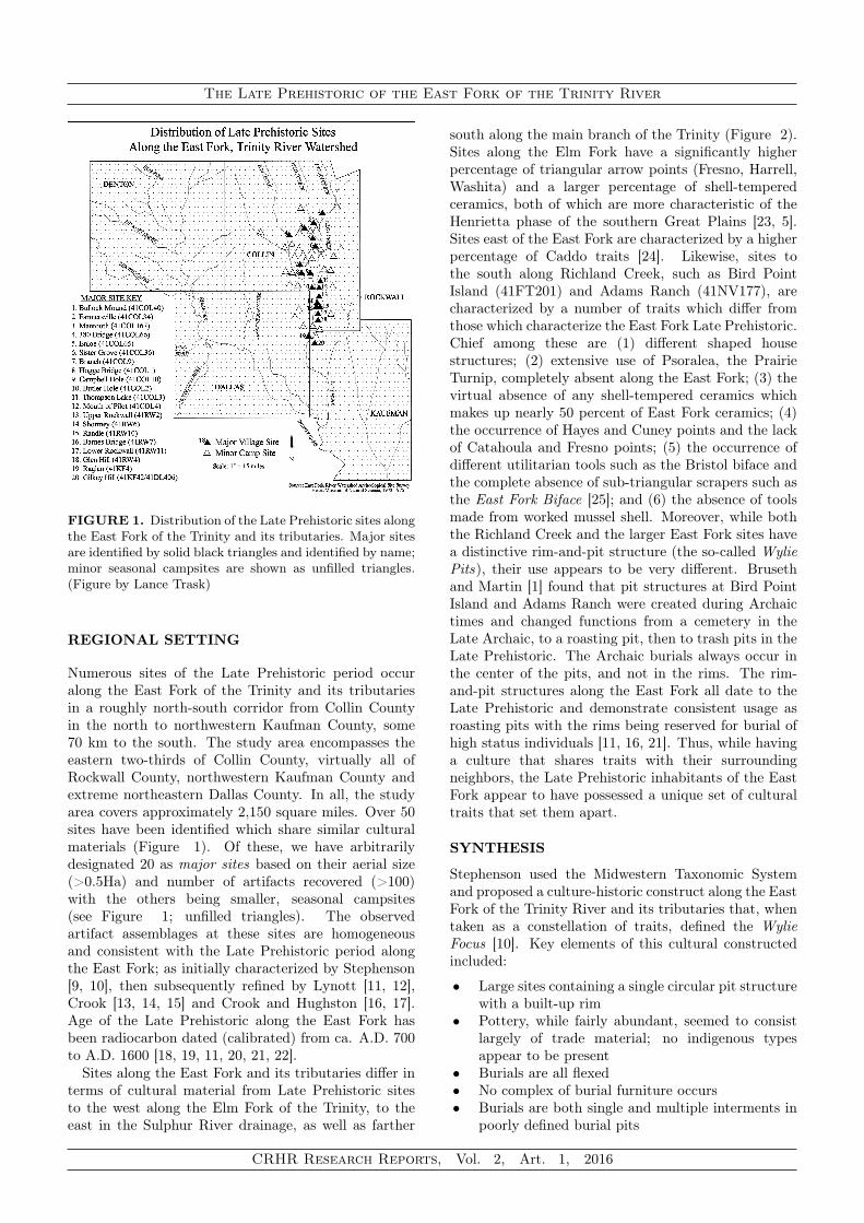
in small amounts (Maydelle Incised, Poynor Engraved,Killough Pinched, etc.) (Figure 22). This occupationis relatively thin, typically found on the surface andto a depth of no more than 10-15 cm. Because ofits relatively thin archeological expression, this lastphase is not present at every East Fork site, but isparticularly well represented at Upper Farmersville,Randle, Lower Rockwall, and Glen Hill with possibleadditional occurrences at Enloe, Sister Grove Creek,Branch, and Raglan.
Diet of the aboriginal inhabitants along the EastFork remained centered on whitetail deer and turtle,supplemented by other small game, shellfish, nuts andwild plants. No change in grinding stone size wasobserved, and as such, the use of maize as a food sourceis believed to have remained minimal. In the Caddohomeland to the east, maize becomes more dominantwithin the diet only after ca. A.D. 1300 [57]. Insmall parts of the Caddo settlement especially alongthe Upper Sulphur River, maize was never an importantelement of the diet [58, 38].
A pure maize diet is deficient in protein and oftenleads to parasitic and dental infection [59, 60, 61].Studies on skeletal remains have shown that thefrequency of dental caries in Northeast Texas Caddosites indicates that maize was an important componentin the diet in all the region except that of the BlacklandPrairie biotic province [62, 57, 50]. In this area, maizewas present but was not as important to the dietas meat, starchy annuals and other wild plants [58].Flotation analyses specifically looking for maize wereconducted at the Sister Grove Creek site [11] and the
CRHR Research Reports, Vol. 2, Art. 1, 2016

The Late Prehistoric of the East Fork of the Trinity River
FIGURE 17. Line drawing of engraved slate gorget fromthe Upper Rockwall site, Rockwall County, Texas withobverse (Bottom) and reverse (top) faces. The stippled lineon the reverse engraved face is a distinct ridge. (Illustrationby Lance Trask)
FIGURE 18. Fresno arrow points from various EastFork sites. Top Row: Upper Farmersville (2), Branch (2),Upper Rockwall, Branch. Bottom Row: Branch, UpperFarmersville (2), Sister Grove Creek, Upper Farmersville (2).(Photo by Laura Nightengale)
Upper Farmersville site [17]; both without success. Theonly verified evidence of maize from any East Fork LatePrehistoric site was a single burned kernel recoveredfrom a hearth at the Hogge Bridge site (R. K. Harris,personal communication, 1974). Based on the size ofthe grinding surface area of manos from the district,the relative lack of the number of grinding stones, andthe carbon isotope data from the cranial fragmentsfrom Branch site, it is doubtful that maize was evera significant component of the diet along the East Fork[22].
One addition to the diet during this second phase
FIGURE 19. Washita arrow points from various East Forksites. L-to-R: Gilkey Hill, Mantooth, Upper Farmersville(2), Mantooth, Upper Farmersville (2). (Photo by LauraNightengale)
FIGURE 20. Perdiz arrow points from various East Forksites. Top Row: Upper Farmersville, Mantooth, Gilkey Hill,Hogge Bridge, Mouth of Pilot, Lower Rockwall. BottomRow: Thompson Lake, Glen Hill, Lower Rockwall, HoggeBridge, Branch, Gilkey Hill. (Photo by Laura Nightengale)
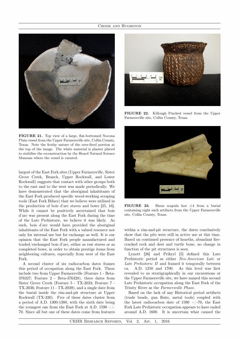
of Late Prehistoric occupation was likely bison. Asdemonstrated by Lohse and colleagues [63], bison weremore abundant in the Southern Great Plains of Texasin a 120-year window between ca. A.D. 1300-1420.The Caddo are known to have participated in wintercommunal hunts for bison [64]. The presence ofbison bone in East Fork sites suggests the aboriginalinhabitants of the area made similar seasonal huntingforays to the west (Figure 23). Winter would have beenthe best time for such hunting trips as the bison wouldhave maximum weight and fat and their coats (robes)would have been at peak condition.
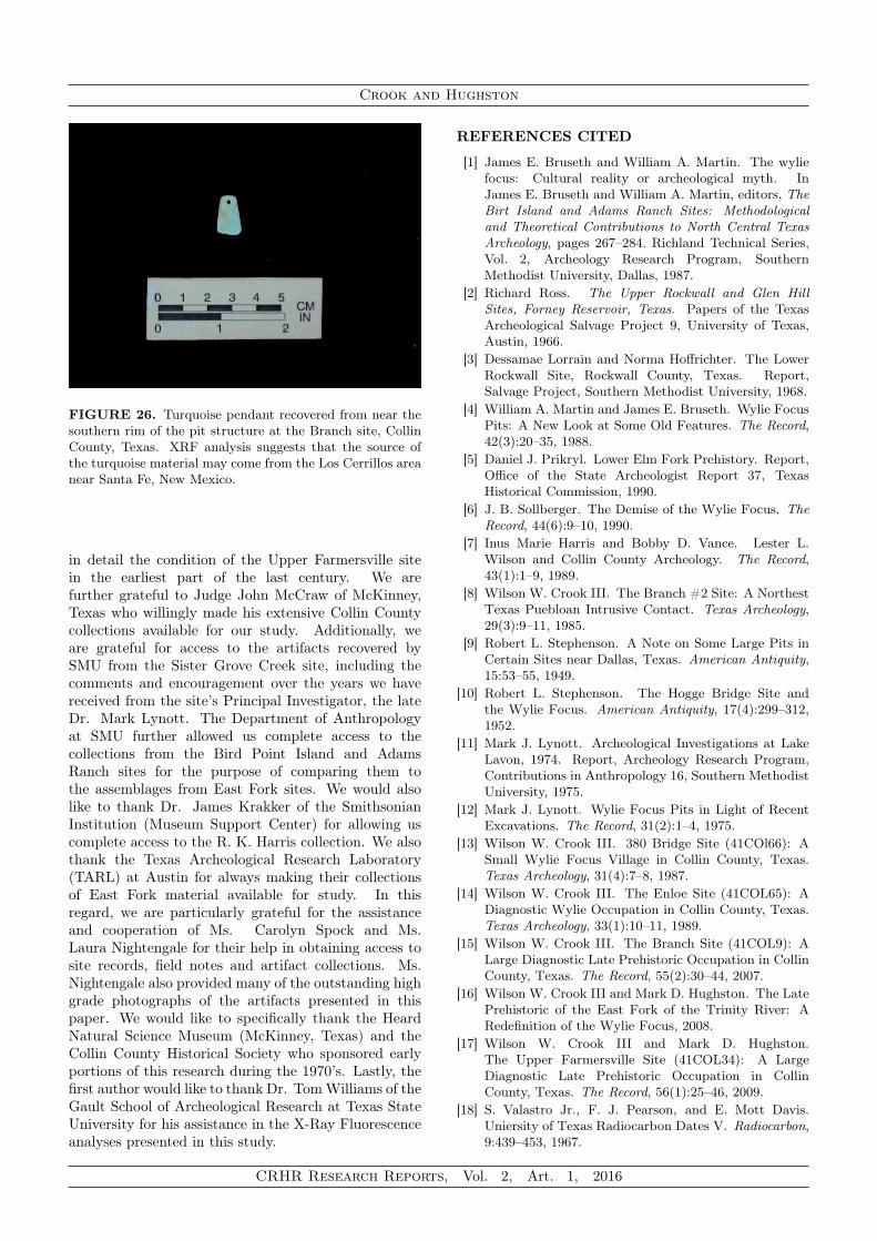
The presence of Caddo ceramics, exotic lithicmaterial from the Ouachita Mountains in Arkansas, rarelead and copper ochres, large numbers of shell beads inhigh status burials, and Puebloan ceramics, obsidian,shell beads and turquoise all indicate that the LatePrehistoric inhabitants of the East Fork participated tosome extent in regional exchange (Figures 24, 25, and26). While the extent of this exchange may not havebeen great, the presence of prestige goods in at least the
CRHR Research Reports, Vol. 2, Art. 1, 2016
Crook and Hughston
FIGURE 21. Top view of a large, flat-bottomed NoconaPlain vessel from the Upper Farmersville site, Collin County,Texas. Note the frothy nature of the over-fired portion atthe top of the image. The white material is plaster placedto stabilize the reconstruction by the Heard Natural ScienceMuseum where the vessel is curated.
largest of the East Fork sites (Upper Farmersville, SisterGrove Creek, Branch, Upper Rockwall, and LowerRockwall) suggests that contact with other groups bothto the east and to the west was made periodically. Wehave demonstrated that the aboriginal inhabitants ofthe East Fork produced specific wood-working scrapingtools (East Fork Biface) that we believe were utilized inthe production of bois d’arc staves and bows [25, 16].While it cannot be positively ascertained that boisd’arc was present along the East Fork during the timeof the Late Prehistoric, we believe it was likely. Assuch, bois d’arc would have provided the aboriginalinhabitants of the East Fork with a valued resource notonly for internal use but for exchange as well. It is ouropinion that the East Fork people manufactured andtraded/exchanged bois d’arc, either as raw staves or ascompleted bows, in order to obtain prestige items fromneighboring cultures, especially from west of the EastFork.
A second cluster of six radiocarbon dates framesthis period of occupation along the East Fork. Theseinclude two from Upper Farmersville (Feature 1 - Beta-376327; Feature 2 - Beta-376328), three dates fromSister Grove Creek (Feature 5 - TX-2033; Feature 7 -TX-2036; Feature 11 - TX-2039), and a single date fromthe burial inside the rim-and-pit structure at UpperRockwall (TX-320). Five of these dates cluster froma period of A.D. 1300-1380, with the sixth date beingthe youngest one from the East Fork at A.D. 1590 +/-70. Since all but one of these dates come from features
FIGURE 22. Killough Pinched vessel from the UpperFarmersville site, Collin County, Texas.
FIGURE 23. Bison scapula hoe #4 from a burialcontaining eight such artifacts from the Upper Farmersvillesite, Collin County, Texas.
within a rim-and-pit structure, the dates conclusivelyshow that the pits were still in active use at this time.Based on continued presence of hearths, abundant fire-cracked rock and deer and turtle bone, no change infunction of the pit structures is seen.
Lynott [26] and Prikryl [5] defined this LatePrehistoric period as either Neo-American Late orLate Prehistoric II and framed it temporally betweenca. A.D. 1250 and 1700. As this level was firstrevealed to us stratigraphically in our excavations atthe Upper Farmersville site, we have named this secondLate Prehistoric occupation along the East Fork of theTrinity River as the Farmersville Phase.
Based on the lack of any Historical period artifacts(trade beads, gun flints, metal tools) coupled withthe latest radiocarbon date of 1590 +/-70, the EastFork Late Prehistoric occupation appears to have endedaround A.D. 1600. It is uncertain what caused the
CRHR Research Reports, Vol. 2, Art. 1, 2016

The Late Prehistoric of the East Fork of the Trinity River
FIGURE 24. Limestone paint pot from a trash pit in therim of the pit structure at the Upper Farmersville site, CollinCounty, Texas. The gray material covering the surface of theartifact has been shown to contain residue from powderedgalena (PbS). The closest source of galena to the East Forkin the Tri-State mining district in northeast Oklahoma.
ultimate demise of the aboriginal inhabitants alongthe East Fork, but it very well could have beenthe result of disease introduced by Europeans and/orenvironmental stress. Bruseth [65] has called the 16thcentury in the Caddo region along the Red River ineastern Texas and Oklahoma the disease century. It isknown that increased sedentism and population densitycontribute to increasing bacteria in the environmentand contributes to spreading infections [50]. Loweredresistance due to poor nutrition and/or stress enablesinfections to rapidly spread.
Starting in the early 11th century A.D. droughtsbecame a periodic factor in the area of North Centraland East Texas that would have resulted in stressedfood supplies [66]. These dry periods became morefrequent after ca. A.D. 1430 with significant periods ofdrought in the middle 15th century, early 16th century,and middle to late 17th centuries A.D. [67]. It has longbeen speculated that the Late Prehistoric inhabitantsof the East Fork may have come into contact with earlySpanish explorers to the region [68, 69]. If so, diseasesthat were so devastating to the Caddo homeland couldhave much more easily decimated a smaller populationalong the East Fork [50, 70].
All of the factors listed above are evidence for anindigenous cultural development along the East Fork ofthe Trinity River and its tributaries that is unique andclearly distinct from those in the surrounding regions.This cultural development began during the Woodlandperiod in North Central Texas and carried over into theLate Prehistoric period. A drying climatic change thatbegan in the middle of the Wylie Phase and became
FIGURE 25. Puebloan obsidian and chalcedony artifactsfrom Late Prehistoric sites along the East Fork. XRFanalysis indicates that the majority of the obsidian artifactsoriginate in the Jemez Caldera area of north-central NewMexico. Top Row: Arrow Points - Upper Farmersville (3),Branch. Middle Row: Arrow Points - Branch (5). BottomRow: Worked obsidian artifacts - Branch (3). (Photo byLaura Nightengale)
progressively drier with time led to the increase inbison in the Southern Great Plains, and subsequentforays by the East Fork inhabitants to take advantageof this new, high-reward resource. Seasonal westwardmovement for hunting led to contact with the peoplesin the Elm and West Forks of the Trinity River alongwith those of the Southern Great Plains. As such, overtime, an arrow point assemblage appeared that showedstrong similarities to the Plains Indian sites. TheLate Prehistoric along the East Fork persisted until thestart of the 17th century when, either through disease,prolonged drought and/or famine, these aboriginalpeoples disappear from the archeological record.
ACKNOWLEDGEMENTS
We are indebted to the many previous researchers inthe area who openly shared their knowledge about theLate Prehistoric occupations of the region. Foremostamong these were the late R. K. “King” Harris, RobertL. Stephenson, Rex Housewright, Lester L. Wilson andBobby Vance. Assistance from these individuals notonly came from allowing us to analyze their collections,but also their complete willingness to give us copies ofall field notes and maps they had made on the sites theyhad worked. We also thank the Warren Dugger family,especially Mr. John Dugger, who not only willinglyopened his land for excavation but extensively described
CRHR Research Reports, Vol. 2, Art. 1, 2016
Crook and Hughston
FIGURE 26. Turquoise pendant recovered from near thesouthern rim of the pit structure at the Branch site, CollinCounty, Texas. XRF analysis suggests that the source ofthe turquoise material may come from the Los Cerrillos areanear Santa Fe, New Mexico.
in detail the condition of the Upper Farmersville sitein the earliest part of the last century. We arefurther grateful to Judge John McCraw of McKinney,Texas who willingly made his extensive Collin Countycollections available for our study. Additionally, weare grateful for access to the artifacts recovered bySMU from the Sister Grove Creek site, including thecomments and encouragement over the years we havereceived from the site’s Principal Investigator, the lateDr. Mark Lynott. The Department of Anthropologyat SMU further allowed us complete access to thecollections from the Bird Point Island and AdamsRanch sites for the purpose of comparing them tothe assemblages from East Fork sites. We would alsolike to thank Dr. James Krakker of the SmithsonianInstitution (Museum Support Center) for allowing uscomplete access to the R. K. Harris collection. We alsothank the Texas Archeological Research Laboratory(TARL) at Austin for always making their collectionsof East Fork material available for study. In thisregard, we are particularly grateful for the assistanceand cooperation of Ms. Carolyn Spock and Ms.Laura Nightengale for their help in obtaining access tosite records, field notes and artifact collections. Ms.Nightengale also provided many of the outstanding highgrade photographs of the artifacts presented in thispaper. We would like to specifically thank the HeardNatural Science Museum (McKinney, Texas) and theCollin County Historical Society who sponsored earlyportions of this research during the 1970’s. Lastly, thefirst author would like to thank Dr. TomWilliams of theGault School of Archeological Research at Texas StateUniversity for his assistance in the X-Ray Fluorescenceanalyses presented in this study.
REFERENCES CITED
[1] James E. Bruseth and William A. Martin. The wyliefocus: Cultural reality or archeological myth. InJames E. Bruseth and William A. Martin, editors, TheBirt Island and Adams Ranch Sites: Methodologicaland Theoretical Contributions to North Central TexasArcheology, pages 267–284. Richland Technical Series,Vol. 2, Archeology Research Program, SouthernMethodist University, Dallas, 1987.
[2] Richard Ross. The Upper Rockwall and Glen HillSites, Forney Reservoir, Texas. Papers of the TexasArcheological Salvage Project 9, University of Texas,Austin, 1966.
[3] Dessamae Lorrain and Norma Hoffrichter. The LowerRockwall Site, Rockwall County, Texas. Report,Salvage Project, Southern Methodist University, 1968.
[4] William A. Martin and James E. Bruseth. Wylie FocusPits: A New Look at Some Old Features. The Record,42(3):20–35, 1988.
[5] Daniel J. Prikryl. Lower Elm Fork Prehistory. Report,Office of the State Archeologist Report 37, TexasHistorical Commission, 1990.
[6] J. B. Sollberger. The Demise of the Wylie Focus. TheRecord, 44(6):9–10, 1990.
[7] Inus Marie Harris and Bobby D. Vance. Lester L.Wilson and Collin County Archeology. The Record,43(1):1–9, 1989.
[8] Wilson W. Crook III. The Branch #2 Site: A NorthestTexas Puebloan Intrusive Contact. Texas Archeology,29(3):9–11, 1985.
[9] Robert L. Stephenson. A Note on Some Large Pits inCertain Sites near Dallas, Texas. American Antiquity,15:53–55, 1949.
[10] Robert L. Stephenson. The Hogge Bridge Site andthe Wylie Focus. American Antiquity, 17(4):299–312,1952.
[11] Mark J. Lynott. Archeological Investigations at LakeLavon, 1974. Report, Archeology Research Program,Contributions in Anthropology 16, Southern MethodistUniversity, 1975.
[12] Mark J. Lynott. Wylie Focus Pits in Light of RecentExcavations. The Record, 31(2):1–4, 1975.
[13] Wilson W. Crook III. 380 Bridge Site (41COl66): ASmall Wylie Focus Village in Collin County, Texas.Texas Archeology, 31(4):7–8, 1987.
[14] Wilson W. Crook III. The Enloe Site (41COL65): ADiagnostic Wylie Occupation in Collin County, Texas.Texas Archeology, 33(1):10–11, 1989.
[15] Wilson W. Crook III. The Branch Site (41COL9): ALarge Diagnostic Late Prehistoric Occupation in CollinCounty, Texas. The Record, 55(2):30–44, 2007.
[16] Wilson W. Crook III and Mark D. Hughston. The LatePrehistoric of the East Fork of the Trinity River: ARedefinition of the Wylie Focus, 2008.
[17] Wilson W. Crook III and Mark D. Hughston.The Upper Farmersville Site (41COL34): A LargeDiagnostic Late Prehistoric Occupation in CollinCounty, Texas. The Record, 56(1):25–46, 2009.
[18] S. Valastro Jr., F. J. Pearson, and E. Mott Davis.Uniersity of Texas Radiocarbon Dates V. Radiocarbon,9:439–453, 1967.
CRHR Research Reports, Vol. 2, Art. 1, 2016
The Late Prehistoric of the East Fork of the Trinity River
[19] W. S. Marmaduke. The Wylie Focus: A Reassessmentby the Analysis of Three Typical Sites. Thesis, 1975.
[20] Mark J. Lynott. Radiocarbon Dating of the WylieFocus in Northcentral Texas. Plains Anthropologist,22(77):233–237, 1978.
[21] Wilson W. Crook III and Mark D. Hughston. TheEast Fork Late Prehistoric: A Redefinition of CulturalConcepts Along the East Fork of the Trinity River,North Central Texas. CreateSpace, Charleston, SouthCarolina, 2015.
[22] Wilson W. Crook III and Mark D. Hughston. TwoNew Radiocarbon Dates from the Upper FarmersvilleSite (41COL34), Collin County, Texas. ArcheologicalJournal of the Texas Prairie Savannah, 5(1):7–20, 2015.
[23] Robert L. Stephenson. Archeological Survey of Lavonand Garza-Little Elm Reservoir Report. Bulletin of theTexas Archeological and Paleontological Society, 20:21–62, 1949.
[24] Timothy K. Perttula. "The Caddo Nation":Archaeological & Ethnographic Perspectives. Universityof Texas Press, Austin, 1992.
[25] Wilson W. Crook III and Mark D. Hughston. The EastFork Biface: A New Distinctive Artifact from NorthCentral Texas. The Record, 55(2):48–64, 2007.
[26] Mark J. Lynott. A Regional Model for ArcheologicalResearch in Northcentral Texas. Dissertation, 1977.
[27] Wilson W. Crook Jr. and R. King Harris. TrinityAspect of the Archaic Horizon: The Carrollton andElam Foci. Bulletin of the Texas Archeological andPaleontological Society, 23:7–38, 1952.
[28] Wilson W. Crook Jr. and R. King Harris. Traits ofthe Trinity Aspect Archaic: Carrollton and Elam Foci.The Record, 12(1):1–16, 1954.
[29] Gerald L. Dawson and Timothy L. Sullivan. Excava-tions at Lake Lavon: 1969. Report, Archeology Re-search Program, Department of Anthropology, South-ern Methodist University, 1973.
[30] Wilson W. Crook III. The Frognot Site (41COL165):A Late Paleoindian to Middle Archaic Occupation inCollin County, Texas. The Record, 55(2):1–10, 2007.
[31] Wilson W. Crook III. The Upper Farmersville NorthSite (41COL166): A Pure Archaic Occupation in CollinCounty, Texas. The Record, 55(2):11–18, 2007.
[32] Wilson W. Crook Jr. and R. King Harris. AnotherDistinctive Artifact: The Carrollton Axe. The Record,13(2):10–18, 1954.
[33] Maynard Cliff. Not With a Bang, But a Whimper:The End of the Archaic in Northeast Texas. Journalof Northeast Texas Archeology, 11:100–107, 1998.
[34] Frank F. Schambach. The Fourche Maline: AWoodland Period Culture of the Trans-MississippiSouth. In David G. Anderson and Robert C.Mainfort Jr., editors, The Woodland Southeast, pages91–112. The University of Alabama Press, Tuscaloosa,2002.
[35] Dee Ann Story. Culture History of the NativeAmericans. In Dee Ann Story, Janice A. Guy,Barbara A. Barnett, Martha D. Freeman, Jerome C.Rose, D. Gentry Steele, Ben W. Olive, and Kevin J.Reinhard, editors, The Archeology and Bioarcheologyof the Gulf Coastal Plains. Research Series No. 38,Arkansas Archeological Survey, Fayetteville, 1990.
[36] Frank F. Schambach. Pre-Caddoan Cultures inthe Trans-Mississippi South: A Beginning Sequence.Research Series 53, Arkansas Archeological Survey,Fayetteville, 1998.
[37] Frank F. Schambach. Fourche Maline and itsNeighbors: Observations on an Important WoodlandPeriod Culture of the Trans-Mississippi South. TheArkansas Archeologist, 40:21–50, 2001.
[38] Timothy K. Perttula. The archeology of the caddoin southwest arkansas, northwest louisiana, easternoklahoma and east texas: An introduction to thevolume. In Timothy K. Perttula and Chester P.Walker, editors, The Archeology of the Caddo, pages1–25. University of Nebraska Press, Lincoln, 2012.
[39] Timothy K. Perttula and Chester P. Walker. TheArcheology of the Caddo. University of Nebraska Press,Lincoln, 2012.
[40] Timothy K. Perttula and Myles R. Miller. From theSouthwest and Northern Mexico to the Southeast andthe Southern Plains: American Indian Ceramics inTexas. Bulletin of the Texas Archeological Society,84:1–3, 2013.
[41] Linda Ellis. Woodland Ceramics in East Texas and aCase Study of Mill Creek Culture. Bulletin of the TexasArcheological Society, 84:137–180, 2013.
[42] Timothy K. Perttula. Caddo Ceramics in East Texas.Bulletin of the Texas Archeological Society, 84:181–212,2013.
[43] Timothy K. Perttula and Linda W. Ellis. AboriginalCeramics Among Groups Living in the PrairieSavannah Region of Texas. Bulletin of the TexasArcheological Society, 84:113–135, 2013.
[44] Timothy K. Perttula, Myles R. Miller, Robert A.Ricklis, D. J. Prikryl, and Christopher Lintz.Prehistoric and Historic Aboriginal Ceramics in Texas.Bulletin of the Texas Archeological Society, 66:175–235,1995.
[45] Wilson W. Crook III and Mark D. Hughston. Manoa Mano: East Fork Grinding Stones. The Journal,134:29–40, 2015c.
[46] Jenny Adams. Toward Understanding the Techno-logical Development of Manos and Metates. Kiva,58(3):331–343, 1993.
[47] Jenny Adams. Ground Stone Use-Wear Analysis: AReview of Terminology and Experimental Methods.Journal of Archaeological Science, 48:129–138, 2014.
[48] R. K. Harris and D. A. Suhm. An Appraisalof the Archeological Resources of Forney Reservoir,Collin, Dallas, Kaufman and Rockwall Counties, Texas.Report, Archeological Salvage Project, University ofTexas, 1963.
[49] J. E. Moseley. Radiography Studies in HematologicBones Disease: Implications for Pathology. In SaulJarcho, editor, Human Pathology. Yale UniversityPress, New Haven, 1966.
[50] S. M. Derrick and D. E. Wilson. The effects of epidemicdisease on caddo demographic structure. Bulletin of theTexas Archeological Society, 72:91–203, 2001.
[51] R. K. Harris, Rex Housewright, Lester L. Wilson,Robert Hatzenbuehler, and Henry Hanna Jr. TheButler Hole Site. The Record, 6(3):8–16, 1947.
CRHR Research Reports, Vol. 2, Art. 1, 2016

Crook and Hughston
[52] R. K. Harris. Trait List of Our Area: Upper RockwallSite. The Record, 6(9):35–37, 1948.
[53] Henry Hanna Jr. Two Rockwall County Indian Sites.The Record, 3:14–17, 1942.
[54] James A. Brown and David H. Dye. Severed Headsand Sacred Scalplocks: Mississippian IconographicTrophies. In Richard J. Chacon and David H. Dye,editors, Taking and Displaying Human Body Parts asTrophies by Amerindians, pages 278–298. Springer,New York, 2007.
[55] R. K. Harris. The Sam Kaufman Site, Red RiverCounty, Texas. Bulletin of the Texas ArcheologicalSociety, 24:43–68, 1953.
[56] Wilson W. Crook III. Puebloan Intrusive Artifacts inArcheological Sites Along the East Fork. ArcheologicalJournal of the Texas Prairie Savannah, 3(1):36–43,2013.
[57] Diane E. Wilson. Bioarchaeological Evidence ofSubsistence Strategies among the East Texas Caddo.In Timothy K. Perttula and Chester P. Walker, editors,The Archeology of the Caddo. University of NebraskaPress, Lincoln, 2012.
[58] Timothy K. Perttula. Caddo Agriculture on theWestern Frontier of the Eastern Woodlands. PlainsAnthropologist, 52(205):79–105, 2008.
[59] Simon W. Hillson. Diet and Dental Disease. WorldArchaeology, 11:147–162, 1979.
[60] Clark S. Larsen, R. Shavit, and M. C. Griffin. DentalCaries Evidence for Dietary Change: An ArcheologicalContext. In Marc A. Kelley and Clark S. Larsen,editors, Advances in Dental Anthropology, pages 179–202. Wiley-Liss, New York, 1991.
[61] Jerome C. Rose, Michael P. Hoffman, Barbara A.Burnett, and Anna M. Harmon. Skeletal Biology ofthe Prehistoric Caddo. In Timothy K. Perttula andJames E. Bruseth, editors, The Native History of theCaddo: Their Place in Southeastern Archeology andEthnohistory, pages 113–128. Studies in Archeology 30,Texas Archeological Research Laboratory, University ofTexas, Austin, 1998.
[62] Diane E. Wilson. Dental Paleopathology in the Sandersand Mitchell Populations. Bulletin of the TexasArcheological Society, 68:147–160, 1997.
[63] Jon C. Lohse, Brendam J. Culleton, Stephen L. Black,and Douglas J. Kennett. A Precise Chronology ofMiddle to Late Holocene Bison Exploitation in the FarSouthern Great Plains. Journal of Texas Archaeologyand History, 1:94–126, 2014.
[64] Mark J. Lynott. Prehistoric Bison Populations inNorthcentral Texas. Bulletin of the Texas ArcheologicalSociety, 50:89–101, 1979.
[65] James E. Bruseth. The Development of CaddoanPolities along the Middle Red River Valley of EasternTexas and Oklahoma. In Timothy K. Perttula andJames E. Bruseth, editors, The Native History ofthe Caddo: Their Place in Southeastern Archeologyand Ethnohistory, pages 47–68. Studies in Archeology30, Texas Archeological Research Laboratory, TheUniversity of Texas at Austin, Austin, 1998.
[66] Larry V. Benson, Michael S. Berry, Edward A. Jolie,Jerry D. Spangler, Donald W. Stahle, and Eugene M.Hattori. Possible Impacts of Early 11th, Midde
12th and Late 13th Century Droughts on WesternNative Americans and the Mississippians of Cahokia.Quarterly Science Review, 26:336–350, 2007.
[67] Timothy K. Perttula and Robert Rogers. TheEvolution of a Caddo Community in Northeast Texas.In Timothy K. Perttula and Chester P. Walker, editors,The Archeology of the Caddo. University of NebraskaPress, Lincoln, 2012.
[68] Wilson W. Crook Jr. Did Moscoso (Latter Part of theDe Soto Expedition) Reach the Trinity River in theDallas Region? The Record, 42(3):109–110, 1988.
[69] Lester L. Wilson. Possible Impact of the Journey ofCabeza de Vaca on the People of the Wylie Focus. TheRecord, 43(1):30, 1989.
[70] A. F. Ramenofsky. Vectors of Death: The Archeologyof European Contact. University of New Mexico Press,Albuquerque, 1987.
CRHR Research Reports, Vol. 2, Art. 1, 2016