the large-scale reference database of flanders as open data - liesbet de wolf
TRANSCRIPT
www.vlaanderen.be\informatievlaanderen
Liesbet De Wolf
The Large-scale Reference Database of Flanders as open data
> New agency since 1/1/2016 > Merger of different entities
§ Departement Bestuurszaken § Infolijn 1700 (call centre) § CORVE (E-government) § Agentschap voor Geografische Informatie Vlaanderen
(AGIV) > Stimulates the digitalization of the Flemish administrations
and the 308 municipalities and 5 provinces > Innovates projects under “Flanders Radical Digital”
Informatie Vlaanderen
Open Belgium 2016
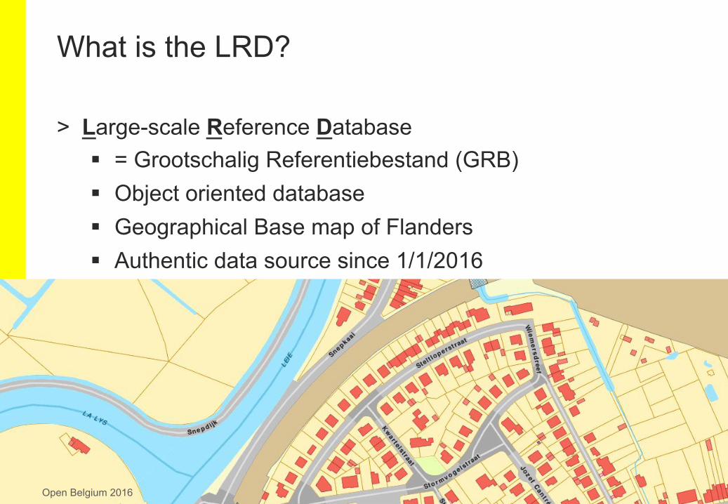
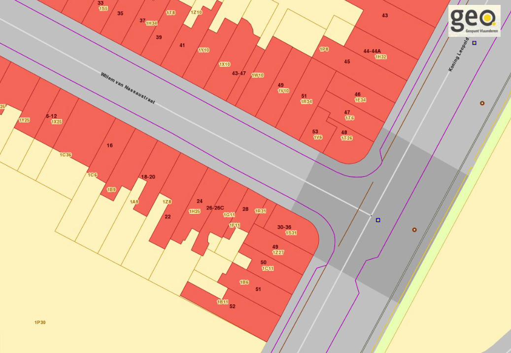
> Large-scale Reference Database § = Grootschalig Referentiebestand (GRB) § Object oriented database § Geographical Base map of Flanders § Authentic data source since 1/1/2016
What is the LRD?
Open Belgium 2016
What is the LRD?
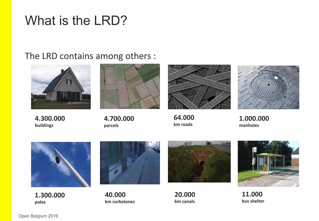
TheLRDcontainsamongothers:
4.300.000buildings
64.000kmroads
4.700.000parcels
40.000kmcurbstones
1.300.000poles
1.000.000manholes
20.000kmcanals
11.000busshelter
Open Belgium 2016
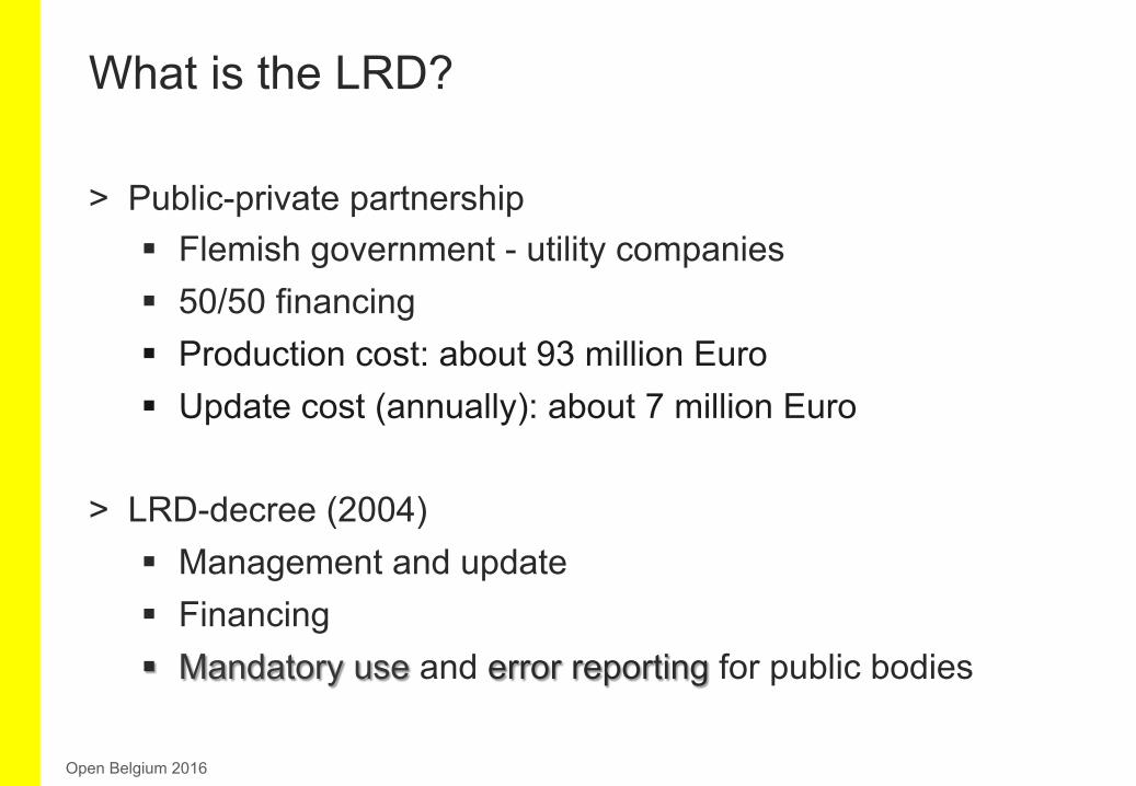
> Public-private partnership § Flemish government - utility companies § 50/50 financing § Production cost: about 93 million Euro § Update cost (annually): about 7 million Euro
> LRD-decree (2004) § Management and update § Financing § Mandatory use and error reporting for public bodies
What is the LRD?
Open Belgium 2016
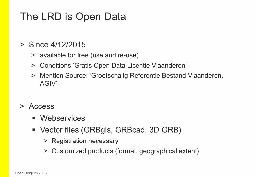
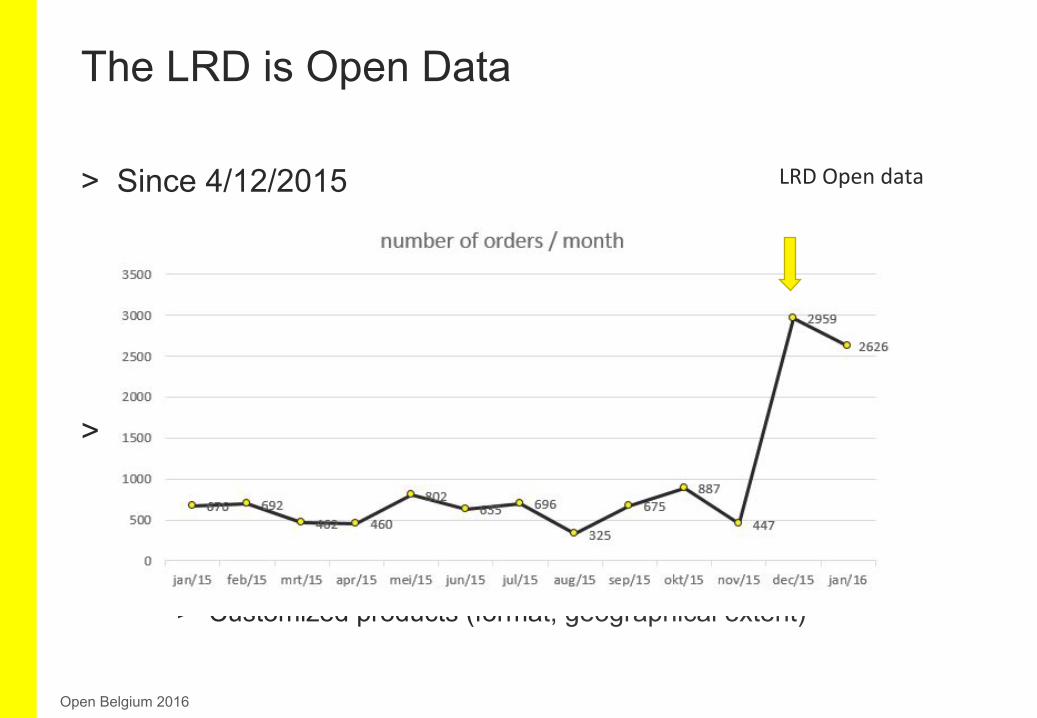
> Since 4/12/2015 > available for free (use and re-use) > Conditions ‘Gratis Open Data Licentie Vlaanderen’ > Mention Source: ‘Grootschalig Referentie Bestand Vlaanderen,
AGIV’
> Access § Webservices § Vector files (GRBgis, GRBcad, 3D GRB)
> Registration necessary > Customized products (format, geographical extent)
The LRD is Open Data
Open Belgium 2016
LRDOpendata
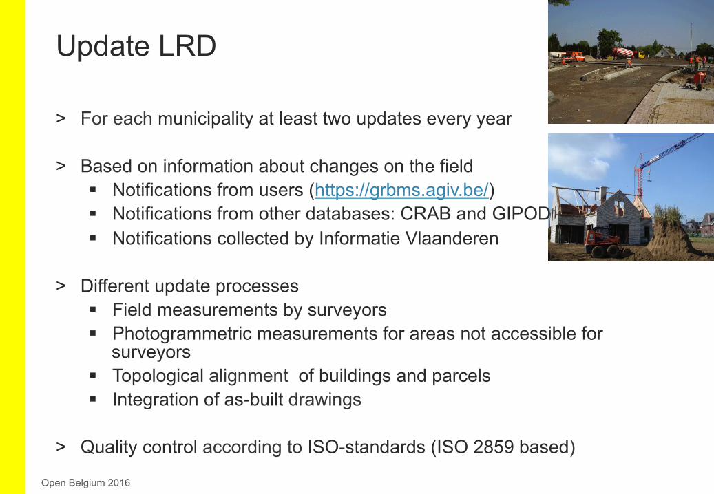
> For each municipality at least two updates every year
> Based on information about changes on the field § Notifications from users (https://grbms.agiv.be/) § Notifications from other databases: CRAB and GIPOD § Notifications collected by Informatie Vlaanderen
> Different update processes § Field measurements by surveyors § Photogrammetric measurements for areas not accessible for
surveyors § Topological alignment of buildings and parcels § Integration of as-built drawings
> Quality control according to ISO-standards (ISO 2859 based)
Update LRD
Open Belgium 2016

Update LRD
Open Belgium 2016
1.700
24.000
370.000
57.000
900.000
Upda=ng2015
newbuilding,demolishedbuilding,
renovatedbuildingbysurveyors
road-relatedchanges
(vb.newpole,newbusshelter,…)
kmconstrucKonandreconstrucKonofroads
newbuilding,demolishedbuilding,
renovatedbuildingby
photogrammetry
88.000
merger,split,
redivisionofparcels
topologicalalignmentsofbuildings-parcels
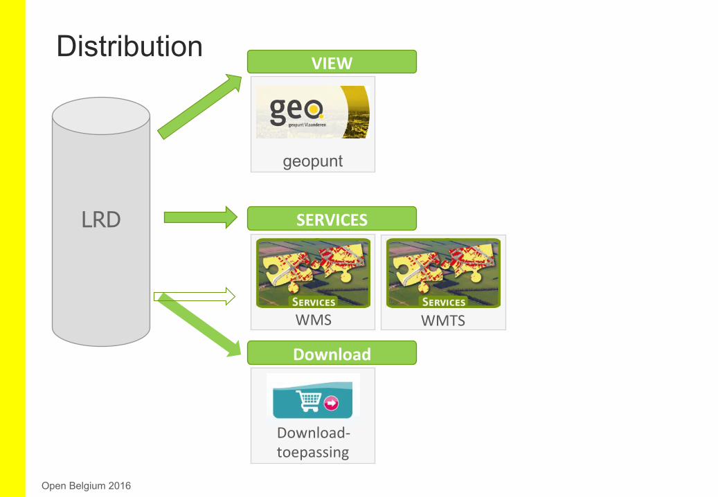
Distribution
Open Belgium 2016
SERVICESLRD
VIEW
geopunt
WMS WMTS
Download
Download-
toepassing
Open Belgium 2016
Open Belgium 2016
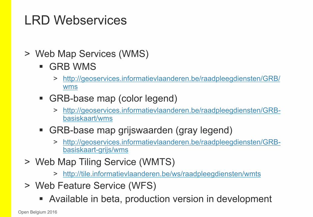
> Web Map Services (WMS) § GRB WMS
> http://geoservices.informatievlaanderen.be/raadpleegdiensten/GRB/wms
§ GRB-base map (color legend) > http://geoservices.informatievlaanderen.be/raadpleegdiensten/GRB-
basiskaart/wms
§ GRB-base map grijswaarden (gray legend) > http://geoservices.informatievlaanderen.be/raadpleegdiensten/GRB-
basiskaart-grijs/wms
> Web Map Tiling Service (WMTS) > http://tile.informatievlaanderen.be/ws/raadpleegdiensten/wmts
> Web Feature Service (WFS) § Available in beta, production version in development
LRD Webservices
Open Belgium 2016
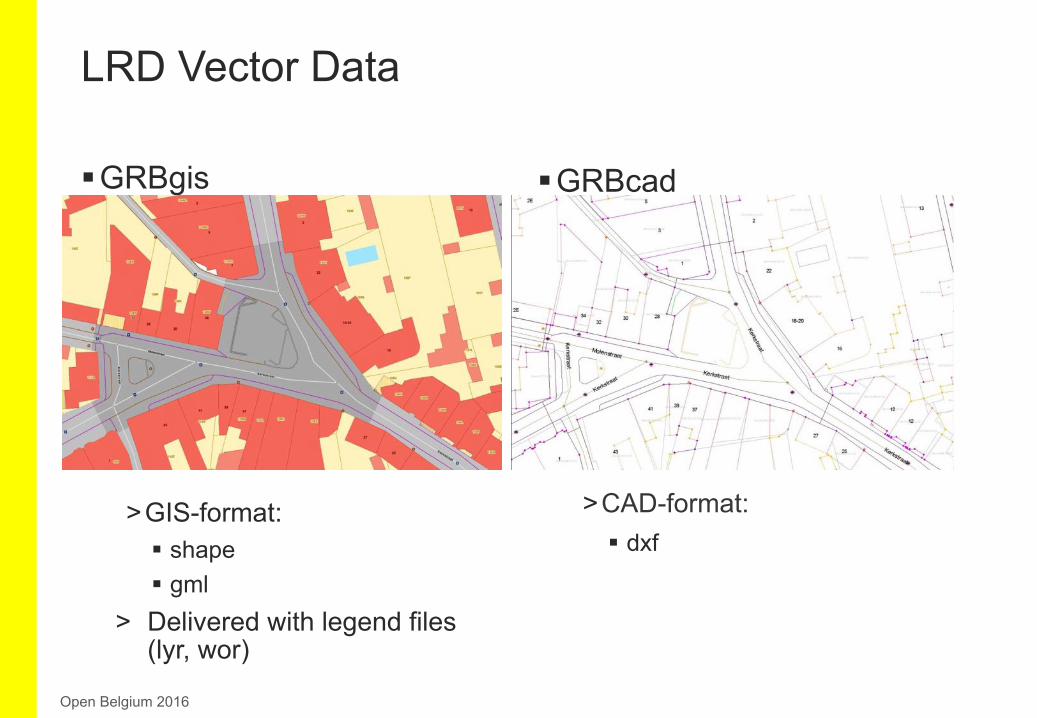
§ GRBgis
> GIS-format: § shape § gml
> Delivered with legend files (lyr, wor)
LRD Vector Data
Open Belgium 2016
§ GRBcad
> CAD-format: § dxf
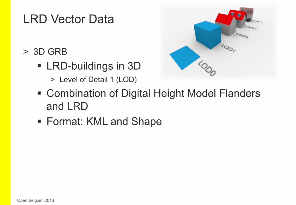
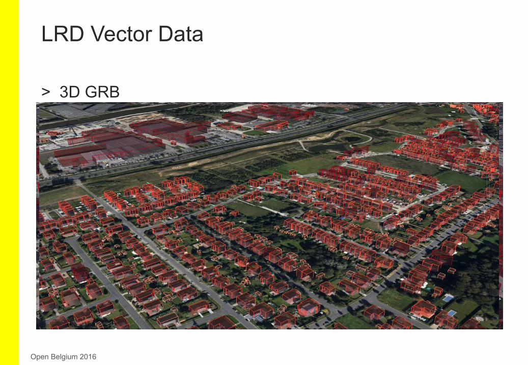
> 3D GRB § LRD-buildings in 3D
> Level of Detail 1 (LOD)
§ Combination of Digital Height Model Flanders and LRD
§ Format: KML and Shape
LRD Vector Data
Open Belgium 2016
> 3D GRB § LRD-buildings in 3D
> Level of Detail 1
§ Combination of Digital Height Model Flanders and LRD
§ Format: KML and Shape
LRD Vector Data
Open Belgium 2016
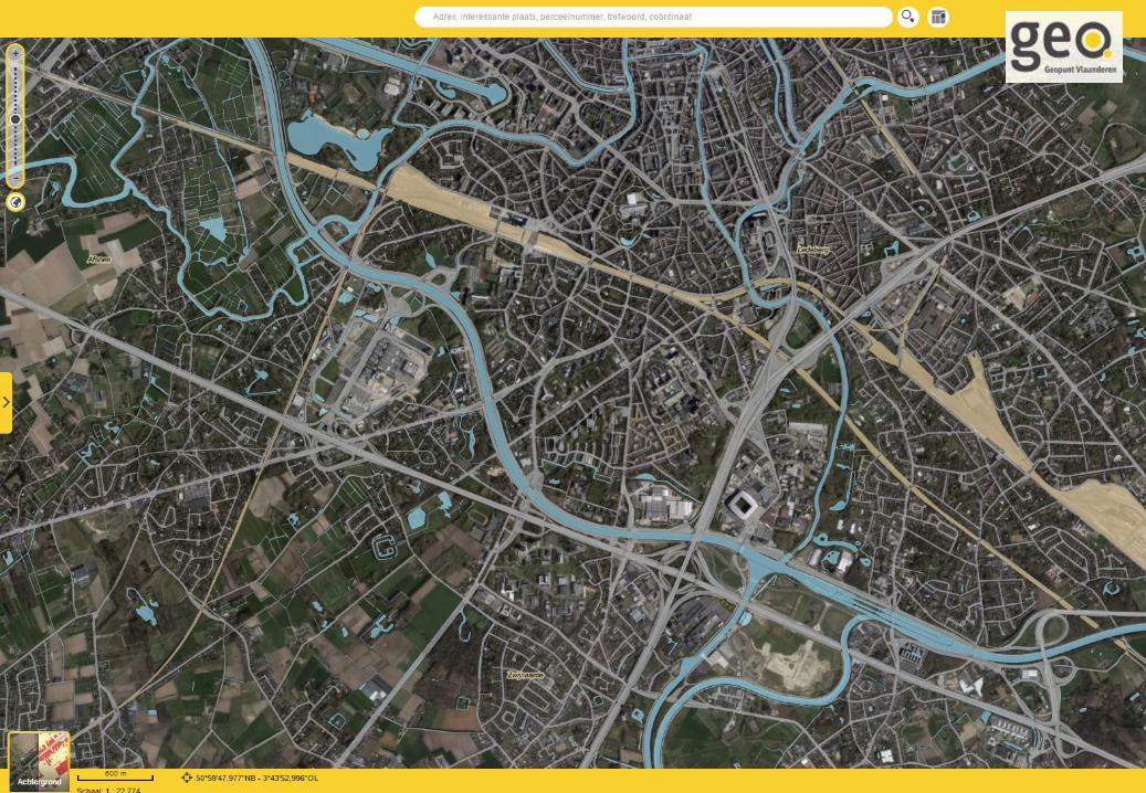
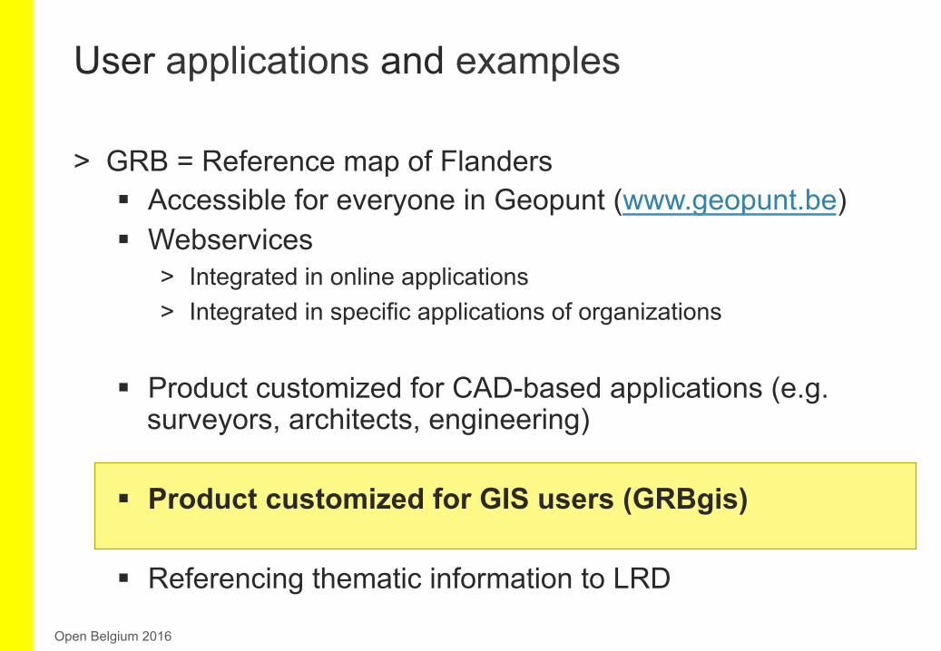
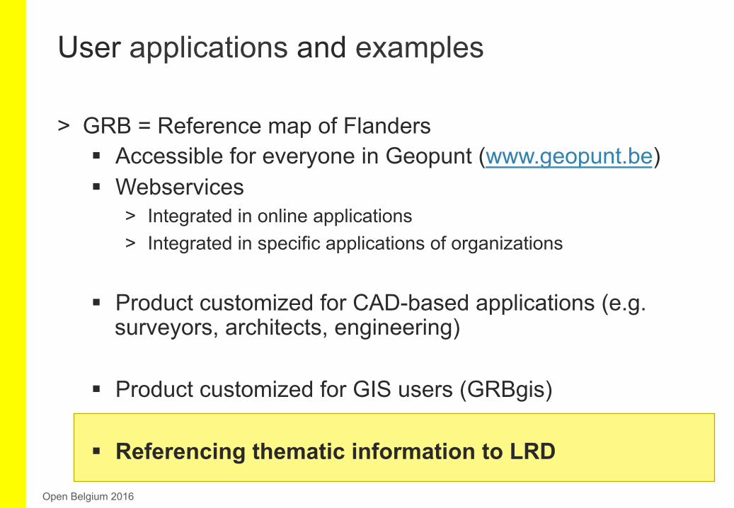
> GRB = Reference map of Flanders § Accessible for everyone in Geopunt
(www.geopunt.be) § Webservices
> Integrated in online applications > Integrated in specific applications of organizations
§ Product customized for CAD-based applications (e.g. surveyors, architects, engineering)
§ Product customized for GIS users (GRBgis)
§ Referencing thematic information to LRD
User applications and examples
Open Belgium 2016
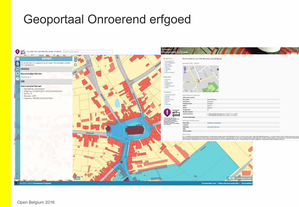
Geoportaal Onroerend erfgoed
Open Belgium 2016
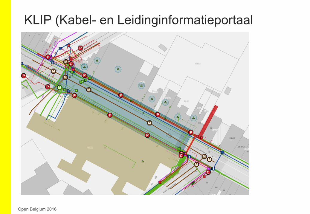
KLIP (Kabel- en Leidinginformatieportaal
Open Belgium 2016
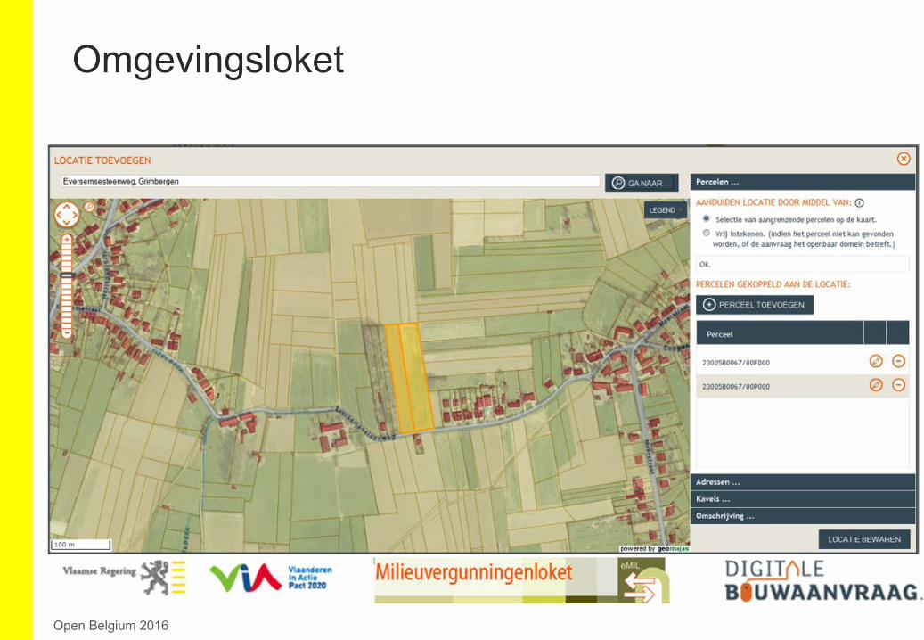
Omgevingsloket
Open Belgium 2016
> GRB = Reference map of Flanders § Accessible for everyone in Geopunt (www.geopunt.be) § Webservices
> Integrated in online applications > Integrated in specific applications of organizations
§ Product customized for CAD-based applications (e.g. surveyors, architects, engineering)
§ Product customized for GIS users (GRBgis)
§ Referencing thematic information to LRD
User applications and examples
Open Belgium 2016
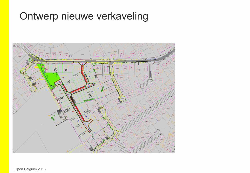
Ontwerp nieuwe verkaveling
Open Belgium 2016
> GRB = Reference map of Flanders § Accessible for everyone in Geopunt (www.geopunt.be) § Webservices
> Integrated in online applications > Integrated in specific applications of organizations
§ Product customized for CAD-based applications (e.g. surveyors, architects, engineering)
§ Product customized for GIS users (GRBgis)
§ Referencing thematic information to LRD
User applications and examples
Open Belgium 2016
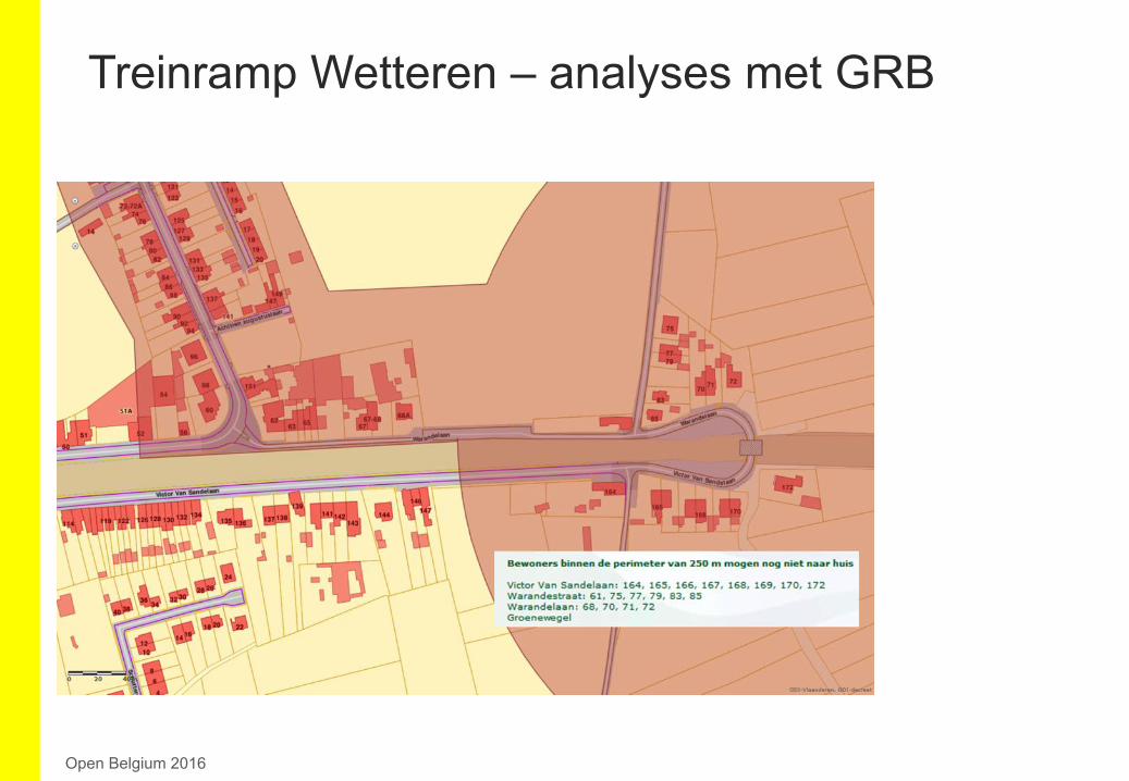
Treinramp Wetteren – analyses met GRB
Open Belgium 2016
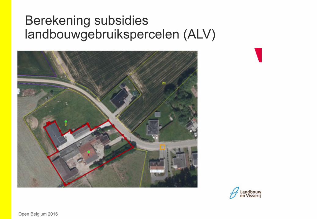
Berekening subsidies landbouwgebruikspercelen (ALV)
Open Belgium 2016
> GRB = Reference map of Flanders § Accessible for everyone in Geopunt (www.geopunt.be) § Webservices
> Integrated in online applications > Integrated in specific applications of organizations
§ Product customized for CAD-based applications (e.g. surveyors, architects, engineering)
§ Product customized for GIS users (GRBgis)
§ Referencing thematic information to LRD
User applications and examples
Open Belgium 2016
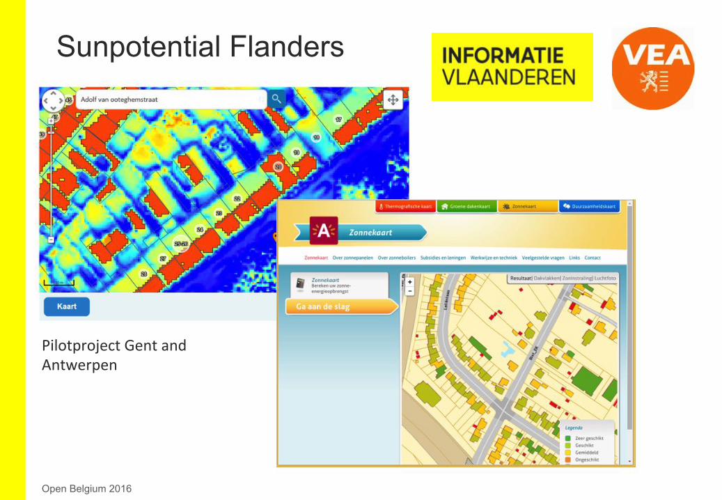
Sunpotential Flanders
Open Belgium 2016
PilotprojectGentand
Antwerpen
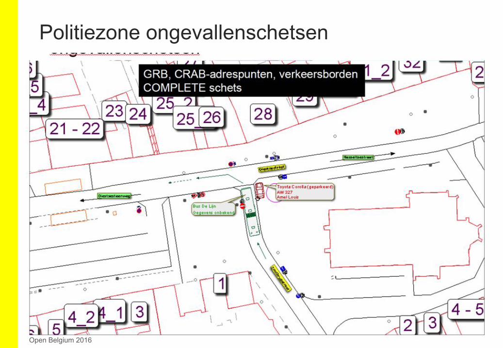
Politiezone ongevallenschetsen
Open Belgium 2016