the influence of geomorphology on the composition of ... · the influence of geomorphology on the...
TRANSCRIPT
Limnetica, 29 (2): x-xx (2011)Limnetica, 33 (2): 327-340 (2014)c© Asociación Ibérica de Limnología, Madrid. Spain. ISSN: 0213-8409
The influence of geomorphology on the composition of aquatic flora
and fauna within a temporary pond network
Margarita Florencio1,4,∗, Laura Serrano2, Patricia Siljestrom3, Rocio Fernández-Zamudio1,2,Pablo García-Murillo2 and Carmen Díaz-Paniagua1
1 Estación Biológica de Doñana (CSIC), Sevilla, Spain.2 Dept. Plant Biology and Ecology, University Sevilla, Sevilla, Spain.3 Instituto de Recursos Naturales y Agrobiología (CSIC), Sevilla, Spain.4 Present address: Azorean Biodiversity Group (CITA-A) and Platform for Enhancing Ecological Research andSustainability (PEERS), Departamento de Ciências Agrárias, Universidade dos Açores, Azores, Portugal.
∗ Corresponding author: [email protected]
Received: 03/03/2014 Accepted: 08/08/2014
ABSTRACT
The influence of geomorphology on the composition of aquatic flora and fauna within a temporary pond network
Geomorphological and hydrological features can provide a sound basis for global wetland classification. Temporary pondslocated on the sandy area of Doñana can be classified into five different geomorphological areas. We hypothesised that theseponds would differ in soil characteristics, which may also explain differences in the composition of their macroinvertebrate,amphibian, and aquatic plant species assemblages. The study ponds were significantly segregated into southern and northerngeomorphological areas based on the depth to the water table. The results of the multivariate ordination of soil variables wereconsistent with a north-south segregation, which was explained by the carbonate and other main ion concentrations in thepond basins. The ponds located in ecotones (marsh-sand and stable-mobile dunes) were particularly rich in amphibians andmacroinvertebrates. This result may be explained because the ponds with the longest permanence of water were located inthese areas, which represented the only flooded ponds during droughts. In addition, they also contained a high number oftemporary ponds, thus favouring connectivity and environmental heterogeneity in these areas.
Key words: Temporary ponds, geomorphology, Doñana, aquatic assemblages, macroinvertebrates, amphibians, aquaticplants.
RESUMEN
Influencia de la geomorfología sobre la composición de la fauna y flora acuáticas de un sistema de lagunas temporales
Las características hidrológicas y geomorfológicas pueden ser de gran utilidad para la clasificación de humedales. Las
lagunas temporales del manto eólico de Doñana se pueden clasificar en función de las cinco áreas geomorfológicas en que
se encuentran. Nuestra hipótesis se basa en que las lagunas de estas áreas difieren en las características de sus suelos, lo
cual puede explicar también las diferente composición de las comunidades de macroinvertebrados, anfibios y plantas que las
habitan. Las lagunas del sur de Doñana se diferenciaron de las del norte principalmente en la distancia a la capa freática.
Se realizó una ordenación de las lagunas a partir de un análisis multivariante de las características del suelo que resultó
consistente con la segregación norte-sur. Se observó una mayor segregación en las comunidades de plantas acuáticas en este
gradiente norte-sur, que se explica en función de las concentraciones de carbonatos y de otros iones principales en el suelo de
las lagunas. Las lagunas localizadas en áreas de ecotono (marisma-arenas y arenas estabilizadas-arenas móviles) resultaron
ser las de mayor riqueza de anfibios y macroinvertebrados. Esto podría deberse a que estas áreas contienen las lagunas
de mayor duración, siendo los únicos medios inundados en épocas de sequía, y al alto número de lagunas temporales que
presentan, favoreciendo la conectividad y heterogeneidad de ambientes.
Palabras clave: Lagunas temporales, comunidades acuáticas, geomorfología, Doñana, macroinvertebrados, anfibios, plantas
acuáticas.
15624_Limnetica 33(2), pàgina 327, 19/11/2014

328 Florencio et al.
INTRODUCTION
The length of the wet phase has long beenregarded as a fundamental factor that influ-ences all other features in temporary aquaticsystems (Rzóska, 1961). The hydrological regi-mes of temporary ponds may differ due tomany factors such as the pond basin soil, whichplays an important role in temporary pondecosystems. Over long-term periods, an area’sinundation frequency and duration affect thephysical and chemical processes involved inthe development of hydric soils (Rabenhorst,2004). Hydrogeomorphic-based approaches arepreferentially applied in wetland functional as-sessments (Cole et al., 1997). These approachesare particularly useful in the classification oftemporary wetlands in semi-arid regions, wherethe unpredictability of the climate results in awide range of hydrological conditions in a singlewater body between years.
Mediterranean temporary ponds are found inmany parts of the world that are characterizedby Mediterranean climates. Most of these pondsform in depressions in soils overlying an imper-meable substrate and result in a perched watertable (Keeley & Zedler, 1998), as described inCalifornia, Chile, South Africa, and western Aus-tralia. By contrast, in the Mediterranean basintemporary ponds also occur in floodplains thatdrain relatively large watershed systems (Keeley& Zedler, 1998) and are not necessarily associ-ated with impermeable fine sediments. They arecommon in areas with a Mediterranean climate,in which the desiccation period generally occursin the summer, and the flooding period followsheavy winter or autumn rainfall (Zedler, 1987;Grillas et al., 2004; Gómez-Rodriguez et al.,2009; Díaz-Paniagua et al., 2010). Despite theworldwide distribution of temporary wetlands,there are few studies addressing the classificationof both flora and fauna based on the geomorpho-logical characteristics of their habitats. However,such an approach has been common in wetlandplant classifications (Haslam, 2003). The abilityof hydrogeomorphic classes to discriminateamong other biological communities has been
occasionally tested in several wetland areas, withsoil organic matter and moisture as the strongestdrivers for the typification of macroinvertebrateassemblages (USEPA, 2002). In the Iberian Pe-ninsula, Alonso (1998) developed a typologyof crustacean assemblages closely related tosubstrate, climate and geographic attributes.Recently, Sahuquillo & Miracle (2013) provideda typology for Mediterranean ponds using crus-tacean assemblages based on water permanence,climatic and orographic features.
However, pond soil characterisation appearsto provide valuable information about the maincharacteristics of an area, which is related to thecomposition of aquatic species, and may pro-vide a novel perspective for the classification ofaquatic communities.
A large network of temporary ponds is locatedin Doñana National Park (SW Spain), wheremore than 3 000 ponds may be inundated duringyears of heavy rainfall (Díaz-Paniagua et al.,2010). These ponds constitute important habitatsfor amphibians, macroinvertebrates, microcrus-taceans, and aquatic vegetation (Díaz-Paniaguaet al., 2010). To manage and conserve thesehabitats, it is of crucial importance to assess theirwater regime and evaluate the main factors sus-taining their wet phase. The several attempts byshort-scale studies to classify Doñana ponds intodifferent hydrological categories have producedcontradictory results (García-Novo et al., 1991;Bravo & Montes, 1993; Manzano, 2001). How-ever, the characteristics of the soil of their pondbasins could provide a geomorphological frame-work upon which to base a classification system.
In this study, we analysed the characteristicsof the soils of temporary ponds located in thedifferent geomorphological areas of Doñana Na-tional Park. We hypothesised that the geomor-phological classification of ponds was robust andthat ponds in different geomorphological areaswould have different compositions of species as-semblages (macroinvertebrates, amphibians, andaquatic plants). We were particularly interestedin determining if idiosyncratic species were ex-clusively associated with particular geomorpho-logical areas.
15624_Limnetica 33(2), pàgina 328, 19/11/2014

Pond geomorphology influences flora and fauna 329
METHODS
Geomorphology of the Doñana pond network
Doñana National Park is a coastal dune area thatis located over a large sedimentary aquifer sys-tem of approximately 3000 km2. The Doñana re-gion was formed in the Quaternary age when theestuary of the Guadalquivir River was enlargedand reshaped by the formation of sandy spits afterthe last postglacial transgression (Siljestrom et
al., 1994). One half of the park includes an exten-sive marsh, and the other half is composed of ae-
olian sands that form a permeable layer throughwhich waters drain to an unconfined aquifer. Thewater table is generally shallow in this area andintersects with smooth depressions in the soilsurface, forming both permanent and temporaryponds (Manzano & Custodio, 2006). This aeo-lian unit has been separated into the followingfive geomorphological areas that differ in theirdynamics, parent material, and age: northern sta-bilised dunes, southern stabilised dunes, mobiledunes, and two contact areas, or ecotones, whichinclude the peridune ponds and the marsh-duneborder (Siljestrom et al, 1994) (Fig. 1).
Figure 1. Location of the pond sample soils (©) and the flora and fauna pond samples (•) in the five geomorphological areasdescribed for Doñana National Park. Localización de las lagunas muestreadas para el análisis de los suelos (©), y para la
determinación de su flora y fauna acuáticas (•) en las cinco áreas geomorfológicas descritas en el Parque Nacional de Doñana.
15624_Limnetica 33(2), pàgina 329, 19/11/2014

330 Florencio et al.
The northern stable dune area is an ancientdune system (6000-12000 BP) where temporaryponds form in the lower areas after the rise of thewater table by rainfall infiltration. The southernstable dune area, which is of more recent origin(2000-4000 BP), has a smaller extension, and thesoils differ in the physico-chemical and miner-alogical characteristics (rich in CaCO3 and othersalts) from those found in the northern stabledunes, which are mostly siliceous (Siljestrom et
al., 1994). In the mobile dunes, discharges froma local dune aquifer form temporary ponds in de-pressions in interdune valleys (or slacks). Thetwo interfaces between these geomorphologicalareas play a special role in the formation of pondsbecause they are characterised by phreatic dis-charges of groundwater. The peridune ecotone isthe area in which mobile dunes and northern sta-ble dunes come in contact. It includes the largestand most permanent ponds of the park that aremainly fed by the dune aquifer. The marsh-stabledune interface is locally known as “La Vera”. Inthis ecotone, the discharges of deep water levelsoriginating from the marsh and stable dunes coin-cide, often resulting in water running off in shal-low and temporary streams after heavy rainfall(Clemente et al., 1998).
Doñana ponds are fed by freshwater (rainfall,runoff, and groundwater discharge) and have nosurface or groundwater connection to the sea,
although they do receive salts of marine ori-gin through airborne deposition (Serrano et al.,2006). Temporary ponds are flooded after heavyrains, which in this area may occur in autumn,winter, or less frequently, in the spring. The dryphase coincides with summer; it starts in themost ephemeral ponds in the spring, whereasthose with the longest hydroperiods (i.e., dura-tion of the flooded period) may retain water untilthe end of summer (Díaz-Paniagua et al., 2010).
Soil sampling
To relate the soil geomorphological characteris-tics of ponds with their aquatic assemblages, soilsamples of 43 pond basins located across the fivedifferent geomorphological areas were obtainedby performing borehole sampling during ponddry periods in 2007 (n = 34) and 2012 (n = 9).We collected samples from each horizon in allprofiles for laboratory analyses. Chemical analy-ses (pH, electrical conductivity, cation exchangecapacity (CEC), phosphorus extraction, organicmatter characterisation, assimilable cations, andcarbonates) were conducted following Sparks &Bartels (1996). Soil texture was determined usinga Boyoucos densimeter (Day, 1986); the percent-ages of silt and clay were summed to providethe overall percentage of fine sediments. Heavymetals were obtained using humid digestion and
Table 1. Percentages of ponds with different water regimes for which macroinvertebrate, amphibian, and aquatic plant speciescomposition was characterised in 2007. Ponds are categorised into one of the five geomorphological areas described for DoñanaNational Park. Water regime was classified as follows: temporary ponds (natural temporary ponds with an annual dry phase),excavated ponds (isolated ponds that have been artificially excavated to maintain water in summer), temporary+excavated (temporaryponds that include an excavated pond in their basin to retain water in summer), permanent ponds (large natural ponds that do notdry up in summer) and streams (running waters after heavy rains than then persist as temporary ponds). For amphibians, we sampledan additional pond; the modified percentage is included in brackets. Porcentajes de lagunas con diferente régimen hídrico sobre el
total de lagunas en las que se muestraron macroinvertebrados, anfibios y plantas acuáticas en 2007. Las lagunas se han clasificado
dentro de cada una de las cinco áreas geomorfológicas descritas en el Parque Nacional de Doñana. En los muestreos se anfibios se
muestreó una laguna más que en los otros grupos, por lo que el porcentaje modificado para este grupo se muestra entre paréntesis.
Northernstable dunes
Southernstable dunes
Mobiledunes
Periduneecotone
La Vera
ecotone
Temporary ponds 61.3 (62.5) 11.8 57.1 87.5 65.4
Excavated ponds 19.4 88.2 42.9 0 11.5
Temporary+excavated ponds 19.4 0 0 0 0
Permanent ponds 0 0 0 12.5 0
Streams 0 0 0 0 23.1N ponds sampled 31(32) 17 7 8 26
15624_Limnetica 33(2), pàgina 330, 19/11/2014

Pond geomorphology influences flora and fauna 331
ICP/OES lectures (Williamson, 1994). To assessthe differences in the groundwater levels of thegeomorphological areas, we also measuredthe depth to the groundwater table in the sampledponds and 36 additional ponds (n = 79 totalsites) throughout the different areas of the park.
Ponds, fauna, and flora
To relate our data on pond soils to the presenceof particular species of aquatic fauna and flora,we used presence/absence data on the vegetation,macroinvertebrates, and amphibians of tempo-rary ponds across the entire park. Data from 89ponds were collected from March-June 2007(an additional pond was sampled to gain moreinformation on amphibians: n = 90 ponds foramphibian data). The ponds’ geomorphologicallocations and water regimes are indicated inTable 1. The water regimes were first classifiedas follows: temporary, permanent, stream, or
artificially excavated. Streams refer to intermit-tent running waters that only flow towards themarsh after heavy rains and then form lenticponds. Artificially excavated ponds refer toholes excavated in the deeper parts of naturalponds to reach the phreatic level during dryperiods and may be considered as permanentwater bodies; they were mainly built to providewater for cattle or wild fauna during the summer(temporary+excavated ponds). These excavatedponds sometimes occupy the entire pond basin,are isolated from natural temporary ponds, andoccur mainly in the southern stable dunes.
Amphibians and macroinvertebrates weresampled using a dip-net with a 1-mm mesh size.We performed three successive sweep-netsacross a stretch of water of c. 1.5 m in eachsampling unit to sample the heterogeneousenvironments mainly based on depth and aquaticplant cover within each pond; we followed thesame procedure for both groups of organisms
Figure 2. Non-metric multi-dimensional scaling ordination performed on the similarity matrix of pond soil samples according topond location in the different geomorphological areas of the Doñana aeolian sands: northern stable dunes (2), southern stable dunes(N), peridune (stable-mobile dunes) ecotone (◦), mobile dunes (▽), and La Vera (marsh-sand) ecotone (•). The relative magnitude ofSpearman’s correlation values between each soil variable and the pond ordination is indicated by the line size (Depth: phreatic depth;Fine: fine fraction; O.M.: organic matter; EC: electrical conductivity; ClayM: % of clay in the clay-rich horizon; ClayS: % of clayin the surface horizon). Ordenación multidimensional no métrica realizada sobre la matriz de similaridad de las muestras de suelode las lagunas localizadas en las diferentes áreas geomorfológicas descritas en el manto eólico de Doñana: Arenas estabilizadas del
norte (2), arenas estabilizadas del sur (N), ecotono peridunar (arenas estabilizadas-dunas móviles (◦), dunas móviles (▽), y ecotono
de La Vera (marisma-arenas) (•). Se indica la magnitud de los valores de la correlación de Spearman entre los tipos de suelos y la
ordenación de las lagunas. (Depth: nivel freático, Fine: fracción fina, O.M.: materia orgánica; EC: conductividad eléctrica, ClayM:
% de arcilla en el horizonte con mayor proporción de arcillas, ClayS: % de arcillas en el horizonte superficial).
15624_Limnetica 33(2), pàgina 331, 19/11/2014

332 Florencio et al.
(see, e.g., Florencio et al. 2009a for a detaileddescription of the process). Aquatic plants wereidentified at the same locations. In our analyses,we examined adult and larval macroinvertebratesseparately (hereafter referred to as “taxa” forsimplicity). Macroinvertebrates were identifiedto species in the case of most adults or genus inthe case of most larvae, although most membersof the orders Bassomatophora, Diptera, Haplo-taxida, and Lumbricula, as well as of the familySaldidae (Heteroptera), were only identified tothe family level. Amphibians and aquatic plantswere identified to the species level.
Data analyses
A multivariate ordination analysis (non-metricMDS) was performed on the similarity matrixof the 14 physico-chemical soil variables usingPrimer 6.0. These variables were measured inthe 43 pond basins that included the deep clayeylayer or the topsoil layer when clay was notpresent. The variables included in this analysiswere all log transformed (X + 1), with theexception of the non-transformed pH; electricalconductivity, organic matter content, fine sedi-ments (clay and silt), carbonates, Tot-P, TotCa,Mg, S, Mg, K, and Fe in the surface horizon;clay and total fine sediment contents in the clay-rich horizon; and distance to the groundwatertable. We then obtained a triangular similaritymatrix using Euclidean distances. A multivariateANOVA analogue (one-way ANOSIM) wasused to test for multivariate differences in thesoil characteristics of samples from pondslocated in different areas, i.e., using the geo-morphological areas as grouping factors in theone-way ANOSIM analyses (Primer v6). TheANOSIM statistic R is close to one when groupsare completely different (Clarke & Warwick,2001). The ANOSIM analyses also allowed forpair-wise comparisons between the differentgeomorphological areas. Spearman’s rank ordercorrelations were also performed on the untrans-formed variables. In addition, differences in thedepth to the groundwater table among the geo-morphological areas were tested using ANOVAand Tukey’s post hoc test (STATISTICA 6.0).
Table 2. Pair-wise comparisons obtained after a one-wayANOSIM analysis performed on pond soil variables betweenthe five geomorphological areas (northern: northern stabledunes; southern: southern stable dunes; mobile dunes; peridune:peridune ecotone; and La Vera: La Vera ecotone) indicate sig-nificant differences ( p < 0.05) between the pair-wise compar-isons except for two cases ( p > 0.1); ANOSIM statistic R isclose to one when groups are completely different. Compara-
ciones pareadas obtenidas en el análisis ANOSIM de una vía
sobre las variables del suelo de las lagunas entre las áreas geo-morfológicas (Northern: arenas estabilizadas del norte, South-
ern: arenas estabilizadas del sur, Mobile Dunes: dunas móviles,
Peridune: ecotono peridunar y Vera: ecotono de La Vera) in-
dicando diferencias significativas en todas las comparaciones
pareadas ( p < 0.05) excepto en dos ocasiones ( p > 0.1); el
estadístico R de ANOSIM se aproxima a 1 cuando los gruposson completamente diferentes.
R p
Northern× Southern 0.99 0.0001Northern x Mobile Dunes 0.86 0.0006Northern× Peridune 0.12 0.11Northern×Vera 0.26 0.012Southern×Mobile Dunes 0.85 0.029Southern× Peridune 0.99 0.002Southern×Vera 0.70 0.001Peridune×Mobile Dunes 0.87 0.006Peridune×Vera 0.16 0.04Mobile Dunes×Vera 0.16 0.177
We analysed the similarity in assemblagecomposition among the sampled ponds usingspecies presence/absence data; separate analyseswere performed for amphibians, aquatic plants,and macroinvertebrates. We obtained triangularsimilarity matrices for each group using theSørensen similarity coefficient (i.e., the inverseof the Sørensen dissimilarity index). To examinedifferences in the species compositions of theponds, we performed three additional one-wayANOSIM analyses using the corresponding trian-gular similarity matrices of amphibians, aquaticplants and macroinvertebrates; geomorphologicalarea was the grouping factor in all three analyses.
RESULTS
Pond soil classification
A non-metric MDS ordination of the 14 pondsoil variables showed that differences amongthe geomorphological areas were mainly at-tributable to a strong north-south spatial gradient
15624_Limnetica 33(2), pàgina 332, 19/11/2014
Pond geomorphology influences flora and fauna 333
Table 3. Exclusive taxa found in particular geomorphological areas in Doñana National Park (presence/absence is indicated as 1/0).The total number of taxa recorded in each area is indicated for each general group (after Florencio et al. 2009a; Díaz-Paniagua et al.,2006; Fernández-Zamudio, 2011). Taxa in bold were found exclusively in a particular area (Adult- A and Larvae- L were different forColeoptera and Heteroptera; Odonata refers only to aquatic larvae). Taxones que resultaron exclusivos o característicos de lagunasde determinadas áreas geomorfológicas del Parque Nacional de Doñana (la presencia/no detección se indica como 1/0). Se indica
el número total de taxa registrados en cada área (según datos de Florencio et al. 2009; Díaz-Paniagua et al. 2006). Se muestran
en negritas los taxa exclusivos de un área determinada (se diferencia entre Adultos -A y Larvas -L para Coleoptera y Heteroptera,
Odonata se refiere sólo a larvas acuáticas).
Northern stable
dunes
Southern stable
dunes
Mobile
dunes
Peridune
ecotone
La Vera
ecotone
Amphibians 8 6 6 10 10
Bufo bufo (Linnaeus, 1758) 0 0 0 1 1
Pelodytes ibericus Sánchez-Herráiz,
Barbadillo, Machordom & Sanchiz, 2000 0 0 0 1 1
Coleoptera 42 39 28 32 40
Yola bicarinata (Latreille, 1804)-A 0 1 1 0 0
Hydaticus leander (Rossi, 1790) -L 0 0 0 0 1
Hygrotus inaequalis (Fabricius, 1777) -A 0 1 0 0 0
Laccobius revelierei Perris, 1864 -A 1 0 0 0 0
Hydrophilus pistaceus (Laporte, 1840) -L 1 0 0 0 1
Hydrochara flavipes (Steven, 1808) -L 0 0 0 0 1
Limnebius furcatus Baudi, 1872 -A 0 1 0 0 0
Gyrinus –L 1 0 0 1 0
Heteroptera 18 16 14 14 17
Microvelia pygmaea (Dufour, 1833) -A 1 0 0 1 0
Odonata 9 7 5 10 8
Lestes macrostigma (Eversmann, 1836) 0 0 0 1 0
Large Crustaceans 4 0 0 0 3
Maghrebestheria maroccana Thiéry, 1988 1 0 0 0 0
Cyzicus grubei Simon, 1886 0 0 0 0 1
Branchipus cortesi Alonso y Jaume, 1991 1 0 0 0 0
Tanymastix stagnalis (Linnaeus, 1758) 1 0 0 0 0
Branchipus schafferi Fischer de Waldheim, 1834 1 0 0 0 0
Streptocephalus torvicornis (Waga, 1842) 0 0 0 0 1
Triops mauritanicus (Ghigi, 1921) 0 0 0 0 1
Aquatic Plants 65 15 28 50 60
Chara vulgaris L. 0 1 1 0 0
Chara fragilis Desv. 0 1 1 0 0
Isolepis fluitans (L.) R. Br. 1 0 0 1 0
Juncus heterophyllus Dufour 1 0 0 1 0
Nitella translucens (Pers.) C. Agardh 1 0 0 0 1
Potamogeton natans L. 1 0 0 0 0
Lemna trisulca L. 0 1 1 0 0
Wolffia arrhiza (L.) Horkel ex Wimmer 0 1 1 0 0
Total number of species 146 83 81 116 138
15624_Limnetica 33(2), pàgina 333, 19/11/2014

334 Florencio et al.
in carbonates and an east-west gradient in clay(Fig. 2). An ANOSIM analysis showed signifi-cant differences between the soil characteristicsof the five geomorphological areas (GlobalR = 0.46, p = 0.0001); all the pair-wise com-parisons between these areas were significant( p < 0.05), except the comparisons between theperidune ecotone and the northern stable dunesand between La Vera ecotone and the mobiledunes ( p > 0.1, Table 2).
The pond soils located in the southern sta-ble dunes and the mobile dunes had significantlyshallower phreatic depths than the rest of theponds (ANOVA, F4,73 = 8.7128; p = 0.0001, andTukey’s test) (Fig. 3). We found larger percent-ages of excavated ponds in these areas (Table 1),which accounted for the shallower depth of thewater table at these sites. Permanent ponds onlyoccurred at sites located in the peridune area (Ta-ble 1), together with other extensive ponds withlong hydroperiods.
Fauna and flora associated with particular
geomorphological areas
The Doñana pond network provides aquatichabitats for a large number of species of floraand fauna (Table 3). For macroinvertebrates,the highest taxon richness was found in pondslocated in the northern stable dunes and La Vera
ecotone, with the exception of Odonata, whichwere richest in the peridune ecotone. We detectedidiosyncratic taxa that were exclusively foundin particular areas, such as Coleoptera, Odonataand particularly the group of large crustaceans.The highest amphibian species richness wasfound in the peridune and La Vera ecotones;two species were exclusive to these habitats.The gradient of conductivity largely contributedto a clear differentiation between aquatic plantcompositions from the northern (northern stabledunes, Vera and peridune area) and southernareas (mobile dunes and southern stable dunes).The lowest richness of aquatic plants wasfound in the southern stable dunes and mobiledunes. We did not observe any plant speciesthat exclusively occurred in one particular area,but several species were primarily associated
Figure 3. Mean± standard deviation of the depth to thegroundwater table (phreatic level) of the ponds located inthe five geomorphological areas described for Doñana Na-tional Park (northern: northern stable dunes; La Vera: La Vera
ecotone-contact area between the northern stable dunes andmarshes; peridune: peridune ecotone-contact area between thenorthern stable dunes and mobile dunes; mobile dunes; south-ern: southern stable dunes). Different letters indicate significantdifferences after Tukey’s post hoc tests for the five geomor-phological areas ( p < 0.05). Media y desviación típica de la
distancia a la capa freática de las lagunas localizadas en lascinco áreas geomorfológicas descritas en el Parque Nacional
de Doñana (Northern: arenas estabilizadas del norte; La Vera:
Ecotono de la Vera-área de contacto entre las arenas estabi-
lizadas del norte y las marismas; Peridune: ecotono peridunar-
área de contacto entre las arenas estabilizadas del norte y lasdunas móviles; Mobile dunes: Dunas móviles; Southern: Are-
nas estabilizadas del sur). Las diferentes letras en la figura
indican diferencias significativas después de realizar el análi-
sis post hoc de Tukey entre las cinco áreas geomorfológicas
( p < 0.05).
with two contiguous areas. Thus, particular plantspecies only appeared in areas with permanentwaters, i.e., in the peridune ecotone that con-tained permanent ponds and in the southern sta-ble dunes that mainly contained excavated ponds(Table 1 & Table 3).
Consequently, ANOSIM analyses revealedthat geomorphological areas differed signifi-cantly in the composition of their macroinverte-brate (Global R = 0.12, p = 0.0002), amphibian(Global R = 0.14, p = 0.0001), and aquatic plantassemblages (Global R = 0.33, p = 0.0001).Pair-wise comparisons revealed that the assem-blage composition of the three organism groupssignificantly differed ( p < 0.05) between themobile dunes and northern stable dunes, northernand southern stable dunes, and southern stabledunes and La Vera ecotone (Table 4). Differences
15624_Limnetica 33(2), pàgina 334, 19/11/2014

Pond geomorphology influences flora and fauna 335
Table 4. Pair-wise comparisons obtained after one-wayANOSIM analyses performed for assemblage compositionamong the five geomorphological areas (northern: northernstable dunes; southern: southern stable dunes; mobile dunes;peridune: peridune ecotone and La Vera: La Vera ecotone).A total of three one-way ANOSIM analyses were performed,one for each biotic assemblage: macroinvertebrates, amphib-ians, and aquatic plants. Only p-values of significant pair-wisecomparisons at p < 0.05 between the biological assemblagesof the geomorphological areas are shown for each group of or-ganisms (ANOSIM statistic R is close to one when groups arecompletely different; all non-significant pair-wise comparisonsat p > 0.06). Comparaciones pareadas obtenidas en los análi-
sis ANOSIM de una vía comparando la composición de las co-
munidades entre las áreas geomorfológicas (Northern: arenas
estabilizadas del norte, Southern: arenas estabilizadas del sur;Mobile Dunes: dunas móviles, Peridune: ecotono peridunar y
Vera: ecotono de La Vera). Se realizaron tres análisis ANOSIM
de una vía, uno para cada grupo de especies: macroinver-
tebrados, anfibios y plantas acuáticas. Sólo se muestran los
p-valores obtenidos en comparaciones pareadas significati-vas con p < 0.05 entre las composiciones biológicas de las
diferentes áreas morfológicas (El estadístico R de ANOSIM
se aproxima a 1 cuando los grupos son completamente dife-
rentes;todas las comparaciones pareadas no fueron significati-
vas con un valor de p > 0.06).
R p
Macroinvertebrates
Mobile Dunes×Northern 0.21 0.05
Mobile Dunes× Peridune 0.22 0.013
Northern× Southern 0.28 0.0001
Southern×Vera 0.17 0.002
Amphibians
Mobile Dunes×Northern 0.31 0.015
Northern× Southern 0.37 0.0001
Northern×Vera 0.12 0.001
Southern×Vera 0.13 0.009
Macrophytes
Mobile Dunes×Northern 0.43 0.001
Mobile Dunes× Southern 0.19 0.038
Mobile Dunes×Vera 0.21 0.041
Northern× Southern 0.68 0.0001
Northern×Vera 0.09 0.003
Peridune× Southern 0.58 0.0001
Southern×Vera 0.57 0.0001
among additional paired areas were also found formacroinvertebrates (1 paired comparison, Table 4),amphibians (1 paired comparison, Table 4) andaquatic plants (4 paired comparisons, Table 4).
DISCUSSION
The categorisation of ponds according to theirgeomorphological areas resulted in a useful androbust classification system that revealed impor-tant differences in the soil types and assemblagesof aquatic flora and fauna. Because wetlands inany region develop according to geomorpholo-gical processes that are driven by the interactionof climate and geology (Gilman, 1994), geomor-phological and hydrological features can providea sound basis for a global wetland classificationsystem in which biological variation is indepen-dently addressed (Semeniuk & Semeniuk, 1997).The Doñana wetlands have been traditionallygrouped into dune ponds and marshes accordingto their location. Both types have been furtherclassified by size, hydrological features, andlittoral vegetation (as reviewed by Serrano et al.,2006). A quantitative hydro-geomorphologicalapproach established a threshold of 1.6 mS cm−1
to segregate dune ponds from marshes duringheavy floods (Espinar & Serrano, 2009). García-Novo et al. (1991) separated dune ponds intotwo categories based on the Na+/Mg2+ ratioof their surface waters, which distinguishedgroundwater recharge and discharge areas duringfloods. Further discrimination among ponds hasnot been achieved, most likely due to the limitedamount of information that can be obtained bymeasuring the concentrations of dissolved orsuspended materials under water level regimesthat show a high degree of fluctuation (but seeFlorencio et al., 2009b). By contrast, we usedordination to determine that the patterns of pondsoil variables agree with the distribution of thedifferent geomorphological areas located withinthe Doñana aeolian sands and that the southernstable dune pond soils were segregated from thepond soils in the other areas.
The geomorphological areas differed sig-nificantly in the assemblage composition ofthe main groups of organisms that inhabitedtheir ponds: macroinvertebrates, amphibians,and aquatic plants. We found that the southernstable dunes and mobile dunes in particular haddistinct floral and faunal assemblages, likelyas a result of the particular features described
15624_Limnetica 33(2), pàgina 335, 19/11/2014
336 Florencio et al.
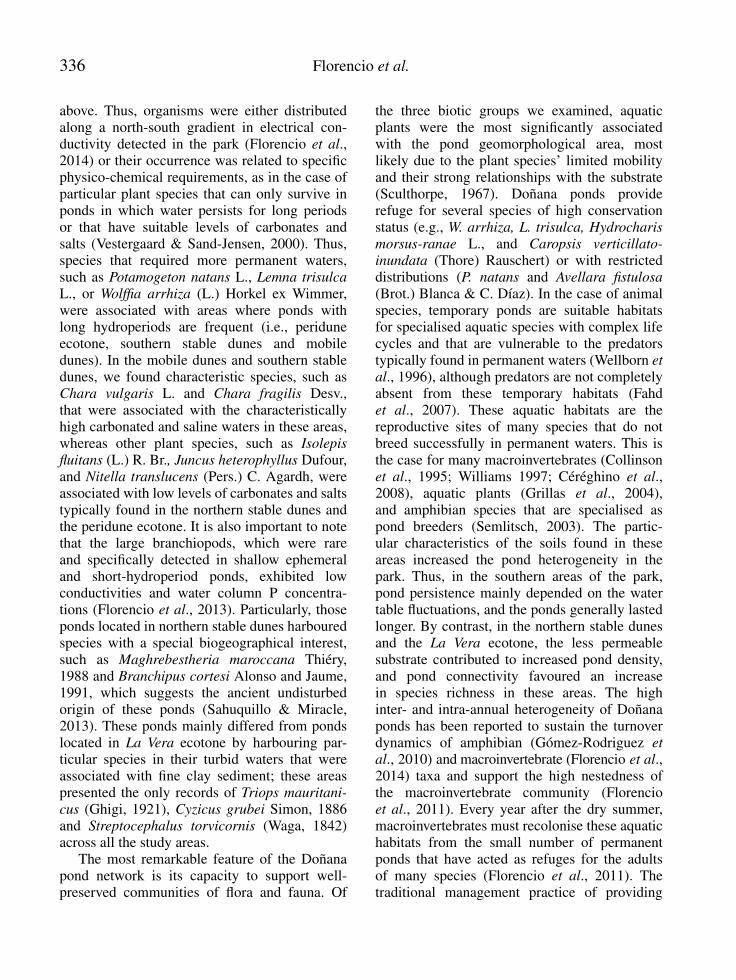
above. Thus, organisms were either distributedalong a north-south gradient in electrical con-ductivity detected in the park (Florencio et al.,2014) or their occurrence was related to specificphysico-chemical requirements, as in the case ofparticular plant species that can only survive inponds in which water persists for long periodsor that have suitable levels of carbonates andsalts (Vestergaard & Sand-Jensen, 2000). Thus,species that required more permanent waters,such as Potamogeton natans L., Lemna trisulca
L., or Wolffia arrhiza (L.) Horkel ex Wimmer,were associated with areas where ponds withlong hydroperiods are frequent (i.e., periduneecotone, southern stable dunes and mobiledunes). In the mobile dunes and southern stabledunes, we found characteristic species, such asChara vulgaris L. and Chara fragilis Desv.,that were associated with the characteristicallyhigh carbonated and saline waters in these areas,whereas other plant species, such as Isolepis
fluitans (L.) R. Br., Juncus heterophyllus Dufour,and Nitella translucens (Pers.) C. Agardh, wereassociated with low levels of carbonates and saltstypically found in the northern stable dunes andthe peridune ecotone. It is also important to notethat the large branchiopods, which were rareand specifically detected in shallow ephemeraland short-hydroperiod ponds, exhibited lowconductivities and water column P concentra-tions (Florencio et al., 2013). Particularly, thoseponds located in northern stable dunes harbouredspecies with a special biogeographical interest,such as Maghrebestheria maroccana Thiéry,1988 and Branchipus cortesi Alonso and Jaume,1991, which suggests the ancient undisturbedorigin of these ponds (Sahuquillo & Miracle,2013). These ponds mainly differed from pondslocated in La Vera ecotone by harbouring par-ticular species in their turbid waters that wereassociated with fine clay sediment; these areaspresented the only records of Triops mauritani-
cus (Ghigi, 1921), Cyzicus grubei Simon, 1886and Streptocephalus torvicornis (Waga, 1842)across all the study areas.
The most remarkable feature of the Doñanapond network is its capacity to support well-preserved communities of flora and fauna. Of
the three biotic groups we examined, aquaticplants were the most significantly associatedwith the pond geomorphological area, mostlikely due to the plant species’ limited mobilityand their strong relationships with the substrate(Sculthorpe, 1967). Doñana ponds providerefuge for several species of high conservationstatus (e.g., W. arrhiza, L. trisulca, Hydrocharis
morsus-ranae L., and Caropsis verticillato-
inundata (Thore) Rauschert) or with restricteddistributions (P. natans and Avellara fistulosa
(Brot.) Blanca & C. Díaz). In the case of animalspecies, temporary ponds are suitable habitatsfor specialised aquatic species with complex lifecycles and that are vulnerable to the predatorstypically found in permanent waters (Wellborn et
al., 1996), although predators are not completelyabsent from these temporary habitats (Fahdet al., 2007). These aquatic habitats are thereproductive sites of many species that do notbreed successfully in permanent waters. This isthe case for many macroinvertebrates (Collinsonet al., 1995; Williams 1997; Céréghino et al.,2008), aquatic plants (Grillas et al., 2004),and amphibian species that are specialised aspond breeders (Semlitsch, 2003). The partic-ular characteristics of the soils found in theseareas increased the pond heterogeneity in thepark. Thus, in the southern areas of the park,pond persistence mainly depended on the watertable fluctuations, and the ponds generally lastedlonger. By contrast, in the northern stable dunesand the La Vera ecotone, the less permeablesubstrate contributed to increased pond density,and pond connectivity favoured an increasein species richness in these areas. The highinter- and intra-annual heterogeneity of Doñanaponds has been reported to sustain the turnoverdynamics of amphibian (Gómez-Rodriguez et
al., 2010) and macroinvertebrate (Florencio et al.,2014) taxa and support the high nestedness ofthe macroinvertebrate community (Florencioet al., 2011). Every year after the dry summer,macroinvertebrates must recolonise these aquatichabitats from the small number of permanentponds that have acted as refuges for the adultsof many species (Florencio et al., 2011). Thetraditional management practice of providing
15624_Limnetica 33(2), pàgina 336, 19/11/2014

Pond geomorphology influences flora and fauna 337
drinking water for the park’s fauna during dryperiods, by making existing pond basins deeperor creating new watering holes, has also gen-erated permanent water bodies that support thebiodiversity of the entire system and are essentialfor the conservation of many aquatic plants.
The high degree of dependence of Doñanaponds on the groundwater table should be takeninto account by environmental managers. Theconservation of these particular habitats shouldbe promoted by the management of groundwa-ter dynamics. Despite Doñana National Parkbeing assigned the highest protection status inSpain, several studies have reported a significantreduction in the length of the aquatic phase oflong-hydroperiod ponds over the last decade dueto groundwater extraction resulting from urbanwater use in the nearby tourist resort of Matalas-cañas (Serrano & Zunzunegui, 2008; Serrano et
al., 2008; Sousa et al., 2009). In general, ground-water overexploitation has been reported in thenorthern stable dunes and adjacent areas due toimproper water management by intensified agri-culture in plastic greenhouses (Muñoz-Reinoso,2001; Manzano & Custodio, 2006). If the sever-ity of this situation is overlooked, the futureof the largest network of temporary ponds inWestern Europe will be at risk.
ACKNOWLEDGEMENTS
This study was funded by the Spanish Ministryof Agriculture, Food and Environment (project158/2010). We thank Isabel Afán and DavidAragonés of LAST_EBD for the map drawingand the management personal of the ParqueNacional de Doñana and the Reserva Biológicade Doñana for their valuable help during ourvisits to the park.
REFERENCES
ALONSO, M. 1998. Las lagunas de la España Penin-sular. Limnetica, 15: 1–176.
BRAVO, M. A. & C. MONTES. 1993. Inventario delas formaciones palustres del manto eólico del Par-
que Nacional de Doñana (SW España). Actas VICongreso Español de Limnología: 31–42.
CÉRÉGHINO, R., J. BIGGS, B. OERTLI & S. DE-CLERCK. 2008. The ecology of European ponds:defining the characteristics of a neglected freshwa-ter habitat. Hydrobiologia, 597: 1–6.
CLARKE, K. R. & R. M. WARWICK. 2001. Change
in marine communities: an approach to statistical
analysis and interpretation, 2nd edition. PRIMER-E, Plymouth, UK.
CLEMENTE, L., L. V. GARCÍA, P. SILJESTROM.1998. Los Suelos del Parque Nacional de Doña-
na. Technical collection, Ed. O.A. Parques Na-cionales, Madrid, Spain.
COLE, A. C., R. P. BROOKS & D. H. WARDROP.1997. Wetland hydrology as a function of hydro-geomorphic (HGM) subclass. Wetlands, 17: 456–467.
COLLINSON, N. H., J. BIGGS, A. CORFIELD, M.J. HODSON, D. WALKER, M. WHITFIELD & P.J. WILLIAMS. 1995. Temporary and permanentponds: an assessment of the effects of drying outon the conservation value of aquatic macroinver-tebrate communities. Biological Conservation, 74:125–133.
DAY, P. R. 1986. Particle Fractionation and Particle-size Analysis. In: Methods of Soil Analysis: Phys-
ical and Mineralogical Methods, 2nd edition, Part1. C. A. Black et al. (eds.): 545–567. Soil ScienceSociety of America Book Series Number 5, Amer-ican Society of Agronomy, Madison, USA.
DÍAZ-PANIAGUA, C., C. GÓMEZ-RODRÍGUEZ,A. PORTHEAULT& W. DE VRIES, 2006. Dis-tribución de los anfibios del Parque Nacional deDoñana en función de la densidad y abundanciade los hábitats de reproducción. Revista Española
de Herpetología, 20: 17–30.DÍAZ-PANIAGUA, C., R. FERNÁNDEZ-ZAMU-
DIO, M. FLORENCIO, P. GARCÍA-MURILLO,C. GÓMEZ-RODRÍGUEZ, A. PORTHEAULT, L.SERRANO & P. SILJESTROM. 2010. Temporaryponds from the Doñana national park: a systemof natural habitats for the preservation of aquaticflora and fauna. Limnetica, 29: 41–58.
ESPINAR, J. L. & L. SERRANO. 2009. A quantita-tive hydrogeomorphic approach to the classifica-tion of temporary wetlands in the Doñana NationalPark (SW Spain). Aquatic Ecology, 43: 323–334.
FAHD, K., M. FLORENCIO, C. KELLER & L. SER-RANO. 2007. The effect of the sampling scale on
15624_Limnetica 33(2), pàgina 337, 19/11/2014

338 Florencio et al.
zooplankton community assessment and its impli-cations for the conservation of temporary ponds insouth-west Spain. Aquatic Conservation: Marine
and Freshwater Ecosystems, 17: 175–193.FERNÁNDEZ-ZAMUDIO, R. 2011. Plantas acuáti-
cas del Parque Nacional de Doñana: aspectos eco-
lógicos y biología de una especie exótica. Ph.D.Thesis, University of Seville (Spain).
FLORENCIO, M., L. SERRANO, C., GÓMEZ-RODRÍGUEZ, A MILLÁN & C. DÍAZ-PANI-AGUA. 2009a. Inter and intra-annual variationof macroinvertebrate assemblages in temporaryponds from the Doñana National Park (SW Spain).Hydrobiologia, 634: 167–183.
FLORENCIO, M., C. GÓMEZ-RODRÍGUEZ, A.GÓMEZ, M. R., E. GUTIÉRREZ, P. SILJE-STROM, L. SERRANO & C. DÍAZ-PANIAGUA.2009b. Towards a quantitative classification oftemporary ponds in Doñana (SW Spain). In: Inter-
national Conference on Mediterranean Temporary
Ponds. Proceedings & Abstracts. Fraga, P. (ed.).Consell Insular de Menorca, Maó: 83–92.
FLORENCIO, M., C. DÍAZ-PANIAGUA, L. SER-RANO & D. T. BILTON. 2011. Spatio-temporalnested patterns in macroinvertebrate assemblagesacross a wide hydroperiod range in a pond net-work. Oecologia, 166: 469–483.
FLORENCIO, M., C. GÓMEZ-RODRÍGUEZ, L.SERRANO & C. DÍAZ-PANIAGUA. 2013.Competitive exclusion and habitat segregationin seasonal macroinvertebrate assemblages intemporary ponds. Freshwater Science, 32(2):650–662.
FLORENCIO, M., C. DÍAZ-PANIAGUA, C. GÓ-MEZ-RODRÍGUEZ & L. SERRANO. 2014. Bio-diversity patterns in a macroinvertebrate commu-nity of a temporary pond network. Insect Con-
servation and Diversity, 4(7): 4–21.GARCÍA-NOVO, F., D. GALINDO, J. A. GARCÍA
SÁNCHEZ, C. GUISANDO, J. JAÚREGUI, T.LÓPEZ, N. MAZUELOS, J. C. MUÑOZ, L. SER-RANO & J. TOJA. 1991. Tipificación de los eco-sistemas acuáticos sobre sustrato arenoso del Par-que Nacional de Doñana. Proceedings of III Sim-posio sobre el Agua en Andalucía, Córdoba, Spain:165–176.
GILMAN, K. 1994. Hydrology and wetland conser-
vation. Wiley, New York, USA.GÓMEZ-RODRÍGUEZ, C., C. DÍAZ-PANIAGUA,
L. SERRANO, M. FLORENCIO & A. POR-THEAULT. 2009. Mediterranean temporary ponds
as amphibian breeding habitats: the importance ofpreserving pond networks. Aquatic Ecology, 43:1179–1191.
GÓMEZ-RODRÍGUEZ, C., C. DÍAZ-PANIAGUA,BUSTAMANTE, J., A. PORTHEAULT & M.FLORENCIO. 2010. Inter-annual variability inamphibian assemblages: Implications for diversityassesment and conservation in temporary ponds.Aquatic Conservation: Marine and Freshwater
Ecosystems, 20: 668–677.GRILLAS, P., P. GAUTHIER, N. YAVERCOVSKI &
C. PERENNOU. 2004.Mediterranean Temporary
Pools, Vol. 1. Issues relating to conservation, func-tioning and management. Station Biologique de laTour du Valat, Arles, France.
HASLAM, S. M. 2003. Understanding Wetlands:
fen, bog and marsh. London, Taylor and FrancisGroup. http://dx.doi.org/10.1201/9780203634189
KEELEY, J. E. & P. H. ZEDLER. 1998. Characteri-zation and Global Distribution of Vernal Pools. In:Ecology, Conservation, and Management of Vernal
Pool Ecosystems-Proceedings from a 1996 Confer-
ence. C. T. Witham, E.T. Bauder, D. Belk, W. R.Ferren Jr., & R. Ornduff (eds.): 1–14. CaliforniaNative Plant Society, Sacramento, USA.
MANZANO, M. 2001. Clasificación de los humeda-les de Doñana atendiendo a su funcionamientohidrológico. Hidrogeología y Recursos Hidráuli-
cos XXIV: 57–75.MANZANO, M. & E. CUSTODIO. 2006. The Do-
ñana aquifer and its relations with the natural en-vironment. In. Doñana, Water and Biosphere. F.García Novo & C. Marín Cabrera (eds.): 141–150 Spanish Ministry of the Environment, Madrid,Spain.
MUÑOZ-REINOSO, J. C. 2001. Vegetation changesand groundwater abstraction in SW Doñana,Spain. Journal of Hydrology, 242: 197–209.
RABENHORST, M. C. 2004. Pedogenesis of hydricsoils- Hydropedology. In: A Guide to Hydric Soils
in the Mid-Atlantic Region, ver. 1.0. L. M. Vasi-las & B. L. Vasilas (eds): 21-36. USDA, NRCS,Morgantown, WV, USA. Downloaded at www.epa.gov/reg3esd1/hydric soils/
RZÓSKA, J. 1961. Observations on tropical rainpoolsand general remarks on temporary waters. Hydro-
biologia, 27: 265–286.SAHUQUILLO, M. & M. R. MIRACLE. 2013. The
role of historic and climatic factors in the distribu-tion of crustacean communities in Iberian Mediter-ranean ponds. Freshwater Biology, 58: 1251–1266.
15624_Limnetica 33(2), pàgina 338, 19/11/2014

Pond geomorphology influences flora and fauna 339
SCULTHORPE, C. D. 1967. The biology of aquatic
vascular plants. Edward Arnold Ltd, London, UK.SEMENIUK, V. & C. A. SEMENIUK. 1997. A geo-
morphic approach to global classification of natu-ral inland wetlands and rationalization of the sys-tem used by the Ramsar Convention-a discussion.Wetlands Ecology and Management, 5: 145–158.
SEMLITSCH, R. D. 2003. Amphibian Conservation.Smithsonian Books, Washington, USA and Lon-don, UK.
SERRANO, L., M. M. REINA, G. MARTIN, I. RE-YES & A. ARECHEDERRA. 2006. The AquaticSystems of Doñana (SW Spain): Watersheds andFrontiers. Limnetica, 25: 11–32.
SERRANO, L. & M. ZUNZUNEGUI. 2008. Therelevance of preserving temporary ponds duringdrought: hydrological and vegetation changesover a 16-year period in the Doñana NationalPark (south-west Spain). Aquatic Conservation:
Marine and Freshwater Ecosystems, 18: 261–279.SERRANO, L., M. P. ESQUIVIAS-SEGURA & M.
ZUNZUNEGUI. 2008. Long-term hydrologicalchanges over a seventeen-year period in temporaryponds of the Doñana N. P. (SW Spain). Limnetica,27: 65–78.
SOUSA, A., P. GARCÍA-MURILLO, J. MORALES,J. & L. GARCÍA-BARRÓN. 2009. Anthropogenicand Natural Effects on the Coastal Lagoons in theSouthwest of Spain (Doñana National Park). Ices
Journal of Marine Science, 66: 1508–1514.SILJESTROM, P., A. MORENO, L. V. GARCÍA
& L. CLEMENTE. 1994. Doñana National Park(SW Spain): Geomorphological characterizationthrough a soil-vegetation study. Journal of Arid
Environments, 26: 315–323.SPARKS, D. L. & BARTELS, J. M. 1996. Methods of
Soil Analysis: Chemical Methods. Part 3, Soil Sci-ence Society of America Book Series, Soil ScienceSociety of Agronomy, Inc., Madison, USA.
USEPA. 2002. Methods for Evaluating Wetland Con-
dition #7 Wetlands Classification. EPA-822-R-02-017. http://www2.epa.gov/sites/production/files/documents/wetlands_7classification.pdf
VESTERGAARD, O. & K. SAND-JENSEN. 2000.Alkalinity and trophic state regulate aquatic plantdistribution in Danish lakes. Aquatic Botany, 67:85–107.
WELLBORN, G., D. K. SKELLY & E. E. WERNER.1996. Mechanisms creating community structureacross a freshwater habitat gradient. Annual Re-
view of Ecology and Systematics, 27: 337–363.WILLIAMS, D. D. 1997. Temporary ponds and their
invertebrate communities. Aquatic Conservation:
Marine and Freshwater Ecosystems, 7: 105–117.WILLIAMSON, A. D. 1994. Supplement to Standard
Measurement Protocols, Florida Radon Research
Program, EPA/600/R-94/001. U.S. EnvironmentalProtection Agency, Air and Energy, Research Tri-angle Park, NC, USA.
ZEDLER, P. H. 1987. The ecology of southern Cali-fornia vernal pools: a community profile. U.S. Fish
and Wildlife Service, Biology Report 85(7.11).
15624_Limnetica 33(2), pàgina 339, 19/11/2014