the first land of civilization was taiwannewidea.org.tw/paleocivilization/the first land of... ·...
TRANSCRIPT

http://[email protected]
The First Land Of Civilization Was Taiwan
Taiwan PaleocivilizationResearch Center
Host / Hsien-Jung Ho

著作者何顯榮 Hsien-Jung, Ho電話:886(4)7124455;886(2)23517725傳真:886(4)7124455網址:http://newidea.org.twe-mail:[email protected]學歷:
1967年成功大學土木工程系學士1969年成功大學土木研究所碩士經歷:
彬松工業股份有限公司董事長
明新科技大學副教授
工業技術研究院副研究員
中華工程公司研究發展課長
台灣飛碟學會理事長、名譽理事長
中華民國宗教哲學研究社理事
中華超心理學研究會監事
國立彰化高中校務顧問
台灣省立台中圖書館大眾科學講座
國立台灣科學教育館大眾科學講座
台灣古文明研究室主持人
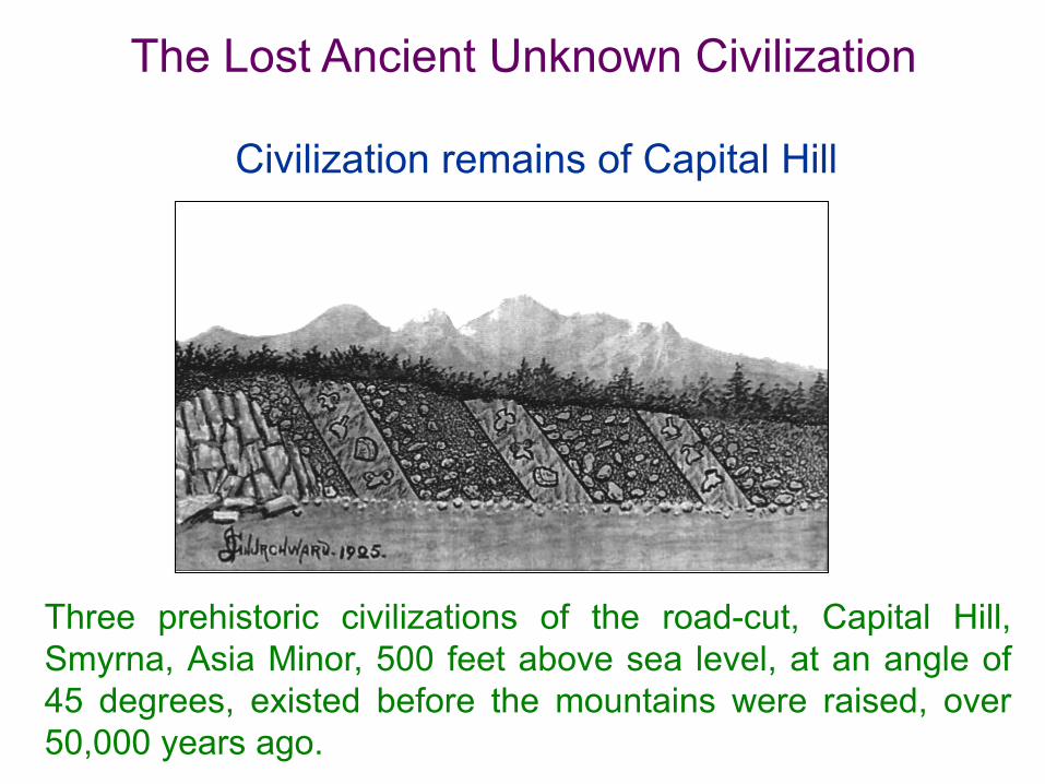
Three prehistoric civilizations of the road-cut, Capital Hill,Smyrna, Asia Minor, 500 feet above sea level, at an angle of45 degrees, existed before the mountains were raised, over50,000 years ago.
Civilization remains of Capital Hill
The Lost Ancient Unknown Civilization

Now 7,000 feet above the level of thesea, Mountains of 5,000 feet higher isintervening. Geologically, the lowestcity dates was in existence more than50,000 years ago.
Niven’s Mexican buried cities
An iron lance at Kushiro City of Japan was ancient unknown civilization There was an iron bar in aqueous
rock at the sea precipice of KushiroCity, Hokkaido in July of 1931. Theexpert investigated, it was the ironlance, about 1.67 m long originally.The aqueous rock was accumulatedin water must take several tenthousand years at least. In otherwords, if time appraised errorless,this iron lance was ancient unknowncivilization that already disappeared.

Mythology and legend rumor ancestor came after the cataclysm
Ethnologist points out: In more than 130 races of Indian inAmerica, mostly there are mythologies taking acataclysmic flood as the theme in all races. According tothe expert estimates, the known flood mythology andlegend are more than 500 in the entire world. Evenaboriginal in mountain area, nomadic people in desert andisland nationalities, including Austronesia language family,have the legends of global cataclysmic flood that destroysmost human, and the cataclysmic flood is all in northernhemisphere.
The reason why ancient civilization lost
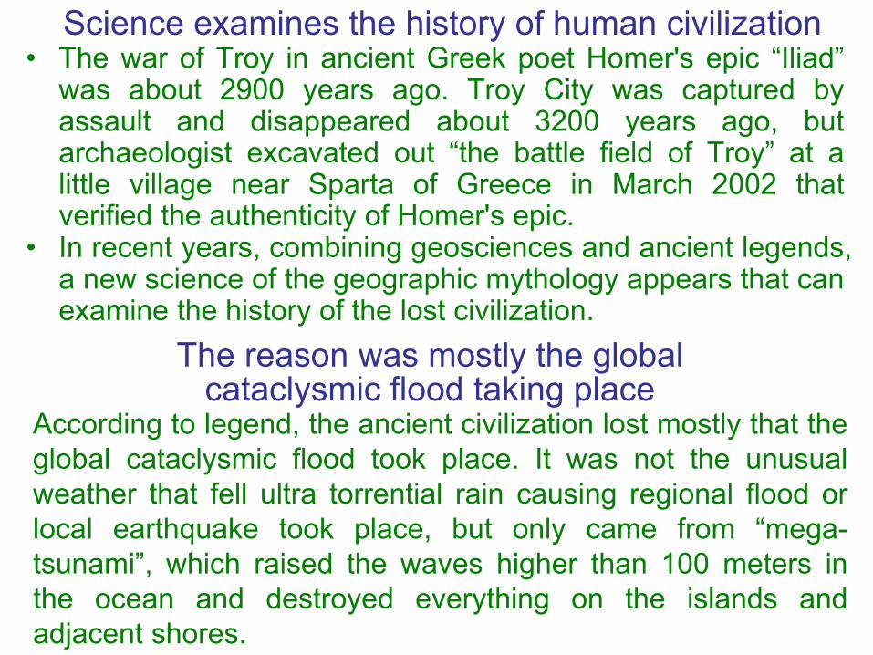
Science examines the history of human civilization • The war of Troy in ancient Greek poet Homer's epic “Iliad”
was about 2900 years ago. Troy City was captured byassault and disappeared about 3200 years ago, butarchaeologist excavated out “the battle field of Troy” at alittle village near Sparta of Greece in March 2002 thatverified the authenticity of Homer's epic.
• In recent years, combining geosciences and ancient legends,a new science of the geographic mythology appears that canexamine the history of the lost civilization.
The reason was mostly the global cataclysmic flood taking place
According to legend, the ancient civilization lost mostly that theglobal cataclysmic flood took place. It was not the unusualweather that fell ultra torrential rain causing regional flood orlocal earthquake took place, but only came from “mega-tsunami”, which raised the waves higher than 100 meters inthe ocean and destroyed everything on the islands andadjacent shores.

There are 2 kinds of the occurrence of mega-tsunami
1. The asteroid strikes the earth’s ocean.An asteroid struck and still added the Yucatan peninsulaopen waters earnestly 65 million years ago that causedthe mega-tsunami and climatic changed, therefore thedinosaur became extinct. But there was no earth markindicating the asteroid struck the ocean in near tenthousands year, so, the lost civilization was not destroyedby the asteroid.2. The flank failure of stratovolcano island.As 4th glacial period finished bringing the large-scalevolcanic eruptions of stratovolcano island and its flankfailure might cause the mega-tsunami.

The 4th glacial period of Europe began climatic change till now
The temperature change pursued 150,000 years ago.
End of glacial period caused eruption of huge volcano
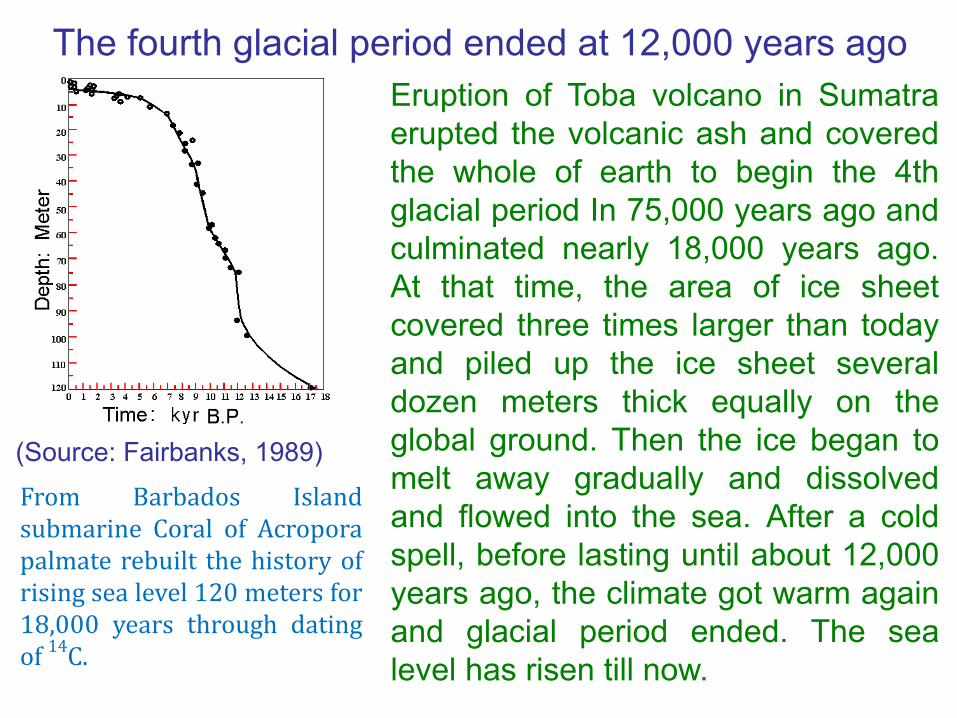
The fourth glacial period ended at 12,000 years ago Eruption of Toba volcano in Sumatraerupted the volcanic ash and coveredthe whole of earth to begin the 4thglacial period In 75,000 years ago andculminated nearly 18,000 years ago.At that time, the area of ice sheetcovered three times larger than todayand piled up the ice sheet severaldozen meters thick equally on theglobal ground. Then the ice began tomelt away gradually and dissolvedand flowed into the sea. After a coldspell, before lasting until about 12,000years ago, the climate got warm againand glacial period ended. The sealevel has risen till now.
From Barbados Islandsubmarine Coral of Acroporapalmate rebuilt the history ofrising sea level 120 meters for18,000 years through datingof 14C.
(Source: Fairbanks, 1989)
Sea level was low 120 meters in 4th glacial period
Some moisture formed the ice and snow, and wasintercepted on the land in the 4th glacial period, so, thesea level was lower than now about 120 meters. TheEurasian edge in west Pacific Ocean is a shelf, includingthe selves of Japan, East China Sea, Taiwan, South Sea,Ryukyu Archicontinent and Sunda Archicontinent, joiningtogether as a piece of continent of the shallow sea land.
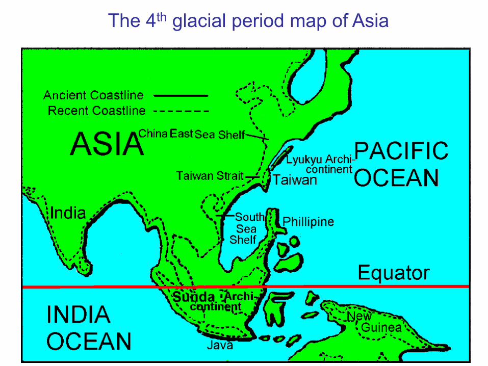
The 4th glacial period map of Asia

Earth's crust balance was destroyed producing the volcanic eruption
When low temperature reached the lowest point, icedlamination deeply and seriously loaded in the earth's crust butremained stable. When getting warm again after a cold spellabout 12,000 years ago, the glacier gradually vanished. Thestress balance was destroyed and adding the continentsshifting that producing the crack in the earth's crust, whichinitiated the magma rising from the cracks, and triggering thevolcanic eruption and strong earthquake.
The formation of volcanoesEach plate of crust extrudesin the plain of contact andmakes the earth's crustbreak. Then the magma inthe high-temperature mantleupwells from the crack,namely the volcanic eruptiontakes place.
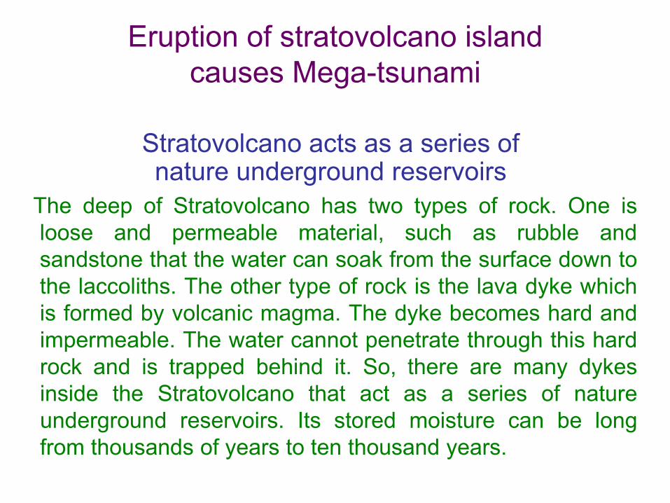
Stratovolcano acts as a series of nature underground reservoirs
The deep of Stratovolcano has two types of rock. One isloose and permeable material, such as rubble andsandstone that the water can soak from the surface down tothe laccoliths. The other type of rock is the lava dyke whichis formed by volcanic magma. The dyke becomes hard andimpermeable. The water cannot penetrate through this hardrock and is trapped behind it. So, there are many dykesinside the Stratovolcano that act as a series of natureunderground reservoirs. Its stored moisture can be longfrom thousands of years to ten thousand years.
Eruption of stratovolcano island causes Mega-tsunami
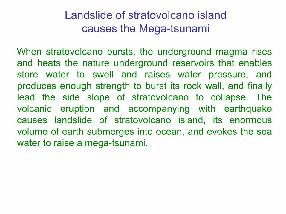
When stratovolcano bursts, the underground magma risesand heats the nature underground reservoirs that enablesstore water to swell and raises water pressure, andproduces enough strength to burst its rock wall, and finallylead the side slope of stratovolcano to collapse. Thevolcanic eruption and accompanying with earthquakecauses landslide of stratovolcano island, its enormousvolume of earth submerges into ocean, and evokes the seawater to raise a mega-tsunami.
Landslide of stratovolcano island causes the Mega-tsunami

Tsunami causes the human disaster The storms or the earthquakes evoke the waves, which aretoo high to usually exceed 15 meters, and wavelength doesnot exceed 100 meters. When the fault happens in the seafloor causing Tsunami, which attacks the coast, invades theinland and causes the human calamity. For example,Tsunami took place in the open waters of Sumatera at theend of 2004 that caused the death and missing of 295,000people in South Asia altogether.
Mega-tsunami causes human century calamities The wave height of Mega-tsunami is over 100 meters in thedeep sea, and wave length can be over one hundred-km-long. The long wave and high water wall can traverse bigocean of thousands of kilometers, and surge into the distantcoast. The tall and big water wall can go deep into dozens ofkilometers in the inland, and cause crushing destruction. Amega-tsunami will become a cataclysm on all the islandsand coastal land, and causes the human calamity.

Mega-tsunami has super force of destruction
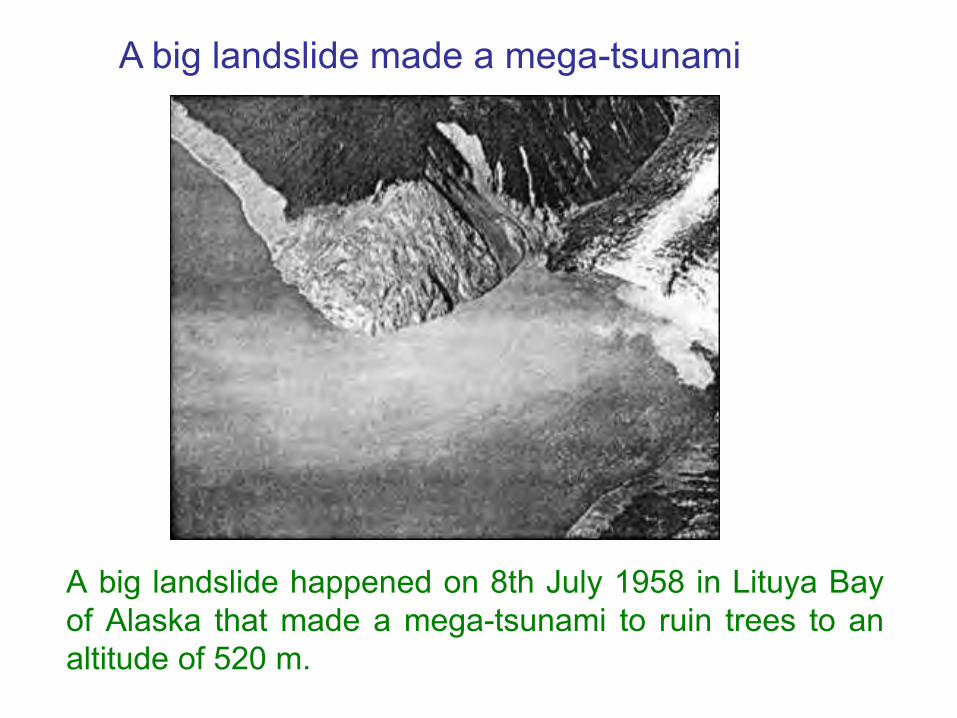
A big landslide happened on 8th July 1958 in Lituya Bayof Alaska that made a mega-tsunami to ruin trees to analtitude of 520 m.
A big landslide made a mega-tsunami

Volcano of Cumbre Vieja on La Palma Island may erupt
In west waters of Africa, volcano of Cumbre Vieja on LaPalma Island, belong to Canary Islands, may erupt;according to estimation, 500 km3 of earth and stone mayavalanche, and will cause a mega-tsunami, whose wavemay have several hundred meters high.

Mega-tsunami maycross the AtlanticOcean westwardswith 720 km/hour ofspeed, will reachthe east bank ofU.S.A. in eighthours.
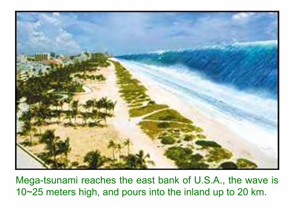
Mega-tsunami reaches the east bank of U.S.A., the wave is10~25 meters high, and pours into the inland up to 20 km.
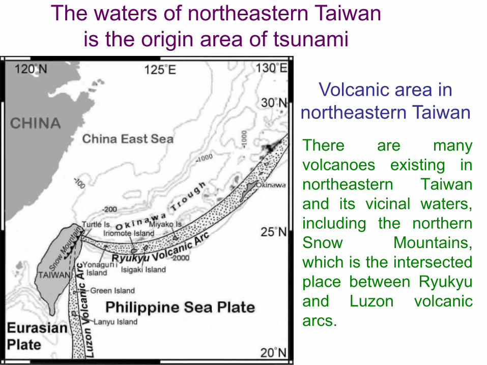
There are manyvolcanoes existing innortheastern Taiwanand its vicinal waters,including the northernSnow Mountains,which is the intersectedplace between Ryukyuand Luzon volcanicarcs.
Volcanic area in northeastern Taiwan
The waters of northeastern Taiwan is the origin area of tsunami
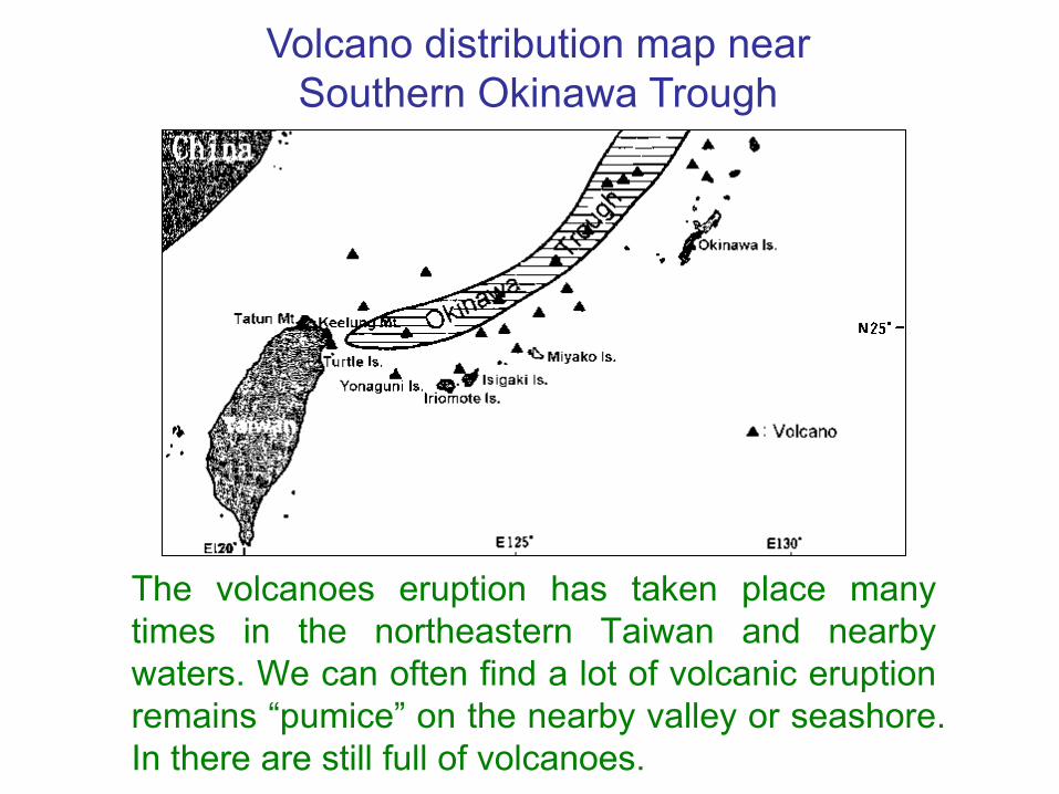
The volcanoes eruption has taken place manytimes in the northeastern Taiwan and nearbywaters. We can often find a lot of volcanic eruptionremains “pumice” on the nearby valley or seashore.In there are still full of volcanoes.
Volcano distribution map near Southern Okinawa Trough
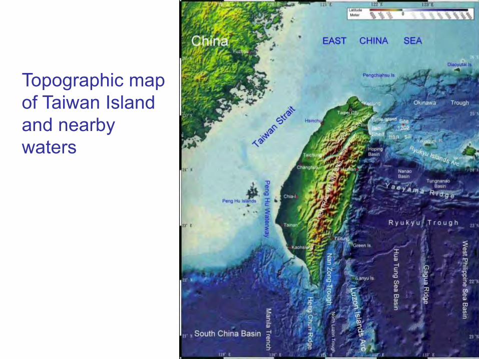
Topographic map of Taiwan Island and nearby waters

There are 60-70 volcanoes inthe seabed and at least 11are still active and 30-40nozzles of hot spring aroundthe active Turtle Island. Thisis a 4m-diameter, 6m-heightnozzle of hot spring, thebiggest one in the world. Thenorth segment of SnowMountains nearby TurtleIsland, there is the volcanoesin the past.
Around Turtle Island is still an active volcanic region

Tsunami is easy to take place in waters of northeastern Taiwan
In 2005, Professor Chao-Shing Lee and professor Yi-BenTsai point out that there are really many residues ofmagma cell still beneath the floor of waters ofnortheastern Taiwan, and submarine volcano group alllocates in the break and the fault of the sea floor, whichcontinue extending and spreading to the northeast cornerof Taiwan along the fault-zone and become the originarea of tsunami.
The records of tsunami at northeast of Taiwan• In about 1850 years, Chengkong of Taitung County
was attacked by the tsunami.• December 18, 1867, the heavy earthquake once took
place near Keelung Islet, caused tsunami, the wavewas up to eight meters, and took a death of severalhundred people that lead to the great calamity.
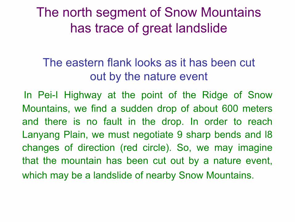
The north segment of Snow Mountains has trace of great landslide
The eastern flank looks as it has been cut out by the nature event
In Pei-I Highway at the point of the Ridge of SnowMountains, we find a sudden drop of about 600 metersand there is no fault in the drop. In order to reachLanyang Plain, we must negotiate 9 sharp bends and l8changes of direction (red circle). So, we may imaginethat the mountain has been cut out by a nature event,which may be a landslide of nearby Snow Mountains.
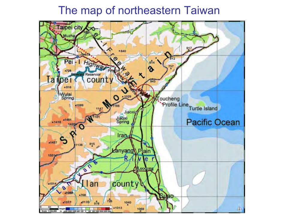
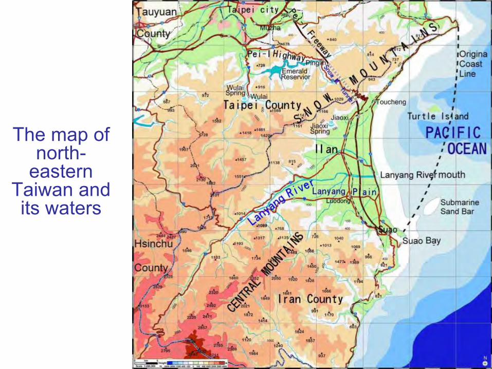
The map of northeastern Taiwan
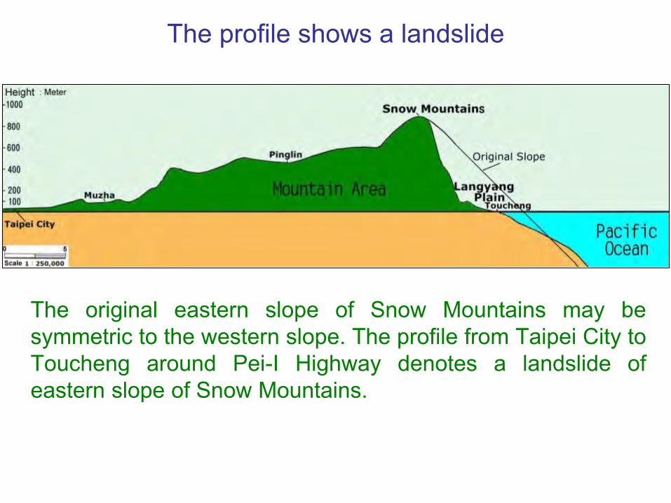
The original eastern slope of Snow Mountains may besymmetric to the western slope. The profile from Taipei City toToucheng around Pei-I Highway denotes a landslide ofeastern slope of Snow Mountains.
The profile shows a landslide
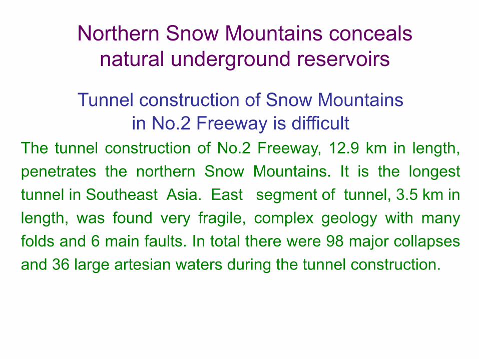
Northern Snow Mountains conceals natural underground reservoirs
Tunnel construction of Snow Mountains in No.2 Freeway is difficult
The tunnel construction of No.2 Freeway, 12.9 km in length,penetrates the northern Snow Mountains. It is the longesttunnel in Southeast Asia. East segment of tunnel, 3.5 km inlength, was found very fragile, complex geology with manyfolds and 6 main faults. In total there were 98 major collapsesand 36 large artesian waters during the tunnel construction.
Tunnel construction was difficult to treat the artesian water
The soil above the Snow Mountains tunnel is 700 meters thick;water pressure of the tunnel is very high. The worst problem ofthe tunnel construction of Snow Mountains was the largestartesian water in the world that yielded water up to a total of650 liter/sec and loss is more than 50,000 metric tons in oneday. It accompanied a large number of mudflows andlandsl ides that bur ied one construct ion machinery.
The artesian water of Snow Mountains is more than 8,000 years old
In September of 2004, National Expressway EngineeringBureau took the samples of the artesian water in the tunnel ofSnow Mountains, and sent to the University of Taiwan andAmerican Miami University to analyze its isotope data. Throughdating the result was as following:
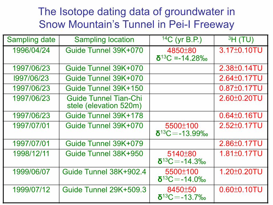
Sampling date Sampling location 14C (yr B.P.) 3H (TU)1996/04/24 Guide Tunnel 39K+070 4850±80
δ13C =-14.28‰3.17±0.10TU
1997/06/23 Guide Tunnel 39K+070 2.38±0.14TUl997/06/23 Guide Tunnel 39K+070 2.64±0.17TU1997/06/23 Guide Tunnel 39K+150 0.87±0.17TU1997/06/23 Guide Tunnel Tian-Chi
stele (elevation 520m)2.60±0.20TU
1997/06/23 Guide Tunnel 39K+178 0.64±0.16TU1997/07/01 Guide Tunnel 39K+070 5500±100
δ13C=-13.99‰2.52±0.17TU
1997/07/01 Guide Tunnel 39K+079 2.86±0.17TU1998/12/11 Guide Tunnel 38K+950 5140±80
δ13C=-14.3‰1.81±0.17TU
1999/06/07 Guide Tunnel 38K+902.4 5500±100δ13C=-14.0‰
1.20±0.20TU
1999/07/12 Guide Tunnel 29K+509.3 8450±50δ13C=-13.7‰
0.60±0.10TU
The Isotope dating data of groundwater in Snow Mountain’s Tunnel in Pei-I Freeway

Sampling date Sampling location 14C (yr B.P.) 3H (TU)1999/10/31 Guide Tunnel 38K+476.2 5510±100 0.70±0.l0TU1999/10/31 Guide Tunnel 29K+503 8600±130 0.60±0.10TU1999/12/26 Guide Tunnel 8K+409.3 6950±180 1.60±0.70TU1999/12/26 Guide Tunnel 9K+561.8 8230±110 0.90±0.20TU
There are natural undergroundReservoirs inside this mountain
The data of 14C isotope dating shows that groundwater inthe tunnel of Snow Mountains is more than 8,000 yr B.P.. 3Hisotope analysis determines a low limit of 1.0 TU thatindicates the old groundwater does not combine with newrainfall. It shows that there are “natural undergroundreservoirs” concealing the groundwater inside the northsegment of Snow Mountains, and It is difficult to flow out.

After digging the tunnel of Snow Mountains, the water ofnatural underground reservoirs lost during the drought in2003, and then more than 300 hectares of tea trees atPinlin just above the tunnel faded the half that neverhappened. It also indicates there are a series of naturalunderground reservoirs inside the northern SnowMountains.
Tea trees faded the half indicatedreservoirs inside Snow Mountains
The northern Snow Mountains is in the volcanic area,several hot springs still exist today in this area, the twomost famous are: Jiaoxi Spring on the east side andWulai Spring on the other side, and there are a series ofnatural underground reservoirs inside it that indicates itis a kind of stratovolcano, which inclines to collapse.
The northern Snow Mountains belongs to the stratovolcano
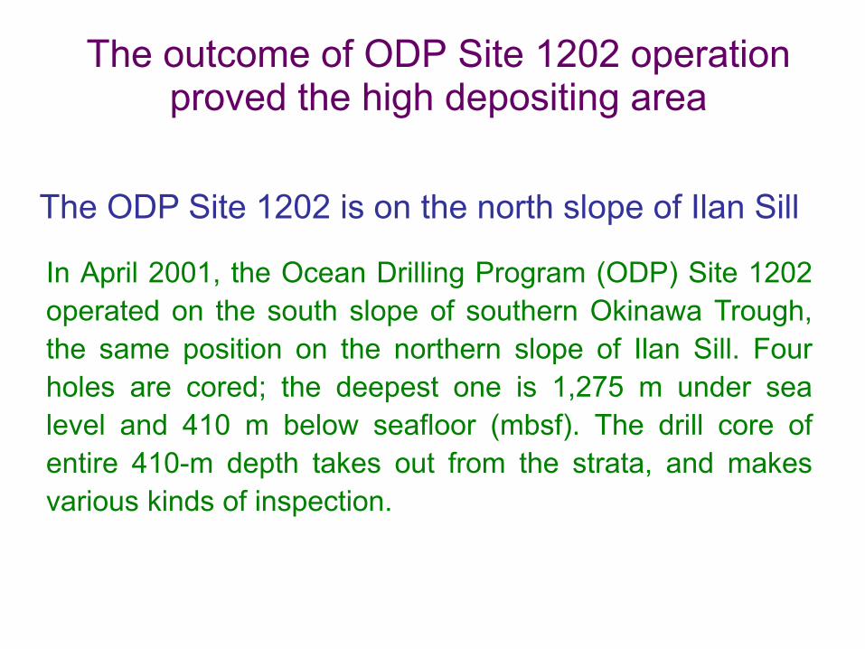
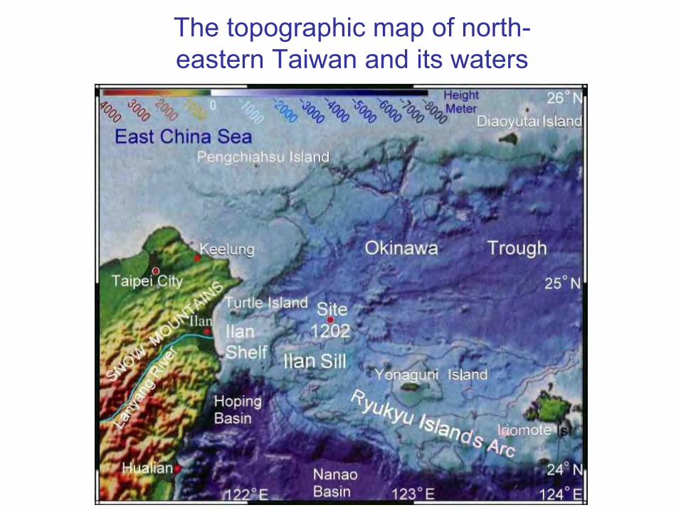
The outcome of ODP Site 1202 operationproved the high depositing area
In April 2001, the Ocean Drilling Program (ODP) Site 1202operated on the south slope of southern Okinawa Trough,the same position on the northern slope of Ilan Sill. Fourholes are cored; the deepest one is 1,275 m under sealevel and 410 m below seafloor (mbsf). The drill core ofentire 410-m depth takes out from the strata, and makesvarious kinds of inspection.
The ODP Site 1202 is on the north slope of Ilan Sill
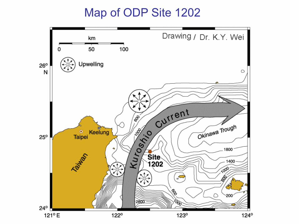
Map of ODP Site 1202
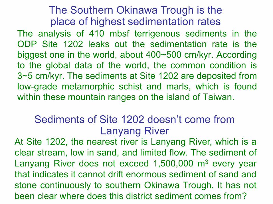
The analysis of 410 mbsf terrigenous sediments in theODP Site 1202 leaks out the sedimentation rate is thebiggest one in the world, about 400~500 cm/kyr. Accordingto the global data of the world, the common condition is3~5 cm/kyr. The sediments at Site 1202 are deposited fromlow-grade metamorphic schist and marls, which is foundwithin these mountain ranges on the island of Taiwan.
The Southern Okinawa Trough is theplace of highest sedimentation rates
At Site 1202, the nearest river is Lanyang River, which is aclear stream, low in sand, and limited flow. The sediment ofLanyang River does not exceed 1,500,000 m3 every yearthat indicates it cannot drift enormous sediment of sand andstone continuously to southern Okinawa Trough. It has notbeen clear where does this district sediment comes from?
Sediments of Site 1202 doesn’t come from Lanyang River

The outcome of ODP Site 1202 proved a big landslide from the volcanic eruptionVolcanic ash reveals nearby volcanic eruption
From the analysis of the drill core of ODP Site 1202, thereare a few volcano glass particle samples in it that showsonce nearby the eruption of volcanoes in the northsegment of Snow Mountains happened, and little part ofthe sediment mixed the volcanic ash.
The volcanoes eruption of SnowMountains cause a big landslide
Once the volcanoes of northern Snow Mountains erupted,the magma upwelled to heat the water of the naturalunderground reservoirs, and then raised the waterpressure and triggered the collapse, which created a biglandslide. The chain effect took place; whole an enormousvolume of earth rolled and fell that made the smoothcoastline to form the beautiful concave arc.

The original coastline of northeast corner of Taiwan was straight
The original coastline of northeast corner of Taiwanwas pushed and raised by Eurasia plate andPhilippine marine plate. So, it should spread fromthe coast of Hua-Tung straightly, through the east ofTurtle Island, until reaches Santiago, and presentswith the precipitous rocky coast.
The map of north-
eastern Taiwan and its waters

The original topographic map
Before landslide of Snow Mountains, the original topo-graphy of northeastern Taiwan should be the red line(contour line of -1000 m) and Black Current passedbetween Ryukyu Islands Arc and Taiwan Island.

Landslide spread into the ocean and formed Ilan Shelf and Ilan Sill
When the landslide happened, the enormous volume ofearth in eastern flank of Snow Mountains dropped intothe Pacific Ocean, and not only filled and led up theseafloor of more than 3,000 meters, but also spread outto form Ilan Shelf, Ilan Sill, and joined the Ryukyu IslandsArc. It also filled out the height of southern OkinawaTrough over thousands of meters that obstructed the flowof Black Current and compelled the flow to upwell.
The topographic map of north-eastern Taiwan and its waters

The big landslide of northern Snow Mountains caused a mega-tsunami
The enormous volume of earth droppedinto the Pacific Ocean
From the east flank of Snow Mountains to the originalcoastline of Ilan, the area is about 800 km2. After volcanoerupted and collapsed that lowered the average elevationabout 600 m; therefore, estimating the volume of earthabout 480 km3 dropped into the Pacific Ocean that causeda mega-tsunami.

• If Volcano of Cumbre Vieja in Canary Islands at the west ofAfrica erupts, estimating 500 km3 of earth and stone maylandslide and cause a wave height over several 100-meterof mega-tsunami.
• The background and environment in the northeast corner ofTaiwan is similar to Volcano of Cumbre Vieja in CanaryIslands. According to the volcano of Cumbre Vieja, thelandslide of Snow Mountains might cause a mega-tsunami,its wave might be over several 100-meter high that becamea worldwide cataclysm and the calamity of human.
Sediment at Site 1202 comes fromthe landslide of Snow Mountains
It is the only answer that the volcanoes of northern SnowMountains have erupted and triggered the big landslide of easthillside that produced the sediments of earth to ODP Site 1202.This big landslide may cause a mega-tsunami that becomes aworldwide cataclysm and the calamity of human.
Big landslide caused a mega-tsunami
The evidences of big landslide in geography and geology
From a viewpoint of geography Lanyang River is a new one
There is very little evidence of thick submarine fans andmajor slope deformation features in the mouth of LanyangRiver, and around it the seashore line and the contour linesbeneath the sea level are very straight and smooth thatshows the river doesn’t deposit the obvious sediments andindicates it is a young river.
Suao Bay was once Lanyang River mouthThere are two nature prominent embankments beside SuaoBay, and all the contour lines bulge out from it at theinfluence of Black Current northwards, and there are severalsand bars outside Suao Bay, including a submarine ellipticsand bar about more than 2.5 km long, indicating that theLanyang River once has flowed out from Suao Bay sincelong time ago.

Topographic map of Lanyang River
Lanyang Plain wasn't formed from alluvium of Lanyang River
Lanyang Plain is a vast triangular plain, about 800 km2, butLanyang River is only a clear stream, which is 75 km in length,low in sand and limited flow. The amount of depositingsediments in Lanyang River is only about 8 million metric tonsevery year that can not be the sources of earth in LanyangPlain. How did the vast triangular Lanyang Plain form?
Lanyang River changed its course proved landslide of Snow Mountains
The great change of Lanyang River course should come froma big landslide of northern Snow Mountain in the east hillside.The place of landslide formed Lanyang Plain directly. Thegreat amount of earth and stone sank into the sea, and thenthere was no obstructer to make a turn to Suao Bay. So, itpour into the sea directly, and formed the new Lanyang Rivercourse and a new river mouth that proved the fact of biglandslide once took place in northern Snow Mountains.
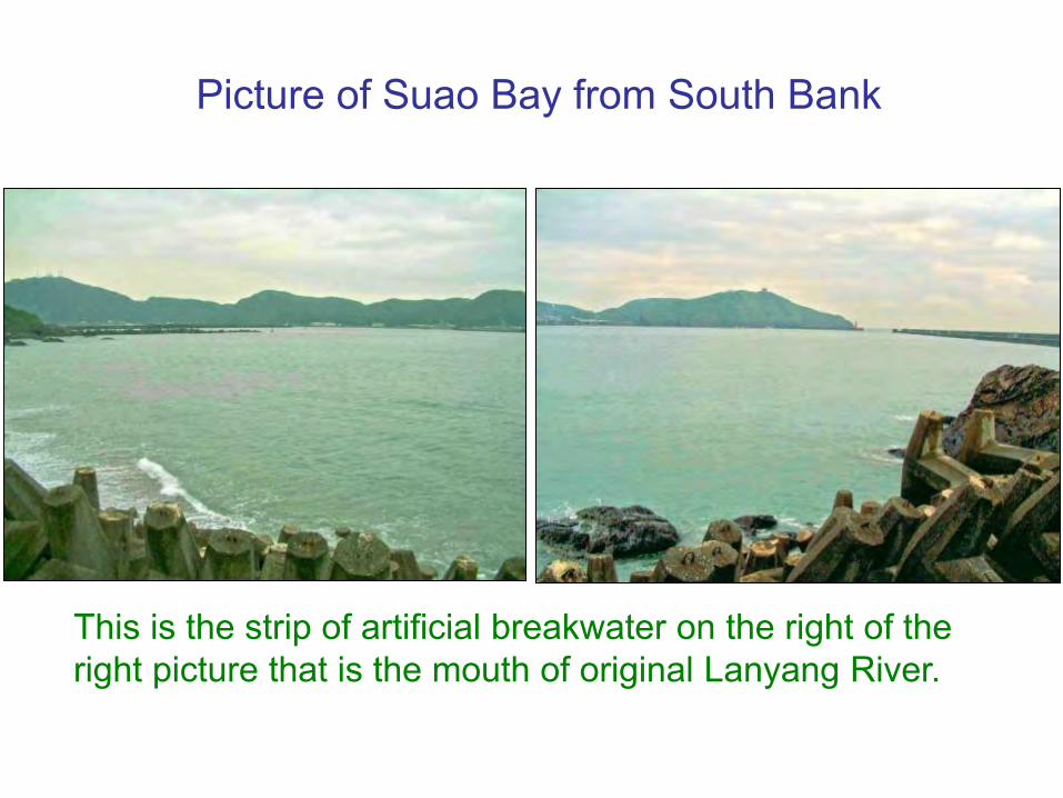
Picture of Suao Bay from South Bank
This is the strip of artificial breakwater on the right of the right picture that is the mouth of original Lanyang River.
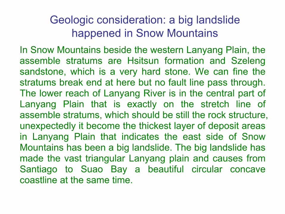
In Snow Mountains beside the western Lanyang Plain, theassemble stratums are Hsitsun formation and Szelengsandstone, which is a very hard stone. We can fine thestratums break end at here but no fault line pass through.The lower reach of Lanyang River is in the central part ofLanyang Plain that is exactly on the stretch line ofassemble stratums, which should be still the rock structure,unexpectedly it become the thickest layer of deposit areasin Lanyang Plain that indicates the east side of SnowMountains has been a big landslide. The big landslide hasmade the vast triangular Lanyang plain and causes fromSantiago to Suao Bay a beautiful circular concavecoastline at the same time.
Geologic consideration: a big landslide happened in Snow Mountains

Geologic Map of North-eastern Taiwan
In the red circle, the stratums break end.
Great change removed mountain and sea in the northeastern Taiwan
The great change of Lanyang River course should come froma big landslide of northern Snow Mountain. The great amountof earth and stone sank into the sea, and then there was noobstructer to make a turn to Suao Bay. So, it pour into the seadirectly, and formed the new Lanyang River course and a newriver mouth that proved the fact of big landslide once tookplace in northern Snow Mountains.
The sediment of Site 1202 was formed from the landslide of Snow Mountains
• Some geologists think that the Ryukyu Islands Arcexpands to the west to touch Taiwan Island. If it is so, thedeep sediments of Site 1202 should not be the same asthe composition of mountains in Taiwan.
• The terrain drops eastwards from Lanyang Plain to IlanShelf, Ilan Sill, and reaches to the south of Yonaguni Islandall the way that shows the sediments at Site 1202 wassupplied from the landslide of Snow Mountains.

From the outcomes of analysis terrigenous sediments atODP Site 1202 express time interval as following:
From the terrigenous sediments the depletion of heavy oxygen isotope began and lasted to
17 kyr~8 kyr
C/N ratio and CaCO3 content of the bulk sediments in the smaller than 63 micron fraction suggested terrestrial source contributed significantly during the period
25 kyr~11 kyr
A reversal of oxygen isotopic values to more positive values suggested
11.6 kyr~11.1 kyr
The average time is about 12,000 years B.P..
When did landslide happen ?
Time that human ancient civilization was destroyed
Japan's oldest ancestor disappeared about 18,000 years ago
Minatokawajin, Japan's oldest ancestor disappeared onOkinawa Island of Ryukyu about 18,000 years ago, and thenno cultural remain appeared after 10,000 years. From thelegend it was destroyed because of flooding the ancient landof Ryukyu in cataclysm. A lot of nationalities of all partssurrounded the Pacific Ocean, including Taiwaneseaboriginals, it was said their ancestors survived after thecataclysm wreaked havoc.
The land of Mu lost about 12,000 years agoAccording to extinction times of first man of Japan anddating times of the drill core at DOP Site 1202, and theend times of the fourth glacial period, infer mega-tsunami happened about 12,000 years ago, it isidentical to sink in times with the land of Mu.
What’s the time of ancientcivilization being destroyed?
From the outcomes of analysis terrigenous sediment atSite 1202, the average time is about 12,000 yearsbefore present. The time interval coincides with themega-tsunami. When the 4th glacial period ended inthis time and the first people in Japan on OkinawaIsland was about 18 kyr BP, briefly the mega-tsunamihappened about 12,000 years ago.

In the world, there are 2 earliest civilization lands: Muand Atlantis. According to the legends both landshave lost already about 12,000 years ago.
The lost continents of earliest civilization in the world
There are 2 earliest civilized continents have already disappeared

The Greek philosopher Plato’s “Dialogues” described: Atlantis was in the Atlantic Ocean.
The lost first civilized continent in the world──Atlantis
Plato The map of Atlantis

The source of Atlantis
2400 years ago, Plato’s “Dialogues” is the recordgiving an oral account of Atlantis from Greek poetSolon, among them there are two:
“Timaeus” described a brief introduction to Atlantis, apreface. The majority of the writing actually deals witha description of the creation of the world andexplanation of natural phenomena.
“Critias” provides a detailed description of the lost islandand its people as well as information about the ancientAthenians.

The Empire of AtlantisAccording to “Dialogues”, the big island of Atlantis lay in thecenter of the Atlantic Ocean in ancient times. The KingPoseidon cut the island apart into ten to rule each on theisland for five pairs of twins' son. The plain is cut apart into90,000 regions; there are commanding officers in each region.The Empire had 1,200,000 soldiers, by means of the fightgroup forced to advocate Atlantis culture. Every place thatbelieved in the god of the Sun may be the colony of Atlantis.
The high civilization of Atlantis Empire Atlantis was under the democratic system; all legal clauseswere all carved on orichalcum post of the temple of Poseidonthat became the law with main royal power. The peoplecontinued to have prosperity and richness, and were verygentle, wise and able, but wouldn’t wallow in the millionaire.Everything is one with the morals. There was exquisitebuilding technology and other high civilization.

There are double-deck ringland and three ring canalsall around in CapitalPoseidonia, 9 km from theseashore. Acropolis in themiddle of the island, thereis the Royal Palace andthe magnificent shrine ofPoseidon, the tutelary godpeople offer sacrifice to.
Capital of Atlantis - Poseidonia
The imagination of Capital Poseidonia

Degeneration of Atlantis Empire For generations the Atlanteans lived simple, virtuous lives.But slowly they began to change. Greed and power beganto corrupt them. They lighted the ambition to conquer theworld. The army of the Empire crossed the Straits ofGibraltar and attacked Europe; having suffered defeat inGreece at last, the tendency of Empire began to go down.
Disappearance of AtlantisAbout 12,000 years ago, heavy earthquake and flood tookplace in succession afterwards, among a day and night,the island of Atlantis, its people and its memory wereswallowed by the sea and disappeared.

Searching having no Atlantis According to Plato’s “Dialogue”, Atlantis is a country on abig island in the Atlantic Ocean. Though all the time andall parts of the world find there are a lot of reports inAtlantis site, but there is not any one yet can be accepted.From ancient times to the present, there is not anyevidence indeed discovering it in the Atlantic Ocean orother areas yet. The geologists surveyed the AtlanticOcean and pointed out the sea floor area rose in fact, notlike the land one that Atlantis sank, so they denied thestatement with Atlantis in the Atlantic Ocean.
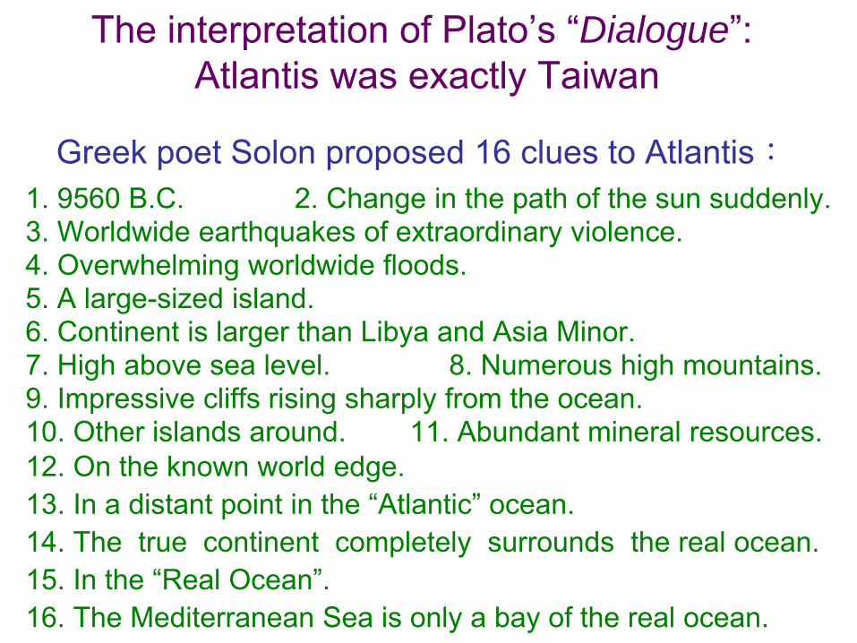
The interpretation of Plato’s “Dialogue”:Atlantis was exactly Taiwan
Greek poet Solon proposed 16 clues to Atlantis:1. 9560 B.C. 2. Change in the path of the sun suddenly. 3. Worldwide earthquakes of extraordinary violence.4. Overwhelming worldwide floods. 5. A large-sized island. 6. Continent is larger than Libya and Asia Minor. 7. High above sea level. 8. Numerous high mountains.9. Impressive cliffs rising sharply from the ocean.10. Other islands around. 11. Abundant mineral resources.12. On the known world edge. 13. In a distant point in the “Atlantic” ocean. 14. The true continent completely surrounds the real ocean. 15. In the “Real Ocean”.16. The Mediterranean Sea is only a bay of the real ocean.
• Item 1: This time corresponded with the volcanic eruptionof the northern Snow Mountain in Taiwan that producedlandslide and caused mega-tsunami to destroy theEmpire of the Sun about 12,000 years ago that was inconformity with the clue of Solon: 9560 B.C.
• Item 2: A comet fell on the earth 12,900 years ago thatcaused a millennium of Younger Dryas. The time wassimilar to the clue of Solon: Change in the path of the sunsuddenly. Actually the path of the Earth doesn’t change.
• Item 3 and 4: The volcanic eruption took place at thenortheast corner of Taiwan with the crushing earthquakeand following incident of mega-tsunami that was inconformity with the clue of Solon.
• Item 5: Taiwan is a large-scale island, in conformity withclue of Solon.
16 clues of Solon are in conformity with environment of Taiwan
• Item 6: Atlantis is a large island of the huge area, and themodern scientist confirms that this large island neverexists in the Atlantic Ocean. When Colombo found theNew World in 1492, the explorers thought vast Americawas Atlantis. According to the book of “The lost Continentof Mu” describes, America is the colony ruled by acivilization country of Empire of the Sun in 12,000 yearsago. The army attacked Greece of Europe should comefrom the Empire of the Sun. But the Empire of the Sunshould be disappearance in Taiwan.
• Item 7 and 8: Taiwan is a large-scale island. Its mountainregion accounts for 2/3 of area, and there are more than200 mountains over 3,000 meters high that is certainly inconformity with the clues of Solon.
• Item 9: The east coast of Taiwan appears above the seadue to the earth's plate is pushed and is all precipitouscliffs, towered on the seashore of the Pacific Ocean that isin conformity with the clue.

• Item 10: Taiwan is a massif, locating between land-massand marine-mass of the Earth, and also lying in the middleof the north and south archipelagoes, there are a lot ofislands around it, including Penghu, Ryukyu, Kyushu andLuzon that are in conformity with the clue of Solon.
• Item 11: There are fertile mineral products in Taiwan, forexample: the ores of gold, silver, copper and iron in theYanliao gulf, the sulphur ore at Peitou, and the jade ore atFengtian that is in conformity with the clue of Solon.
• Item 12: “Known world” refers to old mainland that is to sayEurasia. Taiwan locates on the edge of Eurasia that is inconformity with the clue of Solon.
• Item 13: In the era of Solon, people did not know that therewas American existence, only knew that there was vast andboundless Atlantic Ocean in the west of the Strait ofGibraltar, therefore, America and the Pacific Ocean becamea part of the Atlantic Ocean.
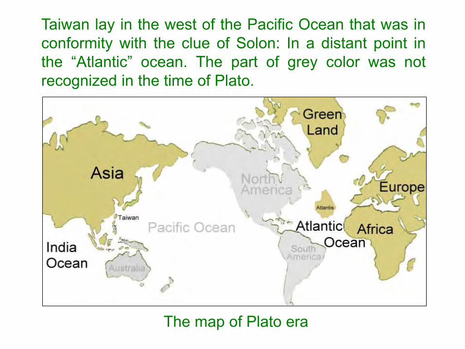
The map of Plato era
Taiwan lay in the west of the Pacific Ocean that was inconformity with the clue of Solon: In a distant point inthe “Atlantic” ocean. The part of grey color was notrecognized in the time of Plato.

• Item 14: In the glacier period, the Strait of Beringbetween Eurasia and America was covered with the iceand snow, so the both continents linked together into a'True Continent', just completely surrounded 'RealOcean' ── the Pacific Ocean only, and there was noTrue Continent to surround the Atlantic Ocean. Accordingto the clue of Solon, Real Ocean is the Pacific Ocean.

• Item 15: According to Solon’s clue, ‘Real Ocean' is thePacific Ocean, but not the Atlantic Ocean; Taiwan is inthe Pacific Ocean that is in conformity with Solon’s clue.
• Item 16: According to item 13th, as Solon knew 'RealOcean' that was the Atlantic Ocean only, so theMediterranean Sea is only a statement of a piece of bayof Real Ocean. After Colombo found America, the NewWorld, in fact the Real Ocean should be corrected fromthe Atlantic Ocean to the Pacific Ocean, and Taiwan is inthe Pacific Ocean of Real Ocean.
Solon offered the above 16 Atlantis clues that all had thefoundations at that time. According to the moderncomments, these clues are in conformity with theenvironment and condition of Taiwan, therefore we candraw the inference: 'Atlantis was ancient Taiwan Island'.

Ancient Taiwan had the Characters of Atlantis
• 1.Geographical condition and growth environmentof Taiwan are in conformity with Atlantis.
• 2. Once there were a great number of elephantsin Taiwan.
• 3. The wild buffalo of ancient Taiwan exited ineverywhere.
• 4. Antilia that Atlantis remained was Taiwan.

1. Geographical condition and growth environ-ment of Taiwan are in conformity with Atlantis
• On the island of Atlantis, Plato narrated that there were thecliffy coast and high mountains and lofty peaks stretching toevery where, and there were grass and trees growingprosperity in broad beautiful plain, and abounded with marsh,rivers and creeks, and also abounded with various plantsand animals. In there the climate was such that two harvestswere possible each year.
• Taiwan Island appearing in the sea is from the Philippinemarine plate and Eurasia plate pushing each other. Thecoast of the east of Taiwan is all precipitous cliffs. In there2/3 land are mountain regions, and more than 200mountains are more than 3,000 meters in height, and highmountains and lofty peaks stretch to every where. Theplains abound with rivers, creeks and marsh. it are the grassand trees that grow prosperity, and the animals are various,biodiversity is 400 times of averages of other countries.
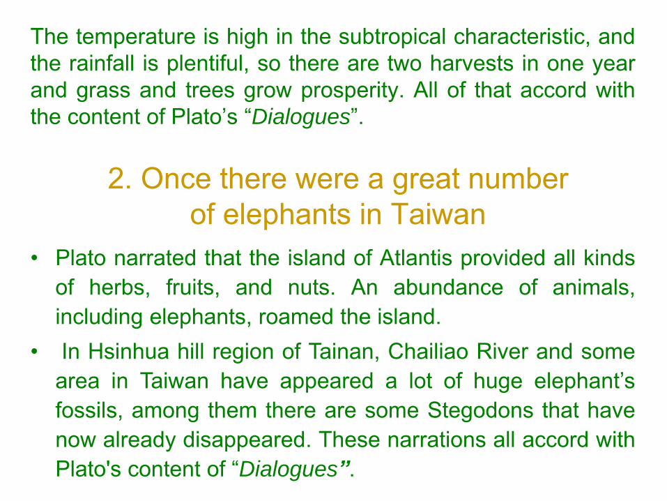
The temperature is high in the subtropical characteristic, andthe rainfall is plentiful, so there are two harvests in one yearand grass and trees grow prosperity. All of that accord withthe content of Plato’s “Dialogues”.
2. Once there were a great number of elephants in Taiwan
• Plato narrated that the island of Atlantis provided all kindsof herbs, fruits, and nuts. An abundance of animals,including elephants, roamed the island.
• In Hsinhua hill region of Tainan, Chailiao River and somearea in Taiwan have appeared a lot of huge elephant’sfossils, among them there are some Stegodons that havenow already disappeared. These narrations all accord withPlato's content of “Dialogues”.
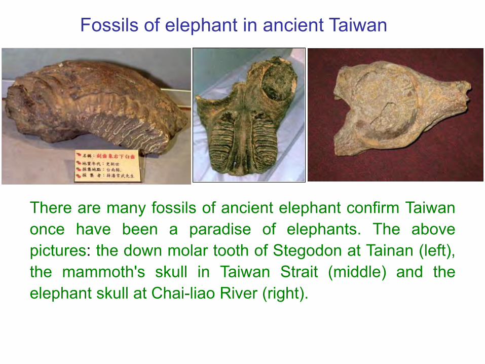
There are many fossils of ancient elephant confirm Taiwanonce have been a paradise of elephants. The abovepictures: the down molar tooth of Stegodon at Tainan (left),the mammoth's skull in Taiwan Strait (middle) and theelephant skull at Chai-liao River (right).
Fossils of elephant in ancient Taiwan

Lian-Jie Wang, the expert of fossil, reserves about70,000~80,000 pieces of Taiwan’s fossil. These arefossils of elephant's molar (left) and the incomplete fossilsof ivory and elephant's vertebra (right) that Lian-Jie Wangkeeps.

3. The wild buffalo of ancient Taiwan exited in everywhere
• Plato narrated that among ten kings of Atlantis, they hada kind of dangerous game to capture the buffalo l withstaves and nooses, and cut its throat, and then itbecame sacrificial offering.
• Taiwan was once the living place of wild buffalo,fishermen had salvaged two kinds of fossils of BubalusTeilhardi and Bubalus Youngi in Peng-Fu Trench.Bovidae fossil has been excavated too in places suchas Zuo-Zhen and Guan-Miao of Tainan County, etc.,especially Chailiao River of Tainan County has beenexcavated a lot. The mostly fossils was at the middlePleistocene Epoch. This characteristic correspondedwith Plato’s Atlantis.

Fossils of wild buffalo in ancient Taiwan
Fossils of skull (left) and lower jaw (right) of wild buffalo inTaiwan. These fossils compare with recently born buffalo'slower jaw (above light color).
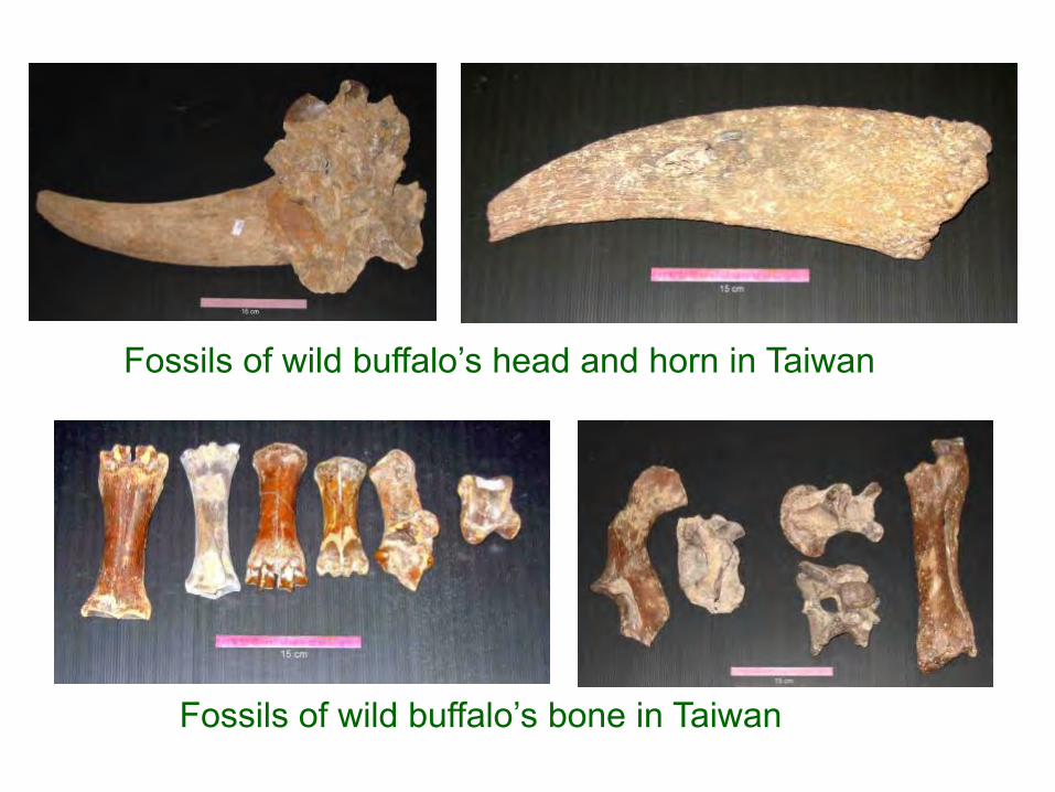
Fossils of wild buffalo’s head and horn in Taiwan
Fossils of wild buffalo’s bone in Taiwan
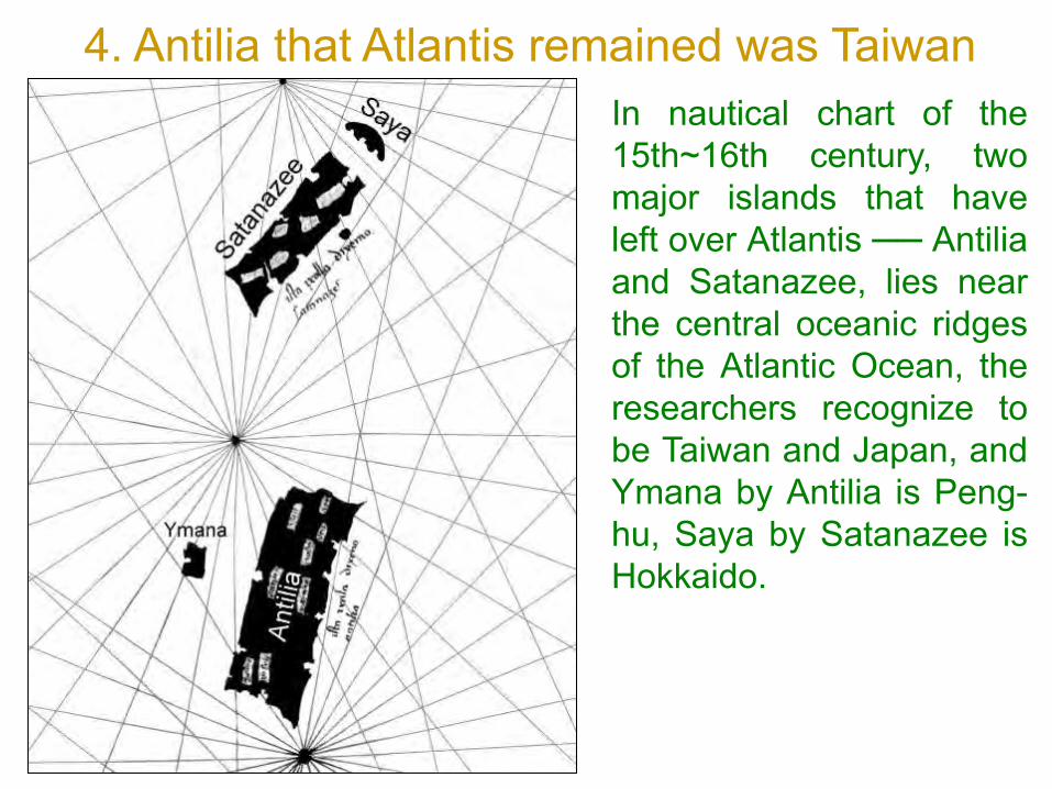
4. Antilia that Atlantis remained was TaiwanIn nautical chart of the15th~16th century, twomajor islands that haveleft over Atlantis ── Antiliaand Satanazee, lies nearthe central oceanic ridgesof the Atlantic Ocean, theresearchers recognize tobe Taiwan and Japan, andYmana by Antilia is Peng-hu, Saya by Satanazee isHokkaido.
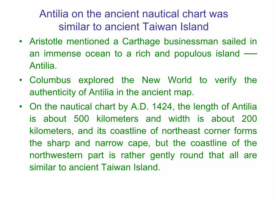
Antilia on the ancient nautical chart was similar to ancient Taiwan Island
• Aristotle mentioned a Carthage businessman sailed inan immense ocean to a rich and populous island ──Antilia.
• Columbus explored the New World to verify theauthenticity of Antilia in the ancient map.
• On the nautical chart by A.D. 1424, the length of Antiliais about 500 kilometers and width is about 200kilometers, and its coastline of northeast corner formsthe sharp and narrow cape, but the coastline of thenorthwestern part is rather gently round that all aresimilar to ancient Taiwan Island.

Scientist's textual research Antilia was Taiwan Island
In 1995 South University of Florida professor RobertFuson’s “Legendary Islands of the Ocean Sea” unveiled atextual research of Antilia. According to its 4 arguments:size and form, main river mouth, five major rivers andcharacteristic of ocean coastline, and sand gold held instore and a lot of western islands was Peng-Fu Islands.He took a conclusion: Antilia, lying in real ocean, in factwas seen for the first time in the Pacific Ocean island ofthe western map ── Taiwan. So Fuson asserted Antiliathat Atlantis remained was Taiwan Island.
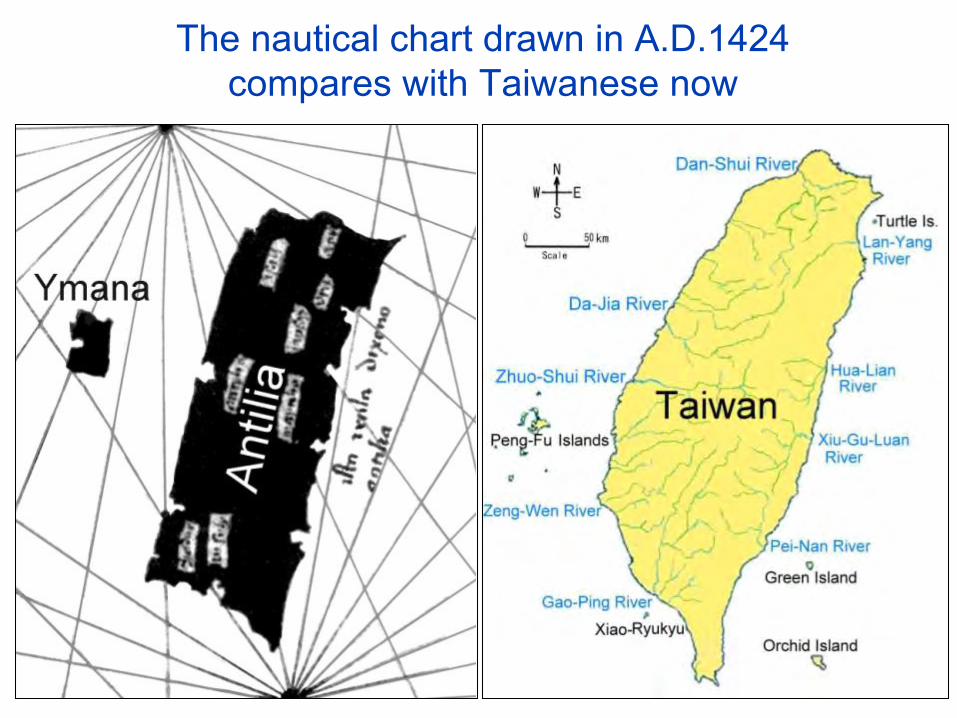
The nautical chart drawn in A.D.1424 compares with Taiwanese now

The Capital site of the Empire of Atlantis should be near Suao Bay
• 1. Building materials of 3 color stone in Capitalcan be found near Suao.
• 2. Cold spring and hot spring in the Capital thathave near Suao too.
• 3. The ancient wood carving pattern of Taiwan issimilar to ring canal in the Capital.
1. Building materials of 3 color stone in Capital can be found near Suao.
• According to “Dialogues”, stone was white, black and red atPoseidon. Stone was excavated from center island and landrings to form covered docking areas.
• The most general colors of marble are white and black, itsreserves in the eastern Taiwan are abundant that start fromSuao in the north and stretch to Taitung long than 200kilometers. Other stone is red Rose Stone, produced in theriverbed of Liwu River, south of Suao nearby.
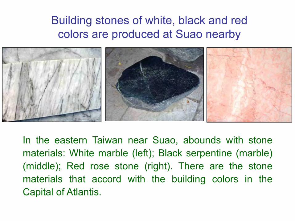
Building stones of white, black and red colors are produced at Suao nearby
In the eastern Taiwan near Suao, abounds with stonematerials: White marble (left); Black serpentine (marble)(middle); Red rose stone (right). There are the stonematerials that accord with the building colors in theCapital of Atlantis.
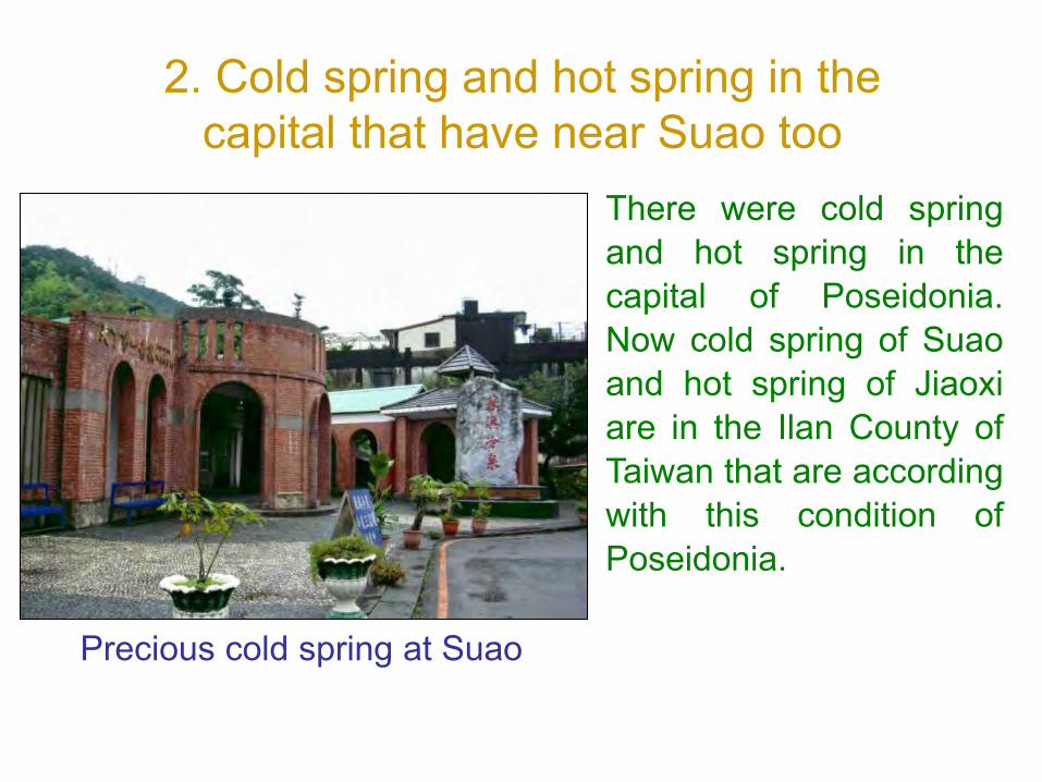
2. Cold spring and hot spring in the capital that have near Suao too
There were cold springand hot spring in thecapital of Poseidonia.Now cold spring of Suaoand hot spring of Jiaoxiare in the Ilan County ofTaiwan that are accordingwith this condition ofPoseidonia.
Precious cold spring at Suao

Ancient wood carving of Ketagalan
In ancient time the Capital of the Empire of Atlantis wasin Ilan, where lived the earliest aboriginal of Kavalan.Ketagalan and Kavalan call themselves the brother'sfriendship now; so, the two should be the directdescendants of the people of Atlantis. There are a capitalfigure and spotted deer in the ancient wood carving ofTaiwanese aboriginal Ketagalan.
3. The ancient wood carving pattern of Taiwan is similar to ring canal in the Capital

Taiwan is the lost civilization land
The imagining figure (left) of Atlantis’ capital, Poseidonia,is similar to ancient wood carving (right) of Ketagalanthat reveals Taiwan is the lost civilization land ──Atlantis.
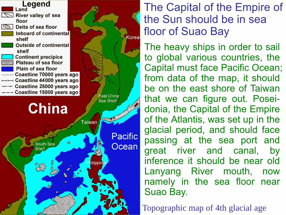
The heavy ships in order to sailto global various countries, theCapital must face Pacific Ocean;from data of the map, it shouldbe on the east shore of Taiwanthat we can figure out. Posei-donia, the Capital of the Empireof the Atlantis, was set up in theglacial period, and should facepassing at the sea port andgreat river and canal, byinference it should be near oldLanyang River mouth, nownamely in the sea floor nearSuao Bay.Topographic map of 4th glacial age
The Capital of the Empire of the Sun should be in sea floor of Suao Bay

Poseidonia, the Capital of Atlantis, should be in the sea floor of Suao Bay.
The Map of original Lanyang River

The army attacking Greece should come from the Empire of the Sun
• The army team that attacked Greece at ancient timescame from Atlantis, the west of the Strait of Gibraltarin the Atlantic Ocean. But the scientist thinks, there isno such continent in the Atlantic Ocean able tocomparable to the sum of Libya and Asia. Theboundless continent was only the New World ofAmerica that nobody knew at that time.
• There was Mayax Empire in America at that time thatwas the colony of the Empire of the Sun, so the armyshould come from the Empire of the Sun. If we shouldfurther understand Plato's Atlantis that need exploringfrom the Empire of the Sun in the land of Mu.

Churchward found the Naacal tablets,the interesting symbols and vignettes,in the Indian temple in 1868, and heresearched and finally deciphered itsmeaning after 2 years. Then hesearched for tablets of remains andancient books around the world, andinvestigated a lot of ancient remains inthe world.
The other lost first civilized continent in the world ── the land of Mu
The Source of the land of Mu
British: JamesChurchward

Naacal tablets in India
The data of “the lost continent of Mu”
Churchward searched the data ofancient book, including: Maya’s ParisCodex, Cortesianus Codex, DresdenCodex and Troano Manuscript, IndianEpic of Lamayana, Egyptian Book ofthe Death and Tibetan Lhasa Record.Then he wrote “The lost continent ofMu” after 50 years to introduce theland of Mu, which lost at 12,000 yearsago. The book was attracted attentionby common people. Churchwardunderstood the existence of ancientLand of Mu in view of the Naacaltablets.

The Empire of the Sun was in the land of Mu Churchward located the Land of Mu
• When Churchward traveled the South Ocean Islands fora month, then from the locations of prehistoric megalithiccivilization where he found drew the map of Mu, whichwas a lost continent in the middle of Pacific Ocean.
• The Domain of Mu extended from somewhere north ofHawaii to the southeast of Easter Island, southwest ofTonga-Tabu, and to the northwest of the Ladrones. Itwas over 8,000 km from east to west, and from north tosouth over 5,000 km. It was a boundless land.
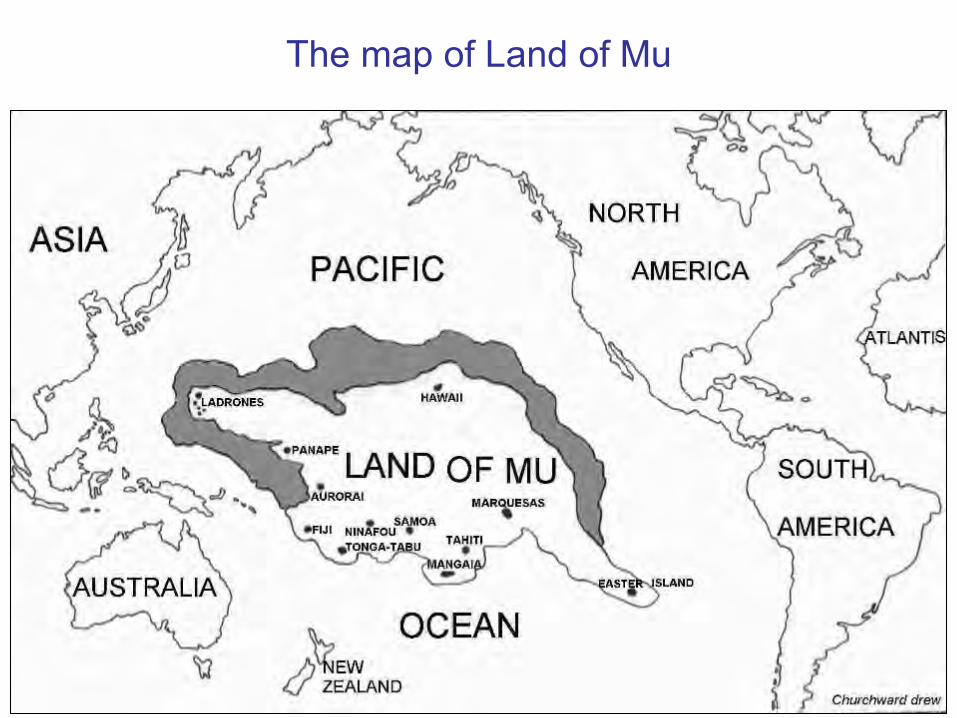
The map of Land of Mu

Churchward’s Description of Mu
Long long ago, there was a great civilized Empire of theSun in the land of Mu, the Motherland of Man, in thePacific Ocean. The Empire ruled the earth, hadpossession of huge temple and 7 beautiful cities. Theirpeople lived with free and unrestrained under the shinysun. The emperor named “La Mu”, and “La” means theSun, “Mu” Means the mother. The civilization of Mudates back more than 50,000 years ago.

Society of the Empire of the Sun La Mu, the Emperor, managed all thing,politics and religion at the RoyalPalace of the Capital. The peopleorganized by ten races, and therewere 64 million people in all; and theleading right of culture was had bywhite race. It was a matriarchalsociety and religion had only one,worshiped the God of Sun, andworshiped the Creator of Universe ──the seven-headed serpent “Narayana”.
The Great Creator——Narayana

The people of the Empire of the Sun emigrated abroad to establish colonies
• One Group of Karas sailed for east to get to MiddleAmerica, and extended to North America and SouthAmerica to establish the colony of Mayax Empire.
• One Group of Nagas sailed for west to get to Burma,and extended to India, Middle Asia and MiddleEurope to establish a colony of Naga Empire.
• One Group of Uighurs sailed for west to get to China,and extended to Mongolia, Eastern Europe andSiberia to establish a colony of Uighur Empire.

The line of colonization from the land of Mu to the entire world
The Destruction of Mu According to Churchward’s description, about 12,000years ago a great catastrophe struck the whole land ofMu. The beginning from the capital, rumblings from thebowels of the earth, followed by earthquakes and volcanicoutbursts. The volcanoes belched out their fire, smokeand lava. A thick black pall of smoke overshadowed theland. The land heaved and rolled like the ocean’s waves,and trembled and shook like the leaves of a tree in astorm. Then huge cataclysmic waves from all sides camerolling in over the land. The cities, forests, people andanimals all were engulfed. Finally, the land of Mu sankinto the ocean and disappeared.

Temples and palaces of Mu came crashing to the groundand monuments and statues were overturned. The citiesbecame heaps of ruins.
A volcanic catastrophe

A volcanic cataclysm
Such as completed the destruction of the Maya edificesin Yucatan, after the earthquakes had shaken them totheir foundation. The Yucatan Mayas—the builders—were virtually wiped out, 9500 B. C.

After the submersion of Mu
After the mega-tsunami, this figure showed the Empireof the Sun was destroyed, and left disused hilltops andalarmed people of Mu.

The other relevant existed records of the land of Mu
1. Map of Mu in “Book of the Dead”2. “Book of the Death” recorded the land
of Mu disappeared3. “Book of the Death” had figures to be
related to the land of Mu4. A North American Indian Tableau
depicts the destruction of Mu5. A commemorative monument to Mu
was found in Gold Gulch of Nevada6. There are existing ruins which tell the
lost continent of Mu

There are existing ruins which tell the lost continent of Mu
• At Copan of Honduras.Quirigua of Guatemala.Opicoand Cirraca-Mecallo of El Salvador have a lot ofprehistoric traces, and leave the symbols related to theland of Mu.
• At Uxmal in Yucatan of Mexico, a ruined temple boreinscriptions commemorative of the “Lands of the West(Mu), whence we came”; and the pyramid ofTeotihuacan in southwest of Mexico City, according to itsinscriptions, was raised as a monument to thedestruction of these same “Lands of the West (Mu)”.

The interpretation of “the land of Mu” is exactly ancient Taiwan
1.The mega-tsunami event in Taiwancorresponded with the land of Mu.
2.The Naacal Tablets reveal the land of Mumay be Taiwan.
3.Many fossils of ancient elephant inTaiwan corresponded with the land of Mu.
1. The mega-tsunami event in Taiwan corresponded with the land of Mu
The land of Mu is not in the middle of the Pacific Ocean
From the perspective of marine geology, except coastalcontinental shelf, the marine depth in the Pacific Oceanexceeds 1,000 meters; the position of Churchward’s Mu-Land is deeper and there is never any continent existed.According to geologic perspective, if the seabed of coralreef descends at a rate of 3 cm/k yr in common, in 10,000years only 30 cm drop. So, the land of Mu is not in themiddle of the Pacific Ocean.
The land of Mu should be near Ryukyu and Taiwan
As for geology, on the Pacific Ocean, there are onlyregions along Japan, Ryukyu, Taiwan and the coasts ofSouth and North America will take place violent volcaniceruption and earthquake in ancient times, andChurchward’s Land of Mu is in the safety area should beexcluded. Because change of the earth's crust withseveral million year or several ten million year as an unitgo on, so the state several ten thousand years ago shouldbe limited with the modern difference. Along the coasts ofSouth and North America have not found any sunkencontinent, so volcanic eruption and sunken continent mayhappen near Japan, Ryukyu or Taiwan.

The landslide of Snow Mountains is understood as the sunk land of Mu
According to "The lost continent of Mu" described thecircumstances, which accorded with the volcanic eruptionat the north segment of Snow Mountains in Taiwan madethe east hillside collapsed and a big landslide causedearth and stone fell into sea, and triggered off a mega-tsunami in the Pacific Ocean, and times were all the same12,000 years ago. The big landslide of Snow Mountainscollapsed that made the capital of the Empire of the Sunin the coast area of Ilan to sink into the sea, and formedthe big circular gulf that Churchward described for thesunk land of Mu.

The topographic
map of north-eastern
corner and waters of Taiwan
The landslide of Snow Mountains is understood as the sunk land of Mu
According to "The lost continent of Mu" described thecircumstances, which accorded with the volcanic eruption atthe north segment of Snow Mountains in Taiwan made the easthillside collapsed and a big landslide caused earth and stonefell into sea, and triggered off a mega-tsunami in the PacificOcean, and times were all the same 12,000 years ago. The biglandslide of Snow Mountains collapsed that made the capital ofthe Empire of the Sun in the coast area of Ilan to sink into thesea, and formed the big circular gulf that Churchwarddescribed for the sunk land of Mu.
Taiwan was verified to be the land of MuThe “mega-tsunami event” at the northeast corner of Taiwancorresponded with the Churchward’s plot of “The lost continentof Mu”, including the volcanic eruption, earthquake,submergence of land in the Pacific Ocean and 12,000 yearsago. So, it can do for the evidences of “Taiwan was exactly theland of Mu”.
2. The Naacal Tablets reveal the land of Mu may be Taiwan
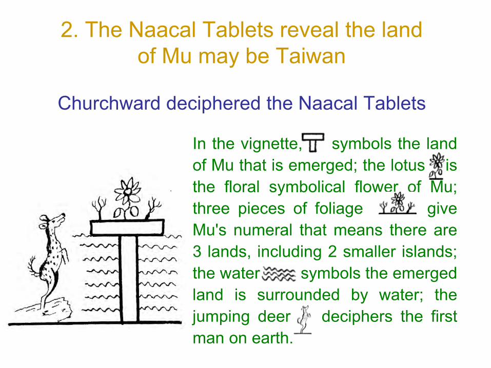
Churchward deciphered the Naacal Tablets
In the vignette, symbols the landof Mu that is emerged; the lotus isthe floral symbolical flower of Mu;three pieces of foliage giveMu's numeral that means there are3 lands, including 2 smaller islands;the water symbols the emergedland is surrounded by water; thejumping deer deciphers the firstman on earth.

3 pieces of foliage shows the land of Mu may be ancient Taiwan
The vignette shows 3 pieces of foliageabove , which symbols the land of Muincluding 3 islands. We can decipher thelarge one is Taiwan Island and the othersmaller two are Ryukyu Archicontinent andPenghu land bridge which separate fromTaiwan with trough and waterway. Theother two are found ancient remains of cityor temple in submarine now, so it may bethe evidences of the land of Mu.

The jumping deer in the vignette was Formosan sika deer
According to the picture of jumping deer (Left), itsappearance and characteristic are very similar toFormosan sika deer (right) that means the first man onearth maybe appeared in Formosa (Taiwan).

Jumping deer is on behalf of the first man should be born in ancient Taiwan
Only growing in southeastern Asia, the Formosan sikadeer is the most and largest one in the world. This deerwas found from plain to mountain in everywhere ofTaiwan, and history of Taiwan and civilization ofaborigine are close correlation with it. Only one year in1638, the record of Netherlander showed 150,000sheets of deerskin exported from Taiwan. From ancienttimes till last century, the deerskin of Taiwan was thelargest export in the world. So, the jumping deer is onbehalf of the first man should be born in ancient Taiwan,and Taiwan may be the motherland of man ── Gardenof Eden.

According to Indian and MayaRecords, there were many ancientelephants walking in the forest inthe glacial era. Roaming throughthe primeval vast forests of theland of Mu were herds of “mightymastodons and elephants” thatflapped their big ears to drive offannoying insects.
3. Many fossils of ancient elephant in Taiwan cor-
respond with the land of MuThe land of Mu once was the paradise of ancient elephants

The fossils of ancient elephant prove Taiwan should be the land of Mu
Many fossils of ancient elephants were excavatedeverywhere in Taiwan, such as: Stegodon Sinensis,Stegodon Akashiensis, Stegodon Aurorae, IndianStegodon, Taiwanese mammoth, Elephas Maxi-mus,Elephas Namadicus, Stegodon Insignis, StegodonOrientalis, Palaeoloxodon Sp., Mastodon etc., whichconfirmed Taiwan once was a paradise of ancientelephants. Its circumstances were similar to the land ofMu, so Taiwan should be the land of Mu.
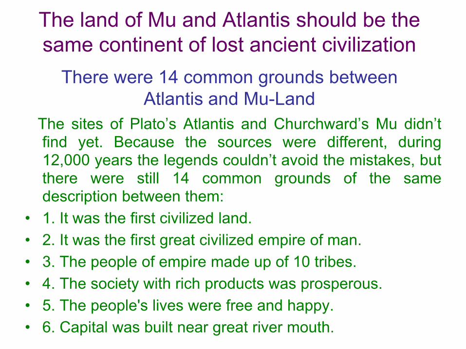
The land of Mu and Atlantis should be the same continent of lost ancient civilization
There were 14 common grounds between Atlantis and Mu-Land
The sites of Plato’s Atlantis and Churchward’s Mu didn’tfind yet. Because the sources were different, during12,000 years the legends couldn’t avoid the mistakes, butthere were still 14 common grounds of the samedescription between them:
• 1. It was the first civilized land.• 2. It was the first great civilized empire of man.• 3. The people of empire made up of 10 tribes.• 4. The society with rich products was prosperous. • 5. The people's lives were free and happy. • 6. Capital was built near great river mouth.

• 7. There were enormous temple and palace in capital.• 8. There were a herd of huge elephants on the
grassland. • 9. There were overseas colonies. • 10. It was ruined by earthquakes.• 11. The cataclysm happened and it sank.• 12. It sank completely in almost a single day.• 13. It disappeared about 12,000 years ago.• 14. It sank on the immense ocean.
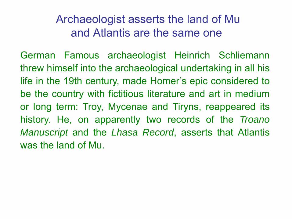
Archaeologist asserts the land of Mu and Atlantis are the same one
German Famous archaeologist Heinrich Schliemannthrew himself into the archaeological undertaking in all hislife in the 19th century, made Homer’s epic considered tobe the country with fictitious literature and art in mediumor long term: Troy, Mycenae and Tiryns, reappeared itshistory. He, on apparently two records of the TroanoManuscript and the Lhasa Record, asserts that Atlantiswas the land of Mu.

The land of Mu and Atlantis should be ancient Taiwan
• These 14 common grounds accord with the essentialcondition of history, including: time, place, personage,culture, affair, etc. that reveals the lost two continentsshould be the same one and the ruler is the Empire of theSun only.
• The site of the Empire of the Sun is in Taiwan, so manyexperts look for the lost continent of civilization that is so-called the land of Mu or Atlantis should be the same landof ancient Taiwan. The map of the line of colonizationfrom the land of Mu to the entire world should be redrawnas the following.
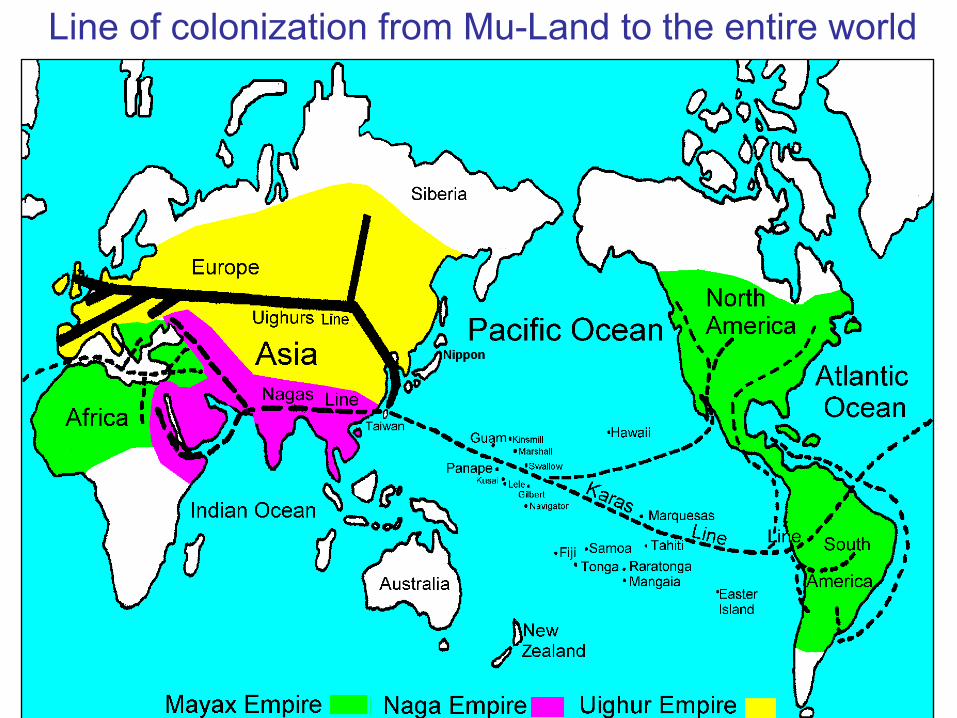
Line of colonization from Mu-Land to the entire world

The land of Mu lost about 12,000 years ago
According to extinction times of first man of Japan anddating times of the drill core at DOP Site 1202, and theend times of the fourth glacial period, infer mega-tsunami event in Taiwan happened about 12,000 yearsago. It is identical to sink in times with the land of Mu.
Donnelley's 13 Propositions of Atlantean Subject • 1. There once existed in the Atlantic Ocean, opposite the
mouth of the Mediterranean Sea, a large island, whichwas the remains of an Atlantic continent, and known tothe ancient world as Atlantis.
• 2. The description of this island given by Plato is not, ashas been long supposed, fable, but veritable history.
• 3. Atlantis was the region where man first rose from astate of barbarism to civilization.
• 4. It became, in the course of ages, a populous andmighty nation, from whose overflowing the shores of theGulf of Mexico, the Mississippi River, the Amazon, thePacific coast of South America, the Mediterranean, thewest coast of Europe and Africa, the Baltic, the BlackSea, and the Caspian were populated by civilizednations.

• 5. It was the true Antediluvian world; the Garden ofEden; the Gardens of the Hesperides; the Elysian Fields;the Gardens of Alcinous; the Mesomphalos; theOlympos; the Asgard of the traditions of the ancientnations; representing a universal memory of a greatland, where early mankind dwelt for ages in peace andhappiness.
• 6. The gods and goddesses of the ancient Greeks, thePhœnicians, the Hindoos, and the Scandinavians weresimply the kings, queens, and heroes of Atlantis; andthe acts attributed to them in mythology are a confusedrecollection of real historical events.
• 7. The mythology of Egypt and Peru represented theoriginal religion of Atlantis, which was Sun-worship.
• 8. The oldest colony formed by the Atlanteans wasprobably in Egypt, whose civilization was a reproductionof that of the Atlantic island.
• 9. The implements of the "Bronze Age" of Europe werederived from Atlantis. The Atlanteans were also the firstmanufacturers of iron.
• 10. The Phœnician alphabet, parent of all the Europeanalphabets, was derived from au Atlantis alphabet, whichwas also conveyed from Atlantis to the Mayas of CentralAmerica.
• 11. Atlantis was the original seat of the Aryan or Indo-European family of nations, as well as of the Semiticpeoples, and possibly also of the Turanian races.
• 12. Atlantis perished in a terrible convulsion of nature, inwhich the whole island sank into the ocean, with nearly allits inhabitants.
• 13. A few persons escaped in ships and on rafts, and,carried to the nations east and west the tidings of theappalling catastrophe, which has survived to our own timein the Flood and Deluge legends of the different nations ofthe old and new worlds.

Donnelly’s 13 propositions are in conformity with environment of Taiwan
1. Atlantis is quoted in the Atlantic Ocean by the mistake.From the clues of Solon, Atlantis is in the Pacific Ocean(Real Ocean) not Atlantic Ocean. Taiwan conforms to theremains of a large land in Pacific Ocean and is known tothe ancient world.
2. According to Homer’s epic of ‘Iliad’, the experts find theremains of Trojan War at the Sparta in Greece that provesthe mythology to be truthfulness. Most people think Plato’sstory of Atlantis is true. According to the ancient books ofChina, Peng-Lai Fairyland is just Taiwan that is also true.Peng-Lai Fairyland is actually Atlantis.
3. Atlantis is human's earliest civilized place, i.e. Eden, itsruler is the Empire of Atlantis, namely the motherland ofman, is in fact the Empire of the Sun that Churchwardtalked about, and according to the statement of this bookthe Empire of the Sun is in ancient Taiwan.

4. The Empire of the Sun sent emigrants in three routes andmigrated to all the world to set up three colonized countries:the all parts of America were ruled by the Kharas Empire;Europe, the Baltic Sea, the Black Sea and area of theCaspian Sea were ruled by the Uighur Empire; The areasof Mediterranean, Africa and Egypt were ruled by the NagaEmpire. Actually the Atlantis Empire was the Empire of theSun, and it disappeared in ancient Taiwan.
5. In the age of the Atlantis Empire in the true Antediluvianworld, the aboriginal in Taiwan had abundant produce;they dwelt for ages in peace and happiness. Certainly thepeople in later age should name the different title as Eden,Asgard…etc., representing a universal memory of thegreat land. These above-mentioned situations show theso-called Atlantis is actually ancient Taiwan.
6. The Empire of Atlantis was Sun-worship that meant it wasthe Empire of the Sun. Both ancient Greece and NorthEurope were the colonies of the Empire of the Sun, just thekings, queens, and heroes of Atlantis became deificationthat was very normal to legend. Atlantis was actually theancient Taiwan.

7. The mythology of Egypt and Peru represented theoriginal religion ‘Sun-worship’ of Atlantis. There are manyremains and totems of Sun-worship till now in Egypt andPeru, which was the colonized country of the Empire ofthe Sun. The Atlantis Empire was Sun-worship thatimplied it was the Empire of the Sun and was in ancientTaiwan.
8. Egypt divides into two religious sects: the east and thewest each claim its ancestor comes from the eastern andwestern continent. In fact there is just the same “thecontinent of Mu”. Certainly the civilization of Egypt camefrom the Empire of the Sun in the land of Mu and it wasonce the colony of the Empire of the Sun, according to‘the lost continent of Mu’. So, we can infer Atlantis is theland of Mu, not only the Egyptian civilization wasreproduced from Atlantis that is to say the reappearing ofancient civilization of Taiwan.

9. In March 2005, the accurate mold of bronze ware andiron ware were dug out in remains of Jiu Xiang Lan ofTaidung in Taiwan. From the mold the archaeologists inferTaiwanese aboriginal had craft civilization technology thata factory produced in a large amount early, so thetechnology of bronze ware and ironware in Europe shouldspread in ancient times from people of Taiwan, who whatwas so called the Atlanteans.
There were themolds of bronzeware and cast irondug out at Jiu XiangLan Remains ofTaidung in Taiwan.

10. Certainly the alphabets of Phoenician, Mayas and allthe European came from the motherland ── the AtlantisEmpire, which was the Empire of the Sun. The ancientaboriginal of Taiwan had ancient writing that the Empireof the Sun left over, and was earlier than the Xia era ofChina (2000 B.C.) in the past. So the true features of theancient alphabets of the world should spread fromancient Taiwanese since the Empire of the Sun.
11. The area of Indo-European family of nations, Semiticpeoples and Turanian races were the colonies under theEmpire of the Sun. Atlantis was the original seat of thesenations, which were under the Empire of Atlantis thatmeant both the empire were the same one. So, thisempire was the Empire of the Sun in the land of Mu andit was found in ancient Taiwan.

12. 12,000 years ago, North section of Snow Mountains inTaiwan volcanic eruption, landslide produced, in the widemountain region of Ilan coast at northeast corner of Taiwanup to 800 km2 avalanched into the sea. The capitalPoseidonia in seashore fell into Pacific Ocean sea floor,and then the descendant thought Atlantis sank into the seaby mistake. In fact the Taiwan island and with wholeresident did not sink into the ocean and become extinct, butjust the survived people recognized by mistake that's it.
13. The landslide of Snow Mountains in Taiwan caused mega-tsunami, and its wave was up to more than several hundredmeters high, certainly it formed the global appallingcatastrophe, so just there were lucky survivors from aholocaust of a few residents, fled from cataclysm in thedifferent nations of the old and new worlds. Some aboriginalof the whole world later spread the ancient legend ofcataclysm to reach us.

The above-mentioned 13 propositions are admitted bymasses, but except article 1: ‘Atlantis was in the AtlanticOcean’ is quoted by the mistake; other propositionsmostly conform with environments of Taiwan; especiallyin March 2005 in the east coast of Taiwan archaeologistsalready found the accurate molds of ancient bronze wareand ironware that were in conformity with article 9, so wecan assert: 'Atlantis was ancient Taiwan'.

The ancient remains of the Empire of the Sun in Taiwan
The land of Mu was Taiwan that should leave over someancient civilization trace of the Empire of the Sun inTaiwan. It have not been just paid attention to byeverybody yet, now we point out the most importantitems as following:1. Some submarine constructions around
Taiwan2. Over one hundred artificial caves3. Megalithic civilizations4. Other remains of civilization

1. Some submarine constructions around Taiwan
There were some megalithic constructions of the Empireof the Sun to be built around Taiwan. After glacial periodended, the sea water went up and submerged them intosea floor:
1. The submarine city beside Hujing Islet2. The submarine stonewall near Dongji Islet3. An ancient memorial altar near seashore at
Maoao of Gongliao4. The submarine rectangular slab stone at Taimali
and submarine pyramid at Jiaroshui etc.5. The submarine altar of temple on Yonaguni
Island in Japan
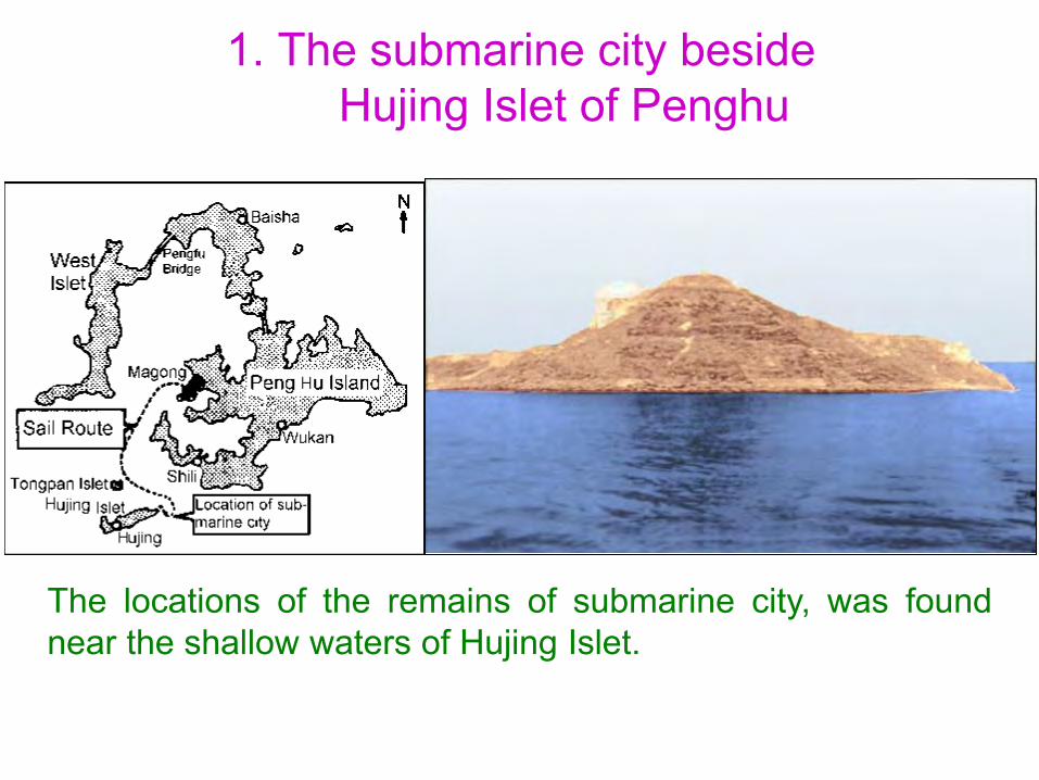
1. The submarine city beside Hujing Islet of Penghu
The locations of the remains of submarine city, was foundnear the shallow waters of Hujing Islet.
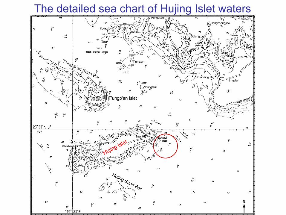
The detailed sea chart of Hujing Islet waters
The course of diving and prospection in Hujing submarine city
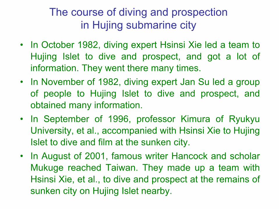
• In October 1982, diving expert Hsinsi Xie led a team toHujing Islet to dive and prospect, and got a lot ofinformation. They went there many times.
• In November of 1982, diving expert Jan Su led a groupof people to Hujing Islet to dive and prospect, andobtained many information.
• In September of 1996, professor Kimura of RyukyuUniversity, et al., accompanied with Hsinsi Xie to HujingIslet to dive and film at the sunken city.
• In August of 2001, famous writer Hancock and scholarMukuge reached Taiwan. They made up a team withHsinsi Xie, et al., to dive and prospect at the remains ofsunken city on Hujing Islet nearby.

Hancock confirms it is a civilization remains after diving and prospecting
Writer Graham Hancock indicates at the pressconference meeting, the sunken city of Hujing Islet willbe really probably the human lost civilization in ancienttimes.
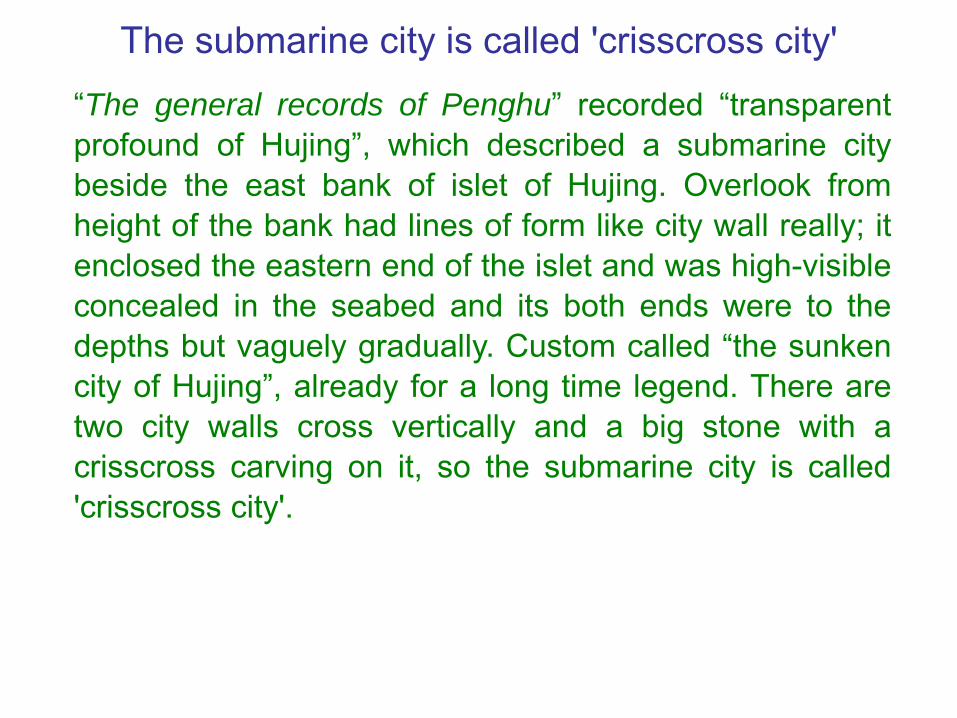
The submarine city is called 'crisscross city'
“The general records of Penghu” recorded “transparentprofound of Hujing”, which described a submarine citybeside the east bank of islet of Hujing. Overlook fromheight of the bank had lines of form like city wall really; itenclosed the eastern end of the islet and was high-visibleconcealed in the seabed and its both ends were to thedepths but vaguely gradually. Custom called “the sunkencity of Hujing”, already for a long time legend. There aretwo city walls cross vertically and a big stone with acrisscross carving on it, so the submarine city is called'crisscross city'.

There are 10 points to prove the wall of sunk city is the artificial construction
• 1. Both east-west and south-north of city wall straightlyextend over 200 meters.
• 2. The 4 directions of city wall happens to point at the 4right directions of east, west south and north in the Earth,and just crisscross vertically.
• 3. The city wall is ladder-shaped and regular in shape; itsheight and some data show it is the wall that forms thecastle.
•4 The distance between every other one of the city wallhas a groove, and it covers with a lot of vertically andhorizontally crossing grooves.
•5. In the city still leave over some building-like stonepillars and the big carved stone of the cross.

•6. There is a round watchtower of 20 meters in diameterthat joins with the northern city wall.
•7. Diver got a very right square stone of city wall, about 50cm in square and 20 cm in thickness that showed the citywall was piled up artificially.
• 8. The city wall is piled up with the stone and used parallelmethod, and the surface and the seam are level andsmooth that can insert the knife.
• 9. The shape of city wall is very carefully and neatly, andthere are the same joints in size.
• 10. Scraping the front and rear of the wall covering, we canfind whole of wall very level and smooth that shows the wallis artificial to build.

The wall of submarine city presents the straight line to
extend limitlessly
The sizes of trapezoid wall are: bottom wide 2.5 m, above wide 1.5 m and height 3 m.
The middle of the walls is concave
In the middle of the two wallsof submarine City, the crossedplace presents the concaveform that may be the wave topat for a long time.
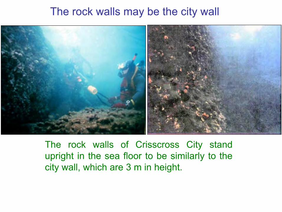
The rock walls may be the city wall
The rock walls of Crisscross City standupright in the sea floor to be similarly to thecity wall, which are 3 m in height.

There is artificial mark of piling up at the submarine wall of Crisscross City
The part wall pours out already,but the horizontal textureshows to be the artificial sign.
A diver stand in the sea floor anddraw out 5 inch thick seaweed,the city wall can be seen that isvertically closely piled up with thesquare stones.
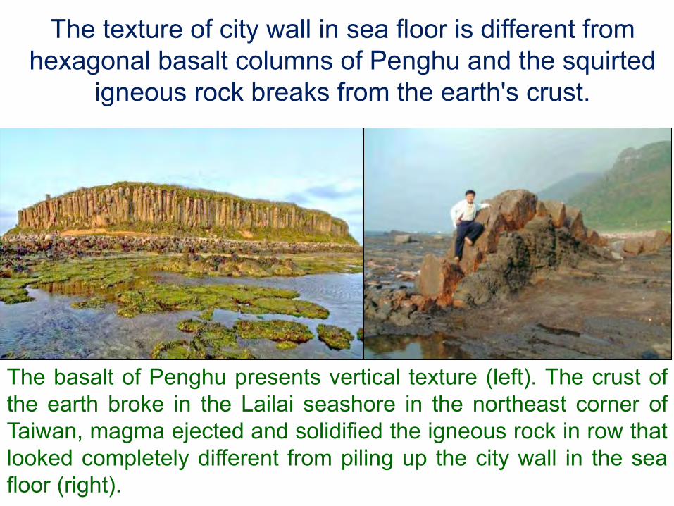
The basalt of Penghu presents vertical texture (left). The crust ofthe earth broke in the Lailai seashore in the northeast corner ofTaiwan, magma ejected and solidified the igneous rock in row thatlooked completely different from piling up the city wall in the seafloor (right).
The texture of city wall in sea floor is different from hexagonal basalt columns of Penghu and the squirted
igneous rock breaks from the earth's crust.
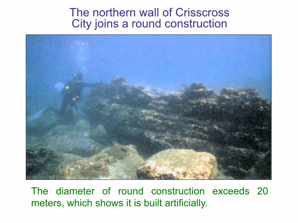
The northern wall of Crisscross City joins a round construction
The diameter of round construction exceeds 20meters, which shows it is built artificially.

Round constructions is watchtower
Comparing to the watchtower of Jericho City in Israel (left),the round construction of Crisscross City (right) should bealso a watchtower, but it is bigger.
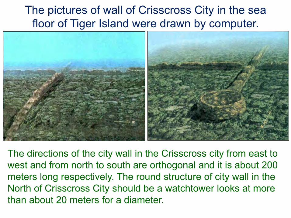
The pictures of wall of Crisscross City in the sea floor of Tiger Island were drawn by computer.
The directions of the city wall in the Crisscross city from east to west and from north to south are orthogonal and it is about 200 meters long respectively. The round structure of city wall in the North of Crisscross City should be a watchtower looks at more than about 20 meters for a diameter.
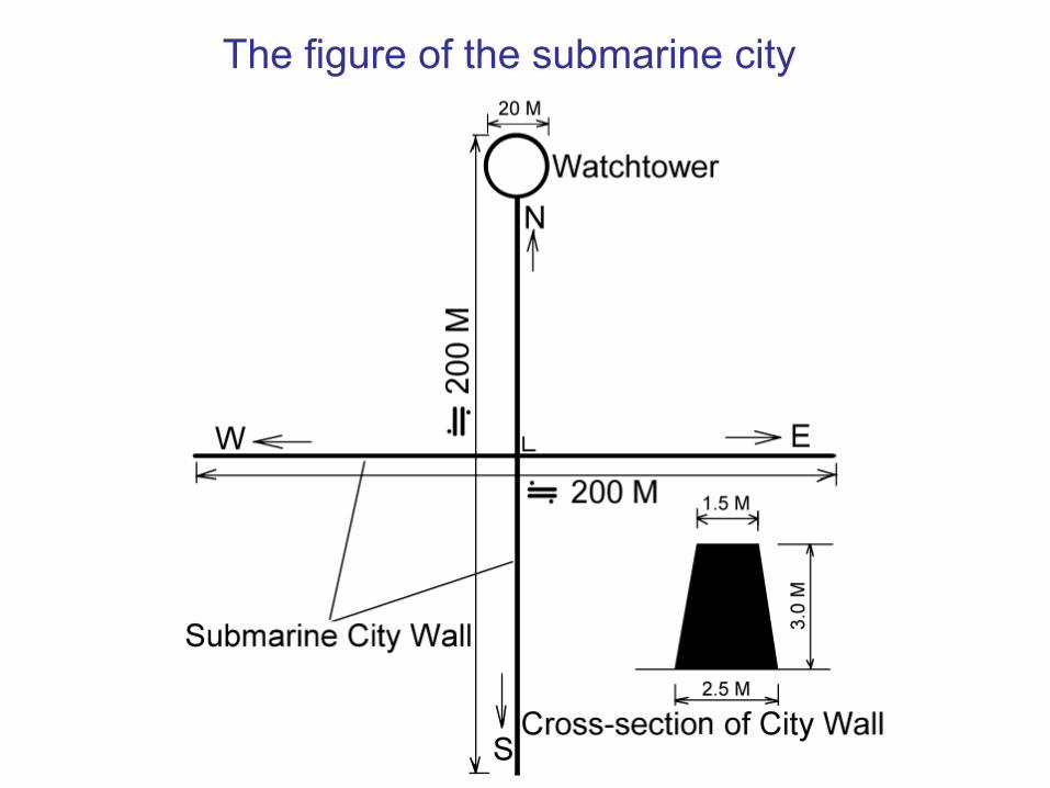
The figure of the submarine city
Computer drawing wall picture of submarine Crisscross City
The directions of city wall are exactly in east, west, southand north, square, and the length of both walls are about200 meters respectively. The round construction of city wallis watchtower; its diameter is more than about 20 meters.
Crisscross City may be the oldest city in the worldIn the fourth glacial period 12,000 years ago, the sea levelis lower by 120 meters than now, and Taiwan Channel iscontinental shelf, so the submarine construction ofCrisscross City can be built before it. It is the city of Jerichoin Israel before 9,000 years in the oldest city of the world atpresent. The history of Crisscross City has more than12,000 years, so it should be the oldest city of the world,and may be the urban trace of Mu-Land in ancient times.

Penghu submarine city should be the remains of the Land of Mu
The wall-like structure in the sunken city of Hujing Islet isbuilt with basalt in regular ladder shape. The directions ofthe two wall are exactly in east-west and south-northexactly, and just crisscross vertically, and the length ofboth walls are about 200 meters respectively. There is around wall of 20 meters in diameter to join with thenorthern city wall that reveals the artificial masterpiece.Professor Kimura of Ryukyu University considers sunkencity should be the urban trace of the land of Mu in ancienttimes. It should be built in 12000 years to 30000 years ago.

2. The submarine stonewall near Dongji Islet of Penghu
The stone wall is high about 1 m, wide about 50 cm and long about 100 m.
The stone wall is piled upand arranged well by thelump of stone shows it isartificial.
3. An ancient memorial altar near seashore at Maoao of Gongliao
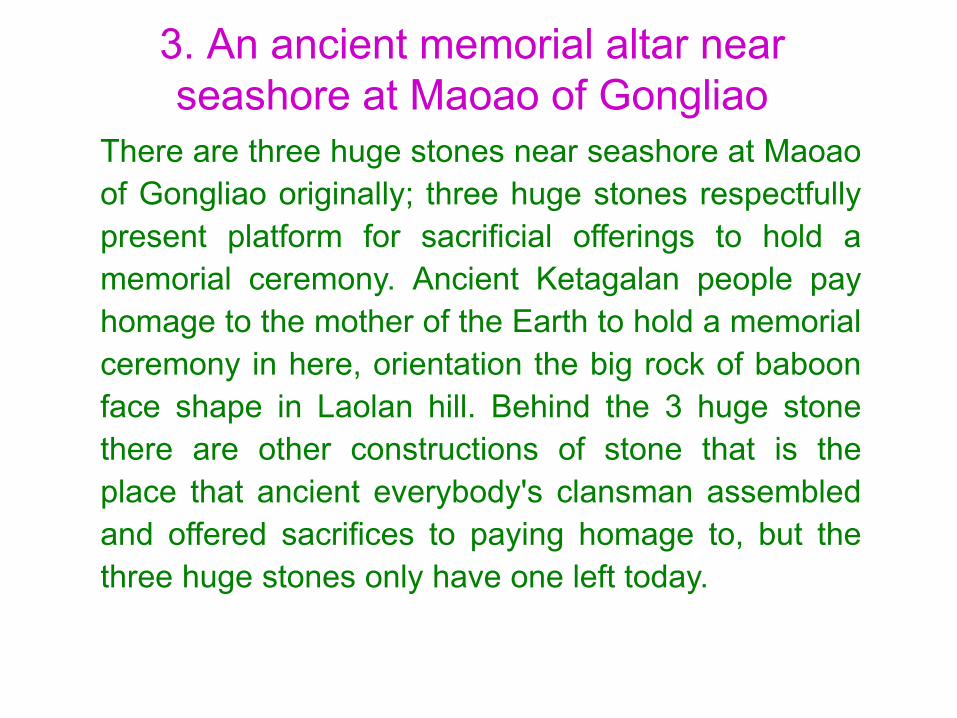
There are three huge stones near seashore at Maoaoof Gongliao originally; three huge stones respectfullypresent platform for sacrificial offerings to hold amemorial ceremony. Ancient Ketagalan people payhomage to the mother of the Earth to hold a memorialceremony in here, orientation the big rock of baboonface shape in Laolan hill. Behind the 3 huge stonethere are other constructions of stone that is theplace that ancient everybody's clansman assembledand offered sacrifices to paying homage to, but thethree huge stones only have one left today.
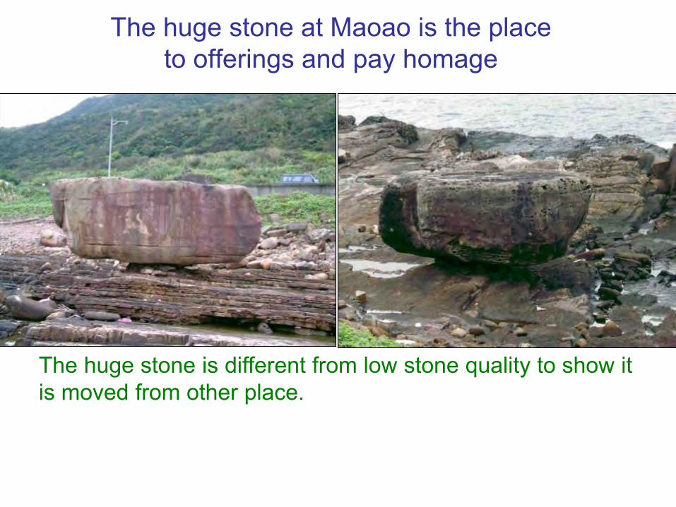
The huge stone at Maoao is the place to offerings and pay homage
The huge stone is different from low stone quality to show itis moved from other place.

Submarine constructions at Maoao
The submarine platform (left) and stone wall (right) are theplace that ancient everybody's clansman assembled to payhomage to the god.
4. The submarine constructions in the other sea floor of Taiwan
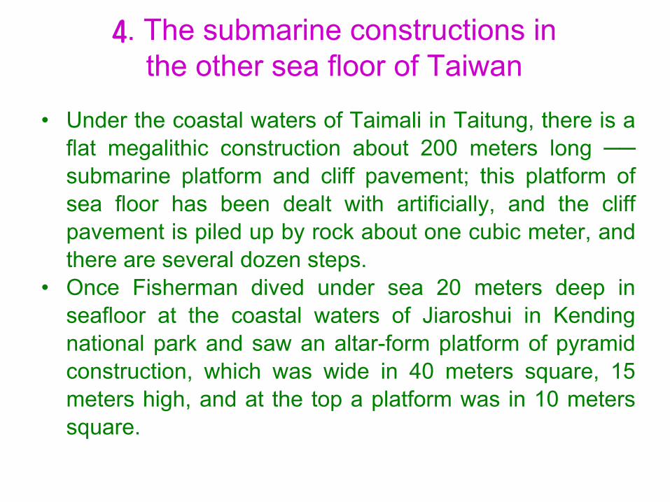
• Under the coastal waters of Taimali in Taitung, there is aflat megalithic construction about 200 meters long ──submarine platform and cliff pavement; this platform ofsea floor has been dealt with artificially, and the cliffpavement is piled up by rock about one cubic meter, andthere are several dozen steps.
• Once Fisherman dived under sea 20 meters deep inseafloor at the coastal waters of Jiaroshui in Kendingnational park and saw an altar-form platform of pyramidconstruction, which was wide in 40 meters square, 15meters high, and at the top a platform was in 10 meterssquare.

5. The submarine monument on Yonaguni Island in Japan
• In the south shallow waters of Arakawabana in GonaguniIsland of Ryukyu about 250 m a submarine constructionis found that east-west is about 200 m long andsouthnorth is about 40-50 m wide. The construction isabout 20-25 m above the seafloor and 5 m beneath thesea level.
• The whole construction seems neatly as is cut artificially,the raised angle assumes the right angle. According tothe investigation, it is considered to be the ancientremains and may be a submarine monument.

The monument of GonaguniIsland in the sea floor
A bird’s eye view of the submarine monument.
An upward view of thesubmarine monument.
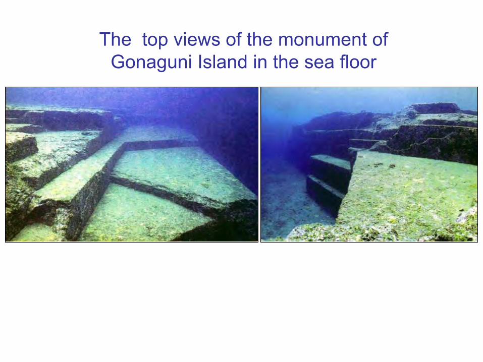
The top views of the monument of Gonaguni Island in the sea floor

A perspective drawing of the monumentof Gonaguni Island

2 Pillar holes of the monument of Gonaguni
Island under the sea level A ditch remains of Arakawabana of Gonaguni Island under the sea level
2. Over one hundred artificial ancient caves in Taiwan
The people of Taiwan dug caves for the dwelling in the 4th glacial period
Taiwan has been wreaked havoc by the ice and snow inthe fourth glacial period, people of the Empire of the Sunneed to tide over several ten thousand years in theabominable living environment. The best method is thatthey seek survival but dig caves and make for thedwelling in order to avoid the severe cold weather, andthen they could survive and propagate.
The ancient Taiwanese cave in the materials of historical book
• In 1400 years ago, “Ryukyu Memoir of Sui Book”described: Ryukyu Country (Taiwan) in the sea. Manycaves were in there,…. The chieftains lived in caves tomanage the country. The data show that many ancientcaves in Taiwan and the ancestor are all inhabited in thecave.
• There were many Taiwanese caves in Sui Dynasty,paradise recorded on the Chinese ancient book washere, and these caves were artificial that Taiwaneseancestor dug, regard as their residence, and near someentrance of caves left the shell mound.
Over one hundred artificial caves in Taiwan
The famous ancient caves of Taiwan have more thanone hundred in 73 places, all excavated artificially.Among them 2/3 is in the north of Taiwan, the density isthe highest area in the world that shows north Taiwan isthe important place of the Empire of the Sun in the landof Mu. Reveal the north of Taiwan is the importantstrategic place of the Empire of the Sun in the land ofMu.

Distribution map of ancient famous caves in Taiwan
The red dot ˙ denotes the place of caves.

The ancient caves of Taiwan are ancient's intelligent masterpieces
The ancestors of Taiwan have superb technology to digout enough caves. It is suitable for glacial period andlives for a long time and as the place that is survivedand multiplied. They pick the fruit near the entrance of acave at the height and fish for the abundant fish andshellfish in the river or sea in the low entrance of a cave,live the life like celestials. There are very superiordesigns in the ancient caves in Taiwan, have thedesigns of 15 items of civilization that are all ancient'sintelligent masterpieces.

15 items of ancient caves in Taiwan are designed superiorly
•1. The entrance of a cave lies in the place of the draft totake the funnel type, in order to ventilate.
• 2. The Caves have several exits in order to prevent thecaves fall in and seal up.
•3. The caves have small holes about 20 cm in diameteropenly to the ground to act as the air ventilates.
•4. There are large-scale platforms in the caves that canhold several dozen people and gather a meeting.
•5. The caves have the slope of undulating height that isbeneficial to drain off water.
•6. The large-scale cave is excavated the well separatelythat is for the occupants in cave to drink.
•7. The caves are from the mountain ridge downward andopen to the seashore that the occupants can fish with a netand pick up the shellfish to allay hunger.

•8. The caves are excavated in the hard quality rock, avoidweak geology, in order to avoid falling in, and guaranteethe security of person.
•9. The entrance is narrow but the inside is spacious in thecave, in order to avoid huge beast's invading.
•10. Enter the large entrance of a cave, and then divide intotwo narrow caves in order to avoid huge beast's invading.
•11. There are two entrances, the southward and northward,in a cave, in order to ventilate with the favorable air andkeep nice and warm.
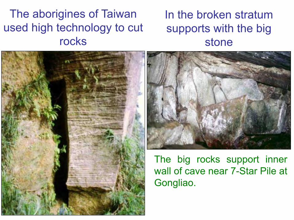
•12. When the cave was excavated the aborigines usedhigh technology to cut rocks.
•13. Utilize the stakes or the stones to act as supports, andthen excavate caves.
•14. At the intersection of the caves, from head to footstorey is ganged up with the shaft.
•15. The cave follows the slope of hillside to build, it is nottoo deep to be overhead, and do benefit to coming in andgoing out and ventilating.
The aborigines of Taiwan used high technology to cut
rocks
The big rocks support innerwall of cave near 7-Star Pile atGongliao.
In the broken stratum supports with the big
stone
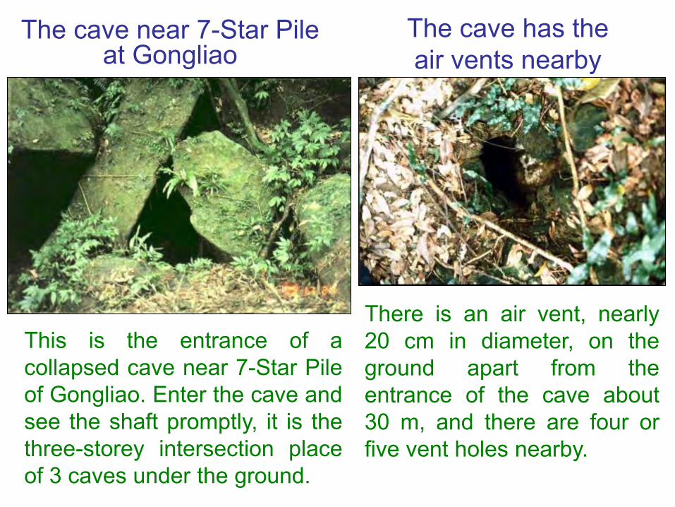
The cave near 7-Star Pile at Gongliao
This is the entrance of acollapsed cave near 7-Star Pileof Gongliao. Enter the cave andsee the shaft promptly, it is thethree-storey intersection placeof 3 caves under the ground.
The cave has the air vents nearby
There is an air vent, nearly20 cm in diameter, on theground apart from theentrance of the cave about30 m, and there are four orfive vent holes nearby.
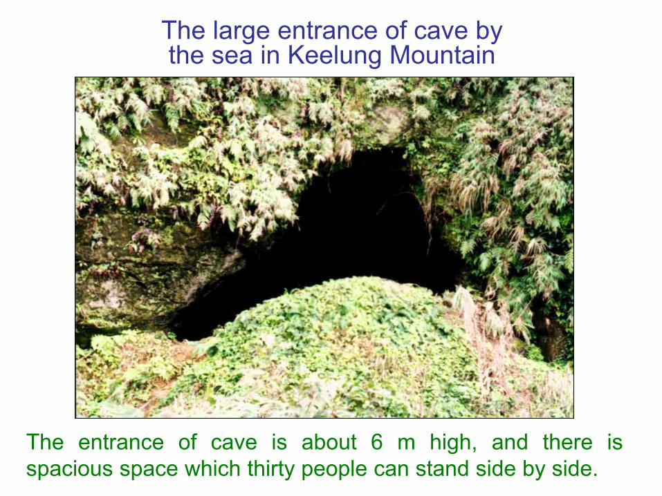
The large entrance of cave by the sea in Keelung Mountain
The entrance of cave is about 6 m high, and there isspacious space which thirty people can stand side by side.

There are 2 entrances of the Bat's cave
The Bat's cave in Keelung Mountain has two adjoiningentrances and there is fresh water well in the cave. Thespacious cave can hold large quantities of people to get ameeting, and it extends several kilometers.
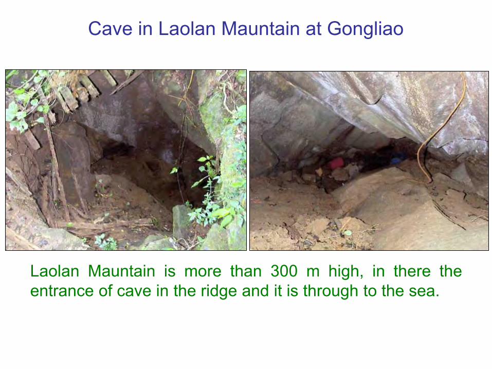
Cave in Laolan Mauntain at Gongliao
Laolan Mauntain is more than 300 m high, in there theentrance of cave in the ridge and it is through to the sea.

Caves at Fanashan in 4th Nuclear Power Plant at Gongliao
No. 1 Cave No. 2 Cave No. 3 Cave

Glittering in the cave wall of Fanashan at Gongliao
The cave walls of No. 1 (left) and No. 2 (right) Glitterwith metal color that is produced at smelting the metallong time ago.

Cave at Liandong Junior School at Ruifung of Taipei County
The cave is about over one hundred meters long. The picturepresents the funnel type at entrance can collect the north windto blow into caves, increase the air and circulate. The cave wallis a rock quality that shows the cave is an ancient artificialconstruction.
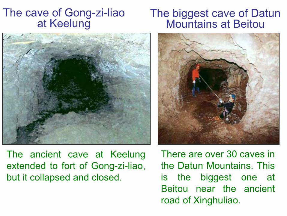
The cave of Gong-zi-liaoat Keelung
The ancient cave at Keelungextended to fort of Gong-zi-liao,but it collapsed and closed.
There are over 30 caves inthe Datun Mountains. Thisis the biggest one atBeitou near the ancientroad of Xinghuliao.
The biggest cave of DatunMountains at Beitou
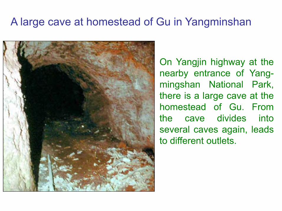
A large cave at homestead of Gu in Yangminshan
On Yangjin highway at thenearby entrance of Yang-mingshan National Park,there is a large cave at thehomestead of Gu. Fromthe cave divides intoseveral caves again, leadsto different outlets.
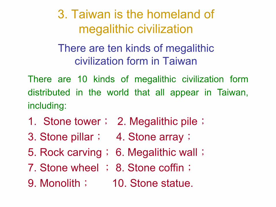
3. Taiwan is the homeland of megalithic civilization
There are ten kinds of megalithic civilization form in Taiwan
There are 10 kinds of megalithic civilization formdistributed in the world that all appear in Taiwan,including:
1. Stone tower; 2. Megalithic pile;3. Stone pillar; 4. Stone array;5. Rock carving; 6. Megalithic wall;7. Stone wheel ; 8. Stone coffin;9. Monolith; 10. Stone statue.

Stone Tower:Pyramid of Qixing Mountain at Taipei
Pyramid of Qixing Mountain at Taipei lies on the highest peak,east peak and south peak intersection platform, the elevationis 1052 meters. It is a precipitous small hillock of thetriangular cone, from the low place is more than 20 metershigh. It is a spout of small ancient volcano originally, on thecone of volcano later increases a lot of stones to pile up, andfills in the hollow part into an intact Pyramid of triangular cone.Present the east-west trend in the north and the south pointsto the south, its summit and Samao-Shan trough form thedirection of south.

Pyramid of Qixing Mountain
views from south views from north

The piled up form of Pyramid stone shows the artificial sign
This is the inclined plane of Pyramid before remove coverings (left) and after removing (right).

Piled stones of Pyramid have been weathered into no edges and corners
The piled stones of Pyramidin lower layer have beenweathered into round shape,which shows it is very old thatshould have a history of tenthousand years.
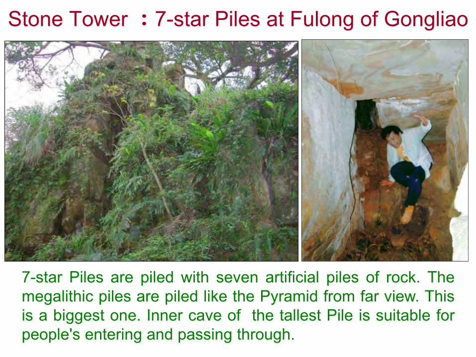
Stone Tower :7-star Piles at Fulong of Gongliao
7-star Piles are piled with seven artificial piles of rock. Themegalithic piles are piled like the Pyramid from far view. Thisis a biggest one. Inner cave of the tallest Pile is suitable forpeople's entering and passing through.

Megalithic Pile :Heaven altar in Qixing Mountain of Taipei
There are 3 steles and a pond of Luneshape in front of the heaven altar.
Megalithic pile isbuilt with 6 bigrocks artificially.
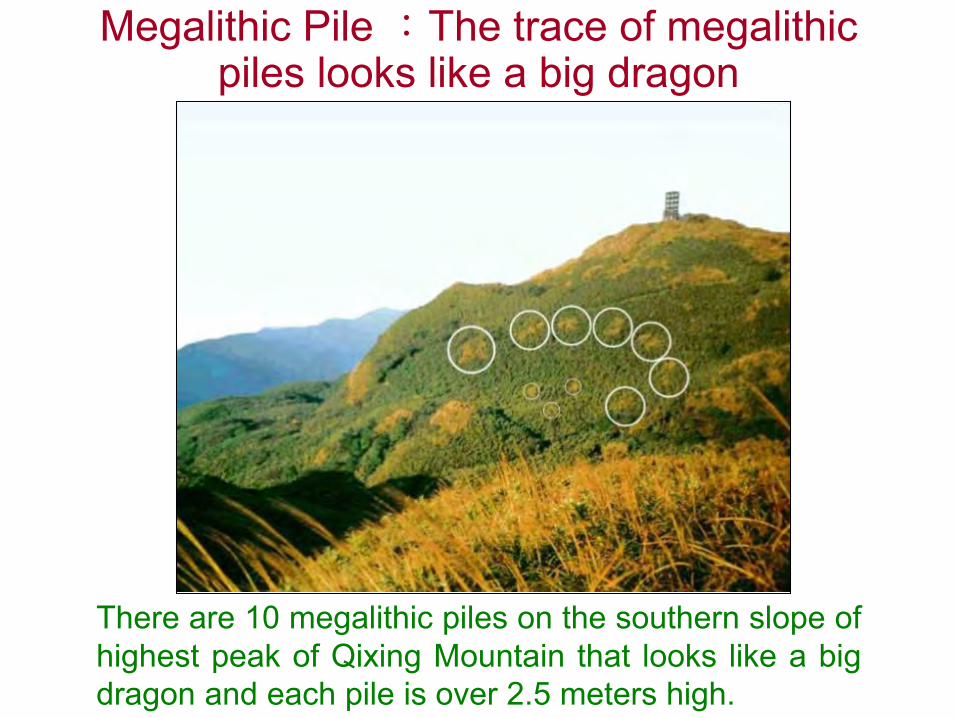
There are 10 megalithic piles on the southern slope ofhighest peak of Qixing Mountain that looks like a bigdragon and each pile is over 2.5 meters high.
Megalithic Pile :The trace of megalithic piles looks like a big dragon

Megalithic Pile :Fanjingshih at Chaigongkeng Mountain of Taipei
Fanjingshih means the stone of reverse compass. It issimilar to baboon's face (left) and we can find out severalhuge stones are piled together (right ).
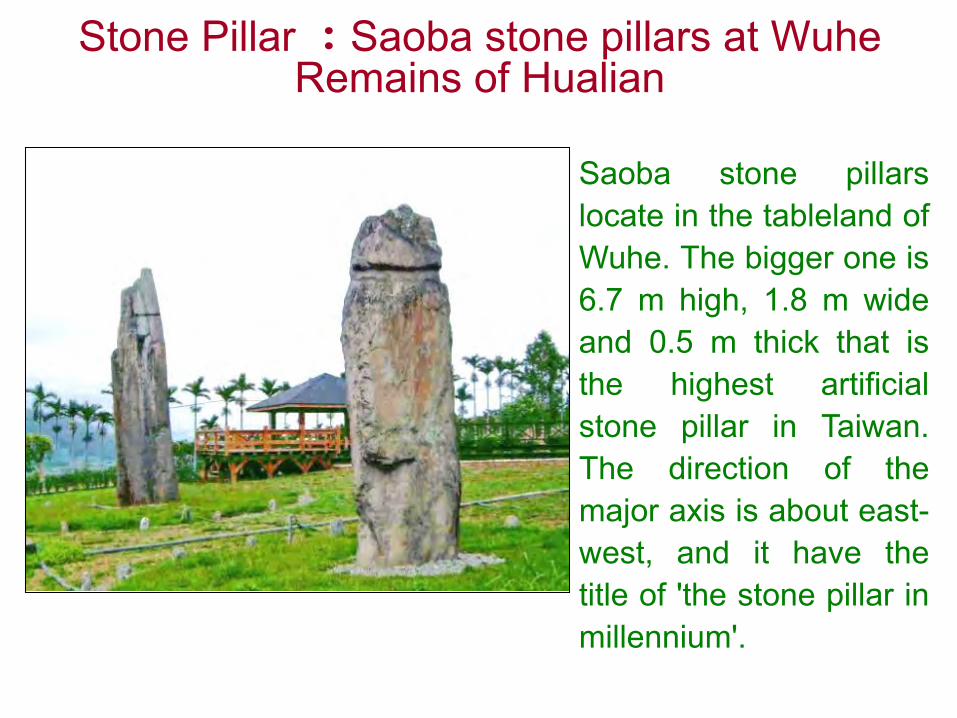
Stone Pillar :Saoba stone pillars at WuheRemains of Hualian
Saoba stone pillarslocate in the tableland ofWuhe. The bigger one is6.7 m high, 1.8 m wideand 0.5 m thick that isthe highest artificialstone pillar in Taiwan.The direction of themajor axis is about east-west, and it have thetitle of 'the stone pillar inmillennium'.
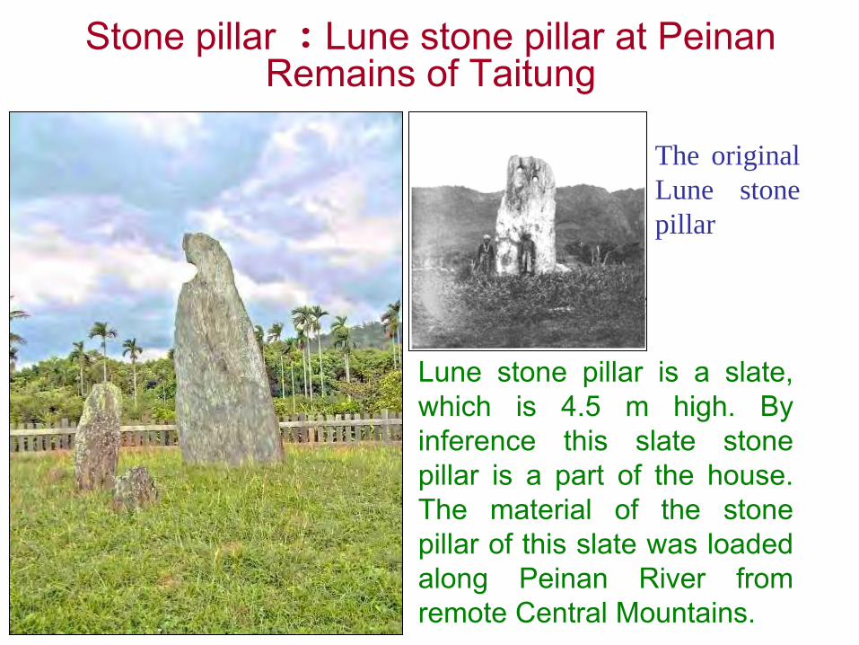
Stone pillar :Lune stone pillar at Peinan Remains of Taitung
Lune stone pillar is a slate,which is 4.5 m high. Byinference this slate stonepillar is a part of the house.The material of the stonepillar of this slate was loadedalong Peinan River fromremote Central Mountains.
The originalLune stonepillar

Stone Array:Wuhe Remains at Ruisui of HualianWuhe Remains in the tableland of Ruisui distributed into anellipse, the length from north to south is about 600 metersand about 400 meters wide. There are many stone pillars,male stones and female stones in this region; i.e. stone array.The famous stone pillars are the 2 Saoba stone pillars, whichonly remain today, the other stone pillars have alreadydisappeared.
Stone Array:Peinan Remains of TaitungAt the beginning of the twentieth century, Japanesescholar Kano Tadao has found at Peinan Remains ofTaitung that erects and arranges countless of stone pillargroup; i.e. stone array. Changed its course, widened andset up such projects as new station of Peinan etc. in therailway of east line in 1980, remove countless stone pillars,only have lonely Lune Pillar left today.

Stone Carving:Moiré Chart of Qixing Mountain at Taipei
Megalithic wall is not the hexagon stone piled up, butcarve from monolith into ‘Moiré Chart’ like geometry. Itsnick has fully 5 cm, lines are very clear, absolutely is noteroded by nature. The geologists confirm it is a pattern ofartificial carving. Its times are several ten thousand yearsago.
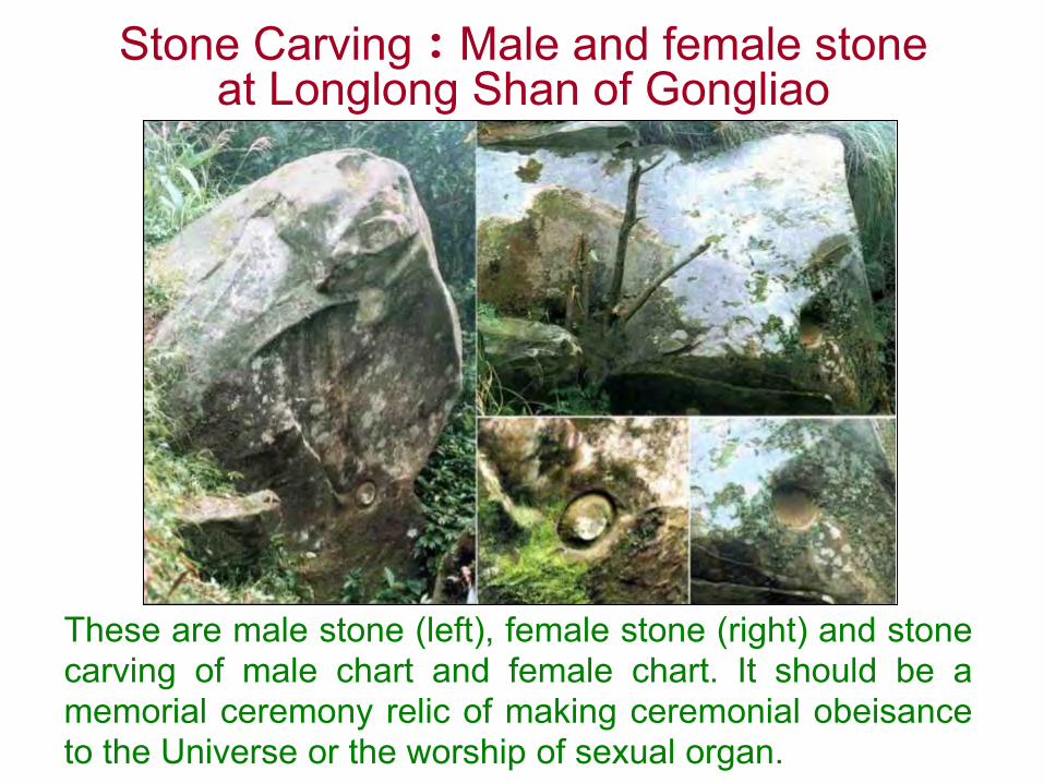
Stone Carving:Male and female stone at Longlong Shan of Gongliao
These are male stone (left), female stone (right) and stonecarving of male chart and female chart. It should be amemorial ceremony relic of making ceremonial obeisanceto the Universe or the worship of sexual organ.
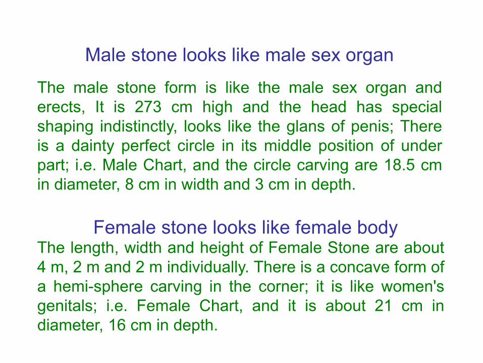
Male stone looks like male sex organ
The male stone form is like the male sex organ anderects, It is 273 cm high and the head has specialshaping indistinctly, looks like the glans of penis; Thereis a dainty perfect circle in its middle position of underpart; i.e. Male Chart, and the circle carving are 18.5 cmin diameter, 8 cm in width and 3 cm in depth.
Female stone looks like female bodyThe length, width and height of Female Stone are about4 m, 2 m and 2 m individually. There is a concave form ofa hemi-sphere carving in the corner; it is like women'sgenitals; i.e. Female Chart, and it is about 21 cm indiameter, 16 cm in depth.

Stone Carving:Laolan Shan stone carving at Gongliao of Taipei
Stone carving (left) slightly presents the rectangle, about 1.2m long and about 70 cm wide, carves a lot of lines andfigures on it. The other one (right) has a sailing boat thatshowed already there was a technology of navigation at thattime and the ability to sail to ocean. The two stone alsocarved the statue of beast's body but man's head that can befound just at the totem of ‘The Classic of Mountains andRivers’, which was written more than 2,000 years ago.
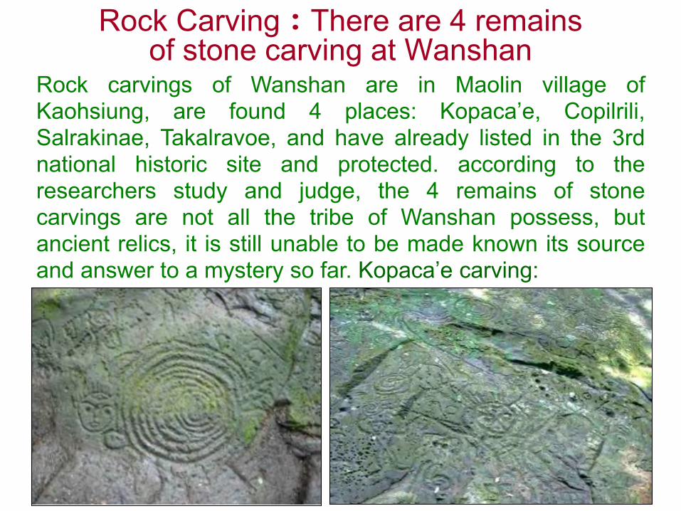
Rock Carving:There are 4 remains of stone carving at Wanshan
Rock carvings of Wanshan are in Maolin village ofKaohsiung, are found 4 places: Kopaca’e, Copilrili,Salrakinae, Takalravoe, and have already listed in the 3rdnational historic site and protected. according to theresearchers study and judge, the 4 remains of stonecarvings are not all the tribe of Wanshan possess, butancient relics, it is still unable to be made known its sourceand answer to a mystery so far. Kopaca’e carving:
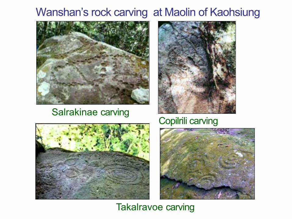
Wanshan’s rock carving at Maolin of Kaohsiung
Salrakinae carving
Takalravoe carving
Copilrili carving

Kopaca’e rock carvings of Taiwan (up) accord with China’s (down)
Concentric circles Man’s face of Man’s face ofof Helan-Shan Helan-Shan Lianyun harbor
Concentric circles Man’s face Man’s face
Both Taiwanese and Chinese culture system of rockcarving are similar. By the research of rock carvings ofconcentric circles and man’s face, China's ancientcivilization is with the fully accurate and believablematerials of archaeology now, prove that set out fromthe primitive culture in prehistoric Pacific Ocean thatmay transmit from Taiwanese aborigines throughLianyun harbor to the whole of China.
Rock carving culture maybe transmits from Taiwan to China

Megalithic Wall:Gravida stone of Dulan Remains at Donghe of Taitung
There are two square prominences and round swellingbelow it in the megalithic wall that make people associate itwith pregnant woman, so known as the gravida stone. Itsmain function or meaning is not so obvious. Left is thefront of it and right is the back.

Megalithic Wall:Gravida stone of BeisananRemains at Changbin of Taitung
The front of gravida stone The back of gravida stone

Stone wheel :Zhongyong Remains at Changbin of Taitung
The other name of stone money is stone wheel or slate withhole. Stone wheel is oblate with a hole in the middle, partlylikes the form of wheel or Chinese ancient coin form withsquare hole.
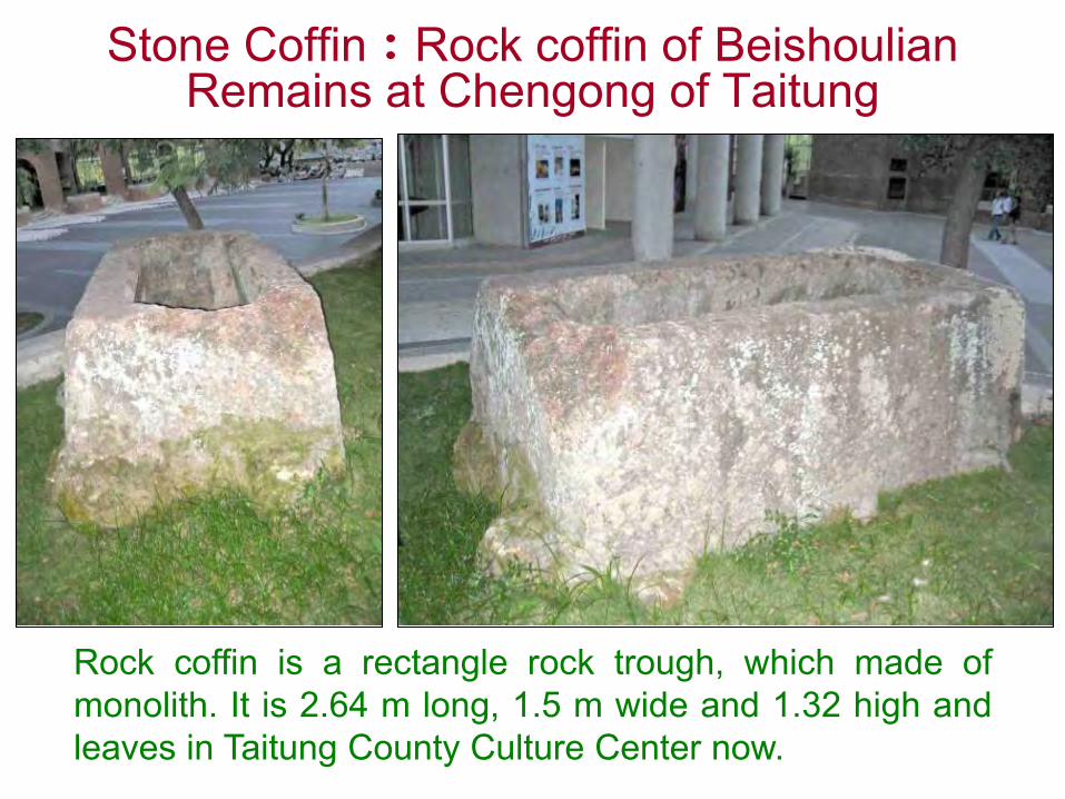
Stone Coffin:Rock coffin of BeishoulianRemains at Chengong of Taitung
Rock coffin is a rectangle rock trough, which made ofmonolith. It is 2.64 m long, 1.5 m wide and 1.32 high andleaves in Taitung County Culture Center now.
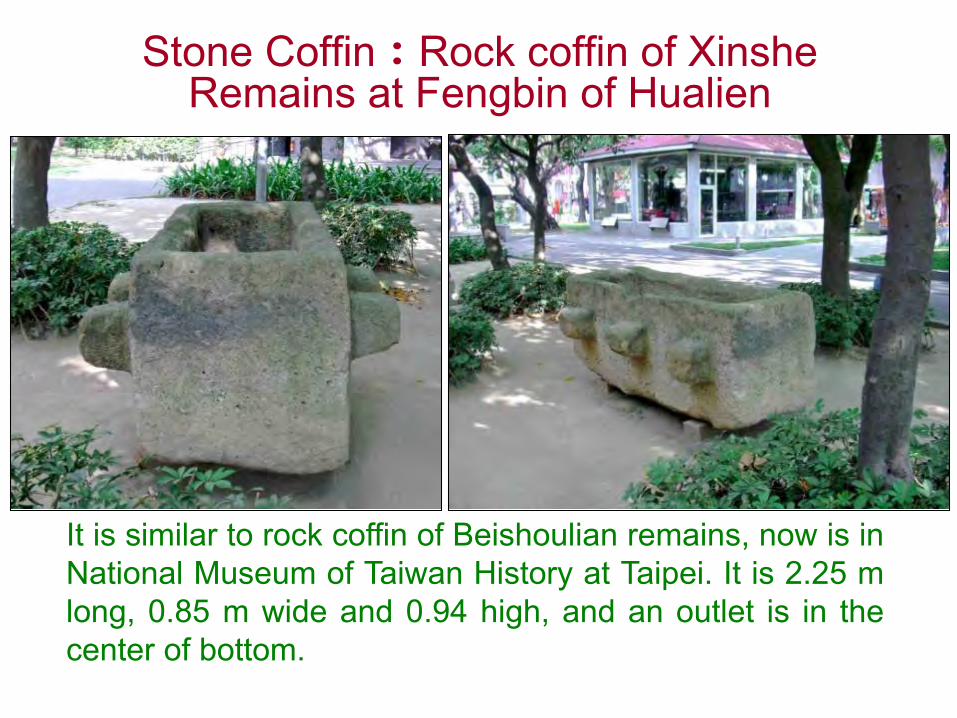
Stone Coffin:Rock coffin of XinsheRemains at Fengbin of Hualien
It is similar to rock coffin of Beishoulian remains, now is inNational Museum of Taiwan History at Taipei. It is 2.25 mlong, 0.85 m wide and 0.94 high, and an outlet is in thecenter of bottom.

Stone Coffin:Rock coffin of Dulan Remains
at Tunghe of Taitung
Stone Coffin:Slate coffin of Taimali Remains at
Taitung County
Slate coffin is made of a lotof slates to become a stonecoffin, which buries thehuman’s body of dead.
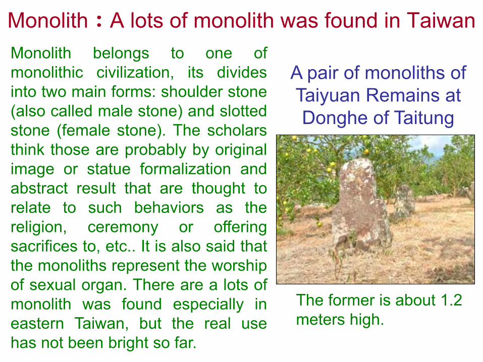
Monolith:A lots of monolith was found in TaiwanMonolith belongs to one ofmonolithic civilization, its dividesinto two main forms: shoulder stone(also called male stone) and slottedstone (female stone). The scholarsthink those are probably by originalimage or statue formalization andabstract result that are thought torelate to such behaviors as thereligion, ceremony or offeringsacrifices to, etc.. It is also said thatthe monoliths represent the worshipof sexual organ. There are a lots ofmonolith was found especially ineastern Taiwan, but the real usehas not been bright so far.
A pair of monoliths of Taiyuan Remains at Donghe of Taitung
The former is about 1.2 meters high.

Shoulder monolith of BaisananRemains at Changbin of Taitung
Above: shoulder monolithBelow: Slotted monolith
The left is slottedmonolith and the rightis shoulder monolith.

Shoulder monolith of ZhongyongRemains at Changbin of Taitung
In 1930 Japanese scholar Kano Tadao has foundmonoliths over everywhere at Zhongyong, which isthe place of most monoliths in Taiwan.

The existence of monoliths in the present at Zhongyong of Changbin
The left is a lot of monoliths in the show room ofZhongyong primary school, the right is the flower bed ofZhongyong community: Stone money, shoulder monolithand allotted monolith.

Stone Statue:Eagle stone at Bisha fishing port of Keelung
The characteristic of eagle stone (left) at wing and headobviously has mark of artificial carving, but watching itfrom other direction completely loses its shape (right), thisis a characteristic of megalithic statue in Taiwan.
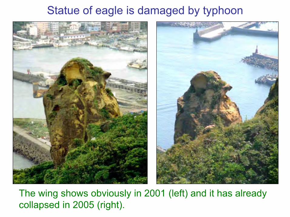
Statue of eagle is damaged by typhoon
The wing shows obviously in 2001 (left) and it has already collapsed in 2005 (right).
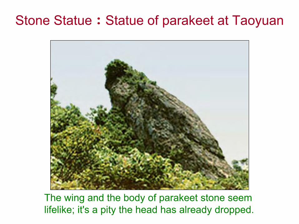
Stone Statue:Statue of parakeet at Taoyuan
The wing and the body of parakeet stone seem lifelike; it's a pity the head has already dropped.
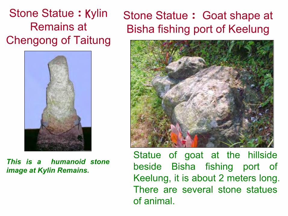
Stone Statue:KylinRemains at
Chengong of Taitung
This is a humanoid stoneimage at Kylin Remains.
Stone Statue: Goat shape at Bisha fishing port of Keelung
Statue of goat at the hillsidebeside Bisha fishing port ofKeelung, it is about 2 meters long.There are several stone statuesof animal.

Stone Statue:Tortoise shape at Qixing Mountain of Taipei
Carving the meticuloushexagon tortoise-shell patternwith tortoise's body, the headof tortoise stretches out thelong neck and obviouslycarved eyes and mouth arelifelike.
Above the artificial wipedplatform has two dinosaursare exactly like kissing eachother.
Stone Statue:Animal altar at Qixing Mountain of Taipei

The home land of megalithic civilization should be ancient Taiwan
According to the record of history, The earlier thecivilization develops, the more its kinds are. Themegalithic civilization of the world has ten kinds of formsaltogether, each distributes in all parts of the world, onlyten kinds of those are all appear in Taiwan that shouldprove its homeland may be most possible in Taiwan.
Civilizations of Mu should prove ancient Taiwan may be Mu-Land
• There are the most important three items of the Remainsof lost civilizations: submarine constructions aroundTaiwan, over one hundred artificial caves and megalithiccivilizations, all of these still in Taiwan now that show theremains of the Empire of the Sun are still in Taiwan.
• There are other ancient civilizations events of ancientages in Taiwan as follows describe. All of those also canprove the land of Mu may be the ancient Taiwan.

4. The civilization events of ancient times in Taiwan
• 1.The ancient writings of civilization relicin Taiwan
• 2. Cultural exchange between Taiwanand China in the remote ages
• 3. In ancient times the Shell Currency ofChina imported from Taiwan
• 4.The ancient industrial area ofKetagalan Tribe in northern Taiwan
• 5.Taiwan is the Fairyland of Peng-Lai
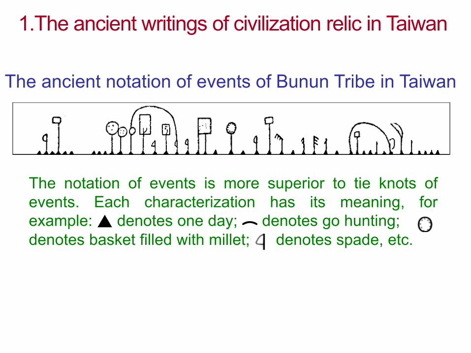
1.The ancient writings of civilization relic in Taiwan
The ancient notation of events of Bunun Tribe in Taiwan
The notation of events is more superior to tie knots ofevents. Each characterization has its meaning, forexample: ▲ denotes one day;︵ denotes go hunting;denotes basket filled with millet; denotes spade, etc.
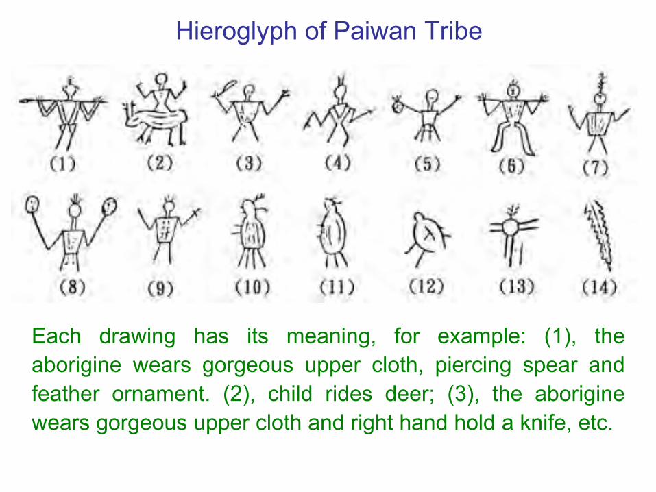
Hieroglyph of Paiwan Tribe
Each drawing has its meaning, for example: (1), theaborigine wears gorgeous upper cloth, piercing spear andfeather ornament. (2), child rides deer; (3), the aboriginewears gorgeous upper cloth and right hand hold a knife, etc.

The ancient scripts of insect-snake style in Taiwan
This is the reliefscripts of wood-carving of PaiwanTribe at TaitungCounty.

The existence of ancient script in Taiwan was proved
• “The Yatang Corpus”, a writing of Yatang Lian more thanone hundred years ago, described with:“In many hills andscenic spots, there is all the tadpole script of steles, whichcannot identify. The tadpole script was earlier than largeseal style of Zhou Dynasty. Has the Chinese come toTaiwan before Three Dynasty about 4,000 years ago?”According to this record, in Qing Dynasty there were manywritings of ancient stele and antiques in Taiwan earlierthan Three Dynasty, but now it almost lost.

The tadpole script of stele was found at Sun-
Moon Lake
From the history ofscript, the tadpolescript of Taiwan wasearlier than the scriptof Yi Emperor Stele.
The unearthed stele ofremote antiquity was morethan 5,000 years on thepeace isle of Keelung. It isstored at Kyoto Royal HouseMuseum in Japan now.
The script of unearthed stele at Keelung
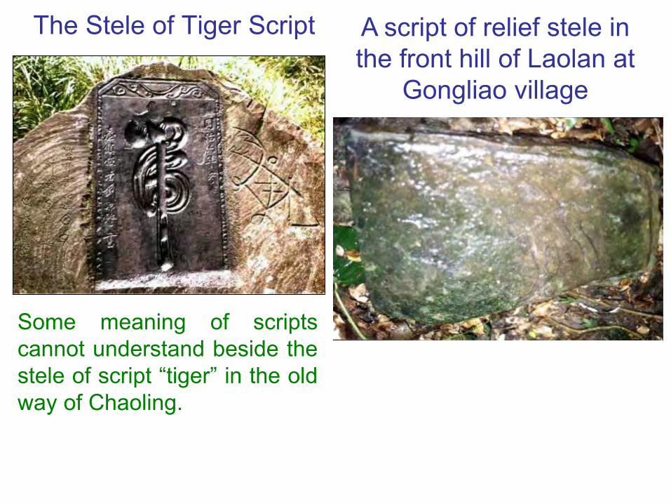
The Stele of Tiger Script
Some meaning of scriptscannot understand beside thestele of script “tiger” in the oldway of Chaoling.
A script of relief stele in the front hill of Laolan at
Gongliao village
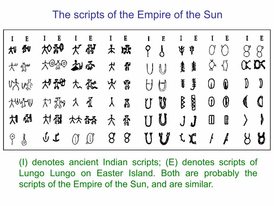
The scripts of the Empire of the Sun
(I) denotes ancient Indian scripts; (E) denotes scripts ofLungo Lungo on Easter Island. Both are probably thescripts of the Empire of the Sun, and are similar.

The totems of tattoo pattern of Paiwan Tribe in aiwan
Some scripts of the Empire of the Sun are similar to thetotems of tattoo pattern in Taiwan.

“Book Scripture”, one of the oldest historical books inChina, recorded as follows: "The native people on theisland wore gorgeous clothes. The cloth set with shells andcitrus were, under imperial decree, taken as the tribute toChina by sea." According to Mr. Bikisjuma, “People on theisland” shall refer to the Taiwanese aboriginals. ProfessorBikisjuma, a famous Japanese scholar, said historydetermined that Fairyland of Peng-Lai was Taiwan andthere were cultural exchanges between Taiwan and Chinaabout 4,200 years ago before the foundation of HsiaDynasty.
2. Cultural exchange between Taiwan and China in the remote ages
“Book Scripture” recorded Taiwanese aboriginals paid tribute to China

Taiwanese aboriginals’ gorgeous clothes set with shiny shells
A gorgeous cloth with shiny shells
A vest sewn with shells
A skirt sewn with shells

Ornament set with shiny shells of Taiwanese aboriginals
Ornament set with shells in
breast
Ornament set with shells in foot
Ornament set with shells in
hand
Ornament set with shells in head
The ballad explains the ancient cultural exchanges of Taiwan and China
Man and woman of Pingpu tribes join to drink in answer tosinging, both praise and admire each other, that was thestyle of men and women antiphonal singing in ‘girl calledthe crowing of cocks’ in Zheng Feng of “The Book of Songs”in china. We can imagine that there are cultural exchangesearly in ancient between China and Taiwan.

3. In ancient times the shell currency of China imported from Taiwan
Japanese scholar inferred shell currency of China imported from Taiwan
Professor Bikisjuma, a Japanesescholar, inferred that “Baby-Safe Shell”used as the materials of currency asshell currency of China about 5,000~6,000 years ago. “Baby-Safe Shell” isthe Cypraea Tigris, a kind of seashelland a scientific name of cowry orcowrie, which is the patron saint forsafe delivery of the baby.
Cypraea tigrisCypraea Tigris was the shell currency of China 5000 years ago.
Taiwan influenced the Chinese economy in the remote ages
Cowry grows in the tropical marine coral reef. Thedomain of China was only restricted in the northbefore Shang Dynasty about 3500 years ago, and nocowry was produced along its coasts. Due to southernwarm black sea currency, Taiwan and its neighboringisles teemed with cowry, so the shell currency all inChina were supplied by Taiwan that indicated Taiwaninfluenced the Chinese economy in the remote ages.

Shell currencies of San-Hsin-Tui have been proven as cowries of Taiwan
The cowries in the two pictures look as the same that proves the ancient shell currency in China came from Taiwan.
Cowries are discovered in San-Hsin-Tuin of China
Cowries are found at Northeast Cape of Taiwan
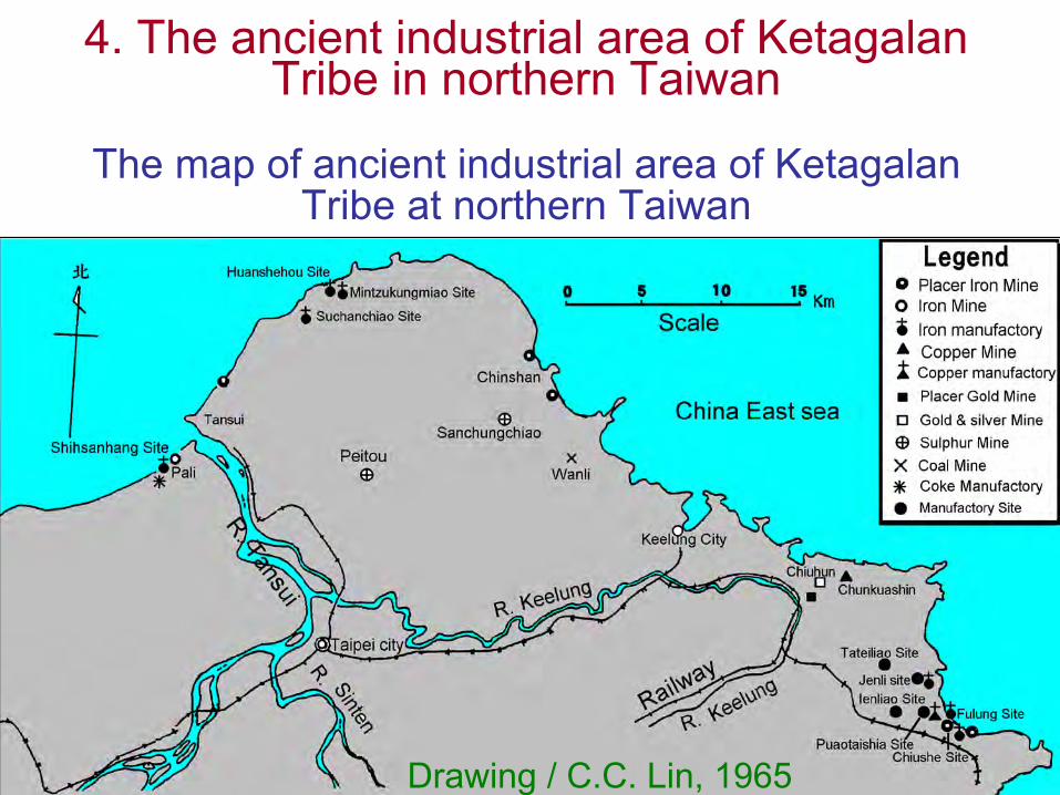
4. The ancient industrial area of KetagalanTribe in northern Taiwan
The map of ancient industrial area of KetagalanTribe at northern Taiwan
Drawing / C.C. Lin, 1965

The map of ancient industrial area at northeastern corner of Taiwan
The smelting plant of earlier generation of Ketagalan tribe
“East Sea view scheme” described: ‘Striving spreadingrecently, yet there are gold, silver and copper minebehind the mountain’. Here is the area of Jiufen andChinkuashih. A large number of wood coal, fine coal,anthracite, coke, pumice, silver residue, copper residueand iron residue are found in the area of Yanliao gulf sitesin recent year that mean a ancient smelting plant ofKetagalan tribe in there. There are colliery industry, ironmining industry, copper mining industry, gold dust miningindustry and gold and silver mining industry in this ancientsmelting industrial region.
Mining industry of Taiwanese Ketagalan tribe
Professor Chao-Gi Lin said: “Ketagalan tribe peopleare the famous hand at mining and smelting, engagesin adopting sand iron and gold dust in their area ofresidence, and exploits such ores as coal, gold andsilver, copper, sulphur and iron-smelting etc. When theHan people begin to move in Taiwan, they havesuperior mined and refined technology already.Ketagalan tribe people are pioneers of the miningindustry of Taiwan, and the Han people and Japanpeople are their undertaking inheritors. By thehistorical data discussion, iron-smelting, paper-making,technology of quarrying sulphur of China may bespread into by Ketagalan tribe people.”
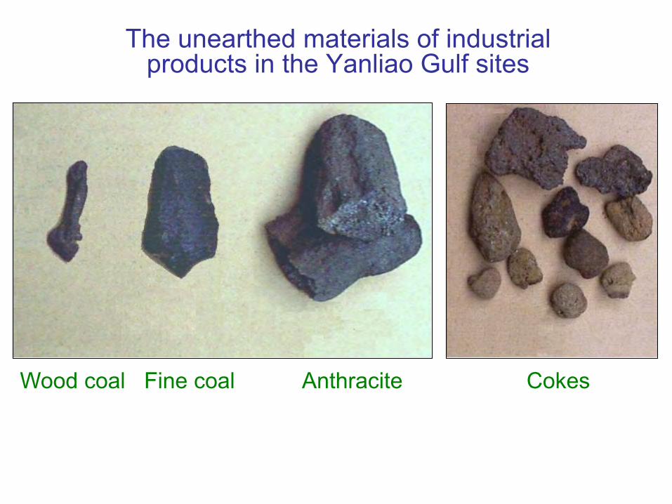
The unearthed materials of industrial products in the Yanliao Gulf sites
Wood coal Fine coal Anthracite Cokes
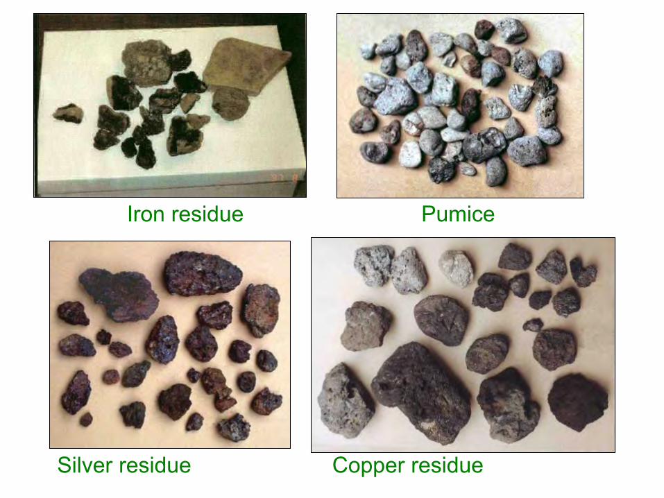
Iron residue Pumice
Silver residue Copper residue

The Jomon potteries about 4,000 yr B.P. were unearthed in Yanliao gulf sites of ancient industrial area.

Shell currency of mill site at Gongliao
Ancient shell currency: cowry Taiwanese Baby-Safe Shell: Tiger cowry

The mill site of ancient clothes with shiny shells at Gongliao
The mill site of ancient clothes with shiny shells wasfound at the south bank of outlet in 4th nuclear powerplant.

The manufacture process of ancient clothes with shiny shells :
1. Knocking shell into slices (left), then mix with hard thinstones, and put into waterwheel stone mortar, then usehydraulic power to grind.2. After grinding, the surface of shell slices is smooth andburnish, and some stone mixes with it (middle).3. Picking the long ground shell slices to decorate as theornament shell slices (right), then pierce a hole with a stringto become an ornament set with shell slices.
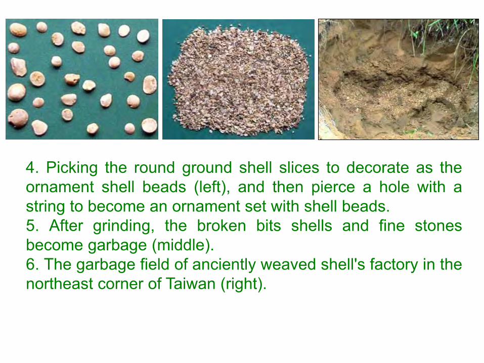
4. Picking the round ground shell slices to decorate as theornament shell beads (left), and then pierce a hole with astring to become an ornament set with shell beads.5. After grinding, the broken bits shells and fine stonesbecome garbage (middle).6. The garbage field of anciently weaved shell's factory in thenortheast corner of Taiwan (right).

The midden ofcowry at Gongliaowas dated morethan 3,500 yr B.P.
Gongliao mill site is earlier than San-Hsin-Tui of China 200 years
According to the report of dating, at Gongliao mill sitethe unearthed shellfish had a history of 3510±40years old, At that time, the world history was Egyptianinitial one, the historical relic was even earlier than3,300 years at Shang Dynasty at San-Hsin-Tui ofSichuan in China too. This is the north ancient culturalgarden of the most great industry of Taiwan, and maybe the ancient industrial area initially of the world too.

“Slight description of island people” proved the ancient industrial area in the northern Taiwan
• In 1349 Yuan dynasty, Da-Yuan Wang toured aroundTaiwan and wrote “Slight description of island people”. Inthis book described: ‘The terrain of Ryukyu (i.e. Taiwan)is coiled vault; in there the trees are very big. It lookedvery close from Penghu. I climb this mountain to observethe sea tide rise and fall; at midnight I look at east valley,in there red light shines the sky, the summit becomescomplete brightness.…’
• In the statement of Da-Yuan Wang, at midnight is notearly morning, and see 'east valley' is in the east valley ofKeelung Mountain, and ‘red light shines the sky, thesummit becomes complete brightness’ means the light ofsmelting industry shines the summit of Keelung Mountainwell-illuminated at midnight that is the identification of theancient industrial region of Yanliao gulf.
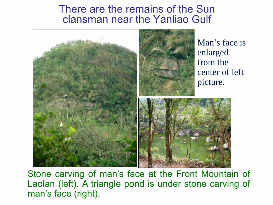
There are the remains of the Sun clansman near the Yanliao Gulf
Stone carving of man’s face at the Front Mountain ofLaolan (left). A triangle pond is under stone carving ofman’s face (right).
Man’s face is enlarged from the center of left picture.

The assembly hall of the Sun clansman at the Front Mountain of Laolan
A ㄇ shape artificial construction was piled from threelayers of slab stones. It should be supported with postsand covered with the cogon grass as the roof andbecome the assembly hall.

5. Taiwan is the Fairyland of Peng-LaiThe ancient book of China described Taiwan
was the Fairyland of Peng-Lai• “The Classic of Mountains and Rivers” recorded: ’Peng-Lai
Mountain (i.e. Taiwan) is in the East Ocean, in there somecelestial being and the immortal medicines are living. Itsanimals, birds and beasts are all white; the imperial palace ismade of gold and silver’.
• About 1730 years ago, Yuo San in his writing: “Records ofthe vicinity of the sea and the land” stated: ‘Yi Continent (i.e.Taiwan) in southeast of Lin-Hai prefecture, 2000 li apart;there is no frost and snow, and grass and tree never fade, inall directions are mountains,.…… The land is fertile andproduces grains of all kinds and there are plenty of fish andmeat.’ Since ancient times in Taiwan, the soil is fertile,growing is prosperous, resources are abundant, livelihood iseasy, that forms the life of Taiwanese people leisurely like‘celestial being of Peng-Lai Mountain’. So, Taiwan is theFairyland of Peng-Lai where the ancient Chinese dream of.

Zi-Xiu Lin described Taiwanese aboriginals were the celestial being
Zi-Xiu Lin in the preface of “Taiwanese general history” wrote:‘‘Before Cheng-Gong Zheng built up a country in Taiwan,there were the people of remote antiquity living. They did notplow but never hungry, not weave but always mildly warm.They examined the season through flower blooming andgrass growing, and differentiated day and night through sunsetting and moon rising. They dwelt in caves of mountain anddrank in valley, and depended on the birds to look for and thebeast to cease. They were no annoyed personnel matters,but had the physiological happiness. Were they not theancient so-called celestial being?” So, as to prove Taiwan inprehistoric period, the aborigine’s forms of livelihood,psychology and physiology were the celestial being.

Taiwan is the most abundant place of the global bio-diversity
Today in Taiwan nourishes the numerous animalindividuals of figure in water areas or land, and luxuriantplant. There are more than 1/10 of world marinebiological kinds around the island of Taiwan, and thereare over 136 kinds of fresh-water fishes even more in theland water areas, among them 38 kinds are peculiarkinds. The difference of height above sea level is greatby land, contain the plants of different temperatures, thefigure of biological kind is nearly equal to whole Europe,show that Taiwan has the abundant resources of bio-diversity in water areas and land. It is apt to live inTaiwan in the ancient times, the Fairyland of Peng-Laideserves.

Shang dynasty copper replaced shell currency Taiwan declined gradually
The people of remote antiquity in the Fairyland of Peng-Lai lived like celestial being, with the result that they hadno volition of progress and development, and caused thebad consequence; in the progress of civilization of theworld, caught up with and surmounted by othernationalities gradually with the passage of time. Chinaespecially develops superior cultures that happen,sweep across and replace Taiwan civilization in order totendency that catches up from behind. Since Shangdynasty rose, then copper coin replaced shell currency.The shell currency of Taiwan withdrew from the Chinesemarket gradually; therefore Taiwan had ancient civilizationgradually on the decline and was downfallen.
The homeland of Austronesian is Taiwan
1.Discussion from linguistics2.Discussion from paleology3.Discussion from genetics4.Discussion from culture
1. Discussion from linguisticsThe languages of Austronesian family belonged to the Taiwanese aborigine
• The people of Austronesian language family were foundfrom the different people of the general Pacific Oceanhad the same language that called Proto-Austronesian,and belonged to the languages of Taiwanese aborigine.
• The place of the most numerous languages may be thehomeland of these language families. The Taiwaneseaborigine have more than twenty languages, the mostone in the world that reveals maybe the homeland ofAustronesian language families.

The authority of linguistics believed Taiwan was the homeland
Jen-Kui Li, an academician, firstly brought up theperspective that Taiwan was the homeland of theAustronesian language families. He found the languagesof Taiwanese aborigine accounted for the 3 branches ofthe all 4, and the components of proto-language werehighest, and kept the accent of Proto-Austronesian, thatindicated it was the most complicated, and handed down avery long time ago. Comparing to other Austronesianfamily didn’t change more that revealed Taiwan was thehomeland of Austronesian language family.

International scholars consider Taiwan is the homeland of Austronesian
• In 1975, two linguists, Richard Shulter and JeffreyMarck, brought up the claim that Taiwan was mostprobably the homeland of the Austronesian languagefamilies.
• In 1985, Dr. Robert Blust issued a paper: “TheAustronesian homeland: A Linguistic perspective” toconsidered that Taiwan was the homeland of theAustronesian language families.
• In 1991 Australian Professor Bellword announced,Austronesians were Dispersal from Taiwan with 7stages. He inferred Austronesian language familiesemigrated from Taiwan to islands one after anotherabout 5000 years ago.

7 Stages Dispersion Map of Austronesian Language Families
In 2002 the 19th International Conference on ComputationalLinguistics, Laurent Sagart, a linguist of France NationalScience Research Center, and Dr. Erika Hageberg, thephysique anthropologist of Oslo University, supported thetheory of Taiwan homeland.
European scholars support the theory of Taiwan homeland
Language phylogenies reveal the Austronesian origin in TaiwanIn January 2009 “Science” reported, Russell Gray, Professor ofUniversity of Auckland of New Zealand, used lexical data andBayesian phylogenetic methods to construct a phylogeny of400 languages. In agreement with the scenario of expansionpulse and settlement pause, the language trees place theAustronesian origin in Taiwan approximately 5230 years ago.Then they migrated to Philippine, and moved fast to scatterfrom Philippine to Pacific Ocean within 1200 years, on wideover 7000 km to reach New Zealand, Hawaii and Easter Island,and Madagascar of the Indian Ocean finally.

Tour of the Austronesian language family migrated over past 5230 years
The Austronesian language family is the one of the largestin the world that has spread from Taiwan to Hawaii, NewZealand, Easter Island and Madagascar.

Remains of civilization in Taiwan
There are many remains of civilization in Taiwan. Investigation results in archaeology from Japanese occupation Time through 1949. Οindicates prehistoric relic and Δ indicates pre-historic relic involved cowry midden.
2. Discussion from paleology
The distribution map of primary prehistory remains in Taiwan
There are more than 1,500remains of Taiwan'sprehistory and the primarysites are over one hundred.
Drawing / Wen-Xun Song 1992, Yi-Chang Lui review

Space-time structure of prehistoric culture in Taiwan
Drawing / Yi-Chang Lui, 1996

The biggest grindstone in the world and its shelter at Yuanshan of Taipei
In 1896 Japanese scholar found the biggest grindstone(left) in the world at Yuanshan and built a shelter (right)for it, but later the shelter was dismantled and thegrindstone lost.
The biggest grindstone was carved words and set up as a stele
Afterwards the big grindstone is found to become a steleat nearby Linji temple. The elder Master Baisheng's script‘No persistence grows mind’ carves in it that loses itsvalue. Very regrettable!
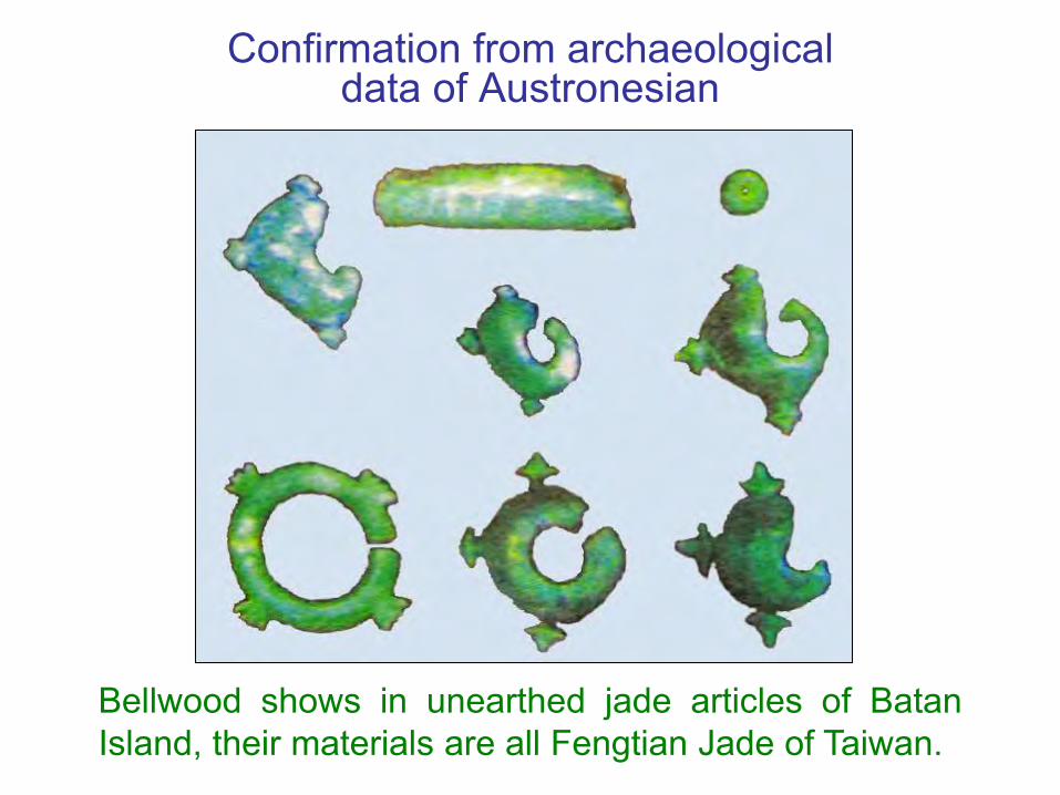
Confirmation from archaeological data of Austronesian
Bellwood shows in unearthed jade articles of BatanIsland, their materials are all Fengtian Jade of Taiwan.

Fengtian Jade is widely distributed Southeast Asia proves Taiwan is homeland
In November 2007, American National Academy of Sciencesannounces that the 80% jade articles of various countries inSoutheast Asia come from Taiwanese Fengtian Jade.Vietnam and Philippine unearthed jade earrings (left) andJade articles in Philippine Bardem archipelago (right) are allFengtian Jade; Verify 'The Taiwan jade spread theory '.

Jiuxianglan Remains had the factories of copper and cast iron before 2,000 years ago
In 2003 there were the molds of bronze ware and castiron unearthed at Jiuxianglan Remains of Taitung inTaiwan. According to it, the archaeologist inferred theTaiwanese aboriginal had the craft civilization technologythat the factory produced in a large amount as early as2,000 years ago. The mold of sandstone compositionscan produce the copper bell, knife handle, and theironware, ear ornaments, lazurite pearl, etc., and itsconformation is quite accurate that shows civilizationtechnology is excellent.
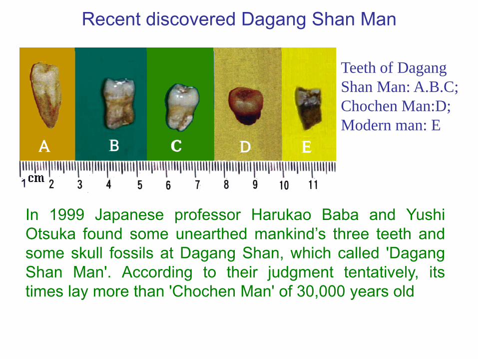
Recent discovered Dagang Shan Man
In 1999 Japanese professor Harukao Baba and YushiOtsuka found some unearthed mankind’s three teeth andsome skull fossils at Dagang Shan, which called 'DagangShan Man'. According to their judgment tentatively, itstimes lay more than 'Chochen Man' of 30,000 years old
Teeth of DagangShan Man: A.B.C; Chochen Man:D; Modern man: E
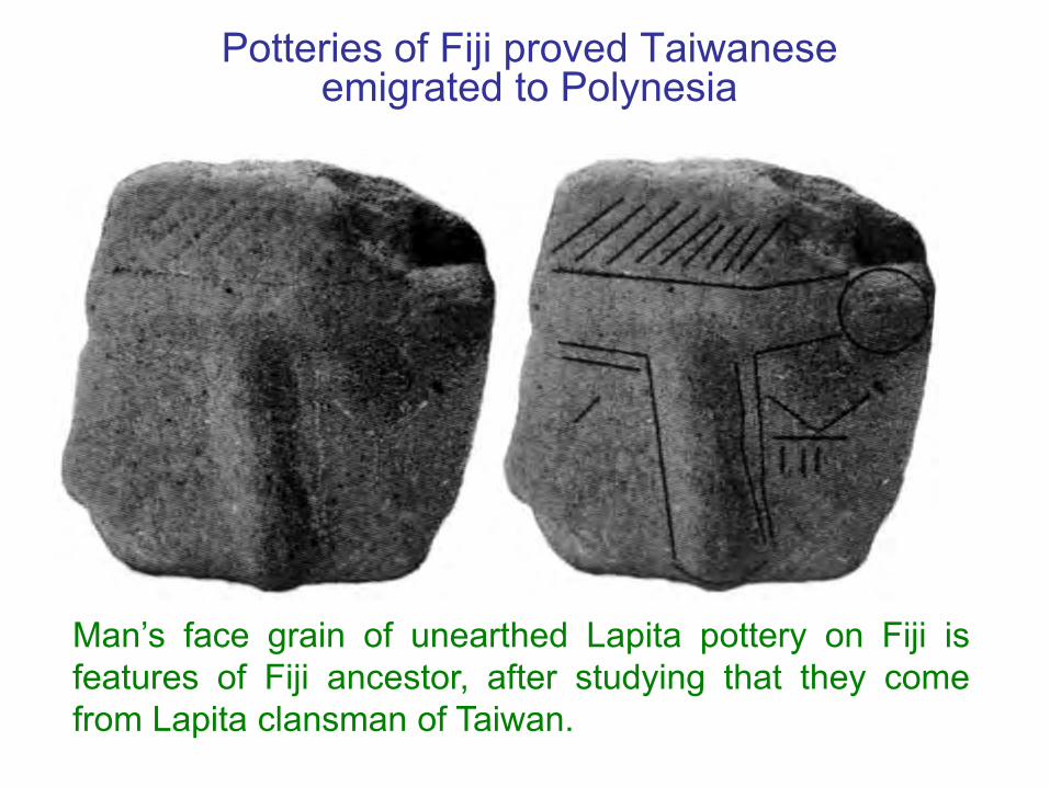
Potteries of Fiji proved Taiwanese emigrated to Polynesia
Man’s face grain of unearthed Lapita pottery on Fiji isfeatures of Fiji ancestor, after studying that they comefrom Lapita clansman of Taiwan.
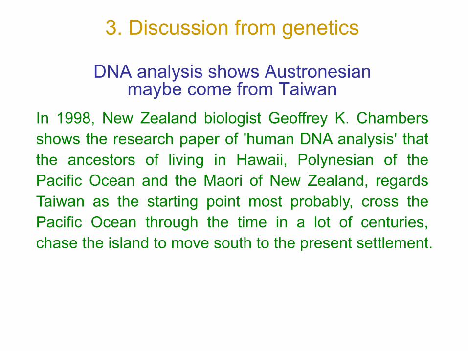
3. Discussion from genetics
DNA analysis shows Austronesian maybe come from Taiwan
In 1998, New Zealand biologist Geoffrey K. Chambersshows the research paper of 'human DNA analysis' thatthe ancestors of living in Hawaii, Polynesian of thePacific Ocean and the Maori of New Zealand, regardsTaiwan as the starting point most probably, cross thePacific Ocean through the time in a lot of centuries,chase the island to move south to the present settlement.
Gene studies show Austronesian comes from Taiwan• In recent years, a lot of both internal and international
famous experts make mitochondria DNA analysis andresearch, which show that Austronesian lives in Polynesianof the Pacific Ocean, Maori of New Zealand etc., theirblood relationship comes from Taiwan.
• In 2003 Austronesian international convention presentation,Geoffrey Chambers, the scholar of New Jealand, issued apaper. He pointed out that Taiwan was the homeland of theAustronesian.
Taiwanese scholar proved Austronesiancame from Taiwan
Professor Marie Lin of Mackay Memorial Hospital issued theresearch results in 2004, shown by direct gene evidence:Polynesian in Hawaii of Oceania area came from Taiwan, andthen just developed maturely in East Indonesia or Melanesiathat proved Austronesian came from Taiwan.

Analysis of Helicobacter pylori verified people migrated to Pacific from Taiwan
A report on the journal “science” in January of 2009,Professor David Graham of Baylor College of Medicine inHouston, utilized two kinds of different Helicobacter pylori,called hpSahul and hspMaori, tracked the mankindmigrates in the history. They utilized the strain ofhspMaori to prove the Taiwanese aboriginal migrated toMelanesia and Polynesia about 5,000 years ago.

4. Discussion from culturePersonal manual weaving facility
The personal manual weaving facility of the women ofKetagalan and Kavalan, the aborigine of Taiwan, spreadto all the aborigines of the world. Aborigine of CarolineIslands Kusaie Island twists banana fiber into thread andweaves thread into cloth. This technical skill immigratedfrom Kavalan’s, the aborigine of Taiwan.

Tapenkeng culture contains whole Taiwan and China
The name of Tapenkeng cultural Remains came fromTapenkeng midden at Bali of Taipei County. It is wide todistribute on Taiwan, including : the west coast, Yuan-Shan of Taipei, Ba-Jia Village of Tainan County, Fengbitouof Kaohsiung county and Yue-Mei of Hua-Lian county,even there are similar sites in the coastal all parts ofFujian and Guangdong.
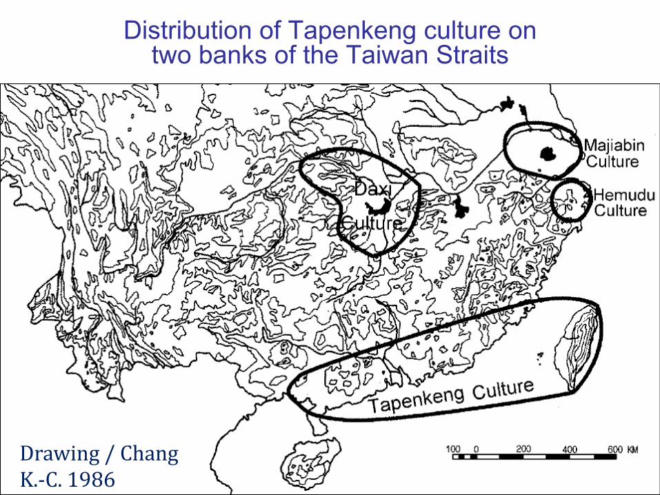
Distribution of Tapenkeng culture on two banks of the Taiwan Straits
Drawing / Chang K.-C. 1986

Tapenkeng culture is the ancestor’s of Austronesian
• Tapenkeng culture began to the culture of nativecountry 3400 years ago till 6300 years ago; its potteryis generally called coarse Jomon Pottery.
• In the distribution area of Austronesian, thearchaeological evidence of unearthed implements atNeolithic Remains, the archaeologists use radioactivityof 14C to determine its era. They find TaiwanTapenkeng culture is the earliest one.
• The content of Tapenkeng culture generally accordswith the Austronesia’s, so, Tapenkeng culture maywell be termed ancestor of Austronesian culture.
Theory of Taiwan homeland of Austronesian is obtained gradually definitely
• By the scientific research of four items: linguistics,paleology, genetics and culture, most scholars havealready admitted that Austronesian comes fromTaiwan.
• Tapenkeng culture is ancestry culture of Austronesian;the opposition person is not enough to deny 'Thetheory of homeland of Taiwan'.
• From inferring that Austronesian language is thelanguage of the Empire of the Sun now, certainly wecan confirm the theory of homeland of Taiwan.

Opposing person is unable to overturn the theory of Taiwan homeland
• The statement of 'The homeland of Austronesianfamily is Taiwan' is agreed by most scholars, and canbe confirmed; But a minority of opposing scholarsobject to it. Among them the most is several ofTaiwan, it still needs more evidences to plead, in factthe evidence has been already more than enough!
• Some of opposing scholars thinks all the time thelanguage of Austronesian is introduced from southernChina to Taiwan, and then spread out again. Ifculture of Austronesian introduces from China toTaiwan, why not find any trace left in China today?

Austronesian is the descendant of the Empire of the Sun
Route of Homo sapiens' migrationThe mankind originated in Africa and emigrated along the present shelf of the Indian Ocean to Southeast Asia and SundaArchicontinent.
Austronesian originated in the land of Mu• The Taiwanese aboriginal's ancestor moves from
Sunda Archicontinent northwards along the SouthSea Archicontinent of west Pacific Ocean reachesTaiwan and the north when the glacial period iswarmer and warmer.
• Taiwan Proto Austronesian lacks the navigation andvessel vocabulary, other areas have not been scarcethat prove Taiwan aborigines has already settleddown in glacial period.
• Ancestor of Austronesian comes from Taiwan, theland of Mu; i.e. they are the descendants of theEmpire of the Sun.
Ketagalan and Kavalan are the direct descendants of People of Mu-Land
Ilan area was the ancient site of the capital of Empire ofthe Sun, the aboriginal initially was Kavalan, they arecertainly direct descendants of the people of Mu-Land;And Katagalan and Kavalan call themselves brother'sfriendship now, but also call themselves the descendantsof the Sun clan, so two clans are direct descendants ofthe Empire of the Sun. We should infer all the Taiwaneseaboriginals are descendants of Empire of the Sun.Extrapolating today Austronesian language is thelanguage of Empire of the Sun, certainly we can confirmthe theory of Taiwan is the homeland of Austronesianlanguage family.

Polynesian who comes from Taiwan sails to the whole world in ancient times
• Polynesian has excellent navigation technology, in notseeing Marginal Ocean; they are two-way sail and theearliest sail to the whole world without by coast inancient times.
• The main scholar and expert admit Polynesian comesfrom Taiwan.
• Indonesian Presbyterian Church executive chairmanJan Rumbrar pointed out in the origin legend of theirnationality their ancestor came from Taiwan.
• In 1995, scholar Starosta pointed out clearly evenmore the plain of Tainan was the emigration center ofAustronesian.

‘Bangka’ was once battleship of Taiwanese aborigines
Twin-hulled ship that Polynesian sailed in the PacificOcean today should be battleship of Taiwaneseaborigines.
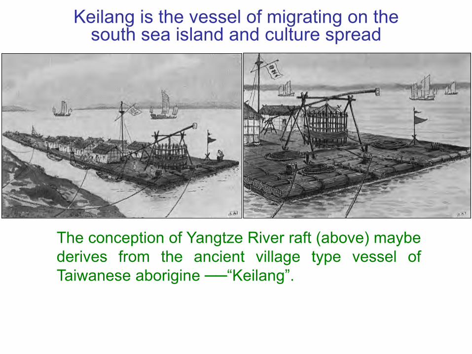
Keilang is the vessel of migrating on the south sea island and culture spread
The conception of Yangtze River raft (above) maybederives from the ancient village type vessel ofTaiwanese aborigine ──“Keilang”.

Austronesian emigrate from Taiwan because the natural disaster
After Mega-tsunami takes place, the civilization of Taiwanis almost totally destroyed, and then glacial period close,there are still extensive earthquake and tsunamicontinuously that make Taiwanese aborigines living inpopular feelings of panic, in order to seek safe place forrefuge. Since 6000 years ago, some aborigines havebrought the family from Taiwan emigrant to warm southislands, and form the territory of ‘Austronesian’.

The map of Austronesian

The circle of Mu’s civilization was within the Austronesian domain
The Empire of the Sun was the motherland of Austronesian
Although the land of Mu was really not in here, but thelocations of megalithic civilization belonged to theEmpire of the Sun, and were all within the Austronesiandomain in the Pacific Ocean. Therefore, it was said thatthe creator of civilization, the Empire of the Sun, was themotherland of Austronesian.

The relics map of megalithic civilization in the Islands of Pacific Ocean
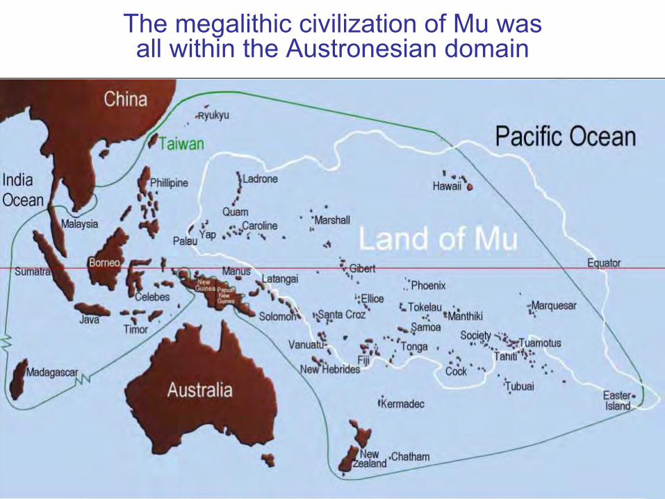
The megalithic civilization of Mu was all within the Austronesian domain
Austronesian is the descendant of the Empire of the Sun
Though the land of Mu is not in the middle of the PacificOcean in fact, but the Empire of the Sun megalithiccivilization in the Pacific Ocean is enclosed and includedin Austronesian domain, so the civilized founder in theworld ──The Empire of the Sun, is the motherland ofAustronesian. The Empire of the Sun is certainly inancient Taiwan, Austronesian is the descendant of theEmpire of the Sun; the homeland of Austronesian iscertainly ancient Taiwan.

The American aboriginal's homeland may be Taiwan
• It is said that the American aboriginals originallymoved in from Siberia by Bering, but modernarchaeology finds the evidence that they come fromthe Pacific Ocean Island that verify Americanaboriginal have settled down by seaway too.
• Blood analysis proves the North American aboriginalmay be with Taiwanese aboriginal's homology.
• According to studying the science the scholar infers :The aboriginals initially in America may be the peoplein Pacific Ocean Island, they move from Taiwan thatare the descendants of the Empire of the Sun.
Ancient remains of Cliff Dwellers in Colorado River area
Initially in America, the aboriginal Cliff Dwellers shouldbe Polynesian, who entered the American door fromthe mouth of Colorado River, they expanded to theupper reaches and inland along this river first, and thenreached a lot of footpaths and inland of its tributaries,including every state in the whole area full of CliffDwellers countless ancestors' traces. These remainsconsist of cliff houses, rock carvings, rock paintings,rock writings and various utensils and instruments.

The Map of the Colorado River and its tributariesThe Cliff Dwellersenter the gatewaythrough the mouth ofColorado River intothe Unit States, andpossibly their prede-cessors as well.
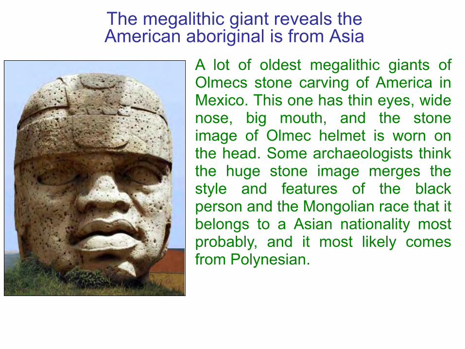
The megalithic giant reveals the American aboriginal is from Asia
A lot of oldest megalithic giants ofOlmecs stone carving of America inMexico. This one has thin eyes, widenose, big mouth, and the stoneimage of Olmec helmet is worn onthe head. Some archaeologists thinkthe huge stone image merges thestyle and features of the blackperson and the Mongolian race that itbelongs to a Asian nationality mostprobably, and it most likely comesfrom Polynesian.
The are common points of civilization in every place of the world
Every continent and island in the world, especially with theresidents on the island in the area of general Pacific, veryremote apart, but mostly there are common points in thegeneration to generation on of the custom, culture andlanguage. These common points may have source of the sameancient civilization that is from the Empire of the Sun. Thecommon points are:1. Megalithic structures in Pacific Ocean Rim2. The similar megalithic carving3. Terraced pyramids all over the world4. The similar ancient writings are over the half world5. The similar unearthed ancient potteries
over the Pacific Ocean Rim6. The colonies worshiped the god of the Sun
The ancient relics of the Empire of the Sun in the world

1.Megalithic structures in Pacific Ocean Rim
Cataclysmic flood caused the motherland of man, theEmpire of the Sun, disappeared in 12,000 years ago, andbrought disaster to the coastal places and scatteredislands in the Pacific Ocean. Now some relics ofmegalithic civilizations still remain here, where all mostthe aborigines don’t know it come from and the use. Eventhe scientists cannot explain it and only regard it as thecivilizations of Mu. Obvious it is the relics of the Empire ofthe Sun that have destroyed after the cataclysmic flood.

The plan of Nan Madol, Ponape

The megalithic wall of city relic at Nan Madol outside Ponape Island
The enormous relics of Nan Madol is an artificial island,there is an intact city under water; The street, stone pillar,stone room, all with group's frame of the basalt column,estimates all about 500,000 pieces, each stone pillar weighsmore than 10 tons, another enclosure 875 meters long, thehighest point can be up to 14 meters.

The relics of unknown usage of megalithic civilization
The Latte stones of Tinian on Saipan Island (left).The black megalith on Palau of Babeldaub Island (right).

Megalithic array on Hinapsan Island Latte pillars on Saipan Is.
The Latte pillars of house of taga (left & right) on Tinian Is.

The front figure (up)and rear picture(down) of Arch ofMaui on Tonga-Tabu Island.

The type of building megalithic wall in some parts of the world is the same.
The masonry work ofstone wall of Ahu onEaster Island (up) andthe megalithic wall ofInca at Cusco (down) aresimilar.
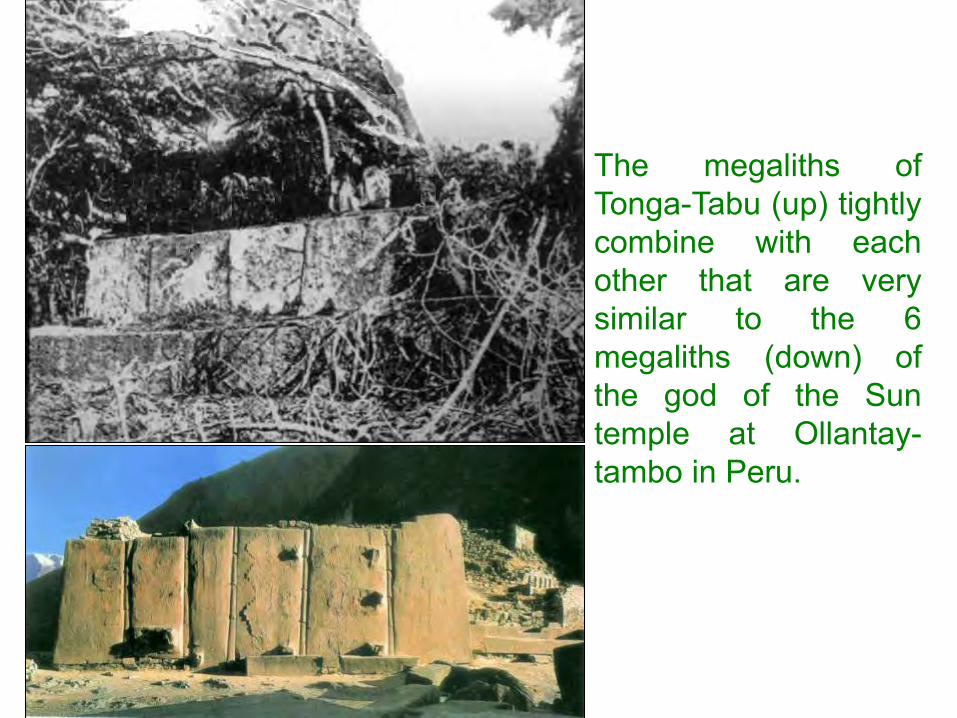
The megaliths ofTonga-Tabu (up) tightlycombine with eachother that are verysimilar to the 6megaliths (down) ofthe god of the Suntemple at Ollantay-tambo in Peru.

2. The similar megalithic carving
The megalithic giant “Moai” on Easter Island
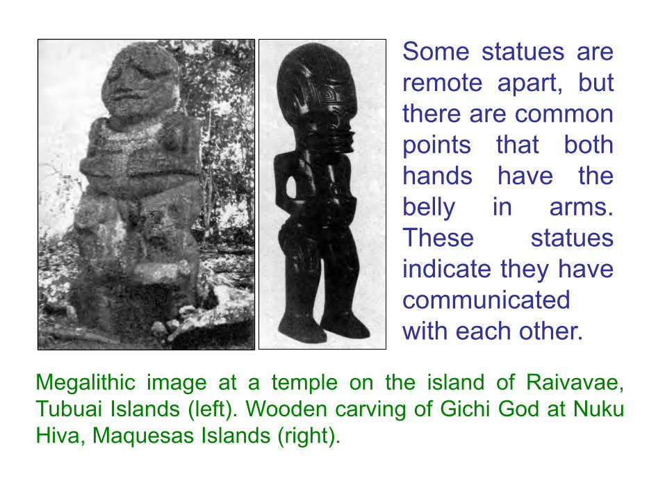
Some statues areremote apart, butthere are commonpoints that bothhands have thebelly in arms.These statuesindicate they havecommunicatedwith each other.
Megalithic image at a temple on the island of Raivavae,Tubuai Islands (left). Wooden carving of Gichi God at NukuHiva, Maquesas Islands (right).

Stone carving image on Jejudo, Korea (left). Stonecarving image of monkey at Nara, Japan (middle).Relief image of monolith at Tiahuanaco, Bolivia (right).
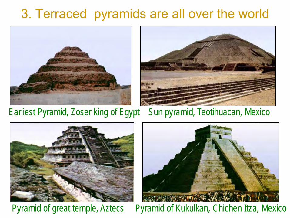
3. Terraced pyramids are all over the world
Earliest Pyramid, Zoser king of Egypt Sun pyramid, Teotihuacan, Mexico
Pyramid of great temple, Aztecs Pyramid of Kukulkan, Chichen Itza, Mexico

Magician pyramid, Uxmal, Mexico Pyramid of inscription temple, Palenque
No.1 pyramid , Tikal, Guatemala Recess Pyramid at El Tajin, Mexico

Terraced pyramid of temple at Tahiti (left). Terracedpyramid of King’s mausoleum at Tuitonga (right).
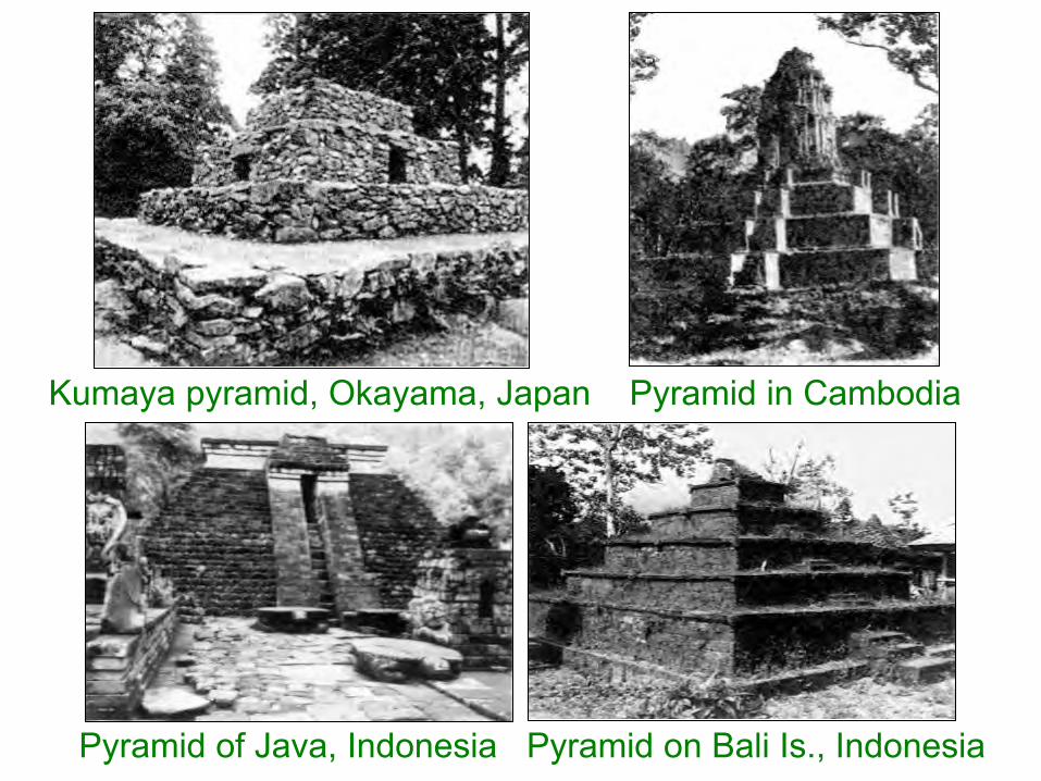
Kumaya pyramid, Okayama, Japan Pyramid in Cambodia
Pyramid of Java, Indonesia Pyramid on Bali Is., Indonesia

4. The similar ancient writings are over the half world
The writings of Lungo Lungo on Easter Island

The similar ancient writings between Lungo Lungo and India
Lungo Lungo (E) and Indian ancient writings (I) are thesame type, and E approaches to original pictograph,which should be the letter of the alphabet of Mu.

5. The similar unearthed ancient potteries over the Pacific Ocean Rim
Jomon potteries of Japan (1~4); Jomon potteries ofEcuador (5~7); Jomon potteries of Taiwan: Tapenkengcultural relics of Niumatao (8); Tapenkeng cultural relics ofZhishanyan (9~10); Yingpu cultural relics of Shuidiliao(11~13), all its textures are very exactly like.

6. The colonies of the Empire of the Sun worshiped the god of the Sun
The word “Inca” means “the son of the Sun” in theaborigines of Inca. The god of the Sun of Egypt ── Ra, isthe same name of the Emperor of Mu and Pharaoh isregarded as “the son of god of the Sun. The word “Apollo”comes from the myth of ancient Greek and Roman. TheAmaterasu, the main goddess of Shinto in Japan, is alsoan Apollo. Apollo is the god of the Sun.
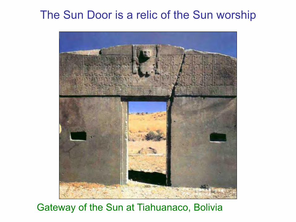
The Sun Door is a relic of the Sun worship
Gateway of the Sun at Tiahuanaco, Bolivia
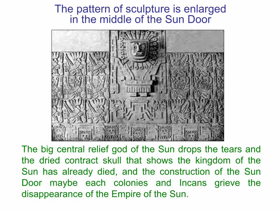
The pattern of sculpture is enlarged in the middle of the Sun Door
The big central relief god of the Sun drops the tears andthe dried contract skull that shows the kingdom of theSun has already died, and the construction of the SunDoor maybe each colonies and Incans grieve thedisappearance of the Empire of the Sun.

The temple of the Sun of Inca remains at Machu Picchu
Inca remains at Machu Picchu (left),there are the temple of the Sun andthe horse post of the god of the Sun(right). Those are the relics of the Sunworship.

The Totem of the Sun in America

Taiwan was once the Center of Domination among federal nations in the world before Zheng-He
Zheng-He's fleet sailed to the Occident 7 timesThe Emperor of Ming Dynasty sent Zheng-He as an envoyto the Occident in 1405. Zheng-He sailed to the Occidentseven times, reached the east coast of Africa farthest.Zheng-He reached Southeast Asia, South Asia, Iran, Arab,Africa east bank and Red Sea amount to more than thirtycountries and regions along the bank within 28 years.
Recent interpretation of Zheng-He fleet's deedIn 2002, Britain retired officer Gavin Menzies published anew book “1421 years: China finds the world”, declaredZheng-He already found the New World in the 15thcentury middle period, and surrounded the whole world.The scholars of Taiwan and China retort the absurd theoryof Zheng-He surrounded the whole world.

Descendants of the Empire of the Sun already set up global trade network
• The Chinese cultural relics from all parts of the world thatMenzies obtains is with good grounds, can mostlyconfirm, and these historical relic information of China, isnot only left by Zheng-He fleets.
• In professor Juxian Wei’s "Chinese find America" pointsout 16 implements of America have the amount of Chinaancient word over 70, peculiar ancient pattern 3, and pot,caldron, oblation, granary…that all already have hadbefore Zheng-He.
• Have already been set up global trade network by thedescendants of the Empire of the Sun before Zheng-He,the Chinese cultural relics in China is transported out bythem and spread to all parts of the world.

Aborigines once called Taiwan was the operation center of federal states
• The term ‘Galan’ of Ketagalan word is for ‘union’ or‘federal’ in modern languages. Wa Lung is also ‘Galan’in Latin word, and ‘Keelung’ or ‘Chilung’ in MandarinChinese, in order to show the places of some parts ofthe world, which are confederate state. There are morethan 20 places, including China, Taiwan, Southeast Asia,Oceania and America, are called ‘Galan’ in differentmother tongue that has associated with each other.
• ‘Taiwan’ in the mother tongue of Ketagalan tribe calls‘Tahuiyuan’, which means ‘center of domination’ or‘operation center’. Aborigines of Ketagalan tribe callthemselves ‘Taiwan' as ‘the operation center' of everyfederal state in the world.

Taiwanese aboriginal signs ' Wa Lung Treaty Documents ' with Holland
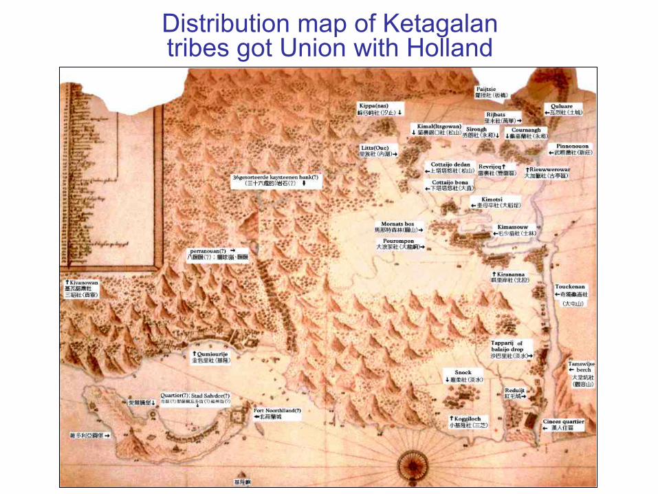
Distribution map of Ketagalantribes got Union with Holland

The feast of Lands Day
Wa Lung Treaty Documents was a diplomatic document,which was signed by Taiwan indigenous tribe meetingrepresentatives and representatives of Holland in 16thCentury. The feast of Lands Day was in accordance with it.

Taiwan was the operation center of federals in the Empire of the Sun
In 650 years ago, before Zheng-He sailed to the Occident,Taiwan was once that climate was warm, the land was fertile,the produce was abundant, industrial development, and thepeople knew the country where the gift abides by the law inthe past, can build up with the businessmen of mutual trustnear various countries, and sign federal peace treaty, so callitself for the operation center of federals. If Taiwan was inancient position of 'the Empire of the Sun', in ancient times,Taiwan certainly had status of ‘operation center of federals’ inthe world.
Ancient book proved Taiwan was operation center of Federal state
In 1349 Yuan dynasty, Da-Yuan Wang’s “Slight descriptionof island people” described: ‘The terrain of Ryukyu (i.e.Taiwan) is coiled vault…. In there yielded gold dust,soybean…. The goods of trade use the stone pearl, agate….“All external countries were about start from here”.’ Thatexplained before Yuan Dynasty, there is trade contacts inChina and all parts of the world, and regarded Taiwan asthe first leading trade country. It is evidence that Taiwan isthe operation center of every federal state in the world.

Ancient Taiwan trade network unties the absurd theory of Zhen-He surround the whole world
Ancient China traded with Taiwan in the most prosperity.Some Chinese historical relics should via Taiwaneseaboriginal, the ancestor of Polynesian that is to say themodern scientist approves, transported to the everyfederals place of the world through the global tradenetwork, it is not the historical relic that Zheng-He leftaround the whole world, so as to explain and feelsuddenly enlightened, unties the Zheng-He’s mystery ofsurrounding the global Earth.
Conclusion: The motherland of the human civilization was exactly ancient Taiwan
• The lost unknown civilization in ancient times was fromthe Empire of the Sun that was developed in ancientTaiwan.
• The lost civilized continents in ancient times, thecontinent of Mu or Atlantis were the same one of Taiwan.
• The motherland of man and the Empire of the Sun wasthe same one exactly in ancient Taiwan.
• The homeland of Austronesian language families wasonly Taiwan.
Hurry up to investigate the treasures of the Empire of the Sun in Taiwan
From describing above, we come to a conclusion that theEmpire of the Sun, the Creator of the civilization, was inancient Taiwan. About 12,000 years ago it was destroyedby the mega-tsunami, which came from the northeasternTaiwan, and only remained few unknown remains ofancient civilizations. If we don’t examine and decipherthose valuable treasures, it will lose forever under high-speed development in present age.
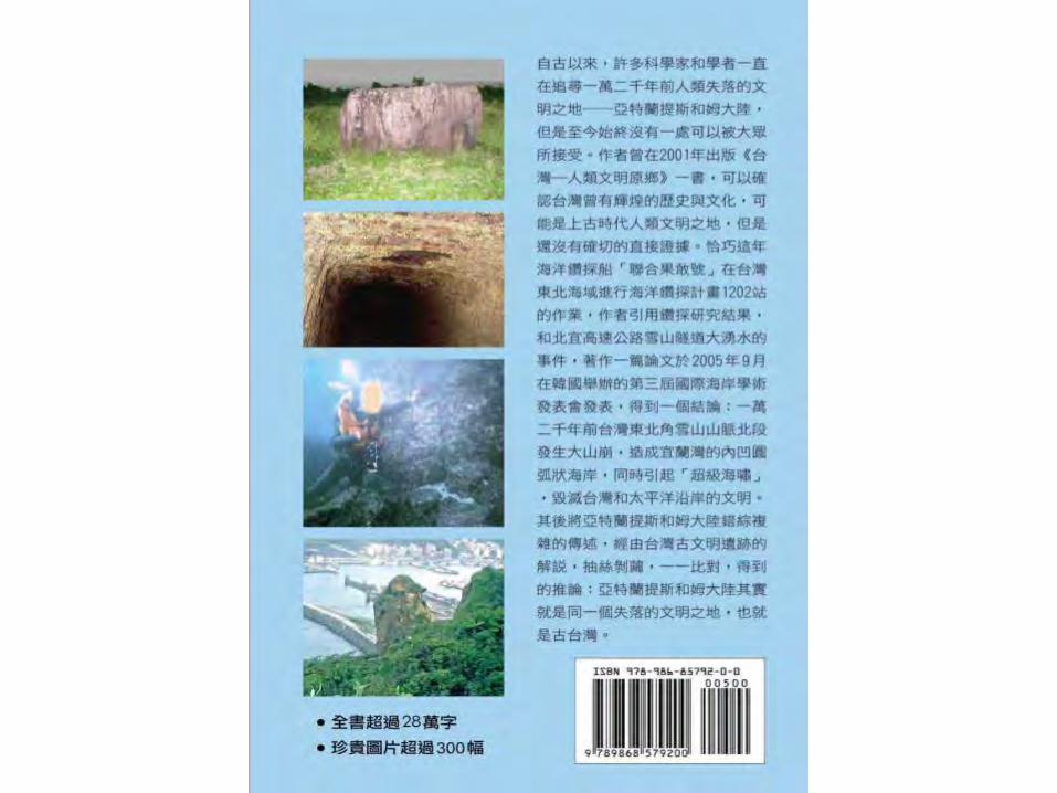

Thank you!