the existing transportation system serving the … … · the existing transportation system...
TRANSCRIPT

THE EXISTING TRANSPORTATION
SYSTEM SERVING THE BYWAY AND
EXPANDING MULTI-MODAL OPTIONS
FOR VISITORS & RESIDENTS 7

Washington State Ferries vessels provide passage to the San Juan Islands from the mainland several times daily.
CORRIDOR MANAGEMENT PLAN 7-1
THE EXISTING TRANSPORTATION SYSTEM SERVING THE BYWAY AND EXPANDING MULTI-MODAL OPTIONS FOR VISITORS & RESIDENTS
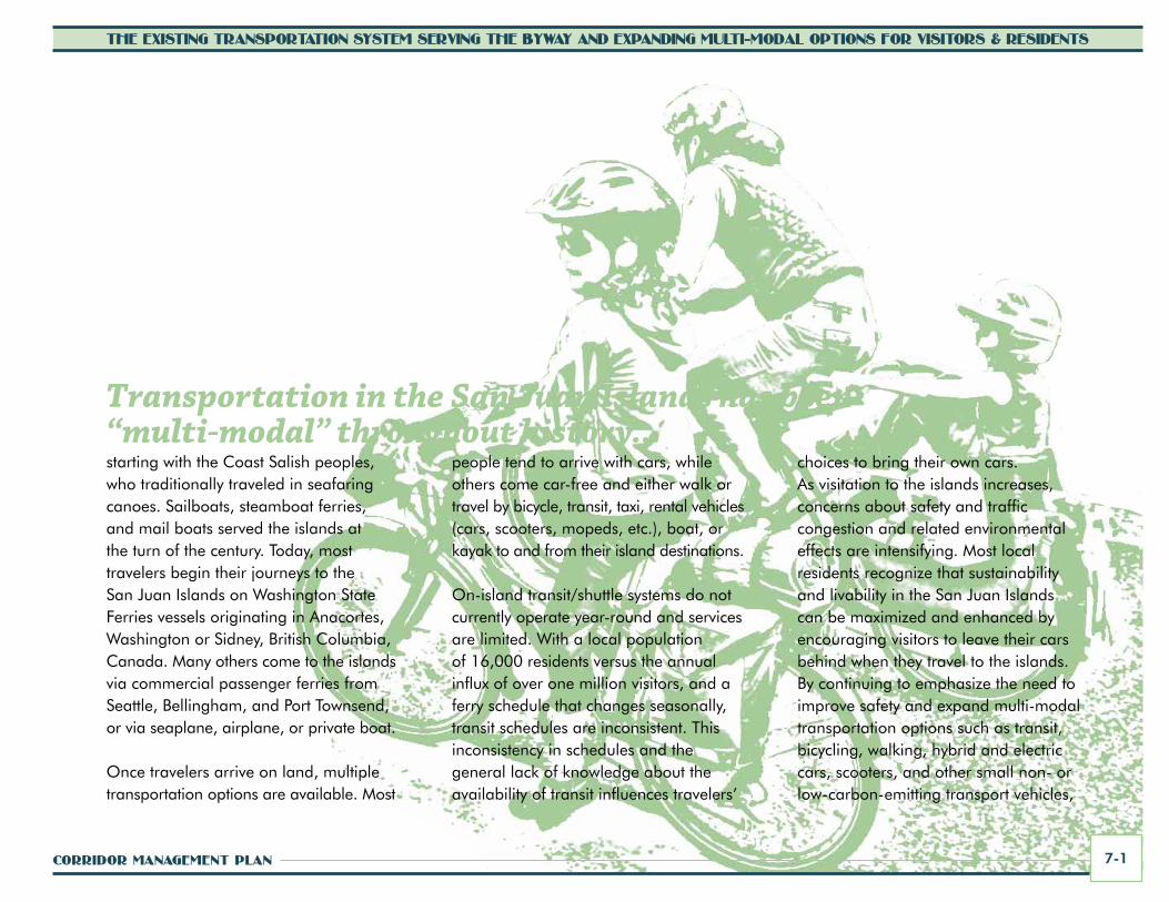
Transportation in the San Juan Islands has been “multi-modal” throughout history... starting with the Coast Salish peoples, who traditionally traveled in seafaring canoes. Sailboats, steamboat ferries, and mail boats served the islands at the turn of the century. Today, most travelers begin their journeys to the San Juan Islands on Washington State Ferries vessels originating in Anacortes, Washington or Sidney, British Columbia, Canada. Many others come to the islands via commercial passenger ferries from Seattle, Bellingham, and Port Townsend, or via seaplane, airplane, or private boat.
Once travelers arrive on land, multiple transportation options are available. Most
people tend to arrive with cars, while others come car-free and either walk or travel by bicycle, transit, taxi, rental vehicles (cars, scooters, mopeds, etc.), boat, or kayak to and from their island destinations.
On-island transit/shuttle systems do not currently operate year-round and services are limited. With a local population of 16,000 residents versus the annual influx of over one million visitors, and a ferry schedule that changes seasonally, transit schedules are inconsistent. This inconsistency in schedules and the general lack of knowledge about the availability of transit influences travelers’
choices to bring their own cars. As visitation to the islands increases, concerns about safety and traffic congestion and related environmental effects are intensifying. Most local residents recognize that sustainability and livability in the San Juan Islands can be maximized and enhanced by encouraging visitors to leave their cars behind when they travel to the islands. By continuing to emphasize the need to improve safety and expand multi-modal transportation options such as transit, bicycling, walking, hybrid and electric cars, scooters, and other small non- or low-carbon-emitting transport vehicles,

SAN JUAN ISLANDS SCENIC BYWAY7-2
THE EXISTING TRANSPORTATION SYSTEM SERVING THE BYWAY AND EXPANDING MULTI-MODAL OPTIONS FOR VISITORS & RESIDENTS
traffic congestion and environmental impacts can be reduced, and the quiet, rural quality of life can be maintained.
This section of the corridor management plan provides:
• a description of the transportation history of the islands
• a summary of existing multi-modal transportation facilities and conditions along the byway
• a description of the byway’s relationship to the regional transportation network
• an assessment of multi-modal transportation needs and recommendations for expanded services and improvement
Transportation History The Coast Salish tribes traveled via canoes throughout the Salish Sea and its tributaries. This was the earliest form of transportation around the region. Throughout history, Coast Salish peoples have been known for their excellent seafaring skills and mastery of the currents and waves. Their sleek, dugout canoes, carefully crafted from red cedar trees from the surrounding forests, generally range from 14 to 26 feet in length. Tribes of the region continue the tradition of canoe-making and seafaring, celebrating this important aspect of their culture through events such as the annual Canoe Journey held each summer.
Expanding Multi-ModalTransportation Options and Enhancing Safety
for All Travelers
The vision for transportation in the San Juan Islands calls
for expansion of multi-modal transportation
options for visitors as well as residents. Expanded
transit services, improved bicycling and walking
facilities, and increased provision of hybrid
and electric transport vehicles for rent are
all actions that, along with promotion of the
opportunity for a “car-free vacation,” will enhance
sustainability and livability in the islands.
Canoe Journey participants

CORRIDOR MANAGEMENT PLAN 7-3
THE EXISTING TRANSPORTATION SYSTEM SERVING THE BYWAY AND EXPANDING MULTI-MODAL OPTIONS FOR VISITORS & RESIDENTS
With European and American settlement in the late 1800s and early 1900s, primary transportation to and from the islands continued to be water-based, and this is still the case today with the ferry service provided by Washington State Ferries. The first military troops and settlers arrived by sailing ships. People continued to use canoes and small rowboats to travel from village to village in the early days. Settlements grew slowly until improved steamship routes and increased commerce began to bring more tourists to the islands. Steamship service began in the late 1800s and most communities had constructed wharfs and were regularly served by wood-fired steamships by 1900.
The first car ferry service between Anacortes, Washington and Sidney, British Columbia, Canada was the privately operated Harvester King, which carried vehicles and passengers from the mainland. This initial service was considered to be experimental. Eventually, the Puget Sound Navigation Company Black Ball Line took over ferry service, operating for 30 years until a dispute ended with the State of Washington assuming control in 1951.
With the exception of a few commercial foot-ferry tour services, the Washington State Ferries system is the primary marine passage provider to the islands today, with terminals at Lopez, Shaw, Orcas and San Juan Islands.
In the early days of settlement, the rocky and forested island terrain made travel difficult. There were no roads, and it was easier to sail, row a boat, or paddle a canoe from place to place than to walk over trails and paths. Thus, many of the earliest settlements were water-oriented, located along the shore. The earliest forms of land travel on the islands were by foot, horseback, and eventually by horse and wagon.
On San Juan Island, the Royal Marines constructed a road to travel between American and English Camps during the joint military occupation of 1859-1872. The road followed the path of a sheep run cleared by Hudson's Bay Company and Cowichan laborers from Vancouver Island. The British troops installed rip-rap rock to reinforce the road. Segments of the rip-rap and wheel ruts from the wagons that once traveled the route are still visible along portions of the road today.
Historic Black Ball Ferry advertisement

SAN JUAN ISLANDS SCENIC BYWAY7-4
THE EXISTING TRANSPORTATION SYSTEM SERVING THE BYWAY AND EXPANDING MULTI-MODAL OPTIONS FOR VISITORS & RESIDENTS
"The military road, in essence, captures the period before the US took formal possession of San Juan Island when the boundary dispute was resolved," National Park historian Mike Vouri has said. "Not only did the road symbolize peacekeeping, it tied one end of the island with the other. This is very much a part of the island's heritage."
In addition to the military routes on San Juan Island, roads within and near settlements on both islands were the first to be developed. Settlers eventually began to develop rough cart tracks, and loggers made skid roads to move timber to the water or mill. Outlying areas remained undeveloped, and it was a long time before villages were fully connected by land. When roads did exist between villages, they were often very rough or impassible particularly after it rained or snowed. On Orcas Island in the early 1890s, there was still no road connecting Olga and Eastsound until local citizens petitioned the county for funds to build a road around Cascade Lake to facilitate wagon passage between the two villages.
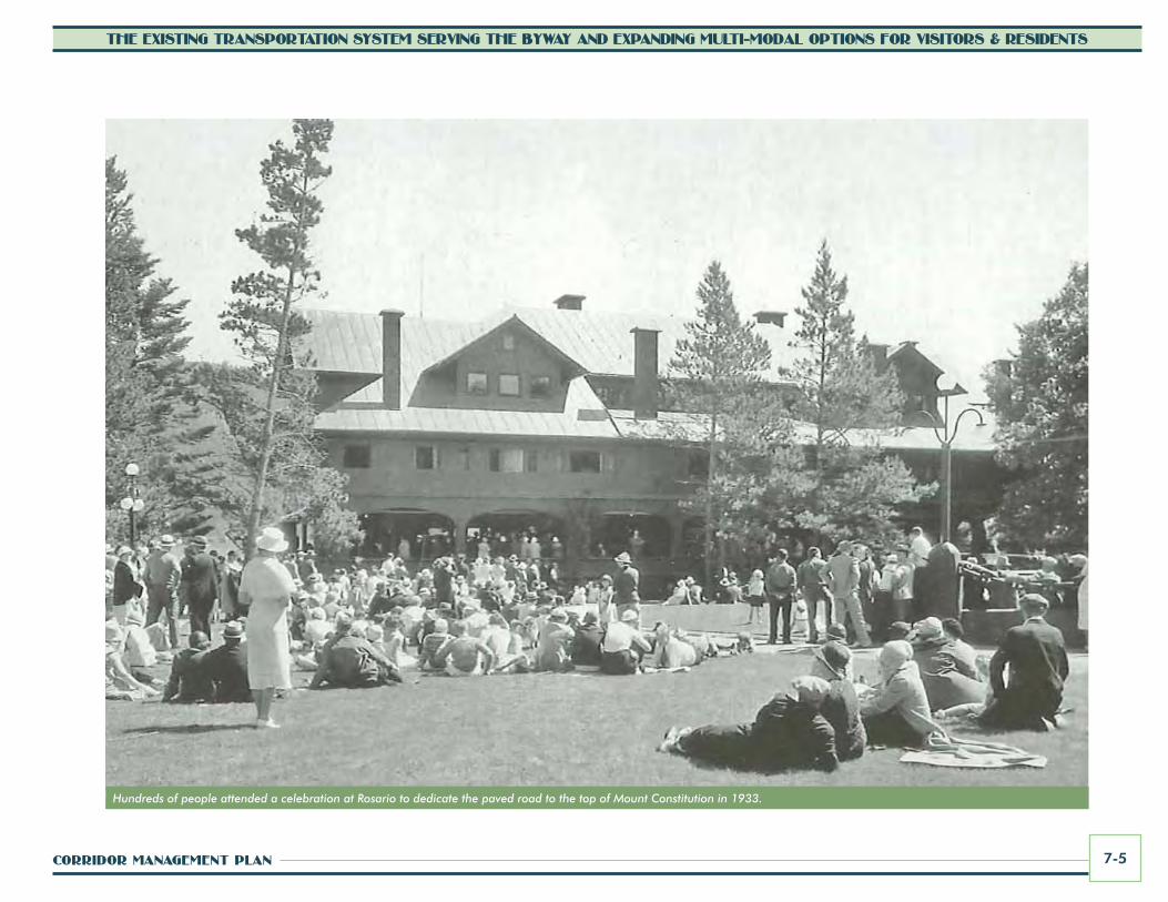
Road construction continued in piece-meal fashion throughout the late 1800s and the 1900s. Robert Moran designed and built roads, trails, and bridges in Moran State Park, which became Washington’s first state park. The road up to Mount Constitution was originally constructed in 1894, a major feat in those days. The road to the top was a large attraction for mainland visitors, who came to see the famous view. It took several hours to make the wagon trip up the mountain and back, requiring “steady nerves and calm horses.” The road was later paved in 1933.
By the 1940s, travel by air to the islands became available through small commercial air services such as Island Sky Ferries and Orcas Island Air Service, the first commuter airline on the West Coast. Today, seaplanes and airplanes service the island regularly.
Historic photo of the Paul Bridge on the road to Mount Constitution
Robert Moran and family at dedication of the road to Mount Constitution
CORRIDOR MANAGEMENT PLAN 7-5
THE EXISTING TRANSPORTATION SYSTEM SERVING THE BYWAY AND EXPANDING MULTI-MODAL OPTIONS FOR VISITORS & RESIDENTS
Hundreds of people attended a celebration at Rosario to dedicate the paved road to the top of Mount Constitution in 1933.

SAN JUAN ISLANDS SCENIC BYWAY7-6
THE EXISTING TRANSPORTATION SYSTEM SERVING THE BYWAY AND EXPANDING MULTI-MODAL OPTIONS FOR VISITORS & RESIDENTS
San Juan ISlandS tranSportatIon tImelIne
“City of Angeles” ferry, circa 1930
This timeline highlights elements of the San Juan Islands’ transportation history.
• For thousands of years – Coast Salish peoples traveled the waters of the Salish Sea in canoes, dugout and carved from red cedars.
• Mid-1800s – Military troops on San Juan Island constructed roads in the American and English Camps, and the Royal Marines built a military route connecting the two encampments.
• Mid- to Late 1800s – Settlers traveled by various means, but most villages were oriented to the shore and water passage from village to village was the predominant form of transportation.
• 1889 – The Puget Sound Navigation Company was formed by Charles E. Peabody, whose family originated the Black Ball Line on the East Coast. Service began as a steamer operation and by the 1930s became the dominant auto carrier ferry system in the region, promoted as the “Black Ball Line.”
• 1892 – The 61-foot, 87-ton steamship Buckeye began operating on the Whatcom-San Juan Islands mail route. The Buckeye had an immediate impact on freight and passenger traffic by providing competition, reducing rates, and improving service.
• 1894 – The Mount Constitution Road was built from Olga.
• 1906 – The ferry City of Angeles was built as a passenger steamer. Its Anacortes-Sidney route initially stopped at Roche Harbor on San Juan Island.
• 1912 – The first automobile trip by a 1910 Model T occurred on Orcas Island, climbing all the way to the top of Mount Constitution.
• 1926 – The Black Ball Line added service to Lopez Island.
• 1930 – The Black Ball Line added service to Shaw Island and Friday Harbor replaced Roche Harbor as the San Juan Island terminus.
• 1933 – The paved road to the top of Mount Constitution in Moran State Park was dedicated, a major event, attracting hundreds of people to the Moran mansion at Rosario.
• 1947 – Engineers studied plans to connect the San Juan Islands with a series of bridges (see page 7-8),

CORRIDOR MANAGEMENT PLAN 7-7
THE EXISTING TRANSPORTATION SYSTEM SERVING THE BYWAY AND EXPANDING MULTI-MODAL OPTIONS FOR VISITORS & RESIDENTS
an ambitious plan that was never implemented.
• 1947 – Bob Schoen of Orcas Island began commuter air service between the islands and the mainland. The next year San Juan Island’s Roy Franklin joined Schoen to operate Island Sky Ferries, bringing regular air service to Orcas, San Juan, and Lopez.
• 1948 – The Friday Harbor Airport got its start as local charter pilot Roy Franklin began using a pasture outside of town for takeoffs and landings. County voters established a port district in 1950, which now owns and operates the Friday Harbor Airport.
• 1951 – The State of Washington purchased the Puget Sound Navigation Company (Black Ball Line) for the sum of $4.9 million, and it eventually became the Washington State Ferries (WSF). WSF originally intended to provide temporary service until a network of bridges could be
built connecting the west and east sides of Puget Sound. In 1959, the state legislature rejected the plan to build cross-sound bridges.
• 1951 – The Port of Friday Harbor formed, acquired the airport, and made plans for a 550-slip marina.
• 1958 – The Port of Orcas was formed and purchased an existing airstrip from a local family.
• 1978 – An inter-island ferry route was established by WSF and served by the MV Vashon, the last all-wood car ferry in the WSF fleet. Islanders nicknamed her “Old Reliable” for her excellent service. She made her last run in 1980, when she was replaced by the Issaquah class ferries.
• 1989 – The annual Canoe Journey event hosted by Pacific Northwest tribes first began with the Paddle to Seattle and the 1993 Paddle to Bella Bella. The event continues to gain popularity
into 2000s, following a different route each year. This year’s Canoe Journey is the 2011 Paddle to Swinomish.
• Present Day Activities – Local jurisdictions coordinate with regional, state, and federal agencies on an ongoing basis to plan, seek funding for, and implement multi-modal transportation improvements throughout the islands to serve residents and visitors alike.
Dr. Heath escorting a passenger from an Island Sky Ferries plane

The proposed inter-island road network with bridges between islands (1947 plan that was never implemented)

CORRIDOR MANAGEMENT PLAN 7-9
THE EXISTING TRANSPORTATION SYSTEM SERVING THE BYWAY AND EXPANDING MULTI-MODAL OPTIONS FOR VISITORS & RESIDENTS
The San Juan Islands Scenic Byway OverviewThe San Juan Islands Scenic Byway includes a 30.3-mile marine route served by the Washington State Ferries system and 90 miles of land routes on San Juan Island and Orcas Island via county, park, and town roads. The marine portion begins at the ferry terminal in Anacortes and continues through the San Juan Islands. Island terminals are located at Friday Harbor on San Juan Island, Orcas Village on Orcas Island, and Lopez and Shaw islands. The marine route is part of the Washington State Marine Highway System, the largest ferry system in the United States, largest vehicle carrier in the world, and the fourth largest passenger carrier in the world.
Riding the ferry is an important part of the local culture in the islands. Many residents commute between islands daily via the ferries. The ferry experience is also a unique and important aspect of the scenic byway experience. Once on board, byway visitors can get out of their vehicles, stretch their legs, purchase refreshments, and take in the panoramic views of the Salish Sea, island landscapes, and the Cascade and Olympic mountains, including Mt. Baker at times. Passengers are sometimes treated with views of whales and other sealife. Ferries are also host to meetings, weddings, and other ceremonies on board. The San Juan Islands vessels provide unique experiences not common on other ferries. For example, jigsaw puzzles are left out on tables for passengers to work on during their journey.
Scenic Byway DesignationThe San Juan Islands Scenic Byway was designated as a state scenic and recreational route by the Washington State Legislature in April 2008. The designation included the marine highway system as part of the scenic byway experience and brought formal recognition to the scenic and recreational values of the San Juan Islands as part of the state’s system of travel ways. This legislation also recognized all routes of the Washington State Ferries as scenic and recreational highways.
San Juan Islands Scenic Byway representatives intend to apply for national scenic byway designation once this corridor management plan is completed. There are two tiers of national designation: All American Roads and National Scenic Byways. All American Roads are recognized nationally and internationally and are considered destinations unto themselves, exhibiting the highest quality scenic byway experience in the country. The San Juan Islands Scenic Byway is eligible to apply for All American Road designation. For more information about national designation and the application process, refer to Section 12 of this CMP.
Other Scenic Byways in the RegionTravelers to Washington have access to several other scenic byways that are within a one- to two-hour drive from the San Juan Islands Scenic Byway:
• the Mount Baker Scenic Byway and Chuckanut Drive near Bellingham
• the Cascade Loop, which includes the North Cascades and Stevens Pass Greenway scenic byways and connects to the Okanogan Trails Scenic Byway and the Coulee Corridor

0 2.25 9 13.5 184.5Miles
Vancouver
Bellingham
Everett
Seattle
Olympia
Tacoma
Bellevue
Victoria
Sidney
Bellingham
Anacortes
Everett
Seattle
Olympia
Tacoma
Bellevue
Victoria
Sidney
Vancouver
W A S H I N G T O N
C A N A D A
V A N C O U V E RI S L A N D
Anacortes
Burlington
Sea-Tac Int’l Airport
Burlington
Sea-Tac Int’l Airport
Mount VernonMount Vernon
Strait of Georgia
Salish Sea
Paci�c Ocean
PugetSound
Strait of Juan de Fuca
MOUNTAINSTO SOUND
GREENWAY
PACIFIC COASTSCENIC BYWAY
CHINOOK PASSSCENIC BYWAY
CASCADE LOOP/NORTH CASCADESSCENIC HIGHWAY
STRAIT OFJUAN DE FUCASCENIC BYWAY
HIDDEN COASTSCENIC BYWAY
CHUCKANUTDRIVE
CASCADE LOOP/STEVENS PASS
GREENWAY
MT. BAKERSCENIC BYWAY
CAPEFLATTERY
TRIBAL SCENICBYWAY
87
3
9
99
9
9
99
99
99
18
18
16
16
512
509
167
167 169
104
101
101
101
101
101
2
97
2
5
5
5
5
405
5
705
90
90
90
520
202
522
522
527
523
524
410
12
520
53620
20
20
MOUNTAINSTO SOUND
GREENWAY
PACIFIC COASTSCENIC BYWAY
CASCADE LOOP/STEVENS PASS
GREENWAY
STRAIT OFJUAN DE FUCASCENIC BYWAY
CAPEFLATTERY
TRIBAL SCENICBYWAY
HIDDEN COASTSCENIC BYWAY
CHINOOK PASSSCENIC BYWAY
MT. BAKERSCENIC BYWAY
CHUCKANUTDRIVE
WHIDBEYSCENIC
ISLE WAY
CASCADE LOOP/NORTH CASCADESSCENIC HIGHWAY
WHIDBEYSCENIC
ISLE WAY
SCENIC BYWAY
SAN JUANISLANDS
FIguRE 7.1 ScEnIc BywAy DESIgnATIOnS

CORRIDOR MANAGEMENT PLAN 7-11
THE EXISTING TRANSPORTATION SYSTEM SERVING THE BYWAY AND EXPANDING MULTI-MODAL OPTIONS FOR VISITORS & RESIDENTS
Riding the ferry is a unique experience, not typical of the nation’s other scenic byways.
• the Whidbey Scenic Isle Way, which crosses Whidbey Island and connects with SR 20 near Anacortes
• the Pacific Coast Scenic Byway, which loops around the Olympic Peninsula and joins the Strait of Juan de Fuca and Cape Flattery Tribal Scenic Byways, as well as the Hidden Coast Scenic Byway
• the Mountains to Sound Greenway, which extends across the Cascades from Seattle to Ellensberg
• the Chinook Pass Byway, which provides access to Mount Rainier National Park and the Mather Memorial Parkway
Figure 7.1 illustrates the locations of these scenic byways. Not only is the San Juan Islands Scenic Byway a destination unto itself, but the system of byways in proximity further strengthens the region’s attractiveness to visitors from throughout the US and abroad.
Existing Regional Transportation SystemExisting Land and Air Transportation to the Byway Visitors often travel by land to reach the Anacortes Ferry Terminal operated by Washington State Ferries via State Route (SR) 20. SR 20 connects to the Interstate 5 corridor in the vicinity of Burlington, Washington, approximately 21 miles east of the terminal. Interstate 5 is a principal route between Canada and Mexico, traveling north to south across Washington, Oregon, and California. From the Anacortes Ferry Terminal, visitors can then travel via Washington State Ferries to the San Juan Islands.
Many visitors to the islands travel from the Seattle metropolitan area via Interstate 5.

SAN JUAN ISLANDS SCENIC BYWAY7-12
THE EXISTING TRANSPORTATION SYSTEM SERVING THE BYWAY AND EXPANDING MULTI-MODAL OPTIONS FOR VISITORS & RESIDENTS
Washington’s primary land transportation routes
Primary east-west highway and interstate routes that connect to Interstate 5 in Washington include:
• SR 20, which extends east over the North Cascades (closed in Winter) to the Methow Valley and connects to US 97 through the Okanogan Valley
• SR 2, which extends east over the Cascade Mountains to Leavenworth, Wenatchee and beyond (and with SR 20 forms the Cascade Loop)
• Interstate 90, which extends from Seattle to Spokane and beyond across the United States
• US 12, which extends east to Yakima and connects to Interstate 82
• SR 14, which parallels the Columbia River (extending through the Columbia River Gorge National Scenic Area) and
Interstate 84 (in Oregon) and is designated as part of the Lewis and Clark National Historic Trail
Visitors to the San Juan Islands Scenic Byway come from everywhere. The islands are known world-wide as a scenic destination. Regionally, visitors travel to the islands from throughout Washington, Oregon, and California, as well as British Columbia, Canada. Many come from the large metropolitan areas of Vancouver, BC, Seattle, and Portland, as well as smaller metropolitan areas along the Interstate 5 corridor, such as Bellingham, Burlington/Mount Vernon, Everett, Tacoma, Olympia, and Vancouver, Washington, and cities along the connecting Interstate 90 corridor, such as Ellensburg and Spokane, Washington. Some travelers to the San Juan Islands come from areas beyond these regions via the land routes listed previously, or they may arrive by air via regional airports, including Seattle-Tacoma International Airport, located 97 land miles from the Anacortes Ferry Terminal.
Commercial air services are available for visitors wishing to travel by air (seaplane or airplane) to the islands. Year-round flights are offered daily (or can be chartered) to Orcas, Lopez, and San Juan Island and other islands from origins in Seattle, Bellingham, Kenmore, Renton, Port Angeles, Anacortes, and Victoria, British Columbia. Seaplane service carries passengers to docks on Orcas Island at Eastsound, Rosario, and West Sound; Friday Harbor and Roche Harbor on San Juan Island; and Fisherman Bay on Lopez Island. More information about commercial airport traffic is provided later in this section. Flying is a popular option for visitors coming to the islands, and the San Juan Islands will continue to be a major destination for small aircraft.

CORRIDOR MANAGEMENT PLAN 7-13
THE EXISTING TRANSPORTATION SYSTEM SERVING THE BYWAY AND EXPANDING MULTI-MODAL OPTIONS FOR VISITORS & RESIDENTS
S. GulfIslands
San JuanIslands
N. GulfIslands
O l y m p i c
P e n i n s u l a
Va
nc
ou
ve
r I
s l an
d
Mt. Baker
Mt. Rainier
MonmouthMountain
Mt. Waddington
GlacierPeak
OO cc ee aa nn
PP aa cc ii ff ii cc
SS OO UU NN DD
DD EE SS OO LL AA TT II OO NN
SS OO UU NN DD
PP UU GG EE TT
F r a s e r R i v e r
S k a g i t R i v e r
Ho
od
C
an
al
CapeFlattery
Ni s
qu
al l y R i v e r
Sq
ua
mi s
h
Ri
ve
r
SS TT RR AA II TT oo ff JJ UU AA NN dd ee FF UU CC AA
SS TT RR AA II TT oo ff GG
EEOO
RRGG
II AA
Basin Boundary
Basin Boundary
Basin Boundary
121°W
121°W
122°W
122°W
123°W
123°W
124°W
124°W
125°W
125°W126°W
51°N
51°N
50°N
50°N
49°N
49°N
48°N
48°N
47°N
47°N
NN
stef
an fr
eela
n -
200
9
Data Sources:SRTM (CGIAR-CSI), NOAA, Wa. DFW, Wa. DNR, BC Digital Atlas, ESRI
0 50 100 km.
0 50 mi.
http
://st
aff.w
wu.
edu/
stef
an/S
alis
hSea
.htm
The Sal i sh SeaThe Sa l i sh SeaThe Salish Sea extends from the north end of the Strait
of Georgia to the south end of the Puget Sound andwest to the mouth of the Strait of Juan de Fuca
& Surrounding Basin
The Marine Highway/Salish SeaThe marine “highway” routes that provide access to the islands are located within the Salish Sea. The place name of the “Salish Sea” was formally endorsed by the British Columbia Geographical Names Office in August 2009, the Washington State Board on Geographic Names in October 2009, and the United States Board on Geographic Names in November 2009. As one of the world’s largest and biologically rich inland seas, the Salish Sea is the unified bi-national ecosystem that includes Washington State’s Puget Sound, the Strait of Juan de Fuca, the San Juan Islands, and British Columbia’s Gulf Islands and the Strait of Georgia. The name recognizes and pays tribute to the first inhabitants of the region, the Coast Salish peoples. Bellingham biologist Bert Webber, who initially proposed the name in 1989, has said that a lot of the credit goes to the support the SeaDoc Society has given to the name. The SeaDoc Society (People and Science Healing the Sea) works to protect the health of marine wildlife and their ecosystems through science and education.
The SeaDoc Society works to protect marine wildlife. Map of the Salish Sea by Cartographer Stefan Freelan

SAN JUAN ISLANDS SCENIC BYWAY7-14
THE EXISTING TRANSPORTATION SYSTEM SERVING THE BYWAY AND EXPANDING MULTI-MODAL OPTIONS FOR VISITORS & RESIDENTS
washington State Ferries Marine transportation services and facilities are the primary means for movement of people and goods between the islands, and between the islands and the mainland. They are an essential part of the transportation system within San Juan County, and serve an important role in tourism and economic development as a gateway to the San Juan Islands and Vancouver Island, British Columbia, Canada. Ferry terminals on four of the islands (San Juan, Orcas, Shaw, and Lopez) serve as hubs to the scenic byway. During the spring, summer, and fall seasons, the Sidney terminal on Vancouver Island is an international portal to the scenic byway. The ferry terminals, along with airports and public ports, landings and marinas, have a substantial effect on the quality of transportation and also on the type, character and function of surrounding land uses. In addition to public ferry service, private commercial vessels and barges provide transportation services throughout the islands.
The ferries sail between the islands and Anacortes, Washington daily. In 2010, more than 1.7 million riders traveled to the islands from Anacortes. Of this, over 800,000 were vehicle drivers, nearly 600,000 were vehicle passengers, and nearly 300,000 were foot passengers (including those with bicycles). Overall annual ridership between Anacortes and the San Juan Islands has remained fairly steady over the last several years. While it was down slightly in 2008, ridership returned to comparable levels of previous years in 2009 and 2010.
Ridership fluctuates seasonally, with the highest levels occurring during the summer months. The table on page 7-15 shows quarterly ferry ridership and trends between 2005 and 2010 for the combined San Juan Islands ferry routes originating in Anacortes. Tickets are only required for westbound travel, so
The Sidney terminal on Vancouver Island, BC is an international portal to the byway.
Travelers deboarding the ferry at Friday Harbor on San Juan Island in the summer

CORRIDOR MANAGEMENT PLAN 7-15
THE EXISTING TRANSPORTATION SYSTEM SERVING THE BYWAY AND EXPANDING MULTI-MODAL OPTIONS FOR VISITORS & RESIDENTS
AnnuAL SAn JuAn ISLAnDS FERRy RIDERSHIp 2005-20102005 2006 2007 2008 2009 2010
January 1 through March 31Vehicle Drivers 164,382 167,716 163,708 159,930 158,862 160,340Vehicle Passengers 95,658 92,092 90,987 88,026 78,682 90,536Foot Passengers* 37,392 33,586 29,340 32,886 40,792 30,310
Subtotal 297,432 293,394 284,035 280,842 278,336 281,186April 1 through June 30Vehicle Drivers 220,720 225,812 221,730 213,570 216,216 217,128Vehicle Passengers 155,112 157,524 154,488 150,876 151,282 150,634Foot Passengers* 76,782 70,576 76,904 71,290 75,566 69,550
Subtotal 452,614 453,912 453,122 435,736 443,064 437,312July 1 through September 30Vehicle Drivers 277,118 277,938 277,746 275,126 281,256 281,868Vehicle Passengers 251,182 255,692 216,052 238,926 248,234 254,028Foot Passengers* 122,202 131,512 163,234 142,406 153,812 152,020
Subtotal 650,502 665,142 657,032 656,458 683,302 687,916October 1 through December 31Vehicle Drivers 181,760 174,906 179,790 166,694 175,862 176,558Vehicle Passengers 113,168 97,226 86,554 102,190 107,568 106,258Foot Passengers* 42,826 35,200 60,456 37,766 37,444 36,200
Subtotal 337,754 307,332 326,800 306,650 320,874 319,016TOTAL 1,738,302 1,719,780 1,720,989 1,679,686 1,725,576 1,725,430Percent Change from Previous Year -2.20% -1.07% .07% -2.40% 2.73% <-.01%
Source: Washington State Ferries
Notes:* Foot passengers include passengers with bicycles Vehicles may be carrying watercraft (boats, canoes, etc.) and/or bicycles

SAN JUAN ISLANDS SCENIC BYWAY7-16
THE EXISTING TRANSPORTATION SYSTEM SERVING THE BYWAY AND EXPANDING MULTI-MODAL OPTIONS FOR VISITORS & RESIDENTS
these are the numbers of riders bound to the islands.
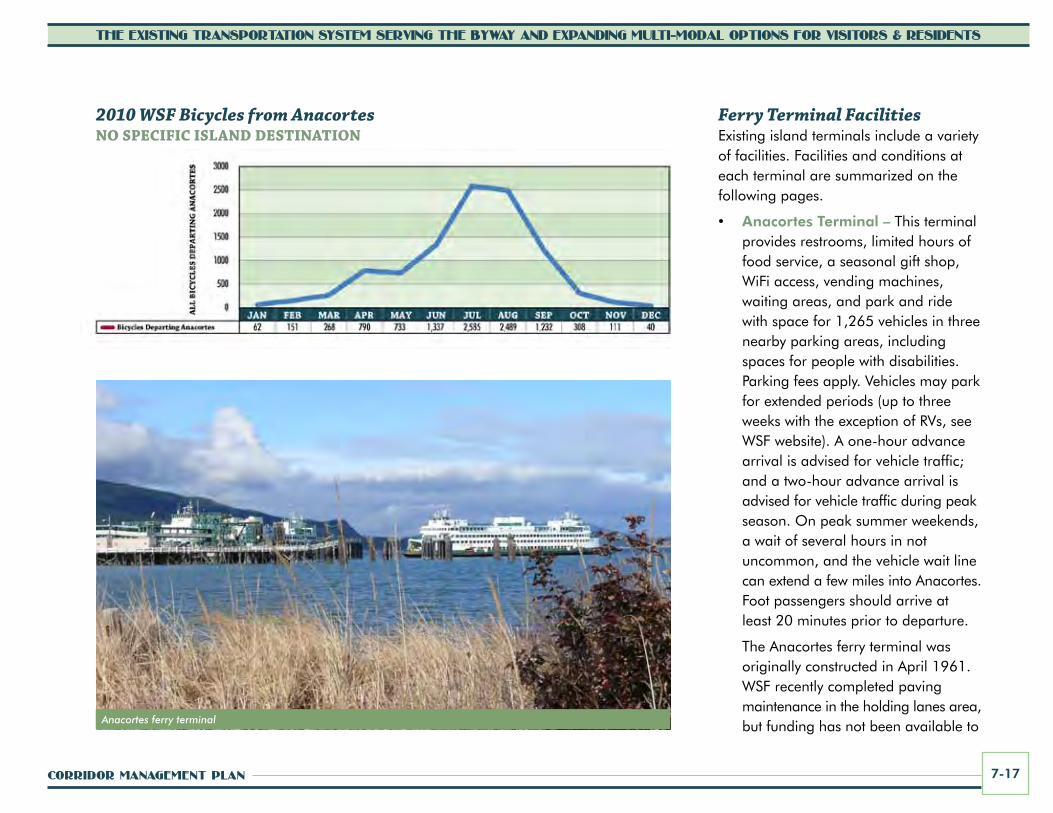
The charts on the right show the monthly levels of riders traveling via all modes aboard Washington State Ferries from Anacortes to the San Juan Islands overall, as well as to San Juan Island and Orcas Island. The second chart shows monthly foot passengers (walk-ons) traveling from Anacortes to all islands, San Juan Island, and Orcas Island. The third chart, on the following page, shows monthly passengers with bicyclists traveling from Anacortes to all islands (a breakdown for specific island destination is not available). As these charts depict, the peak months for WSF travel to the islands are June through August.
Ferry Service from British ColumbiaThe Sidney, British Columbia, Canada route (via Washington State Ferries) to the San Juan Islands carries nearly 18,000 passengers annually. This includes approximately 5,500 vehicle drivers, 6,900 vehicle passengers, and 5,400 foot passengers (walk-ons). The annual opening of this service (typically in April) has become a special event for regional citizens, including mainland tribal members who visit relatives on Vancouver Island.
2010 Washington State Ferries Anacortes to San Juan IslandsALL MODES/RIDERS
2010 Washington State Ferries Anacortes to San Juan IslandswALk-On/FOOT pASSEngERS OnLy
CORRIDOR MANAGEMENT PLAN 7-17
THE EXISTING TRANSPORTATION SYSTEM SERVING THE BYWAY AND EXPANDING MULTI-MODAL OPTIONS FOR VISITORS & RESIDENTS
Anacortes ferry terminal
Ferry Terminal FacilitiesExisting island terminals include a variety of facilities. Facilities and conditions at each terminal are summarized on the following pages.
• Anacortes Terminal – This terminal provides restrooms, limited hours of food service, a seasonal gift shop, WiFi access, vending machines, waiting areas, and park and ride with space for 1,265 vehicles in three nearby parking areas, including spaces for people with disabilities. Parking fees apply. Vehicles may park for extended periods (up to three weeks with the exception of RVs, see WSF website). A one-hour advance arrival is advised for vehicle traffic; and a two-hour advance arrival is advised for vehicle traffic during peak season. On peak summer weekends, a wait of several hours in not uncommon, and the vehicle wait line can extend a few miles into Anacortes. Foot passengers should arrive at least 20 minutes prior to departure.
The Anacortes ferry terminal was originally constructed in April 1961. WSF recently completed paving maintenance in the holding lanes area, but funding has not been available to
2010 WSF Bicycles from AnacortesnO SpEcIFIc ISLAnD DESTInATIOn

SAN JUAN ISLANDS SCENIC BYWAY7-18
THE EXISTING TRANSPORTATION SYSTEM SERVING THE BYWAY AND EXPANDING MULTI-MODAL OPTIONS FOR VISITORS & RESIDENTS
complete other needed improvements and upgrades. The terminal has been on the list for replacement/renovation for quite some time, and design plans have been prepared. However, given state funding challenges, it may be several years before the terminal improvements can be implemented.
• Orcas Landing Terminal – This terminal provides restrooms, waiting areas, and daily park and ride with space for 40 vehicles near the upper tollbooth and 16 additional spaces below the toll booth. Long-term Parking—up to 72 hours—is allowed in some spaces. There is a high demand for parking in the summer, and spaces may not be available. Availability of long-term parking in particular is in short supply, especially during the summer months. A grocery store and a few restaurants and shops are located within walking distance from the ferry parking/waiting area.
A minimum 60-minute advance arrival is recommended for vehicle traffic, and a minimum15-minute advance arrival is recommended for foot passengers. However, more advanced arrival time may be needed during the peak season.
Cars waiting for the ferry can back up on the county road shoulder for a distance from the terminal.
San Juan County coordinated with Orcas Village representatives to develop a master plan for Orcas Landing, a public dock located to the west of the ferry ramp. The master plan calls for upgrades to the dock and ramp and enhancements to pedestrian and bicycle facilities and connections to and from the ferry, as well as visitor information and scenic byway information to be displayed on a kiosk near the terminal. The Orcas Village Plan, adopted in 2008, also stresses the need for improving pedestrian circulation and reducing multi-modal conflicts at the terminal.
• Friday Harbor Terminal – This terminal provides restrooms, waiting areas, and other facilities. Parking areas (off-street and on-street) are located in downtown Friday Harbor, within walking distance to the terminal. The closest park and ride lot to the terminal is located south of the intersection of Nichols Avenue and “B” Street, just east of the upper auxiliary holding areas. This lot has a capacity of 57 spaces and vehicles may park there for up to 72 hours. This lot is typically only open for public parking during the week and off-peak season. During peak season, weekends, and holidays, WSF uses this lot for staging vehicles waiting for the ferry. There are many restaurants and shops in Friday
Orcas Village Ferry Terminal
CORRIDOR MANAGEMENT PLAN 7-19
THE EXISTING TRANSPORTATION SYSTEM SERVING THE BYWAY AND EXPANDING MULTI-MODAL OPTIONS FOR VISITORS & RESIDENTS
Harbor within walking distance to the ferry parking/waiting area. A minimum 60-minute advance arrival is recommended for vehicle traffic, and a minimum 15-minute advance arrival is recommended for foot passengers. However, during peak season this terminal can also experience longer delays.
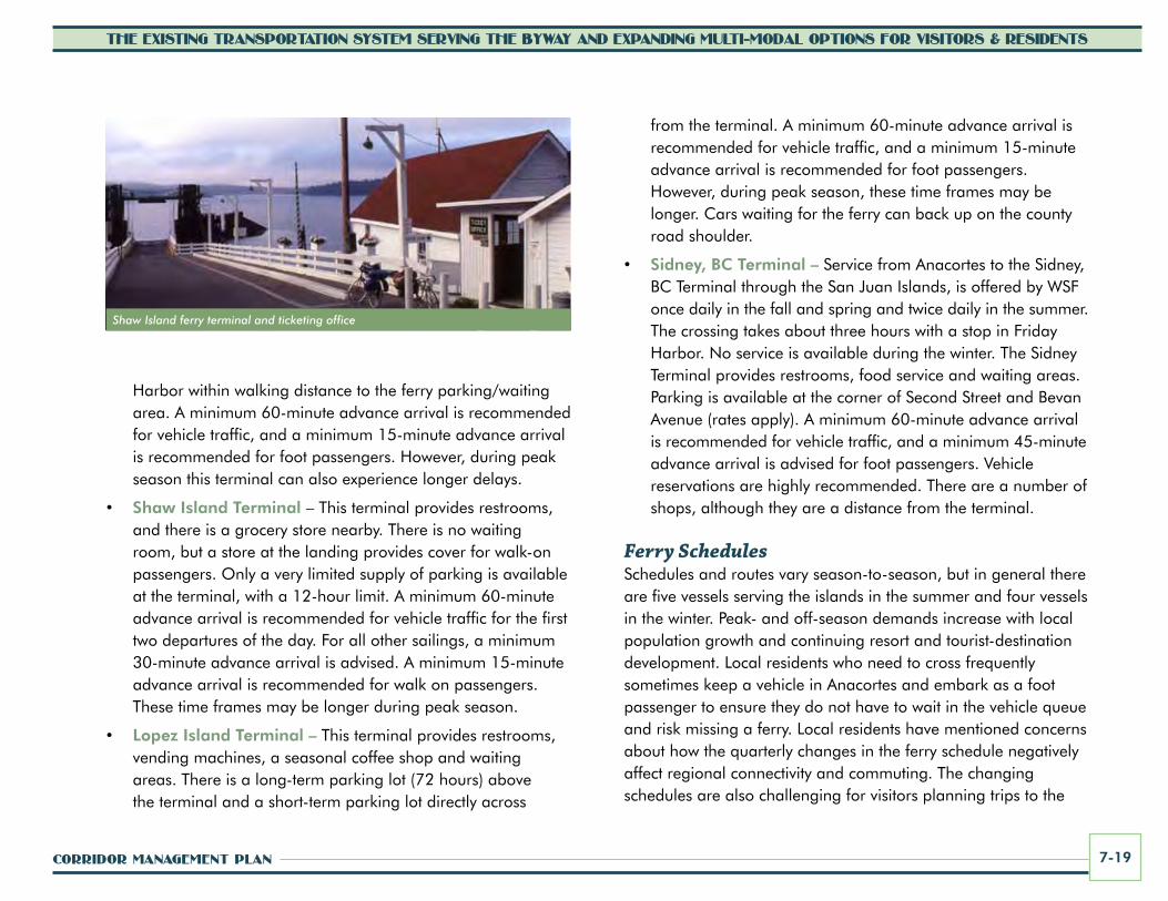
• Shaw Island Terminal – This terminal provides restrooms, and there is a grocery store nearby. There is no waiting room, but a store at the landing provides cover for walk-on passengers. Only a very limited supply of parking is available at the terminal, with a 12-hour limit. A minimum 60-minute advance arrival is recommended for vehicle traffic for the first two departures of the day. For all other sailings, a minimum 30-minute advance arrival is advised. A minimum 15-minute advance arrival is recommended for walk on passengers. These time frames may be longer during peak season.
• Lopez Island Terminal – This terminal provides restrooms, vending machines, a seasonal coffee shop and waiting areas. There is a long-term parking lot (72 hours) above the terminal and a short-term parking lot directly across
from the terminal. A minimum 60-minute advance arrival is recommended for vehicle traffic, and a minimum 15-minute advance arrival is recommended for foot passengers. However, during peak season, these time frames may be longer. Cars waiting for the ferry can back up on the county road shoulder.
• Sidney, BC Terminal – Service from Anacortes to the Sidney, BC Terminal through the San Juan Islands, is offered by WSF once daily in the fall and spring and twice daily in the summer. The crossing takes about three hours with a stop in Friday Harbor. No service is available during the winter. The Sidney Terminal provides restrooms, food service and waiting areas. Parking is available at the corner of Second Street and Bevan Avenue (rates apply). A minimum 60-minute advance arrival is recommended for vehicle traffic, and a minimum 45-minute advance arrival is advised for foot passengers. Vehicle reservations are highly recommended. There are a number of shops, although they are a distance from the terminal.
Ferry SchedulesSchedules and routes vary season-to-season, but in general there are five vessels serving the islands in the summer and four vessels in the winter. Peak- and off-season demands increase with local population growth and continuing resort and tourist-destination development. Local residents who need to cross frequently sometimes keep a vehicle in Anacortes and embark as a foot passenger to ensure they do not have to wait in the vehicle queue and risk missing a ferry. Local residents have mentioned concerns about how the quarterly changes in the ferry schedule negatively affect regional connectivity and commuting. The changing schedules are also challenging for visitors planning trips to the
Shaw Island ferry terminal and ticketing office

SAN JUAN ISLANDS SCENIC BYWAY7-20
THE EXISTING TRANSPORTATION SYSTEM SERVING THE BYWAY AND EXPANDING MULTI-MODAL OPTIONS FOR VISITORS & RESIDENTS
Travelers may take a passenger ferry from Seattle to Friday Harbor or Victoria BC
islands. A local Ferry Advisory Committee has been in existence for nearly 30 years and meets with WSF regularly to address ongoing challenges related to facilities and schedules.
Internet AccessInternet access is available at the Anacortes Terminal for a fee, but is generally not yet publicly available at other San Juan Islands terminals or on board the ferries. Friday Harbor and Orcas terminals have subscription wifi service available. Free wifi is available at some local restaurants and cafés on both San Juan and Orcas islands.
Airport ShuttlesOne commercial shuttle provides service between Seattle-Tacoma International Airport and the Anacortes Terminal. There is also a shuttle from San Juan Island to Seattle-Tacoma International Airport with service once daily, with the exception of Sundays. Saturday service also may not occur sometimes depending on demand.
Multi-modal Priority LoadingWSF vessels provide priority loading for freight, school buses, bicycles, motorcycles, school/sport functions, people with medical needs (with physicians’ notes), people carrying kayaks, vanpools, and carpools, when reserved in advance. WSF provides park and ride lots at most terminals to encourage access by all modes and walk-on ridership. However, the seasonal changes in the ferry schedule make it difficult to coordinate ferry/transit connections. Not all schedules are seamless.
Safety and SecurityThe WSF system prides itself as one of the safest ferry operations in the world. WSF works with the Washington State Patrol and
US Coast Guard to implement security measures and working conditions to ensure the safety and security of passengers. As a port of entry and an international border crossing, WSF works with US Customs and the Canadian Border Protection Services to ensure the security of the US/Canadian Border. Visitors may be subject to delays related to border security and customs procedures depending on the routes they are traveling.
For more information about WSF go to www.wsdot.wa.gov/ferries.
Other water-Based Transportation
Commercial Foot-Ferry Tours and ChartersOther options for reaching the islands by water include various boat charters and tours from Anacortes, Bellingham, and Port Townsend, mostly in the summer season. Some offer whale-and wildlife-watching and/or fishing excursions. In addition, the Victoria Clipper runs between Seattle and Victoria BD with a stop in Friday Harbor, with daily sailings from late spring and summer, through early fall. There are no trips available during the winter months.

CORRIDOR MANAGEMENT PLAN 7-21
THE EXISTING TRANSPORTATION SYSTEM SERVING THE BYWAY AND EXPANDING MULTI-MODAL OPTIONS FOR VISITORS & RESIDENTS
Commercial passenger ferry services (non-WSF) carried approximately 36,000 to 79,000 passengers each year to destinations in the San Juan Islands over the last six years, generating average annual revenue to local businesses of approximately $65,000. Marinas throughout the islands host thousands more private boat visitors each year, generating additional revenue that benefits the local economy.
Public and Private Marine Access and FacilitiesThe San Juan Islands are popular with people traveling by private motor boats and sailing vessels. Public and private marinas dot the shorelines, providing moorage for those visiting for an afternoon as well as long term guests. San Juan Island’s marinas include Friday Harbor, Roche Harbor, Snug Harbor, and Jensen’s Shipyard Cove. Those visiting Orcas can find moorage at public and private marinas at Deer Harbor, West Beach, Bartwood
Lodge, West Sound, Lieber Haven, Rosario Resort, Olga Dock seasonally, and Eastsound Dock for seasonal day use. San Juan County’s Orcas Landing at Orcas Village allows public mooring with a four hour limit.
Hand-launched BoatsHand-launched boaters, such as kayakers and canoeists, are drawn to the scenic beauty and relatively calm waters of the Salish Sea and the San Juan Islands. A number of launch sites, water trailheads, and campsites are available to serve their needs. The islands are part of the Cascadia Marine Trail system (see the following page). As previously mentioned, the islands are a popular venue for the annual Canoe Journey event hosted by Pacific Northwest tribes. San Juan County was the first in the nation to ban small personal motorized watercrafts. Licensed private motor boats and sailboats are allowed, but not personal motorized watercrafts.
Many people dock their boats at the Roche Harbor Marina

SAN JUAN ISLANDS SCENIC BYWAY7-22
THE EXISTING TRANSPORTATION SYSTEM SERVING THE BYWAY AND EXPANDING MULTI-MODAL OPTIONS FOR VISITORS & RESIDENTS
Transportation Facilities in San Juan countySan Juan County and Town of Friday Harbor roadway and transportation facilities are summarized below. The county is currently in the process of updating the Transportation Element of the Comprehensive Plan. Refer to the updated plan element when available for more information in addition to the summary below.
San Juan county comprehensive plan– Transportation goalsThe Transportation Element of the San Juan County Comprehensive Plan includes the following transportation goals:
• To maintain a road planning and improvement system that corresponds to land development goals and policies as expressed in the Land Use Element of the Plan and its subarea plans.
cascadia Marine TrailThe Cascadia Marine Trail is a water trail promoted for use by small, wind- or human-powered beachable watercraft with designated landside campsites and day use points from south Puget Sound to the San Juan Islands. The following sites on and near San Juan Island and Orcas Island are designated points along the Cascadia Marine Trail.
Near and On San Juan Island• Posey Island State Park (separate island northwest of
Roche Harbor)• San Juan County Park• Griffin Bay
Near and On Orcas Island• Point Doughty State Park• Obstruction Pass State Park• Blind Island State Park (separate island)• Jones Island State Park (separate island)
Other San Juan Islands Locations• Stuart Island State Park• Shaw County Park, Shaw Island• Odlin County Park, Lopez Island• Spencer Spit State Park, Lopez Island• James Island State Park
For additional information about public shoreline and beach access sites, refer to Section 6. More information about the Cascadia Marine Trail and the Washington Water Trails Association can be found at www.wwt.org/trails/cmt.
San Juan County Park

CORRIDOR MANAGEMENT PLAN 7-23
THE EXISTING TRANSPORTATION SYSTEM SERVING THE BYWAY AND EXPANDING MULTI-MODAL OPTIONS FOR VISITORS & RESIDENTS
• To maintain a public road system that is as safe and efficient as possible while recognizing the importance of conserving environmental and scenic qualities and island roads.
• To accommodate diverse modes of transportation.
The importance of developing and expanding transportation options, such as transit service and bicycling and walking facilities, has been a growing interest over the last decade.
Existing RoadwaysThe San Juan Islands Scenic Byway land routes primarily consist of county roads managed by San Juan County Public Works, as well as roads within the Town of Friday Harbor that are managed by the town. This sets the byway apart from many other scenic byways in the state, which are most often highways managed by the Washington State Department of Transportation. Only the ferry routes and terminals of the San Juan Islands Scenic Byway are under state management through Washington State Ferries.
The byway route on San Juan Island includes a connecting system of country roads and town streets that form a loop around the island, originating in Friday Harbor, the only incorporated town in San Juan County. The byway traverses argicultural lands in the central portion of the island and follows along dramatic cliffs on the island’s west side, overlooking the Salish Sea. A tour of San Juan Island takes approximately one and a half hours by vehicle or transit, or longer, depending on the amount of time at key sites along the byway. The San Juan Island routes of the byway include the town and county roads listed in the box on the right.
Main Byway Routes
• Front Street
• First Street
• West Street
• Spring Street
• Price Street
• Second Street
• Guard Street
• Tucker Avenue
• Roche Harbor Road
• West Valley Road
• Mitchell Bay Road
• West Side Road
• Bailer Hill Road
• Douglas Road
• Little Road
• Cattle Point Road
• Mullis Street
Note: Refer to Figures 4.3 and 4.5 in Section 4 for a detailed depiction of the byway routes in Friday Harbor and Eastsound. Loops and spurs as suggested side routes of the main byway are not listed. See more information on suggested loops and spurs later in this section.
• Orcas Road
• Deer Harbor Road
• Main Street
• North Beach Road
• Prune Alley
• Olga Road
• Point Lawrence Road
San Juan Island
Orcas Island
SAN JUAN ISLANDS SCENIC BYWAY7-24
THE EXISTING TRANSPORTATION SYSTEM SERVING THE BYWAY AND EXPANDING MULTI-MODAL OPTIONS FOR VISITORS & RESIDENTS
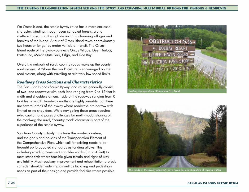
Existing signage along Obstruction Pass Road
The roads on the byway generally have two lanes and shoulders of varying widths.
On Orcas Island, the scenic byway route has a more enclosed character, winding through deep canopied forests, along sheltered bays, and through distinct and charming villages and hamlets of the island. A tour of Orcas Island takes approximately two hours or longer by motor vehicle or transit. The Orcas Island route of the byway connects Orcas Village, Deer Harbor, Eastsound, Moran State Park, Olga, and Doe Bay.
Overall, a network of rural, country roads make up the county road system. A “share the road” culture is encouraged on the road system, along with traveling at relatively low speed limits.
Roadway Cross Sections and CharacteristicsThe San Juan Islands Scenic Byway land routes generally consist of two-lane roadways with each lane ranging from 9 to 12 feet in width and shoulders on each side of the roadway ranging from 0 to 4 feet in width. Roadway widths are highly variable, but there are several areas of the byway where roadways are narrow with limited or no shoulders. While navigating these areas requires extra caution and poses challenges for multi-modal sharing of the roadway, the rural, “country road” character is part of the experience of the scenic byway.
San Juan County actively maintains the roadway system, and the goals and policies of the Transportation Element of the Comprehensive Plan, which call for existing roads to be brought up to adopted standards as funding allows. This includes providing consistent shoulder widths (up to 4 feet) to meet standards where feasible given terrain and right-of-way availability. Most roadway improvement and rehabilitation projects consider shoulder widening as well as bicycling and pedestrian needs as part of their design and provide facilities where possible.
CORRIDOR MANAGEMENT PLAN 7-25
THE EXISTING TRANSPORTATION SYSTEM SERVING THE BYWAY AND EXPANDING MULTI-MODAL OPTIONS FOR VISITORS & RESIDENTS
The main byway roads are all paved (chipseal primarily). The road to Obstruction Pass State Park (a spur off the main byway), is gravel for 2.2 miles from the turn-off at the county-maintained Obstruction Pass Road (which is paved). Cyclical maintenance calls for repaving/adding new chipseal to various roadway segments each year. The county rotates work from one major island to the next seasonally. Newly paved/chipsealed roads can be challenging for bicyclists (with excess gravel on the shoulders). The county provides public notice of when maintenance and repaving activities are scheduled, working with local newspapers and posting information on its website.
Byway routes are open and maintained year-round. Snow and ice can occur intermittently throughout the winter and several routes have freezing sensor signs to advise travelers.
Recreational Vehicle (RV) AccessThe primary routes of the scenic byway are passable to RVs, although in one location, an overhead arch and bridge in Moran State Park on the east side of Orcas Island limits maximum vehicle heights to 14’6”. The short passage through the arch is narrow and is limited to one vehicle at a time. Also RV travel is not recommended on Mount Constitution Road.
There are costs to bring large RVs (over 20 feet) to the islands and limited space in towns and on roads. Costs can range from $150 to $200 to bring RVs aboard the ferries. Navigating RVs on the county’s winding, rural roads can be challenging and can increase congestion and interfere with use by other modes. RV hookups and dump facilities are somewhat limited. The Town of Friday Harbor offers free sewage disposal off of Tucker Street, and some campgrounds also offer services. Moran State Park also offers disposal for a small fee.
Posted Speed LimitsPosted speed limits on the scenic byway land routes are typically 45 miles per hour (mph) or slower (varying between 25-45 mph). On San Juan Island, the majority of the byway is posted at 45 mph with the exception of the more narrow and curving roads along the west side of the island. While traveling southbound on West Side Road, the speed limit drops from 45 mph to 35 mph at San Juan County Park and then alternates between 35 mph and 20 mph until Bailer Hill Road, where it resumes to 45 mph. The highest posted speed limit on Orcas Island is 40 mph, including Orcas Road between milepost 1.0 and Nordstrom Lane (between mileposts 3.0 and 4.0), and the portion between milepost 6.0 (Sunderland Road) and 8.0 (Main Street in Eastsound). The majority of the other byway roads are posted between 25 and 35 mph, with the exception of the roads within Orcas Village and Eastsound, which are posted at 20 mph, and within Friday Harbor, which are posted at 20-25 mph.
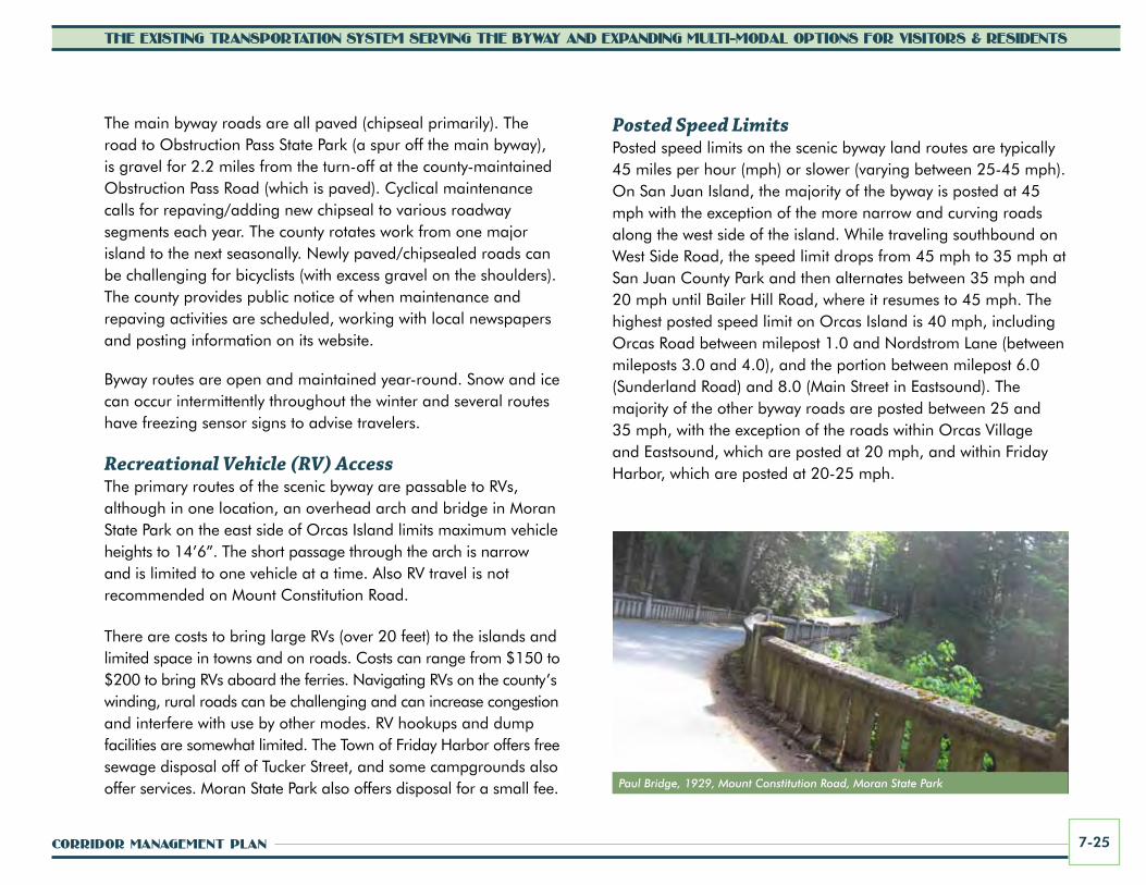
Paul Bridge, 1929, Mount Constitution Road, Moran State Park

SAN JUAN ISLANDS SCENIC BYWAY7-26
THE EXISTING TRANSPORTATION SYSTEM SERVING THE BYWAY AND EXPANDING MULTI-MODAL OPTIONS FOR VISITORS & RESIDENTS
Bridge StructuresThere are two bridges along the main scenic byway routes, both located on Orcas Island. The first of these, the Moran State Park Bridge, is located on Olga Road, at the Olga entrance to Moran State Park. This one-lane concrete bridge was built in the 1920s by Robert Moran, who supported the development of roads, bridges, trails and arches in the park when public funds were not available. The Olga entrance bridge was constructed over a stream in Moran State Park and is adequate to support current loads. Because of the narrowness of the bridge and the arch, and the angle at which the road approaches, the rail and overhead concrete detailing have sustained some minor damage. There is an oversize restriction on the bridge because the bridge is narrow and on a curve. The bridge structure is classified as functionally obsolete due to the narrow roadway.
The second bridge on the main byway route is the West Sound Bridge, located on Deer Harbor Road in West Sound. This bridge is a pre-cast, pre-stressed concrete decking with concrete beams supported by cast-in-place concrete piles. The bridge crosses a small salt
water estuary. The bridge was replaced in 2001 with new deck slabs and a new concrete pile foundation.
Another notable bridge in Moran State Park, but not along the main byway route, is the Paul Bridge. Also built in the 1920s, this bridge was funded by Moran as a memorial to his brother, Paul. It is located on Mount Constitution Road, a spur off of the main byway route. Both of these bridges are important cultural and scenic resources that have been
carefully maintained by the Washington State Parks and Recreation Commission and contribute much to the character of Moran State Park and Orcas Island.
A new bridge was recently constructed on Pt. Lawrence Road, east of Olga, at Cascade Creek.
Pull-Off Areas There are several informal vehicle and designated bicycle pull-off areas along the San Juan Islands Scenic Byway.
Roadside picnic area and pull-off at Map Corner, Orcas Island

CORRIDOR MANAGEMENT PLAN 7-27
THE EXISTING TRANSPORTATION SYSTEM SERVING THE BYWAY AND EXPANDING MULTI-MODAL OPTIONS FOR VISITORS & RESIDENTS
• Vehicle Pull-Off Areas – Vehicle pull-off areas are located along the byway routes on San Juan Island and on Orcas Island. Pull-off areas on San Juan Island are located on Roche Harbor Road, West Side Road, and Cattle Point Road. On Orcas Island, pull-off areas are located along Olga Road (including some in Moran State Park) and along Deer Harbor Road.
These pull-off areas are generally widened roadway sections, paved or unpaved, that provide places for slower vehicles and bicycles to exit the travel lane allowing vehicles to pass. They may also provide short-term parking for travelers to rest, use cell phones, or to access points of interest along the highway, such as scenic viewpoints and historic markers. It is important to note that these areas are not official roadside turnouts. They are not mapped or formally identified in the county roadway network.
Expansive views of the water, Olympic Peninsula and Vancouver Island can be seen from West Side Road on San Juan Island, which is the narrowest segment of the byway and where the most people want to stop to view whales. There appears to be a need for additional pull-offs in this area, but topographic constraints and funding limit the opportunities. Many people will stop their vehicles in the roadway to take in the view, leaving little room for cars to maneuver around them.
A full analysis of existing informal vehicle pull-off areas, as well as the need for formal turnouts is needed. Potential turnout areas where visitors can stop for scenic views, photography, interpretation and other purposes need to be identified. Once desired locations for turnout improvements are identified, they would need to be designed and constructed in accordance with applicable local, state, and federal standards.
• Bicycle Pull-Offs – There are several bicycle pull-off areas that were constructed for safety, allowing bicycles to pull-off the roads. These pull-offs are typically gravel, with a few formalized as picnic stops. The pull-off near San Juan Vineyards on San Juan Island was donated by the local Rotary Club and includes a picnic table and landscaping. Orcas Island also has a picnic table, bike racks, map, and waste receptacle at Map Corner.
Existing and Projected Traffic VolumesAccording to San Juan County 2010 data, the average annual daily traffic (AADT) volume for the San Juan Islands Scenic Byway varied from 600 to 4,014 on San Juan Island and 252 to 3,780 on Orcas Island. (Transportation analysts use AADT to evaluate functions of roadways and to compare existing conditions to design standards for roads carrying similar volumes.)
The San Juan Islands experience seasonal peak traffic volumes from June through September as a result of tourism and visitor traffic, as well as second home/vacation home residents returning to the islands. The increased traffic results in more congestion on the local rural roads, as well as increased ferry waiting times at the terminals. Traffic patterns are closely correlated with the ferry schedule. This pulsing of traffic continues across the islands as people come and go to meet the ferries. Particularly just after arrival, the town of Friday Harbor and Orcas Village experience heavy traffic. School hours also impact traffic patterns, particularly in Friday Harbor with heavier traffic during the morning drop-off period (7:45 am to 8:30 am) and the afternoon pick-up period (2:30 pm to 3:30 pm). School bus drop off and pick up routes and stops on the rural roads outside

SAN JUAN ISLANDS SCENIC BYWAY7-28
THE EXISTING TRANSPORTATION SYSTEM SERVING THE BYWAY AND EXPANDING MULTI-MODAL OPTIONS FOR VISITORS & RESIDENTS
of town can also delay traffic. In Friday Harbor there is also increased traffic during the noon hour as people venture to lunch and run mid-day errands.
Overall, the highest volumes of traffic in San Juan County occur near towns and villages, such as Friday Harbor and Eastsound, and on routes that connect the ferry landings to major destinations. The areas away from developed destinations that receive the highest amount of traffic include Roche Harbor and American Camp on San Juan Island and Moran State Park on Orcas Island. It should be noted that there are also residential areas located in the vicinity of these destinations so it is difficult to determine the amount of traffic that is tourism-driven versus local use. However, the trend shows that traffic quantities drop beyond these destinations, which leads to the assumption that a sizable portion includes tourism- related trips. Lower traffic volumes occur in locations where roads are predominantly used by local residents throughout the year.
The highest volumes of traffic on San Juan Island are experienced primarily in the vicinity of Friday Harbor, branching out from the ferry terminal to points north and south of town along Roche Harbor Road, Mullis Street, and Cattle Point Road. The lowest traffic volumes on San Juan Island are predominantly along West Valley Road, San Juan Valley Road and Mitchell Bay Road. There is also a relatively low volume of traffic along Cattle Point Road east of the American Camp unit of San Juan Island National Historical Park.
On Orcas Island, the highest volumes of traffic occur in the vicinity of Eastsound and between Orcas Village and the village of Eastsound along Orcas Road. There are also fairly high volumes between Eastsound and Moran State Park. The lowest volumes of traffic along the byway on Orcas Island occur in areas that are located further from the ferry terminal and Eastsound and become dead ends, and are predominantly used by residents during the off-peak seasons. These roads include Olga Road south of Point Lawrence Road, Deer Harbor Road, Point Lawrence Road, and Rosario Road.
Traffic congestion is highly influenced by ferry schedules, especially during peak season when cars line up for the ferries.

CORRIDOR MANAGEMENT PLAN 7-29
THE EXISTING TRANSPORTATION SYSTEM SERVING THE BYWAY AND EXPANDING MULTI-MODAL OPTIONS FOR VISITORS & RESIDENTS
The rural, country roads add to the scenic experience of the islands.
Moran State Park reports that 51,209 vehicles traveled on Mount Constitution Road (one way) in 2010. Mount Constitution Road is not a county road; it is maintained by the Washington State Parks and Recreation Commission.
Between the early 1970s to early 1990s, traffic volumes on county roads increased by about 5 percent annually, consistent with population and recreation activity growth during that period of time. However, growth rates on county collector roadways have more recently slowed and forecasted growth is projected to be between 0.3 percent and 1.9 percent annually, depending on the island. The slower rate of growth in traffic volumes is attributed to factors such as the aging county population, which tends to drive less, decrease in ferry traffic, and inconsistent data collection locations. Overall, traffic volumes in the county generally remain comparatively lower than experienced on similar types of roads in similar settings of mainland communities.
In most locations, routine maintenance and gradual upgrading to meet county, state, and federal standards will provide adequate capacity and traffic safety to meet the relatively low increases in traffic volumes anticipated. As discussed elsewhere in this section, gradual implementation of shoulder widening improvements, as funding becomes available, will help to enhance multi-modal travel opportunities and ease seasonal traffic congestion.
Level of Service and Accident RatesAccording to an analysis conducted in 2010, most all San Juan Island collector roadways meet the county’s standard of level of service (LOS) D or better. Only one roadway segment operated at LOS D in 2010, Roche Harbor Road. Projections for 2021
indicate that Roche Harbor Road will continue to operate at LOS D, as will Cattle Point Road, if unimproved.
On Orcas Island, all collector roadways meet the county’s standards of LOS D or better. Only one segment of Orcas Road operated at LOS D in 2010, and projections for 2021 indicate that two segments of Orcas Road and one segment of Olga Road will operate at LOS D if unimproved.
Evaluation of average annual county-wide accident rates indicates that they are lower than averages for other counties of similar size (in area and population), but that certain types of accidents occur here more often than they do statewide. Local trips involve fewer miles traveled and at lower speeds than in other counties, accounting for the lower accident incidence. Compared to the rest of the state, however, more local accidents involve vehicles

SAN JUAN ISLANDS SCENIC BYWAY7-30
THE EXISTING TRANSPORTATION SYSTEM SERVING THE BYWAY AND EXPANDING MULTI-MODAL OPTIONS FOR VISITORS & RESIDENTS
overturning or hitting fixed objects. This may be partly due to narrower road surfaces, poor or no shoulders, and the presence of objects such as trees and fences in road rights-of-way. But while these may contribute to local vehicular accidents, they are also elements of scenic, rural character enjoyed by the travelers on the islands’ roads. The segment of Orcas Road from milepost 3.3 to 4.0 has one of the highest accident frequencies in the county, due to the sharp curves in that vicinity. This stretch of road is identified in the county’s transportation improvement program for improvements.
Existing Bicycle and pedestrian Facilities
Bicycle and Pedestrian UseBicycle and pedestrian activity occurs throughout the byway. Visitors and residents alike travel on foot or bicycle to and from the ferries, through towns and villages, and sites along the byway. 2010 ferry ridership statistics show that nearly 300,000 passengers boarded the ferry in Anacortes for island destinations for the year. Of these, about 186,000 disembarked at Friday Harbor and nearly 60,000 disembarked at Orcas Village. WSF statistics also show that more than 10,000 bicyclists boarded the ferry in Anacortes in 2010. A substantial number of other bicyclists carried their bikes on vehicles or rented them on-island once they arrived.
The town of Friday Harbor conducted bicycle counts over a four-week period in 2007 as well as in 2009 (from mid-August through mid-September each year). Nearly 5,000 bicycle trips were counted on downtown Friday Harbor streets during each four-week period.
Pedestrian traffic occurs along and across various roadways of the scenic byway routes, primarily concentrated in and near
towns, villages, and hamlets, as well as destination sites (state parks, county parks, etc.). The highest intensity of pedestrian traffic generally occurs in Friday Harbor on San Juan Island and Eastsound on Orcas Island, where there are sidewalks, crosswalks, and posted and traveled speeds tend to be lower on the roadways.
Since 1979, the San Juan County Transportation Element has included direction to accommodate safe use of bicycles and pedestrian trails. Enhancing conditions for bicyclists and pedestrians and expanding options for their travel continue to be high priorities of both San Juan County and the Town of Friday Harbor.
A family using the roadside shoulder

CORRIDOR MANAGEMENT PLAN 7-31
THE EXISTING TRANSPORTATION SYSTEM SERVING THE BYWAY AND EXPANDING MULTI-MODAL OPTIONS FOR VISITORS & RESIDENTS
Challenges Associated with the Rural Roadway SystemRoads in the islands, while rural and scenic, can be relatively narrow and may have minimal to no shoulders. There is a strong interest in improving walking and biking opportunities for residents and visitors as well as interest in providing a greater number of low impact trails, especially those that link destinations and are functional alternatives to driving. However, construction of these facilities can be challenging given the rural roadway sections with limited right-of-way. On the other hand, traffic volumes are relatively low on most roadways (except during the summer months in town and at key destinations). Many experienced bicyclists have stated that they feel safer on roadways in the San Juan Islands than in surrounding urban areas because of the lower volumes of traffic.
As funds become available, roads have been rebuilt and right-of-way sought to add shoulders to accommodate bicyclists and trails for pedestrians. However, shoulders can not always be widened the full width to be recognized as official bike lanes. Also, this approach could take 30 or 40 years or more to achieve bicycle and pedestrian access goals on the islands.
Road Shoulder Conditions and Improvement NeedsWithin the county road system, approximately 90 miles of the 207 total miles of county roads make up the San Juan Islands Scenic Byway (44 miles on Orcas Island and 46 miles on San Juan Island). Of this total mileage, only roughly 13 miles of road have paved shoulders that are three feet or wider. San Juan Island has a total of ten miles of road with shoulders 3 feet or wider, including two miles of various roads in Friday Harbor, much of Cattle Point Road, and Roche Harbor Road. Refer to Figures 7.2, 7.3, and 7.4 for locations of three-foot and four-foot shoulder widths.
Maps provided by local bicycling groups highlight suggested bicycling routes on Roche Harbor Road, Little Road, Douglas Road between Bailer Hill Road and Little Road, and Cattle Point Road between Little Road and Mullis Road.
The San Juan Island Trails Plan recommends giving top priority to adding paved shoulders to Douglas, Bailer Hill, and West Side Roads. Widening Cattle Point Road along its full length is also recommended. The Town of Friday Harbor has been adding sidewalks where feasible in town. Sidewalks constructed on Caines Street in 2004 have improved pedestrian access to the senior center, and other small connections have been made, gradually eliminating places where pedestrians have to walk in the street.
Orcas Island has a total of three miles of three-foot or wider shouldered roads, including a two-mile stretch of Orcas Road just west of Eastsound. A one-third-mile stretch of Orcas Road north of the ferry terminal has four-foot shoulders. Orcas Island bicycling routes recommended by local bicycling groups include Orcas Road between the ferry terminal and Deer Harbor Road, Orcas Road between Sunderland Road and Eastsound, and Olga Road from Crescent Beach Drive to the midway point between Eastsound and Rosario.
Bicycle and pedestrian Safety programs and projectsPast programs and projects undertaken to enhance bicycle and pedestrian safety other than road widening include:
• Development of a brochure and safety video, which is available on the county website
• Construction of a series of bicycle pull-offs
• Installation of “Share the Road” signs

CANADA
UNITED STATES
CANADA
UNITED STATES
San JuanChannel
PresidentChannel
LummiBay
EastSound
WestSound
Gri�nBay
DoeBay
CowlitzBay
EchoBay
BurrowsBay
LopezSound
MudBay
LangleyBay
DeepwaterBay
SwiftsBay
ShoalBay
CascadeBay
FishingBay
MassacreBay
ShipBay
NorthBay
Wescott Bay
DavisBay
NorthBay
FalseBay
DeerHarbor
RocheHarbor
OpenBay
MackayeHarbor
ChannelHarney
BuckBay
S a l i s h S e a
S a l i s h S e a
ShawIsland
DecaturIsland
HenryIsland
BlakelyIsland
CypressIsland
LummiIsland
FidalgoIsland
WaldronIsland
SinclairIsland
Spieden Island
Stuart Island
ClarkIsland
SAN JUANISLAND
ORCASISLAND
LopezIslandVancouver
Island
JamesIsland
MoresbyIsland
SidneyIsland
0 1.0 2.00.5Miles
1.5 3.0
FIguRE 7.2 BIcycLE puLL-OFFS, RIDESHARE LOcATIOnS, AnD BywAy LOOpS & SpuRS
6
8
9
10
13
14
15
2
19
22
23
24
18
54 3
7
21
1
1
2
2
11
1
16
17
25
20
26
1
2
2
25
1226
26
26
26
26
26
26
SAn JuAn ISLAnDS ScEnIc BywAyInTRInSIc quALITIES
SALISH SEA1 Portals to the Byway: Ferry Terminals
2 Across the Salish Sea: The Marine Route to and through the San Juan Islands
SAN JUAN ISLAND3 Town of Friday Harbor4 San Juan Historical Museum5 The Whale Museum6 Jackson Beach
7 American Camp Unit of San Juan IslandNational Historical Park
8 Cattle Point Interpretive Area/Lighthouse
9 Lime Kiln Point State Park a.k.a. Whale Watch Park/Lighthouse
10 San Juan County Park
11 English Camp Unit of San Juan IslandNational Historical Park
12 San Juan Islands Museum of Art & Sculpture Park
13 Historic Roche Harbor Resort14 Historic Schoolhouse at the VineyardsORCAS ISLAND15 Orcas Village/Historic Orcas Hotel16 Deer Harbor
17 Eastsound Village, Village Green, Historic Outlook Inn and Crescent Beach
18 Orcas Island Historical Museum19 Historic Rosario Resort and Moran Mansion20 Moran State Park21 Mount Constitution / Interpretive Center22 Olga/Artists' Cooperative in Historic Bldg23 Obstruction Pass State Park24 Historic Doe Bay Resort
BOTH ISLANDS25 Farms & Farmstands Open to the Public*
26 Art Galleries, Studios & Potteries Open to the Public*
1
1AnacortesFerry Terminal
SidneyFerry Terminal
LEgEnDByway Land Routes (Main Routes)Byway Marine RoutesByway Spurs and LoopsAlternative Bicycle Routes**Ferry Route from Sidney B.C.4’ Paved Shoulder3’ to 4’ Paved Shoulder
Bicycle Pull-offs
Rideshare Location
**Note: Portions are gravel.
Refer to the Island detail maps at the end of this
section for enlarged views.

CORRIDOR MANAGEMENT PLAN 7-33
THE EXISTING TRANSPORTATION SYSTEM SERVING THE BYWAY AND EXPANDING MULTI-MODAL OPTIONS FOR VISITORS & RESIDENTS
Bicycle Pull-Off LocationsThere are currently seven bicycle pull-off areas along the byway on San Juan Island and ten on Orcas Island. Refer to Figures 7.2, 7.3, and 7.4 for these locations.
When bicyclists are crossing the road to access a pull-off area on the opposite side of the road, they must use extreme caution to check for oncoming motor vehicles that may be traveling at high speeds.
Share the Road SignsThe county has recently collaborated with bicycle groups on the islands and
Example of a “share the road” sign
installed “share the road” signs at various locations. The sign graphic includes a bicycle, pedestrian, and vehicle.
Treatments at IntersectionsThere are no signalized intersections in San Juan County, but pedestrian crosswalks are located at many intersections in Friday Harbor on San Juan Island and in Eastsound on Orcas Island.
San Juan County Nonmotorized Transportation PlanSan Juan County developed a Nonmotorized Transportation Plan in order to identify safe, alternative methods of transportation throughout the islands. The plan was adopted by the county commissioners as part of the San Juan County Comprehensive Plan in 2005. This plan identifies specific priorities and projects over a 20-year period to improve facilities for non-motorized travel on each island within the county. The plan states a goal to create three-to-four-foot shoulders on arterial roads throughout the island to provide safer travel routes for bicyclists and pedestrians.
Since the Nonmotorized Plan was prepared, San Juan County has widened
shoulders on Cattle Point Road between False Bay Road and Friday Harbor, and constructed nearly three miles of pedestrian trails on San Juan and Orcas Islands. The county also helped trails committees with other projects by facilitating legal descriptions and providing surveying and engineering. This work included extending the pedestrian trail on North Beach Road as well as a new pedestrian trail on Enchanted Forest Road. The county is also collaborating with the San Juan Trails Committee, Orcas Pathways, and other partners on trail opportunities. The “Multi-Modal Transportation Recommendations” provided later in this section include projects and ideas to enhance pedestrian and bicycle safety, access, and mobility.
public TrailsSince the 1990s, there has been a growing interest in the need for more trails to facilitate better bicycle and pedestrian access across the islands. During the Growth Management Act work in that decade, both San Juan County and the Town of Friday Harbor added wording to their planning documents in support of trails for island

SAN JUAN ISLANDS SCENIC BYWAY7-34
THE EXISTING TRANSPORTATION SYSTEM SERVING THE BYWAY AND EXPANDING MULTI-MODAL OPTIONS FOR VISITORS & RESIDENTS
residents. Since then, volunteer-based trail organizations have become active on San Juan and Orcas islands, and each has identified priority corridors for future trail development. Existing trails and trails organizations are described starting below. Although not all of these trails are located directly along the byway, they are located in proximity to it and are an important part of the experience of the San Juan Islands.
• Orcas Pathways – Formed in 2002, is a volunteer-based trails committee, whose mission is to identify a system of pathways for safe nonmotorized travel and recreational opportunities on Orcas Island. Through a grant from the National Park Service Rivers, Trails, and Conservation Assistance Program, an Orcas Island Trails Plan is in process. Orcas Pathways’ main goal is to partner with the community, county agencies, and island-based organizations to identify travel and recreational opportunities with a special emphasis on connectivity between hamlets, activity centers, and recreational points of interest.
• The San Juan Island Trails Committee – Formed in 1999, became a subcommittee of the San
The San Juan Island Trails Committee hard at work
The Trails Plan for San Juan Island was developed using a National Park Service grant.

CORRIDOR MANAGEMENT PLAN 7-35
THE EXISTING TRANSPORTATION SYSTEM SERVING THE BYWAY AND EXPANDING MULTI-MODAL OPTIONS FOR VISITORS & RESIDENTS
Juan County Park Board in 2005 and is now part of the San Juan Island Park and Recreation District program. Through a grant from the National Park Service Rivers, Trails, and Conservation Assistance Program, the San Juan Island Trails Plan was completed in September 2006. The main goal was to develop a long-range plan, with broad community support, for a system of trails connecting key natural, cultural, recreational, residential, and commercial areas on the island. The plan includes a description of existing trails on the island and concepts for future trail opportunities. Priority corridors have been identified along major thoroughfares and between popular recreational destinations. Highlights of the San Juan Island Trails Plan have been integrated into the text below.
• Strong Public Interest in Trails – The San Juan County Parks, Trails and Natural Areas Plan for 2011-2016 (SJC Parks Plan) performed a survey in which 87 percent of respondents ranked hiking and walking trails as important. Respondents also indicated more hiking trails and bike lanes as the most-needed improvement.
ORcAS ISLAnD cOunTy TRAILS
pROpERTy nAME cLASSIFIcATIOnLEngTH
(MI)Deer Harbor Loop Trail Right-of-Way Trail 0.6
Eastsound Trails Right-of-Way Trail 0.7
Enchanted Forest Road Trail Right-of-Way Trail (Pedestrian Only) 0.3
North Beach Road Trail Right-of-Way Trail (Pedestrian Only) 1.0
Subtotal 2.6
Swale Trail Rustic Trail (Pedestrian Only Use in Eastsound) 0.2
Subtotal 0.2
TOTAL MILEAGE 2.8
SAn JuAn ISLAnD cOunTy TRAILS
pROpERTy nAME cLASSIFIcATIOnLEngTH
(MI)Argyle Road Trail Right-of-Way Trail 0.2
Cattle Point DNR 8 Right-of-Way Trail 0.2
Golf Course Road Trail Right-of-Way Trail 0.3
San Juan County Park Right-of-Way Trail 0.3
Subtotal 1.0
Cattle Point Road Trail Rustic Trail 1.3
Eagle Cove Trail Rustic Trail 0.1
Lime Kiln Land Bank Rustic Trail 1.6
Lime Kiln Land Bank – Brinks Trail Rustic Trail 0.1
Reuben Tarte Park Rustic Trail 0.1
Subtotal 3.2
TOTAL MILEAGE 4.2Source: San Juan County Nonmotorized Plan

SAN JUAN ISLANDS SCENIC BYWAY7-36
THE EXISTING TRANSPORTATION SYSTEM SERVING THE BYWAY AND EXPANDING MULTI-MODAL OPTIONS FOR VISITORS & RESIDENTS
Existing TrailsThere are multiple trails located near and along the byway. The table on the previous page lists trails along the byway maintained by San Juan County.
The SJC Parks Plan classifies trails into three subcategories: road right-of-way trail, rustic trail, and bike trail.
• A road right-of-way trail is located within the public right-of-way, typically concrete or gravel, is a minimum of 5 feet wide, and is ADA compliant.
• A rustic trail is a soft-surface trail appropriate for pedestrian, equestrian, or off-road bicycle use providing connections through or between neighborhoods or within natural areas or parks.
• A bike trail is a paved trail established along road corridors, designated for preferential bicycle use and identified by signage and/or pavement markings.
As defined by the SJC Parks Plan, there are currently no shared use paths in county road rights-of-way, including mountain bike trails. There are trails used by pedestrians and/or bicyclists at various parks and areas open to the public on lands outside county rights-of-way. Residents and visitors enjoy miles of trails (paved and rustic) maintained by public land managers other than the county, including the National Park Service, Bureau of Land Management, Washington State Parks, Port of Friday Harbor, Department of National Resources, and private properties. Popular existing trails on San Juan and Orcas Islands are described in more detail below.
The San Juan County Parks, Trails and Natural Areas Plan public involvement process included a series of public open houses held
on the islands in 2009 and 2010. During these open houses, residents on San Juan Island and Orcas Island ranked trails in terms of popularity. The trails with the most use on San Juan Island include Lime Kiln Preserve, Mitchell Hill, and Roche Harbor Trails.
For future trails, San Juan Island residents indicated the Cattle Point Rustic Trail (between Friday Harbor and American Camp) and a cross-island trail as potential priorities, with a trail along San Juan Valley Road as well. On Orcas Island, the responses identified Turtleback Mountain Preserve and Crescent Beach Preserve as two popular trails which residents use now. For future trails, residents suggested several potential trails connecting the hamlets on the island, stressing the need for safe corridors for hikers, bikers, and walkers. Many expressed support for bike trails separated from roadways.
Some priority stretches are from the ferry to Eastsound, the Mount Baker Loop, and around Olga. Residents shared several ideas for trail improvements on the islands, including sign improvements, separation of paths for safer biking, and water trails (canoe/kayak routes that connect to land sites in the islands). Overall, residents typically indicated “rest, relaxation, enjoyment of nature, and exercise” as the most common reasons they use trails. Existing trails open to public use on San Juan Island and Orcas Island are described on the following pages.
San Juan Island Trails • Airport Trails – A three-mile loop from Spring Street, built by
the Port of Friday Harbor, with some assistance by the Trails Committee and Boy Scout Troop #90. Uses include hiking and dog walking. It is a rustic trail as well as a paved road gated to provide emergency access.

CORRIDOR MANAGEMENT PLAN 7-37
THE EXISTING TRANSPORTATION SYSTEM SERVING THE BYWAY AND EXPANDING MULTI-MODAL OPTIONS FOR VISITORS & RESIDENTS
The Roche Harbor trails pass through the San Juan Island Museum of Art & Sculpture Park.
• American Camp and Cattle Point Trails – Nine miles of rustic trails within the American Camp unit of San Juan Island National Historical Park, with a variety of experiences from the open prairie near the Visitor Center and the Redoubt area, to the old logging roads through the woods near Jackle’s Lagoon, to the high climb over Mount Finlayson. Trails are maintained by the National Park Service and are widely visited by both residents and visitors.
• Lime Kiln Point State Park Trails – A total of 1.6 miles of rustic trails, including moderate to easy walking trails, and a wheelchair accessible path leading to the whale-watch overlook. Displays describing the nearby marine life and former lime kiln operations are
provided along the trail, and there is a short, self-guided nature trail. These trails are maintained by Washington State Parks.
• Lime Kiln Preserve Trails – 1.9 miles of rustic hiking trails within the 176-acre Lime Kiln Preserve, owned and managed by the San Juan County Land Bank. Trails connect with those in the State Park, including a new trail going down to Deadman Bay. This is a frequent stop for kayakers providing access to other whale-watching spots along Westside Road.
• Mitchell Hill Trails – Mitchell Hill is a 320-acre parcel of land acquired by the National Park Service as part of the English Camp unit of the National Historical Park. The three miles of rustic trails at Mitchell Hill are mostly
former logging roads where mountain bikers, equestrians and hikers are welcome, but motorized vehicles are not. The National Park Service maintains the trails on Mitchell Hill with the assistance of volunteers.
• English Camp Trails – Four miles of rustic hiking trails that lead to the open Parade Ground, through the woods, up to the cemetery, and to the top of Mount Young. The Bell Point Trail provides access to the point where Garrison Bay meets Mitchell Bay. Trails are maintained by the National Park Service.
• Roche Harbor Village Trails – Hikers, walkers, bikers, and horseback riders use the trail system within and near Roche Harbor. Rustic trails in the village total three miles and are maintained by Roche Harbor employees and volunteers.
• Roche Harbor Highlands Trails – Five miles of rustic trails are open to walkers, horseback riders, and mountain bikers. Signs in this area lead trail users to English Camp. The owners of the property provide trail maintenance, with some assistance by volunteers.
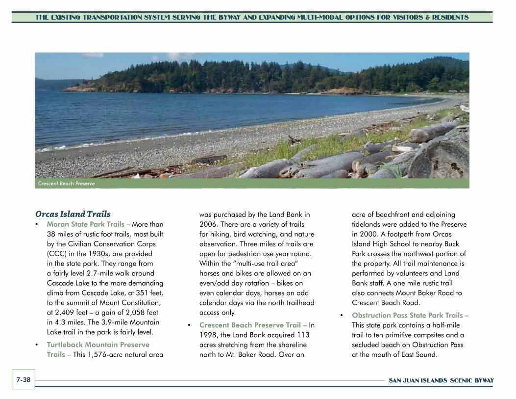
SAN JUAN ISLANDS SCENIC BYWAY7-38
THE EXISTING TRANSPORTATION SYSTEM SERVING THE BYWAY AND EXPANDING MULTI-MODAL OPTIONS FOR VISITORS & RESIDENTS
acre of beachfront and adjoining tidelands were added to the Preserve in 2000. A footpath from Orcas Island High School to nearby Buck Park crosses the northwest portion of the property. All trail maintenance is performed by volunteers and Land Bank staff. A one mile rustic trail also connects Mount Baker Road to Crescent Beach Road.
• Obstruction Pass State Park Trails – This state park contains a half-mile trail to ten primitive campsites and a secluded beach on Obstruction Pass at the mouth of East Sound.
was purchased by the Land Bank in 2006. There are a variety of trails for hiking, bird watching, and nature observation. Three miles of trails are open for pedestrian use year round. Within the “multi-use trail area” horses and bikes are allowed on an even/odd day rotation – bikes on even calendar days, horses on odd calendar days via the north trailhead access only.
• Crescent Beach Preserve Trail – In 1998, the Land Bank acquired 113 acres stretching from the shoreline north to Mt. Baker Road. Over an
Orcas Island Trails• Moran State Park Trails – More than
38 miles of rustic foot trails, most built by the Civilian Conservation Corps (CCC) in the 1930s, are provided in the state park. They range from a fairly level 2.7-mile walk around Cascade Lake to the more demanding climb from Cascade Lake, at 351 feet, to the summit of Mount Constitution, at 2,409 feet – a gain of 2,058 feet in 4.3 miles. The 3.9-mile Mountain Lake trail in the park is fairly level.
• Turtleback Mountain Preserve Trails – This 1,576-acre natural area
[DRAFT AMENDMENTS, 8/17/07, ARE SHOWN IN RED]
Crescent Beach Preserve
Stewardship & Management Plan August, 2001
Adopted by the Land Bank Commission: September 2, 2001 Approved by the Board of County Commissioners: October 16, 2001
San Juan County Land Bank 350 Court Street No. 6
Friday Harbor, WA 98250
Crescent Beach Preserve

CORRIDOR MANAGEMENT PLAN 7-39
THE EXISTING TRANSPORTATION SYSTEM SERVING THE BYWAY AND EXPANDING MULTI-MODAL OPTIONS FOR VISITORS & RESIDENTS
Existing Transit and Taxi ServicesAlthough transit and taxi services exist on both islands, the overall availability of public transportation services is limited. Public shuttle services are offered seasonally for tourists though some local residents use the service when it is available. Characteristics of the services provided are further described below.
San Juan Transit San Juan Transit, based in Friday Harbor, has provided transit and taxi service on San Juan Island for 17 years. When San Juan Island’s popularity as a tourist destination grew in the 1990s, San Juan Transit initiated service to accommodate tourists and offer a low-stress way to tour the island. The transit service started based on a model that would use tourism dollars as its financial base. When it became apparent that tourism funding would not cover all the costs associated with operating a public transit system, a fare-based business model was implemented. Ridership levels have historically been too low to support a year round transit business, and thus San Juan Transit is a seasonal operation. San Juan Transit only increased its one-
way fare one time (in 2001) by $1.00 since starting service in 1994.
Transit service is typically operated from mid-May through Mid-September. A one-way trip costs $5.00 and an all-day pass is $15.00 (2011). The fare for children 13 and under is $2.00. Commuter Books are available with 20 tickets for $40.00 for residents and $50.00 for non-residents. The transit vehicles are wheelchair accessible and carry bicycles. Drivers provide interpretation about various topics, including the historic Roche Harbor Resort, English
Camp, Lime Kiln Point, San Juan Island and Friday Harbor history, and other landmarks along the way. The interpretive program enhances the experience for riders, and many riders have heard about the service through positive reviews of past visitors.
San Juan Transit estimates that 15 to 20 percent of its ridership comes from private boaters, 5 to 7 percent from planes, and the remaining majority from the ferries. Ferries that are overburdened with vehicles result in more walk-ons, creating a higher
San Juan Transit waiting for ferries
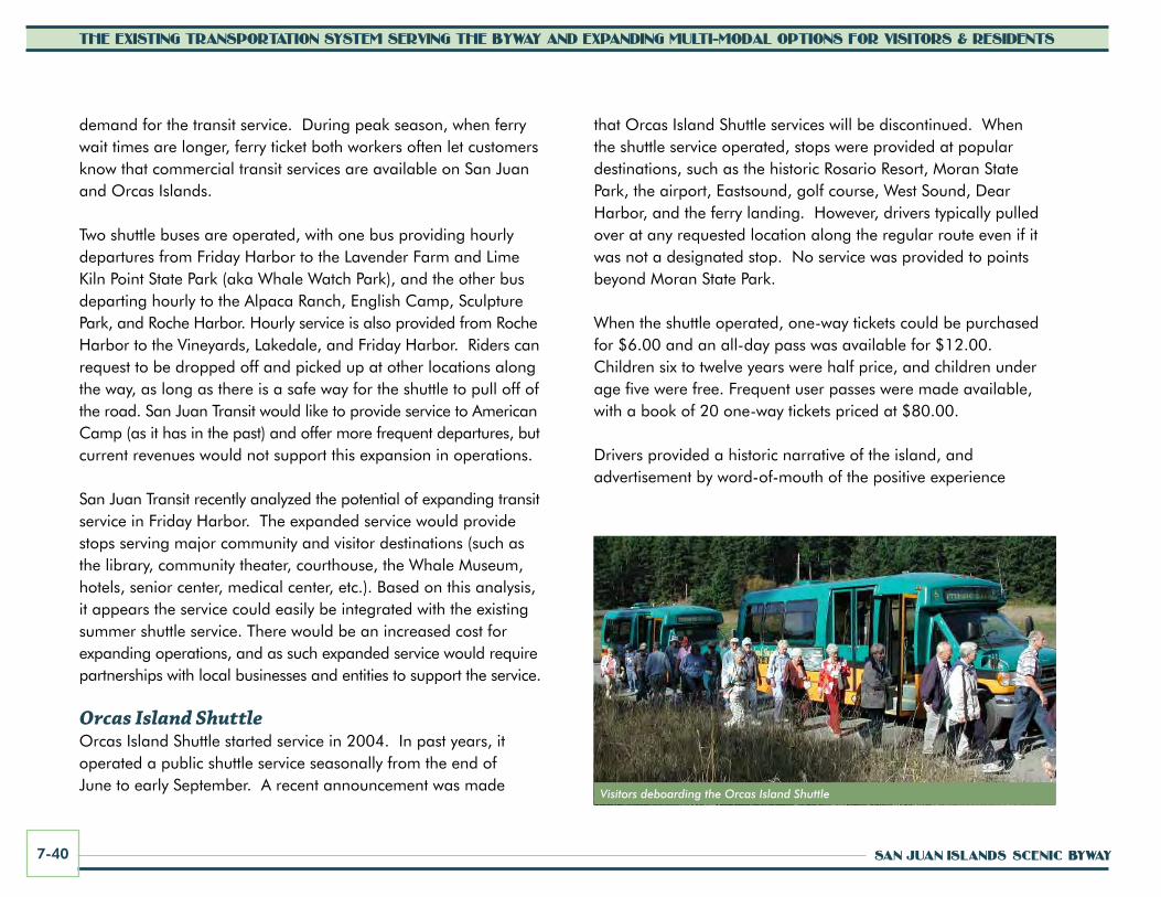
SAN JUAN ISLANDS SCENIC BYWAY7-40
THE EXISTING TRANSPORTATION SYSTEM SERVING THE BYWAY AND EXPANDING MULTI-MODAL OPTIONS FOR VISITORS & RESIDENTS
Visitors deboarding the Orcas Island Shuttle
that Orcas Island Shuttle services will be discontinued. When the shuttle service operated, stops were provided at popular destinations, such as the historic Rosario Resort, Moran State Park, the airport, Eastsound, golf course, West Sound, Dear Harbor, and the ferry landing. However, drivers typically pulled over at any requested location along the regular route even if it was not a designated stop. No service was provided to points beyond Moran State Park.
When the shuttle operated, one-way tickets could be purchased for $6.00 and an all-day pass was available for $12.00. Children six to twelve years were half price, and children under age five were free. Frequent user passes were made available, with a book of 20 one-way tickets priced at $80.00.
Drivers provided a historic narrative of the island, and advertisement by word-of-mouth of the positive experience
demand for the transit service. During peak season, when ferry wait times are longer, ferry ticket both workers often let customers know that commercial transit services are available on San Juan and Orcas Islands.
Two shuttle buses are operated, with one bus providing hourly departures from Friday Harbor to the Lavender Farm and Lime Kiln Point State Park (aka Whale Watch Park), and the other bus departing hourly to the Alpaca Ranch, English Camp, Sculpture Park, and Roche Harbor. Hourly service is also provided from Roche Harbor to the Vineyards, Lakedale, and Friday Harbor. Riders can request to be dropped off and picked up at other locations along the way, as long as there is a safe way for the shuttle to pull off of the road. San Juan Transit would like to provide service to American Camp (as it has in the past) and offer more frequent departures, but current revenues would not support this expansion in operations.
San Juan Transit recently analyzed the potential of expanding transit service in Friday Harbor. The expanded service would provide stops serving major community and visitor destinations (such as the library, community theater, courthouse, the Whale Museum, hotels, senior center, medical center, etc.). Based on this analysis, it appears the service could easily be integrated with the existing summer shuttle service. There would be an increased cost for expanding operations, and as such expanded service would require partnerships with local businesses and entities to support the service.
Orcas Island ShuttleOrcas Island Shuttle started service in 2004. In past years, it operated a public shuttle service seasonally from the end of June to early September. A recent announcement was made
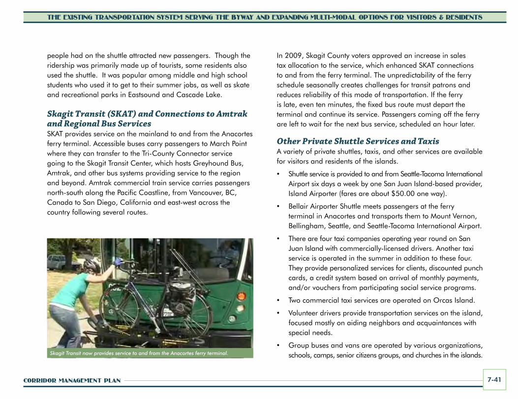
CORRIDOR MANAGEMENT PLAN 7-41
THE EXISTING TRANSPORTATION SYSTEM SERVING THE BYWAY AND EXPANDING MULTI-MODAL OPTIONS FOR VISITORS & RESIDENTS
people had on the shuttle attracted new passengers. Though the ridership was primarily made up of tourists, some residents also used the shuttle. It was popular among middle and high school students who used it to get to their summer jobs, as well as skate and recreational parks in Eastsound and Cascade Lake.
Skagit Transit (SKAT) and Connections to Amtrak and Regional Bus ServicesSKAT provides service on the mainland to and from the Anacortes ferry terminal. Accessible buses carry passengers to March Point where they can transfer to the Tri-County Connector service going to the Skagit Transit Center, which hosts Greyhound Bus, Amtrak, and other bus systems providing service to the region and beyond. Amtrak commercial train service carries passengers north-south along the Pacific Coastline, from Vancouver, BC, Canada to San Diego, California and east-west across the country following several routes.
In 2009, Skagit County voters approved an increase in sales tax allocation to the service, which enhanced SKAT connections to and from the ferry terminal. The unpredictability of the ferry schedule seasonally creates challenges for transit patrons and reduces reliability of this mode of transportation. If the ferry is late, even ten minutes, the fixed bus route must depart the terminal and continue its service. Passengers coming off the ferry are left to wait for the next bus service, scheduled an hour later.
Other Private Shuttle Services and TaxisA variety of private shuttles, taxis, and other services are available for visitors and residents of the islands.
• Shuttle service is provided to and from Seattle-Tacoma International Airport six days a week by one San Juan Island-based provider, Island Airporter (fares are about $50.00 one way).
• Bellair Airporter Shuttle meets passengers at the ferry terminal in Anacortes and transports them to Mount Vernon, Bellingham, Seattle, and Seattle-Tacoma International Airport.
• There are four taxi companies operating year round on San Juan Island with commercially-licensed drivers. Another taxi service is operated in the summer in addition to these four. They provide personalized services for clients, discounted punch cards, a credit system based on arrival of monthly payments, and/or vouchers from participating social service programs.
• Two commercial taxi services are operated on Orcas Island.
• Volunteer drivers provide transportation services on the island, focused mostly on aiding neighbors and acquaintances with special needs.
• Group buses and vans are operated by various organizations, schools, camps, senior citizens groups, and churches in the islands. Skagit Transit now provides service to and from the Anacortes ferry terminal.

SAN JUAN ISLANDS SCENIC BYWAY7-42
THE EXISTING TRANSPORTATION SYSTEM SERVING THE BYWAY AND EXPANDING MULTI-MODAL OPTIONS FOR VISITORS & RESIDENTS
• Some resorts, such as Roche Harbor and Rosario contract with San Juan Transit and Orcas Island Shuttle, respectively, to provide service for their summer employees and guests. Roche Harbor Resort has supplied season transit passes to employees to encourage sustainable transportation use on the island.
San Juan County Coordinated Human Services Transportation Plan
Page 41
San Juan Island (1 van), and Orcas Christian School on Orcas for their own participants. The Lopez Community Church has a van they make available to community events. Some hotels, like Best Western in Friday Harbor, offer shuttles for their clientele. Some places of worship offer rides to assist members to attend weekly services and events.
If there is a requirement to hold a Commercial Drivers License it must be
obtained on the mainland. There are 35 persons with a school bus endorsement in San Juan County who have an active license. All of them also have the passenger endorsement. There are 105 persons with a passenger endorsement only. (Brad Benfield, DOL, Personal Interview). Gas-Voucher and Ferry Ticket Programs
Several agencies, churches, civic groups and organizations offer gas vouchers and/or ferry tickets to eligible residents in need. For some programs such as Medicaid there is a complicated application process that often requires case manager assistance. For other programs such as the Soroptimist Cancer Ferry ticket program only a phone call is required, with no questions asked. Ridesharing
Islanders without cars often walk onto ferries hoping to find someone they know or a “friend of a friend” to get them to their off-island destinations. Electronic ridesharing is available to a limited extent through island-specific websites like lopezrocks.org and an Orcas-oriented Facebook site. Along county roadways there are a series of signs that designate ridesharing opportunities.
“sjRIDESHARE” is the state‟s only
sanctioned hitchhiking system and provides designated safe, accessible sites for potential riders to stand and wait for a ride. It also provides guidelines for both riders and drivers, and is in the process of developing a web-based bulletin board to connect those needing rides with those who are available to provide them.
A mother and daughter try a sjRIDESHARE Site Vehicle Inventory
From the information collected in the interviews and visits discussed in this section, a preliminary chart of transit-capable vehicles found in our county
The sjRIDESHARE program allows opportunity to obtain rides from others on the island.
• Several agencies, churches, civic groups and organizations offer ferry tickets, often focused on citizens with special needs. Sometimes ferry tickets are offered as tourism incentives to visitors and can be a tool for encouraging more visitors to explore the islands without their automobiles.
RidesharingThere is an informal program that islanders often rely on for transportation—electronically-accessible ridesharing via Facebook and websites, where people without cars or who need rides can catch rides from friends or friends of friends. sjRIDESHARE is the only sanctioned hitchhiking system in the state that provides designated, safe, accessible sites for potential riders to stand and wait for a driver. It also provides guidelines for both riders and drivers and is in the process of developing a web-based bulletin board to connect those needing rides with those available to provide them.
Rental VehiclesVisitors have the opportunity to rent a full spectrum of vehicles upon arrival at either San Juan or Orcas island. Bicycles, scoot cars, mopeds, scooters, and automobiles
Businesses could heavily promote “car-free” days and provide additional rentals to encourage more visitors come to the islands without their autos.
Scoot cars are offered as another rental option on San Juan Island.

CORRIDOR MANAGEMENT PLAN 7-43
THE EXISTING TRANSPORTATION SYSTEM SERVING THE BYWAY AND EXPANDING MULTI-MODAL OPTIONS FOR VISITORS & RESIDENTS
can be rented in Friday Harbor, within walking distance of the ferry terminal. On Orcas Island, bicycles, mopeds, and automobiles are available. Free delivery and retrieval of rental cars are offered for anywhere on Orcas Island with reservations at least 24-hours in advance. One auto renting agency on San Juan Island reports rentals tallying approximately 6,900 vehicle days annually, with the busiest time period occuring between mid-June and mid-September. The demand for these services will grow as more visitors choose to come and are encouraged to come to the islands without their own cars for “car-free” vacations.
AirportsAviation has been an important means of transportation to and among the islands since the 1940s. There are many landing areas, ranging from seaplanes and private grass airstrips in agricultural fields, to comparatively larger public airfields with paved runways near population centers (such as the 3,400-foot runway at the Friday Harbor airport). In addition to passenger travel, these and airport-related services provide freight and mail transport, medical evacuation to mainland hospitals and other essential services. San Juan and Orcas islands support public-use airports through island port districts. These are eligible for federal funds for planning and development of airports and terminal facilities.
The Port of Friday Harbor operates the Friday Harbor Airport, located within the Town of Friday Harbor. There are 67 permanent aircraft tie downs and 39 transient tie downs. The Roy Franklin terminal accommodates over 16,000 pilots and passengers per year with scheduled flights to Seattle, Bellingham, and Anacortes and charter service to other islands. The airport includes a 3,400 by 75-foot runway with medium intensity
runway lighting, 45 aircraft tie-downs for guests, 52 port-owned hangars and 123 based aircraft.
The Port of Orcas operates the Orcas Island Airport. It is approximately 60 acres in size and is located within the Eastsound Planning Area. Approximately 5,000 pilots and passengers use the airport annually. The airport has a 500-square-foot terminal building and there are 43 designated aircraft tie-down positions. Kenmore Air float planes provide service to Westsound and Rosario.
While Friday Harbor and Orcas Village are important portals to byway visitors arriving by ferry, it’s important to remember that the airports and seaports are also portals to the scenic byway for pilots, boaters, and their passengers.
Orcas Island Airport

SAN JUAN ISLANDS SCENIC BYWAY7-44
THE EXISTING TRANSPORTATION SYSTEM SERVING THE BYWAY AND EXPANDING MULTI-MODAL OPTIONS FOR VISITORS & RESIDENTS
Multi-modal Transportation RecommendationsRecommendations related to multi-modal transportation for the San Juan Islands Scenic Byway are described below. These recommendations include planned projects that are reflected in county, town, and hamlet plans, as well as new suggestions for pedestrian and bicycle improvements, public transportation, and promotion of local tourism routes and water routes. Implementation of these recommendations will improve transportation and recreation experiences for all byway users including local residents, visitors and recreationists, pedestrians, bicyclists, and those interested in transit services. New construction of pedestrian and bicycle facilities and trails must comply with all applicable local, state, and federal requirements, including Amercicans with Disabilities Act provisions. The Action Plan, Section 11 of this plan, summarizes the scenic byway’s top priority transportation projects.
Bicycling Improvements, Including Roadway Shoulder wideningThe San Juan Islands Scenic Byway organization will continue to work with local, state, and federal agencies, as well as tourism and recreational organizations, to improve conditions for on-road and off-road bicycling throughout the islands. Minimum four-foot-wide shoulders on main corridors to better accommodate bicycling is an important priority. Shoulders also improve conditions for motorists and pedestrians, providing more space for shared use overall. Further promoting and accommodating bicycling will reduce the overall carbon footprint
associated with tourism and the related environmental impacts as well as help to increase tourism (by expanding transportation options) and related economic benefits.
Implement Bicycle Improvements Identified in Approved PlansGeneral county-wide needs for bicycle improvements identified in the San Juan County Nonmotorized Transportation Plan that are recommended for implementation along the scenic byway include:
• Provide linkages between ferry terminals and activity centers.
• Develop wider shoulders on main corridors, roads leading to schools or touring routes.
• Develop public restroom facilities at key destinations and key rest stops on the multi-use trails where needed.
• Provide additional bike pull-outs.
• Work with the Washington State Ferries system to provide staging areas and routing lanes immediately contiguous to the ferry landings.
Providing facilities for safe bicycle travel is a priority.

CORRIDOR MANAGEMENT PLAN 7-45
THE EXISTING TRANSPORTATION SYSTEM SERVING THE BYWAY AND EXPANDING MULTI-MODAL OPTIONS FOR VISITORS & RESIDENTS
• Update the San Juan Islands cycling video posted on the county’s website, and make it available in Anacortes, on the ferries and/or at the island arrival kiosks.
• Develop a new map/brochure for each island of the nonmotorized routes, including trails, with information on road conditions, status of development, preferred corridors, comfort stations, etc. Include more generic information that educates, such as “Rules of the Road” with information on how to walk/ride on shoulders, when to yield, what to do on roads with no shoulders, respect for private property, and other key messages.
ADDITIOnAL BywAy-wIDE REcOMMEnDATIOnS The following additional byway-wide recommendations relate to bicycling improvements and programs:
• The byway website should include or provide links to the bicycling brochures/maps developed for each island. Web-ready content should be developed to provide visitors information about recommended bicycling touring routes, conditions that might be encountered along these routes, locations of bicycle pull-outs, and other information (including any seasonal construction or paving activities that might be occuring along the routes).
• The byway organization should continue to work with WSF, San Juan County, the Town of Friday Harbor, and other public land and facility managers to identify and provide additional bicycling information and facilities that might be needed along the byway route (such as in ferry terminals or at key destinations).
Bicycle improvement recommendations specific to each island are summarized in the following paragraphs.
SAn JuAn ISLAnD• Join key destinations with walking and bicycling corridors/
shared-use paths connecting Friday Harbor with Roche Harbor, Lime Kiln Point State Park/San Juan County Park, American Camp/Cattle Point, and Turn Point/Jackson Beach. Designate this as an important visitor experience and show the route on byway maps.
• Improve roadways where possible to add minimum four-foot-wide road shoulders on main arterial roads, including portions of Cattle Point Road, Bailer Hill Road, West Side Road, and West Valley Road.
• Provide additional wayshowing kiosks and signs in Friday Harbor, as well as other hubs along the byway, to help direct bicycling visitors to key sites and the scenic byway route.
ORcAS ISLAnD• Implement the recommendations of the Eastsound Planning
and Review Committee Sub-area Plan.
Promoting bicycle use will reduce the overall carbon footprint of tourism-generated transportation.

Many visitors use roads on the islands for group biking excursions.

CORRIDOR MANAGEMENT PLAN 7-47
THE EXISTING TRANSPORTATION SYSTEM SERVING THE BYWAY AND EXPANDING MULTI-MODAL OPTIONS FOR VISITORS & RESIDENTS
• Improve Orcas and Olga Road corridor from the ferry landing through Moran State Park to allow safe bicycle and pedestrian travel.
à Obtain grants for Orcas Road widening project.
à Widen paved shoulders to four- feet on the remaining narrow segments of Orcas Road between the ferry and Eastsound.
à Complete the four-foot-wide shoulder widening of the final segments of Olga Road to Moran State Park.
• Construct a bicycle staging area at the ferry landing, including bike racks, kiosk with maps, island and safety information.
• Provide additional wayshowing kiosks and signs at Orcas Landing and Orcas Village vicinity, as well as other hubs along the byway, to help direct bicycling visitors to key sites and the scenic byway route.
Roadway ImprovementsRoadway/shoulder widening to promote safer vehicular traffic and bicycling is recommended, in accordance with county standards, for roads with sub-standard shoulders. Most county road-rebuilding
projects consider the need for road shoulders and facilities to accommodate bicyclists and pedestrians in their design. The county will continue to work towards completion of shoulder widening as right-of-way and funding becomes available. All new improvement projects shall follow applicable San Juan County, state, and federal design standards:
• Shoulders should be a minimum four-foot width, with five-foot preferred. (The minimum four-foot width is consistent with WSDOT and AASHTO standards for recommended bicycling routes, although shoulders must be five-feet-wide to be officially called “bike lanes.”)
• Auto lanes can, in some circumstances, be narrowed to provide space at the shoulders for bicycling. Narrowing travel lanes to minimum dimensions (as delineated by striping) can also calm traffic, prompting drivers to lower their speeds. Opportunities to restripe lane widths would have to be evaluated on a case-by-case basis.
• Chip seal of 3/8-inch or finer should be used whenever possible on shoulders. Newly applied chipseal can create hazards for
Roadway/shoulder widening is recommended where needed to provide space for bicyclists.
bicyclists with excess gravel along the roadway shoulders. Vehicles can unintentionally kick rocks up or bicycle wheels can catch rocks and go off course. The byway organization, bicycling groups, and the County should continue to work together and with WSF and others to notify visitors/bicyclists about paving schedules and encourage motorists to drive at slower speeds along these routes.

SAN JUAN ISLANDS SCENIC BYWAY7-48
THE EXISTING TRANSPORTATION SYSTEM SERVING THE BYWAY AND EXPANDING MULTI-MODAL OPTIONS FOR VISITORS & RESIDENTS
• Care should be taken to avoid transition ridge from the main roadway to the shoulder and a fog line stripe should separate the shoulder from road traffic lanes. (Current county standards require four-inch fog line striping. It is recommended that the county consider use of a wider fog line stripe to delineate bicycle lanes and bicycle routes.)
Share the Road Signs and Promotional ProgramsAdditional “Share the Road” signs in key locations (without creating sign clutter) and promotional efforts are needed to reinforce and support the roadway system as a multi-modal facility and rural bicycling venue. Promotional and educational programs should be continued and enhanced to emphasize bicycling rules and safety practices, as well as to make drivers more aware of the need to share the
roadway with bicyclists. Enforcement is also key to this concept. In strategic areas, the “share the road” signs can be reinforced with a sharrow symbol on the roadway.
Bicycling Information and OrientationA specific bicycle educational brochure/map and web-ready information (accessible through multiple Internet sites) should be created for the scenic byway. The brochure and map should include a list of popular bicycle routes and guidance about existing conditions along these routes. The brochure and map can be updated as more routes are improved (shoulders widened and paths constructed).
pedestrian ImprovementsPedestrian improvements, such as dedicated and delineated paths/trails and
Separated shared use paths/trails connecting major
destinations are recommended where possible to provide a place
for those who do not feel comfortable bicycling on the roadway
Town, village, and hamlet settings that promote walkability will help to get visitors out of their cars and reduce traffic congestion.
Sharrow symbol example

CORRIDOR MANAGEMENT PLAN 7-49
THE EXISTING TRANSPORTATION SYSTEM SERVING THE BYWAY AND EXPANDING MULTI-MODAL OPTIONS FOR VISITORS & RESIDENTS
crosswalks, should be installed where needed along the San Juan Islands Scenic Byway. Residents and visitors alike should be encouraged to get out of their cars and explore the unique experience of portions of the byway on foot (particularly via shared use paths/trails and walking tours). General county-wide needs for pedestrian improvements identified in approved San Juan County plans include:
• Providing linkages between ferry terminals and activity centers.
• Considering a broad range of safety-related issues including crossing improvements, trails that link island destinations, wider shoulders, and school walk route improvements.
• Developing public restroom facilities at key destinations and key rest stops on the multi-use trails where needed.
Pedestrian improvement recommendations specific to each island are summarized in the following paragraphs.
SAn JuAn ISLAnD• Join key destinations with walking
facilities/trails.
• Develop and promote the historic walking tour in Friday Harbor (including
the waterfront walking tour) and supporting interpretation and signing.
• Provide additional wayshowing kiosks and signs in Friday Harbor, as well as other hubs along the byway, to help direct pedestrian visitors to key sites and the scenic byway route.
• Support the creation of a new walking path from town to Griffin Bay.
• Obtain right-of-way to construct separated walking trails along each of the main county corridors.
ORcAS ISLAnD• Improve the Olga Road corridor from
the Olga dock through Moran State Park to allow safe pedestrian (and bicycle) use.
Providing safe pedestrian linkages between ferry terminals and town/village/hamlet activity centers is recommended.
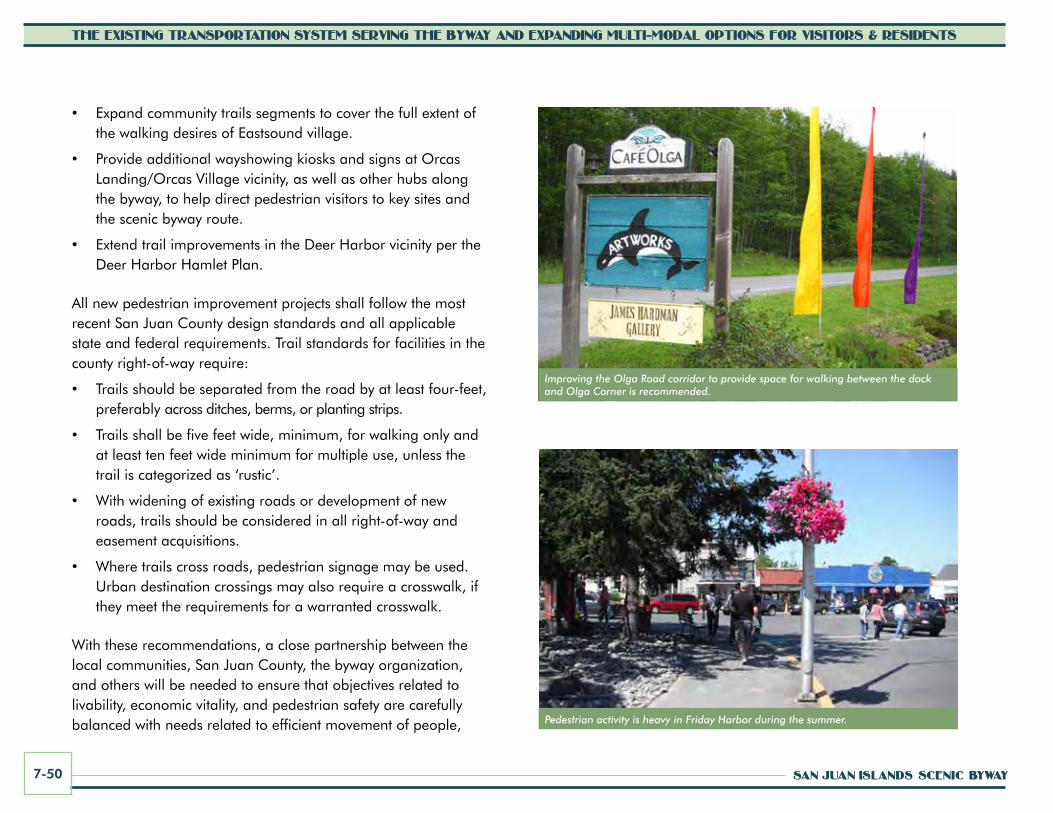
SAN JUAN ISLANDS SCENIC BYWAY7-50
THE EXISTING TRANSPORTATION SYSTEM SERVING THE BYWAY AND EXPANDING MULTI-MODAL OPTIONS FOR VISITORS & RESIDENTS
Improving the Olga Road corridor to provide space for walking between the dock and Olga Corner is recommended.
• Expand community trails segments to cover the full extent of the walking desires of Eastsound village.
• Provide additional wayshowing kiosks and signs at Orcas Landing/Orcas Village vicinity, as well as other hubs along the byway, to help direct pedestrian visitors to key sites and the scenic byway route.
• Extend trail improvements in the Deer Harbor vicinity per the Deer Harbor Hamlet Plan.
All new pedestrian improvement projects shall follow the most recent San Juan County design standards and all applicable state and federal requirements. Trail standards for facilities in the county right-of-way require:
• Trails should be separated from the road by at least four-feet, preferably across ditches, berms, or planting strips.
• Trails shall be five feet wide, minimum, for walking only and at least ten feet wide minimum for multiple use, unless the trail is categorized as ‘rustic’.
• With widening of existing roads or development of new roads, trails should be considered in all right-of-way and easement acquisitions.
• Where trails cross roads, pedestrian signage may be used. Urban destination crossings may also require a crosswalk, if they meet the requirements for a warranted crosswalk.
With these recommendations, a close partnership between the local communities, San Juan County, the byway organization, and others will be needed to ensure that objectives related to livability, economic vitality, and pedestrian safety are carefully balanced with needs related to efficient movement of people, Pedestrian activity is heavy in Friday Harbor during the summer.

CORRIDOR MANAGEMENT PLAN 7-51
THE EXISTING TRANSPORTATION SYSTEM SERVING THE BYWAY AND EXPANDING MULTI-MODAL OPTIONS FOR VISITORS & RESIDENTS
Providing quality hiking trails is an important local goal.
vehicles, and goods on the roadway network. All entities in the county will need to work together to find the best solutions to improve pedestrian mobility and safety.
public Trails Local, state, and federal agencies and land management groups are committed to providing a system of safe, enjoyable outdoor recreation and transportation opportunities for nonmotorized travel to residents and visitors of San Juan County. Local, state, and federal land managers are committed to providing high quality parks, trails, and natural areas that offer a diversity of active and passive recreation experiences and that conserves and respects natural resources and the character of the islands. San Juan County serves an important role in providing parks and
trails, as well as other agencies such as the National Park Service and the Washington State Parks and Recreation Commission. Since 2005, San Juan County has collaborated with trail groups and dedicated resources to the development of trails within the road right-of-way.
The exceptional trail resources of the islands offer an array of experiences for byway travelers and visitors to the area. As such, the San Juan Islands Scenic Byway organization will continue to work closely with federal, state, and local agencies to support trail development and enhancement projects throughout the county. Improvement projects and recommended actions identified in recent plans include:
• Continued regional collaboration among local, state, and federal agencies and organizations to support the public trails system and enhance and expand facilities through partnerships.
• Better define roles of San Juan County Public Works, Parks, and Land Bank in meeting community trail needs.
• Update the Nonmotorized Transportation Plan to reflect trail corridor priorities in conjunction with the update of the transportation element of the County Comprehensive Plan.
• Construct priority trail projects established in San Juan County Land Bank management plans.
• Prioritize needed trail-support facilities (e.g., restrooms, parking) in areas of high traffic and use.
• Encourage collaboration among volunteer trail groups to facilitate sharing and leveraging of knowledge and resources.
• Develop and provide county-wide trail and public land maps for public distribution.

SAN JUAN ISLANDS SCENIC BYWAY7-52
THE EXISTING TRANSPORTATION SYSTEM SERVING THE BYWAY AND EXPANDING MULTI-MODAL OPTIONS FOR VISITORS & RESIDENTS
Park land, the public right-of-way along Cattle Point Road, and the new Terminal Trail at the airport to connect Friday Harbor with American Camp. This trail, approximately seven miles long, is envisioned to be used by pedestrians and bicyclists. The project provides a rustic walking trail along Cattle Point Road in the county right-of-way. (This project is already in process and is nearly complete including the segment from Rossler Road to the American Camp Visitor Center.)
• Friday Harbor-Jackson Beach Link – This proposed new trail would provide a convenient and much needed route to walk or bike from Friday Harbor to the public beach closest to town.
• Support the County in hiring a trails coordinator to explore feasibility of countywide trails plan, establish coordination system with County departments and other agencies, research grant funding opportunities, and be the overall point of contact for trail inquiries.
• Explore opportunity to develop a comprehensive county-wide trails plan.
• Expand the San Juan County Land Bank’s role in acquiring and holding trail easements to facilitate trail development.
• Develop a simple, recognizable “brand” for trails in San Juan County to ensure consistency and user-friendliness across facilities.
• Work with local trails groups to identify priority corridors for trail easements and explore feasibility of developing a “trail easement toolkit” to help landowners make educated decisions about trail easements.
• Help support ongoing maintenance needs with volunteer efforts.
Trail improvement recommendations specific to each island are summarized inthe following paragraphs.
SAn JuAn ISLAnD• Friday Harbor – American Camp
Link / Cattle Point Road Trail – This proposed new trail route would use San Juan Island National Historical
The Redoubt Road at American Camp

CORRIDOR MANAGEMENT PLAN 7-53
THE EXISTING TRANSPORTATION SYSTEM SERVING THE BYWAY AND EXPANDING MULTI-MODAL OPTIONS FOR VISITORS & RESIDENTS
• Roche Harbor – Roche Harbor Highlands – English Camp Link – This walking trail connects Roche Harbor Resort and English Camp, via Roche Harbor Highlands. Much of this five-mile trail already exists.
• San Juan County Park – Lime Kiln Point State Park Link – This is a new 1.5 mile park-to-park trail that would mainly run parallel to Westside Road.
• Cross-Island Trail / English Camp – American Camp Link – This new trail would connect the Roche Harbor-Mitchell Hill-English Camp area with Egg Lake Road through the center of the Island. It could possibly accommodate walkers, horses, and mountain bikes.
The creation of this trail would require significant cooperation of private landowners and the Town of Friday Harbor. This cross-island connection has historic importance. During the 19th century, while British and US soldiers were concurrently stationed on San Juan Island, and before most of the current public roads existed, there was a roadway that connected the two camps, which is commonly referred to as the Historic Military Road. Remnants of this roadway exist, as well as sections that are now contiguous with modern public and private roadways. The San Juan County Department of Public Works conducted an extensive trail feasibility study of it in 1990. At that time, some landowners were supportive of the trail, while some were not in favor of it.
• Friday Harbor Walking Trail – This would be a new, flat walking trail in town that would connect several neighborhoods surrounding the proposed new ball fields, providing safe strolling for people of all ages and abilities.
• Island Nature Trail(s) – A new trail designed to interpret key natural features such as wetland habitat, flora, geography, marine
life, geology, and other resources inherent to San Juan Island.
• Friday Harbor – Roche Harbor Link – An alternative overland route to the existing Roche Harbor Road paved bike shoulder, a distance of approximately 13 miles.
• Cady Mt. Preserve – Develop a new trail within the preserve.
• Lime Kiln Point State Park – Install new interpretive and informational signage to enhance trail use.
ORcAS ISLAnD TRAIL IMpROvEMEnT REcOMMEnDATIOnS• Deer Harbor Loop Trail – Enhance by
adding a hard surface to existing trail.
• Mt. Baker Road Trail – Construct a new trail on Mt. Baker Road from North Beach Road to Terrill Beach Road. This trail is in the design phase and scheduled to be constructed in 2012 once dedicated construction funds are identified.
• North Beach Road Pathway – Expand the North Beach Road pathway from Brandt’s Landing Road to the road end beach access park. (Note: a pathway currently exists on one side of the North Beach Road.)
A new trail from San Juan County Park to Lime Kiln Point State Park is recommended.

SAN JUAN ISLANDS SCENIC BYWAY7-54
THE EXISTING TRANSPORTATION SYSTEM SERVING THE BYWAY AND EXPANDING MULTI-MODAL OPTIONS FOR VISITORS & RESIDENTS
• Eastsound Loop Trail – Create Eastsound Loop trail by adding the Crescent Beach segment, working with Land Bank to close the loop through wetlands from Mt. Baker Road.
• Channel Road Trail – Install a new trail from Deer Harbor Road to Spring Point Road.
• Deer Harbor Road Trail – Install a new trail along Deer Harbor Road.
• Turtleback Mountain Preserve – Develop a new south loop trail.
• Coffelt Farm Preserve – Renovate/replace fence and trail.
planned Transportation Improvement projects/Six year TIpTransportation improvement projects are listed in San Juan County’s six year transportation improvement program (TIP). Refer to the county’s website for the current version of the TIP, which lists projects proposed for improvements within the six-year planning timeframe. Not all TIP projects listed in the program are funded. Some may be funded for planning and/or design, but not for construction.
Two major projects are listed in the TIP related to road segments on the scenic byway. Each of these is described in more detail below.
Enjoying a scenic hiking experience on Orcas IslandTurtleback Mountain Preserve

CORRIDOR MANAGEMENT PLAN 7-55
THE EXISTING TRANSPORTATION SYSTEM SERVING THE BYWAY AND EXPANDING MULTI-MODAL OPTIONS FOR VISITORS & RESIDENTS
Cattle Point Road Realignment, San Juan IslandThis project would realign 1.1 miles of Cattle Point Road on National Park Service property at the American Camp unit of San Juan Island National Historical Park. Erosion threatens the current alignment, a route that provides access to the southern end of San Juan Island. There is no alternative route to the Cattle Point area, and loss of the road would isolate communities at the south end of the island from all services. San Juan County is pursuing funding opportunities for the estimated $7.69 million project in partnership with the National Park Service.
Orcas Road Improvements, Orcas IslandThis project would improve 3.5 miles of Orcas Road north and south of the curves at Nordstrom Lane, possibly from Deer Harbor Road to Sunderland Road. The project would provide redesign, upgrade and widening of the curves, improve sight distance, and enhance general safety for vehicular and pedestrian traffic. The estimated $3 million project would be constructed in phases.
Moran State park Improvement needsWashington State Parks and Recreation Commission and the Friends of Moran State Park have inventoried transportation improvement needs at the park. These improvements include:
• Renovation of boat launches at Mountain Lake and Cascade Lake
• Replacement of CXT pit toilet at Little Summit overlook
• Expansion and improvements to summit parking area
• Repaving of Mount Constitution Road
• Guardrail improvements along Mount Constitution Road
• Replacement and repair of rip-rap along the main park roadway (scenic byway) at Cascade Lake to address erosion concerns
• Various trail improvements, including:
à Saltwater Access Loop Trail
à ADA trail retrofit opportunities at Mountain Lake
Ongoing renovation work of the interpretive center building at the summit and development of interpretive materials are also in need of funding, as discussed in Section 6 of the CMP.
Cascade Lake in Moran State Park

SAN JUAN ISLANDS SCENIC BYWAY7-56
THE EXISTING TRANSPORTATION SYSTEM SERVING THE BYWAY AND EXPANDING MULTI-MODAL OPTIONS FOR VISITORS & RESIDENTS
• Map Corner, Orcas Island – Install exterior prefabricated concrete restrooms, new map, reconfigure parking and vegetation.
• Fowler’s Pond, Orcas Island – Install a new fence and new bike/pedestrian overlook.
• Eastsound/Village Green, Orcas Island – Provide byway information/parking wayside. Identify a location in Eastsound for new exterior prefabricated restrooms.
• Olga Corner, Orcas Island – Provide byway information/parking wayside. Provide exterior prefabricated restrooms.
• Doe Bay, Orcas Island – Provide byway information/parking wayside. Provide exterior prefabricated restrooms.
Travelers Rests: Roadside Turnouts and Interpretive waysidesEnhancing existing informal roadside pull-offs and adding formal turnouts along the byway are recommended. Several locations are suggested below that could be further developed to enhance byway travelers’ experiences and provide opportunities for travelers to rest and/or take in the views during their journey on the San Juan Islands Scenic Byway. In addition to evaluating these locations, an overall study of the need for formal vehicle turnout areas along the scenic byway should be conducted.
• Westside Road, San Juan Island – Westside Road, which runs along the west side of the island, experiences some periods of traffic congestion in summer months along the portion south of Lime Kiln Point State Park. Sweeping views of the Salish Sea and Vancouver Island make this a popular location on the island for viewing wildlife and sunsets. There are a few small pull-off areas for vehicles, which could be enhanced to accommodate more vehicles and provide interpretive information. The first step in this process would be to complete an assessment and feasibility study of potential improvement and expansion opportunities.
• Cattle Point Road, San Juan Island – The proposed plan for Cattle Point Road will realign the road to the north. Interpretive waysides and formalized pull-off areas should be considered in the new design. The Mid-Slope Realignment is the preferred alternative based on environmental analysis. This alternative would relocate the road to the north of the existing location, traversing the south-facing slope of Mount Finlayson. The realignment would be entirely on grade, approximately 4,950 feet in length, with a short slope of 10.5 percent on the eastern end. Olga Corner is a proposed location for a byway wayside with a visitor information kiosk.

CORRIDOR MANAGEMENT PLAN 7-57
THE EXISTING TRANSPORTATION SYSTEM SERVING THE BYWAY AND EXPANDING MULTI-MODAL OPTIONS FOR VISITORS & RESIDENTS
ORcAS ISLAnD• Bicycling loop vicinity of Map Corner
• Little Eastsound Loop (Prune Alley and North Beach Road)
• Big Eastsound Loop (Prune Alley/North Beach Road to Mount Baker Road to Lovers Lane)
• Mount Constitution Road spur in Moran State Park
• Spur to Olga waterfront
• Obstruction Pass State Park spur–unpaved road
On both islands, experience-specific tours are recommended, such as:
• Arts and Culture Tours
• Farms and Barns Tours
• Farmers Market/Farmstand Tours
• Bicycling Tours
• Historic Sites/Heritage Tours
• Wildlife Watching Tour/Nature Tours
Ideally, these local touring routes would become more accessible over time via transit service and bicycling, in keeping with the concept to encourage car-free vacations in the San Juan Islands. As transit and touring services expand and bicycling and trail improvements are made, transit and bicycle tour promotion can adapt and intensify to encourage less driving in the islands.
promote the “car-free” vacation ExperienceThe San Juan Islands Scenic Byway organization will continue to work closely with the San Juan Islands Visitors Bureau, chambers of
promote Local Side Touring RoutesAs a strategy for dispersing visitation, along with enhancing byway visitors’ experiences, several side touring routes have been identified off the main byway route.
SAn JuAn ISLAnD• West Valley Road/Beaverton Valley Road to view farms and
barns (advise travelers that roads are narrow with heavy traffic from the gravel mine)
• False Bay Road for a family bicycling experience (advise travelers that a portion of the route is unpaved)
• Spur to Lavendar Farm
• Spur to Jackson Beach
The route to Obstruction Pass State Park is a spur off the main byway.

SAN JUAN ISLANDS SCENIC BYWAY7-58
THE EXISTING TRANSPORTATION SYSTEM SERVING THE BYWAY AND EXPANDING MULTI-MODAL OPTIONS FOR VISITORS & RESIDENTS
commerce, local communities, state tourism, the National Park Service, Washington State Parks and Recreation Commission, and others to gradually increase promotion of car-free vacation opportunities.
It is important to note that today’s car-free opportunities are still somewhat limited. Friday Harbor is currently the best place in the islands to promote as a car-free vacation destination. Transportation options to support a car-free experience are more limited in areas beyond Friday Harbor across San Juan Island and on Orcas Island. (Rental vehicles are available on both islands so that visitors can choose to arrive without a car and rent a vehicle on-island.)
Promotion of the islands as a car-free experience should start gradually and build. As transit service becomes more readily available throughout the year and expands to provide more regular service to popular destinations, and as more facilities for safe bicycling and walking become available, promotion of the islands as a car-free vacation destination can intensify. Initially, promotion of the car-free experience can emphasize
the availability of rental vehicle opportunities (autos, bicycles, mopeds, mini- and scoot-cars, scooters, etc.), supplemented by seasonal transit service and bicycling opportunities where available. Eventually, as transit service and bicycling and walking routes are expanded and improved, the promotion of car-free vacation opportunities can put more emphasis on the ability to get to popular destinations via transit, bicycling, and walking.
As opportunities to promote car-free vacations grow, the byway organization and its partners should work with local businesses to find more and more ways to encourage visitors to come to the islands without cars. A few strategies are listed below.
• Provide various incentives and discounts for carless visitors, including discounts on the cost of parking in Anacortes, as well as lodging and meal discounts.
• Continue to coordinate with WSF on parking management, including pricing strategies and capacity of parking in Anacortes, ensuring that conditions provide cost incentives for park and ride.
• Leverage tourism marketing (websites, brochures, and other travel media) to promote and advertise the car-free/reduced carbon footprint vacation experience, particularly to the green tourism/sustainable tourism audience. Educate visitors about how choosing alternative transportation benefits the sensitive environment of the islands and Salish Sea, as well as the rural character and scenic beauty found there.
• Promote public transit and find opportunities to subsidize the transit system. The transit system not only provides public transportation for visitors and islanders, but also opportunities for sightseeing, scenic and historic tours and interpretation programs.
Maintaining affordable parking rates in Anacortes could be an incentive for getting more visitors to go “car-free.”

CORRIDOR MANAGEMENT PLAN 7-59
THE EXISTING TRANSPORTATION SYSTEM SERVING THE BYWAY AND EXPANDING MULTI-MODAL OPTIONS FOR VISITORS & RESIDENTS
Transit Services and/or public Transportation
Challenges Associated with Operating Transit and Shuttle SystemsSan Juan Transit and Orcas Island Shuttle experience similar challenges in that they are privately-owned businesses that perform a public service. Because they are public operations, they are
regulated by the Washington Utilities and Transportation Commission (UTC). However, because they are seasonal and privately owned, they are not eligible for transportation grants. They are also not allowed to post stop signs and schedules along the public right-of-way, which would be considered an advertisement. Orcas Island Shuttle has placed sandwich board signs at stop locations where feasible, including the ferry, Deer Harbor, Eastsound, and Rosario Resort.
Operating a public transportation system with a schedule that is dependent on the ferry adds another layer of complication. The UTC requires advance submittal of the season’s schedule and both companies must wait in anticipation for the release of the Washington State Ferries summer sailing schedule in the spring before they can submit the required documentation that will allow them to operate. Coordinating transit schedules (on-island and mainline) with ferry schedules has been a challenge, and schedules are not always seamless, as previously discussed in this section.
Both San Juan Transit and Orcas Island Shuttle cover administrative, operational, and maintenance costs through fares alone—a one-way trip on the island costs $5-6 in comparison to a $2 fare for public transit services on the mainland (2011), which are subsidized by tax dollars. Day-to-day operational costs are kept very low by keeping everything in house, with the exception of San Juan Transit, which goes out-of-house for maintenance. These transit services are also supported by a diversified business model. San Juan Transit and Orcas Island Shuttle both operate charter
Parking in Friday Harbor is an ongoing issue being addressed by local government and business leaders.
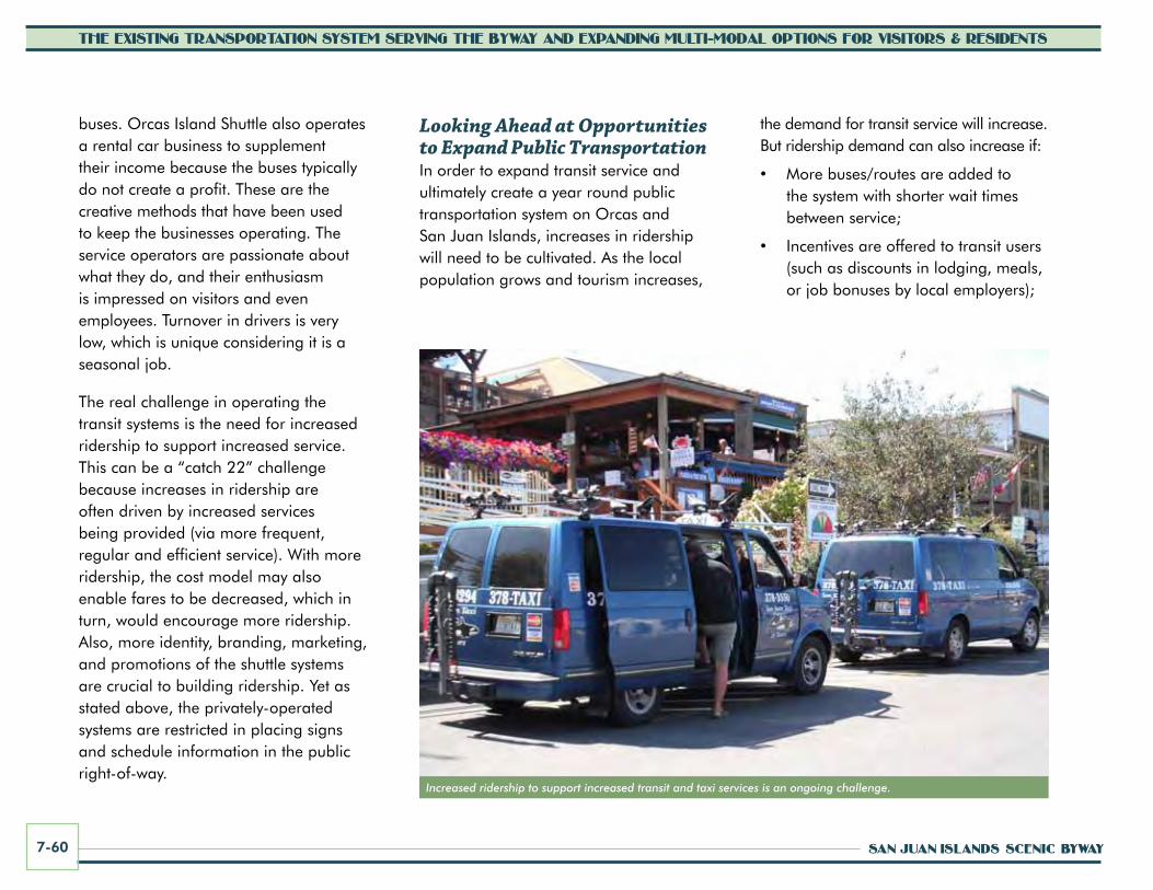
SAN JUAN ISLANDS SCENIC BYWAY7-60
THE EXISTING TRANSPORTATION SYSTEM SERVING THE BYWAY AND EXPANDING MULTI-MODAL OPTIONS FOR VISITORS & RESIDENTS
buses. Orcas Island Shuttle also operates a rental car business to supplement their income because the buses typically do not create a profit. These are the creative methods that have been used to keep the businesses operating. The service operators are passionate about what they do, and their enthusiasm is impressed on visitors and even employees. Turnover in drivers is very low, which is unique considering it is a seasonal job.
The real challenge in operating the transit systems is the need for increased ridership to support increased service. This can be a “catch 22” challenge because increases in ridership are often driven by increased services being provided (via more frequent, regular and efficient service). With more ridership, the cost model may also enable fares to be decreased, which in turn, would encourage more ridership. Also, more identity, branding, marketing, and promotions of the shuttle systems are crucial to building ridership. Yet as stated above, the privately-operated systems are restricted in placing signs and schedule information in the public right-of-way.
Looking Ahead at Opportunities to Expand Public TransportationIn order to expand transit service and ultimately create a year round public transportation system on Orcas and San Juan Islands, increases in ridership will need to be cultivated. As the local population grows and tourism increases,
Increased ridership to support increased transit and taxi services is an ongoing challenge.
the demand for transit service will increase. But ridership demand can also increase if:
• More buses/routes are added to the system with shorter wait times between service;
• Incentives are offered to transit users (such as discounts in lodging, meals, or job bonuses by local employers);

CORRIDOR MANAGEMENT PLAN 7-61
THE EXISTING TRANSPORTATION SYSTEM SERVING THE BYWAY AND EXPANDING MULTI-MODAL OPTIONS FOR VISITORS & RESIDENTS
• Transit service is more widely promoted and marketed/advertised;
• Bus stop signs and schedules are posted at stop locations with the right-of-way;
• The opportunity for a “car-free” vacation is more widely promoted to visitors;
• Local residents begin to rely more on transit for their daily trip needs as service improves; and
• Service becomes more affordable either through significant increases in ridership and/or public and private investment in the system.
From listening to feedback at public meetings and focus group sessions throughout the scenic byway planning process, many islanders are interested in a reliable and affordable year-round public transportation system on the island, for visitors as well as residents.
As local needs for transit increase overall, there will be more opportunities to expand transit service for use by all (residents and visitors). For example, a new critical care hospital facility is planned for construction by 2012. The facility will be located near the Friday Harbor Airport, and its operators (Peace Health) are interested in supporting local transit to get patients from the ferry terminal to the medical campus. There is also interest in daily high-speed foot ferry service to Bellingham.
Analysis of potential cost models for expanding transit service show that partnership funding will be needed to support expanded service. The San Juan Islands Scenic Byway
organization, the Visitors Bureau, and other partners should continue to coordinate with San Juan Transit and the Orcas Island Shuttle to provide support as feasible.
A locally-operated shuttle service may become more feasible if supported by governmental funding programs. The byway is actively pursuing potential options to support transit services and recently received a scenic byways grant to conduct a two-year shuttle service pilot study. The study will evaluate the feasibility of providing expanded transit service during peak season to destinations in the islands and identify actions that would be needed to support the expansion. In the future, the byway may pursue other funding sources, including grants available through the Federal Transit Administration or other agencies.
For example the Paul S. Sarbanes Transit in Parks Program provides funding to federal land management agencies and gateway communities to support transit services that connect visitors to federal lands. Funding has been awarded for pilot programs, vehicle procurement, and capital improvements (park and ride areas, bus stops, trails and bike/pedestrian linkages, etc.) The program does not typically support ongoing operations and maintenance. A local agency can apply for the funds in partnership with the National Park Service, Bureau of Land Management, and/or other federal agency.
Local transit service providers could continue to operate with grant support from federal funding programs or other sources, or new concessionaires could be contracted to provide services or supplement existing transit services. Other creative funding options that could be explored include public/private partnerships and/or a transportation benefit district.

SAN JUAN ISLANDS SCENIC BYWAY7-62
THE EXISTING TRANSPORTATION SYSTEM SERVING THE BYWAY AND EXPANDING MULTI-MODAL OPTIONS FOR VISITORS & RESIDENTS
The Salish Sea passage is a signature experience of the San Juan Islands Scenic Byway
promote Access by water / Expanded water Transportation OptionsOne of the most important features of the San Juan Islands Scenic Byway is the Salish Sea passage. Thirty miles of the byway consist of the marine passage route. Visitors should be encouraged to enjoy the byway while en-route on the marine passage with interpretive and byway information emphasizing this part of the byway experience.
As islands surrounded by water, there are unique opportunities for experiencing the byway by boat and kayak. Shoreline recreation opportunities include boating (and boat launching), wildlife watching, fishing, and kayaking. There are several existing access points along the shorelines of San Juan and Orcas Islands. Maps and brochures should be created listing access sites, mileage of paddle routes, restroom, picnic, parking, and camping facilities, as well as possible connections to public transportation. Developing additional public kayak launches and access points to the water is encouraged along the byway. Salish Sea excursions should be promoted throughout the byway area while still protecting the property rights of those living on or near the water, as well as the sensitive marine environment.
Over the long-term, local partners could explore the option of small passenger-only ferries, reinventing the old time “Mosquito Fleet” service in north Puget Sound and the Salish Sea. South Puget Sound communities are already discussing, planning, and implementing these opportunities (passenger-only ferry service has started between Kingston and Seattle for example). The small passenger boats could connect to transit service that would travel the byway. Foot ferry passengers could also explore the islands by bicycle, moped, scoot car, or rental car.
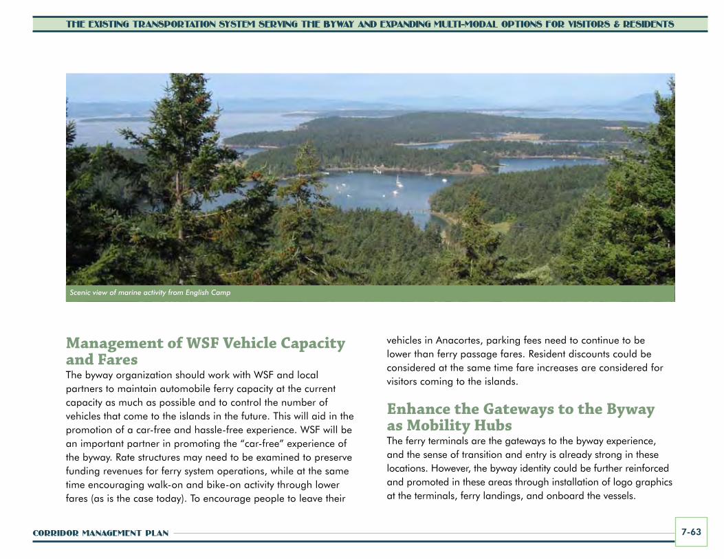
CORRIDOR MANAGEMENT PLAN 7-63
THE EXISTING TRANSPORTATION SYSTEM SERVING THE BYWAY AND EXPANDING MULTI-MODAL OPTIONS FOR VISITORS & RESIDENTS
Management of wSF vehicle capacity and FaresThe byway organization should work with WSF and local partners to maintain automobile ferry capacity at the current capacity as much as possible and to control the number of vehicles that come to the islands in the future. This will aid in the promotion of a car-free and hassle-free experience. WSF will be an important partner in promoting the “car-free” experience of the byway. Rate structures may need to be examined to preserve funding revenues for ferry system operations, while at the same time encouraging walk-on and bike-on activity through lower fares (as is the case today). To encourage people to leave their
Scenic view of marine activity from English Camp
vehicles in Anacortes, parking fees need to continue to be lower than ferry passage fares. Resident discounts could be considered at the same time fare increases are considered for visitors coming to the islands.
Enhance the gateways to the Byway as Mobility HubsThe ferry terminals are the gateways to the byway experience, and the sense of transition and entry is already strong in these locations. However, the byway identity could be further reinforced and promoted in these areas through installation of logo graphics at the terminals, ferry landings, and onboard the vessels.

Public kayak launches help provide public access to the Salish Sea and expand multi-modal travel options.

CORRIDOR MANAGEMENT PLAN 7-65
THE EXISTING TRANSPORTATION SYSTEM SERVING THE BYWAY AND EXPANDING MULTI-MODAL OPTIONS FOR VISITORS & RESIDENTS
FERRy
TRAnSIT
BIcycLE/ScOOTER REnTAL
wALkIng TOuR HuB
RIDESHARE
wI-FI
cAFÉ
cHARgIng STATIOn (ELEcTRIc vEHIcLES)
mobility
hubsTAXI
The term “mobility hubs” is being applied around the country for locations where a majority of people interact with the multi-modal transportation system. A mobility hub can be defined as a transit access point with frequent transit service and a common location for transfers between modes. They are places of connection for walking, biking, park-n-ride, transit, and carpooling or ridesharing. Ferry terminals are in effect “mobility hubs” and important gateways to the byway. For these locations and other places where people are likely to pause and shift modes, the byway organization should continue to work with WSF, the Town of Friday Harbor, the San Juan Islands Visitors Bureau, chambers of commerce, San Juan County, and others to:
• provide bicycle or small vehicle rentals,
• promote transit,
• sponsor walking tours,
• educate visitors about the importance of less driving in the islands,
• provide access to real-time information and free public wireless internet, and
• create seamless transfers and scheduling between ferries and transit.
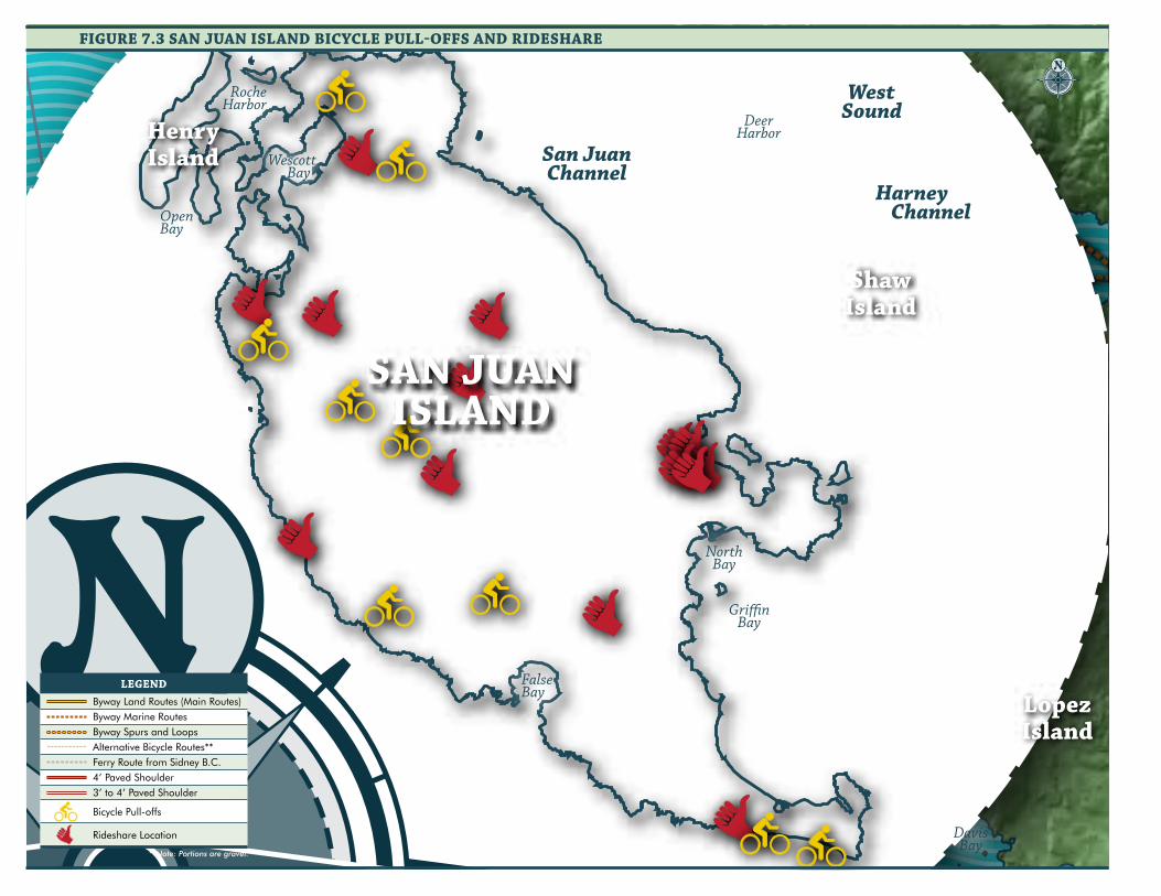
CANADA
UNITED STATES
CANADA
UNITED STATES
San JuanChannel
PresidentChannel
LummiBay
EastSound
WestSound
Gri�nBay
DoeBay
CowlitzBay
EchoBay
BurrowsBay
LopezSound
MudBay
LangleyBay
DeepwaterBay
SwiftsBay
ShoalBay
CascadeBay
FishingBay
MassacreBay
ShipBay
NorthBay
Wescott Bay
DavisBay
NorthBay
FalseBay
DeerHarbor
RocheHarbor
OpenBay
MackayeHarbor
ChannelHarney
BuckBay
S a l i s h S e a
S a l i s h S e a
ShawIsland
DecaturIsland
HenryIsland
BlakelyIsland
CypressIsland
LummiIsland
FidalgoIsland
WaldronIsland
SinclairIsland
Spieden Island
Stuart Island
ClarkIsland
SAN JUANISLAND
ORCASISLAND
LopezIslandVancouver
Island
JamesIsland
MoresbyIsland
SidneyIsland
0 1.0 2.00.5Miles
1.5 3.0
FIguRE 7.3 SAn JuAn ISLAnD BIcycLE puLL-OFFS AnD RIDESHARE0 0.8 1.6 2.4 3.20.4
Miles
LEgEnDByway Land Routes (Main Routes)Byway Marine RoutesByway Spurs and LoopsAlternative Bicycle Routes**Ferry Route from Sidney B.C.4’ Paved Shoulder3’ to 4’ Paved Shoulder
Bicycle Pull-offs
Rideshare Location
**Note: Portions are gravel.

CANADA
UNITED STATES
CANADA
UNITED STATES
San JuanChannel
PresidentChannel
LummiBay
EastSound
WestSound
Gri�nBay
DoeBay
CowlitzBay
EchoBay
BurrowsBay
LopezSound
MudBay
LangleyBay
DeepwaterBay
SwiftsBay
ShoalBay
CascadeBay
FishingBay
MassacreBay
ShipBay
NorthBay
Wescott Bay
DavisBay
NorthBay
FalseBay
DeerHarbor
RocheHarbor
OpenBay
MackayeHarbor
ChannelHarney
BuckBay
S a l i s h S e a
S a l i s h S e a
ShawIsland
DecaturIsland
HenryIsland
BlakelyIsland
CypressIsland
LummiIsland
FidalgoIsland
WaldronIsland
SinclairIsland
Spieden Island
Stuart Island
ClarkIsland
SAN JUANISLAND
ORCASISLAND
LopezIslandVancouver
Island
JamesIsland
MoresbyIsland
SidneyIsland
0 1.0 2.00.5Miles
1.5 3.0
0 0.8 1.6 2.4 3.20.4Miles
FIguRE 7.4 ORcAS ISLAnD BIcycLE puLL-OFFS AnD RIDESHARE
LEgEnDByway Land Routes (Main Routes)Byway Marine RoutesByway Spurs and LoopsAlternative Bicycle Routes**Ferry Route from Sidney B.C.4’ Paved Shoulder3’ to 4’ Paved Shoulder
Bicycle Pull-offs
Rideshare Location
**Note: Portions are gravel.