the alaskan mineral resource assessment program: … · · 2010-10-29t. d. hamilton, j. w. cady,...
TRANSCRIPT

GEOLOGICAL SURVEY CIRCULAR 758
The Alaskan Mineral Resource
Assessment Program:
Guide to Information Contained in the
Folio of Geologic and
Mineral Resource Maps of
the Chandalar Quadrangle, Alaska

The Alaskan Mineral Resource
Assessment Program:
Guide to Information Contained in the
Folio of Geologic and
Mineral Resource Maps of
the Chandalar Quadrangle, Alaska
By H. N. Reiser, W. P. Brosge, J. H. DeYoung, Jr., S. P. Marsh, T. D. Hamilton, J. W. Cady, and N. R. D. Albert
GEOLOGICAL SURVEY CIRCULAR 758
1979
United States Department of the InteriorCECIL D. ANDRUS, Secretary
Geological SurveyH. William Menard, Director
Library of Congress Cataloging in Publication Data
Main entry under title:The Alaskan mineral resource assessment program.(Geological Survey circular ; 758)Bibliography: p. 21-23.1. Mines and mineral re sources-Alaska. 2. Mines and mineral
resources Alaska Maps. I. Reiser, H. N. II. Series:United States. Geological Survey. Circular 758.
QE75.C5 no. 758 [TN24.A4] 557.3'08s[553'.09798] 79-607035
Free on application to Branch of Distribution, U.S. Geological Survey, 1200 South Eads Street, Arlington, VA 22202

CONTENTS Page
Abstract ______________________________________________ 1Introduction ________________________________________________ 1
Purpose and scope _______________________________________ 1 Geography and access ____________________________________ 1 Mineral production and exploration _____________________________ 2 Acknowledgments ______________________________________ 3
Geological investigations ______________________________________ 4 Previous geological investigations _____________________________ 4 Recent studies _________________________________________ 5
Geology of the Chandalar quadrangle ______________________________ 5 Potassium-argon ages ____________________________________ 7
Description of component maps of the Chandalar quadrangle folio ______________ 8Geology (map 1-375) ______________________________________ 8
Revisions of map 1-375 _________________________________ 8Mapping _______________________________________ 8Nomenclature ____________________________________ 8Age assignments __________________________________ 10
Surficial geologic map (map MF-878-A) _________________________ 16Mineral resources map (map MF-878-B) ___________________________ 18Aeromagnetic map and interpretation (map MF-878-C, 2 sheets) ____________ 19Geochemical maps (maps MF-878-D to I) _________________________ 19Interpretation of Landsat imagery (map MF-878-J, 2 sheets), by Nairn R. D. Albert 20
References ____________________________________ 21
ILLUSTRATIONS
FIGURE 1. Index map of Alaska showing location of Chandalar quadrangle 32. Physiographic divisions of the Chandalar quadrangle ______ 43. Index map of the Chandalar quadrangle showing location of the Alyeska haul road and large airfields
(airplane symbols) ____________________________ _ 54. Metamorphic facies and K/Ar ages of rocks in the Chandalar quadrangle 65. Localities where the geologic map of the Chandalar quadrangle (Brosgg and Reiser, 1964) has been
revised in the compilation of the generalized geologic map for the AMRAP folio 86. Revisions of the northwest part of geologic map of Chandalar quadrangle (Brosgg and Reiser, 1964) 97. Revisions of north-central part of geologic map of Chandalar quadrangle (Brosgg and Reiser, 1964) 98. Revisions of northeast part of geologic map of Chandalar quadrangle (Brosg6 and Reiser, 1964) 109. Revision of west-central part of geologic map of Chandalar quadrangle (Brosg6 and Reiser, 1964) 10
10. Revisions of central part of geologic map of Chandalar quadrangle (Brosgl and Reiser, 1964) 1111. Revision of southwest part of geologic map of Chandalar quadrangle (Brosg6 and Reiser, 1964) 1212. Correlation and description of the map units shown on the generalized geologic map of the Chandalar
quadrangle _________________________________ 1413. Generalized geologic map of northern part of Chandalar quadrangle showing the possibly unconformable
relation of the Upper Devonian Hunt Fork Shale to the older Paleozoic sedimentary rocks, to the schist, and to the calcareous rocks that ar3 equivalent to part of the schist 16
TABLE
PageTABLE 1. Component maps of the Chandalar quadrangle mineral resource assessment program _____________ 2
m
The Alaskan Mineral Resource Assessment Program: Guide toInformation Contained in the Folio of Geologic and Mineral
Resource Maps of the Chandalar Quadrangle, Alaska
By H. N. Reiser, W. P. Brosge, J. H. DeYoung, Jr.,S. P. Marsh, T. D. Hamilton, J. W. Cady, and
N. R. D. Albert
ABSTRACT
The Chandalar quadrangle in east-central Alaska was investigated by a multidisciplinary research group to assess the mineral resource potential of the quadrangle. This circular serves as a guide to and integrates with a folio of 10 miscellaneous field study (MF) maps and 2 open-file (OF) reports (table 1) concerned with the geology, geophysics, geochemistry, Landsat imagery, and mineral resources of the area.
Revisions to the previously published Chandalar quadrangle geologic map, a new radiometric age determination, and a bibliogra phy are also included.
INTRODUCTION
PURPOSE AND SCOPE
This circular and the related but separately available folio of maps and open-file reports of the Chandalar quadrangle, Alaska, are one of a series of similar publi cations resulting from the Alaskan Mineral Resource Assessment Program (AMRAP). Their purpose is to provide the basis for a sound long-range national miner als policy and also to aid in Federal, State and industry decisions in planning exploration and development of Alaskan resources.
The Chandalar quadrangle was selected for early study under AMRAP because of impending land selec tion decisions, the area's potential as the possible east ern extension of the southwestern Brooks Range cop per belt (Hawley, 1976), its known gold mineralization, and because the area has recently been made more accessible by completion of the Alyeska Haul Road.
The present report integrates geologic data and mapping collected prior to AMRAP Quly 1975), and the
recent data acquired during the AMRAP-sponsored in vestigation.
GEOGRAPHY AND ACCESS
The Chandalar quadrangle is located in east- central Alaska between lat 67° and 68° N. and long 147° and 150° W. (fig. 1) and comprises ap proximately 14,200 km2 . The area includes five sections of two major physiographic provinces, the Arctic Mountains province, and the Northern Plateaus province (Wahrhaftig, 1965).
The rugged glaciated highlands of the eastern Brooks Range and Porcupine Plateau sections oc cupy the northern two-thirds of the quadrangle (fig. 2). The rounded uplands of the Kokrine- Hodzana Highlands make up the southern part of the quadrangle except for a small area of the Yukon Flats section in the extreme southeast.
A prominent topographic low, the Kobuk Trench, which is probably a fault-controlled fea ture (Payne, 1955; Grantz, 1966), separates these northern and southern physiographic sections. Most of the Kobuk Trench coincides with the Ambler-Chandalar Ridge and Lowland physio graphic section of Wahrhaftig, but he included the easternmost part of the trench along the main Chandalar valley in the Porcupine Plateau (fig. 2).
Drainage within the quadrangle is divided be tween two major tributaries of the Yukon River; the Chandalar River drains the quadrangle to the east and the Koyukuk River to the west. The val leys of the main drainages have been glaciated and have broad flat floors covered by alluvium and
, glacial deposits.

TABLE 1. Component maps of the Cbandalar quadrangle mineral resource assessment program
Report Subject
U.S. Geol. Survey Misc. Geol. Inv. Map 1-375 (Brosge and Reiser, 1964) __________Reconnaissance geology. U.S. Geol. Survey Misc. Field Studies (MF) Maps:
MF-878- A (Hamilton, 1978) _________________________Surficial geology.B (DeYoung, 1978) _________________________Mineral resources.C (Cady, 1978) ____________________________Aeromagnetic contours and
interpretation.D (Marsh and others, 1978) ____________________Geochemical distribution and
abundance of copper, molybdenum, and lead.
E (Marsh and others, 1978) ____________________Geochemical distribution andabundance of zinc.
F (Marsh and others, 1979) ____________________Geochemical distribution andabundance of nickel, cobalt, lanthanum, and yttrium.
G (Marsh and others, 1978) __ ________ _________Geochemical distribution andabundance of barium, arsenic, boron, and vanadium.
H (Marsh and others, 1979) ____________________Geochemical distribution andabundance of antimony and niobium.
I (Marsh and Wiltse, 1979) ______________________Composite geochemical map.J (Albert, LeCompte, Landsat image and interpretations,
and Steele, 1978). ,
U.S. Geol. Survey Open-File Report OF-76-492 (O'Leary and others, 1976)_________Geochemical analyses and statis tical data for stream sediment samples.
U.S. Geol. Survey Open-File Report OF-77-543 (Detra and others, 1977) Geochemical analyses and statis tical data for heavy mineral concentrations and organic samples.
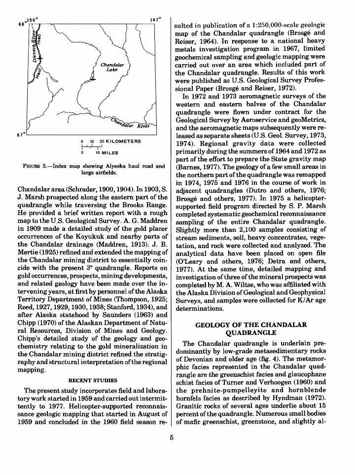
The Alyeska haul road is the only usable road into the quadrangle. It crosses into the Chandalar quadrangle at about the midpoint of the western boundary and follows the valley of the Middle Fork of the Koyukuk River and the Dietrich River to the northern boundary (fig. 3). The haul road extends to Prudhoe Bay to the north and to Livengood to the south, where it joins the public highway. Airstrips at Chandalar Lake and at the Dietrich Alyeska campsite (fig. 3) as well as the several larger lakes in the quadrangle afford access by multi-engine fixed wing aircraft. Winter trails and the now abandoned Beaver-Caro Road served in the past to meet the freighting needs of the gold miners.
MINERAL PRODUCTION AND EXPLORATION
With the exception of recent quarrying of road- building materials, the only mineral production from the Chandalar quadrangle consists of gold and byproduct silver from lode and placer deposits in the area east of Chandalar Lake and from placer
deposits along tributaries of the Koyukuk River at the western edge of the quadrangle. References to these deposits are included in a summary of pub lished reports on mineral occurrences in the quad rangle (Cobb, 1976). Gold placers were discovered in the Koyukuk region about 1885 and in the Chandalar Lake area in 1905 (Chipp, 1970, p. 3-5). Placer mining was done by hand methods until the 1940's; after then, mechanical methods were used on some deposits. Gold production from the deposits in the Koyukuk-Chandalar district (which extends west into the Wiseman, Survey Pass, and Hughes quadrangles) has been esti mated at 12 million g (380,000 troy oz) by Berg, Eberlein, and MacKevett (1964, p. 106). Gold pro duction from placer deposits in the Chandalar Lake area has been estimated at 1.2 million g (40,000 troy oz) of which 400,000 g (14,000 troy oz) were recovered from Big Creek, primarily from mechanized operations since 1950 (Heiner and Wolff, 1968, p. 14). About one gram of silver was produced for every 7 grams of gold from placer deposits of the Chandalar district. Myrtle Creek

Pribilof' Islands/ PACIFIC OCEAN
rKodiakl
100I
200 300 KILOMETERS I I
100 200 MILES
FIGURE 1. Index map of Alaska showing location of Chandalar quadrangle (pattern).
has been one of the biggest gold producers in the Koyukuk mining district (Mulligan, 1974, p. 6). Some small placer operations are currently active.
Gold-quartz vein deposits in the Chandalar Lake area were identified in the early 1900's and some gold-silver ore was produced from under ground workings at the Mikado, Little Squaw, and Summit mines. Since 1960, about 30,000 g (1,000 troy oz) of gold and about 6,000 g (200 troy oz) of silver have been reported produced from the Mikado mine.
Recent exploration activity (as of 1977) is evi denced by a considerable amount of claim staking since 1969, especially in the Big Spruce Creek- North Fork Chandalar River area (1969-1975), in the Geroe Creek area (1975-1977), and along the North Fork of the East Fork of the Chandalar
River (1976-1977). Exploration targets include porphyry copper and molybdenum deposits and contact metamorphic copper deposits.
Over 4 million cubic meters of sand, gravel, fill, and other road building materials have been quar ried along the Koyukuk and Dietrich Rivers for use in the construction of the trans-Alaska pipeline and the pipeline road.
ACKNOWLEDGMENTS
The authors express their appreciation of the work of the scientists who pioneered topographic and geologic mapping of the Chandalar quad rangle (Schrader, 1900 and 1904; Maddren, 1913; Mertie, 1925); their work is incorporated in the present map and reports. Thanks are due to the Alyeska Pipeline Service Company and its per-

Eastern^ Brooks Range
| Porcupine Ptafeau
-----J
Koikrine-hodzana Highlands i , Yuk6n Flats4 - -T - I Action
0 5 10 15 20 25 KILOMETERS[. rill I I II ' i ' ' i n r0 5 10 15 MILES
FIGURE 2. Physiographic divisions of the Chandalar quadrangle.
sonnel for permitting refueling at construction campsites along the pipeline route, thus greatly improving the efficiency of our helicopter opera tions, and to local Alaskans whose helpful coopera tion ranged from providing housing to providing details of local geological information. In particu lar, special thanks are due the late Wayne (Red) Adney prospector, guide, and homesteader of Chandalar Lake; Eskil Anderson and the late Frank Birch of Chandalar Mining and Milling Company; John Graham of Placid Oil Company, and Russell Babcock of Bear Creek Mining Com pany.
We are indebted to many people within the Geological Survey, especially to Betty Mclntire, who coped so ably with our logistic and supply problems, and Henry C. Berg, coordinator of AM- RAP, who assisted throughout the project.
GEOLOGICAL INVESTIGATIONS
PREVIOUS GEOLOGICAL INVESTIGATIONS
Geological investigations in the Chandalar quadrangle began in 1899 when F. C. Schrader and T. G. Gerdine, topographer, made the first geologic and topographic map of the Koyukuk and
450147'
0 10 20 KILOMETERS
0 10 MILES
FIGURE 3. Index map showing Alyeska haul road and large airfields.
Chandalar area (Schrader, 1900,1904). In 1903, S. J. Marsh prospected along the eastern part of the quadrangle while traversing the Brooks Range. He provided a brief written report with a rough map to the U.S. Geological Survey. A. G. Maddren in 1909 made a detailed study of the gold placer occurrences of the Koyukuk and nearby parts of the Chandalar drainage (Maddren, 1913). J. B. Mertie (1925) refined and extended the mapping of the Chandalar mining district to essentially coin cide with the present 3° quadrangle. Reports on gold occurrences, prospects, mining developments, and related geology have been made over the in tervening years, at first by personnel of the Alaska Territory Department of Mines (Thompson, 1925; Reed, 1927,1929,1930,1938; Stanford, 1934), and after Alaska statehood by Saunders (1963) and Chipp (1970) of the Alaskan Department of Natu ral Resources, Division of Mines and Geology. Chipp's detailed study of the geology and geo chemistry relating to the gold mineralization in the Chandalar mining district refined the stratig raphy and structural interpretation of the regional mapping.
RECENT STUDIES
The present study incorporates field and labora tory work started in 1959 and carried out intermit tently to 1977. Helicopter-supported reconnais sance geologic mapping that started in August of 1959 and concluded in the 1960 field season re
sulted in publication of a l:2,r>0,000-scale geologic map of the Chandalar quadrangle (Brosge and Reiser, 1964). In response to a national heavy metals investigation program in 1967, limited geochemical sampling and geologic mapping were carried out over an area which included part of the Chandalar quadrangle. Results of this work were published as U.S. Geological Survey Profes sional Paper (Brosge and Reiser, 1972).
In 1972 and 1973 aeromagnetic surveys of the western and eastern halves of the Chandalar quadrangle were flown under contract for the Geological Survey by Aeroservice and geoMetrics, and the aeromagnetic maps subsequently were re leased as separate sheets (U.S. Geol. Survey, 1973, 1974). Regional gravity data were collected primarily during the summers of 1964 and 1972 as part of the effort to prepare the State gravity map (Barnes, 1977). The geology of a few small areas in the northern part of the quadrangle was remapped in 1974, 1975 and 1976 in the course of work in adjacent quadrangles (Dutro and others, 1976; Brosge and others, 1977). In 1975 a helicopter- supported field program directed by S. P. Marsh completed systematic geochemical reconnaissance sampling of the entire Chandalar quadrangle. Slightly more than 2,100 samples consisting of stream sediments, soil, heavy concentrates, vege tation, and rock were collected and analyzed. The analytical data have been placed on open file (O'Leary and others, 1976; Detra and others, 1977). At the same time, detailed mapping and investigation of three of the mineral prospects was completed by M. A. Wiltse, who was affiliated with the Alaska Division of Geological and Geophysical Surveys, and samples were collected for K/Ar age determinations.
GEOLOGY OF THE CHANDALAR QUADRANGLE
The Chandalar quadrangle is underlain pre dominantly by low-grade metasedimentary rocks of Devonian and older age (fig. 4). The metamor- phic facies represented in the Chandalar quad rangle are the greenschist facies and glaucophane schist facies of Turner and Verhoogen (1960) and the prehnite-pumpelleyite and hornblende hornfels facies as described by Hyndman (1972). Granitic rocks of several ages underlie about 15 percent of the quadrangle. Numerous small bodies of mafic greenschist, greenstone, and slightly al-

0 5 10 15 20 25 KILOMETERS11 ^ ^ i j i i i i
0 5 10 15 MILES
FIGURE 4. Metamorphic facies and K-Ar ages of rocks in the Chandalar quadrangle.
tered mafic volcanic rocks, as well as one small ultramafic body, occur in the quadrangle. Folding and faulting are complex; several thrust faults have been mapped, but the full extent of the thrusting is not known. Within the quadrangle the physiographic divisions correspond with three geologically distinct terranes.
The southern part of the quadrangle, coinciding with the Kokrine-Hodzana Highlands is mostly underlain by granodiorite, quartz monzonite, gra nite, and gneissic granite of Cretaceous age. Mig- matite and thermally altered schist border these intrusives in discontinuous outcrop.
The Kobuk Trench, flanking the north side of the Kokrine-Hodzana Highlands, is for the most part a wide flat valley covered by surficial deposits. Slightly metamorphosed sedimentary rocks form subdued outcrops in small areas, but probably rep resent the major rock type underlying the lowland. The dominant outcrops are an ophiolitic as semblage of mafic volcanic rocks including pillow basalt, chert, some greenstone, and one ultramafic body. A narrow band of buried volcanic rocks aligned with the mafic outcrops is also indicated by the aeromagnetic studies. Both the sedimentary and volcanic rocks are metamorphosed to the
6

EXPLANATION
Unconsolidated surficial deposits
Rocks not metamorphosed
Prehnite-pumpellyite fades
Greenschist fades
Hornblende hornfels fades
Glaucophane schist facies, overprinted by hornblende hornfels facies
Ultramafic rocks
Granitic rocks
Migmatite
SYMBOLS
Geologic contact, approximately located; where contact separates metamorphic rock units, it indicates approximate location of a facies change
Radiometric age sample locality in granitic rocks, and ages determined for biotite (B), hornblende (H), and zircon (Z)
Radiometric age sample locality in thermally metamorphosed schist, and ages determined for biotite (B) and muscovite (M)
FIGURE 4. Continued.
prehnite-pumpellyite facies. The age of the meta- sedimentary rocks is uncertain, possibly Devo nian; the volcanic rocks are probably not older than Mississippian or younger than Jurassic. The youngest rocks in the quadrangle are in the trench. Cretaceous polymictic conglomerates with interbedded gray wackes occur near the southwest corner and basalt flows of probable Tertiary age near the southeastern corner of the quadrangle.
The mountainous terrane of the northern three- fourths of the quadrangle comprising the eastern
Brooks Range and Porcupine Plateau physio graphic sections is underlain by schist, phyllite, slate, limestone, marble, greenstone, and granitic intrusives. Generally the metasedimentary rocks belong to the low-grade greenschist facies, but somewhat higher grade metamorphosed rocks occur in T. 34 N., R. 2 W., where relict glaucophane in chloritized amphibole schist indicates a retro graded former glaucophane schist facies. The ex tent that the greenschist may have replaced former glaucophane schist facies elsewhere in the quadrangle is unknown (U.S. Geol. Survey, 1975). Contact aureoles of hornblende hornfels facies occur around the granitic intrusives. Biotite- garnet schist and tactite are the typical contact rocks of the northern plutons, whereas andalusite-staurolite-biotite schists are associ ated with the southeastern granitic body. Un- metamorphosed sedimentary rocks, consisting mostly of Mississippian limestone, shale, and con glomerate are exposed beneath Devonian rocks in a structural window in the northwest corner of the quadrangle.
Complex folding and thrust faulting are evident in the mountains north of the Kobuk Trench. The plate of Devonian rocks thrust over the Mississippian rocks has a minimum displacement of 18.5 km. A thrust plate of similar minimum displacement but involving pre-Mississippian schist is mapped in the vicinity of Chandalar Lake and is in turn overlain by another thrust plate containing calcareous schist and the northernmost granitic pluton. The Kobuk Trench itself may mark a major linear fault zone (Grantz, 1966); the volcanic rocks and chert within the trench have been interpreted to be oceanic rocks that have been obducted onto the continental crust represented by the Brooks Range (Patton and others, 1977).
POTASSIUM-ARGON AGES
Isotopic age determinations made prior to AMRAP on micas and zircons from one southern and one northern granitic pluton (Brosge and Reiser, 1964) are shown on figure 4. The micas from both plutons and the zircon from the south ern pluton gave compatible ages, indicating a Middle Jurassic to middle-Cretaceous age. The zircon from the northern pluton, however, indi cated a Late Devonian minimum age.
Recent K/Ar determinations for hornblende in a granodiorite collected at Big Spruce Creek indi cate an Ordovician or older age (D.L. Turner and

M. L. Silberman, written commun., 1977). This new age determination makes uncertain the pre viously inferred Devonian age of the sequence of calcareous and quartz-muscovite schists appar ently intruded by the granodiorite.
DESCRIPTION OF COMPONENT MAPS OF THE CHANDALAR QUADRANGLE FOLIO
GEOLOGY (MAP 1-375)
The multicolored geologic map of the Chanda- lar quadrangle at 1:250,000 scale (Brosge and Reiser, 1964) is based on the reconnaissance mapping done in 1959 and 1960. In the course of the 1975 and 1976 AMRAP studies some ad ditional mapping was done, but not enough to warrant publication of a revised geologic map. Detailed maps of three copper prospects in the quadrangle are included in the folio (Marsh and Wiltse, 1979). Other new information obtained since 1960 by the U.S. Geological Survey and the Alaska Division of Geological and Geophysical Surveys has been combined with the previous mapping in the compilation of a generalized geologic map which is used as the base for the maps in the Chandalar AMRAP folio. Revised parts of the generalized geologic map that incor porate this new information are outlined on figure 5, and they are reproduced in this circular as
68'150° 147°
67°
Fig. 6 Fig. 7Fig. 8
FIGURE 5. Localities where the geologic map of the Chanda lar quadrangle (Brosgg and Reiser, 1964) has been revised in the compilation of the generalized geologic map for the AMRAP folio.
figures 6 to 11, with the revised contacts, faults, or map unit symbols shown by full black lines. The revised correlation and description of the generalized map units is shown as figure 12. The more significant revisions of the mapping, stratigraphic nomenclature, and age assignments are described below.
REVISIONS OF MAP 1-375
MAPPING
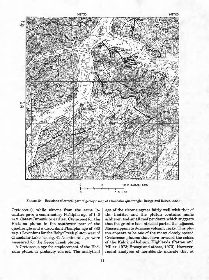
Most of the slate and phyllite exposed beneath the Lisburne Group in the northwest corner of the quadrangle (fig. 6) was originally mapped as the Devonian Hunt Fork Shale and as Mississippian Kayak Shale. The rocks in this small area have since been recognized as part of a phyllite unit of probable Cambrian or Ordovician age that crops out extensively farther west (Dutro and others, 1976). Because of their small area they are here included in the undifferentiated Paleozoic and Mesozoic(?) phyllite unit. Some mafic sills and a pillow basalt flow in the northcentral and north east parts of the quadrangle that were not recog nized in the original mapping have been added to the present map (figs. 7 and 8). In addition, the contacts of the Hunt Fork Shale and of the Skajit Limestone have been revised at several places along the northern edge of the quadrangle (figs. 6, 7, and 8). At Big Spruce Creek in the west-central part of the quadrangle a sill of hornblende granodiorite has been added to the map within an area previously mapped as tactite (fig. 9). This sill is shown in more detail on the map of the Venus prospect by M. A. Wiltse (Marsh and Wiltse, 1979). In the central part of the quadrangle (fig. 10) the areas of tactite north of Squaw Lake and of greenstone and greenschist south of Squaw Lake are smaller than originally shown. The flat thrust faults that dip beneath the Chandalar gold mining area from the north and from the south have been relocated to conform to the detailed mapping by Chipp (1970), and a few high-angle faults have been added.
In the southwest part of the quadrangle (fig. 11) a small body of serpentinite that was previously mapped as volcanic rocks has been separately mapped as ultramafic.
NOMENCLATURE
Quartz pebble conglomerate (Cretaceous). The name "Bergman group" used on map 1-375 has
8

149° 30'
10 KILOMETERS_I
5 MILES
FIGURE 6. Revisions of the northwest part of the geologic map of Chandalar quadrangle (Brosge and Reiser, 1964).
148° 30' 148° 00'
5 MILES
FIGURE 7. Revisions of north-central part of geologic map of Chandalar quadrangle (Brosge and Reiser, 1964).
been abandoned (Patton, 1973) and has been re placed by informal descriptive terms for these rocks in the adjacent Wiseman and Bettles quad rangles (Patton and Miller, 1973).
Hunt Fork Shale (Upper Devonian). The Hunt Fork Shale has been mapped continuously from its type area in the Killik River quadrangle (Chapman and others, 1964) to the Chandalar quadrangle. The term "slate and sandstone" used on map 1-375 has therefore been replaced by the name Hunt Fork Shale on the generalized map. As outlined, the lower part of the Hunt Fork Shale as generalized includes some thin interbed- ded reefs that were previously mapped as "Skajit Limestone." It also includes some brown-
weathering shale that occurs locally below the horizon of these reefs and that has now been rec ognized in the adjacent Philip Smith Mountains quadrangle as the upper part of a newly recog nized unnamed Upper Devonian formation that is in part coeval with the Hunt Fork (Brosge and others, 1977; Dutro and others, 1977). The basal conglomerate of the "slate and sandstone" unit that was differentiated in a few places on map 1-375 may also be equivalent to the upper part of this new formation. The rocks equivalent to the lower part of the new formation are mapped sepa rately as the purple and green slate and phyllite unit and the limestone and siltstone unit which underlie the Hunt Fork.

147° 30'
5 MILES
FIGURE 8. Revisions of northeast part of geologic map of Chandalar quadrangle (Brosge and Reiser, 1964).
149° 30'
10 KILOMETERS
0 5 MILES
FIGURE 9. Revision of west-central part of geologic map of Chandalar quadrangle (Brosge and Reiser, 1964).
AGE ASSIGNMENTS
Lisburne Group (Pennsylvanian and Missis- sippiari) and Kayak Shale (Mississippian). New collections of fossils from the Wiseman quadrangle show that the Lisburne Group about 25 km west along strike from the Lisburne in the northwest corner of the Chandalar quadrangle
includes Pennsylvanian as well as Mississippian limestone (Armstrong and others, 1976). Fieldwork in that area has also shown that the thin conglomerate at the base of the Kayak Shale is part of the Mississippian, and not the Devonian Kanayut Conglomerate as it was shown on map 1-375. Therefore the Kanayut Conglomerate has been deleted from the map, and the age of the Lisburne has been revised to Pennsylvanian and Mississippian, although it is not known that beds as young as Pennsylvanian are actually pre served in the small area of Lisburne outcrop within the Chandalar quadrangle.
Skajit Limestone (Silurian to Upper Devonian). The age of the Skajit Limestone re cently has been revised to Silurian and Devonian on the basis of Silurian brachiopods found in the western Brooks Range (Oliver and others, 1975, p. 27 and fig. 12). This revision has been con firmed by the discovery of Silurian brachiopods in limestone boulders in the stream that bisects the large anticlinal exposure of the Skajit in the northeast corner of the Chandalar quadrangle (J. T. Dutro, Jr., written commun., 1977).
Granitic rocks (Mesozoic and older). The granitic rocks were assigned a Mesozoic or late Paleozoic age on map 1-375. Micas from two of the plutons gave K/Ar ages of 101 to 125 m.y. (Early
10
148° 30" 148° 00'
10 KILOMETERS
5 MILES
FIGURE 10. Revisions of central part of geologic map of Chandalar quadrangle (Brosg6 and Reiser, 1964).
Cretaceous), while zircons from the same lo calities gave a confirmatory Pb/alpha age of 140 m.y. (latest Jurassic or earliest Cretacous) for the Hodzana pluton in the southwest part of the quadrangle and a discordant Pb/alpha age of 380 m.y. (Devonian) for the Baby Creek pluton west of Chandalar Lake (see fig. 4). No mineral ages were measured for the Geroe Creek pluton.
A Cretaceous age for emplacement of the Hod zana pluton is probably correct. The analytical
age of the zircons agrees fairly well with that of the biotite, and the pluton contains mafic schlieren and small roof pendants which suggests that the granite has intruded part of the adjacent Mississippian to Jurassic volcanic rocks. This plu ton appears to be one of the many closely spaced Cretaceous plutons that have invaded the schist of the Kokrine-Hodzana Highlands (Patton and Miller, 1973; Brosge and others, 1973). However, recent analyses of hornblende indicate that at
11

149° 30'
1O KILOMETERS
5 MILES
FIGURE 11. Revision of southwest part of geologic map of Chandalar quadrangle (Brosge and Reiser, 1964).
least some of the granitic rocks in the northern part of the quadrangle are Ordovician or older.
During his 1975 mapping of the Venus prospect on Big Spruce Creek, M. A. Wiltse sampled a small, previously unmapped sill of partly metamorphosed hornblende granodiorite porphyry similar to that in some of the larger bodies of "gneissic granitic rocks" previously mapped northeast of Big Spruce Creek and along the northern margin of the Geroe Creek pluton. Replicate samples of hornblende and of partially chloritized and sericitized hornblende from the sill on Big Spruce Creek have been analyzed by D. L. Turner and M. L. Silberman (written commun., 1977). The average K/Ar ages determined were 286 m.y. (Permian) for the partially chloritized hornblende and 486 m.y. (Ordovician) for the purer samples of hornblende. These analytical ages appear to be reliable; however, some uncer tainty remains about the age of these granitic rocks because Wiltse also found two small bodies of sheared granodiorite in the Skajit Limestone at the Gayle prospect (Marsh and Wiltse 1979), where the Skajit contains brachiopods of Devon ian or Silurian age. Because of this uncertainty the granitic rocks in the northern part of the quadrangle are not assigned to any specific part of the Paleozoic, and the generalized unit of all granitic rocks is shown as Mesozoic and older.
Mafic rocks and chert (Mississippian to Jurassic). On map 1-375 the unmetamorphosed volcanic rocks and chert in the southern part of the quadrangle were considered to be Late Devon
) in age, although a note was added just be fore publication that similar rocks in the adjacent Christian quadrangle are Carboniferous or younger in age. The volcanic rocks and chert of this southern belt have recently been assigned a Jurassic to Permian age (Patton and Miller, 1973) on the basis of Permian fossils found in the Wise- man quadrangle and Jurassic K/Ar dates on mafic rocks in the Christian quadrangle. The whole suite of volcanic rocks, ultramafic rocks, and chert around the Koyukuk Basin has more recently been assigned a Mississippian to Jurassic age (Patton and others, 1977), and this age has been shown for those rocks in the generalized map of the Chandalar quadrangle.
Greenstone and greenschist; hornblende schist (Mesozoic(?) and Paleozoic). Metamorphosed mafic rocks in the central and northern parts of the quadrangle were assigned a probable Devo nian age on map 1-375 and were considered to be probably age equivalents to the volcanic rocks in the southern part of the quadrangle. Inasmuch as the volcanic rocks are now thought to be Mississippian to Jurassic, some of the metamorphosed mafic rocks may be as young as Jurassic. However, many of the mafic rocks in the northern part of the quadrangle are probably De vonian. Recent fieldwork has shown that part of the tabular body in the Hunt Fork Shale along the north edge of the quadrangle at longitude 148° (fig. 7) is a pillowed flow, rather than a sill and that a few more flows occur in the Devonian shale north of the quadrangle (Brosge and others, 1977). In addition, a K/Ar age of 363±11 m.y. (Devonian) has been measured for albite from a gabbro sill that intrudes the Hunt Fork 33 km north of the Chandalar quadrangle (M. L. Silber man, written commun., 1977). The generalized unit of metamorphosed mafic rocks and the unit of thermally metamorphosed mafic rocks are there fore shown as Mesozoic(?) and Paleozoic in age.
Quartz-muscovite schist; garnet-mica schist; biotite-staurolite schist; calcareous schist and marble; feldspathic chloritic schist; chloritized amphibole schist (Paleozoic or older). The schist units were previously assigned a Devonian age, but new radiometric dates indicate that the pro- tolith of the schist may be early Paleozoic or Pre- cambrian image. On map 1-375 each of the schist units was correlated with a less metamorphosed Devonian unit of similar composition. The pelitic quartz-muscovite schist was correlated with the
12

Hunt Fork Shale, and the calcareous schist with the limestone and siltstone unit. This lithologic correlation is supported by the apparent geo graphical and structural continuity between each of the schist units and its presumed Devonian counterpart where these units cross the axis of the large anticlinorium that plunges northeast ward from the granite near Chandalar Lake. The calcareous schist crops out on the axis of this anti clinorium on the west side of the Middle Fork of the Chandalar River, while just across the river, the slightly less metamorphosed limestone and siltstone unit crops out on the axis (fig. 13). The structural continuity of the calcareous schist with the limestone and siltstone unit at this place is evident from the continuity of a long linear mag netic anomaly that follows the strike of the cal careous schist along the anticlinorium for about 40 km and continues on eastward into the area of limestone and siltstone (Cady, 1978). The Hunt Fork Shale overlies the limestone and siltstone and also some of the calcareous schist on the axis of the anticlinorium and extends southward to the area of quartz-muscovite schist on the south flank. Since all the rocks involved have been re gionally metamorphosed to greenschist facies, the geographic relations suggest that the well- foliated schist units simply grade northeastward into the less metamorphosed bedded Devonian rocks.
A post-Devonian, probably Cretaceous age for this regional metamorphism can be inferred from the metamorphism of the fossiliferous Devonian rocks, from the presence of schist clasts in the Cretaceous conglomerate, and from the Creta ceous radiometric dates of micas in the Baby Creek pluton and adjacent schist. However, re cent radiometric dating by D. L. Turner of glaucophane, paragonite, and actinolite from schist in the western Brooks Range gives evi dence that two other metamorphic events pre ceded the Cretaceous granitic intrusions a late Precambrian blueschist event (Forbes and others, 1977) and a Triassic event that retrograded the blueschist (Alaska Division of Geological and Geophysical Surveys, 1973, p. 27-30, 34-36). The schist in the Chandalar quadrangle probably has a metamorphic history similar to the schist in the western Brooks Range because the schist belt is continuous between the two places and because the chloritized amphibole schist in the Chandalar area is at least in part retrograded glaucophane
schist. This, these new radiometric data would indicate that the schist is Precambrian. A Pre cambrian or early Paleozoic age of the schist is also indicated by the Ordovician K/Ar age of the granodiorite that intrudes the calcareous schist on Big Spruce Creek.
The Precambrian or early Paleozoic age of the schist is not certain, however, because both of the lines of evidence based on radiometric ages seem to be in conflict with paleontologic data. The blueschist facies terrane in the western Brooks Range includes beds of marble that contain Paleozoic (probably Devonian) fossils (Alaska Di vision of Geological and Geophysical Surveys, 1973, p. 28). At the copper prospects of the Chan dalar area small bodies of granodiorite occur in fossiliferous Devonian or Silurian limestone as well as in the calcareous schist where the dated granodiorite sample was obtained. These appar ent conflicts have several possible solutions, but since they are not resolved, an indefinite age has been assigned to the schist.
Relations between the Hunt Fork Shale and the schists can be interpreted to fit either a Precam brian or a Devonian age of the schist protolith because there is a regional unconformity beneath the Hunt Fork. The Hunt Fork contains a basal conglomerate in many places and rests uncon- formably (Brosge and Dutro, 1973) on the Skajit Limestone and on several Devonian units younger than the Skajit. If the schists are Pre cambrian, the Hunt Fork was probably deposited unconformably upon them. On the east side of the Middle Fork of the Chandalar the basal conglom erate of the Hunt Fork rests on the moderately metamorphosed calcareous rocks of presumed Devonian age that are the lateral equivalents of the calcareous schist unit (see fig. 13). If the schist is Precambrian these less metamorphosed rocks must also be part of the Precambrian rather than part of the Devonian limestone and siltstone unit, and the basal contact of the Hunt Fork at this place is a profound unconformity rather than a minor one. The contact of the Hunt Fork with the calcareous schist and the feldspathic schist units west of the Middle Fork might also be such an unconformity, although the basal conglomerate was not found in that area. The nature of the con tact between the Hunt Fork and the quartz- muscovite schist unit is uncertain in the two places where it has been mapped, partly because of poor exposures and partly because of the diffi-
13

EX
PLA
NA
TIO
NG
eolo
gy g
ener
aliz
ed a
nd r
evis
ed f
rom
Bro
sge
and
Rei
ser
(196
4) a
nd Q
iipp
(197
0)
CO
RR
ELA
TIO
N O
F M
AP
UN
ITS
SUR
FIC
IAL
DE
POSI
TS
J Q
UA
TE
RN
AR
Y
FOSS
ILIF
ER
OU
S, P
AR
TL
Y M
ETA
MO
RPH
OSE
D
SED
IME
NT
AR
Y R
OC
KS
MET
AM
OR
PHIC
, IN
TR
USI
VE
, AN
D V
OL
CA
NIC
RO
CK
S
Unc
onfo
rmity
Unc
onfo
rmity
CRETACEOUS
PEN
NSY
LV
AN
IAN
]
AN
D
J M
ISSI
SSIP
PIA
N
Dps
a
DCS
Dls
DSs
k
> DE
VO
NIA
N
DE
VO
NIA
N A
ND
SI
LU
RIA
N
gs ph
hs
cfs
csm m
fcs
ME
SOZ
OIC
(?)
AN
D
PAL
EO
ZO
IC
PAL
EO
ZO
IC
OR
OL
DE
Rmig
:(?)
1C [C
R
gr
umf
} T
ER
TIA
RY
(?)
JUR
ASS
IC T
O
MIS
SISS
IPPI
AN
MES
OZO
IC A
ND
OL
DE
R

DES
CR
IPTI
ON
OF
MA
P U
NIT
S
IPM
ls
Dhf
Dps
This
map
is g
ener
aliz
ed f
rom
Bro
sge
and
Rei
ser
(196
4).
Man
y of
thes
e m
ap u
nits
ar
e co
mbi
natio
ns o
f un
its s
how
n se
para
tely
on
the
olde
r m
ap.
The
Dev
onia
n an
d D
evon
ian(
?) a
ge t
hat
was
ass
igne
d to
the
met
amor
phic
roc
ks b
y B
rosg
e an
d R
eise
r (1
964)
is h
erei
n re
vise
d to
ear
ly P
aleo
zoic
or
olde
r.
SUR
FIC
IAL
DE
POSI
TS
Unc
onso
lidat
ed s
edim
enta
ry d
epos
its (
Qua
tern
ary)
FOSS
ILIF
ER
OU
S PA
RT
LY
ME
TA
MO
RPH
OSE
D
SED
IME
NT
AR
Y
RO
CK
S
Qua
rtz
pebb
le c
ongl
omer
ate
(Cre
tace
ous)
Lis
burn
e G
roup
(Pe
nnsy
lvan
ia!!
and
Mis
siss
ippi
an)
and
Kay
ak S
hale
(M
issi
ssip
pian
)-L
imes
tone
, dol
omite
, sh
ale,
and
con
glom
erat
e
Hun
t For
k Sh
ale
(Upp
er D
evon
ian)
Sla
te a
nd p
hylli
te
Purp
le a
nd g
reen
sla
te a
nd p
hylli
te (
Dev
onia
n)
Purp
le a
nd g
reen
and
esiti
c vo
lcan
ic s
hear
ed c
ongl
omer
ate
(Dev
onia
n)
Chl
oriti
c si
ltsto
ne a
nd g
rit
(Dev
onia
n)-S
chis
tose
; in
part
gra
ywac
ke
Lim
esto
ne a
nd s
iltst
one
(Upp
er D
evon
ian)
-Sch
isto
se; i
nclu
des
som
e gr
een
slat
e lo
cally
Skaj
it L
imes
tone
(U
pper
and
Mid
dle
Dev
onia
n an
d U
pper
Si
luri
an)-
Lim
esto
ne, d
olom
ite, a
nd m
arbl
e
MET
AM
OR
PHIC
, IN
TR
USI
VE
, AN
D V
OL
CA
NIC
RO
CK
S
Ves
icul
ar o
livin
e ba
salt
flow
s (T
ertia
ry?)
Mig
mat
ite-I
nter
cala
ted
mic
a sc
hist
and
gra
nite
; gra
nite
with
maf
ic
incl
usio
ns
Gra
nitic
roc
ks K
/Ar
date
s of
bio
tite
are
101
m.y
. and
125
m.y
. (B
rosg
e an
d R
eise
r, 19
64);
of h
ornb
lend
e, 4
86 m
.y.
(M.L
. Si
lber
man
and
D.L
. Tur
ner,
wri
tten
com
mun
., 19
77)
Dps
a
DCS
Dls
DSs
k
ch
umf
hs ph qms
gms
bss
cfs
fcs
Maf
ic r
ocks
and
che
rt-P
illo
w b
asal
t, an
desi
te, m
inor
che
rt;
dior
ite;
diab
ase
and
gabb
ro.
Che
rt (
ch)
diff
eren
tiate
d w
here
abu
ndan
t
Ultr
amaf
ic r
ocks
Gre
enst
one
and
gree
nsch
ist-
Incl
ude
pillo
wed
flo
ws
in H
unt F
ork
Shal
e (D
hf)
in n
orth
east
par
t of
the
quad
rang
le
Hor
nble
nde
schi
st M
ostl
y ho
rnfe
ls f
acie
s
Phyl
lite
and
schi
stos
e w
acke
Qua
rtz
mus
covi
te s
chis
t
Gar
net m
ica
schi
st-M
ostly
hor
nfel
s fa
cies
Bio
tite
stau
rolit
e sc
hist
Hor
nfel
s fa
cies
Cal
care
ous
schi
st, m
arbl
e, a
nd t
acti
le (
t) lo
cally
Und
iffe
rent
iate
d ca
lcar
eous
sch
ist
(csm
) an
d fe
ldsp
athi
c ch
lori
tic
schi
st (
fcs)
Feld
spat
hic
chlo
ritic
sch
ist I
nclu
des
met
adio
rite
sill
s an
d py
ritic
qu
artz
ite
Chl
oriti
zed
amph
ibol
e sc
hist
-Loc
al r
emna
nt g
lauc
opha
ne
GEO
LOG
IC S
YM
BO
LS
Con
tact
-Das
hed
whe
re a
ppro
xim
ate;
dot
ted
whe
re c
once
aled
Nor
mal
fau
lt-D
ashe
d w
here
inf
erre
d, q
ueri
ed w
here
dou
btfu
l, do
tted
whe
re c
once
aled
; U
, upt
hrow
n si
de;
D, d
ownt
hrow
n si
de
Thr
ust
faul
t-Q
ueri
ed w
here
dou
btfu
l; d
otte
d w
here
con
ceal
ed.
Saw
teet
h on
upp
er p
late
FIG
URE
12. C
orr
elat
ion a
nd d
escr
ipti
on o
f the
map
uni
ts s
how
n on
the
gen
eral
ized
geo
logi
c m
ap o
f the
Cha
ndal
ar q
uadr
angl
e.

0 5 10 15 20 25 KILOMETERSKM',', i I h ' H
10 15 MILES
FIGURE 13. Generalized geologic map of northern part of Chandalar quadrangle showing the possibly unconformable relation of the Upper Devonian Hunt Fork Shale to the older Paleozoic sedimentary rocks, to the schist, and to the calcareous rocks that are equivalent to part of the schist.
culty in distinguishing the more phyllitic phases of the Hunt Fork from some of the phyllitic schists.
SURFICIAL GEOLOGIC MAP (MAP MF-878-A)
Initial fieldwork along the Dietrich River and the Middle Fork of the Koyukuk River was car ried out in connection with trans-Alaska pipeline activities in 1969-1971, and the entire Chandalar quadrangle subsequently was covered by ground and helicopter traverses during 1975 and 1976.
Able field and office assistance was provided by Robert M. Thorson during 1975 and 1976 and by James P. McCalpin during 1976 and 1977.
The surficial geologic map of the Chandalar quadrangle is based on (1) surface observations of morphology and composition of unconsolidated deposits, (2) examination of test pits, trenches, road cuts, and other shallow excavations, (3) stratigraphic study of bluff exposures, and (4) analyses of maps and drill logs prepared by U.S. Geological Survey personnel and Alyeska consul-
16

EXPLANATION
Unconsolidated Quaternary deposits
Mostly Mississippian sedimentary rocks
Hunt Fork Shale (Upper Devonian)
Undivided Paleozoic sedimentary rocks older than the Hunt Fork Shale
Calcareous rocks mapped as probably the Devonian limestone and siltstone unit that occurs in unit (Pzs). These rocks are also equivalent to the calcareous schist unit in the lower part of the undivided schist and granitic rocks
Undivided schist and granitic rocks
SYMBOLS
Geologic contact, includes some faults
Contact of base of Hunt Fork Shale on olderrocks. Dashed where doubtful; dotted where concealed
Thrust fault contact of Hunt Fork Shale. Sawteeth on upper plate
Axis of anticlinorium, showing direction of plunge
FIGURE 13. Continued.
tants for the corridor occupied by the trans- Alaska pipeline (see map MF-878-B). Placement of glacial deposits within the standard central Brooks Range stratigraphic sequence was based on similarities in position, extent, and postglacial modification to Anaktuvuk, Sagavanirktok, Itkil lik, and Echooka drift sheets at type localities designated by Detterman, Bowsher, and Dutro (1958) and on subsequent correlations by Williams (1962), Hamilton (1969), and Hamilton and Porter (1975). Drift nomenclature has been revised in accordance with the recommendations of Keroher and others (1966) and Hamilton and Porter (1975). The former Anaktuvuk and Sagavanirktok glacial advances and deposits are currently termed Anaktuvuk River and
Sagavanirktok River to avoid conflict with pre viously named rock units (Keroher and others, 1966, p. 91 and 3379; Sable, 1977, p. 24-30). Itkil- lik and Echooka are replaced by Itkillik I, Itkillik II, and late Itkillik, which correspond to the drift sequence described and illustrated by Hamilton and Porter (1975).
Surficial geology of the Chandalar quadrangle is dominated by the effects of successive episodes of Pleistocene valley-glacier activity which deeply scoured mountain passes and valley systems and deposited vast quantities of drift and outwash at and beyond the south flank of the Brooks Range. Glacier erosion oversteepened the walls of mountain valleys, creating unstable rock faces subject to falls, slides, and flows of rock and debris and to the accumulation of talus rubble (tr) and of landslide (Is) and flow-slide (fl) deposits. Glacier retreat from massive end moraines near the south flank of the range left extensive closed basins (stippled pattern) which received thick deposits of lacustrine sediment (1), alluvium (al), fluvial and eolian sand (sa), and fan delta sediment (fd) at the mouths of tributary streams. The older glacial deposits generally are more weathered, more dis sected by stream erosion, and often bear rela tively thick blankets of ice-rich, frozen silt and muck. Younger deposits are less altered by post glacial processes and hence provide more suitable and readily accessible construction materials.
The oldest glacial deposits, presumably of the Anaktuvuk River Glaciation (ad), consist of highly eroded and fragmentary weathered drift patches and erratics beyond the limits of later ice advances in Funchion Valley and the main valley of the Chandalar. Outwash related to this ad vance forms terraces incised within older pregla- cial terrace gravel (Tpt). During the subsequent Sagavanirktok River Glaciation, large valley glaciers flowed south through the Brooks Range along the Chandalar and Koyukuk drainage sys tems (Williams, 1962) and coalesced with one or more smaller ice tongues that originated in un named highlands south of the range. The coales- cent piedment glacier complex deposited an ex tensive drift sheet (sd) within the broad struc tural trough presently occupied by the South Fork of the Koyukuk River and the West Fork and trunk stream of the Chandalar system. Ice flowed eastward nearly to the southeast corner of the Chandalar quadrangle and westward beyond the quadrangle's western boundary. Drift deposited
17
during the subsequent Itkillik Glaciation (id:) defines a piedmont lobe formed by the coalescence of glaciers at the mouths of the Koyukuk's South Fork and the Chandalar's North Fork (Williams, 1962). Less extensive glaciers farther east depos ited individual drift sheets within the Brooks Range and at its southern flank. Itkillik II depos its (id2, io2 , and ik), which formed within the main forks of the Chandalar Valley and the South Fork of the Koyukuk Valley (Williams, 1962), include extensive ice-contact gravel and outwash deposits and generally lack significant cover of ice-rich or organic silt. These deposits provide particularly well drained and stable surfaces and abundant borrow materials. Late Itkillik deposits (id3 and io3), which generally occur in tributary valleys, consist largely of poorly sorted till, fine-grained glaciolacustrine sediments, and outwash overly ing lake beds.
Holocene glaciation has been restricted to rela tively high altitudes predominantly in a 25-km- wide belt centered on the Continental Divide (Hamilton, 1977), and only a few small drift bodies (nd, ndi, and nd2) are present in the Chan dalar quadrangle. Rock glaciers are more abun dant and widespread. They occur to altitudes as low as 600 m (2,000 ft) along the South Fork of the Koyukuk and at altitudes of 900 m (3,000 ft) and above along tributaries to the Chandalar's North Fork. Rock glaciers formed from talus cones and aprons along valley sides are most abundant, but many others occupy abandoned cirques at valley heads. Additional Holocene deposits include beach deposits (b) along lake shores, solifluction sheets and aprons (s) on slopes, alluvium (al) along valley centers, and fans (f) at the mouths of tributary streams. Many of these deposits are much more abundant than indicated on the map, because the scale is too small to show alluvium along smaller tributary valleys, minor beach de posits, and small or thin sheets of talus and sol ifluction debris.
With the exception of sediments beneath the larger rivers and lakes, all surficial deposits of the Chandalar quadrangle are perennially frozen. Permafrost lies at shallow depth (0.2 to 1 m) be neath poorly drained or well insulated surfaces such as peat and organic silt; its depth is greater and more variable (1-5 m) beneath more open- textured deposits such as sand, gravel, and rock rubble.
Radiocarbon dates from the central Brooks
Range have been discussed by Hamilton and Porter (1975). We concluded that the Itkillik I ice advance was broadly contemporaneous with the Late Wisconsin advance of the Laurentide ice sheet, that the Itkillik II readvance probably oc curred about 14,000 14 C yr B.P., and that late Itkillik fluctuations may represent individual events that terminated by 10,000 yr B.P. or ear lier. More recent preliminary radiocarbon dates from the Koyukuk and Chandalar Valleys sug gest that initial deposition of Itkillik I drift may have occurred more than 30,000 14 C yr B.P. and that this ice advance may be older than pre viously believed. Dating and identification of peat and wood specimens collected in the Chandalar quadrangle during 1975 and 1976 are now in progress, and results will be published when they are available. Since publication of the surficial geologic map (MF-878-A), seven radiocarbon dates have become available for the Chandalar quadrangle; dates and measured sections were published by Hamilton (1979).
MINERAL RESOURCES MAP (MAP MF-878-B)
The locations of mines, prospects, and mineral occurrences and favorable areas for the occur rence of mineral deposits are shown on the min eral resources map and described in the tables accompanying the map. In addition, the resource potential of the principal mineral commodities is discussed, and, where possible, quantitative esti mates are made of resource potential. The as sessments of favorable areas have been made with respect to the possible existence of mineral deposits within an area. The probability of dis covery of existing mineral deposits is contingent upon the intensity of search effort and the effec tiveness of the methods used and is not considered in this evaluation. The terminology used in dis cussing mineral resources has been jointly adopted by the Bureau of Mines and the Geologi cal Survey (U.S. Bur. Mines and U.S. Geol. Sur vey, 1976).
Mineral resource potential areas have been selected on the basis of information about known deposits, combined with geologic, geophysical, geochemical, and earth satellite data presented in other components of the Chandalar quadrangle folio. The particular criteria used to delineate each area are listed on the map sheet. In some areas, mineral deposits of the specified type(s) are known to exist. Other areas, although not known
18
to contain mineral deposits, are considered per missible for the occurrence of some type(s) of min eral deposits because of geology and exploration history. The concept of geologic permissibility was proposed by Lasky (1947, p. 3) to consider the question of "Could ore be here?" in contrast to the concept of geologic probability "Should ore be here?" In this report, areas are considered to be permissible for the occurrence of deposits of a specified type if they have not been explored to the extent that any undetected mineral deposits would have already been discovered, and if they contain specific indicators of the deposit type such as characteristic alteration, geochemical anomalies, or related types of mineralization, or they contain geologic units, relations, or envi ronments similar to those of areas that are known to contain deposits of the type under considera tion.
The boundaries of the mineral resource areas have been determined with the assistance of the authors of the component maps of this study with final responsibility resting on the author of the mineral resources map. The relationship between geologic environments and various types of min eral deposits as described in Brobst and Pratt (1973) was used in considering the limits of a fa vorable area. The report of Boyle (1974) was of valuable assistance in interpreting the relation ship between geochemical information and possi ble deposit types. The interpretation of aeromagnetic data provided some indication of subsurface structure and plutons. Although circu lar and linear features interpreted from earth satellite imagery were not a primary consid eration in delineating any of the areas, the coin cidence of these features with mineral resource potential areas has been noted on the mineral re sources map in order to provide a basis for possi ble future applications of this technology to min eral resource appraisal.
The possibility exists that areas designated as favorable may not contain deposits and that areas not commented upon may contain deposits. This is of particular importance in areas where bed rock exposure is poor, such as along the Middle Fork of the Chandalar River. Despite this limita tion, the mineral resource assessment provides usable information for decisionmakers in gov ernment and industry.
Seven types of deposits have been described as favorable within the selected areas. Examples of
four of these types have been observed: placer gold deposits, vein-type gold deposits, contact- metamorphic copper bodies, and porphyry copper or molybdenum deposits. Although strata-bound base metal deposits in sedimentary rocks, mas sive sulfide deposits in volcanic rocks, and rare- earth deposits associated with pegmatitic rocks have not been found, these types of deposits occur elsewhere in similar geologic environments to those of the areas in the Chandalar quadrangle and may occur in the areas designated on the mineral resources map.
AEROMAGNETIC MAP AND INTERPRETATION (MAP MF-878-C, 2 SHEETS)
The western and eastern halves of the aeromagnetic map (sheet 1) and of the Chandalar quadrangle were flown separately and were re leased as open-file reports by the U.S. Geological Survey in 1973 (western half) and 1974 (eastern half). Regional trends calculated from the Inter national Geomagnetic Reference Field were re moved from both maps, but a difference in datums prevented connecting the contour lines across the join. Very complex variations of the magnetic field in the Chandalar quadrangle indicate significant variations in magnetite content of rocks exposed at the surface and also buried at depth.
The interpretive map (sheet 2) identifies mag netic rock units, many of which differ in their distribution from mapped geologic formations.
Among the rock units delineated by highs on the aeromagnetic map are an anticline of contact-metamorphosed calc-mica schist; a highly complex and variable band of quartz-muscovite schist; volcanic rocks associated with the Kobuk Trench; and granitic plutons south of the Kobuk Trench. In contrast to those south of the trench, granitic rocks north of the Kobuk Trench are nonmagnetic. Magnetic mapping may help to de lineate copper, molybdenum, lead, and zinc depo sits associated with the magnetic calc-mica schist and nonmagnetic granite and limestone. Detailed magnetic mapping may be useful in delineating faults in the quartz-muscovite schist which may contain gold-bearing veins. Two magnetic lows may mark nonmagnetic, possibly mineralized shear zones or alteration zones in the quartz- muscovite schist.
19

GEOCHEMICAL MAPS (MAPS MF-878-D to I)
The distribution and abundance of selected elements as obtained from stream sediment sam ples are shown on a series of geochemical maps. These elements were selected on the basis of their potential economic importance, their ranges of concentrations, or on their importance as geochemical pathfinders to economic deposits. The geochemical data are plotted on a screened base map showing the generalized geology, topog raphy, and sample localities. Values of the selected elements are shown by map symbols, and the ranges of values are indicated on accompany ing histograms. Statistical data are shown along with a perspective plot of each element. The geochemical maps show the results of minus 80 mesh (177 micrometers) stream sediment sam ples. Panned concentrates, rock, and vegetation samples were also taken and have been used in the mineral resource evaluation. Raw geochemi cal data as well as an explanation of sampling, preparation, and analytical procedures of all samples are given in U.S. Geol. Survey Open-File Report OF-76-492 (O'Leary and others, 1976) and in U.S. Geol. Survey Open-File Report OF- 77-543 (Detra and others, 1977). The minus 80- mesh (177 micrometers) stream sediment medium was used in this study because of the regional setting in the north-central Brooks Range. The study area is one of generally high relief with short, fast moving streams and broad glacial valleys. All samples were taken from ac tive streams, as close to the center channel as possible. All sediments were considered to be lo cally derived. Care was taken, when sampling an obviously glaciated terrane, to sample above or upstream from morainal material, wherever pos sible. Most samples were taken in areas where bedrock was within 30 meters of the sample site. The minus 80-mesh (177 micrometers) stream sediment has proved to be the most effective medium where clastic sediments are being de rived from local bedrock (Foster and others, 1976). Stream sediment samples were air dried and prepared by shaking through an 80-mesh (177 micrometers) stainless steel sieve. The minus 80-mesh (177 micrometers) fraction was saved for analysis. The samples were analyzed by a six-step, DC-arc semiquantitative spectro- graphic method described by Grimes and Marran- zino (1968) for the analysis of geologic material. Owing to the high limits of determination for zinc
(200 parts per million) by the semiquantitative spectrographic method, all samples were analyzed for zinc by atomic absorption methods described by Ward, Lakin, Canney, and Van Sickle (1969).
Because of previous work done (Chipp, 1970; Brosge and Reiser, 1972; Mertie, 1925; Reed, 1927; Stanford, 1934; Thompson, 1925) no sam pling was done in the gold district in the central part of the quadrangle, although geochemical data from previous work are included (Brosge and Reiser, 1972).
A composite geochemical map showing major alteration zones and detailed geologic maps of selected mineral prospects are shown in a geochemical interpretation map.
INTERPRETATION OF LANDSAT IMAGERY(MF-878-J, 2 sheets)
By NAIRN R. D. ALBERT
Interpretations of Landsat data were made on (1) a black and white Landsat mosaic (band 7) of the State of Alaska compiled by the U.S. Depart ment of Agriculture and (2) computer-enhanced black and white and color Landsat imagery proc essed by the U.S. Geological Survey in Flagstaff, Arizona. Landsat scenes selected for computer enhancement are 1772-20565, taken September 3, 1974; 1773-21020, taken September 4, 1974; and 2208-20425, taken August 18, 1975.
The black and white computer-enhanced prod ucts include horizontal, vertical, and diagonal first derivative images. Color computer-enhanced Landsat products include linearly "stretched" standard false color, sinusoidally "stretched" false color, and simulated natural color images. Be cause of geometric aberrations, image 2208- 20425 could not be mosaicked by computer to the other two images. Thus, all computer-enhanced products are in two sections (see MF-878-J, sheet 1). As a geologic mapping tool, Landsat imagery is probably most effective for reconnaissance studies, contributing remotely sensed informa tion about geomorphology, structural features, and variations in spectral response of surficial materials, which can be used to plan and direct geologic mapping and geochemical sampling. However, in the Chandalar quadrangle, where reconnaissance geologic mapping and geochemi cal sampling were completed prior to the Landsat study, the Landsat interpretation augmented geological and geophysical observations by (1)
20
identifying the possible extensions of numerous mapped faults; (2) providing additional evidence for the presence and location of several possible faults that were not clearly evident on the ground or on aerial photographs; (3) identifying numer ous lineaments that were undetected previously; (4) analyzing joint and fracture patterns on a quadrangle-wide basis; (5) identifying numerous circular features, some of which have diameters of over 150 km; (6) identifying arcuate features; and (7) detecting several iron oxide colored areas that have escaped recognition on the ground.
Several of these observed Landsat phenomena seem to be directly related to mineral resources. One of the more notable conjectured fault exten sions passes through the two known porphyry copper deposits and closely coincides with the northern limit of the gold-bearing quartz-mica schist unit. A number of lineaments show a strong correlation with known mineralization and geochemical anomalies, suggesting a strong likelihood for significant mineralization in the Your Creek-Middle Fork area. Several of the ob served concentric circular and arcuate features coincide with anticlines or synclines and with areas of copper or gold mineralization. Several iron oxided colored areas were identified on Land- sat imagery and may warrant further field inves tigation.
Many of the methods used to apply Landsat im agery to mineral resource assessment in the Chandalar quadrangle are relatively new and their potential contribution toward better under standing of the areal geology remains to be fully explored. Several of the various computer en hancement techniques used to generate the Land- sat imagery in this study have not yet been re ported in the literature. Additionally, because a large number of lineaments and circular features observed on this imagery do not correspond to geologically known or geophysically inferred fea tures and seem to indicate the workings of poorly understood, or perhaps even unknown, geologic or tectonic processes, their role in mineralization is rather vague at present.
REFERENCES
Alaska Division of Geological and Geophysical Surveys, 1973,Annual Report: p. 27-30, p. 34-36.
Albert, N. R. D., LeCompte, J. R., and Steele, W. C., 1978,Interpretation of Landsat imagery of the Chandalar
quadrangle, Alaska: U.S. Geol. Survey Misc. Field Studies Map MF-878 J, 3 sheets, scale 1:250,000.
Armstrong, A. K., Mamet, B. L., Brosge, W. P., and Reiser, H. N., 1976, Carboniferous section and unconformity at Mount Doonerak, Brooks Range, northern Alaska: Am. Assoc. Petroleum Geologists Bull., v., 60, no. 6, p. 962- 972.
Barnes, D. F., 1977, Bouguer gravity map of Alaska: U.S. Geol. Survey Geophys. Inves. Map GP-913, 1:2,500,000 scale.
Berg, H. C., Eberlein, G. D., and MacKevett, E. M., Jr., 1964, Metallic mineral resources, in Mineral and water re sources of Alaska: U.S. 88th Cong., 2d sess., Senate Comm. Interior and Insular Affairs, Comm. Print, p. 95- 125.
Boyle, R. W., 1974, Elemental associations in mineral deposits and indicator elements of interest in geochemical pros pecting (revised): Energy, Mines and Resources, Canada Geol. Survey Paper 74-45, 40 p.
Brobst, D. A., and Pratt, W. P., 1973, United States mineral resources: U.S. Geol. Survey Prof. Paper 820, 722 p.
Brosge, W. P., and Dutro, J. T. Jr., 1973, Paleozoic rocks of northern and central Alaska: Am. Assoc. Petroleum Geologists Mem. 19, p. 361-375.
Brosge, W. P., and Reiser, H. N., 1964, Geologic map and sec tion of the Chandalar quadrangle Alaska: U.S. Geol. Sur vey Misc. Geol. Inves. Map 1-375, 1:250,000 scale.
1972, Geochemical reconnaissance in the Wiseman and Chandalar districts and adjacent region, southern Brooks Range, Alaska: U.S. Geol. Survey Prof. Paper 709, 21 p.
Brosge, W. P., Reiser, H. N., and Yeend, Warren, 1973, Recon naissance geologic map of the Beaver quandrangle, Alaska: U.S. Geol. Survey Misc. Field Studies Map MF- 525, 1:250,000.
Brosge, W. P., Reiser, H. N., Dutro, J. T., Jr., and Detterman, R. L., 1977, Generalized geologic map of the Philip Smith Mountains quadrangle, Alaska: U.S. Geol. Survey Open- File Map OF-77-430, 1:200,000.
Cady, John W. 1978, Aeromagnetic map and interpretation of the Chandalar quadrangle, Alaska: U.S. Geol. Survey Misc. Field Studies Map MF-878-C, 2 sheets, scale 1:250,000.
Chapman, R. M., Detterman, R. L., and Mangus, M. D., 1964, Geology of the Killik-Etivluk Rivers area, Alaska: U.S. Geol. Survey Prof. Paper 303-F, p 325-407.
Chipp, E. R., 1970, Geology and geochemistry of the Chandal ar Area, Brooks Range, Alaska: Alaska Div. Mines and Geology, Geol. Rept. 42, 39 p.
Cobb, E. H., 1976, Summary of references to mineral occur rences (other than mineral fuels and construction mate rials) in the Chandalar and Wiseman quadrangles, Alaska: U.S. Geol. Survey Open-File Rept. 76-340, 205 p.
Detra, D. E., Smith, S. C., Risoli, D. A., and Day, G. W., 1977, Spectrogaphic analyses of heavy mineral concentrate samples and chemical analyses of organic samples from the Chandalar quadrangle, Alaska: U.S. Geol. Survey Open-File Report 77-543, 151 p.
Detterman, R. L., Bowsher, A. L., and Dutro, J. T., Jr., 1958, Glaciation on the arctic slope of the Brooks Range, north ern Alaska: Arctic, v. 11, no. 1, p. 43-61.
DeYoung, J. H., Jr., 1978, Mineral Resources Map of the Chandalar quadrangle, Alaska: U.S. Geol. Survey Misc. Field Studies Map, MF-878-B, one sheet, 1:250,000 scaje.
21

Dutro, J. T. Jr., Brosge, W. P., Lanphere, M. A., and Reiser, H. N., 1976, Geologic significance of Doonerak structural high, central Brooks Range, Alaska: Am. Assoc. Petro leum Geologists Bull., v. 60, no, 6, p 952-961.
Dutro, J. T., Jr., Brosge, W. P., and Reiser, H. N., 1977, Upper Devonian depositional history, central Brooks Range, Alaska: U.S. Geol. Survey Circ. 751-B, p. B16-B18.
Forbes, R. B., Garden, J. R., Turner, D. L., and Connelly, William, 1977, Tectonic implications of Alaskan blue- schist terranes: Alaska Geol. Soc. Symposium Program and Abstracts, p. 21-22.
Foster, H. L., Albert, N. R. D., Barnes, D. F., Curtin, G. C., Griscom, Andrew, Singer, D. A., and Smith, J. G., 1976, The Alaskan Mineral Resource Assessment Program; Background information to accompany folio of geologic, and mineral resource map of the Tanacross quadrangle: U.S. Geol. Survey Circ. 734, 23 p.
Grimes, D. J., and Marranzino, A. P., 1968, Direct-current arc and alterating-current spark emission spectrographic field methods for the semiquantitative analysis of geologic materials: U. S. Geol. Survey Circ. 591, 6 p.
Grahtz, Arthur, 1966, Strike-slip faults in Alaska: U.S. Geol. Survey open-file report, 82 p.
Hamilton, T. D., 1969, Glacial geology of the lower Alatna Valley, Brooks Range, Alaska, p. 181-223, in Schumm, S. A., and Bradley, W. C., eds., United States Contributions to Quaternary Research: Geol. Soc. Spec. Paper 123,305 p.
1978, Surficial Geologic map, Chandalar quadrangle, Alaska: U.S. Geol. Survey Misc. Field Studies Map MF- 878A, 1 sheet, scale 1:250,000.
1978, Surficial geologic map of the Philip Smith Mountains quadrangle, Alaska: U.S. Geol. Survey Misc. Field Inv. Map MF-879-A, scale 1:250,000.
1979, Quaternary stratigraphic sections with radiocarbon dates, Chandalar quadrangle, Alaska: U.S. Geol. Survey Open-File Report 79-751.
Hamilton, T. D., and Porter, S. C., 1975, Itkillik glaciation in the Brooks Range, northern Alaska: Quaternary Re search, v. 5, no. 4, p. 471-497.
Hawley, C. C., 1976, Exploration and distribution of stratiform sulfide deposits in Alaska, in Recent and ancient sedimen tary environments in Alaska, Symposium proceedings: Alaska Geol. Soc., p. T1-T23.
Heiner, L. E., and Wolff, E. N., 1968, Final report mineral resources of northern Alaska: MIRL Kept. 16, College Alaska, 306 p.
Hyndman,.D. W., 1972, Petrology of igneous and metamorphic rocks: N. Y., McGraw-Hill Book Co., 533 p.
Keroher, G. C., and others, 1966, Lexicon of geologic names of the United States for 1936-1960: U.S. Geol. Survey Bull. 1200, 4341 p.
Lasky, S. G., 1947, The search for concealed deposits a reorientation of philosophy: Am. Inst. Mining Metall. En gineers Tech. Pub. No. 2146, 8 p.
Maddren, A. G., 1913, The Koyukuk-Chandalar Region, Alaska: U.S. Geol. Survey Bull. 532,119 p.
Marsh, S. P., Detra, D. E., and Smith, S. C., 1978, Geochemical and generalized geologic map showing distribution and abundance of copper, molybdenum, and lead in stream sediments in the Chandalar quadrangle, Alaska: U.S. Geol. Survey Misc. Field Studies Map MF-878-D, 1 sheet, scale 1:250,000.
1978, Geochemical and generalized geologic map show ing distribution and abundance of zinc in stream sedi ments in the Chandalar quadrangle, Alaska: U.S. Geol. Survey Misc. Field Studies Map MF-878-E, 1 sheet, scale 1:250,000 1978, Geochemical and generalized geologic map show ing distribution and abundance of barium, arsenic, boron, and vanadium in stream sediments in the Chandalar quadrangle, Alaska: U.S. Geol. Survey Misc. Field Studies Map MF-878-G, 1 sheet, scale 1:250,000 1979, Geochemical and generalized geologic map show ing distribution and abundance of nickel, cobalt, lantha num, and yttrium in stream sediments in the Chandalar quadrangle, Alaska: U.S. Geol. Survey Misc. Field Studies Map MF-878-F, 1 sheet, scale 1:250,000 (in press).
1979, Geochemical and generalized geologic map showing distribution and abundance of antimony and niobium in stream sediments in the Chandalar quadrangle, Alaska: U.S. Geol. Survey Misc. Field Studies Map MF- 878-H, 1 sheet, scale 1:250,000 (in press).
Marsh, S. P., and Wiltse, M. A., 1979, Composite geochemical map showing major alteration zones, and detailed geologic maps of selected mineral prospects, Chandalar quadrangle, Alaska: U.S. Geol. Survey Misc. Field Studies Map MF-878-1,1 sheet, scale 1:250,000 (in press).
Mertie, J. B., Jr., 1925, Geology and gold placers of the Chan dalar district, Alaska: U.S. Geol. Survey Bull. 773-E, p. 215-263.
Mulligan, J. J., 1974, Mineral resources of the trans-Alaska pipeline corridor: U.S. Bur. Mines Inf. Circ. 8626, 24 p.
O'Leary, R. M., McDanal, S. K., McDougal, C. M., Day, G. W., and Marsh, S. P., 1976, Chemical analyses and statistical data for stream sediment samples from the Chandalar quadrangle, Alaska: U.S. Geol. Survey Open-File Report OF-76-492,115 p., 1 map.
Oliver W. A., Merriam, C. W., and Churkin, Michael, Jr., 1975, Ordovician, Silurian and Devonian corals of Alaska: U.S. Geol. Survey Prof. Paper 823-B, p. 13-44.
Patton, W. W., Jr., 1973, Reconnaissance geology of the north ern Yukon-Koyukuk Province, Alaska: U.S. Geol. Survey Prof. Paper 774-A, 17 p.
Patton W. W., Jr., and Miller, T. P., 1973, Bedrock geologic map of Settles and southern part of Wiseman quadrang les, Alaska: U.S. Geol. Survey Misc. Field Studies Map MF-492,1:250,000.
Patton, W. W., Jr., Tailleur, I. L., Brosge, W. P., and Lanphere, M. A., 1977, Preliminary report on the ophiolites of north ern and western Alaska, in North American Ophiolites: Oregon State Dept. Geol. and Mineral Industries Bull. 95.
Payne, T. G., 1955, Mesozoic and Cenozoic tectonic elements of Alaska: U.S. Geol. Survey Misc. Geol. Inv. Map 1-84, scale 1:5,000,000
Reed, I. M., 1927, Report on some of the quartz prospects of the Chandalar district: Alaska Terr. Dept. Mines, Misc. Inv. 31-2, 4 p.
1929, Report on mining conditions in the Chandalar district: Alaska Terr. Dept. Mines, Misc. Inv. 31-3, 5 p.
1930, Report on the Little Squaw area of the Chandalar Mining district: Alaska Terr. Dept. Mines, Misc. Inv. 31-4,17 p.
1938, Upper Koyukuk region, Alaska: Alaska Dept.
22

Mines unpublished report, 169 p. Sable, E. G., 1977, Geology of the western Romanzof
Mountains, Brooks Range, Alaska: U.S. Geol. SurveyProf. Paper 897, 84 p.
Saunders, R. H., 1963, Report on exploration in the Chandalardistrict, 1962, Alaska Div. Mines and Geology, Misc.Inv., 4 p.
Schrader, F. C., 1900, Preliminary report on a reconnaissancealong the Chandalar and Koyukuk Rivers, Alaska, in1899: U.S. Geol. Survey Twenty-first Ann. Rept., pt. 2, p441-486.
Schrader, F. C., 1904, A reconnaissance in northern Alaska:U.S. Geol. Survey Prof. Paper 20,139 p.
Stanford, J. V., 1934, Report on Little Squaw, Bonanza, andMikado groups of claims, Chandalar, Alaska: AlaskaTerr. Dept. Mines, Misc. Inv. 31-5,10 p.
Thompson, G. L., 1925, Report on the property of the Chandal ar Gold Company: Alaska Terr. Dept. Mines, Misc. Inv.31-1, 36 p.
Turner, F. J., and Verhoogen, John, 1960, Igneous andMetamorphic Petrology: N.Y., McGraw-Hill Book Co.Inc., 694 p.
U.S. Bureau of Mines and U.S. Geological Survey, 1976, Prin ciples of the mineral resource classification system of the U.S. Bureau of Mines and U.S. Geological Survey: U.S. Geol. Survey Bull. 1450-A, 5 p.
U.S. Geological Survey, 1973, Aeromagnetic Survey, western half of Chandalar quadrangle, northeast Alaska: U.S. Geol. Survey open-file map, 1 sheet, scale 1:250,000
1974, Aeromagnetic map of eastern half of the Chandalar quadrangle, northeastern Alaska: U.S. Geol. Survey open-file map, 1 sheet, scale 1:250,000
-1975, Mated metamorphic beds (sic) in southern BrooksRange, in Geological Survey research 1975: U.S. Geol.Survey Prof. Paper 975, p. 66.
Wahrhaftig, Clyde, 1965, Physiographic divisions of Alaska:U.S. Geol. Survey Prof. Paper 482, 52 p.
Ward, F. M., Lakin, H. W., Canney, F. C., and Van Sickle, G.H., 1969, Atomic absorption methods of analysis useful ingeochemical exploration: U.S. Geol. Survey Bull. 1289, 45P-
Williams, J. R., 1962, Geologic reconnaissance of the Yukon Flats District, Alaska: U.S. Geol. Survey Bull. 1111-H, p. 289-331.
23