strathy township temagami area sudbury mining … the grid was established with a 350 degree...
TRANSCRIPT
l•J1MO4SW0153 2 16336 STRATHY 010
GROUND ELECTROMAGNETIC SURVEY
PENROSE NORTH PROPERTY
Strathy Township
Temagami Area
Sudbury Mining Division
Ontario
Driffield Cameron
January 5, 1996
r*, t

31MCWSW01S3 2 16336 STRATHY O 1 OC
TABLE OF CONTENTS
Introduction . . . . . . . . . . . . . . . . . . . . . . . . . . . . . . . . . . l
Location ...... . . . . . . . . . . . . . . . . . . . . . . . . . . . . . . . . l
Access ........... . . . . . . . . . . . . . . . . . . . . . . . . . . . . . l
Claim Information . . . . . . . . . . . . . . . . . . . . . . . . . . . . . 2
Summary of Previous Work ...................... 2
Survey Information . . . . . . . . . . . . . . . . . . . . . . . . . . . . 2
Interpretation . . . . . . . . . . . . . . . . . . . . . . . . . . . . . . . . 3
Recommendations and Conclusions . . . . . . . . . . . . . . . 3
Bibliography . . . . . . . . . . . . . . . . . . . . . . . . . . . . . . . . . . 4
Statement of Qualifications . . . . . . . . . . . . . . . . . . . 5
LIST OF ILLUSTRATIONS
Key Map . . . . . . . . . . . . . . . . . . . . . . . . . . . . . . . . . . . . . . . la
Grid Map . . . . . . . . . . . . . . . . . . . . . . . . . . . . . . . . . . . . . . Ib
Electromagnetic Survey Plan, scale 1:1,200 .... Back pocket
GROUND ELECTROMAGNETIC SURVEY
PENROSE NORTH PROPERTY
INTRODUCTION
The Penrose North claim (1189326) in Strathy Township was staked in early January 1992 when the Ontario Government lifted the portion of the Indian Caution which had covered Strathy and two other townships in the Temagami area. Because of the Caution, the area received little attention during the gold exploration boom of the late 1970's and the 1980's.
This claim is contiguous with the north boundary of the Stroud Resources property on which a reserve of 314,000 tons grading 0.217 oz Au/ton has been defined, and is located 900 feet north of the N14W trending Main Zone. The Sey-Bert Occurrence, which is located at the eastern boundary, consists of northeasterly striking quartz veins from which samples reportedly ran up to 0.36 oz Au/ton and shear samples which returned up to 1.8 oz Au/ton. With the exception of an airborne magnetometer and electromagnetic survey having covered a portion of the northern part of the claim, the Toronto assessment files record no work, other than that of the current claim holder, having been done on the claim.
LOCATION
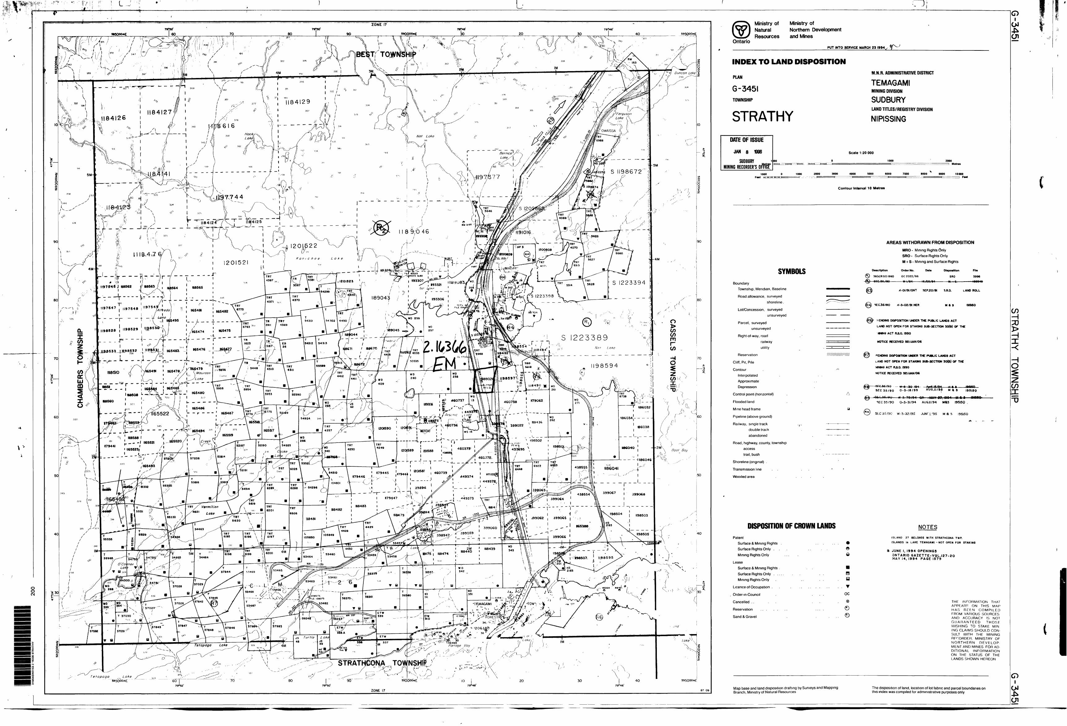
The claim is located in east central Strathy Township in the Temagami area of the Sudbury Mining Division. It is recorded on the Strathy claim sheet (G-3451) and is situated within the NTS quadrangle 31-M/4. The ground occurs at latitude 47 06' and at longitude 79 47'30".
ACCESS
Highway 11 passes through the eastern part of the township, and is located within 40 feet of post one of the claim. A bush road from Highway 11 to the east end of Arsenic Lake crosses a pipeline which traverses the west side of the claim from north to south, and provides ready access to this portion of the property. The town of Temagami is located in the southeastern corner of the township and is approximately 80 kilometers north of North Bay (via Highway 11) and 415 kilometers north of Toronto (following Highways 400 and 11).

SCH\TEMAGAMl- J '
1 NORTH
Penrose North PropertyStrathy TownshipOntarioScale 1:20,000
1*41 W.
3* 15 W.
TKCNCH WAS BLAftTtD IMTO Bf CROCK PK.ODUCOM
CONSIDERABLE LOCAL RUBftLt IM A AREA OF W1IMO*
OUTCROP.
too'
GRID MAP
PCMKOCC MOKTH PIU)PtRTY
iTItATH*- TOWNSHIP
TC/YlAaAml AKKA, OMTAKIO
SCALE ("i ZOO*. Sl-M/4
O.M.C.

CLAIM INFORMATION
The claim, which is the subject of this report, is number 1189326. It is recorded in the name of Michel George Caron of P.O. Box 362, Porcupine, Ontario, PON ICO.
SUMMARY OF PREVIOUS WORK
A review of the Toronto assessment files indicated only one filing on the claim. In 1963, a combined airborne magnetic and electromagnetic survey flown by Geophysical Engineering and Surveys Limited for Goldfields Mining Corporation Limited traversed the northern portion of the claim. The electromagnetic unit (a vertical 1,100 cycle transmitting coil on one wing and a vertical receiving coil on the other wing) outlined a northwest striking electromagnetic trend which is over 5,000 feet long and which has a 1.2 ratio of in phase to out of phase at the northwest corner of the claim. This response occurs on the easterly flank of a magnetic high.
Geologic Data Inventory Folio 201 indicates that in 1938 International Nickel carried out geological work, and trenching, stripping and sampling on a block which includes this claim.
No drilling is recorded on the claim.
SURVEY INFORMATION
The survey was run with a Ronka EM16 manufactured by Geonics Limited. The instrument is a sensitive receiver which measures the in phase and quadrature components of secondary fields which have been induced in conductive bodies in the ground by VLF-transmitting stations which operate for submarine positioning. The in phase can be read from +150 to -15O per cent, to an accuracy of one unit, and the quadrature can be read from +4S to -45, to a one unit accuracy.
A grid with a base line oriented 350 degrees astronomic and consisting of 5,667 feet of line had been cut, chained, and picketed. The picket lines (4,437 feet) were surveyed with readings taken at 50 foot intervals on line 1230 north and at 100 foot intervals on the remaining lines. The operator always faced easterly, perpendicular to the direction to the transmitting station. For this survey, the station (NSS)in Annapolis, Maryland, which transmits at 21.4 khz., was used.
The electromagnetic survey was completed by D.M. Cameron of 2517 Cavendish Drive, Burlington, Ontario, L7P 4J4 on January l, 1996. The grid stations were reestablished by D.M. Cameron on December 31, 1995 and on January l, 1996.

INTERPRETATION
The grid was established with a 350 degree astronomic base line so that the picket lines would cut both the approximate N14W trend of the Stroud-Leckie-Penrose (Big Dan) gold deposit and the northeasterly trend of the mineralization from the Sey-Bert Occurrence, or parallel to subparallel structures, as well as the northwesterly trending airborne electromagnetic anomaly which was identified in the assessment files.
The natural gas pipeline which traverses the claim from north to south, approximately perpendicular to the picket lines, produced the strong conductive response shown on the survey plan. It is interesting to note that the curves are effected somewhat by a single strand overhead line located approximately 70 feet west of the pipeline. Also, the power line on the east side of Highway 11 is producing a strong effect on the in phase component of the readings taken near the east ends of the picket lines. The in phase readings taken on line 4 north to the east of the base line have been effected by cultural elements (presumably a smaller diameter pipeline) south of the picket line. Unfortunately with all the response noise caused by cultural effects, little of use to mineral exploration on the majority of the property was obtained from the survey.
However, at the west end of line O a partial profile of a weak conductive response may be indicative of the local swampy area butting on an outcrop ridge, or both could be indicative of changes in the normal structural or compositional pattern of the rocks.
RECOMMENDATIONS AND CONCLUSIONS
Little information of direct relevance to mineral exploration was obtained from the survey, as was thought likely. However, the outcrop adjacent to the weak crossover on the west end of line O should be prospected to determine if any signs of gold mineralization are in evidence, because that area is the closest portion of the property to the northerly strike extension of the Stroud-Leckie-Penrose Deposit, which occurs approximately 900 feet to the south.
Because of the interference of the pipeline and the power lines to geophysical exploration, comprehensive prospecting, mapping, detailed humus sampling, and rock sampling should be completed to help identify gold mineralization related^to.^he deposit to the south, or to occurrences to the east ~ ̂ ^c^/a
/^Burlington, Ontario January 5, 1996
BIBLIOGRAPHY
Bennett, G. and Innes, D.G. 1971. Strathy Township, District of Nipissing; Ontario Department of Mines and Northern Affairs, Preliminary Map P.667, scale 1:15,840.
Bennett, G. and Innes, D.G. 1971. Chambers and Strathy Townships, Nipissing District; Ontario Division of Mines, Map 2323, scale 1:31,680.
Clark, A.R. 1964. Airborne Magnetic and Electromagnetic Survey, Net Lake Area, Strathy Township, Ontario, Goldfields Mining Corporation Limited; assessment files, Mines and Minerals Library, Toronto, 3p.
Fyon, A.J. and Crocket, J.H. 1986. Exploration Potential for Base and Precious Metal Mineralization in Part of Strathy Township, Temagami Area; Ontario Geological Survey, Open File Report 5591, 46p.
Geological Survey of Canada 1965. Airborne Magnetic Survey, Timagami, Ontario; Map 1491G, scale 1:63,360.
Geological Survey of Canada 1965. Airborne Magnetic Survey, Ville-Marie, Quebec-Ontario; Map 7075G, scale 1:250,000.
Ontario Geological Survey 1985. Strathy Township, District of Nipissing, Ontario; Geological Survey Geological Data Inventory Folio 201, Compiled by the staff of the Resident Geologist's office, Cobalt, 104p.
Savage, W.S. 1935. Part of Strathy Township; Ontario Department of Mines, Forty-fourth Annual Report, Vol.XLIV, Part VII, 1935, p.48-56.

STATEMENT OF QUALIFICATIONS
This is to certify that:
I graduated from Acadia University, Wolfville, Nova Scotia in 1971 with a Bachelor of Science Degree in Geology.
I have worked continuously in mining exploration since graduation.
I am a Fellow of the Geological Association of Canada.
I am a Member of the Association of Professional Geologists and Geophysicists of Quebec.
I am a Member of the Canadian Institute of Mining, Metallurgy and Petroleum, and a Member of the Prospectors and Developers Association of Canada.

Ministry ofNorthern Developmentand Mine*
Ontario
Report of Work Conducted After Recording Claim
Mining Act
Transaction Number
Pereor^lnlbrmeflonooescted on thb term Is obtain^this cotectic*! should be dfcected to the Provlnciel Manager. Mining Lands. MMstry of Northern Development and Mines. Fourth Floor. 158 Cedar Street.Sudbury. Ontario. P3E 6AS. telephone (705) 670-7264.
Instructions: - Please type or print and submit in duplicate.- Refer to the Mining Act and Regulations fcx
Recorder.- A separate copy of this form must be comf.- Technical reports and maps must accompa- A sketch, showing the claims the work is a
2.163 66
31M04SW01S3 2 16336 STRATHY 900Recorded Holden*)
MICHCL
OontNo.
UfcfcSl
Box -362. O/N/T. (CoTOMwNpfthes
STRATHY
Telephone No.
70 5- 255 -f 660
SLJDBLIR.VM or a Ptan No.
Work Performed DEC. 3 1. ms*
Work Performed (Check One Work Group Only)WorkGroup Type
Geotechnical Survey
Physical Work. Induolng Drilling
RehabWtatton
Other Authorized Work
Assays
Assign mont from Reserve
Total Assessment Work Claimed on the Attached Statement of Costs
Note: The Minister may reject for assessment work credit all or part of the assessment work submitted if the recorded holder cannot verify expenditures claimed in the statement of costs within 30 days of a request for verification.
Pereon* and Survey Company Who Performed the Work (Give Name and Address of Author of Report)Name
b R l FFlfTLD CflfflEKoM (TftoTH6lrt
-
Address
25TH CAVENDISH D It. j BufcLlNGTfcW, Q UT. L1P4J4
(attach a schedule If neceiasry)
Certification of Beneficial Interest * See Note No. 1 on reverse sMe
l certify that at the time the work was performed, the deJms covered in this work report were recorded in the current holder's name or held under a beneficial Were* by the current recorded holder. J/IAI.S
ReconJod Hold0r or AQMI (Se^raiura)
Certification of Work Reportl certify thet l have a personal knowledge of the facts set forth in this Work report, having performed the work or witnessed seme during and/or KB LCMnptoUuii end annexed report is true.
Nsine end Address off Person CeiWykiy
DRIFFifi.D 2.SH CAVENDISH D f?. OWT..Tetopone No.
los-iis-enioDate CertWed By (9gnature)
For Office Us* OnlyTotal Value Cr. Recorded Date Recorded
Doomed Approval Date
Date Ntice for Amendments Sent
Gs.
Dot*JQ^Vx-uji^ i- f
t: L.JAN -8 1996
A.M. P.M.
0241 (OOT1)

liS)T*
r o DO
ValueAftMMI
Work Don* on thla Clai
"Jj
if
Credits you are claiming in this report may be cut back. In order to minimize the adverse effects of such deletions, please indicate from which claims you wish to priorize the deletion of credits. Please mark (.x) one of the following:
1. D Credits are to be cut back starting with the claim listed last, working backwards.
2. BCredits are to be cut back equally over all claims contained in this report of work.
3. D Credits are to be cut back as priorized on the attached appendix.
In the event that you have not specified your choice of priority, option one will be implemented.
Note 1: Example* of beneficial interest are unrecorded transfers, option agreements, memorandum of agreements, etc., with respect to the mining claims.
Note 2 : If work has been performed on patented or leased land, please complete the following:
l certify that the recorded holder had a beneficial interest in the patented or leased land at the time the work was performed.
Signature Date

Ontario
Ministry o*Northern Developmentand Mines
Ministers du Devetoppemerrt du Nord et des mines
Statement of Costs tor Assessment Credit
ttat des couts aux fins du credit devaluation
Mining Act/Loi sur les mines
Transaction Ho.IN* de transaction
Personal information collected on this form is obtained under the authority of the Mining Act. This information will be used to maintain a record and ongoing status of the mining daim(s). Questions about this collection should be directed to the Provincial Manager. Minings Lands. Ministry of Northern Development and Mines. 4th Floor, 159 Cedar Street. Sudbury. Ontario P3E 6A5. telephone (705) 670-7264.
Les renseignements personnels contenus dans la presente formute sont recueillis en vertu de la Lol sur les mine* et serviront A tenir a jour un registre des concessions minieres. Adresser toute quesiton sur la collece de ces renseignements au chef provincial des terrains miniers. ministers du Devetoppement du Nord et des Mines. 159. rue Cedar. 4* etage, Sudbury (Ontario) P3E 6A5. telephone (705) 670-7264.
1. Direct Costs/Couts directs
Type
Wage* SaMras
Contractor's and Consultant's Fee* Droitsde ('entrepreneuret d* ('expert-COASMi
Suppitot Used Foumituft* utfltefes
E^ulpnwfrt Rental Location d*flMTOfftol
Description
Labour Main-d'oeuvreField Supervision Supervision sur le terrain
Type
REPORT WRlTlUfi
Type
Type
m*e ^.m.-ife
Amount Montan!
^600
f SOO
too
Total Direct Costs Total des coOts directs
Totals Total global
ftoo
\SOQ
fob
^200.
2. Indirect Costs/Couts indirects* * Mote: When claiming Rehabilitation work Indirect costs are not
allowable as assessment work.Pour le remboursement des travaux de rehabilitation, les couts indirects ne sont pas admissMes en tant que travaux d'evaluation.
Type
Transportation Trancport
Food and Lodging NourriUireet•-^a- - - — — — - — —nvuVw^vmvffn
MobHtzaUon andDemobttzatton MoMMsetkm et demobHlsatlon
DescriptionTypeCAR.
L6D6E, mtftLS
CAR
Amount Montant
7.15
SZ.60
3 Ift. okSub Total of Indirect Costs
Total partiel des couts IndirectsAmount Allowable (not greater than 20* of Direct Coat*) Montant admissible (n'excedant pet 20 H das coOta direct*)Total Value of Asaeaament CredK Vatour total* du crMK (Tow o( Dtoct and ABowaW* d*tvaluatlonImflrael caotel rToM dM eadn dbocK
Totals Total global
7.75
az.^3lS.ok^^oa.4i446.00
zfeoa.4-i
Note: The recorded holder will be required to verify expenditures claimed in this statement of costs within 30 days of a request for verification. If verification is not made, the Minister may reject for assessment work all or part of the assessment work submitted.
Note : Le titulaire enregistre sera tenu de verifier tes depenses demandees dans le present etat des couts dans tes 30 jours suivant une demande d eel effet. Si la verification n'est pas effectuee, le ministre pout rejeter tout ou une partie des travaux d'evaluation presentes.
Filing Discounts Remises pour depot
1. Work filed within two years of completion is claimed at 10046 of the above Total Value of Assessment Credit.
1. Les travaux deposes dans les deux ans suivant leur achevement sont rernboursesalOO*(Jelavaleurtotalesusnieritwin^
2. Work filed three, four or five years after completion is claimed at 50*fe of the above Total Value of Assessment Credit. See calculations below:
Total Value of Assessment Credit Total Assessment Claimed
x 0.50
2. Les travaux deposes trois, quatre ou cinq ans apres tour achevement sont rembourses a 50 "W) de la valour totate du credit d'evaluation susmentkmne. Voir les calculs ci-dessous.
Vatour totate du credit d'ftvaluation
x 0.50
Evaluation Mate demandee
Certification Verifying Statement of Costs
l hereby certify:that the amounts shown are as accurate as possible and these costs were incurred while conducting assessment work on the lands shown on the accompanying Report of Work form.
that as AGENT(Recorded Holder. Agent. Position in Company)
to make this certification
Attestation de I'etat des couts
J'atteste par la presente :que les montants indiques sont le plus exact possible et que ces depenses ont ete engagees pour effectuer les travaux d'evaluation sur les terrains indiques dans la formule de rapport de travail ci-joint.
l am authorized Et qu'a litre de je suis autorise(titulaire enregistre. repnfeentant. poste occup* dans la compagnie)
a faire cotte attestation.
Date
Nota : Dans cone formule. kxsqu'il designe des personnes. le masculin est utilis6 au sens neutre.
OntarioMinistry of Ministere duNorthern Development Developpement du Nordand Mines et des Mines
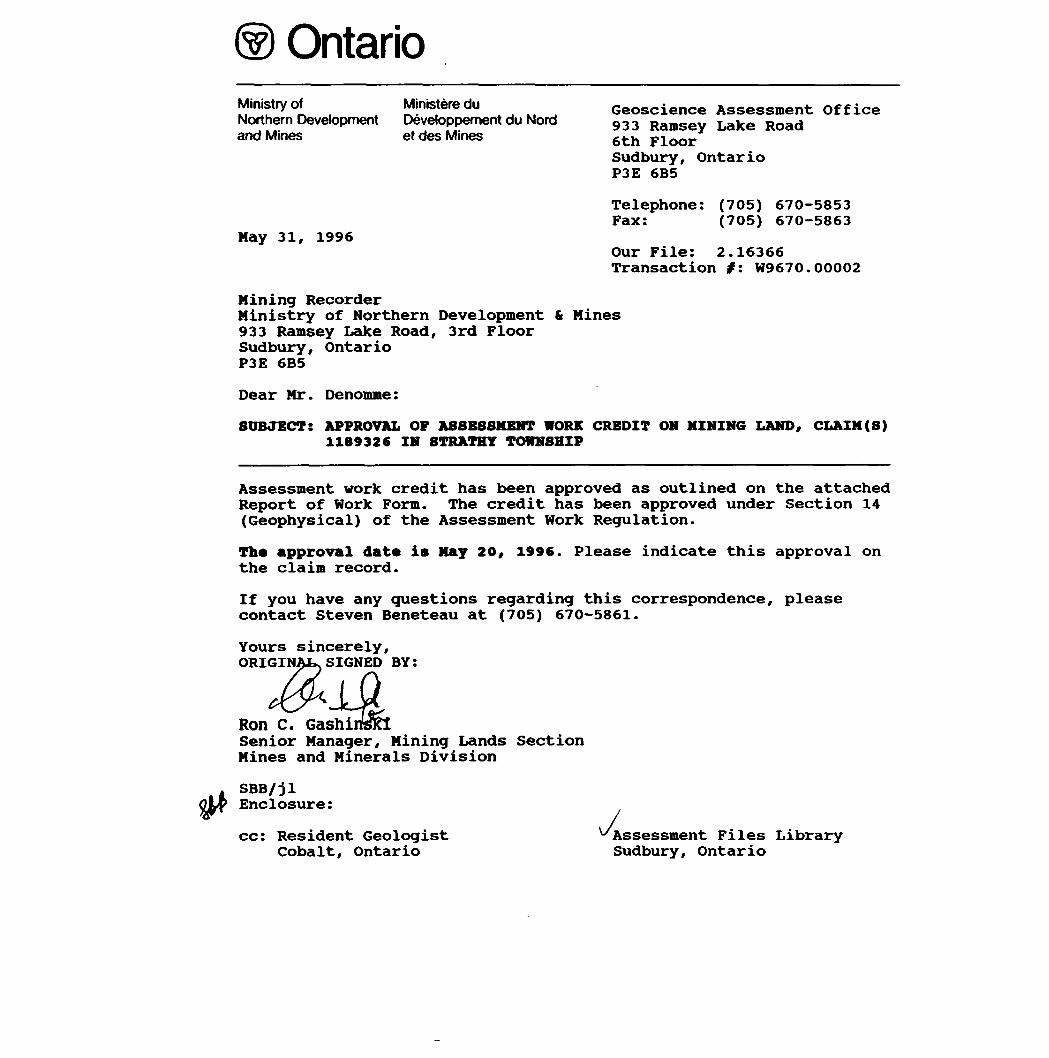
May 31, 1996
Geoscience Assessment Office 933 Ramsey Lake Road 6th Floor Sudbury, Ontario P3E 6B5
Telephone: (705) 670-5853 Fax: (705) 670-5863
Our File: 2.16366 Transaction #: W9670.00002
Mining RecorderMinistry of Northern Development St Mines933 Ramsey Lake Road, 3rd FloorSudbury, OntarioP3E 6B5
Dear Mr. Denomme:
SUBJECT: APPROVAL OF ASSESSMENT WORK CREDIT ON MINING LAND, CLAIM(S) 1189326 IN STRATHY TOWNSHIP
Assessment work credit has been approved as outlined on the attached Report of Work Form. The credit has been approved under Section 14 (Geophysical) of the Assessment Work Regulation.
Th* approval dat* is May 20, 1996. Please indicate this approval on the claim record.
If you have any questions regarding this correspondence, please contact Steven Beneteau at (705) 670-5861.
Yours sincerely, ORIGINAL. SIGNED BY:
Ron C. GashiiSenior Manager, Mining Lands SectionMines and Minerals Division
SBB/jl Enclosure:
cc: Resident Geologist Cobalt, Ontario
Assessment Files Library Sudbury, Ontario
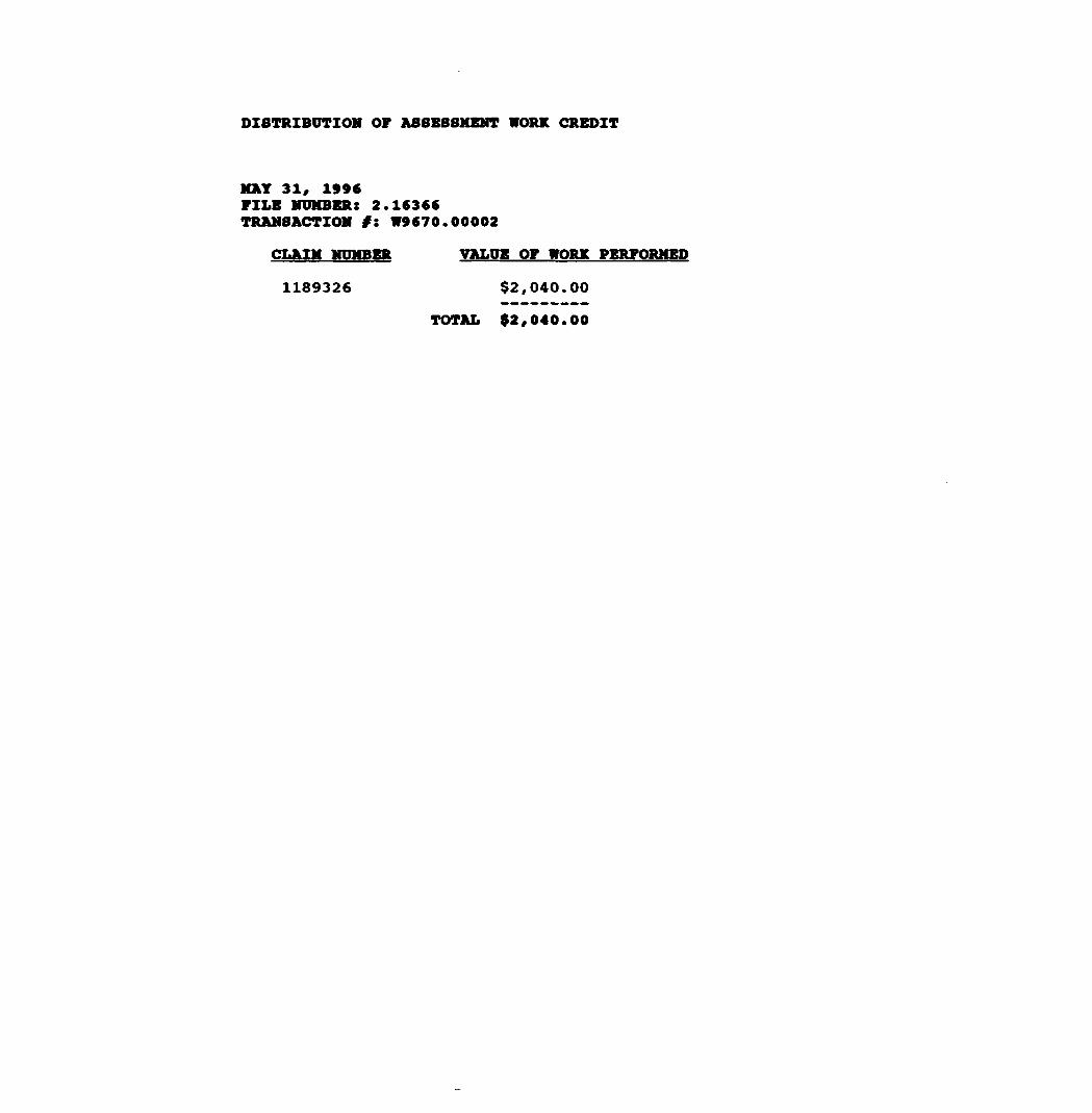
DISTRIBUTION OF ASSESSMENT WORK CREDIT
MAT 31, 1996FILE NUMBER: 2.16366TRANSACTION /: W9670.00002
CLAIM NUMBER VALUE OF WORK PERFORMED
1189326 $2,040.00
TOTAL $2,040.00
L Jo i04
OoCM
ZONE 1779*46'
40 595QOOmE
BEST; TOW
i 11841271I84J26
S 1198672
119*674 t ,.'/
W S I2Q
f ^ 11 A ji i rt A
89/046
~" wS 1223394
"5 1 223398
1197547 1 197548 |
S 12233891165481 - i 165476
"?"~ ~ ~ - -1198594
18932* } l|985971|118
V - 1 1165480l l
1)18508
^- i 4493l J Arsenic . Lake
I20J589 I20)5flfl , l i "
Boot Bay i
--\P6
TRT \ 5620 V
Tetapaga Lake
STRATHCONA, TOWNS
40 595000mE
7905O' 79048' 79046'
ZONE 17 87 09
Ministry ofNaturalResources
Ministry ofNorthern Developmentand Mines
OntarioPUT INTO SERVICE MARCH 23 1994,
INDEX TO LAND DISPOSITION
PLAN
G-3451TOWNSHIP
STRATHY
M.N.R. ADMINISTRATIVE DISTRICT
TEMAGAMIMINING DIVISION
SUDBURYLAND TITLES/REGISTRY DIVISION
NIPISSING
DATE OF ISSUE
JAN 8 1996
SUDBURY MINING RECORDER'S OrW
too
1000It SI
1000
Scale 1:20 000
2000 3000 4000 5000
1000 2000
6000ZE
70003Z
8000 9000
MvtrM
10000FMt
Contour Interval 10 Metre*
AREAS WITHDRAWN FROM DISPOSITION
MRO- M ining Rights OnlySRO- Surface Rights OnlyM 4- S - Mining and Surface Rights
SYMBOLS Description
36(a)RSOI960
BoundaryTownship, Meridian, Baseline
Road allowance, surveyed
shoreline.
Lot/Concession, surveyedunsurveyed
Parcel, surveyedunsurveyed
Right-of-way, road
railway utility
Reservation
Cliff, Pit, Pile
ContourInterpolated
ApproximateDepression
Control point (horizontal)
Flooded land
Mine head frame
Pipeline (above ground)
Railway, single track double track
abandoned
Road, highway, county, township
access
trail, bush
Shoreline (original) .
Transmission line . .
Wooded area
Order No.
OC 2022/66 W 1/81———
Date
li/Oi/81
Disposition
SRO
File
3996
ioimo
rf-OI/91/ONT SEP.20/91 5.R.O.
SEC.36/80 ^-3-02/91 NER M a a
LAND ROLL
196190
PENDING DISPOSITION UNDER THE PUBLIC LANDS ACT
LAND NOT OPEN FOR STAKING SUB-SECTION SO(B) OF THE
4MNG ACT RAO. 1990
NOTICE RECEIVED 98/J AN/OS
PENDING DISPOSITION UNDER THE PUBLIC LANDS ACT
LAND NOT OPEN FOR STAKING SUB-SECTION 30(B) OF THE
MINING ACT R.S.O. 1990
NOTICE RECEIVED 9B/JAN/O6
SEC.86/&3 W 8 10 /91SEC 35/90 0-S-I8/9S
Apfii IK/OA__iji A ^AUG.il/9S M AS 199190
SEC 35/90 0-5-31/94 AUG.II/94 M*S I95I5Q .
StC35/^0 W-S-32/95 JUNr,|.'95 MSS 195150
•i"
DISPOSITION OF CROWN LANDS NOTES
PatentSurface S Mining Rights . Surface Rights Only . . Mining Rights Only
LeaseSurface S Mining Rights . Surface Rights Only . Mining Rights Only
Licence of Occupation .
Order-m-Council
Cancelled .. .
Reservation .. .
Sand S Gravel
ISLAND 27 BELONGS WITH STRATHCONA TWP.
ISLANDS in LAKE TEMAGAMI - NOT OPEN FOR STAKING
* JUNE l. 1994 OPENINGSONTARIO GA2ETTE-VOL.I27-2O MAY 14. 1994 PAGE 1579
B B
Toc
THE INFORMATION THAT APPF.ARP ON THIS MAP HAS BEEN COMPILED FROM VARIOUS SOURCES AND ACCURACY IS NOT GUARANTEED THOSE WISHING TO STAKE MIN ING CLAIMS SHOULD CON SULT WITH THE MINING RECORDER. MINISTRY OF NORTHERN DEVELOP MENT AND MINES FOR AD DITIONAL INFORMATION ON THE STATUS OF THE LANDS SHOWN HEREON
Map base and land disposition drafting by Surveys and Mapping Branch, Ministry of Natural Resources
The disposition of land, location of lot fabric and parcel boundaries on this index was compiled for administrative purposes only
COH
O)i"D
CD
en

*-PIPEUJNE CLEARING
'V-34 MLI2+30M 2M1W rS f*4
H6132&
: 6EOJJIC5 EM/6.
2.1-4 KHZ,
SURVEY FACING O^ECTION; 5ASTERLV.
STATIO/X/: MARYLANDAT 35J'A5T
L8W 3+75W
IM PHASE
VLF ELECTROMAGNETIC SURVEY
PENROSE NORTH PROPERTYSTRATHY TOWMSHlPj TElVlAGAfrt/ AREA.
SUDBURY MINING DIVISION, ONTARIO SCALE: iin.sloo*t. si-m/4JANUARY rH6 b.rA.
31M04SW0153 2 16336 STRATHY 210