stevens creek dam - valleywater.org
TRANSCRIPT

SEISMIC STABILITY EVALUATIONS OF CHESBRO, LENIHAN, STEVENS CREEK, AND UVAS DAMS
(SSE2)
PHASE A: STEVENS CREEK AND LENIHAN DAMS
STEVENS CREEK DAM COMPILATION REPORT (REPORT No. SSE2A-SC)
Prepared for
SANTA CLARA VALLEY WATER DISTRICT 5750 Almaden Expressway San Jose, CA 95118 January 2013

TABLE OF CONTENTS
SSE2 Rpt SSE2A-SC.docx i
OVERVIEW OF SEISMIC STABILITY EVALUATION OF STEVENS CREEK DAM
1.0 Introduction ..........................................................................................................................1
2.0 General Description of Stevens Creek Dam ........................................................................1
3.0 Review of Available Data and Preliminary Engineering Analyses (Work Plan) – Tab 1 ....................................................................................................................................3
4.0 Work Plan and Addenda for Supplemental Investigations – Tabs 1 and 2 .........................4
5.0 Supplemental Field Investigations and Laboratory Testing – Tab 3 ...................................5
6.0 Site Characterization and Material Properties – Tab 4 ........................................................6
6.1 Site Characterization ................................................................................................6
6.2 Dam Zoning and Material Properties .......................................................................7
7.0 Ground Motions – Tab 4 ......................................................................................................8
8.0 Engineering Analyses – Tab 5 .............................................................................................9
9.0 Conclusions and Recommendations ..................................................................................10
Figures
1 Representative Cross Sections
2 Cross Sections Showing Dam Zoning
Project Deliverables
Tab 1 Site Investigations and Laboratory Testing at Stevens Creek Dam – Work Plan
Tab 2 Site Investigations and Laboratory Testing at Stevens Creek Dam – Addendum and Addendum II to Work Plan
Tab 3 Site Investigations and Laboratory Testing – Data Report (Report No. SC-1)
Tab 4 Site Characterization, Material Properties, and Ground Motions (Report No. SC-2)
Tab 5 Engineering Analyses (Report No. SC-3)

OVERVIEW OF SEISMIC STABILITY EVALUATION OF STEVENS CREEK DAM
SSE2 Rpt SSE2A-SC.docx 1
1.0 INTRODUCTION
In May 2010, the Santa Clara Valley Water District (District) retained Terra / GeoPentech (TGP), a joint venture of Terra Engineers, Inc. and GeoPentech, Inc., to complete seismic stability evaluations of Chesbro, Lenihan, Stevens Creek and Uvas Dams. These evaluations were required by the Division of Safety of Dams (DSOD) in June 2008 as part of their Phase III screening process of the State’s dams located in highly seismic environments. The evaluations are also a vital part of the District’s Dam Safety Program (DSP). Phase A of the project includes work on Stevens Creek and Lenihan Dams while Phase B includes work on Chesbro and Uvas Dams. The general scope of the project consists of the field, laboratory, and office studies required to evaluate the seismic stability of the four referenced dams.
This compilation report documents the results of our seismic stability evaluation of Stevens Creek Dam. The various aspects of the evaluation have been documented in several deliverables that were submitted to the District and to the Division of Safety of Dams (DSOD) as the evaluation efforts proceeded. The purpose of the compilation report is to provide a compendium of the various project deliverables preceded by an overview of the work performed highlighting the key aspects and findings of the seismic stability evaluation.
There were several project deliverables supporting the seismic stability evaluation of the dam:
1. Site Investigations and Laboratory Testing at Stevens Creek Dam – Work Plan (November 2010) – TAB 1
2. Site Investigations and Laboratory Testing at Stevens Creek Dam – Addendum (January 2011) and Addendum II (September 2011) to Work Plan – TAB 2
3. Site Investigations and Laboratory Testing – Data Report (Report No. SC-1; February 2012) – TAB 3
4. Site Characterization, Material Properties, and Ground Motions (Report No. SC-2; May 2012) – TAB 4
5. Engineering Analyses (Report No. SC-3; December 2012) – TAB 5
These deliverables can be found after each numbered tab following this overview and are briefly summarized in the sections below.
2.0 GENERAL DESCRIPTION OF STEVENS CREEK DAM
Stevens Creek Dam is located in Santa Clara County, California, about 1 mile southwest of the City of Monta Vista. The dam is an earthfill structure that was constructed across Stevens Creek in 1935. The dam impounds Stevens Creek Reservoir that has a maximum capacity of 3,138 acre-feet at the nominal spillway elevation of 537.8 feet1. DSOD has classified Stevens Creek Dam as a “High Hazard” dam.
Appurtenant structures include a broad-crested concrete-lined side channel spillway located in the right abutment and an outlet conduit beneath the dam embankment connected to an inlet 1 Unless otherwise noted in this document, all elevations are referenced to NAVD88 vertical datum.

OVERVIEW OF SEISMIC STABILITY EVALUATION OF STEVENS CREEK DAM
SSE2 Rpt SSE2A-SC.docx 2
structure in the reservoir on the right side of the streambed, and to an outlet structure that allows reservoir water to discharge into Stevens Creek approximately 50 feet beyond the toe of the dam.
Major modifications were made to the dam and appurtenant structures in 1985-1986 to address seismic stability and spillway capacity issues:
1. Buttresses were constructed upstream and downstream of the original embankment;
2. The existing spillway weir located outside the dam in the right abutment was removed and the length of the spillway crest was extended at a right angle at the same elevation to increase the capacity of the spillway; and
3. The existing outlet conduit was extended both upstream and downstream to accommodate the construction of the upstream and downstream buttresses, the original intake structure was demolished and a new intake structure was built further upstream at the right abutment and a new downstream outlet structure was also constructed that is similar to the original structure with some minor dimensional changes to improve its performance under seismic loading.
Figure 1 contains representative cross sections through the current configuration of the dam at the maximum section (Station 7+50) and at Stations 9+70 and 4+00 on the left and right sides of the dam, respectively. The locations of the three sections are shown on the insert in the lower portion of the figure. The original dam embankment was designed as a two-zone earthfill dam, with an "impervious" upstream zone and a "pervious" downstream zone. However, subsequent studies indicated that the dam may in fact be more like a homogenous embankment. Thus, the embankment zones are referred to as upstream embankment and downstream embankment. The original embankment has slopes of 2.5 horizontal to 1 vertical (2.5H : 1V) both upstream and downstream. Overburden soils were generally excavated beneath the upstream embankment and a cutoff trench was constructed at about the midpoint of the upstream embankment by excavating into the Santa Clara Formation. The Santa Clara Formation is a poorly indurated conglomerate with lesser interbeds of sandstone, siltstone and claystone - it is essentially a very dense clayey gravel.
The foundation beneath the downstream embankment includes older alluvial terrace deposits – mostly sands and gravels with varying amounts of fines, with some colluvium on the mid and upper abutments. Younger alluvial deposits– mostly sandy and silty gravels and some sand layers – underlie the channel section of the foundation beneath the downstream embankment.
The upstream buttress is 100 feet wide and half the dam height (approximate elevation 488 feet); the downstream buttress is 50 feet wide and extends to elevation 556.8 feet, nominally 19 feet above the spillway elevation, between Stations 5+10 and 10+40. The crest of the downstream buttress slopes down uniformly to the elevation of the original dam crest between Station 10+40 and the left abutment and between Station 5+10 and the spillway at the right abutment. The slopes of the upstream and downstream buttresses are the same as those of the original embankment (i.e., 2.5H : 1V). An inclined filter and drain was placed between the original downstream slope and the new buttress fill.
A minimum 50-foot wide strip of the upstream buttress foundation is underlain by Santa Clara Formation bedrock. Some younger alluvium appears to underlie the upstream portion of the original embankment (upstream of the cutoff trench) and the downstream margin of the upstream
OVERVIEW OF SEISMIC STABILITY EVALUATION OF STEVENS CREEK DAM
SSE2 Rpt SSE2A-SC.docx 3
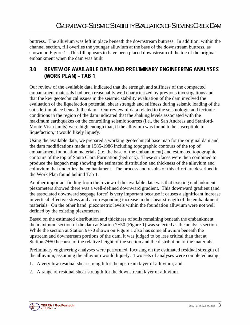
buttress. The alluvium was left in place beneath the downstream buttress. In addition, within the channel section, fill overlies the younger alluvium at the base of the downstream buttress, as shown on Figure 1. This fill appears to have been placed downstream of the toe of the original embankment when the dam was built
3.0 REVIEW OF AVAILABLE DATA AND PRELIMINARY ENGINEERING ANALYSES (WORK PLAN) – TAB 1
Our review of the available data indicated that the strength and stiffness of the compacted embankment materials had been reasonably well characterized by previous investigations and that the key geotechnical issues in the seismic stability evaluation of the dam involved the evaluation of the liquefaction potential, shear strength and stiffness during seismic loading of the soils left in place beneath the dam. Our review of data related to the seismologic and tectonic conditions in the region of the dam indicated that the shaking levels associated with the maximum earthquakes on the controlling seismic sources (i.e., the San Andreas and Stanford-Monte Vista faults) were high enough that, if the alluvium was found to be susceptible to liquefaction, it would likely liquefy.
Using the available data, we prepared a working geotechnical base map for the original dam and the dam modifications made in 1985-1986 including topographic contours of the top of embankment foundation materials (i.e. the base of the embankment) and estimated topographic contours of the top of Santa Clara Formation (bedrock). These surfaces were then combined to produce the isopach map showing the estimated distribution and thickness of the alluvium and colluvium that underlies the embankment. The process and results of this effort are described in the Work Plan found behind Tab 1.
Another important finding from the review of the available data was that existing embankment piezometers showed there was a well-defined downward gradient. This downward gradient (and the associated downward seepage force) is very important because it causes a significant increase in vertical effective stress and a corresponding increase in the shear strength of the embankment materials. On the other hand, piezometric levels within the foundation alluvium were not well defined by the existing piezometers.
Based on the estimated distribution and thickness of soils remaining beneath the embankment, the maximum section of the dam at Station 7+50 (Figure 1) was selected as the analysis section. While the section at Station 9+70 shown on Figure 1 also has some alluvium beneath the upstream and downstream portions of the dam, it was judged to be less critical than that at Station 7+50 because of the relative height of the section and the distribution of the materials.
Preliminary engineering analyses were performed, focusing on the estimated residual strength of the alluvium, assuming the alluvium would liquefy. Two sets of analyses were completed using:
1. A very low residual shear strength for the upstream layer of alluvium; and,
2. A range of residual shear strength for the downstream layer of alluvium.

OVERVIEW OF SEISMIC STABILITY EVALUATION OF STEVENS CREEK DAM
SSE2 Rpt SSE2A-SC.docx 4
The results of these analyses are discussed in the Work Plan located behind Tab 1 and indicated the following:
1. Even if the residual shear strength of the upstream alluvium layer were negligible (a low enough number that can be "confirmed" without further investigation), large seismic displacements would be localized to the upstream buttress area and would not affect the existing dam itself; thus, there was no need to perform any additional site investigation work for the alluvium in this area.
2. The sections of the embankment that are potentially susceptible to greater amounts of earthquake-induced deformation are in areas that are downstream of the upstream embankment, where thicker alluvial deposits are known to underlie the dam. The most critical area appears to be along the maximum section over the former stream channel where younger alluvial deposits underlie the portion of the dam downstream of the upstream embankment.
4.0 WORK PLAN AND ADDENDA FOR SUPPLEMENTAL INVESTIGATIONS – TABS 1 AND 2
Based on the review of the available data and the results of the preliminary engineering analyses, a program of investigations was developed to supplement existing data, and focused on evaluating and/or confirming:
1. the liquefaction potential and residual strength of the soils left in place beneath the dam;
2. the ability of the soils left in place to accommodate dynamic drainage and reduce the potential for the buildup of pore pressure in the alluvium as a result of earthquake loading;
3. the ability of the soils left in place to act as a horizontal drainage layer beneath the embankment as evidenced by piezometric levels within these soils;
4. the distribution of piezometric levels (and direction of seepage forces) within the dam embankment; and
5. the engineering properties of the embankment materials.
As discussed in the Work Plan (Tab 1), the supplemental subsurface investigations to fill in data gaps identified during our review of the available data included sonic borings, rotary wash borings, downhole OYO geophysical suspension logging, and installation of piezometers at four locations on the dam, and one location downstream of the toe of the dam. A phased approach was to be used for the program where sonic borings were to be drilled first to provide near-continuous recovery of the embankment and foundation materials. Laboratory testing of samples from the sonic borings would be completed to determine physical and index properties that would provide data for soil classification and liquefaction potential analyses. These tests would also be used to target soil layers for sampling and field testing in companion mud rotary borings adjacent to each sonic boring location. It was also understood that the need for Becker Penetration Tests (BPTs) in the alluvium to supplement the evaluation of the liquefaction potential of these materials would be evaluated if the gravel content in the foundation soils was found to be greater than 30 percent based on the results of laboratory tests made on samples from

OVERVIEW OF SEISMIC STABILITY EVALUATION OF STEVENS CREEK DAM
SSE2 Rpt SSE2A-SC.docx 5
the sonic borings, and depending upon the maximum grain size of the gravel particles encountered. Laboratory testing would include a large number of index property tests and some engineering property tests on samples of the materials collected in the borings.
As discussed in the Addendum to the Work Plan (located behind Tab 2), the key findings from Phase 1 of the investigations are related to the groundwater levels within the alluvium and the need for Becker Penetration Testing based on the gravel content of the alluvium. Data collected from Casagrande piezometers installed in the sonic borings clearly showed that the Younger Alluvium at Station 7+50 is acting as a horizontal drainage blanket beneath the downstream portion of the dam and that the amount of seepage through the dam embankment is relatively small compared to the hydraulic capacity of the alluvium to convey water horizontally. As a result, the saturated thickness of the Younger Alluvium is typically 2 feet or less, except in the vicinity of the toe of the dam where the saturated layer is as much as 8 feet thick and where the groundwater head is probably controlled by the elevation of the water in Stevens Creek at the outlet structure.
Initial results of gradation test on samples of the alluvium from the Phase 1 sonic borings revealed that the alluvium had a high gravel content, and it was concluded, in consultation with the District and DSOD, that Becker Penetration Tests would be needed to provide data to aid in the characterization of the liquefaction potential of the alluvium.
Therefore, as described in the Addendum to the Work Plan (Tab 2), Phase 2 of the investigation program was modified by replacing two of the mud rotary borings originally planned in the embankment by BPT borings, adding three BPT borings at the toe of the dam, modifying the number of vibrating wire piezometers, and adding sealed observation wells in two of the BPT borings at the toe. In addition, a program of Cone Penetrometer Test probes (CPTs) was also recommended to provide a profile of resistance through the embankment and alluvium, supplement the results of the sonic and OYO profiling, and “tie together” the information at discrete depths available from previous investigations and from the additional borings planned.
Upon review of the results of the Phase 2 investigations with the District and DSOD, it was decided to proceed with a third phase of investigations aimed at further investigating the higher density of the alluvium under the dam suggested by the BPT borings. The additional investigations were to include one additional mud rotary boring in the embankment with shear wave velocity measurements using OYO suspension logging, three CPTs with seismic cone, one instrumented BPT boring in the embankment and possibly a second instrumented BPT boring at the toe of the dam. The details of the plan for these investigations are described in Addendum II to the Work Plan that can be found after the Addendum to the Work Plan behind Tab 2.
5.0 SUPPLEMENTAL FIELD INVESTIGATIONS AND LABORATORY TESTING – TAB 3
Explorations were completed on the crest of the dam, downstream of the toe, and at two locations on the downstream slope. As indicated above, the site investigations were divided into three phases.
Phase 1 included the drilling of five borings using a sonic rig and the installation of a Casagrande piezometer in each of the sonic borings.

OVERVIEW OF SEISMIC STABILITY EVALUATION OF STEVENS CREEK DAM
SSE2 Rpt SSE2A-SC.docx 6
Phase 2 consisted of the following:
1. Pilot program of three CTPs;
2. Drilling of three mud rotary borings with SPT energy calibration;
3. OYO down-hole geophysical logging in each of the three mud rotary borings;
4. Drilling of eight Becker borings;
5. Hammer energy monitoring on three of the Becker borings; and
6. Installation of vibrating wire piezometers and standpipe piezometers.
Phase 3 included drilling of one mud-rotary boring with OYO down-hole geophysical logging and completion of CPTs with seismic cone shear wave velocity measurements at three locations.
The geotechnical laboratory testing program included extensive physical and index property tests on samples of alluvium collected in the borings to (a) allow classification of the soil and (b) provide the information on gradation and plasticity to support empirical correlations between penetration resistance and the potential for triggering of liquefaction and residual shear strength. The program also included some index property tests and limited engineering property testing in the form of undrained triaxial compression tests with pore pressure measurements on embankment materials to check the undrained strength measurements and effective strength measurements made by previous investigators, as well as a consolidation test on the embankment materials.
The data collected during the supplemental field investigation and laboratory testing program are documented in a Data Report (Report No. SC-1) found behind Tab 3.
6.0 SITE CHARACTERIZATION AND MATERIAL PROPERTIES – TAB 4
The results of the supplemental field investigations and laboratory testing were interpreted and combined with the results of the previous investigations and available data to summarize the geology of the site, describe the conditions of the dam and foundation, and characterize the material properties to be used in the engineering analyses for the seismic stability evaluation of the dam. The results of this effort are documented in Report No. SC-2 found behind Tab 4. It should be noted that some typographical errors were found in Report No. SC-2 after it had been issued in final form in May 2012. These errors have been corrected in the version included behind Tab 4.
6.1 Site Characterization
Some key findings of the site characterization are as follows:
1. The foundation beneath the dam downstream of the upstream embankment includes older alluvial terrace deposits with some colluvium on the mid and upper abutments and younger alluvial deposits in the channel section of the foundation. Overburden soils were generally removed from beneath the upstream embankment zone to the top of the Santa Clara Formation bedrock and from the cutoff trench that was excavated into the Santa Clara Formation bedrock and is located beneath the center of the upstream embankment zone. An

OVERVIEW OF SEISMIC STABILITY EVALUATION OF STEVENS CREEK DAM
SSE2 Rpt SSE2A-SC.docx 7
isopach map showing the estimated distribution of alluvial and colluvial soils that remain in place within the foundation of the dam was developed based on a detailed review and analysis of a number of drawings documenting the conditions that existed in the foundation area prior to and during construction of the original dam and of the buttresses; and on the results of field investigations completed by prior investigators as well as those completed by TGP in 2010-2011.
2. The data provided by the existing piezometers as well as those installed by TGP in 2010-2011 clearly show that the alluvium left in place beneath the downstream embankment is functioning as a very effective horizontal drainage blanket and that there is a downward gradient within the embankment materials above the alluvium. The measured total heads in the piezometers in the Younger Alluvium at the maximum section of the dam indicate that water is perched on the surface of the underlying comparatively impermeable Santa Clara Formation bedrock.
3. The groundwater levels within the Younger Alluvium at the maximum section were monitored over a period of five months from December 2010 through May 2011 and were found to be low; i.e., within 2 feet of the bottom of the alluvium under the crest and within 10 feet of the bottom of the alluvium at the toe of the dam. In addition, they were found to be strongly influenced by groundwater levels downstream of the dam – not by the reservoir level. These levels are in turn controlled by precipitation and recharge from Stevens Creek at the downstream outlet structure. Similarly, the data from a piezometer located on the dam crest at Station 4+00 indicate that some seepage probably occurs through the older terrace alluvium that remains in the foundation beneath both sides of the dam, and is likely fed by groundwater within the abutments.
6.2 Dam Zoning and Material Properties Figure 2 shows the generalized configuration of the dam and its foundation at the maximum section (Section A-A – Station 7+50) and at a section through the right abutment (Section C-C' – Station 4+00). The various material zones identified are: Original Embankment – Upstream and Downstream; Upstream and Downstream Buttresses; Filter/Drain; Rip Rap at Downstream Toe; Fill at Downstream Toe; Alluvium; and Bedrock – Santa Clara Formation. The alluvium is further divided into two zones: Younger Alluvium and Older Alluvium.
The key findings related to material properties are as follows:
1. There is little difference in the physical and index properties and shear strength of the upstream "impervious" and downstream "pervious" embankments. However, the significance of these original embankment designations is that alluvium was removed beneath the upstream "impervious" embankment but left in place beneath the downstream "pervious" embankment.
2. The upstream and downstream embankments are generally classified as clayey sand with gravel. The clay matrix was found to control the behavior of these materials and they were determined to be non-liquefiable and to have a relatively high undrained shear strength.
3. The upstream buttress constructed in 1985-1986 was generally founded on Santa Clara Formation bedrock after removal of the alluvium.

OVERVIEW OF SEISMIC STABILITY EVALUATION OF STEVENS CREEK DAM
SSE2 Rpt SSE2A-SC.docx 8
4. The base of the downstream buttress constructed in 1985-1986 was not founded on bedrock, but on alluvium left in place in the foundation, overlain by fill material which appears to have been placed downstream of the toe of the original embankment during original dam construction.
5. The alluvium left in place beneath the downstream embankment is functioning as a very effective drainage blanket. The groundwater levels in the alluvium at the maximum dam section are low and the saturated thickness of the alluvium typically varies from 1 foot near the crest to 6 feet near the toe. The saturated thickness of the alluvium is not controlled by the elevation of the water in the reservoir but by groundwater levels in the toe area that vary with precipitation and recharge from releases through the reservoir outlet works into Stevens Creek downstream of the dam.
6. The strength of the alluvium left in place is positively influenced by the low piezometric levels and correspondingly high values of effective confining stresses in the alluvium.
7. Characterization of the liquefaction potential and post-liquefaction residual shear strength of the alluvium is based on estimates of (N1)60 (corrected standard penetration test (SPT) blow counts) derived from BPT test results interpreted using the method proposed by Harder. After several discussions with DSOD, a mean (N1)60 value of 20 blows/foot was agreed-upon for the purpose of the seismic deformation analyses. In addition, an (N1)60 value of 25 blows/foot is used as a benchmark value for calculating and comparing seismic deformations, in order to understand the sensitivity of the estimated seismic deformations to the uncertainty in (N1)60 values.
7.0 GROUND MOTIONS – TAB 4
Site-specific input ground motions were developed for use in the seismic deformation analyses, as documented in Report No. SC-2 (Tab 4).
Key elements in the development of these site specific ground motions are as follows:
1. Stevens Creek Dam is classified as a "high consequence" dam by DSOD.
2. The two seismogenic faults controlling the seismic hazard at the dam are the Stanford-Monte Vista and San Andreas faults. The Stanford-Monte Vista event controls the shaking condition at the site for periods of 2 seconds or less for the lower magnitude earthquake scenario. The San Andreas event has a larger earthquake magnitude and controls the shaking condition at the site for periods larger than about 2 seconds.
3. Shear-wave velocity measurements were collected at the site using an OYO Suspension PS logging system within four boreholes which penetrated 5 m to 10 m into the foundation rock. Based on these measurements, the average shear-wave velocity within the upper 10 m of the foundation rock is 960 m/s. Based on geologic experience at the site, it is anticipated that the Santa Clara Formation to a foundation depth of 30 m would be similar to that observed within the boreholes to a depth of 10 m. Therefore, a site-specific VS30 of 960 m/s was used in the development of the design response spectra for the Stanford-Monte Vista and San Andreas events.

OVERVIEW OF SEISMIC STABILITY EVALUATION OF STEVENS CREEK DAM
SSE2 Rpt SSE2A-SC.docx 9
4. Three seed time histories were selected for the Stanford-Monte Vista event and adjusted to match the target response spectra. It should be noted that the Arias Intensity values of the three selected ground motions exceed the best estimate of Arias Intensity provided by the Watson-Lamprey and Abrahamson relationship with 84th percentile ground motion inputs.
5. Seed time histories for the San Andreas event were selected through a multi-step screening of the PEER Ground Motion Database. The selection process screened all 3,551 records in the Database and yielded eight records with values of Arias Intensity and significant duration similar to those of the San Andreas event. These eight records, as well as the Denali TAPS record, were chosen and evaluated, and three final seed time histories were selected. The final three selected seed time histories were then adjusted to match the target response spectra. As for the Stanford-Monte Vista event, the Arias Intensity values of the three ground motions exceed the best estimate of Arias Intensity provided by the Watson-Lamprey and Abrahamson relationship with 84th percentile ground motion inputs.
8.0 ENGINEERING ANALYSES – TAB 5
The purpose of the engineering analyses was to evaluate the seismic stability of the dam during the Maximum Credible Earthquake (MCE) and to assess the seismic deformations of the structure as a result of the MCE. To that end, the scope of the analyses included the following:
1. seepage analyses to establish total heads and pore pressures associated with steady state seepage;
2. static and pseudo-static stability analyses; and
3. non-linear dynamic analyses of seismic deformations.
The engineering analyses were based on the site characterization, material properties, and ground motions discussed above and documented in Report No. SC-2 (Tab 4). The results of the analyses are contained in Report No. SC-3 that is found behind Tab 5. Key findings from the analyses are summarized below.
The finite element seepage analyses showed good agreement between measured piezometric levels and calculated total heads and provided a reliable basis for defining pore-water pressures for stability and seismic deformation analyses.
The factor of safety for steady state seepage under full reservoir level was found to be 1.9 and the factor of safety for rapid drawdown conditions was calculated as 2.3; these values exceed the minimum required values of 1.5 and 1.3, respectively, specified by the US Army Corps of Engineers.
The yield acceleration from pseudo-static loading of the dam ranged from 0.12g to 0.13g. The factor of safety of the downstream slope immediately after shaking was calculated as 1.6 using the post-liquefaction residual strength for the alluvium based on an (N1)60 value of 20 blows/foot. This indicates there is a large factor of safety against a flow slide in the event that liquefaction were to occur.

OVERVIEW OF SEISMIC STABILITY EVALUATION OF STEVENS CREEK DAM
SSE2 Rpt SSE2A-SC.docx 10
The results of the seismic deformation analyses indicated the following:
1. For a residual shear strength of the alluvium based on a (N1)60 value of 20, the calculated seismically induced permanent horizontal crest displacements range from 0.9 to 3.1 feet downstream and the calculated vertical displacements (settlements) range from 0.1 to 0.2 feet. For a residual shear strength of the alluvium based on a (N1)60 value of 25, the crest displacements drop to 0.2 to 1.5 feet downstream with a vertical settlement of about 0.1 feet.
2. The vertical displacements associated with the earthquake loading may be somewhat underestimated by the FLAC analyses using a Mohr-Coulomb soil model because the shear modulus of the embankment soils is kept constant during shaking when, in fact, there may be some reduction in the shear modulus due to cyclic loading; thus, we have estimated the maximum vertical displacements may be 0.5 to 1 foot.
The sensitivity of the computed permanent seismic displacements to the timing of triggering of liquefaction was evaluated by comparing the displacements based on triggering when the excess pore pressure generated by shaking equals the vertical effective stress to the displacements calculated assuming the soil liquefies at the start of shaking. These analyses showed that the simple but unrealistic assumption that liquefaction occurs at the start of shaking leads to a maximum calculated horizontal crest displacement of 4.6 feet rather than a maximum horizontal crest displacement of 3.1 feet.
9.0 CONCLUSIONS AND RECOMMENDATIONS
Our analyses estimated that the maximum crest settlement would be about 1 foot and the maximum lateral displacement of the crest would be about 3 feet as a result of the Maximum Credible Earthquake (MCE) which we considered acceptable given the 19 feet of freeboard and the 130-foot width of the dam at the spillway elevation. In addition, the likelihood of significant cracks forming in the crest and in other areas was judged to be very low. Our analyses also identified an area in the upstream embankment where extension strains were predicted in the FLAC analysis, but concluded that cracking would not occur because horizontal stresses within the embankment after the design earthquake were equal to, or larger than, they were before the event.
Based on their independent analyses, DSOD estimated that the permanent seismic deformations of the dam may range from 1 to 3 feet of crest settlement and 5 to 10 feet of lateral displacement for the range of ground motions and soil strengths they considered. DSOD concluded that their estimated vertical movements were acceptable because of the 19 feet of freeboard of the dam. They also concluded that if transverse cracking associated with their estimated lateral movements were to occur it could be controlled by the inclined filter that separates the original downstream slope of the dam from the downstream buttress. In summary, although the estimates of movement developed by TGP and DSOD differ, the conclusions related to adequacy of dam freeboard and potential for transverse cracking are the same.
However, DSOD concluded, based on their own FLAC analyses, that longitudinal cracks on the upstream slope near the connection between the upstream buttress and the original dam had the potential to open following the earthquake. DSOD postulated that longitudinal cracks starting in this area could extend to the alluvium. DSOD indicated that the potential for longitudinal

OVERVIEW OF SEISMIC STABILITY EVALUATION OF STEVENS CREEK DAM
SSE2 Rpt SSE2A-SC.docx 11
cracking was of concern because such cracking could allow the full reservoir head to be applied to the underlying alluvium layer and potentially lead to erosion and piping of the underlying alluvium layer and/or high uplift pressures at the toe of the dam. DSOD indicated that remedial measures would be needed to mitigate these concerns, and suggested that, as a minimum, some treatment at the toe of the dam would be needed to prevent piping or uplift due to the cracking.
TGP and the District have concluded that the potential for longitudinal cracking, although very unlikely, cannot be completely ruled out considering the results of DSOD's analyses. Consequently, the District decided to evaluate and implement remedial measures that may include treatment at the toe of the dam to mitigate the potential for piping and/or uplift due to the cracking, and/or replacement or treatment of the alluvium in the area near the toe of the dam to reduce seismic deformations and eliminate the cracking concern.
We recommend that piezometric levels, vertical and lateral movements, and seepage flows continue to be monitored and evaluated to assure the continued safe operation of the dam. We also recommend that the condition of the dam be inspected immediately following future earthquakes to check that movements are consistent with those expected based on our engineering analyses and/or the independent engineering analyses by DSOD.

SECTION C-C (STATION 4+00)
560
540
520
500
480
460
440
560
540
520
500
480
460
440
ELE
VA
TIO
N, F
EE
T
UPSTREAMEMBANKMENT
DOWNSTREAMEMBANKMENT
FILTER/DRAIN DOWNSTREAM BUTTRESS
SPILLWAY CREST ELEV. 537.8 FEET
CUT-OFF TRENCH
OLDER ALLUVIUM (TYP.)
SANTA CLARA FORMATION
2.51
2.51
2.51
APPROX. ELEV. 554 FEET
UPSTREAM BUTTRESS
UPSTEAMEMBANKMENT
SANTA CLARA FORMATION
DOWNSTREAMEMBANKMENT
FILTER/DRAINDOWNSTREAM
BUTTRESS
RIPRAP AT TOE OF DAM
DOWNSTREAM BUTTRESS CREST APPROX. ELEV. 557 FEET
(BETWEEN STAS. 5+10 AND 10+40)ORIGINAL DAM CREST
APPROX. ELEV. 547 FEET
APPROX. ELEV. 488 FEET
SPILLWAY CREST ELEV. 537.8 FEET
CUT-OFF TRENCHALLUVIUM (TYP.)
560
540
520
500
480
460
440
420
400
560
540
520
500
480
460
440
420
400
ELE
VA
TIO
N, F
EE
T
2.51
2.51
2.51
FILL
SECTION A-A (STATION 7+50)
UPSTREAM BUTTRESS
560
540
520
500
480
460
440
420
560
540
520
500
480
460
440
420
FILTER/DRAIN DOWNSTREAM BUTTRESSSPILLWAY CREST ELEV. 537.8 FEET
CUT-OFF TRENCH
ALLUVIUM (TYP.)
ELE
VA
TIO
N, F
EE
T
SECTION B-B (STATION 9+70)
SANTA CLARA FORMATION
2.51
2.51
2.51
UPSTEAMEMBANKMENT
DOWNSTREAMEMBANKMENT
2.51
APPROXIMATE SCALE IN FEET
30 0 30 60
TERRA / GeoPentecha Joint Venture
SEISMIC STABILITY EVALUATIONS (SSE2)
Figure
1
REPRESENTATIVE CROSS SECTIONSSTEVENS CREEK DAM
Rev
. 1
01/1
0/20
13
SS
E2A
-SC
A
B
A
B
C
C
Location Key

CROSS SECTION SHOWING DAM ZONINGSTEVENS CREEK DAM
SEISMIC STABILITY EVALUATIONS (SSE2)
Figure5-1
SECTION A-A (STATION 7+50)
SPILLWAY CREST ELEVATION: 537.8'
SECTION C-C (STATION 4+00)SPILLWAY CRESTELEVATION: 537.8'
ORIGINAL EMBANKMENT - UPSTREAM
ORIGINAL EMBANKMENT - DOWNSTREAM
UPSTREAM AND DOWNSTREAM BUTTRESSES
FILTER/DRAIN MATERIAL
RIP RAP AT DOWNSTREAM TOE
FILL AT DOWNSTREAM TOE
YOUNGER ALLUVIUM
OLDER ALLUVIUM
BEDROCK - SANTA CLARA FORMATION
LEGEND
Horizontal distance (Feet)
400
-500 -400 -300 -200 -100 0 100 200 300 400
500
600
Ele
vatio
n (F
eet)
Horizontal distance (Feet)
-200 -100 0 100 200
500
600
Ele
vatio
n (F
eet)
A
A
C
C
Location Key
Figure
2
CROSS SECTIONS SHOWING DAM ZONINGSTEVENS CREEK DAM
TERRA / GeoPentech a Joint Venture
SEISMIC STABILITY EVALUATIONS (SSE2)
Rev
. 2
01/1
0/20
13
SS
E2A
-SC