steep slope protection - ohio's balanced growth documents/bllup final... · steep slope...
TRANSCRIPT
116
Background
What is Steep Slope Protection?
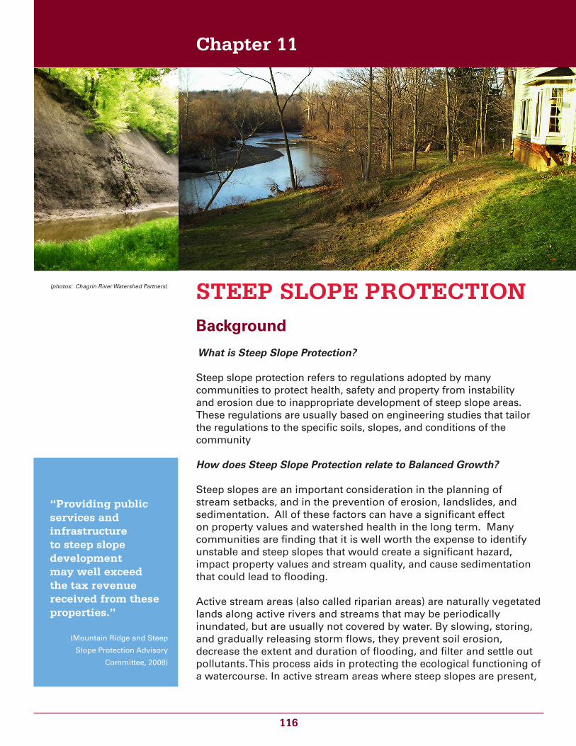
Steep slope protection refers to regulations adopted by many communities to protect health, safety and property from instability and erosion due to inappropriate development of steep slope areas. These regulations are usually based on engineering studies that tailor the regulations to the specific soils, slopes, and conditions of the community
How does Steep Slope Protection relate to Balanced Growth?
Steep slopes are an important consideration in the planning of stream setbacks, and in the prevention of erosion, landslides, and sedimentation. All of these factors can have a significant effect on property values and watershed health in the long term. Many communities are finding that it is well worth the expense to identify unstable and steep slopes that would create a significant hazard, impact property values and stream quality, and cause sedimentation that could lead to flooding.
Active stream areas (also called riparian areas) are naturally vegetated lands along active rivers and streams that may be periodically inundated, but are usually not covered by water. By slowing, storing, and gradually releasing storm flows, they prevent soil erosion, decrease the extent and duration of flooding, and filter and settle out pollutants. This process aids in protecting the ecological functioning of a watercourse. In active stream areas where steep slopes are present,
STEEP SLOPE PROTECTION
Chapter 11
(photos: Chagrin River Watershed Partners)
“Providing public services and infrastructure to steep slope development may well exceed the tax revenue received from these properties.”
(Mountain Ridge and Steep
Slope Protection Advisory
Committee, 2008)
117
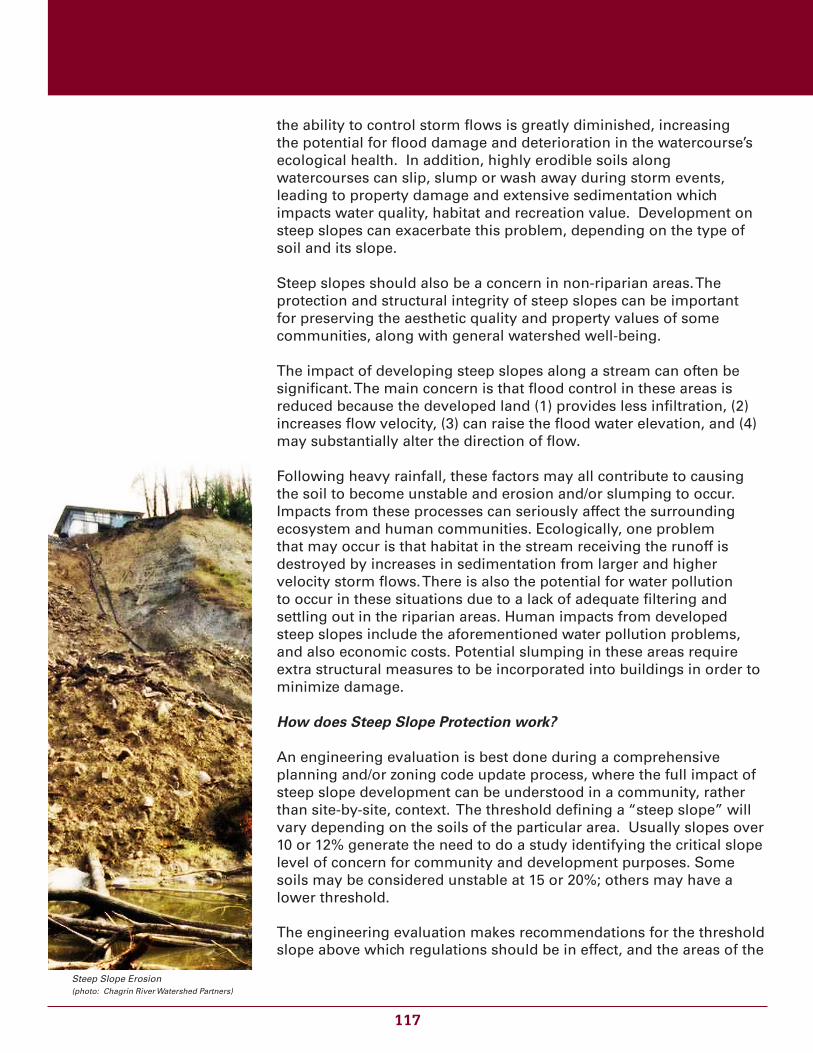
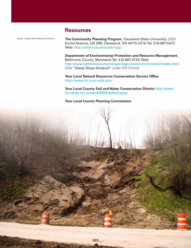
the ability to control storm flows is greatly diminished, increasing the potential for flood damage and deterioration in the watercourse’s ecological health. In addition, highly erodible soils along watercourses can slip, slump or wash away during storm events, leading to property damage and extensive sedimentation which impacts water quality, habitat and recreation value. Development on steep slopes can exacerbate this problem, depending on the type of soil and its slope.
Steep slopes should also be a concern in non-riparian areas. The protection and structural integrity of steep slopes can be important for preserving the aesthetic quality and property values of some communities, along with general watershed well-being.
The impact of developing steep slopes along a stream can often be significant. The main concern is that flood control in these areas is reduced because the developed land (1) provides less infiltration, (2) increases flow velocity, (3) can raise the flood water elevation, and (4) may substantially alter the direction of flow.
Following heavy rainfall, these factors may all contribute to causing the soil to become unstable and erosion and/or slumping to occur. Impacts from these processes can seriously affect the surrounding ecosystem and human communities. Ecologically, one problem that may occur is that habitat in the stream receiving the runoff is destroyed by increases in sedimentation from larger and higher velocity storm flows. There is also the potential for water pollution to occur in these situations due to a lack of adequate filtering and settling out in the riparian areas. Human impacts from developed steep slopes include the aforementioned water pollution problems, and also economic costs. Potential slumping in these areas require extra structural measures to be incorporated into buildings in order to minimize damage.
How does Steep Slope Protection work?
An engineering evaluation is best done during a comprehensive planning and/or zoning code update process, where the full impact of steep slope development can be understood in a community, rather than site-by-site, context. The threshold defining a “steep slope” will vary depending on the soils of the particular area. Usually slopes over 10 or 12% generate the need to do a study identifying the critical slope level of concern for community and development purposes. Some soils may be considered unstable at 15 or 20%; others may have a lower threshold.
The engineering evaluation makes recommendations for the threshold slope above which regulations should be in effect, and the areas of the
Steep Slope Erosion(photo: Chagrin River Watershed Partners)

118
community requiring protection. It also will include recommendations addressing the permitted and prohibited types of development, and specific provisions for construction and design practices within the protected area. Sometimes there are recommendations for multiple areas, or zones, with different regulations, based on differing soil types and steepness of slopes.
Once the engineering study is complete, the recommendations can be worked into a regulation that achieves the purpose of protecting health, safety, and property.
Issues
• Threshold of Instability: In both stream and upland areas, the threshold of instability on a slope (amount of steepness where instability is a concern) is highly variable and dependent on the soil type, vegetation, length and age of the slope.
• Type of Development: The possible impact of erodible slopes is also variable depending on the type of development proposed. A picnic shelter or trail, for example, may be far less impacting on a slope, and less susceptible to damage, than a house foundation. In some soils, the “no-build” threshold may be 20% (ratio of height to width of the slope); in some soils it may be 12%.
• Engineering Assessment: It is important for communities with potential steep slope conditions to have them assessed by a qualified professional engineer as part of a comprehensive plan process, and/or build requirements for such assessments into development regulations, so that appropriate recommendations can be made for protection.
• Coastal Erosion Along Lake Erie: A special case of steep slope protection exists along parts of the shore of Lake Erie in Ohio. This is called the Coastal Erosion Area. A Coastal Erosion Area is a designated land area along the Lake Erie shore that is anticipated to be lost due to Lake Erie related erosion if preventative measures are not taken. The objective of the Coastal Erosion Area program is to reduce the risk of damage to or loss of property, possessions, infrastructure and life due to coastal erosion along Lake Erie. Administered by the Ohio Department of Natural Resources, the Coastal Erosion Area program requires permits for certain work occurring within the designated area. The ODNR can also provide guidance and assistance on technical solutions for dealing with coastal erosion, and information on funding and loan resources for the work involved. There is a Lake Erie Shore Erosion Management Plan with additional guidance and information. For more information, see the Resources section.
Slope erosion can impact community infrastructure.
(photo: Chagrin River Watershed Partners)
119
Recommendations
The development of areas containing steep slopes should generally be discouraged. Conservation and restoration of landscaped slopes should be a high priority for soil and sediment erosion control. Keep-ing a variety of plant types is much more effective than monocultures due to the layers of vegetation that offer higher levels of protection. In situations where conservation is not feasible, development should be done with the intent of minimizing soil disturbances, maximizing re-tention of trees and vegetation, and complementing steep slope char-acter. In addition, the following three options can assist in establishing stream setback widths that provide the same watercourse protection as flatter areas.
Option 1: Permit Based Hillside Protection Zones.
Regulations are passed that limit development activity in areas with slopes between appropriate percentage slopes (for example, between 15% and 30%). In order for permits to be given for disturbances in these areas, additional information including topographic maps, grad-ing and site plans, geotechnical reports, details on future and present site stability, and an erosion and sediment control plan must be sub-mitted for review.
Following this review, the Building Inspector issues permits based on conditions set forth by the Planning Commission. Some activities such as driveways on slopes greater than 10%, embankments above 33%, and excavations above 40% are prohibited, as are projects that may endanger public health, safety, or welfare.
Option 2: Expansion of Stream Setback for Designated Slope.
For many communities, minimum widths are usually established for stream setbacks. In areas in which steep slopes exist within the desig-nated stream setbacks, these widths are expanded. The expansions to the original widths should be determined for the soils involved. Ex-amples are as follows:
• Add 10 feet for slopes between 15-17%
• Add 30 feet for slopes between 18-20%
• Add 50 feet for slopes between 21-23%
• Add 60 feet for slopes between 24-25%
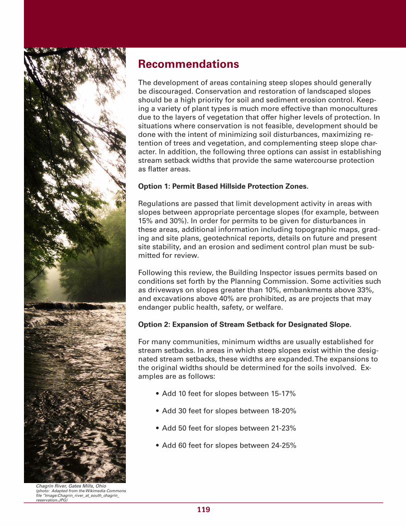
Chagrin River, Gates Mills, Ohio(photo: Adapted from the Wikimedia Commons file “Image:Chagrin_river_at_south_chagrin_reservation.JPG)
120
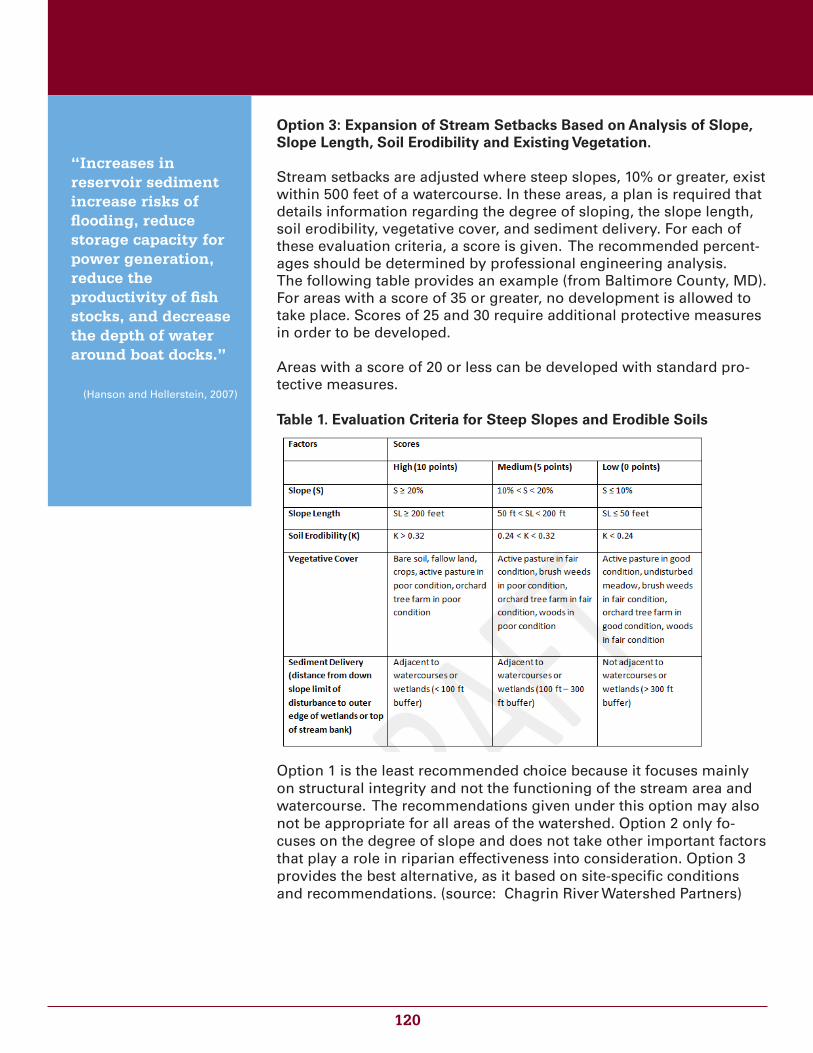
Option 3: Expansion of Stream Setbacks Based on Analysis of Slope, Slope Length, Soil Erodibility and Existing Vegetation.
Stream setbacks are adjusted where steep slopes, 10% or greater, exist within 500 feet of a watercourse. In these areas, a plan is required that details information regarding the degree of sloping, the slope length, soil erodibility, vegetative cover, and sediment delivery. For each of these evaluation criteria, a score is given. The recommended percent-ages should be determined by professional engineering analysis. The following table provides an example (from Baltimore County, MD). For areas with a score of 35 or greater, no development is allowed to take place. Scores of 25 and 30 require additional protective measures in order to be developed.
Areas with a score of 20 or less can be developed with standard pro-tective measures.
Table 1. Evaluation Criteria for Steep Slopes and Erodible Soils
Option 1 is the least recommended choice because it focuses mainly on structural integrity and not the functioning of the stream area and watercourse. The recommendations given under this option may also not be appropriate for all areas of the watershed. Option 2 only fo-cuses on the degree of slope and does not take other important factors that play a role in riparian effectiveness into consideration. Option 3 provides the best alternative, as it based on site-specific conditions and recommendations. (source: Chagrin River Watershed Partners)
“Increases in reservoir sediment increase risks of flooding, reduce storage capacity for power generation, reduce the productivity of fish stocks, and decrease the depth of water around boat docks.”
(Hanson and Hellerstein, 2007)
121
Example Regulations
The following regulations provide examples of the options given above. The regulation examples listed below all take different approaches to protecting steep slopes, with some similarities. In Chagrin Falls, the ordinance supports development on a permit basis, but has requirements for percentages of the parcel that will stay undisturbed by development based on slope grade. Cincinnati enacted a code that established a “Hillside Overlay District”, which included 23 hillside areas that were chosen from a hillside study. These areas require a permit for development, and standards for construction that have the visual aesthetics in mind. The City of Richmond Heights, Ohio, also has an ordinance that designates “Protected Hillside Zones” with a corresponding map which limits development in these areas for safety, environmental health and aesthetic reasons. The ordinance from Baltimore, Maryland, is an example of option 3. The Chagrin Falls, Richmond Heights, Cincinnati, and Bath Township codes are examples from Ohio that illustrate option 1. Chagrin Falls, Ohio: Hillside Protection Ordinance http://www.conwaygreene.com (Click on “Databases” at the top of the page and choose “Municipal Codes” from the drop down menu, then choose “Chagrin Falls, Ohio” in the list of municipalities. Click the “Start Here” button; then in the Chagrin Falls folder to the left, click on the folder entitled“PART ELEVEN - PLANNING AND ZONING CODE“ and then choose chapter 1165 “Hillside Protection” under “TITLE SEVEN.)
Bath Township, Ohio: Steep Slopes Regulations http://www.bathtownship.org(Click on “Zoning” to the left and then choose “ZONING RESOLUTION” at the center of the screen. Click the “ARTICLE IV - Use, Area, Height Regulations”. See Section 412)
Cincinnati Hillside Overlay District: http://library.municode.com/index.aspx?clientId=19996&stateId=35&stateName=Ohio (Click on “TITLE XIV ZONING CODE OF THE CITY OF CINCINNATI” to the left, and then click “Chapter 1433 - HILLSIDE OVERLAY DISTRICTS” at the center of the screen.)
Richmond Heights, Ohio: Protected Hillside Zonehttp://www.conwaygreene.com (Click on “Databases” at the top of the page and choose “Municipal Codes” from the drop down menu, then choose “Richmond Heights, Ohio” in the list of municipalities. Click the “Start Here” button; then in the Richmond Heights folder to the left, click on the folder entitled“PART ELEVEN - PLANNING AND ZONING CODE“ and then choose chapter 1198 “Protected Hillside Zone” under “TITLE SEVEN.)
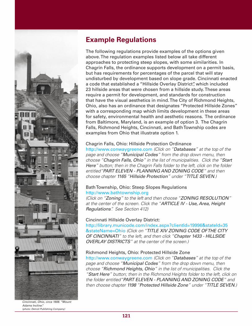
Cincinnati, Ohio, circa 1908. “Mount Adams Incline.” (photo: Detroit Publishing Company)
122
Baltimore County, Maryland: Protection of Water Quality, Streams, Wetlands and Floodplains. http://www.baltimorecountymd.gov/Agencies/environment/eir/waterqua.html (Steep slopes guidelines are contained in Sec. 14-341. “Design Standards for Forest Buffers and Building Setbacks”.)
Refer to the Example Regulations Matrix for a comparison of these regulations. (link)
Use of the Guidance and Example Regulations
This example guidance and/or regulations should never be adopted without careful legal review to assure that they are adapted to fit the authority and needs of the specific governmental body. They may need to be adapted for use by the specific type of local government and must be independently evaluated against potentially applicable federal or state law. The law director/ solicitor, county prosecutor or other appropriate qualified legal counsel should always be con-sulted prior to adoption of any enforceable measures based upon this guidance document to insure compliance and consistency with any applicable state and federal law, and to consider potential legal rami-fications and liability in the implementation of the laws or rules to be adopted. Questions about the models and guidance can be directed to the Ohio Balanced Growth Program.
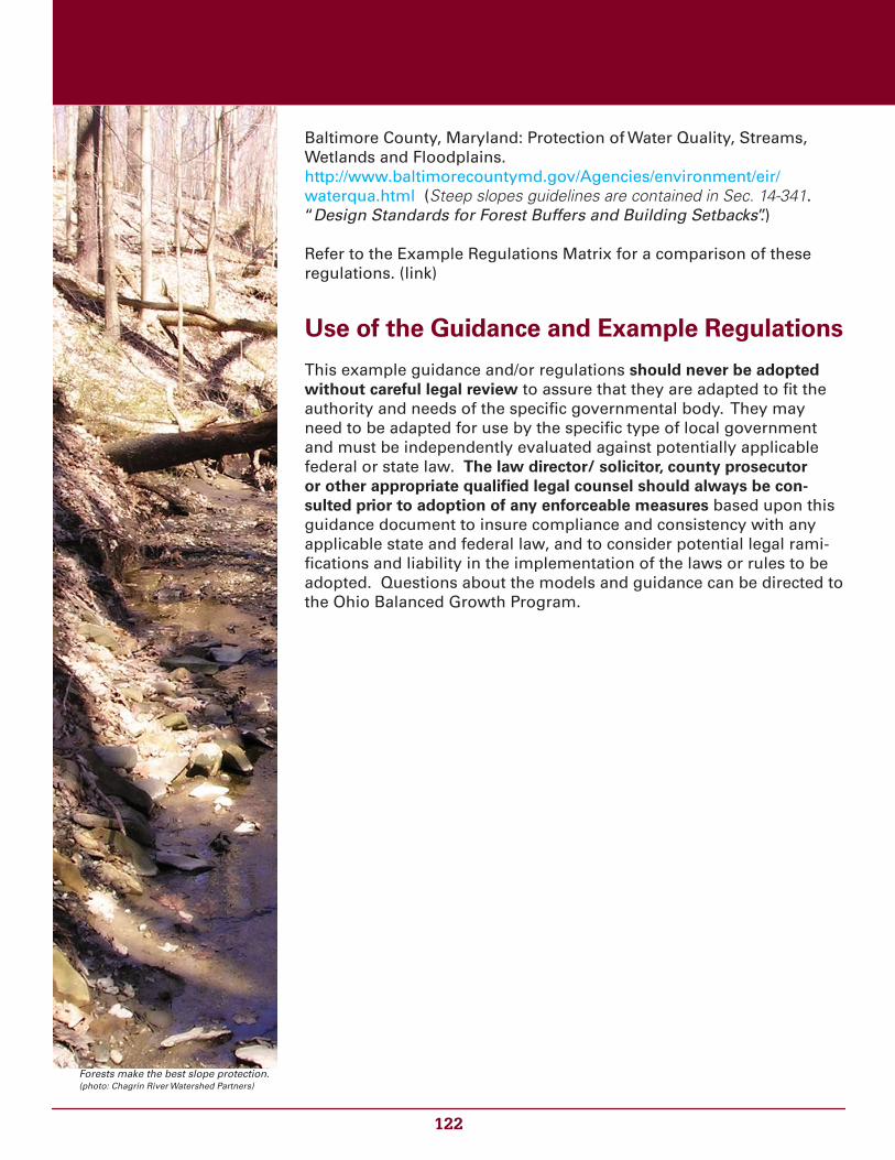
Forests make the best slope protection. (photo: Chagrin River Watershed Partners)
123
Resources
The Community Planning Program, Cleveland State University, 2121 Euclid Avenue, UR 26B, Cleveland, OH 44115-2214; Tel: 216-687-5477; Web: http://urban.csuohio.edu/cpp/
Department of Environmental Protection and Resource Management, Baltimore County, Maryland; Tel: 410-887-3733; Web: http://www.baltimorecountymd.gov/Agencies/environment/eir/index.html(See “Steep Slope Analysis” under EIR Forms)
Your Local Natural Resources Conservation Service Office http://www.oh.nrcs.usda.gov/
Your Local County Soil and Water Conservation District http://www.dnr.state.oh.us/tabid/9093/default.aspx
Your Local County Planning Commission
Ohio Department of Natural ResourcesCoastal Erosion Area information: http://www.ohiodnr.com/Ohio_Coast/RegulatoryHome/CEA_Permits/tabid/9290/Default.aspx_)Lake Erie Shore Erosion Management Plan: http://www.ohiodnr.com/Coastal_Main_Menu/HelpforLandowners/ProgramsforResourceImprovement/LakeErieShoreErosionManagementPlan/tabid/20501/Default.aspx
123
(photo: Chagrin River Watershed Partners)