standards of practice, ethics & code of · pdf filestandards of practice, ethics &...
TRANSCRIPT

STANDARDS OF PRACTICE,ETHICS & CODE OF
CONDUCT
February 20, 2016
This course satisfies the requirementsof 201 KAR 18:192 (3)(2)
Chris R. Gephart, PLS209 Grandview DriveFt. Mitchell, KY [email protected]
1
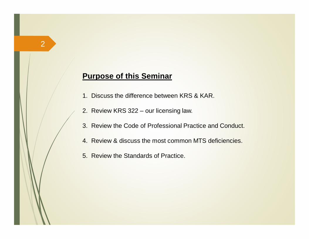
Purpose of this Seminar
1. Discuss the difference between KRS & KAR.
2. Review KRS 322 – our licensing law.
3. Review the Code of Professional Practice and Conduct.
4. Review & discuss the most common MTS deficiencies.
5. Review the Standards of Practice.
2
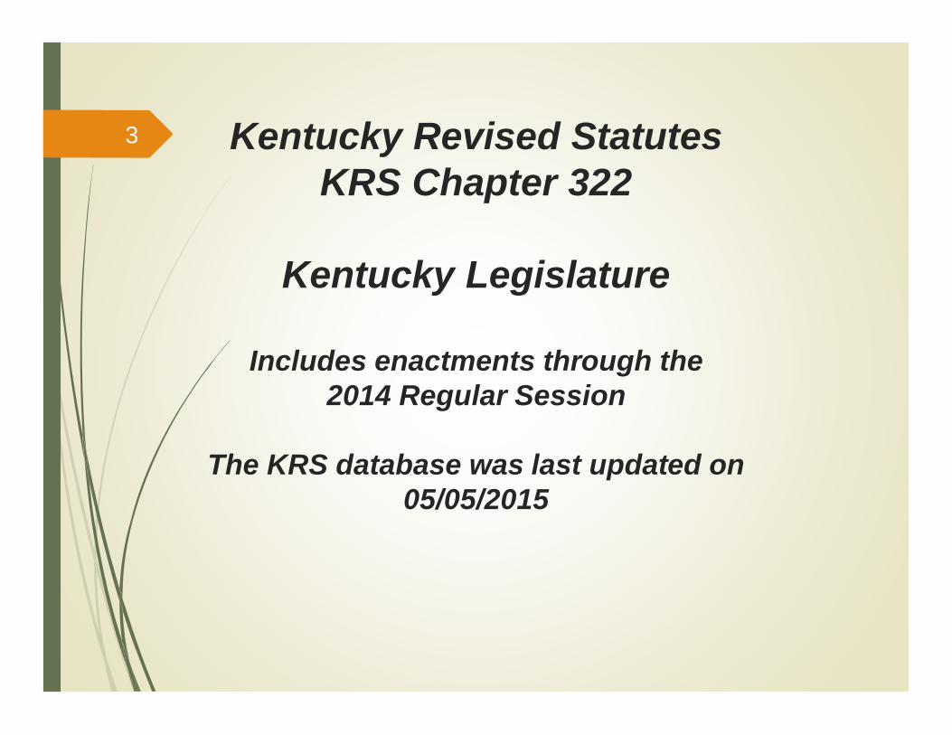
Kentucky Revised StatutesKRS Chapter 322
Kentucky Legislature
Includes enactments through the2014 Regular Session
The KRS database was last updated on05/05/2015
3

Kentucky LegislatureIncludes enactments through the 2014 Regular Session
The KRS database was last updated on 05/05/2015Engineers and Surveyors.010 Definitions for chapter..015 Repealed, 2010..020 Practice of engineering or land surveying without license prohibited..030 Exceptions to KRS 322.020..040 Requirements for licensure as a professional engineer – Education,
experience..045 Requirements for licensure as a professional land surveyor – Education,
experience..047 Alternate requirements for licensure as a professional land surveyor until
June 30, 2011 – Education, experience..050 Requirements for applicants..060 Prerequisites for practice of engineering by a business entity – Permit –
Responsibility for conduct – Disciplinary action – Requirement of boardcertificate or letter for incorporation or for registration as a foreigncorporation.
.070 Application for licenses.
.080 Time, place, scope of examination.
.090 Reexamination.
4

Kentucky LegislatureIncludes enactments through the 2014 Regular Session
The KRS database was last updated on 05/05/2015
Engineers and Surveyors.100 License fees..110 Licensure – Designations – Rights associated with license..120 Licensure by endorsement..130 Repealed, effective January 1, 1999..140 Repealed, effective January 1, 1999..150 Repealed, effective January 1, 1999..160 Renewal of license or permit – Duty of executive director – No renewal
fee for years spent in Armed Forces..170 Replacement and reissuance of certain licenses and permits..180 Grounds for denial of licensure and for disciplinary action..190 Investigation and resolution of complaints – Appeals..200 Repealed, 2010..230 State Board of Licensure for Professional Engineers and Land Surveyors
– Membership – Terms – Oath.240 Qualifications of board members..250 Appointment of board members – Vacancies.260 Officers of board
5
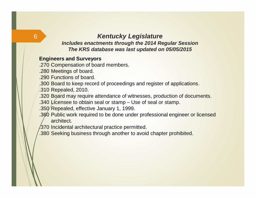
Kentucky LegislatureIncludes enactments through the 2014 Regular Session
The KRS database was last updated on 05/05/2015
Engineers and Surveyors.270 Compensation of board members..280 Meetings of board..290 Functions of board..300 Board to keep record of proceedings and register of applications..310 Repealed, 2010..320 Board may require attendance of witnesses, production of documents..340 Licensee to obtain seal or stamp – Use of seal or stamp..350 Repealed, effective January 1, 1999..360 Public work required to be done under professional engineer or licensed
architect..370 Incidental architectural practice permitted..380 Seeking business through another to avoid chapter prohibited.
6
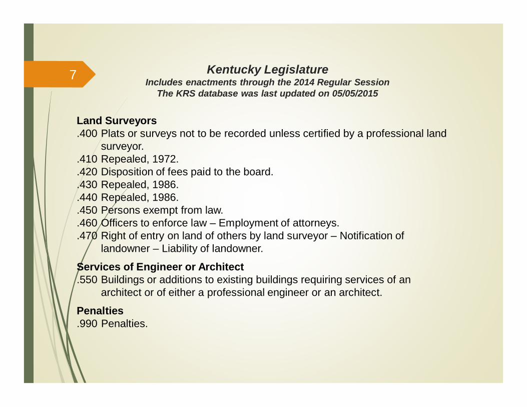
Land Surveyors.400 Plats or surveys not to be recorded unless certified by a professional land
surveyor..410 Repealed, 1972..420 Disposition of fees paid to the board..430 Repealed, 1986..440 Repealed, 1986..450 Persons exempt from law..460 Officers to enforce law – Employment of attorneys..470 Right of entry on land of others by land surveyor – Notification of
landowner – Liability of landowner.
Services of Engineer or Architect.550 Buildings or additions to existing buildings requiring services of an
architect or of either a professional engineer or an architect.
Penalties.990 Penalties.
Kentucky LegislatureIncludes enactments through the 2014 Regular Session
The KRS database was last updated on 05/05/2015
7
Kentucky Revised StatutesKRS Chapter 322
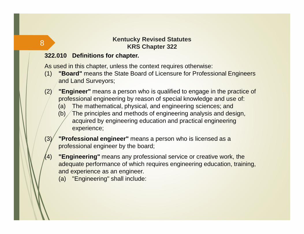
322.010 Definitions for chapter.As used in this chapter, unless the context requires otherwise:(1) "Board" means the State Board of Licensure for Professional Engineers
and Land Surveyors;
(2) "Engineer" means a person who is qualified to engage in the practice ofprofessional engineering by reason of special knowledge and use of:(a) The mathematical, physical, and engineering sciences; and(b) The principles and methods of engineering analysis and design,
acquired by engineering education and practical engineeringexperience;
(3) "Professional engineer" means a person who is licensed as aprofessional engineer by the board;
(4) "Engineering" means any professional service or creative work, theadequate performance of which requires engineering education, training,and experience as an engineer.(a) "Engineering" shall include:
8
Kentucky Revised StatutesKRS Chapter 322
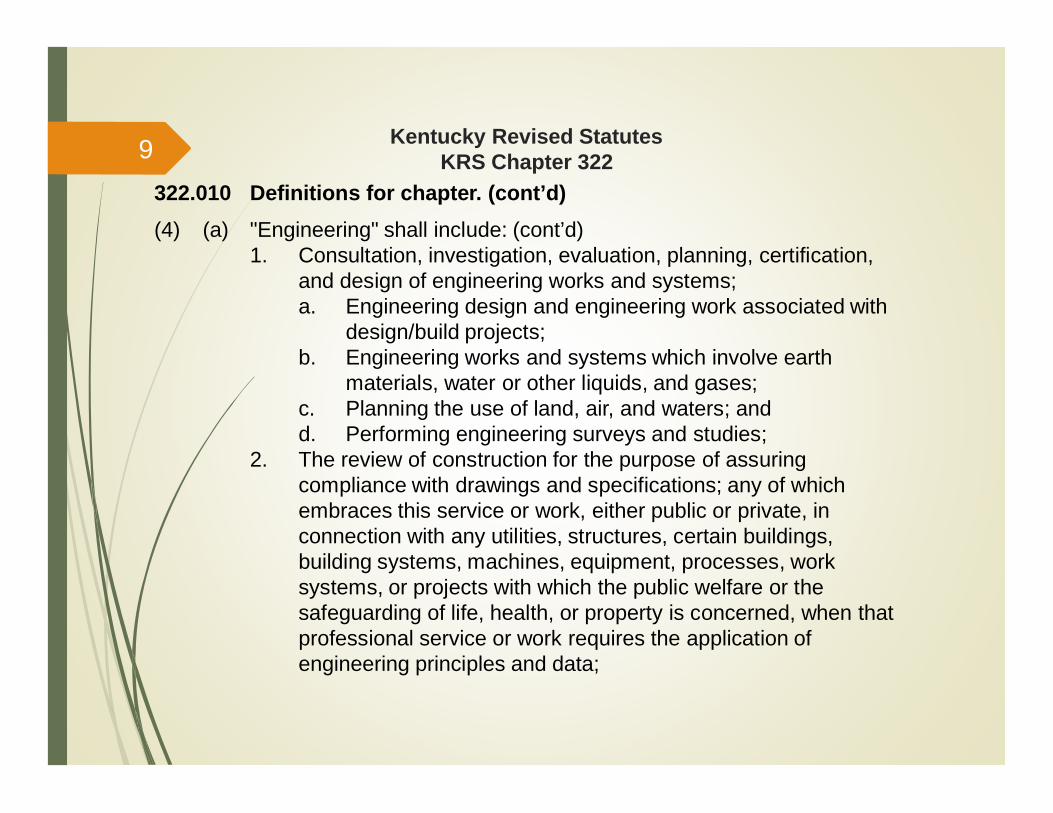
322.010 Definitions for chapter. (cont’d)(4) (a) "Engineering" shall include: (cont’d)
1. Consultation, investigation, evaluation, planning, certification,and design of engineering works and systems;a. Engineering design and engineering work associated with
design/build projects;b. Engineering works and systems which involve earth
materials, water or other liquids, and gases;c. Planning the use of land, air, and waters; andd. Performing engineering surveys and studies;
2. The review of construction for the purpose of assuringcompliance with drawings and specifications; any of whichembraces this service or work, either public or private, inconnection with any utilities, structures, certain buildings,building systems, machines, equipment, processes, worksystems, or projects with which the public welfare or thesafeguarding of life, health, or property is concerned, when thatprofessional service or work requires the application ofengineering principles and data;
9
Kentucky Revised StatutesKRS Chapter 322
322.010 Definitions for chapter. (cont’d)(4) (a) "Engineering" shall include: (cont’d)
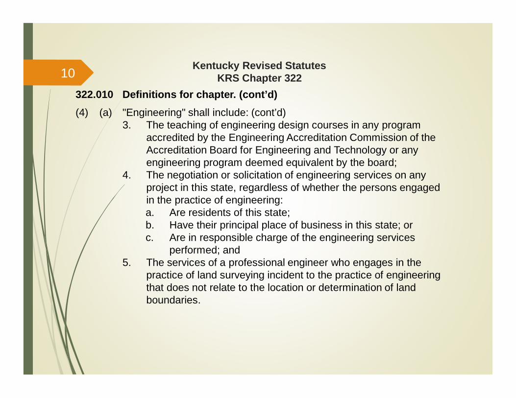
3. The teaching of engineering design courses in any programaccredited by the Engineering Accreditation Commission of theAccreditation Board for Engineering and Technology or anyengineering program deemed equivalent by the board;
4. The negotiation or solicitation of engineering services on anyproject in this state, regardless of whether the persons engagedin the practice of engineering:a. Are residents of this state;b. Have their principal place of business in this state; orc. Are in responsible charge of the engineering services
performed; and5. The services of a professional engineer who engages in the
practice of land surveying incident to the practice of engineeringthat does not relate to the location or determination of landboundaries.
10
Kentucky Revised StatutesKRS Chapter 322
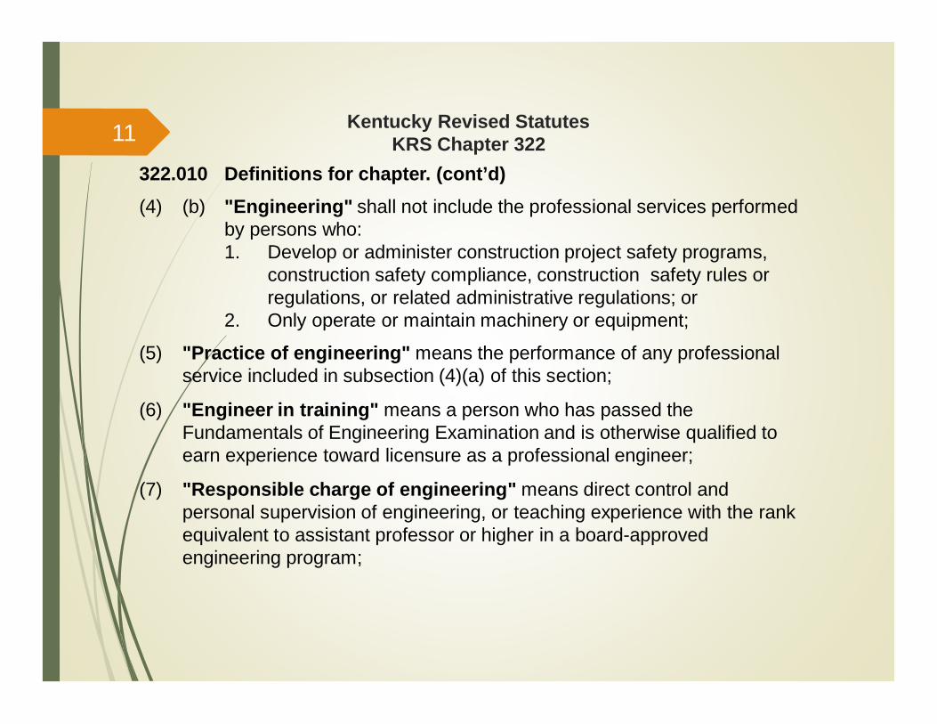
322.010 Definitions for chapter. (cont’d)(4) (b) "Engineering" shall not include the professional services performed
by persons who:1. Develop or administer construction project safety programs,
construction safety compliance, construction safety rules orregulations, or related administrative regulations; or
2. Only operate or maintain machinery or equipment;
(5) "Practice of engineering" means the performance of any professionalservice included in subsection (4)(a) of this section;
(6) "Engineer in training" means a person who has passed theFundamentals of Engineering Examination and is otherwise qualified toearn experience toward licensure as a professional engineer;
(7) "Responsible charge of engineering" means direct control andpersonal supervision of engineering, or teaching experience with the rankequivalent to assistant professor or higher in a board-approvedengineering program;
11
Kentucky Revised StatutesKRS Chapter 322
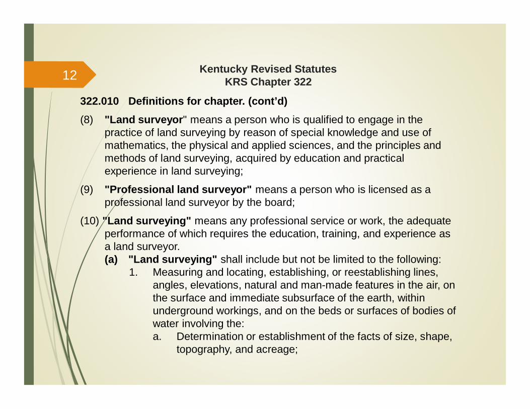
322.010 Definitions for chapter. (cont’d)(8) "Land surveyor" means a person who is qualified to engage in the
practice of land surveying by reason of special knowledge and use ofmathematics, the physical and applied sciences, and the principles andmethods of land surveying, acquired by education and practicalexperience in land surveying;
(9) "Professional land surveyor" means a person who is licensed as aprofessional land surveyor by the board;
(10) "Land surveying" means any professional service or work, the adequateperformance of which requires the education, training, and experience asa land surveyor.(a) "Land surveying" shall include but not be limited to the following:
1. Measuring and locating, establishing, or reestablishing lines,angles, elevations, natural and man-made features in the air, onthe surface and immediate subsurface of the earth, withinunderground workings, and on the beds or surfaces of bodies ofwater involving the:a. Determination or establishment of the facts of size, shape,
topography, and acreage;
12
Kentucky Revised StatutesKRS Chapter 322
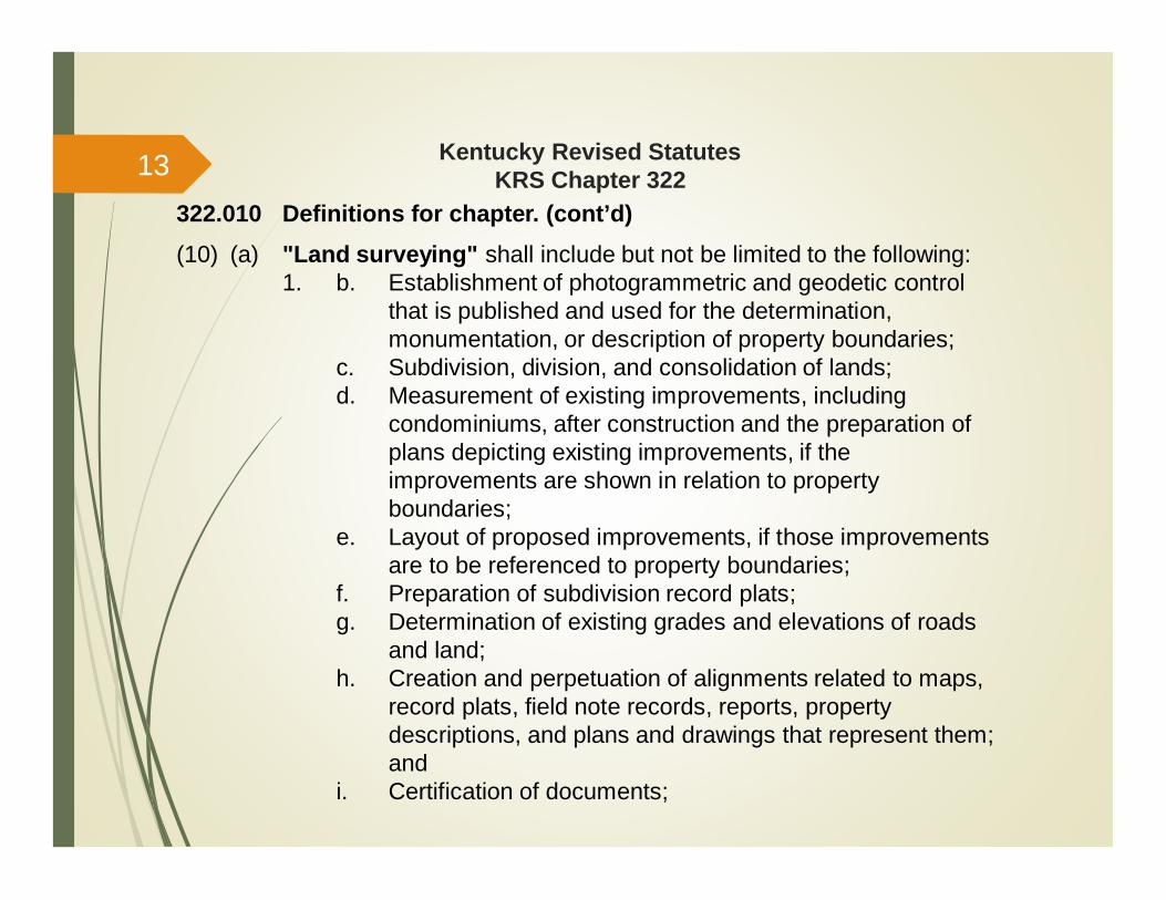
322.010 Definitions for chapter. (cont’d)(10) (a) "Land surveying" shall include but not be limited to the following:
1. b. Establishment of photogrammetric and geodetic controlthat is published and used for the determination,monumentation, or description of property boundaries;
c. Subdivision, division, and consolidation of lands;d. Measurement of existing improvements, including
condominiums, after construction and the preparation ofplans depicting existing improvements, if theimprovements are shown in relation to propertyboundaries;
e. Layout of proposed improvements, if those improvementsare to be referenced to property boundaries;
f. Preparation of subdivision record plats;g. Determination of existing grades and elevations of roads
and land;h. Creation and perpetuation of alignments related to maps,
record plats, field note records, reports, propertydescriptions, and plans and drawings that represent them;and
i. Certification of documents;
13
Kentucky Revised StatutesKRS Chapter 322
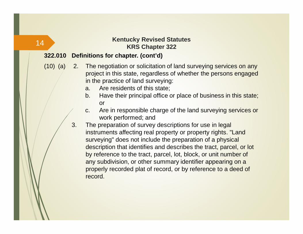
322.010 Definitions for chapter. (cont’d)(10) (a) 2. The negotiation or solicitation of land surveying services on any
project in this state, regardless of whether the persons engagedin the practice of land surveying:a. Are residents of this state;b. Have their principal office or place of business in this state;
orc. Are in responsible charge of the land surveying services or
work performed; and3. The preparation of survey descriptions for use in legal
instruments affecting real property or property rights. "Landsurveying" does not include the preparation of a physicaldescription that identifies and describes the tract, parcel, or lotby reference to the tract, parcel, lot, block, or unit number ofany subdivision, or other summary identifier appearing on aproperly recorded plat of record, or by reference to a deed ofrecord.
14

Kentucky Revised StatutesKRS Chapter 322
322.010 Definitions for chapter. (cont’d)(10) (b) "Land surveying" shall not include:
1. The measurement of crops or agricultural land area under anyagricultural program sponsored by an agency of the federalgovernment or the state of Kentucky;
2. The services of a professional engineer who engages in thepractice of land surveying incident to the practice ofengineering, if the land surveying work does not relate to thelocation or determination of land boundaries; or
3. The design of grades and elevations of roads and land;
(11) "Practice of land surveying" means the performance of anyprofessional service included in subsection (10)(a) of this section;
(12) "Land surveyor in training" means a person who has passed theFundamentals of Land Surveying Examination and is otherwise qualifiedto earn experience toward licensure as a professional land surveyor;
(13) "Responsible charge of land surveying" means direct control andpersonal supervision of land surveying, or teaching experience with therank equivalent to assistant professor or higher in a board-approved landsurveying program;
15
Kentucky Revised StatutesKRS Chapter 322
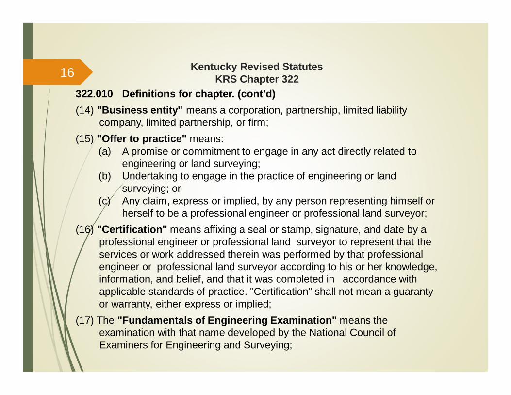
322.010 Definitions for chapter. (cont’d)(14) "Business entity" means a corporation, partnership, limited liability
company, limited partnership, or firm;(15) "Offer to practice" means:
(a) A promise or commitment to engage in any act directly related toengineering or land surveying;
(b) Undertaking to engage in the practice of engineering or landsurveying; or
(c) Any claim, express or implied, by any person representing himself orherself to be a professional engineer or professional land surveyor;
(16) "Certification" means affixing a seal or stamp, signature, and date by aprofessional engineer or professional land surveyor to represent that theservices or work addressed therein was performed by that professionalengineer or professional land surveyor according to his or her knowledge,information, and belief, and that it was completed in accordance withapplicable standards of practice. "Certification" shall not mean a guarantyor warranty, either express or implied;
(17) The "Fundamentals of Engineering Examination" means theexamination with that name developed by the National Council ofExaminers for Engineering and Surveying;
16
Kentucky Revised StatutesKRS Chapter 322
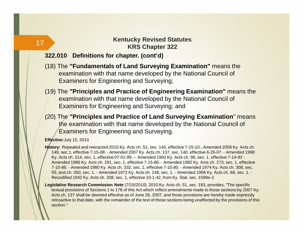
322.010 Definitions for chapter. (cont’d)(18) The "Fundamentals of Land Surveying Examination" means the
examination with that name developed by the National Council ofExaminers for Engineering and Surveying;
(19) The "Principles and Practice of Engineering Examination" means theexamination with that name developed by the National Council ofExaminers for Engineering and Surveying; and
(20) The "Principles and Practice of Land Surveying Examination" meansthe examination with that name developed by the National Council ofExaminers for Engineering and Surveying.
Effective:July 15, 2010
History: Repealed and reenacted 2010 Ky. Acts ch. 51, sec. 140, effective 7-15-10.- Amended 2008 Ky. Acts ch.149, sec.1, effective 7-15-08. - Amended 2007 Ky. Acts ch. 137, sec. 140, effective 6-26-07. - Amended 1998Ky. Acts ch. 214, sec. 1, effective 07-01-99. -- Amended 1992 Ky. Acts ch. 96, sec. 1, effective 7-14-92 -Amended 1986 Ky. Acts ch. 291, sec. 1, effective 7-15-86. - Amended 1982 Ky. Acts ch. 273, sec. 1, effective7-15-86. - Amended 1980 Ky. Acts ch. 332, sec. 1, effective 7-15-80. - Amended 1974 Ky. Acts ch. 308, sec.55; and ch. 350, sec. 1. - Amended 1972 Ky. Acts ch. 148, sec. 1. - Amended 1966 Ky. Acts ch. 68, sec. 1. -Recodified 1942 Ky. Acts ch. 208, sec. 1, effective 10-1-42, from Ky. Stat. sec. 1599e-2.
Legislative Research Commission Note (7/15/2010). 2010 Ky. Acts ch. 51, sec. 183, provides, "The specifictextual provisions of Sections 1 to 178 of this Act which reflect amendments made to those sections by 2007 Ky.Acts ch. 137 shall be deemed effective as of June 26, 2007, and those provisions are hereby made expresslyretroactive to that date, with the remainder of the text of those sections being unaffected by the provisions of thissection."
17
Kentucky Revised StatutesKRS Chapter 322
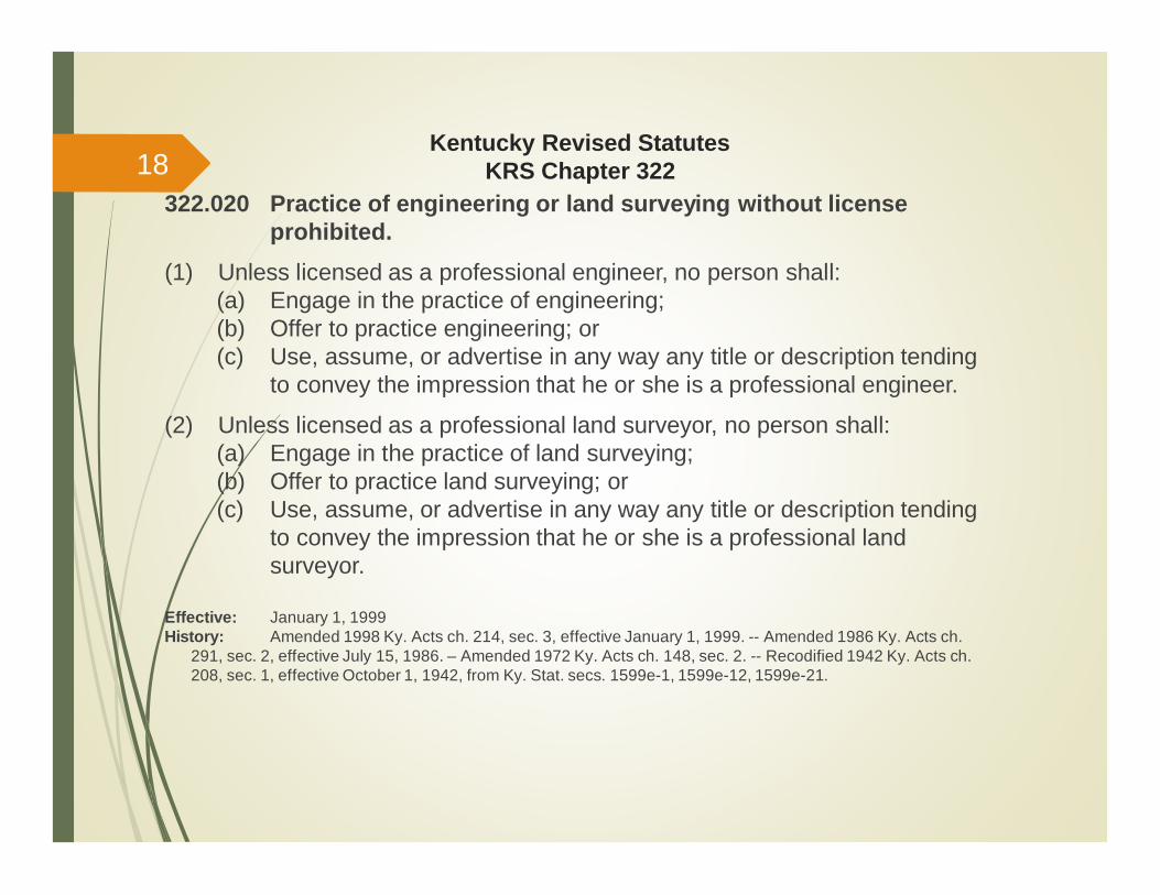
322.020 Practice of engineering or land surveying without licenseprohibited.
(1) Unless licensed as a professional engineer, no person shall:(a) Engage in the practice of engineering;(b) Offer to practice engineering; or(c) Use, assume, or advertise in any way any title or description tending
to convey the impression that he or she is a professional engineer.
(2) Unless licensed as a professional land surveyor, no person shall:(a) Engage in the practice of land surveying;(b) Offer to practice land surveying; or(c) Use, assume, or advertise in any way any title or description tending
to convey the impression that he or she is a professional landsurveyor.
Effective: January 1, 1999History: Amended 1998 Ky. Acts ch. 214, sec. 3, effective January 1, 1999. -- Amended 1986 Ky. Acts ch.
291, sec. 2, effective July 15, 1986. – Amended 1972 Ky. Acts ch. 148, sec. 2. -- Recodified 1942 Ky. Acts ch.208, sec. 1, effective October 1, 1942, from Ky. Stat. secs. 1599e-1, 1599e-12, 1599e-21.
18
Kentucky Revised StatutesKRS Chapter 322
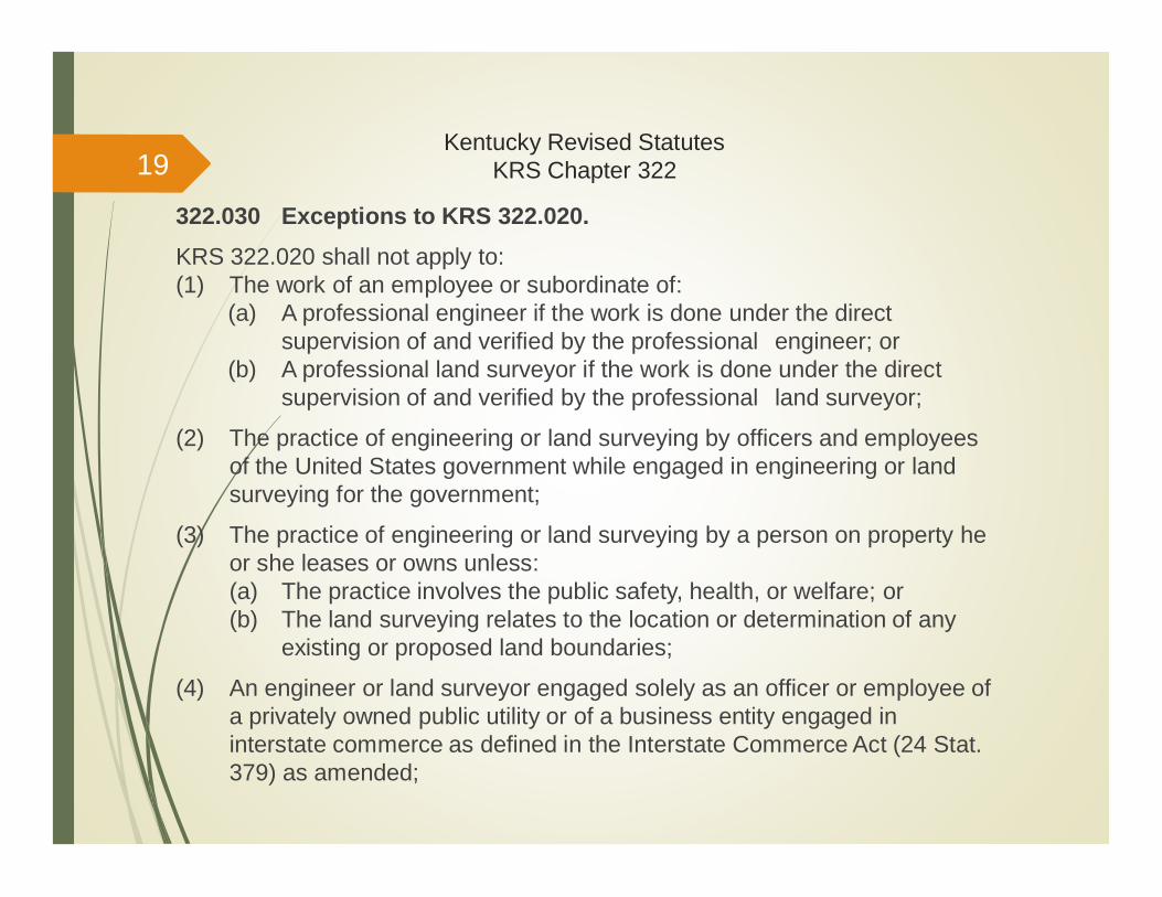
322.030 Exceptions to KRS 322.020.KRS 322.020 shall not apply to:(1) The work of an employee or subordinate of:
(a) A professional engineer if the work is done under the directsupervision of and verified by the professional engineer; or
(b) A professional land surveyor if the work is done under the directsupervision of and verified by the professional land surveyor;
(2) The practice of engineering or land surveying by officers and employeesof the United States government while engaged in engineering or landsurveying for the government;
(3) The practice of engineering or land surveying by a person on property heor she leases or owns unless:(a) The practice involves the public safety, health, or welfare; or(b) The land surveying relates to the location or determination of any
existing or proposed land boundaries;
(4) An engineer or land surveyor engaged solely as an officer or employee ofa privately owned public utility or of a business entity engaged ininterstate commerce as defined in the Interstate Commerce Act (24 Stat.379) as amended;
19
Kentucky Revised StatutesKRS Chapter 322
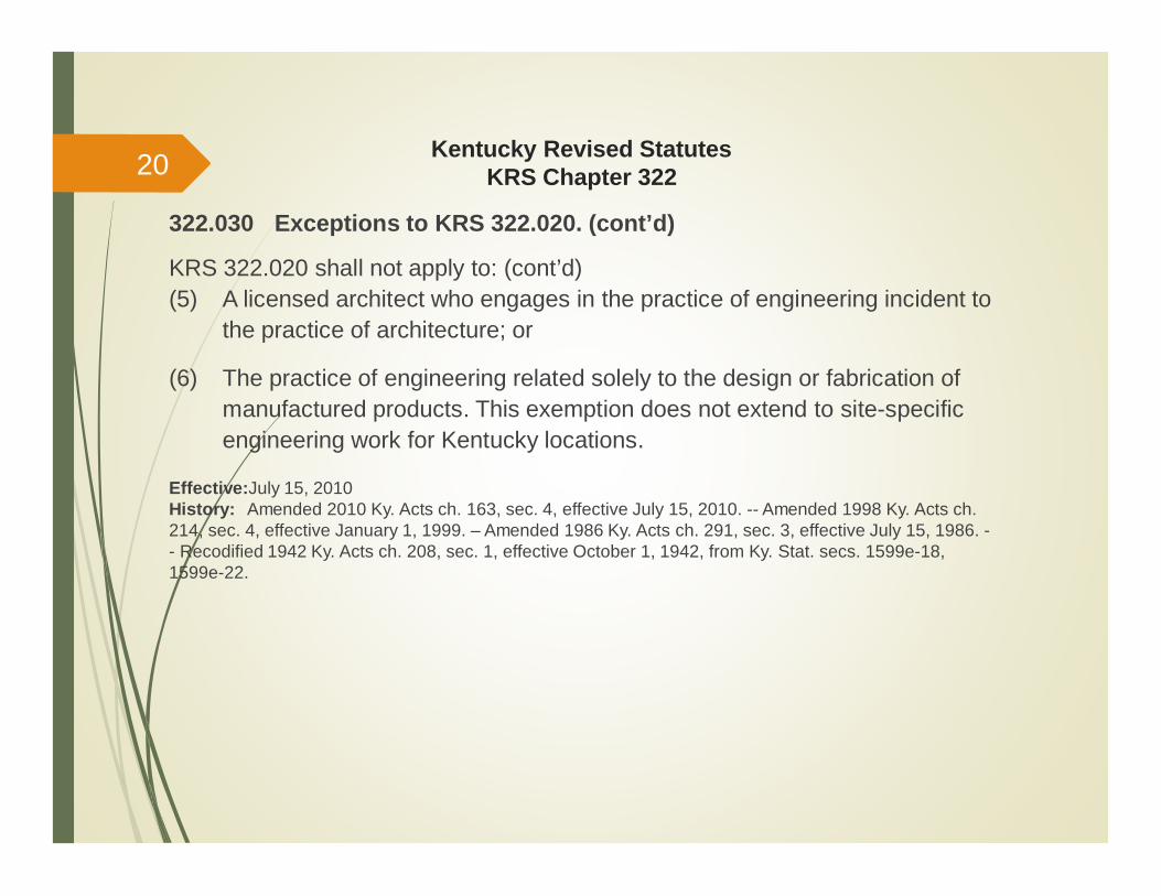
322.030 Exceptions to KRS 322.020. (cont’d)
KRS 322.020 shall not apply to: (cont’d)(5) A licensed architect who engages in the practice of engineering incident to
the practice of architecture; or
(6) The practice of engineering related solely to the design or fabrication ofmanufactured products. This exemption does not extend to site-specificengineering work for Kentucky locations.
Effective:July 15, 2010History: Amended 2010 Ky. Acts ch. 163, sec. 4, effective July 15, 2010. -- Amended 1998 Ky. Acts ch.214, sec. 4, effective January 1, 1999. – Amended 1986 Ky. Acts ch. 291, sec. 3, effective July 15, 1986. -- Recodified 1942 Ky. Acts ch. 208, sec. 1, effective October 1, 1942, from Ky. Stat. secs. 1599e-18,1599e-22.
20
Kentucky Revised StatutesKRS Chapter 322
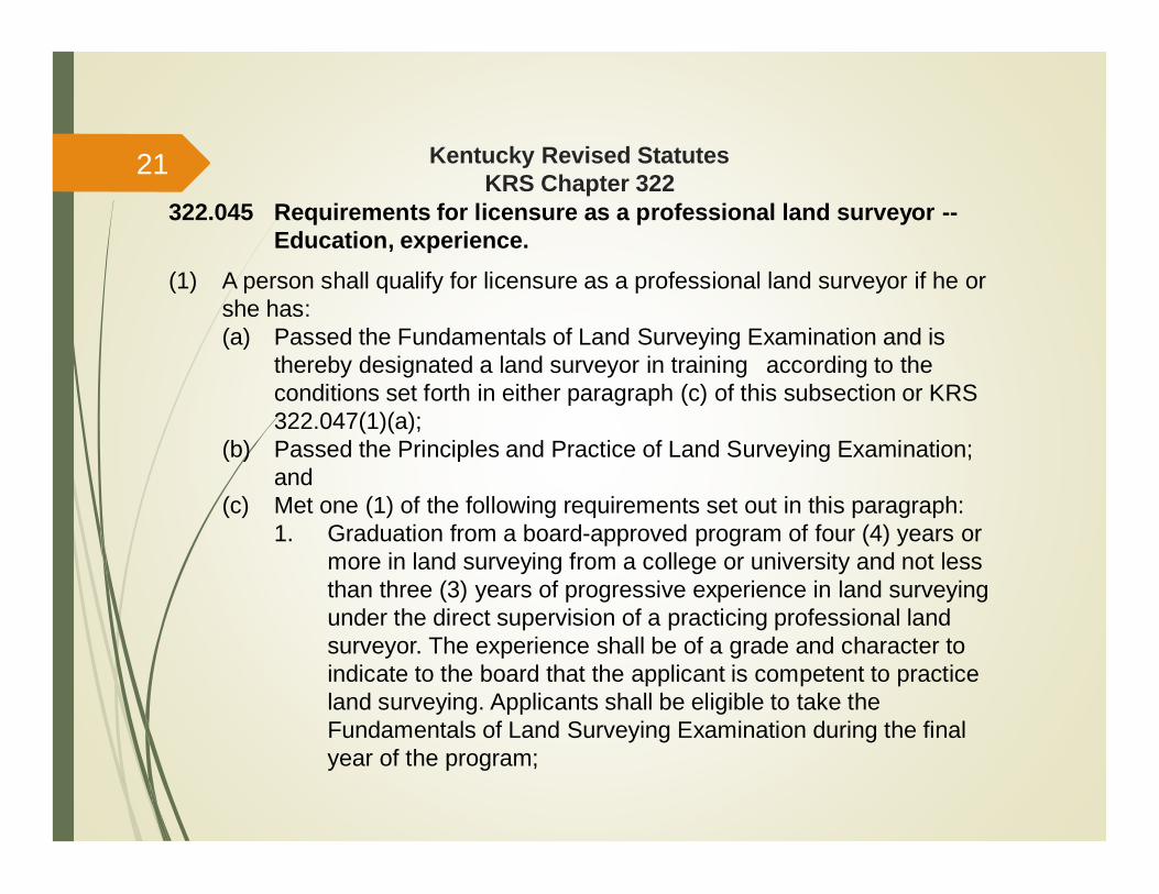
322.045 Requirements for licensure as a professional land surveyor --Education, experience.
(1) A person shall qualify for licensure as a professional land surveyor if he orshe has:(a) Passed the Fundamentals of Land Surveying Examination and is
thereby designated a land surveyor in training according to theconditions set forth in either paragraph (c) of this subsection or KRS322.047(1)(a);
(b) Passed the Principles and Practice of Land Surveying Examination;and
(c) Met one (1) of the following requirements set out in this paragraph:1. Graduation from a board-approved program of four (4) years or
more in land surveying from a college or university and not lessthan three (3) years of progressive experience in land surveyingunder the direct supervision of a practicing professional landsurveyor. The experience shall be of a grade and character toindicate to the board that the applicant is competent to practiceland surveying. Applicants shall be eligible to take theFundamentals of Land Surveying Examination during the finalyear of the program;
21
Kentucky Revised StatutesKRS Chapter 322
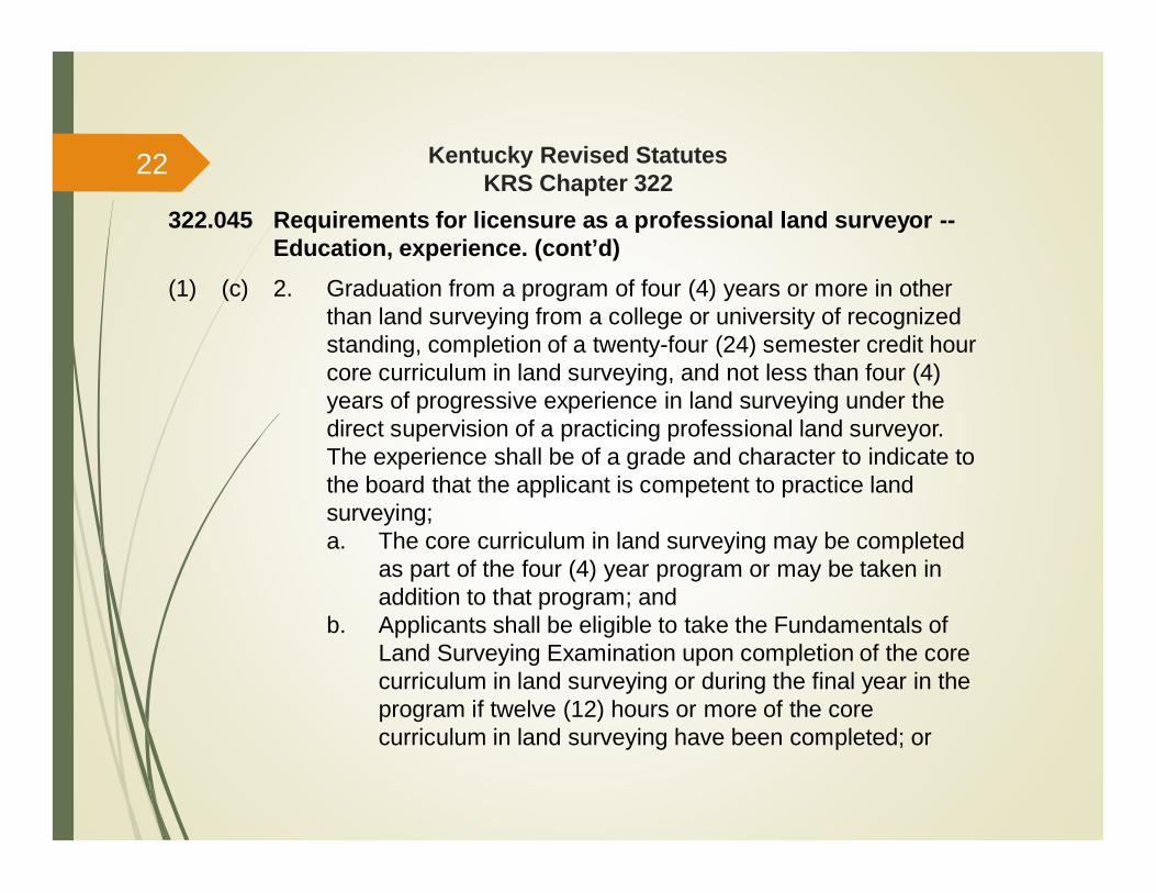
322.045 Requirements for licensure as a professional land surveyor --Education, experience. (cont’d)
(1) (c) 2. Graduation from a program of four (4) years or more in otherthan land surveying from a college or university of recognizedstanding, completion of a twenty-four (24) semester credit hourcore curriculum in land surveying, and not less than four (4)years of progressive experience in land surveying under thedirect supervision of a practicing professional land surveyor.The experience shall be of a grade and character to indicate tothe board that the applicant is competent to practice landsurveying;a. The core curriculum in land surveying may be completed
as part of the four (4) year program or may be taken inaddition to that program; and
b. Applicants shall be eligible to take the Fundamentals ofLand Surveying Examination upon completion of the corecurriculum in land surveying or during the final year in theprogram if twelve (12) hours or more of the corecurriculum in land surveying have been completed; or
22

Kentucky Revised StatutesKRS Chapter 322
322.045 Requirements for licensure as a professional land surveyor --Education, experience. (cont’d)
(1) (c) 3. Graduation from a civil, mining, or agricultural engineeringprogram of four (4) years or more accredited by the EngineeringAccreditation Commission of the Accreditation Board for Engineeringand Technology or any engineering program deemed equivalent bythe board, completion of twelve (12) semester credit hours of thecore curriculum in land surveying referenced in subparagraph 2. ofthis paragraph, and not less than four (4) years of progressiveexperience in land surveying under the direct supervision of apracticing professional land surveyor. The experience shall be of agrade and character to indicate to the board that the applicant iscompetent to practice land surveying;a. The twelve (12) hours of the core curriculum in land surveying
may be completed as part of the engineering program or maybe taken in addition to that program; and
b. Applicants shall be eligible to take the Fundamentals of LandSurveying Examination upon graduation from the engineeringprogram or during the final year in the program if twelve (12)hours of the core curriculum in land surveying have beencompleted.
23
Kentucky Revised StatutesKRS Chapter 322
322.045 Requirements for licensure as a professional land surveyor --Education, experience. (cont’d)
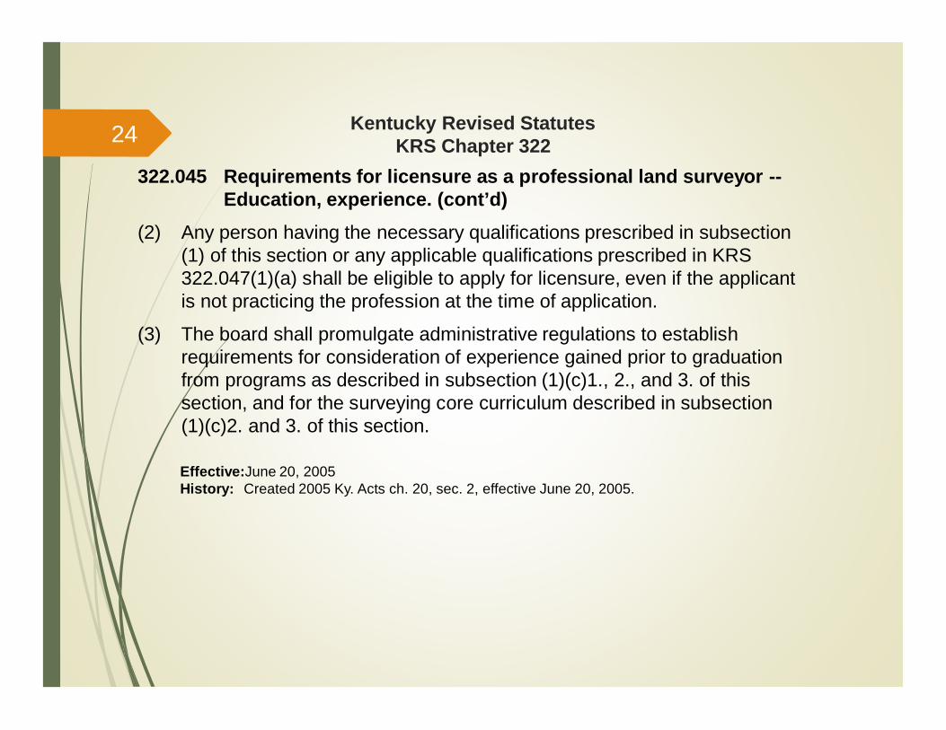
(2) Any person having the necessary qualifications prescribed in subsection(1) of this section or any applicable qualifications prescribed in KRS322.047(1)(a) shall be eligible to apply for licensure, even if the applicantis not practicing the profession at the time of application.
(3) The board shall promulgate administrative regulations to establishrequirements for consideration of experience gained prior to graduationfrom programs as described in subsection (1)(c)1., 2., and 3. of thissection, and for the surveying core curriculum described in subsection(1)(c)2. and 3. of this section.
Effective:June 20, 2005History: Created 2005 Ky. Acts ch. 20, sec. 2, effective June 20, 2005.
24

Kentucky Revised StatutesKRS Chapter 322
322.060 Prerequisites for practice of engineering by a business entity --Permit -- Responsibility for conduct -- Disciplinary action –Requirement of board certificate or letter for incorporation orfor registration as a foreign corporation.
(1) (a) A business entity shall not engage in the practice of engineering inthis state unless:1. At least one (1) of its principals or officers, or a designated
employee, is a professional engineer who is in responsiblecharge of the engineering work;
2. The professional engineer in responsible charge is located atthe Kentucky office, if one is maintained; and
3. The board has issued a permit to the business entity.(b) To apply for a permit, a business entity offering engineering services
in this state shall file with the board, on a form prescribed by theboard:1. The names and addresses of all principals and officers;2. The license number of principals, officers, and employees who
are professional engineers in responsible charge of thebusiness entity's practice of engineering in this state; and
3. A list of locations of all offices in this state at which the businessentity offers professional engineering services.
25
Kentucky Revised StatutesKRS Chapter 322
322.060 Prerequisites for practice of engineering by a business entity --Permit -- Responsibility for conduct -- Disciplinary action –Requirement of board certificate or letter for incorporation orfor registration as a foreign corporation. (cont’d)
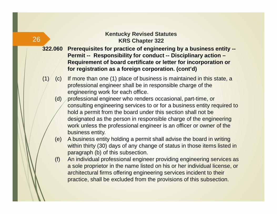
(1) (c) If more than one (1) place of business is maintained in this state, aprofessional engineer shall be in responsible charge of theengineering work for each office.
(d) professional engineer who renders occasional, part-time, orconsulting engineering services to or for a business entity required tohold a permit from the board under this section shall not bedesignated as the person in responsible charge of the engineeringwork unless the professional engineer is an officer or owner of thebusiness entity.
(e) A business entity holding a permit shall advise the board in writingwithin thirty (30) days of any change of status in those items listed inparagraph (b) of this subsection.
(f) An individual professional engineer providing engineering services asa sole proprietor in the name listed on his or her individual license, orarchitectural firms offering engineering services incident to theirpractice, shall be excluded from the provisions of this subsection.
26
Kentucky Revised StatutesKRS Chapter 322
322.060 Prerequisites for practice of engineering by a business entity --Permit -- Responsibility for conduct -- Disciplinary action –Requirement of board certificate or letter for incorporation orfor registration as a foreign corporation. (cont’d)
(2) (a) A business entity shall not engage in the practice of land surveying inthis state unless:1. At least one (1) of its principals or officers, or a designated
employee, is a professional land surveyor in direct responsiblecharge of the land surveying work;
2. The professional land surveyor in responsible charge is locatedat the Kentucky office, if one is maintained; and
3. The board has issued a permit to the business entity.(b) To apply for a permit, a business entity offering land surveying
services in this state shall file with the board, on a form prescribed bythe board:1. The names and addresses of all principals and officers;2. The license numbers of the principals, officers, and employees
who are professional land surveyors in responsible charge ofthe practice of land surveying in this state; and
3. A list of locations of all offices in this state at which the businessentity offers professional land surveying services.
27

Kentucky Revised StatutesKRS Chapter 322
322.060 Prerequisites for practice of engineering by a business entity --Permit -- Responsibility for conduct -- Disciplinary action –Requirement of board certificate or letter for incorporation orfor registration as a foreign corporation. (cont’d)
(2) (c) If more than one (1) place of business is maintained in this state, aprofessional land surveyor shall be in responsible charge of the landsurveying work for each office.
(d) A professional land surveyor who renders occasional, part-time, orconsulting services to or for a business entity required to hold apermit from the board under this section shall not be designated asthe person in responsible charge of the land surveying work unlessthe professional land surveyor is an officer or owner of the businessentity.
(e) A business entity holding a permit shall advise the board in writingwithin thirty (30) days of any change of status.
(f) An individual professional land surveyor providing land surveyingservices as a sole proprietor in the name listed on his or herindividual license shall be excluded from the provisions of thissubsection.
28
Kentucky Revised StatutesKRS Chapter 322
322.060 Prerequisites for practice of engineering by a business entity --Permit -- Responsibility for conduct -- Disciplinary action –Requirement of board certificate or letter for incorporation orfor registration as a foreign corporation. (cont’d)
(3) (a) After a business entity applies for a professional engineering orprofessional land surveying permit and pays the proper fees, theboard shall review the application and, upon approval, shall issue apermit.
(b) The board may suspend, revoke, or refuse to issue a permit forviolation of the code of professional practice and conduct.
(c) The expiration date and renewal period for each permit and renewalprocedures shall be established by administrative regulationspromulgated by the board.
(4) (a) No business entity shall be relieved of responsibility for the conductor acts of its agent, employees, or officers by reason of itscompliance with this section.
(b) No individual practicing professional engineering or professional landsurveying shall be relieved of the responsibility for professionalservices performed by reason of the individual's employment orrelationship with a business entity holding a permit under thissection.
29
Kentucky Revised StatutesKRS Chapter 322
322.060 Prerequisites for practice of engineering by a business entity -Permit - Responsibility for conduct - Disciplinary action -Requirement of board certificate or letter for incorporation orfor registration as a foreign corporation. (cont’d)
(5) Disciplinary action against a business entity holding a permit under thissection shall be administered in the same manner and on the samegrounds as disciplinary action against an individual professional engineeror professional land surveyor.
(6) The Secretary of State shall not accept articles of incorporation, articles oforganization, statement of qualification or certificate of limited partnershipor an application for a certificate of authority to transact business as aforeign corporation, limited liability company or limited partnership or astatement of foreign qualification from a business entity which includes inits name or, among objects for which it is established, any of the words,"engineer,“ "engineering," "surveyor," "surveying," "land surveying," or anymodification or derivation thereof, unless the filing with the Secretary ofState includes a certificate or letter from the board.
30
Kentucky Revised StatutesKRS Chapter 322
322.060 Prerequisites for practice of engineering by a business entity -Permit - Responsibility for conduct - Disciplinary action -Requirement of board certificate or letter for incorporation orfor registration as a foreign corporation. (cont’d)
Effective:July 15, 2010
History: Repealed and reenacted 2010 Ky. Acts ch. 51, sec.141, eff. 7-15-10; and amended 2010 Ky.Acts ch. 163, sec.6, eff. 7-15-10- Amended 2007 Ky. Acts ch.137, sec.141, eff. 6-26-07,- Amended 1998Ky. Acts ch. 214, sec.7, eff. 1-1-99.- Amended 1992 Ky. Acts ch. 96, sec 2, eff. 7-14-92.- Amended 1986Ky. Acts ch. 291, sec.6, eff. 7-15-86.-Recodified 1942 Ky. Acts ch. 208, sec.1, eff. 10-1-42, from Ky. Stat.sec. 1599e-12.
Legislative Research Commission Note (7/15/2010). This section was amended by 2010 Ky. Acts ch.163, and repealed and reenacted by 2010 Ky Acts ch. 51. Pursuant to Section 184 of Acts ch. 51, it wasthe intent of the General Assembly that the repeal and reenactment not serve to void the amendment, andthese Acts do not appear to be in conflict; therefore, they have been codified together.
31
Kentucky Revised StatutesKRS Chapter 322
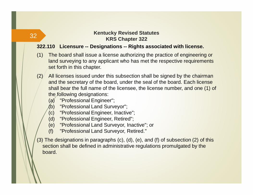
322.110 Licensure -- Designations -- Rights associated with license.(1) The board shall issue a license authorizing the practice of engineering or
land surveying to any applicant who has met the respective requirementsset forth in this chapter.
(2) All licenses issued under this subsection shall be signed by the chairmanand the secretary of the board, under the seal of the board. Each licenseshall bear the full name of the licensee, the license number, and one (1) ofthe following designations:(a) "Professional Engineer";(b) "Professional Land Surveyor";(c) "Professional Engineer, Inactive";(d) "Professional Engineer, Retired";(e) "Professional Land Surveyor, Inactive"; or(f) "Professional Land Surveyor, Retired."
(3) The designations in paragraphs (c), (d), (e), and (f) of subsection (2) of thissection shall be defined in administrative regulations promulgated by theboard.
32
Kentucky Revised StatutesKRS Chapter 322
322.110 Licensure -- Designations -- Rights associated with license.(cont’d)
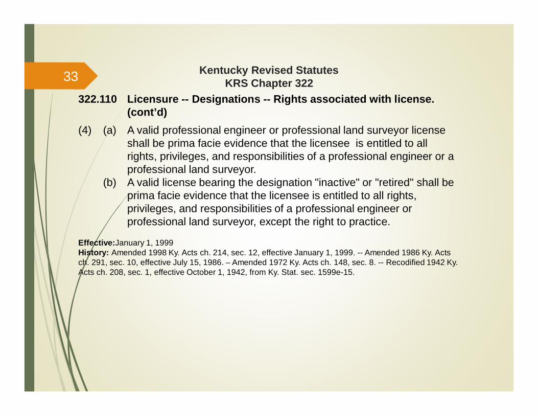
(4) (a) A valid professional engineer or professional land surveyor licenseshall be prima facie evidence that the licensee is entitled to allrights, privileges, and responsibilities of a professional engineer or aprofessional land surveyor.
(b) A valid license bearing the designation "inactive" or "retired" shall beprima facie evidence that the licensee is entitled to all rights,privileges, and responsibilities of a professional engineer orprofessional land surveyor, except the right to practice.
Effective:January 1, 1999History: Amended 1998 Ky. Acts ch. 214, sec. 12, effective January 1, 1999. -- Amended 1986 Ky. Actsch. 291, sec. 10, effective July 15, 1986. – Amended 1972 Ky. Acts ch. 148, sec. 8. -- Recodified 1942 Ky.Acts ch. 208, sec. 1, effective October 1, 1942, from Ky. Stat. sec. 1599e-15.
33
Kentucky Revised StatutesKRS Chapter 322
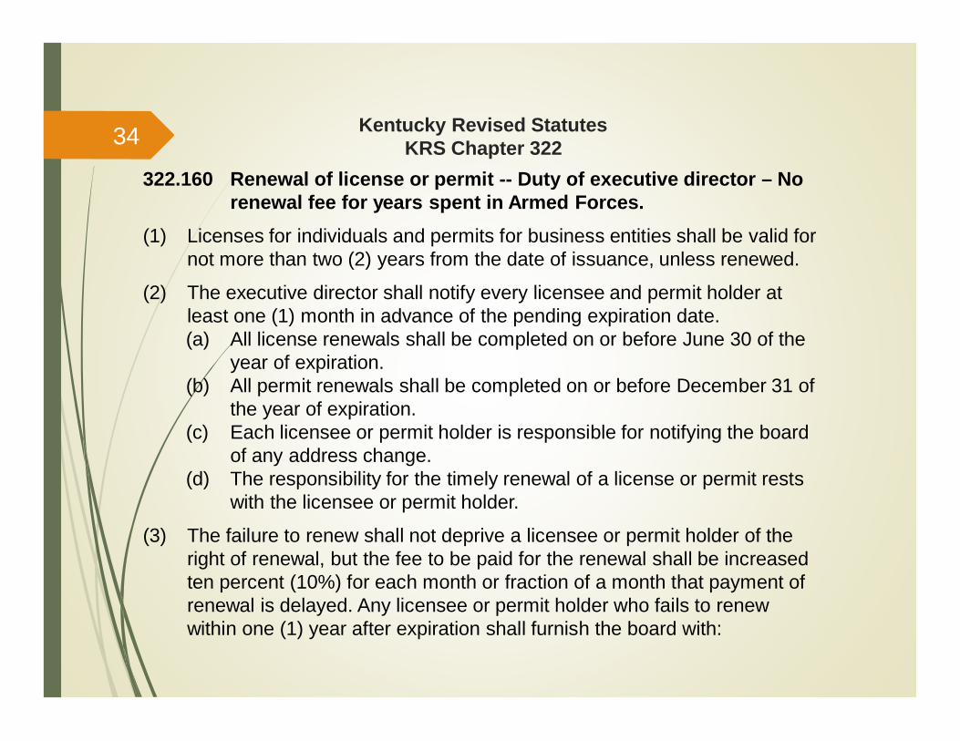
322.160 Renewal of license or permit -- Duty of executive director – Norenewal fee for years spent in Armed Forces.
(1) Licenses for individuals and permits for business entities shall be valid fornot more than two (2) years from the date of issuance, unless renewed.
(2) The executive director shall notify every licensee and permit holder atleast one (1) month in advance of the pending expiration date.(a) All license renewals shall be completed on or before June 30 of the
year of expiration.(b) All permit renewals shall be completed on or before December 31 of
the year of expiration.(c) Each licensee or permit holder is responsible for notifying the board
of any address change.(d) The responsibility for the timely renewal of a license or permit rests
with the licensee or permit holder.
(3) The failure to renew shall not deprive a licensee or permit holder of theright of renewal, but the fee to be paid for the renewal shall be increasedten percent (10%) for each month or fraction of a month that payment ofrenewal is delayed. Any licensee or permit holder who fails to renewwithin one (1) year after expiration shall furnish the board with:
34
Kentucky Revised StatutesKRS Chapter 322
322.160 Renewal of license or permit -- Duty of executive director – Norenewal fee for years spent in Armed Forces.
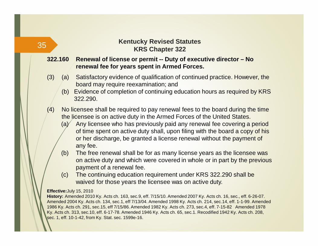
(3) (a) Satisfactory evidence of qualification of continued practice. However, theboard may require reexamination; and
(b) Evidence of completion of continuing education hours as required by KRS322.290.
(4) No licensee shall be required to pay renewal fees to the board during the timethe licensee is on active duty in the Armed Forces of the United States.(a) Any licensee who has previously paid any renewal fee covering a period
of time spent on active duty shall, upon filing with the board a copy of hisor her discharge, be granted a license renewal without the payment ofany fee.
(b) The free renewal shall be for as many license years as the licensee wason active duty and which were covered in whole or in part by the previouspayment of a renewal fee.
(c) The continuing education requirement under KRS 322.290 shall bewaived for those years the licensee was on active duty.
Effective:July 15, 2010History: Amended 2010 Ky. Acts ch. 163, sec.9, eff. 7/15/10. Amended 2007 Ky. Acts ch. 16, sec., eff. 6-26-07.Amended 2004 Ky. Acts ch. 134, sec.1, eff 7/13/04. Amended 1998 Ky. Acts ch. 214, sec.14, eff. 1-1-99. Amended1986 Ky. Acts ch. 291, sec.15, eff 7/15/86. Amended 1982 Ky. Acts ch. 273, sec.4, eff. 7-15-82 Amended 1978Ky. Acts ch. 313, sec.10, eff. 6-17-78. Amended 1946 Ky. Acts ch. 65, sec.1. Recodified 1942 Ky. Acts ch. 208,sec. 1, eff. 10-1-42, from Ky. Stat. sec. 1599e-16.
35

Kentucky Revised StatutesKRS Chapter 322
322.190 Investigation and resolution of complaints -- Appeals.Any person or organization, including the board upon its own volition, may filewith the executive director of the board a written complaint alleging violation ofany provision of this chapter. The executive director shall cause the complaint tobe investigated.
(1) If the investigation reveals that the alleged violation did occur but was notof a serious nature, the board may issue a written admonishment to thelicensee. A copy of the admonishment shall be placed in the permanent fileof the licensee. The licensee shall have the right to file a response to theadmonishment within thirty (30) days of its receipt and to have theresponse placed in the permanent licensure file. The licensee mayalternatively, within thirty (30) days of the receipt, file a request for hearingwith the board. Upon receipt of this request, the board shall set aside thewritten admonishment and set the matter for hearing in accordance withthe provisions of KRS Chapter 13B.
36
Kentucky Revised StatutesKRS Chapter 322
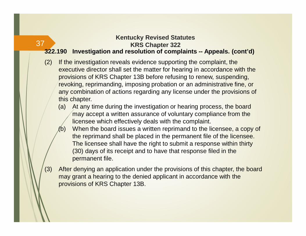
322.190 Investigation and resolution of complaints -- Appeals. (cont’d)(2) If the investigation reveals evidence supporting the complaint, the
executive director shall set the matter for hearing in accordance with theprovisions of KRS Chapter 13B before refusing to renew, suspending,revoking, reprimanding, imposing probation or an administrative fine, orany combination of actions regarding any license under the provisions ofthis chapter.(a) At any time during the investigation or hearing process, the board
may accept a written assurance of voluntary compliance from thelicensee which effectively deals with the complaint.
(b) When the board issues a written reprimand to the licensee, a copy ofthe reprimand shall be placed in the permanent file of the licensee.The licensee shall have the right to submit a response within thirty(30) days of its receipt and to have that response filed in thepermanent file.
(3) After denying an application under the provisions of this chapter, the boardmay grant a hearing to the denied applicant in accordance with theprovisions of KRS Chapter 13B.
37
Kentucky Revised StatutesKRS Chapter 322
322.190 Investigation and resolution of complaints -- Appeals. (cont’d)
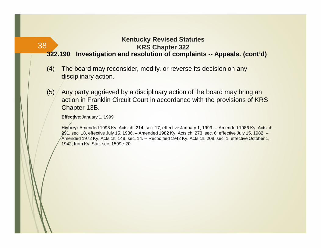
(4) The board may reconsider, modify, or reverse its decision on anydisciplinary action.
(5) Any party aggrieved by a disciplinary action of the board may bring anaction in Franklin Circuit Court in accordance with the provisions of KRSChapter 13B.Effective:January 1, 1999
History: Amended 1998 Ky. Acts ch. 214, sec. 17, effective January 1, 1999. -- Amended 1986 Ky. Acts ch.291, sec. 18, effective July 15, 1986. – Amended 1982 Ky. Acts ch. 273, sec. 6, effective July 15, 1982. --Amended 1972 Ky. Acts ch. 148, sec. 14. -- Recodified 1942 Ky. Acts ch. 208, sec. 1, effective October 1,1942, from Ky. Stat. sec. 1599e-20.
38
Kentucky Revised StatutesKRS Chapter 322
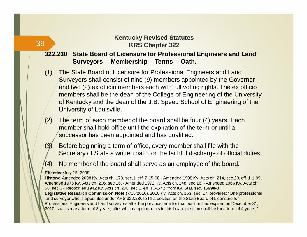
322.230 State Board of Licensure for Professional Engineers and LandSurveyors -- Membership -- Terms -- Oath.
(1) The State Board of Licensure for Professional Engineers and LandSurveyors shall consist of nine (9) members appointed by the Governorand two (2) ex officio members each with full voting rights. The ex officiomembers shall be the dean of the College of Engineering of the Universityof Kentucky and the dean of the J.B. Speed School of Engineering of theUniversity of Louisville.
(2) The term of each member of the board shall be four (4) years. Eachmember shall hold office until the expiration of the term or until asuccessor has been appointed and has qualified.
(3) Before beginning a term of office, every member shall file with theSecretary of State a written oath for the faithful discharge of official duties.
(4) No member of the board shall serve as an employee of the board.Effective:July 15, 2008History: Amended 2008 Ky. Acts ch. 173, sec.1, eff. 7-15-08.- Amended 1998 Ky. Acts ch. 214, sec.20, eff. 1-1-99.Amended 1976 Ky. Acts ch. 206, sec.16. - Amended 1972 Ky. Acts ch. 148, sec.16. - Amended 1966 Ky. Acts ch.68, sec.3 - Recodified 1942 Ky. Acts ch. 208, sec.1, eff. 10-1-42, from Ky. Stat. sec. 1599e-3.Legislative Research Commission Note (7/15/2010). 2010 Ky. Acts ch. 163, sec. 17, provides: "One professionalland surveyor who is appointed under KRS 322.230 to fill a position on the State Board of Licensure forProfessional Engineers and Land surveyors after the previous term for that position has expired on December 31,2010, shall serve a term of 3 years, after which appointments to this board position shall be for a term of 4 years."
39

Kentucky Revised StatutesKRS Chapter 322
322.240 Qualifications of board members.(1) Each appointed member of the board shall:
(a) Be a citizen of the United States;(b) Have been a resident of this state for at least five (5) years; and(c) Be a resident of this state at the time of appointment and for the term
of the appointment.(2) One (1) member of the board shall be a citizen at large who is not
associated with or financially interested in the practice of engineering orland surveying.
(3) Eight (8) members of the board shall be a professional engineer or aprofessional land surveyor engaged in the respective practice for at leasttwelve (12) years and shall have been in responsible charge of importantengineering or land surveying work for at least five (5) years.(a) At least five (5) members of the board shall be professional
engineers licensed in Kentucky for at least four (4) years prior to thedate of their appointment;
(b) At least three (3) members of the board shall be professional landsurveyors licensed in Kentucky for at least four (4) years prior to thedate of their appointment; and
40
Kentucky Revised StatutesKRS Chapter 322
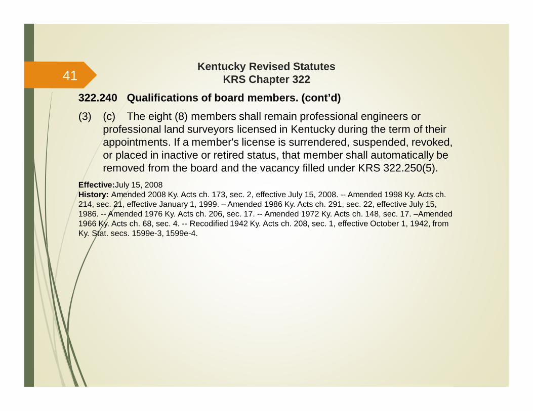
322.240 Qualifications of board members. (cont’d)(3) (c) The eight (8) members shall remain professional engineers or
professional land surveyors licensed in Kentucky during the term of theirappointments. If a member's license is surrendered, suspended, revoked,or placed in inactive or retired status, that member shall automatically beremoved from the board and the vacancy filled under KRS 322.250(5).
Effective:July 15, 2008History: Amended 2008 Ky. Acts ch. 173, sec. 2, effective July 15, 2008. -- Amended 1998 Ky. Acts ch.214, sec. 21, effective January 1, 1999. – Amended 1986 Ky. Acts ch. 291, sec. 22, effective July 15,1986. -- Amended 1976 Ky. Acts ch. 206, sec. 17. -- Amended 1972 Ky. Acts ch. 148, sec. 17. –Amended1966 Ky. Acts ch. 68, sec. 4. -- Recodified 1942 Ky. Acts ch. 208, sec. 1, effective October 1, 1942, fromKy. Stat. secs. 1599e-3, 1599e-4.
41
Kentucky Revised StatutesKRS Chapter 322
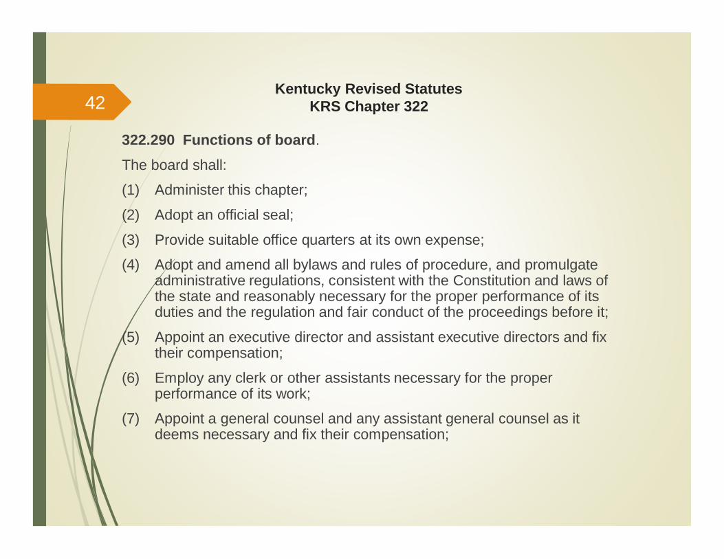
322.290 Functions of board.
The board shall:
(1) Administer this chapter;
(2) Adopt an official seal;
(3) Provide suitable office quarters at its own expense;
(4) Adopt and amend all bylaws and rules of procedure, and promulgateadministrative regulations, consistent with the Constitution and laws ofthe state and reasonably necessary for the proper performance of itsduties and the regulation and fair conduct of the proceedings before it;
(5) Appoint an executive director and assistant executive directors and fixtheir compensation;
(6) Employ any clerk or other assistants necessary for the properperformance of its work;
(7) Appoint a general counsel and any assistant general counsel as itdeems necessary and fix their compensation;
42

Kentucky Revised StatutesKRS Chapter 322
322.290 Functions of board (cont’d).
(8) Appoint investigatory personnel, as it deems necessary, and fix theircompensation;
(9) Appoint committees of licensees, as it deems necessary, to reviewissues before the board and make recommendations to the board;
(10) Make expenditures, as it deems necessary, for any purpose that itconsiders reasonably necessary for the proper performance of itsduties, including paying the expenses of the board’s delegates tonational conventions of and membership dues to the National Councilof Examiners for Engineering and Surveying or other affiliated nationalboards or societies;
(11) Adopt and promulgate by administrative regulation a code ofprofessional practice and conduct, which shall be based upon generallyrecognized principles of professional ethical conduct and binding uponpersons licensed under this chapter. A code of professional practiceand conduct shall be made known to all licensees and applicants andshall include but not be limited to the following objectives;
43

Kentucky Revised StatutesKRS Chapter 322
322.290 Functions of board (cont’d).(11) (a) The protection of the public health, safety, and welfare;
(b) The maintenance of standards of objectivity, truthfulness, andreliability in public statements;(c) The avoidance of conflicts of interest;(d) The prohibition of solicitation or acceptance of engineering or landsurveying work on any basis other than qualifications for the workoffered;(e) The prohibition of association with any person engaging in illegal
or dishonest activities; and(f) The limitation of professional service to the area of competence ofthe licensee;
(Enables 201 KAR 18:142 – Code of Professional Practice and Conduct)
(12) Adopt appropriate standards of practice;(Enables 201 KAR 18:150 – Standards of Practice)
(13) Promulgate administrative regulations in accordance with KRS Chapter13A to establish rules for the use of stamps, seals, and signatures inelectronic transactions;
44
Kentucky Revised StatutesKRS Chapter 322
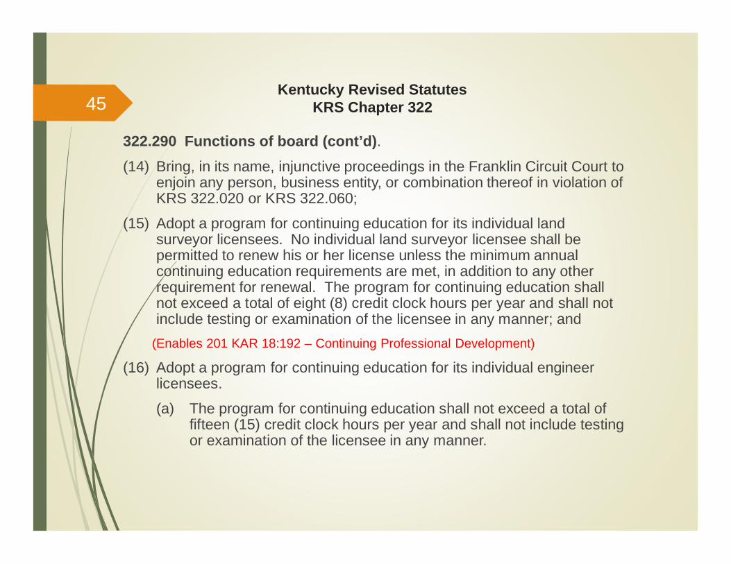
322.290 Functions of board (cont’d).(14) Bring, in its name, injunctive proceedings in the Franklin Circuit Court to
enjoin any person, business entity, or combination thereof in violation ofKRS 322.020 or KRS 322.060;
(15) Adopt a program for continuing education for its individual landsurveyor licensees. No individual land surveyor licensee shall bepermitted to renew his or her license unless the minimum annualcontinuing education requirements are met, in addition to any otherrequirement for renewal. The program for continuing education shallnot exceed a total of eight (8) credit clock hours per year and shall notinclude testing or examination of the licensee in any manner; and
(Enables 201 KAR 18:192 – Continuing Professional Development)
(16) Adopt a program for continuing education for its individual engineerlicensees.
(a) The program for continuing education shall not exceed a total offifteen (15) credit clock hours per year and shall not include testingor examination of the licensee in any manner.
45
Kentucky Revised StatutesKRS Chapter 322
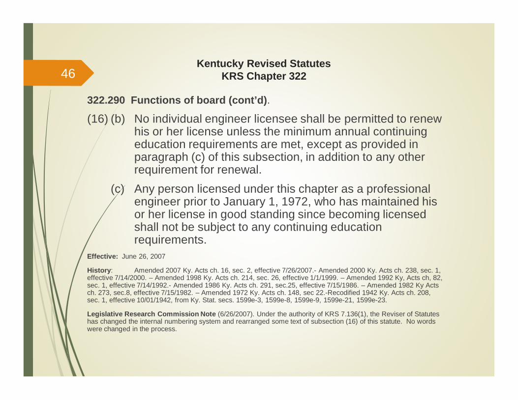
322.290 Functions of board (cont’d).
(16) (b) No individual engineer licensee shall be permitted to renewhis or her license unless the minimum annual continuingeducation requirements are met, except as provided inparagraph (c) of this subsection, in addition to any otherrequirement for renewal.
(c) Any person licensed under this chapter as a professionalengineer prior to January 1, 1972, who has maintained hisor her license in good standing since becoming licensedshall not be subject to any continuing educationrequirements.
Effective: June 26, 2007
History: Amended 2007 Ky. Acts ch. 16, sec. 2, effective 7/26/2007.- Amended 2000 Ky. Acts ch. 238, sec. 1,effective 7/14/2000. – Amended 1998 Ky. Acts ch. 214, sec. 26, effective 1/1/1999. – Amended 1992 Ky, Acts ch, 82,sec. 1, effective 7/14/1992.- Amended 1986 Ky. Acts ch. 291, sec.25, effective 7/15/1986. – Amended 1982 Ky Actsch. 273, sec.8, effective 7/15/1982. – Amended 1972 Ky. Acts ch. 148, sec 22.-Recodified 1942 Ky. Acts ch. 208,sec. 1, effective 10/01/1942, from Ky. Stat. secs. 1599e-3, 1599e-8, 1599e-9, 1599e-21, 1599e-23.
Legislative Research Commission Note (6/26/2007). Under the authority of KRS 7.136(1), the Reviser of Statuteshas changed the internal numbering system and rearranged some text of subsection (16) of this statute. No wordswere changed in the process.
46
Kentucky Revised StatutesKRS Chapter 322
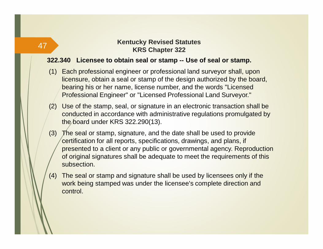
322.340 Licensee to obtain seal or stamp -- Use of seal or stamp.(1) Each professional engineer or professional land surveyor shall, upon
licensure, obtain a seal or stamp of the design authorized by the board,bearing his or her name, license number, and the words "LicensedProfessional Engineer" or "Licensed Professional Land Surveyor."
(2) Use of the stamp, seal, or signature in an electronic transaction shall beconducted in accordance with administrative regulations promulgated bythe board under KRS 322.290(13).
(3) The seal or stamp, signature, and the date shall be used to providecertification for all reports, specifications, drawings, and plans, ifpresented to a client or any public or governmental agency. Reproductionof original signatures shall be adequate to meet the requirements of thissubsection.
(4) The seal or stamp and signature shall be used by licensees only if thework being stamped was under the licensee's complete direction andcontrol.
47
Kentucky Revised StatutesKRS Chapter 322
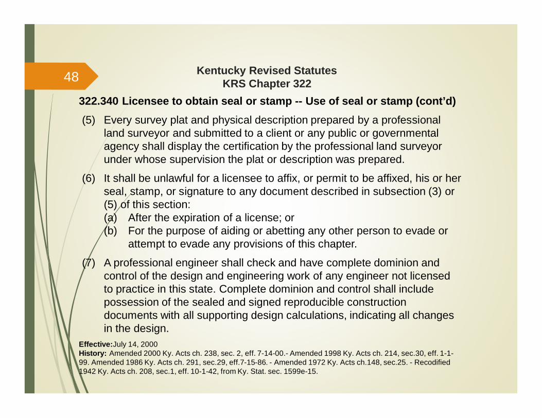
322.340 Licensee to obtain seal or stamp -- Use of seal or stamp (cont’d)(5) Every survey plat and physical description prepared by a professional
land surveyor and submitted to a client or any public or governmentalagency shall display the certification by the professional land surveyorunder whose supervision the plat or description was prepared.
(6) It shall be unlawful for a licensee to affix, or permit to be affixed, his or herseal, stamp, or signature to any document described in subsection (3) or(5) of this section:(a) After the expiration of a license; or(b) For the purpose of aiding or abetting any other person to evade or
attempt to evade any provisions of this chapter.
(7) A professional engineer shall check and have complete dominion andcontrol of the design and engineering work of any engineer not licensedto practice in this state. Complete dominion and control shall includepossession of the sealed and signed reproducible constructiondocuments with all supporting design calculations, indicating all changesin the design.
Effective:July 14, 2000History: Amended 2000 Ky. Acts ch. 238, sec. 2, eff. 7-14-00.- Amended 1998 Ky. Acts ch. 214, sec.30, eff. 1-1-99. Amended 1986 Ky. Acts ch. 291, sec.29, eff.7-15-86. - Amended 1972 Ky. Acts ch.148, sec.25. - Recodified1942 Ky. Acts ch. 208, sec.1, eff. 10-1-42, from Ky. Stat. sec. 1599e-15.
48
Kentucky Revised StatutesKRS Chapter 322
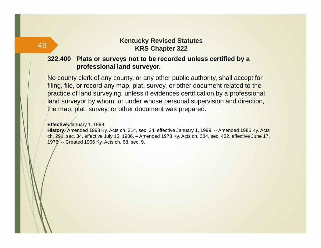
322.400 Plats or surveys not to be recorded unless certified by aprofessional land surveyor.
No county clerk of any county, or any other public authority, shall accept forfiling, file, or record any map, plat, survey, or other document related to thepractice of land surveying, unless it evidences certification by a professionalland surveyor by whom, or under whose personal supervision and direction,the map, plat, survey, or other document was prepared.
Effective:January 1, 1999History: Amended 1998 Ky. Acts ch. 214, sec. 34, effective January 1, 1999. -- Amended 1986 Ky. Actsch. 291, sec. 34, effective July 15, 1986. – Amended 1978 Ky. Acts ch. 384, sec. 482, effective June 17,1978. -- Created 1966 Ky. Acts ch. 68, sec. 9.
49
Kentucky Revised StatutesKRS Chapter 322
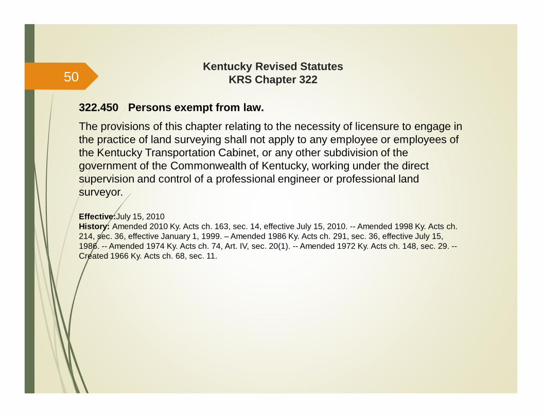
322.450 Persons exempt from law.The provisions of this chapter relating to the necessity of licensure to engage inthe practice of land surveying shall not apply to any employee or employees ofthe Kentucky Transportation Cabinet, or any other subdivision of thegovernment of the Commonwealth of Kentucky, working under the directsupervision and control of a professional engineer or professional landsurveyor.
Effective:July 15, 2010History: Amended 2010 Ky. Acts ch. 163, sec. 14, effective July 15, 2010. -- Amended 1998 Ky. Acts ch.214, sec. 36, effective January 1, 1999. – Amended 1986 Ky. Acts ch. 291, sec. 36, effective July 15,1986. -- Amended 1974 Ky. Acts ch. 74, Art. IV, sec. 20(1). -- Amended 1972 Ky. Acts ch. 148, sec. 29. --Created 1966 Ky. Acts ch. 68, sec. 11.
50
Kentucky Revised StatutesKRS Chapter 322
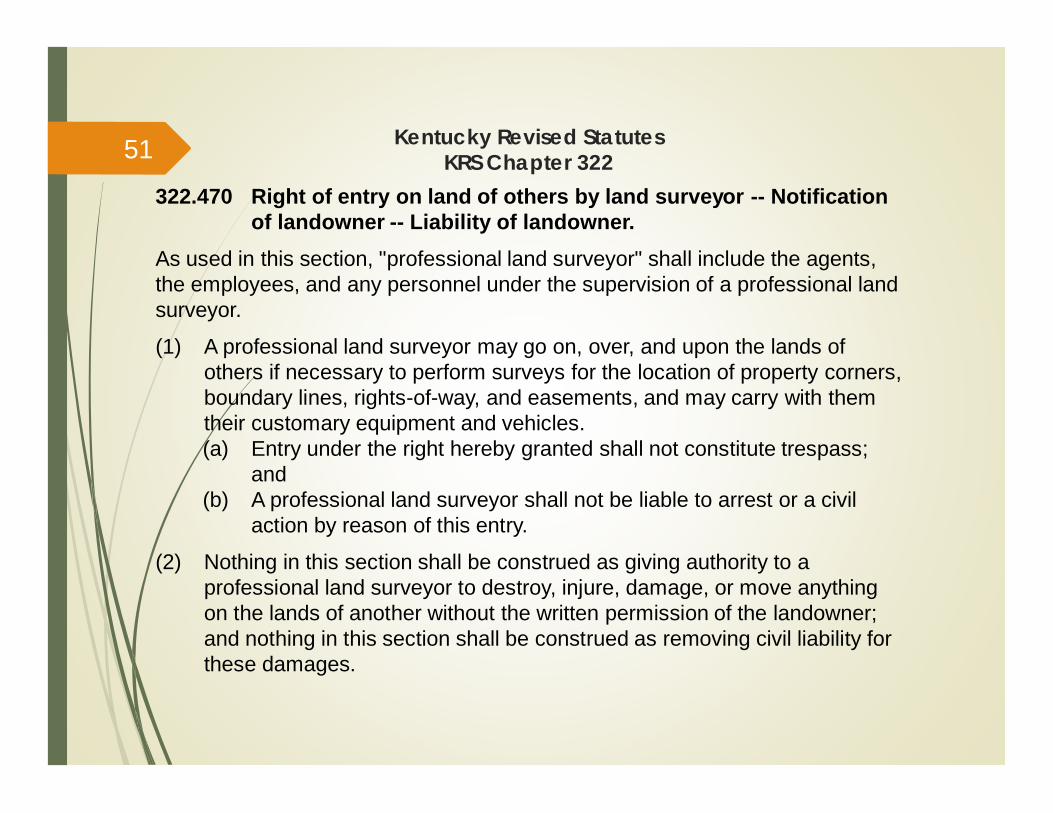
322.470 Right of entry on land of others by land surveyor -- Notificationof landowner -- Liability of landowner.
As used in this section, "professional land surveyor" shall include the agents,the employees, and any personnel under the supervision of a professional landsurveyor.
(1) A professional land surveyor may go on, over, and upon the lands ofothers if necessary to perform surveys for the location of property corners,boundary lines, rights-of-way, and easements, and may carry with themtheir customary equipment and vehicles.(a) Entry under the right hereby granted shall not constitute trespass;
and(b) A professional land surveyor shall not be liable to arrest or a civil
action by reason of this entry.
(2) Nothing in this section shall be construed as giving authority to aprofessional land surveyor to destroy, injure, damage, or move anythingon the lands of another without the written permission of the landowner;and nothing in this section shall be construed as removing civil liability forthese damages.
51
Kentucky Revised StatutesKRS Chapter 322
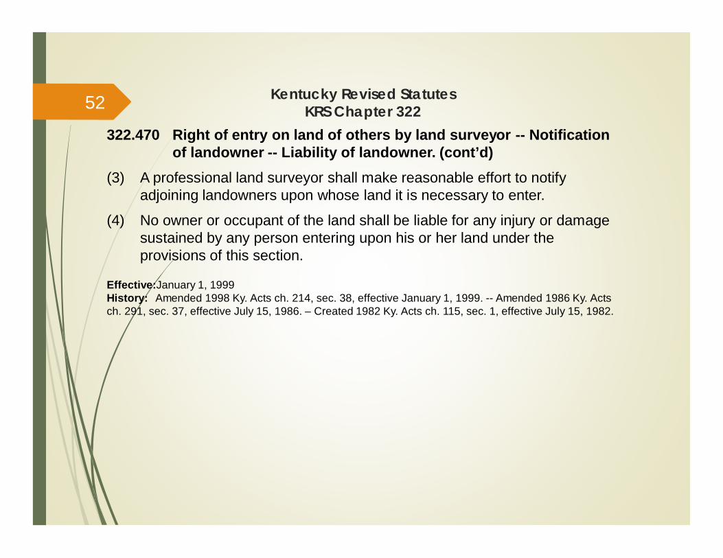
322.470 Right of entry on land of others by land surveyor -- Notificationof landowner -- Liability of landowner. (cont’d)
(3) A professional land surveyor shall make reasonable effort to notifyadjoining landowners upon whose land it is necessary to enter.
(4) No owner or occupant of the land shall be liable for any injury or damagesustained by any person entering upon his or her land under theprovisions of this section.
Effective:January 1, 1999History: Amended 1998 Ky. Acts ch. 214, sec. 38, effective January 1, 1999. -- Amended 1986 Ky. Actsch. 291, sec. 37, effective July 15, 1986. – Created 1982 Ky. Acts ch. 115, sec. 1, effective July 15, 1982.
52
201 KAR 18:142. Code ofProfessional Practice and
Conduct
53

201 KAR 18:142. Code of professional practice and conduct
**SEE NEW CODE PASSED ON 11-10-15**RELATES TO: KRS 322.180 (3), 322.291 (11)STATUTORY AUTHORITY: KRS 322.290 (11)NECESSITY, FUNCTION, AND CONFORMITY: KRS 322.290(11) requires theboard to promulgate a code of professional practice and conduct, which shallbe binding upon persons licensed under KRS Chapter 322. This administrativeregulation establishes a code of professional practice and conduct.
SECTION 1. Definitions.(1) “Conflict of Interest” means any circumstance in which a licensee’s
personal or financial interest is contrary to the interests of the public, hisor her employer, or current or past client.
(2) “Direct supervisory control” in the practice of engineering means that anengineer licensee directly supervises and takes responsibility forconsultation, investigation, evaluation, planning, design and certification ofan engineering project and includes only that work performed by anemployee as defined in subsection (4) of this section.
54
201 KAR 18:142. Code of professional practice and conduct
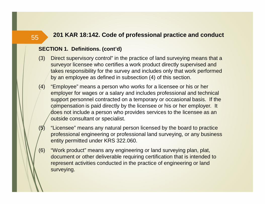
SECTION 1. Definitions. (cont’d)(3) Direct supervisory control” in the practice of land surveying means that a
surveyor licensee who certifies a work product directly supervised andtakes responsibility for the survey and includes only that work performedby an employee as defined in subsection (4) of this section.
(4) “Employee” means a person who works for a licensee or his or heremployer for wages or a salary and includes professional and technicalsupport personnel contracted on a temporary or occasional basis. If thecompensation is paid directly by the licensee or his or her employer. Itdoes not include a person who provides services to the licensee as anoutside consultant or specialist.
(5) “Licensee” means any natural person licensed by the board to practiceprofessional engineering or professional land surveying, or any businessentity permitted under KRS 322.060.
(6) “Work product” means any engineering or land surveying plan, plat,document or other deliverable requiring certification that is intended torepresent activities conducted in the practice of engineering or landsurveying.
55
201 KAR 18:142. Code of professional practice and conduct
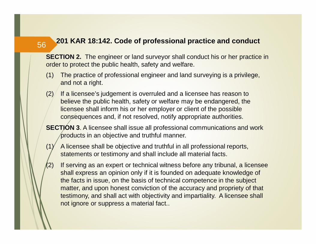
SECTION 2. The engineer or land surveyor shall conduct his or her practice inorder to protect the public health, safety and welfare.(1) The practice of professional engineer and land surveying is a privilege,
and not a right.
(2) If a licensee’s judgement is overruled and a licensee has reason tobelieve the public health, safety or welfare may be endangered, thelicensee shall inform his or her employer or client of the possibleconsequences and, if not resolved, notify appropriate authorities.
SECTION 3. A licensee shall issue all professional communications and workproducts in an objective and truthful manner.
(1) A licensee shall be objective and truthful in all professional reports,statements or testimony and shall include all material facts.
(2) If serving as an expert or technical witness before any tribunal, a licenseeshall express an opinion only if it is founded on adequate knowledge ofthe facts in issue, on the basis of technical competence in the subjectmatter, and upon honest conviction of the accuracy and propriety of thattestimony, and shall act with objectivity and impartiality. A licensee shallnot ignore or suppress a material fact..
56
201 KAR 18:142. Code of professional practice and conduct
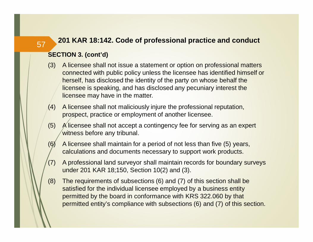
SECTION 3. (cont’d)(3) A licensee shall not issue a statement or option on professional matters
connected with public policy unless the licensee has identified himself orherself, has disclosed the identity of the party on whose behalf thelicensee is speaking, and has disclosed any pecuniary interest thelicensee may have in the matter.
(4) A licensee shall not maliciously injure the professional reputation,prospect, practice or employment of another licensee.
(5) A licensee shall not accept a contingency fee for serving as an expertwitness before any tribunal.
(6) A licensee shall maintain for a period of not less than five (5) years,calculations and documents necessary to support work products.
(7) A professional land surveyor shall maintain records for boundary surveysunder 201 KAR 18;150, Section 10(2) and (3).
(8) The requirements of subsections (6) and (7) of this section shall besatisfied for the individual licensee employed by a business entitypermitted by the board in conformance with KRS 322.060 by thatpermitted entity’s compliance with subsections (6) and (7) of this section.
57
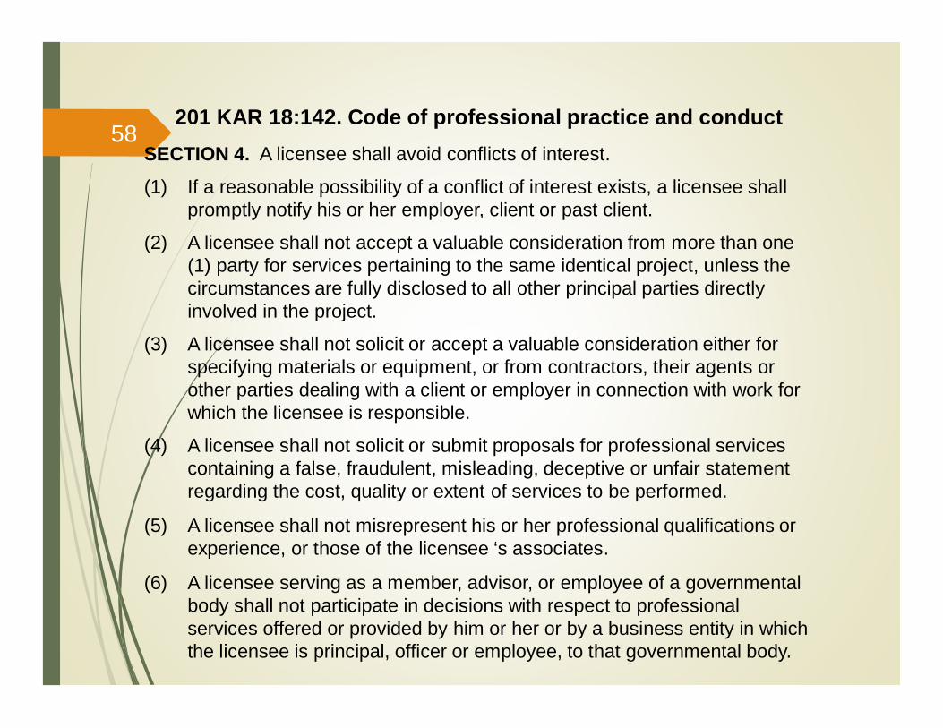
SECTION 4. A licensee shall avoid conflicts of interest.
(1) If a reasonable possibility of a conflict of interest exists, a licensee shallpromptly notify his or her employer, client or past client.
(2) A licensee shall not accept a valuable consideration from more than one(1) party for services pertaining to the same identical project, unless thecircumstances are fully disclosed to all other principal parties directlyinvolved in the project.
(3) A licensee shall not solicit or accept a valuable consideration either forspecifying materials or equipment, or from contractors, their agents orother parties dealing with a client or employer in connection with work forwhich the licensee is responsible.
(4) A licensee shall not solicit or submit proposals for professional servicescontaining a false, fraudulent, misleading, deceptive or unfair statementregarding the cost, quality or extent of services to be performed.
(5) A licensee shall not misrepresent his or her professional qualifications orexperience, or those of the licensee ‘s associates.
(6) A licensee serving as a member, advisor, or employee of a governmentalbody shall not participate in decisions with respect to professionalservices offered or provided by him or her or by a business entity in whichthe licensee is principal, officer or employee, to that governmental body.
201 KAR 18:142. Code of professional practice and conduct58

SECTION 5. A licensee shall solicit or accept engineering or land surveyingwork only on the basis of his or her, or the licensee’s firm’s or associates’qualifications for the work offered.
(1) A licensee shall not offer or accept any valuable consideration in order tosecure specific work, exclusive of commissions paid by individuallicensees for securing salaried positions through employment agencies. Alicensee may participate in design-build projects.
(2) A licensee may advertise professional services if the advertising is notfalse or misleading.
SECTION 6. A licensee shall not knowingly associate with any personengaging in fraudulent, illegal or dishonest activities.
(1) A licensee shall not permit the use of his or her, or the licensee’s businessentity’s name by any person or business entity that he or she knows orhas reason to believe is engaging in fraudulent, dishonest or illegalactivities.
(2) A licensee shall not aid or abet the illegal practice of engineering or landsurveying.
201 KAR 18:142. Code of professional practice and conduct59

201 KAR 18:142. Code of professional practice and conduct
SECTION 7. A licensee shall perform his or her services only in the areas of hisor her competence.
(1) A licensee shall undertake to perform professional assignments only ifqualified by education or experience in the specific technical fieldinvolved.
(2) A licensee may accept an assignment requiring education or experienceoutside his or her own field of competence, but only to the extent that hisor her services are restricted to those parts of the project in which thelicensee is competent. All other parts of the project shall be certified bylicensed associates, consultants or employees.
(3) If a question of the competence of a licensee to perform a professionalassignment in a specific technical field is an issue and cannot beotherwise resolved to satisfaction of the board, the board, upon a majorityvote or upon request by the licensee, may require the licensee tosatisfactorily complete an examination the board deems appropriate andrelevant.
60
201 KAR 18:142. Code of professional practice and conduct
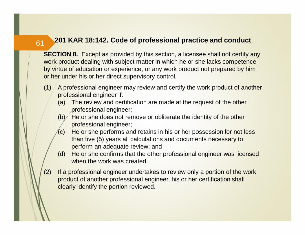
SECTION 8. Except as provided by this section, a licensee shall not certify anywork product dealing with subject matter in which he or she lacks competenceby virtue of education or experience, or any work product not prepared by himor her under his or her direct supervisory control.
(1) A professional engineer may review and certify the work product of anotherprofessional engineer if:(a) The review and certification are made at the request of the other
professional engineer;(b) He or she does not remove or obliterate the identity of the other
professional engineer;(c) He or she performs and retains in his or her possession for not less
than five (5) years all calculations and documents necessary toperform an adequate review; and
(d) He or she confirms that the other professional engineer was licensedwhen the work was created.
(2) If a professional engineer undertakes to review only a portion of the workproduct of another professional engineer, his or her certification shallclearly identify the portion reviewed.
61
201 KAR 18:142. Code of professional practice and conduct
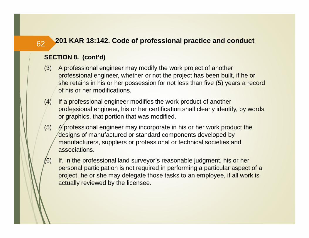
SECTION 8. (cont’d)(3) A professional engineer may modify the work project of another
professional engineer, whether or not the project has been built, if he orshe retains in his or her possession for not less than five (5) years a recordof his or her modifications.
(4) If a professional engineer modifies the work product of anotherprofessional engineer, his or her certification shall clearly identify, by wordsor graphics, that portion that was modified.
(5) A professional engineer may incorporate in his or her work product thedesigns of manufactured or standard components developed bymanufacturers, suppliers or professional or technical societies andassociations.
(6) If, in the professional land surveyor’s reasonable judgment, his or herpersonal participation is not required in performing a particular aspect of aproject, he or she may delegate those tasks to an employee, if all work isactually reviewed by the licensee.
62
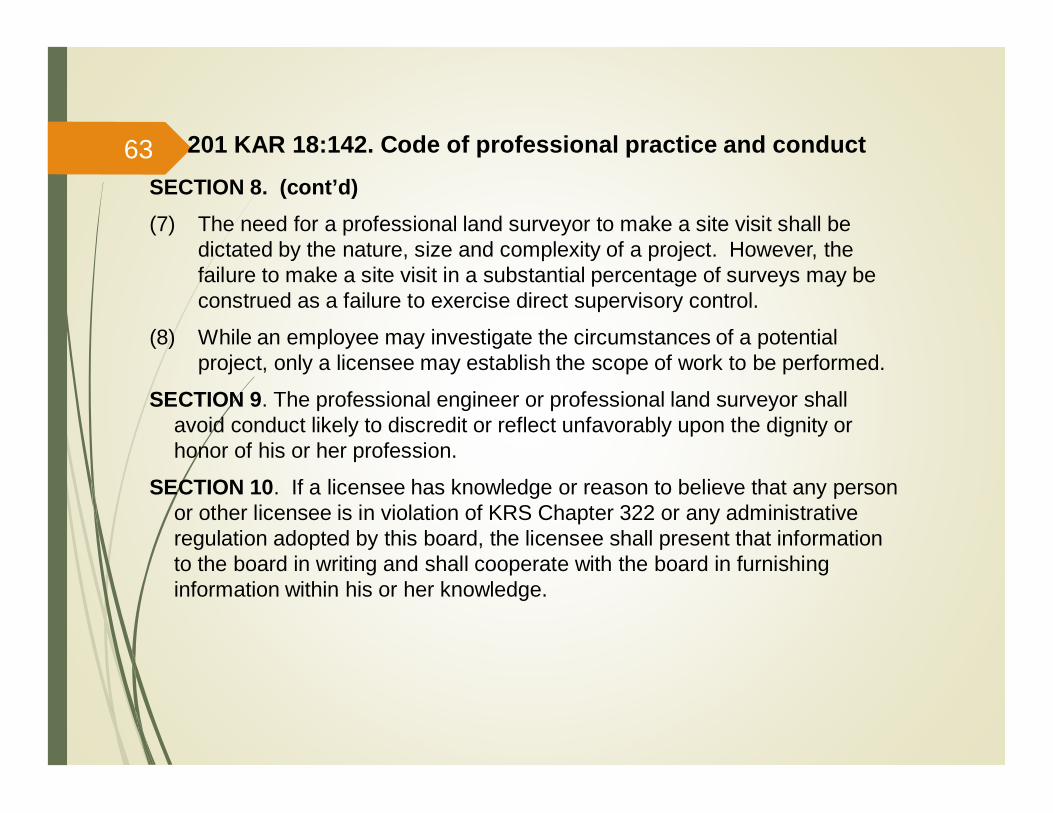
SECTION 8. (cont’d)(7) The need for a professional land surveyor to make a site visit shall be
dictated by the nature, size and complexity of a project. However, thefailure to make a site visit in a substantial percentage of surveys may beconstrued as a failure to exercise direct supervisory control.
(8) While an employee may investigate the circumstances of a potentialproject, only a licensee may establish the scope of work to be performed.
SECTION 9. The professional engineer or professional land surveyor shallavoid conduct likely to discredit or reflect unfavorably upon the dignity orhonor of his or her profession.
SECTION 10. If a licensee has knowledge or reason to believe that any personor other licensee is in violation of KRS Chapter 322 or any administrativeregulation adopted by this board, the licensee shall present that informationto the board in writing and shall cooperate with the board in furnishinginformation within his or her knowledge.
201 KAR 18:142. Code of professional practice and conduct63
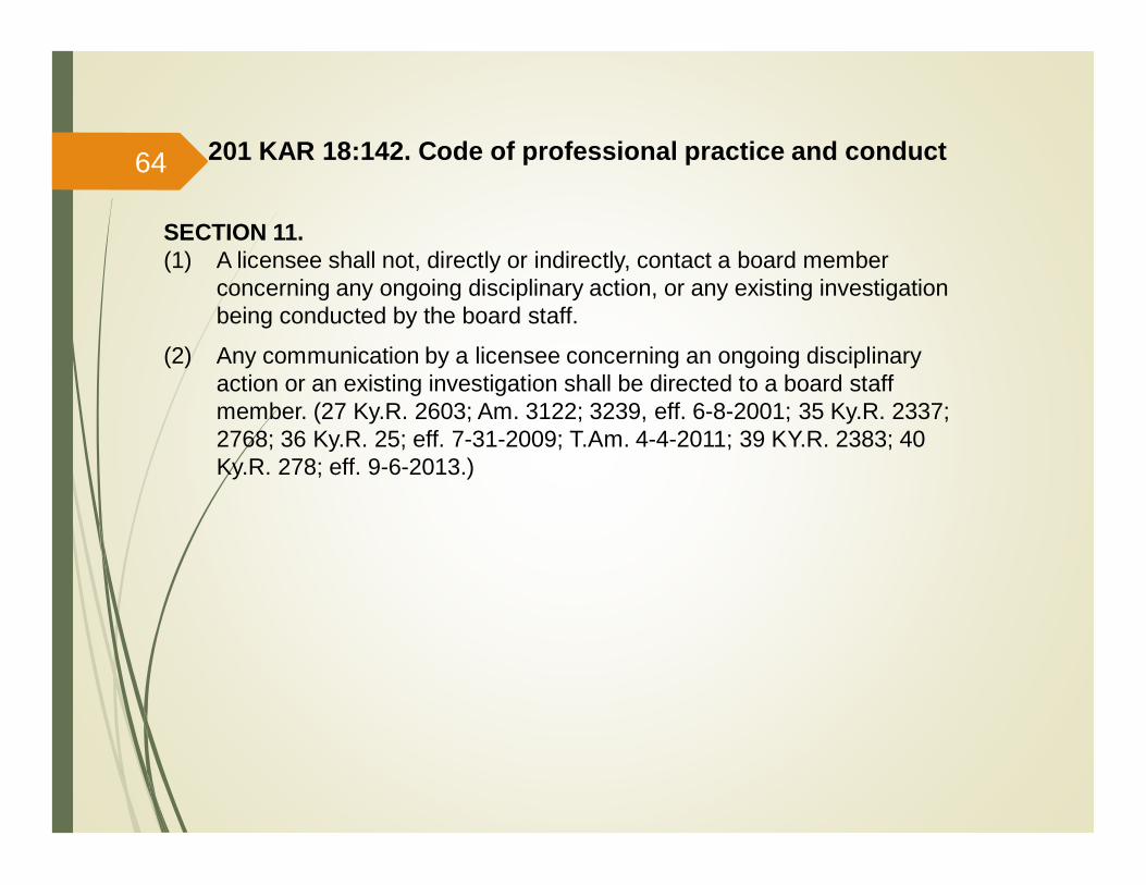
SECTION 11.(1) A licensee shall not, directly or indirectly, contact a board member
concerning any ongoing disciplinary action, or any existing investigationbeing conducted by the board staff.
(2) Any communication by a licensee concerning an ongoing disciplinaryaction or an existing investigation shall be directed to a board staffmember. (27 Ky.R. 2603; Am. 3122; 3239, eff. 6-8-2001; 35 Ky.R. 2337;2768; 36 Ky.R. 25; eff. 7-31-2009; T.Am. 4-4-2011; 39 KY.R. 2383; 40Ky.R. 278; eff. 9-6-2013.)
201 KAR 18:142. Code of professional practice and conduct64
201 KAR 18:150.Standards of Practice
65
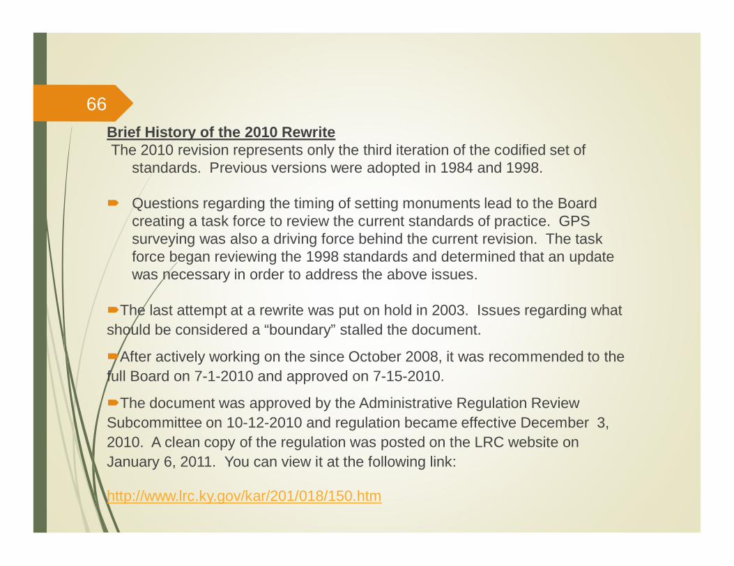
Brief History of the 2010 RewriteThe 2010 revision represents only the third iteration of the codified set of
standards. Previous versions were adopted in 1984 and 1998.
Questions regarding the timing of setting monuments lead to the Boardcreating a task force to review the current standards of practice. GPSsurveying was also a driving force behind the current revision. The taskforce began reviewing the 1998 standards and determined that an updatewas necessary in order to address the above issues.
The last attempt at a rewrite was put on hold in 2003. Issues regarding whatshould be considered a “boundary” stalled the document.
After actively working on the since October 2008, it was recommended to thefull Board on 7-1-2010 and approved on 7-15-2010.
The document was approved by the Administrative Regulation ReviewSubcommittee on 10-12-2010 and regulation became effective December 3,2010. A clean copy of the regulation was posted on the LRC website onJanuary 6, 2011. You can view it at the following link:
http://www.lrc.ky.gov/kar/201/018/150.htm
66
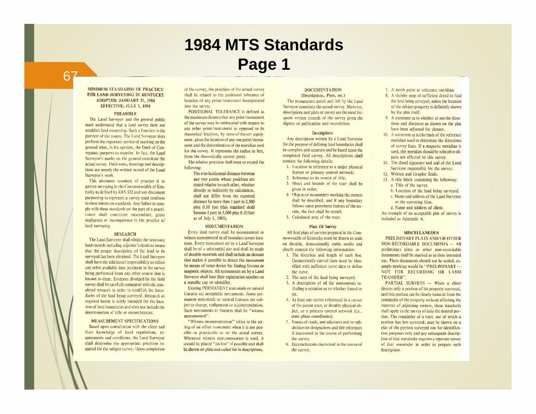
1984 MTS StandardsPage 1
67
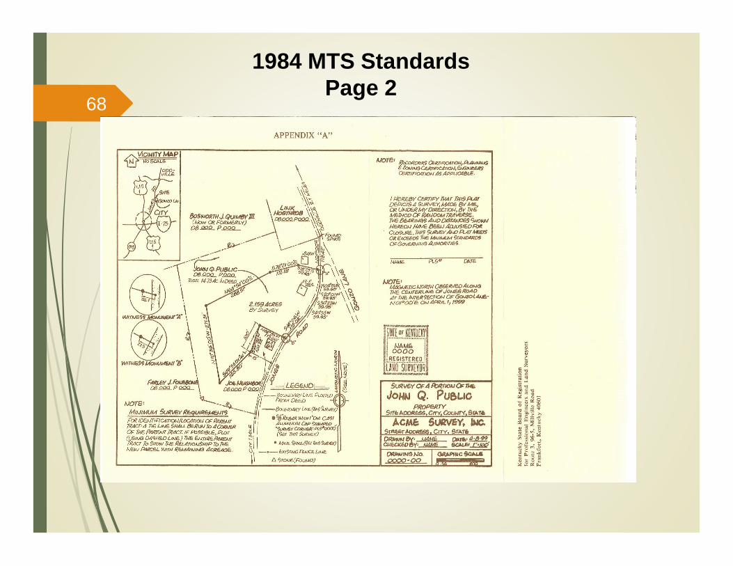
1984 MTS StandardsPage 2
68
69
Top Five Most Common Surveying Standards of Practice Deficiencies
1. Failure to provide the location of observation of the magnetic meridianwhen the magnetic meridian is used as the basis for bearings on a survey.
The item was one of the 2010 revisions. Previously the plat needed onlyto state that the magnetic meridian is the basis for bearings. Becauselocal magnetic attraction can affect the compass needle greatly, it is veryhelpful to future surveyors to know exactly where a magnetic observationwas made.
2. Failure to include the record source of each road which abuts the propertybeing surveyed.
While a road right-of-way is different in some ways from other types ofadjoining properties, it is an adjoining property nevertheless. Thestandards require that all adjoining properties be researched to determinethe record source. In many cases, a diligent search will turn up a deed forthe road right-of-way which adjoins the property you are surveying.
If after searching the public record, you are unable to find a recordsource, then a note on the plat to that effect will suffice. It is alsoadvisable to note what information you relied upon to establish the right-of-way in the absence of a deed.
70
Top Five Most Common Surveying Standards of Practice Deficiencies(cont’d)
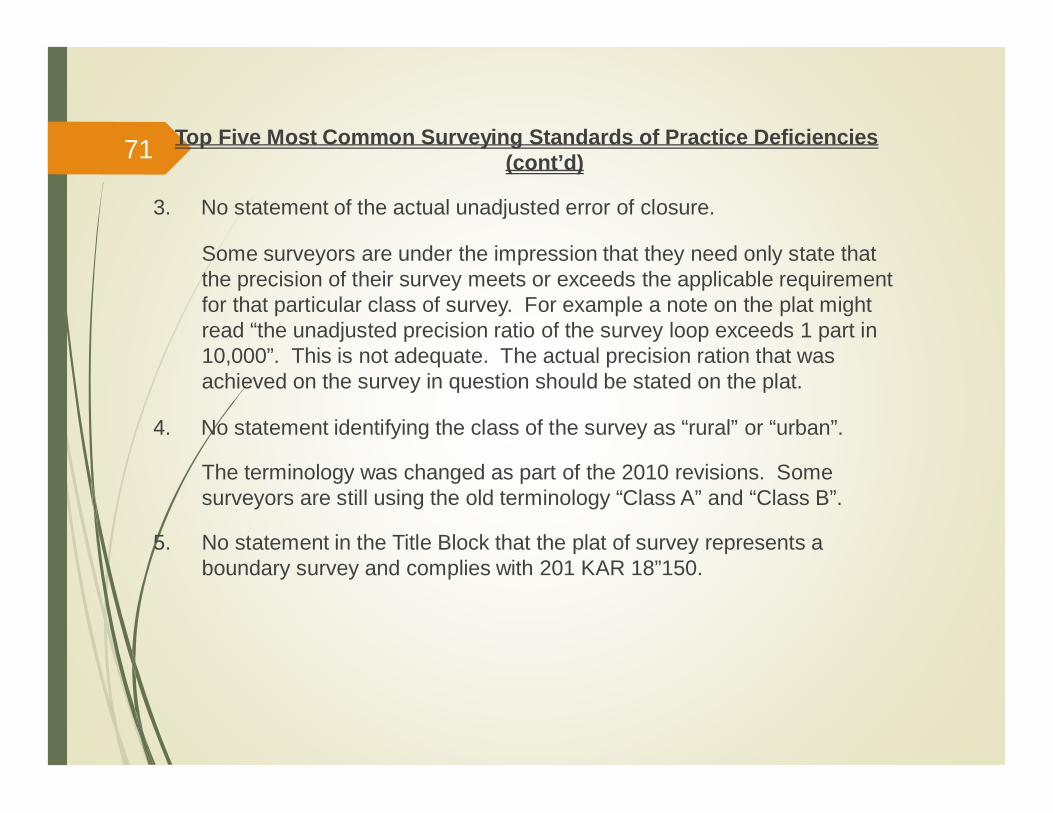
3. No statement of the actual unadjusted error of closure.
Some surveyors are under the impression that they need only state thatthe precision of their survey meets or exceeds the applicable requirementfor that particular class of survey. For example a note on the plat mightread “the unadjusted precision ratio of the survey loop exceeds 1 part in10,000”. This is not adequate. The actual precision ration that wasachieved on the survey in question should be stated on the plat.
4. No statement identifying the class of the survey as “rural” or “urban”.
The terminology was changed as part of the 2010 revisions. Somesurveyors are still using the old terminology “Class A” and “Class B”.
5. No statement in the Title Block that the plat of survey represents aboundary survey and complies with 201 KAR 18”150.
71
201 KAR 18:150. Standards of Practice
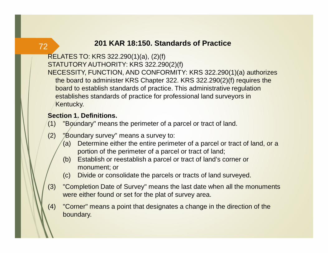
RELATES TO: KRS 322.290(1)(a), (2)(f)STATUTORY AUTHORITY: KRS 322.290(2)(f)NECESSITY, FUNCTION, AND CONFORMITY: KRS 322.290(1)(a) authorizes
the board to administer KRS Chapter 322. KRS 322.290(2)(f) requires theboard to establish standards of practice. This administrative regulationestablishes standards of practice for professional land surveyors inKentucky.
Section 1. Definitions.(1) "Boundary" means the perimeter of a parcel or tract of land.
(2) "Boundary survey" means a survey to:(a) Determine either the entire perimeter of a parcel or tract of land, or a
portion of the perimeter of a parcel or tract of land;(b) Establish or reestablish a parcel or tract of land’s corner or
monument; or(c) Divide or consolidate the parcels or tracts of land surveyed.
(3) "Completion Date of Survey" means the last date when all the monumentswere either found or set for the plat of survey area.
(4) "Corner" means a point that designates a change in the direction of theboundary.
72
201 KAR 18:150. Standards of Practice
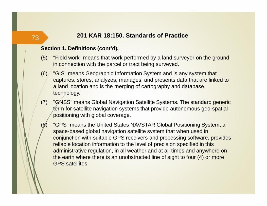
Section 1. Definitions (cont’d).(5) "Field work" means that work performed by a land surveyor on the ground
in connection with the parcel or tract being surveyed.
(6) "GIS" means Geographic Information System and is any system thatcaptures, stores, analyzes, manages, and presents data that are linked toa land location and is the merging of cartography and databasetechnology.
(7) "GNSS" means Global Navigation Satellite Systems. The standard genericterm for satellite navigation systems that provide autonomous geo-spatialpositioning with global coverage.
(8) "GPS" means the United States NAVSTAR Global Positioning System, aspace-based global navigation satellite system that when used inconjunction with suitable GPS receivers and processing software, providesreliable location information to the level of precision specified in thisadministrative regulation, in all weather and at all times and anywhere onthe earth where there is an unobstructed line of sight to four (4) or moreGPS satellites.
73
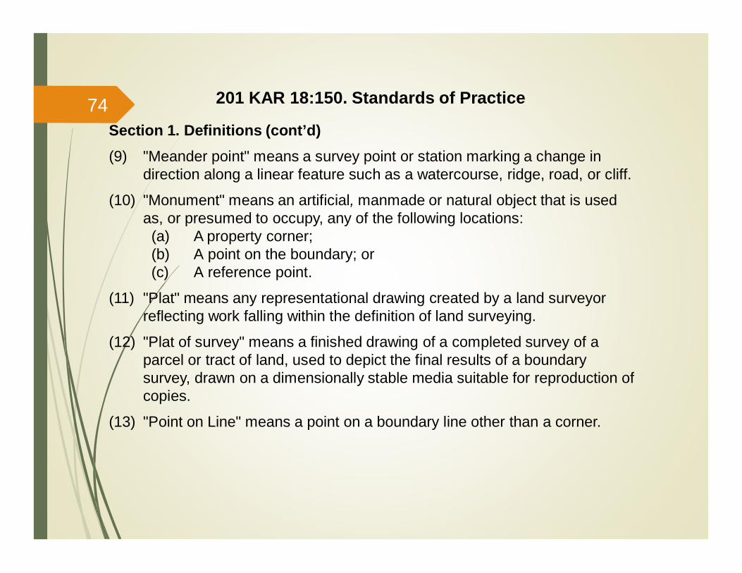
Section 1. Definitions (cont’d)(9) "Meander point" means a survey point or station marking a change in
direction along a linear feature such as a watercourse, ridge, road, or cliff.
(10) "Monument" means an artificial, manmade or natural object that is usedas, or presumed to occupy, any of the following locations:(a) A property corner;(b) A point on the boundary; or(c) A reference point.
(11) "Plat" means any representational drawing created by a land surveyorreflecting work falling within the definition of land surveying.
(12) "Plat of survey" means a finished drawing of a completed survey of aparcel or tract of land, used to depict the final results of a boundarysurvey, drawn on a dimensionally stable media suitable for reproduction ofcopies.
(13) "Point on Line" means a point on a boundary line other than a corner.
201 KAR 18:150. Standards of Practice74
Section 1. Definitions (cont’d)(14) "Reference monument" means a monument:
(a) That does not occupy the same defined position as a propertycorner; and
(b) Whose relationship to the corner of the property is established bybearing and distance to the actual corner.
(15) "Relative Positional Accuracy" means the value expressed in feet thatrepresents the uncertainty due to random errors in measurements in thelocation of any point on a survey relative to any other point on the samesurvey at the 95 percent confidence level.
(16) "Retracement survey" means a boundary survey of an existing parcel ortract of land.
201 KAR 18:150. Standards of Practice75
Section 2. Application.(1) Boundary surveys. The standards of practice established in Sections 1
through 12 of this administrative regulation:(a) Shall apply to the work product related to:
1. Boundary surveys used for the purpose of creating, depicting,or locating interests in land;
2. Partial surveys;3. Boundary surveys of leases; and4. Deed descriptions written by professional surveyors;
(b) Shall be the minimum standards of practice for a professional landsurveyor; and
(c) Shall not limit the establishment of more stringent standards ofpractice for a professional land surveyor by:1. An agency;2. An owner;3. A contract; or4. The professional land surveyor.
(d) Shall not apply to surveys to determine or define political areasincluding historical, school, fire, voting, utility or magisterial districts,municipal or county limits, or governmental permit limits.
201 KAR 18:150. Standards of Practice76
Section 2. Application (cont’d).(2) Land surveying work other than boundary surveys. The standards of
practice established in Sections 1, 2, 3, and 13 of this administrativeregulation:(a) Shall apply to the work of the professional land surveyor falling within
the definition of land surveying, but not falling within the definition ofa boundary survey;
(b) Shall be the minimum standards of practice for a professional landsurveyor for that work; and
(c) Shall not limit the establishment of more stringent standards ofpractice for a professional land surveyor by:1. An agency;2. An owner;3. A contract; or4. The professional land surveyor.
201 KAR 18:150. Standards of Practice77
Section 3. Compliance.
(1) Failure to comply with this administrative regulation shall constitutemisconduct, gross negligence, incompetence, or a combination of theseviolations in the practice of professional land surveying.
(2) A professional land surveyor shall not represent that:(a) A boundary survey determines land ownership; or(b) A boundary survey provides more than evidence of rights in land; or(c) Land ownership can be established by any survey.
Section 4. Actual Boundary Survey.
(1) The marks and monuments on the ground as found and verified, or as setby a professional land surveyor shall constitute the actual boundarysurvey.
(2) Any plat of survey shall accurately represent the actual boundary survey.
(3) Record research and field work required by the provisions of thisadministrative regulation:(a) Shall be used by a professional land surveyor to determine the
location of the boundary of the property to be surveyed; and(b) Shall not be used by a professional land surveyor to determine title.
201 KAR 18:150. Standards of Practice78
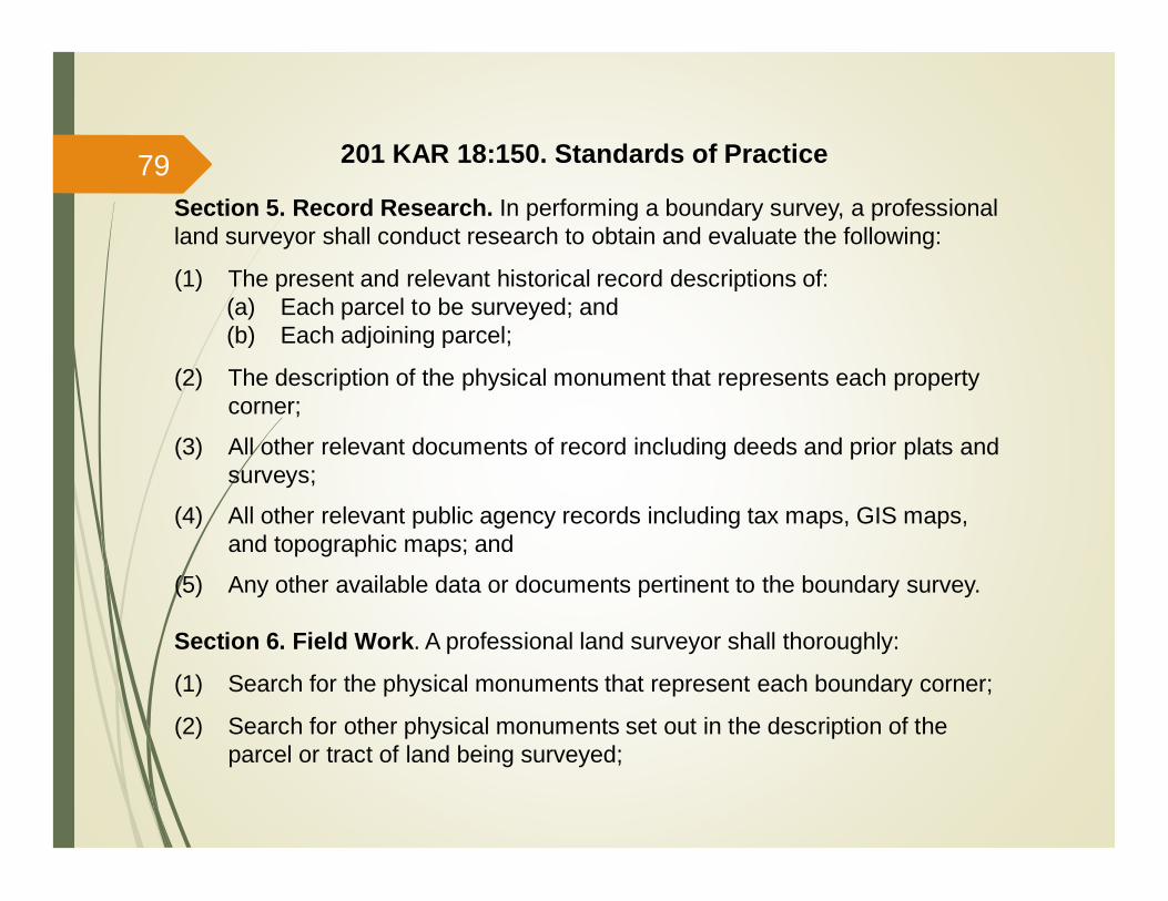
Section 5. Record Research. In performing a boundary survey, a professionalland surveyor shall conduct research to obtain and evaluate the following:
(1) The present and relevant historical record descriptions of:(a) Each parcel to be surveyed; and(b) Each adjoining parcel;
(2) The description of the physical monument that represents each propertycorner;
(3) All other relevant documents of record including deeds and prior plats andsurveys;
(4) All other relevant public agency records including tax maps, GIS maps,and topographic maps; and
(5) Any other available data or documents pertinent to the boundary survey.
Section 6. Field Work. A professional land surveyor shall thoroughly:
(1) Search for the physical monuments that represent each boundary corner;
(2) Search for other physical monuments set out in the description of theparcel or tract of land being surveyed;
201 KAR 18:150. Standards of Practice79
Section 6. Field Work. (cont’d)
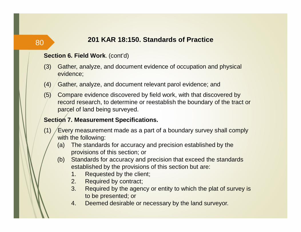
(3) Gather, analyze, and document evidence of occupation and physicalevidence;
(4) Gather, analyze, and document relevant parol evidence; and
(5) Compare evidence discovered by field work, with that discovered byrecord research, to determine or reestablish the boundary of the tract orparcel of land being surveyed.
Section 7. Measurement Specifications.(1) Every measurement made as a part of a boundary survey shall comply
with the following:(a) The standards for accuracy and precision established by the
provisions of this section; or(b) Standards for accuracy and precision that exceed the standards
established by the provisions of this section but are:1. Requested by the client;2. Required by contract;3. Required by the agency or entity to which the plat of survey is
to be presented; or4. Deemed desirable or necessary by the land surveyor.
201 KAR 18:150. Standards of Practice80

Section 7. Measurement Specifications. (cont’d)(2) A professional land surveyor shall conduct measurements with
instruments and equipment that are properly:(a) Adjusted;(b) Maintained; and(c) Calibrated to meet the appropriate tolerance required for the
classification of survey as specified in subsection (5) of this section.
(3) A boundary survey shall be conducted utilizing a method of measurementthat achieves the appropriate minimum tolerance specified in subsection(5) of this section.
(4) A boundary survey for platting or describing a parcel or tract of land shall beclassified as "Urban" or "Rural".(a) An Urban survey shall:
1. Consist of urban or suburban land; and2. Include a parcel or tract of land lying within, or adjacent to:
a. A city or town limit;b. A commercial business area;c. An industrial area; ord. A residential area that is outside a city or town limit and
contains subdivided lots smaller than five (5.0) acres.
201 KAR 18:150. Standards of Practice81
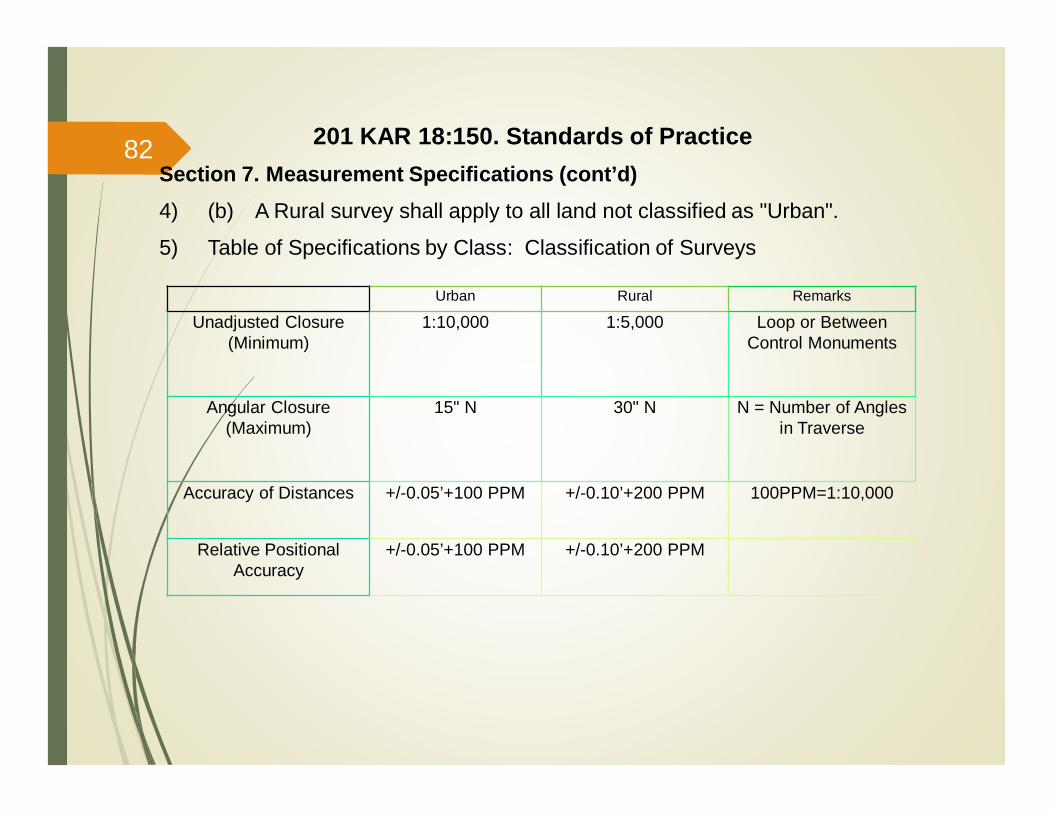
201 KAR 18:150. Standards of Practice
Urban Rural Remarks
Unadjusted Closure(Minimum)
1:10,000 1:5,000 Loop or BetweenControl Monuments
Angular Closure(Maximum)
15" N 30" N N = Number of Anglesin Traverse
Accuracy of Distances +/-0.05’+100 PPM +/-0.10’+200 PPM 100PPM=1:10,000
Relative PositionalAccuracy
+/-0.05’+100 PPM +/-0.10’+200 PPM
Section 7. Measurement Specifications (cont’d)4) (b) A Rural survey shall apply to all land not classified as "Urban".
5) Table of Specifications by Class: Classification of Surveys
82

Section 8. Global Positioning Systems.
(1) It shall be acceptable practice to incorporate the use of survey grade GPSequipment into any boundary survey. The accuracy and precision of allmeasurements made with that equipment shall, at a minimum, meet allother accuracy and precision standards required otherwise by law or rulesunder Section 7(5) of this administrative regulation. If using GPSequipment in the course of a boundary survey, the professional landsurveyor shall state on the face of the plat of survey, the following:(a) A note stating what portion (or all) of the boundary survey was
performed using GPS equipment;(b) The type of GPS equipment used, including manufacturer and model
number, and whether single or dual frequency receivers were used;(c) The type of GPS survey that was performed, including static, real
time kinematic ("RTK"), network adjusted real time kinematic, etc.;(d) A note that discloses the precision of the GPS work done, either in
relative positional accuracy, or vector closure.(e) A statement identifying the horizontal datum, the vertical datum, and
the Geoid model used; and
201 KAR 18:150. Standards of Practice83
Section 8. Global Positioning Systems (cont’d)(2) The professional land surveyor shall at a minimum retain adequate
documentation, in either paper or electronic format, of raw field data,adjustment calculations and closure, or relative positional accuracycalculations or computations necessary to support the accuracy andprecision of the work product.
Section 9. Monumentation.
(1) Monumentation standards established in this section shall apply to allboundary surveys:
(2) Unless an adequate monument already exists at each boundary corner, aprofessional land surveyor shall set a monument or a referencemonument at each corner of the boundary as provided in this section.
201 KAR 18:150. Standards of Practice84
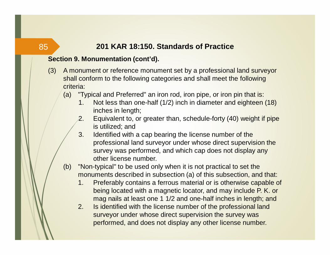
Section 9. Monumentation (cont’d).(3) A monument or reference monument set by a professional land surveyor
shall conform to the following categories and shall meet the followingcriteria:(a) "Typical and Preferred" an iron rod, iron pipe, or iron pin that is:
1. Not less than one-half (1/2) inch in diameter and eighteen (18)inches in length;
2. Equivalent to, or greater than, schedule-forty (40) weight if pipeis utilized; and
3. Identified with a cap bearing the license number of theprofessional land surveyor under whose direct supervision thesurvey was performed, and which cap does not display anyother license number.
(b) "Non-typical" to be used only when it is not practical to set themonuments described in subsection (a) of this subsection, and that:1. Preferably contains a ferrous material or is otherwise capable of
being located with a magnetic locator, and may include P. K. ormag nails at least one 1 1/2 and one-half inches in length; and
2. Is identified with the license number of the professional landsurveyor under whose direct supervision the survey wasperformed, and does not display any other license number.
201 KAR 18:150. Standards of Practice85
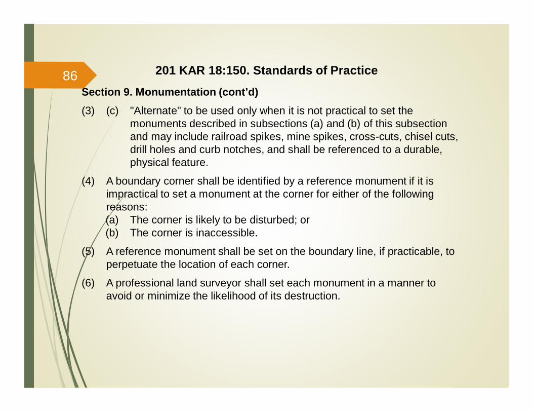
Section 9. Monumentation (cont’d)(3) (c) "Alternate" to be used only when it is not practical to set the
monuments described in subsections (a) and (b) of this subsectionand may include railroad spikes, mine spikes, cross-cuts, chisel cuts,drill holes and curb notches, and shall be referenced to a durable,physical feature.
(4) A boundary corner shall be identified by a reference monument if it isimpractical to set a monument at the corner for either of the followingreasons:(a) The corner is likely to be disturbed; or(b) The corner is inaccessible.
(5) A reference monument shall be set on the boundary line, if practicable, toperpetuate the location of each corner.
(6) A professional land surveyor shall set each monument in a manner toavoid or minimize the likelihood of its destruction.
201 KAR 18:150. Standards of Practice86
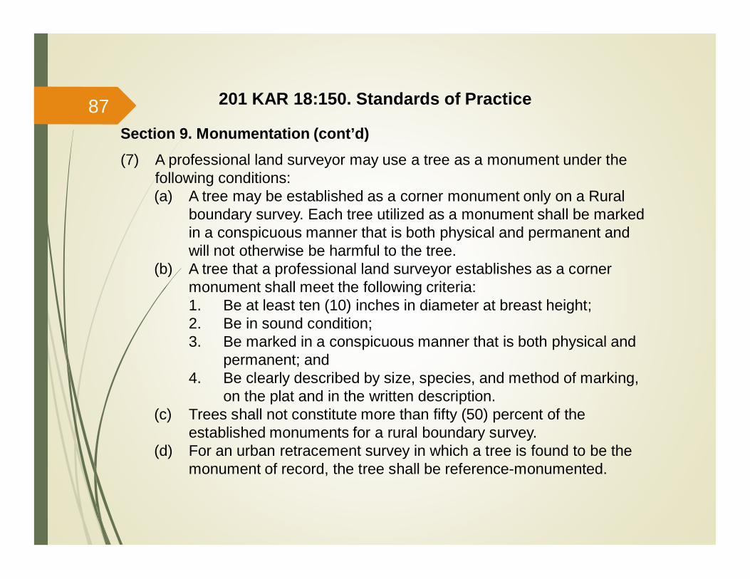
Section 9. Monumentation (cont’d)(7) A professional land surveyor may use a tree as a monument under the
following conditions:(a) A tree may be established as a corner monument only on a Rural
boundary survey. Each tree utilized as a monument shall be markedin a conspicuous manner that is both physical and permanent andwill not otherwise be harmful to the tree.
(b) A tree that a professional land surveyor establishes as a cornermonument shall meet the following criteria:1. Be at least ten (10) inches in diameter at breast height;2. Be in sound condition;3. Be marked in a conspicuous manner that is both physical and
permanent; and4. Be clearly described by size, species, and method of marking,
on the plat and in the written description.(c) Trees shall not constitute more than fifty (50) percent of the
established monuments for a rural boundary survey.(d) For an urban retracement survey in which a tree is found to be the
monument of record, the tree shall be reference-monumented.
201 KAR 18:150. Standards of Practice87

Section 9. Monumentation (cont’d)(8) A corner monument that a professional land surveyor has determined is
not of sound condition, fails to meet the standards established in thisadministrative regulation, or is inadequate under the definition ofmonument within this administrative regulation, shall be reference-monumented to perpetuate the corner location. All existing recordmonuments discovered during the performance of the survey shall bepreserved and shall not be altered or destroyed.
(9) (a) Linear monuments may consist of a watercourse, ridge, road, or cliff,and:(b) 1. The point at which a boundary line intersects a linear monument
shall be monumented or reference monumented; and2. A physical feature that represents a linear monument shall be
monumented or reference monumented at a minimum of every1,000 feet, and those monuments shall be set in intra-visiblepairs not to exceed 1,000 feet in spacing between pairs.
(10) All monumentation shall be set prior to the time the plat of survey, orrecord plat is issued by the surveyor. The signing and sealing of a surveyplat is certification by the professional land surveyor that all cornersshown on the plat are set on the ground.
201 KAR 18:150. Standards of Practice88
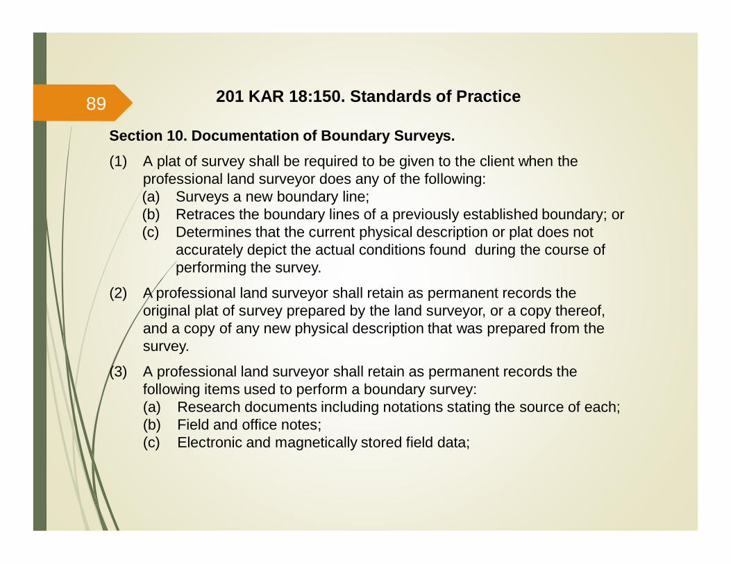
Section 10. Documentation of Boundary Surveys.(1) A plat of survey shall be required to be given to the client when the
professional land surveyor does any of the following:(a) Surveys a new boundary line;(b) Retraces the boundary lines of a previously established boundary; or(c) Determines that the current physical description or plat does not
accurately depict the actual conditions found during the course ofperforming the survey.
(2) A professional land surveyor shall retain as permanent records theoriginal plat of survey prepared by the land surveyor, or a copy thereof,and a copy of any new physical description that was prepared from thesurvey.
(3) A professional land surveyor shall retain as permanent records thefollowing items used to perform a boundary survey:(a) Research documents including notations stating the source of each;(b) Field and office notes;(c) Electronic and magnetically stored field data;
201 KAR 18:150. Standards of Practice89

Section 10. Documentation of Boundary Surveys (cont’d).(3) (d) Documents of calculation stating the:
1. Relative positional accuracy or closure as required by Section 7of this administrative regulation;
2. Adjustment method;3. Bearing reference datum; and4. Determination of corners;
(e) Plat of survey and written description, if any, of the surveyed parcelor tract of land;
(f) All other pertinent information necessary to reproduce the boundarysurvey; and
(g) All other pertinent information supporting the location of theboundary lines and corners of the boundary survey.
(4) Written description. A written description prepared by a professional landsurveyor shall be complete, shall accurately describe the actual boundarysurvey and, contain the following information:(a) The general location of the land that was surveyed;(b) The specific location of the land in reference to a major physical
feature or recognized control network;(c) The reference of at least one (1) boundary corner to a corner of the
parent tract;
201 KAR 18:150. Standards of Practice90

Section 10. Documentation of Boundary Surveys (cont’d).(4) (d) The direction and length of each line, as follows:
1. Each bearing represented in degrees, minutes and secondswith each distance represented to the hundredths of a foot;
2. Any geometrically-curved line identified with a beginning point,terminus point, and sufficient curve data to define the curve;and
3. A description of each prominent terrain feature, if any, that theboundary follows;
(e) A notation as to whether each monument was found or set;(f) The identification of each tree utilized as a new corner monument,
including breast height diameter, species of tree, method of marking,and a notation whether the tree is a record monument or a newlyestablished monument;
(g) A complete description of each "set" monument, to include, ifappropriate, the monument’s length, diameter, type of material andthe identifying cap or other identifier that was used;
201 KAR 18:150. Standards of Practice91
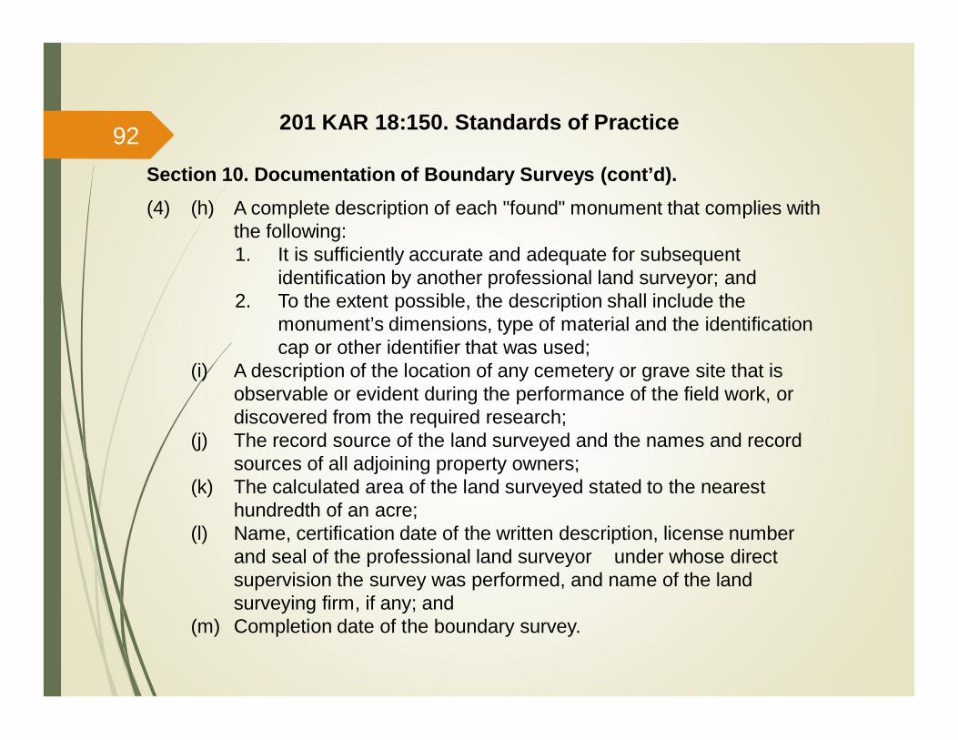
Section 10. Documentation of Boundary Surveys (cont’d).(4) (h) A complete description of each "found" monument that complies with
the following:1. It is sufficiently accurate and adequate for subsequent
identification by another professional land surveyor; and2. To the extent possible, the description shall include the
monument’s dimensions, type of material and the identificationcap or other identifier that was used;
(i) A description of the location of any cemetery or grave site that isobservable or evident during the performance of the field work, ordiscovered from the required research;
(j) The record source of the land surveyed and the names and recordsources of all adjoining property owners;
(k) The calculated area of the land surveyed stated to the nearesthundredth of an acre;
(l) Name, certification date of the written description, license numberand seal of the professional land surveyor under whose directsupervision the survey was performed, and name of the landsurveying firm, if any; and
(m) Completion date of the boundary survey.
201 KAR 18:150. Standards of Practice92

201 KAR 18:150. Standards of Practice
Section 10. Documentation of Boundary Surveys (cont’d).(5) Plat of survey. A plat of survey shall be drawn to scale on durable,
dimensionally-stable media, and clearly contain the following information:(a) Direction and length of each line as follows:
1. Each bearing represented in degrees, minutes, and secondswith each distance represented to the hundredths of a foot;
2. Any geometrically-curved line identified with a beginning point,terminus point, and sufficient curve data to define the curve;and
3. A depiction of each prominent terrain feature, if any, that theboundary follows:
(b) The calculated area of the land surveyed, stated to the nearesthundredths of an acre;
(c) A notation as to whether each monument was found or set;(d) A complete description of each set monument that marks or
references a boundary corner to include, if appropriate, themonument’s length, diameter, type of material and the identifying capor identifier that was used;
(e) A complete description of each found monument that complies withthe following:
93
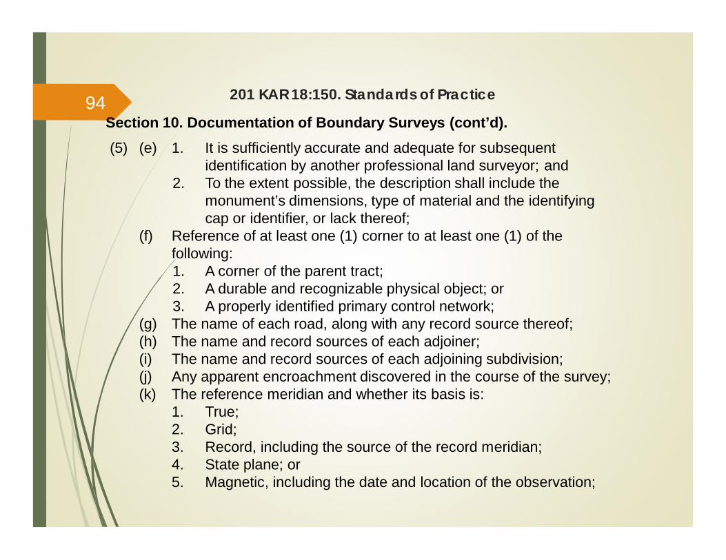
201 KAR 18:150. Standards of Practice
Section 10. Documentation of Boundary Surveys (cont’d).(5) (e) 1. It is sufficiently accurate and adequate for subsequent
identification by another professional land surveyor; and2. To the extent possible, the description shall include the
monument’s dimensions, type of material and the identifyingcap or identifier, or lack thereof;
(f) Reference of at least one (1) corner to at least one (1) of thefollowing:1. A corner of the parent tract;2. A durable and recognizable physical object; or3. A properly identified primary control network;
(g) The name of each road, along with any record source thereof;(h) The name and record sources of each adjoiner;(i) The name and record sources of each adjoining subdivision;(j) Any apparent encroachment discovered in the course of the survey;(k) The reference meridian and whether its basis is:
1. True;2. Grid;3. Record, including the source of the record meridian;4. State plane; or5. Magnetic, including the date and location of the observation;
94
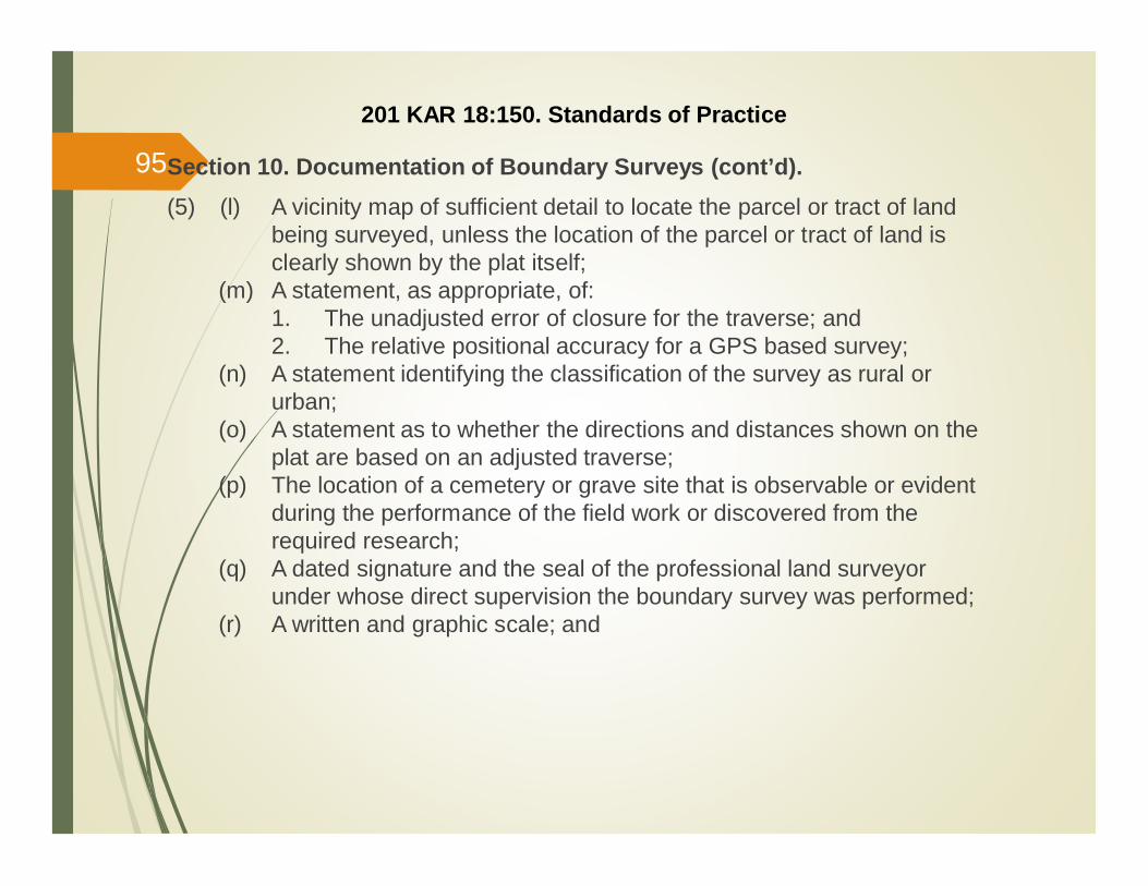
Section 10. Documentation of Boundary Surveys (cont’d).(5) (l) A vicinity map of sufficient detail to locate the parcel or tract of land
being surveyed, unless the location of the parcel or tract of land isclearly shown by the plat itself;
(m) A statement, as appropriate, of:1. The unadjusted error of closure for the traverse; and2. The relative positional accuracy for a GPS based survey;
(n) A statement identifying the classification of the survey as rural orurban;
(o) A statement as to whether the directions and distances shown on theplat are based on an adjusted traverse;
(p) The location of a cemetery or grave site that is observable or evidentduring the performance of the field work or discovered from therequired research;
(q) A dated signature and the seal of the professional land surveyorunder whose direct supervision the boundary survey was performed;
(r) A written and graphic scale; and
201 KAR 18:150. Standards of Practice
95
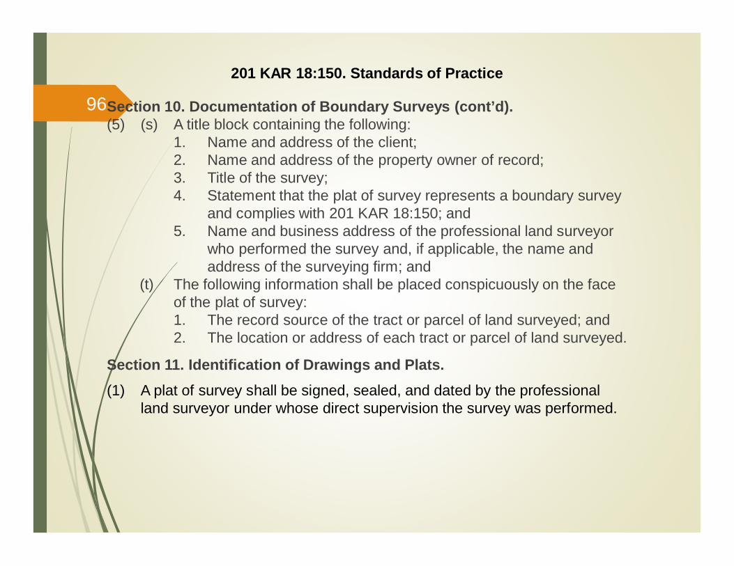
Section 10. Documentation of Boundary Surveys (cont’d).(5) (s) A title block containing the following:
1. Name and address of the client;2. Name and address of the property owner of record;3. Title of the survey;4. Statement that the plat of survey represents a boundary survey
and complies with 201 KAR 18:150; and5. Name and business address of the professional land surveyor
who performed the survey and, if applicable, the name andaddress of the surveying firm; and
(t) The following information shall be placed conspicuously on the faceof the plat of survey:1. The record source of the tract or parcel of land surveyed; and2. The location or address of each tract or parcel of land surveyed.
Section 11. Identification of Drawings and Plats.(1) A plat of survey shall be signed, sealed, and dated by the professional
land surveyor under whose direct supervision the survey was performed.
201 KAR 18:150. Standards of Practice
96
201 KAR 18:150. Standards of Practice
Section 11. Identification of Drawings and Plats. (cont’d)(2) Working drawings or unfinished plats of not yet completed boundary
surveys shall be prominently marked or stamped in at least sixteen (16)point type or its equivalent, as follows: Preliminary - Not For Recording orLand Transfer.
Section 12. Partial Boundary Surveys.(1) In performing a boundary survey, a professional land surveyor shall not be
required to survey the parent tract in its entirety in order to create asmaller tract for conveyance if the following conditions are met:(a) Adequate evidence exists that conforms to the deeds of record;(b) Sufficient monumentation exists that is verifiable to establish the
lines common to the boundary of the parent tract; and(c) There is sufficient evidence and monumentation to establish the lines
common to the adjoining tracts without adversely affecting theproperty interests of any adjoining owners.
97
201 KAR 18:150. Standards of Practice
Section 12. Partial Boundary Surveys. (cont’d)(2) In performing a boundary survey, a professional land surveyor is not
required to survey the entire boundary of a tract of land in order to mark aboundary line or replace a boundary corner when the following conditionsare met:(a) Sufficient evidence is found and verified to establish the record
location of that portion of the boundary being surveyed; and(b) The marked boundary line or reestablished boundary corner does
not adversely affect the property interests of any adjoining owners.
(3) A plat of survey for that part of the boundary surveyed pursuant to thissection of this administrative regulation, shall be required to comply withthis administrative regulation for the part of the boundary that wassurveyed, and shall graphically delineate and designate that portion of theboundary covered by the survey.
98
201 KAR 18:150. Standards of Practice
Section 13. Plats, Drawings, and Graphic Representations of Non-Boundary Survey Work Mandatory Disclosures.
(1) Plats, drawings, and graphic representations created by a professionalland surveyor, not representing either a plat of survey, or a preliminaryplat, drawing, or graphic representation of a boundary survey, shall meetthe following criteria:(a) Be clearly marked as to their intended use; and(b) State affirmatively in a title block in at least twelve (12) point type or
its equivalent, that the work does not represent a boundary surveyand is not intended for land transfer; and
(c) May be signed and sealed by the professional land surveyor underwhose direct supervision the work represented by the plat, drawing,or graphic representation was performed or the document wasprepared.
(2) A professional land surveyor shall state in a note or notes, on the face ofany plat, drawing or graphical representation of any work product fallingwithin the definition of land surveying but not constituting either a plat ofsurvey, or a preliminary plat, drawing or graphic representation of aboundary survey, the following mandatory informational disclosures forthe work product:
99
201 KAR 18:150. Standards of Practice
Section 13. Plats, Drawings, and Graphic Representations of Non-Boundary Survey Work Mandatory Disclosures. (cont’d)
(2) (a) For whom and by whom the work product was created;(b) The purpose of the work product;(c) The method employed to create the work product and its underlying
values and specifications;(d) The location of the parcel or tract of land with which the work product
is concerned;(e) The date or dates that the work was performed;(f) The date of any certification of the work product by the licensee;(g) The mathematical scale employed in any graphic representation of
the work performed; and(h) The degree of accuracy or level of quality of the work product
expressed in terms of mathematical precision. (12 Ky.R. 291; eff. 9-10-85; Am. 16 Ky.R. 592; 1157; eff. 12-6-89; 24 Ky.R. 1540; 1866;2062; eff. 3-12-98; 37 Ky.R. Am. 768; Am. 1178; eff. 12-3-2010.)
100

Questions / Comments?
101