st. clair avenue west transportation master plan · st. clair avenue west transportation master...
TRANSCRIPT

ST. CLAIR AVENUE WESTTRANSPORTATION MASTER PLAN
FROM KEELE STREET TO OLD WESTON ROAD
JULY 2019
St Clair Avenue West Transportation Master Plan
Table of Contents
Executive Summary............................................................................. i
1.0 INTRODUCTION .........................................................................1
1.1 Background .......................................................................................... 1
1.2 Study Area ............................................................................................ 1
1.3 Environmental Assessment Process ................................................. 1
1.3.1 The Ontario Environmental Assessment Act.......................... 3
1.3.2 Municipal Class Environmental Assessment .......................... 3
1.3.2.1 The Transportation Master Plan ........................................... 8
1.3.2.2 Part II Orders .......................................................................... 8
1.3.3 Public Work Class Environmental Assessment ..................... 9
1.3.4 The Canadian Environmental Assessment Act .................... 10
1.4 Related / Adjacent Studies and Projects .......................................... 10
1.5 Planning Policy Framework .............................................................. 12
1.5.1 Provincial Policy Framework .................................................. 12
1.5.1.1 Accessibility for Ontarians with Disabilities Act ............... 12
1.5.1.2 The Planning Act ................................................................. 12
1.5.1.3 Growth Plan for the Greater Golden Horseshoe (2017) ... 12
1.5.2 City of Toronto Policy Framework ......................................... 13
1.5.2.1 City of Toronto Official Plan (Adopted by Council 2002; Approved, in part, by the Ontario Municipal Board in June 2006 & June 2015) ................................................................ 13
1.5.2.2 Toronto Pedestrian Charter (2002) ..................................... 13
1.5.2.3 Cycling Network 10 Year Plan (2016) ................................. 13
1.5.2.4 Vision Zero (2017) ................................................................ 14
1.5.2.5 Complete Streets Guidelines (2014) ................................... 14
2.0 IDENTIFIED PROBLEMS AND OPPORTUNITIES .................15
2.1 Problems and Opportunities ............................................................. 15
2.2 Accommodating Planned Growth and Community Revitalization . 16
2.3 Problem and Opportunity Statement ................................................ 16

St Clair Avenue West Transportation Master Plan
3.0 EXISTING CONDITIONS ..........................................................17
3.1 Natural Environment .......................................................................... 17
3.1.1 Vegetation ........................................................................................... 17
Exhibit 3-1: Description of Vegetation Communities ...................... 18
3.1.2 Wildlife ..................................................................................... 22
3.1.3 Avifauna ................................................................................... 22
3.1.4 Species at Risk and Species of Conservation Concern ....... 23
3.1.5 Fish and Fish Habitat .............................................................. 24
3.1.6 Contamination ......................................................................... 26
3.1.7 Groundwater and Geotechnical Investigation ...................... 27
3.1.8 Soil ............................................................................................ 33
3.2 Socio-Economic Environment .......................................................... 34
3.2.1 Demographic Profile ............................................................... 34
3.2.2 Land Use .................................................................................. 35
3.2.3 Noise and Vibration ................................................................. 37
3.2.4 Air Quality ................................................................................ 37
3.3 Cultural Environment ......................................................................... 38
3.3.1 Archaeological Resources ..................................................... 38
3.3.2 Built Heritage and Cultural Heritage Landscapes ................ 39
3.4 Municipal Servicing and Utilities ...................................................... 49
3.4.1 Transportation Features ......................................................... 49
3.4.2 Roadway Network ................................................................... 49
3.4.3 Public Transit........................................................................... 50
3.4.4 Cycling ..................................................................................... 53
3.4.5 Pedestrian Facilities ................................................................ 55
3.5 Existing Traffic Conditions ............................................................... 57
3.5.1 Traffic Simulation Study Area and Period ............................. 57
3.5.2 Existing Traffic Operations Assessment - Aimsun .............. 57
3.5.3 Existing Traffic Operations Assessment - Synchro ............. 59
3.6 Safety and Traffic Calming Reporting ................................... 62
4.0 Evaluation of Alternatives ......................................................63
4.1 Alternative Planning Solutions to the Undertaking ........................ 63

St Clair Avenue West Transportation Master Plan
4.2 Alternatives Background ................................................................... 64
4.3 Planning Alternatives Analyzed ........................................................ 66
4.3.1 Alternative 1: Widen St. Clair Avenue West between Keele Street and Old Weston Road .................................................. 69
4.3.2 Alternative 2: Extend Gunns Road from Weston Road to Union Street ............................................................................. 70
4.3.3 Alternative 3: Extend Davenport Road to Lloyd Avenue ..... 71
4.3.4 Alternative 4: Extend Keele Street to the Gunns Road extension (in conjunction with Alternative 2 – Gunns Road extension) ................................................................................ 72
4.3.5 Alternative 5: Extend Davenport Road to Improved Union Street (in conjunction with Alternative 4 – Keele Street and Gunns Road Extensions) ........................................................ 77
4.3.6 Alternative 6: Extend Davenport Road to West Toronto Street ........................................................................................ 78
4.3.7 Alternative 7: Extend Gunns Road to connect to the extension of Davenport Road between the Kitchener GO Rail corridor and Union Street ....................................................... 79
4.3.8 Alternative 8: Extend Keele Street to connect to the extension of Davenport Road between the Kitchener GO Rail corridor and Union Street ....................................................... 80
4.4 Evaluation Criteria ............................................................................. 81
4.5 Preliminary Screening ....................................................................... 83
4.5.1 Transportation Efficiency ....................................................... 83
4.5.2 Constructability ....................................................................... 85
4.5.3 Neighbourhood Traffic ............................................................ 86
4.5.4 Summary of Alternative Screening ........................................ 87
4.6 Natural, Cultural and Socio-Economic Environments Considerations ................................................................................... 88
5.0 IDENTIFICATION OF THE RECOMMENDED PLAN ..............91
5.1 Design Parameters ............................................................................ 93
5.2 St. Clair Avenue West Widening ....................................................... 94
5.3 Gunns Road Extension ...................................................................... 96
5.4 Keele Street Extension ...................................................................... 98
5.5 Davenport Road Extension ............................................................. 100
5.6 Union Street Improvement .............................................................. 101

St Clair Avenue West Transportation Master Plan
5.7 Traffic Operations ............................................................................ 103
5.7.1 Network Performance – Aimsun Modelling ........................ 103
5.7.2 Intersection Performance – Synchro Assessment ............. 104
5.8 Pedestrian Access Improvements .................................................. 104
5.9 Cycling Access Improvements ....................................................... 109
5.10 Transit Improvements...................................................................... 111
5.11 Municipal Services and Utilities ..................................................... 111
5.12 Staging of Improvements ................................................................ 113
5.13 Cost Estimates ................................................................................. 115
6.0 CONSULTATION AND ENGAGEMENT ............................... 116
6.1 Notification ....................................................................................... 116
6.1.1 Study Consultation ............................................................... 117
6.1.2 Public Consultation Events .................................................. 117
6.1.3 Potentially Impacted Property Owners ................................ 118
6.2 Stakeholder Consultation ................................................................ 119
6.2.1 Toronto Transit Commission (TTC) ..................................... 131
6.2.2 Hydro One and Infrastructure Ontario ................................. 132
6.2.3 Turnberry Residents Association ........................................ 132
6.3 Agency and Stakeholder Meetings ................................................. 133
6.3.1 Technical Advisory Committee ............................................ 133
6.3.2 Metrolinx ................................................................................ 133
6.3.3 Toronto Transit Commission ............................................... 133
6.3.4 Constructability Workshops................................................. 134
6.3.5 CP Section ............................................................................. 134
6.3.6 Utilities ................................................................................... 134
6.3.7 Toronto and Region Conservation Authority...................... 134
6.3.8 Hydro One and Infrastructure Ontario ................................. 135
6.3.9 Impacted Property Owner Meetings .................................... 135
6.3.10 SmartTrack St. Clair-Old Weston Station Stakeholder Meetings ................................................................................. 135
6.3.11 Public Event #1 ...................................................................... 136
6.3.12 Public Event #2 ...................................................................... 138
6.3.13 Indigenous Community Engagement .................................. 141

St Clair Avenue West Transportation Master Plan
7.1 Natural Environment ........................................................................ 142
7.1.1 Designated Features ............................................................. 142
7.1.2 Vegetation .............................................................................. 145
7.1.3 Wildlife ................................................................................... 145
7.1.4 Species of Conservation Concern ....................................... 146
7.1.5 Fish and Fish Habitat ............................................................ 148
7.1.6 Tree Inventory........................................................................ 149
7.1.7 Contamination and Waste Management ............................. 154
7.1.8 Groundwater .......................................................................... 155
7.1.9 Soil .......................................................................................... 158
7.2 Socio-Economic Environment ........................................................ 158
7.2.1 Land Use and Property Impact............................................. 158
7.2.2 Noise and Vibration ............................................................... 161
7.2.3 Air Quality .............................................................................. 163
7.2.4 Traffic and Safety .................................................................. 164
7.2.5 Active Transportation ........................................................... 166
7.3 Cultural Environment....................................................................... 167
7.3.1 Archaeological Resources ................................................... 167
7.3.2 Built Heritage and Cultural Heritage Landscapes .............. 168
7.4 Permits and Approvals .................................................................... 170
7.4.1 Municipal ................................................................................ 170
7.4.2 Provincial ............................................................................... 171
7.4.3 Federal ................................................................................... 172
7.4.4 Rail Authorities ...................................................................... 172
7.4.5 Hydro One .............................................................................. 173
7.5 Summary of Identified Concerns and Mitigation / Commitments to Future Work ...................................................................................... 173

St Clair Avenue West Transportation Master Plan
List of Exhibits
Exhibit 1-1: Study Area ................................................................................................. 2
Exhibit 1-2: Municipal Class Environmental Assessment Process........................... 6 Exhibit 1-3: Study Process ........................................................................................... 7
Exhibit 3-1: Description of Vegetation Communities ............................................... 18
Exhibit 3-2 a: Existing Natural Environment ............................................................. 20
Exhibit 3-2 b: Existing Natural Environment ............................................................. 21
Exhibit 3-3: Summary of Historic Species of Conservation Concern ..................... 23
Exhibit 3-4 a: Areas of Potential Environmental Concern ....................................... 28
Exhibit 3-4 b: Areas of Potential Environmental Concern ....................................... 29
Exhibit 3-4 c: Areas of Potential Environmental Concern ....................................... 30
Exhibit 3-5: Borehole and Monitoring Well Locations ............................................. 30 Exhibit 3-6: Land Use Designations .......................................................................... 30
Exhibit 3-7: Summary of Existing Cultural Heritage Resources ............................. 40
Exhibit 3-8 a: Existing Cultural Heritage Resources ................................................ 46 Exhibit 3-8 b: Existing Cultural Heritage Resources ................................................ 47
Exhibit 3-8 c: Existing Cultural Heritage Resources ................................................ 48
Exhibit 3-9: Existing Public Transit Services ............................................................ 51
Exhibit 3-10: Existing Cycling Facilities ....................................................................54
Exhibit 3-11: Existing Pedestrian Facilities ............................................................... 56 Exhibit 3-12: Existing Weekday AM Peak Hour Traffic Conditions (Ext. Area) ...... 58
Exhibit 3-13 Existing Weekday AM Peak Hour Volumes (Study Area) ................... 60 Exhibit 3-14 Existing Lane Configurations (Study Area) ......................................... 61 Exhibit 3-15 – Existing Intersection Operations ....................................................... 62
Exhibit 4-1: Map Illustrating Alternatives 1 to 5 ........................................................ 67 Exhibit 4-2: Map Illustrating Alternatives 6 to 8 ........................................................ 68
Exhibit 4-3: Keele Street Extension Alternative 1 ..................................................... 73 Exhibit 4-4: Keele Street Extension Alternative 2 ..................................................... 74
Exhibit 4-5: Keele Street Extension Alternative 3 ..................................................... 75
Exhibit 4-6: Keele Street Extension Alternative 4 ..................................................... 76
Exhibit 4-7: Evaluation Criteria .................................................................................. 81
Exhibit 4-8: Transportation Efficiency Ranking Within Study ................................. 84
Exhibit 4-9: Alternatives 1 to 5 ................................................................................... 84

St Clair Avenue West Transportation Master Plan
Exhibit 4-10: Alternatives 6 to 8 ................................................................................. 84 Exhibit 4-11: Alternative 7A Concept ......................................................................... 86 Exhibit 4-12: Summary of Alternative Screening Recommendations..................... 87
Exhibit 5-1: Recommended Improvements Key Map ............................................... 92 Exhibit 5-2: St. Clair Avenue West Widening ............................................................ 94
Exhibit 5-3: Typical Cross-section of Widened St. Clair Avenue West ................... 94
Exhibit 5-4: Gunns Road Extension ........................................................................... 96
Exhibit 5-5: Typical Cross-section of Gunns Road Extension ................................ 96
Exhibit 5-6: Cross-section of a Typical Multi-use Trail ............................................ 97
Exhibit 5-7: Keele Street Extension ........................................................................... 98
Exhibit 5-8: Typical Cross-section of Keele Street Extension ................................. 99
Exhibit 5-9: Cross Section of a Typical Street and Bike Lane ................................. 99
Exhibit 5-10: Davenport Road Extension ................................................................ 100
Exhibit 5-11: Typical Cross-section of Davenport Road Extension ...................... 100
Exhibit 5-12: Union Street Improvement ................................................................. 102 Exhibit 5-13: Typical Cross-section of Improved Union Street ............................. 102
Exhibit 5-14: Traffic Performance of the Recommended Package of Improvements (AIMSUN Model) ........................................................ 103
Exhibit 5-15: Do Nothing 2031 Traffic Volumes ...................................................... 105
Exhibit 5-16: 2031 Traffic Volumes with Recommended Improvements .............. 106
Exhibit 5-17: Traffic Performance of the Recommended Package of Improvements (Synchro Model) ........................................................ 107
Exhibit 5-18: Future Lane Configurations ............................................................... 108 Exhibit 5-19: Proposed Pedestrian Facility Network .............................................. 109 Exhibit 5-20: Proposed Cycling Facility Network ................................................... 110 Exhibit 5-21: Preliminary Bus Route Map with SmartTrack Station (2025) .......... 112 Exhibit 5-22: Improvement Staging Order ............................................................... 113 Exhibit 5-23: Cost Estimates of Recommended Improvements ............................ 115 Exhibit 6-1: External Agency Participation ............................................................. 122
Exhibit 6-2: Summary of Key External Agency and Public Comments Received during PE #1 and Responses ............................................. 137
Exhibit 6-3: Summary of Key External Agency and Public Comments Received during PE #2 and Responses ............................................. 139 Exhibit 7-1: Preliminary Impacts to Lavender Creek Ravine and Natural Feature .................................................................................................. 144

St Clair Avenue West Transportation Master Plan
Exhibit 7-2: Emission Comparison at St. Clair / Keele / Weston Intersection ...... 163 Exhibit 7-3: Summary of Identified Concerns and Proposed Mitigation and
Commitments to Future Work ............................................................. 174

St Clair Avenue West Transportation Master Plan
List of Appendices
A Natural Environment Memo
B Arborist Report
C-1 Phase One Environmental Site Assessment (Study Area)
C-2 Phase One Environmental Site Assessment (153 Weston Road)
D Soil and Groundwater Management Plan
E-1 Noise Memo
E-2 Toronto Municipal Code, Chapter 591, Noise
E-3 Toronto Municipal Code, Chapter 363, Vibrations from Construction Activity
F-1 Stage 1 Archaeological Assessment Report
F-2 Stage 1 -2 Archaeological Assessment Report
F-3 Stage 1-2 Archaeological Assessment Report, Record of Indigenous Engagement
G Cultural Heritage Existing Conditions and Impact Assessment Report
H Utility Report
I-1 Traffic Operational Analysis Report
I-2 Transportation Analysis Summary
J Long-Term Alternatives Evaluation Matrix
K-1 Evaluation of Potential TTC Streetcar Stop Below St. Clair Rail Bridge
K-2 Gunns Road Extension Alternatives Evaluation Memo
K-3 Keele Street Extension Re-Alignment Option Evaluation
K-4 Davenport Road Alignment Evaluation
L-1 Detail Design: St. Clair Avenue West
L-2 Detail Design: Gunns Road Extension
L-3 Detail Design: Keele Street Extension to Gunns Road
L-4 Detail Design: Davenport Road – Union Street Extension
M-1 Record of Consultation
M-2 St. Clair West Conceptual Constructability Review Workshop Memo
N Environmental Impact Statement for The Proposed Keele Street Extension

i
St Clair Avenue West Transportation Master Plan
Executive Summary
1.0 Introduction
In 2012, the City of Toronto undertook a Functional Planning Study (FPS) to investigate
short-term and long-term solutions to improve traffic congestion concerns on St. Clair
Avenue West, from Keele Street to Old Weston Road. The St. Clair Avenue at the
Georgetown GO Underpass Transportation Infrastructure Planning Study Report was
completed in June 2015.
The City of Toronto initiated a Transportation Master Plan (TMP) study following the
Municipal Class Environmental Assessment (EA) process in September 2015, to identify
area-wide infrastructure improvements that address traffic congestion on St. Clair Avenue
West between Keele Street and Old Weston Road. Exhibit E-1 is a map of the study
area showing both the extended and primary study areas for the project.
Exhibit E-1: Study Area

ii
St Clair Avenue West Transportation Master Plan
Municipal infrastructure projects are subject to the Ontario Environmental Assessment
Act (EA Act). The Environmental Assessment (EA) is an approved self-assessment
process under the EA Act for a specific group or “class” of projects. Projects are
considered approved subject to compliance with an approved EA process. The Municipal
Class Environmental Assessment (Municipal Engineers Association October 2000, as
amended in 2007, 2011 and 2015) applies to municipal infrastructure projects including
roads, bridges, water and wastewater.
This study has been carried out according to the Municipal Class Environmental
Assessment (MCEA) process following Approach #3 of the Municipal Master Plan
Process. As per the Approach #3 Master Plan process, this Transportation Master Plan
(TMP) documents the following four of five phases of the MCEA process for the Schedule
‘C’ road projects investigated:
• Phase 1: identify the problem or opportunity • Phase 2: identify alternative solutions • Phase 3: examine alternative methods of implementing the preferred solution • Phase 4: prepare and file the Transportation Master Plan (TMP)
As part of the St. Clair Avenue West TMP study, the City is completing the Ministry of
Infrastructure (MOI) Public Work Class Environmental Assessment process specifically
for property requirements at 153 Weston Road.
This TMP has been completed to evaluate and select infrastructure improvements and
outline an implementation strategy. The TMP documents the study process; the existing
natural, cultural and socio-economic factors; a summary of stakeholder consultation
undertaken; generation of alternatives; evaluation and selection of the preferred
alternative; potential environmental effects; and proposed mitigation measures. The
study was carried out under the direction of senior staff of the City of Toronto and
managed by WSP on behalf of the City. External technical agencies and stakeholders
were consulted throughout the project as well.
2.0 Consultation
The consultation program was extensive; it is documented in Section 6.0 and the
detailed public consultation reports available in Appendix M. External agencies,
including the Toronto and Region Conservation Authority, Infrastructure Ontario,
Metrolinx, TTC, utilities, emergency service providers, Local Councillors, other potentially
interested stakeholders, all property owners in the vicinity of the study area, and
specifically impacted property owners were consulted and engaged during the study.
Members of the public were also notified of the study through local newspaper
publications and the City’s website, and were invited to contact the project team to join
the project mailing list and provide input throughout the study.

iii
St Clair Avenue West Transportation Master Plan
Indigenous Community engagement is documented in Section 6.5. Indigenous
communities have expressed a low level of concern in the project to the Project Team.
Key points of contact during the study included:
• Notice of Study Commencement: September 10, 2015
• Notice of Public Event #1: November 17, 2015
• Public Event #1: December 2, 2015
• Notice of Public Event #2: June 7, 2018
• Public Event #2: June 23, 2018 and June 25, 2018
3.0 Existing Conditions
Section 3.0 provides a summary of the existing conditions in the study area, including
socio-economic environment, cultural environment, and transportation.
Natural Environment
Section 3.1 documents the existing natural environment within the study area.
There are limited natural environment features within the study area, due to its urbanized
nature. The main natural environment in the study area is the Lavender Creek ravine and
vegetated area south of the terminus of Keele Street, just south of Lavender Road. This
natural feature is protected under the City of Toronto Ravines and Natural Features By-
law, and is a Toronto and Region Conservation Authority (TRCA) regulated area.
Wildlife habitat is limited due to the developed nature of the study area. While the
majority of wildlife observed are tolerant of humans and development, one (1) species-at-
risk (SAR) was observed during July 2018 field investigations. Barn Swallow (SAR) nests
were observed on the wooden structures at 153 Weston Road. No other potentially
present SAR identified by the Ministry of Natural Resources and Forestry (MNRF) are
considered likely to be found within the study area.
There is one (1) water feature within the study area, located within the natural feature
south of the existing Keele Street terminus. This water feature was determined to
function as indirect fish habitat by contributing flow to direct fish habitat downstream.
Correspondence with TRCA in 2017 confirmed this water feature is not a fisheries
habitat.
Socio-Economic Environment
Section 3.2 provides a summary of the socio-economic environment within the study
area.

iv
St Clair Avenue West Transportation Master Plan
The City of Toronto Zoning By-Law 569-2013 designates the lands within the study area
as predominantly “Residential” and “Employment Industrial”, with pockets of ‘Commercial
Residential” and ‘Open Space”. The rail corridor that runs north-south through the study
area is zoned as “Utility and Transportation”.
Cultural Environment
Section 3.3.1 provides a summary of the Stage 1-2 archaeological assessments
completed for the study. While the majority of the area has been cleared of
archaeological potential, there are additional areas with deeply buried archaeological
potential that will require further testing in the next design phase.
Section 3.3.2 provides a summary of the built-heritage resources, cultural heritage
landscapes, and areas with archaeological potential within the study area. Cultural
Heritage Existing Conditions and Impact Assessment Memos were completed for the
study (Appendix G).
Twenty-two (22) cultural heritage resources were identified during the survey of the study
corridor. Of the 22 cultural heritage resources, only one property was designated under
Part IV of the Ontario Heritage Act (By-law 599-83) within the study area: the Heydon
House Hotel (1834 St. Clair Avenue West).
Transportation
Existing transportation networks and conditions are documented in Section 3.5 of the
Transportation Master Plan (TMP). Currently transportation connections for pedestrians,
cyclists and vehicles are limited through the study area. The single travel lane per
direction of St. Clair Avenue under the Metrolinx Kitchener GO rail corridor is the only
continuous east-west vehicular / pedestrian link. In the case of incidents in this block of
St. Clair, there is a risk of gridlock in the transportation system. This also results in
circuitous trips throughout the study area, adding to turning volumes and queuing at
intersections, and adding to emergency response times. Pedestrians are not well-served
by the existing network: there are no connections between St. Clair Avenue and the
adjacent streets between Weston Road and Old Weston Road, and no crossings of the
rail corridor except at Rogers Road, St. Clair Avenue, and Old Weston Road. The
distances between crossing points are well in excess of 500 metres.
There are no cycling connections through the study area. Cycling facilities such as the
Lavender Creek trail on the west and Davenport Road bike lanes on the east reach to the
edges of the study area, but cyclists are exposed to vehicular conflicts in the study area
and must use circuitous routes. This inhibits cycling activity.
An assessment of existing traffic conditions indicates a poor level of service at the
intersections of St. Clair Avenue with Weston Road/Keele Street and Old Weston Road.
Queuing is extensive during peak periods.

v
St Clair Avenue West Transportation Master Plan
In summary, the existing transportation network provides a poor level of service to all
modes through this area, and offers little access to development areas or the planned
SmartTrack station north of St. Clair Avenue.
4.0 Problems and Opportunities
St. Clair Avenue West is a heavily-used road in the City of Toronto that generally features
two lanes of traffic in each direction alongside the dedicated TTC streetcar right-of-way
(ROW). In the area of the railway underpass between Keele Street / Weston Road and
Old Weston Road, the bridge span limits the roadway to one traffic lane in each direction
(plus one dedicated streetcar lane per direction)
Section 2.0 provides the identified problems and opportunities for this study.
Problem and Opportunity Statement
The north/south rail corridor in the vicinity of St. Clair Avenue West between Keele Street
and Old Weston Road limits east/west movement for cyclists, pedestrians and vehicles.
This results in issues of congestion and connectivity.
The Transportation Master Plan will evaluate alternatives to improve movement using
existing and potential new road connections for the benefit of all modes of travel.
5.0 Alternatives and Evaluation
Section 4.0 documents the evaluation of the alternative planning solutions to the
undertaken, and the alternatives considered for the study, as well as the evaluation
criteria used to evaluate the alternatives.
The feasibility and effectiveness of the alternatives were evaluated in both the FPS and
TMP based on these criteria: property impacts, transportation planning, cultural
environment, natural environment, transportation / operations / engineering /
constructability, and estimated construction cost. These evaluation criteria were refined
with input from stakeholders including the public.
Seven (7) alternative planning solutions to the undertaken were considered, including:
• A: “Do Nothing”
• B: High Occupancy Vehicle Lane
• C: Mixed Streetcar and General Purpose Lane
• D: Build New Road Connections
• E: Widen Existing Road
• F: Build New Pedestrian and Cycling Facilities
• G: Transit Improvements
vi
St Clair Avenue West Transportation Master Plan
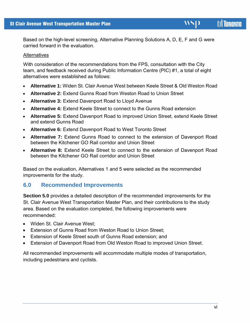
Based on the high-level screening, Alternative Planning Solutions A, D, E, F and G were
carried forward in the evaluation.
Alternatives
With consideration of the recommendations from the FPS, consultation with the City
team, and feedback received during Public Information Centre (PIC) #1, a total of eight
alternatives were established as follows:
• Alternative 1: Widen St. Clair Avenue West between Keele Street & Old Weston Road
• Alternative 2: Extend Gunns Road from Weston Road to Union Street
• Alternative 3: Extend Davenport Road to Lloyd Avenue
• Alternative 4: Extend Keele Street to connect to the Gunns Road extension
• Alternative 5: Extend Davenport Road to improved Union Street, extend Keele Street and extend Gunns Road
• Alternative 6: Extend Davenport Road to West Toronto Street
• Alternative 7: Extend Gunns Road to connect to the extension of Davenport Road between the Kitchener GO Rail corridor and Union Street
• Alternative 8: Extend Keele Street to connect to the extension of Davenport Road between the Kitchener GO Rail corridor and Union Street
Based on the evaluation, Alternatives 1 and 5 were selected as the recommended
improvements for the study.
6.0 Recommended Improvements
Section 5.0 provides a detailed description of the recommended improvements for the
St. Clair Avenue West Transportation Master Plan, and their contributions to the study
area. Based on the evaluation completed, the following improvements were
recommended:
• Widen St. Clair Avenue West;
• Extension of Gunns Road from Weston Road to Union Street;
• Extension of Keele Street south of Gunns Road extension; and
• Extension of Davenport Road from Old Weston Road to improved Union Street.
All recommended improvements will accommodate multiple modes of transportation,
including pedestrians and cyclists.

vii
St Clair Avenue West Transportation Master Plan
Transportation Assessment
The transportation effects of the alternatives were modelled using the AIMSUN computer
software, a microsimulation program. The model simulated traffic throughout the study
area, for the weekday a.m. peak period. The operational performance of the
improvements was compared to the “Do Nothing” scenario for the planning horizon of
2031, incorporating all known information regarding development and traffic growth. The
recommended improvements are projected to result in measurable improvements over
do-nothing, decreasing delay at the St. Clair / Weston and St. Clair / Old Weston
intersections and throughout the network. Total travel time and stopped time are also
expected to decrease, reflecting the greater efficiency of the network.
The proposed package of improvements will also have multimodal transportation benefits,
summarized as follows:
• Comprehensive network of pedestrian connections, including sidewalks and ramps to
connect St. Clair Avenue to adjacent local streets;
• Comprehensive network of cycling facilities to connect to all existing facilities and
provide safe access throughout the study area;
• Enable access to the planned St. Clair-Old Weston SmartTrack Station for TTC buses,
pedestrians and cyclists; and
• Enhanced emergency services vehicle access throughout the study area.
Construction Staging
The project will be undertaken in coordination with the replacement of the rail bridge over
St. Clair Avenue, which is needed in the immediate term to accommodate electrification
of the GO service and other rail improvements. Thus the first element to be constructed
will be the widening of St. Clair Avenue.
The other project components will be completed subsequently. The extensions of Gunns
Road and Keele Street should be completed together, to minimize the potential for traffic
infiltration into residential neighbourhoods. The Davenport Road extension would follow.
Property Requirements
Property required for each of the improvements have been identified, and consultations
have been conducted with the property owners. Property requirements are identified in
Section 7.0 of the TMP.
Costs
The capital costs of the improvements have been estimated based on the designs. The
cost is identified in Section 5.13 of the TMP. These costs are inclusive of the road work,
active transportation, transit, utility and structural costs. These costs are exclusive of

viii
St Clair Avenue West Transportation Master Plan
property acquisition costs, which are to be finalized through the detailed design stage. It
should also be noted that these costs do not include those associated with the St. Clair-
Old Weston SmartTrack Station. The overall cost estimate for the recommended
improvements is $219M.
7.0 Environmental Impacts and Recommended Mitigation Measures
and Commitment to Future Work
Potential impacts, concerns, recommended mitigations, commitments to future works,
and other permits and approvals for the recommended improvements are outlined in
Section 7.0, and summarized in Table E-2.
Table E-2: Potential Environmental Impacts and Recommended Mitigation
Measures and Commitments to Future Work
Anticipated Impact Recommended Mitigation Measure and
Commitment to Future Work
Natural Environment
• Loss of vegetation and trees and associated impacts to wildlife
• Impacts to species-at-risk habitat
• Impacts to TRCA regulated area and lands designated under the City of Toronto Ravine and natural feature protection By-Law
• Impacts to contributing fish habitat
• Impacts to properties with high and moderate potential for environmental contamination
• Tree preservation and compensation plans for impacts to the natural feature south of the Keele Street terminus shall be refined and updated in the next design phase, in correspondence with TRCA and City of Toronto Ravines and Natural Features Office.
• The potential to cause serious harm to fish risk will be reviewed during the next design phase.
• Additional groundwater and geotechnical work will be required during the next design phase to confirm geological and hydrogeological conditions within the study and identify potential impacts to groundwater during and following construction.
• Groundwater and Soil Management Plan should be developed and based on the recommendations developed as part of this TMP, and implemented during construction.
• Further Phase Two ESAs be completed for all impacted properties determined to be of high or medium APEC in order to determine the soil and groundwater quality at the locations of the APECs.
Cultural Environment
• Direct and indirect impacts to built-heritage resources and cultural heritage landscapes
• All previously undisturbed areas, and locations with archaeological potential must be cleared prior to the start of construction.
• Should previously unknown or unassessed deeply buried archaeological resources be uncovered during development, they may be a new archaeological site and therefore subject to

ix
St Clair Avenue West Transportation Master Plan
Anticipated Impact Recommended Mitigation Measure and
Commitment to Future Work
• Areas with archaeological potential existing within the study area
• Unanticipated discovery of archaeological or human remains
Section 48 (1) of the Ontario Heritage Act. The proponent or person discovering the archaeological resources must cease alteration of the site immediately and engage a licensed archaeologist to carry out archaeological fieldwork, in compliance with the Ontario Heritage Act.
• A Cultural Heritage Evaluation Report shall be completed at the ABC Lumber facility at 153 Weston Road, and the ten impacted of worker houses on the west side of Old Weston Road at Davenport Road to determine its eligibility for listing or designation under Part IV of the OHA and inclusion on the City of Toronto Heritage Register.
• A Heritage Impact Assessment should be completed at the Heydon House Hotel prior to construction activity
Socio-Economic Environment
• Property impacts as a result of the recommended improvements
• Contaminated groundwater and soils
• Creation of noise, vibration and dust during construction
• Compensation to private property owners will be provided as part of property acquisition process.
• Construction activities will comply with the City of Toronto noise control and vibration by‐law. Should exemptions to the noise by‐law be required, the appropriate application should be made to City Council.
Traffic Operations and Design
• Need to maintain emergency service access
• Traffic interruptions and delays during construction
• Concerns with neighbourhood traffic
• Construction staging for the St. Clair Avenue widening must ensure that emergency service access is maintained at all times.
• Following construction of the recommended improvements, the City will monitor traffic volume, speed and collisions to determine if changes to local streets are needed to ensure safe and efficient transportation.
Active Transportation Design
• Details of the cross-ride designs and cycling treatments along the roads influenced by this TMP will be refined and established.
• Bike troughs are required for the three sets of stair connections along St. Clair Avenue West leading to Townsley Street, Davenport Road and Mulock Avenue.

x
St Clair Avenue West Transportation Master Plan
Anticipated Impact Recommended Mitigation Measure and
Commitment to Future Work
• Pedestrian crosswalks and active transportation-related signage need to be designed at all study intersections as per the Ontario Traffic Manual.
• Opportunities to refresh pavement markings should be investigated for intersections in the vicinity of the recommended improvements.
• Opportunities to enhance active transportation facilities through roads with retaining walls and underpasses should be investigated through murals, art, street lighting placement, and railings – based on input from the City.
• Curb cuts and tactile warning strip indicators along the two Hydro access roads should be provided where they intersect with the sidewalk and multi-use trail
• Opportunities to connect the proposed cycling facilities to existing or future facilities should be investigated.
• Opportunities to reduce intersection radii based on refined surface transit routes should be investigated.
• Active transportation facilities should be coordinated between the various stakeholders including work related to the St. Clair-Old Weston SmartTrack Station.
• Additional pedestrian connections such as sidewalks along Townsley Street should be investigated.
Utilities
• Need to coordinate with utilities regarding existing and future locations
• There are potential conflicts with existing utility locations. Further consultation with the utility agencies will be required during the next design phase.
Rail Authorities • Coordinate and seek rail corridor access permits, flagging, construction submittals for both Metrolinx and Canadian Pacific Rail’s review.
Permitting and Approvals
• Permits, approvals, and exemptions need to be sought in the next design phase
• Obtain a permit to injure, destroy or remove trees under the City of Toronto’s Trees By-law.
• Obtain a permit under the City of Toronto’s Ravine and Natural Feature Protection By-law.
• If it is determined during Detail Design that the construction works will not adhere to the City of

xi
St Clair Avenue West Transportation Master Plan
Anticipated Impact Recommended Mitigation Measure and
Commitment to Future Work
Toronto noise by-law (Chapter 591, City of Toronto Municipal Code), a noise by-law exemption will be sought during the next design phase.
• An amendment to the City of Toronto’s City-Wide Zoning By-law 569-2013 may be required for the proposed new roads.
• A Road Occupancy Permit will be required for the construction period, which will be obtained prior to the initiation of the construction.
• A permit from TRCA would be required prior to any development/site alteration within the TRCA regulated area (O.Reg. 166/06).
• Obtain an exemption to the Endangered Species Act for barn swallow, and develop and implement mitigation requirements associated with the exemption in accordance with the ESA.
• A PTTW and EASR registration is required if dewatering greater than 50,000 L/day is required.
• Archaeological clearance must be obtained from the Ministry of Tourism, Culture and Sport prior to the start of construction.
• Potential permitting requirements under the Species at Risk Act will be reviewed during the next design phase. If required, a SARA permit will be obtained prior to construction.
• Hydro One and Infrastructure Ontario approval for proposed works on 153 Weston Road. The approval in principal obtained from Hydro One as part of this study is valid for 24 months