south willamette design workshop report
DESCRIPTION
from October 3, 2011TRANSCRIPT

South Willamette Design Workshop Summary of Participants’ Design IdeasOctober 3, 2011
BackgroundOn Monday, October 3rd, the Eugene Planning Department hosted a public
design workshop, or “charrette” to imagine the future of the South Willamette Street area, bounded roughly by 24th Avenue and 32nd Avenue on the north and the south and Amazon Park and the base of College Hill on the east and west. The South Willamette Street corridor was one of several “key transit corridors and core commercial areas” identified in the Envision Eugene project, a location where compact urban development could be encouraged to accommodate the city’s future growth. The purpose of the event was to discuss in small groups the future of the area and then generate and record ideas that will be used to develop an urban design plan for the area. The event was held in the Bascom Tykeson Room at the Eugene Public Library.
Participants in the workshop were asked to consider and discuss the following questions: What areas need to stay the same? Where might change happen? What
32nd Ave
24th Ave
College Hill
Amazon Park
Study Area Boundary

is really terrific about the area, and where should we have more of it? What kinds of new buildings would fit in? Where should they be, and how tall should they be? Where do we need more open space or pedestrian connections?
In small groups, participants developed their own plans for the South Willamette area using an aerial photo map and colored paper representing categories of three primary topics of concern, as shown in the color key to the right: Street character and transportation; parks, public space and green infrastructure; and building types and use. The designs and discussion produced by each group by the end of the evening are summarized in the following pages. A detailed record of each group’s notes also is included in Appendix A of this document.

Table 1Major Themes of Table 1:Street Character and Transportation• Create a distinctive place -- a cool, urban hub -- for South Eugene.
• Introduce block structure to areas east and west of Willamette Street to create access from College Hill all the way to Amazon Park.
• Reconnect the block structure (E-W and N-S) through Woodfield Station.
• Create better bike access on Willamette Street, Oak Street, and perhaps other locations within the district.
• Create a trolley line down Willamette Street, connecting butte to butte.
Parks, Public Space, and Green Infrastructure• Create a new public space in the core of the block between Willamette
and Oak Streets and 27th and 28th Avenue.
• Create smaller public spaces or semi-public spaces associated with developments off side streets near Willamette at regular intervals throughout the district.
Building Types and Use• Focus commercial uses and through traffic along Willamette Street.
• Oak Street becomes a destination with mixed-uses.
• Encourage taller, higher-density buildings overlooking Amazon Park, the Willard School site, and where the topography allows tall buildings without blocking views.

Major Themes of Table 2:Street Character and Transportation• Provide for cars, transit, and pedestrians on Willamette Street.
• Move bikes routes off Willamette Street to parallel side streets because Willamette is not wide enough for bikes, pedestrians and cars.
• Provide parking off Willamette Street in garages, side streets, and alleys; parking shared by multiple businesses is desired.
• Create a pedestrian connection between Woodfield Station and Southtowne.
• Add two Pedestrian Crossings across Willamette Street.
• Add sidewalks to neighborhoods.
Parks, Public Space, and Green Infrastructure • Integrate green space into neighborhood, including soft and hardscape
areas.
• Keep the Willard School and the adjacent green space, but add housing to the site.
Building Types and Use• Focus commercial activity along Willamette Street.
• Focus high density housing (taller buildings/towers) along the edge of Amazon Park.
• Provide medium density housing on Portland Street near 24th Avenue (R-3).
Table 2
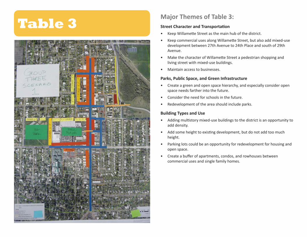
Table 3Major Themes of Table 3:Street Character and Transportation• Keep Willamette Street as the main hub of the district.
• Keep commercial uses along Willamette Street, but also add mixed-use development between 27th Avenue to 24th Place and south of 29th Avenue.
• Make the character of Willamette Street a pedestrian shopping and living street with mixed-use buildings.
• Maintain access to businesses.
Parks, Public Space, and Green Infrastructure• Create a green and open space hierarchy, and especially consider open
space needs farther into the future.
• Consider the need for schools in the future.
• Redevelopment of the area should include parks.
Building Types and Use• Adding multistory mixed-use buildings to the district is an opportunity to
add density.
• Add some height to existing development, but do not add too much height.
• Parking lots could be an opportunity for redevelopment for housing and open space.
• Create a buffer of apartments, condos, and rowhouses between commercial uses and single family homes.
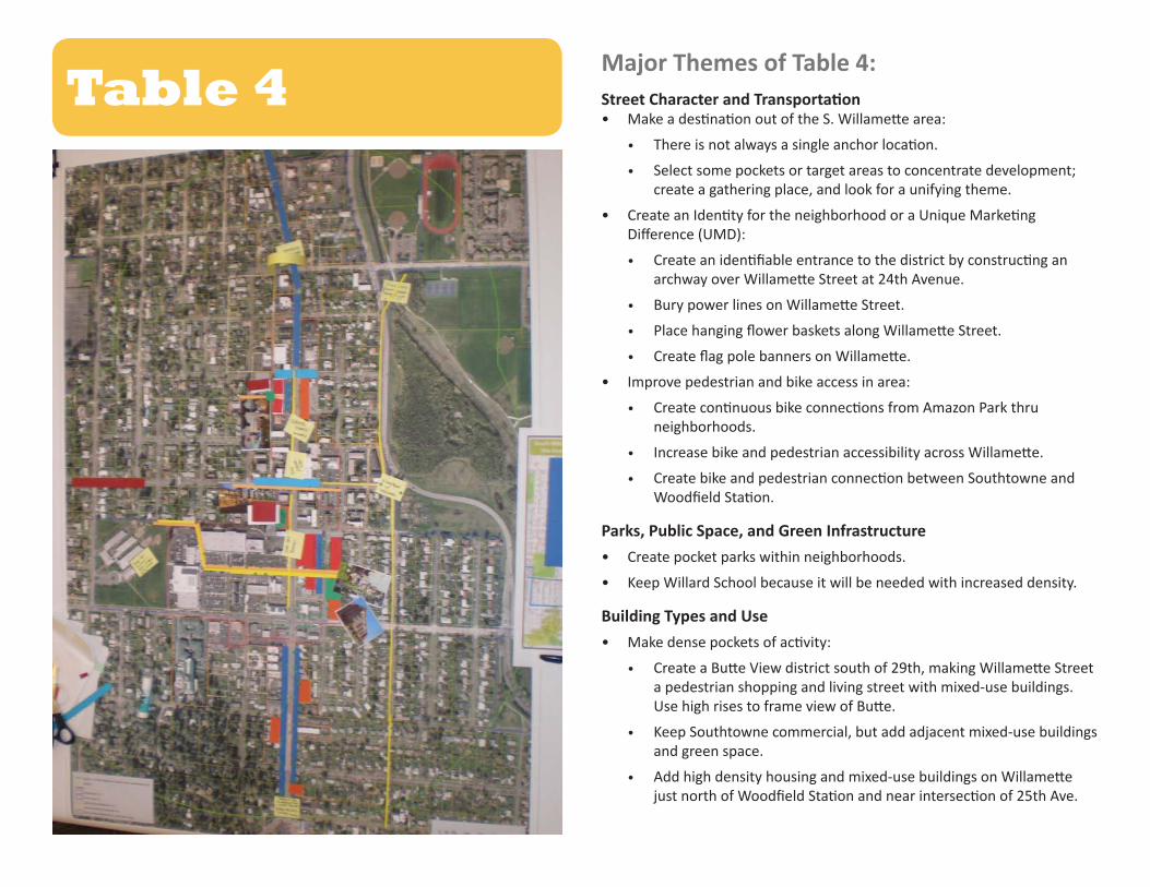
Major Themes of Table 4:Street Character and Transportation • Make a destination out of the S. Willamette area:
• There is not always a single anchor location.
• Select some pockets or target areas to concentrate development; create a gathering place, and look for a unifying theme.
• Create an Identity for the neighborhood or a Unique Marketing Difference (UMD):
• Create an identifiable entrance to the district by constructing an archway over Willamette Street at 24th Avenue.
• Bury power lines on Willamette Street.
• Place hanging flower baskets along Willamette Street.
• Create flag pole banners on Willamette.
• Improve pedestrian and bike access in area:
• Create continuous bike connections from Amazon Park thru neighborhoods.
• Increase bike and pedestrian accessibility across Willamette.
• Create bike and pedestrian connection between Southtowne and Woodfield Station.
Parks, Public Space, and Green Infrastructure• Create pocket parks within neighborhoods.
• Keep Willard School because it will be needed with increased density.
Building Types and Use • Make dense pockets of activity:
• Create a Butte View district south of 29th, making Willamette Street a pedestrian shopping and living street with mixed-use buildings. Use high rises to frame view of Butte.
• Keep Southtowne commercial, but add adjacent mixed-use buildings and green space.
• Add high density housing and mixed-use buildings on Willamette just north of Woodfield Station and near intersection of 25th Ave.
Table 4

Major Themes of Table 5:Street Character and Transportation• Create a more direct throughway from Amazon Parkway to the area:
Straighten Amazon Parkway and direct it to High St. at 27th Ave.
• Create a loop route from new Amazon Parkway to 29th Avenue to Willamette Street and back to Amazon Parkway via 24th Avenue. Possibly make the loop one-way.
• Connect dead end streets like 25th Avenue and 26th Avenue to Amazon Parkway to alleviate possible congestion caused by loop and reestablish the block grid.
• Resolve 29th Avenue and Willamette Street intersection issues using a roundabout or other redesign.
• Add street trees to Willamette Street as long as they not create pedestrian or building access obstacles.
• Gradually replace parking in front of buildings with alley parking in smaller lots and/or multistory lots.
• Reconstruct and improve alleyways to use as bike and pedestrian boulevards.
Parks, Public Space, and Green Infrastructure• Add urban plazas or pocket parks in denser areas.
Building Types and Use• Focus commercial uses along Willamette Street.
• Add mixed-use development along Portland Street and Oak Street from 24 Place to 27th Avenue.
• Add higher density housing along High Street and Amazon Parkway, but maintain low building heights (duplexes, rowhouses, etc.).
• Redevelop Willard School site as apartments and condos with a park or green space.
Table 5
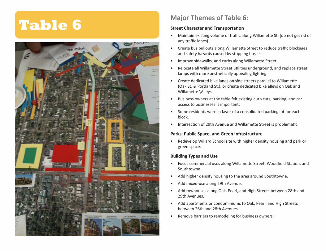
Major Themes of Table 6:Street Character and Transportation• Maintain existing volume of traffic along Willamette St. (do not get rid of
any traffic lanes).
• Create bus pullouts along Willamette Street to reduce traffic blockages and safety hazards caused by stopping busses.
• Improve sidewalks, and curbs along Willamette Street.
• Relocate all Willamette Street utilities underground, and replace street lamps with more aesthetically appealing lighting.
• Create dedicated bike lanes on side streets parallel to Willamette (Oak St. & Portland St.), or create dedicated bike alleys on Oak and Willamette \Alleys.
• Business owners at the table felt existing curb cuts, parking, and car access to businesses is important.
• Some residents were in favor of a consolidated parking lot for each block.
• Intersection of 29th Avenue and Willamette Street is problematic.
Parks, Public Space, and Green Infrastructure• Redevelop Willard School site with higher density housing and park or
green space.
Building Types and Use• Focus commercial uses along Willamette Street, Woodfield Station, and
Southtowne.
• Add higher density housing to the area around Southtowne.
• Add mixed-use along 29th Avenue.
• Add rowhouses along Oak, Pearl, and High Streets between 28th and 29th Avenues.
• Add apartments or condominiums to Oak, Pearl, and High Streets between 26th and 28th Avenues.
• Remove barriers to remodeling for business owners.
Table 6
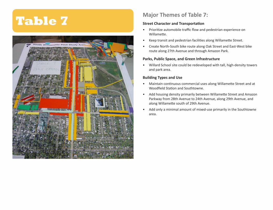
Major Themes of Table 7:Street Character and Transportation• Prioritize automobile traffic flow and pedestrian experience on
Willamette.
• Keep transit and pedestrian facilities along Willamette Street.
• Create North-South bike route along Oak Street and East-West bike route along 27th Avenue and through Amazon Park.
Parks, Public Space, and Green Infrastructure• Willard School site could be redeveloped with tall, high-density towers
and park area.
Building Types and Use• Maintain continuous commercial uses along Willamette Street and at
Woodfield Station and Southtowne.
• Add housing density primarily between Willamette Street and Amazon Parkway from 28th Avenue to 24th Avenue, along 29th Avenue, and along Willamette south of 29th Avenue.
• Add only a minimal amount of mixed-use primarily in the Southtowne area.
Table 7
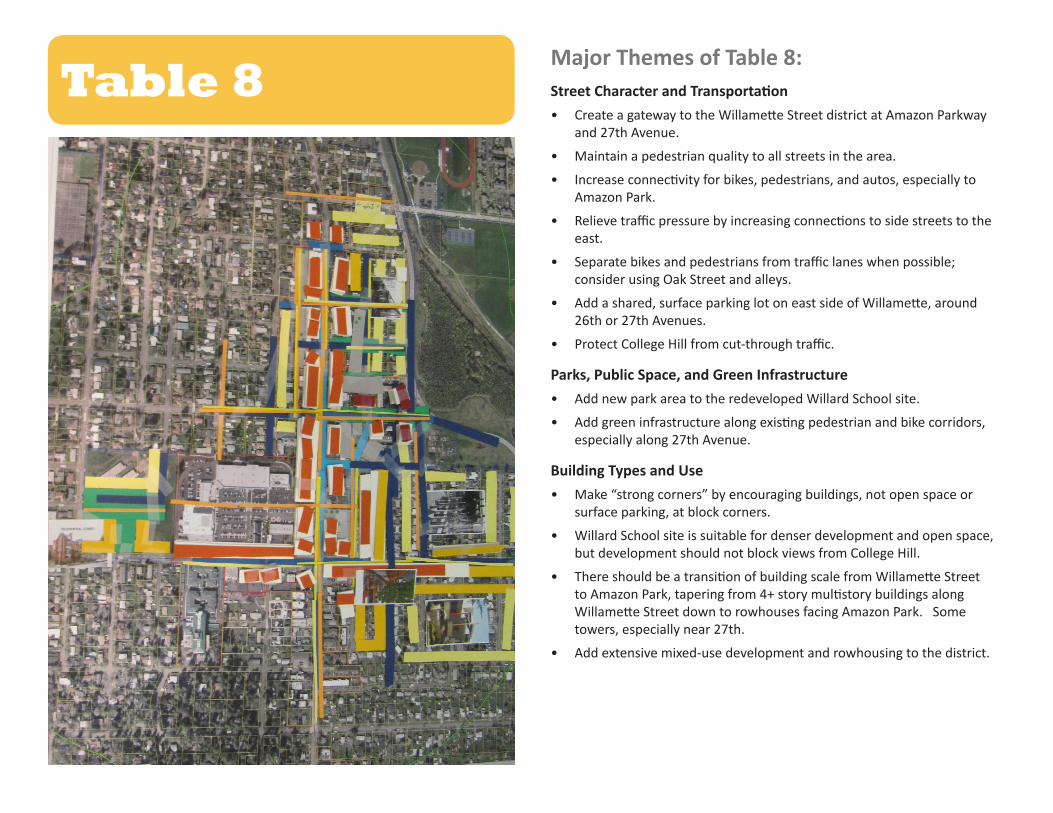
Major Themes of Table 8:Street Character and Transportation• Create a gateway to the Willamette Street district at Amazon Parkway
and 27th Avenue.
• Maintain a pedestrian quality to all streets in the area.
• Increase connectivity for bikes, pedestrians, and autos, especially to Amazon Park.
• Relieve traffic pressure by increasing connections to side streets to the east.
• Separate bikes and pedestrians from traffic lanes when possible; consider using Oak Street and alleys.
• Add a shared, surface parking lot on east side of Willamette, around 26th or 27th Avenues.
• Protect College Hill from cut-through traffic.
Parks, Public Space, and Green Infrastructure• Add new park area to the redeveloped Willard School site.
• Add green infrastructure along existing pedestrian and bike corridors, especially along 27th Avenue.
Building Types and Use• Make “strong corners” by encouraging buildings, not open space or
surface parking, at block corners.
• Willard School site is suitable for denser development and open space, but development should not block views from College Hill.
• There should be a transition of building scale from Willamette Street to Amazon Park, tapering from 4+ story multistory buildings along Willamette Street down to rowhouses facing Amazon Park. Some towers, especially near 27th.
• Add extensive mixed-use development and rowhousing to the district.
Table 8

Table 1• Cool hub – urban – for South Eugene• Distinctive place• Get out and walk• Willamette Street has more traffic (through) paired with Oak
Street a mixed-use (destination)• Commercial fronts Willamette with parking behind• New intense mixed-use facing Oak• Willamette/ Oak are complementary• Introduce block structure to east and west to create access from
College Hill all the way to Amazon Park• Willard School becomes neighborhood playfield park w/ housing
and parking• New urban 2/3 block park at center of district• Reconnect block structure E-W and N-S through Woodfield
Station• Taller buildings overlooking parks (Amazon) and where
topography allows (don’t block views)• Better bike access on Willamette, Oak, and . . . .• Trolley down Willamette Street, butte to butteFollow-up comments emailed to the Planning Department from an area neighbor:• I would cut every one of the larger blocks in the project in half
with an 8 foot wide (or larger) path for pedestrians and bicyclist to better get around the homes and businesses. See photos of Bandon-by-the-Sea which has a path like this.
• We have a few cut blocks here in our neighborhood and they are
used all of the time. Only here they do not have “eyes” facing them from the local homes or businesses. We need there to be businesses or homes that face these cut through paths and celebrate the Ultra-Cool Entrance that could be “of the alley”.
Appendix A:Raw Table Notes
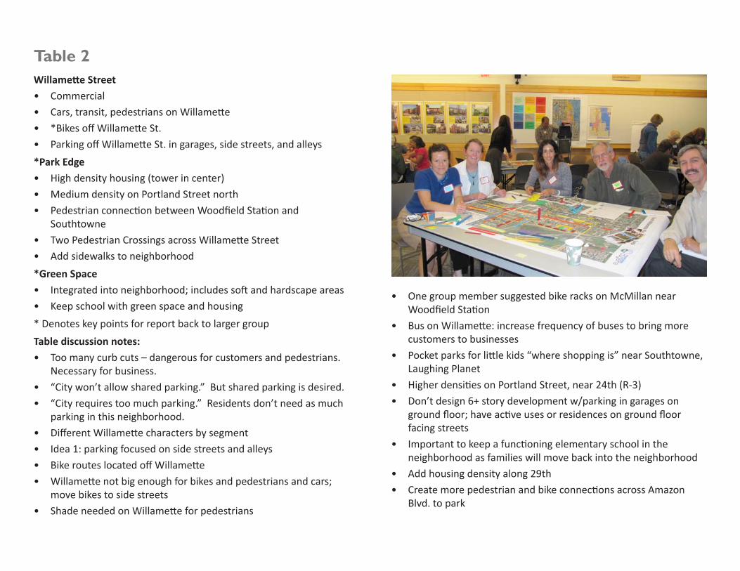
Table 2 Willamette Street• Commercial• Cars, transit, pedestrians on Willamette• *Bikes off Willamette St.• Parking off Willamette St. in garages, side streets, and alleys*Park Edge• High density housing (tower in center)• Medium density on Portland Street north• Pedestrian connection between Woodfield Station and
Southtowne• Two Pedestrian Crossings across Willamette Street• Add sidewalks to neighborhood*Green Space • Integrated into neighborhood; includes soft and hardscape areas• Keep school with green space and housing* Denotes key points for report back to larger groupTable discussion notes:• Too many curb cuts – dangerous for customers and pedestrians.
Necessary for business.• “City won’t allow shared parking.” But shared parking is desired.• “City requires too much parking.” Residents don’t need as much
parking in this neighborhood.• Different Willamette characters by segment• Idea 1: parking focused on side streets and alleys• Bike routes located off Willamette• Willamette not big enough for bikes and pedestrians and cars;
move bikes to side streets• Shade needed on Willamette for pedestrians
• One group member suggested bike racks on McMillan near Woodfield Station
• Bus on Willamette: increase frequency of buses to bring more customers to businesses
• Pocket parks for little kids “where shopping is” near Southtowne, Laughing Planet
• Higher densities on Portland Street, near 24th (R-3)• Don’t design 6+ story development w/parking in garages on
ground floor; have active uses or residences on ground floor facing streets
• Important to keep a functioning elementary school in the neighborhood as families will move back into the neighborhood
• Add housing density along 29th • Create more pedestrian and bike connections across Amazon
Blvd. to park

Table 3Underlying assumptions:• Gas/peak-oil/climate change• Population• Access to business• Not too high (but higher buildings)Green:• Urban agriculture• Open spaceSchools: Where?Notes: • Mixed-use development• Changing demographics• Green and open space – hierarchy, especially farther into the
future• Schools, what will happen in the future?
• Redevelopment of the areas (parks)• What if in the future it is needed again?
• Keep Willamette Street commercial as the main hub - make it mixed-use, as well• Pedestrian shopping and living street with mixed-use building
• Opportunity for density in the area• Commercial on bottom, residential on top• Lots of parking lots: Parking lots could be an opportunity for
redevelopment of lots into housing and open space • Buffer from commercial to single family homes with apartments,
condos, and rowhouses.• Destination commercial
• Keep planning for that?
• Will residents, if higher density, go to shop there if there are other smaller grocery stores nearby
• Navigate how people get there
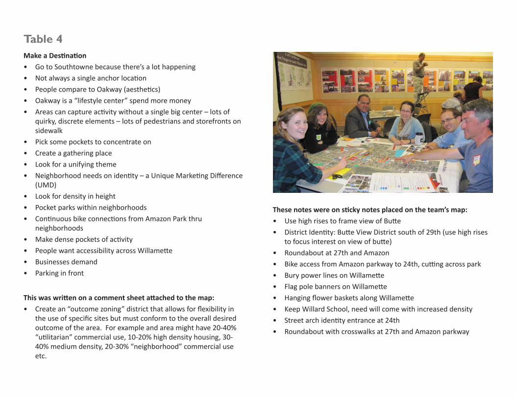
Table 4Make a Destination• Go to Southtowne because there’s a lot happening• Not always a single anchor location• People compare to Oakway (aesthetics)• Oakway is a “lifestyle center” spend more money• Areas can capture activity without a single big center – lots of
quirky, discrete elements – lots of pedestrians and storefronts on sidewalk
• Pick some pockets to concentrate on• Create a gathering place• Look for a unifying theme• Neighborhood needs on identity – a Unique Marketing Difference
(UMD)• Look for density in height• Pocket parks within neighborhoods• Continuous bike connections from Amazon Park thru
neighborhoods• Make dense pockets of activity• People want accessibility across Willamette• Businesses demand• Parking in front
This was written on a comment sheet attached to the map:• Create an “outcome zoning” district that allows for flexibility in
the use of specific sites but must conform to the overall desired outcome of the area. For example and area might have 20-40% “utilitarian” commercial use, 10-20% high density housing, 30-40% medium density, 20-30% “neighborhood” commercial use etc.
These notes were on sticky notes placed on the team’s map:• Use high rises to frame view of Butte• District Identity: Butte View District south of 29th (use high rises
to focus interest on view of butte) • Roundabout at 27th and Amazon• Bike access from Amazon parkway to 24th, cutting across park• Bury power lines on Willamette• Flag pole banners on Willamette• Hanging flower baskets along Willamette• Keep Willard School, need will come with increased density• Street arch identity entrance at 24th• Roundabout with crosswalks at 27th and Amazon parkway
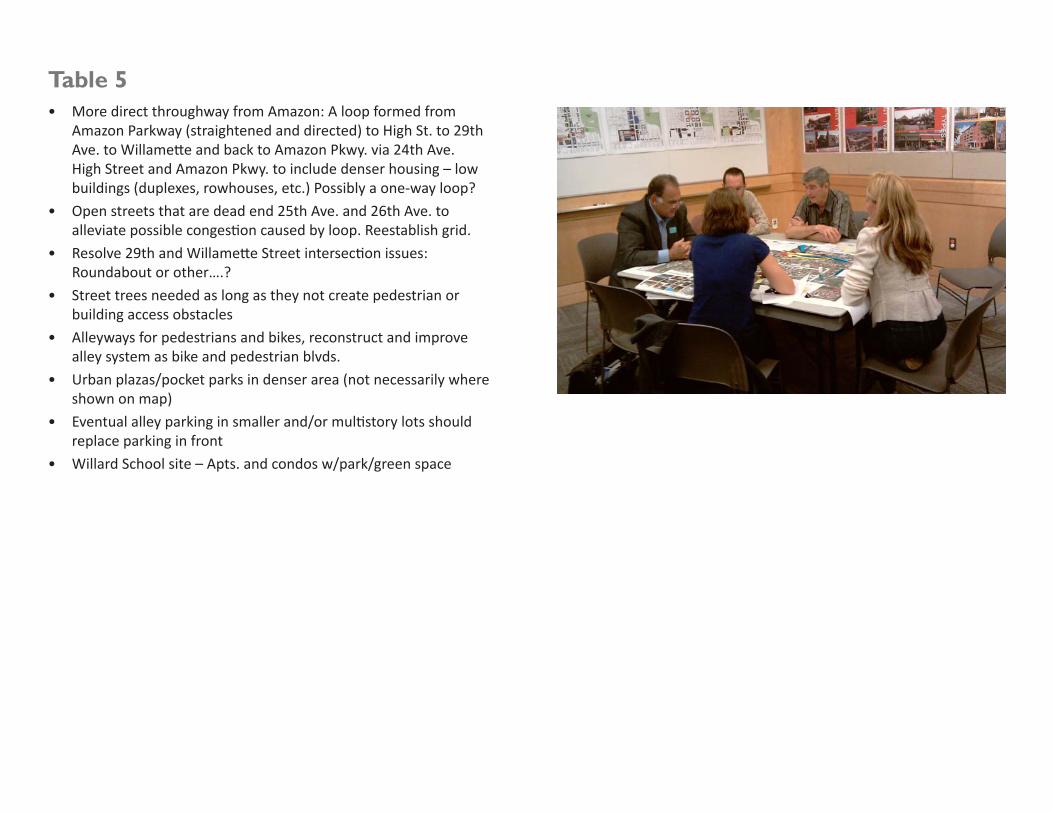
Table 5• More direct throughway from Amazon: A loop formed from
Amazon Parkway (straightened and directed) to High St. to 29th Ave. to Willamette and back to Amazon Pkwy. via 24th Ave. High Street and Amazon Pkwy. to include denser housing – low buildings (duplexes, rowhouses, etc.) Possibly a one-way loop?
• Open streets that are dead end 25th Ave. and 26th Ave. to alleviate possible congestion caused by loop. Reestablish grid.
• Resolve 29th and Willamette Street intersection issues: Roundabout or other….?
• Street trees needed as long as they not create pedestrian or building access obstacles
• Alleyways for pedestrians and bikes, reconstruct and improve alley system as bike and pedestrian blvds.
• Urban plazas/pocket parks in denser area (not necessarily where shown on map)
• Eventual alley parking in smaller and/or multistory lots should replace parking in front
• Willard School site – Apts. and condos w/park/green space

Table 6• Customer base of S. Willamette enters the area from the south
not the north. Why does the PowerPoint presentation always only show the view from the north?
• What are the primary employment opportunities in the area? How can the area become a mixed-use/ walkable neighborhood if there were only limited employment opportunities in the area?
• Willamette St. must continue to accommodate the same volume of traffic as it currently does (do not get rid of any traffic lanes).
• There hasn’t been much new commercial along the corridor. New businesses have simply been replacing those that have gone out of business.
• Planning department should remove barriers to remodeling for business owners.
• Removal of power lines along S. Willamette would be an improvement.
• Business owners at the table felt existing parking and car access to businesses is important.
• Business owners felt that parking and existing curb cuts should remain the same, but some residents were in favor of a consolidated parking lot for each block.
• Intersection of 29th and Willamette is problematic. Some felt the redesign of it was done poorly.
• What is the population of the S. Willamette area? How many people are using the area?
• Some felt the discussion was dominated by business interests• Buses stopping on Willamette are problematic, blocking
traffic, and creating safety hazards. Bus pullouts would be an improvement.
• Bike lanes should be on alleys (between Oak and Willamette or Portland and Willamette) or on side streets (Oak, and Portland) parallel to Willamette Street, but not on Willamette Street itself
• The area around Southtowne would be a good area for higher density housing.
• Mixed-use was proposed along 29th• Rowhouses were proposed along Oak between 27th and 29th• Willard School area is also opportunity for higher density housing
with park.

Follow up comments emailed to the Planning Department from South Willamette business owner:• Relocate all utilities underground• Replace street lamps with more aesthetically appealing lighting
solution • Refurbish sidewalks, and curbs• Within boundaries offer a test program with relaxed standards for
improvements to the business and apartment properties with an extra eye toward improving aesthetics. While adhering to safety issues, allow a standard of code compliance that improves the status quo...but does not meet all current codes.
• Assign a “facilitator representative” to prospective re-modelers along the street. A liaison between the remodeler’s position...within planning. Their role would be to “package” a prospective remodel with prospective compromises...and get this approved by a ?weekly committee. Send letter invitation to business and property owners announcing this plan offer.
• Create a system of plantings that don’t impede business, but add greenery. Sizes would be important. Affected property owners should have say in positioning. Some could be located on the commercial properties I suspect...with a one-time property tax credit dependent on the size of the plantings. This would allow less impact on the sidewalk.
• Reduce the one traffic bottleneck; buses stopping. Find a solution for this, and Willamette Street could accommodate 20% increase in traffic over 20 years.
• Create an alternate bike and walkway path on a parallel path to Willamette St. Put some resources toward making this well-lit, pleasant ambience as allowed, and good path-bed with intelligent bike/pedestrian solutions.
• I may be wrong, but I believe that over 75% of the affected property owners would disagree with reducing the number of lanes used for auto traffic from current. Including dedicating turn
lanes and mass transit dedicated lanes. If anyone has congestion issues in mind now, this certainly would amplify the problem. Further, as vehicles sought to avoid the newly created bottleneck, there would be more vehicle miles travelled, and the impact would be felt on the alternate routes. Also, of course to me as a commercial property owner, with less exposure, comes less value in my property.
A Photoshop representation looking north from 29th Avenue down Willamette Street without utility lines and streetlights.

Table 7• Bike path routing• Willamette St. and pedestrian facilities and transit• Building types:
• High rise and parks• Apartments/condos• Rowhouses/cottages• Commercial on Willamette• Minimal mixed-use
1. Issues of defining Willamette solution: two options2. Commercial along Willamette continuous and intensify3. Street configuration:
• Keep all lanes, but maybe reconfigure for volume• Transit• LTD- keep buses on Willamette maybe fewer lanes but issues w/
buses• Maybe treat intersections different – extra lane?

Table 8• Increase connectivity – all modes…bikes, pedestrians, autos.
• Particularly bike and pedestrian connection to Amazon Park• Relieve traffic pressure by increasing connections to side
streets to the east• Transitions of scale of buildings from Willamette to Amazon Park.
4+ story multistory buildings along Willamette. Taper height to rowhouses facing Amazon Park. Some towers, especially near 27th.
• Create a gateway to Willamette St. district and to Amazon Park and parkway at 27th
• Add shared surface parking lot on east side of Willamette, around 26th or 27th.
• Make “strong corners” with development (no open space) at corners. There is enough open space.
• Lots of mixed-use buildings and rowhouses• Separate bikes and pedestrian from traffic lanes when possible.
Consider Oak Street for bikes. • Consider use of alleys for pedestrians, bikes, or access to parking. • Willard School site is suitable for denser development and open
space. Do not block views from College Hill. • On-street parking on Willamette• Protect College Hill from cut-through traffic• All streets should have a pedestrian quality