sitka mining district
TRANSCRIPT

DEPAR- OF THE INTERIOR
UTlTED STATFS GEOLOGICAL SURVEY GEORGE OTte SMITH, IB'mmop
SITKA MINING DISTRICT
ALASKA
BY
ADOLPH KNOPF*
WASHINGTON QOVERNXEPTT PRfRTINCt O F P f U E
1912


CONTENTS.
Prefam,by Alfred H. Introductory ~tatement--------,-+--------_--------------------~---~+- Hiatorlcal . Geogrtlphic 8ketch -------------- - - - - ,----- - -----------------------d-
Climate -.---------------,,,---,,,----
Glaciation -,,,,,,,,,,---------------.-..-----_------------,--d-+--- Genera1 peologg,,,,-,-,----------+----~-------------------------+~--
Straufled pock% -- .. ---.---------------------* hhwdve m k . ~ --. . .---_- "------ .----_,-,-,,
Deep-seated mclta ------------------------------------------.- Dike rocks,.,,,,,,,,,-----,-,--~*~-------- -----------------
Relation of Intrusive rocks to minerallmtlon ------.---------------- Blag Bay-----------,,-,-,------------------------------------------+-
Geography md hl&ory,,--,-------------------.--,-------------,- General geol~gg---,,-,-,--,-------------------------~----------+- Petrography ------------ - ---+ --. --- . .. --- A --- - - -.- --- --- -------- Ecouomh ,neolag~,---,------,~----------~--.--.------------------- Bpeci~l d e s c r l p t i o n a - - - - , , - - - - - - - - - - - - - . _ - - - , , , - - - - - - , -
Chichagoff mlne---------------------------------------------- Golden (;ate mine -----,-----2--_---------..L --------------,-
Illtst Cove SIlning Co -,----,-_---- _------------------------- other ~a~M,,*,-+-+---------------------------,---------- Prlncma Phnder prospwt ----------------------------+ ,,
BimI -----,,,,,-,,,,*,,,------------------ --------------------,----
Genernl geologs-,----,,-----.----.-- - - Ow deposlta------------------------.---------------.----------,- Bpecial deacrlptions-------------------------------------+--------
Cache mlne--------------------------I----------------------,- Bauer Cascade Lucky Chance mine------------------------------------------ Other pros~t~- , - - - - - - . - - - - - - -__- - - - - - - - - - , - - - - - - - - - - - - - - - -
XonmeWlc Grrtnlte ,-,-*,,,,,,,,,,--- -------------------------------------- Gypsum
The g y p m depa~it---------------------:-------------------- Mlne developmcnts------------------------------------------- Market
(=on~lualon-,------------------~------------------------------------ a
Page. 5
PAW. -=I. Oeologlc IrsFonnalwrrance map of tbe 81th and Jmtean minlng
dl~Ictr,,,,,,,,,--,,,--,,---,---,-------,,,------- 316 F r o m 1. Pros- at Klng Ray,, ,,,,,,----,,,,------ -- 19
2 M i o n a c m strlke of roc& at bead of Klag Rng, ,,,, -,-+-- 20 R Claim map of CChlchnd and Golden Gate propertien ,,----,--- 22 4. P r o m s In the rlclnity of 811ka nud RiIver Bay --,,,-,,-,-, 23
4

By ALFRED EL BBOOKIJ.
The first attempt at lode gold mining in Alaska was made near Sitka in 1871 but was soon abnndoned. In the s u d i a g quarter of a century but little was acmmpli~hed in this field toward establishing productive enterprises. An era of commercial mining was begun by the discovery of gypsum deposita near Iyoukeen Cove about 1902 and of auriferous lodes noar Klag Ray in 1905. The output of the mines at these localities, which are on Chichagof Island, in tha Sitkxt district, has helped to swell the value of the annual mineral produc- tion of Alaska.
Several geologists have visited the Sitka region since 1895 and brief reports regarding its mineral resouma have been publkhed, but most of these are out of stock at the Geological Survey. The growing interest in the mineral resources of: this field led ta their further invedigation by Mr. Knopf in 1909 nnd to the preparation of this report, which summarims all the data thus far collected, Ih prep- aration and pnblication is in accord with the pnernl plan to pnblish summary acxounts af the geology of the mining districts of Alaska as fast as c i m m s t a n ~ permit. In conformity with this plan reports have already h n published on the Retchikan, Wrangell, Juneau, Bemers Bay, and Pornpine mining districts of southeastern Alaska?
As the areal geology and the stratigraphic sequence in the Sitks, district a m still imperfectly known, this report is necessnrily of a,
pmlimiurtry &am&r ; but if the mining industry of the Si&a district continues to advance, more thorough studies will be undertaken a4 m n as cirmunstanm permit. Mr. Kmpfs mnclnsion, here set forth, that the gmpacke-date
belt pasaIleling the line of granite intrusive along the weatern side of Bichsgvf and Baranof islands is a promising field for the occur- rence of aurifemus lodes should be of interest ta the pmapector. His
=Wright, C. W., The Porcapine placer diatrlet, Alaska: Bull. U, Ei, OeoI. Buwey No. 286, 1904. 88 pp. Spencer, A. C., The Juneau gold belt, AIaalta: Wright, C. W.. A wcon. nalaaance of Admiralty l a I a n 4 Alaska: Bull. U. I. Ceol. Rurvey No. 287, 19013, 181 pp. Wrlght, C. W. and P. E., The Ketchlkan and Wransell mlnlnc dlstrlcta, Alnnka: null.
. U. 8. Owl. Same7 No. 347. 1908, 210 gp. TCnopf, Adolph, Geology of the Bemm nay mgloa : Ball. 1CI. 8. QeoL Eimeg No. 446, IBll, 68 pp.
5

suggestion that the graywackes and slates may be of Jurassic or Cre- taceous w, and not Paleozoic, as hitherto supposed, map have an important bearing on the geoZ0g-y of other pmh of Alaska. These rocks have generally been correlated with the Orca group of Prince William Sound, whose age is undetermined but is supposed to M-aic.

THE S1TlC.A MINING DISTRICT. ALASJLL
INTRODUCTORY STATEMENT.
In the following report the writer aims to present s Mef sketch of the geology of the Sitka mining district, with especial reference to the mineral resources of the west mast. The mining industry of the district has been in a state of nearly complete stagnation during the last decade, but the discovery of high-grade gold ore in 190: at Klag Bay, 50 miles north of Sftka, and the subsequent prosperous career of the mine founded on the original discovery have given a new impetus to development and hare attracted attention ko t.he comparatively anpmspected terrihv on the wmt coast of Chichagof Island.
The data on which this report is based are drawn fmm various sourcea In Jme, 1910, the wsitef spent t h m weeks in investigating the geology at mag Bay and the surrounding inlets and subsequently spent a few days in examining the prospects in the vicinity of Sitka; To supplement the data obtained from his own field work the writer has drawn freely on the unpublished field notes of F. E. and C!. W. Wrighk, and has examined their collections and microscopic thin sections. In 3904 F. E. Wright made a monuaiaganct? study of the gpolagic section from Taku Inlet t o Sitka by way of Peril Strait and investigated the geology of Silver Bay and the west c& of Baranof Island ss far south as W h ~ l e Bay; in 1805 C. TIT, Wright made a reconnaissance trip along the east coast of Bamnof Island and around Chichagof Island. Brief preliminary accounts of these in- vmtigstiofls have already been published,' but owing t o unforeseen drcumstanw more detailed reports were not- prepared. Because of the writer's partial familiarity with the field it became his task, in view of the renewed interest in the region, to assemble the known
* Wdght, F. E. and C. W.. ~ n o m i c developments In wnthamntem AIsaka : Bull. U. S. -1. 8utv6y No. 259, 1905, pp. 55-58. Wright, C. W., M e mlnlng In aclutbeterm Alaska: Bull. Fb 8. -1. Sowry No. 814, 1907, pp. 5941. Wrkght. F. E. and C, W., The RetcILlkan and Wrsngell mlning dlstrlcts, Alaska: BuH. U. 8. Owl. B u m y No. 347, 1008, p. 84.
2. -- 7

facts concerning its geulogy and m i n e d reso- me area is large and much of it is geologically nnexplored and the h a w l e d p of it is correspondingly maper, but it has nevertheless bean thought worth while to bring tagether the existing p l o g i c data.
HISTORICAL NOTES.
The first attempts at I d e mining in Alaskzt under the American rhgime -ere undertaken in the vicinity of Sitka in 1871. This work was done on a quartz ledge outcropping at the f a h of Indian River, 1 mile east of Sitka. Although no serious efforts were put forth, the matter aroused some 1 ~ ~ x 1 excitement, and news of the discoverg nppeared even in San Fmncisco newEipapers. In 1872 threa placer miners discovered near the head of Silver Bay the quartz ledge sub- sequently known as the Lower ledge, but it was considad valudm by them. Some of the ore was seen by Nicholas Hayley, who had pmviously worked in the mines at Grass Valley, Cal., and the Comstoclr, and who was then serving in the gamimn stationed at Sitka, and the lode waa Imated by him. Late in the same year he discovered the Stewart ledge, which was named after Maj. Jmph Stewart, United Statas Armg, Before 1880 many other ledp had been discovered in the district around Silver Bay. In 18'79 a 10- stamp mill was erected on the Stewart property.
Pehroff; writing in 1880, says: Dim~erieer of ppld-benslng quartz have been made on Ratanof Island, in
the lrnmedlate ~lclnlty of Sltka, only since the transfer of the Terrltorg, and for a time quIte an excitement wan cmntd; but now t h m ledgm nre mrcely worked at nll, bdng ~ l m p t y held by the owners for farther developments or until mme prwtul can be d l m v e M for working with pmat the peculiar grade of ere existing t b m . In the winter of 1880-81 a considerable part of the population of
Sitka participated in the st&mpeds thst led to the faunding of Jn- nesu After the lapse of nearly 40 years since the original discovery of gold-bearing qunrtz, none of the properties at Silver Bay have been put on a productive basis. During that t ime some remarknble mining failnm have taken place on Barenof Lslmd, those at Rod- man Bay and PandG Basin being well known throughout suuthaastern Alaska. This state of a f h k led to the nearly complete extinction of all interest in lode mining in tha Sitka district, and it ia only since the discovery of gold ore at RIag Bay on Cbichbgof h h d in 1965 that interest has in some measure revived.
OWQRkPHIC BTZETCH, The Sitka mining district comprises Chichagof, Baranof, and
b o f islands, together with a few smaller islands, The btal land area roughly approximates 4,500 sqmm rnilm, the greater portion of
lTmth vol. 8, Regort on the popdutlon, iaduatden, and resourno of Maah, - - p. 30.

which i s included in Chichagof and Baranof khnds. Those two islands farm in effect a single land mass, pd13alIy tapering south- astwsrd, mparated into two parts only by a narrow body of water known as Peril Strait. Its extreme length from Point Adolphus on the north to C s p Ommaney on the south is 150 miles, and the aver- nge width is 30 miles. On the east the islwds are sep~mted from tlw other islands of the AIexander Archipelago by Chatham Strait, on the north they are separated from the mainland by Icy Strait, and on the west they am bordered by the Pa&c Ooesn. The topogrephic features of t h e islands are entirely similar to
&use of the reminder of southeastern Aasktt. The coast line is indented by numerous bays and fiords, many of which, lika Tenakee Met and Whale Bay, penetrate far inland into the heart of the islands and render territory accessible that is otherwise nearly im- penetrable, The d i e f is rugged and the mountains rise abruptly Pmm the shore, at many places forming bold cliBs, hundreds of feet high, surmounted by precipitous slopes, rising 2,000 to 3,000 feeL The ruggedness increases toward the interior of the islands, and little is yet Imown cmcerning the inland portion of this region. Ia p- e d , the altitudes range from 2,000 to 4,000 feet.
T h e region i! well forested with coniferous s p i e s , mainly hem- lock, Bpruce, and cednx, both red and yellow. Jack pine is found in small amount amd is limited to open, boggy park, being apparen* unable to compete in the more favorable situations with the other conifem On the west mast, BS at mag Bay, the timber Iine d e a 1,500 feet
above sea levd, but in protected localities it reaches 2,500 fest. 7 3 % dimetar and height of the t r m vary considerably from place to pIace; at Elag Bay, far example, 18 inches appears t o be the average dimwhr, wh- along Indian River, east of Sitka, m m c e n t trees are common, spruces as much ss 6 feet in diameter and 175 feet in height h a ~ i n g been noted. As a mle, the snpply of timber is ade- quate for general mining purposes, but the stand of logging timhr is mmparetively ~ B I J and is m n exhausted at any om lomlity.
A thick and Inxnriant undergrowth is common in the forest and cmsists ZrrgeIy of Mneberry brush and devil's club, with wrioas other kinds of growth, such as willowtr, alder, salmon harry, and the high-bush cranbemy. On account of the frequent rainfall this under- growth is almost continuously wet, and thia feature, together wi& its jungle-like character and the numerous windfalls of t imbr, make the
'
forest a formidable obstruction to hhe prospactor. The geographic and climatic features, as well a6 t h e fomt, impme
Iirnihtims on the pmpector'a activities, As the waternays furnish the ody means of communication with the entars of supply, which are few and widely wparated, a boat, preferably a power ha t , be-
fEW7°-BalL 504--

10 THP] SIT= MIXING DISTRICT, W R d
rtotnes a n-ry part of the prospector's quipmenf. The waters are often rough land stormy, the islaadg are exposed to the open ocean, and in winter the beads of the bays ara frozen u p 4 conditions that tend to restrict p m p t i n g to the summer months. h order to utilize the few favomb1e months of the year as eflectively as possible, prospecting has hitherto k e n confined mainly to examination of the shore-line expwures and to the country clmly bordering the coast.
The cIimata of the region is cool-t.anperate and humid, The pre- cipitation is l~eavy , tha number of rainy days is large, and f oggg and cloudy weather is of frequent occurrence.
Records have been kept for a longer M o d a t Sitka thsan at any other Alaska st ation, ao that unnsudly full statistics concerning the climatic features are available. The mean nnnual temperatnre at Sitka is 4 4 O F. The mean monthly temperaturn for February, the ealcfest month, is 33", and for August, the wrtmest month, 56", the mean annual range being thus only 23".
The average annuaI precipitation, including melted mm, is 88 inches, and the extremes on record since 1868 am 59 and 140 inch= The avmge number of days during which precipitation takes place is 208. At w bvel the precipitation ismusually in the form of rain, but there is a considerable snowfall on the mountaim, which, even at moderite altitudes, often remains until late in swnmer.
Thssesbtbtlca am aknn horn the more corn- tables fn Gmgnpby .ad of Alaska p~ * I (& s . O r w b , n. ernion oa r u m b by ( . d v a d *bar, it.: PmL P.P 8 V so\. m i 4 0. 45, IW
The presentdny glaciation is represented, so far as is now known, by a few small glaciers only, but doubt le~ a number of others will bB discovered when the interior of the islands becomes Getter known. At Pand4 Basin, east of Sitka, a glacier occupies the hanging valley at the head of the h s i n ; and another smrrIfer glacier, known as VaIdenar ' Glacier, lies a t the head of Green Lake Valler, east of Silver Bay.


Evidence of a former greatly extended glaciation, of which the present glaciation is the vanishing remnant, is everywhere visible. The deeply fiorded character of many of the waterways is the most immediate token of the former glacial m p a n c y of the region, and this evidenm is corroborated everywhere by smaller and more low1 features due to glacial action. These consist of polished and striated surfaces and of gIaciaI drift several feet thick containing striated bowIders,
At Elw Bay broad, glacially moothed surfaces were found up to an altitude of l,3W feet on the 0mk of Doolth Mountain, an iaolatgd mountain which is too small to have supported an independent glacia- tion. The smooth, flattish summit, reaching m altitude 2&00 feet above sea level, may itself owe its farm to the action of &I overriding ice sheet, for the neighboring mountains that attain higher altitudes show wrrate profiles. As Dmlth Mauntain practically sbnds on the shore of the Pacific Ocean, these figures furnish a rough estimate of the minimum tliickness of the ice shed as it reached the open m a n during the glacid epoch.
The & of Chichagof and Baranof islands lie in broad belts that strike northwest and southeast, conforming with the p-vailing structuml trend of southeastern Maska. The Gore of the islands is made up largely of granitoid rocks, mainly qu&a diorites, which, as a rule, have been intruded parallel to the stratified rocks. The gene& distribution of the rocks is shown on the sketch map forming Plate I.
B!CZUWXED BOCKS.
The oldest rods consist of ch&, commonly brewiated and folded, land banded quartzite resembling pywacke. Small dikes of mela- phyre cut the strata at numerous IocslIities. Thaa rocks outcrop for wveml miles along the north shore of Chichagof Island, between Idaho Inlet and Port Frederick, and continue southeastward fmm Port; Frederick to Point Augusta. AZtho~gh the thickness of this seriss of rocks has not hen determined, it is believed to exceed wv- era1 thouad feet. On the w e t at Xdaho Inlet the racks am in- truded by lightalmed quartz diorite, which is gneissic dong #%
contact and has altered them to a ompact biotite &st. The overlying rocks are cherty limestones of Silurian age, as de-
termined by fossils found at Port Frederick and Freshwater Bay- They are particularly well exposed along the south side of F d - water Bay, where they have hen studied in some d&il? The rod$4 stand nearly vertiwlIy and am over 1,000 feet thick, the lower two-
' Kindle. El. M., Noter on the Faleomic faunal and stratigraphy of aoatheastem Aln~ba : Soar. -logy, vol 16, 1PW, p. 322,

thirds of thk thickness mnskting of darkimJ, M y laminated limestones. A h the Silnrian at this ImIity am 50 feet or more of Middle Demnian lim stone, stratified in beds 1 to 4 feet thick.
A thick seriw of melapkipre lava flow and tuffs interstnitifid with limestone beds of Vpper Devonian age is e m on the northmet side of Fmhw~ter Bag end forms a belt of mcka extending north* westwand to But Frederick. As the t u f f Ms am fossilifemus, it is probable that the Iavas were en~pted under mbmarine conditions. The melaphyres are mainly altered halts, red, p n , or black in color, the red being perhaps the most curnmon. They me dense grained mks and show a porphyritic texture, due to the ppeaence of scatbred cqshls of feldspar.
Somewhat over 1,000 feet of hmmtme of Mkkippian (lower Qrbniferous) age overlies the m e l a p h p and is exposed in Pod Frederick and along the northewit shorn of Freshwater Bay. Gn-_ cerning the latter locality Kindle reporta: On the northeastern side of the bay. and -lie the BUurlan and IDeVonlan
llmeettones already desc~Jbed, the Carboniferous Ilme&mes fotm a low, narrow pmln~ula, never more than a few hundred yards !n wldth, pmjwting out 4 milen from the mainland. The BtrIRe varics from N. 35' E, ta N. 40' W., but generally ha# a northmterly and southeasterly tread. The dlp Is hfgh, ire quently 90". I t l a gometlmert easterly and aemetimea westerly, the §ion of dfp depending w whether or not the Ilmb of the large fold to which all this pcnlnmrla and the older bmW m the swth alde of the bay belong in ~lllghtly overtnmd a t any glsm point. The thiclrmm ol the mveral diriaions of the limeatones wblch are exprreed a h g the north ot this pealusula i~ fndl- m t d nppmxtrnately i n the following &&lo& which begLns gbmC one-half mlle above (nortbwwt of) North Pawage Point:
I"ett. e. R m I a of large gray limestone fYagmentpl,--,,,--,--4----- 100 d. Hard gmy Ilmwtone, much fractured by namerow i m g l a r
jofata. and breaking fub smtlll irregnlar fragments on weathering. Iarm Prduftoidm mmman. Dip, SOe to $0' toward rwuthwe~t. Btrike, N. 40" W ,--,--,,,,,,, 90
c. Qray limestone with Fpequent bpnda of black chert. warm Dlp, 80' t0 DO" NFk Strike K. 10' to 20' W , Z76
b. Dark-pray limestone wlth black chert bands. M a abundant near upper and 1 m Umitk Arerage mke. N: 30" a wlp, 70' to me NW ,-,,,-,,,,,,,,,- 250
a. Llm&oae ~lmiiar to b, w l l r eammort --,--,,,,--- 275
rn At Iyoukem CoPe, Freshwater Bay, beds have been found
associated with cherty limestones, which apparently overlie the lower Carboniferous mIts axposed along the southwestern shore of the cove. They are p r o v i s i d y regmded ES of P d a n a Trias- sic ggaS
1 Op. dt, pp. 8-L *Wslgbf C. Wq The Mldlnl mt- and matmrltl* at mutkmhtum Abuh : IWL U. 8.
-1. B u m No. 344 190% p 126.

BTRATIFTED ROCKS. 13
AIong the west mast of Chichagof and Barsnof islands the rocks appear to be di&ible into two large mbdivfsioas. Tha -ternmost of ~hese-that~ itj the belt of mcks Iying against the granitic axis of the idan-nsists of greenstonea and phyllita, amociated with limestones, cheFta calmreous chlorite schists, and nmphibal jte schist P.
The phyllites md 4chists are remarkably crinkled and contorted and in many p l m are gnarled and laminated with hots and vein- lets of quartz. The penstones, limmtones, and cherts show at some lmdities a. pmfonnd fracturing and brecxiation, so that the rocks RIW in f a t ~mmemented rubbles. This fenture is strihglg displayed along the show of N h a s i n a Pmap and Katlian Bay, a few miles north of Sith. Greenatone from Lisianski Penimula, on Nakwa- aina Passage, pmvw microscopically to be an andesits of micro- litic texture; tuffs and smygddoids, as at the head of Ford Arm, f o m part of the greenstone ~ r i e , that Without doubt they repre- sent a succession of much-alkred surface volcnnic mcks. Fossils have not hen found in any of the m c i a t e d rocks, that the age of this mries of rwks is not known. By analogy with the Juneau kgion it has been mmnid that they are of upper Carbanifemus age.' To the west of them mh is 8 belt of pywacka and slate, which
forms Ohe bdm& at Silwr Bay, Sitk., and Rlag Bay. The f i a is northwed-southeast and the dip is steep southwest, commonly TO0 or higher. At mmy plaoes the designation "slate-graywacka formation ?' is apt to convey a m.konception as to the relative abundance of data At Sitka, for example, graywscke constitutes such a preponderant proportion of the formation that all the surfaco exposures consist esentislly of that mck. East of the mouth of 'Indian Rimr rnaasive outcrops of gmywacke several hundred feet thick appear, which show no d k n i b l s stratification. At one point near Indian Ri1.e~ a 10-inch belt of fine oonglamemte, trending N. 70" W., was noted. The matrix of this eonglomemh is thomughly litbified, so that the rock breaks across the pebbltx. This atratum of wngIomerate is not separ~ted, as in ordinary sedimenary rmb, by sedimentation phnes, but gradas irregularly, though abruptly, into the inclosing pywacke . The p y w a c k e s were designnted '' pyroclastic diodes by Becker 2
rtnd lwally are usurlly referred to 6s diorites, but the gediments~ character of the p g w a c k e s has been uniformly recognized by aU other gmlogish who have examined them.
Conglomerate and conglameratic graywacke occur at Old S i h The pebbles of these rocks comprise slate, schist, chert, mdesih, snd
iWrIpht, F. B and C. W., The Ketchiknn and W m g e l l mIQtnL Al-: Bd. D. Gd. Burveg MR 347, 1808, p. 66.
8 Becaer, G. F., BeconmI~@nnce of tbc old fields of muthem dlneb Mth m e ootea on general gwlogy : Eighteenth Ann. Rept, U. &. Geol. Burveg, pt, R Igs& p. 43.

fsIsite. To the west the conglomerate is overlain by a p a t thick- neas of obscure mkj pmibly indurated argiIlites, much f r a c t d and interlaced with quartz veinlets, whose derivation has not been satisfactorily determined. T h m in turn re overlain by con- glomeratic graywacke carrying pebbles 2 to 3 inches in diameter and by the blue-gray coIored gsagmacke typic81 of the Sitka region.
The slate-graywacka forrntrtion hss so far proved to be unfmsilif- e m s , and its age remains unknown. It is hlieved to rest uncon- fomnbIy on the greenstones and amciated rocks to the east, but this unmnformabIe superposition, if it exists, has not yet b n obsemed in the field. The lithologic difference and the probably superior de- p e of metamorphism of the underlying rmka ~lrongly suggest uncon- formity. So, too, d m the character of the pebbles in the conglomer- ate beds; but as these beds are not basal conglomemtw this fact is not conclusive, but is open to other interpretations. It. is well to point out that a considerable volume of p e e n graywackes, whose recog- nition, and discrimination from gemstones is not pmsible by the unaided eye, underlies the congIomeratic bgds at Old Sitks. The permliar character of these graywackes may be due either to the fact that they reprmnt transition strata or, on the other hand, that they are derived immediately from the underlying &.
The graywacke-slate formation has been ten tntively assigned to tha It is not txn ~unreasoneble conjecture, pending the accumu-
lation of stronger evidence, ta suppose that it may aventually prove to be of the same age as the Bernsrs formation of the Juneau region, late Jurassic or early Cretaceous. In l i t h o l o ~ and dagree of meh- rnorpbism of the graywsckm and s l a k it b r s a striking similarity to that formation.
The youngest mxks of the region are the postgIacia1 l a m and tuffs that make up the volcanic cone of Mount Edgeenrnbe on 1Cmof Island. It is reportad, upon somewhat qnestionnble evidence, that Mount Edgecumbe was in eruption as late as I'i06.* The volcanic rOCILF am mainly h s i o and&& or basalta md display a striking diversity of color, texture, and crystallinity. They include black g l q &thy pmims, and gray holmrystalline Invas, A lava eol- lected at the shm east of Mount Edgecumbe mnsista of a gray, highly porous & which is thickly studded with glassy tabular pIagiocIase feldspars, ranging in length from three-tenths b four- tenths of an inch. According to a, rough estimate the feldspar phenm cysts farm half the bnlk of the m k . Small g l a ~ g grains of olivine ltm sparingly scltttered throughout the rocks Under the m i m c o p a the plagiwlase phenocrysts prove to be s mlcic Iabradorite near
'Wrlgbt, F. E and C W, Bull. U. 8. -1. B m j No, 247, 1908, p. 85, "Bwker, O. P.. op. elk 0. 13.

Ab,An, ; some of the olivine forms crystals large enough to be termed phenoerysts, but most of it is found in the megostasis between the feldspar phenocrpts. The mesostasis is holocrysblline and consists of a doleritic aggrwte of nugite and feldspar laths, with accessory magnetite and hematite.
Extensive me- of partitoid mcks form the mutral parts of the islands. The dominant type is a quartz diorita composed esntially of andesine feldspar, quartz, bidih, and hornblende. As a ruls the dark minerals we, not very abundant and the dioritm axe medium- p i n e d rocks of light color. At a few localities rocks more basic than quartz diarite are known. Hornblende gabbro is found at the head of Tenakee Inlet, and a highly shattered and &eared gsbbro occurs along Nakwasina Passage and Katlian Bay. At Port Althorp, on tha north shore of Chichagof Island, e x p m s of hornblendit+-a black rock consisting entirely of hornblend+form a mass one-f ourth mile wide. The intrusive rocks are commonly fresh and unaltewd tnnd are
little affected by schistose or gneissic structures. The marginal por- tiom of some of the intmsive masses, however, show gneissic folia- tion. At such localities the diorites are flanked by bdts of crystalline schists, mch as mphibolite schists and biotite Pichists, whose cry+ tallinity diminishes at increasing distanm from the mntaet. Such schists are encountered at widely separated poi&-at Patterson and Gut Bays, on the east side of the south end of Baranof Island, and along Icy Strait, on the north shore of Chichagof Island.
The intrusive character of the quartz diorite masses is well eshb- lished, and with the exception of various dike mcks and the recent lavas on Kruzof Island they axe the y o u n p t rocks of the region. On account of their dose resemblanm to the dioritic rocks of the Go& Range on t h e mainland and their extensive distribution they are regarded as pert of the p a t series of deep-seated igneous rocks that invaded the province of southeastern Alaska in late Mesozoic time. Some older ganitoid rocks may probably bn included among the
Mesozoic quartz diorites of the Sitka mining district, but they have
7 not been certainly recognized and discriminated from the younger *
rocks on account af lack of detailed observations. The quartz diorite p i s , containing large plates of biotite, at SchuIze Head, Peril
.- Strait, may belong to such an older series of igneous rocks, but this is hardly more t h a i a suggestion.

16 THE NTRb MlBTNG DIBTBICT, ALAS-
Pegmatite and aplite dikes acmmpany the qaarh diori* and lampmphyric dikes have b found a t some places. Emerson1 has described a spessnrtite dike as occurring at Hot Springs, near Sitka, and F. E. Wright has determined others from the same Imlity to be vogesites. The lamprophyric dikes are dark rocks resembling diabases, and they appear to lx comparatively rare.
The aplite d i h are of greater import:anee and ara widely distrib- uted, though nowhere present in large numbers. They are finely p n u l a r white or light-gray rocks, with a tendency to m obscure porphyritic texture. They are locally known as porpbgriw but will here be designated diorite aplites. Microscopically they prove t o have a hypidiomorphic or pmidiomorphic granular strnctum and are seen to consist essentially of andesine (AbzAnl) with minor amounts of biobite or hornblende. Pyrite, calcite, muscovite, and chlorite appear as secondary minerals.
A remarkable feature connected with the &mite aplites is their occurrence in the gaywackesI&te formation st long &titan-s much as several miles-from known a m s of the diorite intrusions.
* Equally striking is their uniformitg of appmnce, so that rock$ collected from widely separated localities, hare identical character- istics. C)n account of their light color the dikes are readily ditin- guished on shore eqaures from the somber-colored graywackes and slates that inclose them and on account of their conspicuousness their nnmber, which is mnll, is IilzeIy to be overestimated.
The general geologic investigation of seltheastem Alaska has shown khat rn& of the mineral deposita so far d imwmd ocmr in proximity to areas of diaritic mks. The great mssses of diorita are themselves practic~lly barren of ore bodies The conclusion hw been drawn, from the clustering of mineral d e p i t s ammd intrusive cen- ters and from other facts, that the mineralization was sn effect of the diorite intrusions; that the miad-beasring solutions were expelled from great bodies of slowly cooling molten m k that underlay the diorites now e x p o d at the surfam ; and the metallic contents of the highly heated so1utions were de@M in the colder surrounding rock% The connection between intrusion and minerdization in southeastern dlarska is most clearly and forcibly illugtmtad by the copper deposits of Kasaan Peninsula and the Hetta Inlet region. These deposits are commonly situated at or near the contact of Lime- stone with intrusive dioritic rocks and form highly irregular mas-
1Ehrrlmaa Alaska E x ~ 1 t l a a . vol. 4, p. IS, 1804.

and lenses embedded in the limestone. The are consista of auriferous chalcopyrite nsssociated with iron oxide3 and sulphides, calcite, and various lime silicates, principally the prnet andsadite. The deposita blow to the soxalled contact-metamorphic type of ore bodies and their rnineml~gic make-up shows that they were formad under condi- tions of high temperskure-mnditions obviously accompanying the intrusion of the diorites. Copper deposits of similar origin are found a b at Rainy HolJow and White Horn+ which are in Canadian territory but lie in the ,same mehlIogenetic province.
The gold-quartz deposits am l e s evidently of magmatic origin than are the contactmetamorphic copper ores. It is a noteworthy fact, however, that the gold content of the copper ores is comparable in mount with that, of tha'ores exploited solely for their gold con- tent, so that it is poaaible and perhaps probable that the gold in both c1a- of deposit was derived from the =me s o m . The gold-ore bodies are found st greater distance from the intrusiv~ msstsses, and payable deposits are not found in the belts of schists flanking the intrusive rocks.
Tha foregoing brief fPsum6 of our knowledge concerning th8 origin of mineralization in southeastern Alaska has been presented in order to show upon what grounds a wider distribution of mineralization in the Sitka mining district than is a t premnt known may be mawnably expctecl. The extmsive mrmx of dimitic mcks that have invaded the centml
podions of Chichagof md Baranof islands are s favombIe geologic feature, The h o r n n u i f e m s rninemlielttion tmk place subse- quent to the injection of the diorite splite dikes, and the probability is it was an effect of the great diorite invasion. It is a reasonable wppsition, themfore, that if the minemlization foIlows the w e laws that am believed ta hold for the rest of southeastern Alaska, the Iwg zones danfrino. the diorite belts oonstitute the territory in which other ore bodies than those now known are most likely to be found.
At present the only place in the region under discussion at which dear proof of the mineralizing activity of the diorite magma is shown is on Lsmesurier Island, in Icy Strait. A deposit of molybde- nits om bas been diacoaered here lying at the contact of diorite and limestone, the ore consisting of flakes of molybdenife intergrown with garnet and other lime silicates. Farther north, a t Glacier Bey, - capper ore, consisting of chalcopyrite in a pangue of garnet and cal- - cih, is found in rt similer geologic environment.
- .-

18 THE SIT= MXITIHC) bfS'EBfCI9, A L B B K L
HLAG BAY.
Hlag Bay is on the west m s t of Chichagof Idand and is part of an extensive archipelago of which Hhm Bay forms the antrance from the Pacific Ocean. The mast north of Rhaz Bay is flanked for 8ev- erd miles seaward by rocks, reefs, and low wooded islets. mraz Bay lies 16 mile northwest of Sal%burg Sound, and the voy-
age from the mines ta Sitka necessitstes a coastwise run of 8 to 12 miles in the open ocean. The toid distance to S i h is 50 miles, and the aperating mines maintain their own gasoline boats. Freighters plying between SeatEIe and seuthe&em Mash bring in occasionally heavy machinery and supplies and take out shipments of naccumulated concentrates.
During the winter tha upper 3 miles of Klag Bay is frozen over. The two productive gold mines in the Sitka mining digtrict are at
tbe head of IUag Bay. The high grade of the om, which yields, aa milled, from $15 to $90 a tan in gold, greatly exceeds that o f the average value of the gold ore of southeastern Alaska, which in I909 wm $2.78 rt ton. This has naturally attracted considerable attention to the region and has stimulated prospecting of the shores of the neighboring bays, inlets, and passages.
Gold was found at KIag Bay by chance in the Bummer of 1906 by an Indian engaged in salmon fishing, who went mhom to obtain water from rt. d stream near the h e d of the bay. While moping to drink he noticed gold in one of the numerous fragments of quartz in the Iwd of the stream. On further examination he found f h ~ t the ore contained condersble more frea gold, and won thereafter the find was reported at Sitka. 'She aid of whiternen was enlisted and the cropping from which the quartz float was derived was quiekly d'iscov- end. Claims were thereupon located in aceordance with the mining laws, the original discoverer retaining one-fourth interest. A mall shmpede from Sitka ensued soon after and a large number of claims were staked on both flanks of Doolth Mountain in Sephmber, 1905. (See fig. 1.) Two proprties, known as the Chichagoff and Golden Gate mines, have been brought to the producing stage.
T h e general geoloo of the region at the head of mag Bay ig
exwedingy simple. The rocks consist -tidy of thick, rnagsive beds of gr~ywmke inhrstmtified with clay slats& The only igne- ous rocks are a few narrow dikes of ddiorite aplite. To the northe& t h e rocks are succeeded by a wide belt of gmmstona~ (altered amygdaloidsl bssalts in part), cstlcareous schists, limestones, and
Thie archipelago is in part shown on Coa~t and W e t l c Survey Chart 8280.

highly ccinhted black phyllites and amphibolitic ~~ This belt of metamorphic m k a is succeeded inland by diorite, which appears at the coast 15 miles northwest of Hlag Bay and is e x p o d north- ward to LiSianski Strait.
The graywackes and dates are well e x p d along the shores of the bay. As a rule they are not intimately interstratifid, as iEl com-
FIGURE I.-Rnspects nt Klag Bag.
mon among the gray wacke-sl~h formations of the Juneau region, Prince William Sound, and Kenai Peninsda, but form dternating Mts several hundred feet thick The graywacke is by far the dominant rock and f m s massive exposures that are hundmds of feet thick and are without discernible stratification. Sdme strata, shown by absolntely oontin~~ous 'exposures along the shore line,

attain a thick& of 1,400 feet, and t h i c h e s in ex- of 8,900 feet, in which perhaps a few narrow belts of slate are incladd, have been measured at the head of Klag Bay, as shown on figure 2.
The strike of the rccks ranges from N, 40" W. to N. 50° W. and the dip is 70" S, Whether the massive beds of graywackes main- train their great thickness for considerable distances along the strike was not determined, but it is b l i e v d that they will h found to dovetail with lenses of slate. The basis of this surmise is the fact that near the head of U d e n Passage a marked lenticular interstrati- fication of gmyvacko and slate was okrred. The lenses of gray- wacke range from a few inches to ~ v e r a I feet in thickness and swell m d pinch abruptly.
The rocks show a cleavage or hsility which is best displayed in the argillacmus members and is but poorly developed or absent in Ihe graprrsckes. It coincides in direction with the stratificatim.
Cmywsckm S l a t e Diorite spl ih Q SmiOIIlmmIDmm
BTon~m 2.-Bedlon acms ntrlkc of rocka m t heaa of Kt1111 Bar.
Locally the slates show considerable plication, with tearing and kneading of thin intercalated dmta, but no evidence was procrred that folding on a more extensive scale has taken plm.
The graywackes are sedimentary foc&~rnpnre sandstoneti which are so firmly cemented that they fracture across rather than amnnd the component mineral grains. They are exceedingly hard nnd tough and in color range from gray to blue-gray? usually math- e r i q to an ash-gray tint on exposed surfaces. The outcrops are considembly jointd, m that the rock breaks in large anguIar blocks. As a rule none of the minerd particles that go to make up the
g f a ~ a c k e s are distinguishable by the eye. The texture, however, varies wnsiderably in different beds, and in the coarser-textured varieties of graywacke much gIas*sy quartz can m d i l y be detected in the form of numerous angular particles. All graywacke beds show the presence of many small angular fiagmenh of black slate. Under the microscope the graywakes are found to consist largely of angu-

K U G BAT. 21
lar grains of quartz ma feldspar, mainly plagioc1ase. The grains are poorly sized; the smaller are Bharply angular, but many of the larger particles show rounded corners, Rmk fragments are of com- mon occurrence and comprise slate and other sedimentaries and pilo- taxitic andeite, some of them perfectly rounded The mjneral pay- ticles do not form a closely fittlng mosaic on account of the presence of a faXy large proportion of argillaceous matrix.
The ore bodies at the head of mag Bay consist of quartz lodes mmpying shear zmes in pywacke. They coincide in strike and dip with the stratification m d schistosity of the inclosing country rock On account of the thick-bedded character of the graywncke, only the roughly schigtose structure and not the stratification of the wall roclrs is as a rule determinable negr the lodea
The ore W i e s range in thickness from a few inches to 18 feet or mow; in the prducing propertie the average thickness is perhaps 6 or 6 feet; in the prospects it is a few inches or ~ t , most a few feet. The values are l o c a l i d in short shook Zn some lodes the fissuring is continuous for mnsiderable lengths, but the fissmd zone is barren of quartz and consists of sheared triturated graywacke; in other lodes the quartz is continuous but the gold d u e s cease. In the vicinity of the lodes the graymacke bas been reduwd to a
black, h@y-polished and imqphrly scllistose or slaty condition. In the midst of the sheared rock there remain numerous lenses and horns of massive graywacke. In places tho #hear Exone may be 30 or more fwt in width and mrrespondi~gly lean1 y mineralized. The lodea show a well-marked ribbon structure, which is empha-
sized by the fact that the eepar~te ribbons of quartz are separated by thin slab of black schistme graywacke. These partings raangw from mere BIaments to slabs several inches thick. A s the quartz breaks free and clean from them, they often deceptively appeer to form the walls of the ore body, but when t,hey are broken through, mare era is commonly f o m d behind them Slabs of the lode slack off across the ore body up to such apparent walls, but however regtdar and well defhed these walls may a p p r to be, not much reliance can be placed on the p m p t i w that they mark the limits of profihble ore. Where the partings of schistme graywade become thick and numer- ous the ore baij becomes s typical stringer l d e and a carresponding decrease in the grade of the ore takes place. In the ore shoots, how- ever, the lodaa consist pmtically of solid quartz.
The forego@ shdtnral fatnres of the ore bcdies w t that fn>m a principa.1 k d driven along the generd trend of the shear zone numerous cmmctlt~ should be made into M h the hanging wall

and the footwd Not only do the apparent walla pmvo unrelia- ble guida conoerning the ore bodies but it is conceivable that where large horses of p y w a c k e occur in the shear m a , the led@ may split and curve around the massive rmk and on resuming its general trend
may faElow a padlel caurse at a d i a n m of some feet in either the footwall or the hanging. wall of the original coum.
The mineralogy of the ore is simple. The gangue is a milk-white quartz of drusy'texture, with which e small amount of carbonate ia associated. This weathem red on the dumps and is therefore plainly evident. In addition the microscape shows that some albite m u m with the carbonate. The quartz carries a considerable number of fragments of slaty pywacke, which ere found microscopically to to'be completely sericitized. wta is the most abundant motallic
mineral ; galena and fiw gold nm the only other metallic rninemls. The presenm of galena with the pyrite indicates everywhere hi& vslues in gold. The pyrite occurs not only in rnaasive form but as deeply striated cubes in the vein quartz and a h as minute cubes in the neighbring wall mk.
0 - - Galme is relatively ram and is as a rule
Frannr J . 4 l n l m msp of Chlch- intergrown with pyrite; it does not mur
and OOMM ate pmp- in the wall rocks. The gold is found ertIa both as isolated particles embedded in
the qnarta and as particles intergrown with the sulphides. The ores are fresh and show little evidenca of oxidation, the un-
altsred sulpbidcrs exbnding practicauy to the surfnce-a fact nn- donbtedly due. to the glacial rtbrasion that the region has undmg~m~ in the recent geoIogic past.
C A i c ~ o f &.-The Chichawff mine, usudly h o r n as the DeGroff mine, is now the property of the Chichagaff Gold Mining Co, It is situated at tidewater at the head of KIag Bay (fig. 3). The milling pl~nt in operation during a10 consisted of two batteries 'of two Wpound &imps, dropping 104 times a minute in triple dis- charge mortars. The ore was crushed to one-fourt,h inch me~h, and the pulp pmed to a 10-foot Chilian mill. The oontlenkrating equipment

~G BAY, 23 a
includes a classifier, two Wilfleg tables, and one mlfiey slime fable. The eapacity of the mill w ~ s 20 t w s a day. At present the tailings, which average nearly $10 a ton, are impounded for futnre cyanida- tion. Electric power is employed, which is transmitted miles from the generating ~tstion on Sister Lake. The hydroelectric plant and transmission line is under thc control of a company jointly owned by the Chichagoff Gold Mining Co. and the Golden Gate Mining Co., both of mbich it supplies with power, The plant is rated at 150 horse- p o w e ~ and is driven by a turbine under 44 ponnds pressure. In summer enough wahr is available to develop several times this power, but the capacity of the plant is fixed by the minimum winter flow. In the summer of 1910, becrtuse of increased development of the
mine and the inefficiency of the Chilien mill, it was decided to emt R new mill of standard design equipped with 10 stamps of heavier pattern. Thia mill will doubtless be in operation during 1911.
The om b d y was found in 1905, as already related, by tracing to its source the quartz float so abundantly strewn in the bed of the small stream. The lode did not outcrop along the shore, but wsa found in place one-quarter of a mile idand, at an eIevation of 275 feet. At the - outcrop the lode ranged from 2 to 4 feet in width. The float ore was carefully gathered and shipped to the smelter at Tacoma,. This ore was rich enough to yield between $15,000 and $20,000. The proceeds were applied to development work and the mine has paid its own w ~ y fmm the start. A drift tunnel 220 feet long was run on the ledge and rtwo ore shmts were encounhmd, the second of which was 18 feet wide at a maximum and averaged $63 B ton a- this width. Later a mmnd tunnel was driven 162 feet vertically beneath the upper tun- nel, commencing behind the mill, which is situated at the beach. Ore was encountered at 800 feet from the portal, apparently belong- ing to the bottom of the first ore shoot. A raise was put through to the upper tunnel, and the ore thus dadoped is now being doped. Unexpectedly .it was found that the ore shoot had a considerably p t e r strike leagth in the intermediate leveIs than was indicated on either the upper or lower tunnel levels. In addition to this encour- aging feature the ore shoot rnaktained it# width and remarkably high average value. Meanwhile development was vigorously continued on the l o r n tunnel in order to undercut the $BM)R~ om shoot.
The p l o g i c features at the mine are simple. The Mrock at the d i w o ~ e ~ ~ a u t c m p is glaciated and mvered with several feet of glacial drift containing atriatea blocks ~ n d cobbles of graywadre and some of diorite. The camtry rock indosing the ore body is a nearly massive p p r a & of dark bIue-gray color and dense texture. It pmms to be
5 exmdingly hard and tough under the drill. In the mmin tunnel some
24 THE SIT= MINING DISTRICT, ALASKA.
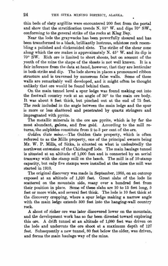
thin be& of slats argillita wem enmuntered 200 feet from the p o d and show that the strat*ation trends N. 55" W. and dips TO0 SW., conforming to the geneml strilre of the rocks at mag Bay.
Near the lodm the graywacke has been powerfully s h e a d and has been transformed to a Mack, bdlhntly lustrous, schistme rock resem- hling a polished and slickensided slate. The strike of the ahear zone nlong which the ore makes is approximately N. 45" W. and its dip is 70" SW. Rich om is limited to short shoots, but on account of the pouth of the mint! the shepe of the shwts is not well known. It is a fair inference from the data a t hand, however, that they are lenticular in both strike and dip. The l d e shows in pIam a pronounced ribhn sdmcture and is tmveraed by numemns false walls. Some of thew walls are remarhbly well developed, and it might often be; thought unlikely that ore would h found behind them, On the main tunnel level a spur ledge was found d g out into
the footwlal1 m t r y rwk at mn angle of 30' to the main ore body. It was about 8 feet thick, ht pinched out at the end of 75 feet. The twk includd in the angle betwmn the main ledge and the spur iY more or less shnttered and penetmted by quartz stzingers and impregnated with pyrite.
The metanic minerals in the om ~ r n pyrite, which k by far the most abundant, galena, and free gold, According to the mill re- turns, the sulphides constitute from 2 to 8 per cent of Ghe ore.
G&m Gate &we.-The Golden Gate property, which is eften refer& to as the Mills properly, me of the principltI owners being Mr. W. P. of Sitka, is situated on what is undoubtedly the n o d w e s t extension of the Chichagoff lode, The main haulage tunnel is situated at an altitude of 1,000 feet and is connected by an ae.rial tramwap with the stamp mill on the beech. The mill is of 10-stamp capacity, but only five stamps were installed at the tima the mill w~ started in 1910.
The original dbmvery wag made in Sephrnber, 11905, on an outcrop exposed at an altitude of 1,520 feet. Great slabs of the lode Lie scattered on the mountain side, many over a hundred feet from their position in place. Sone of t k dabs am 10 tu 15 feet long, 5 feet or more wide, and several feet thick me l d e is 10 feet thick ~t the di~eovery cropping, where a spur kdge making a n a m w angle with the main ledfie axtends 300 feet inta the hanging-wall country rock.
A shoot of richer ore was h h r d h d bwer on the mountain, and the development wmk bas so far been d i r d towad exploring tkis ore. A drift t u n d at an eltitade of 1;080 feet was driven an the lode and undercuts the om shoat st a maximum depth of 127 feet. Subsequently a new tunnel, 80 feet below the older, wats driven, and forms the main haulage wway of the mine.

%G BAY. 25
Sumeys indicate that the Golden Gate and Chichagoff mines tire
situated on the same lode, but actual continuity can not be traced on the surface, either because glacial drift and vegetation cover the apex of the lode or because the shear zone is barren of quartz mineralization along the intervening stretch. Either condition is equally probable.
The geologic and mlneralogic features of the ore bdy me similar to those of the Chichagofl. The average width of the explored por- tion of the ore body is somewhat smaller and the grade of ore is lower, dthough it was reported late in June, 1910, that a shoot carrying d u e s camparable to those of the older property had been encountered. On the surface 150 feet in the footwaU county rock of the lsde is
a dike, which is 100 feet wide at its widest point. It. trends parallel with the formation and can be traced a few hundred feet only. On the hanging-wall side the dike consists of a white cmmely grtlnitoid rock, which the micrmmpe shows is composed essentially of quartz and albite in hypidiornorphic arrangement, buk much cmsl~ed. To- ward tlie footwall the dike changes, appnrently by gradation, into a rock resembling a greenstone. The microscope shows that this green rock formerly consisted of R coarsely granular agsemblage of plagio- clase, probably albite, hornblende, and biotite, but that it now con- sists of brecciated fragments embedded in a hegrained matrix of attrition prodllcts imrnpod of hornblende, chlorite, and feldspar.
Eemt Cove Mining Ca.-The H i d Cove property is situated on the northwest side of Doolth Mountain. A tunnel 800 feet long is driven on the lode at 400 feet altitude, at a point one-half mile inland .from Mine Covc. The lode aversges 3 feet in thick- ness, and the ore resembles that of the Chichago8 and Golden! Gate mines, though metallic minerals nre materiaIly less abnndnnt and am usually concentrated in the slaty material inclosed in the vein qnmtz. Some pay streaks remarkably rich in free gold have been encow- tered. Thi.: lode is sometimes considered the northw~tern 'exten- sion of the Chichagoff lode on the southeast side of Doolth Mom- tain, but it lies too far to the northeast-that is, in the fmtwdl of the Chichagoff l o d e t o be the exteasion of that ore body.
Other proapcts.-A considerable number of prospects, such as the Monte C ~ s b , Plora, Jumbo, Big Four, and others, have h n locahd in the region around Klag Bay. The smount of development is generally smaU, and as the geologic features are entirely similar to the ore bodies already described individual descriptions are hardly necessary. The presene of these prospects indicates that m i n e d z a . tion is widespread throughout the region. The showing at the various prospects is commonly not large, but it must be confemd that if onIy the barren portion of the shear zone of the mmt prodoc-
26 THE SITKA MINTNO DIBTRXCT, A L B ~
tive mine of Klag Bay were known, it would hardly p m n t a mom enconraging appearance than that shown by the poorest pFospect in the Tegirla
Princea8 P i d m prospect.-The Princess Pindm pmqed is not on the peninsula between Rlag Bay and Ogden Passage, as am the othess previously dwribed, but is near the entrance of a. bay localIy known as Pinh Bay, 6 or 8 miles northwest of Mine Cove. Ore was discovered hem in June, 1910, outeroppieg in the cliffs at the water's edge along a shore line that had been more or IPS thoroughly exem- ined by various prmpectors. This fact is of soma interest and lead8 to the belief that the shore linm have not been so carefully examined but that other prospects will bedi~overed.
The ore body shows a face of 7 feet of wrse white qua* carry- ing some scattered b~rnches of pyrrhotite admixed with chalcopyrite, The trend of the deposit is probably S 40" E. (tme) land the dip is 80" SW. The footwall is a blue-black dsty rock rand the hanging wall is a greenstone bmist . Assays 03 samples taken raercms the entire width of the lade show an avernge value of $10 a ton in gold.
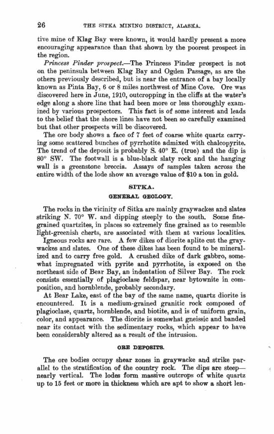
The rock3 in the vicinity of Sitka are mainly graywackm and slab Btnking X. 70° W. and dipping steeply to the south. Some fine- grained quartzitites, in pl~ees so extremely fine gained as to remble l i g h t - p n i s h cherts, are m i n t e d with them a t various 1ocalit.ies. Igneous r m h are rare. A few dikes of diorite apIite cut the gray-
wackes and slates. One of these dikes has been found to be mineral- ized and to carry free gold. A crushed dike of dark gabbro, some- what impregnated with pyrits and pyrrhotite, is exposed on the northeast side of Bear Bay, an indentation of Silver Bny. The m k consists essentially of plagioclase feldspar, near bytomite in corn- posit ion, and hornblende, roba ably wcondary.
At Bear Lake, east of the bay of the same name, qtlsrtz diorite k encountered. It is a medium-grained granitic rack composed of plagioclase, quartz, hornblende, and biotite, and is of uniform grain, color, and appearance. The diorite is somewhat gneissic and banded near its contact with the mdimentary rocks, which appear to have k n considerably altered as a r d t of the intrusion.
The ore bodies Q C C U ~ ~ shear tmes in graywwke md strike par- allel to the stratification of the m t r y m k The dips a m steep- nearly vertical. The I d e a form m d v e o u h q s of white quartz up ta 16 feet or more in thickness which are apt to show a short len-

ticular stru- along the strike and to q E i t up intu stringer Ides. 'Shey are imqplsr in &ape, bellying out and constricting abruptly. f i a r the lodes the country rock is much sheared m d is penetrated by numerous transverse stringers as well as 'by veins parallel to the shear planes.
A charwhristic fatm of the ore bodies Is the insigdhnt amount of metallic rmlphides-in many ledges an almost vanishing quantity- contained in the vein gua.rtz. Pyrite, pyrrhotite, and ~rsenopyrite are the principal sulphides; galena and sphalerite have been observed, but are elttramely rare. The sulphides are at many places concen- tram in and around fragments of slate or sheared gmywacke in- cluded in the ledges, even though the quartz itself is barren. Om bodies of a type different from the auriferous quartz lodes
ah~ady described have attracted some attention. These consist of beds of &atbred qusrtzih, which is finklike in texture, recemented by quarh veinlets, carrying in p l a w though ramly, pyrrhotib and armnopyrite. Some quartzite strata weather so that the surfw ex- posures somewhat resemble vein quartz, but the minerahation is so feeb1~ tbrtt it is diflicult to understand why t h y should have hen located as ore bodies.
SPECLBL D~UB;fPTIONR.
, Omhe m<ae.-The Cache mine, located in October, 1872, and origi- nally known aa the Stewart mine, is situated 14 miles east of the head of Silver Bay, at m elevation of 120 feet abave sea level (fig. 4). A 10-stamp mill was built in 1879 but has long ago fallen into ruins, and the tramways leading t~ it are thicketad with new growth of alders. ?Sha mine has been in litigation for many years.
The om body, which stands nearly vertical, is^ opened on three lev& by drift tunnels aggregating 300 feet in length. The low& turmel is 160 fset long and trends S. 70" E.; at the mouth the ore body is 4 feet thick and increases to a maximum of 13 feet solid qurrrtz, ita average thickness being abut 10 feet. The waIls of the ere M y are extremely curved, dipping in reverse directions from place to place. PracticslIy no metallic wlphides are visible in the qua&, except a streak on the south wall, which is fairly mineralized with pyrite. The other two tunnels, the upper b i n g abut 80 feet almve the lower, &OW essentially the; same features, but not so much qua-
Barn w&w-a71R Ban= h e lies 2 miles swthwest sf the hsad - of Silver Bay. The main development ~onsists of a crosscut tunnel
at an altitude of 1,250 feet, This tunnel, which is 900 feet long and intersects the main ore M y at a depth of 400 feet, traverses thick massive beds of pywacke, which are gritty or conglomeratic at the portal, and encounters severs1 smder ledges driking parallel with

the formation. At tha end a drift 150 fset long is turned off on the om body and kends S. 45' E. The hanging wall is slate end the foot- wall is graywacke, The ore body consists of cryptocrpstdline quartz- ite traversed by m m w quartz veidets and leanly mineralized with pyrrhotite.
Ceacude ctnj,.-This claim is on the eash fork of Indian River, 3 miles from Sitka, and is the only one diecovered in the vicinity of
F l G U a B 4.-Fro~ects in the ~ c l n l t y of E t t h find BNver Bay,
$i&a or Silver Bay in r e d yam The country rock st this l+ cality consists of cherty quartzite and slate striking N. 55" W. and .
*
dipping approximateIy wrtical. The quartzite, which is flintlike in texture, weathers milk white, so that it resembles a quartz lode, The ore body consists of shattered quartzite oemented by quartz vein- lets and is in places mineraked with pyrrhotite and arenopyrite. Chalcopyrite is presant as an extremely mw cpmtituenf. A 5-foot

bed of slate appears to form the wall rock on the southwest side of the ore body, but toward the northe& the boundary is indehite. The ore body is exposed by own cutting and is 300 feet long. Its width apparenkly ranges from 4 to 20 feet, but them dimensions will doubtless be dependent upon assay returns.
E~ic?iy Chance mim.l-This property is situated in a p&pitnus mountain range, 2,000 feet above sea level md 4 miles, as the crow flies, or CI by wagon rmd, h m the head of Silver Bay. The q u ~ r t z ledge has a maximurn width of 8 feet where it outcrops, but in the tunnel it is not constant in width and appears to merge into a series of narrow stringers penetrating the mineralized slate-hanging wall. The footwall, of graywacke, is locally h o r n as diorite because of its compact, massive ststructure. A 600-foot b e 1 faUows the ledge and connects through a raise with a surface pit. The surface im- provements comprise a 10-stamp mill, a sawmill, and a water-power plant. High values are reported from pa* of this vein and many specimens of free gold have been obtained.
Of FfRr prospeds.-Many other prospects, padly developed, notably the Lower Ledge, Bullion, Free Gold, Librty Lode, silver Bay group, and the Baston are still held in the above-described area, some of which have very favorable surface showings, but Iack of capital and inefficient management has caused a mspension of explorations for the last few years.
Granite is a possible sesoum of the region, although, so far as is h i o m to the writer, no attempt has been made to utilize this re- sourca The market that might Eogimlly be expedxd for Maskan buiIding stone comprises portland,-Oreg., and the cities an Puget Sound. The f a d that granite from the quarries at Raymond, Gal., which are 200 miles from the -board, is able to compete with the h a 1 product of the Pacific Northwest in their home market indi- categ a strong possibility far Alaskan p n i t e , provided it is of requisite grade. The quarries can be located at Gdewater, and the water haul to market is no longer thsn that from San Francisco to Puget Sound At present the only output of building s h e Erom southeastern Blaska is marble, lsnd thie h s been in-sing steadily
, ffom year to year.
Wdgbt, P. E. aad C. W., ICwnomic d d o p m e n t a in aontheastern Alwh : BaIL U. I. -1. Surveg No. 259, 1805, p. 58. The matter io €hi& nnd the following paragraph is quoted literally irom the report cited.
2& aleo Wright, C. W., The building stones and mstedala of muthemtern A l a t a : B1111. U. 3. W. S m y No. 3 4 4 p. 123, 1908.

The general distribution of granite' is indicated on the &etch map (PI. I, p. 10). Stone of good quality is found at Gut Bay on the east mast of Baranof Island and at the mat end of Long Arm, ?Vhde Bay, on the wmt c a s t of the =ma idsnd. At the latter locality the granite is of hendwme appearance. It is of light-gray color, medium taxture, and even p i n . The feldspars are clear and frash and give the rock a live color, Accurately designated the rock is a qnnrtz diorite, consisting of plsgiwlase feldqsr (ande- sine or labradorite, quartz, biotite, and a minor amount of horn- blende, The biotite, as a rule, is splendsntly lustrous. The awes sorg minerals are zircon, apatite, and magnetita.
The only extenidw depolllt of gypanrn known In wnthea&m klaslm ia sltuatea on Gyprmm Creek, a mile from Its mouth, at Iyoukeen Cove on the enet aide of Chichagof Idand. Tbe m m m beds appsreotlr o m i e the Car- honlieroas m k s exposed along the i~lntbw-tern shore of Igoukeen Cove and forming the ridge mnthwest of Gypsum Creek, though the area of mtact Is bnrfed under d e p gravel d e w t a along the beach and h the valley. The mountain ridge to the northmet is made up of fa granltl~ mass Iutmdlng the older llme~tmc and quarbiite. 8trbctnrally the gg-psum beda a m folded and &teeply tflted and were probably lald d o m p&ou~ to the granitic Invamion. They are at present regarded as of Permhn or Txlasalc age.
The geology In tbe b e d l a t e vicinlty of the ggpaum bsdn 1s dscure and nelther foot mI1 mr hanging mll of the depaslt 1s empmd Blulfs 05 a cherty lhestone nWdng northwent and dipping to the northmat nre ergom near the entrance to the tunnel at the lower mine worklnfp on Gypsum Creek The gypaum bedm in the tunnel and lower levele have an =st-we& to N. p 10 rn E. atrlke, with a nortberIj dip of 20" to Ma. Channels repreeentlng old watercourPee and now filllled w l h gravel wash are numeroas throughoul thls deptrlt These $ravels resemble rmcwsoltdat~ cmglornemte beds and have bwn mlstnken for both hanging and foot walls of the gypanm beds at plnta in the work In@. A careful inspwtian of the gravels uhows that the W R R ~ bar the mme cbnracter a ~ l that now in the creek bdl. Of ~IgniBcance la the presenco of cobble8 of granite corresponding to the Intmelve mass at the head of the creek, which invaded the area mbsequent to the deposltfon of the ggpaum beda.
This mrn B e p ~ I t , the p r o m .oi t$e Pacttfe Cmmt Qypwm Oa, h e h ertenalvely developed durlng the la& Pew years and large ablpmenta of tbe rock are king made to the plamter mill at Tacoma, W&&, where it la pmqmml for the market, The development8 consii~t of a wharf 2,000 feet In length. extendlug to deep water, where rock blna of 1,000 tons capacity have t e n bullt, and of n +
railrmd about u mlle In length to the mine workings. At the mine rock blna of 1,500 tons mpctty have been erected. thus affording mfUclent storage capacity ,
Reprhted from Rull . U. S. Gaol. Survep No. 345, pp. 124-125, 1908.

CONCLUSION. 31
dufing intervals of trampartatton of the gypam to tbe plaster mill, A verticrll shaft U s been m k for 190 feet and from it two levels have been extenaed at polnta Wl and 160 feet In depth, bth of which are almost entlrelg In m u m . The main devQopments are on the IW-ia,t level and Include 1,200 I& of work- lug#, exposrng tbe gygmm b& mer an area 450 by !225 feet. Both the thickness and the lateral extent of the bed are RtllP undetermined. At a pint $00 feet weat of the ~baft investlgattom were madp In former yyeara of a mgmm exmure on the creek bank, where a short tunnel was rirlvm and a %foot sbaft nunk almost entirely tn gyp-, but work at tbia point was &mntinued.
Gypsum is In much demand along the Peclfk coast as wall plaster and f d - lher and in the manufacture of cement, The Pumt Soand market b aupplled h large measure from the depo%its In ICan~ah Colorado, Wyoming, and Ctah. The Califomla market I s supplied from local deposits and those ln Kemda and Utah, Tranapor&tion from thew points to the wboard cMes costs from %4 to ?3 per ton, and the present market priccs [1(K)RJ of flr~t-gradegyp- products In t h w cities are a s follows: Crude, .$b to $7 per ton; land plaster, $6 t o $8 pw ton; plaster of Parig $8 to $11 per ton; wall plaster, $9 to $12 per ton.
The known mineral resources of the Sitka mining district are gold and msm. To these granite may, perhaps, be added as a possi- bls andevel oped resourn
The gold is found in quartz lodes, which commonly occupy shear mnes in graywwke. Two propertie, both situated at Rlag Bay, on the cogst of Chichagof Idand, have so far hen put on a productive basis and give strong promise of a prosperous career. The ores, which range in value from $15 rto $90 a ton, are of considerably higher gr~de than the average ore of southeastern Alaska. -4 large number of ore bodies of the same general character have long been known to occur near Sitka, but owing to the low-grade ores contained in them none have yet been brought to a producing stage.
The ore bodies of the xegion show neither in their mode of occur- rence or origin m y obvious or immediate relation to contacts of dis- similar mks , to dikes, or to other igneous .rocks. The principal mineral belt appears to lie along the edge of the slate-graywach formatiol.r bordering the band of metamorphic rocla thaS flank the diorite warring in the central portion of the islands. The better- known ore deposits are found i n graywacke, but. this is doubtless a f a d of no essential significanm and should not deter the prospecbr from searching in other kinds of rock The question is some-
= times asked by the prospector whether the formation at some par- ticular lmaIity is favorable. To this it can be answered that experi- ence has shown that no one kind of rock is more likely to contain gold-ore deposits than another. In point of fact, a more complex

32 TEE SITKA MINING DISTRICT, A U K $ .
set sf conditions is nemmtry than the presence of a "favorable formstion." That a favorable set of oonditions is most likely to be found in th zones that border the long belb of granitic m k s trav- ersing the region has already been maintained in this report. The indications afforded by present developments poi& strongly to the mncIusion that the entire strip of territory contiguom to the west mast of Ckichagof Island offers a more enmmging inducement to the mmh for new ore bodies than m y other prt of the, region.