site planning and design for enhanced stormwater management
TRANSCRIPT

Site Planning and Design for Enhanced Stormwater
Management
A primer on how better site design and conservation of natural areas can make it easier to comply with
new stormwater requirements

Key Elements
• Early Site Mapping and Natural Resource Inventory• Maintain and Expand Forest Canopy• Reduce Clearing and Preserve Highly Permeable Soils• Keep Away from Steep Slopes and Maintain Natural
Contours• Maintain Natural Flows Paths and Stream Buffers• Use Pervious Areas for Disconnections, Stormwater
Treatment or Reforestation• Use Better Site Design to Minimize Site Impervious
Cover• Understand Site Constraints for LID Practices
Caveats
• These techniques are primarily applied to new development
• For ESD techniques at more urban redevelopment sites, consult the redevelopment and stormwatertraining module.
• Many better site design techniques are established (or prevented) in local land development codes

EARLY SITE MAPPING/ASSESSMENT
What it is: What it replaces:
ESD plan and map submitted at earliest stage of development review including forest conservation, wetlands, soils, steep slopes, drainage, zero-order streams, buffers, sensitive areas, suitable soils, proposed impervious cover, computed nutrient loads and initial ESD approach

Site mapping and stormwater concept plans are mandated at the earliest stages of development plan review

Mapping Requirements
• Wetlands• Major Water Ways• Floodplains• Critical Areas• Wetland Buffers• Perennial Streams• Stream Buffers • Forest Stand
Delineation
• Steep slopes• Springs and seeps• Highly erodible soils• Topography• Existing drainage area• Hydrologic Soil
Groups• Zero-order streams

Environmental and Soil Features

MAXIMIZE FOREST CANOPYWhat it is: What it replaces:
Property Line to Property LineClearing and Grubbing
Preservation of Priority Forestsand Reforestation of Turf Areas

Maximize Forest Canopy
• Preserve existing forest and go beyond forest conservation requirements
• Reforest open areas throughout the site
• Priority planting of hydrologically-connected tree clusters

Minimize Clearing of Native Vegetation
• Clearing and grading of native vegetation should be limited to the minimum needed to:– Build lots– Allow access– Provide fire protection
• A suggested limit of disturbance (LOD) is 5 to 10 feet outward from building pads

Site Fingerprinting
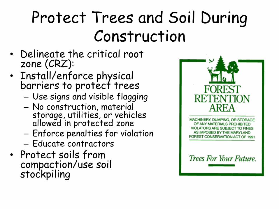
Protect Trees and Soil During Construction
• Delineate the critical root zone (CRZ):
• Install/enforce physical barriers to protect trees– Use signs and visible flagging– No construction, material
storage, utilities, or vehicles allowed in protected zone
– Enforce penalties for violation– Educate contractors
• Protect soils from compaction/use soil stockpiling

Trees are not adequately protected at this site, where construction materials are
stored within the CRZ of trees

Forest Conservation is an Effective Runoff Reduction Strategy

Center for Watershed Protection
Reforestation of Turf Areas Also Helps to Reduce Site Runoff (and
Reduce Maintenance Costs)

Comparison of Runoff Coefficients for Different Land Cover

Comparison of Nutrient Concentrations For Different Land Covers

Flow x Concentration = Annual Nutrient Load

The Cost of Open Space Management
Open Space Management Strategy Annual Maintenance Costs
Natural Open Space
Only minimum maintenance, trash/debris cleanup
$75/acre
Lawns
Regular mowing $240 to $270/acre
Passive Recreation
Trails, bike paths, etc. $200/acre

Reforestation in New Development

PRESERVE HIGHLY PERMEABLE SOILS
• Reduces runoff produced by the site
• Ideal location for making LID practices work

PROTECT SOILS AND NATURAL CONTOURS
What it is: Construction site practices provide greatest possible conservation of original soil structure so that only a small footprint is disturbed around the final hardscape
What it replaces:
Mass grading Soil Compaction
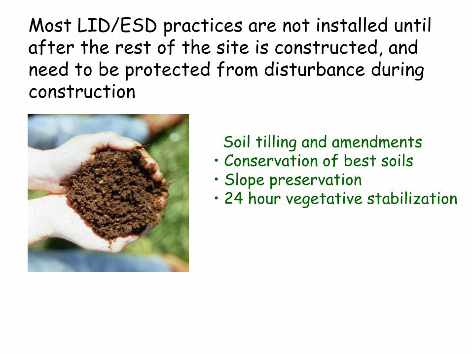
• Soil tilling and amendments• Conservation of best soils• Slope preservation• 24 hour vegetative stabilization
Most LID/ESD practices are not installed until after the rest of the site is constructed, and need to be protected from disturbance during construction

AQUATIC BUFFERS AND NATURAL FLOW PATHS
Create a variable width buffer system along all perennial streams that also encompasses critical environmental features
• floodplains
• steep slopes
• freshwater wetlands

Source: Center for Watershed Protection

Streamside Zone Middle Zone Outer Zone
Center for Watershed Protection

Not so good.
Good.
Center for Watershed Protection

5. MINIMIZE SITE IMPERVIOUS COVER What it is: narrower streets, permeable driveways,
clustered development, smaller cul-de-sacs, better pedestrian access.
What it replaces:
Super-sized lots, streets, sidewalks and cul-de-sacs
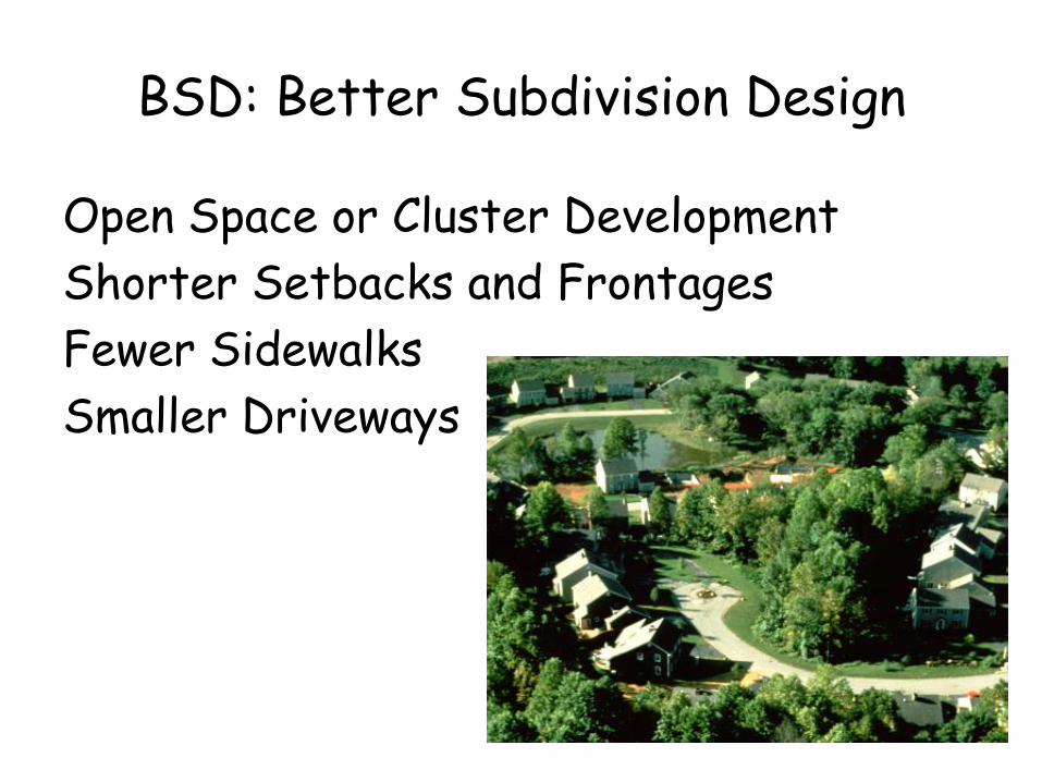
BSD: Better Subdivision Design
Open Space or Cluster Development
Shorter Setbacks and Frontages
Fewer Sidewalks
Smaller Driveways

treed lots increasemarketability and resale
Open space design reduces lawn area, preserves trees,
and is more attractive
Preserved wooded lots provide recreation
Open Space or Cluster Subdivisions are Major Tool

Open Space or Cluster Design
Advocate open space development that:• incorporates smaller lot sizes • minimizes total impervious area• conserves natural areas• provides community space• promotes watershed protection

Photo courtesy of Randall Arendt
Open Space Development
Conventional Development

Millcreek subdivision in Lancaster, PA uses narrow streets, shorter setbacks,
and sidewalks on one side of the street

Open space was conserved at the Millcreek subdivision by
clustering lots

These lots achieve a more compact design, allowing for more open space
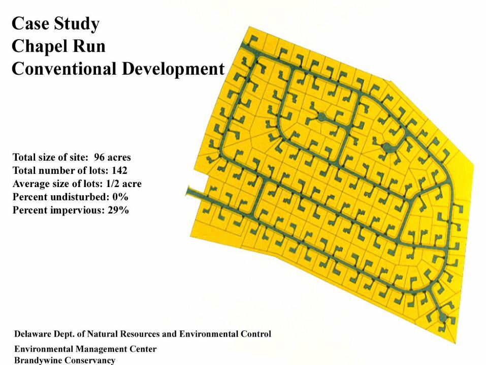


Photo courtesy of Randall Arendt
Cleared Site
Vegetation Preserved

Original Unclustered Site Plan, 25 lots

Final Clustered Site Plan 25 lots

Relax Setbacks & Frontages
• To reduce total road length in the community
– Relax side yard setbacks
– Allow narrower frontages
• Relax front setbacks to minimize driveway lengths

Road
10-12 ft. R.O.W.
40-60 ft. front setback
40-60 ft. rear setback
25 ft. side yard setback
Geometry of a Typical One-Acre Lot

The driveways in this large lot subdivision produce a great deal of needless impervious cover

Relax Front Setbacks
Relax Frontages & Side Setbacks
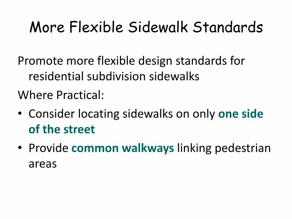
More Flexible Sidewalk Standards
Promote more flexible design standards for residential subdivision sidewalks
Where Practical:
• Consider locating sidewalks on only one side of the street
• Provide common walkways linking pedestrian areas

This subdivision creates needless imperviouscover by having sidewalks on both sides of the streetand around the cul-de-sac
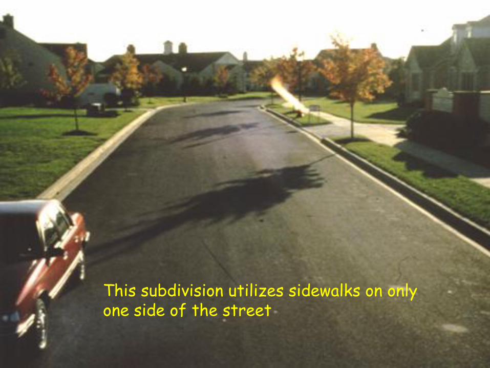
This subdivision utilizes sidewalks on onlyone side of the street
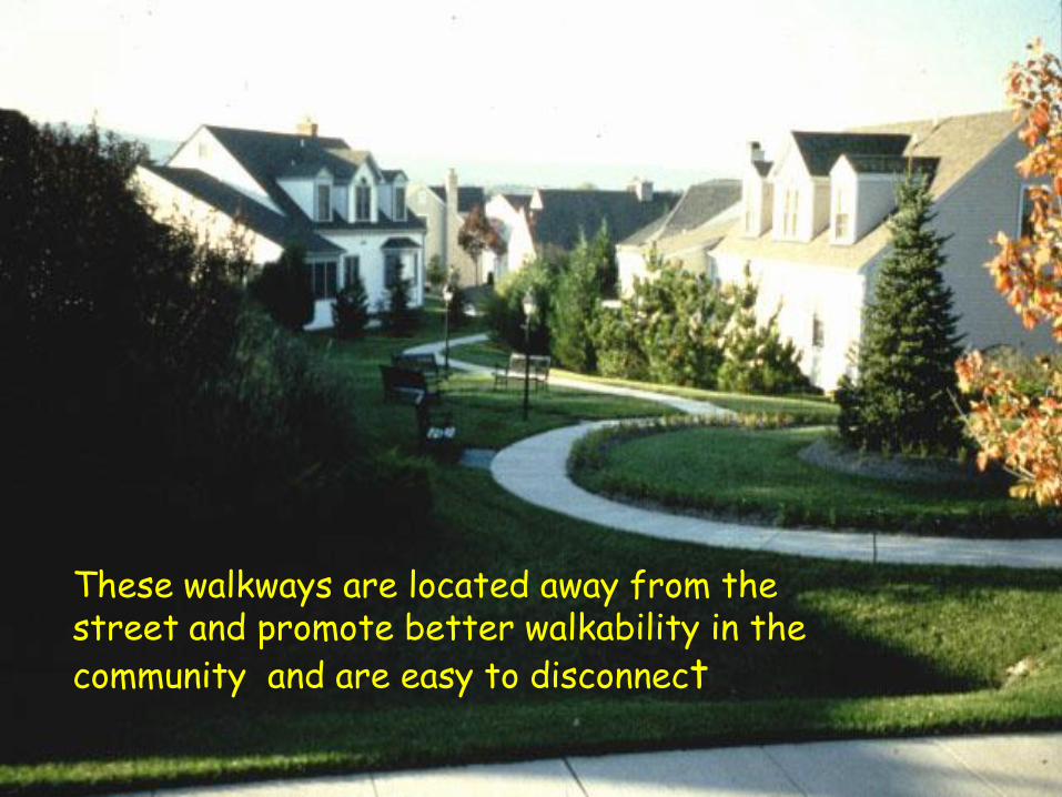
These walkways are located away from the street and promote better walkability in thecommunity and are easy to disconnect

Alternative and Shared Driveways
Reduce imperviousness by:
• promoting alternative driveway surfaces
• promoting shared driveways that connect two or more homes together.

Some Driveways Can be Massive

Direct Rooftop Runoff to Pervious Areas
Direct rooftop runoff to pervious areas such as yards, open channels, or vegetated areas and avoid routing rooftop runoff to the roadway and the stormwater conveyance system.

Better Site Design for Residential Streets
• Narrow Street Width
• Reduced Street Length
• Lower Right-of-Way Width
• Fewer and Smaller Cul-de-Sacs
• More Vegetated Open Channels

Reduce Residential Street Width
Design residential streets for minimum pavement width needed to:
• support travel lanes
• on-street parking
• emergency, maintenance, & service vehicle access
• based on traffic volume
Photo courtesy of Randall Arendt

“closed” section road
“open” section road

Traditional Street Queuing Street

This road is just wide enough to support travel lanes, on-street parking and emergency access

This road is designed so that parking lanes can also serve as queuing lanes

Reduce Residential Street LengthReduce the
total length of residential streets by examining alternative layouts that increase the number of
homes served per unit length.

Reduce Residential ROW Widths
• Residential street right-of-way widths should be the minimum to accommodate – the travel-way– sidewalk– open channels
• Utilities and stormdrains should belocated within thepavement sectionof the right-of-way.

Design Options for Narrower ROWs on Residential Streets

Examples of Narrower ROW Widths
Source ROW Width Pavement Width & Purpose
Portland, OR 35’ 40’
20’ residential street 26’ residential street
Montgomery County, MD
20’ 44’
46 – 60’
16’ residential alley 20’ residential street 26’ residential street
ASCE, 1990 (Recommendations)
24 – 26’ 42 – 46’
22 – 24’ residential alley 26’ residential street

Clearing and
Grading
Allowable Landscaping

This road right-of-way is just wide enough to account for pavementand open channels. Other factors contributing to the narrow width isthe lack of sidewalks and placement of utilities underground
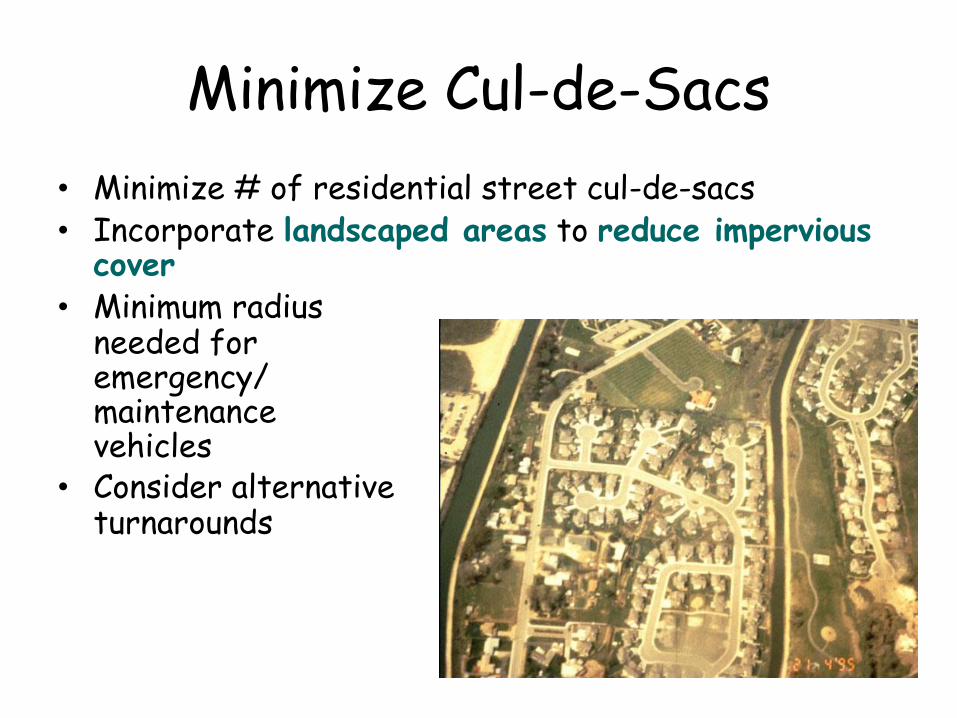
Minimize Cul-de-Sacs
• Minimize # of residential street cul-de-sacs • Incorporate landscaped areas to reduce impervious
cover• Minimum radius
needed foremergency/maintenancevehicles
• Consider alternativeturnarounds

40 FT CUL-DE-SACW/ ISLAND
30 FT RADIUS CUL-DE-SAC
T-SHAPEDTURNAROUND
LOOP ROAD
Alternative Turnaround Options


Alternative Cul-de-sac - Loop Road

Center for Watershed Protection

Use Vegetated Open Channels
Where density, topography, soils, and slope permit, use vegetated open channelsin the street ROW to convey and treatstormwater runoff.


This dry swale provides a more natural alternative to
traditional curb and gutter while providing water quality
benefits

Better Site Design for Parking Lots
• Lower Parking Ratios
• Revised Parking Codes
• More Efficient Parking Lot Design
• Structured Parking
• Treatment of Parking Lot Runoff at Source

Lower Parking Ratios
Required parking ratios should be enforced as both a maximum and a minimum in order to curb excess parking
Center for Watershed Protection

Center for Watershed Protection

Center for Watershed Protection

Parking Demand Ratios for Selected Land Uses
Land Use
Single Family Homes
Professional Offices
Retail
Restaurant
Industrial
Church
Golf Course
Typical Parking Ratio Used
2 spaces per dwelling unit
1 space per 200 ft2 gross floor area
1 space per 250 ft2 gross floor area
1 space per 50 ft2 gross leasable area
1 space per 1,000 ft2 gross floor area
1 space per 5 seats
4 spaces per hole
Center for Watershed Protection

Reduce Parking Lot Imperviousness
Reduce parking lot imperviousness by: • Providing compact car spaces• Minimizing stall dimensions• Incorporating
efficient parkinglanes
• Using perviousmaterial in spilloverarea

Treat Runoff Within or
Adjacent to Parking Lot

Photo Copyright 1999, Center for Watershed Protection
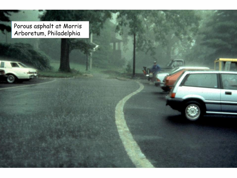
Porous asphalt at Morris Arboretum, Philadelphia


ESD Site Planning Checklist
Must answer 12 questions related to ESD site and stormwater planning
Should be able to answer “Yes” or “does not apply”
Show on the site plan If answer is “No”, must provide a written
narrative as to why it could not have been used
.

ESD Implementation Checklist Check all of the Following ESD Practice That Were Implemented at Site Yes No N/A
Environmental Mapping Was Conducted at Site Prior to Layout XNatural Areas Were Conserved (e.g., forests, wetlands, steep slopes, floodplains)
X
Stream, Wetland and Shoreline Buffers Were Reserved XDisturbance of Permeable Soils Was Minimized XNatural Flow Paths Were Maintained Across the Site XBuilding Layout Was Fingerprinted to Reduce Clearing and Grading at Site XSite Grading Promoted Sheetflow From Impervious Areas to Pervious Ones XSite Design Was Evaluated to Reduce Creation of Needless Impervious Cover XSite Design Was Evaluated to Maximize Disconnection of Impervious Cover XSite Design Was Evaluated to Identify Potential Hotspot Generating Area for Stormwater Treatment
X
Erosion and Sediment Control Practices and Post Construction StormwaterManagement Practices Were Integrated into a Comprehensive Plan
X
Tree Planting Was Used at the Site to Convert Turf Areas into Forest X

Solution: Rain gardens or rainwater harvesting