“simpson tract” non-riverine wetland restoration project
TRANSCRIPT

“Simpson Tract” Non-Riverine Wetland Restoration Project
Beaufort County, NC
Tar-Pamlico River Basin (Cataloging Unit #03020104)
Site-Specific Restoration Plan
(Task 3)
NC EEP Contract #D05027-1
Prepared For:
North Carolina Department of Environment and Natural Resources Ecosystem Enhancement Program
1652 Mail Service Center Raleigh, NC 27699-1652
April 2006

Submitted By:
Wetlands Resource Center
3970 Bowen Road Canal Winchester, Ohio 43110
614-864-7511
Prepared By:
Land Management Group, Inc. PO Box 2522
Wilmington, NC 28403
Phone. 910-452-0001 Fax. 910-452-0060
Project Manager: Christian A. Preziosi
Office. 910-452-0001 Cell. 910-471-0515
Email. [email protected]

EXECUTIVE SUMMARY
The proposed restoration project at the Simpson Tract Property is intended to provide suitable,
high-quality non-riverine wetland restoration as compensatory mitigation for wetland impacts
authorized through the North Carolina Ecosystem Enhancement Program (EEP). The objective
of the project is to provide for the functional restoration of non-riverine swamp forest via the re-
establishment of a characteristic vegetative community and hydrologic regime. Anticipated
functions and values resulting from the restoration project include increased nutrient retention,
nutrient cycling, floodwater storage, and flood abatement In addition, the project will provide
ancillary benefits to aquatic and wildlife habitat via enhanced niche habitat, microclimate
modification and shade, and increased food-web support.
The Simpson Tract Property is currently managed for silvicultural production. The project site
consists entirely of monoculture pine stands with sparse hardwood colonization. Under contract
with the EEP, Wetland Resource Center, LLC (WRC) will restore 30.0 acres of non-riverine
wetland which drain south into the Pungo Canal (a tributary of the Pungo River) in Beaufort
County, NC.
The following site-specific restoration plan provides site information related to existing
conditions and watershed characteristics. In addition, more specific information regarding project
implementation and monitoring is enclosed.
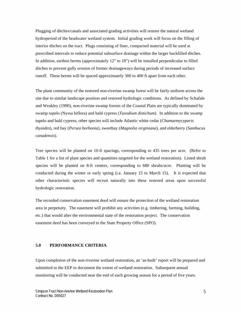
1.0 PROJECT SITE IDENTIFICATION AND LOCATION
As approved by the EEP, WRC has targeted 30.0 acres of land currently managed for silvicultural
production located at the headwaters of Pungo Creek, a fourth-order tributary of the Pungo River
within the Tar-Pamlico River Basin (USGS 8-digit Hydrologic Unit 03020104; DWQ Subbasin
03-03-07). The project site is located west of NC Route 32 in Beaufort County, NC (Figure 1.).
Simpson Tract Non-riverine Wetland Restoration Plan Contract No. D05027
1

Directions to the project site from Raleigh (NC) are provided below:
From Raleigh (NC), take Highway 64 East to Washington. Out of Washington, take NC 32 north towards Plymouth. Continue north on NC 32 for 16 miles . Rodman Road will be on your left .Continue down Rodman Road until it dead ends. The restoration site is located to the north of the dead end road.
2.0 WATERSHED CHARACTERIZATION
Non-riverine wetlands in the Outer Coastal Plain provide a number of functions necessary to
support adequate water quality parameters in the region. These wetlands provide for flood
retention and abatement, nutrient transformation, and habitat. As these systems are typically
located in the headwaters area, the value of these functions is even greater due to the potential for
increased residence time. At the present time, these functions have been compromised through
the extensive silvicultural management of the site (ditching, bedding, clear-cutting, etc.). The
Pungo River and its tributaries, in particular, have exhibited significant water quality impairments
associated with low dissolved oxygen (DO), high total nitrogen (TN), and high total phosphorus
(TP). High nutrient concentrations originate from non-point source loading associated with
intensive agricultural and silvicultural practices common throughout the watershed. These
impairments are likely exacerbated by channelization of local streams, resulting in diminished
nutrient uptake in riparian areas. Furthermore, hypoxic/anoxic conditions and toxic algal blooms
have contributed to various fish kills reported in the Pungo River over the past 10 years.
The tract consists of Dare muck (Typic Medisaprist) and Croatan muck (Terric Medisaprist)
(Figure 2). The Dare series consists of nearly level, very poorly drained soils with organic muck
to 60” below the soil surface. The Croatan series consists of very poorly drained soils of shallow
depressions of headwater swamps. The organic surface is typically to 24 inches and is underlain
by clay loam. Both soil series were formed in marine sediments and typically occur along broad
flats of interstream divides. Under natural conditions (i.e. not drained), the seasonal high water
table is at or near the surface, and permeability is slow.
Elevations of the project area range from 37.0 ft to 40.0 ft above mean sea level (MSL). Several
large “blueline” ditches drain the site towards the Pungo Canal (Figure 3).
Simpson Tract Non-riverine Wetland Restoration Plan Contract No. D05027
2

3.0 EXISTING CONDITIONS
The 30-acre restoration area is part of a larger tract of land (1,391 acres). Approximately 950
acres have been determined to be non-jurisdictional (“non-wetlands”) by the NRCS (USACE
concurrence of this determination has also been provided). The remaining acreage has been
confirmed to be jurisdictional wetlands. The predominant land use of the tract (both
jurisdictional and non-jurisdictional areas) is silvicultural production. Prior land use practices
(including herbicide, pesticide, and fertilizer application) serve as potential contributors to
decreased water quality of adjacent surface waters (i.e. ditches and ‘blue-line’ streams). The
natural vegetative assemblage of the tract has been modified over the years via prescribed
drainage improvements (i.e. ditching), bedding, and planting of loblolly pine (Pinus taeda).
These silvicultural practices have resulted in a community dominated by pine in more mature
stands outside of the proposed wetland restoration area. Hardwood species characteristic of
headwater swamp communities of the Coastal Plain are either absent entirely or occur only in
sparse locations. Typical canopy species of an undisturbed area would include swamp tupelo
(Nyssa biflora), bald cypress (Taxodium distichum), pond pine (Pinus serotina), and Atlantic
white cedar (Chamaecyparis thyoides). Understory species typical of non-riverine swamp forest
communities include American titi (Cyrilla racemiflora), sweet bay (Magnolia virginiana), red
bay (Persea borbonia), fetterbush (Lyonia lucida), red maple (Acer rubrum), and catbrier (Smilax
species). Photographs documenting pre-project conditions are provided in Appendix A.
Threatened and Endangered Species: A review of threatened and endangered species potentially
occurring on the site was conducted at the North Carolina Heritage Program office. The Simpson
Tract project is located within the Hoke quadrangle. A review of this area revealed two
threatened or endangered species within a 1 mi.2 area. Several state listed species were found to
the northeast, within the Van Swamp Gameland. The Black-throated Green Warbler (Dendroica
virens waynei) is listed as a significantly rare species. The Red-cockaded Woodpecker (Picoides
borealis) is listed as an endangered species due to deterioration of suitable habitat. Each of these
species utilizes habitats (cypress swamps and long-leaf pine savannahs) not occurring within the
immediate vicinity of the wetland restoration area. Therefore, no impact to these listed species is
anticipated.
Simpson Tract Non-riverine Wetland Restoration Plan Contract No. D05027
3

Cultural Resources: The project will not have an effect on any structures/properties eligible or
listed on the National Register of Historic Places. Based upon a review of maps at the North
Carolina Office of Archives and History, there are no known significant archaeological resources
on the buffer restoration site.
Potential Constraints: Current ownership of the property resides with Thomas D. Simpson. A
copy of the recorded conservation easement deed is included as Appendix B.
The site is situated within a large 1,391 acres and is unencumbered for ingress and egress for
restoration, monitoring, and management activities. There are no known utilities within the
conservation easement area. Based upon drainage influence of interior ditches, ditch
modifications will affect the hydrology of those areas contained within the restoration site.
Beyond these areas, hydrology is influenced by ditches and/or canals to be left undisturbed.
Therefore, there will be no hydrologic trespass issues for adjacent properties.
4.0 PROJECT SITE RESTORATION PLAN
Based upon site assessments, 30.0 acres of non-riverine wetland habitat will be restored on-site.
The proposed restoration project is intended to provide suitable, high-quality non-riverine
wetland restoration as compensatory mitigation for wetland impacts authorized through the EEP.
The objective of the project is to restore wetland vegetation and hydrologic conditions
characteristic of headwater swamp forests. The enclosed site plan (Figure 4) depicts areas
targeted for non-riverine wetland restoration.
The area located within the proposed 30-acre site will be restored via plugging of ditches and
vegetative plantings. Initial site preparation will include grubbing and herbicide application for
control of invasive and/or noxious species. A water-soluble herbicide mixture (e.g. Accord,
Rodeo, Chopper, Garlon 4, or equivalent) will be applied with standard rates and methodology
suitable for wetland mitigation site development. Herbicide application will be conducted during
a period considered optimum for treatment (i.e. August) to allow for planted species to have a
competitive edge during early growth and development.
Simpson Tract Non-riverine Wetland Restoration Plan Contract No. D05027
4
Simpson Tract Non-riverine Wetland Restoration Plan Contract No. D05027
5
Plugging of ditches/canals and associated grading activities will restore the natural wetland
hydroperiod of the headwater wetland system. Initial grading work will focus on the filling of
interior ditches on the tract. Plugs consisting of finer, compacted material will be used at
prescribed intervals to reduce potential subsurface drainage within the larger backfilled ditches.
In addition, earthen berms (approximately 12” to 18”) will be installed perpendicular to filled
ditches to prevent gully erosion of former drainageways during periods of increased surface
runoff. These berms will be spaced approximately 300 to 400 ft apart from each other.
The plant community of the restored non-riverine swamp forest will be fairly uniform across the
site due to similar landscape position and restored hydrologic conditions. As defined by Schafale
and Weakley (1990), non-riverine swamp forests of the Coastal Plain are typically dominated by
swamp tupelo (Nyssa biflora) and bald cypress (Taxodium distichum). In addition to the swamp
tupelo and bald cypress, other species will include Atlantic white cedar (Chamaemycyparis
thyoides), red bay (Persea borbonia), sweetbay (Magnolia virginiana), and elderberry (Sambucus
canadensis).
Tree species will be planted on 10-ft spacings, corresponding to 435 trees per acre. (Refer to
Table 1 for a list of plant species and quantities targeted for the wetland restoration). Listed shrub
species will be planted on 8-ft centers, corresponding to 680 shrubs/acre. Planting will be
conducted during the winter or early spring (i.e. January 15 to March 15). It is expected that
other characteristic species will recruit naturally into these restored areas upon successful
hydrologic restoration.
The recorded conservation easement deed will ensure the protection of the wetland restoration
area in perpetuity. The easement will prohibit any activities (e.g. timbering, farming, building,
etc.) that would alter the environmental state of the restoration project. The conservation
easement deed has been conveyed to the State Property Office (SPO).
5.0 PERFORMANCE CRITERIA
Upon completion of the non-riverine wetland restoration, an ‘as-built’ report will be prepared and
submitted to the EEP to document the extent of wetland restoration. Subsequent annual
monitoring will be conducted near the end of each growing season for a period of five years.

Simpson Tract Non-riverine Wetland Restoration Plan Contract No. D05027
6
Vegetative monitoring will include the establishment of fifteen (15) 0.10-acre permanent plots
corresponding to a total of 1.5 acres (equivalent to 5% of the restoration area). Vegetative
planting will be deemed successful if survivorship of plantings and volunteers of desirable
species1 meets or exceeds a target stem density of 320 stems/acre.
Shallow groundwater hydrology and surface inundation will be monitored via six (6) automated
wells (RDS, Inc. Ecotone-20s) located within the restoration area and paired with vegetation
plots. Wells will be installed in accordance with installation methods outlined in the Wetlands
Regulatory Assistance Program (WRAP) Technical Note 00-02 (Sprecher 2000). Water levels
will be recorded once daily. Data will be downloaded from the wells every three months (i.e.
once quarterly). Data from well downloads will be compiled and graphically displayed to
demonstrate hydroperiods of monitored areas.
As stated above, the primary hydrologic success criteria will be the establishment of a static water
table at, or within, 12” of the soil surface for 12.5% of the growing season (equivalent to 32 days
based upon SCS-established growing season dates) during periods of normal rainfall.
Three (3) permanent reference wells will be installed within non-riverine wetlands just north of
the project site. This area consists of relatively undisturbed jurisdictional wetlands subject to
seasonal inundation from high groundwater levels.
Monitoring reports will be submitted annually to the EEP (by January 1 of each year). These
reports will include results of vegetative monitoring and photographic documentation of site
conditions. Monitoring reports will also identify any contingency measures that may need to be
employed to remedy any site deficiencies. For instance, deer browse tubes and fencing may need
to be used if evidence of significant herbivory or deer browse is observed. In addition,
supplemental planting may be necessary in areas of reduced survivorship.
1 Desirable species are considered as noninvasive species characteristic of non-riverine wetland habitats.

6.0 CONCLUSION
WRC will be initiating site restoration activities that will culminate in the restoration of 30.0
acres of non-riverine wetland located in TAR-7 of the Tar-Pamlico Basin. Reversion of
silvicultural land to wetland habitat will decrease source nutrient loading and concurrently
increase nutrient removal capacity. In addition, the project will provide ancillary benefits to
aquatic and wildlife habitat via enhanced niche habitat, microclimate modification and shade, and
increased food-web support. By doing so, the proposed project will help to effectively mitigate
for authorized loss of non-riverine wetland habitat within the Tar-Pamlico Basin.
Simpson Tract Non-riverine Wetland Restoration Plan Contract No. D05027
7

Table 1. Proposed Buffer Plant List
Non-riverine Wetland Zone 1 (Trees)
Stem Target: 435/ac
Species # planted (% of total)
Bald cypress (Taxodium distichum) 3,915 22.58% White Cedar (Chamaemycyparis thyoides) 2,610 15.05% Swamp tupelo (Nyssa biflora) 3,915 22.58% Zone 2 (Shrubs) 680/ac Red Bay (Persea borbonia) 2,300 13.26% Elderberry (Sambucus canadensis) 2,300 13.26% Sweet Bay (Magnolia virginiana) 2,300 13.26% Total Plants 17,340
Simpson Tract Non-riverine Wetland Restoration Plan Contract No. D05027
8

SOURCES OF INFORMATION
Griffith et al. 2002. Ecoregions of North Carolina. U.S. Environmental Protection Agency, Corvallis, OR.
Mitsch, W.J. and J.G. Gosselink. 1993. Wetlands (Second Edition). Van Nostrand Reinhold,
New York. Schafale, M.P. and A.S. Weakely. 1990. Classification of the Natural Communities of North
Carolina. Third approximation. N.C. Natural Heritage Program , Raleigh, N.C.
Skaggs, R.W. et al. 1995. Reference Simulations for Evaluating Wetland Hydrology, in Campbell, K. (ed.), Versatility of Wetlands in the Agricultural Landscape. American Society of Agricultural Engineers, pp. 1-10.
Sprecher, S. W. (2000). "Installing Monitoring Wells/Piezometers in Wetlands," ERDC TN-
WRAP-00-02, U.S. Army Research and Development Center, Vicksburg, MS. Thornwaite, C.W. and J.R. Mather. The Water Balance. Philadelphia, PA; Drexel Institute of
Technology, Climatological Laboratory, Publication No. 8. Thom, B.G. 1967. Coastal and Fluvial Landforms: Horry and Marion Counties, South Carolina.
Louisiana State University Coastal Studies Institute. Coastal Studies Series 19, Technical Report 44. Baton Rouge, LA.
USDA-SCS. 1981. Soil Survey of Washington County, North Carolina. U.S. Army Corps of Engineers. 2001. Regulatory Guidance Letter (RGL) 01-01. Guidance for
the Establishment and Maintenance of Compensatory Mitigation Projects under the Corps Regulatory Program Pursuant to Section 404(a) of the Clean Water Act and Section 10 of the Rivers and Harbors Act of 1899. 13 pp.
Walbridge, M.R. 1993. Functions and values of forested wetlands in the southern United States.
Journal of Forestry 91: 15-19. Walton, W.C. 1989. Analytical Groundwater Modeling. Lewis Publishers: Chelsea, Michigan.
173 pp.
Simpson Tract Non-riverine Wetland Restoration Plan Contract No. D05027
9
Simpson Tract Tar-Pamlico River Basin
HUC: 03020104Subbasin:03-03-07 Land Management Group, Inc.
Figure 1.Vicinity Map
Delorme Gazetteer
SITE
SCALE: 1" = 2 miles

Ct
Da
Tr
Tr
Ct
Tr
Da
NC-3
2
Rodman Rd
Mye
rs R
d
Long
Rid
ge R
d
0 2,000 4,000
ft
Simpson Tract Tar-Pamlico River Basin
HUC: 03020104Subbasin:03-03-07 Land Management Group, Inc.
Figure 2. USDA Soil Survey
Beaufort County

0 2,000 4,000
ft
Simpson Tract Tar-Pamlico River Basin
HUC: 03020104Subbasin:03-03-07 Land Management Group, Inc.
Figure 3.USGS Topographic Map
Hoke, NC

Ct
Da
Tr
Tr
30 acreWetland
45.0 acreBuffer
Van Swamp Gameland
USGSBlueline Stream
ExistingCanal
NC-3
2
Rodman Rd
Mye
rs R
d
Long
Rid
ge R
d
0 2,000 4,000
ft
Simpson Tract Tar-Pamlico River Basin
HUC: 03020104Subbasin:03-03-07 Land Management Group, Inc.
Figure 4.Proposed Site Design

Appendix A. Site Photographs (Pre-Construction)

Land Management Group, Inc.
Wilmington, N.C.Environmental Consultants
Appendix A.Current Site Conditions
NC EEPSimpson Tract
Beaufort County, NCMarch 2006
Large drainage canal adjacent to Rodman Road
Clear-cut zone located within proposed restoration area

Land Management Group, Inc.
Wilmington, N.C.Environmental Consultants
NC EEPSimpson Tract
Beaufort County, NCMarch 2006
Van Swamp Gamelands located north of project site
Logging deck located within proposed project boundary
Appendix A.Current Site Conditions

Appendix B. Conservation Easement
