sharing information about ssa and the need for...
TRANSCRIPT

The U.S. outer space situational awareness sharing law:
Sharing information about SSA and the need for global cooperation
by
Patrick M. Schwomeyer
A thesis submitted to McGill University
In partial fulfillment of the requirements of
The degree of MASTER OF LAWS (LL.M.)
Institute of Air and Space Law
McGill University
Montreal, Quebec
13 June 2011
© Patrick M. Schwomeyer, 2011

Unless otherwise noted, the conclusions expressed herein are solely those of the
author writing in his personal capacity. They are not intended and should not be
thought to represent official ideas, attitudes, or policies of any agency of the
United States Government. The author has used publicly-available information in
the researching and presentation of this work.

For my little Canuck, Lilla.

i
Acknowledgments
First and foremost I want to thank my wife, Jennifer, who has supported me from
day one. Without her I would fail. Readers will thank her for her editorial support since
without it my incoherence would be unbearable for them.
I want to thank my thesis supervisor, Professor Paul Stephen Dempsey, Director
of the Institute of Air and Space Law. Without Dr. Dempsey‘s guidance, wisdom and
assistance I would have been lost.
I also want to thank Professor Ram Jakhu for sharing his vast expertise of all
things outer space related. Dr. Jakhu‘s enthusiasm and availability to students within the
institute is truly appreciated by all.
To my peers, especially Duncan Blake, Milan Plücken, Timiebi Aganaba, Mike
Mineiro, Ronald Spencer, Jr. and Matthew Burris, many thanks for engaging my many
questions. A special thanks to Emilie Mézi for helping translate the Abstract.
Lastly, I would be remiss if I did not acknowledge and thank the United States Air
Force and my superiors for supporting me and investing in my betterment.

ii
Abstract
The world is quickly realizing how important space situational awareness (SSA)
is to maintain the safety of all space faring entities. In order to achieve the safest
environment possible, the sharing of information is critical. Without SSA data sharing,
both nations and organizations are incapable of possessing absolute awareness of space
and all the space objects orbiting therein.
The field of SSA data sharing will be addressed in three parts. First, the technical
background describing the outer space environment, orbital mechanics, SSA sensors and
SSA data will be explored to provide a foundation for fully appreciating the legal strides
needed in order to achieve greater international cooperation. Next, Section III will
undertake an analysis of the law, policy and participants of SSA collection and
dissemination within the United States by undertaking a review of 10 U.S.C. § 2274. The
last part, Section IV, will broaden the investigation to include the other entire world
players, including foreign governments, private enterprises and astronomers, as well as
review several governance models which could provide potential governance structures
for an international SSA data sharing network.

iii
Résumé
Le monde réalise rapidement l‘importance de la conscience en situation spatiale
(SSA) puisqu‘elle permet le maintien de la sécurité des Etats actifs en matière spatiale.
Dans le but d'atteindre l'environnement le plus sécuritaire possible, le partage de
l'information reste critique. En effet, sans partage de données SSA, nations et
organisations sont incapables de posséder la connaissance absolue de l'espace et de tous
les objets spatiaux en orbite qui s‘y trouvent.
Le partage de données SSA est abordé ici en trois parties. Tout d'abord, il s‘agit
d‘explorer le contexte technique décrivant l'environnement de l'espace, de la mécanique
orbitale, capteurs SSA et données SSA. Cette étude permet d‘établir de solides bases pour
apprécier pleinement les avancées juridiques nécessaires afin d‘atteindre une plus grande
coopération internationale. Ensuite, il s‘agira d‘analyser dans la Section III le système
legislative ainsi que les politiques et les acteurs à la collecte de SSA et sa diffusion au
sein des États-Unis. Cette dernière étude se fera par examen des 10 U.S.C. § 2274. La
dernière partie, Section IV, va élargir l'enquête afin d'inclure d‘autres acteurs, et ce, à
échelle mondiale, incluant gouvernements étrangers, entreprises privées, astronomes,
ainsi que plusieurs modèles de gouvernance susceptibles de constituer un corps de
gouvernance potentiels gérant le partage des données internationales d‘un réseau SSA.

iv
Abbreviations & Acronyms
9/11 September 11, 2001
AFB Air Force Base
AFSPC Air Force Space Command
AFWA Air Force Weather Agency
ALTAIR ARPA Long-Range Tracking and Instrumentation Radar
ARPA Advanced Research Project Agency
CA Conjunction analysis
CCPAISD
Center on Collection, Processing and
Analysis of Information on Space Debris
CFE Commercial and Foreign Entities (Program)
CME Coronal mass ejections
CSMs Conjunction summary messages
CSpOC Combined Space Operations Center
Disaster Charter
Charter on Cooperation to Achieve the Coordinated
Use of Space Facilities in the Event of Natural or
Technological Disasters
DoD Department of Defense
DoS Department of State
DREAM Dynamic Radiation Environment Assimilation Model
EC European Community
EISCAT European Incoherent Scatter Radar
ESA European Space Agency
FTCA Federal Tort Claims Act
FY Fiscal year
GEO Geosynchronous earth orbit
GEODSS Ground-Based Electro-Optical Deep Space Surveillance System
GLONASS Global Navigation Satellite System
GPS Global Positioning System
GRAVES Grand réseau adapté à la veille spatiale
GTO Geosynchronous transfer orbits

v
ICJ International Court of Justice
IGA Intergovernmental Agreement
ISES International Space Environment Service
ISON International Scientific Optical Network
ISS International Space Station
JFCC SPACE Joint Functional Component Command for Space
JSpOC Joint Space Operations Center
LEO Low earth orbit
Liability Convention
Convention on International Liability for Damage
Caused by Space Objects
MEO Medium earth orbit
MIT Massachusetts Institute of Technology
MOSS Moron Optical Space Surveillance System
NASA National Aeronautics and Space Administration
NOAA National Oceanic and Atmospheric Administration
OIG Orbital Information Group
OST Outer Space Treaty
PAR Phased-array radar
PARCS Perimeter Acquisition Radar Attack Characterization System
SBSS Space Based Space Surveillance
SDA Space Data Association
SDC Space Data Center
SEC Space Environment Center
SOHO Solar and Heliospheric Observatory
SP Special perturbations
SSA Space situational awareness
SSN Space Surveillance Network
SSS Space Surveillance System
SSTC Space Surveillance Test and Validation Centre
STM Space traffic management
SWPC Space Weather Prediction Center
vi
TIRA Tracking and Imaging Radar
TLE Two-line element set
U.N. United Nations
U.S. United States of America
U.S.C. United States Code
UCS Union of Concerned Scientists
UNCOPUOS United Nations Committee on the Peaceful Uses of Outer Space
UNIDIR United Nations Institute for Disarmament Research
USAF United State Air Force
USSTRATCOM United States Strategic Command
WWA World Warning Agency
vii
Table of Contents
Acknowledgements ....................................................................................................i
Abstract ......................................................................................................................ii
Résumé .......................................................................................................................iii
Abbreviations & Acronyms ......................................................................................iv
Table of Contents .......................................................................................................vii
List of Figures ............................................................................................................ix
I. Introduction ..........................................................................................................1
II. Background: The Physical SSA Environment .....................................................9
1. Space Objects: Payloads, Debris, & Near-Earth Objects ........................11
2. Orbital Mechanics ....................................................................................18
3. Space Surveillance Sensors......................................................................23
a. Radars ..........................................................................................26
b. Telescopes ....................................................................................30
c. Space-Based Sensors ...................................................................31
4. Satellite Surveillance Data .......................................................................32
5. Space Weather .........................................................................................36
6. Summary ..................................................................................................44
III. SSA & the United States ......................................................................................46
1. History......................................................................................................48
2. 10 U.S.C. § 2274: SSA Services & Information......................................56
a. Legal Authority & Chain of Command: The Joint Space
Operations Center ........................................................................57

viii
b. Eligible Entities ............................................................................64
c. § 2274-Agreements ......................................................................68
d. User Fees & Charges ...................................................................75
e. Immunity ......................................................................................78
3. Summary ..................................................................................................84
IV. Global Outer Space SSA Actors & International Governance Structures ...........86
1. National Participants ................................................................................88
a. Russian Federation .......................................................................88
b. China ............................................................................................89
c. Canada..........................................................................................90
d. Australia .......................................................................................91
2. Organizational Participants ......................................................................92
a. International Space Optical Network ...........................................92
b. ESA & Europe .............................................................................94
c. Space Data Association................................................................98
3. Individual Astronomers ...........................................................................100
4. Summary ..................................................................................................102
V. Conclusion ...........................................................................................................103
Bibliography ..............................................................................................................108

ix
List of Figures
2-1. Monthly Number of Objects in Earth Orbit by Object Type ..............................15
2-2. The U.S. Space Surveillance Network ...............................................................25
4-1. The International Scientific Optical Network .....................................................92
4-2. Overall SSA Sharing Concept ............................................................................96

1
The U.S. outer space situational awareness sharing law:
Sharing information about SSA and the need for global cooperation
_____________
"Knowledge is the antidote to fear."
- Ralph Waldo Emerson
I. Introduction
What is situational awareness? Imagine a man hiking in the wilderness and
looking for wildlife. He is walking along a creek bed in autumn. Each footfall is
deliberately placed, his ears are on high alert for the faintest sounds and his eyes are as
focused as laser beams, and he is utilizing his peripheral vision too. He is aware of the
wind‘s direction and the thunderclouds building to his north. He has spotted a few other
hikers and he is cognizant of their positions around him. This individual is fully aware of
his surroundings. He double and triple checks his map, compass and handheld navigation
device. His situational awareness is extremely high. Now, imagine another hiker
wandering aimlessly about the same forest without a map. He is thinking about work on
Monday and he doesn‘t even notice the thunder clouds behind him spewing lightning or
the turkey gobbling off to his left about 50 meters away. This hiker is oblivious to his
surroundings. Said another way, his situational awareness is poor.

2
No matter what the situation is, from pilots flying in the skies to individuals
driving their cars, awareness of one‘s surrounding is of paramount importance at all times
for safety of life and property—outer space is no exception. As vast as it may appear,
outer space is becoming an extremely crowded place, specifically in the near-Earth
environment which encompasses the portion of outer space used by humans up to
roughly 37,000 kilometers altitude. This is the area wherein all human activity and
technological mastery takes place; consequently it is the most crowded and littered
portion as well. It is vital that everyone utilizing this expanse maintain the highest state
of situational awareness as is possible to ensure safety to themselves, their space objects
and everyone else operating in that location. In order to achieve this difficult task, many
aspects come into play. Sensors, computer programs, analysts and space craft
maneuvering are required to adequately maintain space situational awareness (SSA).
Regulations are needed to ensure the data from these observations are shared and
disseminated as widely as possible, liability is addressed, and structures are in place to
facilitate the exchange of information.
This thesis will examine the technological background, the United States legal
regime surrounding SSA data sharing, as well as the involvement of other nations and
private industry, in an attempt to offer a sound basis for the development of an
international organization capable of synergizing the world‘s SSA data collection abilities
into one centralized data sharing network.
3
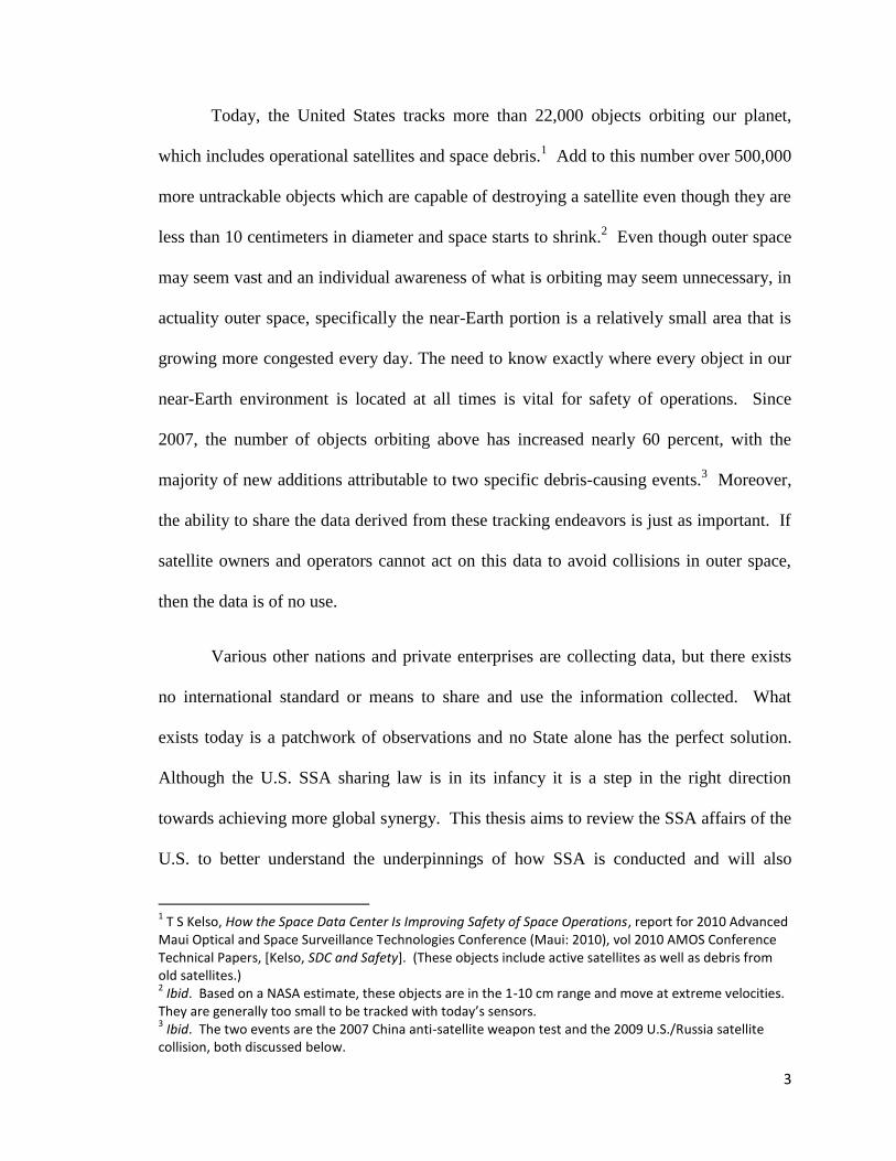
Today, the United States tracks more than 22,000 objects orbiting our planet,
which includes operational satellites and space debris.1 Add to this number over 500,000
more untrackable objects which are capable of destroying a satellite even though they are
less than 10 centimeters in diameter and space starts to shrink.2 Even though outer space
may seem vast and an individual awareness of what is orbiting may seem unnecessary, in
actuality outer space, specifically the near-Earth portion is a relatively small area that is
growing more congested every day. The need to know exactly where every object in our
near-Earth environment is located at all times is vital for safety of operations. Since
2007, the number of objects orbiting above has increased nearly 60 percent, with the
majority of new additions attributable to two specific debris-causing events.3 Moreover,
the ability to share the data derived from these tracking endeavors is just as important. If
satellite owners and operators cannot act on this data to avoid collisions in outer space,
then the data is of no use.
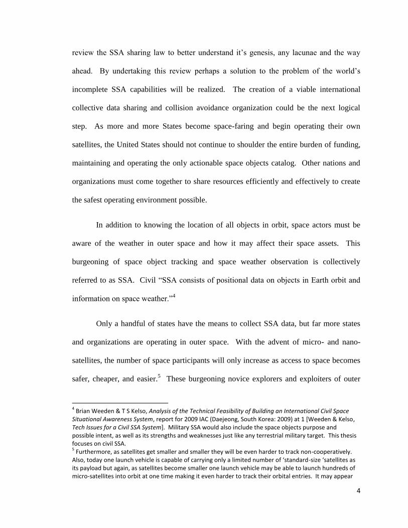
Various other nations and private enterprises are collecting data, but there exists
no international standard or means to share and use the information collected. What
exists today is a patchwork of observations and no State alone has the perfect solution.
Although the U.S. SSA sharing law is in its infancy it is a step in the right direction
towards achieving more global synergy. This thesis aims to review the SSA affairs of the
U.S. to better understand the underpinnings of how SSA is conducted and will also
1 T S Kelso, How the Space Data Center Is Improving Safety of Space Operations, report for 2010 Advanced
Maui Optical and Space Surveillance Technologies Conference (Maui: 2010), vol 2010 AMOS Conference Technical Papers, [Kelso, SDC and Safety]. (These objects include active satellites as well as debris from old satellites.) 2 Ibid. Based on a NASA estimate, these objects are in the 1-10 cm range and move at extreme velocities.
They are generally too small to be tracked with today’s sensors. 3 Ibid. The two events are the 2007 China anti-satellite weapon test and the 2009 U.S./Russia satellite
collision, both discussed below.
4
review the SSA sharing law to better understand it‘s genesis, any lacunae and the way
ahead. By undertaking this review perhaps a solution to the problem of the world‘s
incomplete SSA capabilities will be realized. The creation of a viable international
collective data sharing and collision avoidance organization could be the next logical
step. As more and more States become space-faring and begin operating their own
satellites, the United States should not continue to shoulder the entire burden of funding,
maintaining and operating the only actionable space objects catalog. Other nations and
organizations must come together to share resources efficiently and effectively to create
the safest operating environment possible.
In addition to knowing the location of all objects in orbit, space actors must be
aware of the weather in outer space and how it may affect their space assets. This
burgeoning of space object tracking and space weather observation is collectively
referred to as SSA. Civil ―SSA consists of positional data on objects in Earth orbit and
information on space weather.‖4
Only a handful of states have the means to collect SSA data, but far more states
and organizations are operating in outer space. With the advent of micro- and nano-
satellites, the number of space participants will only increase as access to space becomes
safer, cheaper, and easier.5 These burgeoning novice explorers and exploiters of outer
4 Brian Weeden & T S Kelso, Analysis of the Technical Feasibility of Building an International Civil Space
Situational Awareness System, report for 2009 IAC (Daejeong, South Korea: 2009) at 1 [Weeden & Kelso, Tech Issues for a Civil SSA System]. Military SSA would also include the space objects purpose and possible intent, as well as its strengths and weaknesses just like any terrestrial military target. This thesis focuses on civil SSA. 5 Furthermore, as satellites get smaller and smaller they will be even harder to track non-cooperatively.
Also, today one launch vehicle is capable of carrying only a limited number of ‘standard-size ‘satellites as its payload but again, as satellites become smaller one launch vehicle may be able to launch hundreds of micro-satellites into orbit at one time making it even harder to track their orbital entries. It may appear

5
space may not possess the ability to maintain their own independent SSA data and will
come to rely upon those States that do, namely the United States of America. Should the
United States shoulder this burden alone?
Today, more than 50 countries own operational satellites, but only a handful are
capable of tracking their orbits.6 Much like the United States providing free,
uninterrupted global positioning satellite (GPS) signals to the entire world, SSA data is
also shared free via the internet.7 Like GPS, the collection and sharing of SSA data is
truly a global asset. The United States Strategic Command (USSTRATCOM), a unified
combatant command of the Department of Defense, is specifically delegated the space
observance mission and has amassed a rather large database of space objects which are
tracked via sensors all over the world by the Joint Space Operations Center (JSpOC) in
southern California.8 The National Aeronautics and Space Administration (NASA) also
studies space debris within its Orbital Debris Program Office.9 Additionally, the United
States Department of Commerce‘s National Oceanic and Atmospheric Administration
(NOAA), along with the U.S. Air Force Weather Agency (AFWA) and NASA, observe
and forecast outer space weather. Collectively, USSTRATCOM, NOAA and NASA are
continually working to share the information they collect and analyze with other nations
and private satellite owners and operators; however, the current legal regime governing
on radars as if the rocket exploded into fragments. Information must be shared between States and organizations ahead of time. 6 Tony Skinner, “Spatial Awareness: Addressing the Space Debris Threat”, Jane's Strategic Advisory Service
*Skinner, “Addressing the Space Debris Threat”+. 7 See Space-Track.org, discussed in detail in Chapter 3.
8 USSTRATCOM Space Control and Space Surveillance Fact Sheet (July 2010) [Space Control Fact Sheet].
9 NASA, Orbital Debris Program Office Webpage. (Note: All web page addresses can be found in the
bibliography section.)

6
SSA data sharing is in its infancy and there is much that needs to be done to make this
effort truly an international success.
The European Union, through the European Space Agency (ESA), is also actively
planning for its own SSA capability, which up until now is only found within a handful
of European Community states, such as France, Germany and Italy. The Russian
Federation has a rather robust SSA architecture as well, but does not regularly share their
information. Moscow, Russia is also the headquarters for the International Scientific
Optical Network (ISON) which is comprised of scientists and their telescopes from
Russia, other Asian countries, Eastern Europe, Africa and even South America.10
Amateur astronomers, backyard hobbyists and educational institutions are also active in
tracking and identification of space objects. Lastly, and perhaps the most important
endeavor is the ongoing private industry effort to create its own SSA network, known as
the Space Data Association (SDA).11
Even satellites which are labeled as ‗classified‘ for national security reasons by
their respective States are observed, tracked and published by other nations and amateurs
alike. For example, the public portion of the satellite catalog maintained by
USSTRATCOM—and accessible by almost anyone in the world—filters out the United
States classified space objects, yet the Union of Concerned Scientists publishes a list of
active satellites including those kept out of the U.S. public catalog, so to do amateur
astronomers. One argument against global sharing of SSA data is based on national
10
Site of initiative astronomical projects: International Scientific Optical Network (ISON) & Low Frequency VLBI Network (LFVN) [ISON Website]. 11
Space Data Association Website [SDA Website].
7
security, but as is seen when comparing the varying resources no satellite is truly hidden
in outer space.12
These national and private systems are not linked with one another as they ought
to be, even in the face of national security concerns. A unified international organization
tasked with the operational responsibility to gather, refine and distribute SSA data will go
a long way to attain greater safety and understanding of the outer space environment as
well as promote the peaceful use of outer space. Collectively, the burden can be shared
more equitably and unity of effort will prevail. Such an organization would aid in
preventing unneeded redundancy and provide common transparency and confidence for
all space actors who are members of an international organization and agree to share their
SSA data. Furthermore, as the foremost global provider of SSA data the United States
dedicates entire military missions and funding for the cost-free benefit of all space actors,
foreign and domestic. Based solely on the sheer number of satellites the United States
has in space, the United States has the most to lose by not maintaining complete SSA.
However, every space-faring state possessing even a single satellite in outer space must
also maintain SSA over its assets. All states are required as part of international
reasonability to continually supervise all activities undertaken by itself or its private
citizens.13
Any state which launches a satellite or licenses the launch of a satellite is
negligent if it does not then track and avoid collisions with other space objects.14
States
with the means or money to launch a satellite, but without the ability to maintain SSA
12
The issue may then become the intent and purpose of each satellite, but a global SSA data sharing entity does not need this information set in order to maintain safety and avoid collisions. 13
Treaty Governing the Activities of States in the Exploration and Use of Outer Space, including the Moon and Other Celestial Bodies, 27 Jan 67, 610 UNTS 205, 18 UST 2410 [Outer Space Treaty]. Even those States which are not a party to the Outer Space Treaty may have a duty under customary international law. 14
Convention on International Liability for Damage Caused by Space Objects, 29 Mar 72, 961 UNTS 187, 24 UST 2389, [Liability Convention].
8
over the satellite should cooperate fully with those nations that do and provide all
necessary data for creating the most precise orbital track possible. In return they are
ensured their costly asset will not perish from reckless oversight.
The issue of SSA data sharing will be addressed in three parts. First, the technical
background describing the outer space environment, orbital mechanics, SSA sensors and
data will be explored to provide a foundation for fully appreciating the legal strides
needed in order to achieve greater international cooperation. Next, this thesis will
undertake an analysis of the law, policy and participants of SSA collection and
dissemination within the United States. The legislative and political history will be
traced up to the current iteration of the law. The most pertinent sections of the current
U.S. SSA sharing law are examined and lacunae are pointed out when discovered. The
last part, Chapter 4, will briefly broaden the investigation to include the other non-United
States actors active within the SSA filed, including foreign governments, private
enterprise and amateurs. Throughout this thesis several entities will be highlighted as
potential models for creating a global data sharing organization capable of handling the
day-to-day collection and dissemination of SSA data the world over. These organizations
include the International Space Environment Service, ISON and SDA. The concluding
chapter will recommend a new international organization to govern a world-wide,
internationally operated network for global SSA data sharing and analysis.

9
II. Background: The Physical SSA Environment
When one envisions the vastness of outer space and views the marvelous pictures
captured by the Hubble telescope, it is easy to imagine there is so much limitless room to
operate a satellite that the likelihood of collisions between two objects, whether man-
made or naturally occurring, is so minimal that no one needs to worry about one
another‘s space assets. However, space quickly dwindles when we focus on only the
areas most useful to mankind: the low earth orbit (LEO) from roughly 100 kilometers to
2,000 kilometers; medium earth orbit (MEO) from about 2,000 kilometers to 35,000
kilometers, geosynchronous transfer orbits, and the geosynchronous earth orbit (GEO) at
35,786 kilometers in altitude.15
The near-Earth environment is the chief location for
placing satellites which provide the most scientific and technology useful benefits for
mankind. Humans are also best equipped to operate within near-Earth, namely LEO, on
a continual basis. With over 22,000 man-made objects in outer space the vast majority of
them are located only within LEO and GEO.16
In order to continually observe and track both man-made and naturally occurring
objects in space, as well as observe and predict space weather, varying sensors are
required and must be dispersed over the globe as widely as possible for maximum
effectiveness. Many entities operate space observation platforms. For example, the
United States network of sensors for surveillance of outer space is known as the Space
Surveillance Network (SSN) and is comprised of radars, telescopes and satellites working
15
This area is collectively referred to as the near-Earth environment. 16
Space Control Fact Sheet, supra note 8. Several satellite constellations operate in MEO, with the most recognized being those constellations providing positioning, navigation and timing, such as GPS.

10
together to capture the locations of as many objects in space as technically possible.17
These networks combined with the other aspects of the outer space environment, such as
weather, constitute the technical underpinning of SSA.
The outer space environment is very demanding in terms of its weather activity
and the physical effects it has upon satellites. Combined with the weather created by the
Sun‘s radiation, other aspects of space affect satellite efficacy, position and operational
life-span. For instance, the Sun‘s energy when excessively active can cause the Earth‘s
atmosphere to swell from increased heat which in turn causes satellites in LEO to de-orbit
more quickly than when the Sun‘s emitted energy is weaker. These aspects of the outer
space environment include gravity, Earth‘s atmosphere, cosmic rays, and near earth
objects such as asteroids and meteoroids.
The outer space environment is an extremely harsh and dangerous area in which
to operate. Even while Sputnik I was the only man-made space craft circling above; it
was already being impacted upon by the unseen forces of space weather. As equally
important to possessing valuable SSA data regarding the location of objects in outer
space is observing, predicting and disseminating timely space weather data. Much like
weather occurring within the Earth‘s atmosphere and the negative outcomes it can
produce upon humans‘ activities, such as tsunamis, earthquakes, and tornados; outer
space weather too can have drastic effects upon the man-made objects orbiting within.
Knowledge about space weather is vital for the effective fusion of SSA data, as is an
understanding of how gravity and Earth‘s atmosphere operate to affect the orbital
mechanics of an orbiting object in outer space.
17
Ibid.
11
The following sub-sections will discuss these aspects in the following order:
space objects; orbital mechanics; space surveillance sensors; satellite surveillance data;
and finally, space weather.
1. Space Objects: Payloads, Debris, & Near-Earth Objects
There are over 22,000 man-made space objects in orbit today, and interestingly,
only 16,000 are in the United States public catalog.18
The additional 6,000 objects being
tracked are filtered out of the public version of the SSN catalog because there is not
enough sound observational data to refine the objects‘ orbits to safely place it in the
catalog for others to rely upon or they are classified for national security reasons.19
NASA‘s Orbital Debris Program Office has further indicated more than 500,000
small (less than 10 centimeters) objects orbit Earth as well and travel at high enough
velocities to cause catastrophic consequences were they to collide with another space
object.20
The Union of Concerned Scientists also maintains a very detailed listing of the
known active satellites, which as of January 31, 2011 numbers 957.21
As can be seen
from the figures above, the vast majority of space objects in outer space are non-
operational and uncontrollable.
Broadly, space objects are divided into two main categories: naturally occurring
and man-made. Of the man-made, or artificial space objects, they are further divided into
operational space craft and space debris. All categories are briefly described below.
18
NASA, Orbital Debris Quarterly News (Houston: NASA Orbital Debris Program Office, Jan 11) at 9 [Orbital Debris Qtly]. 19
Kelso, SDC and Safety, supra note 1. Classified space craft not listed by the U.S. are often still tracked by other nations and even amateurs. 20
Ibid. 21
See, Union of Concerned Scientists webpage at http://ucsusa.org/satellites.

12
Natural space objects are often referred to as minor bodies or near-earth objects
(NEOs) and include meteoroids, asteroids, and comets.22
NEOs are natural objects which
orbit around the Sun rather than Earth, but a number of their orbits bring them within
very close proximity to Earth, hence the reference NEO.23
The vast majority of NEOs
are simply dust particles measured in millimeters and are too small to track.24
The danger
of micrometeoroids is not their size, but rather their velocities. Traveling at hyper speeds
of 10 kilometers per second they are like bullets from a gun—a very powerful gun.25
They are relatively small, but pack a huge punch; therefore, awareness of NEOs is
important and is often done with statistical computer modeling after examination of the
outer layer, or skin, of space objects which are brought back to Earth.26
Artificial space objects are divided into two primary categories: active space craft
and debris. The Convention on International Liability for Damage Caused by Space
Objects (Liability Convention) offers a slim definition of a ‗space object‘ to include its
component parts ―as well as its launch vehicle and parts thereof.‖27
According to the
treaty‘s drafting history the U.N. Committee on the Peaceful Use of Outer Space‘s
(UNCOPUOS) Legal Subcommittee indicated the term ‗space object‘ had a common
understanding and was clear enough to not require a definition.28
Therefore, a common
22
ESA, Space Situational Awareness Webpage, [ESA SSA Webpage]; International Astronomical Union, Minor Planet Center. See also, Ernst Fasan, “Asteroids and other Celestial Bodies - Some Legal Differences” (1998) 26:1 J of Space L 33. 23
ESA SSA Webpage, supra note 22. 24
Brian Weeden, “The Numbers Game: What's in Earth Orbit and How Do We Know?”, The Space Review: Essays and Commentary about the Final Frontier (26 Jan 11) at 1 *Weeden, “The Numbers Game”+. 25
NASA, Micrometeoroids and Orbital Debris (MMOD) Webpage. 26
Weeden, “The Numbers Game”, supra note 24 at 1. 27
Liability Convention, supra note 14 at Art I(d). 28
W F Foster, “The Convention on International Liability for Damage Caused by Space Objects” (1972) 10 Can YB Int'l L 137 at 139.

13
sense approach is required as there is no clear, detailed legal definition other than the
Liability Convention, Article I(d) cited above.
The term ‗space object‘ includes both functioning space craft as well as any
debris derived therefrom. The United Nations defines space debris as ―all man-made
objects, including fragments and elements thereof, in Earth orbit or re-entering the
atmosphere, that are non-functional.‖29
Space debris takes many forms, but can be
separated into four main types: microparticulate matter, inactive payloads, mission-
related debris, and fragmentation debris.30
The SSN is currently tracking over 10,000
pieces of debris larger than 10 centimeters.31
Inactive payloads are space craft (also referred to as satellites), which are no
longer properly functioning or have simply run out of fuel. These space objects are still
in one piece and are therefore large enough to be tracked by Earth-based sensors. What
is crucial is that these Earth-based sensors be able to recognize inactive payloads as no
longer having the capability to maneuver (if maneuvering were even possible when they
were operational), should a predicted collision be foreseen and require a response that
involves altering the orbit of one or more of the space objects involved.32
Obviously, the
inactive payload will be unable to maneuver on its own.
29
UN Office for Outer Space Affairs, Space Debris Mitigation Guidelines of the Committee on the Peaceful Uses of Outer Space, UNCOPUOS, (2007) [Debris Mitigation Guidelines]. 30
Michael W Taylor, “Trashing the Solar System One Planet at a Time: Earth's Orbital Debris Problem” (2007-2008) 20 Geo Int'l Envtl L Rev 1 at 9 *Taylor, “Trashing the Solar System”+. 31
HQ AFSPC/XOCS, Satellite Situation Report (Colorado Springs: 7 Mar 11). 32
This is also where it is important for owners and operators to provide their own data to the SSA databases as to the location, maneuvering abilities and maneuvering plans for their respective satellites.

14
Mission-related debris is made up of ―all objects dispensed, separated, or released
as part of the planned mission.‖33
These are items which were intentionally ―launched or
released into space during normal operations.‖34
Operational debris includes nose cones,
sensor covers, deployment articles, upper stages, rocket bodies, bolts, straps, fuel tanks
and anything else jettisoned as the mission proceeds.35
Thankfully, some operational
debris is now designed to re-enter Earth‘s atmosphere more rapidly, and there also exists
more environmentally friendly designed space craft that lessen the amount of operational
debris being created, such as explosive bolt retainers.
The opposite of mission-related debris is fragmentation debris. Any space object
which explodes or has an unplanned break-up results in fragmentation debris. The SSN
currently tracks approximately 9,000 fragments.36
For instance, in October 2010, the
International Space Station (ISS) was forced to move to avoid debris fragments from a
19-year old defunct NASA satellite.37
At least once per year the ISS routinely performs
station-keeping maneuvers to avoid debris.38
Intentional fragmentation events have taken place as well, most commonly in the
form of anti-satellite (ASAT) testing. More recently in 2007, China destroyed its
Fengyun-1C weather satellite in LEO, using a rocket launched from earth.39
As a result,
there are approximately 3,000 new pieces of fragmentation debris being tracked and
33
NASA, Orbital Debris Qtly, supra note 18 at 10. 34
Taylor, “Trashing the Solar System” supra note 30 at 9. 35
Ibid; UN Office for Outer Space Affairs, Debris Mitigation Guidelines, supra note 29. (See for example, Guideline 1. Limit debris released during normal operations.) 36
NASA, Orbital Debris Qtly, supra note 18 at 10. 37
Ibid at 1. 38
Ibid. 39
Michael C Mineiro, “FY-1C and USA-193 ASAT Intercepts: An Assessment of Legal Obligations Under Article IX of the Outer Space Treaty” (2008) 34:2 Journal of Space Law 321 *“ASAT Intercepts”+; See also, Taylor, “Trashing the Solar System” supra note 30.

15
many more which are untrackable.40
It is predicted these new debris fragments will
remain in orbit below 2000 kilometers for decades.41
Figure 2-1. Monthly Number of Objects in Earth Orbit by Object Type
(Credit: Union of Concerned Scientists)
The unintentional fragmentation event resulting from the collision of the Cosmos-
2251 and Iridium-33 satellites on February 10, 2009, is perhaps the current catalyst for
recognizing just how essential knowledge about what is going on in outer space is and
was a call for greater SSA and an overall world awakening and general appreciation for
the potential ―tragedy of the commons‖ scenario within the outer space environment.42
40
T S Kelso, “How the Space Data Center is Improving Safety of Space Operations” 2010 AMOS Conference Technical Paper delivered at the Advanced Maui Optical and Space Surveillance Technologies Conference, Maui, (2010) at 1 *Kelso, “SDA Improving Safety”+. 41
Mineiro, “ASAT Intercepts”, supra note 39 at 342. 42
Frans G von der Dunk, “Too-Close Encounters of the Third-Party Kind: Will the Liability Convention Stand the Test of the Cosmos 2251-Iridium 33 Collision?” International Institute of Space, Proceedings of the 52nd Colloquium on the Law of Outer Space (2009, American Insitute of Aeronautics and Astronautics,

16
Roughly 87 percent of the man-made objects in orbit are fragmentation debris and
inactive satellites.43
Cosmos-2251 was a defunct Russian military satellite launched in 1993, and
Iridium-33 was fully operational, providing active telecommunications.44
When the two
satellites collided, they created a fragmentation debris cloud in an already congested 785
kilometers altitude, which is projected to remain in orbit for decades.45
Interestingly,
Iridium spokeswomen Elizabeth Mailander, confirmed that had Iridium been given a
‗precise warning‘, then it could have moved Iridium-33 out of the orbital path of
Cosmos-2251.46
Much like NEOs, microparticulate matter is, as the name indicates, comprised of
very tiny pieces of debris. NEOs and microparticulate matter differ in that
microparticulate matter is man-made. This source of space debris most often takes the
form of spent fuel and propellants that went unused during launch.47
Interestingly, the
United Nation‘s (UN) Space Debris Mitigation Guideline 5 calls for space craft
‗passivation‘, which ―requires the removal of all forms of stored energy, including
residual propellants and compressed fluids….‖48
Effectively, this is choosing between
the lesser of two evils, in that if passivation were not implemented, then operational
debris that retains compressed fluids becomes a much greater explosion hazard resulting
in larger fragmentation debris. When the tanks are drained they are no longer an
Inc, 2010) at 199 *von der Dunk, “Close Encounters”+. See also, Garrett Hardin, “Tragedy of the Commons” (13 Dec 1968) Science 1234. 43
Space Control Fact Sheet, supra note #. 44
von der Dunk, “Close Encounters”, supra note 42 at 199. 45
Ibid. 46
Ibid at 203. 47
UN Office for Outer Space Affairs, Debris Mitigation Guidelines, supra note 29 at Guideline 5. 48
Ibid.

17
explosion hazard. Moreover, when space craft surfaces are worn down over time from
the harsh space environment, the surface materials, such as paint, are flecked off creating
additional micro-particulate matter.49
A single, small paint chip can have serious impact
upon larger space objects.
Taking into account the historical increase of active and inactive space objects
orbiting in outer space, there has been a four-fold increase since the space age began 30
years ago.50
The United States current Satellite Box Score reports a total of 15,899
objects being monitored.51
Recognizing that the majority of space debris is currently
untrackable due mainly to its size, there is much improvement that can be done to
advance SSA in this regard. The number of untrackable (less than 1 centimeter in
diameter) and potentially trackable (between 1 and 10 centimeters in diameter) is
reported to be in the billions.52
This ‗potentially trackable‘ range of between 1 and 10
centimeters is the most serious issue facing SSA today because these objects are too
small to track effectively yet they are too large to counter with satellite shielding.53
Perhaps the evolved Space Fence radars due to come on line by the end of the
decade will shed more light on the seriousness of the debris problem.54
The users of SSA
data must know where space objects are located so not to accidentally destroy or interfere
with one another‘s own multi-million dollar assets.
49
Taylor, “Trashing the Solar System” supra note 30 at 11. 50
Skinner, “Spatial Awareness: Adressing the Space Debris Threat”, supra note 6. 51
NASA, Orbital Debris Qtly, supra note 18 at 10. 52
Weeden, “The Numbers Game”, supra note 24 at 1. 53
Lecture between Brian Weeden and McGill Institute of Air and Space Law (15 Mar 11) [Weeden, Lecture]. 54
The Space Fence concept is discussed below.

18
2. Orbital Mechanics
Space objects basically populate several defined regions in outer space—LEO,
MEO, and GEO. Each of these orbits is better suited for specific missions, such as earth
observation and communications in LEO, navigation satellites in MEO, and
telecommunication and broadcasting satellites in GEO. The geostationary transfer orbit
is used to re-orbit or maneuver GEO satellites into their permanent orbits after being
launched from Earth into LEO. Understanding orbit types and the forces that affect
satellites found in these orbits is essential to a review of the overall importance of SSA,
especially because today‘s technology only allows for predictive tracking abilities versus
actual real-time, continual tracking of objects as seen in the aviation field.
Although there is no legal delimitation to where the atmosphere ends and outer
space begins, it is generally accepted to be approximately 100 kilometers in altitude.55
LEO extends from the ‗end‘ of the Earth‘s atmosphere up to approximately 1,000 or
2,000 kilometers.56
This lower altitude is ideal for greater satellite Earth-imaging camera
resolution. It also requires much less energy to transmit communications back to Earth
and it also requires much less rocket energy to place a LEO satellite into orbit versus
other higher orbital insertions.57
Objects in LEO take about 90 minutes to complete one
trip around the Earth, called a period, and therefore perform many periods around the
55
David Wright, Laura Grego & Lisbeth Gronlund, The Physics of Space Security: A Reference Manual (Cambridge: American Academy of Arts and Sciences, 2005) at 39 [Wright, Grego & Gronlund, Physics of Space]. 56
Ibid at 40. LEO has also been defined as extending up to 2,000 km. 57
Edward P Chatters IV, Bryan Eberhardt & Michael S Warner, “Orbital Mechanics”, Ch 6 in Air Command and Staff College, ed, AU-18 Space Primer (Maxwell AFB: Air University Press, 2009) at 89 [Chatters IV, Eberhardt & Warner, “Orbital Mechanics”+.
19
Earth in a single day.58
Today, manned space flight is only located in LEO;59
in fact, the
International Space Station (ISS) is located here at an altitude of 340 kilometers.60
There
are approximately 462 active satellites in LEO and an untold amount of space debris
ranging from simple bolts to entire rocket bodies.61
With LEO being so close to terra firma, the Earth‘s gravitational pull, although
far less than what is found below 100 kilometers altitude, still affects satellites and space
debris over time.62
This phenomenon is referred to as atmospheric drag. Although it
affects space objects no matter their orbital location, it is most serious for objects in
LEO.63
The gravitational pull exerted on objects also varies due to the Earth‘s imperfect
spherical shape.64
Atmospheric drag will slowly cause a satellite to de-orbit and re-enter
Earth‘s atmosphere; therefore, satellites in LEO must have the ability to boost themselves
up to higher orbits to continually counter the effects of gravity, called station keeping.65
The effects of gravity are important to understand and factor into any predictive
SSA tracking scheme, both to ensure an accurate orbital picture is maintained for each
tracked object, as well as re-entry of old and ‗dead‘ satellites and their launch vehicles,
and the launch of new space objects which must travel to, or through, LEO. These
effects are taken into account by computer modeling.
58
Wright, Grego & Gronlund, Physics of Space, supra note 55. 59
Taylor, “Trashing the Solar System” supra note 30 at 6. 60
Chatters IV, Eberhardt & Warner, “Orbital Mechanics”, supra note 57 at 90. 61
See, UCS Satellite Database, online: <http://www.ucsusa.org/nuclear_weapons_and_global_security/space_weapons/technical_issues/ucs-satellite-database.html>. 62
Wright, Grego & Gronlund, Physics of Space, supra note 55 at 39. 63
Ibid. 64
Ibid at 40. 65
Ibid at 39.

20
In addition to the earth‘s gravity, the Moon, Sun and even Jupiter can affect the
orbital track of space objects.66
Furthermore, during high levels of solar activity the
earth‘s atmosphere may expand beyond its normal range, causing even greater
atmospheric drag upon space objects as far up as 200 kilometers, which will re-enter and
burn up more rapidly if not corrected by more constant and costly station keeping.67
The MEO lies in between LEO and GEO from approximately 2,000 kilometers to
36,000 kilometers.68
Satellites in this area perform communications and, most notably,
global positioning. The United States Global Positioning System (GPS) constellation of
31 satellites, and the Russian Global Navigation Satellite System (GLONASS)
constellation of roughly the same number, orbit within this region. The harshest natural
condition impacting satellites in MEO is radiation (the Van Allen radiation belts are
located generally in this area) which harm the satellite‘s electronic components if
radiation hardening countermeasures are not added.69
The GEO holds a unique location in outer space, specifically within the
geostationary orbit (the orbital plane directly above the equator at zero degrees).70
This is
where satellites appear stationary in the night sky because the time it takes them to travel
one period equals the same amount of time it takes the earth to make a single rotation of
its own.71
All objects in GEO take 24 hours to make one rotation around the earth.72
66
Ibid. 67
Ibid at 40. 68
Ibid at 42. 69
Ibid. 70
Note: geosynchronous and geostationary have separate meanings. 71
Chatters IV, Eberhardt & Warner, “Orbital Mechanics”, supra note 57 at 91. 72
Ibid at 92.

21
This phenomenon occurs at 35,786 kilometers.73
Geostationary satellites sitting above
the equator are able to cover nearly 43 percent of the Earth‘s surface and are ideal for
telecommunications and broadcasting.74
Regarding space weather, the GEO falls just
beyond the densest region of the Van Allen radiation belts.75
The counter point to this
fact is with the GEO‘s great distance from the earth, it is consequently closer to the sun
and during high solar activity the Sun can damage GEO satellites much more easily than
satellites located within MEO and LEO.76
Of note is one special orbital location in outer space best suited for space weather
observation and therefore important for our discussion of SSA. The scientist, Joseph-
Louis Lagrange, discovered five unique positions within the Sun-Earth system which
offer unique vantage points for observing the solar system.77
Of particular importance for
solar weather observation and prediction is Lagrange Point One (L1).78
L1 is located
―about a hundredth of the distance to the Sun‖ from the earth where the gravitational
forces of both the earth and the Sun effectively cancel one another out, and the satellite
takes 24 hours to orbit the sun exactly like the earth.79
A satellite placed in the L1 orbital
position stays between the Earth and the Sun at all times. From a space weather
standpoint, solar winds emanating from the Sun reach L1 about one hour before reaching
73
Wright, Grego & Gronlund, Physics of Space, supra note 55 at 43. 74
Ibid. The earth’s poles are not covered by satellites in the geostationary orbit. 75
Van Allen Radiation Belts are two belts surrounding the earth which contain higher concentrations of plasma that, because of the Earth’s gravitational pull, remain in the same general location. The Sun’s solar winds affect the Van Allen Belts, causing them to have an irregular shape, continually shifting and affecting satellites beyond LEO. 76
Wright, Grego & Gronlund, Physics of Space, supra note 55 at 44. 77
European Space Agency, Space Science: What are Lagrange Points? (12 Feb 09). 78
Ibid. (The other four Lagrange points are not useful for space weather applications.) 79
Ibid.
22
Earth providing valuable early warning80
The information relayed from L1 satellites,
such as the ‗solar watchdog satellite‘, provides important situational awareness. Many
satellites can be powered down or placed in ‗safe-mode‘ to protect their sensitive
electronics during solar flares and other space weather phenomenon that has been
observed sooner by space weathers satellites at L1.81
Satellites initially placed into outer space may have to maneuver into their final
position via the geostationary transfer orbit (GTO) which effectively ‗sling-shots‘ the
satellite into its geostationary orbit using the earth‘s rotation and the satellite‘s own
thrusters or rockets. The satellite may have to transit through other highly populated
areas wherein proper SSA is a necessity.
The U.S. Space Surveillance Network endeavors to observe all satellite
maneuvers, but often must rely on historical and out of date data since it cannot perform
real-time tracking of every active payload. This is where the Space Data Association
(SDA) becomes relevant. The newly operational SDA is a consortium of private satellite
owners and operators coming together to share data on the orbital location of their
respective satellites. Owners and operators are always communicating with their
satellites and know where they are. They can track them constantly and in real-time
(however, this could change as newcomers with fewer resources enter the field). Work is
ongoing to synergize commercial data with USSTRATCOM‘s sensor network for better
overall SSA. The SDA is discussed in more detail in Chapter 4.
80
Ibid. 81
NOAA Space Weather Prediction Center, A Profile of Space Weather (Boulder: NOAA, 2010) [NOAA, Space Weather].

23
In addition to space crafts‘ routine orbital movements, there are a multitude of
potential actions space objects execute, known as ‗space events‘.82
Space events are
typically those actions which impact or have the potential to impact a third-party man-
made space object.83
Space events include launches, maneuvers in outer space,
intentional separations, unintentional break-ups, and atmospheric re-entries.84
Space
events are most commonly controlled by operators on the ground; however, adverse
space weather can sometimes cause unplanned or undesired space events to occur. If the
orbital period of a satellite is less than 87.5 minutes, then it is an indicator that the
satellite is decaying and will re-enter Earth‘s atmosphere if not boosted back up to a
higher altitude.85
It is critical for outer space safety that these space events are observed,
tracked and if new space debris is created, it is properly and expediently cataloged.
3. Space Surveillance Sensors
Today, the United States, Russia and a few other entities employ several types of
sensors to gather SSA data. Historically, these sensors were not originally designed for
space surveillance, but rather for Cold War ballistic missile warning.86
This is evidenced
by the geographical location of most sensors arranged in a pattern to protect respective
territorial boundaries. For example, there are no American sensors located in the
southern hemisphere and Russia and China have no sensors outside of their geographic
82
Edward P Chatters IV, “Space Event Processing”, Ch 12, in Air Command and Staff College, ed, AU-18 Space Primer (Maxwell AFB: Air University Press, 2009) at 163. 83
Ibid. 84
Ibid. 85
Chatters IV, Eberhardt & Warner, “Orbital Mechanics”, supra note 57 at 98. 86
Weeden & Kelso, Tech Issues for a Civil SSA System, supra note 4 at 2.

24
regions. The sensors currently operating are largely antiquated and in need of upgrades
or replacement.
The United States Space Surveillance Network (SSN) is an aging hodgepodge of
sensors employing the aforementioned ―‗predictive‘ technique to monitor space objects;
i.e., [ ] spot checks them rather than tracking them continually.‖87
This predictive
technique uses the data collected by sensors and the orbital mechanics discussed above to
determine the most logical orbit for each object catalogued. So, when an actively
controlled space object is maneuvered or boosted by its owners and operators it may be
lost to the SSN for some time due to its new path.
The SSN is limited to conducting spot checks only mainly because the system is
simply not ubiquitous enough. The SSN will need more sensors with greater geographic
distribution across the entire globe with more accessibility in order to achieve perfect
SSA. This is one of the SSN‘s biggest impediments. Also most sensors are used
primarily for other purposes, like ballistic missile launch detection, before being tasked
for SSA missions.88
These are just a few reasons a global SSA network is necessary.
Combining the world‘s sensor data, or even the sensors themselves, will complement one
another and fill SSA voids. In the future this may allow for continuous tracking
capability as one State‘s sensor hands-off the space object to its next sensor or another
State‘s sensor and so on; as opposed to only employing a predictive technique. The U.S.
SSN‘s sensors mainly include ground-based radars and advanced telescopes but there are
a number of advanced space-based satellites capabilities being tested and developed able
87
Space Control Fact Sheet, supra note 8. 88
Ibid.
25
to track space objects without the earth-based sensors‘ limitations such as clouds and
daylight.89
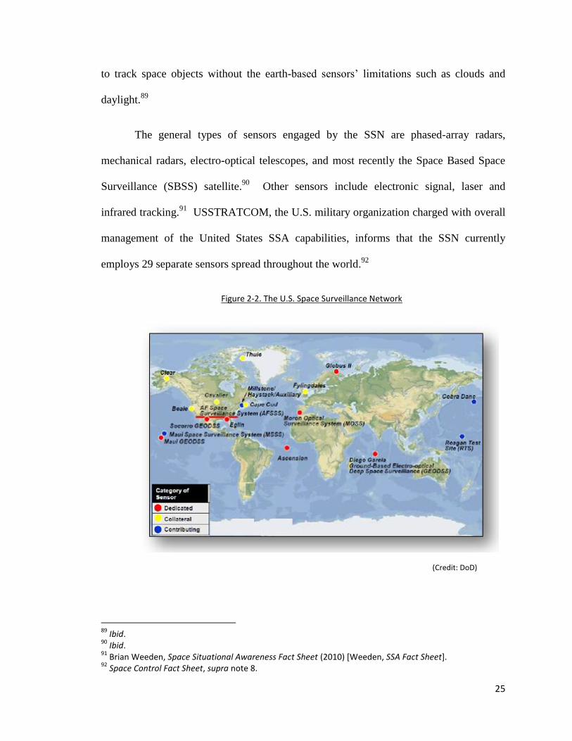
The general types of sensors engaged by the SSN are phased-array radars,
mechanical radars, electro-optical telescopes, and most recently the Space Based Space
Surveillance (SBSS) satellite.90
Other sensors include electronic signal, laser and
infrared tracking.91
USSTRATCOM, the U.S. military organization charged with overall
management of the United States SSA capabilities, informs that the SSN currently
employs 29 separate sensors spread throughout the world.92
Figure 2-2. The U.S. Space Surveillance Network
(Credit: DoD)
89
Ibid. 90
Ibid. 91
Brian Weeden, Space Situational Awareness Fact Sheet (2010) [Weeden, SSA Fact Sheet]. 92
Space Control Fact Sheet, supra note 8.

26
As indicated throughout this section, some sensors within the SSN possess only
one mission—space surveillance; however, the majority are only performing part-time
space surveillance. Hence, for SSA and SSN purposes, each sensor is labeled either
dedicated, collateral or contributing. (See Figure 2-2 above.) Collateral sensors only
provide SSA data as a secondary or even tertiary mission, and contributing sensors are
not owned by the United States Air Force and perform other missions before providing
the USAF with additional SSA data. The lack of dedicated, immediately taskable sensors
is a critical issue for maintaining accurate SSA.
In addition to the United States SSN, the Russian Federation operates a network
of SSA sensors called the Space Surveillance System (SSS), which is comprised of many
of the same types of sensors which make up the SSN.93
Also, mirroring the SSN, the SSS
is primarily composed of sensors which are not solely tasked to handle SSA, but rather
provide constant missile defense warning.94
a. Radars
Conventional radars use narrow beams of energy and can ‗lock-on‘ and follow a
satellite as it crosses the radars field of view.95
Many conventional types of radar contain
moving antennas to enable active following of the object being tracked.96
SSN
mechanical radars include the Ronald Reagan Ballistic Missile Test Site‘s Advanced
Research Project Agency (ARPA), Long-Range Tracking and Instrumentation Radar
93
Weeden, SSA Fact Sheet, supra note 91 at 2. 94
Ibid. 95
Space Control Fact Sheet, supra note 8; See also, Edward P Chatters IV & Brian J Crothers, “Space Surveillance Network”, Ch 19, in Air Command and Staff College, ed, AU-18 Space Primer (Maxwell AFB: Air University Press, 2009) *Chatters IV & Crothers, “SSN Primer”+. 96
Chatters IV & Crothers, “SSN Primer”, supra note 95 at 249.

27
(ALTAIR) on the Kwajelin Atoll in the Western Pacific, and the Haystack radar operated
by the Lincoln Laboratory of the Massachusetts Institute of Technology (MIT).97
ALTAIR is primarily designed to detect foreign missile launches and is operated by the
United States Army; hence; it is a ‗contributing‘ sensor to the SSN. It is also used for
tracking objects in LEO and GEO.98
Detection of foreign missile launches is essentially
an SSA function as all payloads are launched on missiles (or in non-military terms,
rockets). The only difference is what is being launched by the rocket, either munitions or
satellites. The ALTAIR can track up to 32 objects at a time99
, and it performs over
42,000 tracks per year.100
Additionally, it is used as one of the primary tracking radars
during all manned space flight missions.101
MIT‘s Haystack radar divides it usage between educational research and as a
contributing portion of the SSN.102
It only provides several hundred hours of SSN
tracking data per year, yet is one of the most capable assets on the planet.103
The images
produced by the Haystack radar are used by USSTRATCOM ―to assess satellite
structure, mission, and status‖ and also to track orbital debris down to 1 centimeter in
size.104
Under perfect conditions this civilian-owned and operated system can track
objects the size of only a few millimeters.105
Again, this is an example of United States
radar being tasked for two different usages. Perhaps even more interesting is the fact that
the Haystack radar is used both as a civilian educational tool and as a strategic military
97
Space Control Fact Sheet, supra note 8. 98
United States Army, Space Operations Webpage [USA, Reagan Test Cite]. 99
United States Army, ARPA Long-Range Tracking and Instrumentation Radar (ALTAIR). 100
FAS, Advanced Research Project Agency (ARPA) Long-range Tracking and Identification Radar (ALTAIR). 101
USA, Reagan Test Cite, supra note 98. 102
Massachusetts Institute of Technology, Haystack Upgrade Program Webpage (2004) [MIT, Haystack]. 103
Weeden, “The Numbers Game”, supra note 24 at 1. 104
MIT, Haystack, supra note 102. 105
Weeden, “The Numbers Game”, supra note 24 at 1.
28
‗spy‘ radar helping intelligence analysts decipher the actual purpose and intent of a space
craft. Of note as well, is the detail of the data which the Haystack is capable of
producing. This dual-use radar evidences the fact that national security concerns should
not be a deterrent for a globally combined SSN and SSA data sharing, due to the internal
controls and filters that can be placed upon the data transmitted from a national asset to
the global organization.
The newest types of radars are the phased-array radars (PAR), which can scan
vastly larger swaths of outer space and track all objects within its fan-like energy beam
simultaneously.106
PARs do so by continually repeating the fanned signal hundreds of
times a minute and as long as the object is within the radars swath, it will capture the
object‘s orbital path.107
The energy beam is ‗moved‘ electronically without any
mechanically moving parts.108
If part of the energy fan intersects an object, the energy is
reflected back to a receiver which then decodes its location, size and orbit.109
It is this
orbital path (along with other collected data points) that is used to ‗predict‘ the complete
orbital path for the object. PARs offer the best data of all the sensors with their ability to
include range data (height, latitude and longitude) as opposed to an ‗angles only‘ method
which lacks range data used by optical telescopes and space fences.110
In many cases,
space objects being tracked are handed off from one SSN sensor to the next to develop
106
Space Control Fact Sheet, supra note 8. 107
Ibid. 108
Chatters IV & Crothers, “SSN Primer”, supra note 95 at 249. 109
Space Control Fact Sheet, supra note 8. 110
Weeden & Kelso, Tech Issues for a Civil SSA System, supra note 4 at 4 & 7.

29
the best orbital data. The one downside to the sophistication of PARs is obviously the
massive cost to develop and manufacture them.111
One example of a PAR is the Perimeter Acquisition Radar Attack
Characterization System (PARCS) radar,112
located at Cavalier Air Force Station, North
Dakota, approximately 24 kilometers south of the Canadian border.113
It is a fixed radar
with no moving parts and ―is pointed northward over the Hudson Bay.‖114
Reportedly,
the PARCS radar is capable of tracking nearly half of the known space objects in outer
space.115
Although the PARCS radar is an essential asset to the SSN, tracking space
objects is not its primary mission. Its primary mission is to collect real-time sea-launched
and intercontinental ballistic missile launch warnings for United States and Canadian
national defense.116
The Air Force‘s Pave Paws Radar System, of which there are actually two
operating within the United States, also acts as a collateral PAR sensor. One PAR system
which has a dedicated SSA mission is the AN/FPS 85 at Eglin Air Force Base, Florida.117
As mentioned above, dual- and multi-use mission sets for a single asset is one of the
major limitations to the overall ability to conduct thorough SSA data collection.
111
Chatters IV & Crothers, “SSN Primer”, supra note 95 at 250. 112
John Pike & Robert Sherman, AN/FPQ-16 Perimeter Acquisition Radar Attack Characterization System (PARCS) (1999) [Pike & Sherman, PARCS Radar]. 113
Peterson Air Force Base, 10th Space Wing Squadron, Fact Sheet [PAFB, 10th Space Wing]. 114
Pike & Sherman, PARCS Radar, supra note #. 115
Chatters IV & Crothers, “SSN Primer”, supra note 95 at 253; PAFB, 10th Space Wing, supra note 113. The PARCS radar tracks essentially any object large enough for its sensor to pick up, including those in polar orbit. 116
PAFB, 10th Space Wing, supra note 113. 117
Chatters IV & Crothers, “SSN Primer”, supra note 95 at 252.
30
Another future project under way to replace aging sensors, particularly the Air
Force Space Surveillance System (AFSSS) radars (formerly the Naval Space Surveillance
system), is the new 3.5 billion dollar S-band, commonly called Space Fence,118
which
began surveying outer space in 1961.119
Colloquially, it is referred to as a ‗fence‘
because it stretches along the 33rd
parallel spanning the southern United States, creating a
narrow, continent-wide energy beam which tracks everything crossing within its fan,
16,000 kilometers into space.120
The new Space Fence will be able to track micro-
satellites and much smaller debris while extending beyond 16,000 kilometers altitude,
and it is expected that the amount of trackable objects will increase tenfold.121
On a related note, the United States and Australia recently signed an agreement to
cooperate in SSA. This agreement may include the addition of a second S-band space
fence in Western Australia providing much need coverage of the southern hemisphere.122
b. Telescopes
The other important group of sensors are of the electro-optical class, which are
essentially large, ultra-sensitive telescopes augmented with digital recording devices and
computers.123
Electro-optical sensors allow for real-time analysis.124
The USAF‘s
premier SSN electro-optical sensor system is the Ground-Based Electro-Optical Deep
118
“USA Moves Ahead with Next-Generation 'Space Fence' Tracking”, Defense Industry Daily online *“New Space Fence”+. 119
Chatters IV & Crothers, “SSN Primer”, supra note 95 at 252. 120
Ibid. 121
“New Space Fence”, supra note 118. 122
Weeden, Lecture, supra note 53. 123
Space Control Fact Sheet, supra note 8. 124
Ibid; See also, Chatters IV & Crothers, “SSN Primer”, supra note 95 at 250.

31
Space Surveillance System (GEODSS).125
The GEODSS is comprised of three
operational sites spread geographically across the world.126
The sensitive 1-meter
telescopes coupled with their digital cameras are capable of ‗seeing‘ ―objects 10,000
times dimmer than [what] the human eye can detect.‖127
One limitation relevant to all
optical sensors is their inability to function during daylight due to their high sensitivity,
and fundamental reliance on light reflection from the object being viewed.128
Another
degrading factor is increased cloud cover. When conditions are optimal, GEODSS ―can
track objects as small as a basketball more than [32,000 kilometers] away….‖129
Each
GEODSS telescope (of which each site has multiple) can track numerous objects within
its field of view at the same time and feeds this data instantly to the Joint Space
Operations Center discussed below.130
GEODSS is an example of a single-mission
system dedicated directly to SSA data collection. Another dedicated SSA system
complimentary to the three GEODSS systems is the Moron Optical Space Surveillance
System (MOSS) in Spain.131
The GEODSS and MOSS combined enable the SSN to
monitor the entire GEO region.132
c. Space-Based Sensors
The youngest category of sensors are not terrestrially based, but rather stationed
within the outer space environment itself. The Space Based Space Surveillance (SBSS)
125
United States Air Force Space Command, Ground-Based Electro-Optical Deep Space Surveillance, Fact Sheet (2010). 126
Ibid. (The sites are located in New Mexico, Diego Garcia and Hawaii.) 127
Ibid. 128
Ibid. 129
Ibid. 130
Ibid. 131
Chatters IV & Crothers, “SSN Primer”, supra note 95 at 252. 132
Ibid.

32
satellite is a dedicated SSN sensor capable of sensing objects in orbit with its cameras
―mounted on an agile, two-axis gimbal, which allows ground operators to quickly move
the camera between targets without having to expend time and fuel to reposition the
entire spacecraft.‖133
To date there exists only one SBSS satellite, but more are planned
in the future.134
Canada is also active in space-based SSA with its SAPPHIRE satellite
system discussed in Chapter 4.
Altogether these differing sensors combine to observe tens of thousands of space
objects located within the varying Earth orbits. As technology advances, the ability to
track a greater number of objects of even smaller size and with more accuracy will grow.
Even so, radars today, such as the Haystack and the space fence are capable of rendering
extremely detailed images of the objects they track, enabling an assessment as to the
space objects purpose and intent important only for national security reasons. The SSA
data needed to avoid collisions and aid in entry, re-orbit and de-orbit are simply the
following: space weather; surveillance data which is essentially an object‘s orbit; as well
as command and control; that is who owns and/or operates the space object. The owner
or operatory is vital so they can be notified in the event of a potential collision, especially
if their asset can be controlled by maneuvering.
4. Satellite Surveillance Data
The data collected from these sensors is ultimately compiled into a catalog for
analysis and actionable use. Currently, only a few entities possess a catalog in some
form, with the United States‘ SSA catalog being by far the most robust. With over
133
Space Control Fact Sheet, supra note 8. 134
Turner Brinton, “Competition Delayed for SBSS Follow-on Satellite”, Space News online.

33
16,000 objects contained in the public catalog and new entries added daily as well as
deletion of objects which decay and re-enter the earth‘s atmosphere, maintaining the
catalog is no small feat. The ultimate goal is to perform ―cradle-to-grave‖ surveillance,
which entails tracking all new space objects from the moment they are launched until
they re-enter the atmosphere and either disintegrate or return to Earth.135
But how does a
tracked object get into the catalog in the first place? This section provides an overview
about SSA data. The following chapter includes discussion regarding which details the
analysis and dissemination of the collected data via the U.S. SSA sharing law.
The United States alone conducts over 500,000 individual sensor observations per
day.136
This is where the process begins. Specifically, the first observation is hopefully
the terrestrial rocket launch carrying the satellite(s) payload. Military sensors are able to
detect launches as if they were ballistic missile launches and mathematically determine
what their predicted orbits will be.137
Each taskable sensor which falls within the
calculated path of the launch will be notified to look out for the object.138
The sensors
will also watch for mission-related orbital debris. Each new object, including the payload
itself, will be tracked and eventually cataloged. When an object is within a sensor‘s field
of view, it is tracked and the data recorded consists of the object‘s exact location at that
moment in time.139
Newly launched objects require a little time to pass in order to
collect enough observations to create a refined element set. Once the ―positional
135
Weeden, “The Numbers Game”, supra note 24 at 1. 136
Weeden & Kelso, Tech Issues for a Civil SSA System, supra note 4 at 7. 137
Weeden, “The Numbers Game”, supra note 24 at 1. 138
Ibid. 139
Weeden & Kelso, Tech Issues for a Civil SSA System, supra note 4 at 7.
34
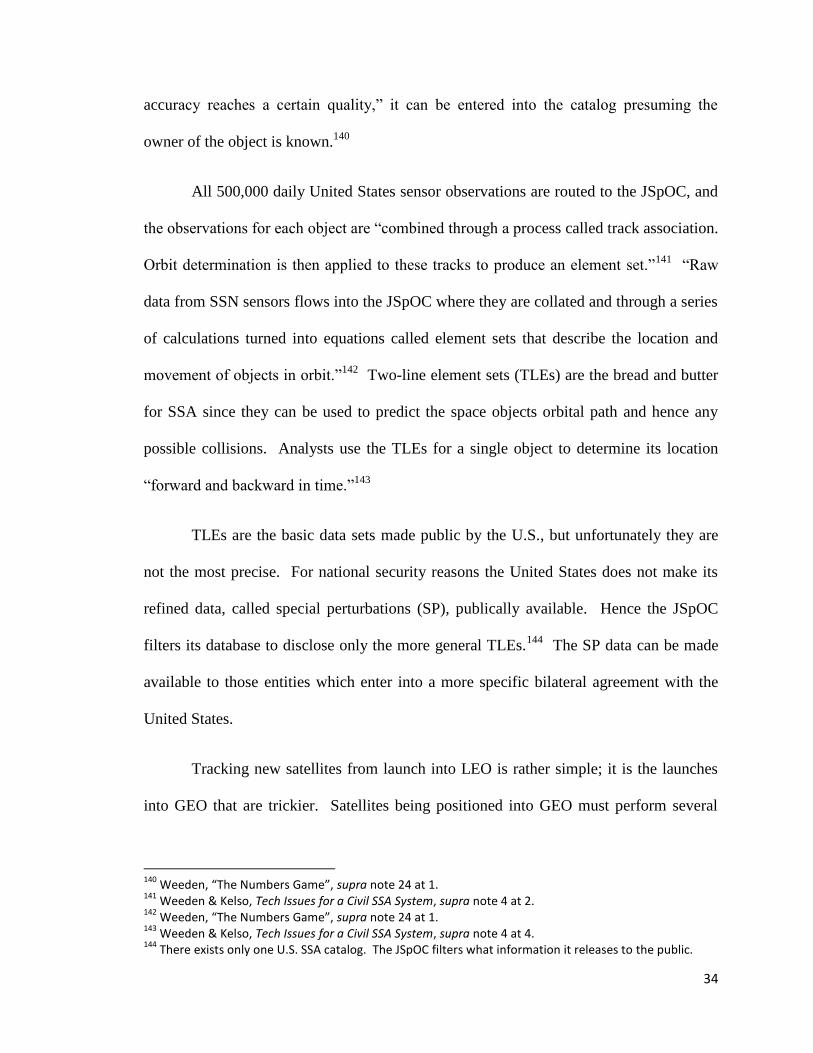
accuracy reaches a certain quality,‖ it can be entered into the catalog presuming the
owner of the object is known.140
All 500,000 daily United States sensor observations are routed to the JSpOC, and
the observations for each object are ―combined through a process called track association.
Orbit determination is then applied to these tracks to produce an element set.‖141
―Raw
data from SSN sensors flows into the JSpOC where they are collated and through a series
of calculations turned into equations called element sets that describe the location and
movement of objects in orbit.‖142
Two-line element sets (TLEs) are the bread and butter
for SSA since they can be used to predict the space objects orbital path and hence any
possible collisions. Analysts use the TLEs for a single object to determine its location
―forward and backward in time.‖143
TLEs are the basic data sets made public by the U.S., but unfortunately they are
not the most precise. For national security reasons the United States does not make its
refined data, called special perturbations (SP), publically available. Hence the JSpOC
filters its database to disclose only the more general TLEs.144
The SP data can be made
available to those entities which enter into a more specific bilateral agreement with the
United States.
Tracking new satellites from launch into LEO is rather simple; it is the launches
into GEO that are trickier. Satellites being positioned into GEO must perform several
140
Weeden, “The Numbers Game”, supra note 24 at 1. 141
Weeden & Kelso, Tech Issues for a Civil SSA System, supra note 4 at 2. 142
Weeden, “The Numbers Game”, supra note 24 at 1. 143
Weeden & Kelso, Tech Issues for a Civil SSA System, supra note 4 at 4. 144
There exists only one U.S. SSA catalog. The JSpOC filters what information it releases to the public.

35
maneuvers in order to achieve their final orbit.145
If the tracking agency is informed
about the scheduled maneuver, called the burn plan, then it is much easier to track the
object. Without the burn plan, the SSN relies on what is called ‗non-cooperative
tracking,‘ which basically means no active cooperation is provided from the object being
tracked.146
The SSN must track non-cooperative active satellites after they perform
maneuvers; this delays the ability to update the object‘s orbit and threatens the ability to
conduct precise conjunction assessments. A lot of satellites are ‗lost‘ for a short amount
of time after they maneuver since sensors are not tasked ahead of time to expect the
satellite in a different position than its predicted path. Most active satellites today
employ onboard GPS or ground based range finding to continually know the precise
location of their satellites.147
Perhaps even more difficult is the tracking of debris, which when newly found,
must be traced all the way back in time to the launching state before it will, as a matter of
policy, be entered into the U.S. public catalog. If the owner of the object is unknown or
the element set data is too weak to create high enough accuracy, then the objects are not
entered into the public catalog, even though they are still tracked. This is why the
publically accessible catalog only contains roughly 16,000 objects when the United States
is often quoted as tracking over 20,000 objects.148
All 20,000 objects are taken into
account when conjunction assessments and other advanced services are performed.
145
Weeden, “The Numbers Game”, supra note 24 at 1. 146
Kelso, “SDA Improving Safety”, supra note 40 at 2. (Non-cooperative tracking is most often associated with the tracking of space debris.) 147
Ibid. 148
Weeden, “The Numbers Game”, supra note 24 at 1.

36
When factoring weather, gravity, atmospheric drag and other physical
characteristics, the location of all objects can be calculated and collisions can be avoided.
This process is repeated over and over to continually update and maintain the precision of
the space object catalog. Overall, this entire operation is what was originally referred to
as space surveillance, but today is better known as SSA, because information other than
orbital position is collated to include space weather observations and predictions.149
While maintaining the catalog and continually updating the pathways for each
object, the analysts are also maintaining overall SSA and looking for any potential
collisions. From a safety standpoint, collision avoidance is the reason why good SSA is
vital. The element sets are utilized for conjunction assessments (CA), which ―is the
process by which close approaches between two objects in orbit are determined.‖150
As
each element set is used to create a track for each object that can then be predicted
forward, CAs can be constantly performed with the aid of computer modeling. The
difficulty is in the ‗all versus all‘ CA analysis needed for all 22,000 objects, not just one-
on-one collisions.151
5. Space Weather
I believe we’re on the threshold of a new era in which
space weather can be as influential in our daily lives as
ordinary terrestrial weather.152
-Richard Fisher
149
Weeden & Kelso, Tech Issues for a Civil SSA System, supra note 4 at 2. 150
Ibid at 6. 151
Ibid. 152
“More Active Sun Means Nasty Solar Storms Ahead”, Space.com online *“Active Sun”+. (Quoting Richard Fisher, head of NASA’s Heliophysics Division.)

37
The space weather threat is much greater than any intentional man-made threat.
Many people believe outer space is a vacuum, or void, where all is calm and heavenly,
but to the contrary, outer space is renowned for its violence where natural conditions can
change rapidly. Last, but not the least bit important is the interaction of outer space
weather and objects in orbit. Understanding the weather in outer space is truly an
extraordinary science. As this thesis is being prepared, the Sun is also preparing to
become much more active as it enters into its 11-year cycle of peak solar storms.153
This
section only attempts a cursory introduction to space weather to impart its importance to
SSA. The ability to observe, decipher and disseminate how the weather in outer space is
affecting satellites, both physically and electromagnetically, aids in real-time space object
tracking as well as predictive tracking abilities and anomaly resolution.
Terrestrial weather on Earth is not to be dismissed in dealing with SSA, since
there are many ground stations and nodes interacting continually with the assets in outer
space. Some have noted the need to understand terrestrial weather is just as important as
knowing outer space weather—‗mud to sun‘.154
Like weather on Earth, space weather
originates with the Sun where nuclear fusion occurs at its center, resulting in
electromagnetic and plasma (charged particles) discharges outwards in all directions.155
This includes the visible light one can see and the infrared radiation one can feel.156
The
Sun‘s charged particles also move quickly, but not at the speed of light. They generally
move at approximately 1.3 million kilometers per hour through the solar system in the
153
Ibid. 154
Kelly Hand, et al, “Environmental Space Situation Awareness and Joint Space Effects” 2010 AMOS Conference Technical Paper delivered at the Advanced Maui Optical and Space Surveillance Technologies Conference, Maui (2010) at 3 *Hand, “Environmental SSA”+. 155
Ibid at 4. (“Electromagnetic energy travels at the speed of light, taking about 8 minutes to travel the 93 million mile distance from the Sun to the Earth.”) 156
Ibid.
38
form of solar wind interacting with the gravitational pull of planets and moons.157
The
solar winds first interact with the Earth‘s gravitational field at approximately 1.6 million
miles out. The Sun‘s energy interacting with the Earth‘s magnetic gravitation field in
turn creates the magnetosphere which encompasses the planet.158
The interactions
between the Sun‘s energy and the Earth‘s magnetosphere are what create space
weather.159
NOAA‘s Space Environment Center (SEC) operates the Space Weather
Prediction Center (SWPC), whose primary responsibility is to observe and forecast outer
space weather. The SEC explains, ―the active elements of space weather [include]
particles, electromagnetic energy, and magnetic field, rather than the more commonly
known [terrestrial] weather contributors of water, temperature, and air.‖160
The SEC is
also the World Warning Agency (WWA), of the International Space Environment
Services organization (ISES), discussed in more detail below.161
From time-to-time outer space experiences solar storms which increase solar
winds from their benign speeds of 1.3 million kilometers per hour to nearly 7.2 million
kilometers per hour.162
The SWPC categorizes solar storms into three areas; geomagnetic
157
NASA, Solar Dynamics Observatory, [NASA, SDO Webpage]. (This is the cycle much like the cycle of water vapor and cloud formation on earth, which is heated by radiation and evaporated from the surface until it forms clouds heavy enough to release their water as precipitation back down to the Earth’s surface. “Another important difference is that, unlike the atmosphere we live in, the tenuous gas in space is ionized. This means that some (or all) of the electrons have been stripped from the atoms, resulting in a gas of positively charged ions and negative electrons called a plasma. These charged particles are steered and accelerated by the magnetic fields that pervade the solar system.”) 158
Kelly Hand, “Environmental SSA”, supra note 154 at 4. 159
Weeden, Lecture, supra note 53. 160
NOAA, Space Weather, supra note 81 at 1. (The SWPC is also referred to as the SEC.) 161
ISES, International Space Environment Service [ISES Webpage]. 162
NASA, SDO Webpage, supra note 157.

39
storms, solar radiation storms, and radio blackouts.163
These storms pose hazards to
space, their ground stations and any other piece of technology utilizing radio frequencies
or even simply electricity. For example, space weather, which causes interferences to
satellite communications during certain periods of time, can be planned for by ―switching
to terrestrial communications or using more robust [satellites].‖164
The sources of the Sun‘s space weather include coronal holes, coronal mass
ejections (CME), and solar flares.165
Galactic cosmic rays and interplanetary dust also
play a role as well.166
Coronal holes create ―a continuous outflow of high-speed solar
wind.‖167
CMEs can contain billions of ―tons of matter that can be accelerated to several
million miles per hour…‖.168
All of this solar material interacts with whatever object
happens to cross its path, whether it is a planet, an astronaut, a functioning space object,
or debris. The strongest CMEs can reach Earth in less than 24 hours causing major
black-outs on the ground and destruction of satellites in orbit.169
Solar flares are bright
flashes of x-rays that can make the Sun appear 1,000 times brighter and wreak havoc on
radio communication waves.170
X-rays damage solar panels causing quicker aging of
163
NOAA, Space Weather, supra note 81 at 3. (Geomagnetic storms can cause electric charges in space wherein the surfaces satellites can become over-charged. When geomagnetic disruption occurs in the upper atmosphere, radio frequencies become degraded and the physical satellites can experience ‘satellite drag’ which can cause them to slow down and even change orbit. Solar radiation storms may harm astronauts, equipment and radio frequency.) 164
Kelly Hand, “Environmental SSA”, supra note 154 at 6. 165
NOAA, Space Weather, supra note 81 at 3. 166
NASA, SDO Webpage, supra note 157. 167
NOAA, Space Weather, supra note 81 at 3. 168
Ibid. (The high speeds can range from 250 to 1000 km/s (about 600,000 to 2,000,000 mph).) 169
NASA, SDO Webpage, supra note 157. 170
Ibid. (X-rays are a type of electromagnetic radiation (between ultraviolet light and gamma rays in wavelength, frequency, and energy) - basically, it's light that is way past the blue-violet end of the visible spectrum - we cannot see it. They have a shorter wavelength (and higher frequency) as compared to visible light. Each photon of X-ray radiation has a lot of energy. X-rays can go through most solid objects. X-ray images of celestial objects are one way of learning about their high-energy properties. For example,

40
equipment.171
When severe space weather occurs in outer space and travels from the Sun
to Earth, it interacts with the earth‘s magnetosphere, causing long-lasting geomagnetic
storms. These storms can occur particularly around the same altitude of the
geosynchronous orbit.172
This interaction is the cause of the magnificent Aurora Borealis
lights over the North Pole.173
The Sun‘s energetic particles are also known as cosmic rays, which include all
forms of energized particles traveling in outer space and interacting with Earth no matter
their source.174
Galactic cosmic rays are those cosmic rays that originate from outside of
our solar system, but typically from within our own Milky Way galaxy.175
They travel at
nearly the speed of light and have been traveling around the Milky Way for millions of
years, trapped by the galactic magnetic field.176
Galactic cosmic rays interact with
satellites just like the Sun‘s cosmic rays. Cosmic rays can contain ―…a billion times
more energy than is possible in man-made particle accelerators on Earth.‖177
Accurate prediction and sharing of space weather information is very important to
the safety of operations in outer space. Particularly, space weather affects
communications in a variety of ways, and radio operators must have up-to-date space
the sun's corona emits X-rays, especially over sunspots. The Einstein X-ray satellite was launched in 1978 to survey celestial X-ray sources: source, http://cse.ssl.berkeley.edu/cms/.) 171
Ibid. 172
NOAA, Space Weather, supra note 81 at 4; NASA, SDO Webpage, supra note 157. “The Earth's magnetosphere is a bubble created around us by our magnetic field that protects us from most of the particles the Sun throws at us.” 173
Weeden, Lecture, supra note 53. 174
NASA, Cosmicopia - Cosmic Rays Webpage. 175
Ibid. 176
Ibid. 177
“Death Rays from Space”, Astrobiology Magazine online.

41
weather data.178
Precise navigation and timing systems are also affected. A radiation
storm can cause ship and plane navigation equipment to be off by kilometers.179
Outer
space weather can also cause the Earth‘s atmosphere and magnetosphere to overheat and
expand. Satellites in LEO interact with the expanded atmosphere and de-orbit more
rapidly, re-entering the atmosphere sooner than expected. 180
Charged energy particles
have also physically damaged microchips and even altered the software of space-based
systems, so much so that many satellites are placed in safe-mode during solar storms.181
One instance of concern for the adverse effects of space weather manifested itself during
the accident investigation of the Space Shuttle Columbia‘s tragic disintegration during re-
entry on February 1, 2003.182
On January 31, 2003, either a CME or solar flare erupted
from the Sun and was thought to have passed through the Earth‘s atmosphere at roughly
the same time the shuttle was beginning its de-orbit burn.183
The Columbia Accident
Investigation Board saw this event as possibly affecting the orbiter‘s re-entry but later
ruled it out as a contributing factor. This example demonstrates space weather‘s affects
upon spacecraft may have a potentially deleterious impact and must always be taken into
account during anomaly resolution. The JSpOC often checks space weather when
performing anomaly resolution for unexplained satellite errors and malfunctions.
178
NOAA, Space Weather, supra note 81 at 4. (These weather updates include solar radio bursts and geomagnetic alerts.) 179
Ibid at 5 180
Ibid. “Skylab is an example of a spacecraft re-entering Earth’s atmosphere prematurely as a result of higher-than-expected solar activity.”) Strategically, some satellites are capable of boosting themselves back up to higher orbits. 181
Ibid at 5. 182
Columbia Accident Investigation Board, ed, Columbia Accident Investigation Board Report Volume 1 (Washington DC: 2003) at 90. 183
Ibid. (Investigation by the SWPC found no correlation with the CME and the Columbia explosion.)
42
Additionally, as more and more humans venture into outer space or undertake
routine sub-orbital point-to-point travel or even long-distance commercial aviation over
the North Pole, space weather will pose new health hazards in the form of increased
exposure to harmful radiation.184
There are several weather satellites located at the L1 point, which contribute to the
collection of weather data.185
One such satellite is the solar watchdog satellite that is
currently observing the Sun.186
It is operated jointly by NASA and the ESA as part of the
Solar and Heliospheric Observatory (SOHO) project.187
NASA also operates the Solar
Dynamics Observatory (SDO) to study the Sun‘s radiation,188
and the Solar Terrestrial
Relations Observatory (STEREO), which will study coronal mass ejections and can
image 90 percent of the solar surface.189
Currently, NASA offers access to its web-based dissemination system called the
Integrated Space Weather Analysis System, which offers ―space weather information that
combines forecasts based on the most advanced space weather models with concurrent
space environment information.‖190
The AFWA provides a magnetosphere modeling
forecast in three hour intervals; this predicts how plasma may interact with satellites.191
In the future, there is a possibility of placing weather sensors on every new
satellite launched in order to determine the immediate space weather surrounding the
184
NOAA, Space Weather, supra note 81. 185
Lagrange point 1 is discussed in detail below. 186
NASA, SOHO: Solar and Helospheric Observatory. 187
Ibid. 188
NASA, SDO Webpage, supra note 157. 189
NASA, STEREO: 3D View of the Sun and Heliosphere Webpage. 190
NASA, Integrated Space Weather Analysis System Webpage. 191
Kelly Hand, “Environmental SSA”, supra note 154 at 7.

43
space craft.192
ESA hosts its own online space weather web server as well.193
The Royal
Observatory of Belgium operates the Solar Influences Data Center, providing forecasts,
space weather warnings and real-time monitoring as does the Chinese Solar Activity
Prediction Center in Beijing. These agencies are just two examples of the 13 regional
space weather warning centers (RWC) of the International Space Environment Service.194
Internationally, the ISES represents the pinnacle of weather data sharing
―provid[ing] standardized rapid free exchange of space weather information and
forecasts…‖ globally.195
As mentioned above, NOAA‘s SEC is the lead agency for ISES
and also acts as the main data distribution hub.196
The network of RWCs enables the
ISES to synergize its efforts to produce a usable end product for the entire world. Each
RWC is better suited to provide tailored data to entities, including government agencies,
commercial enterprises and scientific organizations operating within its respective
region.197
The data exchanged are highly varied in nature and in format,
ranging from simple forecasts or coded information up to more
complicated information such as images. An important strength
of the data exchange system is that RWCs often have access to
data from unique instrumentation available from the scientific
community in its region. Exchange through ISES makes these
data available to the wider international scientific and user
community.198
192
Skinner, “Adressing the Space Debris Threat”, supra note 6. (Statement made by Joseph Rouge, Director of the DOD National Security Space Office.) 193
ESA, Space Weather Web Server Webpage. 194
Regional Warning Center - China, “Solar Activity Prediction Center, NAOC” Webpage; Royal Observatory of Belgium, Solar Influences Data Analysis Center Webpage. 195
ISES Webpage, supra note 161. The 13 regional centers are located in: China (Beijing), USA (Boulder), Russia (Moscow), India (New Delhi), Canada (Ottawa), Czech Republic (Prague), Japan (Tokyo), Australia (Sydney), Sweden (Lund), Belgium (Brussels), Poland (Warsaw), South Africa (Hermanus) and Brazil (São José dos Campos). 196
Ibid. 197
Ibid. 198
Ibid.

44
ISES is governed by a Constitution and bylaws, and managed by an international
Directing Board meeting annually.199
The Directing Board management includes an
elected Director, Deputy Director, Space Weather Secretary and World Days
Secretary.200
Additionally, each RWC provides a representative to the Board. Liaisons
from affiliated scientific unions are also present.201
Thomas Bogdan, Director of the SWPC, stated in an interview during the Space
Weather Enterprise Forum, ―[s]pace weather forecasting is still in its infancy, but we‘re
making rapid progress.‖202
Only continued international cooperation will make it so, and
more importantly, the fusing of space weather data with the SSA data created from
observing objects in orbit will create more safety and security in outer space. A recent
report from the Los Alamos National Laboratory specifically targeted the real-time
integration of space weather into SSA and unveiled its prototype space weather tool
called the Dynamic Radiation Environment Assimilation Model (DREAM).203
The
information processed by DREAM is derived from information gathered by the SWPC.
6. Summary
As can be seen from the explanation above, the outer space environment is not as
friendly as one might generally envision. Space weather has deleterious effects upon
space objects and creates an extremely harsh environment which is in constant motion
and change. The ability to predict space weather improves every day.
199
Ibid. 200
Ibid. 201
Ibid. 202
“Active Sun”, supra note 152. 203
Geoffrey D Reeves, “Integration of Space Weather into Space Situational Awareness”, 2010 AMOS Conference Technical Paper delivered at the Advanced Maui Optical and Space Surveillance Technologies Conference, Maui (2010).

45
The diverse types of space objects found throughout the near-Earth environment
must all be tracked. The space debris too small to track today, but too large to effectively
shield against, must be dealt with promptly. As new technologies are developed and
sensors deployed, the ability to track objects smaller than 10 centimeters will greatly
improve SSA and multiply the current catalog of tracked space objects many fold. This
will require more funding and analysis to understand it all. New satellites will be smaller
and more readily available, and the potential for collisions will only increase as more and
more non-space actors obtain the ability to exploit space with their own means.
The importance of SSA is evidenced by the recent Cosmos-Iridium collision, and
even though the probability of two space objects colliding with one another is relatively
minuscule, it is not impossible. Combined, sensors are able to track various sizes and
types of space objects, space events and space weather to contribute to a safe outer space
environment. The SSA data collected is only valuable if it (or the end product of
conjunction assessment analysis) is disseminated to all of the users of outer space. This
will allow those with the capability to maneuver to do so and avoid risk of a costly
collision.
Many countries and organizations currently participate and contribute in some
form or another to the advent of SSA. Unfortunately, there is unneeded duplication of
effort and a lack of sharing which can be overcome technically, legally and politically.
The remainder of this paper examines how this sharing is currently accomplished
throughout the world, particularly within the United States, and how it can be performed
superiorly through the creation of an international organization.

46
III. SSA & the United States
…the United States will pursue the following goals in its
national space programs: … Strengthen stability in space
through: domestic and international measures to promote
safe and responsible operations in space; improved
information collection and sharing for space object
collision avoidance…204
-National Space Policy, 2010
Beginning with the launch of Sputnik I in 1957, the United States has possessed
the need to know what is happening in outer space, particularly by their Cold War
counterparts the Soviet Union. With the birth of the space age, the necessity for SSA
quickly followed. In fact, in 1958, shortly after the passage of the National Aeronautics
and Space Act, NASA began providing SSA data to foreign countries by mailing them
the information through the postal system.205
SSA was yet another characteristic of the
Cold War between the United States and the Soviet Union—both observing the heavens
and trying to decipher what was peering down upon them from above.
Today, the United States and the Russia Federation remain the most prominent
actors in the field of space surveillance. However, between the two countries, the United
States has the most advanced capabilities to both survey outer space and analyze the
collected data. As was seen in the previous chapter, the United States possesses many
capabilities for SSA data collection with its vast array of radars, telescopes and satellites.
The Russian Federation possesses many of these capabilities as well; however, the
204
White House, National Space Policy of the United States of America (28 June 2010) (Washington DC: 2010) (President: Barack Obama). 205
Charles Spillar & Mike Pirtle, “Commercial and Foreign Entities (CFE) Pilot Program Status Update and Way Ahead” 2009 AMOS Conference Technical Paper delivered at the Advanced Maui Optical and Space Surveillance Technologies Conference, Maui (2009) at 3 *Spillar & Pirtle, “CFE Pilot Program”+.

47
sharing aspect is non-existent.206
The United States has the technical capabilities and
manpower to crunch the data into useable information for, among other things, collision
avoidance and re-entry prediction. Although the United States is quite capable, it is also
not 100 percent effective as evidenced by the recent Iridium-Cosmos collision. There are
gaps in the SSN‘s coverage due to geographic limitations and sensor distribution. There
are also concerns over system maintenance and the increasing funding necessary to
maintain the needed operational capability for such a vast undertaking. Throughout this
chapter, these potential problems with the United States‘ SSA capabilities will be
highlighted in an attempt to demonstrate a rational basis for creating an international data
sharing organization.
Specifically, the focus of this chapter addresses the United States and its legal
relationship with SSA information sharing. A brief history discussing the lead-up to the
current SSA sharing legislation is first discussed, followed by a detailed analysis of the
current SSA sharing law located at 10 U.S.C. § 2274. Space situational awareness
services and information: provision to non-United States Government entities. This
analysis includes: what entity within the United States government is delegated the legal
responsibility to manage SSA collection and sharing; how the information is collated;
who (what foreign entity) is entitled to access SSA data, either via the publicly available
catalog accessible over the internet or by specific legal agreement under 10 U.S.C. §
2274; what a ‗2274-Agreement‘ encompasses; fees associated with the program; and the
immunities afforded the United States government and its constituents in relation to this
program.
206
Non-United States entities involved in SSA are discussed in the next chapter.

48
1. Legislative History
The United States Congress created the original pilot program for SSA sharing
not too long ago, in 2004.207
This was an attempt ―to determine [the] feasibility and
desirability of providing space surveillance data support‖ to both commercial satellite
owners and operators and foreign entities, such as other governments and their space
agencies.208
Prior to the creation of this test program, NASA handled the dissemination
of SSA data to all entities outside the U.S. government referred to as ‗Commercial and
Foreign Entities‘ (CFEs).
With a memorandum of agreement between the DoD and NASA, NASA provided
the unclassified element sets and other data to CFEs through the Goddard Space Flight
Center‘s Orbital Information Group‘s (OIG) website, to anyone who simply registered
online.209
Security protocols were nil. NASA acted as a buffer between the CFEs and
the United States military; yet, CFEs were still wary of having to rely solely upon a
foreign country for their SSA data, even if not solely upon a foreign military.
The disseminated SSA data had always been collected by the military‘s Space
Surveillance Network for national defense purposes and remains so today; however, the
only change is who has the legislative responsibility to disseminate the SSA data to
CFEs.210
When the USAF officially took sole control over the new pilot program, there
was even more consternation among CFEs and astronomers who rely on the SSA data for
207
National Defense Authorization Act for Fiscal Year 2004, PL 108-136, Sec 913 (24 Nov 2003). [NDAA 2004]. 208
Michael W Taylor, “Space Debris Mitigation Measures: United States Department of Defense”, Power point presentation delivered at the Institue of Air and Space Law (2009) at 7 *“Debris Mitigation Presentation”+. 209
Spillar & Pirtle, “CFE Pilot Program”, supra note 205 at 3. (The OIG website is no longer operational.) 210
Effectively, any non-United States government entity is referred to as a ‘CFE’.

49
safety and science. The move to an all-military run program was viewed as a step back in
cooperation and transparency by many in the international community. Today, this is one
of the biggest complaints by end-users, that is, having to rely on a foreign military for
their data, much like the reliance upon the DoD‘s GPS system for positioning, navigation
and timing. No one can fully trust that the proverbial plug will never be pulled.
In 2000, the DoD initiated a review of the SSA sharing program to determine
possible options for more streamlined management, national security oversight,
efficiency and simply the best way to move forward. The Air Force created the SSA
Task Force who, upon review of the current sharing program, discovered among other
things, a potential violation of United States fiscal law.211
The United States government,
under Title 10 of the United States Code, was expending federal funds in support of non-
United States entities by providing SSA data and analytical products free of charge
without legislative authority to do so. Generally, ―[t]he established rule [of law] is that
the expenditure of public funds is proper only when authorized by Congress, not that
public funds may be expended unless prohibited by Congress.‖212
Fundamentally, all
federal government expenditures must be traceable back to a specific authorization and
appropriation or else the expenditure is unlawful.
The DoD General Council and Air Force Space Command (AFSPC) legal officers
determined new legislation was needed to ensure fiscal law was not violated.213
This
review would eventually lead to the drafting of 10 U.S.C. § 2274, a law which would
211
Spillar & Pirtle, “CFE Pilot Program”, supra note 205 at 3. 212
United States v. MacCollom, 426 US 317 at 321 (1976). 213
Spillar & Pirtle, “CFE Pilot Program”, supra note 205 at 3.

50
authorize the expenditure of monies for SSA data sharing to CFEs as well as the option
for charging fees for reimbursement of expenses.
Nevertheless, before this move occurred, a DoD level decision was made to
maintain the status quo and keep the link between the SSN and the CFEs via NASA
without pushing for the new legislation.214
However, with the tragic terrorist events of
September 11, 2001 (9/11), NASA‘s role as civil intermediary would hurriedly come to a
close.
As 9/11 unfolded and U.S. security measures were heightened, on September 12,
2001, several questionable users registered for access to satellite data through the OIG‘s
SSA data sharing website.215
Namely, from somewhere inside Afghanistan a new user
registered suspiciously as ‗newboy1‘.216
In 2006, it was later reported that the U.S.
military had ―recovered documents detailing the passage of spy satellites‖ from
Afghanistan caves which had been abandoned by al Qaeda.217
In the wake of 9/11, anything and everything which posed a potential threat to
United States national security was scrutinized, including NASA‘s lax satellite data
dissemination policies and oversight surrounding the OIG website and SSA sharing. At
this time, the SSN was tracking and publically cataloging around 10,000 space objects,
none of which were classified United States military or intelligence community assets.218
214
Ibid. 215
William Harwood, “Satellite watchers worried about Air Force restrictions”, CBS News "Space Place" online (2005) *Harwood, “Watchers worried”+. 216
Ibid. (Newboy1 was not publically elaborated upon by the US military or intelligence community, i.e., whether Newboy1 was an actual terrorist or simply an amateur astronomer.) 217
Patrick Radden Keefe, “I Spy”, Wired 14:2 (2006) *Keefe, “I Spy”+. 218
Harwood, “Watchers worried”, supra note 215. (The public U.S. catalog does however include foreign military assets.)

51
It was determined a revived review of the SSA data sharing program was once again in
order.
The review quickly culminated in August of 2002, resulting in draft legislation for
a 3-year CFE pilot program administered directly to CFEs by the DoD.219
NASA‘s role
as SSA data dissemination liaison was over. The legislation was added to the National
Defense Authorization Act for Fiscal Year 2004 at section 913, which amended Chapter
135 of Title 10 of the United States Code.220
During a presentation at the annual
Advanced Maui Optical and Space Surveillance Technologies Conference, Lieutenant
Colonel Charles Spillar and Major Mike Pirtle from Air Force Space Command,
described the CFE pilot program as follows:
The overarching goal of the CFE effort is to engage the U.S. on
the world stage to encourage international cooperation and
transparency with foreign nations and/or consortia on space
activities that are of mutual benefit. In other words, the U.S. will
provide space situational awareness (SSA) information to CFE
mission partners in order to protect manned spaceflight, prevent
on orbit collisions, and minimize the debris field surrounding the
Earth. It is in the best interests of all space-faring nations and
consortia to protect the assets they have on orbit; the CFE program is designed to provide U.S.-generated data to help
accomplish that goal.221
The new program would provide the same basic data dissemination which was
offered by NASA, as well as even more advanced product offerings and more meticulous
data sets under more specific bilateral agreements. The CFE Pilot Program only awaited
delegation of authority from the Secretary of Defense pursuant to 10 U.S.C. § 2274(a)
before being officially initiated. As originally enacted, 10 U.S.C. § 2274(i) read, ―…[t]he
pilot program under this section shall be conducted during the three-year period
219
Spillar & Pirtle, “CFE Pilot Program”, supra note 205 at 3. 220
NDAA 2004, supra note 207. 221
Spillar & Pirtle, “CFE Pilot Program”, supra note 205 at 1.

52
beginning on a date specified by the Secretary of Defense, which date shall be not later
than 180 days after the date of the enactment of this section.‖ (Emphasis added.) 222
Interestingly, subsection (a) read, ‖[t]he Secretary of Defense may carry out a pilot
program to determine the feasibility and desirability of providing to non-United States
Government entities space surveillance data support…‖ (Emphasis added). The program
was optional, but must be started within six months or else the opportunity was lost. In
any event, delegation of authority was quickly performed, and by the end of 2004,
AFSPC was paving the way for the Air Force‘s SSA sharing trial run.223
The 3-year period would have ended on May 21, 2007; therefore, Congress
amended the act to replace the above quoted subsection (i) with, ―may be conducted
through September 30, 2009.‖224
In 2008, Congress amended the law yet again to extend
the pilot program for an additional year.225
Meanwhile, in January of 2005, the Air Force implemented the ‗CFE Storefront'
which operates the DoD website at ‗www.space-track.org‘ and was to initially operate
alongside the NASA OIG‘s SSA data sharing website during the transitional hand-off
phase between the two programs.226
Unfortunately, the OIG‘s website suffered a
catastrophic malfunction only a few months into the transition phase, and in lieu of
repairing the site it was simply taken offline.227
The website, www.space-track.org was
222
Space Surveillance Network: pilot program for provision of satellite tracking support to entities outside United States Government, 10 USC § 2274 (2003) [10 USC § 2274 (2003)]. 223
Spillar & Pirtle, “CFE Pilot Program”, supra note 205. 224
Space situational awareness services and information: provision to non-United States Government entities, as amended, 10 USC § 2274 (2009) [10 USC § 2274]. (See amendments section.) 225
Ibid. 226
Spillar & Pirtle, “CFE Pilot Program”, supra note 205. 227
Ibid.

53
by then fully functioning anyway. This marked the military‘s initial sole-source
dissemination of basic United States SSA data to CFEs.
During the ensuing years and until 2009, the pilot program was refined and
reworked. The CFE Storefront was to ―field, process & track requests, package & deliver
products, establish contractual relationships with customers, develop[] new
tools/processes for DoD to better support CFE request, [and] work with DoD to develop
[a] long term plan.‖228
The Storefront was operated by Aerospace Corporation, a government contractor
in charge of the overall CFE Support Office.229
The initial plan called for providing basic
data for free via www.space-track.org and eventually through more detailed bilateral
agreements, providing technically advanced assistance for a fee, including:
Launch Support. Pre launch safety screenings and/or early
orbit determination
Conjunction Assessment (CA). CA determines the likelihood
of a conjunction between orbiting objects. This includes
screening for planned maneuvers
End-of-life support. Includes reentry support and planned
de-orbit operations
Anomaly resolution support. Includes altitude determination,
spacecraft configuration.230
In the interest of safety, the DoD also provides emergency support for potential
conjunction to all CFEs unconditionally by providing unsolicited emergency notifications
to anyone whose space assets is predicted to potentially collide with another object.
―Even if the requesting agency has no pre-existing agreement with AFSPC, AFSPC will
228
Dave Maloney, “Space Surveillance Support to Commercial and Foreign Entities (CFE) Pilot Program” at 9 *Maloney, “CFE Pilot Program .ppt”+. 229
Capt Angie Blair, Press Release, “Air Force Space Command Website Provides Worldwide Space Surveillance Support”, Story ID 05-001; See also, Aerospace online: http://www.aero.org/index.html. 230
Maloney, “CFE Pilot Program .ppt”, supra note 228 at 18-19.

54
assist that agency, if doing so will prevent on-orbit collisions or will otherwise enhance
the flight safety of on-orbit assets, including all manned spacecraft from any country.‖231
Early on, as of mid-2009, there were nine signed agreements with commercial
users for the more detailed conjunction analysis and launch support information.232
Today, there are more than 19 such agreements.233
Initially, there were over 39,000
registered accounts with the Space Track website from 110 different countries.234
This
number has grown exponentially today.
Space Track is the gateway to the DoD‘s unclassified ‗public catalog‘ mentioned
in the previous chapter and discussed in more detail below. Space Track users are privy
to only the basic orbital data comprised of two-line element sets. Currently, the site
boasts over 81,730,258 two-line element sets in the database.235
The User Agreement
provides the following warning:
WARNING!
TWO-LINE ELEMENT (TLE) SET IS THE MEAN
KEPLERIAN ORBITAL ELEMENT AT A GIVEN POINT IN
TIME FOR EACH SPACE OBJECT REPORTED. A TLE IS
GENERATED USING THE SIMPLIFIED GENERAL
PERTURBATIONS THEORY AND IS REASONABLY
ACCURATE FOR LONG PERIODS OF TIME. A TLE
AVAILABLE TO THE PUBLIC SHOULD NOT BE USED
FOR CONJUNCTION ASSESSMENT PREDICTION.
SATELLITE OPERATORS ARE DIRECTED TO CONTACT
THE JOINT SPACE OPERATIONS CENTER … FOR
ACCESS TO APPROPRIATE DATA AND ANALYSIS TO
SUPPORT OPERATIONAL SATELLITES.236
231
Spillar & Pirtle, “CFE Pilot Program”, supra note 205 at 1. 232
Taylor, “Debris Mitigation presentation”, supra note 208 at 10. (The DoD did not charge a fee for the advanced services.) 233
“Space Debris Threat Needs International Response, Military Official Says”, Space.com online (22 Mar 11). 234
Spillar & Pirtle, “CFE Pilot Program”, supra note 205 at 1. 235
Space Track: The Source for Space Surveillance Data,Website [Space Track Website]. 236
Space Track User Agreement, online [Space Track User Agreement].

55
Furthermore, users must also agree not to redistribute any data without prior express
permission, pay user fees, and hold the United States harmless for any legal issues arising
from the use of Space Track.237
Upon accessing Space Track by username and password, the user has access to
the TLE data as well as satellite decay and re-entry information, access to the Satellite
Catalog, searchable by launch date, decay date, common name, satellite designator
number, or users may simply view the satellite ‗box score‘ which provides satellite data
for each space faring country.238
As of April 2011, Space Track has cataloged over
38,000 objects.239
In order for an object to be publically cataloged, the owner must be
identifiable. For this reason, there are additional objects not found in the public catalog
but which are still being tracked for SSA. Once the owner (if ever) is identified, then the
object can be placed in the public catalog.
The CFE pilot program concluded in 2009, after the House Committee on Science
and Technology‘s Subcommittee on Space and Aeronautics finalized its hearings
surrounding SSA sharing wherein the SSA sharing law was overhauled.240
On December
22, 2009, the USAF‘s pilot program was transferred to USSTRATCOM as a fully
operational mission.241
The program was revamped and strengthened to include more
237
Ibid. Discussed in more detail below. So far the United States is not charging for access to the basic data. 238
Space Track Website, supra note 235. (Registration required for access.) 239
Ibid. This includes objects which have already decayed. As of April 2011, the SATCAT contains 16,070 objects currently in orbit. 240
“Committee Examines Ways to Make the Space Environment Safer for Civil and Commercial Users”, Space Ref online. 241
Duane Bird, “Sharing Space Situational Awareness Data”, 2010 AMOS Conference Technical Paper delivered at the Advanced Maui Optical and Space Surveillance Technologies Conference, Maui (2010) at 1 *“Sharing SSA”+.

56
analysts, updated internal procedures and additional computational capabilities in order to
avoid another collision like the recent Iridium-Cosmos catastrophe.242
2. 10 U.S.C. § 2274: SSA Services & Information
On October 28, 2009, the most current amendment to 10 U.S.C. § 2274 officially
transitioned the SSA pilot program to a full-fledged operational SSA sharing, services
and information program. This section will review and comment on the amended law in
detail.243
242
Ibid. 243
10 USC § 2274, supra note 224. Reproduced infra: § 2274. Space situational awareness services and information: provision to non-United States Government entities (a) Authority. The Secretary of Defense may provide space situational awareness services and information to, and may obtain space situational awareness data and information from, non-United States Government entities in accordance with this section. Any such action may be taken only if the Secretary determines that such action is consistent with the national security interests of the United States. (b) Eligible Entities. The Secretary may provide services and information under subsection (a) to, and may obtain data and information under subsection (a) from, any non-United States Government entity, including any of the following: (1) A State. (2) A political subdivision of a State. (3) A United States commercial entity. (4) The government of a foreign country. (5) A foreign commercial entity. (c) Agreement. The Secretary may not provide space situational awareness services and information under subsection (a) to a non-United States Government entity unless that entity enters into an agreement with the Secretary under which the entity-- (1) agrees to pay an amount that may be charged by the Secretary under subsection (d); (2) agrees not to transfer any data or technical information received under the agreement, including the analysis of data, to any other entity without the express approval of the Secretary; and (3) agrees to any other terms and conditions considered necessary by the Secretary. (d) Charges. (1) As a condition of an agreement under subsection (c), the Secretary may (except as provided in paragraph (2)) require the non-United States Government entity entering into the agreement to pay to the Department of Defense such amounts as the Secretary determines appropriate to reimburse the Department for the costs to the Department of providing space situational awareness services or information under the agreement. (2) The Secretary may not require the government of a State, or of a political subdivision of a State, to pay any amount under paragraph (1).
57
This rather brief piece of legislation may prove to be the catalyst for much greater
cooperation and organization for outer space activities, not just SSA, but perhaps even
future space traffic management (STM). STM is the logical follow-on from SSA, as
without SSA it would be fundamentally impossible to control traffic and provide active
management, protocols and guidance over movements in outer space.
a. Legal Authority & Chain of Command: The Joint Space Operations Center
Many decades-old policies have been changed as a result
of rationally questioning why the policy originated. In
some cases, we have re-looked at security issues and
decided the risk of not sharing the data out-weighed the
risk of sharing it.244
NASA originally possessed the legal power to distribute SSA data to CFEs, but
the events surrounding September 11, 2001, and the ensuing CFE pilot program ended
(e) Crediting of funds received. (1) Funds received for the provision of space situational awareness services or information pursuant to an agreement under this section shall be credited, at the election of the Secretary, to the following: (A) The appropriation, fund, or account used in incurring the obligation. (B) An appropriate appropriation, fund, or account currently available for the purposes for which the expenditures were made. (2) Funds credited under paragraph (1) shall be merged with, and remain available for obligation with, the funds in the appropriation, fund, or account to which credited. (f) Procedures. The Secretary shall establish procedures by which the authority under this section shall be carried out. As part of those procedures, the Secretary may allow space situational awareness services or information to be provided through a contractor of the Department of Defense. (g) Immunity. The United States, any agencies and instrumentalities thereof, and any individuals, firms, corporations, and other persons acting for the United States, shall be immune from any suit in any court for any cause of action arising from the provision or receipt of space situational awareness services or information, whether or not provided in accordance with this section, or any related action or omission. (h) Notice of concerns of disclosure of information. If the Secretary determines that a commercial or foreign entity has declined or is reluctant to provide data or information to the Secretary in accordance with this section due to the concerns of such entity about the potential disclosure of such data or information, the Secretary shall, not later than 60 days after the Secretary makes that determination, provide notice to the congressional defense committees of the declination or reluctance of such entity.
244 Bird, “Sharing SSA”, supra note 241 at 5. (Major Duane Bird was speaking on behalf of USSTRATCOM.)

58
that authority. Today, 10 U.S.C. § 2274(a) explicitly delegates SSA sharing to the DoD.
The Secretary of Defense is authorized to administer a discretionary SSA sharing
program for providing data to CFEs. The law also allows the DoD to ‗obtain‘ SSA data
from CFEs, thus creating a two-way cooperative information sharing process.245
The Secretary of Defense must make a positive determination that the security of
the nation is not jeopardized by entering into each specific SSA data sharing
agreement.246
This threshold issue is necessary for every SSA data sharing agreement,
whether the data is provided automatically via Space Track‘s public catalog (which
requires extremely basic registration requirements) or a more detailed one-on-one
agreement providing more detailed special perturbation SSA data and analytical services.
National security interests are often defined as those interests that are vital to the
protection and safety of a State and its citizens including ―freedom from foreign
interference or influence—military, economic, or political—in domestic affairs.‖247
What is in the United States‘ national security interests is for the United States alone to
determine, as security can only be defined from the subjective standpoint of the State
itself.248
Effectively, sharing SSA data with a CFE who in turn may cause harm to the
United States must not be allowed. This was the concern with the registration of
Newboy1 from within Afghanistan shortly after the 9/11 terrorist attacks. Being a
subjective test, the potential interpretation of what exactly constitutes a national security
245
10 USC § 2274, supra note 224 at (a). 246
Ibid. 247
George Kurian, ed, ‘National Security Policy’, in The Encyclopedia of Political Science (Washington DC: CQ Press, 2011). 248
See, Robert J Art, ‘Security’ in The Oxford Companion to the Politics of the World, 2e, Joel Krieger, ed. (Oxford University Press Inc, 2001) Oxford Reference Online.

59
threat tends to change with the shifting political winds that blow through the national
capital.
Within the DoD, the Secretary of Defense delegated the SSA Sharing program to
U.S. Strategic Command located at Offutt Air Force Base, in Omaha, Nebraska.249
This
occurred on December 22, 2009.250
Upon receiving the new mission, General Kevin P.
Chilton, then Commander of USSTRATCOM, pronounced, ―[w]e will continue to work
closely with the commercial and foreign space communities to understand their evolving
needs and desires for space situational awareness information, and continue to grow out
cooperative relationships to share information in ways that will improve space flight
safety.‖251
STRATCOM offers two avenues for sharing SSA information, either the
basic Space Track services or through a more detailed signed agreement under 10 U.S.C.
§ 2274(c).
Amateur astronomers and scientists often make use of the basic data, while active
satellite owners and operators, such as Intelsat, tend to rely on the 2274-Agreement for
more precise data. While USSTRATCOM oversees the entire SSA operation and enters
into the agreements with non-United States entities, it has further delegated the day-to-
day operations to one of its subordinate units.
United States Strategic Command is one of the ten United States military unified
commands within the DoD and is responsible for three main missions: cyberspace
operations; global strike capabilities, including management of the nuclear arsenal; and
249
US Strategic Command, Press Release, “Commecial & Foreign Entities Pilot Program Transitions to U.S. Strategic Command” (Jan 4, 2010) *“CFE Program moves to USSTRATCOM”+. 250
Bird, “Sharing SSA”, supra note 241 at 1. 251
“CFE Program moves to USSTRATCOM”, supra note 249.

60
all space related operations.252
SSA data sharing falls within the third mission set and is
further delegated to the Joint Functional Component Command for Space (JFCC
SPACE), located at Vandenberg Air Force Base in southern California.253
JFCC SPACE
further sub-divides its space mission into three main areas: the Joint Space Operations
Center; The Joint Navigation Warfare Center, which handles the GPS constellation; and
the Missile Warning Center, which ―coordinates, plans, and executes world-wide missile,
nuclear detonation and space re-entry event detection to provide timely, accurate and
unambiguous strategic warning in support of the United States and Canada.‖254
Of the three main JFCC SPACE missions, the JSpOC oversees and manages the
day-to-day SSA operation as well as other space related missions. With the primary goal
of detecting, tracking and identifying all man-made space objects, the JSpOC‘s SSA
Operations Team operates 24 hours a day, seven days a week.255
The JSpOC has the
ability to task any sensor within the SSN to observe particular objects of interest or
specific areas of space. The data gathered allows the JSpOC team to ―maintain a current
computerized catalog of all Earth-orbiting man-made objects, charts preset positions,
plots future orbital paths, and forecasts times and general location for significant man-
made objects reentering the Earth‘s atmosphere.‖256
Aside from tracking space objects, the JSpOC is also capable of providing the
more advanced analytical features mentioned throughout this thesis. For instance, the
JSpOC routinely provides conjunction analysis and collision avoidance warnings for all
252
USSTRATCOM Webpage, Fact Sheet [USSTRATCOM Webpage]. 253
JFCC SPACE Webpage, Fact Sheet [JFCC SPACE Webpage]. 254
Ibid. 255
Space Control Fact Sheet, supra note 8. 256
Ibid.

61
active satellites, including NASA‘s recently retired manned space shuttle and all
International Space Station operations.257
The JSpOC accomplishes this by creating a
―theoretical box around a high interest object (e.g. the Space Shuttle or satellite), and
projects the flight path several days in advance. If any of the catalogued objects
intersects this theoretical box, the JSpOC forwards the analysis to the‖ appropriate owner
or operator who decides whether a maneuver is necessary.258
It is important (for a
discussion on liability if nothing else) to point out that the JSpOC does not suggest or
recommend specific maneuver actions, but only provides the information needed for the
third party to make its own decision whether to maneuver or not.
The process for notifying CFEs is by Conjunction Summary Messages (CSMs),
which ―contain vector and covariance data computed using Special Perturbations
theory.‖259
This method provides extremely accurate and actionable SSA far beyond the
basic general perturbations (TLE) data available on Space Track. The JSpOC also tracks
and screens 6,000 additional, un-cataloged objects referred to as ‗analyst satellites.‘260
Analyst satellites include the aforementioned objects which cannot be traced back to their
Launching State or the responsible owner is not yet known.261
Analyst satellites also
include the portion of classified military and intelligence space assets which for national
security reasons are filtered out of the public version of the space objects catalog.262
Additionally, the DoD also may decide not to disclose foreign space assets whose
governments deem them classified, such as France who in 2007 threatened to disclose the
257
Ibid. 258
Ibid. 259
Bird, “Sharing SSA”, supra note 241 at 1. 260
Ibid at 2. 261
Ibid. 262
Ibid.

62
location of 20 to 30 classified United States space objects, which France was tracking
with its GRAVES Radar, if the U.S. did not reciprocally remove positional data relating
to France‘s classified space assets from the U.S. public catalog.263
The U.S. subsequently
removed France‘s sensitive satellites from the public catalog.
Effectively, the DoD maintains only one catalog. The public catalog with the less
actionable GP data is simply a filtered version of the more robust classified catalog.
Also important is the ability to provide emergency CA notification to any and all
CFEs whether or not there is an agreement in place to do so, based on common ―space
flight safety‖ concerns.264
The U.S. military indicates, ―[a] close approach must be
within one kilometer and less than 200 meters radial miss distance in low Earth orbit or
within five kilometers in deep space to warrant contact with an owner-operator.‖265
If a
potential collision is sighted, then the JSpOC is authorized to contact the owner or
operator 72 hours prior to the ‗Time of Closest Approach.‘266
This 72-hour period is a
very short window for the CFE to digest the data received, decide if more information is
desired, and determine whether a maneuver is warranted. The JSpOC has the
owner/operator contact information for roughly 93 percent of all active satellites and will
‗cold-call‘ them if the situation is deemed an emergency.267
Major Duane Bird, speaking on behalf of USSTRATCOM, also notes that the 72-
hour warning time often shrinks because of the bureaucracy of international politics,
―[u]nfortunately, our Department of Defense, at the request of a handful of governments,
263
Peter B de Selding, “French Say 'Non' to U.S. Disclosure of Secret Satellites”, Space News online. 264
Bird, “Sharing SSA”, supra note 241 at 2. 265
Tiffany Chow, SSA Sharing Program: SWF Issue Brief (Superior, Colorado: Secure World Foundation, 2010) at 5 [Chow, SSA Sharing Program]. (Citing, Amy Ianacone, "614 AOC/COD Conjunction Assessment" presentation.) 266
Bird, “Sharing SSA”, supra note 241. 267
Ibid.

63
is serving as a middle-man. Instead of [the JSpOC] sending these warnings directly to
the [owner/operator], they send it [up the DoD chain of command who then sends it] to
the US embassy in that country, who then forwards it to the host nations, who then passes
it on to the proper agency or organization.‖268
Currently, the two nations requiring this
method of contact happen to be the two most active space fairing nations in outer space
besides the United States—Russia and China.269
Should the JSpOC experience an event causing an inability to carry out its SSA
mission an alternate military facility, the 614th Air and Space Operations Center,
Detachment 1, located in the greater Washington D.C. area acts as a back-up and is in a
continual ready state to take over day-to-day operations if necessary.270
The SSA data sharing program is rapidly evolving and the DoD is providing more
and more data to varying non-United States Government entities. In this regard, there
have been recent talks of moving the JSpOC from solely a United States operation to a
combined coalition effort.271
Mr. Bill Lynn, Deputy Secretary of Defense, noted on
November 3, 2010, ―[t]urning our space operations center into a coalition enterprise, with
close allies working side-by-side with our own commanders, could bring levels of
cooperation to new heights.‖272
Furthermore, the Air Force Space Command High
Frontier Journal, reports that the Combined Space Operations Center (CSpOC) concept
268
Ibid. 269
Chow, SSA Sharing Program, supra note 265 at 5. 270
Naval Support Facility Dahlgren: 614th Air and Space Operations Center (AOC), Detachment 1 Fact Sheet (2010). 271
The “Joint” in JSpOC refers to the multi-service make-up of the military operation. The JSpOC involves representatives from the Air Force, Army and Navy. 272
Office of the Assistant Secretary of Defense (Public Affairs), Speech #1515, “Remarks on Space Policy at U.S. Strategic Command Space Symposium: As Delivered by Deputy Secretary of Defense William J. Lynn, III, Omaha, Nebraska, Wednesday, November 03, 2010” (3 Nov 2010) *“Bill Lynn, Speech”+.

64
has been exercised on multiple occasions and most recently during the ‗Schreiver
Wargame 2010‘ military exercise involving Australia, Canada and Great Britain.273
US Strategic Command has begun discussions with key coalition
partners to develop the way ahead for establishing a CSpOC.
These early discussions suggest the initial iteration of the
CSpOC will likely be based on virtual connections and data
sharing between coalition nations‘ space operations centers and
the US Joint Space Operations Center.274
Working together will enable greater SSA data sharing, analysis and preservation
of a safe outer space environment. The migration from a JSpOC to a CSpOC would be
one excellent step in alleviating the world‘s concern over reliance on the United States
military as the sole-source provider of actionable SSA data.
b. Eligible Entities
10 U.S.C. § 2274(b) describes those entities to which the Secretary of Defense
may provide services and information to, as well as receive data from.275
The JSpOC is
continually urging both foreign governments and commercial entities to participate.276
Fundamentally, any non-United States Government entity is eligible to participate if the
legal requirements are fulfilled and national security concerns are non-existent.
273
Lt Gen Larry D James, “Senior Leader Perspective: The Challenge of Integration, Lessons from Schriever Wargame 2010” (2010) 7:1 Air Force Space Command High Frontier Journal 9 at 9. (“The 2010 edition of Air Force Space Command’s Schriever Wargame (SW 10) explored the complex world of 2022 … a world comprised of peer space and cyberspace competitors; a world where reliance on coalition space and cyber capabilities would be key to warfighting success; and a world where space and cyberspace capabilities would be challenged both kinetically and non-kinetically in the air, sea, land, space, and cyber domains.”) 274
Ibid at 10. 275
10 USC § 2274, supra note 224 at (b). (“(b) Eligible Entities. The Secretary may provide services and information under subsection (a) to, and may obtain data and information under subsection (a) from, any non-United States Government entity, including any of the following: (1) A State. (2) A political subdivision of a State. (3) A United States commercial entity. (4) The government of a foreign country. (5) A foreign commercial entity.”) 276
See generally, Bird, “Sharing SSA”, supra note 241.

65
If the DoD shares SSA data with another United States government entity, the
inter-agency agreement would not fall within the purview of 10 U.S.C. § 2274. The DoD
routinely provides NASA with CA for the ISS and any other manned space flight
mission, as well as CA for any one of the myriad NASA scientific satellites. Other
United States Agencies operating satellites and requiring SSA data include the
Intelligence Community (i.e., the National Reconnaissance Office and the Central
Intelligence Agency), the National Oceanic and Atmospheric Agency and the United
States Geological Survey. The JSpOC also operates a United Sates government entity-
only web site called ‗Space Data Source‘ for accessing unclassified space data
information within the Federal government.277
Additionally, the emergency CA
situations which warrant the JSpOC to notify the owners or operators without request or
agreement whose satellite may be in danger are also not covered under 10 U.S.C. §
2274.278
Although the law expressly states ―any non-United States Government entity‖
(emphasis added), it goes on to list five specific categories of eligible entities: States,
political subdivisions of a States, United States commercial entities, the governments of
foreign countries, and foreign commercial entities.279
The two commercial entities
(foreign and domestic) are relatively straight forward. These entities makeup the global
space industrial base and include the likes of Boeing, Intelsat, Iridium, and United
Launch Alliance from the United States; as well as, Arianespace from France;
277
See generally, spacedatasource.org at https://www.spacedatasource.org/perl/login.pl. (Authorized U.S. government users must complete the STRATCOM Orbital Data Request form.) 278
Taylor, “Debris Mitigation presentation”, supra note 208 at 12. 279
10 USC § 2274, supra note 224.

66
MacDonald, Dettwiler and Associates from Canada; and Surrey from the United
Kingdom.
The complication arises when defining ‗entity.‘ The law includes States, their
political subdivisions, and foreign countries as eligible entities. Presumably, this was
done with respect to the geo-political climate which is constantly in flux. One could
make an argument that country ‗x‘ is not an ‗entity‘ as defined under this law and is
therefore ineligible to receive SSA data. However, by listing the potential eligible
entities, the intent of the law can be seen to include every imaginable form of non-United
States government entity. One question might arise in regard to individual scientists or
backyard sky-watchers not associated with an entity but requesting a 2274-agreement for
more refined data. Presumably they are not an eligible entity as the law stands, although
they can register for access to the Space Track website for the weaker TLE data.
Black‘s Law Dictionary defines an ‗entity‘ as, ―[a]n organization (such as a
business or a governmental unit) that has a legal identity apart from its members.‖280
It
goes on to include political subdivisions as a possible ‗public entity.‘281
‗Country‘ is
defined as ―[a] nation or political state [or] the territory of such a nation or state.‖282
Hence, the crux of the definition falls to whether or not the organization, structure or
body seeking SSA data must have the capacity to enter into legal agreements as required
under subsection (c) of the SSA sharing law.
Furthermore, the Convention on Rights and Duties of States adopted by the
Seventh International Conference of American States of 1933 (Montevideo Convention),
280
Bryan A Garner, ed, Black's Law Dictionary, 8th ed (St Paul: West Publishing Co, 2004) at 573. 281
Ibid. 282
Ibid at 377.

67
Article 1 reads, ―[t]he state as a person of international law should possess the following
qualifications: (a) a permanent population; (b) a defined territory; (c) government; and (d)
capacity to enter into relations with the other states.‖283
Therefore, any non-commercial
governmental entity which does not possess all four of these elements would fall within
Category 4 as a foreign country or even outside of one of the enumerated categories since
they are merely representative and not wholly inclusive of ‗non-United States
government entity‘ under the SSA sharing law. For example, according to the United
States Department of State (DoS) webpage entitled ―Independent States in the World,‖
Taiwan is not listed.284
Per the accompanying note with respect to China being listed as
an independent State, the DoS remarks, ―[w]ith the establishment of diplomatic relations
with China on January 1, 1979, the US Government recognized the People's Republic of
China as the sole legal government of China and acknowledged the Chinese position that
there is only one China and that Taiwan is part of China.‖285
Taiwan, a space-faring
nation, typically does not meet this definition of a state, but could still garner recognition
as an eligible entity by the United States government as a foreign country or a political
subdivision of China.286
In summary, this law is meant to include as many space faring entities as possible
in order to maintain the safest outer space environment imaginable.
283
Convention on Rights and Duties of States adopted by the Seventh International Conference of American States (Montevideo Convention), 26 Dec 1933, Vol CLXV LNTS 3802, 49 Stat 3097, Treaty Series 881. 284
Independent States in the World, online: Dept of State webpage <http://www.state.gov/s/inr/rls/4250.htm>. 285
Ibid. 286
Taiwan owns and/or operates numerous satellites including Formosat I and II.

68
c. § 2274-Agreements
In accordance with 10 U.S.C. § 2274(c), there must be an agreement between the
United States Government and the CFE prior to any exchange of data.287
This currently
occurs in one of two ways, either by: (a) simply accessing Space Track online and
completing the user agreement or (b) via the more detailed written bilateral contract.
Either way the entity must agree: (1) to reimburse the costs, if any, associated with
sharing the SSA data, (2) not to transfer any of the shared information to a third party
without express permission288
, and (3) all other appropriate terms and conditions (the
obligatory catch-all).289
The government is not yet charging fees for reimbursement of
SSA services provided.290
With respect to subsection (c)(2), there was some concern by commercial satellite
owners and operators that the data provided to the JSpOC could possibly ―reveal
proprietary ‗trade secrets‘ that could give competitive advantage‖ to others.291
Purportedly, subsection (c)(2) will address and protect this concern. The legislative
history also discloses discussion concerning this issue and its relationship to the Freedom
of Information Act (FOIA). The FOIA entitles anyone interested in publically held
information the right to obtain United States government records in whole or in part so
287
10 USC § 2274, supra note 224 at (c). “(c) Agreement. The Secretary may not provide space situational awareness services and information under subsection (a) to a non-United States Government entity unless that entity enters into an agreement with the Secretary under which the entity—“ 288
This restriction was not seen in the earlier SSA sharing rules and could be hard to enforce or lead to more restrictive requirements if it is actually found too hard to enforce. 289
10 USC § 2274, supra note 224 at (c)1-3. “(1) agrees to pay an amount that may be charged by the Secretary under subsection (d); (2) agrees not to transfer any data or technical information received under the agreement, including the analysis of data, to any other entity without the express approval of the Secretary; and (3) agrees to any other terms and conditions considered necessary by the Secretary.” 290
Bird, “Sharing SSA”, supra note 241 at 1. Charging for this service may be a valid concern should the costs of maintaining SSA skyrocket with the anticipated number of smaller objects which will soon be trackable increases. 291
Chow, SSA Sharing Program, supra note 265 at 8.

69
long as they are not exempted from disclosure under the law.292
How would these trade
secrets be protected should a concerned citizen submit a FOIA request asking for
government disclosure of public documents encompassing any and all information
surrounding the SSA sharing program? These records would have to be released unless
one of the nine enumerated FOIA exemptions apply, which limit by law what must be
released. Of the nine listed exemptions there are only two applicable to this situation,
generally, national security related information and confidential trade secrets.293
During drafting of the SSA sharing law, it appeared there was a push for adding a
specific FOIA exemption within 10 U.S.C. § 2274, but it was ultimately determined that
the current exemptions under FOIA would suffice. Specifically, House Report 111-288
discloses that ―[t]he [Senate] provision included an exemption from the [FOIA] to
exclude from disclosure any data or analysis provided pursuant to a space situational
awareness (SSA) agreement, as well as the SSA agreement itself. The House bill
contained a similar provision (sec. 912). The House recedes with an amendment that
would delete the exemption from the FOIA.‖ 294
The House of Representatives found:
The commercial and foreign entities, including satellite owners
and operators, are under no obligation to provide any data to the
DOD under SSA agreements. Not only would the information be
voluntarily provided, but in many instances, the SSA data or
information could be proprietary, business sensitive, or trade
secrets. In evaluating whether an agency may protect certain
kinds of financial or commercial information from public release
under the FOIA, the courts have looked at whether the
information was provided to the government voluntarily or under
compulsion. The conferees believe that the current exemptions in
law pertaining to the FOIA are adequate to protect the SSA data
292
See generally, Freedom of Information Act, as amended, Pub L No 89-554, 80 Stat 383 (1966) [FOIA]. 293
Ibid. See Exemptions (b)(1) and (b)(4). 294
US, HR Rep 111-288, National Defense Authorization Act for Fiscal Year 2010 Conference Report, 111th Cong, 2009 (Conference Report to Accompany HR 2647) at 792.

70
and information, related analysis, and the agreements under
which the data and information are provided from disclosure.295
Had an express FOIA exclusion made its way into the final SSA sharing law, then
FOIA Exemption (b)(3) would have clearly applied, as it exempts information
―specifically exempted from disclosure by statute.‖296
As it stands, FOIA Exemption
(b)(4), which protects "trade secrets and commercial or financial information obtained
from a person that is privileged or confidential" may apply, or Exemption (b)(1), which
prevents disclosure of national security information (basically, classified information)
concerning the national defense or foreign policy.297
Upon accessing Space Track, the new user is required to complete the online
registration form and agree to the terms of use. The terms include (1) and (2) set out
above as well as notifying all entities that there are currently no charges being charged
for SSA data.298
The only condition falling within the catch-all provision is an agreement
―not to share, assign or transfer his or her username or password to another.‖299
Users
must also agree to hold the United States Government harmless and to acknowledge the
government has immunity provided by 10 U.S.C. § 2274(g).300
Users must agree that: (a)
United States Federal law governs, (b) unilateral termination is authorized, and (c)
written SSA sharing agreements (2274-Agreements or individual Orbital Data Requests)
prevail over any of the terms applicable to initiating a basic Space Track account.301
295
Ibid at 793. 296
FOIA, supra note 292 at (b)(3). 297
Ibid at (b)(4) and (b)(1). 298
Space Track User's Agreement, supra note 236. 299
Ibid. 300
Ibid. (Immunity is discussed in more detail below). 301
Ibid.

71
Approved Space Track users are able to access the GP data and the Satellite
Catalog free of charge. Space Track users may also request CA and launch support
services by contacting USSTRATCOM directly and entering into a more detailed, per
occurrence written agreement (the so-called Orbital Data Request). The USSTRATCOM
point of contact is located within its Plans and Policy Directorate (J5).302
Written bilateral agreements between the U.S. and commercial entities are entered
into more easily than non-commercial, non-United States governmental entities, mainly
due to the bureaucracy involved when negotiating on an international government-to-
government plane which necessitates the involvement of the Department of State (DoS).
The J5 Directorate only has the legal authority to directly enter into agreements with
commercial entities.303
―The services [the JSpOC] can provide include conjunction
assessment and launch support, both tracking and launch CA, but also anomaly
resolution, re-entry or de-orbit support, disposal/end-of-life support and electromagnetic
interference resolution.‖304
Inter-governmental agreements involve the detailed DoS‘s review process,
commonly referred to as the ‗Circular 175 procedure.‘305
This review ensures the legality
of all international agreements and treaties and that they are entered into in accordance
with international law and the U.S. Constitution. It is clear 2274-Agreements do not rise
to the level of an international treaty (requiring Senate approval) so far as the United
302
Space Track Website, supra note 235. (‘J’ standing for ‘Joint’ since USSTRATCOM is a unified military command comprised of personnel from all services of the DoD. The Air Force, Navy, Marine Corps, and Army comprise the ‘services’.) 303
Bird, “Sharing SSA”, supra note 241 at 5. 304
Ibid. 305
“United States Department of State Circular No. 175” (1956) 50 Am J Int'l L 784. (This journal reproduces the Circular in full. Circular No. 175 was issued on December 13, 1955. Current procedures are found at 22 CFR 181.4 and 11 FAM 720.)

72
States is concerned. The true question concerns the ‗other international agreements‘
rhetoric. The DoS states:
Specifically, the Circular 175 procedure seeks to confirm that the
making of treaties and other international agreements by the
United States is carried out within constitutional and other legal
limitations, with due consideration of the agreement's foreign
policy implications, and with appropriate involvement by the
State Department.
…
The more typical Circular 175 request is an action memorandum
from a bureau or office in the State Department to a Department
official at the Assistant Secretary level or above, seeking
authority to negotiate, conclude, amend, extend, or terminate an
international agreement. A ―blanket‖ Circular 175 authorization
may be appropriate where a series of agreements of the same
general type are to be negotiated according to a more or less
standard formula.
…
The Circular 175 procedure does not apply to documents that are
not binding under international law. Thus, statements of intent or
documents of a political nature not intended to be legally binding
are not covered by the Circular 175 procedure. The
determination whether a document is or is not an "international
agreement" must be made by the Office of the Legal Adviser at
the State Department.306
Regardless of whether the DoD determines a 2274-Agreement rises to the level of
an international agreement is for the DoS Legal Advisor to decide. This author believes
such SSA data sharing agreements are in fact international agreements, thus falling
within the purview of the Circular 175 process as well as being bound under international
law.307
An agreement between two sovereign entities fundamentally involves
306
US Department of State, Circular 175 Procedure, online: DoS <http://www.state.gov/s/l/treaty/c175/index.htm>. (The Circular 175 process covers both types of international agreements, treaties and executive agreements. This thesis is not concerned with ‘treaties’ per se, requiring advice and consent of the U.S. Senate, as they are not applicable to SSA data sharing agreements.) 307
See generally, Marian Nash, “Contemporary Practice of the United States Relating to International Law” (1994) 88 Am J Int'l L 515 at 515-19. (Entails a discussion on international acts not constituting agreements.)

73
international law. The International Court of Justice (ICJ) in the Case Concerning
Maritime Delimitation and Territorial Questions (Qatar v. Bahrain), found no hard and
fast rule governing the form required for an international agreement.308
A 2274-
Agreement, in written form between two States, would be an international agreement.309
Hopefully, as data sharing becomes more commonplace, the DoS will be able to
approve a blanket authorization enabling USSTRATCOM to enter into SSA sharing
agreements more expeditiously. The DoD defines an ‗international agreement‘ as:
E2.1.1.1. Any agreement concluded with one or more foreign
governments (including their agencies, instrumentalities, or
political subdivisions) or with an international organization, that:
E2.1.1.1.1. Is signed or agreed to by personnel of any
DoD Component, or by representatives of the DoS or
any other Department or Agency of the U.S.
Government;
E2.1.1.1.2. Signifies the intention of its parties to be
bound in international law.
E2.1.1.1.3. Is denominated as an international agreement
or as a memorandum of understanding, memorandum of
agreement, memorandum of arrangements, exchange of
notes, exchange of letters, technical arrangement,
protocol, note verbal, aide memoire, agreed minute,
contract, arrangement, statement of intent, letter of
intent, statement of understanding or any other name
connoting a similar legal consequence. …310
To date, only three ‗potential‘ international agreements have been accomplished.
The first, with Australia, was penned on October 27, 2010.311
Although, this joint
announcement more than likely is not the actual SSA data sharing agreement 308
Case Concerning Maritime Delimitation and Territorial Questions (Qatar v Bahrain), [1994] ICJ Rep 112 at 120-22. 309
See generally, Vienna Convention on the Law of Treaties, May 23, 1969, 1155 UNTS 331. 310
DoD Directive 5530.3—International Agreements, incorporating, Change 1, 18 Feb 1991, ed, 1987) at Enclosure 2. 311
Joint Announcement by the United States of America and Australia on Bilateral Cooperation in the Civil Use of GPS and Civil Space Activities, United States & Australia, 27 Oct 10 [Obtained from DoS].

74
contemplated under 10 U.S.C. § 2274 (and more of a political statement), it does
pronounce that ―this cooperative framework will identify mechanisms to support
monitoring and managing the space environment, including reducing the threat of
satellite collisions and space debris.‖312 It is believed that through this agreement the
United States will try to build a second ‗Space Fence‘ S-band radar in Australia, greatly
expanding the overall geographical coverage of SSA in LEO and beyond.313
More recently, as reported on February 8, 2011, the United States and France
signed a more specific SSA data sharing agreement and it is also reported that the United
States and Canada are finalizing an SSA agreement as well.314
It is interesting that the
agreement between the United States and France was signed at a very high level (by the
respective Defense Secretaries) and not by USSTRATCOM/J5 personnel or the
USSTRATCOM Commander, adding greater weight to the agreement. USSTRATCOM
has indicated it is seeking authorization to enter into international agreements directly and
has stated, ―[w]e hope to be given the authority to sign agreements and start sharing data
with other governments as well, but the process to get that authority from our government
has not been completed yet.‖315
Such a high level of involvement—that of the DoS with
its Circular 175 review, the signatory authority higher than desired, and the valid national
security concerns—would tend to add to the weight of such international agreements as
binding under international law. This coupled with STRATCOM‘s endeavor to enter into
all future government-to-government SSA sharing agreements would further lead to the
312
Ibid. 313
Weeden, Lecture, supra note 53. 314
Dan De Luce, “US, France agree to share space data”, Google News online (8 Feb 11); See also, ed. Yan, “U.S., France sign space agreement”, Xinhua News, English News online (8 Feb 11). 315
Bird, “Sharing SSA”, supra note 241 at 5.

75
conclusion that these are indeed more than mere political statements, but are instead
operational, quasi-contractual instruments.
d. User Fees & Charges
Section 2274(d) discusses the possibility of charging user fees to cover
reimbursement for the costs incurred by the DoD for associated SSA sharing operations.
The law expressly requires the entity to agree to such charges as a condition precedent to
receiving SSA data and services.316
The applicability of fees however, does not apply to
2274-Agreements between the United States and another State or one of its political
subdivisions.317
As discussed previously, the original SSA sharing regime was
potentially violating U.S. fiscal law because no express authority existed for the DoD to
expend taxpayer funds for the benefit of foreign entities and SSA sharing.
Current funding for SSA sharing comes from primarily two sources, the Air Force
Research, Development, Test and Evaluation budget and USSTRATCOM‘s budget.318
Currently, the United States does not charge user fees for SSA sharing.319
One can only
imagine the monetary resources needed to fund the operation as the technology develops
316
10 USC § 2274, supra note 224 at (d). “(d) Charges. (1) As a condition of an agreement under subsection (c), the Secretary may (except as provided in paragraph (2)) require the non-United States Government entity entering into the agreement to pay to the Department of Defense such amounts as the Secretary determines appropriate to reimburse the Department for the costs to the Department of providing space situational awareness services or information under the agreement. (2) The Secretary may not require the government of a State, or of a political subdivision of a State, to pay any amount under paragraph (1).” 317
Ibid at (d)(2). 318
Chow, SSA Sharing Program, supra note 265 at 3. (“Collection of the SSA data made available through the SSA Sharing Program is funded primarily through [the RTDE budget], while the actual maintenance of Space Track and support for the program’s partnerships and other logistics are financed through both the AFSPC’s and JSpOC’s budgets.”) 319
Bird, “Sharing SSA”, supra note 241 at 1. (“It’s not right to charge satellite owner/operators * + for data that will enable them to keep their satellite from breaking into hundreds or thousands of pieces; further polluting the final frontier.”)

76
to track and catalog more and more objects. ―From FY 2010 to FY 2011, the requested
SSA budget increased 70 percent to roughly $900 million.‖320
With the current global,
and more pointedly the U.S., budgetary woes the need for an international solution may
become clearer in the near future. As an example of the manpower and effort expended,
the JSpOC conducts re-entry assessments around the clock and the typical re-entry
assessment goes something like this:
When an object is appears to be re-entering within seven days,
orbital analysts in the JSpOC will increase sensor tasking
(monitoring) and begin to project a refined re-entry time and
location. At the four-day point, a monitor run is accomplished
three times a day. Messages indicating the calculated re-entry
time and location are transmitted to forward users and customers
at the four-, three-, two- and one-day points. Starting at the 24-
hour point, the object is monitored at the highest level of
scrutiny, with processing at the 12, six, and two-hour points.
Again, ground traces and messages are transmitted. The object
is monitored through re-entry.321
The JSpOC runs this operation for every object that begins to decay and prepares for re-
entry into the Earth‘s atmosphere.
Other reasons postulated for why it might prove undesirable for the United States
to initiate user fees is that it might create a disincentive for users to cooperate.
They may prefer to use an alternative source of SSA information
instead. Since SSA sharing Program partners provide data on
their space assets to the United States as part of the agreement,
their defection from the program could harm the quantity and
quality of data available to the United States.322
Although this statement has some merit in regard to cooperating satellites vis-à-vis non-
cooperative space objects, this author doubts ‗defection‘ would prevail should the United
States initiate cost reimbursement. What might happen should the U.S. take this
320
Chow, SSA Sharing Program, supra note 265 at 3. 321
Space Control Fact Sheet, supra note 8 at 2. 322
Chow, SSA Sharing Program, supra note 265 at 8.

77
approach is a demand by users for the United States to undertake some form of liability
or guarantee which is currently avoided under domestic U.S. law.323
This argument can
best be surveyed by comparing SSA sharing to the provision of free GPS signals by the
U.S. to the world over.
Currently, GPS is provided free of charge. Furthermore, it is legislatively
forbidden to ever charge for its use in the future.324
The United States government has
asserted its position in disfavor of an international liability regime for GPS service in
favor of domestic law claims. In so doing, it often cites to the fact that it does not charge
direct user fees. The same rationale could also be applied to SSA sharing. Since the
United States does not charge user fees it should not incur liability for SSA services.
Even if this argument is faulty from a tortious legal review (versus one based on
contractual law), the U.S. has taken an additional step not seen within the legislation
covering GPS services by expressly asserting its sovereign immunity for all actions and
inactions associated in any way whatsoever with SSA data sharing and the chain of
events that often follows.325
10 U.S.C. § 2274(e) further details how the funds received should be deposited
within U.S. coffers.326
Basically, they are not to be placed into the general treasury, but
are to be made available for specific SSA sharing expenditures. This author believes,
short of instituting an international cooperative organization for SSA sharing, a rational,
323
See, 10 USC § 2274(g) discussed below. 324
Global Positioning System, 10 USC § 2281 (2010) at (b). 325
10 USC § 2274, supra note 224 at (g). See, subsection (g) discussed below. 326
Ibid at (e).

78
minimal cost reimbursement scheme is warranted under the current fiscal constraints
facing the United States government agencies and the military.
e. Immunity
The SSA sharing law provides blanket immunity for any and all ―SSA services‖
of the United States government, its actors and contractors ―from any suit in any court for
any cause of action….‖327
Interestingly, this provision of immunity was not present in
the original SSA sharing law covering the initial pilot program phase from 2004 through
2010. Although ‗SSA services‘ are not explained, the tone of the provision suggests an
all-encompassing definition to include those services offered through Space Track and
the advanced services such as conjunction analysis, launch support and re-entry support.
The failure on behalf of the U.S. to provide SSA information to avert disaster is also
covered as any related ―omission.‖328
Had this subsection not been added to the law, the United States could have
potentially been held liable under domestic law, such as the Federal Tort Claims Act
(FTCA), wherein the U.S. has waived its sovereign immunity for, among other things, its
negligent, non-discretionary acts. Generally, the United States can be held liable:
for injury or loss of property, or personal injury or death caused
by the negligent or wrongful act or omission of any employee of
the government while acting within the scope of his office or
employment, under circumstances where the United States, if a
327
Ibid at (g). “(g) Immunity. The United States, any agencies and instrumentalities thereof, and any individuals, firms, corporations, and other persons acting for the United States, shall be immune from any suit in any court for any cause of action arising from the provision or receipt of space situational awareness services or information, whether or not provided in accordance with this section, or any related action or omission.” 328
Ibid.

79
private person would be liable to the claimant in accordance with
the law of the place where the act or omission occurred.329
Specifically, and most applicable to SSA sharing, there is an exception to this limited
waiver of sovereign immunity in that the United States does not accept liability for
negligent acts which are ―based upon the exercise or performance or the failure to
exercise or perform a discretionary function.‖330
Unfortunately, the FTCA does not
define discretionary acts and leaves it for the courts to decipher. For this reason, this
author finds it was a prudent move on behalf of the U.S. legislators to include an express
immunity provision within the SSA sharing law immunizing even those negligent acts
which might be found as non-discretionary and thus exposing the United States under the
FTCA.
Outer space is perhaps the most dangerous and difficult medium in which
humanity operates, and holding operators liable for their negligent acts may stifle the
information sharing process. However, it should be noted that, as written, the immunity
offered could encompass even intentional torts and criminal acts, something that perhaps
is a little too protective.331
Another aspect of the SSA sharing law immunity provision is its relationship with
international law, such as the Liability Convention. Per the United States Constitution,
Article IV, paragraph 2, known colloquially as the supremacy clause, "all treaties made,
or which shall be made, under the authority of the United States, shall be the supreme law
of the land; and the judges in every state shall be bound thereby. . . ."332
Consequently,
329
Federal Tort Claims Act, as amended, 28 USC § 1346(b) et seq [FTCA]. 330
Ibid at § 2680(a). 331
The FTCA also excludes certain intentional torts from sovereign immunity. 332
US Constitution, Art IV, para 2.

80
international treaties are the supreme law within the United States and trump any
domestic legislation which may conflict. This being the case, the immunity provided
under this law may only apply within the domestic legal realm and liability might still be
found at the international level should another State seek U.S. liability for damage
associated with SSA data sharing activities.
The Treaty on Principles Governing the Activities of States in the Exploration and
Use of Outer Space, Including the Moon and Other Celestial Bodies (OST), Article VI(1),
to which the U.S. is a party, asserts that ―State Parties to the treaty shall bear international
responsibility for national activities in outer space … whether carried on by governmental
agencies or by non-governmental entities… .‖333
SSA activities within the U.S. are
clearly national because they are within the purview of the Department of Defense.334
OST, Art. VI(1) ensures the U.S. is primarily (as opposed to vicariously) liable for its
actions surrounding its SSA activities. Additionally, the U.S. could be vicariously liable
for the acts of its agents and contractors performing SSA-related duties on its behalf
should something go awry on an international level.
Attributing responsibility is another issue altogether especially for activities in
outer space and to date there have been no cases before the ICJ or otherwise directly
333
Outer Space Treaty, supra note 13. 334
What about Intelsat or another commercial entity located within the United States and providing SSA data via the Space Data Association? This was one reason the SDA decided to incorporate in the Isle of Man versus the U.S. If Intelsat conducted a maneuver to avoid collision with a third-party, but caused a collision instead, then Intelsat would be liable, but so to would the U.S. under the Outer Space Treaty and Liability Convention for its ‘national activities’.
81
related to State responsibility in outer space. One comparable area of international law
which could, by analogy, be applied to outer space arises from the maritime field.335
The Liability Convention provides a liability regime for damage caused by outer
space objects. The Liability Convention aims at expanding and detailing Articles VI and
VII of the OST.336
The Liability Convention is only applicable in situations where the
launching State(s) and the State suffering damages are parties to the treaty. Including the
United States, there are over 100 parties to the treaty.337
The convention defines the
‗Launching State‘ to include State parties which launch or pay for the launch of a space
object and also includes those States whose territories or facilities are involved.338
Which legal entities under this convention would be held liable to compensate for
damage caused to another legal entity in the context of SSA data sharing activities?
What happens if the JSpOC provides erroneous data which is subsequently relied upon
for maneuver and the maneuver causes a collision with a third-party‘s space object? The
Liability Convention, Article III, provides launching State liability for ―damage caused
elsewhere than on the surface of the earth to a space object…only if the damage is due to
its fault‖ or the fault of those it is responsible for.339
This is not absolute liability; rather
it is fault-based, akin to negligence. Since only the launching State(s) may be held liable
under this convention, it may prove difficult to hold the United States liable for erroneous
SSA data if the U.S. is not one of the launching States. If the U.S. happens to also be a
335
See generally, Corfu Channel Case (United Kingdom of Great Britain and Northern Ireland v Albania), (1949) ICJ Rep 4. (Holding Albania liable for activities within its territorial waters); But see, Case Concerning Oil Platforms (Islamic Republic of Iran v United States of America), (2003) ICJ Rep 161. 336
Outer Space Treaty, supra note 13. 337
This includes ratifications, signatories and successions; 195 total. See, UNOOSA’s webpage: <http://www.oosa.unvienna.org/oosatdb/showTreatySignatures.do>. 338
Liability Convention, supra note 14 at Art I(c). 339
Ibid at Art III.

82
launching State for the space object involved in a collision that also involved SSA data
sharing and maneuver, then Art. III may apply. However, the difficulty which arises with
Art. III is a practical one, in that the ability to actually prove damages due to fault is
difficult when operating in outer space.
Much like the U.S. position with respect to provision of free GPS signals where
the U.S. often points out that no other State is obligated to use the signal and therefore the
U.S. does not accept responsibility for any damage arising from the use of the GPS
signals, the U.S. would however recognize responsibility for physical damage caused by
one of its GPS satellites in outer space to another State‘s space asset in accordance with
the Liability Convention, Art. III, or for damages in the atmosphere or on the ground
under Art. II. The U.S. view on GPS liability is contrary to the prevailing view among
the world community who would hold the U.S. liable for any damage arising from faulty
GPS signals, not just physical impacts in space.340
It is this author‘s opinion that should
the scenario arises where faulty SSA data were provided by the U.S. that the U.S. would
take the same position it does with respect to GPS signals. If an SSA satellite, of which
there are very few, were to cause damage to another space object in outer space or
damage on Earth, then the U.S. would accept responsibility under the Liability
Convention.
It would be judicious for the United States to include a cross liability waiver in its
2274-Agreements. This is expressly authorized within the Liability Convention in
accordance with Article XXIII which allows States to conclude ―international agreements
340
Jiefang Huang, “Development of the Longer-Term Legal Framework for the Global Navigation Satellite System” (1997) 22 Ann Air & Sp L 585.
83
reaffirming, supplementing or extending its provisions.‖341
The chief example of the
actual application of Article XXIII can be seen within the International Space Station
Intergovernmental Agreement of 1998 (ISS IGA). Article XVI of the ISS IGA sets forth
the conditions for agreed upon waivers of liability for ‗protected space operations‘ and
subsection (c) explicitly addresses the Liability Convention: ―[f]or avoidance of doubt,
this cross-waiver of liability includes a cross-waiver of liability arising from the Liability
Convention where the person, entity, or property causing the damage is involved in
Protected Space Operations and the person, entity, or property damaged is damaged by
virtue of its involvement in Protected Space Operations.‖342
In essence, the ISS IGA members have contracted away their right to seek
remedies under the Liability Convention between and among partners for certain
happenstances. This provision would not apply to third party, non-partner states such as
a collision between the ISS and a satellite owned by China or India. In such a case the
ISS IGA members would be joint and severally liable.343
The same would hold true between two contracting parties to a 2274-Agreement.
If a satellite collides with another satellite whose owner is not a party to the agreement,
then third-party liability may arise. For this reason the United States may also seek some
form of indemnity from the entity to which it is providing SSA data for maneuvers if said
maneuvers subsequently cause damage to a third party.344
Although the U.S. might be
341
Liability Convention, supra note 14 at Art XXIII(2). 342
Agreement Among the Government of Canada, Governments of the Member States of the European Space Agency, the Government of Japan, the Government of the Russian Federation, and the Government of the United States of America Concerning Cooperation on the Civil International Space Station (ISS Intergovernmental Agreement) at 16. (Obtained from NASA’s website.) 343
Liability Convention, supra note 14 at Art IV. 344
Ibid at V.

84
liable under international law, it may nevertheless seek contractual reimbursement from
its SSA sharing partner involved in the conjunction.
3. Summary
In conclusion, this chapter has attempted to highlight particular issues
surrounding the United States SSA sharing law. 10 U.S.C. § 2274 is a concerted effort to
share with as many willing CFEs as possible, to produce the safest operating environment
allowable under current geo-political conditions. Absent national security concerns all
space faring entities can partake. The agreements required for SSA sharing to commence
are facially simplistic, but raise several issues, including what level of agreement under
international law and politics they amount to, protection of the data and information
transferred as well as potential liabilities which may arise. As the future of the crowded
outer space environment unfolds and the technological innovations increase, these
questions will be definitively answered.
The next part of this thesis introduces the non-United States space actors active in
SSA data collection and sharing as well as potential models for combining the world‘s
SSA assets into one streamlined entity to observe, analyze and distribute SSA
information. The United States is heading in a positive direction for international
cooperation in all matters, especially outer space as seen by the varying official
statements outline above. This is further evidenced by considering President George W.
Bush‘s 2006 national space policy which addressed SSA in a much different light than
the current policy under President Obama. President Bush‘s space policy coldly focused
on the responsibilities of the Secretary of Defense and placed complete responsibility for
SSA therein. The Bush space policy stated:

85
In this capacity, the Secretary of Defense shall support the space
situational awareness requirements of the Director of National
Intelligence and conduct space situational awareness for: the
United States Government; U.S. commercial space capabilities
and operations, particularly human space flight activities and, as
appropriate, commercial and foreign entities.345
Compare President Bush‘s policy from 2006, with President Obama‘s 2010 space policy
and it is clear there is a shift away from President Bush‘s one-way, non-cooperative
process to more bilateral cooperative undertakings.
Even from within the DoD, there are many calling for more international
cooperation. For instance, representatives from within USSTRATCOM consistently
meet with industry and State officials often stressing that ―USSTRATCOM and AFSPC
fervently hope to team with commercial and international consortia to build upon their
current efforts, ultimately leading to an era of unprecedented international cooperation to
keep space safe for manned spaceflight, satellite operations, and scientific research.‖346
345
White House, U.S. National Space Policy, Fact Sheet from the Office of Science and Technology Policy (Washington DC: 2006)(President: George W Bush) at 4. 346
Spillar & Pirtle, “CFE Pilot Program”, supra note 205 at 1 & 3.

86
IV. Global Outer Space SSA Actors &
International Governance Structures
We know now that it is always easier not to cooperate, but
that it is always more difficult to succeed alone.347
- ESA Director-General
Today, States, private entities, universities, and individuals possess space
surveillance capabilities and are actively employing them for national interests, corporate
responsibility and science. Unfortunately, all of the non-United States entities combined
do not have the same situational awareness of space as the United States has alone. With
the near global coverage, manpower, and analytical knowhow, the U.S. is clearly in the
forefront.
However, viewed individually no system is perfect, not even the United States,
but combined they could create a truly global and highly accurate satellite catalog. A
global cooperative governance structure could make the maintenance and update of
sensors more transparent and economical as costs can be distributed among the
participants.348
As well as maintain awareness of the growing space debris issue. Today,
the system maintenance requirements are increasing quickly since most sensors were
brought online during the Cold War and are nearing the end of their useful life unless
costly refurbishments are undertaken. New sensors are coming on line and more data is
being collected which will only result in even more expenditures—both human capital
and monetary for the additional analysis required. ―Cost motivations are the most
347
James D Rendleman & J Walter Faulconer, “Improving International Space Cooperation: Considerations for the USA” (2010) 26 Space Pol’y 143 at 144 [Rendleman & Faulconer, “Improving Cooperation”+. 348
Weeden & Kelso, Tech Issues for a Civil SSA System, supra note 4 at 1.

87
important rationale given for cooperation…[and] offers the opportunity to improve the
efficacy of the expenditures.‖349
The United States could team with other entities in forming an international
framework for direct SSA sharing if only certain obstacles are overcome. If the world‘s
political will and global interest succeed the global SSA players will be able to synergize
their efforts and the resultant product can exceed what one country, even the U.S., might
achieve on its own.
This section will look at the non-U.S. actors and international organizations active
in the SSA field. Russia, China, Japan, Canada and several countries within Europe are
involved as well as several international organizations, such as ISON, ESA and SDA.
The aim will be to offer sound references for a central clearing house aimed at the
collection and dissemination of SSA data, including space weather, orbital data, and
direct satellite owner and operator contact information. Members of such an organization
would be able to share their data and have access to all other member‘s pooled SSA data
to analyze and utilize for peaceful purposes. Such a data center could also provide
analytical skills to members lacking the knowledge and wherewithal to decipher SSA
data related to the direct safety of their satellites.350
Mr. Bill Lynn, the Deputy Secretary of Defense, recently emphasized that there
are 60 nations operating in some form or another in outer space.351
However, only a
handful have SSA capabilities. As micro and nano-satellites become commonplace and
the cost to access space declines, more and more nations will make use of space for far
349
Rendleman & Faulconer, “Improving Cooperation” supra note 347 at 144-45. 350
Weeden & Kelso, Tech Issues for a Civil SSA System, supra note 4 at 2. 351
Bill Lynn, “Speech”, supra note 272.

88
less than what it cost their predecessors. Perceivably, with only one micro-satellite in
space a small nation may not appreciate the potential mission impacts and intertwined
safety issues which abound. A global SSA data sharing network can alleviate this
concern and provide education and operational assistance to these smaller space actors.
Although not as robust as the United States Space Surveillance Network and its
SSA analytical capabilities, many other entities are active on some level. This section
will review the activities of these States, international organizations and other players.
1. National Participants
a. Russian Federation
With the second largest SSA network behind the U.S., Russia‘s network of
sensors are sometimes referred to as the Space Surveillance System (SSS).352
Just like
the United States SSN, the Russian SSS radars were primarily developed at the beginning
of the Cold War for missile defense and only later re-allocated for SSA data collection.
Geographically, Russia‘s network of government sensors are even more poorly
distributed than the United States network. The SSS is solely within Asia and Eastern
Europe greatly limiting its orbital reach. The SSS is primarily operated by the military
with its Okno optical tracking station in northern Tajikistan being of prominence.353
There are numerous sensors ―located in former Soviet republics and are operated by
Russia under a series of bilateral agreements with the host countries.‖354
In fact, nearly
352
Weeden, SSA Fact Sheet, supra note 91 at 2. 353
Brian Weeden, Paul Cefola & Jaganath Sankaran, “Global Space Situational Awareness Sensors” 2010 AMOS Conference Technical Paper delivered at the Advanced Maui Optical and Space Surveillance Technologies Conference, Maui (2010), *Weeden, Cefola & Sankaran, “Global Sensors”+. ‘Okno’ means ‘window’ in Russian. 354
Weeden, SSA Fact Sheet, supra note 91 at 2.
89
half of Russia‘s SSA sensors are located just outside its territorial boundaries.355
This
regionally limited distribution ―leads to degraded accuracy of [LEO] objects and a very
limited catalog of objects in geostationary orbit as those stationary over the Western
Hemisphere are essentially untrackable.‖356
The Russian Federation‘s satellite catalog is not publicly accessible, however,
during the United Nations Institute for Disarmament Research (UNIDIR), 2009 Space
Security Conference, Andrey Grebenshcikov of the Russian Ministry of Foreign Affairs,
suggested a ―better system for data exchange be developed.‖357
To this end Russia will
officially submit proposals to the U.N on this matter.358
b. China
Like much of China‘s government and military matters, SSA is often the product
of speculation. It has been reported, however, that China does operate a series of eight
phased-array radars and one long-range precision mechanical tracking radar.359
Much
like Russia‘s geographic limitations, China does not operate any radar on foreign soil, but
does possess ―two Yuanwang tracking ships which can be deployed to broaden its
coverage. These ships are primarily used to support China‘s human spaceflight activities,
and could be deployed to provide SSA for other activities.‖360
China‘s optical sensors
355
Weeden, Cefola & Sankaran, “Global Sensors”, supra note 353 at 5. 356
Weeden & Kelso, Tech Issues for a Civil SSA System, supra note 4 at 3. 357
Space Security 2009: Moving towards a Safer Space Environment, Conference Report 15-16 June 2009, report for UNIDIR (Geneva: United Nations, 2009), vol UNIDIR/2009/9 at 9 [Space Security Conference]. 358
Ibid. 359
Weeden, Cefola & Sankaran, “Global Sensors”, supra note 353 at 7. 360
Ibid.

90
include ―the Purple Mountain Observatory, which operates multiple telescopes in four
separate locations …[but] does not have global coverage of the GEO belt.‖361
c. Canada
Canada entered the space surveillance field alongside the United States in 1958,
operating telescopes and radars, but by 1992 the program was decommissioned due to
outdated technologies and budget constraints.362
Canada‘s newly energized Surveillance
of Space Program operates, inter alia, a renewed space-based SSA mission. Soon
Canada will bring online its Sapphire satellite whose primary mission is SSA. Canada
has largely ‗leap-frogged‘ the SSA field by forgoing the development and operation of
new, dedicated SSA radars and telescopes and has elected to develop space-based SSA
sensors instead.
The space segment of the Sapphire System is comprised of the
Sapphire Satellite - an autonomous spacecraft with an electro-
optical payload which will act as a contributing sensor to the
United States (US) Space Surveillance Network (SSN). It will
operate in a circular, sunsynchronous orbit at an altitude of
approximately 750 kilometers and image a minimum of 360
space objects daily in orbits ranging from 6,000 to 40,000
kilometers in altitude.363
Currently, the Near Earth Object Surveillance Satellite (NEOSSat) is actively tracking
space objects in high altitude Earth orbits.364
The advantages of space surveillance from space include the lack of weather
interference and artificial light interference.365
One of the primary purposes of re-
361
Ibid at 9. 362
Paul Maskell & Lorne Oram, “Sapphire: Canada’s Answer to Space-Based Surveillance of Orbital Objects” 2008 AMOS Conference Technical Paper delivered at the Advanced Maui Optical and Space Surveillance Technologies Conference (2008) at 1-2 *Maskell & Oram, “Sapphire”+. 363
Ibid at 1. 364
Weeden, Cefola & Sankaran, “Global Sensors”, supra note 353 at 9.

91
establishing itself in space surveillance is Canada‘s desire to re-integrate itself with the
United States SSN.366
By offering the Sapphire for tasking by the JSpOC, Canada
assures continual access to the United States‘ higher fidelity SSA data.367
Here is another
example of the potential for a more global SSA network. With Canada as an example of
how a foreign State contributing to the U.S. SSN may well be successful, other State‘s
resources could be ‗plugged in‘ as well.368
To the contrary, the JSpOC could plug-in to
an already existing network such as ESA, SDA or ISON, enable a security filter for
removing the national security data, like purpose and intent of a space object, to
effectuate global data sharing.
d. Australia
Much like Canada, Australia has primarily chosen to partner with the United
States to fulfill its SSA needs. Geographically, Australia is in a great position because it
is ideal for placing SSA sensors for coverage of Asian and Middle Eastern based space
launches as well as tracking orbits over the southern hemisphere.369
With talk of building
a new Space Fence within its territory, Australia would become a major contributor to
space surveillance.370
365
Maskell & Oram, “Sapphire”, supra note 362. 366
Ibid. 367
Ibid. 368
Of course, the aim would be to create an autonomous internationally governed organization. 369
Brett Biddington & Roy Sach, Australia's Place in Space: Toward a National Space Policy (Canberra: Kokoda Foundation, 2010) vol 13 at 43-56. “Space launches from Iran, China, North and South Korea, and Japan into typical highly-inclined LEO orbits are conducted in a southerly direction. The actual launch almost certainly will be detected by US satellites with powerful infrared sensors … However, the US has no reliable means of detecting the payload until it has crossed Antarctica and is ascending northwards across the Atlantic. In the intervening 40 minute period, especially if one vehicle has launched several satellites, they can have been placed into discrete orbits to achieve quite different operational objectives.” 370
Weeden, “The Numbers Game”, supra note 24 at 2.

92
2. Organizational Participants
a. International Scientific Optical Network
Headed by the Keldysh Institute of Applied Mathematics of the Russian Academy
of Sciences, the ISON is an extremely capable civilian space surveillance cooperative.371
As can be seen from Figure 4-1 below, the ISON network is robust consisting of over ―30
telescopes in 20 observatories in 10 countries.‖372
It is the ―largest optical space
surveillance telescope network in the world,‖373
and it has taken more than one million
measurements.374
Figure 4-1. The International Scientific Optical Network
(Credit: ISON)
371
Igor Molotov, et al, “Faint High Orbit Debris Observations with ISON Optical Network” 2009 AMOS Conference Technical Paper delivered at the Advanced Maui Optical and Space Surveillance Technologies Conference (2009), *“ISON Optical Network”+. 372
Weeden, Cefola & Sankaran, “Global Sensors”, supra note 353. 373
Weeden, “The Numbers Game”, supra note 24 at 2. 374
Space Security Conference, supra note 357 at 10.
93
As the name ‗ISON‘ indicates it is only made up of telescopes. There are no
radars within this network, but combined these telescopes can reach deep into the outer
reaches of GEO and the highly elliptical orbits.375
Its main focus being the GEO region,
ISON was initiated in 2004 ―is an open international non-government project mainly
aimed at being a free source of information on space objects for scientific analysis and
other applications.‖376
The ISON has also teamed up with the Astronomical Institute of
the University of Bern, Germany, focusing primarily on space debris.377
The multiple
telescopes dedicated to ISON are subdivided into smaller groups depending on the region
in outer space they are best geared towards, but more importantly all of the data collected
by the individual sensors, whether it be from the Collepardo Observatory in Italy, the
Russian Milkovo Observatory, or the Tarija Observatory in Bolivia, all of the data
collected is sent to the Center on Collection, Processing and Analysis of Information on
Space Debris (CCPAISD) in Russia.378
This concerted effort should be lauded for its cooperative value and its
governance structure employed as a template for an even greater global SSA network to
include radars and data provided by the owners and operators of space objects. Vladimir
Agapov, Senior Scientist-Researcher at the Keldysh Institute, stated while speaking at the
2009 UNIDIR conference, ―[t]he success of the ISON project has proven the feasibility
of creating an international observation network and data centre.‖379
375
Weeden, Cefola & Sankaran, “Global Sensors”, supra note 353. 376
Igor Molotov, et al, “ISON Optical Network”, supra note 371. 377
Ibid. 378
Ibid. 379
Space Security Conference, supra note 357 at 10.

94
b. ESA & Europe
Today, Europe taken as a whole does not have a SSN of its own and relies
primarily on the United States and Russia for its SSA data.380
However, there are several
individual European States which do possess their own SSA sensors including France,
Germany, the United Kingdom, Norway, Spain, and Italy; and recently, Europe though
ESA, has begun a preparatory program to study the feasibility of operating its own
European SSS.381
―The Preparatory Programme will develop plans, architectures, and
policies to provide space surveillance of Earth orbit, space weather prediction and
warning, and tracking and identification of hazardous Near-Earth objects such as
asteroids.‖382
This is an example of European reluctance to rely upon foreign States for
its critical SSA needs.
The ESA Ministerial Council officially launched this preparatory program in
2008, but its origins date back to 2002 when ESA initiated the first design study, which
aimed to create a catalog of objects greater than 10 cm in size within both LEO and
GEO.383
In 2002 ―[i]t was estimated that such a system would be capable to maintain the
orbits of 98 % of the LEO objects and 95 % of the GEO objects contained in the
USSTRATCOM catalogue.‖384
In fact, today ESA publishes the ‗Classification of
Geosynchronous Objects‘ list which contains many objects in GEO that are not listed in
380
T Schildknecht, T Flohrer & T Michal, “Proposal for a European Space Surveillance System - Results of an ESA Study” 2006 AMOS Conference Technical Paper delivered at the Advanced Maui Optical and Space Surveillance Technologies Conference, Maui (2006), [Schildknecht, Flohrer & Michal, “European SSA Proposal”+. 381
Weeden, SSA Fact Sheet, supra note 91 at 3. 382
Ibid. 383
Schildknecht, Flohrer & Michal, “European SSA Proposal”, supra note 380. The SSA Preparatory Program is voluntary and the following EU States are involved: Austria, Belgium, Finland, France, Germany, Greece, Italy, Luxembourg, Norway, Portugal, Spain, Switzerland, and United Kingdom. 384
Ibid.

95
the United States SSN public catalog.385
There have, however, been naysayers which
believe such an ESA-wide system will not work ―due to [the] military aspects‖ inherent
in SSA operations, but does see the potential for a trilateral operation between the United
States, France, and Germany.386
The ESA preparatory SSA program is another excellent model to study how
several States are able to combine their efforts into one synergized system. The aim of
the preparatory program is to determine ―customer requirements and their integration, the
initiation of an integrated catalogue, extension of correlated data to service provisions
and international cooperation and data fusion.‖387
The program will look into governance
as well as data and security policies, all of which would be applicable to a global SSA
data sharing network. Figure 4-2 below, demonstrates the overall concept envisioned in
any SSA sharing endeavor and as the ESA SSA preparatory program matures the concept
can be refined and expanded globally.
385
Weeden, “The Numbers Game”, supra note 24 at 2. “This list includes 103 dead payloads or rocket bodies listed in the US military catalog without orbital elements and another 67 pieces of debris not listed at all but which can be clearly identified with a particular launch.” 386
Amy Butler, “EADS Astrium Sees Limited Cooperation”, Aviation Week online. 387
Emmet J Fletcher, “Status and Progress in the Space Surveillance and Tracking Segment of ESA's Space Situational Awareness Programme” 2010 AMOS Conference Technical Paper delivered at the Advanced Maui Optical and Space Surveillance Technologies Conference, Maui (2010) at 1 [Fletcher, “Status of ESA's SSA Programme”+.

96
Figure 4-2. Overall SSA Sharing Concept
(Credit: ESA)
The system architecture envisioned for ESA‘s SSA system would first integrate
the existing nationally owned sensors, pool State‘s individual expertise, and then evolve
to add new ESA-owned sensors. The main issues with creating seamless interoperability
include data standardization and fusion.388
With respect to the governance and data
management hurdles, ESA has built the Space Surveillance Test and Validation Centre
(SSTC) near Madrid, Spain, as its central data center with the goal of handling both civil
and military data while managing the individual national security issues involved in such
cooperation.
Emmet J. Fletcher of ESA eloquently summed up international SSA cooperation
in his address during the 2010 Advanced Maui Optical and Space Surveillance
Technologies Conference:
388
Ibid at 7.
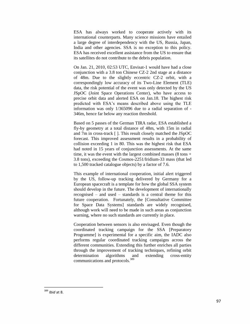
97
ESA has always worked to cooperate actively with its
international counterparts. Many science missions have entailed
a large degree of interdependency with the US, Russia, Japan,
India and other agencies. SSA is no exception to this policy.
ESA has received excellent assistance from the US to ensure that
its satellites do not contribute to the debris population.
On Jan. 21, 2010, 02:53 UTC, Envisat-1 would have had a close
conjunction with a 3.8 ton Chinese CZ-2 2nd stage at a distance
of 48m. Due to the slightly eccentric CZ-2 orbit, with a
correspondingly low accuracy of its Two-Line Element (TLE)
data, the risk potential of the event was only detected by the US
JSpOC (Joint Space Operations Center), who have access to
precise orbit data and alerted ESA on Jan.18. The highest risk
predicted with ESA‘s means described above using the TLE
information was only 1/365096 due to a radial separation of -
346m, hence far below any reaction threshold.
Based on 5 passes of the German TIRA radar, ESA established a
fly-by geometry at a total distance of 48m, with 15m in radial
and 7m in cross-track [ ]. This result closely matched the JSpOC
forecast. This improved assessment results in a probability of
collision exceeding 1 in 80. This was the highest risk that ESA
had noted in 15 years of conjunction assessments. At the same
time, it was the event with the largest combined masses (8 tons +
3.8 tons), exceeding the Cosmos-2251/Iridium-33 mass (that led
to 1,500 tracked catalogue objects) by a factor of 7.6.
This example of international cooperation, initial alert triggered
by the US, follow-up tracking delivered by Germany for a
European spacecraft is a template for how the global SSA system
should develop in the future. The development of internationally
recognised – and used – standards is a central theme for this
future cooperation. Fortunately, the [Consultative Committee
for Space Data Systems] standards are widely recognised,
although work will need to be made in such areas as conjunction
warning, where no such standards are currently in place.
Cooperation between sensors is also envisaged. Even though the
coordinated tracking campaign for the SSA [Preparatory
Programme] is experimental for a specific aim, the IADC also
performs regular coordinated tracking campaigns across the
different communities. Extending this further enriches all parties
through the improvement of tracking techniques, refining orbit
determination algorithms and extending cross-entity
communications and protocols.389
389
Ibid at 8.

98
Fletcher mentions the Tracking and Imaging Radar (TIRA) system operated by
Germany‘s FGAN Research Institute which is ESA‘s primary partner for space debris
observation and tracking.390
The TIRA system can detect space objects as small as 2 cm
at 1,000 km in altitude.391
Norway is also home to several sensors primarily the
European Incoherent Scatter Radar (EISCAT) system, which can detect 2 cm objects, and
the GLOBUS II tracking radar focusing on the GEO region.392
The French military
operates the Grande Reseau Adapte a la Veille Spatiale (GRAVES) radar mentioned in
the previous chapter, which operates much like the U.S. Space Fence and can cover a
very broad area.393
ESA does already operate several of its own telescopes, with its
primary optical sensor being the Space Debris Telescope located in Spain.394
Taken as a whole, ESA‘s endeavor to create a cross-boundary SSA network
within Europe and eventually owning its own compliment of sensors is another
governance structure that can be refined and implemented on a global scale.
c. Space Data Association
Perhaps the most promising multi-entity organization for shared SSA data is the
Space Data Association (SDA) comprised of a number of private satellite corporations
who own and operate various satellite systems throughout the world.395
It was initiated in
2009 by three of the world‘s largest communication satellite companies—Inmarsat,
390
ESA, Space debris measurements Webpage, online: ESA 391
Ibid. 392
Ibid; See also, Weeden, Cefola & Sankaran, “Global Sensors”, supra note 353. 393
Weeden, Cefola & Sankaran, “Global Sensors”, supra note 353 at 6. 394
Ibid at 7. 395
SDA Website, supra note 11.

99
Intelsat and SES—as a non-profit organization.396
It is incorporated in the Isle of Man
partly to curb fears from CFEs over placing the database on U.S. soil garnering U.S.
oversight.397
The SDA now boasts a membership of more than 20 different owners and
operators with a ―legal framework to protect and control the use of shared data.‖398
Reportedly, the SDA is negotiating with the United States and ISON to create even more
robust data sharing agreements.399
The members of SDA each provide ―their own orbital data—including planned
maneuvers…‖400
Since members typically use their own internal data format the SDA
must turn each contributor‘s data into a single, standard format. This data integration
issue is often one of the cited hurdles for an international data sharing organization.
Senior Research Astrodynamicist for Analytical Graphics, Inc. (AGI), Dr. T.S. Keslo,
recently emphasized ―[w]hen the data is combined with SSN data for non-member
satellites and debris, [the SDA] provides the best overall SSA for screening close
approaches available today.‖401
Although the JSpOC may disagree with this statement,
no one can deny that the more entities involved and actively sharing SSA data the safer
outer space will be.
396
Ibid. 397
Peter B de Selding, “Satellite Operators to Create Database to Combat Interference”, Space News online (2009) *de Selding, “Database to Combat Interference”+. These fears must be reconciled before a truly global SSA data sharing organization can be realized. 398
Space Data Association, Press Release, “Space Data Association Now Performs Conjunction Screening for More Than 300 Satellites” (Jan 21, 2011). 399
Weeden, SSA Fact Sheet, supra note 91 at 4. 400
Kelso, “SDA Improving Safety”, supra note 40 at 3. The SDA will also concentrate on radio frequency interference; See further, de Selding, “Database to Combat Interference”, supra note 397. “The database will assemble information on satellite location, broadcast frequencies and power, signal polarization and coverage areas.” 401
Kelso, “SDA Improving Safety”, supra note 40. Dr. Kelso works for the Analytical Graphics, Inc., at the Center for Space Standards and Innovation which manages the SDA’s satellite database.

100
Not only does the Space Data Center provide improved SSA for
satellite operators and support more efficient decision making, it
could be used by the Joint Space Operations Center (JSpOC) at
Vandenberg AFB to improve their SSA, too. Instead of having
to dedicate additional resources to closely tracking and
recovering maneuvering satellites, the JSpOC could simply use
the SSN to verify the operator-reported orbits from the [Space
Data Center] periodically, freeing up SSN resources for tracking
noncooperative objects. …
Of course, to encourage maximum participation by satellite
operators in such a data sharing arrangement, the US must be
willing to reciprocate by sharing the best available orbital data
they have on as many objects as possible. That means US data
policy should be changed to support the release of high-accuracy
orbital data—in line with the new US national space policy.402
The SDA is clearly a model of genuine cooperation, albeit without the geo-
political hurdles often seen when States are involved. Of all of the organizations and
agreements surveyed, the SDA may be the best model for creating a fully integrated and
global SSA data sharing network.
3. Individual Astronomers
As far back as 1958 amateur sky watchers, backyard scientists and professionals
were scouring the sky for man-made space objects. Even the U.S. Air Force was utilizing
this niche with its Harvest Moon program with the aim to collaborate with amateurs for
better SSA.403
It was the military‘s Harvest Moon program which eventually evolved
into the SSN.404
Today, the internet is a powerful tool in every respect and is not lost on
astronomy. Amateur astronomers have been collaborating to provide a valuable resource
to global SSA. ―Amateur observers around the world [ ] do an excellent job of tracking
402
Ibid at 3-4. 403
Maskell & Oram, “Sapphire”, supra note 362 at 1. 404
Ibid.

101
larger, and often classified, objects that governments don‘t like to talk about. Armed
with binoculars, stopwatches, and backyard telescopes, they can be surprisingly accurate
and well informed.‖405
Amateurs often specialize in the so-called ‗black satellites‘ or
classified space objects which are not disclosed to the general public via national means,
such as through the U.S. public space catalog. For instance one amateur astronomer
armed with only binoculars and a stop watch has successfully tracked the U.S. Central
Intelligence Agency‘s highly classified KH-11 "Keyhole" satellites.406
Together
astronomers track over 140 classified space objects407
and have organized themselves
around the website called Heavens Above, which publicizes data on all types of satellites
as well as NEOs and planets.408
Even the member States of the U.N. have recognized the inability to maintain
secrecy in outer space and during the 2009 UNIDIR Conference on Space Security
found:
In the discussions about space object databases, it was proposed
that, in the future, space activities will become transparent and
the idea of ―hiding‘ objects in space will be irrelevant. The
question is one of starting this database, which is dependent on
the good will of the key players involved. Once the key players
engage, momentum is expected to rapidly increase—more
information from key players will be donated to the database and
more new players will become involved.409
The takeaway from the work of individual astronomers is the fact that no satellite
is hidden in outer space, even though States actively pursue satellite stealth technologies.
Spy agencies often attempt to hide their space assets from states, but it is proving harder
405
Weeden, “The Numbers Game”, supra note 24 at 2. 406
Keefe, “I Spy”, supra note 217. The Keyhole satellite can discern objects on Earth as small as a softball. 407
Ibid. 408
See generally, ‘Heavens Above Website’, <http://www.heavens-above.com/>. 409
Space Security Conference, supra note # at 9.
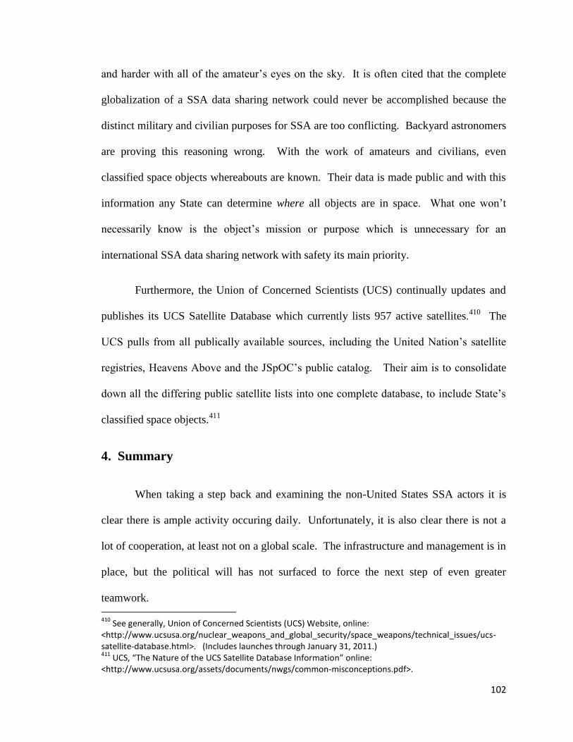
102
and harder with all of the amateur‘s eyes on the sky. It is often cited that the complete
globalization of a SSA data sharing network could never be accomplished because the
distinct military and civilian purposes for SSA are too conflicting. Backyard astronomers
are proving this reasoning wrong. With the work of amateurs and civilians, even
classified space objects whereabouts are known. Their data is made public and with this
information any State can determine where all objects are in space. What one won‘t
necessarily know is the object‘s mission or purpose which is unnecessary for an
international SSA data sharing network with safety its main priority.
Furthermore, the Union of Concerned Scientists (UCS) continually updates and
publishes its UCS Satellite Database which currently lists 957 active satellites.410
The
UCS pulls from all publically available sources, including the United Nation‘s satellite
registries, Heavens Above and the JSpOC‘s public catalog. Their aim is to consolidate
down all the differing public satellite lists into one complete database, to include State‘s
classified space objects.411
4. Summary
When taking a step back and examining the non-United States SSA actors it is
clear there is ample activity occuring daily. Unfortunately, it is also clear there is not a
lot of cooperation, at least not on a global scale. The infrastructure and management is in
place, but the political will has not surfaced to force the next step of even greater
teamwork.
410
See generally, Union of Concerned Scientists (UCS) Website, online: <http://www.ucsusa.org/nuclear_weapons_and_global_security/space_weapons/technical_issues/ucs-satellite-database.html>. (Includes launches through January 31, 2011.) 411
UCS, “The Nature of the UCS Satellite Database Information” online: <http://www.ucsusa.org/assets/documents/nwgs/common-misconceptions.pdf>.

103
V. Conclusion
Given the current state of affairs, it would seem that there
is little that satellite operators can do to protect their
satellites. Yet, we will see that a more thorough review of
existing complementary capabilities suggests that parts of
the problem can be addressed through collaboration,
freeing up more capable resources to focus on the
particularly challenging aspects of providing improved
space situational awareness (SSA).412
As can be seen from the technical and legal aspects of SSA and data sharing, there
is much to be done in this rapidly evolving field of technology and law. However, from
this review, several short and long term conclusions can be drawn. The necessity of
possessing SSA for safety is growing. New players will begin using space just as the old
players have done in the past, but with smaller (and hence harder to track) and cheaper
space objects. If not for the worldly acknowledged issue of space debris, the recognized
need for SSA would still lie dormant. The nascent legal regime surrounding SSA sharing
has a strong foundation in 10 U.S.C. § 2274 which will only grow stronger as
international cooperation matures.
It is this author‘s opinion that the world‘s space actors are realizing just how
important SSA is, how costly it is to possess and maintain the ability to collect raw SSA
data, and the importance of knowing how to apply it. Cost aside, the issue of space
debris is perhaps the strongest argument for sharing SSA with every actor in outer space.
Even though the United States operates the most advanced SSA data collection and
catalog maintained in the world, it is not without its shortcomings, which include:413
location and distribution; age of sensors and the hardware and software systems to
412
Kelso, “SDA Improving Safety”, supra note 40 at 2. 413
Weeden & Kelso, Tech Issues for a Civil SSA System, supra note 4.

104
analyze the data; and the lack of cooperative (versus noncooperative) data from other
actors.414
From this it is clear that more sharing is the only way to cost-effectively
maintain adequate SSA.
The U.S. SSA sharing law is functioning as intended, although it appears quicker
implementation of 2274-Agreements between the U.S. and other States is desired. This is
true of any international political-legal process. SSA sharing agreements with
commercial entities appear to be growing steadily with more and more companies
entering into agreements with the U.S. The SDA also appears to be maturing into a
position of leadership among SSA sharing endeavors.
Upon review of the SSA sharing law, it is clear the Joint Space Operations
Command is the nerve center for the United States SSA sharing mission. Delegated
down from the Secretary of Defense, the JSpOC works all day, every day, to ensure outer
space is as safe as possible. Unfortunately, its capabilities are not sufficient to ensure
total safety of space, as evidenced by the recent Iridium-Cosmos collision, which went
unpredicted by the JSpOC. The limitations of the U.S. SSN have been highlighted
throughout this thesis and the challenges of going it alone are evident. The JSpOC has
evolved as rapidly as any military mission can be expected, but budgetary constraints are
clear throughout the entire DoD, and only getting worse. It is this author‘s opinion that
transforming the JSpOC into a CSpOC is the perfect first step towards greater
transparency and sharing of information first among allies, such as Australia, Canada,
and Great Britain, and then with other CFEs. After a successful combined operation is
414
Kelso, “SDA Improving Safety”, supra note 40.

105
proven, more nations can be invited into the sharing pool, including the members of the
SDA who don‘t already possess a sharing agreement with the United States.
One clear strength of 10 U.S.C. § 2274 is its breadth of allowable participants.
With virtually no limitation of who can work with the United States to share SSA data (so
long as there are no national security concerns present) more and more CFEs will move
to become partners with the U.S. and the JSpOC. Indeed, during a recent UNIDIR
conference it was discussed that:
[s]atellite operators complain that the US Air Force is often slow
to respond to requests. That is understandable, given the
demands of maintain SSA against ever increasing amounts of
debris and satellites. The US Air Force budgets for maintaining
such a capability have generally not kept up with the need for
personnel and information tools. … Because the US military
advantage in maintain a closed catalogue is therefore declining,
it would be in the interest of the United States to lead the way in
a cooperative programme for SSA, first with close allies, and
then broadening to other space-capable nations as experience is
gained.415
Perhaps another legal limitation is the speed at which it takes the U.S. to
internally review a proposed State-to-State 2274-Agreement via the State Department‘s
Circular 175 process. Hopefully, a blanket Circular 175 authorization will be
forthcoming to standardize the formal agreement process between the U.S. and foreign
States. If the USSTRATCOM Commander is given the ability to work directly and enter
into 2274-Agreements with the State‘s agency or agencies involved in space activities,
agreements will be entered more swiftly.
As additional nations such as Canada and Australia, and other organizations such
as ESA and ISON, develop and mature their own space surveillance assets, their value to
415
Security in Space: The Next Generation, Conference Report 31 March - 1 April 2008, report for UNIDIR (New York: United Nations, 2008), vol UNIDIR/2008/14 at 183.

106
the world SSA community will increase and more reciprocal, cost-effective cooperation
will be realized. The United States could demonstrate its commitment to international
cooperation by amending the SSA sharing law to legislatively disallow reimbursement
for data sharing related costs as seen with the current GPS law. The U.S. policy is
already against charging SSA sharing reimbursement fees and with more and more two-
way cooperation on the horizon, it will make even less sense to request fees in the
future.416
This measure may also alleviate concerns over dependence on a foreign
military for SSA data from States and amateurs alike. Furthermore, with respect to the
immunity afforded to U.S. suppliers of SSA data, it should be scaled back to exclude
intentionally tortious acts and acts of gross negligence.
Overall, the SSA sharing law has proven effective, but much more can be done.
As the law matures, it will be seen that cooperation is the best policy. So much so that by
pursuing a robust domestic SSA sharing policy through the implementation of 10 U.S.C.
§ 2274, it may lead to an international SSA data sharing network with U.S. acting only as
another cog in the wheel.
The creation of a viable international collective data sharing and collision
avoidance organization could be the ultimate logical step. The technical challenges of
sharing SSA data, such as synchronized data formats and data security elements, will be
overcome as entities share more and more information and the kinks are worked out.
Furthermore, an international SSA sharing network would be best suited to ―detect non-
compliance with applicable international treaties and recommendations, support liability
416
In the near term it may be prudent for the U.S. to charge fees in order to maintain the SSN, until other nation’s assets are integrated and costs are spread more evenly.
107
assessment and enable the allocation of responsibility for space objects to launching
States or Organizations.‖417 Using the lessons learned from ESA‘s attempt to create a
European State-to-State international SSA sharing program will prove vital. By
combining the International Space Environment Service‘s space weather data networking
knowhow for sharing in real-time and integrating the infrastructure of the SSN‘s sensors
and the ISON‘s optical assets will create seamless data collection. Combining all of
these factors with the analytical and managerial capabilities of the commercial Space
Data Association and a CSpOC, perhaps then a truly global network can be realized.
417
Fletcher, “Status of ESA's SSA Programme”, supra note 387 at 3.

108
Bibliography
Treaties & International Documents
Agreement Among the Government of Canada, Governments of the Member States of the
european Space Agency, the Government of Japan, the Government of the
Russian Federation, and the Government of the United States of America
Concerning Cooperation on the Civil International Space Station (1998) [ISS
Intergovernmental Agreement] (obtained from NASA) online: NASA
<ftp://ftp.hq.nasa.gov/pub/pao/reports/1998/IGA.html >.
Convention on Rights and Duties of States adopted by the Seventh International
Conference of American States, 26 Dec 1933, Vol CLXV LNTS 3802, 49 Stat
3097, Treaty Series 881, [Montevideo Convention] online: United Nations
<http://treaties.un.org/pages/showDetails.aspx?objid=0800000280166aef >.
Convention on International Liability for Damage Caused by Space Objects, 29 Mar 72,
961 UNTS 187, 24 UST 2389, [Liability Convention] online: UN OSSA
<http://www.oosa.unvienna.org/oosa/SpaceLaw/liability.html >.
Joint Announcement by the United States of America and Australia on Bilateral
Cooperation in the Civil Use of GPS and Civil Space Activities, United States &
Australia, 27 Oct 10 online: DoS
<http://www.state.gov/documents/organization/151126.pdf >.
UN Institute for Disarmament Research, Security in Space: The Next Generation,
Conference Report 31 March - 1 April 2008, report for UNIDIR (New York:
United Nations, 2008), vol UNIDIR/2008/14.
_____, Space Security 2009: Moving towards a Safer Space Environment, Conference
Report 15-16 June 2009, report for UNIDIR (Geneva: United Nations, 2009) vol
UNIDIR/2009/9.
Treaty Governing the Activities of States in the Exploration and Use of Outer Space,
including the Moon and Other Celestial Bodies, 27 Jan 67, 610 UNTS 205, 18
UST 2410 [Outer Space Treaty].
UN Office for Outer Space Affairs, Space Debris Mitigation Guidelines of the Committee
on the Peaceful Uses of Outer Space, UNCOPUOS (2007) online: UNOOSA
<http://www.unoosa.org/pdf/bst/COPUOS_SPACE_DEBRIS_MITIGATION_G
UIDELINES.pdf >.
Vienna Convention on the Law of Treaties, 23 May 69, 1155 UNTS 331, 8 ILM 679.

109
U.S. Statutes & Government Documents
Columbia Accident Investigation Board, ed, Columbia Accident Investigation Board
Report Volume 1 (Washington DC: 2003) online: NASA
http://www.nasa.gov/columbia/home/CAIB_Vol1.html.
Department of Defense, DoD Directive 5530.3—International Agreements,
incorporating, Change 1, 18 Feb 1991, online: DoD
<http://www.dtic.mil/whs/directives/corres/pdf/553003p.pdf >.
_____, Space Track: The Source for Space Surveillance Data Website online: Space-
Track.org <http://www.space-track.org/perl/home.pl >.
_____, Space Track User Agreement Webpage online: Space-Track.org
<http://www.space-track.org/perl/user_agreement.pl >.
Department of State, Circular 175 Procedure online: DoS
<http://www.state.gov/s/l/treaty/c175/index.htm >.
_____, Independent States in the World online: DoS
<http://www.state.gov/s/inr/rls/4250.htm >.
_____, ―United States Department of State Circular No. 175‖ (1956) (Reprinted in 50
Am J Int'l L 784).
Freedom of Information Act as amended, Pub L No 89-554, 80 Stat 383 (1966).
Federal Tort Claims Act as amended, 28 USC §§ 1346(b) et seq.
Global Positioning System,10 USC § 2281 (2010), .
HQ AFSPC/XOCS, Satellite Situation Report (Colorado Springs: 7 Mar 11).
HR Rep 111-288, National Defense Authorization Act for Fiscal Year 2010 Conference
Report, 111th Cong, 2009 (Conference Report to Accompany HR 2647).
National Defense Authorization Act for Fiscal Year 2004, PL 108-136, § 913 (24 Nov
2003).
Office of the Assistant Secretary of Defense (Public Affairs), Speech, #1515, ―Remarks
on Space Policy at U.S. Strategic Command Space Symposium: As Delivered by
Deputy Secretary of Defense William J. Lynn, III, Omaha, Nebraska, Wednesday,
November 03, 2010‖ (3 Nov 2010) online: DoD
<http://www.defense.gov/speeches/speech.aspx?SpeechID=1515 >.

110
Space situational awareness services and information: provision to non-United States
Government entities as amended, 10 USC § 2274 (2009).
Space Surveillance Network: pilot program for provision of satellite tracking support to
entities outside United States Government, 10 USC § 2274 (2003).
White House, National Space Policy of the United States of America, 28 June 2010
(Washington DC: 2010) (President: Barack Obama).
_____, U.S. National Space Policy, fact sheet from the Office of Science and Technology
Policy (Washington DC: 2006) (President: George W Bush).
Jurisprudence
Case Concerning Maritime Delimitation and Territorial Questions (Qatar v Bahrain),
[1994] ICJ Rep 112.
Case Concerning Oil Platforms (Islamic Republic of Iran v United States of America),
[2003] ICJ Rep 161.
Corfu Channel Case (United Kingdom of Great Britain and Northern Ireland v Albania),
[1949] ICJ Rep 4.
United States v. MacCollom, 426 US 317 (1976).
Secondary Sources: Government Published
Blair, Capt Angie, Press Release, Story ID 05-001, ―Air Force Space Command Website
Provides Worldwide Space Surveillance Support‖ online: Space Banter.com
<http://www.spacebanter.com/showthread.php?t=48321 >.
Chatters IV, Edward P, ―Space Event Processing‖, Ch 12, in Air Command and Staff
College, ed AU-18 Space Primer (Maxwell AFB: Air University Press, 2009)
online: Air University <http://space.au.af.mil/au-18-2009/au-18-2009.pdf >.
Chatters IV, Edward P & Brian J Crothers, ―Space Surveillance Network‖, Ch 19, in Air
Command and Staff College, ed AU-18 Space Primer (Maxwell AFB: Air
University Press, 2009) online: Air University <http://space.au.af.mil/au-18-
2009/au-18-2009.pdf >.
Chatters IV, Edward P, Bryan Eberhardt & Michael S Warner, ―Orbital Mechanics‖, Ch
6, in Air Command and Staff College, ed AU-18 Space Primer (Maxwell AFB:
Air University Press, 2009) online: Air University <http://space.au.af.mil/au-18-
2009/au-18-2009.pdf >.

111
European Space Agency, Space Debris Measurements online: ESA
<http://www.esa.int/esaMI/Space_Debris/SEMD31WPXPF_2.html >.
_____, Space Situational Awareness, online: ESA
<http://www.esa.int/SPECIALS/SSA/SEMYTICKP6G_0.html >.
_____, Space Weather Web Server, online: ESA <http://www.esa-spaceweather.net/ >.
_____, Space Science: What are Lagrange Points?, 12 Feb 09) online: ESA
<http://www.esa.int/esaSC/SEMM17XJD1E_index_0.html >.
James, Lt Gen Larry D, ―Senior Leader Perspective: The Challenge of Integration,
Lessons from Schriever Wargame 2010‖ (2010) 7:1 Air Force Space Command
High Frontier Journal 9 online: AFSPC
<http://www.afspc.af.mil/library/highfrontierjournal.asp >.
Maloney, Dave, ―Space Surveillance Support to Commercial and Foreign Entities (CFE)
Pilot Program‖ (Presentation) online: Celestrak http://celestrak.com/NORAD/elements/notices/Space_Surveillance_Support_to_C
FE_Pilot_Program_V07.pdf.
National Aeronautics and Space Administration, Cosmicopia - Cosmic Rays Webpage
online: NASA <http://helios.gsfc.nasa.gov/weather.html >.
_____, ―Death Rays from Space‖, Astrobiology Magazine online: NASA
<http://www.astrobio.net/exclusive/3227/death-rays-from-space >.
_____, Integrated Space Weather Analysis System online: NASA
<http://iswa.gsfc.nasa.gov/iswa/iSWA.html >.
_____, Micrometeoroids and Orbital Debris (MMOD) Webpage online: NASA
<http://www.nasa.gov/centers/wstf/laboratories/hypervelocity/mmod.html >.
_____, Orbital Debris Program Office Webpage online: NASA
<http://orbitaldebris.jsc.nasa.gov/ >.
_____, Orbital Debris Quarterly News (Houston: NASA Orbital Debris Program Office,
Jan 11).
_____, SOHO: Solar and Helospheric Observatory online: NASA
<http://sohowww.nascom.nasa.gov/home.html >.
_____, Solar Dynamics Observatory online: NASA
<http://sdo.gsfc.nasa.gov/mission/spaceweather/spaceweather.php >.

112
_____, STEREO: 3D View of the Sun and Heliosphere online: NASA
<http://stereo.gsfc.nasa.gov/mission/mission.shtml >.
National Oceanic and Atmospheric Agency, Space Weather Prediction Center, A Profile
of Space Weather (Boulder: NOAA, 2010) online: NOAA
<http://www.swpc.noaa.gov/primer/primer_2010.pdf >.
Peterson Air Force Base, 10th Space Wing Squadron, Fact Sheet online: Peterson AFB
<http://www.peterson.af.mil/library/factsheets/factsheet.asp?id=4710 >.
Regional Warning Center - China, ―Solar Activity Prediction Center, NAOC‖ online:
RWC - China <http://rwcc.bao.ac.cn/ >.
Royal Observatory of Belgium, Solar Influences Data Analysis Center online: SIDC
<http://sidc.oma.be/index.php3 >.
US Air Force Space Command, Ground-Based Electro-Optical Deep Space Surveillance,
Fact Sheet online: US Air Force
<http://www.af.mil/information/factsheets/factsheet.asp?id=170 >.
US Army, ARPA Long-Range Tracking and Instrumentation Radar (ALTAIR) online: US
Army <http://www.smdc.army.mil/kwaj/rangeinst/altair.html >.
_____, Space Operations, Fact Sheet, online: US Army
<http://www.smdc.army.mil/KWAJ/SpaceOps.html >.
US Strategic Command, JFCC SPACE Webpage, Fact Sheet online: USSTRATCOM
<http://www.stratcom.mil/factsheets/JFCC_-_SPACE/ >.
_____, Space Control and Space Surveillance, Fact Sheet online: USSTRATCOM
<http://www.stratcom.mil/factsheets/USSTRATCOM_Space_Control_and_Space
_Surveillance/ >.
_____, Press Release, ―Commecial & Foreign Entities Pilot Program Transitions to U.S.
Strategic Command‖ (4 Jan 10) online: STRATCOM
<http://www.stratcom.mil/news/2010/137/Commercial_Foreign_Entities_Pilot_Pr
ogram_Transitions_to_US_Strategic_Command/ >.
Secondary Sources: Books, Articles, Websites
Biddington, Brett & Roy Sach, Australia's Place in Space: Toward a National Space
Policy, vol 13 (Canberra: Kokoda Foundation, 2010).

113
Bird, Duane, ―Sharing Space Situational Awareness Data‖ 2010 AMOS Conference
Technical Paper delivered at the Advanced Maui Optical and Space Surveillance
Technologies Conference, Maui (2010) online: AMOS
<http://www.amostech.com/TechnicalPapers/2010.cfm >.
Brinton, Turner, ―Competition Delayed for SBSS Follow-on Satellite‖, Space News
online: spacenews.com <http://www.spacenews.com/military/100916-sbss-
follow-on-competition-delayed.html >.
Butler, Amy, ―EADS Astrium Sees Limited Cooperation‖, Aviation Week online:
Aviation Week
<http://www.aviationweek.com/aw/generic/story_generic.jsp?id=news/awx/2010/
07/17/awx_07_17_2010_p0-241910.xml&topicName=farn10 >.
Chow, Tiffany, SSA Sharing Program: SWF Issue Brief (Superior, Colorado: Secure
World Foundation, 2010).
―Committee Examines Ways to Make the Space Environment Safer for Civil and
Commercial Users‖ online: Space Ref
<http://www.spaceref.com/news/viewpr.rss.html?pid=28082 >.
De Luce, Dan, ―US, France agree to share space data‖, Google News (8 Feb 11) online:
<http://www.google.com/hostednews/afp/article/ALeqM5gZhghFiCaEeOuu6Z3K
zglLJwQN_g?docId=CNG.ca75d68733ba56c6dff1582ac6bf480a.411 >.
De Selding, Peter B, ―French Say 'Non' to U.S. Disclosure of Secret Satellites‖, Space
News (8 Jun 07) online: Space.com <http://www.space.com/3913-french-
disclosure-secret-satellites.html >.
_____, ―Satellite Operators to Create Database to Combat Interference‖, Space News (2
Nov 09) online: Space News
<http://www.spacenews.com/satellite_telecom/091102-satellite-operators-create-
database-combat-interference.html >.
Federation of American Scientists, Advanced Research Project Agency (ARPA) Long-
range Tracking and Identification Radar (ALTAIR) online: FAS.org
<http://www.fas.org/spp/military/program/nssrm/initiatives/altair.htm >.
Fasan, Ernst, ―Asteroids and other Celestial Bodies - Some Legal Differences‖ (1998)
26:1 J Space L 33.
Fletcher, Emmet J, ―Status and Progress in the Space Surveillance and Tracking
Segment of ESA's Space Situational Awareness Programme‖ 2010 AMOS
Conference Technical Paper delivered at the Advanced Maui Optical and Space

114
Surveillance Technologies Conference, Maui (2010) online: AMOS
<http://www.amostech.com/TechnicalPapers/2010.cfm >.
Foster, W F, ―The Convention on International Liability for Damage Caused by Space
Objects‖ (1972) 10 Can YB Int'l L 137.
Garner, Bryan A, ed, Black's Law Dictionary, 8th ed (St Paul: West Publishing Co,
2004).
Hand, Kelly, Richard Benz, Thomas Holts, Travis Longmire, Benjamin T Hendrickson &
Martin France, ―Environmental Space Situation Awareness and Joint Space
Effects‖ 2010 AMOS Conference Technical Paper delivered at the Advanced
Maui Optical and Space Surveillance Technologies Conference, Maui (2010),
online: AMOS <http://www.amostech.com/TechnicalPapers/2010.cfm >.
Hardin, Garrett, ―Tragedy of the Commons‖ (13 Dec 1968) Science 1234.
Harwood, William, ―Satellite watchers worried about Air Force restrictions‖, CBS News
"Space Place" (2 Mar 05) online: Spaceflight Now
<http://spaceflightnow.com/news/n0503/02observing/ >.
Huang, Jiefang, ―Development of the Longer-Term Legal Framework for the Global
Navigation Satellite system‖ (1997) 22 Ann Air & Sp L 585.
International Astronomical Union, Minor Planet Center online: IAU
<http://www.minorplanetcenter.net/ >.
International Scientific Optical Network, Site of initiative astronomical projects:
International Scientific Optical Network (ISON) & Low Frequency VLBI Network
(LFVN) online: Russian Academy of Sciences
<http://lfvn.astronomer.ru/main/english.htm >.
International Space Environment Service Website online: ISES <http://www.ises-
spaceweather.org/ISES.php?target=about-ISES&id=p1&include=about-
ISES&title=ISES >.
Keefe, Patrick Radden, ―I Spy‖, Wired 14:2 (Feb 06) online: Wired
<http://www.wired.com/wired/archive/14.02/spy.html >.
Kelso, T S, ―How the Space Data Center is Improving Safety of Space Operations‖ 2010
AMOS Conference Technical Paper delivered at the Advanced Maui Optical and
Space Surveillance Technologies Conference, Maui (2010) online: AMOS
<http://www.amostech.com/TechnicalPapers/2010.cfm >.

115
Kurian, George, ed, National Security Policy, in The Encyclopedia of Political Science
(Washington DC: CQ Press, 2011) online: CQ Press
<http://library.cqpress.com/teps/encyps_1086.1. >.
Maskell, Paul & Lorne Oram, ―Sapphire: Canada‘s Answer to Space-Based Surveillance
of Orbital Objects‖ 2008 AMOS Conference Technical Paper delivered at the
Advanced Maui Optical and Space Surveillance Technologies Conference (2008),
online: AMOS
<http://www.amostech.com/TechnicalPapers/2008/SSA_and_SSA_Architecture/
Maskell.pdf >.
Massachusetts Institute of Technology, Haystack Upgrade Program (2004) online: MIT
<http://www.haystack.mit.edu/obs/haystack/LincolnUpgrade.pdf >.
Mineiro, Michael C, ―FY-1C and USA-193 ASAT Intercepts: An Assessment of Legal
Obligations Under Article IX of the Outer Space Treaty‖ (2008) 34:2 J Space L
321.
Molotov, Igor, Vladimir Agapov, Zakhary Khutorovsky, Vladimir Titenko, Vasily
Rumyantsev, Vadim Biryukov, Nasredin Minikulov, Makhmud Gulyamov,
Bakhodur Abdulloev, Sergei Andrievsky, Svetlana Kashuba, Vladimir Kashuba,
Raguli Inasaridze, Teimuraz Phiralishvili, Vova Ayvazian, Yury Ivashchenko,
Ivan Korobtsev, Tatyana Tsukker & Vladimir Tergoev, ―Faint High Orbit Debris
Observations with ISON Optical Network‖ 2009 AMOS Conference Technical
Paper delivered at the Advanced Maui Optical and Space Surveillance
Technologies Conference (2009) online: AMOS
<http://www.amostech.com/TechnicalPapers/2009/Orbital_Debris/Molotov.pdf >.
―More Active Sun Means Nasty Solar Storms Ahead‖, Space.com (9 Jun 10) online:
Space.com <http://www.space.com/8563-active-sun-means-nasty-solar-
storms.html >.
Nash, Marian, ―Contemporary Practice of the United States Relating to International
Law‖ (1994) 88 Am J Int'l L 515.
Naval Support Facility Dahlgren: 614th Air and Space Operations Center (AOC),
Detachment 1, Webpage online: DC Military.com
<http://www.dcmilitary.com/special_sections/sw/100410_NSF_Dahlgren/ss_152
518_31972.shtml >.
Pike, John & Robert Sherman, AN/FPQ-16 Perimeter Acquisition Radar Attack
Characterization System (PARCS), (1999) online: FAS.org
<http://www.fas.org/spp/military/program/track/par.htm >.
Reeves, Geoffrey D, ―Integration of Space Weather into Space Situational Awareness‖
2010 AMOS Conference Technical Paper delivered at the Advanced Maui Optical

116
and Space Surveillance Technologies Conference, Maui (2010) online: AMOS
<http://www.amostech.com/TechnicalPapers/2010.cfm >.
Rendleman, James D & J Walter Faulconer, ―Improving International Space Cooperation:
Considerations for the USA‖ (2010) 26 Space Pol‘y 143.
Schildknecht, T, T Flohrer & T Michal, ―Proposal for a European Space Surveillance
System - Results of an ESA Study‖ 2006 AMOS Conference Technical Paper
delivered at the Advanced Maui Optical and Space Surveillance Technologies
Conference, Maui (2006) online: AMOS
<http://www.amostech.com/TechnicalPapers/2006.cfm >.
Skinner, Tony, ―Spatial Awareness: Addressing the Space Debris Threat‖, Jane's
Strategic Advisory Service, online: IHS Jane‘s <http://jmsa.janes.com >.
Space Data Association, Press Release, ―Space Data Association Now Performs
Conjunction Screening for More Than 300 Satellites‖ (21 Jan 11) online: SDA
http://www.space-data.org/sda/wp-
content/uploads/downloads/2011/01/SDA_press_release_21_Jan_2011_RELEAS
ED.pdf.
_____, Website online: SDA <http://www.space-data.org/sda/>.
―Space Debris Threat Needs International Response, Military Official Says‖, Space.com
(22 Mar 11) online: Space <http://www.space.com/11191-space-debris-
international-response.html >.
Spillar, Charles & Mike Pirtle, ―Commercial and Foreign Entities (CFE) Pilot Program
Status Update and Way Ahead‖ 2009 AMOS Conference Technical Paper
delivered at the Advanced Maui Optical and Space Surveillance Technologies
Conference, Maui (2009) online: AMOS
<http://www.amostech.com/TechnicalPapers/2009.cfm >.
Taylor, Michael W, ―Trashing the Solar System One Planet at a Time: Earth's Orbital
Debris Problem‖ (2007-2008) 20 Geo Int'l Envtl L Rev 1.
_____, ―Space Debris Mitigation Measures: United States Department of Defense‖
(power point presentation delivered at the Institue of Air and Space Law, 2009)
online: McGill University
<http://www.mcgill.ca/files/iasl/Session_3_Michael_Taylor.pdf >.
Union of Concerned Scientists, Satellite Database online: UCS
<http://www.ucsusa.org/nuclear_weapons_and_global_security/space_weapons/te
chnical_issues/ucs-satellite-database.html >.
117
―USA Moves Ahead with Next-Generation 'Space Fence' Tracking‖, Defense Industry
Daily (2 Jun 11) online: DefenseIndustryDaily.com
<http://www.defenseindustrydaily.com/Air-Force-Awards-First-Phase-of-Next-
Generation-Space-Fence-05511/#contracts >.
Von der Dunk, Frans G, ―Too-Close Encounters of the Third-Party Kind: Will the
Liability Convention Stand the Test of the Cosmos 2251-Iridium 33 Collision?‖
International Institute of Space, Proceedings of the 52nd Colloquium on the Law
of Outer Space (2009) (American Insitute of Aeronautics and Astronautics, Inc,
2010).
Weeden, Brian, Lecture between Brian Weeden and McGill Institute of Air and Space
Law, Montreal, Quebec (15 Mar 11).
_____, Space Situational Awareness Fact Sheet (2010) online: Secure World Foundation
<www.swfound.org >.
_____, ―The Numbers Game: What's in Earth Orbit and How Do We Know?‖, The Space
Review: Essays and Commentary about the Final Frontier (26 Jan 11) online: The
Space Review <www.thespacereview.com/article/1417/1 >.
Weeden, Brian, Paul Cefola & Jaganath Sankaran, ―Global Space Situational Awareness
Sensors‖ 2010 AMOS Conference Technical Paper delivered at the Advanced
Maui Optical and Space Surveillance Technologies Conference, Maui (2010),
online: AMOS <http://www.amostech.com/TechnicalPapers/2010.cfm >.
Weeden, Brian & T S Kelso, Analysis of the Technical Feasibility of Building an
International Civil Space Situational Awareness System, report for 2009 IAC
(Daejeong, South Korea: 2009) online: Secure World Foundation
<http://swfound.org/resource-library/space-situational-awareness >.
Wright, David, Laura Grego & Lisbeth Gronlund, The Physics of Space Security: A
Reference Manual (Cambridge: American Academy of Arts and Sciences, 2005)
online: American Academy of Arts and Sciences
<http://www.amacad.org/publications/rulesSpace.aspx >.
Yan, ed, ―U.S., France sign space agreement‖, Xinhua News, English News (8 Feb 11)
online: Xinhua News Agency <http://news.xinhuanet.com/english2010/sci/2011-
02/09/c_13723248.htm >.