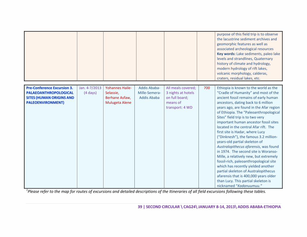
second circular sessions and excursions · pdf file3 | second circular \ cag24\ january...
TRANSCRIPT

22
1144TTHH CCOO
““4400SSOOLLUU
EETTHHIIOOPP
1 | S
SSEE
2244TTHH CCOOLLOONNGGRREESS
00 YYEEAARRSSUTTIIOONNSS T
UUNN
CCoonnffeerree
PPIIAANN GGEEOOSSOOnn bbeehh
SECOND CIRC
SSEECCEESSSSIIOO
LLLLOOQQUUIIUUSSSS OOFF GGEE
4400TTHH
SS OOFF GGSSTTOO AAFFRR
JJAANNIITTEEDD NNAA
AADDD
eennccee WWee
SCCIIEENNCCEE AANNhhaallff ooff tthhee
CULAR \ CAG
CCOONNDDNNSS AANN
DDEE
UUMM OOFF AAEEOOLLOOGGIICCAANNNNIIVVEE
SSAAff ((119977RRIICCAANN DD
AANNUUAARRYYAATTIIOONNSS CCDDIISS AABBAA
eebbssiittee:: hh
OORRGGAANNDD MMIINNEERRAGGEEOOLLOOGGIICC
PPAARR
G24\ JANUA
D CCIIRRCCUNNDD EEXXEETTAAIILLSS
AAFFRRIICCAANNCCAALL SSOOCCEERRSSAARRYY OO
7733‐‐22001133DDEEVVEELLOO
YY 88‐‐1144,, 22CCOONNFFEERRAABBAA,, EETTHH
hhttttpp::////ww
AANNIIZZEEDD BBYYRAALL EENNGGIINNEECCAALL SSOOCCIIEE
RRTTNNEERRSS
ARY 8‐14, 20
UULLAARRXXCCUURRSSSS
N GGEEOOLLOOCIIEETTYY OOFFOOFF GGSSAAff
33)):: EEAARRTTOPPMMEENNTT
22001133 RREENNCCEE CCEEHHIIOOPPIIAA
wwwwww..CCAAGG
EEEERRIINNGG AASSTTYY OOFF AAFFRR
13\ ADDIS A
SSIIOONNSS
OGGYY ((CCAAGGAAFFRRIICCAAff
TTHH SSCCIIEETT CCHHAALLLL
EENNTTRREE
GG2244..oorrgg..
SSSSOOCCIIAATTIIOORRIICCAA ((GGSSAAff
ABABA‐ETHIO
S
GG2244)) AA ((GGSSAAff1144
EENNCCEESS LLEENNGGEESS
..eett
OONN ((EEGGMMEEAAff))
OPIA
44))
SS””
AA))

2 | SECOND CIRCULAR \ CAG24\ JANUARY 8‐14, 2013\ ADDIS ABABA‐ETHIOPIA
TTAABBLLEE OOFF CCOONNTTEENNTTSS INTRODUCTION 4ORGANIZING COMMITTEE 4INTERNATIONAL SCIENTIFIC COMMITTEE 5CONFERENCE SECRETARIAT 6GENERAL CONFERENCE PROGRAM 6REGISTRATION 6CONFERENCE REGISTRATION FEES 6ABSTRACT SUBMISSION 7IMPORTANT DATES 7CORRESPONDENCE 8
LIST OF SESSIONS 9DESCRIPTION OF SESSIONS 11 SESSION 1: PRECAMBRIAN GEOLOGY 11 1.1 Craton Formation and Destruction 11 1.2. Nature and Significance of the Pan‐African Orogeny 11 1.3. Metamorphic Evolution and Tectonic Styles of the East African Orogens 12 1.4. Neoproterozoic Chemostratigraphy, Deformation and Metamorphic
History of the ANS and MB (Gondwana) 13 SESSION 2: HISTORICAL GEOLOGY 14 2.1. Sedimentology, Stratigraphy, Palaeontology, Palaeoenvironments (In
Memory of the Late Dr. Mohammed Umer Mohammed) 14 2.2. Early Hominin Paleobiology, Taxonomy, and Associated Paleoecological
Contexts between 4.5 and 3.0 Million Years Ago 15 SESSION 3: THE EAST AFRICAN RIFT SYSTEM 16 3.1. The East African Rift System: Tectonics and Volcanism 16 SESSION 4: EARTH RESOURCES 17 4.1. Mineral Resources 17 4.2. Geothermal Resources 17 4.3. Hydrocarbon Resources 18 4.4. Groundwater Resources 18 4.5. Ethiopia’s Mining Development 19 4.6. Remote Sensing, Image Processing, Modeling and GIS Applications in Earth
Resources Mapping and Mineral Exploration 20 SESSION 5: ENVIRONMENTAL GEOLOGY, ENGINEERING GEOLOGY AND
GEOHAZARDS 21 5.1. Geohazards 21 5.2. Engineering Geology 22 5.3. Environmental and Health Impacts of Mining in Africa (Special Session
under the Auspices of IGCP/SIDA Projects 594 and 606) 23 5.4. Medical Geology (In Memory of the Late Prof. Serrano Pinto, former
Goodwill Ambasador of the GSAf) 24 SESSION 6: GEOHERITAGES AND GEOTOURISM 24 6.1. Geoheritages and Geotourism in Africa 24

3 | SECOND CIRCULAR \ CAG24\ JANUARY 8‐14, 2013\ ADDIS ABABA‐ETHIOPIA
SESSION 7: EARTH SCIENCE EDUCATION IN AFRICA 26 7.1. Earth Science Education in Africa 26 SESSION 8: GEOSCIENCE INFORMATION IN AFRICA 27 8.1. Geoscience Information in Africa 27 SESSION 9: OPEN SESSION 28
LIST OF WORKSHOPS AND SHORT COURSES 29DESCRIPTION OF WORKSHOPS AND SHORT COURSES 30 WORKSHOP 1: Geoparks 30 WORKSHOP 2: Application on Ammonites and other Invertebrates:
Morphometric Analysis Using the Software Past (Paleontological Statistic) 30
WORKSHOP 3: Hyperspectral Remote Sensing for Mineral Exploration 31 WORKSHOP 4: Geological and Environmental Remote Sensing 31 WORKSHOP 5: Non‐Destructive Analyses of Gems and Lapidary Materials 32
LIST OF ROUNDTABLES 33DESCRIPTION OF ROUNDTABLES 34 ROUNDTABLE 1: Geoheritage & Geoparks: a Tool for Local Sustainable
Development 34 ROUNDTABLE 2: Women in Geosciences 34
LIST OF SYMPOSIUMS 36DESCRIPTION OF SYMPOSIUM 37 SYMPOSIUM 1: The Second YES Africa Symposium under the Theme “YES
Projects and Research Initiatives for Geoscience and Sustainable Development in Africa” 37
LIST OF FIELD EXCURSIONS 38MAP OF FIELD EXCURSION ROUTES 44DESCRIPTION OF EXCURSIONS 45 PRE‐CONFERENCE EXCURSION 1: The Main Ethiopian Rift 45 PRE‐CONFERENCE EXCURSION 2: Quaternary Palaeoenvironment and
Geomorphology in the Main Ethiopian Rift 46 PRE‐CONFERENCE EXCURSION 3: Palaeoanthropological Sites (Human Origins
and Paleoenvironment) 48 MID‐CONFERENCE EXCURSION 2: Geology of Addis Ababa and Volcanic
Morphology 49 MID‐CONFERENCE EXCURSION 3: Wonchi Volcano and Thermal Springs 50 POST‐CONFERENCE EXCURSION 1: The Blue Nile Gorge 51 POST‐CONFERENCE EXCURSION 2: Tertiary Continental Flood Basalt and Volcanic
Rift Margin 52 POST‐CONFERENCE EXCURSION 3: The Precmbrian Geology and Associated
Mineralizations of Western Ethiopia 54 POST‐CONFERENCE EXCURSION 4: Afar Rift Geodynamics, Erta’ale Active
Volcano and Dallol 56
GSAf ANNOUNCEMENT: ANNOUNCEMENT FOR CAG25 BID BY A EUROPEAN COUNTRY 58

4 | SECOND CIRCULAR \ CAG24\ JANUARY 8‐14, 2013\ ADDIS ABABA‐ETHIOPIA
INTRODUCTION
The "Colloquium of African Geology" (CAG) is a major biennial meeting organized under the
auspices of the Geological Society of Africa (GSAf). Since the first colloquium in 1965, this
Colloquium has been hosted by several European and African countries. The African countries that
had a chance to organize this event were Swaziland, Zimbabwe, Morocco, Mozambique, Tunisia
and South Africa. Based on the decision of the Geological Society of Africa (GSAf) General
Assembly held on 14 January 2011 at the University of Johannesburg, South Africa (during the 23rd
Colloquium), the organization of the next Colloquium of African Geology (CAG24) as well as the
14th Conference of the Geological Society of Africa and the 40th Anniversary of the Geological
Society of Africa (1973‐2013) was assigned to Ethiopia. This will be conducted at the United
Nations Economic Commission Conference Center (UNECA) in Addis Ababa, Ethiopia from 8 to 14
January 2013. The CAG24 will be organized by the Ethiopian Geosciences and Mineral Engineering
Association (EGMEA) in cooperation with governmental and non‐governmental organizations
under the auspices of the Geological Society of Africa (GSAf). The Theme of the Conference is: “40
Years of GSAf (1973‐2013): Earth Sciences Solutions to African Development Challenges”.
The Second Circular presents details of the sessions, workshops, short courses, roundtables and
field excursions to be held during the conference.
ORGANIZING COMMITTEE
Girma Woldetinsae (Ministry of Mines; Chair‐CAG24)
Gezahgne Yirgu (Addis Ababa University, Vice Chair‐CAG24)
Ketsela Tadesse (Ministry of Mines, Vice Chair‐CAG24)
Tadesse Alemu (Geological Survey of Ethiopia, Secretary‐CAG24)
Abebe Mekuriaw (Ethiopian Academy of Sciences, Member‐CAG24)
Asfawossen Asrat (Addis Ababa University, Chair‐Science Program‐CAG24)
Aster Gebremariam (UNECA, Chair‐Public Relations‐CAG24)
Getahun Demissie (GEOMET PLC, Advisor‐CAG24)
Getnet Mewa (Ministry of Mines, Chair‐Fund Raising‐CAG24)
Hundie Melka (Geological Survey of Ethiopia, Member‐CAG24)
Metasbia Demissie (Member‐CAG24)
Mulugeta Alene (Addis Ababa University, Chair‐Auditing‐CAG24)
Seifu Kebede (Addis Ababa University, Chair‐Field Excursions‐CAG24)
Senbeto Chewaka (National Mining Corporation, Member‐CAG24)
Tadesse Berhanu (Addis Ababa University, Chair‐logistics‐CAG24)
Tenalem Ayenew (Addis Ababa University, Member‐CAG24)

5 | SECOND CIRCULAR \ CAG24\ JANUARY 8‐14, 2013\ ADDIS ABABA‐ETHIOPIA
INTERNATIONAL SCIENTIFIC COMMITTEE
Aberra Mogessie (President, GSAf, Austria, aberra.mogessie@uni‐graz.at)
Abeinomugisha Dozith (Uganda, d.abeinomugisha.go.ug)
Alberto Riccardi (IUGS; [email protected])
Alfred Kroener (Germany; [email protected]‐MAINZ.DE)
Andrea Förster (GFZ/Germany, for@gfz‐potsdam.de)
Asfawossen Asrat (Vice President, GSAf‐Eastern Africa, Ethiopia, [email protected])
Berket Haileab (Carleton, USA; [email protected])
Bushra Ibrahim Elhur (Sudan; bushra@petroenergy‐ep.com)
Christian Koeberl (Austria; [email protected])
Eckart Wallbrecher (Austria; eckart.wallbrecher@uni‐graz.at)
Edmund Nickless (BGS, England; [email protected])
Ezzoura Errami (Morocco; [email protected])
Genene Mulugeta (Sweden, [email protected])
Georg Hoinkes (Austria; georg.hoinkes@uni‐graz.at)
Giday WoldeGabriel (LANL, USA; [email protected])
Gregory Tanyleke (Vice President, GSAf‐Central Africa, Cameroun, [email protected])
Gbenga Okunlola (Vice President, GSAf‐Western Africa; [email protected])
Hassan Helmy (Vice President, GSAf‐Northern Africa, Egypt; [email protected])
Jack Hess (GSA, U.S.A; [email protected])
Jacques Varet (France, [email protected])
J.‐P. Liégeois (Belgium, [email protected])
Jörg Ebbing (NGU, Norway; [email protected])
Larry Woodfork (EarthLink, USA; [email protected])
Lopo Vasconcelos (Vice President, GSAf‐Southern Africa, Moz.; [email protected])
Marteen de wit (South Africa; [email protected])
Mohamed Abdelsalam (U. S. A., [email protected])
Patrick Leahy ([email protected])
Peter Bowden (France; [email protected])
Robin Renaut (Canada; [email protected])
Sospeter Muhnogo (Tanzania, [email protected])
Teshaie Woldai (ITC. Netherlands, [email protected])
Yohannes Haile‐Selassie (CMNH, USA; [email protected])

6 | SECOND CIRCULAR \ CAG24\ JANUARY 8‐14, 2013\ ADDIS ABABA‐ETHIOPIA
CONFERENCE SECRETARIAT
EGMEA Secretariat
School of Earth Sciences, Addis Ababa University, R. No. 121
P. O. Box 32739, Addis Ababa, Ethiopia
Tel: +251‐1‐6554176/+ 251‐1‐912084503 (Mobile)
E‐Mail: [email protected]/[email protected]
GENERAL CONFERENCE PROGRAM
Pre‐conference field trips: January 4‐7, 2013
Registration and Reception: January 8, 2013
Scientific Sessions: January 9‐13, 2013
Mid Conference Field Excursion or City Tour: January 11, 2013
GSAf 14th Congress and 40th Anniversary of GSAf : January 14, 2013
Post‐conference field trips: January 15‐22, 2013
REGISTRATION
Online Registration is active and will stay open till 30 September 2012. Please visit the CAG24
web site (www.cag24.org.et) and complete the online form. Those of you, who prefer to
register on a printed form, please access the printable registration form from the web page,
print it, scan completed form and send the scanned copy to the Conference Secretariat
([email protected]) before 30 September, 2012.
CONFERENCE REGISTRATION FEES
Event Fee in USD Normal Full Registration 400 Accompanying person 150 GSAf members Registration 350 Late Full Registration* 450 Early Student Registration 150 Late Student Registration* 200 On site Full registration 500 On Site Student Registration 250 *After December 1, 2012
Conference registration fees will cover costs of reception, coffee/tea breaks and lunch during
the scientific sessions, one day Mid Conference excursion or city tour and conference

7 | SECOND CIRCULAR \ CAG24\ JANUARY 8‐14, 2013\ ADDIS ABABA‐ETHIOPIA
materials. Pre‐/post‐conference excursion fees will cover costs of transportation,
accommodation, meals, and guidebook. Participants are required to pay registration fees by
bank transfer before December 1, 2012 (see address below and the attached payment form).
After this date, it will be possible to pay the registration fees at the conference registration
desk with a 10% surcharge. Refund will be charged by 20% deduction. No refund will be made
after December 1, 2012.
Bank Transfer address:
Commercial Bank of Ethiopia (CBE)
Arat Kilo Branch (A/C number: 0170959040900)
SWIFT CODE: CBETETAA
in favour of CAG24‐2013
ABSTRACT SUBMISSION Abstracts will be accepted for oral or poster presentation. Please indicate your preference
when submitting. Abstracts are to be submitted by e‐mail as an attached file in Word format
to the Conference Secretariat at the following e‐mail addresses ([email protected]
/[email protected]). The deadline for abstract submission is August 31, 2012.
Acceptance will be decided by the end of September 2012.
Abstract Format: Abstract is limited to one A4‐size page, text only without any figures or tables. Top, bottom, left, and
right margins 25 mm.
Title: Upper and lower case, left justified, Times font, 14 pt bold.
Contributors’ names: Upper and lower case, left justified, first name first, surname last, Times font, 11
pt.
Affiliation: Upper and lower case, left justified, Times font, 10 pt. Numbered superscripts should be used
to indicate the affiliation of each contributor. E‐mail address can be added in parentheses at the end of
the corresponding contributor’s affiliation.
Main text: Single‐spaced text, Times 10 pt font, no section headings.
IMPORTANT DATES
August 31, 2012
Sept. 30, 2012
Abstract submission Deadline
Online Registration Deadline
Sept. 30, 2012 Decision on abstracts and fellowship requests
communicated to applicants
October 31 Release of 3rd Circular
December 1, 2012 Deadline for payment of fees by bank transfer
Deadline for money refund

8 | SECOND CIRCULAR \ CAG24\ JANUARY 8‐14, 2013\ ADDIS ABABA‐ETHIOPIA
CORRESPONDENCE
All correspondence concerning REGISTRATION, AND PAYMENTS FOR CONFERENCE
PARTICIPATION AND EXCURSION cab be addressed to:
EGMEA Secretariat
School of Earth Sciences, Addis Ababa University, R. No. 121
P. O. Box 32934, Addis Ababa, Ethiopia
Tel: +251‐1‐6554176/+ 251‐1‐912084503 (Mobile)
E‐Mail: [email protected]
All correspondence concerning SESSIONS, ABSTRACT SUBMISSION, APPLICATION FOR
SPONSORSHIP can be be addressed to:
Dr. Asfawossen Asrat, Chairman, Science Committee
School of Earth Sciences, Addis Ababa University
P.O. Box 1176, Addis Ababa, Ethiopia Phone: 251‐911‐407553
E‐mail: [email protected]
All correspondence concerning FIELD EXCURSIONS can be be addressed to:
Dr. Seifu Kebede, Chairman, Field Excursion Committee
School of Earth Sciences, Addis Ababa University
P.O. Box 1176, Addis Ababa, Ethiopia Phone: 251‐911‐407553
E‐mail: [email protected]

9 | SECOND CIRCULAR \ CAG24\ JANUARY 8‐14, 2013\ ADDIS ABABA‐ETHIOPIA
LLIISSTT OOFF SSEESSSSIIOONNSS SSEESSSSIIOONN SSUUBB‐‐
SSEESSSSIIOONN TTIITTLLEE CCOONNVVEENNEERRSS KKEEYYNNOOTTEE
SSPPEEAAKKEERRSS 11.. PPRREECCAAMMBBRRIIAANN
GGEEOOLLOOGGYY 11.. 11.. Craton Formation and Destruction A. Kroner, J.P. Liegeois
A. Hofmann, A. Bendaoud A. Kroner
11.. 22.. Nature and Significance of the Pan‐African Orogeny J. P. Liegeois, A. Asrat, M. G. Abdel Salam, A. Mogessie, R. J. Stern
J. P. Liegeois
11.. 33.. Metamorphic Evolution and Tectonic Styles of the East African Orogens
H. Fritz, C. Hauzenberger TToo bbee ddeetteerrmmiinneedd
11.. 44.. Neoproterozoic Chemostratigraphy, Deformation and Metamorphic History of the ANS and MB (Gondwana)
M. Alene, A. Asrat, M. Beyth S. Muhongo
22.. HHIISSTTOORRIICCAALL GGEEOOLLOOGGYY
22.. 11.. Sedimentology, Stratigraphy, Palaeontology, Palaeoenvironments (In Memory of the Late Dr. Mohammed Umer Mohammed)
B. Atnafu, D. Lebenie, R. Bussert, A. Eisawi
TToo bbee ddeetteerrmmiinneedd
22.. 22.. Early Hominin Paleobiology, Taxonomy, and Associated Paleoecological Contexts between 4.5 and 3.0 Million Years Ago
Y. Haile‐Selassie, B. Asfaw
Y. Haile‐Selassie
33.. TTHHEE EEAASSTT AAFFRRIICCAANN RRIIFFTT SSYYSSTTEEMM
33.. 11.. The East African Rift System: Volcanism and Tectonics
G. Woldegabriel, B. Abebe G. Woldegabriel
44.. EEAARRTTHH
RREESSOOUURRCCEESS 44.. 11.. Mineral Resources H. Helmy, S. Tadesse,
M. Gebreselassie, S. Gebreselassie
A. Mogessie
44.. 22.. Geothermal Resources J. Varet, G. Demissie, A. Förster G. Demissie44.. 33.. Hydrocarbon Resources K. Tadesse, L. Vasconcelos,
W. Ahmed L. Vasconcelos

10 | SECOND CIRCULAR \ CAG24\ JANUARY 8‐14, 2013\ ADDIS ABABA‐ETHIOPIA
44.. 44.. Groundwater Resources T. Ayenew, S. Kebede, A. Makarigakis, M. Razack
R. Callow
44.. 55.. Ethiopia’s Mining Development K. Hailu, G. Mekonnen, S. Chewaka
R. Chase,CEO, NYOTA
44.. 66.. Remote Sensing, Image Processing, Modeling and GIS Applications in Earth Resources Mapping and Mineral Exploration
T. Woldai, F. van Ruitenbeek TToo bbee ddeetteerrmmiinneedd
55.. EENNVVIIRROONNMMEENNTTAALL GGEEOOLLOOGGYY,, EENNGGIINNEEEERRIINNGG
GGEEOOLLOOGGYY AANNDD
GGEEOOHHAAZZAARRDDSS
55.. 11.. Geohazards G. Mulugeta, G. Yirgu, A. Ayele,G. Mewa
TToo bbee ddeetteerrmmiinneedd
55.. 22.. Engineering Geology K. Woldearegay, T. Raghuvanshi 55.. 33.. Environmental and Health Impacts of Mining in
Africa (Special Session under the Auspices of IGCP/SIDA Projects 594 and 606)
C. T. Davies, B. Mapani, B. Kribek
C. T. Davies
55.. 44.. Medical Geology (In Memory of the Late Prof. Serrano Pinto, former Goodwill Ambasador of the GSAf)
S. Kebede, E. F. da Silva TToo bbee ddeetteerrmmiinneedd
66.. GGEEOOHHEERRIITTAAGGEESS AANNDD GGEEOOTTOOUURRIISSMM
66.. 11.. Geoheritages and Geotourism in Africa A. Asrat, E. Errami, M. Demissie, A. Mogessie
A. Asrat
77.. EEAARRTTHH SSCCIIEENNCCEE EEDDUUCCAATTIIOONN IINN
AAFFRRIICCAA
77.. 11.. Earth Science Education in Africa F. Toteu, J. Martinez‐Frias, S. Gaines, A. Mogessie
F. Toteu
88.. GGEEOOSSCCIIEENNCCEE IINNFFOORRMMAATTIIOONN IINN
AAFFRRIICCAA
88.. 11.. Geoscience Information in Africa K. Tadesse, M. Urvois, K. Asch, G. Schneider, I. Jackson
TToo bbee ddeetteerrmmiinneedd
99.. OOPPEENN SSEESSSSIIOONN 99.. 11.. Open Session G. Woldetinsae, T. Alemu

11 | SECOND CIRCULAR \ CAG24\ JANUARY 8‐14, 2013\ ADDIS ABABA‐ETHIOPIA
DDEESSCCRRIIPPTTIIOONN OOFF SSEESSSSIIOONNSS
SSEESSSSIIOONN 11:: PPRREECCAAMMBBRRIIAANN GGEEOOLLOOGGYY Session 1.1. Craton Formation and Destruction Conveners:
Prof. Alfred Kröner, Dept. of Geosciences, University of Mainz, Germany, and Chinese Academy of Geological Sciences, Beijing, China (kroener@uni‐mainz.de)
Prof. Jean‐Paul Liègeois, Free University of Brussels, Belgium ([email protected]) Prof. Axel Hofmann, University of Johannesburg, South Africa ([email protected]) Dr. Abder Bendaoud, University of Science and Technology Houari Boumedienne, Algiers,
Algeria ([email protected]) The formation of cratons and their possible destruction is one of the most important events in the history of continental evolution, yet we neither fully understand the mechanisms of craton formation nor the cause and mechanism of craton destabilization and destruction. This multidisciplinary session is aimed at an exchange of ideas on a wide range of topics related to the formation and evolution of cratons in Africa and other Gondwana‐derived continents and their relationship to tectonics, metamorphism, and mantle dynamics. The Kaapvaal craton of southern Africa is considered one of the oldest and most stable cratons, whereas the eastern part of the Tanzania may have been destroyed and reworked during the Pan‐African orogeny, and the Sahara metacraton may be an example for partial craton destruction. Is the evolution of the North China craton a general model for craton destabilization? Formation et destruction des cratons La formation des cratons et leur possible destruction (partielle) est l'un des événements les plus importants de l'histoire de l'évolution d'un continent. Cependant, nous ne comprenons que partiellement les mécanismes de formation d'un craton et de leur déstabilisation ou destruction. Cette session pluridisciplinaire vise à un échange d'idées sur un large éventail de sujets liés à la formation et à l'évolution des cratons en Afrique et dans les autres continents constitutifs du Gondwana et leur relation avec la tectonique, le métamorphisme, et la dynamique du manteau. Le craton du Kaapvaal en Afrique australe est considéré comme l'un des cratons anciens les plus stables, la partie orientale de la Tanzanie semble avoir été détruite ou du moins largement remobilisée pendant l'orogenèse pan‐africaine et le métacraton saharien est un exemple de destruction de masse d'un craton. Enfin, nous pouvons nous poser la question: l'évolution du craton en Chine du Nord peut‐elle être considérée comme le modèle de la déstabilisation d'un craton? Session 1.2. Nature and Significance of the Pan‐African Orogeny Conveners:
Prof. Jean‐Paul Liègeois, Royal Museum for Central Africa, Belgium ([email protected]) Dr. Asfawossen Asrat, School of Earth Sciences, Addis Ababa University, Ethiopia

12 | SECOND CIRCULAR \ CAG24\ JANUARY 8‐14, 2013\ ADDIS ABABA‐ETHIOPIA
Prof. Mohamed G. Abdelsalam, Department of Geological Science & Engineering, Missouri University of Science and Technology, USA ([email protected])
Prof. Aberra Mogessie, Institute of Earth Sciences, Karl‐Franzens University of Graz, Austria (aberra.mogessie@uni‐graz.at)
Prof. R. J. Stern, Geosciences Department, University of Texas at Dallas, USA ([email protected])
The Pan‐African orogeny of Neoproterozoic and Early Paleozoic age shaped the African continent and a large part of the world because it is globally linked to the continental convergence that generated the Gondwana Supercontinent. Consequently, the expression "Pan‐African" is also widely used outside Africa (in addition to Brasiliano, Cadomian, Vendian, etc). However, the term Pan‐African orogeny is used by different authors in a wide number of ways, including referring to: (1) all Neoproterozoic (1000‐542 Ma) orogenic events, (2) Ediacaran collisional and post‐collisional events (630‐570 Ma), (3) Ediacaran‐Cambrian orogenic events (635‐488 Ma). Consequently, nowadays, Precambrian geology researchers do not restrict the use of the term Pan‐African orogeny to the original definition of Kennedy (1964), a ~500 Ma thermo‐tectonic event based on K‐Ar ages, which now must be regarded as cooling ages. These variations arise from the fundamental loose definition of an orogeny (that can include the early oceanic accretion phases preceding the main collisional phase) combined with the diachronic character of such a large orogenic event. We think it is time to redefine the term Pan‐African orogeny, ~50 years after Kennedy’s original but obsolete definition. Refining the term Pan‐African orogeny requires understanding its nature and significance within the entire African continent and in other continents that were part of the Gondwana Supercontinent. This requires a nested approach of acquiring multidisciplinary geoscientific records from continent‐wide scale to detailed studies. The Colloquium of African Geology is a well‐suited platform to advance our knowledge of the Pan‐African orogeny through original presentations and share ideas on future research. All original as well as review contributions dealing with the Neoproterozoic are thus welcomed, provided a final conclusion is given concerning the definition of the Pan‐African orogeny. Session 1.3. Metamorphic Evolution and Tectonic Styles of the East African
Orogens Conveners:
Prof. Harald Fritz, Karl‐Franzens University of Graz, Austria (harald.fritz@uni‐graz.at) Prof. Christoph Hauzenberger, Karl‐Franzens University of Graz, Austria
(christoph.hauzenberger@uni‐graz.at) The East African Antarctic Orogen, extending from the Mediterranean coast to Antarctica, forms the largest contiguous Neoproterozoic to Cambrian mobile belt on Earth. Gondwana fragments have been assembled through opening and closure of individual oceanic basins arising in complex patterns of spatially and temporally varying tectonometamorphic events. Each of these events may have been accompanied by distinctly different thermal and tectonic evolutionary paths related to extension, orogen growth and orogen decay.
13 | SECOND CIRCULAR \ CAG24\ JANUARY 8‐14, 2013\ ADDIS ABABA‐ETHIOPIA
Decryption of temporal relationships and definition of metamorphic conditions and tectonic styles is essential to define the different geodynamic settings that operated through time. Contributions are invited that present research upon operational developments of the East African Orogen. Presentations on timing, metamorphic conditions and structural evolution throughout the orogen will help to define crustal domains with potential different modes of orogen growth and decay. Session 1.4. Neoproterozoic Chemostratigraphy, Deformation and
Metamorphic History of the ANS and MB (Gondwana) Conveners:
Dr. Mulugeta Alene, School of Earth Sciences, Addis Ababa University, Ethiopia ([email protected])
Dr. Asfawossen Asrat, School of Earth Sciences, Addis Ababa University, Ethiopia ([email protected])
Prof. Michael Beyth, Geological Survey of Israel, Israel ([email protected], [email protected])
Documenting the tectono‐metamorphic history as well as the chemostratigraphic and geochronologic records of the Arabian‐Nubian Shield (ANS) and the Mozambique Belt (MB) terrains is a key in the understanding of the nature of fragmentation and reconstitution of supercontinents in the Neoproterozoic. Interpreting the various perturbations of the marine carbon cycle during the formation of the ANS, elucidating collisional tectonics and metamorphism of the ANS and MB, together with geochronologic (& possibly paleomagnetic) constraints provide insight into the multiphase geotectonic evolution of the Gondwana supercontinent. Besides differentiating the various deformation and metamorphic phases, studies on stable isotope chemistry (namely δ13C and 87Sr/86Sr) of carbonate rocks are increasingly becoming useful tools to establish paleogeography and paleoclimate and make regional correlations. The objective of this session is therefore to dedicate a discussion platform for potential contributions on such topics as the C and Sr isotope record of the Neoproterozoic sediments, and the timing and sequence of Neoproterozoic magmatism, deformation and metamorphism. The contributions will help advance our understanding particularly on the relationship between the ANS and the MB, and demonstrate the significance of results on the evolution of the Neoproterozoic supercontinent cycle.

14 | SECOND CIRCULAR \ CAG24\ JANUARY 8‐14, 2013\ ADDIS ABABA‐ETHIOPIA
SSEESSSSIIOONN 22:: HHIISSTTOORRIICCAALL GGEEOOLLOOGGYY Session 2.1. Sedimentology, Stratigraphy, Palaeontology,
Palaeoenvironments (In Memory of the Late Dr. Mohammed Umer Mohammed)
Conveners:
Dr. Balemwal Atnafu, Addis Ababa University, Ethiopia ([email protected]) Dr. Dawit Lebenie, Gondar University, Ethiopia ([email protected]) Dr. Robert Bussert, Germany ([email protected]) Dr. Ali Eisawi, School of Applied Earth Sciences, Al Neelain University, Sudan
([email protected]) The 24th Colloquium on African Geology provides an opportunity to address the much debated and controversial issues in the sedimentology and stratigraphy of Africa. For instance, there exists a widespread belief that Karoo sediments represent the oldest sediments in the continent although Early Paleozoic sediments are widespread in northern Africa and extend south to Ethiopia. This indicates that the southern extension of transgressions from the Paleotethys in the North is ill‐defined. Similarly, the northern extension of Karoo rift sediments and their regional correlation, as well as the Permo‐Carboniferous glacial sediments, their depositional environment and ice movement direction are still debated. The Mesozoic break‐up of Gondwana and the formation of the Tethyan passive margin is another controversial issue. On the one hand, the breakup of Gondwana along the former East African Orogen is widely interpreted to have started in the Late Palaeozoic, suggesting the rift and drift phases as a transitional process, starting in the Late Permian and finishing in the Callovian. On the other hand, there are studies that indicate the separation of Madagascar to have occurred in the Late Liassic and this event was relatively short‐lived, with a distinct episode of rifting followed by separation and continental drift. Other debated issues include the stratigraphic imprint of the Mid Cretaceous Opening of the South and Central Atlantic, the timing of uplift and widespread lateralization in the late Cretaceous or Early Tertiary, the African stratigraphic record of major global extinction events (P‐T boundary and K‐T boundary), etc. Moreover, Quaternary Palaeoenvironmental and paleoclimatic reconstruction in Africa has been a major field of research in order to understand the ecological and climatic context of the rich and diverse palaeoanthropological and archaeological record of Africa, as well as to understand the global climatic system of the past. This session will attempt to concentrate on the above interesting issues under the following topics:
1. Rift‐related sedimentation and stratigraphy: Patterns of siliciclastic sedimentation in an active vs. passive tectonic settings, ancient and modern examples from Africa
2. Lacustrine vs. marine evaporites in Africa: Indicators of aridity? Evaporite Texture, Depositional Models and Hydrology

15 | SECOND CIRCULAR \ CAG24\ JANUARY 8‐14, 2013\ ADDIS ABABA‐ETHIOPIA
3. Shallow marine carbonate platforms and reefs: lithological, paleontological and stratigraphical characteristics
4. Glacial sedimentation in Africa: lithofacies, depositional environments, extent of glaciations, ice movement directions and regional correlation
5. Deep sea sedimentation in Africa: erosional, transport and depositional processes, geological controls and lithofacies
6. Palynology and micropaleontology: Biozonation trends and correlation of African strata
7. Quaternary paleoenvironments and palaeoclimates of Africa All original as well as review contributions covering any of the above themes are welcome in this session. Subsequently, a peer‐reviewed publication of selected papers presented in this session is possible. Session 2.2. Early Hominin Paleobiology, Taxonomy, and Associated
Paleoecological Contexts between 4.5 and 3.0 Million Years Ago
Convener:
Dr. Yohannes Haile‐Selassie, Cleveland Museum of Natural History, USA ([email protected])
Dr. Berhane Asfaw, Rift Valley Research Center, Addis Ababa, Ethiopia ([email protected])
This session will bring together paleoanthropologists, paleoecologists, and specialists from other related disciplines interested in addressing the paleobiology, phylogeny, diversity, and paleoecology of early human ancestors that lived between 4.5 and 3 million years ago. Currently, there are at least five early hominin species named from approximately 4.5 to 3 million years ago (Ma): Ardipithecus ramidus (4.4 Ma), Australopithecus anamensis (4.2 – 3.9 Ma), Australopithecus afarensis (3.7–2.9 Ma), Kenyanthropus platyops (3.5 Ma), and Australopithecus bahrelghazali (3.5 Ma). The vertebrate fossils associated with these hominins have been used to reconstruct their paleoenvironmental contexts using different analytical methods. Recent discoveries indicate that there could even be more, yet unnamed, hominin species in eastern Africa between 4 and 3 Ma. Some of these species are better known than others in terms of their paleobiology, phylogentic relationships, and paleoenvironmental contexts, while others are poorly known because they are either known from a single specimen, their holotypes are poorly preserved, or their fossil record and the associated fauna is scrappy. These, added to the lack of adequate paleoenvironmental explanations for such diversity, have been the major reasons for some researchers to doubt the presence of multiple hominin species that contemporaneously inhabited the African landscape between 4 and 3 million years ago. Presentations in this session will highlight the various lines of evidence (paleontological, paleoecological, geological, etc.) available to address the presence or absence of early hominin diversity between 4 and 3 million years ago and discuss early hominin paleobiology and phylogenetic relationships based on recent fossil discoveries in eastern Africa. It is also hoped that this session will create new venues for international scientific collaborations and open significant discussion forums for participant scientists.

16 | SECOND CIRCULAR \ CAG24\ JANUARY 8‐14, 2013\ ADDIS ABABA‐ETHIOPIA
SSEESSSSIIOONN 33:: TTHHEE EEAASSTT AAFFRRIICCAANN RRIIFFTT SSYYSSTTEEMM Session 3.1. The East African Rift System: Tectonics and Volcanism Conveners:
Dr. Giday Woldegabriel, Los Alamos National Laboratory, USA ([email protected]) Dr. Bekele Abebe, School of Earth Sciences, Addis Ababa University, Ethiopia
([email protected]) This session will address the following topics:
I. State of knowledge: Eastern African Rift System ‐ Volcanism and Tectonics II. Regional synthesis: Similarities and differences within the “Rift Basins”
i. Volcanism ii. Tectonics
III. Volcanism, Geophysics, Geochemistry, Petrology, Geochronology, etc. i. Extrusive
1. Explosive Volcanism and Calderas 2. Lava Flows
ii. Intrusive Rocks IV. Tectonics
i. Neotectonics ii. Syn‐rift tectonics iii. Pre‐rift versus syn‐rift tectonics
Original contributions dealing with the above topics are welcome in this session.

17 | SECOND CIRCULAR \ CAG24\ JANUARY 8‐14, 2013\ ADDIS ABABA‐ETHIOPIA
SSEESSSSIIOONN 44:: EEAARRTTHH RREESSOOUURRCCEESS Session 4.1. Mineral Resources Conveners:
Prof. Hassan Helmy, Department of Mineralogy, Minia University, Egypt ([email protected])
Prof. Solomon Tadesse, School of Earth Sciences, Addis Ababa University, Ethiopia ([email protected])
Mr. Masresha Gebreselassie, Geological Survey of Ethiopia, Ministry of Mines, Ethiopia ([email protected])
Dr. Solomon Gebreselassie, Department of Earth Sciences, Mekelle University, Ethiopia ([email protected])
Mineral resources have played a key role in the development of human civilisations and technologies. Humans have been exploiting the properties of rocks and minerals since the Stone Age while the Bronze Age and the Iron Age marked the advent of metallurgy and required the mastery of high‐temperatures furnaces, respectively to make bronze, iron alloys and steel artifacts. Raw materials are the backbone of every economy. Products from the mineral industry can be found in all sectors of today’s society and the worldwide demand for fossil and mineral resources continues to grow. The availability of many reserves is declining as the world population grows and demand for raw materials rises. At the end, our society needs better knowledge of how non‐renewable resources can contribute to a sustainable economy while managing the use of resources within the Earth's environmental limits. This session welcomes papers on the evaluation, extraction and management of natural resources in the sub‐surface of the Earth including gold and base metals, industrial minerals, gem and dimension stones and may concern individual deposits or prospects and describe their geological and tectonic features, metal content, isotopic signatures, genesis, exploration potential etc., or it may embrace whole belts and provinces: simple or complex, in terms of their ore types and geological evolution. We also welcome papers on the metallogeny with overviews of ore‐forming processes and the geological evolution in space and time. Papers on advances on small scale mining are of special interest in the session.
Session 4.2. Geothermal Resources Conveners:
Prof. Jacques Varet, BRGM, France ([email protected]) Mr. Getahun Demissie, GEOMET Plc., Ethiopia ([email protected]) Prof. Andrea Förster, GFZ, Germany (for@gfz‐potsdam.de)
This session will cover the following topics:
1. Reconnaissance of geothermal resources 2. Prefeasibility studies of given sites
18 | SECOND CIRCULAR \ CAG24\ JANUARY 8‐14, 2013\ ADDIS ABABA‐ETHIOPIA
3. Feasibility studies 4. Development of HE sites 5. LE and cascade use projects
Approaches by disciplines (volcanology, geochemistry, geophysics, reservoir engineering, etc.) would be integrated as subtitles in the above mentioned topics. All original contributions covering the above topics are welcome in this session. Session 4.3. Hydrocarbon Resources Conveners:
Dr. Ketsela Tadesse, Ministry of Mines, Ethiopia ([email protected]) Prof. Lopo Vasconcelos, Department of Geology, Eduardo Mondlane University,
Mozambique ([email protected]) Dr. Wolela Ahmed, Ministry of Mines, Ethiopia
The aim of this session is to foster insights about hydrocarbon resources, the structure and development of sedimentary basins, oil and gas discoveries and prospects in different basins in Africa and analogies from the rest of the world. Oral and poster presentations submitted for this session should address methods and parameters used in assessing petroleum systems, including proven systems and current hydrocarbon production with emphasis on Paleozoic, Mesozoic and Cretaceous and Neogene rift basins. Reservoir characterization studies, source rock potential, seal analysis, stratigraphic studies, such as sequence stratigraphy, biostratigraphy, chemostratigraphy and depositional models can be included. Papers on hydrocarbon (petroleum, oil shale and coal) exploration (geophysics and geochemistry, etc), reservoir geology, reservoir petrology, hydrocarbon charge mechanisms can be presented. Session 4.4. Groundwater Resources Conveners:
Prof. Tenalem Ayenew, School of Earth Sciences, Addis Ababa University, Ethiopia ([email protected])
Dr. Seifu Kebede, School of Earth Sciences, Addis Ababa University, Ethiopia ([email protected])
Prof. Alexandros Makarigakis, UNESCO Addis Ababa, Ethiopia Prof. M. Razack, University of Poitiers, France
The amount of groundwater on Earth is much more than the fresh surface water resources. Groundwater plays very important role in supplying drinking water for communites and irrgiation development. Groundwater is vital in supporting the livelihood of the people of Africa and the world at large. Judicious utilization of groundwater demands undertsnding the movment and occurrence of groundwater and the amount and mechanism of recharge. It is also important to study the hydraulic charaterstics and extent of water bearing geological formations (aquifers) which in turn demands detailed hydrogeological mapping and evaluatinion of the role of the complex geological and geomorphological environments

19 | SECOND CIRCULAR \ CAG24\ JANUARY 8‐14, 2013\ ADDIS ABABA‐ETHIOPIA
in localizing groundwater. It is also important to understand the quality of groundwater. In most of Africa, the hydrogeology is quite complex and geogenic water quality problems such as fluoride affected millions of people in many countries. Due to lack of understanding of the hydrogeology many drilled boreholes were found to be dry or failed to supply sufficient water. This is apparently the case in most of the Great East African Rift System and peripheral lowlands and semi‐arid regions of Africa. The complexity of the geology and the limited hydrogeological knolwedge, poor groundwater quality and lack of financial reosurces for detailed hydrogeological mapping and exploration hindered the judicious utilization of the groundwater resources. In recent years, many African countries gave great empahsis to develop groundwater for community water supply and irrigation. This noble effort has to be supported by knowledge‐based groundwater utilization and managment. The groundwater resources session is expected to adress the current state of knowledge of the hydrogeology and the challenges and prospects of groundwater development in Africa. Best experiences from other countries are also expected to be presented. It also explores the role that hydrogeology and hydrogeologists can play in making groundwater exploration and development projects more successful and cost effective. We welcome also case studies from water well drilling industry on advances in water well drilling technology, water quality testing and groundwater monitoring. Session 4.5. Ethiopia’s Mining Development Conveners:
Dr. Kebede Hailu, NYOTA Minerals Ltd., Addis Ababa, Ethiopia ([email protected])
Mr. Gebregziabher Mekonnen, Ministry of Mines, Addis Ababa, Ethiopia ([email protected])
Mr. Senbeto Chewaka, National Mining Corporation, Addis Ababa, Ethiopia ([email protected])
The history of mineral resources exploration and mining in Ethiopia has been known at least for over a century. The major actors who are the government Geological Survey, the international companies, multinational organizations and academic and research institutions, have played significant role in exploring and developing the mineral resources of the country. Following the 1993 Mining proclamation, which acknowledged the participation of private investment in the mineral sector; and subsequent promulgation of the mining regulation of 1994 considerably enhanced the inflow of foreign direct investment, in addition to enhancing local investments in specific commodities. During the last decade, there has been an explosion of mineral exploration activities in Ethiopia by private players in the mineral sector resulting in new findings, interesting from both economic and academic contexts. To date, regional to detailed exploration works have shown the occurrences and/or economic deposits of different mineral commodities including precious minerals such as gold, silver, platinum, precious gemstones, base metals such as copper, lead, zinc with or without association of precious metals (gold/silver), Industrial minerals such as rare metals, soda ash, potash, various cement raw materials (limestone, clay, gypsum, pumice,

20 | SECOND CIRCULAR \ CAG24\ JANUARY 8‐14, 2013\ ADDIS ABABA‐ETHIOPIA
sandstone, marl, etc.), energy minerals of both fossil fuel and coal, and other energy minerals, as well as construction minerals and ornamental stones which are the main supply of the country’s booming infrastructure and construction industries. The forthcoming 24th Colloquium of African Geology would definitely be a good opportunity and platform for the mineral developers (private and government) to reveal these developments in the mineral resources endowment of the country. This session is expected to bring together all involved in the fast track way forward business (explorers, developers, brokers, researchers, financers) and would serve as a forum of information and experience exchanges and networking. All interested are invited to participate in this session by presenting their findings and works so far achieved for the geological community of the world. Session 4.6. Remote Sensing, Image Processing, Modeling and GIS
Applications in Earth Resources Mapping and Mineral Exploration
Conveners:
Prof. Tsehai Woldai, ITC, the Netherlands ([email protected]) Prof. Frank van Ruitenbeek, ICT, the Netherlands ([email protected])
Many countries, but particularly those with under explored mineral resources, need efficient methods for upgrading their geoscience knowledge base, which primarily includes updating of the national geological map coverage. Geologists the world over make use of various remotely sensed data (optical, microwave, hyperspectral including airborne geophysics) and GIS tools at their disposal to increase the efficiency of geologic mapping and exploration campaigns. This, in combination with strategically planned field follow‐ups that exploit Mobile GIS for rapid and consistent field data acquisition, provides enormous efficiency gains in updating the geoscience knowledge base of a region or country. Furthermore, the standardized and seamless format of the resulting map databases provides a base archive that warrants streamlined updates in the future. Papers related to remotely sensed applications on the following topics are highly welcome: Geological mapping, Mineral and Petroleum exploration, Geothermal exploration, Groundwater exploration, Mineral prospectivity modelling, hydrothermal alteration mapping, Anomaly mapping from geochemical and other data sets, and Data Integration and fusion.

21 | SECOND CIRCULAR \ CAG24\ JANUARY 8‐14, 2013\ ADDIS ABABA‐ETHIOPIA
SSEESSSSIIOONN 55:: EENNVVIIRROONNMMEENNTTAALL GGEEOOLLOOGGYY,, EENNGGIINNEEEERRIINNGG GGEEOOLLOOGGYY AANNDD
GGEEOOHHAAZZAARRDDSS
Session 5.1. Geohazards Conveners:
Prof. Genene Mulugeta, Uppsala University, Sweden ([email protected]) Prof. Gezahegn Yirgu, School of Earth Sciences, Addis Ababa University, Ethiopia
([email protected]) Dr. Atalay Ayele, Institute of Geophysics, Space Science and Astronomoy, Addis Ababa
University, Ethiopia ([email protected]) Dr. Getnet Mewa, Geological Survey of Ethiopia, Addis Ababa, Ethiopia
([email protected]) The aim of the geohazards session is to offer participants a forum for scientific discussion, where they can present current research and be encouraged to develop important lines of research within this field. With a few exceptions countries in sub‐Saharan Africa have limited capacity to conduct research on geohazards, or to apply the knowledge and deploy technologies to mitigate geohazards. There is therefore an urgent need to improve our basic understanding of the social, environmental and economic risks posed by geohazards, the relationships between those risks, and our ability to cope with them. Understanding the full scope of geohazards is a prerequisite for disaster risk reduction and increased resilience to these events. This requires both a solid scientific understanding of geohazards, as well as addressing the full risk management cycle, necessary for appropriate policy and decision making.
Several factors contribute to Africa´s high vulnerability to hazards, including climate change, high levels of poverty and food insecurity, increase in population density, poor land use management practices, urbanization, and failures of policy and institutional frameworks. Despite the damaging effect of geohazards, little is done to prevent them. The effects of global climate change will most probably aggravate this situation. In addition, there is a clear disparity between current development activity and understanding of impending natural hazards in the continent. The level of awareness of the potential impacts of geohazards that can disrupt social and economic activity of the people is low and not properly captured by decision makers, investors and the public at large. Ground and space based observation technologies combined with Geographical Information Systems (GIS) of impending geohazards are advancing to date and are being applied to mitigate and assess catastrophic events like drought and desertification, fires, flooding, pest infestations, earthquakes, volcanic eruptions, ground water movement and landslides. Space based techniques are especially suitable for inaccessible and hostile places in Africa and can serve the continent very well. Several research activities of the kind outlined above are ongoing in the continent and contributors are encouraged to submit their recent findings to this session.

22 | SECOND CIRCULAR \ CAG24\ JANUARY 8‐14, 2013\ ADDIS ABABA‐ETHIOPIA
Session 5.2. Engineering Geology Conveners:
Dr. Kifle Woldearegay, Department of Earth Sciences, Mekelle University, Ethiopia ([email protected])
Dr. Tarun Raghuvanshi, School of Earth Sciences, Addis Ababa University, Ethiopia ([email protected])
In most parts of the world in general and in Africa in particular there is a boom in the construction industry especially in large‐scale projects such as dams, buildings, and roads. Moreover, various geo‐hazards have been increasing at an alarming rate, affecting human lives, engineering projects, agricultural lands and the environment. Resource extraction (such as mining) is also increasing, especially in Africa. With the increase in economic development in Africa, the construction industry (including dams, buildings, railways, tunnels, etc) is expected to increase at a much faster rate. With the increase in population and climate change, geohazards are expected to increase. There is, therefore, a great demand for quantitative geological information and recommendations in order to ensure that geologic factors affecting the planning, design, construction, operation, and maintenance of construction works are adequately recognized, interpreted, and presented for use in engineering, mining, and related practice. This session welcomes papers in any of the following themes: Theme 1: Engineering Geology and Structures – Dams, Building, bridges: (i) Foundation condition assessment for existing and anticipated adverse conditions; (ii) Advancement in analytical techniques for foundation condition appraisal; (iii) Foundation improvement methods. Theme 2: Geo‐hazards ‐ Role of Engineering Geology: (i) Geohazard mapping and zonation; (ii) Risk analysis of geohazards; (iii) Innovative mitigation methods. Theme 3: Roads and railways in difficult ground: (i) Roads and railways in expansive soils; (ii) Roads and railways in mountainous terrains; (iii) Roads and Railways in tectonically active areas. Theme 4: Engineering geology in underground openings and mining: (i) Rock mass characterization and support assessment for underground openings; (ii) Engineering geological challenges of tunnelling in fault zones and soft ground; (iii) Slope stability studies and open pit mine planning. Theme 5: Geological construction materials: (i) Mapping and resource evaluation of geological construction materials; (ii) Quality of geological construction materials Case studies in the above themes and topics are also welcome.

23 | SECOND CIRCULAR \ CAG24\ JANUARY 8‐14, 2013\ ADDIS ABABA‐ETHIOPIA
Session 5.3. Environmental and Health Impacts of Mining in Africa (Special Session under the Auspices of IGCP/SIDA Projects 594 and
606) Sponsored by:
Conveners:
Prof. Theo C. Davies, University of Venda, South Africa ([email protected]) Prof. Benjamin Mapani, University of Namibia ([email protected]) Prof. Bohdan Kribek, Czech Geological Survey, Czech Rep. ([email protected])
As the demand for mineral resources and fossil fuels continues to grow worldwide, the impact of mining will be an increasingly important concern in the field of environmental science. In addition, the legacy of mining has left thousands of sites in Africa contaminated by mining and associated practices such as tailings processing and disposal. In this session, we will explore the geochemistry, mineralogy, and microbiology of metals and trace elements in mining‐impacted environments. Acid, neutral, and alkaline systems will be considered. Topics of this Session would include:
1. Evaluation of potential links between contamination and health in mining districts; 2. Soils and surface contamination by metals and gaseous emissions in mining and
mineral processing districts; 3. Response of plants to heavy metal stress and bioremediation; 4. Contamination of wetlands, surface and groundwaters; 5. Modelling of dispersion of dust and gaseous emissions from mining operations and
smelters; 6. Geochemistry, mineralogy and microbiology of solid mine wastes; 7. Recycling, Reuse and rehabilitation of mine wastes; 8. Geochemical modelling of contaminant transport near cultivable areas; 9. Environmental issues related to small‐scale and artisanal mining; and 10. Environmental policy and legislation – impact assessments, best practices, etc.
The session is designed (1) to correlate and integrate the results of multidisciplinary studies carried out in contaminated sites and areas using the best contemporary procedures for statistical analysis, management and compilation of the geochemical data; (2) to strengthen the capacity of African institutions in environmental geochemistry by cooperation with foreign experts and organizations, (3) to raise public awareness of the impacts of mining on the environment and human health, and (4) to facilitate cooperation among geoscientists and medical scientists. You are invited to submit a full version of your oral or poster presentation to the Special Issue on "Environmental and Health Impacts of Mining in Africa", which will be published in

24 | SECOND CIRCULAR \ CAG24\ JANUARY 8‐14, 2013\ ADDIS ABABA‐ETHIOPIA
the Journal of Geochemical Exploration (IF: 2.12). Please read over the journal's Author Guidelines at (http://www.journals.elsevier.com/journal‐of‐geochemical‐exploration). The Special Issue is open to both original research articles as well as review articles. The deadline for submission is April 30th, 2013. If you have any questions about this Special Issue, please do not hesitate to contact us.
Session 5.4. Medical Geology (In Memory of the Late Prof. Serrano Pinto, former Goodwill
Ambasador of the GSAf) Conveners:
Dr. Seifu Kebede, School of Earth Sciences, Addis Ababa University, Ethiopia ([email protected])
Prof. Eduardo Ferreira da Silva, Aveiro University, Portugal ([email protected]) Every day we eat, drink and breathe minerals and trace elements, never giving a thought to what moves from the environment and into our bodies. For most of us this interaction with natural materials is harmless, perhaps even beneficial, supplying us with essential nutrients. However, for some, the interaction with minerals and trace elements can have devastating, even fatal effects. These interactions are the realm of medical geology, a fast‐growing field that not only involves geoscientists but also medical, public health, and veterinary, agricultural, environmental and biological scientists (The Elements Magazine, 3: 369‐440). This particular session will deal with geology related health issues including causal link between geology and health, climate and animal or human health, their inventory, pathway of geological materials of health significance to human metabolism, and social and economic effects of the diseases.

25 | SECOND CIRCULAR \ CAG24\ JANUARY 8‐14, 2013\ ADDIS ABABA‐ETHIOPIA
SSEESSSSIIOONN 66:: GGEEOOHHEERRIITTAAGGEESS AANNDD GGEEOOTTOOUURRIISSMM Session 6.1. Geoheritages and Geotourism in Africa Conveners:
Dr. Asfawossen Asrat, School of Earth Sciences, Addis Ababa University, Ethiopia ([email protected])
Prof. Ezzroua Errami, Chouaïb Doukkali University, Morocco ([email protected]) Mrs. Metasebia Demissie, Addis Ababa, Ethiopia ([email protected]) Prof. Aberra Mogessie, Institute of Earth Sciences, Karl‐Franzens University of Graz,
Austria (aberra.mogessie@uni‐graz.at) Geoheritage and geoconservation as well as the related terms geodiversity, geoparks and geotourism are recently conceived and developed concepts. In the current world where economic developments in many parts of the world are mostly driven by large scale exploration and exploitation of earth resources, sustainable development could be at risk without concerted effort of all concerned to preserve geological heritages. As a result, only recently have geoheritages been given due attention and geoconservation initiatives being recognized by many international institutions as of global importance. It is now largely recognized that earth systems are linked to the on‐going history of human development, providing the resources for development, and a sense of place, with aesthetic, historical, cultural and religious values. The fact that geoheritages represent both discovered and yet undiscovered information about earth’s history call for their protection, because if not conserved, they will be lost to future generations. It is also time that this fact be recognized in Africa, a continent strewn with varied and diversified geoheritage which should be conserved and used for sustainable tourism (geotourism). In this session we accept original research papers as well as reviews dealing with the above concepts. Papers on any part of Africa are especially encouraged. The objective in this session is to provide a forum of discussion for all researchers working on geoheritages, geoconservation, geoparks and geoutorism. It is hoped that the results of the deliberations could provide scientific basis for policy makers to define the necessary legislation, policy and regulations for selecting and prioritizing among the most important geoheritages and geosceneries in the continent for geoconservation programs and for the establishment of geoparks, in some of the geoheritage sites.
26 | SECOND CIRCULAR \ CAG24\ JANUARY 8‐14, 2013\ ADDIS ABABA‐ETHIOPIA
SSEESSSSIIOONN 77:: EEAARRTTHH SSCCIIEENNCCEE EEDDUUCCAATTIIOONN IINN AAFFRRIICCAA Session 7.1. Earth Science Education in Africa Conveners:
Prof. S. Felix Toteu, Earth Sciences Unit, UNESCO Nairobi ([email protected]) Prof. Jesus Martinez‐Frias, Chair of the IUGS/COGE, Spain ([email protected]‐csic.es) Mrs. Sarah Gaines, UNESCO Paris ([email protected]) Prof. Aberra Mogessie, Institute of Earth Sciences, Karl‐Franzens University of Graz,
Austria (aberra.mogessie@uni‐graz.at) This session is an opportunity to evaluate and discuss progresses in Earth science education in Africa since the CAG23 in Johannesburg in 2011. The session will also build on the new impetus given by the African Delegations to UNESCO in support of UNESCO’s Earth Science Education Initiative in Africa (ESEIA) at the earth science education event held during the 40th anniversary of IGCP in February 2012 in Paris. Participants are welcomed to submit abstracts on the experience of individual country or institution on Geo‐education, with a focus on practical experiences, models and collaborations. We expect the participation of UNESCO, GSAf, AAWG, GIRAF, CGMW, OneGeology, AEGOS and IUGS‐COGE, plus other partners interested to join. An important part of the session will be devoted to the discussion and the launching of the African Network of Earth Science Institutions (ANESI) as part of the first three initial activities to start implementing the ESEIA.

27 | SECOND CIRCULAR \ CAG24\ JANUARY 8‐14, 2013\ ADDIS ABABA‐ETHIOPIA
SSEESSSSIIOONN 88:: GGEEOOSSCCIIEENNCCEE IINNFFOORRMMAATTIIOONN IINN AAFFRRIICCAA Session 8.1. Geoscience Information in Africa Conveners:
Mr. Ketema Tadesse, AEGOS ([email protected]) Dr. Marc Urvois, AEGOS ([email protected]) Dr. Kristin Asch, GIRAF ([email protected]) Dr. G. Schneider, OneGeology Dr. Ian Jackson, OneGeology ([email protected])
Managing and providing access to geoscience data and knowledge underpins public policy‐making across various levels of governance as well as investment, research and education. Each geoscience organisation, in Africa and beyond, possesses essential geology‐related information but it could be better accessible and interoperable, and is hardly ever connected to its extensions in the neighbouring countries. Very rarely, it is linked in with the global geoscience community activities and provisions, e.g. by contributing to and using of global standards. The scope of this session encompasses spatial data infrastructure and regional geoinformation initiatives; interoperability and standards; delivery, dissemination and exploitation of geoscience data and information; best practices and progress to date. Participants are welcome to submit abstracts on their experience of individual countries or institutions on these topics, with a focus on Africa. We expect the participation of GSAf, GIRAF, OneGeology, AEGOSUNECA, AAWG, YES and other partners interested to join. The Session will encompass up‐to‐date presentations on geoinformation projects, initiatives and organization in Africa and discussions in depth on specific issues. In particular contributions concerning: geothermal energy, groundwater and surface water issues, mineral resources and mining are invited to be presented within the Session. However, any thematic contributions on geoscience information projects and issues in Africa are invited to present.
28 | SECOND CIRCULAR \ CAG24\ JANUARY 8‐14, 2013\ ADDIS ABABA‐ETHIOPIA
SSEESSSSIIOONN 99:: OOPPEENN SSEESSSSIIOONN Convener:
Dr. Girma Woldetinsae, Ministry of Mines, Addis Ababa, Ethiopia ([email protected])
Mr. Tadesse Alemu, Geological Survey of Ethiopia, Addis Ababa, Ethiopia ([email protected])
All other contributions which might not fit to any of the above sessions and sub‐sessions can be submitted to the open session.

29 | SECOND CIRCULAR \ CAG24\ JANUARY 8‐14, 2013\ ADDIS ABABA‐ETHIOPIA
LLIISSTT OOFF WWOORRKKSSHHOOPPSS AANNDD SSHHOORRTT CCOOUURRSSEESS
WWOORRKKSSHHOOPP// SSHHOORRTT CCOOUURRSSEE
TTIITTLLEE IINNSSTTRRUUCCTTOORRSS DDAATTEESS
FFEEEE ((UUSSDD)) MMAAXX.. NNOO.. OOFF PPAARRTTIICCIIPPAANNTTSS SSTTUUDDEENNTTSS OOTTHHEERRSS
WWOORRKKSSHHOOPP 11 Geoparks Patrick Mc Keever,
Ezzourra Errami, Felix Toteu,
8 JAN. 2013 50 100 20
WWOORRKKSSHHOOPP 22 Application on Ammonites and other Invertebrates: Morphometric analysis using the software PAST (Paleontological statistic)
Hasina Nirina Randrianaly
11 JAN. 2013 25 50 20
WWOORRKKSSHHOOPP 33 Hyperspectral Remote Sensing for
Mineral Exploration Tsehai Woldai, F. van Ruitenbeek
11‐12 JAN. 2013 100 200 20
WWOORRKKSSHHOOPP 44 Geological and Environmental Remote
Sensing Mohammed Abdel Salam
11‐12 JAN. 2013 100 200 20
WWOORRKKSSHHOOPP 55 Non‐destructive Analyses of Gems and
Lapidary Materials Vera M. F. Hammer 14‐16 JAN. 2013 100 200 20
30 | SECOND CIRCULAR \ CAG24\ JANUARY 8‐14, 2013\ ADDIS ABABA‐ETHIOPIA
DDEESSCCRRIIPPTTIIOONN OOFF WWOORRKKSSHHOOPPSS AANNDD SSHHOORRTT CCOOUURRSSEESS
WWOORRKKSSHHOOPP 11:: GGEEOOPPAARRKKSS Instructors:
Prof. Patrick Mc Keever, UNESCO Paris Prof. Ezzroua Errami, Chouaïb Doukkali University, Morocco ([email protected]) Prof. S. Felix Toteu, Earth Sciences Unit, UNESCO Nairobi ([email protected])
The Geopark concept has grown rapidly during recent years and today the Global Geopark Network (GGN, www.globalgeopark.org) counts 88 members worldwide, but still none in the African continent. Luckily, there are several ongoing initiatives in many African countries. The one‐day pre‐conference workshop jointly organized by UNESCO and the African Association of Women in Geosciences (AAWG) during the 24th Colloquium of African Geology (CAG‐24) in Addis Ababa (Ethiopia) is designed to support the efforts being made in various countries in the area of geo‐conservation in general and in that of geopark in particular. The geopark concept with illustration from GGN experiences, the status of the concept in Africa, the challenges in creating a geopark in Africa and discussions around one or two promising projects in Africa will form the architecture of the workshop. A call for participation setting the requirements will be sent in July and about 20 applicants among the already registered participants to the CAG24 will be selected for the workshop.
WWOORRKKSSHHOOPP 22:: AAPPPPLLIICCAATTIIOONN OONN AAMMMMOONNIITTEESS AANNDD OOTTHHEERR IINNVVEERRTTEEBBRRAATTEESS:: MMOORRPPHHOOMMEETTRRIICC AANNAALLYYSSIISS UUSSIINNGG TTHHEE SSOOFFTTWWAARREE PPAASSTT ((PPAALLEEOONNTTOOLLOOGGIICCAALL SSTTAATTIISSTTIICC))
Instructor:
Dr. Hasina Nirina Randrianaly, Department of Paleontology and Biologic Anthropology, University of Antananarivo, Madagascar ([email protected]; [email protected])
The goal of the course is teaching students how to apply the software PAST (Paleontological statistic) for using a morphometric analysis. The course program will be based on the following topics:
i. Morphology: as example the study of Ammonites shell Morphology and Intraspecific variation based on ontogeny and dimorphism;
ii. Morphometric analysis will teach the students how to apply the software Past (free software Paleontological statistic);
iii. Morphometric analysis by univariate, bivariate and multivariate will demonstrate the intraspecific variation;
iv. Consequence of the result in the biostratigraphy framework.

31 | SECOND CIRCULAR \ CAG24\ JANUARY 8‐14, 2013\ ADDIS ABABA‐ETHIOPIA
WWOORRKKSSHHOOPP 33:: HHYYPPEERRSSPPEECCTTRRAALL RREEMMOOTTEE SSEENNSSIINNGG FFOORR MMIINNEERRAALL EEXXPPLLOORRAATTIIOONN
Instructors:
Prof. Tsehai Woldai, ITC, the Netherlands ([email protected]) Prof. Frank van Ruitenbeek, ICT, the Netherlands ([email protected])
Hyperspectral remote sensing has become widely used for the detection and mapping of minerals using field spectrometers, drill core scanners and airborne sensors. It involves measurements of reflected visible and near‐infrared radiation and is used for the characterization of host lithologies and mapping of hydrothermal alteration minerals that are associated to mineralization. Hyperspectral remote sensing and near infrared spectroscopy are commonly applied on a regional scale for exploration target generation and at prospect scale for detailed evaluations. In this course, participants will i) learn the basics of hyperspectral remote sensing for mineral exploration, ii) experience the interpretation of hyperspectral data with dedicated software and iii) get an overview of the challenges, opportunities and limits of the method through interactive theory sessions and hands on computer exercises. Topics include:
• Near infrared spectroscopy of rock and minerals; • Interpretation of hyperspectral data sets; • Field spectra, high‐resolution drill‐core imagery, remote sensing imagery; • Exploration and geological case studies.
WWOORRKKSSHHOOPP 44:: GGEEOOLLOOGGIICCAALL AANNDD EENNVVIIRROONNMMEENNTTAALL RREEMMOOTTEE SSEENNSSIINNGG Instructor:
Prof. Mohamed G. Abdelsalam, Department of Geological Science & Engineering, Missouri University of Science and Technology, USA ([email protected])
The workshop will provide theoretical background on the characteristics of sub‐orbital and orbital optical and radar remote sensing data (spectral, spatial, temporal, and radiometric) as well and Digital Elevation Model (DEM) data. This will be followed with giving examples of popular remote sensing platforms. The course will ends with giving hands‐on training on remote sensing digital image processing for geological and environmental applications geological and geomorphological mapping, mineral exploration, and water resource management.

32 | SECOND CIRCULAR \ CAG24\ JANUARY 8‐14, 2013\ ADDIS ABABA‐ETHIOPIA
WWOORRKKSSHHOOPP 55:: NNOONN‐‐DDEESSTTRRUUCCTTIIVVEE AANNAALLYYSSEESS OOFF GGEEMMSS AANNDD LLAAPPIIDDAARRYY MMAATTEERRIIAALLSS
Instructor:
Dr. Vera M.F. Hammer, State Gem Institute, Natural History Museum Vienna, Austria (vera.hammer@nhm‐wien.ac.at)
The three days Short Course and training will help the participants to get familiar with the identification of the common and even some unusual gemstones, treatments, synthetics and imitations. The course needs knowledge on fundamentals concepts in mineralogy and crystallography as background. The maximum number of participants is 20. The course deals on the following topics. Introduction to Gem Materials I (Classifying Gems: Definitions, Coloured Gems and Diamonds, The Gemstone Book (CIBJO), Natural Materials, Modified Gemstones Treatments, Artificial Products); Introduction to Gem Materials II (Non‐transparent Gems, Optical Effects, Glass, Plastics, Organic Gems, Ornamental Stones); Introduction to Gem Materials III (Special Equipment for Gem Testing, Scientific Methods); Introduction to Gem Materials IV: (Geology of Gemstone Deposits, Colour of Gemstones, Typical Inclusions); Introduction to Gem Materials V (Different Syntheses, Diamond: natural ‐ treated ‐ synthetic or imitation? Mussels ‐ Snails ‐ Corals (CITES), Pearls); Introduction to Gem Materials VI (Gemstones and Culture); Introduction to Gem Materials; VII: (Tutorial and hands‐on training).

33 | SECOND CIRCULAR \ CAG24\ JANUARY 8‐14, 2013\ ADDIS ABABA‐ETHIOPIA
LLIISSTT OOFF RROOUUNNDDTTAABBLLEESS
RROOUUNNDDTTAABBLLEE TTIITTLLEE CCOONNVVEENNEERRSS MMOODDEERRAATTOORRSS
RRAAPPPPOORRTTEEUURR DDAATTEESS
RROOUUNNDDTTAABBLLEE 11 Geoheritage & Geoparks: a tool
for local sustainable development Ezzourra Errami, Asfawossen Asrat
Ezzourra Errami, Asfawossen Asrat
Lala Andrianaivo 11 JAN. 2013
RROOUUNNDDTTAABBLLEE 22 Women in Geosceinces Ezzourra Errami, Aster Gebremariam Monica Omulo
Ezzourra Errami, Aster Gebremariam
Monica Omulo 11 JAN. 2013

34 | SECOND CIRCULAR \ CAG24\ JANUARY 8‐14, 2013\ ADDIS ABABA‐ETHIOPIA
DDEESSCCRRIIPPTTIIOONN OOFF RROOUUNNDD TTAABBLLEESS
RROOUUNNDDTTAABBLLEE 11:: GGEEOOHHEERRIITTAAGGEE && GGEEOOPPAARRKKSS:: AA TTOOOOLL FFOORR LLOOCCAALL SSUUSSTTAAIINNAABBLLEE DDEEVVEELLOOPPMMEENNTT
Conveners and Moderators:
Prof. Ezzroua Errami, Chouaïb Doukkali University, Morocco; African Geoparks Network & African Association of Women in Geosciences ([email protected])
Dr. Asfawossen Asrat, School of Earth Sciences, Addis Ababa University, Ethiopia; African Geoparks Network & Geological Society of Africa ([email protected])
Rapporteur:
Lala Andrianaivo, African Geoparks Network ([email protected]) The African Geoparks Network “AGN” was initiated by the African Association of Women in Geosciences “AAWG” during its pre‐conference meeting held in Abidjan, Ivory Coast in May 2009. The AGN aims to identify and make an inventory of the geological sites of outstanding value in Africa; to promote and increase the awareness among policy makers and the general public in Africa, particularly local communities about the necessity of the protection and the valorization of African geological heritage through the creation of geoparks for a sustainable local development; and to build the capacity of local population in the field of geoheritage through a strong networking and the organization of conferences, seminars, symposia, training courses and workshops. In that framework, the AGN and the AAWG in collaboration with the GSAf decided as a follow up of the First International Conference on African and Arabian Geoparks, held in 2011 in Morocco, to organize a series of workshops and roundtables in order to continue to promote the geoheritage and geoparks as a tool for local sustainable development in Africa. This roundtable will focus on the role geoparks could play in the local sustainable development in Africa and also will be an opportunity to create multidisciplinary task groups to promote and implement the AGN objectives in different African countries. All researchers in the fields of geoheritage, geotourism, conservation, environment and sustainable development, policy makers, economists, geopark and local community administrators and leaders, NGOs, business operators, Medias and individuals with interest in geoheritage development are invited to participate and contribute to make this event a success. RROOUUNNDDTTAABBLLEE 22:: WWOOMMEENN IINN GGEEOOSSCCEEIINNCCEESS Conveners and Moderators:
Prof. Ezzroua Errami, Chouaïb Doukkali University, Morocco; African Association of Women in Geosciences ([email protected])
Mrs. Aster Gebremariam, UNECA, Addis Ababa, Ethiopia ([email protected]) Dr. Monica Omulo, Maseno University, Kenya; African Association of Women in
Geosciences ([email protected])

35 | SECOND CIRCULAR \ CAG24\ JANUARY 8‐14, 2013\ ADDIS ABABA‐ETHIOPIA
Rapporteur: Dr. Monica Omulo, Maseno University, Kenya; African Association of Women in
Geosciences ([email protected]) Women geoscientists are participating in the promotion of Earth Sciences for Society in their respective countries. This roundtable, through exchange of experiences, will focus on challenges women are facing while pursuing this goal and will offer them an opportunity to connect and network in order to overcome all these barriers. After an introduction of the African Association of Women in Geosciences: its challenges and perspectives, the roundtable will open discussion in order to outline the priority of women in each African country represented, taking into consideration their cultural, political, and socio‐economic situations. After the priorities are outlined, small working groups by regions will be formed in order to come up with concrete proposals for activities to be conducted under the umbrella of the AAWG during the years 2013‐2015. At the end of the roundtable, each regional working group will be called upon to share their proposed activities with the other participants, and lead a larger conversation. This roundtable will provide the Association and its partners as well as decision makers with concrete proposals to be conducted in line with the main objectives of the Association. It will also be an opportunity for the AAWG to sustain its work on the continent by creating national chapters in each country. The roundtable is open to both women and men geoscientists as well as to all those interested in Earth Sciences for Societal development in Africa. It will provide an interactive platform for sharing different opinions, views and experiences on how women and men could work hand in hand in order to better participate in the development of the continent.
36 | SECOND CIRCULAR \ CAG24\ JANUARY 8‐14, 2013\ ADDIS ABABA‐ETHIOPIA
LLIISSTT OOFF SSYYMMPPOOSSIIUUMMSS
SSYYMMPPOOSSIIUUMM TTIITTLLEE CCOONNVVEENNEERRSS DDAATTEESS
SSYYMMPPOOSSIIUUMM 11 The Second YES Africa Symposium: YES Projects
and Research Initiatives for Geoscience and Sustainable Development in Africa
EEllyyvviinn NNkkhhoonnjjeerraa,, YYaayyeehh DDeessaalleeggnn,, CCeecciilliiaa MMuukkoossii,, AAmmeell BBaarriicchh,, EEnnaass AAhhmmeedd,, SStteepphheenn NNyyaannggoonnddee,, Ivy Ddamba
11‐13 JAN. 2013

37 | SECOND CIRCULAR \ CAG24\ JANUARY 8‐14, 2013\ ADDIS ABABA‐ETHIOPIA
TTHHEE SSEECCOONNDD YYEESS AAFFRRIICCAA SSYYMMPPOOSSIIUUMM UUNNDDEERR TTHHEE TTHHEEMMEE
““YYEESS PPRROOJJEECCTTSS AANNDD RREESSEEAARRCCHH IINNIITTIIAATTIIVVEESS FFOORR GGEEOOSSCCIIEENNCCEE AANNDD SSUUSSTTAAIINNAABBLLEE DDEEVVEELLOOPPMMEENNTT IINN AAFFRRIICCAA””
Conveners:
Elyvin Nkhonjera ([email protected]) Yayeh Desalegn ([email protected]) Cecilia Mukosi ([email protected]) Amel Barich ([email protected]) Stephen Nyangonde ([email protected]) Ivy Ddamba ([email protected])
Enas Ahmed Sub Themes
1. Earth Resources and Sustainable Development in Africa 2. Mining, Environment and sustainable development in Africa 3. Integration of Geosciences with other disciplines for African Development 4. Geoconservation and its contribution to sustainable development in Africa
January 12 (Day one)
1. Opening ceremony
2. Oral Presentations
3. Poster Presentations
N.B: Both oral and poster presentations will be based on the proposed sub‐themes. January 13 (Day two)
1. Roundtable One: Geoscience communication in Africa Organizers: Cecilia Mukosi, Amel Barich, Enas Ahmed Contacts: [email protected], [email protected]
2. Roundtable Two: YES Africa Project Presentations Organizers: Amel Barich, Ivy Ddamba Contacts: [email protected], [email protected]
January 14 (Day three)
1. GSAf Student Chapter roundtable Organizers: Elyvin Nkhonjera, Yayeh Desalegn Contacts: [email protected], [email protected]
2. GSAf student launch Organizers: Elyvin Nkhonjera, Yayeh Desalegn, Stephen Nyangonde
Contacts: [email protected], [email protected], [email protected]

38 | SECOND CIRCULAR \ CAG24\ JANUARY 8‐14, 2013\ ADDIS ABABA‐ETHIOPIA
LLIISSTT OOFF FFIIEELLDD EEXXCCUURRSSIIOONNSS
PPRREE‐‐CCOONNFFEERREENNCCEE EEXXCCUURRSSIIOONNSS EEXXCCUURRSSIIOONN DDAATTEESS
((DDUURRAATTIIOONN)) LLEEAADDEERRSS//
CCOOOORRDDIINNAATTOORRSS IITTIINNEERRAARRYY11
LLOOGGIISSIITTCCSS FFEEEE
((UUSSDD)) EEXXCCUURRSSIIOONN HHIIGGHHLLIIGGHHTTSS
PPrree‐‐CCoonnffeerreennccee EExxccuurrssiioonn 11.. TTHHEE MMAAIINN EETTHHIIOOPPIIAANN RRIIFFTT
Jan. 6‐7/2013(2 days)
Giday Woldegabriel, Bekele Abebe
Addis Ababa‐Metehara‐ Addis Ababa
All meals covered; Overnight at Awash Fall Lodge on full board; entrance fee at Awash park covered; means of transport: Bus
210 The Main Ehiopian rift a volcano‐tectonic rift where crustal breakage is being witnessed. The purpose of this trip is to observe rift structures and volcanics in the northern section of the Main Ethiopian Rift. Key words: Rift tectonics, rift faults and volcanic products, tectonic lake, neo‐ tectonics, calderas and craters, rift margin architecture, tectonic and volcanic landforms, volcanic landscape of the Southern Afar depression; (bird watching, wildlife, thermal waters, fauna and flora of Awash National Park)
PPrree‐‐CCoonnffeerreennccee EExxccuurrssiioonn 22.. QQUUAATTEERRNNAARRYY PPAALLAAEEOOEENNVVIIRROONNMMEENNTT AANNDD GGEEOOMMOORRPPHHOOLLOOGGYY IINN TTHHEE MMAAIINN EETTHHIIOOPPIIAANN RRIIFFTT
Jan. 5‐7/2013(3 days)
Balemwal Atnafu,Agazi Negash
Addis Ababa‐Ziway‐
Hawassa‐Addis Ababa
All meals covered; 2 nights at hotels on full board; entrance fee at Melka Kunture and Tiya covered; means of transport: Bus
360 The Lakes of the East African Rift system have been shown to contain high‐resolution volcano‐tectonics and palaeo‐climate proxy records that extend back into the Miocene. In the central segment of the Main Ethiopian Rift, the Ziway–Shala lake basin system includes four residual lakes which have been subjected to strong changes in lacustrine conditions, at least during the Late Pleistocene. The
39 | SECOND CIRCULAR \ CAG24\ JANUARY 8‐14, 2013\ ADDIS ABABA‐ETHIOPIA
purpose of this field trip is to observe the lacustrine sediment archives and geomorphic features as well as associated archeological resources Key words: Lake sediments, paleo lake levels and strandlines, Quaternary history of climate and hydrology, modern hydrology of rift lakes, volcanic morphology, calderas, craters, residual lakes, etc.
PPrree‐‐CCoonnffeerreennccee EExxccuurrssiioonn 33.. PPAALLAAEEOOAANNTTHHRROOPPOOLLOOGGIICCAALL SSIITTEESS ((HHUUMMAANN OORRIIGGIINNSS AANNDD
PPAALLEEOOEENNVVIIRROONNMMEENNTT))
Jan. 4‐7/2013(4 days)
Yohannes Haile‐Selassie, Berhane Asfaw, Mulugeta Alene
Addis Ababa‐Mille‐Semera‐Addis Ababa
All meals covered; 3 nights at hotels on full board; means of transport: 4 WD
700 Ethiopia is known to the world as the “Cradle of Humanity” and most of the ancient fossil remains of early human ancestors, dating back to 6 million years ago, are found in the Afar region of Ethiopia. The “Paleoanthropological Sites” field trip is to two very important human ancestor fossil sites located in the central Afar rift. The first site is Hadar, where Lucy (“Dinknesh”), the famous 3.2 million‐years‐old partial skeleton of Australopithecus afarensis, was found in 1974. The second site is Woranso‐Mille, a relatively new, but extremely fossil‐rich, paleoanthropological site which has recently yielded another partial skeleton of Australopithecus afarensis that is 400,000 years older than Lucy. This partial skeleton is nicknamed “Kadanuumuu.”
1Please refer to the map for routes of excursions and detailed descriptions of the Itineraries of all field excursions following these tables.

40 | SECOND CIRCULAR \ CAG24\ JANUARY 8‐14, 2013\ ADDIS ABABA‐ETHIOPIA
MMIIDD‐‐CCOONNFFEERREENNCCEE EEXXCCUURRSSIIOONNSS EEXXCCUURRSSIIOONN DDAATTEESS
((DDUURRAATTIIOONN)) LLEEAADDEERRSS IITTIINNEERRAARRYY
LLOOGGIISSIITTCCSS FFEEEE
((UUSSDD)) EEXXCCUURRSSIIOONN HHIIGGHHLLIIGGHHTTSS
MMiidd‐‐CCoonnffeerreennccee EExxccuurrssiioonn 11.. AADDDDIISS AABBAABBAA CCIITTYY TTOOUURR
Jan. 11/2013 (1 day)
Tadesse Berhanu, Merhawi Gebregziabher,Addis Hailu
Addis Ababa Picnic lunch; Guided tour of Addis Ababa; means of transport: Bus
Included in Conf. Reg. Fee
Major landmarks of Addis Ababa; visit of the National Museum
MMiidd‐‐CCoonnffeerreennccee EExxccuurrssiioonn 22.. GGEEOOLLOOGGYY OOFF AADDDDIISS AABBAABBAA AANNDD VVOOLLCCAANNIICC MMOORRPPHHOOLLOOGGYY
Jan. 11/2013 (1 day)
Gezahegn Yirgu, Tadewos Chernet, Dereje Ayalew
Addis Ababa‐ Debre Seit‐ Addis Ababa
Picnic lunch; guided tour; means of transport: Bus
Included in Conf. Reg. Fee
The purpose of this trip is to give visitors a brief introduction to rift structures, volcanic morphology, volcanic products and associated resources. This trip is an abridged version of the other visits in volcanic province of Ethiopia. Key words: Rift Margin, plateau volcanics, volcanic products, crater lakes, maars, central and fissural volcanics, associated resources.
MMiidd‐‐CCoonnffeerreennccee EExxccuurrssiioonn 33.. WWOONNCCHHII VVOOLLCCAANNOO AANNDD TTHHEERRMMAALL SSPPRRIINNGGSS
Jan. 11/2013 (1 day)
Seifu Kebede, Tsegaye Abebe
Addis Ababa‐Ambo‐Wonchi‐
Woliso‐ Addis Ababa
Picnic lunch; means of transport: Bus
Included in Conf. Reg. Fee
Wonchi is a central volcano sitting in an E‐W oriented volcano‐tectonic zone called the Yerer Tulu Welel Volcanic Lineament. It is a prominent volcano dotted by crater lakes, mud pools, thermal springs. It is known for its beautiful landscape. The volcano has visible influence on water rock interaction, fauna and flora. Key words: Water‐rock interaction, CO2 sequestration analogue, CO2 dominated naturally sparkling groundwaters, Wonchi volano, mud pools.

41 | SECOND CIRCULAR \ CAG24\ JANUARY 8‐14, 2013\ ADDIS ABABA‐ETHIOPIA
PPOOSSTT‐‐CCOONNFFEERREENNCCEE EEXXCCUURRSSIIOONNSS EEXXCCUURRSSIIOONN DDAATTEESS
((DDUURRAATTIIOONN)) LLEEAADDEERRSS IITTIINNEERRAARRYY
LLOOGGIISSIITTCCSS FFEEEE
((UUSSDD)) EEXXCCUURRSSIIOONN HHIIGGHHLLIIGGHHTTSS
PPoosstt‐‐CCoonnffeerreennccee EExxccuurrssiioonn 11.. TTHHEE BBLLUUEE NNIILLEE GGOORRGGEE
Jan. 15‐16/2013(2 days)
Mohammed Abdelselam, Dawit Lebenie
Addis Ababa‐ Debre Markos‐
Addis Ababa
All meals covered; 1 night at hotel on full board; means of transport: Bus
220 The Blue Nile Basin, situated in the NW Ethiopian Plateau, contains 1400m thick Mesozoic sedimentary section underlain by Neoproterozoic basement rocks and overlain by Early–Late Oligocene and Quaternary volcanic rocks. The purpose of this field trip is to observe the stratigraphic and structural setup of the Blue Nile Basin. The Blue Nile Basin has evolved in three main phases: (i) pre‐sedimentation phase, include pre‐rift peneplanation of the Neoproterozoic basement rocks, possibly during Palaeozoic time; (ii) sedimentation phase from Triassic to Early Cretaceous; (iii) post‐sedimentation phase, including Early–Late Oligocene eruption of 500–2000m thick flood basalts and shield volcanics. The plateau was subsequently deeply incised which has unloaded upto 850 meters of rocks. Key words: Mesozoic sedimentation, Uplifting history, flood basalts, deep incision and origin of drainage basins, Blue Nile canyon and its origin.

42 | SECOND CIRCULAR \ CAG24\ JANUARY 8‐14, 2013\ ADDIS ABABA‐ETHIOPIA
PPoosstt‐‐CCoonnffeerreennccee EExxccuurrssiioonn 22.. TTEERRTTIIAARRYY CCOONNTTIINNEENNTTAALL FFLLOOOODD BBAASSAALLTT AANNDD VVOOLLCCAANNIICC RRIIFFTT MMAARRGGIINN
Jan. 15‐22/2013(8 days)
Dereje Ayalew, Gezahegn Yirgu
Addis Ababa‐ Bahirdar‐Debark‐ Lalibela‐Woldiya‐ Semera‐
Addis Ababa
All meals covered; 7 nights at hotels on full board; all entrance fees; means of transport: 4WDs
1280 The Ethiopian volcanic province in general and the flood basalts in particular are the youngest example of a major continental volcanic plateau. Because of their relatively young age and their eruption in a region where plate movements are slow, we find a complete record from the initial, high‐flux, flood volcanic phase through to its shutdown and the onset of continental rifting, and finally the initiation of sea‐floor spreading. The region represents an ideal situation to study the nature of the mantle source of continental flood volcanism and the manner in which magmas derived from this source interacted with the continental lithosphere. The purpose of this field trip is to observe the complete record of the volcanic province of Ethiopia and associated tectonic features, and resources. Key words: Continental flood basalt evolution; Simen Mountain National Park and rift margin and rift floor tectonics and volcanism.
PPoosstt‐‐CCoonnffeerreennccee EExxccuurrssiioonn 33.. TTHHEE PPRREECCMMBBRRIIAANN GGEEOOLLOOGGYY AANNDD AASSSSOOCCIIAATTEEDD MMIINNEERRAALLIIZZAATTIIOONNSS OOFF WWEESSTTEERRNN EETTHHIIOOPPIIAA
Jan. 15‐19/2013(5 days)
Tadesse Alemu,Kebede Hailu
Addis Ababa‐ Nekemt‐
Gimbi‐Nejo‐ Addis Ababa
All meals covered; 4 nights at hotels on full board; means of transport: 4WDs
680 The Precambrian of western Ethiopia that extends northwards from 60N for about 650 kilometer is the largest Precambrian block in the country. It forms the western and wider branch of the low‐grade volcano‐sedimentary terrain of the Arabian‐Nubian shield (ANS) bounded both to

43 | SECOND CIRCULAR \ CAG24\ JANUARY 8‐14, 2013\ ADDIS ABABA‐ETHIOPIA
the east and to the west by the gneissic terrain of the Mozambique Belt (MB). The main objective of this field excursion is to visit areas where polyphase deformation and metamorphism have affected Precambrian layered and intrusive sequences and to get insight about the geodynamic evolution of the Precambrian basement of western Ethiopia. The excursion consists of observations of lithology and structures, and mineralization of critical outcrops exposed along the trip route.
PPoosstt‐‐CCoonnffeerreennccee EExxccuurrssiioonn 44.. AAFFAARR RRIIFFTT GGEEOODDYYNNAAMMIICCSS,, EERRTTAA’’AALLEE AACCTTIIVVEE VVOOLLCCAANNOO AANNDD DDAALLLLOOLL
Jan. 15‐22/2013(8 days)
Tesfaye Kidane
Addis Ababa‐ Afdera‐Erta’Ale‐Dallol‐Mekelle‐
Addis Ababa
All meals covered; 3 nights at hotels on full board; 4 nights camping; means of transport: 4WDs
1800* Rift tectonics and active volcanism: rift faults and volcanic products, neo‐tectonics, calderas and craters, rift margin architecture, tectonic and volcanic landforms; Erta’Ale active volcano, salt plains of the Danakil depression; discussion on the birth of an ocean.
Notes: In all excursions, the fees cover the following: hotel accommodation on full board (including all meals): double bed accommodation in best hotels in each destination; adequate bottled water supply during the trip; entrance fees where applicable. Tents and cooked foods will be provided where applicable. However, fees will not cover the following expenses: video charges where applicable, International flights, other expenses of personal nature like tips, telephone calls and laundry services. Transportation: Excellent, conditioned Toyota 4WD Land Cruiser/Toyota Minibus (manufacturing year 2008 and later) with AC (Air Conditioner), seat belts, First aid kit, Fire extinguisher, Roof rack, Couple spare tires on off roads, Towropes and enough toolkits; Well‐experienced English speaking drivers with prior experience of driving in the areas visited; comprehensive local insurance for the cars; local flight expenses covered where applicable. *Minimum attendance must be greater than 7 participants, if not fee may increase to up to 2110 USD.
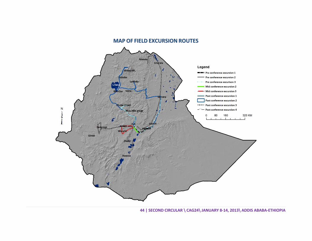
44 | SECOND CIRCULAR \ CAG24\ JANUARY 8‐14, 2013\ ADDIS ABABA‐ETHIOPIA
MMAAPP OOFF FFIIEELLDD EEXXCCUURRSSIIOONN RROOUUTTEESS

45 | SECOND CIRCULAR \ CAG24\ JANUARY 8‐14, 2013\ ADDIS ABABA‐ETHIOPIA
DDEESSCCRRIIPPTTIIOONN OOFF FFIIEELLDD EEXXCCUURRSSIIOONNSS
Main Ethiopian Rift:Fentale volcano (background) and historical basaltic lava flows
PPRREE‐‐CCOONNFFEERREENNCCEE EEXXCCUURRSSIIOONN 11.. TTHHEE MMAAIINN EETTHHIIOOPPIIAANN RRIIFFTT (January 6‐7/2013)
Leaders:
Dr. Bekele Abebe, School of Earth Sciences, Addis Ababa University, Ethiopia ([email protected])
Dr. Giday Woldegabriel, Los Alamos National Laboratory, USA ([email protected]) January 6/2013 (Day 1): Addis Ababa‐Awash Stop 1: Visit three Maar Lakes (subterranean explosion crater lakes) namely Bishoftu, Hora,
Babogaya and an artificial Maar depression filling reservoir of Kuriftu by driving and walking around the Lake.
Stop 2: Between Mojo and Nazret: observe prominent normal fault features resulting in horst and grabens.
Stop 3: Just after Wolenchiti observe en echelon faults of the Wonji Fault Belt and while driving along the road observe the volcano segments of Boseti and Fentale.
Stop 4: Kone volcanic complex‐observe nested caldera features, ash fall deposits, spatter cones and very recent lava flows.
Stop 5: Metahara: a) observe Fentale volcano (active volcano, last eruption in 1820) and the EW elongated caldera, b) observe active normal faults within the rift axis and their formation. Discuss the tectonic significance of the active normal faults (tension cracks); c) observe the blister caves (the Metehara blister cave field is the largest in the world). Night in Awash Park.
January 7/2013 (Day 2): Awash‐Addis Ababa Stop 1: Observe the geology of Awash National Park (The Awash River falls, Fantale volcano;
Tinishu Fentale, the Welded tuff plain, Blister caves; fissures, Sabober tuff ring, the recent and old lava flows; Lake Beseka and hotsprings) and its fauna.
Stop 2, 3 and 4: Sodere thermal springs and recreation (in a thermal water‐fed swimming pool).
Additional details in: F. Williams (2006) Geology of the Awash National park.

46 | SECOND CIRCULAR \ CAG24\ JANUARY 8‐14, 2013\ ADDIS ABABA‐ETHIOPIA
Main Ethiopian Rift: Ziquala Silicic centre
PPRREE‐‐CCOONNFFEERREENNCCEE EEXXCCUURRSSIIOONN 22.. QQUUAATTEERRNNAARRYY PPAALLAAEEOOEENNVVIIRROONNMMEENNTT AANNDD GGEEOOMMOORRPPHHOOLLOOGGYY IINN TTHHEE MMAAIINN EETTHHIIOOPPIIAANN RRIIFFTT
(January 5‐7/2013)
Leaders: Dr. Balemwal Atnafu, Addis Ababa University, Ethiopia ([email protected]) Dr. Agazi Negash, Palaeoanthropology and Palaeoenvironment Program, Addis Ababa
Unviersity, ([email protected]) January 5/2013 (Day 1): Addis Ababa‐Butajira –Ziway Stop 1: Guided tour of Melka Kunture Archeological Site (famous Paleolitic site). Stop 2: Visit Tiya Stelae site (a UNESCO World Heritage site). Stop 3: Observe foothills of the Gurage Mountains and associated marginal grabens; at
Butajira discuss geologic and tectonic features and evolution of the rift. Stop 4: Observe the Siltie Debrezeyit tectonic features (horst and graben structures and
faults) with stop at Koshe town. Stop 5: Stop at Gademota vantage point and observe the rift floor and associated Lakes,
Lake sediments and volcanic products and associated volcano‐tectonic structures. Night in Ziway January 6/2013 (Day 2): Ziway‐Hawassa Stop 1: Observe Paleo Lake strandlines around western Ziway caldera or Meki. Stop 2: Observe the Bulbula River section south of Adami Tulu and walk down to the river
floor to see the Holocene and Pre‐Holocene surfaces and the volcanic products at the Lake sediments.
Stop 3: Observe the Bulbula section at Bulbula Bridge. A section widely documented for its record of Holocene and Pre‐Holocene Lake Level fluctuations.

47 | SECOND CIRCULAR \ CAG24\ JANUARY 8‐14, 2013\ ADDIS ABABA‐ETHIOPIA
Stop 4: At the Abiyata‐Shalla National Park, observe two of the Lakes (Langano and Shalla) and thermal springs at closer distance; walk down to Lake Shalla and see the Lake, thermal springs and the Ajewa lake sediment section.
Stop 5: At Langano‐Arsi Negele vantage point observe the four rift valley Lakes and discuss the history of Lake Level fluctuation and its paleo‐climate significance.
Stop 6: Observe Lake Hawassa: Balchi volcano, fumeroles and thermal springs in the Lake Hawassa caldera.
Night in Hawassa January 7/2013 (Day 3): Hawassa‐Addis Ababa Stop 1: Visit Wondogent thermal springs; Landslide features in rift margins, and from a
vantage point observe the Lake Hawasa Caldera. Stop 2: Observe ground fissures in soft sediments between Meki and Ziway; discuss their
origin and significance. Stop 3: Lake Koka area and associated agro‐business development; observe the prominent
Ziquala central volcano. Stop 4: Observe Maar Lakes and Maar depressions of Bishoftu, discuss their hydrology and
paleoclimate significance as well as their water resources significance. Night in Addis Ababa.

48 | SECOND CIRCULAR \ CAG24\ JANUARY 8‐14, 2013\ ADDIS ABABA‐ETHIOPIA
Hominid fossil bearing sediments and tuffs from Woranso‐Mille, Afar
PPRREE‐‐CCOONNFFEERREENNCCEE EEXXCCUURRSSIIOONN 33.. PPAALLAAEEOOAANNTTHHRROOPPOOLLOOGGIICCAALL SSIITTEESS ((HHUUMMAANN
OORRIIGGIINNSS AANNDD PPAALLEEOOEENNVVIIRROONNMMEENNTT)) (January 4‐7/2013)
Leaders:
Dr. Yohannes Haile‐Selassie, Cleveland Museum of Natural History, USA ([email protected])
Dr. Berhane Asfaw, Rift Valley Research Center, Addis Ababa, Ethiopia ([email protected])
Dr. Mulugeta Alene, School of Earth Sciences, Addis Ababa University, Ethiopia ([email protected])
January 4, 2013 (Day 1): Addis Ababa‐Semera The group will leave Addis Ababa early in the morning and spend a night in Semera, the capital of the Afar Regional State. January 5, 2013 (Day 2): Semera –Weranso Mille‐Semera The group will leave Semera early in the morning and drive to the Woranso‐Mille study area. The first stop will be at the locality where “Kadanuumuu” was discovered. This will be followed by a visit to the localities on the north side of the Mille River. The group will drive back to Semera at the end of the day. January 6, 2013 (Day 3): Semera‐Hadar‐Semera The group will leave Semera early in the morning and drive to Hadar via Eliwoha. The first stop will be at the new Hadar town followed by a trip to the locality where Lucy was found. At the end of the tour, the group will drive back to Semera. January 7, 2013 (Day 4): Semera‐Addis Ababa The group will leave Semera for Addis Ababa and that will be the end of the trip.

49 | SECOND CIRCULAR \ CAG24\ JANUARY 8‐14, 2013\ ADDIS ABABA‐ETHIOPIA
A crater lake (Maar) in Debre Zeit; the Yerer silicic centre at the background
MMIIDD‐‐CCOONNFFEERREENNCCEE EEXXCCUURRSSIIOONN 22.. GGEEOOLLOOGGYY OOFF AADDDDIISS AABBAABBAA AANNDD VVOOLLCCAANNIICC MMOORRPPHHOOLLOOGGYY (January 11/2013)
Leader:
Prof. Gezahegn Yirgu, School of Earth Sciences, Addis Ababa University, Ethiopia ([email protected])
Dr. Tadewos Chernet, Geological Survey of Ethiopia Dr. Dereje Ayalew, School of Earth Sciences, Addis Ababa University, Ethiopia
([email protected]) January 11/2013: Addis Ababa‐Debre Zeit‐Addis Ababa Stop 1: At Entoto (rift shoulder): observe the Addis Ababa rift embayment; the various
volcanic landforms such as central volcanoes (Ziquala; Yerer, Wachaca, Furi), scoria cones alignments and observe the city of Addis Ababa and its landscapes and extents; Visit the famous 20th century seat of Ethiopian King Menelik at Entoto; Visit the Filwuha thermal springs and discuss their origin.
Stop 2: At Dukem observe closely the Ziquala central volcano and Yerer volcano; observe the scoria cones and spatter cones dotting the area; discuss their significance.
Stop 3: Visit three Maar Lakes (subterranean explosion crater lakes) namely Bishoftu, Hora, Babogaya and an artificial Maar depression filling reservoir of Kuriftu by driving and walking around the Lake; some of the Maar lakes have been cored and some of them returned annually laminated lake sediments which contributed to high resolution palaeoclimate reconstruction; the Lakes are groundwater fed; discuss classic example of isotope hydrology based investigation of the hydrology of the Lakes.

50 | SECOND CIRCULAR \ CAG24\ JANUARY 8‐14, 2013\ ADDIS ABABA‐ETHIOPIA
The Wonchi Caldera
MMIIDD‐‐CCOONNFFEERREENNCCEE EEXXCCUURRSSIIOONN 33.. WWOONNCCHHII VVOOLLCCAANNOO AANNDD TTHHEERRMMAALL SSPPRRIINNGGSS (January 11/2013)
Leader:
Dr. Seifu Kebede, School of Earth Sciences, Addis Ababa University, Ethiopia ([email protected])
Dr. Tsegaye Abebe ([email protected]) January 11/2013: Addis Ababa‐Ambo‐Wonchi‐Woliso‐Addis Ababa Stop 1: At Ambo, 125 Km west of Addis Ababa, visit the unique naturally sparkling thermal
springs; springs emerging at the foothill of the Wonchi Volcano are CO2 rich, mildly acidic but with high HCO3 content. Discuss carbonate disequilibria in the thermal waters; observe associated travertine deposits (active and relict). Origin of the thermal springs relate to heating from dykes that have produced the Wonchi volcano, CO2 gas coming from metamorphic de‐carbonation of underlying Mesozoic sediments. Significance of the springs in understanding the Impacts of carbon capture and storage has been noted.
Stop 2: At a vantage point at Altufa (10 Km along Ambo Woliso road) observe the E‐W running Ambo fault (500 meter throw) and having similar orientation as the southern Margin of the Afar rift and Gulf of Aden Rift.
Stop 3: From the summit of Wonchi volcano (3500 m asl), observe the beautiful and spectacular landscape of the rim of the volcano.
Stop 4: At another point observe the lake, its monasteries and spectacular landscape; observe the Afro‐Alpine trees near the apex of the Wonchi volcano; discuss about the bathymetry of the Lake, its hydrology, observe landslide scars and drowned trees.
Stop 5: At Darian, walk 2 Kms and observe active deposition of silica and iron oxide associated with thermal springs and discuss its significance in understanding carbon capture and storage impact.
Stop 6: At Woliso ‐ Negash Lodge, observe basalt dykes and associated thermal waters; on the way to Addis, short stop at Awash Bridge to observe the Becho plain and headwaters of the Awash River (the only inland drainage in Ethiopia).

51 | SECOND CIRCULAR \ CAG24\ JANUARY 8‐14, 2013\ ADDIS ABABA‐ETHIOPIA
The Blue Nile Gorge
PPOOSSTT‐‐CCOONNFFEERREENNCCEE EEXXCCUURRSSIIOONN 11.. TTHHEE BBLLUUEE NNIILLEE GGOORRGGEE (January 15‐16/2013)
Leaders: Prof. Mohamed G. Abdelsalam, Department of Geological Science & Engineering,
Missouri University of Science and Technology, USA ([email protected]) Dr. Dawit Lebenie, Gondar University, Ethiopia ([email protected])
January 15/2013 (Day 1): Addis Ababa‐Debre Markos Stop 1: At Debrelibanos observe the Jema valley section; Portugese bridge of 17th Century,
visit Debrelibanos monastery and its historical significance. Stop 2: From vantage point at Goha Tsion, observe the spectacular Blue Nile Canyon (second
largest next to the famous Colorado Canyon and first in Africa). Discuss the Mesozoic sedimentary section from at the vantage point.
Stop 3: With short stops at various localities, observe closely and rapidly the sedimentary sections, associated fossils, sedimentary structures.
Stop 4: On the way to Dejen, observe the mega Landslide body and its significance for road construction and its implication to desiccation of the Blue Nile Plateau.
January 16/2013 (Day 2): Debre Markos – Addis Ababa Stop 1: Drive up the Choke Shield volcano, 40 Km east of Debre Markos, and observe the
geologic history of the shield volcano, inter‐Trappean sediments. Stop 2: On Dejen plain, observe volcanic soils (black cotton soils) and discuss their
significance in civilization of the Nile Valley.
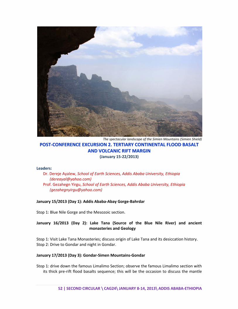
52 | SECOND CIRCULAR \ CAG24\ JANUARY 8‐14, 2013\ ADDIS ABABA‐ETHIOPIA
The spectacular landscape of the Simien Mountains (Simien Shield)
PPOOSSTT‐‐CCOONNFFEERREENNCCEE EEXXCCUURRSSIIOONN 22.. TTEERRTTIIAARRYY CCOONNTTIINNEENNTTAALL FFLLOOOODD BBAASSAALLTT AANNDD VVOOLLCCAANNIICC RRIIFFTT MMAARRGGIINN
(January 15‐22/2013) Leaders:
Dr. Dereje Ayalew, School of Earth Sciences, Addis Ababa University, Ethiopia ([email protected])
Prof. Gezahegn Yirgu, School of Earth Sciences, Addis Ababa University, Ethiopia ([email protected])
January 15/2013 (Day 1): Addis Ababa‐Abay Gorge‐Bahrdar Stop 1: Blue Nile Gorge and the Mesozoic section. January 16/2013 (Day 2): Lake Tana (Source of the Blue Nile River) and ancient
monasteries and Geology Stop 1: Visit Lake Tana Monasteries; discuss origin of Lake Tana and its desiccation history. Stop 2: Drive to Gondar and night in Gondar. January 17/2013 (Day 3): Gondar‐Simen Mountains‐Gondar Stop 1: drive down the famous Limalimo Section; observe the famous Limalimo section with
its thick pre‐rift flood basalts sequence; this will be the occasion to discuss the mantle

53 | SECOND CIRCULAR \ CAG24\ JANUARY 8‐14, 2013\ ADDIS ABABA‐ETHIOPIA
plume related volcanic eruption history that led to the plateau formation by erupting flood basalts and uplifting basement; observe spectacular erosional landscape.
Stop 2: Visit Simien Mountains National Park, a world Heritage site with spectacular erosional landscape; watch endemic fauna of Ethiopia (Ethiopian Wolf, Gelada Baboons and Walia Ibex).
January 18/2013 (Day 4): Gondar‐Lalibela Stop 1, 2, and 3: On the way to Lalibela observe and discuss desiccation history of the Nile and Tekeze rivers; observe volcanic landscapes and stratigraphy of the Ethiopian Plateau. January 19/2013 (Day 5): Lalibela‐Woldia Stop 1: Visit Lalibela rock hewn churches, excavated into scoriaceous basalts. The churches
are UNESCO World Heritage Sites; holiest places which attract pilgrims thoughout the year particularly in December during the Ethiopian Christmas.
Stop 2: Marginal Graben: observe marginal graben of Kobo and discuss its tectonic evolution.
January 20/2013 (Day 6): Woldia‐Haik‐Semera Stop 1, 2, 3: Selected stops on a traverse down into the Afar depression with time to discuss the morphotectonic evolution of the marginal graben, the structure, preservation and dissection of the flexure margin, the syn‐rift volcanic and Afar depression basins. January 21/2013 (Day 7): Semera‐Awash Stop 1: Observe the Afar Rift active magmatic segment and discuss the structure and
petrology of the stratoid volcanic formation. Stop 2: Visit the famous Awash River Valley and associated hominid fossil bearing
formations and the famous site where Australopiticus Afarenis (3.2 million years) has been discovered in 1974.
Night in Awash Park January 22/2013 (Day 8): Awash‐Addis Ababa Stop 1: Observe Awash National Park and its fauna. Stop 2, 3 and 4: Observe structures and volcanism associates with normal faults of the
Fentale, Kone and Bosetic magmitc segments.

54 | SECOND CIRCULAR \ CAG24\ JANUARY 8‐14, 2013\ ADDIS ABABA‐ETHIOPIA
Yubdo dunite‐brbirite complex
PPOOSSTT‐‐CCOONNFFEERREENNCCEE EEXXCCUURRSSIIOONN 33.. TTHHEE PPRREECCAAMMBBRRIIAANN GGEEOOLLOOGGYY AANNDD AASSSSOOCCIIAATTEEDD MMIINNEERRAALLIIZZAATTIIOONNSS OOFF WWEESSTTEERRNN EETTHHIIOOPPIIAA
(January 15‐19/2013) Leaders:
Mr. Tadesse Alemu, Geological Survey of Ethiopia, Ministry of Mines, Ethiopia ([email protected])
Dr. Kebede Hailu, NYOTA Minerals, Ethiopia ([email protected]) January 15/2013 (Day 1): Addis Ababa‐Nekemte Leave Addis Ababa after breakfast for Nekemte. Some stops in between for refreshment. Overnight stay at Nekemte January 16/2013 (Day 2): Nekemte‐Gimbi‐Inango‐Daleti Stops at exposures of different migmatites and appreciate the migimatization process from early up to complete stage where rocks melted with formation of granites. Observe and discuss about the NW‐trending Didesa Shear Zone and make observations on how strain partitioned from brittle deformation to ductile deformation. Departure from Nekemte early morning; Stop 1: Didesa Bridge; Stop 2: Abasina village; Stop 3: Ihud Gebeya; Lunch in Gimbi; Stop 4: Inango; Stop 5: Daleti; Overnight stay at Gimbi.

55 | SECOND CIRCULAR \ CAG24\ JANUARY 8‐14, 2013\ ADDIS ABABA‐ETHIOPIA
January 17/2013 (Day 3): Gimbi‐Homa‐Ganjii‐Tulu Kapii‐Yubdo‐Guliso Stops at exposures of the 780‐760 Ma old Homa peralkaline granitic gneiss (older anorogenic granitoid magmatism in the Precambrian basement of western Ethiopia); the Ganjii monzogranite (the younger within‐plate granitoid emplaced at ca. 620‐625 Ma); Tulu Kapii syenite; the Yubdo mafic‐ultramafic rocks and associated PGE mineralization; the Guliso metasediments. Departure from Gimbi early morning; Stop 1: Homa area to visit the exposures of granitic gneiss; Stop 2: Ganjii village to visit exposures of Ganjii granitoids; Stop 3: Tulu Kapii area to see the gold mineralization associated with the syenite intrusives and pay a visit to the on‐going gold mining activities in the area conducted by NYOTA Minerals Ltd.; Lunch in Tulu Kapii; Stop 4: Yubdo mafic‐ultramafic complexes and a visit to Platinum mining site; Stop 5: Guliso metasediments; Overnight stay in Guliso. January 18/2013 (Day 4): Guliso‐Bila‐Tulu Dimtu‐Kemeshi‐Agelo Meti Stops to visit critical exposures of Abshala mélanges and the Tulu Dimtu thrust‐fold belt. The Tulu Dimtu thrust‐fold belt is a prominent deformational belt which is comprised of a NNE‐trending fold and thrust/shear belt overprinted by a NW‐SE strike‐slip faults/shear zones. It is characterized by a variety of lithological units, including metamorphosed volcanic, volcaniclastic and sedimentary successions with associated mafic‐ultramafic rocks of probable ophiolitic origin, and granitoid intrusives. Departure from Guliso early morning; Stop 1: Kemeshi junction to Tulu Dimtu road section; to see the relationships between the Guliso formation and the Tulu Dimtu mafic‐ultramafic rocks. To demonstrate the lithological association of the Abshala mélanges; Stop 2: Abshala River to see the tectonics of the Abshala mélanges, and climb the Tulu Dimtu hill to see the serpentinized dunite and associated chromium and nickel mineralization; Box lunch somewhere on the Tulu Dimtu hill; Stop 3: Sayi river; visit exposures of basic metavolcanics, which are variably sheared and deformed; Stop 4: Agelo Meti area; to visit outcrops showing fold and thrust structures; Overnight stay in Nejo. January 18/2013 (Day 5): Nejo‐Addis Ababa Arrival at Addis Ababa and transfer to Hotel.

56 | SECOND CIRCULAR \ CAG24\ JANUARY 8‐14, 2013\ ADDIS ABABA‐ETHIOPIA
Erta’ale volcanic lake
PPOOSSTT‐‐CCOONNFFEERREENNCCEE EEXXCCUURRSSIIOONN 44.. AAFFAARR RRIIFFTT GGEEOODDYYNNAAMMIICCSS,, EERRTTAA’’AALLEE AACCTTIIVVEE VVOOLLCCAANNOO AANNDD DDAALLLLOOLL
(January 15‐22/2013) Leaders:
Dr. Tesfaye Kidane, School of Earth Sciences, Addis Ababa University, Ethiopia ([email protected] )
January 15/2013 (Day 1): Addis Ababa‐Awash Departure early morning from Hotel and drive to Awash; a break in Debre Zeit (Bishoftu) to visit some maar craters and stop over for lunch in Nazareth (Adama); stop 1 at Kone Caldera; stop 2 at Beseka Lake, at the foot of Fantale volcano, close to Metehara, and short walk to see some of the open normal faults; overnight in Awash National Park (at the Awash Fall Lodge ideally situated close to the Awash fall).
January 16/2013 (Day 2): Awash‐Semera Early morning: visit in the Awash National Park; drive to Semera after breakfast; stop 1: MER margin fault; Lunch in Gewane; stop 2: Afar Stratoid exposure; stop 3: SW Tendaho Graben (close to the Tendaho Dam); overnight in Semera. January 17/2013 (Day 3): Semera‐Afdera Drive towards Afdera (after breakfast and some official arrangements in Semera); a short stop at Serdo village (which has been destroyed by the 1969 Earthquake of magnitude 5.9); stop 1: NE border of Tendaho Graben; top 2: Manda Hararo Rift; Stop over for lunch at Silsa; visit the Afdera Salt Mining site; overnight in Afdera (camp at the lake shore).

57 | SECOND CIRCULAR \ CAG24\ JANUARY 8‐14, 2013\ ADDIS ABABA‐ETHIOPIA
January 18/2013 (Day 4): Afdera‐Erta’ale After breakfast and official arrangements leave for Erta’ale; stop over at Kusowad among the basalts for lunch and arrange for camels and guides; drive to the base of Erta’ale; climb to the Erta’ale summit on foot starting late afternoon; set camp on Erta’ale summit and dinner. January 19/2013 (Day 5): Erta’ale Erta’ale visit (the main crater, the southern crater, walking around the summit, etc.); overnight in Erta’ale camp.
January 20/2013 (Day 6): Erta‘ale‐Hamedella After breakfast descent from Erta’ale camp to base camp rejoining the vehicles and drive to Hamedella (Dallol); overnight in Hamedella (camp). January 21/2013 (Day 7): Dallol‐Mekelle Visit of the Dallol area in the morning (Dallol volcano, salt caravans, etc.); have a lunch box in Dallol; drive towards Mekele in the afternoon; overnight in Mekelle. January 22/2013 (Day 8): Mekelle‐Addis Ababa Transfer to Mekele Airport; flight back to Addis Ababa; on Arrival at Addis Ababa transfer to Hotel.

58 | SECOND CIRCULAR \ CAG24\ JANUARY 8‐14, 2013\ ADDIS ABABA‐ETHIOPIA
GGSSAAff AANNNNOOUUNNCCEEMMEENNTT
AANNNNOOUUNNCCEEMMEENNTT FFOORR CCAAGG2255 BBIIDD BBYY AA EEUURROOPPEEAANN CCOOUUNNTTRRYY
The Colloquium of African Geology takes place every two years. The last one (CAG23) was in Jan. 2011 at the University of Johannesburg, South Africa. At that time Ethiopia won the bid and the CAG24 is being organized by the Ethiopian Geoscience and Mineral Engineering Association (EGMEA) under the auspices of the GSAf, and will take place at the UNECA Conference Center in Addis Ababa, Ethiopia in January 2013. Traditionally it was necessary to have the Colloquium within the 2 years period. However, because of the world soccer games in July 2010 which was held in South Africa, it was postponed from July 2010 to January 2011 and as a result the coming Colloquium is also set for January 2013. The present GSAf Council is elected to serve until the end of the Colloquium (CAG24) and it will present itself for re‐election or new council members (partly) will replace it during an election that will be conducted during the 14th Conference of the Geological Society of Africa, which should also take place during the Colloquium. According to our constitution and the decision of the General Assembly of the GSAf at a meeting held during the 13th Conference of the GSAf in Johannesburg, the next Colloquium (CAG25) will take place in Europe in 2015 (if we keep the two year term) or a bit earlier during the summer (in 2014). Therefore, we would like to inform all our European members and institutions about the possibility of submitting a bid to organize the next Colloquium. It is important that those who are interested should inform the GSAf president (mogessie@uni‐graz.at) before, 31 July, 2012. Once we know which countries have shown interest, we will ask them to start preparing a detailed bid which will be presented to the GSAf Council members the latest by November 15, 2012. Based on the bids, three countries will be selected to present their bids at the 14th Conference of the Geological Society of Africa during the CAG24 in Addis Ababa, Ethiopia and the members of the GSAf based on the bid presentation will make the final decision.