scope of remote sensing in earth science of remote s… · hydrocarbon exploration ......
TRANSCRIPT

Scope of Remote Sensing Scope of Remote Sensing
in Earth Sciencein Earth Science
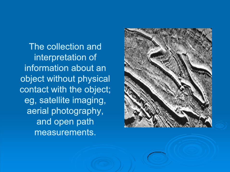
The collection and The collection and
interpretation of interpretation of
information about an information about an
object without physical object without physical
contact with the object; contact with the object;
eg, satellite imaging, eg, satellite imaging,
aerial photography, aerial photography,
and open path and open path
measurements.measurements.

Satellite remote Satellite remote
sensing has sensing has
become a common become a common
tool to investigate tool to investigate
the different fields the different fields
of Earth and of Earth and
environmental environmental
sciences. sciences.

GEOLOGYGEOLOGY

Remote sensing is Remote sensing is used as a tool to used as a tool to extract information extract information about the land surface about the land surface structure, composition structure, composition or subsurface, but is or subsurface, but is often combined with often combined with other data sources other data sources providing providing complementary complementary measurements. measurements.

Remote sensing is not Remote sensing is not
limited to direct geology limited to direct geology
applications applications -- it is also it is also
used to support logistics, used to support logistics,
such as route planning for such as route planning for
access into a mining area, access into a mining area,
reclamation monitoring, reclamation monitoring,
and generating basemaps and generating basemaps
upon which geological upon which geological
data can be referenced or data can be referenced or
superimposed.superimposed.

Geological applications of remote sensing include the Geological applications of remote sensing include the following:following:
surficial deposit / bedrock mapping surficial deposit / bedrock mapping
lithological mapping lithological mapping
structural mapping structural mapping
sand and gravel (aggregate) exploration/ exploitation sand and gravel (aggregate) exploration/ exploitation
mineral exploration mineral exploration
hydrocarbon exploration hydrocarbon exploration
environmental geology environmental geology
geobotany geobotany
baseline infrastructure baseline infrastructure
sedimentation mapping and monitoring sedimentation mapping and monitoring
event mapping and monitoring event mapping and monitoring
geogeo--hazard mapping and planetary mapping hazard mapping and planetary mapping

Geoenvironmental Geoenvironmental
research can help to research can help to
identify the causes of identify the causes of
these events, point these events, point
the way to the way to
rehabilitation rehabilitation
measures, and lend measures, and lend
support for early support for early
warning systems warning systems

Remote sensing Remote sensing
adds considerably adds considerably
to this research by to this research by
providing a wide providing a wide
variety of sensors variety of sensors
operated from operated from
airborne and airborne and
satellite platforms. satellite platforms.

The GARS Program The GARS Program
of UNESCO and of UNESCO and
IUGS provides a IUGS provides a
means of continually means of continually
investigating the investigating the
geological geological
applicability of applicability of
remoteremote--sensing sensing
techniques. techniques.

The multispectral The multispectral
scanner images scanner images
from the first nonfrom the first non--
meteorological, meteorological,
civilian Earth civilian Earth
observation observation
satellites, the US satellites, the US
LANDSAT series LANDSAT series
launched in 1972 launched in 1972
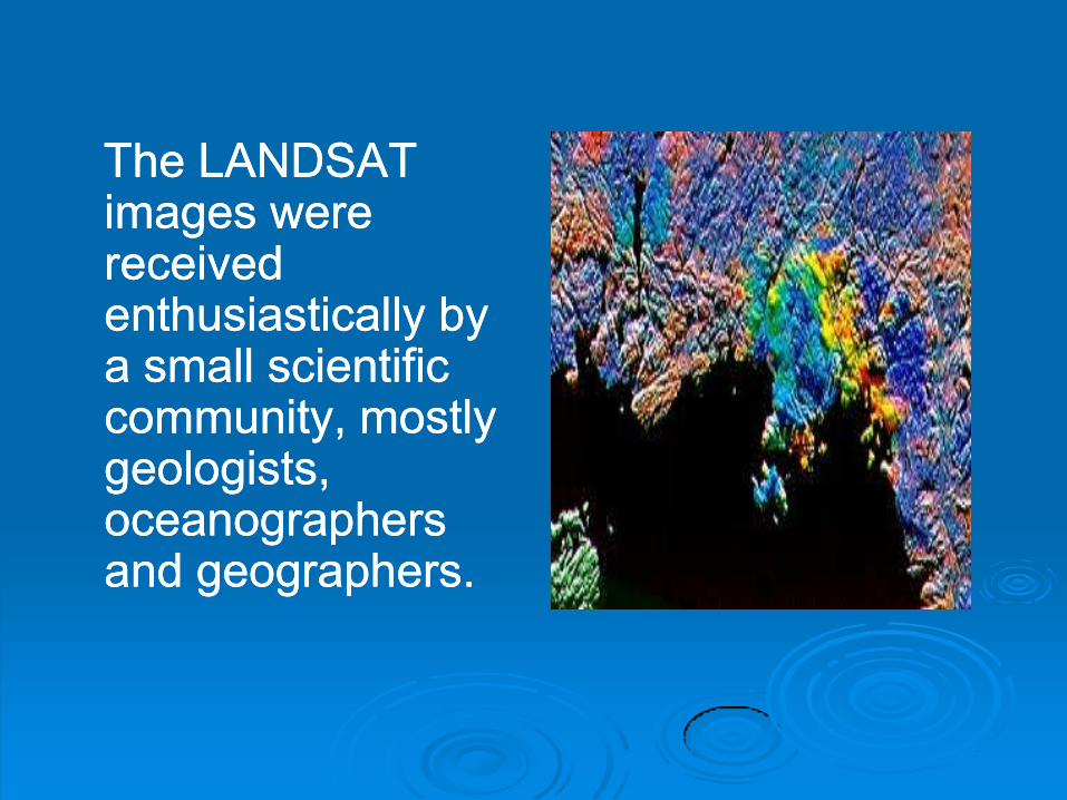
The LANDSAT The LANDSAT images were images were received received enthusiastically by enthusiastically by a small scientific a small scientific community, mostly community, mostly geologists, geologists, oceanographers oceanographers and geographers. and geographers.

The GARS Program, The GARS Program, jointly sponsored by jointly sponsored by UNESCO and IUGS, UNESCO and IUGS, was inaugurated in was inaugurated in 1984 (Weber, 1985) 1984 (Weber, 1985) LANDSATLANDSAT--1,and 1,and LANDSATLANDSAT--4, containing 4, containing Thematic Mapper, was Thematic Mapper, was launched, adding an launched, adding an additional three bands additional three bands in the SWIR (shortin the SWIR (short--wave infrared) to the wave infrared) to the existing visible (VIS) existing visible (VIS) and nearand near--infrared (NIR) infrared (NIR) bands. bands.

Remote sensing has Remote sensing has
become a widely become a widely
accepted research accepted research
tool by almost all tool by almost all
Geological Surveys Geological Surveys
the world over.the world over.


Why remote Why remote
sensing?sensing?

A synoptic view of A synoptic view of
regional scale is a regional scale is a
much different much different
perspective than perspective than
point ground point ground
observations observations
when trying to when trying to
map structural map structural
elementselements. .

Remote sensing Remote sensing offers this offers this perspective and perspective and allows a geologist to allows a geologist to examine other examine other reference ancillary reference ancillary data simultaneously data simultaneously and synergistically, and synergistically, such as geosuch as geo--magnetic magnetic information.information.

Remote sensing gives the overview Remote sensing gives the overview
required to required to
1.Construct regional unit maps, useful for 1.Construct regional unit maps, useful for
small scale analyses, and planning field small scale analyses, and planning field
traverses to sample and verify various traverses to sample and verify various
units for detailed mapping; units for detailed mapping;
2.Understand the spatial distribution and 2.Understand the spatial distribution and
surface relationships between the units. surface relationships between the units.

Remote sensing offers Remote sensing offers
this perspective and this perspective and
allows a geologist to allows a geologist to
examine other examine other
reference ancillary reference ancillary
data simultaneously data simultaneously
and synergistically, and synergistically,
such as geosuch as geo--magnetic magnetic
information.information.

Geologic Unit MappingGeologic Unit Mapping
Mapping geologic Mapping geologic
units consists units consists
primarily of primarily of
identifying identifying
physiographic units physiographic units
and determining the and determining the
rock lithology or rock lithology or
coarse stratigraphy coarse stratigraphy
of exposed units. of exposed units.

Data requirementsData requirements
Two different scales of mapping require slightly Two different scales of mapping require slightly different imaging sources and parameters:different imaging sources and parameters:
1. For site specific analysis, airphotos provide a 1. For site specific analysis, airphotos provide a high resolution product that can provide high resolution product that can provide information on differential weathering, tone, and information on differential weathering, tone, and microdrainage. Photos may be easily viewed in microdrainage. Photos may be easily viewed in stereo to assess relief characteristics. stereo to assess relief characteristics.
2. Regional overviews require large coverage area 2. Regional overviews require large coverage area and moderate resolution. An excellent data and moderate resolution. An excellent data source for regional applications is a synergistic source for regional applications is a synergistic combination of radar and optical images to combination of radar and optical images to highlight terrain and textural information. highlight terrain and textural information.


Today, with each new satellite in space, Today, with each new satellite in space,
some of the previous work has to be some of the previous work has to be
repeated in order to test the new repeated in order to test the new
technologies. This has led to a wider technologies. This has led to a wider
acceptance of remote sensing for acceptance of remote sensing for
geological applications and it has found its geological applications and it has found its
place among the disciplines of the earth place among the disciplines of the earth
sciences. sciences.
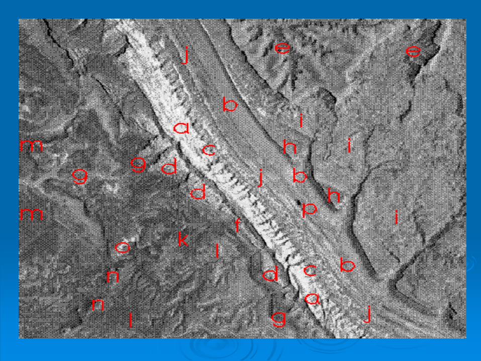
Interpretation of the pictureInterpretation of the picture
The Navajo Sandstone The Navajo Sandstone
((aa) is the brightest single unit in the scene, followed by the valley floor to the ) is the brightest single unit in the scene, followed by the valley floor to the east, much of which is covered by alluvium east, much of which is covered by alluvium
((bb). The Entrada ). The Entrada
((cc) and Wingate ) and Wingate
((dd) Sandstones are notably darker, as is the top surfaces of the Mesaverde ) Sandstones are notably darker, as is the top surfaces of the Mesaverde
((ee). Note that the Wingate "pinches" out along the Fold towards the bottom of ). Note that the Wingate "pinches" out along the Fold towards the bottom of the image, which suggests that its dip steepens making its outcrop pattern the image, which suggests that its dip steepens making its outcrop pattern thinner. The Kayenta Formation thinner. The Kayenta Formation
((ff) is barely discernible in the image as a thin, darker tone, but the Chinle ) is barely discernible in the image as a thin, darker tone, but the Chinle
((gg), also darker, has a wider outcrop pattern, because it is thicker and less ), also darker, has a wider outcrop pattern, because it is thicker and less steeply dipping. The Emery Sandstone steeply dipping. The Emery Sandstone
((hh) has a darker tone than the overlying Masuk Shale ) has a darker tone than the overlying Masuk Shale
((ii) because, in the field, it is dark brown (similar to the Dakota Sandstone seen ) because, in the field, it is dark brown (similar to the Dakota Sandstone seen in the foreground of this picture from the ground).in the foreground of this picture from the ground).

These dark These dark
features are features are
outspillings of salt outspillings of salt
that have been that have been
called "salt called "salt
glaciers". glaciers".

Atlas Mountain system of Atlas Mountain system of northwest Africa northwest Africa

Atlas Mountain system of Atlas Mountain system of
northwest Africa northwest Africa

The white sinuous band against a fold ridge The white sinuous band against a fold ridge
is a dry stream or wadi.is a dry stream or wadi.

These are the highest mountains in Africa and resemble parts of the These are the highest mountains in Africa and resemble parts of the
Alps except that the vegetation is distinctly different.Alps except that the vegetation is distinctly different.

Thank Thank
YouYou