sanjay s. gahlout deputy director general national informatics centre
Post on 19-Dec-2015
220 views
TRANSCRIPT
Sanjay S. GahloutDeputy Director GeneralNational Informatics Centre
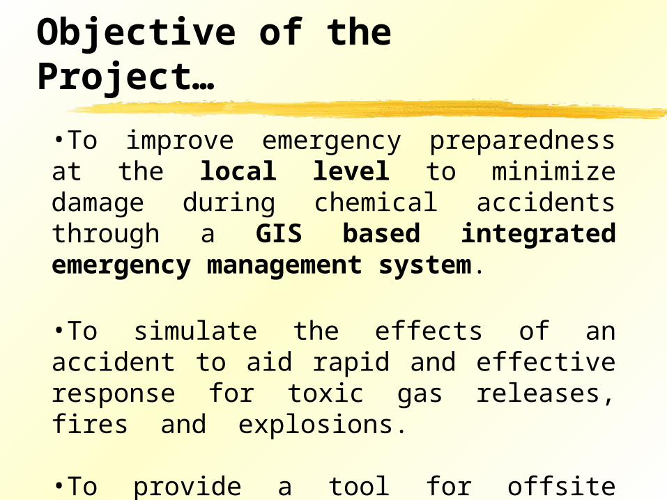
Objective of the Project…
•To improve emergency preparedness at the local level to minimize damage during chemical accidents through a GIS based integrated emergency management system.
•To simulate the effects of an accident to aid rapid and effective response for toxic gas releases, fires and explosions.
•To provide a tool for offsite emergency planning and response.
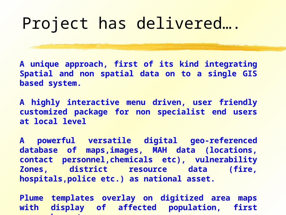
Project has delivered….
A unique approach, first of its kind integrating Spatial and non spatial data on to a single GIS based system.
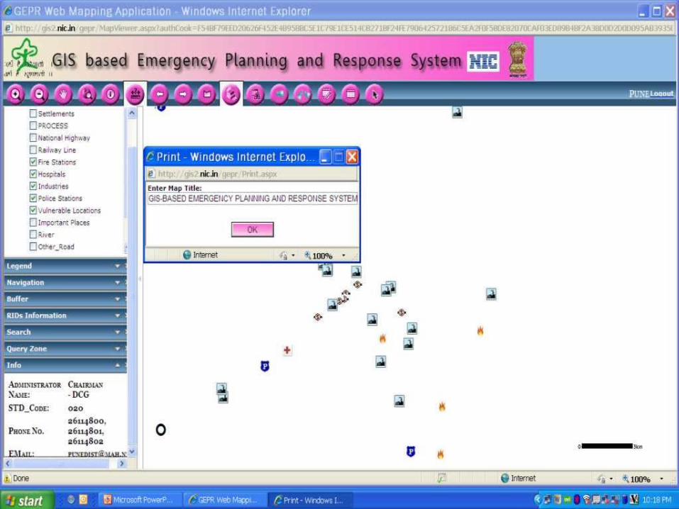
A highly interactive menu driven, user friendly customized package for non specialist end users at local level
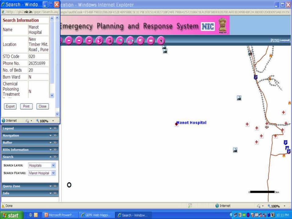
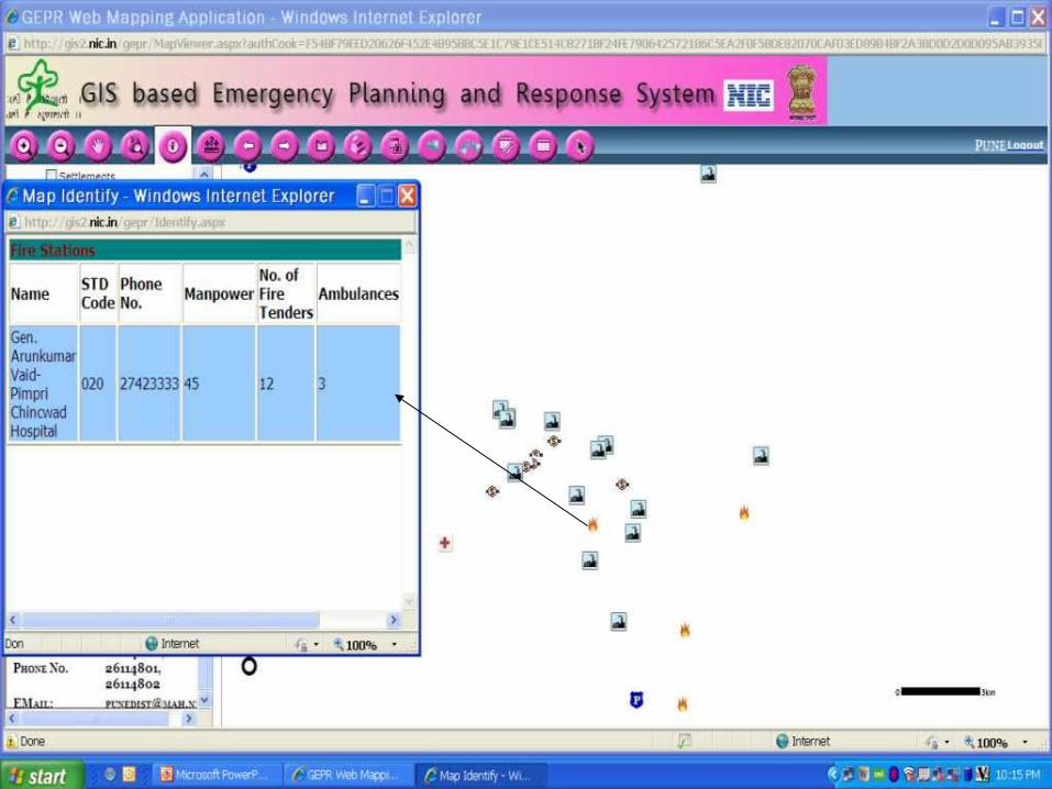
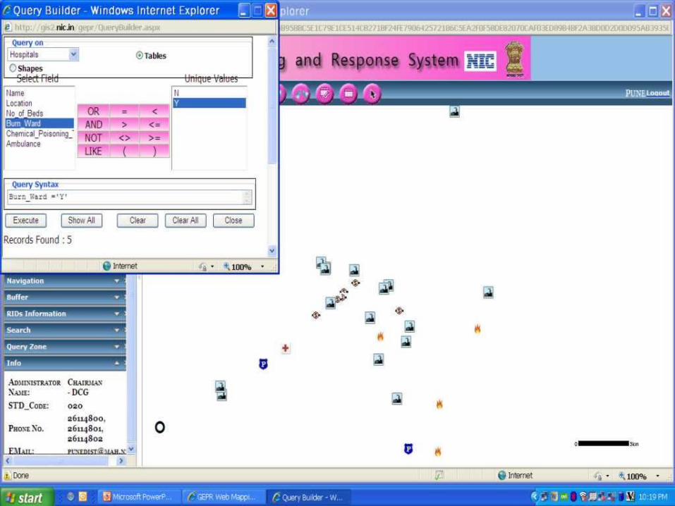
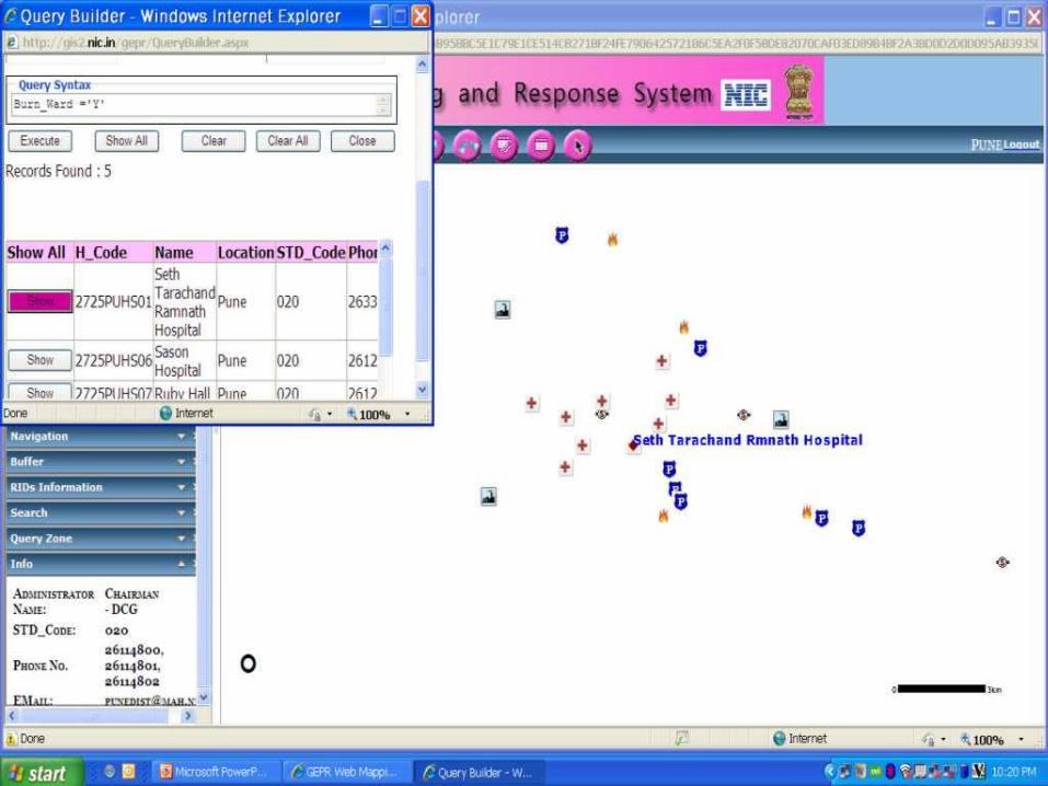
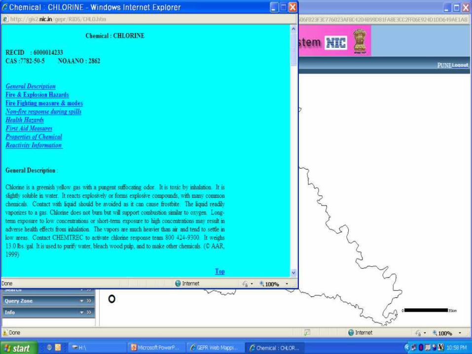
A powerful versatile digital geo-referenced database of maps,images, MAH data (locations, contact personnel,chemicals etc), vulnerability Zones, district resource data (fire, hospitals,police etc.) as national asset.
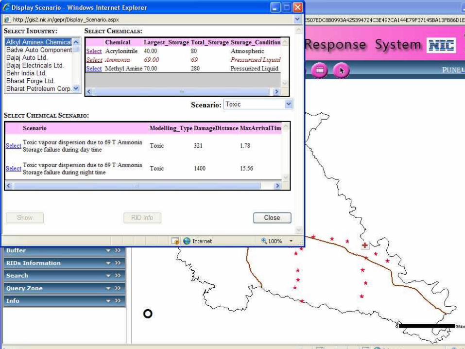
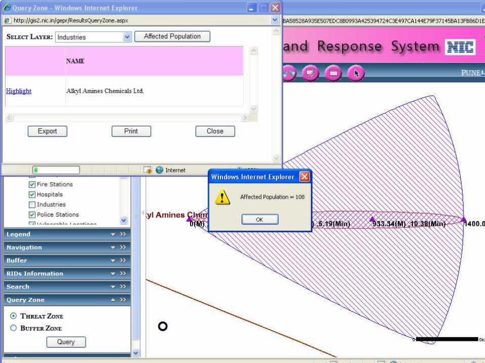
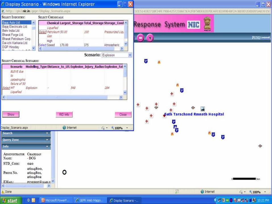
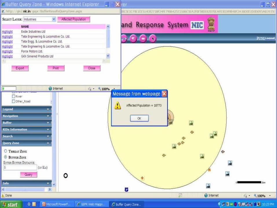
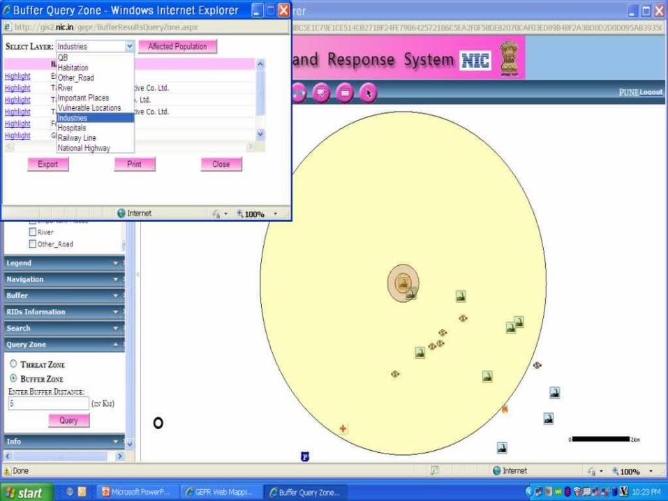
Plume templates overlay on digitized area maps with display of affected population, first responders etc.
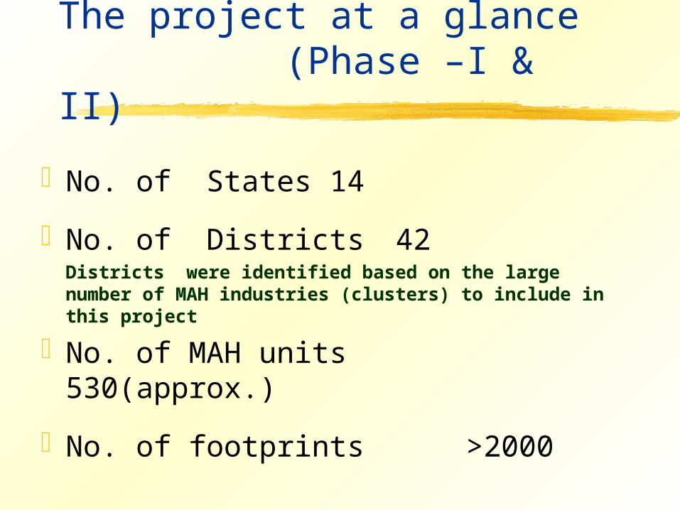
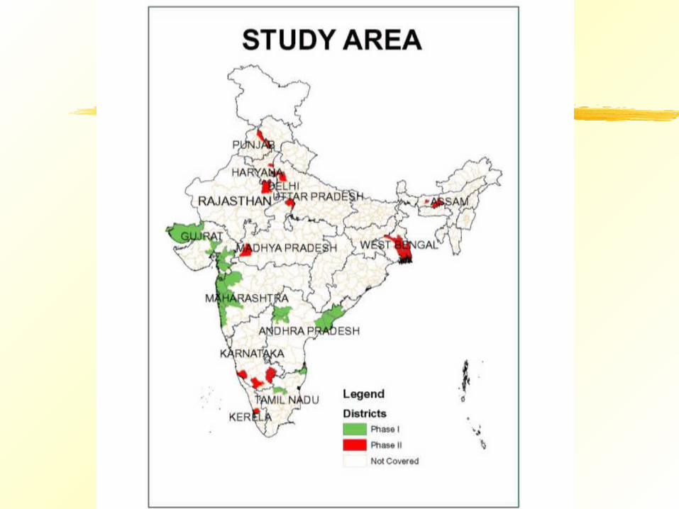
The project at a glance (Phase –I & II)
No. of States 14
No. of Districts 42Districts were identified based on the large number of MAH industries (clusters) to include in this project
No. of MAH units 530(approx.)
No. of footprints >2000
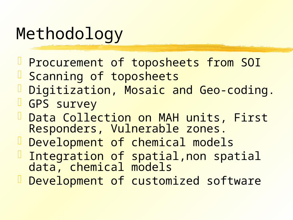
Methodology
Procurement of toposheets from SOIScanning of toposheetsDigitization, Mosaic and Geo-coding.GPS surveyData Collection on MAH units, First
Responders, Vulnerable zones.Development of chemical modelsIntegration of spatial,non spatial data,
chemical models Development of customized software
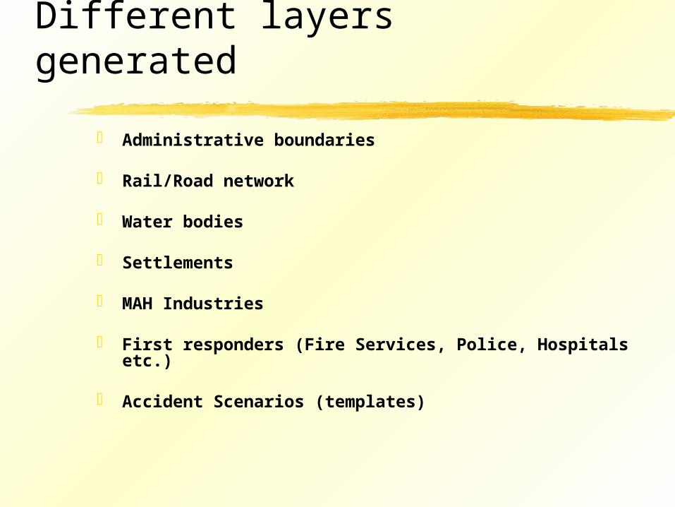
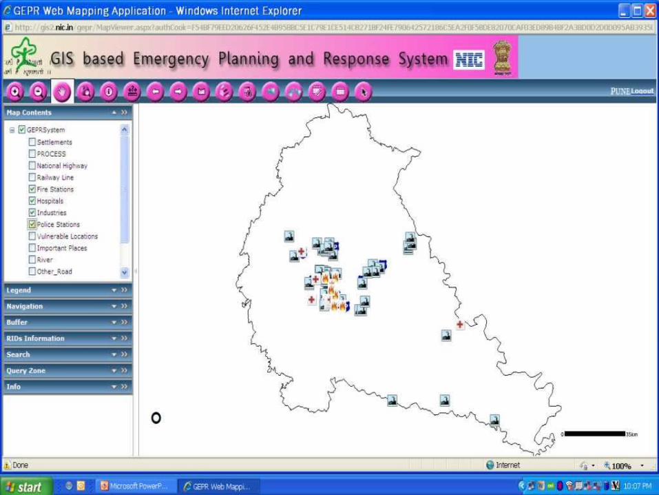
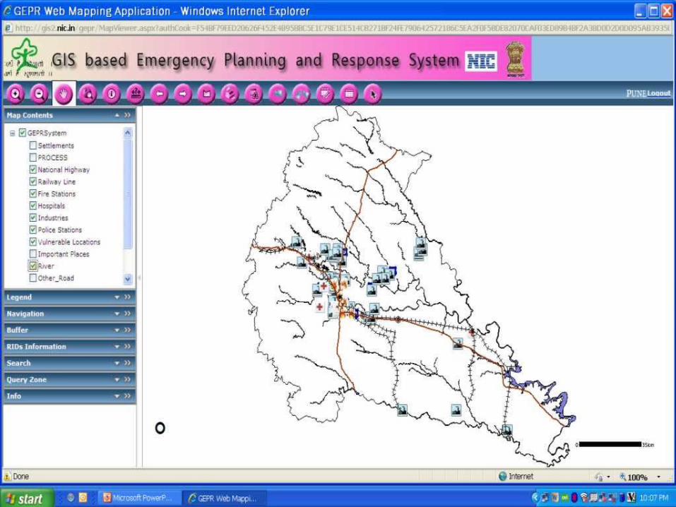
Different layers generated
Administrative boundaries
Rail/Road network
Water bodies
Settlements
MAH Industries
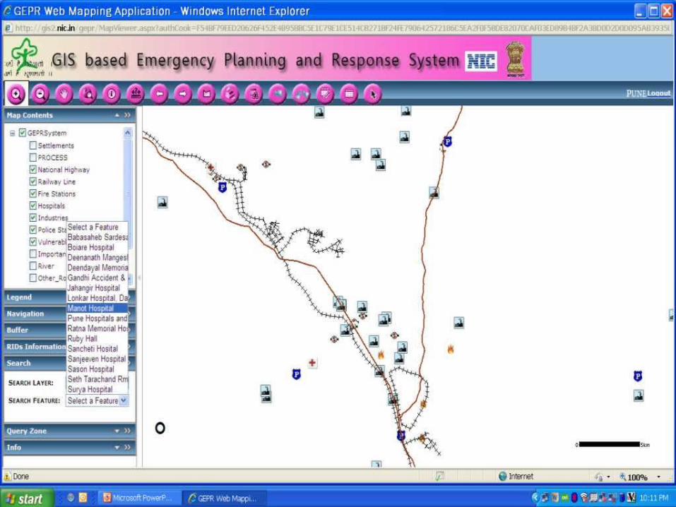
First responders (Fire Services, Police, Hospitals etc.)
Accident Scenarios (templates)
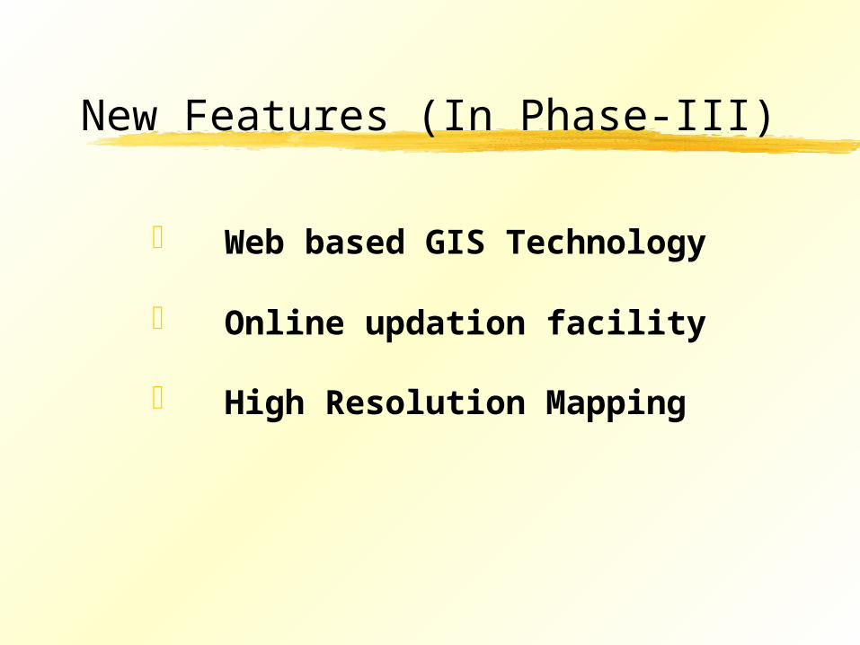
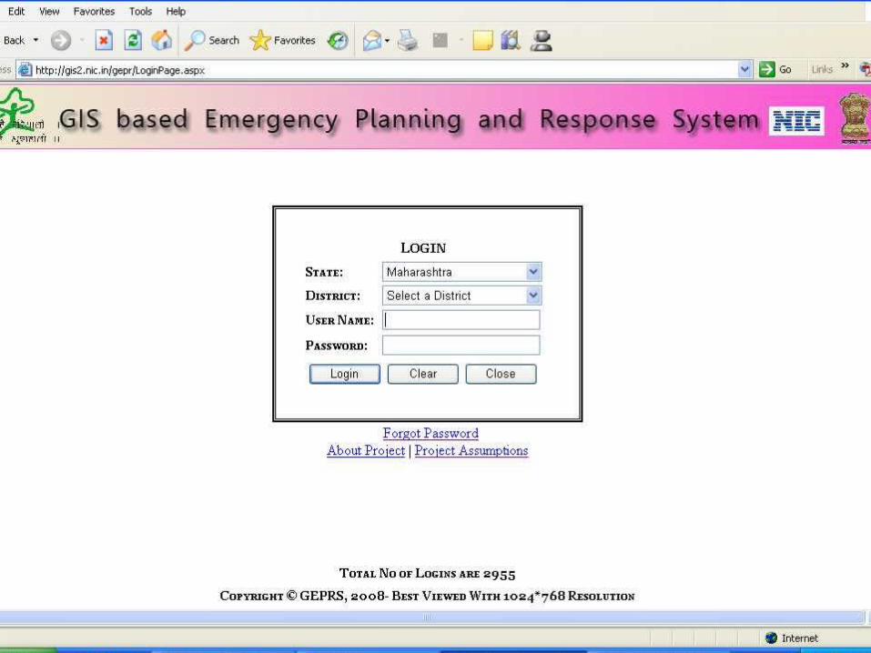
New Features (In Phase-III)
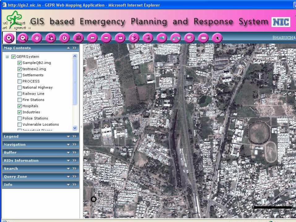
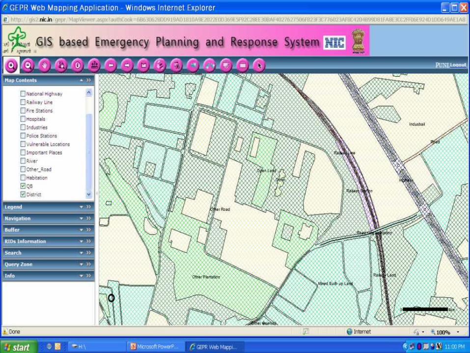
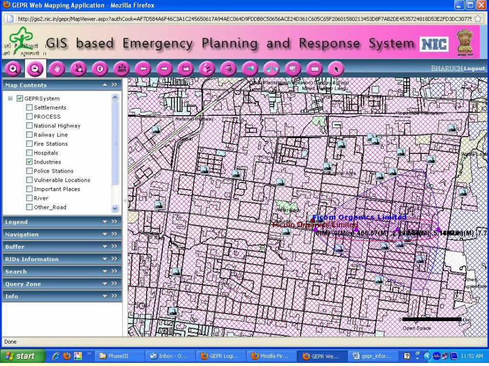
Web based GIS Technology
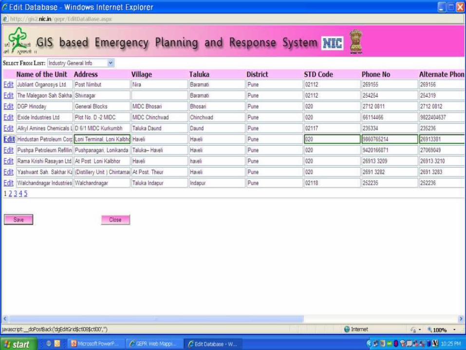
Online updation facility
High Resolution Mapping
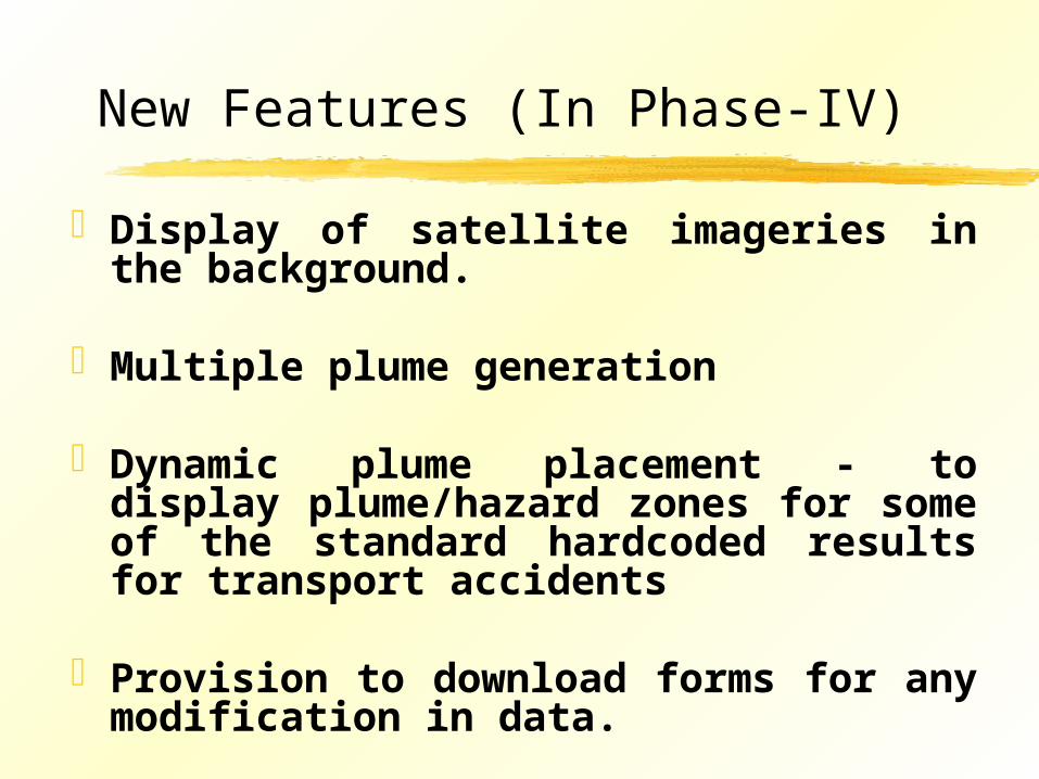
New Features (In Phase-IV)
Display of satellite imageries in the background.
Multiple plume generation
Dynamic plume placement - to display plume/hazard zones for some of the standard hardcoded results for transport accidents
Provision to download forms for any modification in data.