rf analysis in asymmetric warfare - esri
TRANSCRIPT
Air Force Information Operations Center
This Briefing is:
RF Analysis in Asymmetric Warfare
UNCLASSIFIED
Lothar Deil16 Jun 07
Overview
• Traditional RF Analysis – IMOM Engineer Software
• Map based displays• The Geospatial Leap• Examples• Conclusion
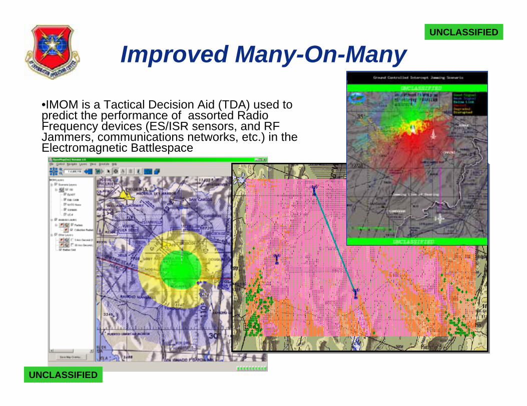
Improved Many-On-Many
•IMOM is a Tactical Decision Aid (TDA) used to predict the performance of assorted Radio Frequency devices (ES/ISR sensors, and RF Jammers, communications networks, etc.) in the Electromagnetic Battlespace
UNCLASSIFIED
UNCLASSIFIED
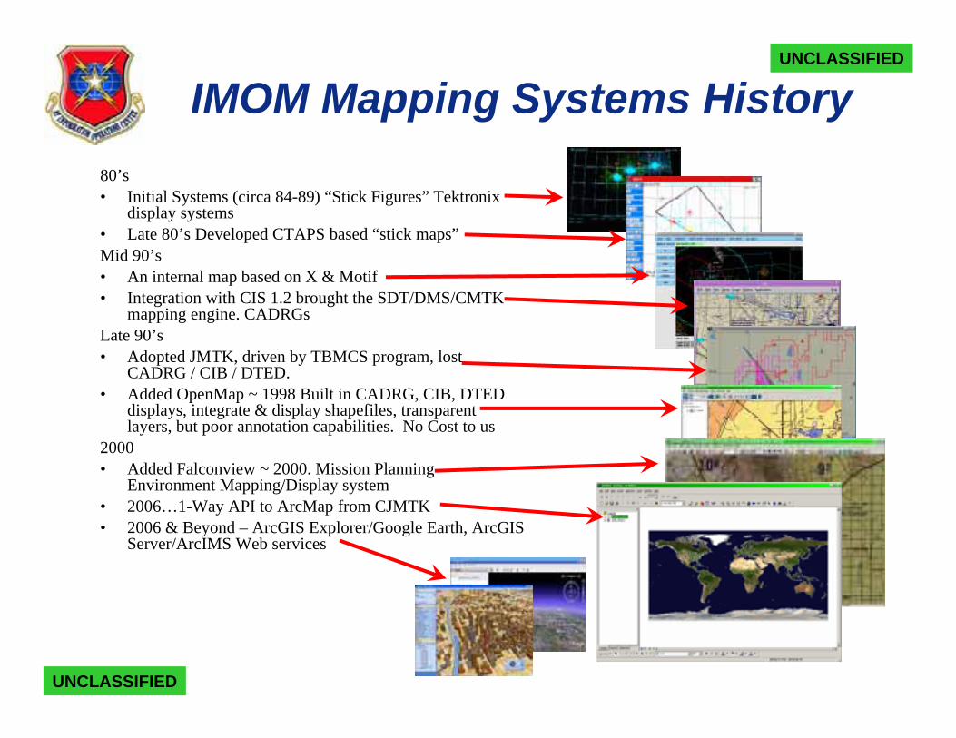
IMOM Mapping Systems History80’s • Initial Systems (circa 84-89) “Stick Figures” Tektronix
display systems• Late 80’s Developed CTAPS based “stick maps”Mid 90’s • An internal map based on X & Motif• Integration with CIS 1.2 brought the SDT/DMS/CMTK
mapping engine. CADRGsLate 90’s• Adopted JMTK, driven by TBMCS program, lost
CADRG / CIB / DTED. • Added OpenMap ~ 1998 Built in CADRG, CIB, DTED
displays, integrate & display shapefiles, transparent layers, but poor annotation capabilities. No Cost to us
2000• Added Falconview ~ 2000. Mission Planning
Environment Mapping/Display system• 2006…1-Way API to ArcMap from CJMTK• 2006 & Beyond – ArcGIS Explorer/Google Earth, ArcGIS
Server/ArcIMS Web services
UNCLASSIFIED
UNCLASSIFIED
The Geospatial Leap
• Not Just a Map (Major paradigm shift for current users)• A true geospatial system provides capabilities than can
lead to new insights• Combine traditional RF analysis with non-RF information• Toolbox vs. Turnkey
• New capabilities require new skills/perspectives• Translate geospatially oriented data and processes into
information layers• Assess information layers for meaningful inter-relationships• Display results as actionable decision aids
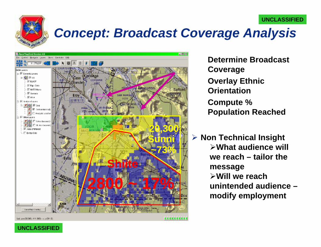
Concept: Broadcast Coverage Analysis
1. Determine Broadcast Coverage
2. Overlay Ethnic Orientation
3. Compute % Population Reached
Non Technical InsightWhat audience will
we reach – tailor the message
Will we reach unintended audience –modify employment
Shiite
Sunni
2800 ~ 17%
20,300
~73%
UNCLASSIFIED
UNCLASSIFIED
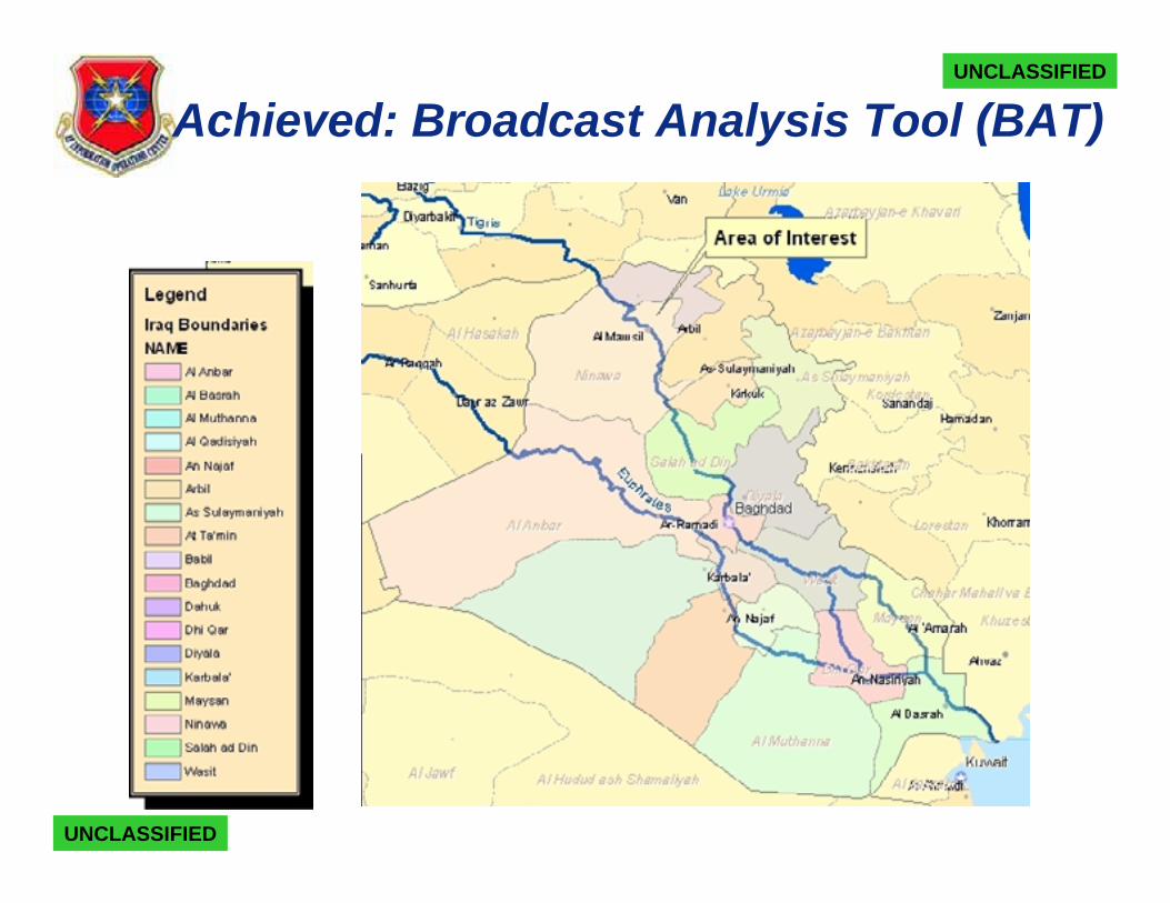
Achieved: Broadcast Analysis Tool (BAT)
UNCLASSIFIED
UNCLASSIFIED
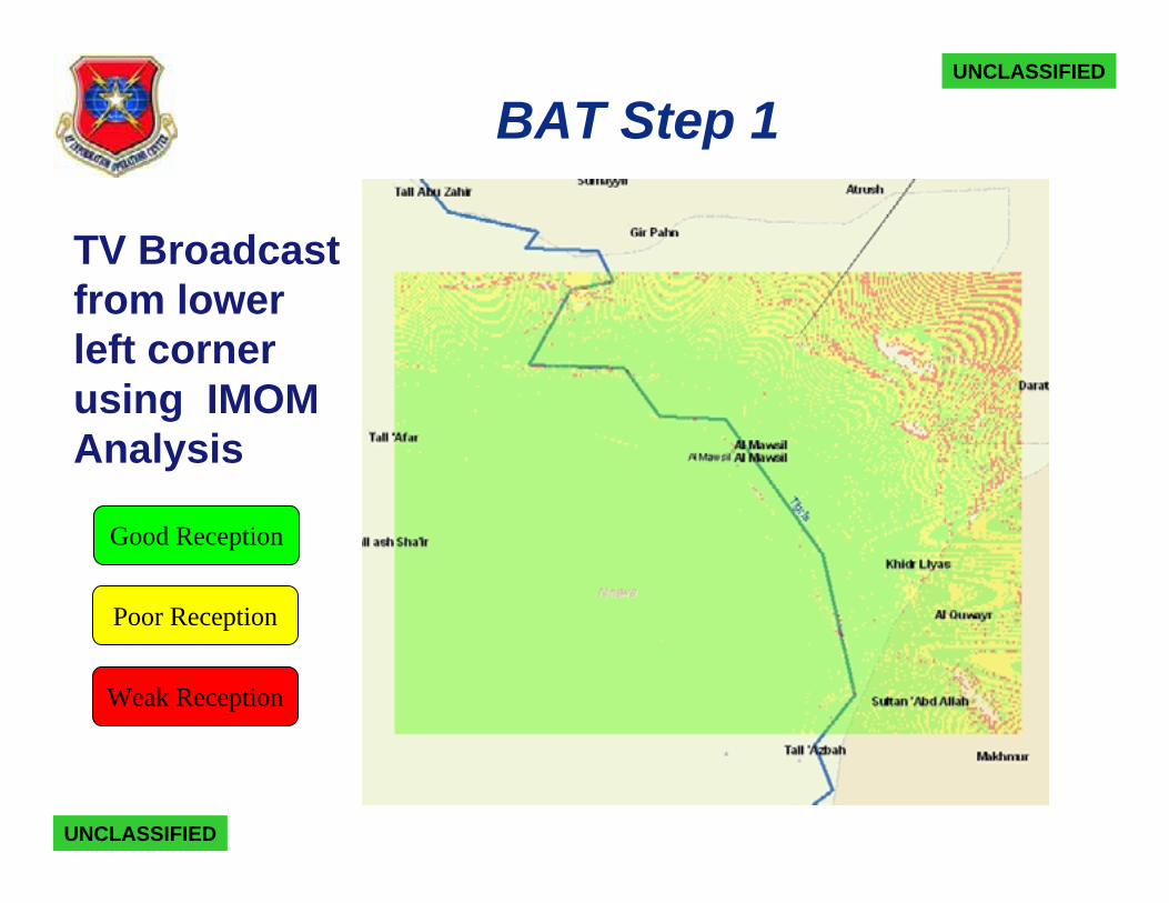
BAT Step 1
TV Broadcast from lower left corner using IMOM Analysis
UNCLASSIFIED
UNCLASSIFIED
Good Reception
Poor Reception
Weak Reception
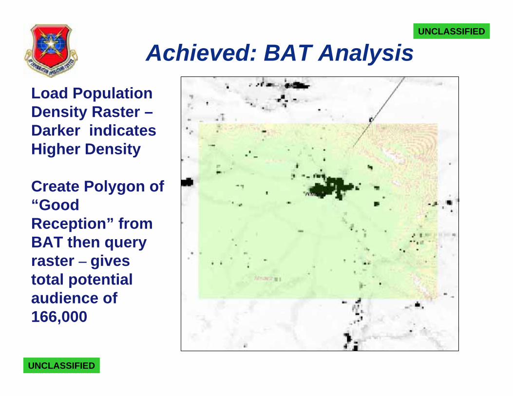
Achieved: BAT AnalysisLoad Population Density Raster –Darker indicates Higher Density
Create Polygon of “Good Reception” from BAT then query raster – gives total potential audience of166,000
UNCLASSIFIED
UNCLASSIFIED
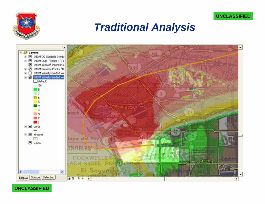
Traditional Analysis
UNCLASSIFIED
UNCLASSIFIED
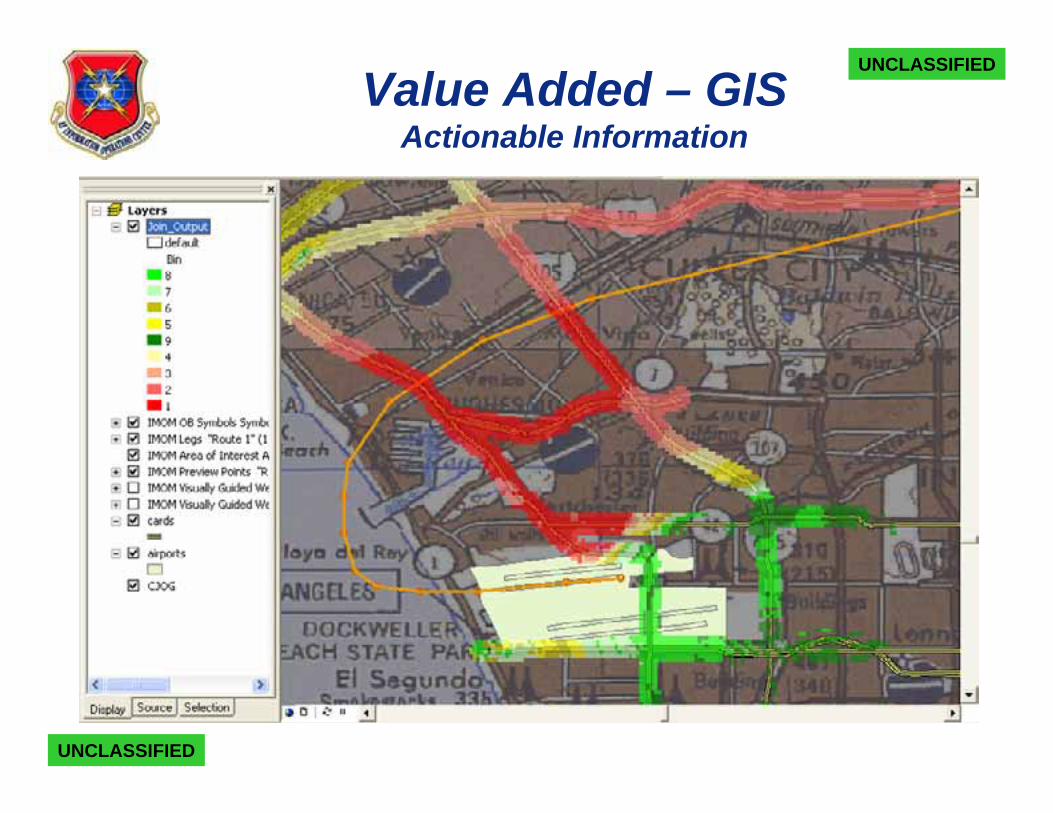
Value Added – GISActionable Information
UNCLASSIFIED
UNCLASSIFIED
Conclusions
IMOM Engineer augmented with ArcGIS/CJMTK can provide meaningful actionable insight for the warfighter
• Metrics are limited by available data and interpretation of tactics
• Metrics can be built from a innumerable datasets such as:
• Infrastructure – buildings, roads, pipelines, airports, etc.
• Cultural orientation or areas of influence
• Demographics – male, female, age group, income etc.
• Analyst has opportunity to represent enemy tactics, operational limits, and environmental considerations into analysis
UNCLASSIFIED
UNCLASSIFIED