regions how the earth is divided for study. geographers choose how they will classify the world...
TRANSCRIPT


Big Idea Review
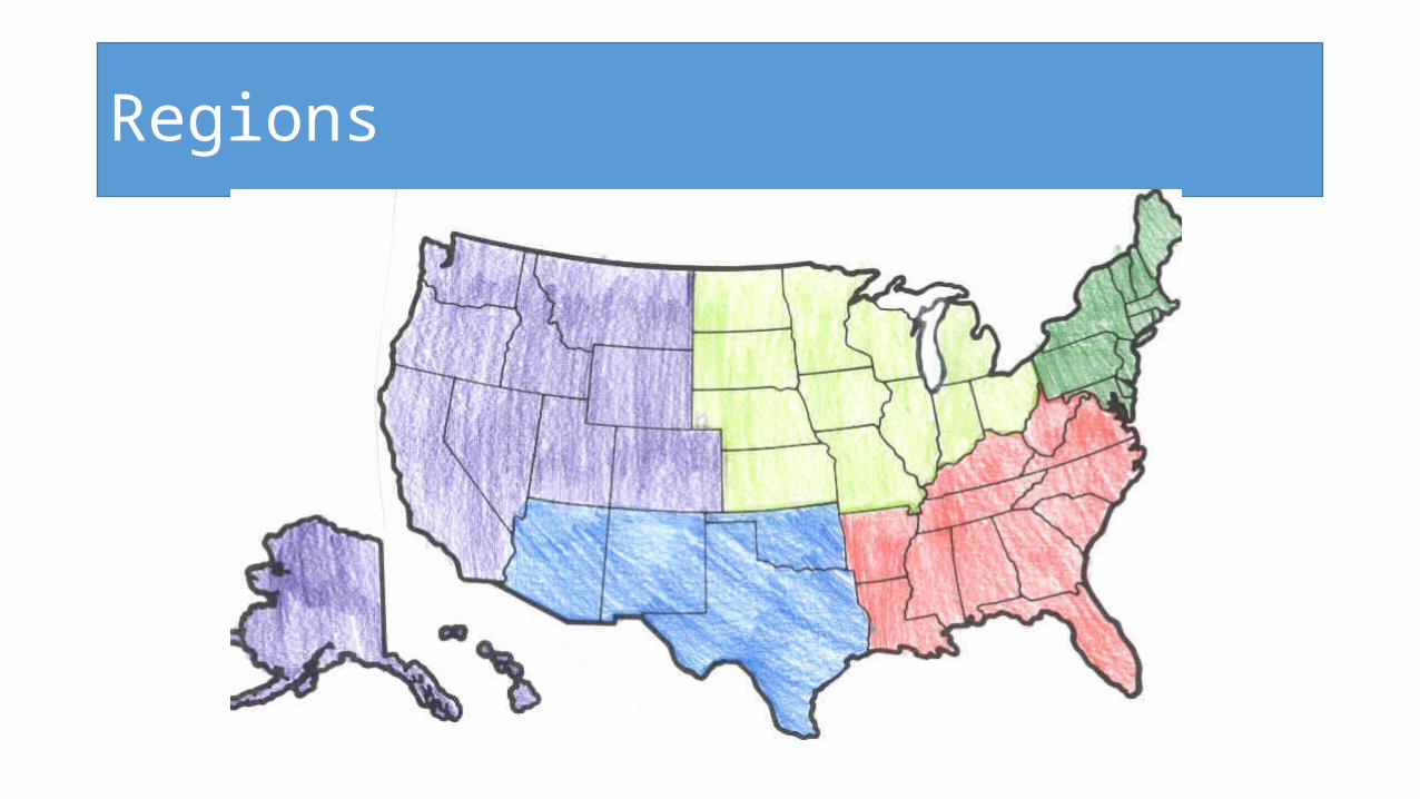
Regions

Regions
How the earth is divided for study.
Geographers choose how they will classify the world based on common characteristics.

3 Types of Regions
•Formal •Functional•Perceptual

A. Formal Region• Based on cold hard facts• A place with similar attributes or
characteristics – a common human or physical property such as
• political identity, • climate, • landforms

B. Functional RegionOrganized around a focal point (node), that include areas that are linked to them through communication patterns, transportation routes, or even television broadcasts.
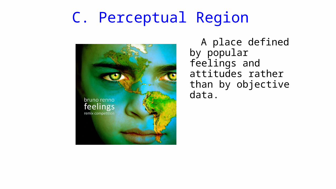
C. Perceptual Region A place defined by
popular feelings and attitudes rather than by objective data.

A resident of Katy, TX watches the Houston news on Fox. This is an example of a
• formal region• functional region• perceptual region

The American Midwest is an example of a
A. Formal RegionB. Functional RegionC. Perceptual Region
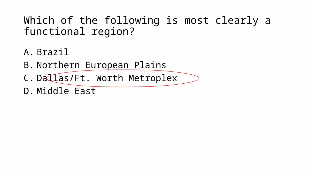
Which of the following is most clearly a functional region?
A. BrazilB. Northern European PlainsC. Dallas/Ft. Worth MetroplexD. Middle East
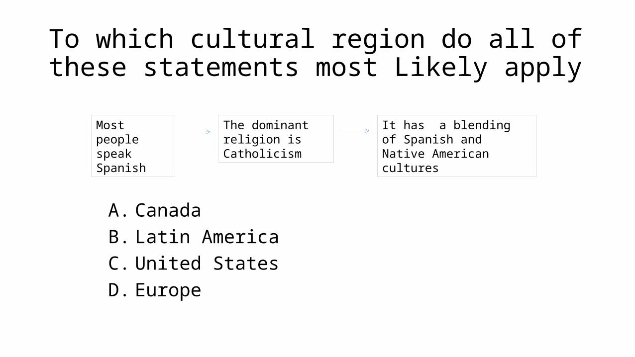
To which cultural region do all of these statements most Likely apply
A. CanadaB. Latin AmericaC. United StatesD. Europe
Most people speak Spanish
The dominant religion is Catholicism
It has a blending of Spanish and Native American cultures
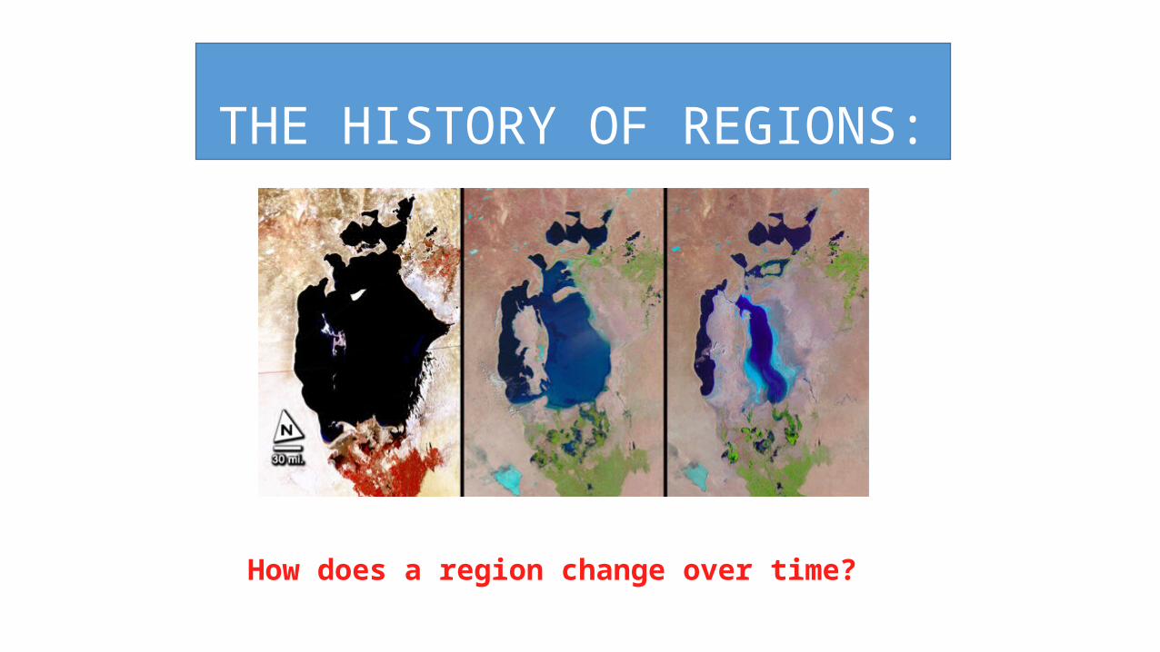
THE HISTORY OF REGIONS:
How does a region change over time?
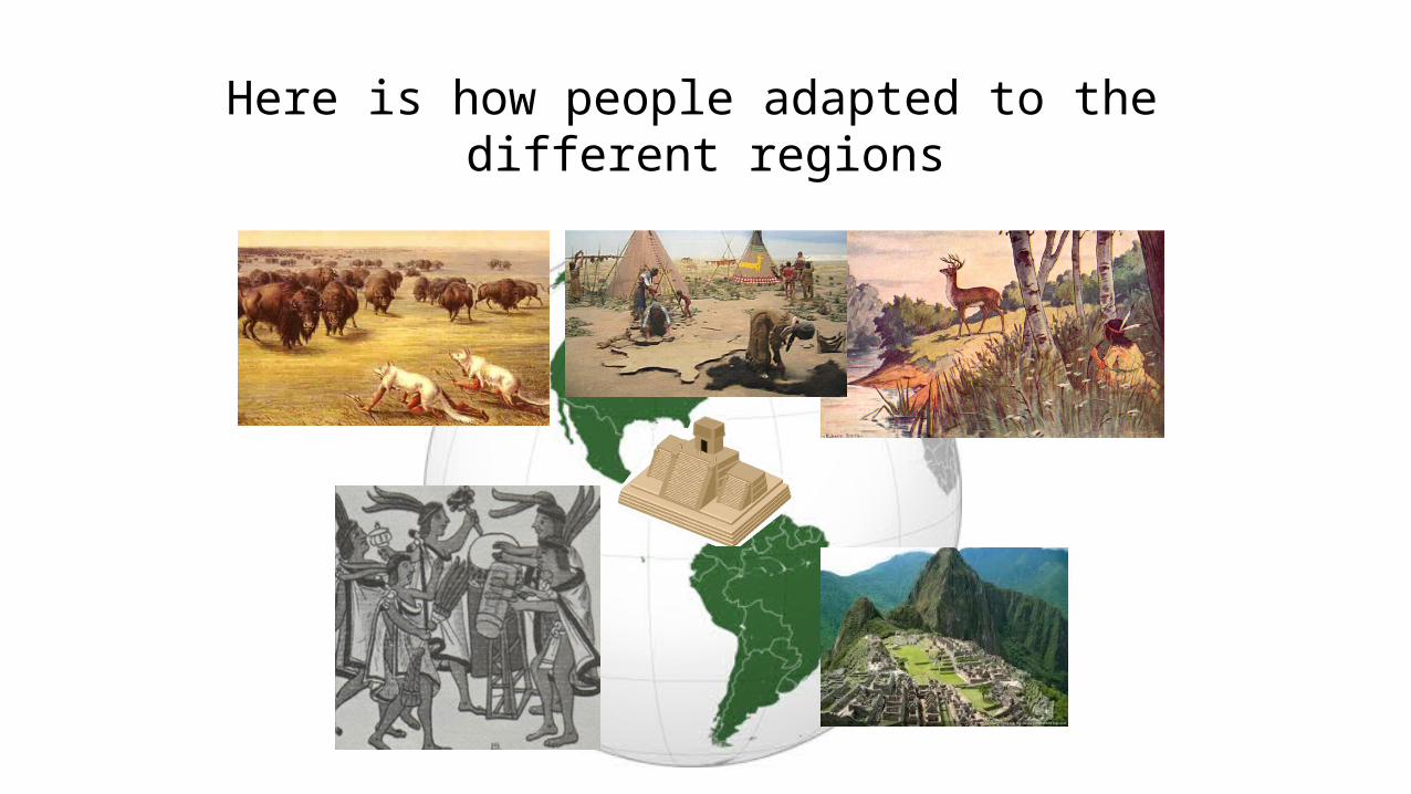
These two continents contain many, many physical regions that are geographically connected. Here is how people adapted to the
different regions
Here is what happened in these regions….
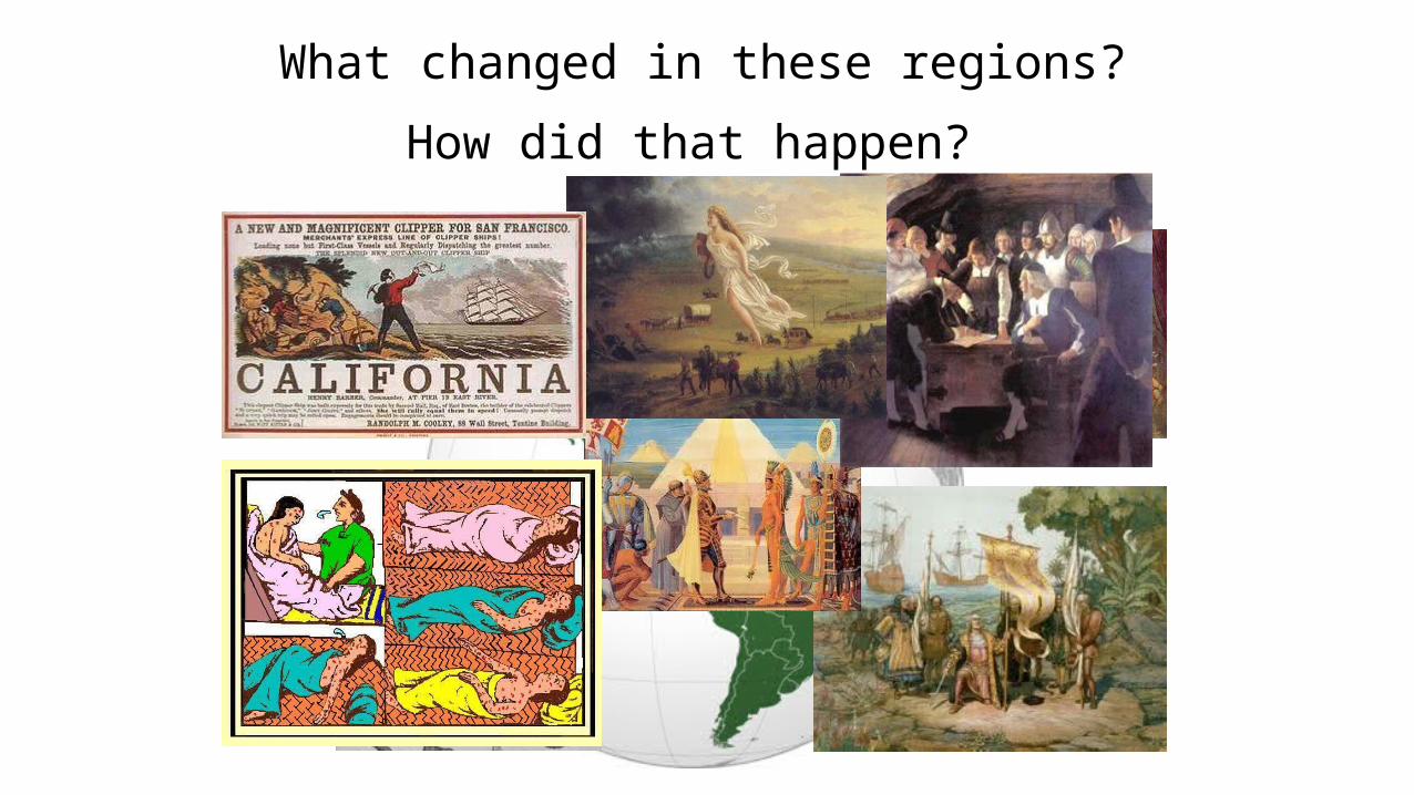
What changed in these regions?
How did that happen?
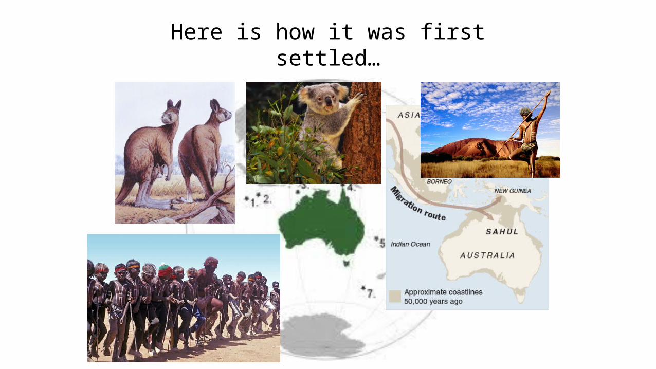
This continent is the only continent that is also ONE country…Here is how it was first settled…
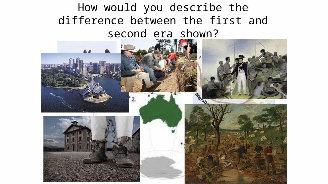
Here is what happened in the region…
How would you describe the difference between the first and second era shown?
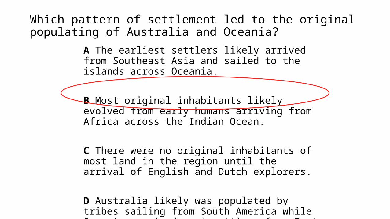
Which pattern of settlement led to the original populating of Australia and Oceania?
A The earliest settlers likely arrived from Southeast Asia and sailed to the islands across Oceania.
B Most original inhabitants likely evolved from early humans arriving from Africa across the Indian Ocean.
C There were no original inhabitants of most land in the region until the arrival of English and Dutch explorers.
D Australia likely was populated by tribes sailing from South America while Oceania received most settlers from East Asia.

Regions We Studied

Important Ideas Five Oceans
▪ Atlantic, Pacific, Indian, Arctic and Southern Seven Continents
▪ Africa, Antarctica, Asia, Australia, Europe, North America and South America
Latitude, landforms, and nearness to bodies ofwater greatly affect climate
Landforms, soil and climate greatly affect the plants and animals that can be found in each place
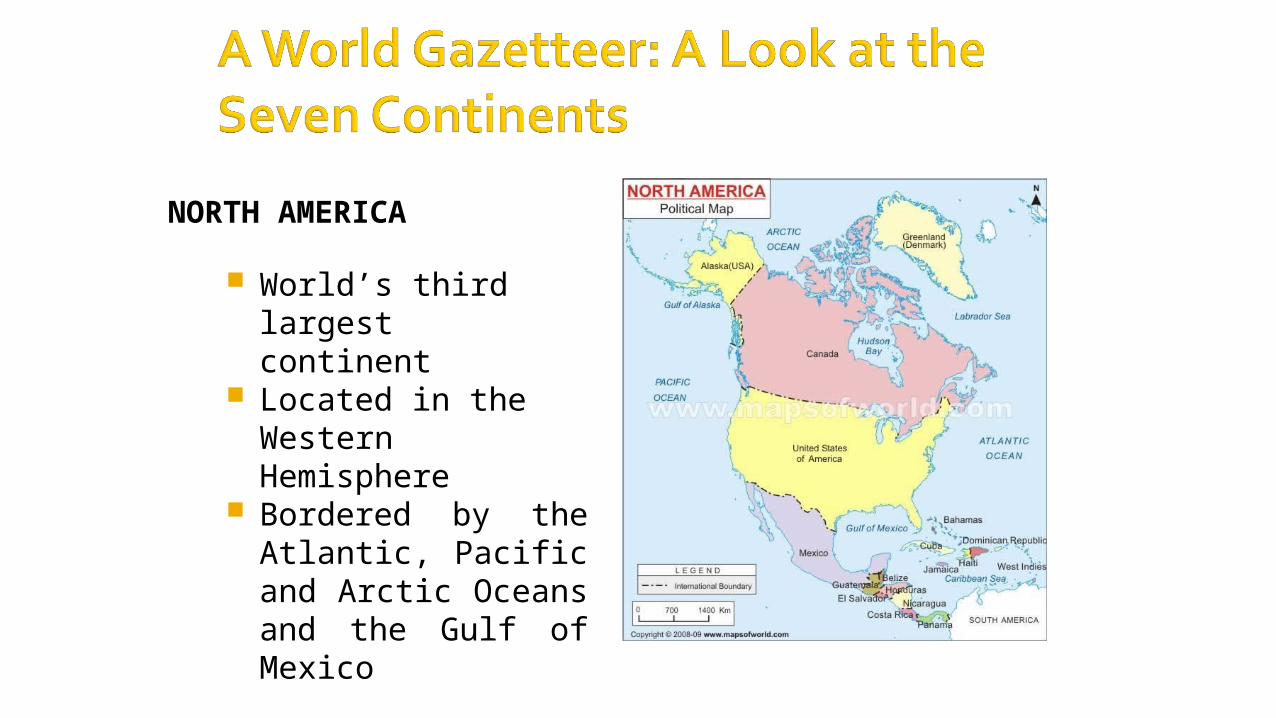
NORTH AMERICA
World’s third largestcontinent
Located in the Western Hemisphere
Bordered by the Atlantic, Pacific and Arctic Oceans and the Gulf of Mexico
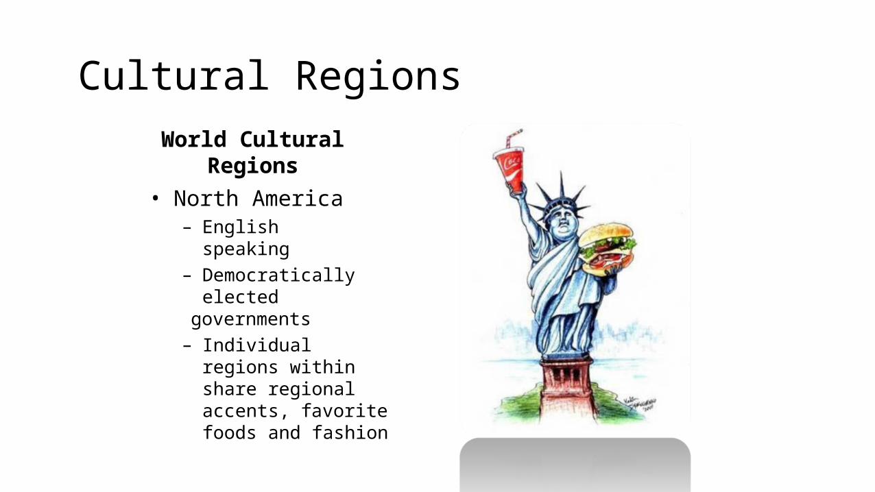
Cultural RegionsWorld Cultural Regions• North America
– English speaking– Democratically
electedgovernments
– Individual regions within share regional accents, favorite foods and fashion
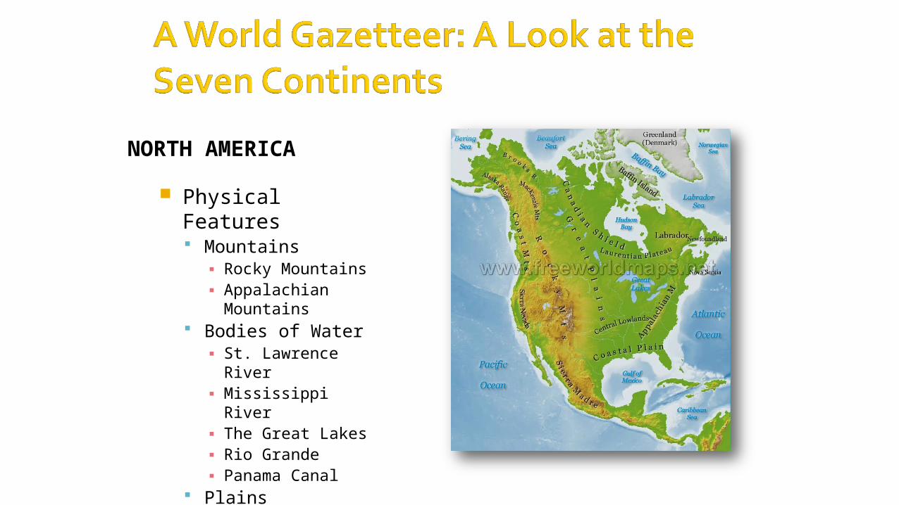
NORTH AMERICA
Physical Features Mountains
▪ Rocky Mountains▪ Appalachian
Mountains Bodies of Water
▪ St. Lawrence River▪ Mississippi River▪ The Great Lakes▪ Rio Grande▪ Panama Canal
Plains▪ The Great Plains
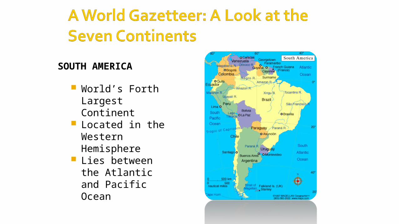
SOUTH AMERICA
World’s Forth LargestContinent
Located in the Western Hemisphere
Lies between the Atlanticand Pacific Ocean

SOUTH AMERICA
Physical Features
Mountains▪ Andes Mountains (longest
range in the world) Grasslands and Plains
▪ Pampas Rainforests
▪ Amazon Rainforest Bodies of Water
▪ Amazon River▪ Orinoco River▪ Rio de la Plata
Climate▪ Warm due to location near
theequator
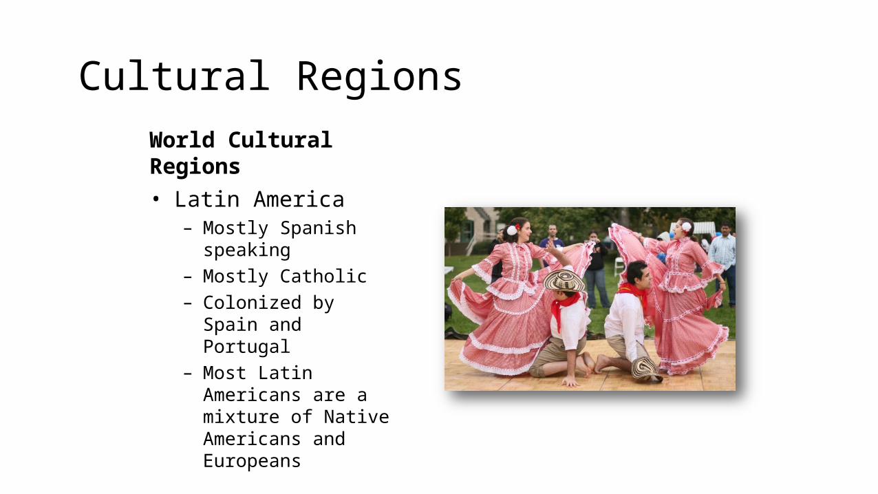
Cultural RegionsWorld Cultural Regions• Latin America
– Mostly Spanish speaking– Mostly Catholic– Colonized by Spain
and Portugal– Most Latin Americans are a
mixture of Native Americans and Europeans
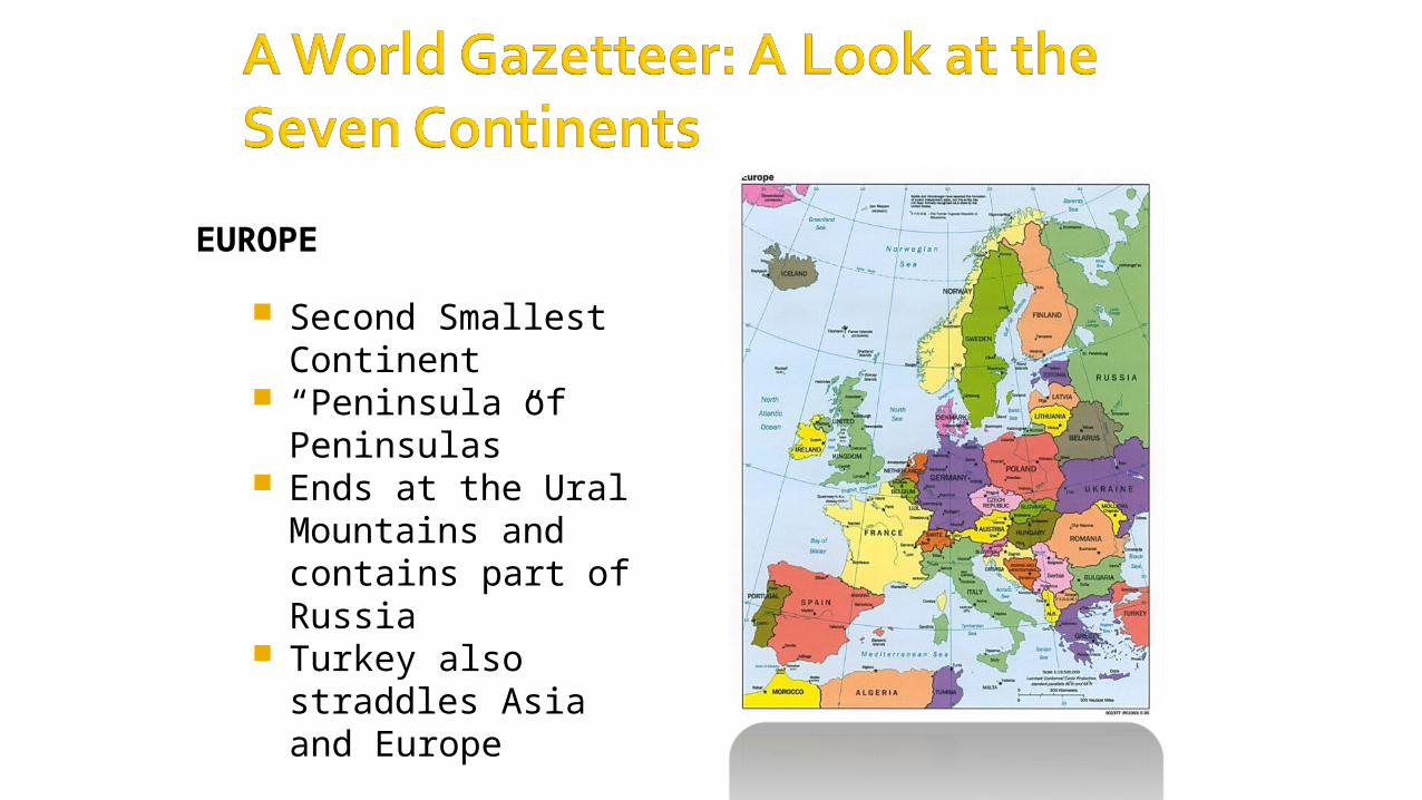
EUROPE
Second Smallest Continent
“Peninsula of Peninsulas”
Ends at the Ural Mountains and contains part of Russia
Turkey also straddles Asiaand Europe
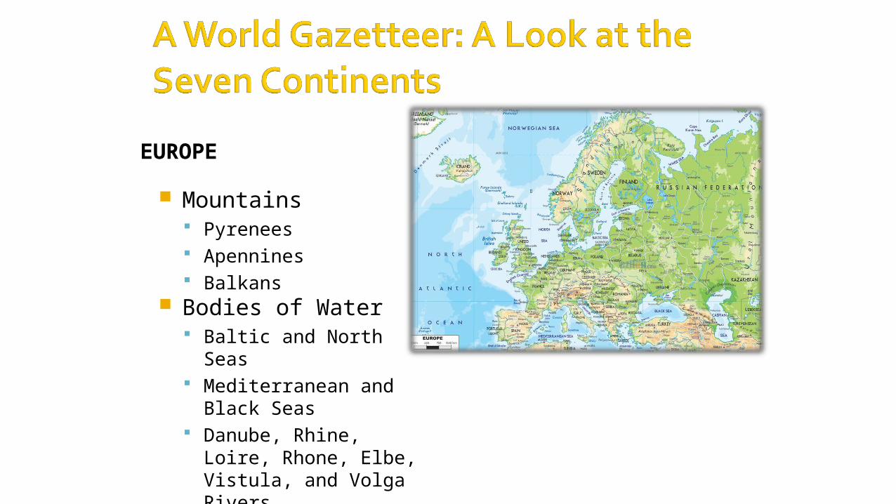
EUROPE
Mountains Pyrenees Apennines Balkans
Bodies of Water Baltic and North Seas Mediterranean and
Black Seas Danube, Rhine, Loire,
Rhone, Elbe, Vistula, and Volga Rivers
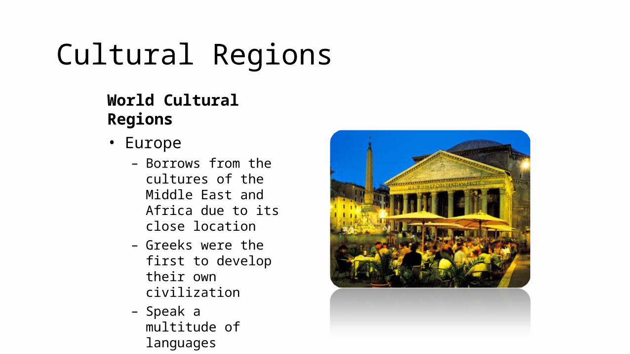
Cultural RegionsWorld Cultural Regions• Europe
– Borrows from the cultures of the Middle East and Africa due to its close location
– Greeks were the first to develop their own civilization
– Speak a multitude of languages
– Mostly Christian
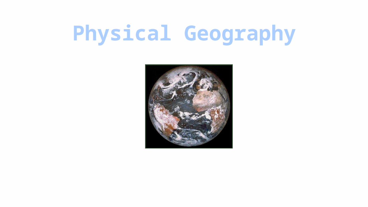
Physical Geography
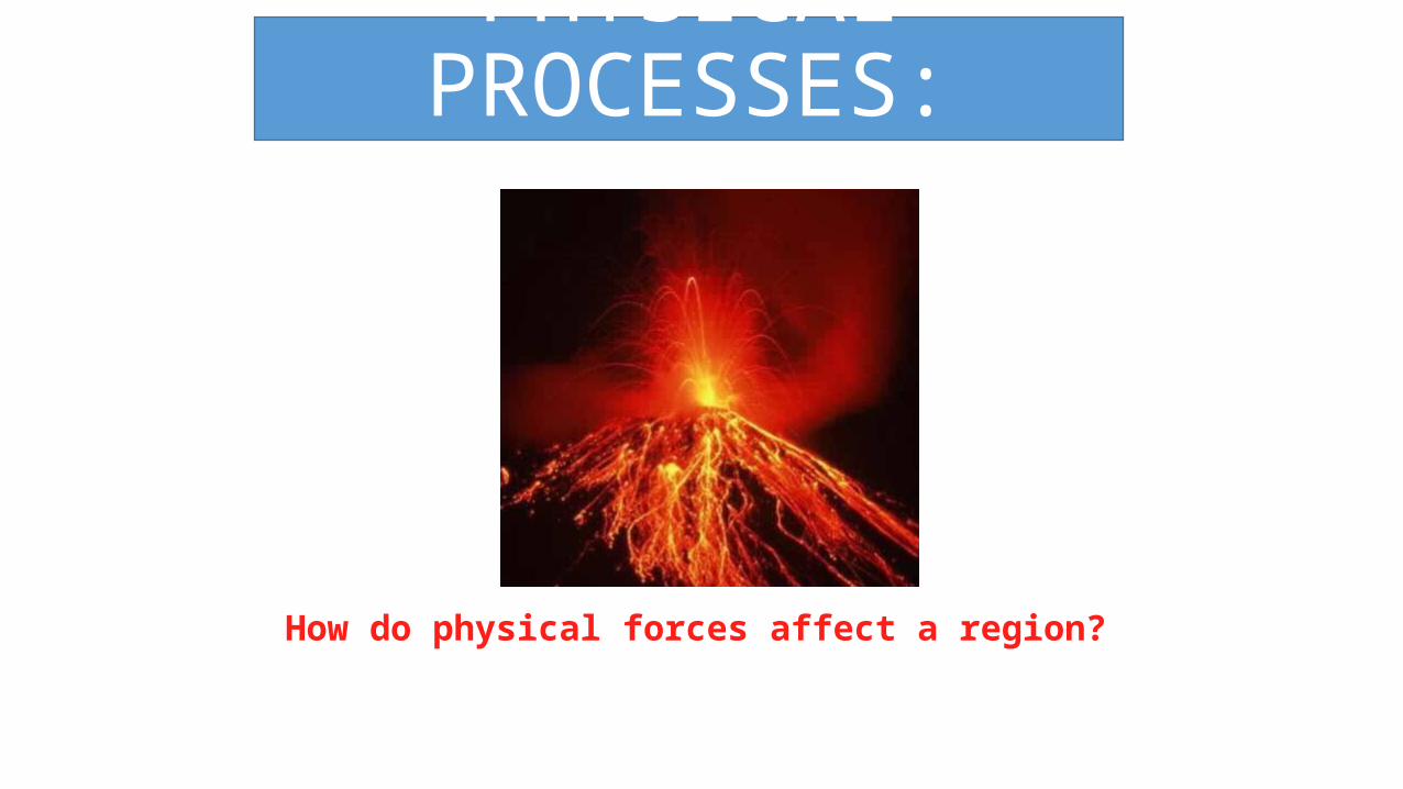
PHYSICAL PROCESSES:
How do physical forces affect a region?
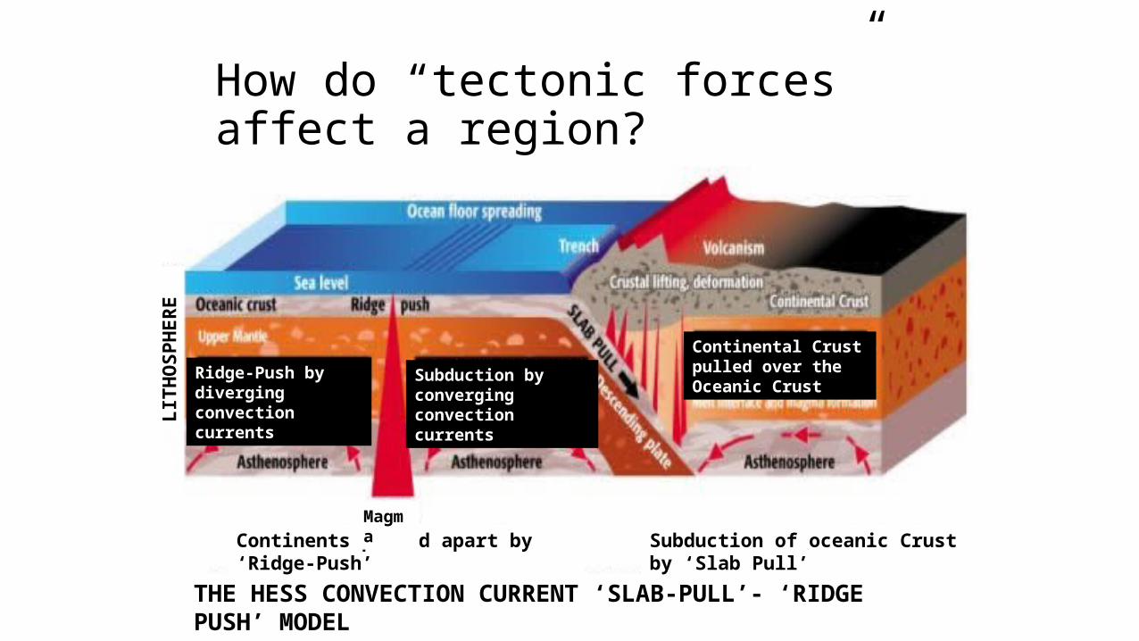
How do “tectonic forces” affect a region?
THE HESS CONVECTION CURRENT ‘SLAB-PULL’- ‘RIDGE PUSH’ MODEL
Continents pushed apart by ‘Ridge-Push’ Subduction of oceanic Crust by ‘Slab Pull’Magma
Ridge-Push by diverging convection currents
Subduction by converging convection currents
Continental Crust pulled over the Oceanic Crust
LITH
OSP
HER
E

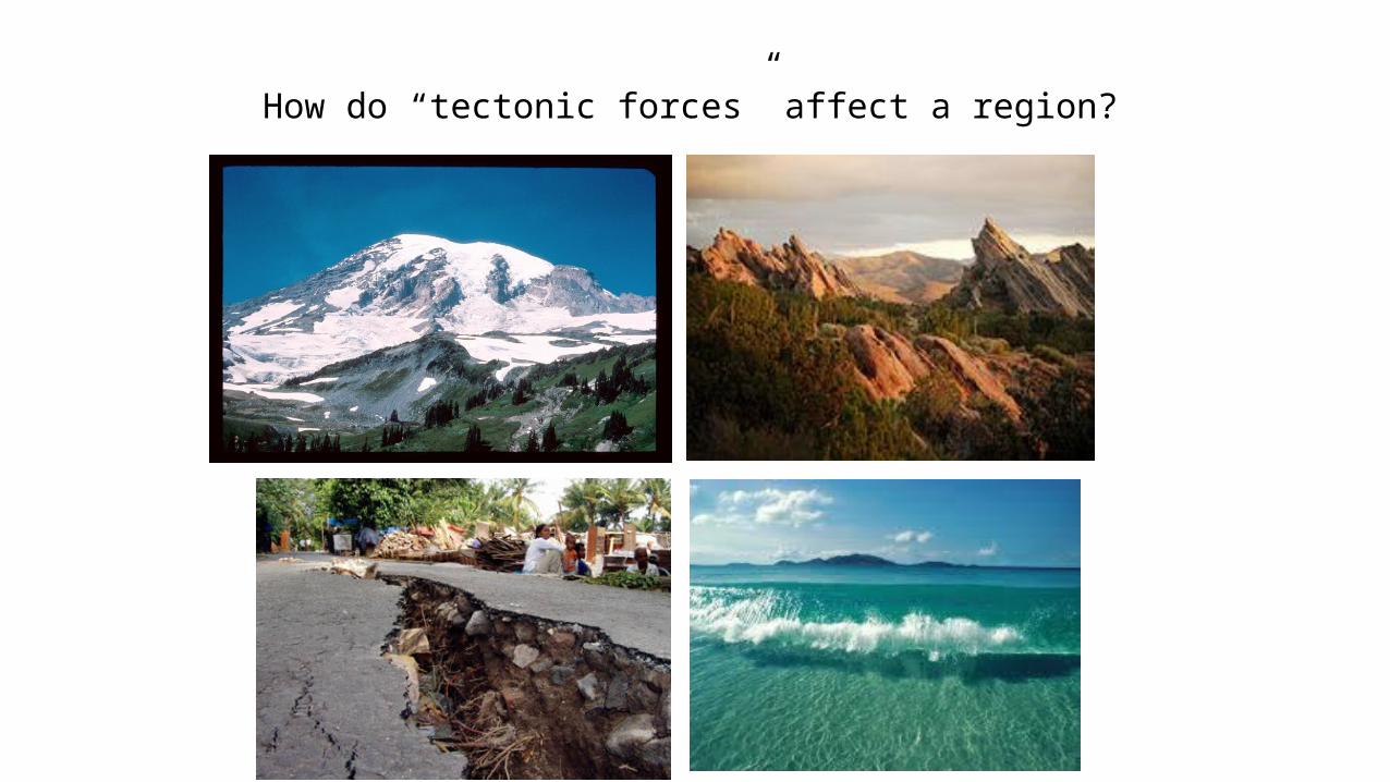
How do “tectonic forces” affect a region?
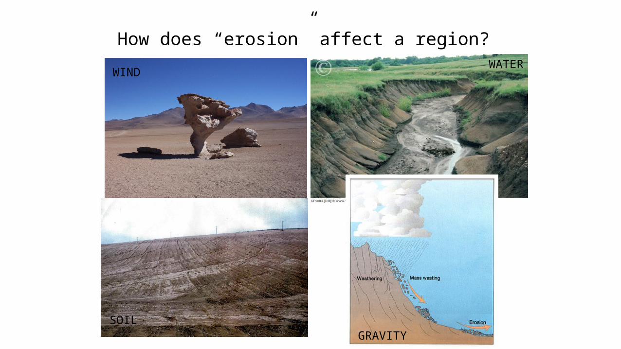
How does “erosion” affect a region? WATER
WIND
SOILGRAVITY
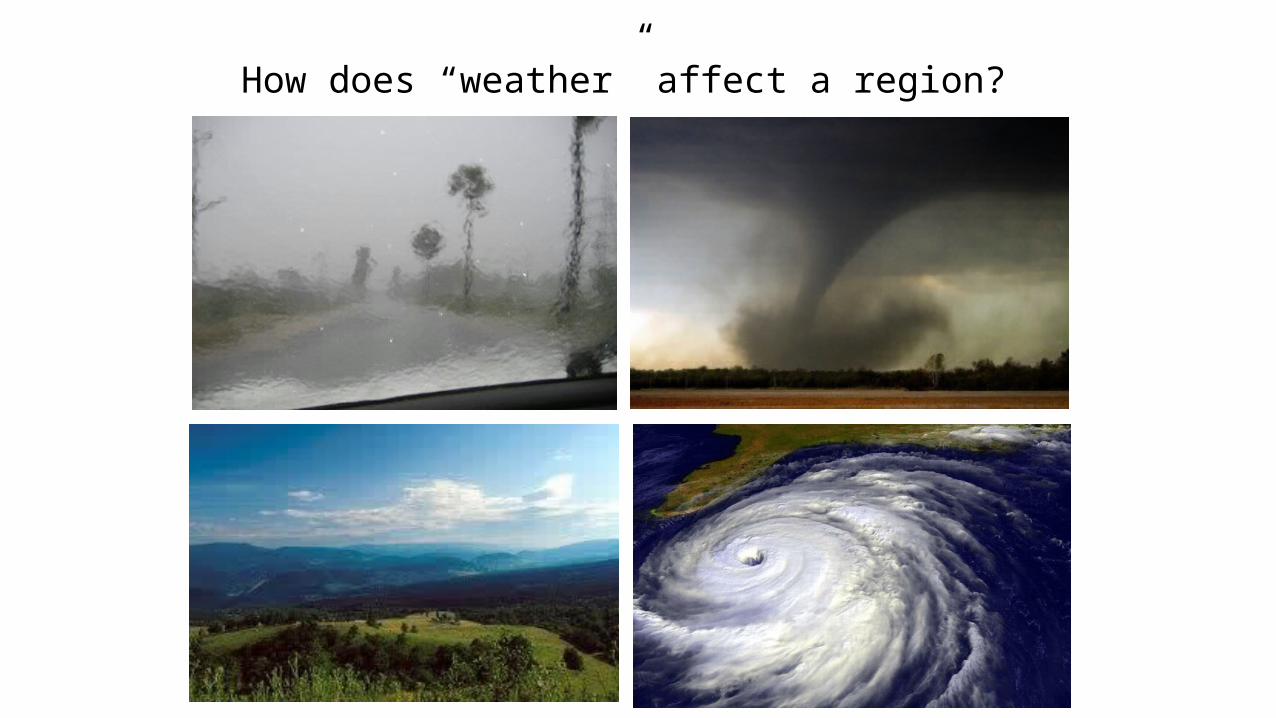
How does “weather” affect a region?
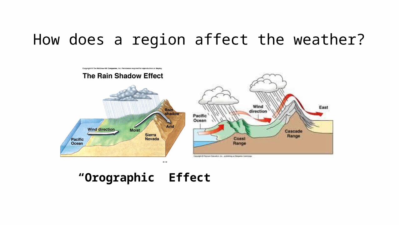
How does a region affect the weather?
“Orographic” Effect
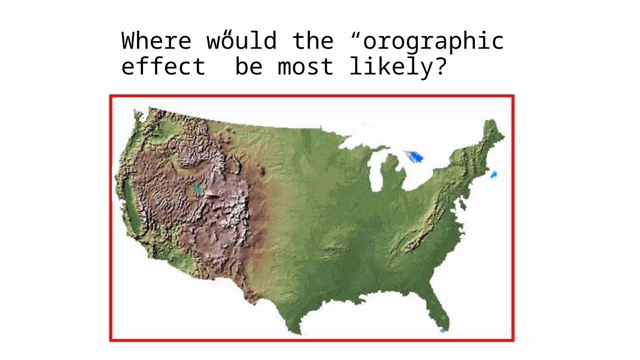
Where would the “orographic effect” be most likely?
Coastal Plains
Interior Lowlands
Great Plains
Basin and Ridge Ap
pala
chia
n M
ount
ains
Rocky Mountains
Coas
tal R
idge
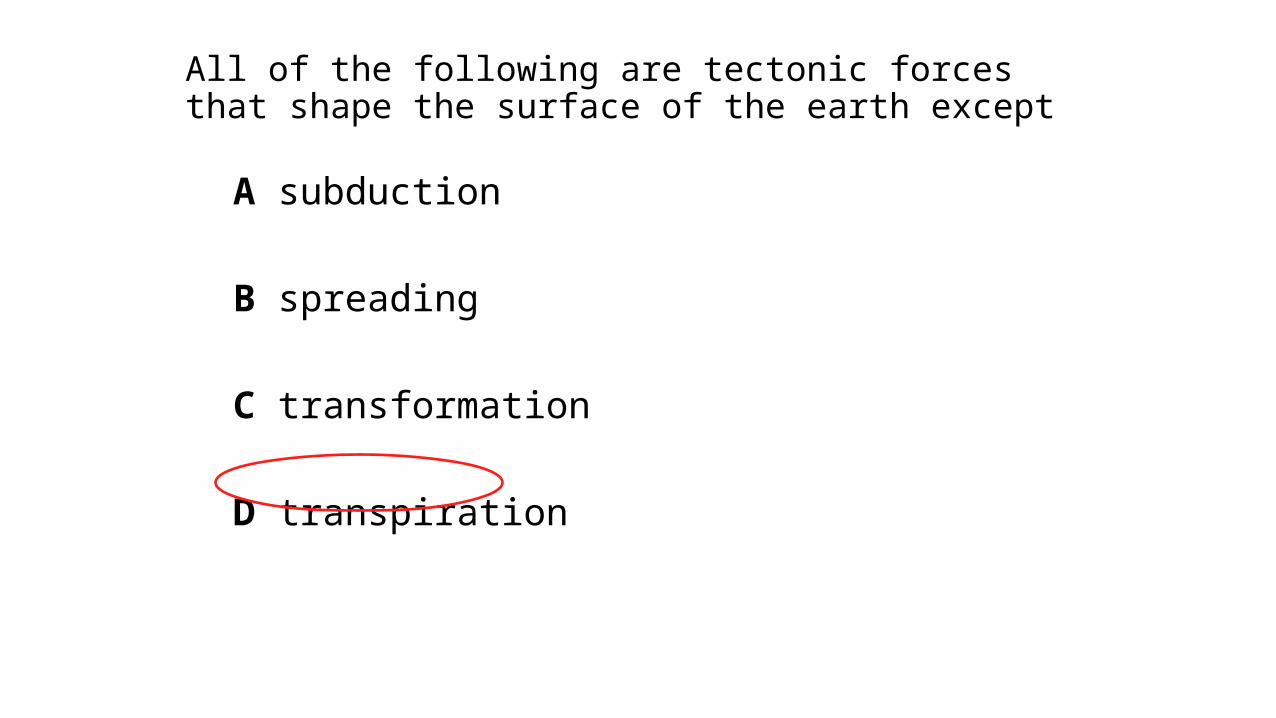
All of the following are tectonic forces that shape the surface of the earth except
A subduction
B spreading
C transformation
D transpiration
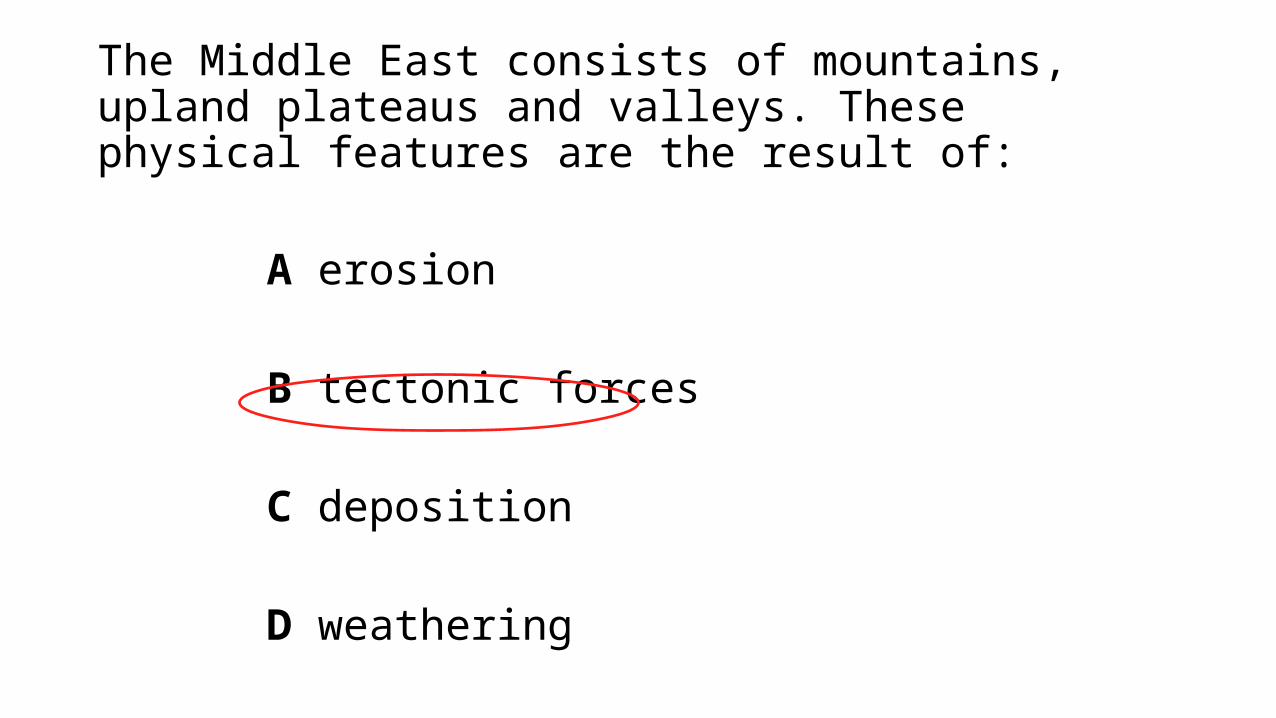
The Middle East consists of mountains, upland plateaus and valleys. These physical features are the result of:
A erosion
B tectonic forces
C deposition
D weathering
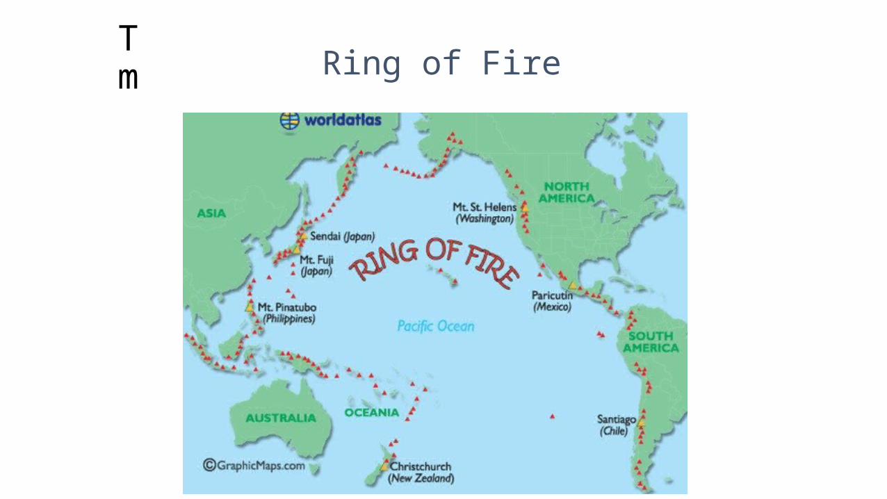
The same tectonic force, many continents… Ring of Fire
Because of its location along the "Ring of Fire," Japan is particularly susceptible to which of the following hazards?
A. earthquakes and volcanoes
B. floodings and droughts
C. monsoons and floodings
D. earthquakes and tornados
The Pacific Islands in the Ring of Fire are affected by all of the following except —
A volcanoes
B earthquakes
C tsunamis
D tornadoes
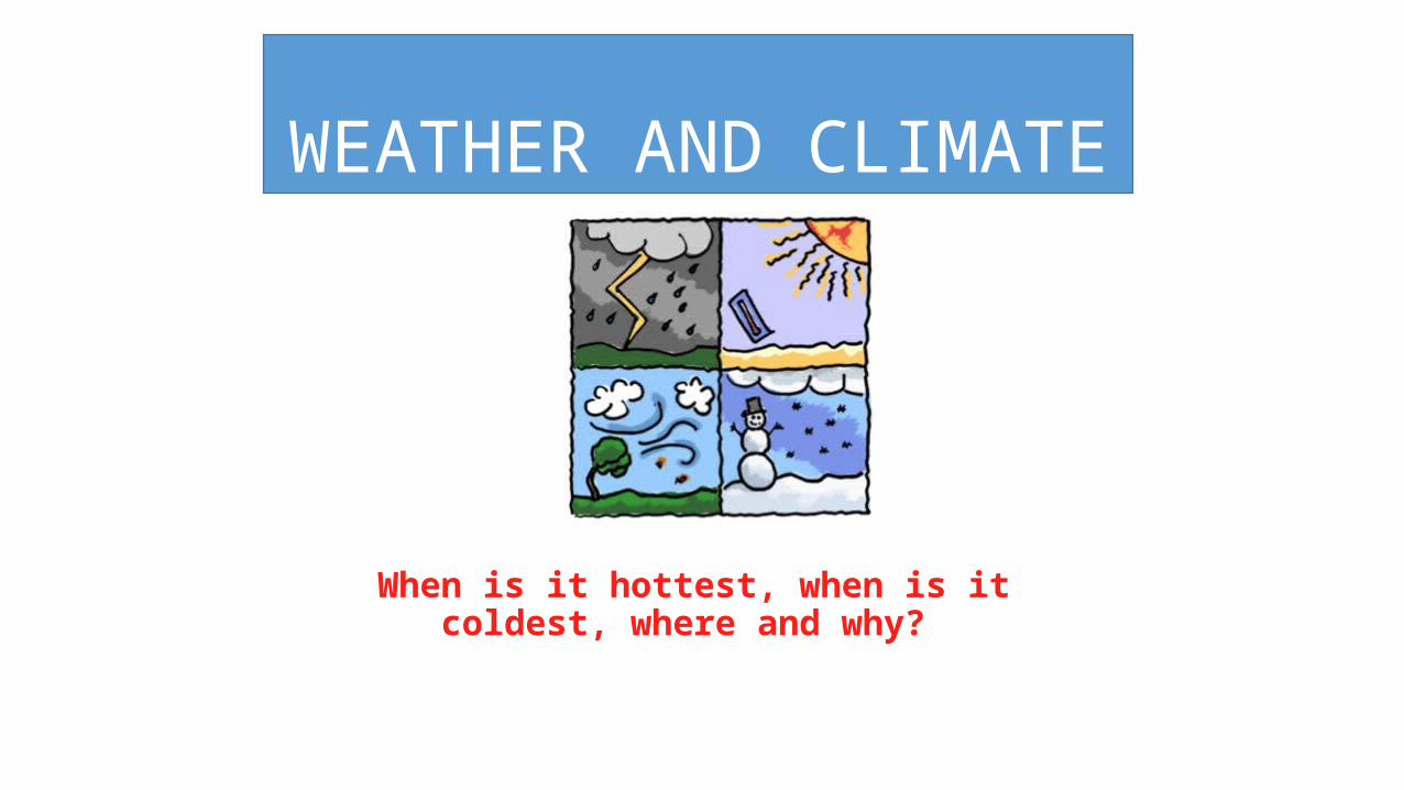
WEATHER AND CLIMATE
When is it hottest, when is it coldest, where and why?
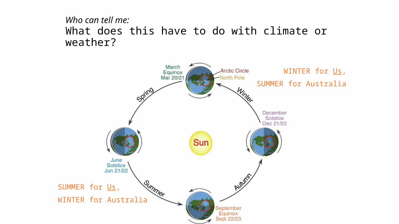
Who can tell me: What does this have to do with climate or weather?
SUMMER for Us,
WINTER for Australia
WINTER for Us,
SUMMER for Australia
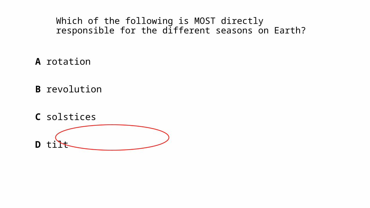
Which of the following is MOST directly responsible for the different seasons on Earth?
A rotation
B revolution
C solstices
D tilt

Equator always gets it.
Who can tell me:What does LATITUDE have to do with climate and weather?
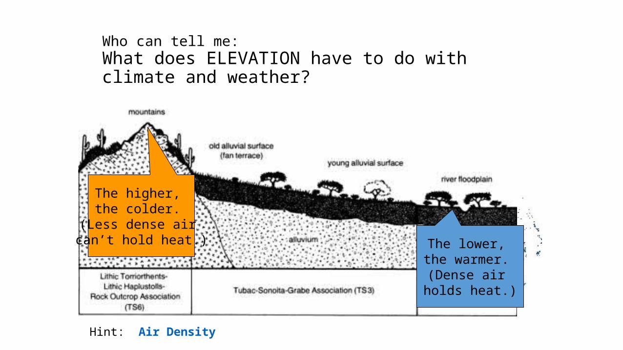
Who can tell me:What does ELEVATION have to do with climate and weather?
Hint: Air Density
The higher, the colder.
(Less dense air can’t hold heat.) The lower,
the warmer. (Dense air
holds heat.)

Which of the following is not correlated to temperature?
A Longitude
B Latitude
C Elevation
D. Continentality
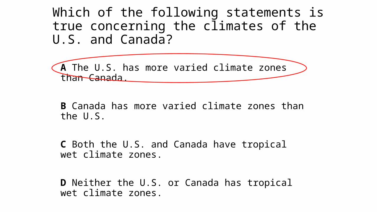
Which of the following statements is true concerning the climates of the U.S. and Canada?
A The U.S. has more varied climate zones than Canada.
B Canada has more varied climate zones than the U.S.
C Both the U.S. and Canada have tropical wet climate zones.
D Neither the U.S. or Canada has tropical wet climate zones.
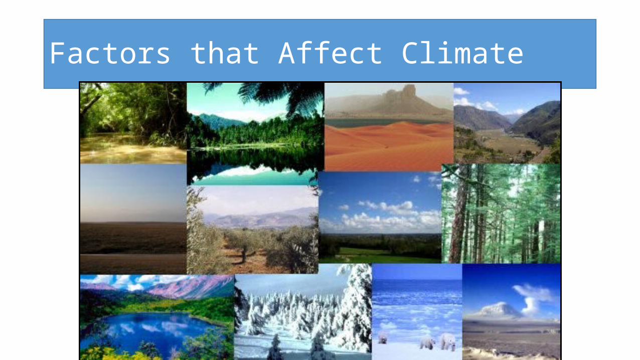
Factors that Affect Climate