record packet copy
TRANSCRIPT
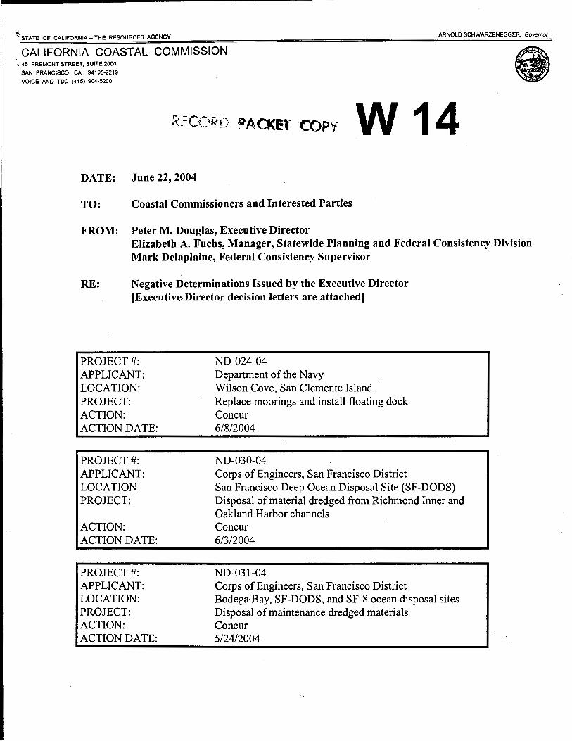
~STATE OF CALIFORNIA- THE RESOURCES AGENCY ARNOLD SCHWARZENEGGER, Governor
CALIFORNIA COASTAL COMMISSION , 45 FREMONT STREET, SUITE 2000
SAN FRANCISCO, CA 94105-2219
VOICE AND TOO (415) 904-5200
RECORD PACKET COPY w 14 DATE: June 22,2004
TO: Coastal Commissioners and Interested Parties
FROM: Peter M. Douglas, Executive Director Elizabeth A. Fuchs, Manager, Statewide Planning and Federal Consistency Division Mark Delaplaine, Federal Consistency Supervisor
RE: Negative Determinations Issued by the Executive Director [Executive Director decision letters are attached]
PROJECT#: APPLICANT: LOCATION: PROJECT: ACTION: ACTION DATE:
PROJECT#: APPLICANT: LOCATION: PROJECT:
ACTION: ACTION DATE:
PROJECT#: APPLICANT: LOCATION: PROJECT: ACTION: ACTION DATE:
ND-024-04 Department of the Navy Wilson Cove, San Clemente Island Replace moorings and install floating dock Concur 6/8/2004
ND-030-04 Corps of Engineers, San Francisco District San Francisco Deep Ocean Disposal Site (SF-DODS) Disposal of material dredged from Richmond Inner and Oakland Harbor channels Concur 6/3/2004
ND-031-04 Corps of Engineers, San Francisco District Bodega Bay, SF-DODS, and SF-8 ocean disposal sites Disposal of maintenance dredged materials Concur 5/24/2004

PAGE 2
PROJECT#: APPLICANT: LOCATION: PROJECT: ACTION: ACTION DATE:
PROJECT#: APPLICANT: LOCATION: PROJECT: ACTION: ACTION DATE:
PROJECT#: APPLICANT: LOCATION: PROJECT: ACTION: . ACTION DATE:
PROJECT#: APPLICANT: LOCATION:
PROJECT:
ACTION: ACTION DATE:
PROJECT#: APPLICANT: LOCATION: PROJECT: ACTION: ACTION DATE:
ND-035-04 Corps of Engineers, Los Angeles District Santa Barbara Harbor Six year mainte11ance dredging and disposal program Concur , 6/18/2004
ND-036-04 Corps of Engineers, Los Angeles District Ventura Harbor, Ventura Co. Six year maintenance dredging and disposal program Concur 6/22/2004
ND-038-04 Department of the Navy Ocean floor offPort Hueneme Harbor, Ventura Co. Testing of the Centurion acoustic monitoring project Concur 6/15/2004
ND-040-04 National Park Service F Ranch site adjacent to Drakes Estero, Point Reyes National Seashore, Marin Co. Demolish existing and construct new water chlorination building and related facilities Concur 6/22/2004
NE-041-04 Texaco Exploration & Production Hollister Ranch, Santa Barbara Co. Remove and abandon 7 mi. pipelines No effect 6/16/2004

PAGE 3
PROJECT#: APPLICANT: LOCATION: PROJECT:
ACTION: ACTION DATE:
PROJECT#: APPLICANT: LOCATION:
PROJECT: ACTION: ACTION DATE:
ND-042-04 Corps ofEngineers, Los Angeles District Port of Los Angeles, Los Angeles Co. Sand mining in main channel for Pier 300 landfill construction Concur 6/22/2004
ND-043-04 National Park Service Santa Monica Mountains National Recreation Area, Los Angeles Co. Install barrier fences and signs at Park Service boundary Concur 6/22/2004

STATE OF CALIFORNIA THE RESOURCES AGENO
CALIFORNIA COASTAL COMMISSION 45 FREMONT, SUITE 2000 SAN FRANCISCO, CA 94105-2219 VOICE AND TDD (415) 904- 5200 FAX ( 415) 904-5400
Commanding Officer Naval Base Coronado ATTN: William Crouse P.O. Box 357040 San Diego, CA 92135-7040
ARNOLD SCHWARZENEGGER, GOVERNOR
June 8, 2004
Subject: Negative Determination ND-024-04, Replacement of moorings and installation of a floating dock at Wilson Cove, San Clemente Island
Dear Mr. Crouse:
The Coastal Commission staffhas reviewed the above-referenced negative determination for improving U.S. Navy vessel mooring and berthing capability at San Clemente Island to support increased training activities and logistics operations at the San Clemente Island Range Complex. The Navy proposes to: (1) install three replacement and repair two existing large vessel moorings in north Wilson Cove; (2) replace five small-boat moorings in south Wilson Cove; and (3) attach a new 850 sq.ft. floating dock to the existing Wilson Cove pier.
The five large-vessel moorings are designed to secure vessels up to 275 feet long in water depths less than 120 feet using chains anchored into bedrock. Drilling anchor holes to a maximum depth of 40 feet into bedrock for the three replacement moorings will be conducted from a barge positioned over the anchorage site. A 9-inch or 30-inch diameter casing will extend from the barge to the ocean floor, water within the casing will be removed, and a 9-inch or 30-inch diameter drill extended to the ocean floor. Extruded sand and rock from the drilling will be removed through the casing to the barge and later disposed at an existing Navy landfill on San Clemente Island. The anchor chain will be extended to the bottom ofthe drilled hole and concrete poured through the casing to secure the anchor chain in place. The anchor chain will then extend to the ocean surface and attach to a mooring buoy. If the 9-inch drill is used, at most 0.65 cubic yards of material would be generated from each drill hole, for a maximum total volume of 1.95 cu.yds. If the 30-inch drill is used, at most 7.3 cubic yards of material would be generated from each drill hole, for a maximum total volume of21.9 cu.yds. In addition to the
·embedded anchor, each mooring system could also include an 8,000 to 20,000 pound deadweight anchor. Repair of the two existing large vessel moorings (riser moorings with chains connecting the buoy to three anchors on the ocean floor) would involve re-positioning the anchors and removing excess chain.
The five proposed small boat moorings would replace in the same location moorings that previously existed in Wilson Cove. These moorings would be installed in water up to 90 feet deep, use 9,000-pound deadweight anchors connected by chain to the mooring buoy, and secure boats up to 36 feet long. In addition, the outermost mooring will be designed to accommodate a
ND-024-04 (U.S. Navy)· Page2
/
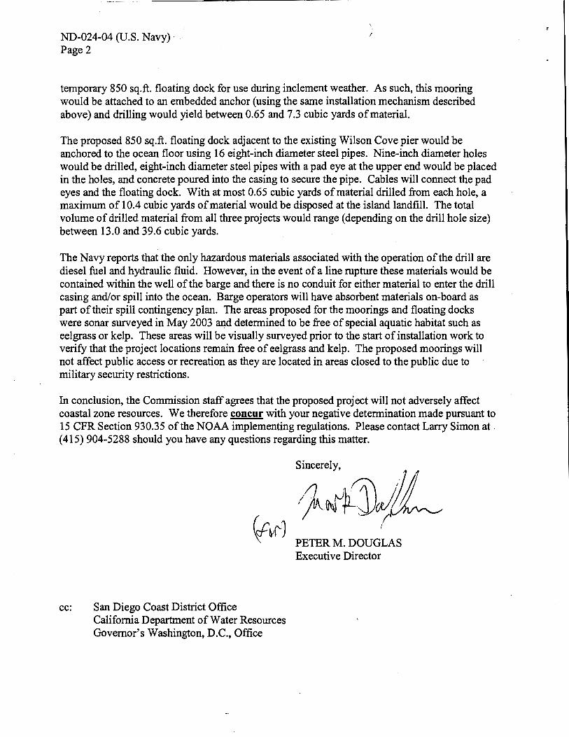
temporary 850 sq.ft. floating dock for use during inclement weather. As such, this mooring would be attached to an embedded anchor (using the same installation mechanism described above) and drilling would yield between 0.65 and 7.3 cubic yards of material.
The proposed 850 sq.ft. floating dock adjacent to the existing Wilson Cove pier would be anchored to the ocean floor using 16 eight-inch diameter steel pipes. Nine-inch diameter holes would be drilled, eight-inch diameter steel pipes with a pad eye at the upper end would be placed in the holes, and concrete poured into the casing to secure the pipe. Cables will connect the pad eyes and the floating dock. With at most 0.65 cubic yards of material drilled from each hole, a maximum of 10.4 cubic yards of material would be disposed at the island landfill. The total volume of drilled material from all three projects would range (depending on the drill hole size) between 13.0 and 39.6 cubic yards.
The Navy reports that the only hazardous materials associated with the operation of the drill are diesel fuel and hydraulic fluid. However, in the event of a line rupture these materials would be contained within the well of the barge and there is no conduit for either material to enter the drill casing and/or spill into the ocean. Barge operators will have absorbent materials on-board as part of their spill contingency plan. The areas proposed for the moorings and floating docks were sonar surveyed in May 2003 and determined to be free of special aquatic habitat such as eelgrass or kelp. These areas will be visually surveyed prior to the start of installation work to verify that the project locations remain free of eelgrass and kelp. The proposed moorings will not affect public access or recreation as they are located in areas closed to the public due to military security restrictions.
In conclusion, the Commission staff agrees that the proposed project will not adversely affect coastal zone resources. We therefore concur with your negative determination made pursuant to 15 CFR Section 930.35 of the NOAA implementing regulations. Please contact Larry Simon at. ( 415) 904-5288 should you have any questions regarding this matter.
cc: San Diego Coast District Office California Department of Water Resources Governor's Washington, D.C., Office
PETER M. DOUGLAS Executive Director
STATE OF CALIFORNIA- THE RESOURCES AGENCY
CALIFORNIA COASTAL COMMISSION 45 FREMONT STREET, SUITE 2000
SAN FRANCISCO, CA 94105-2219
VOICE AND TDD (415) 904-5200
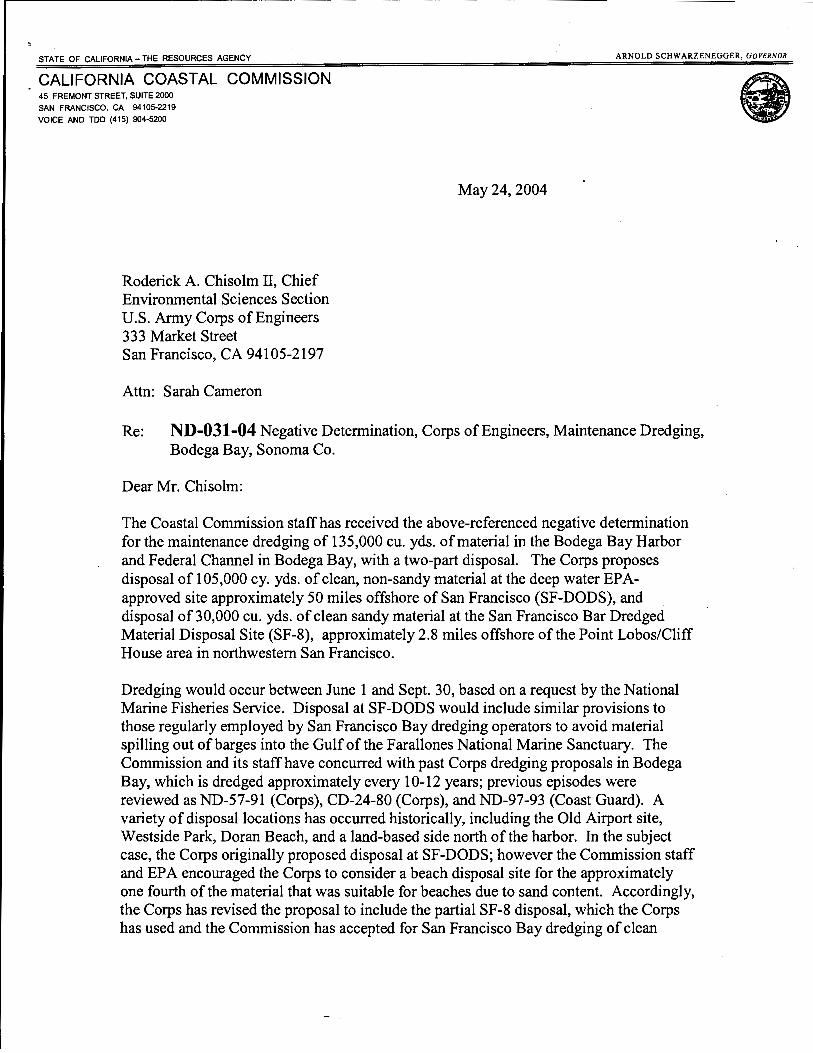
Roderick A. Chisolm II, Chief Environmental Sciences Section U.S. Army Corps of Engineers 333 Market Street San Francisco, CA 94105-2197
Attn: Sarah Cameron
ARNOLD SCHWARZENEGGER, GOVERNOR
May24, 2004
Re: ND-031-04 Negative Determination, Corps ofEngineers, Maintenance Dredging, Bodega Bay, Sonoma Co.
Dear Mr. Chisolm:
The Coastal Commission staffhas received the above-referenced negative determination for the maintenance dredging of 135,000 cu. yds. of material in the Bodega Bay Harbor and Federal Channel in Bodega Bay, with a two-part disposal. The Corps proposes disposal of 105,000 cy. yds. of clean, non-sandy material at the deep water EPAapproved site approximately 50 miles offshore of San Francisco (SF-DODS), and disposal of 30,000 cu. yds. of clean sandy material at the San Francisco Bar Dredged Material Disposal Site (SF-8), approximately 2.8 miles offshore of the Point Lobos/Cliff House area in northwestern San Francisco.
Dredging would occur between June 1 and Sept. 30, based on a request by the National Marine Fisheries Service. Disposal at SF-DODS would include similar provisions to those regularly employed by San Francisco Bay dredging operators to avoid material spilling out of barges into the Gulf of the Farallones National Marine Sanctuary. The Commission and its staff have concurred with past Corps dredging proposals in Bodega Bay, which is dredged approximately every 10-12 years; previous episodes were reviewed as ND-57-91 (Corps), CD-24-80 (Corps), and ND-97-93 (Coast Guard). A variety of disposal locations has occurred historically, including the Old Airport site, Westside Park, Doran Beach, and a land-based side north of the harbor. In the subject case, the Corps originally proposed disposal at SF-DODS; however the Commission staff and EPA encouraged the Corps to consider a beach disposal site for the approximately one fourth of the material that was suitable for beaches due to sand content. Accordingly, the Corps has revised the proposal to include the partial SF -8 disposal, which the Corps has used and the Commission has accepted for San Francisco Bay dredging of clean

Page2
sandy materials. Beaches closer to Bodega Bay were problematic due to habitat concerns and National Marine Sanctuary policies; moreover, Bodega Bay beaches are not eroding. The Commission has previously determined SF-8 disposal to constitute beach replenishment because material from that site migrates to and feeds Ocean Beach in San Francisco, which does experience erosion problems.
Under the federal consistency regulations (Section 930.35), a negative determination can be submitted for an activity "which is the same as or similar to activities for which consistency determinations have been prepared in the past." While these disposal sites have not been used for Bodega Bay disposal, the maintenance dredging of Bodega Bay is similar to past similar projects, and the disposal is similar to past San Francisco Bay disposal proposals (the three most recent of which were ND-012-04, ND-005-03, and ND-004-02). Thus, this project is similar to the above-referenced consistency and negative determinations with which we previously concurred. We therefore concur with your negative determination made pursuant to 15 CFR Section 930.35 of the NOAA implementing regulations. Please contact Mark Delaplaine of the Commission staff at ( 415) 904-5289 if you have any questions.
cc: North Central Coast Area Office California Department of Water Resources Governor's Washington, D.C., Office
Sincerely,
PETER M. DOUGLAS Executive Director

STATE OF CALIFORNIA-THE RESOURCES AGENC't
CALIFORNIA COASTAL COMMISSION 45 FREMONT, SUITE 2000 SAN FRANCISCO, CA 94105-2219 VOICE AND TDD (415) 904-5200 FAX ( 415) 904- 5400
Roderick A. Chisholm, IT Chief, Environmental Sciences Section San Francisco District Corps of Engineers ATTN: Neil Hedgecock 333 Market Street San Francisco, CA 94105-2197
ARNOLD SCHW ARZENEGGER, GOVERNOR
June 3, 2004
Subject: Negative Determination ND-030-04, disposal at SF-DODS of materials dredged from Richmond Inner Harbor channels
Dear Mr. Chisholm:
The Coastal Commission staff has reviewed the above-referenced negative determination. The Corps proposes to dispose of up to 160,000 cubic yards of material dredged from Port of Richmond inner harbor channels at the San Francisco Deep Ocean Disposal Site (SF-DODS), located 49 nautical miles west of the Golden Gate Bridge. Dredging at the Port of Richmond is scheduled to commence in June 2004. The proposed maintenance dredging is subject to the permit and/or federal consistency jurisdiction of the San Francisco Bay Conservation and Development Commission (BCDC). Only the offshore disposal is subject to Coastal Commission jurisdiction.
The Coastal Commission has reviewed past federal consistency submittals for administrative authorizations for disposal at the SF-DODS site in conjunction with Corps of Engineers dredging at the Port of Richmond. Through these reviews the Commission has determined that transportation of dredged material through the coastal zone. to SF-DODS, and disposal at this site, if not properly conducted, could affect the coastal zone. The Commission has determined that key to avoiding these effects is the continuation of adequate testing and monitoring provisions. The Commission noted that use of the SF-DODS site would not be authorized unless: (1) an adequate monitoring program is in place to assure dredging will not affect the Gulf of the Farallones National Marine Sanctuary, and to assure that transportation of dredged material through the coastal zone will not result in premature spills and adverse effects on coastal waters; and (2) testing establishes that the dredged material complies with "Green Book" standards for ocean disposal (i.e., Evaluation of Dredged Material Proposed for Ocean Disposal, Testing Manual, 1991, EPA/COE).
The Commission staff received a copy of the U.S. Environmental Protection Agency's letter of June 2, 2004, in which EPA confirmed its concurrence in the proposed project. In that letter EPA stated that Richmond Harbor sediment samples were subjected to full "Tier Ill" testing in
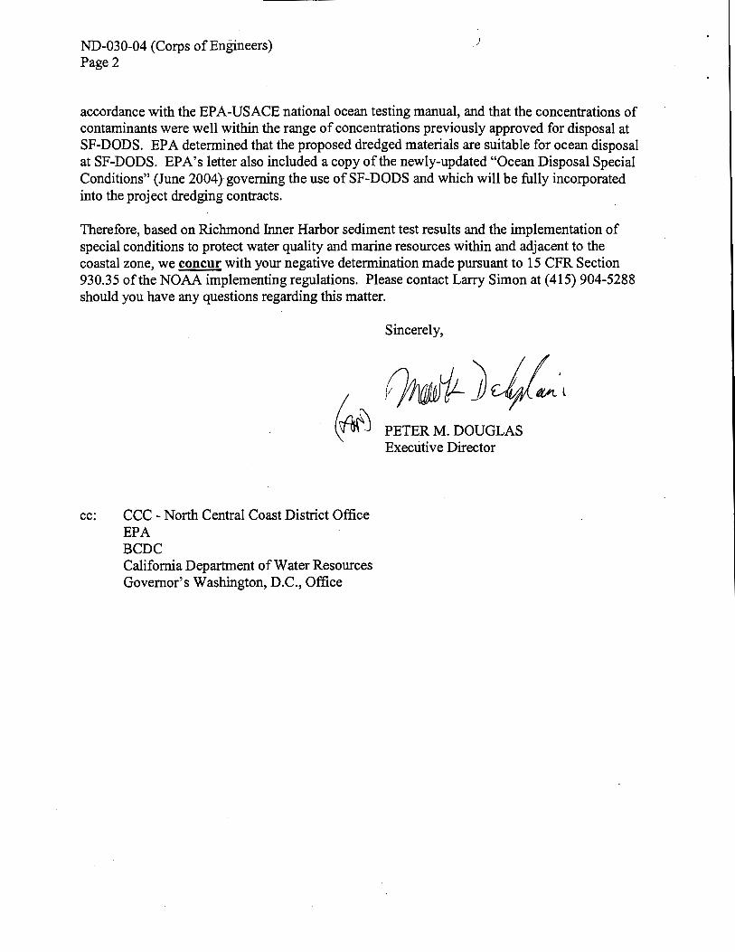
ND-030-04 (Corps ofEngineers) Page2
accordance with the EPA-USACE national ocean testing manual, and that the concentrations of contaminants were well within the range of concentrations previously approved for disposal at SF-DODS. EPA determined that the proposed dredged materials are suitable for ocean disposal at SF-DODS. EPA's letter also included a copy of the newly-updated "Ocean Disposal Special Conditions" (June 2004) governing the use of SF-DODS and which will be fully incorporated into the project dredging contracts.
Therefore, based on Richmond hmer Harbor sediment test results and the implementation of special conditions to protect water quality and marine resources within and adjacent to the coastal zone, we concur with your negative determination made pursuant to 15 CFR Section 930.35 ofthe NOAA implementing regulations. Please contact Larry Simon at (415) 904-5288 should you have any questions regarding this matter.
Sincerely,
~)J/-·~ ~ PETER M. DOUGLAS
Executive Director
cc: CCC - North Central Coast District Office EPA BCDC California Department of Water Resources Governor's Washington, D.C., Office

STATE OF CAUFORNIA- THE RESOURCES AGENCY
CALIFORNIA COASTAL COMMISSION 45 FREMONT STREET, SUITE 2000
SAN FRANCISCO, CA 94105-2219
VOICE AND TOO (415) 904-5200
Mrs. Ruth Bajza Villalobos Chief, Planning Division Los Angeles District U.S. Army Corps of Engineers ATTN: Randy Tabije P.O. Box 532711 Los Angeles, CA 90053-2325
ARNOLD SCHWARZENEGGER, GOVERNOR
June 18, 2004
Re: ND-035-04, Negative Determination, Corps of Engineers, 6-Year maintenance dredging program, Santa Barbara Harbor
Dear Mrs. Villalobos:
The Coastal Commission staff has received the above-referenced negative determination for a 6-Year maintenance dredging program for Santa Barbara Harbor. The project includes annual dredging ofup to 600,000 cu. yds. of sandy material, with beach and surf zone disposal. The primary receiver site is East Beach, with a secondary site (between Mission Beach and the East Side Channel) to be used if it erodes and if the City of Santa Barbara requests its use.
The Corps has tested the sediments; the test results show that, as has been the case historically, they are suitable for beach and nearshore disposal. As has also been the case in past maintenance dredging at the harbor, dredging and disposal operations will be limited to the period between September 1 and April 30, with a single-point discharge if dredging occurs after March 1, to protect grunions. The current proposal includes all the avoidance, minimization, monitoring, and coordination measures that the Commission previously found necessary to protect environmentally sensitive habitat (including snowy plovers, grunions, tidewater gobies, and steelhead trout), recreation, water quality, and other coastal resources.
Under the federal consistency regulations (Section 930.35), a negative determination can be submitted for an activity "which is the same as or similar to activities for which consistency determinations have been prepared in the past." The Commission and its staff have concurred with a number of consistency and negative determinations for similar activities in Santa Barbara Harbor: CD-21-83, CD-25-86, CD-46-89, CD-58-90, CD-79-91, ND-4-92, CD-40-92, CD-32-93, and CD-49-98. The last of these was a 6-year dredge program, which the Commission reviewed and concurred with as a consistency determination. (Also, the Commission staff has previously agreed with a

Page2
Corps negative determination for a 6-Year dredging program in the Channel Island and Port Hueneme Harbors, following a Commission concurrence for a similar consistency determination for a previous 6-Year dredge program at those harbors.)
In conclusion, the Coastal Commission staff agrees that the proposed project is the same as or similar to consistency determinations with which we have previously concurred. We therefore concur with your negative determination made pursuant to 15 CFR Section 930.35 of the NOAA implementing regulations. Please contact Mark Delaplaine of the Commission staff at ( 415) 904-5289 if you have any questions regarding this matter.
Sincerely,
~)J/M<v. ( ~~ PETER M. DOUGLAS ~ Executive Director
cc: Ventura Area Office California Department of Water Resources Governors Washington D.C. Office

STATE OF CALIFORNIA THE RESOURCES AGENO
CALIFORNIA COASTAL COMMISSION 45 FREMONT, SUITE 2000 SAN FRANCISCO, CA 94105-2219 VOICE AND TDD (415) 904-5200 FAX ( 415) 904- 5400
Ruth Bajza Villalobos Chief, Planning Division Los Angeles District U.S. Army Corps of Engineers ATTN: Kirk Brus P.O. Box 532711 Los Angeles, CA 90053-2325
ARNOLD SCHWARZENEGGER. GOVERNOR
June 22, 2004
Subject: Negative Determination ND-036-04, six-year maintenance dredging program at Ventura Harbor, Ventura County
Dear Ms. Villalobos:
The Coastal Commission staffhas received the above-referenced negative determination for a sixyear maintenance dredging program at Ventura Harbor. The project includes annual dredging of between 500,000 and one million cu.yds. of sandy material and disposal of those materials at McGrath State Beach via a pipeline crossing of the sand spit at the mouth of the Santa Clara River. Nearshore disposal off South Beach is an alternative to beach replenishment at McGrath State Beach should high flows in the Santa Clara River threaten to damage the disposal pipeline.
The Corps has tested the sediments and results indicate that these materials are suitable for beach and nearshore disposal. Dredging and disposal operations will be limited to the period between September 15 and March 15, with a single-point discharge if dredging occurs after March 15 to protect grunions. The current proposal includes all the avoidance, minimization, monitoring, and coordination measures that the Commission previously found necessary to protect environmentally sensitive habitat (including snowy plovers, grunions, tidewater gobies, and steelhead trout), public access and recreation, water quality, and other coastal resources.
Under the federal consistency regulations (Section 930.35), a negative determination can be submitted for an activity "which is the same as or similar to activities for which consistency determinations have been prepared in the past." The Commission and its staff have concurred with a number of consistency and negative determinations for similar activities in Ventura Harbor (CD-017-89, ND-021-92, ND-035-92, ND-021-94, CD-054-94, ND-051-95, ND-103-96, CD-104-96, ND-083-97, and CD-064-98). The last ofthese was a six-year maintenance dredge program, which the Commission reviewed and concurred with as a consistency determination. (Also, the Commission staffhas previously agreed with a Corps negative determination for a sixyear maintenance dredging program in the Channel Island and Port Hueneme Harbors, following a Commission concurrence for a similar consistency determination for a previous six-year maintenance dredge program at those harbors.)

ND-036-04 (Corps ofEn6 .neers) Page 2
In conclusion, the Commission staff agrees that the proposed project is the same as or similar to consistency determinations with which we have previously concurred. We therefore concur with your negative determination inade pursuant to 15 CFR Section 930.35 of the NOAA implementing regulations. Please contact Larry Simon at (415) 904-5289 should you have any questions regarding this matter.
cc: South Central Coast District Office California Department of Water Resources Governor's Washington, D.C., Office
Sincerely,
PETER M. DOUGLAS Executive Director
STATE OF CALIFORNIA THE RESOURCES AGENCY
CALIFORNIA COASTAL COMMISSION 45 FREMONT, SUITE 2000 SAN FRANCISCO, CA 94105-2219 VOICE AND TDD (415) 904-5200 FAX ( 415) 904- 5400
Thomas Carr Naval Base Ventura County ATTN: James Danza 311 Main Road, Suite 1 Point Mugu, CA 93042-5001
ARNOLD SCHW ARZENEGGER, GOVERNOR
June 15, 2004
Subject: Negative Determination ND-038-04, Centurion Acoustic Monitoring Project at Port Hueneme, Naval Base Ventura County.
Dear Mr. Carr:
The Coastal Commission staff has reviewed the above-referenced negative determination. The Navy proposes to temporarily install and test an undersea array of sensors for port security at the entrance to Port Hueneme. Currently, potential subsurface threats (e.g., mini-submarines, unmanned underwater vehicles, diver delivery platforms) that could enter ports are largely undetectable. The Navy states that the proposed Centurion system builds on existing undersea surveillance systems but takes advantage ofnew all-optical sensor technology to increase reliability. The Navy proposes to lay a cable array on the sandy ocean floor outside the entrance to Port Hueneme Harbor. Two cables, each approximately 1.5 miles long, would extend from a shore landing point at the Navy's Port Hueneme facility seaward on either side of the undersea Hueneme canyon; after approximately one-quarter mile, the western cable would curve upcoast and the eastern cable downcoast. A short section of cable that crosses the beach and connects the two-cable array to the Navy's Port Operations Building adjacent to the shoreline will be buried in a six-inch deep, hand-dug trench. A 1 00-pound anchor would be attached to the end of each cable to hold the array in place.
The cable array will be deployed on the ocean floor for a maximum of nine months. The sensor system is passive and does not require active acoustics for calibration and testing; standard ship traffic will be used to calibrate and test the system. The Navy surveyed the proposed array locations and found no critical habitat or archaeological resources. At the end of the test period, the Navy will remove all cable array components. The beach cable crossing is located on a Navy facility that is closed to public access and recreation due to military security restrictions. The proposed array will not adversely affect commercial or recreational fishing due to its location on the rim of Hueneme Canyon inshore of the main local fishing grounds.
In conclusion, the Commission staff agrees that the proposed project will not adversely affect coastal zone resources. We therefore concur with your negative determination made pursuant to

ND-038-04 (U.S. Navy) Page2
15 CFR Section 930.35 of the NOAA implementing regulations. Please contact Larry Simon at ( 415) 904-5288 should you have any questions regarding this matter.
cc: South Central Coast District Office California Department of Water Resources Governor's Washington, D.C., Office
Sincerely,
PETER M. DOUGLAS Executive Director

• STATE OF CAUFORNIA ··THE RESOURCES AGENCY
CALIFORNIA COASTAL COMMISSION 45 FREMONT STREET, SUITE 2000
• SAN FRANCISCO, CA 94105·2219
VOICE AND TOO (415) 90+5200
Don L N eubacher Superintendent Point Reyes National Seashore ATTN: Chelsea Donovan Point Reyes, CA 94956
ARNOLD SCHWARZENEGGER. GOVF.RNOR
June 22,2004
Re: ND-040-04, Negative Determination, National Park Service, Chlorination Project, F Ranch, North ofDrakes Estero, Point Reyes National Seashore, Marin Co.
Dear Mr. Neubacher:
The Coastal Commission staffhas reviewed the above-referenced negative determination for the replacement of an existing chlorination facility, adjacent to a historic ranch (F Ranch) located 624 meters north of Drakes Estero, at the Point Reyes National Seashore. The project consists of replacing the chlorination building on an existing concrete pad, replacing water lines and electric lines between existing wells and the building, and adding gravel to an existing gravel road (and extending it 8ft.). The chlorination facility serves an existing ranch complex, including a visitor facility. The water and electric lines would be located within existing wetlands; however the impact would be temporary (0.007 acres of temporary impact, with construction occurring during the dry season), the alignment is the same as the existing lines, and the wetlands will be revegetated upon project completion. The existing chlorination building will be removed and the new facility will be more attractive, replacing a fiberglass structure with a wood structure.
In conclusion, the wetland impacts will be temporary, the project is located on federal land, and the project will benefit water quality, visitor services, and scenic public views. The Commission staff therefore agrees that the proposed project will not adversely affect coastal zone resources, and we therefore concur with your negative determination made pursuant to 15 CPR Section 930.35 of the NOAA implementing regulations. Please contact Mark Delaplaine at ( 415) 904-5289 if you have any questions regarding this matter.
. t=l»#~ ((If') PETER M. DOUGLAS
cc: North Central Coast District Office California Department of Water Resources Governor's Washington, D.C., Office
Executive Director

STATE OF CALIFORNIA ·-THE RESOURCES AGENCY
CAUFORNIA COASTAL COMMISSION 45 FREMONT STREET, SUITE 2000 SAN FRANasco, . CA 94105-2219 VOICE AND TI>D ( 415) 90+5200
June 16, 2004
Brian G. Dugas Padre Associates, Inc. 1012 Pacific Street, Suite. A San Luis Obispo, CA 93401
Re: NE-041-04 No Effects Determination, Texaco Hollister Ranch Pipeline Abandonment Project, Santa Barbara County.
Dear Mr. Dugas:
ARNOLD SOIWARZENEGGER, Governor
The Coastal Commission staff received your June 10, 2004, letter requesting Coastal Commission concurrence with a consistency certification for removal, or abandonment-inplace of three seven-mile long Texaco Exploration and Production, Inc. pipelines. The County of Santa Barbara has granted a Final Development Plan for the project (98-DP-40), in an area where the permit was appealable to the Commission, and the appeal period has run with no appeals being filed. In approving the project, the County required a number of permit conditions to mitigate potentially significant environmental impacts caused by the project. These conditions include measures to prevent or mjnirnjze erosion, grading, oil spills, and affects to riparian vegetation and special-status plants and wiidlife. The County also is requiring that all areas disturbed by pipeline abandonment and removal activities be revegetated and restored.
The Coastal Commission staff has decided not to act on this consistency certification. This decision is based on the fact that the project received a permit from the County and that permit addressed all relevant coastal resource issues. Pursuant to regulations implementing the Coastal Zone Management Act, the Commission's concurrence in your consistency certification "shall be conclusively presumed" if the Commission does not either concur in or object to that certification (15 CFR § 930.62(a)). If you have questions, please contact Alison Dettmer, Manager of the Energy arid Ocean Resources Unit, at 415/904-5205.
Sincerely,
PETERM. DOUGLAS Executive Director
Cc: Matthew Vandersande, U.S. Army Corps of Engineers Nicole Horn, Santa Barbara County Energy Division

STATE OF CALIFORNIA-THE RESOURCES AGENC.
CALIFORNIA COASTAL COMMISSION 45 FREMONT, SUITE 2000 SAN FRANCISCO, CA 94105-2219 VOICE AND TDD (415) 904· 5200 FAX ( 415) 904- 5400
Ruth Bajza Villalobos Chief, Planning Division U.S. Army Corps of Engineers ATTN: Larry Smith P.O. Box 532711 Los Angeles, CA 90053-2325
-j
ARNOLD SCHWARZENEGGER, GOVERNOR
June 22, 2004
Subject: Negative Determination ND-042-04, Sand mining and disposal operations in Port of Los Angeles, Los Angeles County
Dear Ms. Villalobos:
The Coastal Commission staffhas reviewed the above-referenced negative determination. The Corps proposes to modify the previously-concurred with Channel Deepening Project (CD-050-00, CD-006-02, and ND-044-03) in the Port of Los Angeles as follows: (1) mine coarse-grained sand within the area delineated as Dredge Element 203 (D203) for placement at the Pier 300 Expansion Site; (2) dredge D203 to a maximum depth of -90 feet mean lower low water (MLLW) as required to produce two million cu.yds. of coarse-grained sand; (3) dredge finegrained silt and sandy silt from D204, D207, and D21 0 (originally intended for placement at the Pier 300 Expansion Site) to backfill the borrow pit created at D203 and restore this area to the authorized project depth of -53 feet MLL W. The Corps proposes these modifications to take advantage of the opportunity to use quality structural fill material found at D203 for the authorized 40-acre Pier 300 Expansion Site Landfill, rather than lower quality silt and sandy silt from other authorized dredge areas.
Construction activities and environmental impacts associated with the proposed dredge and fill modifications are similar to the Channel Deepening Project activities and impacts previously approved by the Commission in the aforementioned consistency and negative determinations. Proposed dredging and disposal activities will create additional short-term turbidity impacts similar to those previously reviewed by the Commission for the Channel Deepening Project. The U.S. Fish and Wildlife Service and NOAA Fisheries concurred with the Corps' determination that the proposed modifications would not create adverse effects on the foraging activities of either the California least tern or California brown pelican. The Corps concluded that the proposed Channel Deepening Project modifications would not generate significant adverse effects on water quality or marine resources, and that all previously approved mitigation measures and monitoring commitments incorporated into the Channel Deepening Project will remain unchanged by the proposed modifications.

ND-042-04 (Corps ofEn~.aeers) Page 2
In conclusion, the proposed modifications to the Channel Deepening Project in the Port of Los Angeles will not significantly affect the coastal zone. The Commission has previously reviewed the need for and design of the Channel Deepening Project and found it consistent with the California Coastal Management Program. Under the federal consistency regulations (Section 930.35), a negative determination can be submitted for an activity "which is the same as or similar to activities for which consistency determinations have been prepared in the past." The Commission and its staff have previously concurred with consistency and negative determinations for the Channel Deepening Project in the Port of Los Angeles (CD-050-00, CD-006-02, and ND-044-03), and the proposed modifications raise no coastal resource issues that were not reviewed by the Commission in those earlier actions. Potential impacts to marine resources and water quality from the proposed modifications to the previously-concurred with project will not be significant and appropriate mitigation measures remain incorporated into the project. We therefore concur with your negative determination made pursuant to 15 CFR Section 930.35 ofthe NOAA implementing regulations. Please contact Larry Simon at (415) 904-5288 should you have any questions regarding this matter.
Sincerely,
~~141 \t- \.\') PETER M. DOUGLAS
Executive Director
Cc: South Coast District Office California Department of Water Resources Governor's Washington, D.C., Office
STATE OF CALIFORNIA-THE RESOURCES AGENC\
CALIFORNIA COASTAL COMMISSION 45 FREMONT, SUITE 2000 SAN FRANCISCO, CA 94105-2219 VOICE AND TDD (415) 904- 5200 FAX ( 415) 904- 5400
WoodySmeck Superintendent Santa Monica Mountains National Recreation Area ATTN: Evan Jones 401 West Hillcrest Drive Thousand Oaks, CA 91360-4207
ARNOLD SCHWARZENEGGER, GOVERNOR
June 22, 2004
Subject: Negative Determination ND-043-04, Erecting barrier fencing and posting NPS signs on boundary adjacent to private property, NPS Tract 124-24, Santa Monica Mountains National Recreation Area (NRA), Los Angeles County.
Dear Mr. Smeck:
The Coastal Commission staff has reviewed the above-referenced negative determination. Subsequent to telephone conversations between National Park Service (NPS) staff at the Santa Monica Mountains National Recreation Area (SMMNRA) and Coastal Commission staff, the NPS submitted this after-the-fact negative determination on June 17, 2004, for emergency action undertaken by the NPS on May 4, 2005. The NPS reports that a recent field investigation by its law enforcement staff identified illegal vehicular travel across public lands (APN 4464-019-900; NPS Tract 124-4) within NPS jurisdiction near Castro Crest in the Santa Monica Mountains NRA. The Chief Ranger at SMMNRA ordered his staffto erect barrier fencing and/or post NPS regulatory signs at six locations on the NPS parcel to deter the vehicular access and the associated park resource damage: four at NPS/private property boundary sites and two at interior sites within the parcel. The resource damage includes removal of and disturbance to native vegetation and environmentally sensitive habitat, soil compaction, prevention of establishment of new vegetation, and increased sediment runoff. The negative determination submitted by the NPS includes a map and photographs illustrating the the locations of the installed fences and signs on the NPS parcel, and the approximate location of the coastal zone boundary where it crosses the parcel. (The Coastal Commission issued a Cease and Desist Order (No. CCC-03-CD-015) in December 2003, in which the Commission found that there is not a legally existing road at this location and ordered the adjacent property owner to stop any and all removal of native vegetation and to stop road grading, clearing, or maintenance on the NPS parcel.)
The NPS states in its negative determination that Title 36 ofthe United States Code of Federal Regulations, Section 4.10(a) prohibits operating a motor vehicle on National Park Service lands except on designated "park roads, in parking areas, and on routes and areas designated for offroad vehicle use." The NPS further states that:

ND-043-04 (NPS) Page2
The Superintendent's Compendium for Santa Monica Mountains National Recreation Area specifically defines park roads open to the public as those illustrated on the park's official map and guide. According to the official map and guide, NPS Tract 124-24 has no roads open for public use, and therefore, the park was acting within its authority to block the illegal vehicular use.
The negative determination reports, and the submitted photographs document, that the fencing is wildlife-passable. The NPS states that minimal vegetation was disturbed while installing the fence posts and that no public recreational trails are associated with the subject parcel.
The Commission staff agrees that the fencing and signage do not adversely affect coastal resources adjacent to the NPS parcel, in particular, public access and recreation, environmentally sensitive habitat, and water quality. By blocking unauthorized vehicular access onto NPS lands, these coastal resources will be protected from the impacts of such use at this location. Therefore, the Commission staff concurs with your negative determination made pursuant to 15 CFR Section 930.35 ofthe NOAA implementing regulations. Please contact Larry Simon at (415) 904-5288 should you have any questions regarding this matter.
cc: South Central Coast District Office California Department of Water Resources Governor's Washington, D.C., Office Melanie Beck, NPS
Sincerely,
PETER M. DOUGLAS Executive Director