queen charlotte track brochure - doc.govt.nz · the queen charlotte track is the marlborough sounds...
TRANSCRIPT

Published by: Department of ConservationWaitohi/Picton Office P O Box 161, Picton 7250 New Zealand November 2017
Editing and design: Creative Services, DOC National Office
This publication is produced using paper sourced from well-managed, renewable and legally logged forests.
Cover photo: Queen Charlotte Track Inc/Richard Briggs Photography
QueenCharlotte Track
INTRODUCTIONDeep in the heart of the Marlborough Sounds, South Island, New Zealand, the spectacular Queen Charlotte Track stretches from the legendary Meretoto/Ship Cove to Anakiwa, home of Outward Bound New Zealand’s school. The track passes through lush coastal forest, around historic bays, along skyline ridges, crossing both private and public land and offers unsurpassed views of the Queen Charlotte/Tōtaranui and Kenepuru sounds. The track is a unique partnership between the Department of Conservation (DOC), Marlborough District Council and private landowners (see the Private land fees section).The 70-kilometre track is wide and benched and is suitable for both walkers and mountain bike riders, taking 3 to 5 days to complete walking, or 2 to 3 days mountain biking. Walking boots or a mountain bike and a good level of fitness are required. Much of the track’s charm is its relative ease of access, which allows visitors to walk or bike the track in sections. Road and boat transport services are available from Picton. You can also arrange for your gear to be transported between overnight stops by one of the boat operators. Historic Meretoto/Ship Cove is the favoured point for beginning the track. There are many places to stay along the way, either in private accommodation or in DOC campsites.The Queen Charlotte Track is the Marlborough Sounds section of Te Araroa — The Long Pathway, a hiking trail the length of New Zealand, from Cape Reinga to Bluff. For more information on Te Araroa go to www.teararoa.org.nz.The track is also one of NZ’s Great Rides as part of Nga Haerenga The New Zealand Cycle Trail. For more information go to www.nzcycletrail.com.
For more information about the Queen Charlotte Track, visit www.doc.govt.nz or contact:Department of ConservationPicton i-SITEPicton ForeshorePO Box 29, Blenheim 7240Phone: (03) 520 3113 Fax: (03) 573 5021Email: [email protected] Charlotte Track Incorporatedwww.qctrack.co.nzDepartment of ConservationNelson Visitor CentreMillers Acre Centre / Taha o te Awa79 Trafalgar Street, Nelson 7010PO Box 375, Nelson 7040Phone: (03) 546 9339Email: [email protected]
MARLBOROUGH SOUNDS
On Tawa Saddle. Photo: Z Heine
Getting therePicton is the best place to access the track from. Anakiwa, Te Mahia Saddle, Mistletoe Bay, Torea Saddle and Bay and Kenepuru Saddle are all accessible by road. Endeavour Inlet, Resolution Bay and Meretoto/Ship Cove can only be accessed by sea. Many short walks can be enjoyed from these places. Transport operatorsA number of companies offer boat transport to and from points along the track, including Meretoto/Ship Cove and Anakiwa. Further information is available from the Picton i-SITE.

Coo
king
she
lter
App
roxi
mat
e al
titud
e ab
ove
sea
leve
l
App
roxi
mat
e nu
mbe
r of
tent
site
s
Wat
er ta
xi s
top
Tim
e/di
stan
ce fr
om
mai
n tra
ck
Pric
e pe
r nig
ht
Schoolhouse Bay
No 5 m 6 Yes 10 min/800 m $6
Camp Bay Yes 5 m 20 Yes 0 (on the track) $8
Bay of Many Coves
Yes 305 m 6 No 0 (on the track) $6
Black Rock Yes 260 m 4 No 0 (on the track) $6
Cowshed Bay
Yes 5 m 30 No 10 min/1 km $13
Umungata (Davies Bay)
Yes 1 m 25 No 2 min/100 m $6
ACCOMMODATION/CAMPING
There are six DOC-managed, ‘self-registration’ campsites on the track, each with toilets and water supply. There are no cooking facilities at the campsites; you need to carry your own cooker. Avoid disposing of food scraps around the campsites as this causes visible pollution and attracts vermin. Remember there are no rubbish facilities: please take your rubbish out with you.Camping fees for DOC campsites are to be deposited in the self-registration box at each site or prepaid at the Picton i-SITE or DOC office.
Toilets • Always use toilets, where provided, to avoid polluting
waterways and bush margins. If you need to, go at least 50 m (100 steps) off the track or away from any waterway and bury your waste and toilet paper.
• Never put rubbish or food down the toilets. • After you have used it, close the toilet lid and the door.• Carry hand-sanitiser for personal hygiene.A number of private accommodation providers offer hostel, cabin, motel and hotel lodgings, and tent sites. The private tracks that leave the main track to private accommodation are not constructed to the same standard as the Queen Charlotte Track and may be narrow, steep, and slippery when wet. Some private accommodation sites may not be signposted, so make sure you get clear directions when you book.
DOC campsites
MOUNTAIN BIKING
Mountain biking is a great alternative to walking the Queen Charlotte Track, which is part of Nga Haerenga, the NZ Cycle Trail. Biking on the track is permitted all year round except for the section between Meretoto/Ship Cove and Kenepuru Saddle, which is closed to bikes over the busy summer season from 1 December to 28 February each year. Allow 2 to 3 days to ride the entire track, but sections of the track make good day rides, particularly between Meretoto/Ship Cove and Kenepuru Saddle (27 km) and between Mistletoe Bay and Anakiwa (12.5 km).Queen Charlotte Track is graded as intermediate/grade 3 and advanced/grade 4 mountain biking. Most riders will find some sections of the track easier to walk. If you are moderately fit and experienced at mountain biking, the track is very rideable, albeit steep and challenging in certain sections, especially when rain has rendered it slippery and muddy. Less experienced riders may prefer to avoid the ridge-top sections of the central part of the track by riding along Kenepuru Road between Kenepuru Saddle and Portage.There are no facilities along the way for repairing bikes; please make sure you have adequate tools and equipment and are competent to complete your own repairs.Approximate biking times:• Meretoto/Ship Cove to Camp Bay: 26.5 km, 5 hr• Camp Bay to Torea Saddle: 23 km, 4 hr• Torea Saddle to Anakiwa: 20.5 km, 4 hr.
Mountain bike track gradesIntermediate/Grade 3: Steep slopes and/or avoidable obstacles possibly on narrow
track and/or with poor traction. There may be exposure at the track’s outside edge.
Advanced/Grade 4: A mixture of long, steep climbs, narrow track, poor traction
and obstacles that are difficult to avoid or jump over. Generally exposed at the track’s outside edge. Most riders will find some sections easier to walk.
Umungata (Davies Bay) cooking shelter. Photo: Pete Brady
Private land feesSections of the track cross private land. Track users are required to have a Queen Charlotte Track Land Cooperative (Q.C.T.L.C.) Pass for all Q.C.T.L.C. private land between Kenepuru Saddle, Torea Saddle, Te Mahia Saddle and Anakiwa. The pass fee contributes to track maintenance, enhancement and access. For more information on the pass contact the Q.C.T.L.C. [email protected] or www.qctlc.com.Please respect the owners’ property and do not use vehicles or take firearms or dogs on the track.
Pass fees: $10.00 for a 1 day pass.$18.00 for up to 5 consecutive days.$35.00 for an annual pass.Schoolchildren are free.Passes can be purchased at local i-SITEs, online, from a dispensing machine at Anakiwa and some businesses near the track.
YOUR SAFETY IS YOUR RESPONSIBILITYPlease rememberThe Sounds Foreshore ReservePublic access to most bays and beaches in the Marlborough Sounds is guaranteed by the unique Sounds Foreshore Reserve. This is an approximately 20-metre wide strip of publicly owned land above the mean high water mark. If you use this reserve, please respect the rights of any nearby residents. Some landowners have riparian (private) rights to the foreshore.
Fire• We encourage the use of gas cookers. No fires are permitted
in campsites or along the track.• During periods of extreme drought and high fire risk, the
track may be closed.
Water• All water should be treated, filtered or boiled for 3 minutes to
make it safe to drink.• Do not use soap in streams.• Always carry drinking water, particularly between Kenepuru
and Te Mahia saddles.• Water taps are provided at the DOC campsites and washing
sinks are provided in the cooking shelters.• Water supplies are limited, so use sparingly.• During dry seasons a water supply may be empty.
JettiesMany jetties in the Sounds, such as the one at Outward Bound New Zealand, Anakiwa, are privately owned. Boat owners can use them for picking up and dropping off passengers and luggage only. Please do not tie up or leave your boat unattended at any jetty in the Sounds.
RubbishThere are no rubbish facilities along the track: please take your rubbish away with you.
WaspsWasps are common in late summer and autumn, particularly on beech trees. Carry antihistamines if you are allergic to their stings.
Pigs and goatsYou may encounter a wild pig or goat along the track – they will usually take fright and disappear quickly into the bush. These pests are responsible for the disturbed ground and chewed plants along the track. You may also encounter hunters with dogs and/or firearms looking for these pest animals.
Camp Bay to Torea Saddle: 8 hr, 23 km (3 hr to campsite at Bay of Many Coves)The track passes through private land in this section. Make sure you have your Q.C.T.L.C. Pass (see Private land fees section overleaf for more information).This is the longest and most arduous section of the journey; most mountain bikers will need to push their bike in various places here. However, from the top of the ridge you will be well rewarded with magnificent panoramas of the Sounds. Climb out of Camp Bay to Kenepuru Saddle and follow the ridge separating Queen Charlotte Sound from Kenepuru Sound. Above Bay of Many Coves and Kumutoto Bay are two DOC campsites, Bay of Many Coves and Black Rock, each with water, toilets and a cooking shelter. Eventually the track descends to Torea Saddle between Portage and Torea Bay. There is a DOC campsite at Cowshed Bay and private accommodation in Portage.
Torea Saddle to Mistletoe Bay: 4 hr, 8 kmThe track passes through private land in this section. Make sure you have your Q.C.T.L.C. Pass (see Private land fees section overleaf for more information).This part of the journey also follows the ridgeline. Here gorse and mānuka are prolific, sheltering shrubs and trees that will one day shade the way. A side walk leads to a lookout just before the descent to Te Mahia Saddle begins. At Mistletoe Bay there are cabins and campsites. To book, contact Mistletoe Bay Eco Village (phone 03 573 5048 or go to www.mistletoebay.co.nz). There is also private accommodation at Te Mahia Bay.
Mistletoe Bay to Anakiwa: 4 hr, 12.5 kmBeginning on the road above Mistletoe Bay, this section follows old bridle paths high above the water. The track rounds an obvious point and descends to the DOC campsite at Umungata Bay (Davies Bay). The final hour’s walking is on an easy path through mature beech forest to Anakiwa. At Anakiwa there are a car park, shelter, toilet, and phone near the track end, and a jetty. Here you can catch a boat to Picton (see Getting there) or stay in nearby accommodation (go to www.qctrack.co.nz for options).
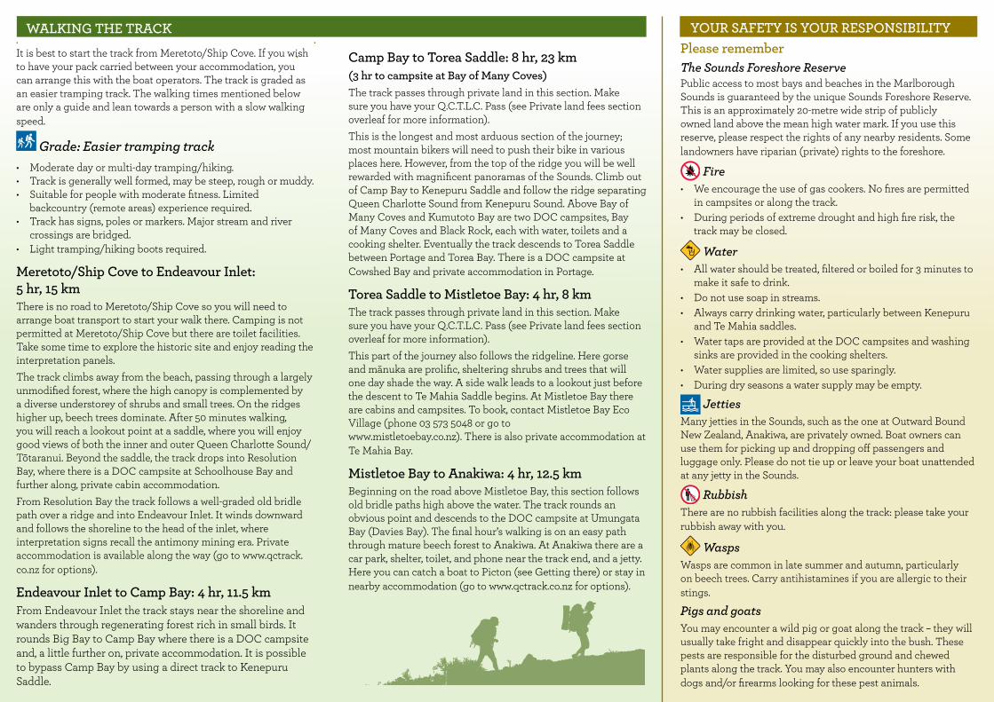
WALKING THE TRACK
It is best to start the track from Meretoto/Ship Cove. If you wish to have your pack carried between your accommodation, you can arrange this with the boat operators. The track is graded as an easier tramping track. The walking times mentioned below are only a guide and lean towards a person with a slow walking speed.
Grade: Easier tramping track• Moderate day or multi-day tramping/hiking.• Track is generally well formed, may be steep, rough or muddy.• Suitable for people with moderate fitness. Limited
backcountry (remote areas) experience required.• Track has signs, poles or markers. Major stream and river
crossings are bridged.• Light tramping/hiking boots required.
Meretoto/Ship Cove to Endeavour Inlet: 5 hr, 15 kmThere is no road to Meretoto/Ship Cove so you will need to arrange boat transport to start your walk there. Camping is not permitted at Meretoto/Ship Cove but there are toilet facilities. Take some time to explore the historic site and enjoy reading the interpretation panels. The track climbs away from the beach, passing through a largely unmodified forest, where the high canopy is complemented by a diverse understorey of shrubs and small trees. On the ridges higher up, beech trees dominate. After 50 minutes walking, you will reach a lookout point at a saddle, where you will enjoy good views of both the inner and outer Queen Charlotte Sound/Tōtaranui. Beyond the saddle, the track drops into Resolution Bay, where there is a DOC campsite at Schoolhouse Bay and further along, private cabin accommodation.From Resolution Bay the track follows a well-graded old bridle path over a ridge and into Endeavour Inlet. It winds downward and follows the shoreline to the head of the inlet, where interpretation signs recall the antimony mining era. Private accommodation is available along the way (go to www.qctrack.co.nz for options).
Endeavour Inlet to Camp Bay: 4 hr, 11.5 kmFrom Endeavour Inlet the track stays near the shoreline and wanders through regenerating forest rich in small birds. It rounds Big Bay to Camp Bay where there is a DOC campsite and, a little further on, private accommodation. It is possible to bypass Camp Bay by using a direct track to Kenepuru Saddle.

12.5km, 4h
400
2000
400
20008 km, 4h 23 km, 8h
11.5km, 4h 10.5km, 3h 4.5km, 2h
AnakiwaDavies Bay campsite
e Mahia Saddle Black Rockcampsite campsite
Kenepuru Saddle
Camp Baycampsite
Endeavour InletResolution Bay
Schoolhouse Baycampsite
Meretoto/Ship Cove
orea Saddle
Cowshed Baycampsite
Bay of Many CovesTT
Altitude (metres)Altitude (metres)
En
de
av
ou
r In
let
dnuoS uahaM
yaB ototumuK
Torea
Lochm
araB
ay
Onahau B
ay
Anakiwa
LinkwaterPicton
Davies Baycampsite
Schoolhouse Bay campsite
Camp Baycampsite
KenepuruSaddle
Blumine Island(Oruawairua)
Bay of Many Coves campsite
Black Rock campsite
Mistletoe Bay
Torea Saddle
Clova Bay
yaB iatearaM
rmAe ovGr
Double Bay
yaB airatiaW
Te Mahia
Resolution Bay
Bay ofMany Coves
Ruakaka Bay
yaB auhauhaT
ro yaB doo
wkcalB
Mt Stokes1203 m
Bay
WaikawaBay
•
Te MahiaSaddle
Bay
Base data supplied by Geographx Ltd—copyright reserved
Printed December 2013
To TitirangiTo Anakoha Bay
o u ndS urupeneK
To Antimony Mine
Cowshed Baycampsite
Waima Way
Fitz’s Folly
Land Haven
Shamrock RidgeBlack RockStation
ManukaLane
Eatwells Lookout
GatenbyGulch
Meretoto/Ship Cove
B
B
B
B
B
BB
B
B
B
Tory Channel/Kura Te Au
Queen Charlotte Sound / Tōtaranui
B
Portage Bay
kilometres
0 1 2
lennaTo r y Ch
Blumine Island(Oruawairua)
Base data supplied by Geographx Ltd—copyright reserved
Sealed road
Unsealed road
Easier tramping track/Advanced mountain bike track*
Pass required, visit www.qctlc.com
Tramping track
Non-DOC track, access to accommodation
This map is a guide only. For more information consult NewTopo Queen Charlotte Track or NZTopo50 maps BQ28 Havelock, BQ29 Waikawa and BP29 Endeavour Inlet.
Queen Charlotte Track is the Marlborough Sounds section of Te Araroa—The Long Pathway, a hiking trail the length of New Zealand, from Cape Reinga to Bluff. For more information on Te Araroa go to www.teararoa.org.nz.
Toilets
Campsite
No camping
Water supply
Shelter
Picnicking
Information
Public phone
Car park
*Ship Cove to Kenepuru Saddle is closed to mountain bikes1 December–28 February.
Easier tramping track/Advanced mountain bike track on private land (boundaries marked by blue posts on the track)
B Boat service
Short walksWith such good access by road and/or sea, most sections of the track can be used for day walks. There are also several short side-trips along the way.• At Meretoto/Ship
Cove, you can take the Waterfall Track to a small waterfall in the forest (30 minutes return).
• At the head of Endeavour Inlet the Antimony Tramping Track leads up to a saddle and passes through an area that was extensively mined for antimony in the late 1880s (up to 2 hours return).
• In Mistletoe Bay, the James Vogel Nature Track allows you to explore the forest behind the picnic and camping area (45 minutes return). The Peninsula Walk explores the peninsula between Mistletoe and Waterfall bays (30 minutes return).
lennaTo r y Ch
Blumine Island(Oruawairua)
Base data supplied by Geographx Ltd—copyright reserved
Sealed road
Unsealed road
Easier tramping track/Advanced mountain bike track*
Pass required, visit www.qctlc.com
Tramping track
Non-DOC track, access to accommodation
This map is a guide only. For more information consult NewTopo Queen Charlotte Track or NZTopo50 maps BQ28 Havelock, BQ29 Waikawa and BP29 Endeavour Inlet.
Queen Charlotte Track is the Marlborough Sounds section of Te Araroa—The Long Pathway, a hiking trail the length of New Zealand, from Cape Reinga to Bluff. For more information on Te Araroa go to www.teararoa.org.nz.
Toilets
Campsite
No camping
Water supply
Shelter
Picnicking
Information
Public phone
Car park
*Ship Cove to Kenepuru Saddle is closed to mountain bikes1 December–28 February.
Easier tramping track/Advanced mountain bike track on private land (boundaries marked by blue posts on the track)
B Boat service