prt in eskilstuna - · pdf fileprt in eskilstuna route choice and ... bath prt study. photo...
TRANSCRIPT
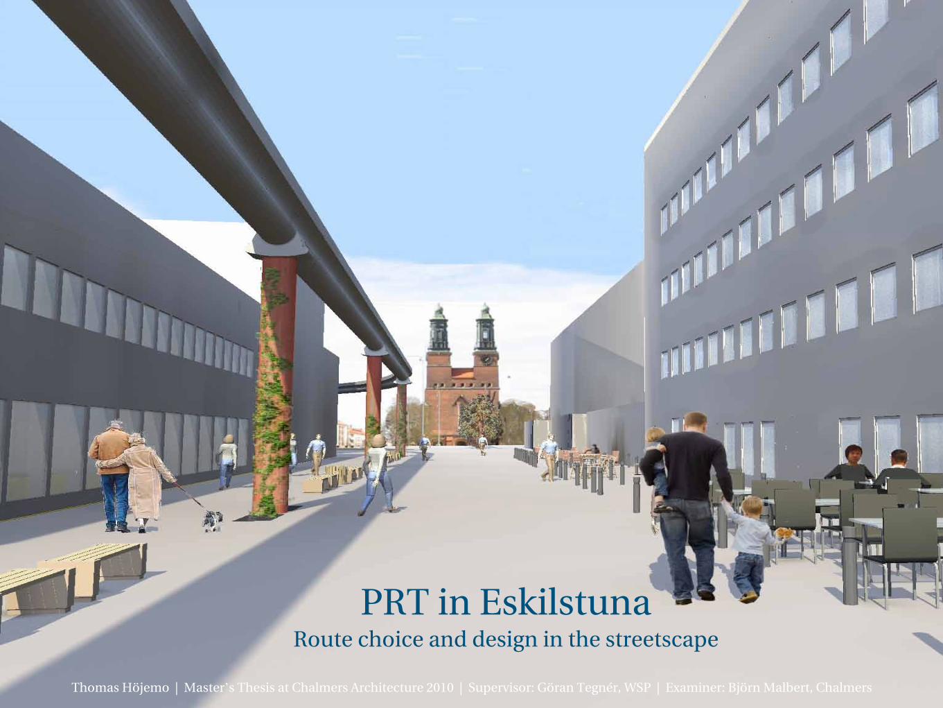
PRT in EskilstunaRoute choice and design in the streetscape
Thomas Höjemo | Master’s Thesis at Chalmers Architecture 2010 | Supervisor: Göran Tegnér, WSP | Examiner: Björn Malbert, Chalmers

How does PRT work?
Where is Eskilstuna?
Why?
Which goals?
What problems?
What opportunities?
How?
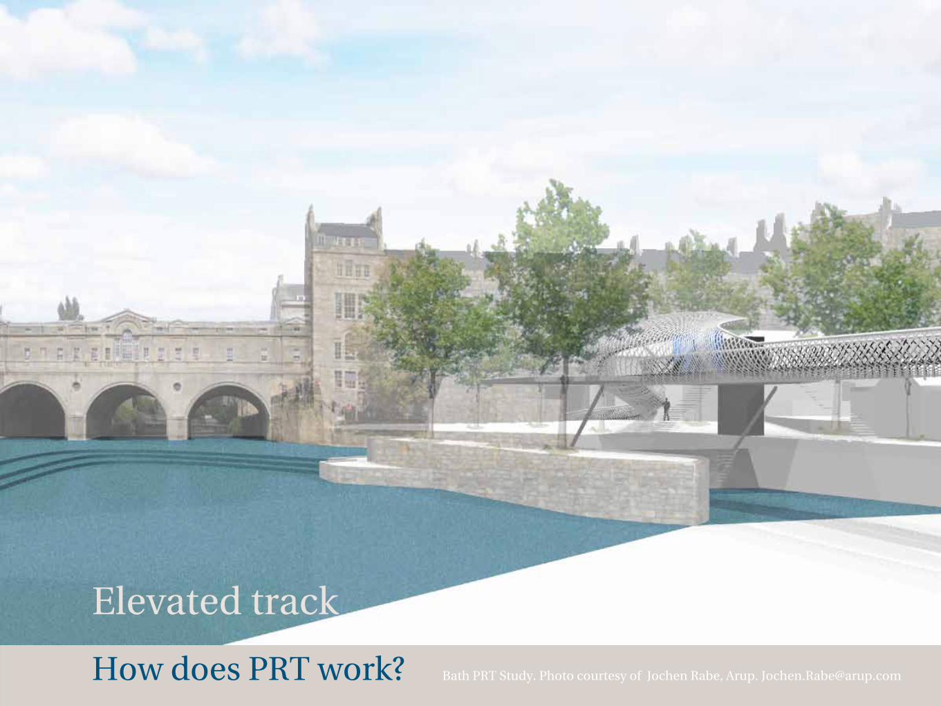
How does PRT work? Bath PRT Study. Photo courtesy of Jochen Rabe, Arup. [email protected]
Elevated track
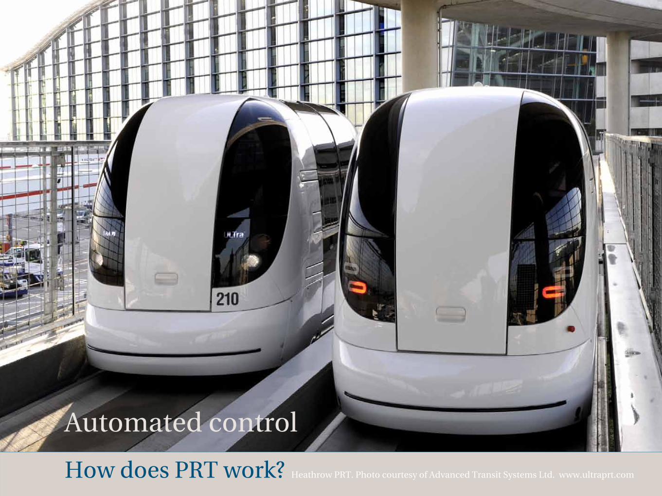
How does PRT work? Heathrow PRT. Photo courtesy of Advanced Transit Systems Ltd. www.ultraprt.com
Automated control

How does PRT work?
4-6 persons per vehicle
PRT vehicle. Photo: Courtesy of Advanced Transit Systems Ltd. www.ultraprt.com
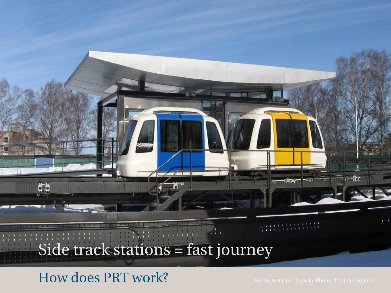
How does PRT work? Vectus test site, Uppsala. Photo: Thomas Höjemo
Side track stations = fast journey
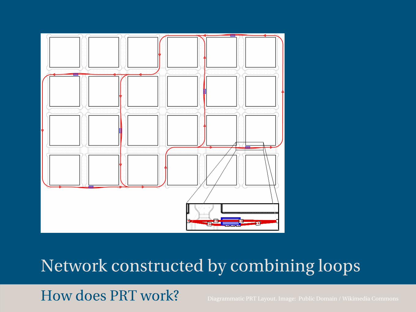
How does PRT work? Diagrammatic PRT Layout. Image: Public Domain / Wikimedia Commons
Network constructed by combining loops

How does PRT work?
Where is Eskilstuna?
Why?
Which goals?
What problems?
What opportunities?
How?
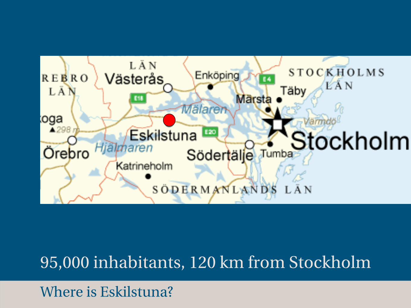
Where is Eskilstuna?
95,000 inhabitants, 120 km from Stockholm
Where is Eskilstuna?
Kungsgatan
Rådhusbron
J.A. Selanders gata
Nyb
roga
tan
Ham
ngatan
Hamngatan
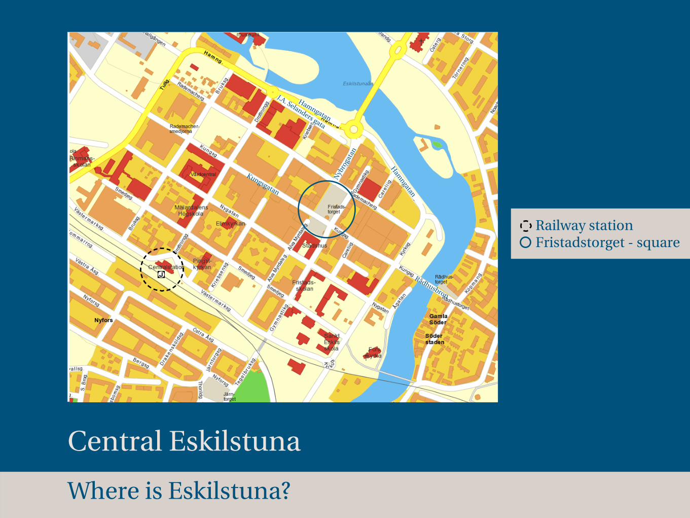
Central Eskilstuna
Railway station Fristadstorget - square
Where is Eskilstuna?
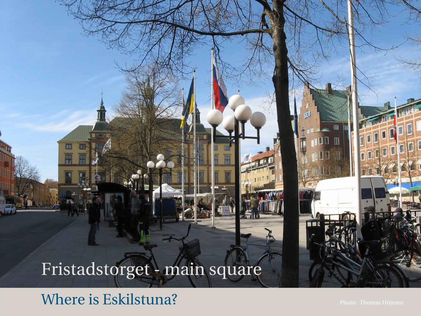
Fristadstorget - main square
Photo: Thomas Höjemo

How does PRT work?
Where is Eskilstuna?
Why?
Which goals?
What problems?
What opportunities?
How?
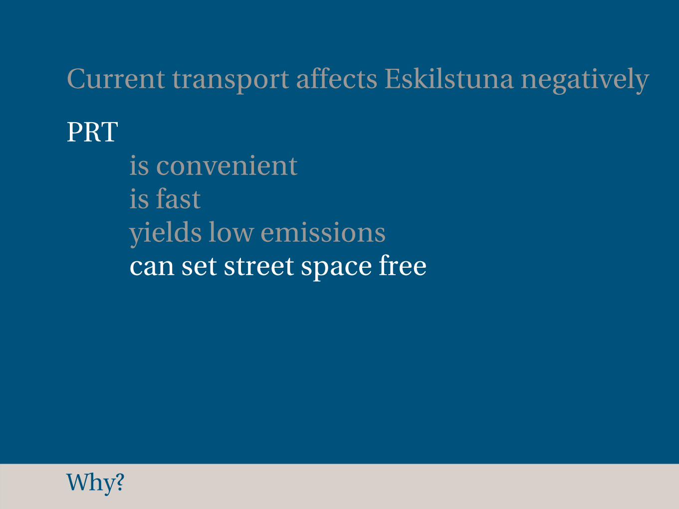
Why?
Current transport affects Eskilstuna negatively
Why?
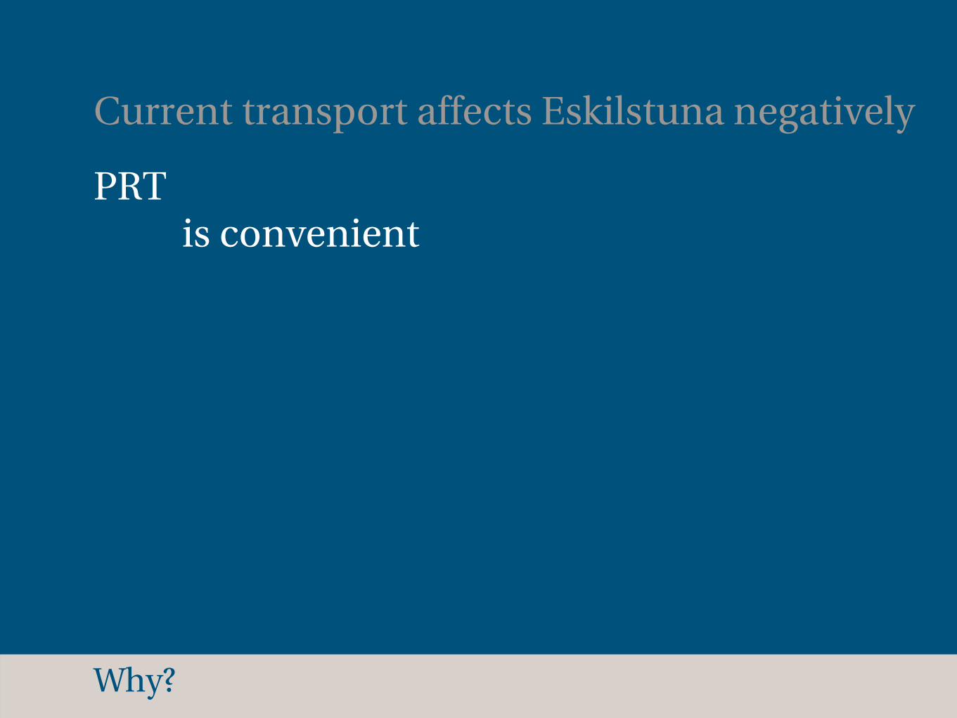
Current transport affects Eskilstuna negatively
PRT is convenient
Why?
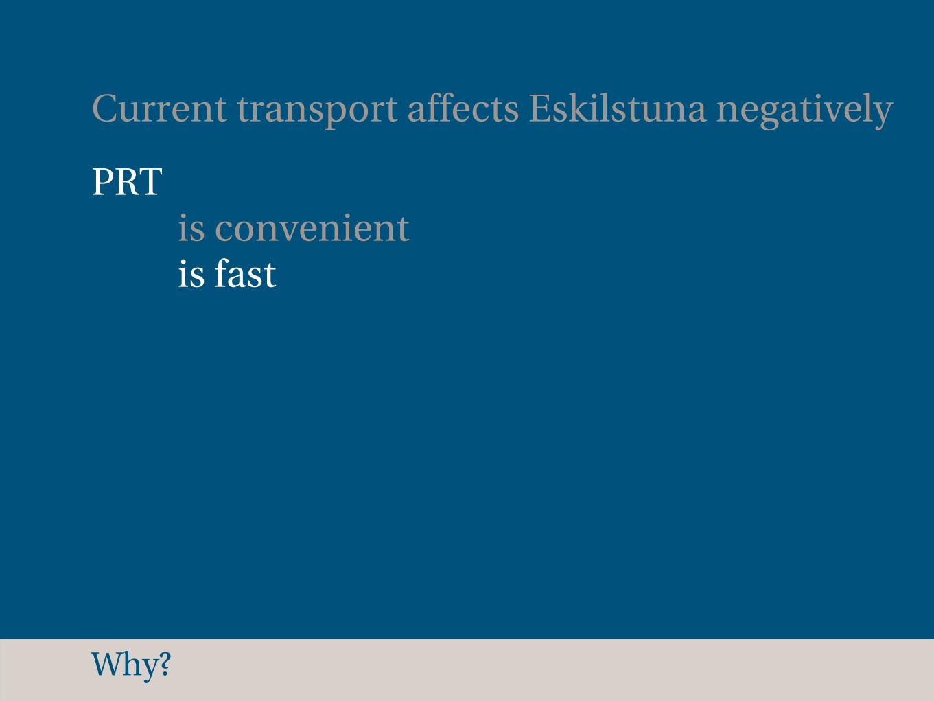
Current transport affects Eskilstuna negatively
PRT is convenient is fast
Why?
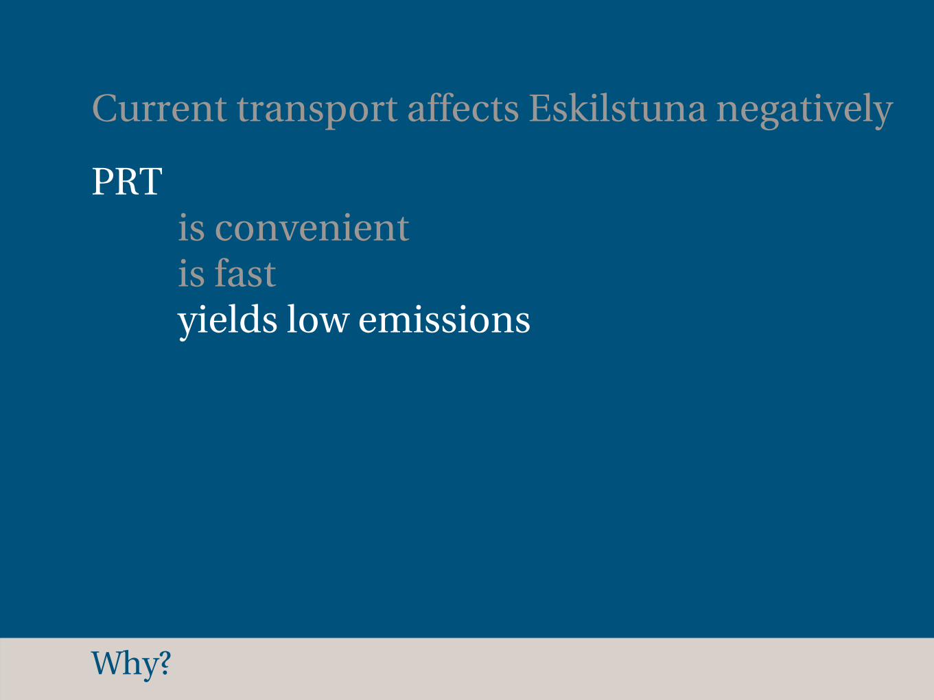
Current transport affects Eskilstuna negatively
PRT is convenient is fast yields low emissions
Why?
Current transport affects Eskilstuna negatively
PRT is convenient is fast yields low emissions can set street space free

How does PRT work?
Where is Eskilstuna?
Why?
Which goals?
What problems?
What opportunities?
How?
Which goals?
Reduce pollution
Which goals?
Reduce pollution
Take the streetscape into account
Which goals?
Reduce pollution
Take the streetscape into account
Prioritize pedestrians and cyclists
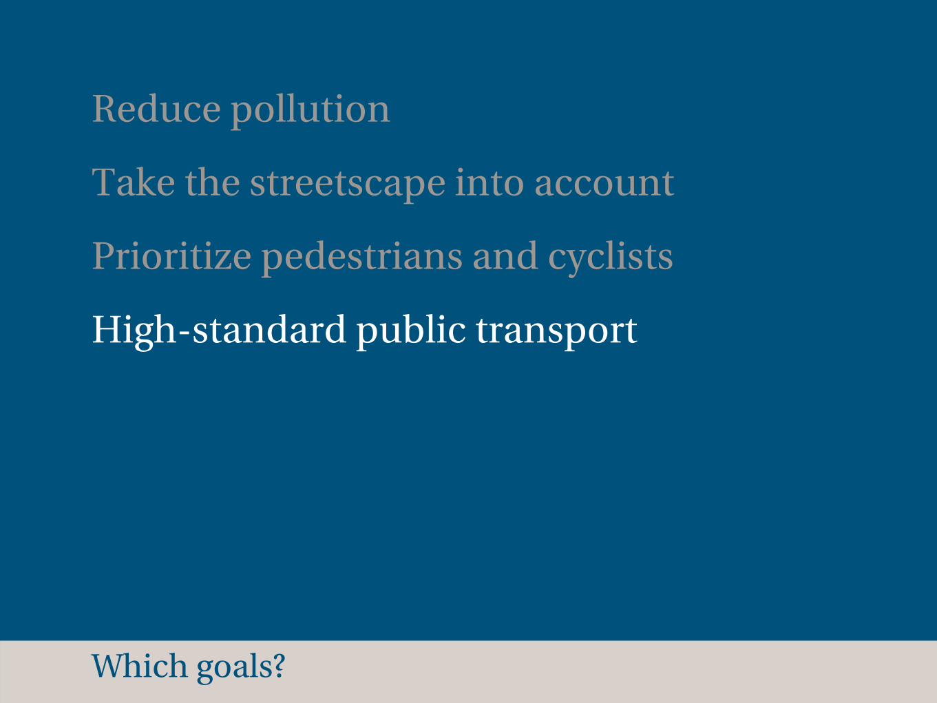
Which goals?
Reduce pollution
Take the streetscape into account
Prioritize pedestrians and cyclists
High-standard public transport

How does PRT work?
Where is Eskilstuna?
Why?
Which goals?
What problems?
What opportunities?
How?

What problems?
No system in use yet (catch 22)
What problems?
No system in use yet (catch 22)
Visual dominance of the street

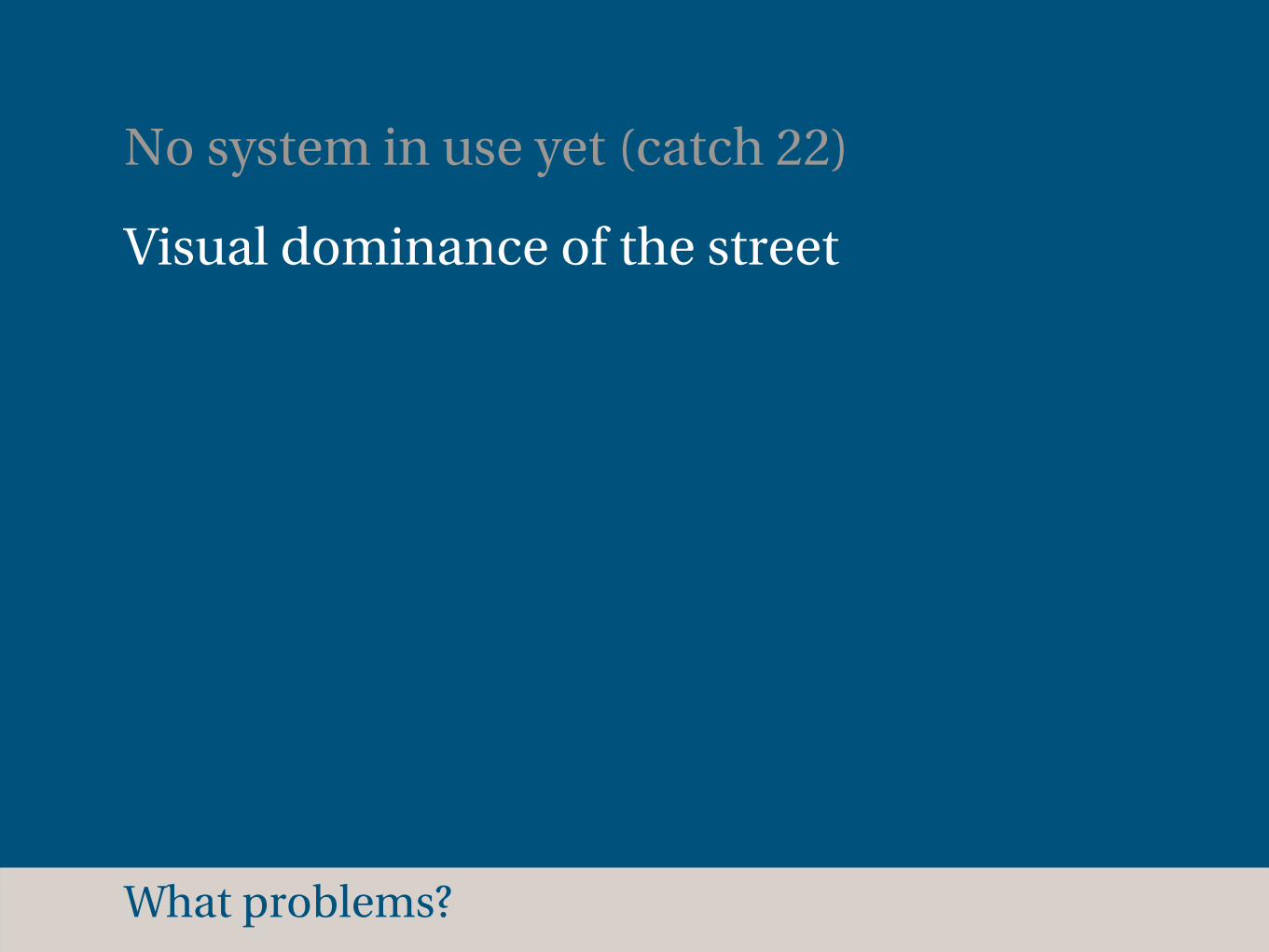
What problems?
No system in use yet (catch 22)
Visual dominance of the street
Privacy concerns - view into apartments
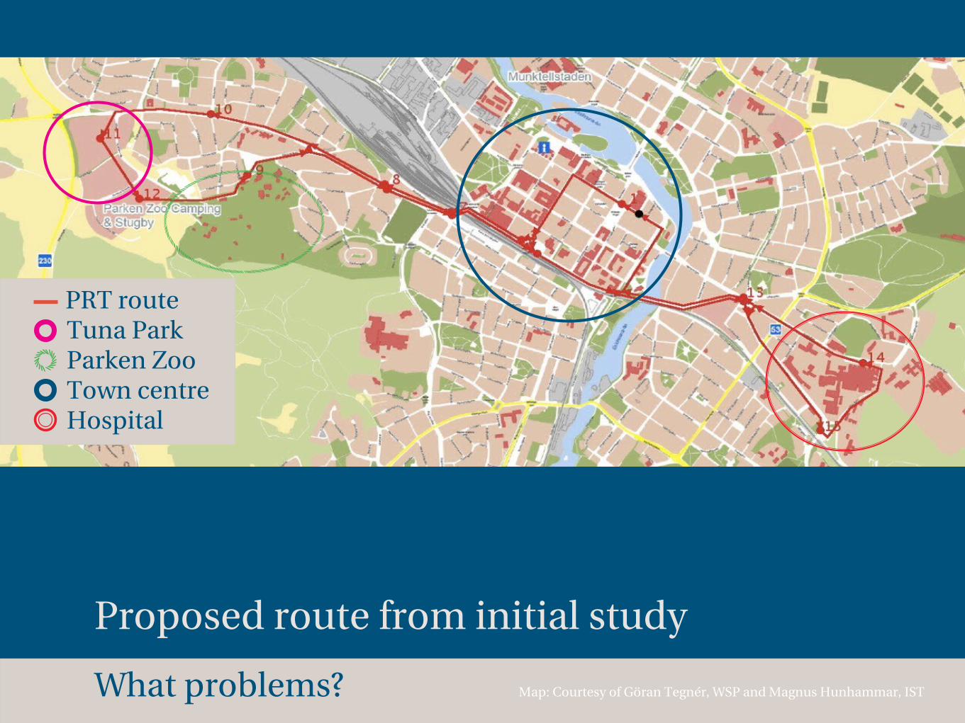
Förstudie i EskilstunaEskilstuna
Bild: Sträckning för föreslagen pionjärbana. Källa: Göran Tegnér (2009), WSP.
Initial study in EskilstunaEskilstuna
Image: Route for proposed pioneer PRT track.What problems?
Proposed route from initial study
Map: Courtesy of Göran Tegnér, WSP and Magnus Hunhammar, IST
PRT route Tuna Park Parken Zoo Town centre Hospital
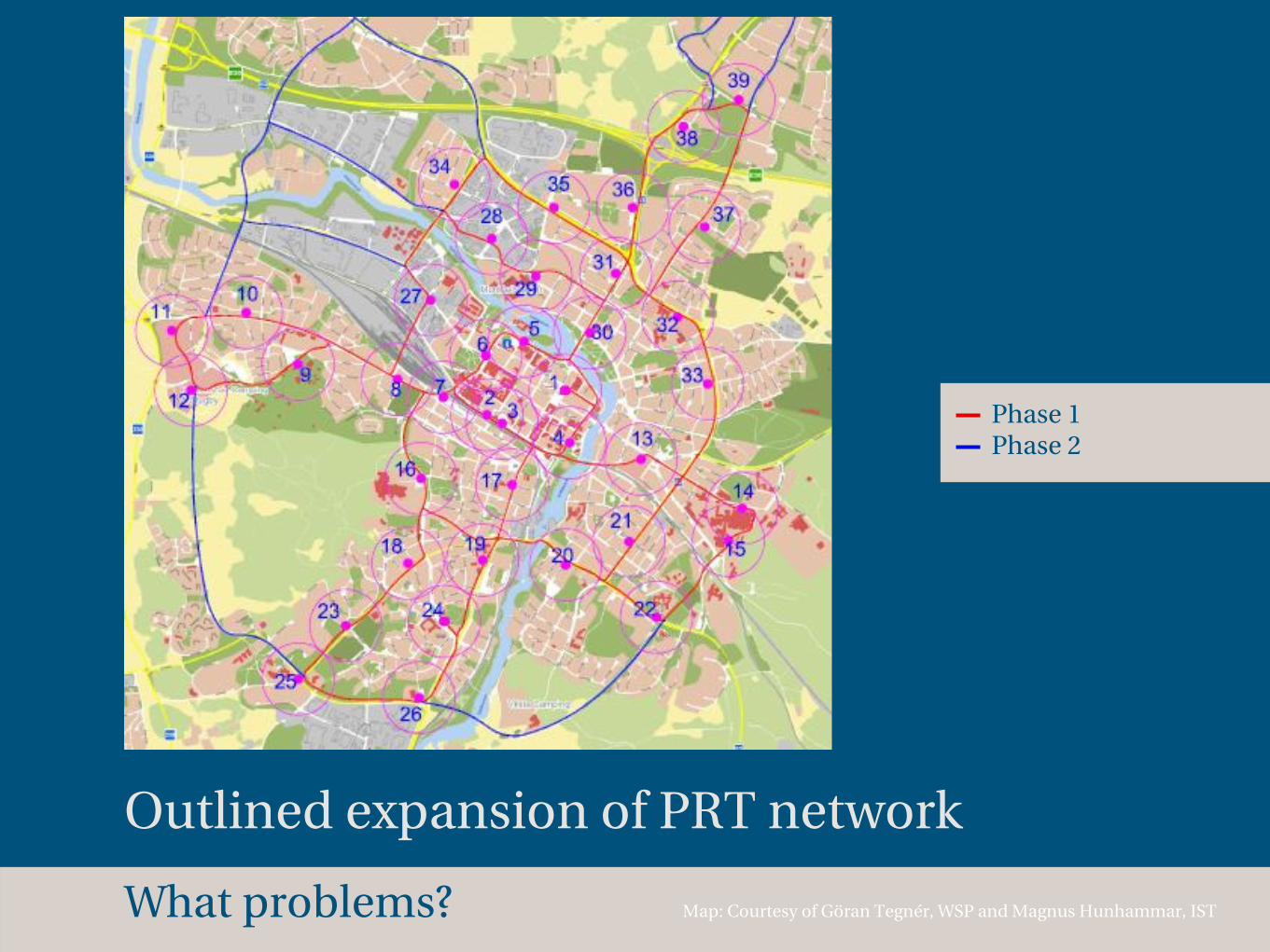
Outlined expansion of PRT network
Map: Courtesy of Göran Tegnér, WSP and Magnus Hunhammar, IST
9
Spårbilar i Eskilstuna? Öppet möte kring en pilotbana 090917 Magnus Hunhammar / Institute for Sustainable Transportation
Etapp 1 och 2, Stadsnät röd resp blå markering
Figur 6: Förslag till stationslägen för etapp 1, 250 m cirklar runt 39 stationer Föreslagna stationslägen är placerade med mål att nå viktiga lägen som skolor, arbetsplatser, handelsplatser, parkeringsplatser, tätare bostadsområden, vårdcentraler, idrottsplatser, etc. Ett gångavstånd på 250 m till sin station upplevs som ett kort avstånd. Med 39 stationer kan man erhålla detta korta gångavstånd för nästan alla.
Stadsnät grunden (etapp 1):
Spårlängd: 26 km (pilotbanans sträckor inräknat) Antal stationer: 39 st (pilotbanans stationer inräknat) Yttre ring (etapp 2):
Spårlängd: 13 km
Phase 1 Phase 2
What problems?
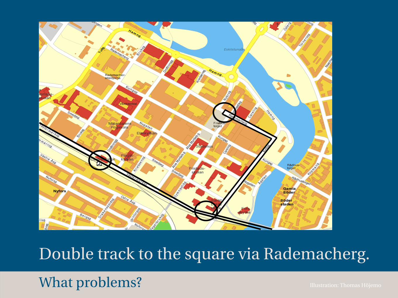
Double track to the square via Rademacherg.
Illustration: Thomas HöjemoWhat problems?
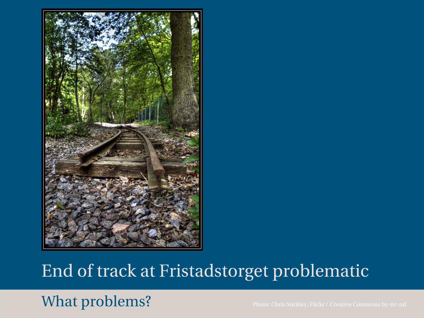
End of track at Fristadstorget problematic
Photo: Chris Stickley, Flickr / Creative Commons by-nc-ndWhat problems?

Site of section
What problems?
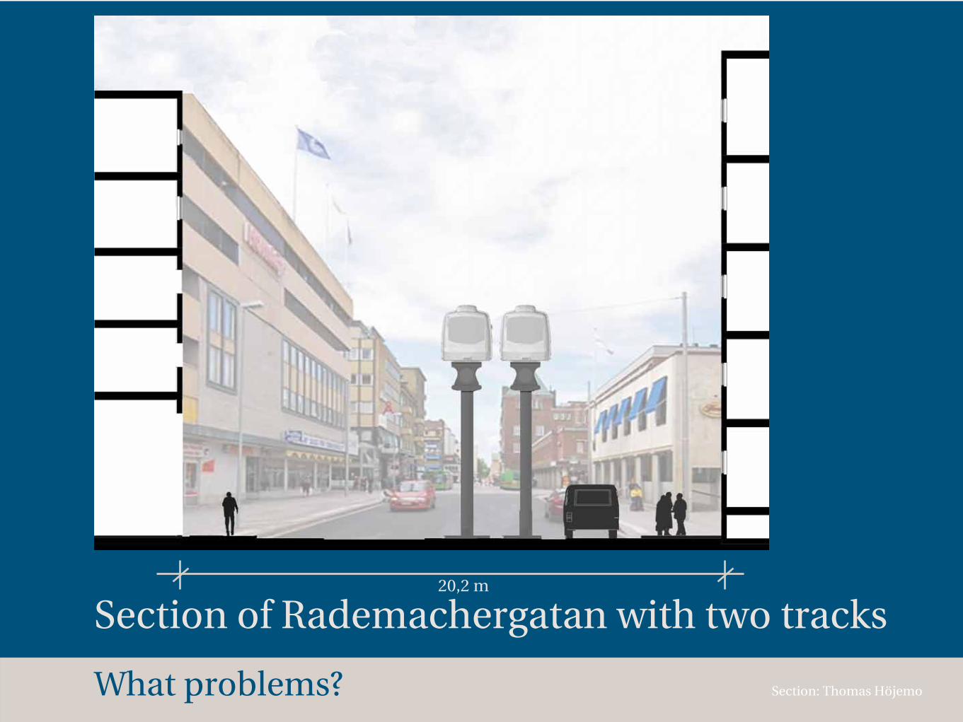
Section of Rademachergatan with two tracks
Section: Thomas Höjemo
20,2 m
What problems?
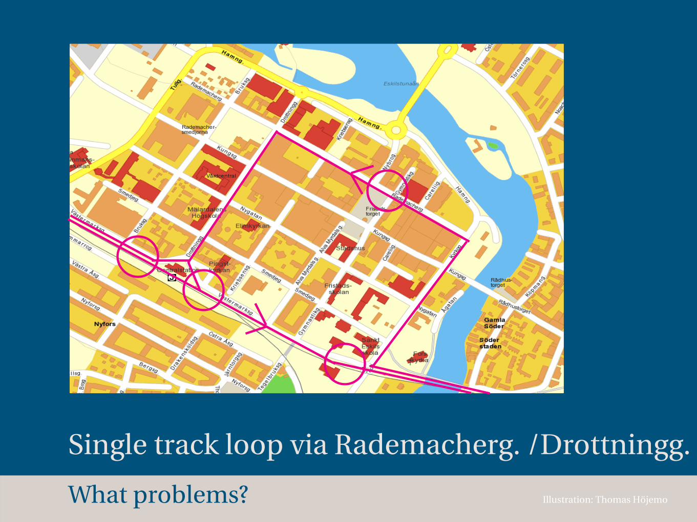
Single track loop via Rademacherg. /Drottningg.
Illustration: Thomas HöjemoWhat problems?
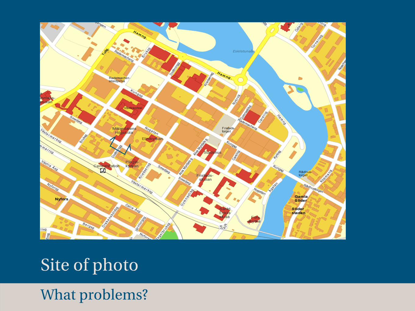
Site of photo
What problems?
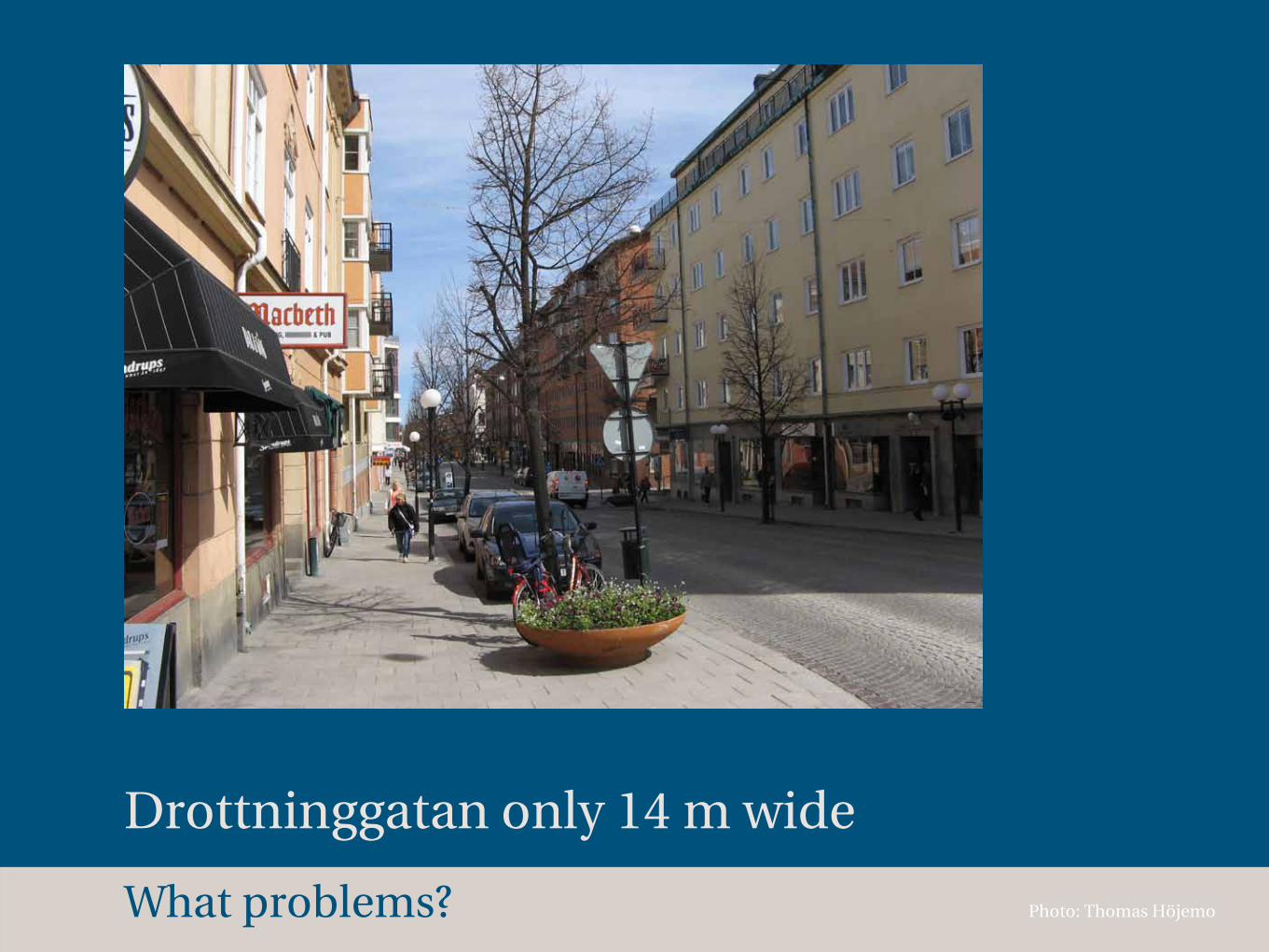
Drottninggatan only 14 m wide
Photo: Thomas HöjemoWhat problems?
100 m
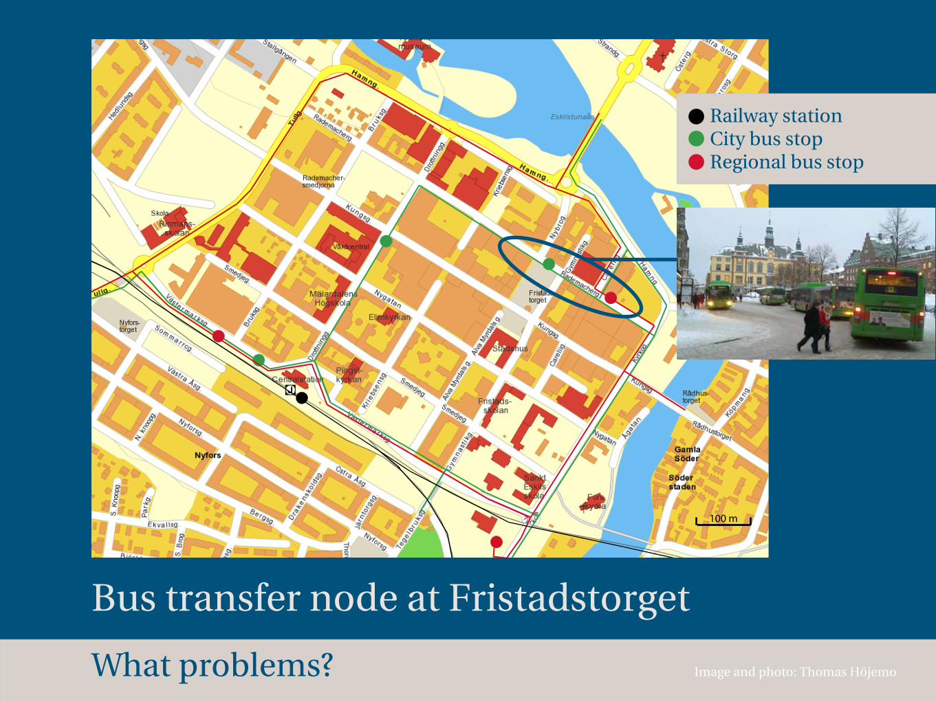
Bus transfer node at Fristadstorget
Image and photo: Thomas Höjemo
Railway station City bus stop Regional bus stop
What problems?

Many bus passengers lead to big PRT station
Images: Thomas Höjemo
Vehicles coming in Vehicles at platform Vehicles on their way out Passing vehicle
72 m
What problems?

How does PRT work?
Where is Eskilstuna?
Why?
Which goals?
What problems?
What opportunities?
How?
What opportunities?
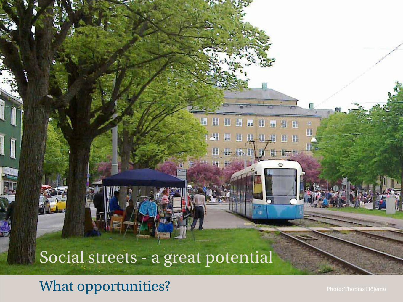
Social streets - a great potential
Photo: Thomas Höjemo
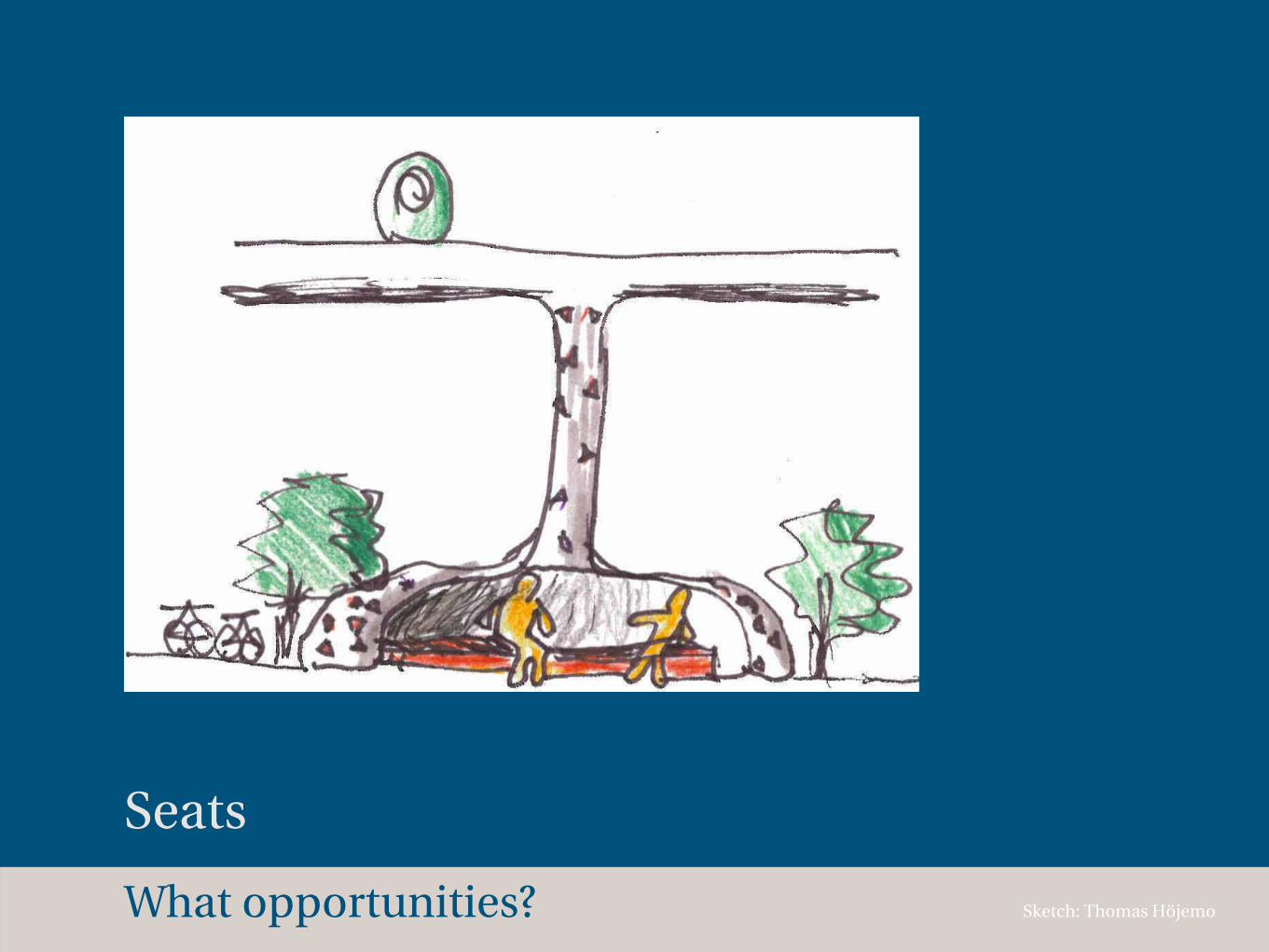
What opportunities?
Seats
Sketch: Thomas Höjemo
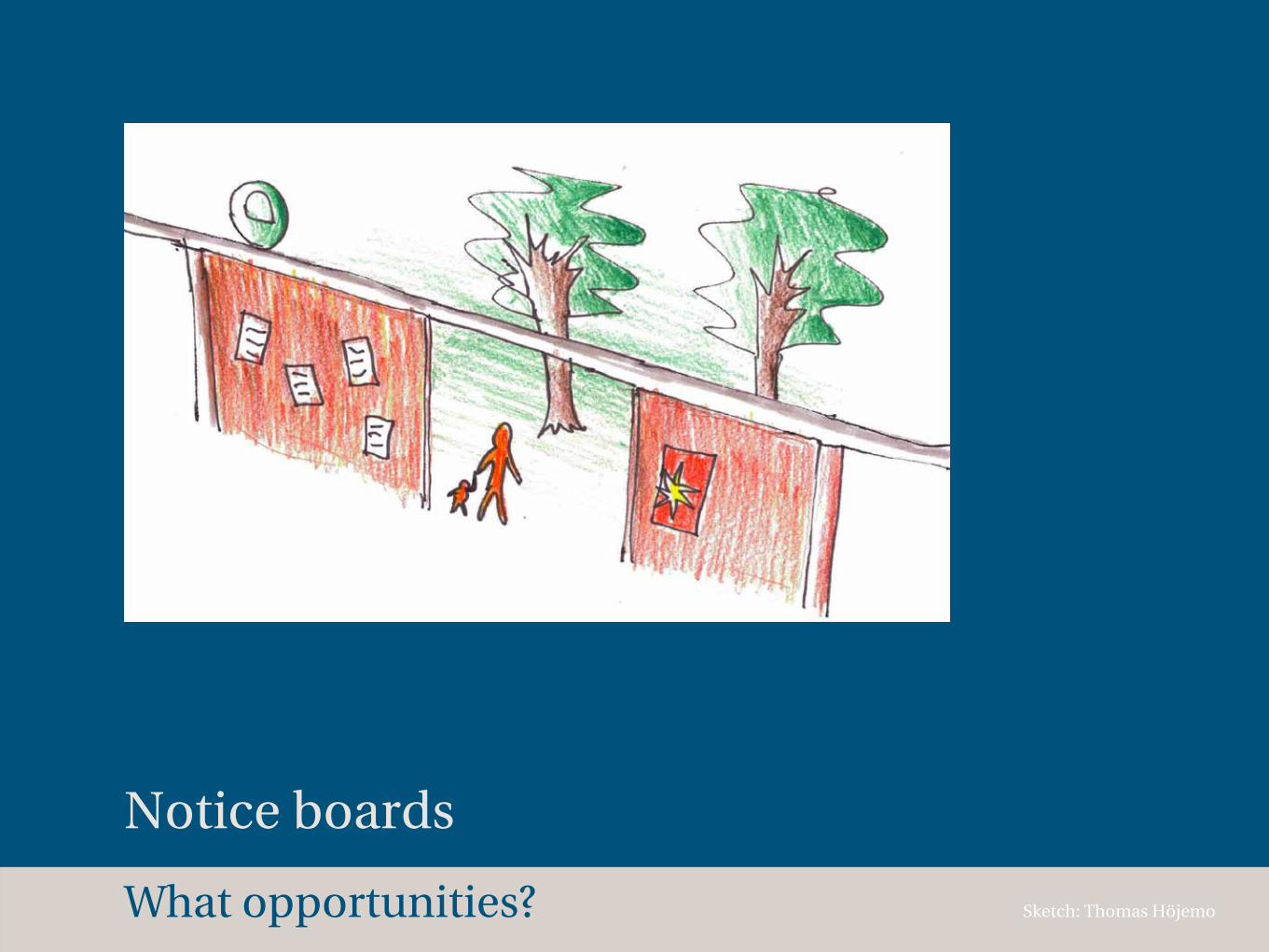
What opportunities?
Notice boards
Sketch: Thomas Höjemo

What opportunities?
Exhibitions
Sketch: Thomas Höjemo
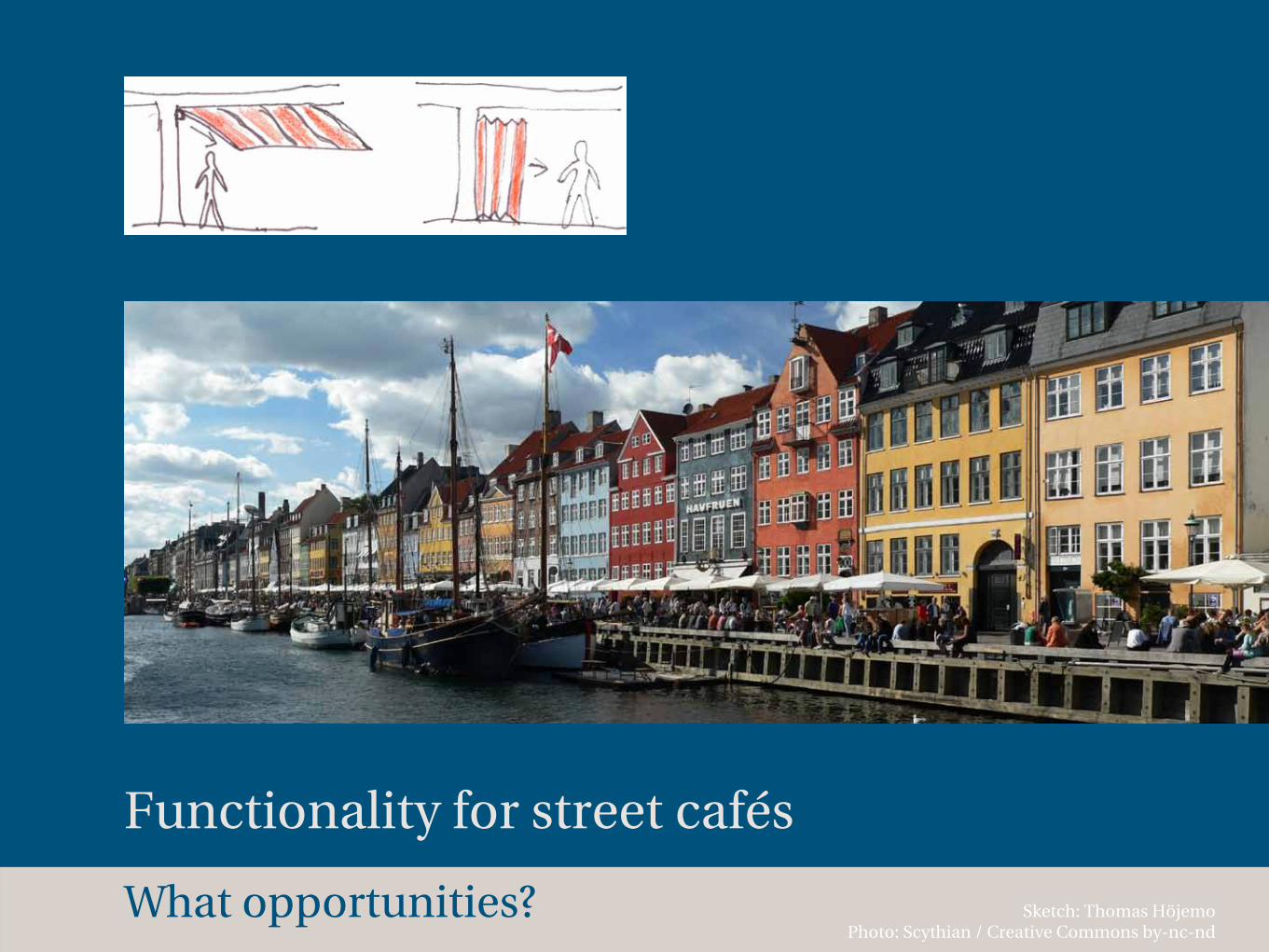
What opportunities?
Functionality for street cafés
Sketch: Thomas Höjemo Photo: Scythian / Creative Commons by-nc-nd
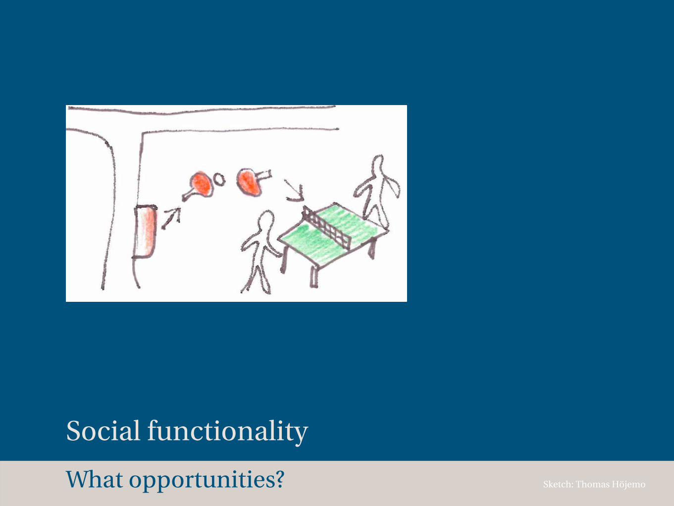
What opportunities?
Social functionality
Sketch: Thomas Höjemo
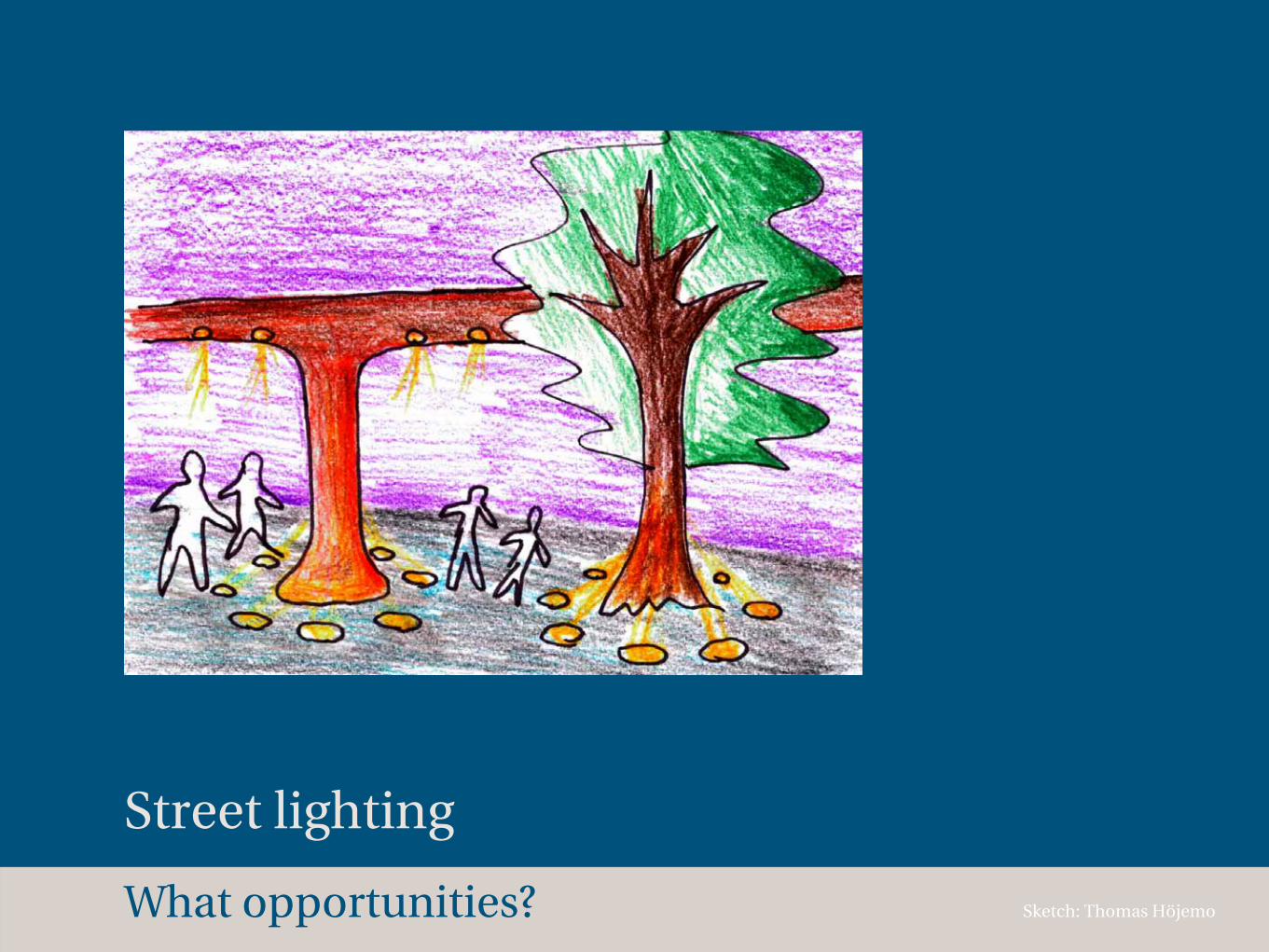
What opportunities?
Street lighting
Sketch: Thomas Höjemo

How does PRT work?
Where is Eskilstuna?
Why?
Which goals?
What problems?
What opportunities?
How?
Design strategies
Choose wide streets
Design strategies
Choose wide streets
Plan for several small stations
Choose wide streets
Plan for several small stations
Make site-specific designs
Design strategies

Choose wide streets
Plan for several small stations
Make site-specific designs
Work together with existing public transport
Design strategies
Choose wide streets
Plan for several small stations
Make site-specific designs
Work together with existing public transport
Improve for pedestrians and cyclists
Design strategies
100 m
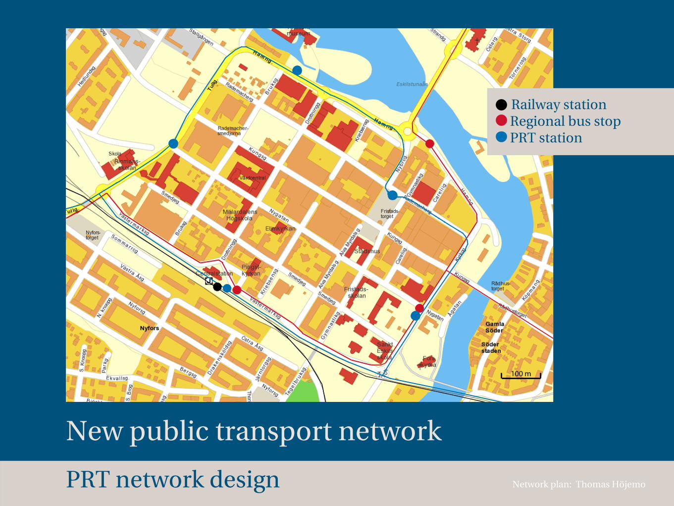
PRT network design
New public transport network
Railway station Regional bus stop PRT station
Network plan: Thomas Höjemo

100 m
S RESECENTRUM
S T
ULL
GATAN S VATTENPALATSET
S FRISTADSTORGET
S F
ORS
KYRKA
N
PRT network design
PRT station circle radius 250 m
Good accessability
Network plan: Thomas Höjemo
100 m
S RESECENTRUM
S T
ULL
GATAN S VATTENPALATSET
S FRISTADSTORGET
S F
ORS
KYRKA
N
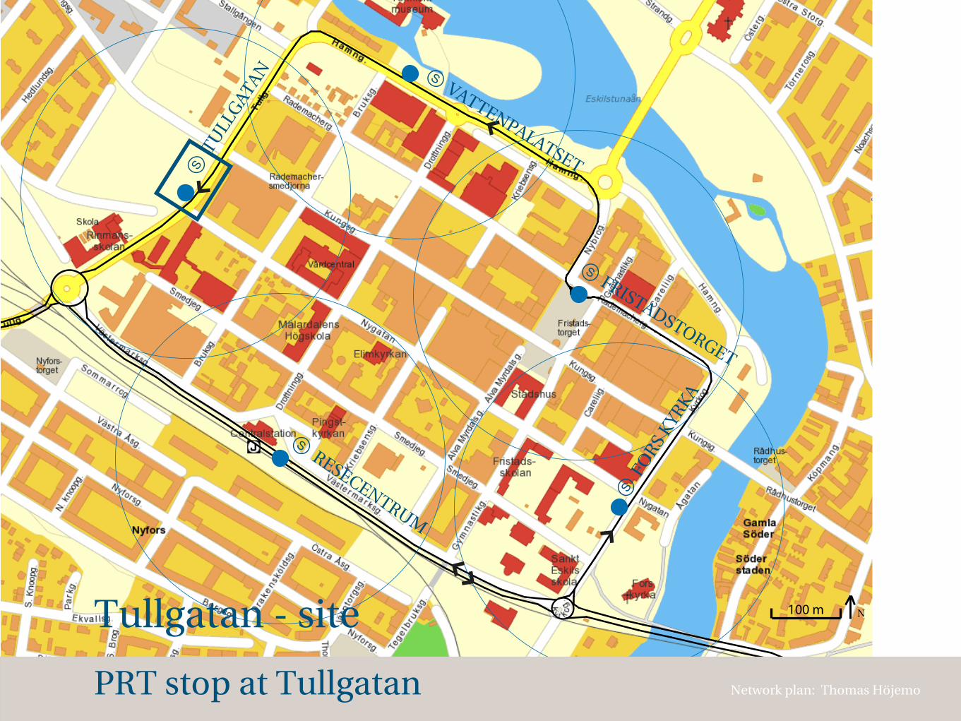
PRT stop at Tullgatan
Tullgatan - site
Network plan: Thomas Höjemo
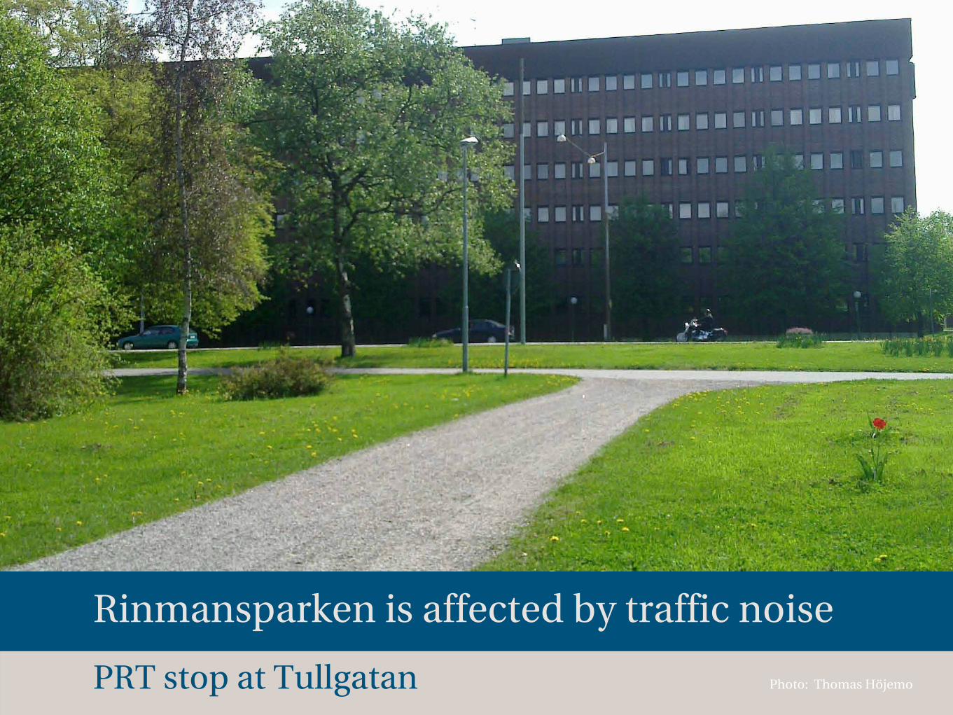
PRT stop at Tullgatan
Rinmansparken is affected by traffic noise
Photo: Thomas Höjemo
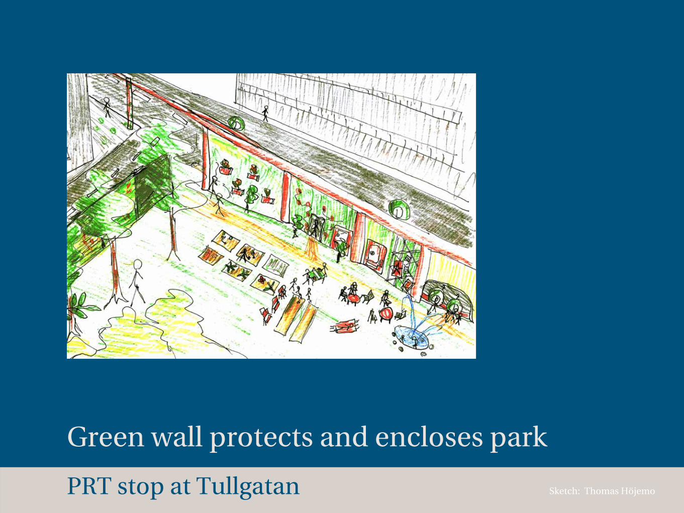
PRT stop at Tullgatan Sketch: Thomas Höjemo
Green wall protects and encloses park
100 m
S RESECENTRUM
S T
ULL
GATAN S VATTENPALATSET
S FRISTADSTORGET
S F
ORS
KYRKA
N
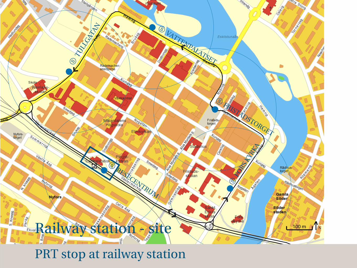
PRT stop at railway station
Railway station - site
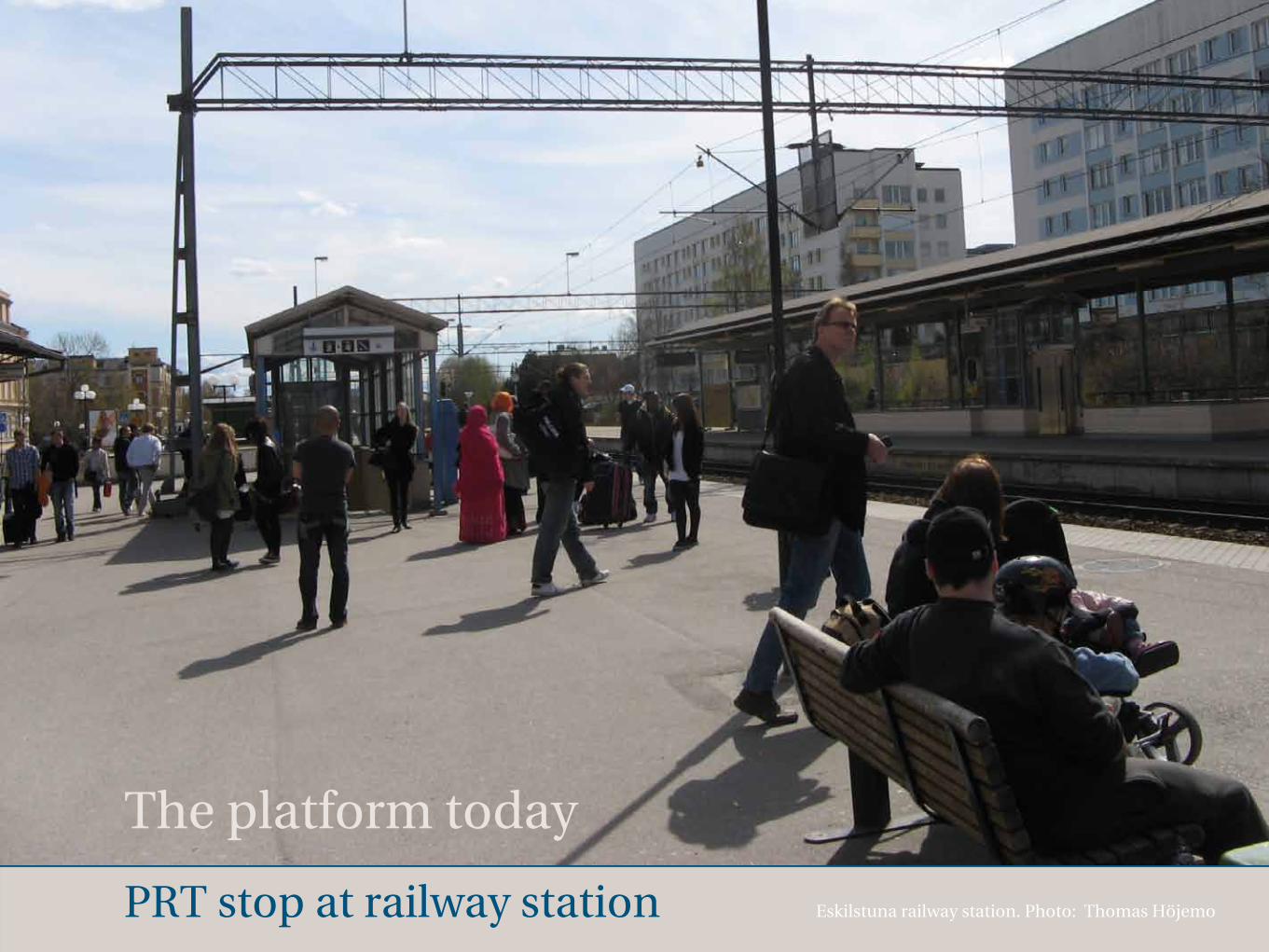
PRT stop at railway station
The platform today
Eskilstuna railway station. Photo: Thomas Höjemo
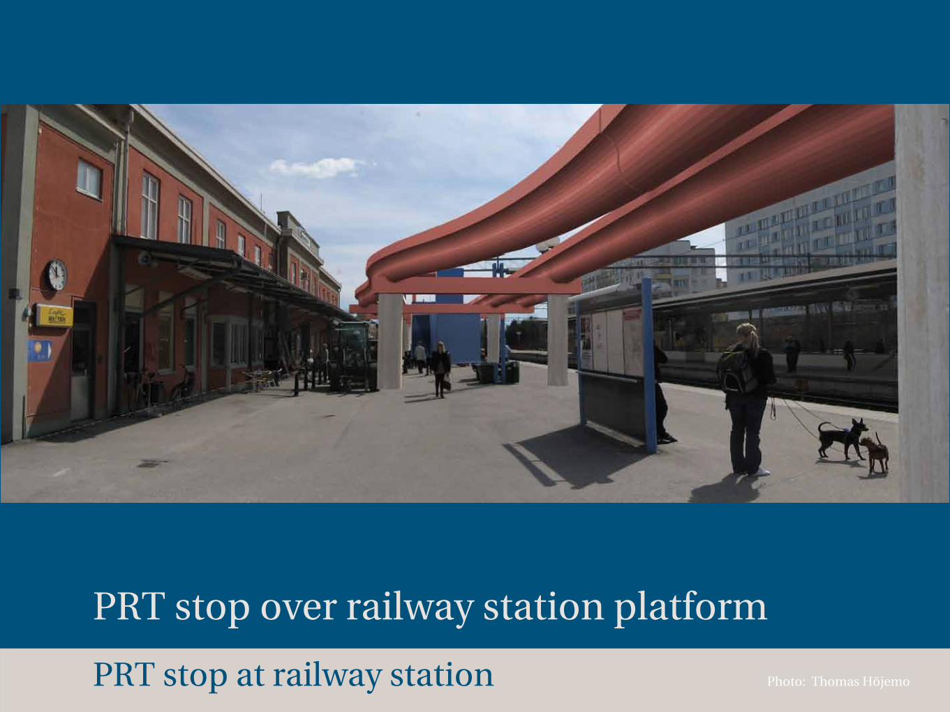
PRT stop at railway station
PRT stop over railway station platform
Photo: Thomas Höjemo
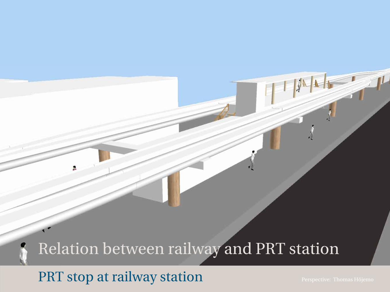
PRT stop at railway station
Relation between railway and PRT station
Perspective: Thomas Höjemo
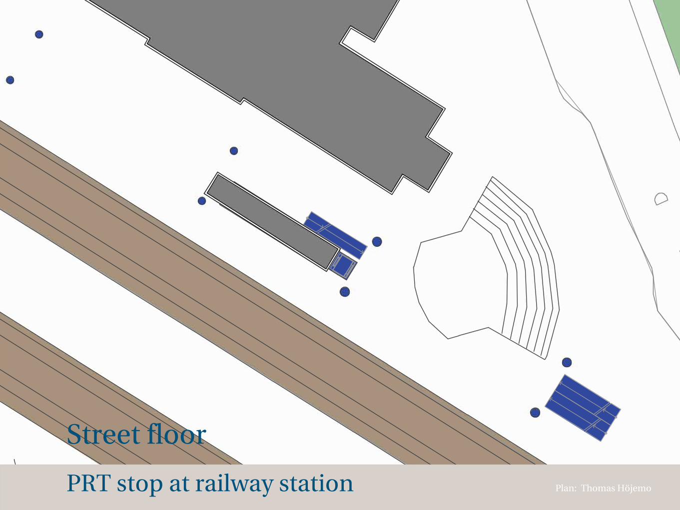
PRT stop at railway station
Street floor
Plan: Thomas Höjemo
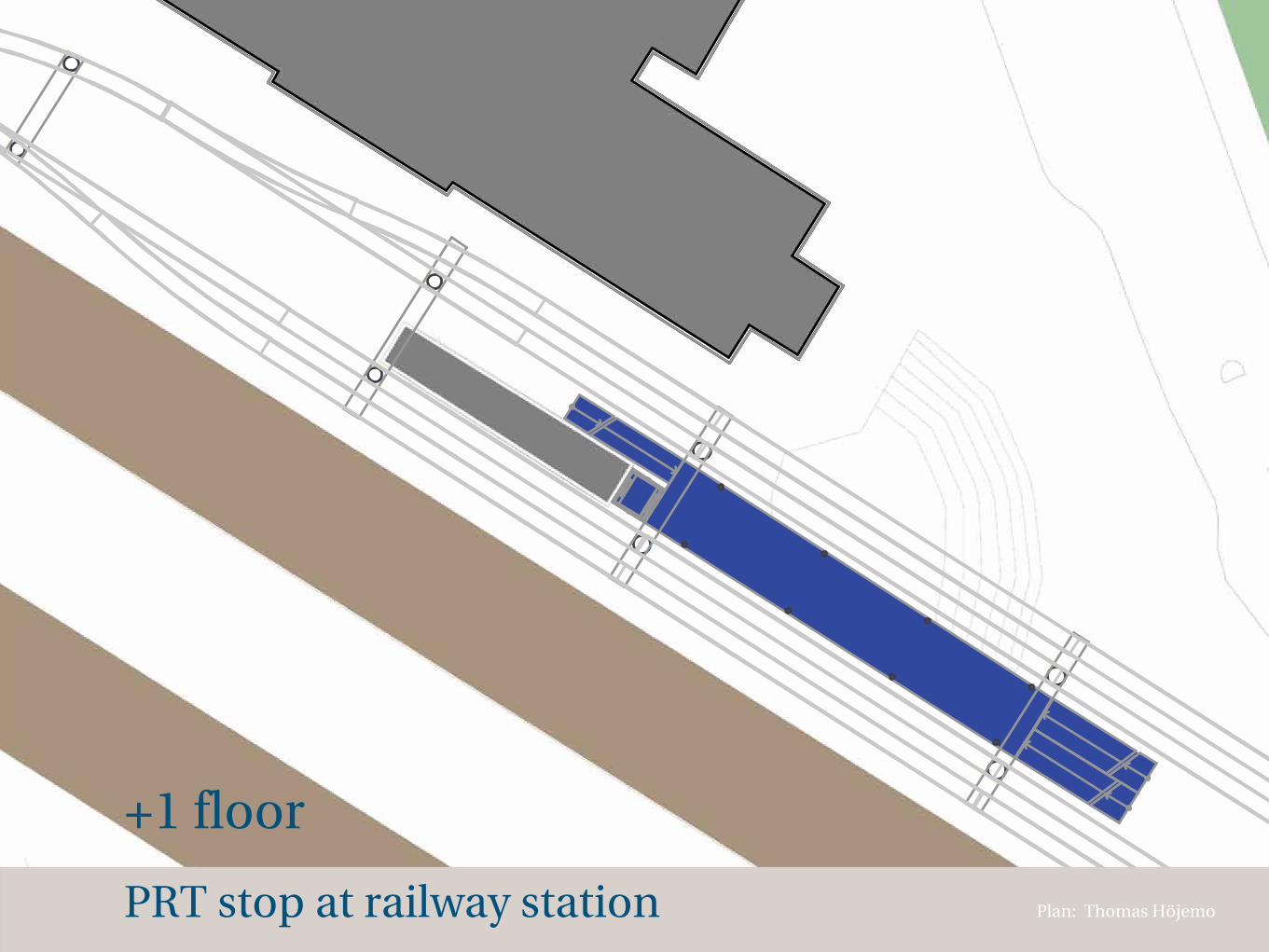
PRT stop at railway station
+1 floor
Plan: Thomas Höjemo
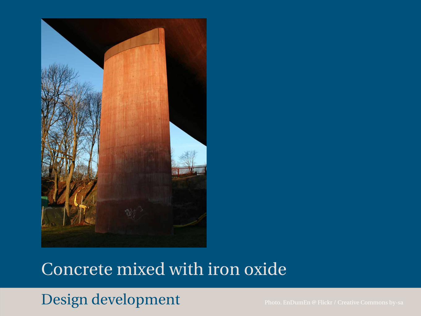
Design development Photo. EnDumEn @ Flickr / Creative Commons by-sa
Concrete mixed with iron oxide
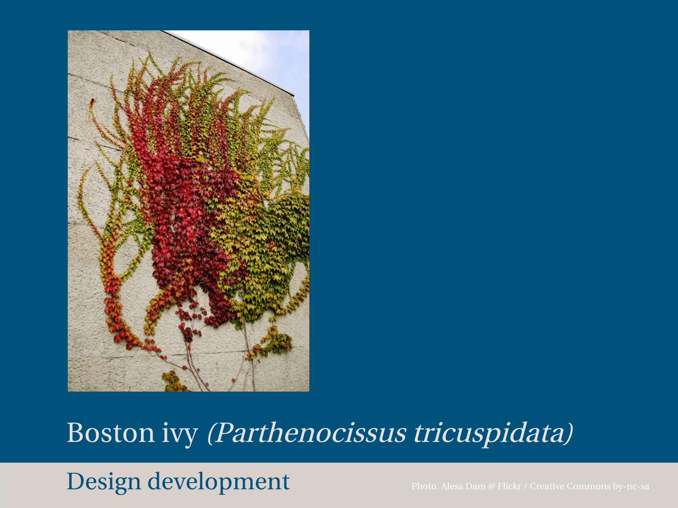
Design development Photo. Alesa Dam @ Flickr / Creative Commons by-nc-sa
Boston ivy (Parthenocissus tricuspidata)

Design development Image: Thomas Höjemo
Column design for pedestrian streetscape
100 m
S RESECENTRUM
S T
ULL
GATAN S VATTENPALATSET
S FRISTADSTORGET
S F
ORS
KYRKA
N
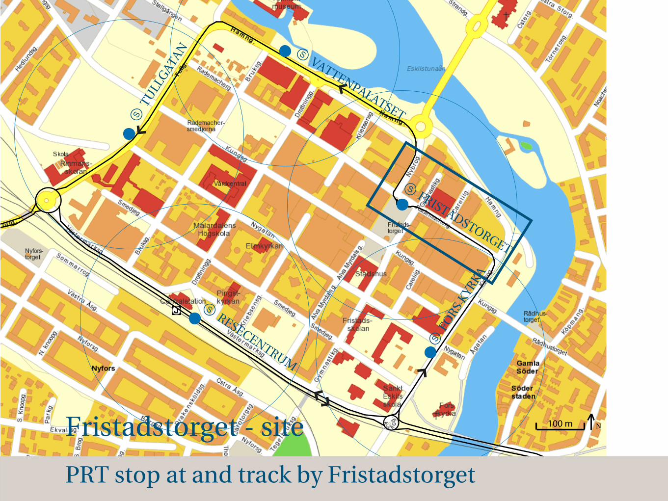
PRT stop at and track by Fristadstorget
Fristadstorget - site
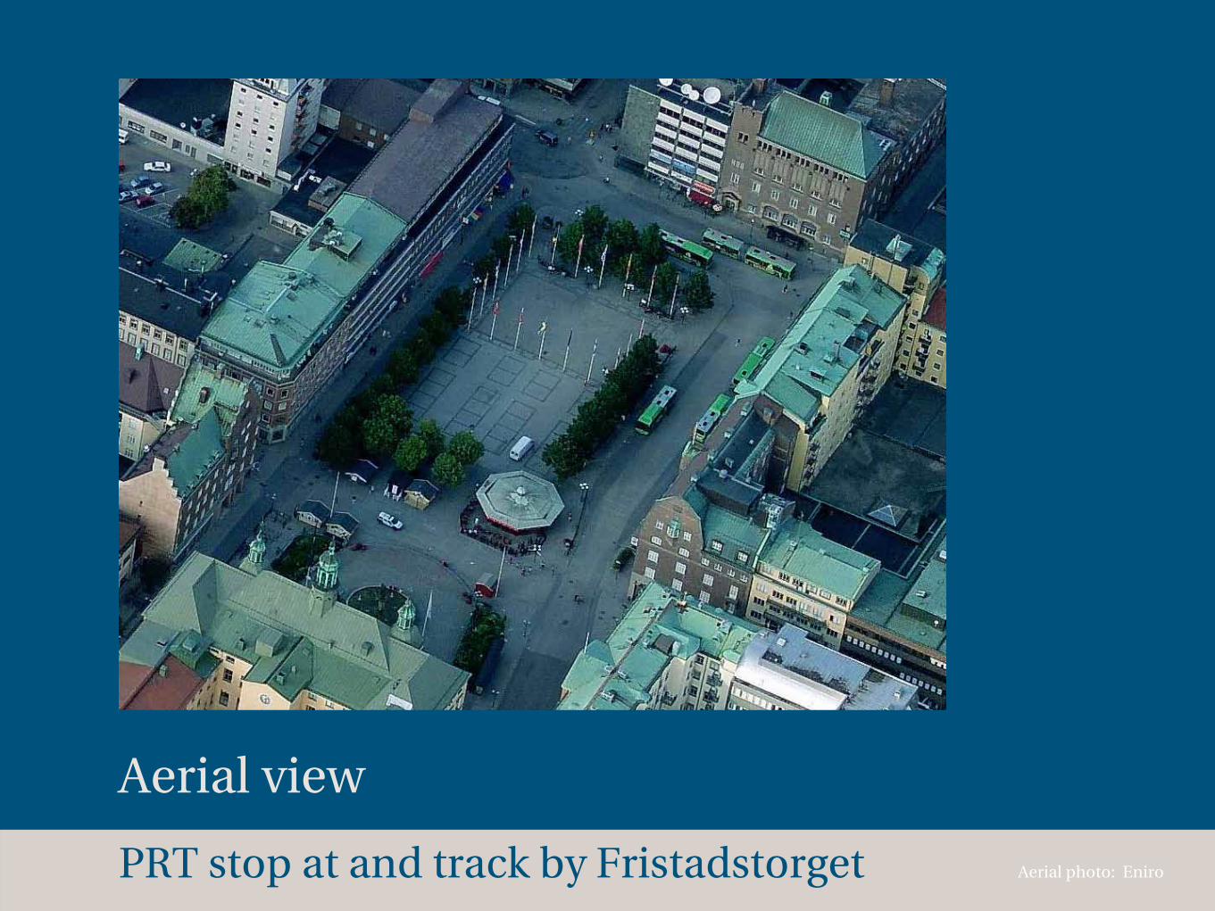
Aerial view
Aerial photo: EniroPRT stop at and track by Fristadstorget
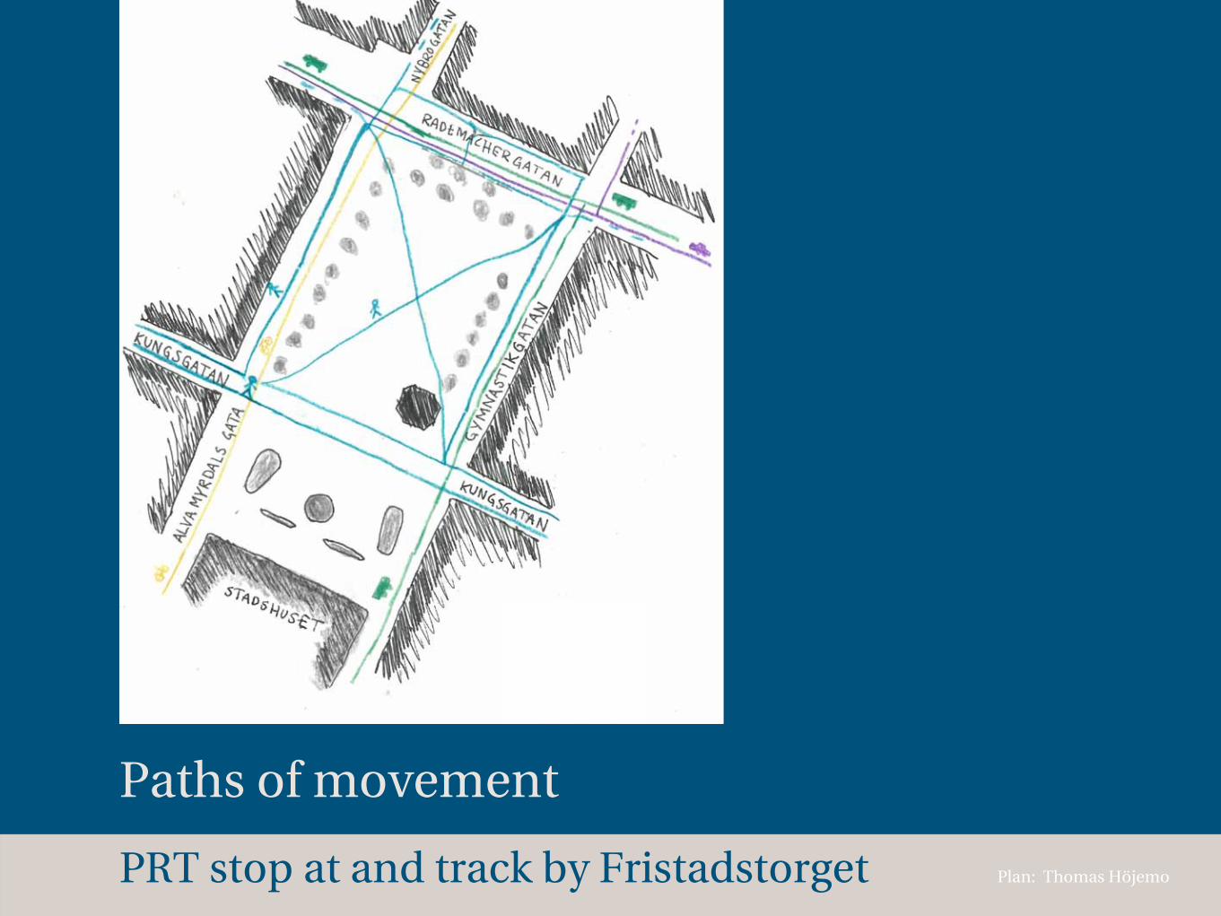
Paths of movement
Plan: Thomas HöjemoPRT stop at and track by Fristadstorget
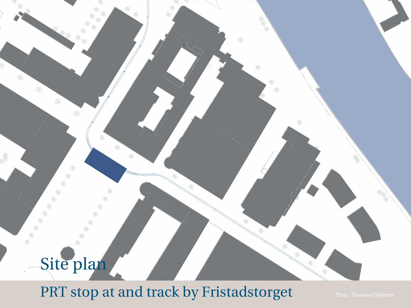
Site plan
Plan: Thomas HöjemoPRT stop at and track by Fristadstorget
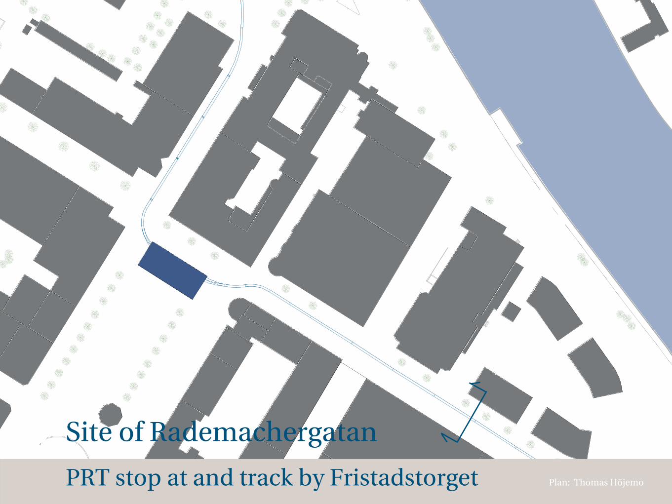
Site of Rademachergatan
Plan: Thomas HöjemoPRT stop at and track by Fristadstorget
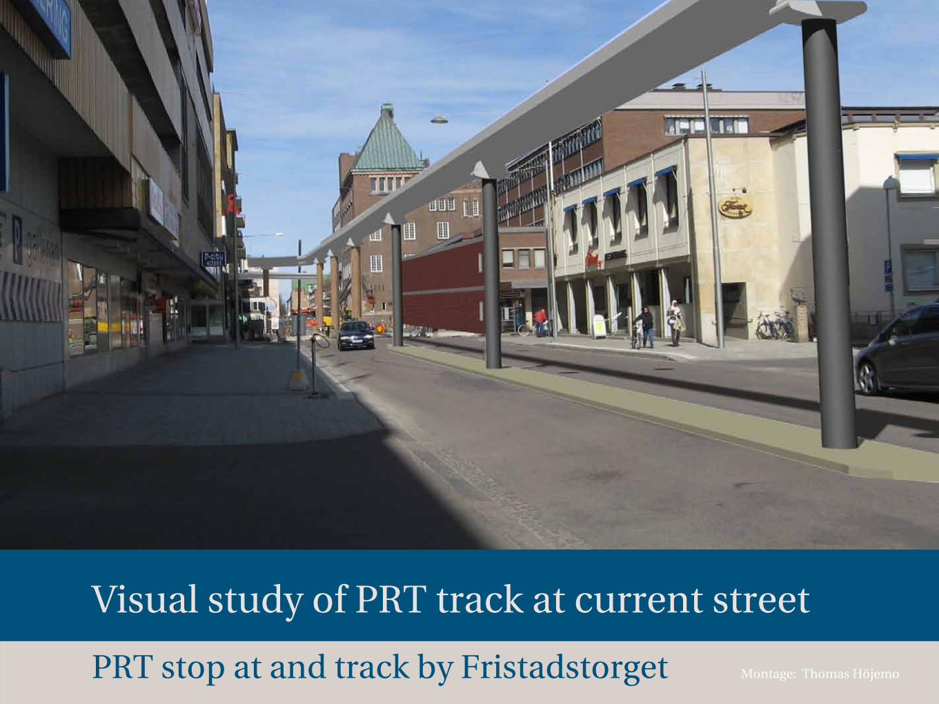
Montage: Thomas Höjemo
Visual study of PRT track at current street
PRT stop at and track by Fristadstorget
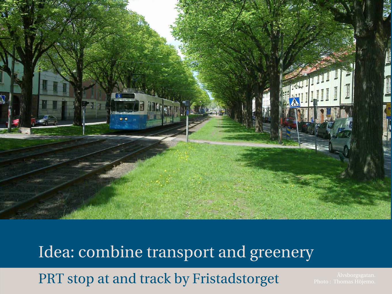
Idea: combine transport and greeneryÄlvsborgsgatan.
Photo : Thomas Höjemo. PRT stop at and track by Fristadstorget
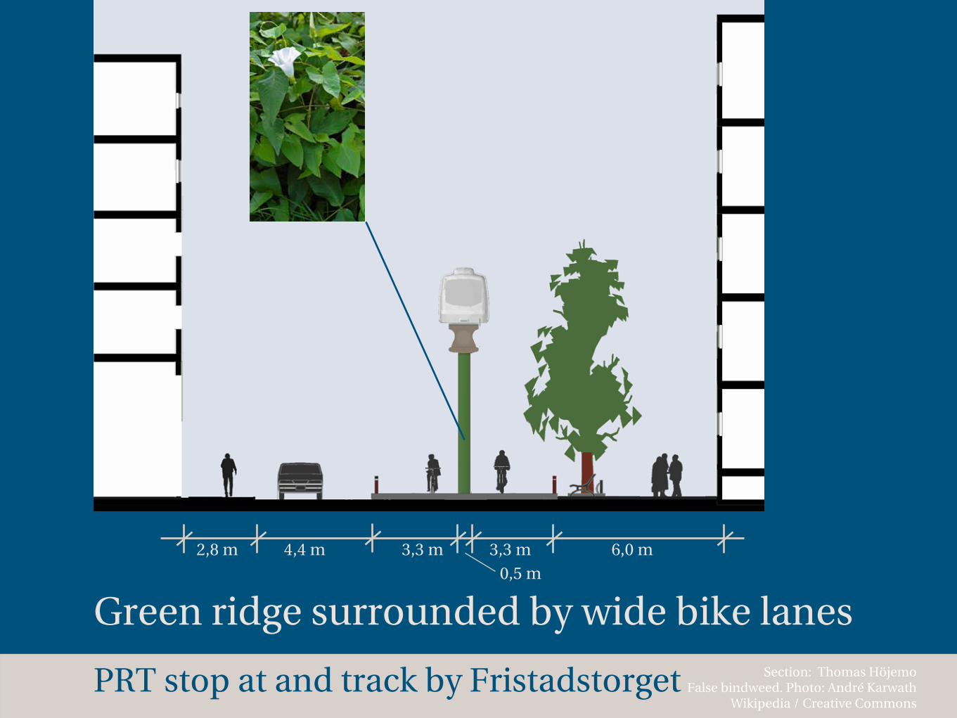
Section: Thomas Höjemo False bindweed. Photo: André Karwath
Wikipedia / Creative Commons
Green ridge surrounded by wide bike lanes
4,4 m 3,3 m 3,3 m2,8 m 6,0 m
PRT stop at and track by Fristadstorget
0,5 m

Site of station
Plan: Thomas HöjemoPRT stop at and track by Fristadstorget
Kiosk70 m 2
Restaurant 220 m 2
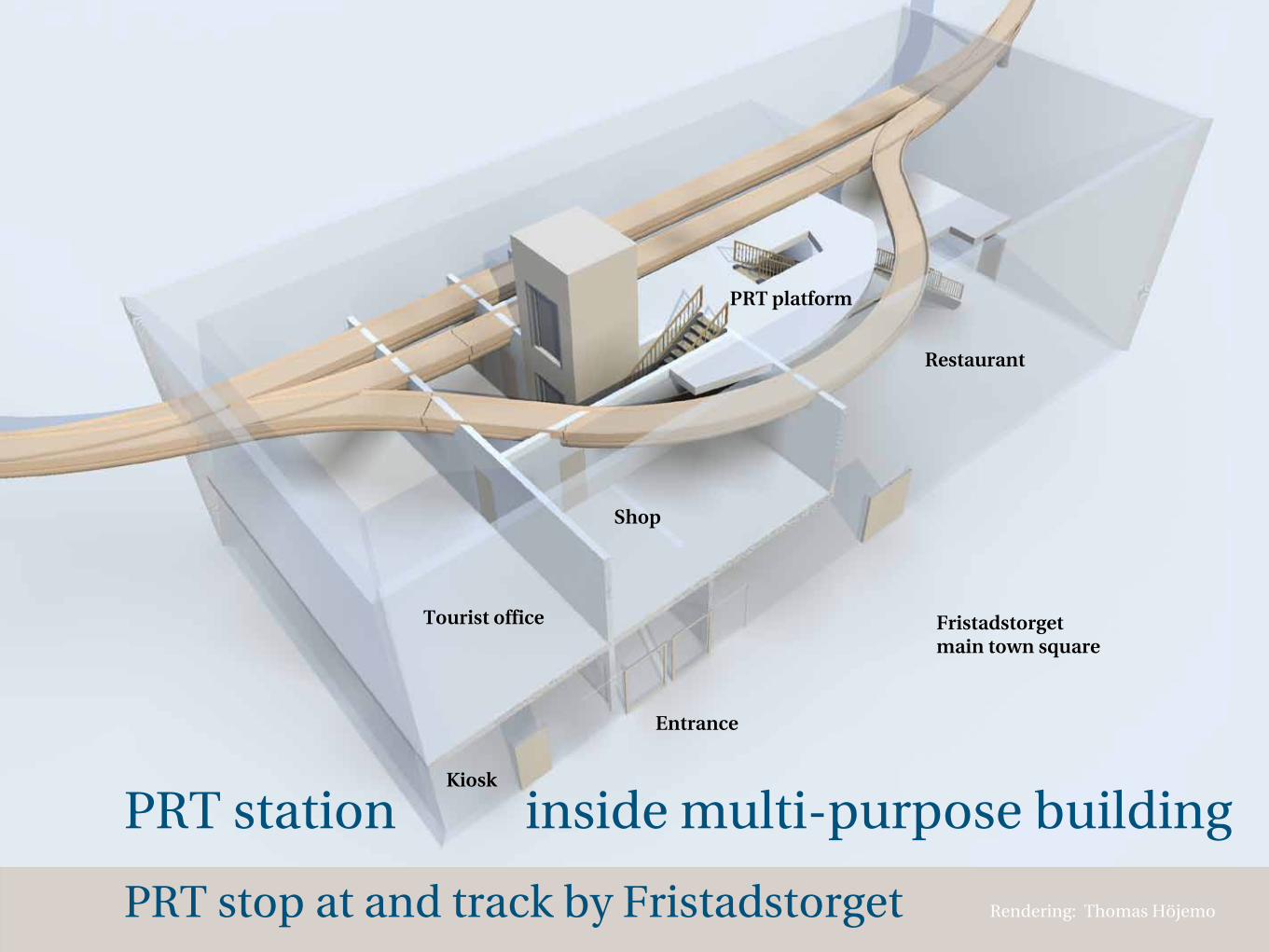
Tourist office
PRT platform
Kiosk
Restaurant
Shop
Entrance
Fristadstorget main town square
Rendering: Thomas Höjemo
PRT station inside multi-purpose building
PRT stop at and track by Fristadstorget
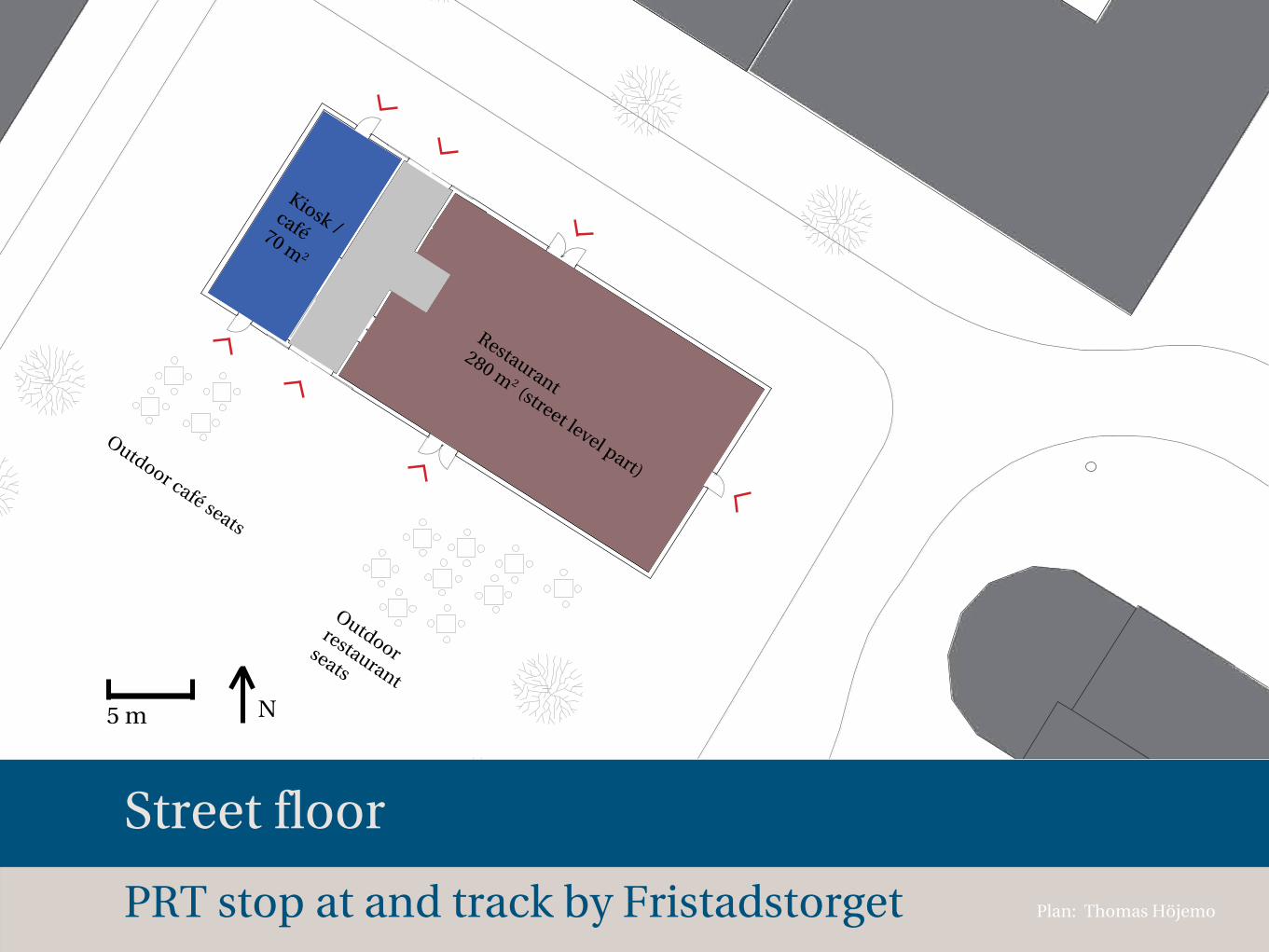
Restaurant
280 m 2 (street level part)
Kiosk /café 70 m 2
Outdoor restaurant
seats
Outdoor café seats
5 m N
Plan: Thomas Höjemo
Street floor
PRT stop at and track by Fristadstorget

Montage: Thomas Höjemo
The building in relation to the square
PRT stop at and track by Fristadstorget
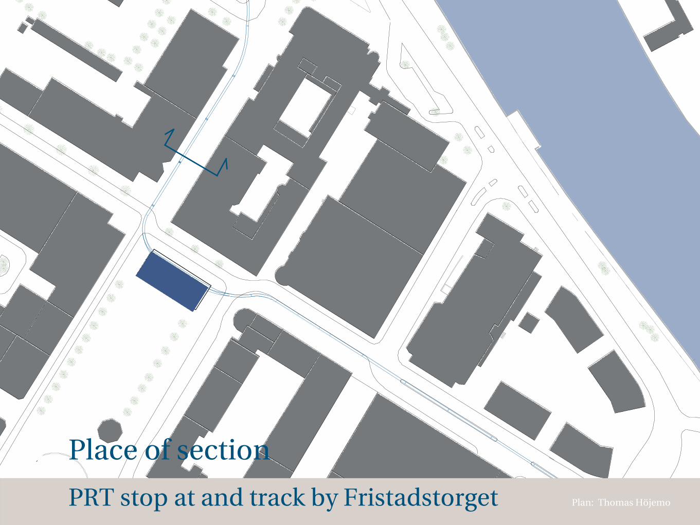
Place of section
Plan: Thomas HöjemoPRT stop at and track by Fristadstorget
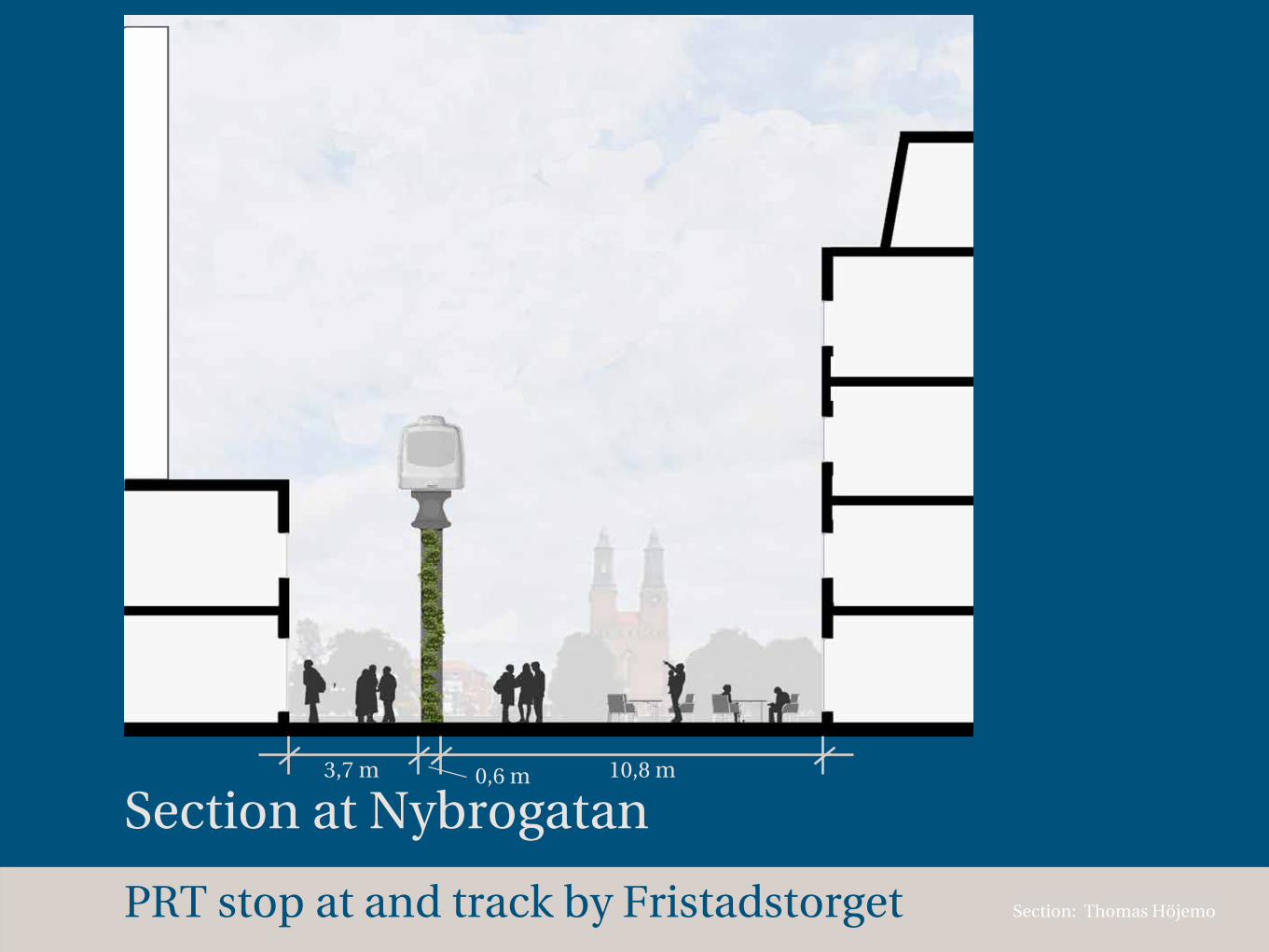
Section: Thomas Höjemo
Section at Nybrogatan3,7 m 0,6 m 10,8 m
PRT stop at and track by Fristadstorget

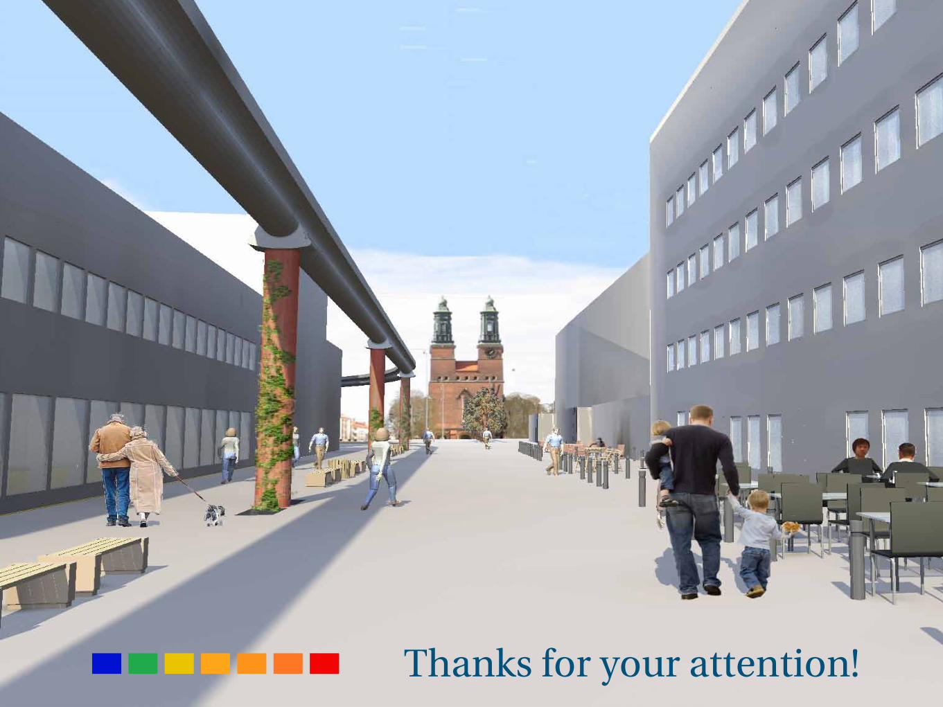
Rendering: Thomas Höjemo
Perspective at Nybrogatan
PRT stop at and track by Fristadstorget
Thanks for your attention!