progress report the great lakes maritime information delivery system the university of toledo...
TRANSCRIPT

Progress ReportThe Great Lakes Maritime Information Delivery System
The University of ToledoNovember 7, 2006
IntermodalTransportation Institute

GREAT LAKESMARITIME IMFORMATION
DELIVERY SYSTEM
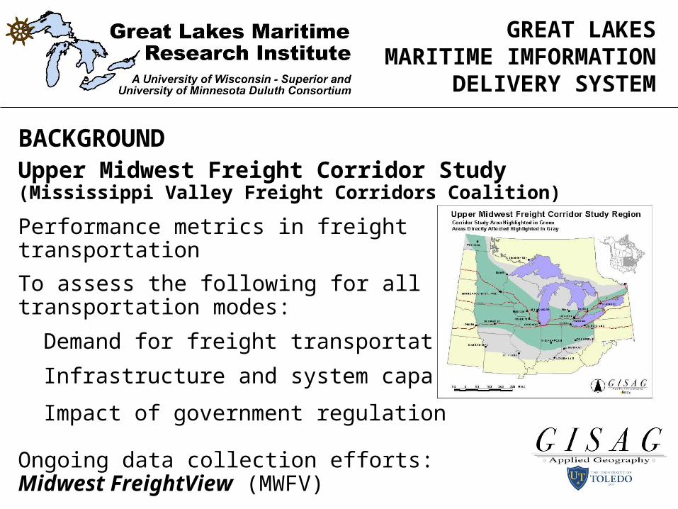
BACKGROUNDUpper Midwest Freight Corridor Study(Mississippi Valley Freight Corridors Coalition)
To establish a regional approach forimproving freight transportation in theUpper Midwest
To establish multi-state, multi-jurisdictional partnership of public andprivate sector stakeholder interests.
To study short- and long-term issuessurrounding anticipated increases in freight movement and impacts on the region’s infrastructure and economic health.
GREAT LAKESMARITIME IMFORMATION
DELIVERY SYSTEM
BACKGROUNDUpper Midwest Freight Corridor Study(Mississippi Valley Freight Corridors Coalition)
Performance metrics in freight transportation
To assess the following for all transportation modes:
Demand for freight transportation
Infrastructure and system capacities
Impact of government regulation
Ongoing data collection efforts:Midwest FreightView (MWFV)

GREAT LAKESMARITIME IMFORMATION
DELIVERY SYSTEM
GREAT LAKES DATA WORKSHOP: JUNE 9, 2006
US Army Corps of Engineers Transport Canada
Lakes Carriers Association NOAA
Detroit Port Authority Port of Duluth
Great Lakes Commission St. Lawrence Seaway
US Maritime Administration University of Toledo
American Great Lakes Ports Association
Canadian Chamber of Maritime Commerce
University of Wisconsin-Superior (GLMRI)
University of Minnesota Duluth (GLMRI)
ISSUES TO BE ADDRESSED BY THE SYSTEM
Jobs
Economic impact of Great Lakes shipping
The value of shipping to states, cities regions, etc.
Environmental impacts/benefits compared to other modes
Shipper savings associated with GL MTS
Congestion effects of other modes in comparison to GL MTS
Competition effects of Maritime Transportation and rates in contrast to other modes
Safety issues with diverting freight traffic to GL MTS
GREAT LAKESMARITIME IMFORMATION
DELIVERY SYSTEM
RECOMMENDATIONS FOR DATA ACQUISITION
Cargo flows
Facilities (e.g., docks, terminals, locks, etc.)
Linking Great Lakes maritime freight movements and the economy of the Great Lakes Region
Environmental Data (air, water, ballast)
Data to support air and water pollution reductions based on diverting traffic from highway
Data to support comparative analysis of Great Lakes Fleet vs. Railroads and Trucks
Compiled lists of current sources of data
GREAT LAKESMARITIME IMFORMATION
DELIVERY SYSTEM

MAIN ELEMENTS OF THE SYSTEM
Detailed data repository for vessel movements, port functions commodity flows, economic activity, environmental impacts, etc.
An Internet-based GIS data viewer (Citrix Metaframe Delivery)
An Internet-based information delivery site for prepared maps, tables, graphics, text, etc.
An information clearinghouse and centralized data facility to furnish links to other information resources, (private firms, government agencies, universities, etc.)
A data exchange to support user inquiries and furnish information on demand
GREAT LAKESMARITIME IMFORMATION
DELIVERY SYSTEM

GREAT LAKESMARITIME IMFORMATION
DELIVERY SYSTEM
DATA COLLECTED AND ADDED TO GIS REPOSITORYIntrastate Employment patterns for each commodity type by SIC,NAICS, (Demographics Plus, Inc. Business Counts Database)
Population and Socioeconomic data representing market demandwithin the region
Port Locations—U.S. (BTS National Transportation Atlas)
Waterway Network—Great Lakes and Inland Waterways (Army Corps of Engineers)
Navigation Facilities, Locks, etc.

GREAT LAKESMARITIME IMFORMATION
DELIVERY SYSTEM
DATA COLLECTED AND ADDED TO REPOSITORY, Cont.
Dock Locations and attributes: US and Canada
1. I.D. code number 10. Latitude/Longitude
2. Name 11. Operator
3. Location 12. Owner
4. Address / Phone 13. Purpose
5. County 14. Slip length / width / depth
6. State/Province 15. Vessel loading / unloading equipment
7. Waterway 16. Vessel loading / unloading speed
8. Port 17. Railway connections
9. Mile (river locations) 18. Notes of interest

GREAT LAKESMARITIME IMFORMATION
DELIVERY SYSTEM
DATA COLLECTED AND ADDED TO REPOSITORY, Cont.
Port Operations Data such as Tonnages, Commoditiestransshipped (Lake Carriers Assn.), Vessels Serviced, Equipment, etc.
Baseline 2002 commodity flows through the Saint LawrenceSeaway and Great Lakes System obtained from the FHWA Freight Analysis Framework estimated from 2002 Commodity Flow Survey Data. This data set provided the research team with a skeleton framework upon which to addsubsequent flow data as it is obtained.
GREAT LAKESMARITIME IMFORMATION
DELIVERY SYSTEM
PROGRESS THUS FAR
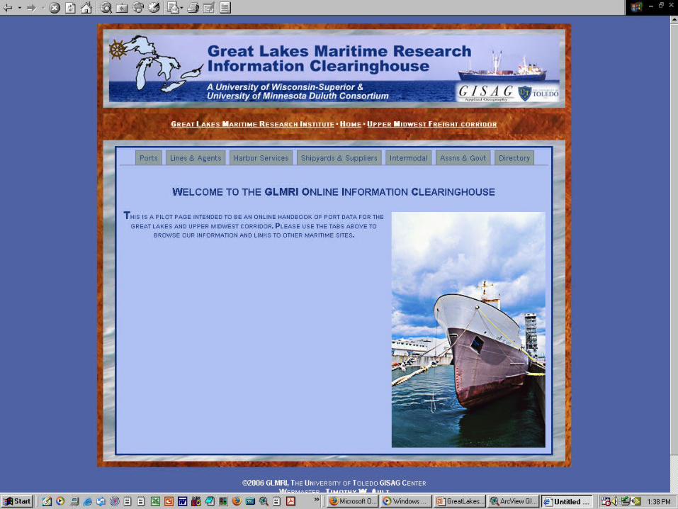
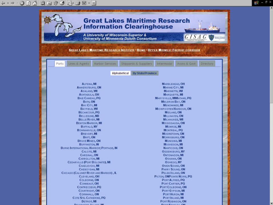
Project Web Page: Information Delivery Service
Basic prepared maps for viewing and download among a variety of jurisdictions: county, congressional district, etc.
Prepared tables and graphs for viewing and download,
Simple mapping functions in the data viewer,
Query functions for more advanced users, and
Analysis functions and specialized functions in the database for advanced users.
Publishing function for research results

GREAT LAKESMARITIME IMFORMATION
DELIVERY SYSTEM
PROGRESS THUS FAR
Project Web Page: Information Delivery Service
Documentation of database contents and information available on the project web page
Technical manuals available in .pdf format in downloadable form for detailed directions on use
Web-based documentation / tutorials for instruction for specific functions such as basic mapping, query functions, and more advanced analysis functions.
On-line help functions for routine problems
Technical support via telephone & email

PROGRESS THUS FAR
Project Web Page
http://maritime.utoledo.edu
GREAT LAKESMARITIME IMFORMATION
DELIVERY SYSTEM


GREAT LAKESMARITIME IMFORMATION
DELIVERY SYSTEM
PROGRESS THUS FAR
The GIS data viewer…a brief demonstration

Viewer Display

Pull Down Menu
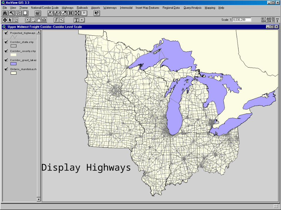
Display Highways
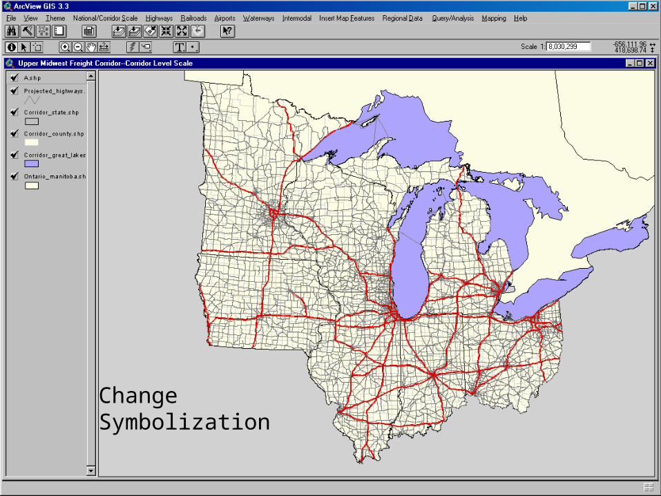
ChangeSymbolization

Open Ports fromPull Down Menu

Display Ports

June, 2006Coal TonnageSource: Lake Carriers Assn.

Open Docks fromPull Down Menu

Display Docks
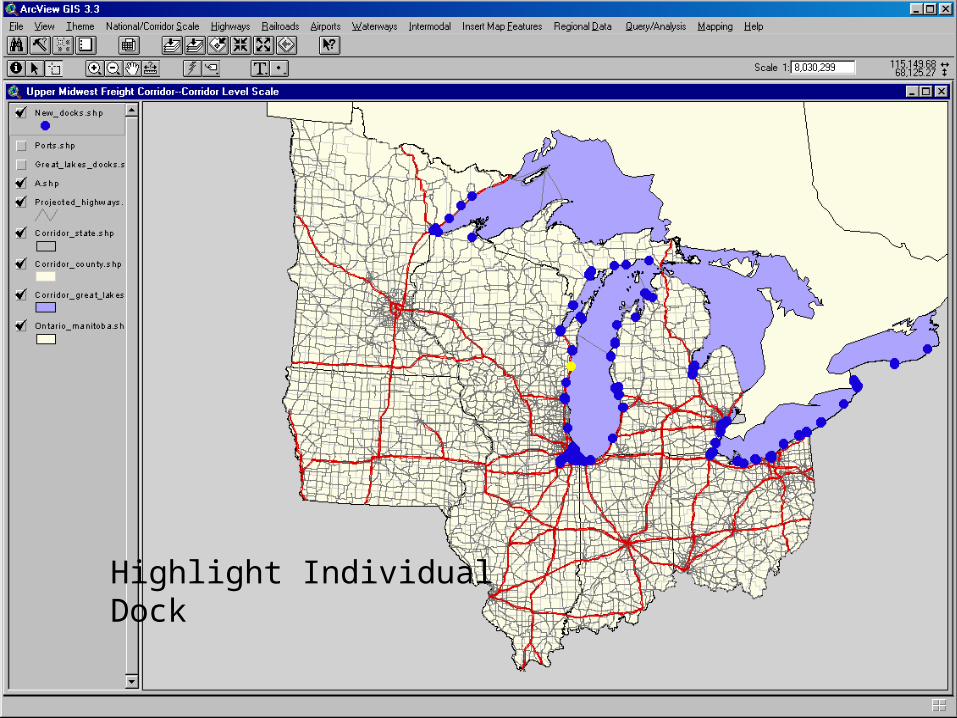
Highlight IndividualDock

Tabular Displayof Dock Data
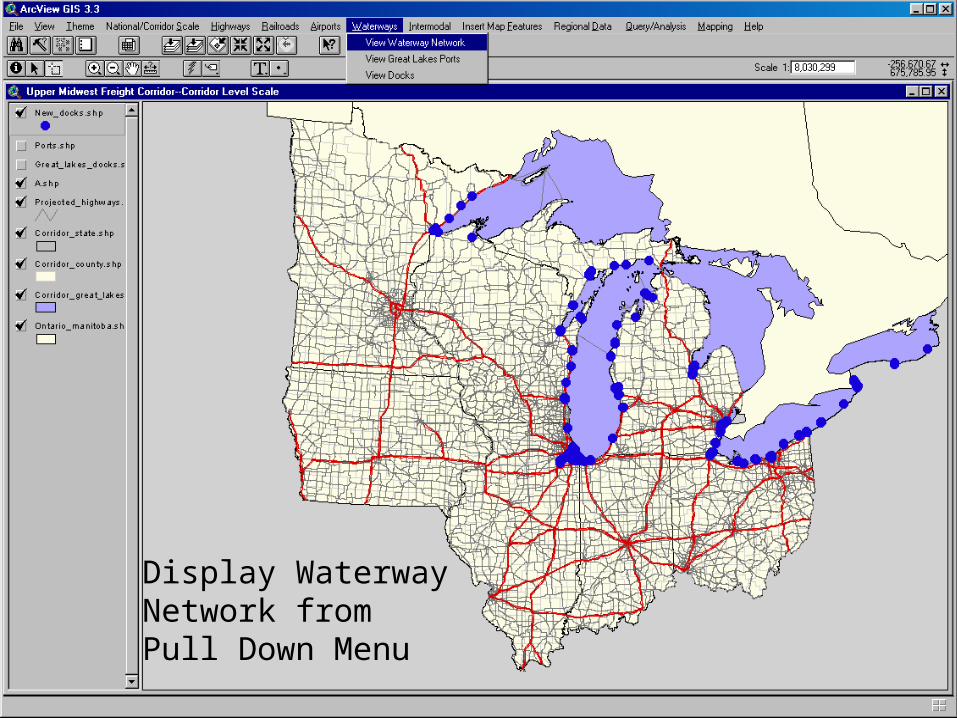
Display WaterwayNetwork from Pull Down Menu
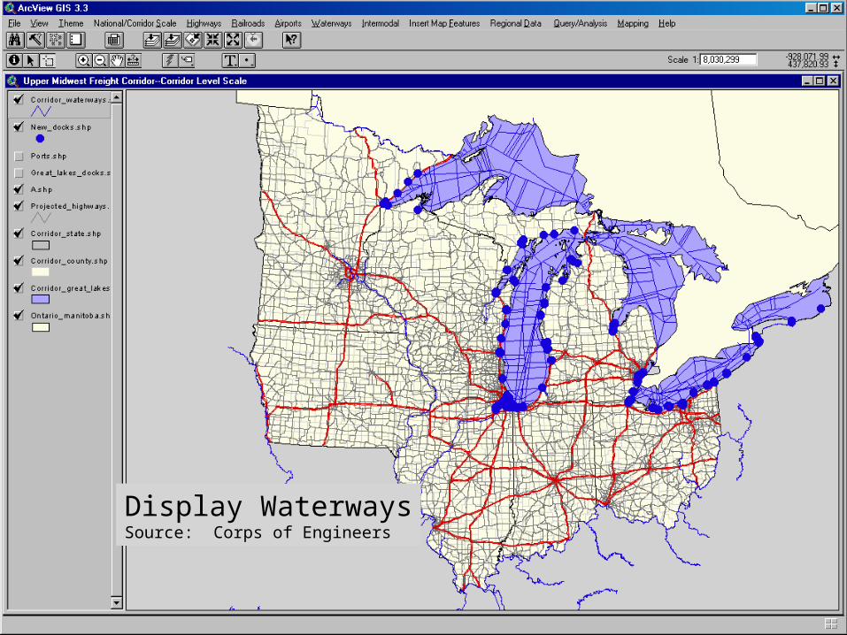
Display WaterwaysSource: Corps of Engineers

Highlight Flow Linesfrom FAF Data
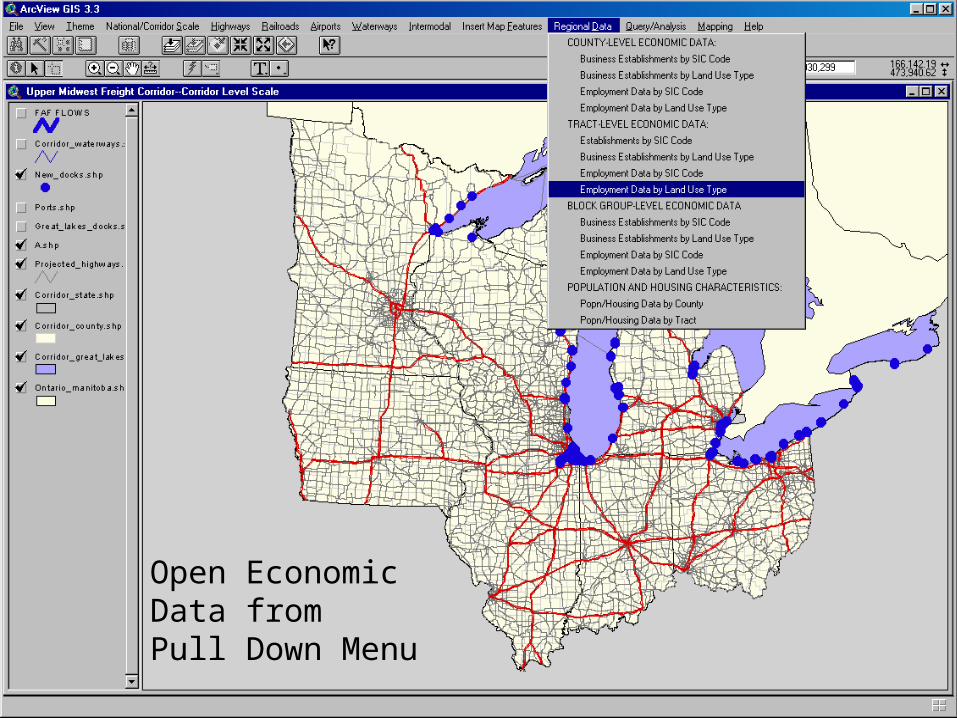
Open EconomicData fromPull Down Menu

ManufacturingEmployment, Docksand Highways
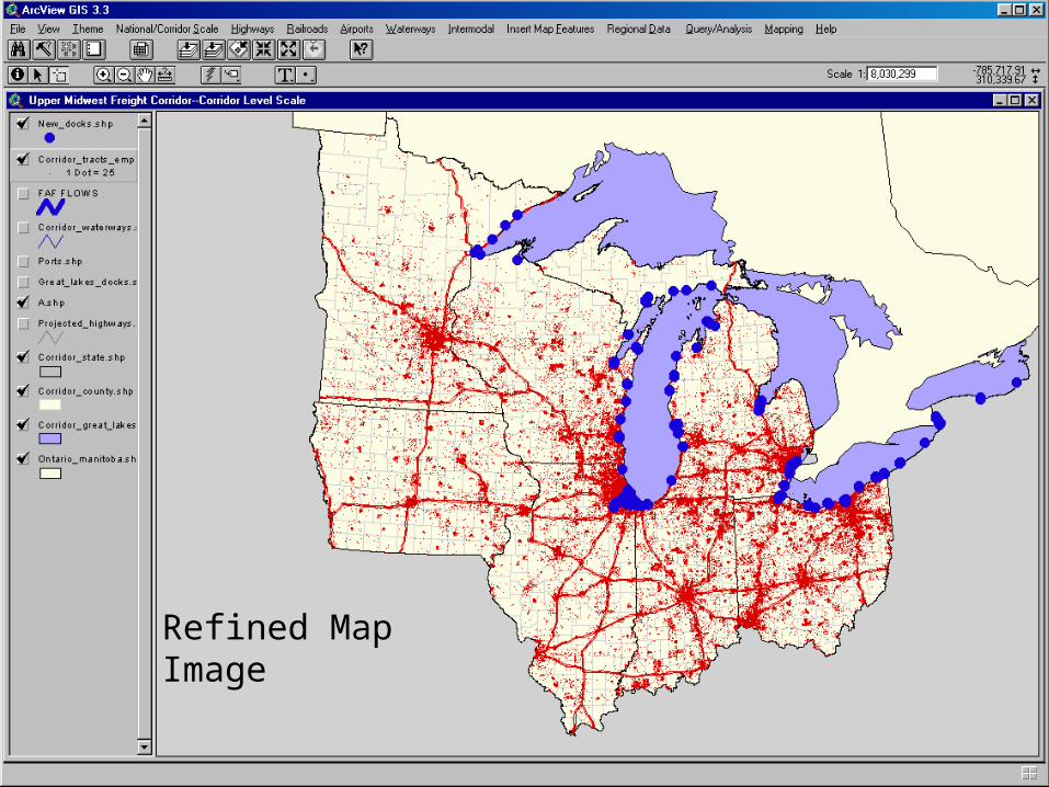
Refined Map Image
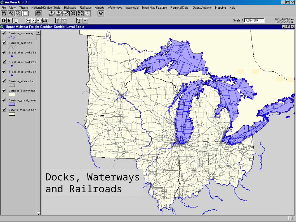
Docks, Waterwaysand Railroads
GREAT LAKESMARITIME IMFORMATION
DELIVERY SYSTEM
LOOKING AHEAD:
Continual Updating and Additions to Project Web Site
Future Meetings with Partners and industry Stakeholders
Data Collection, Management and Information Delivery Efforts to Continue
Pursue opportunities for adopting automated data acquisition technologies--including AIS
Promote regional economic development in the Great Lakes through support of maritime industry
Great Lakes Maritime Exchange (MISNA)
GREAT LAKESMARITIME IMFORMATION
DELIVERY SYSTEM
LOOKING AHEAD:Great Lakes Maritime Exchange (Affiliated with MISNA)
Advance Vessel Schedule Information including ETAs and ETDs
Actual Arrival and Departure Data
Advance and real-time vessel movement monitoring (AIS)
Vessel Traffic Analysis
Historical Vessel Movement
Port and Terminal Utilization Studies
Promote Maritime Interests (MISNA, 2006)
GREAT LAKESMARITIME IMFORMATION
DELIVERY SYSTEM
Thank you
Questions?
