presentation - commission on mountain cartography
TRANSCRIPT
Juan Ignacio GaleraLenk 14 February 2008
Mobile Mountain Cartography

14:44 2
Mobile Mountain Mapping
1. Introduction
2. La Mirada Circular
3. Mobile Mountain Cartography

14:44 3
Introduction
14:44 4
Introduction
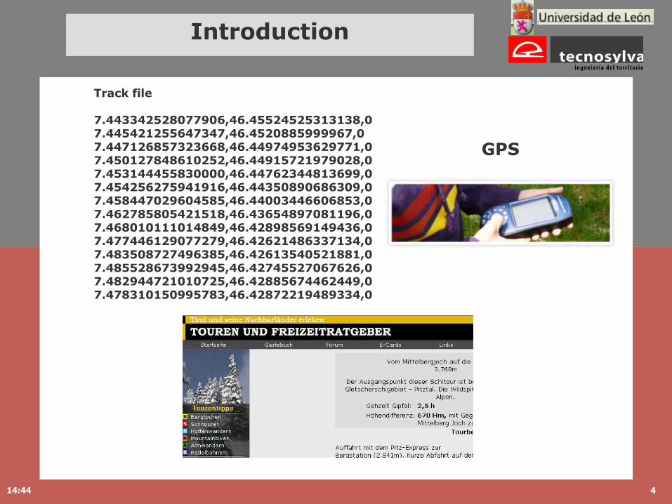
Track file
7.443342528077906,46.45524525313138,0 7.445421255647347,46.4520885999967,0 7.447126857323668,46.44974953629771,0 7.450127848610252,46.44915721979028,0 7.453144455830000,46.44762344813699,0 7.454256275941916,46.44350890686309,0 7.458447029604585,46.44003446606853,0 7.462785805421518,46.43654897081196,0 7.468010111014849,46.42898569149436,0 7.477446129077279,46.42621486337134,0 7.483508727496385,46.42613540521881,0 7.485528673992945,46.42745527067626,0 7.482944721010725,46.42885674462449,0 7.478310150995783,46.42872219489334,0
GPS

14:44 5
La Mirada Circular
1. Introduction
2. La Mirada Circular
3. Mobile Mountain Cartography
project of sustainable and intelligent tourism
14:44 6
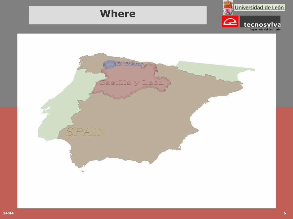
Where
14:44 7
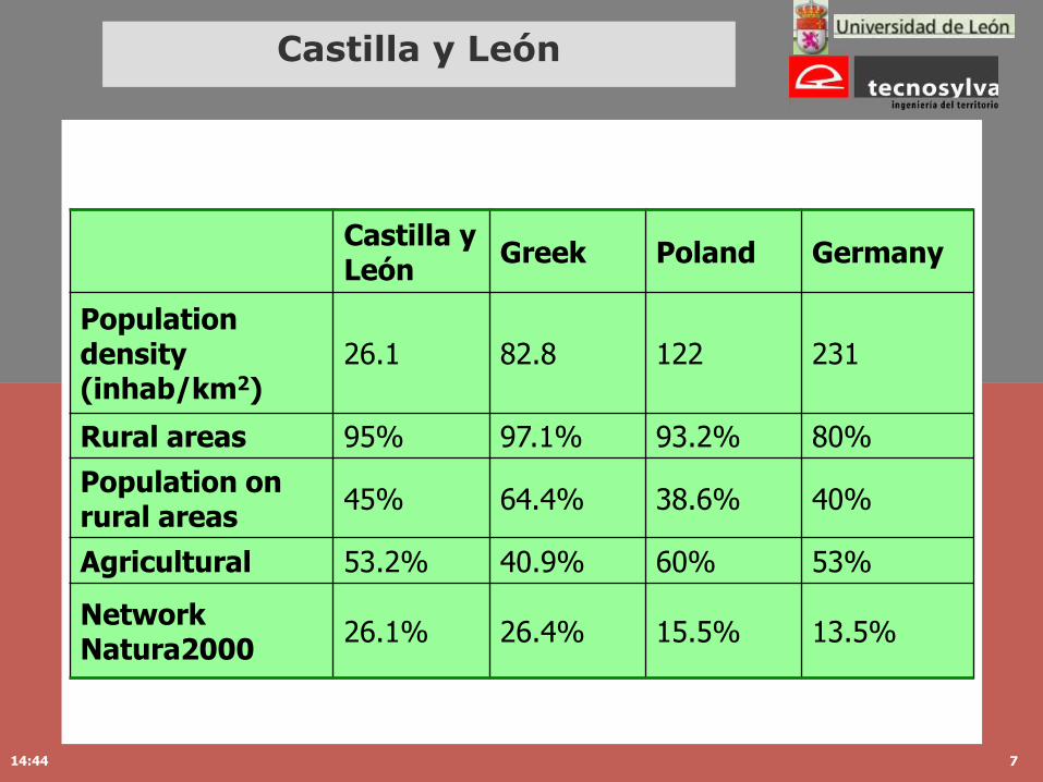
Castilla y León
Castilla y León
Greek Poland Germany
Population density (inhab/km2)
26.1 82.8 122 231
Rural areas 95% 97.1% 93.2% 80%
Population on rural areas
45% 64.4% 38.6% 40%
Agricultural 53.2% 40.9% 60% 53%
Network Natura2000
26.1% 26.4% 15.5% 13.5%
14:44 8
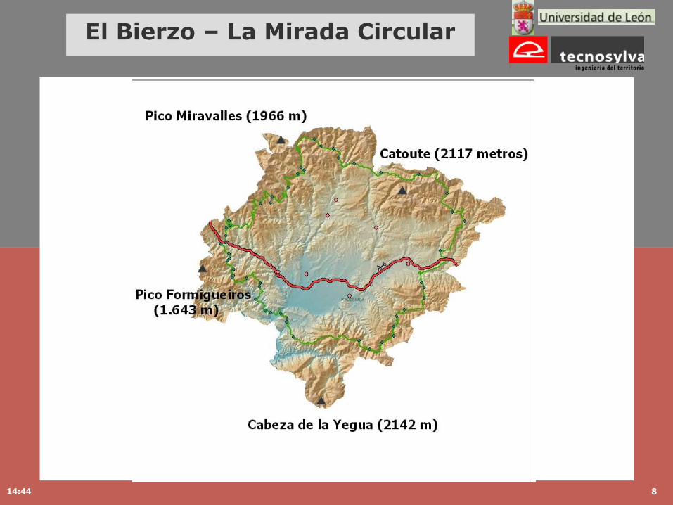
El Bierzo – La Mirada Circular

14:44 9
Traditional Village from El Bierzo
14:44 10
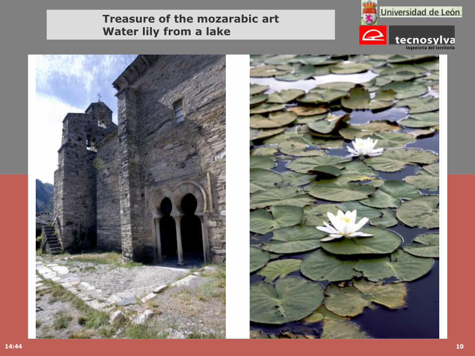
Treasure of the mozarabic artWater lily from a lake

14:44 11
Hippie and Ecological village
14:44 12
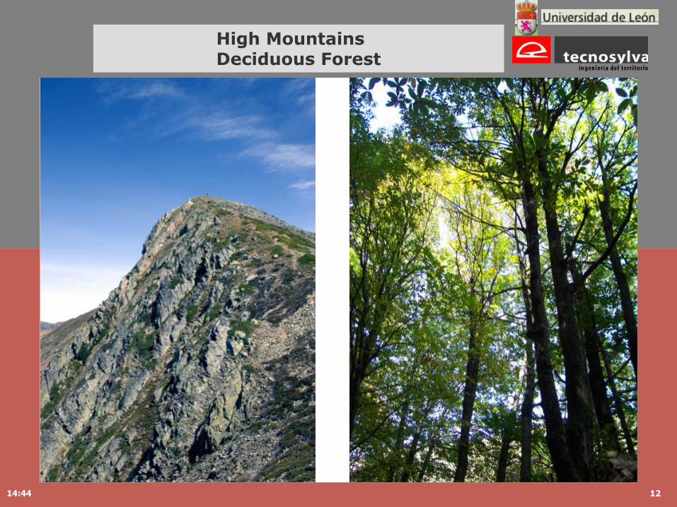
High Mountains Deciduous Forest

14:44 13
Mediterranean nature

14:44 14
Chestnut tree
14:44 15
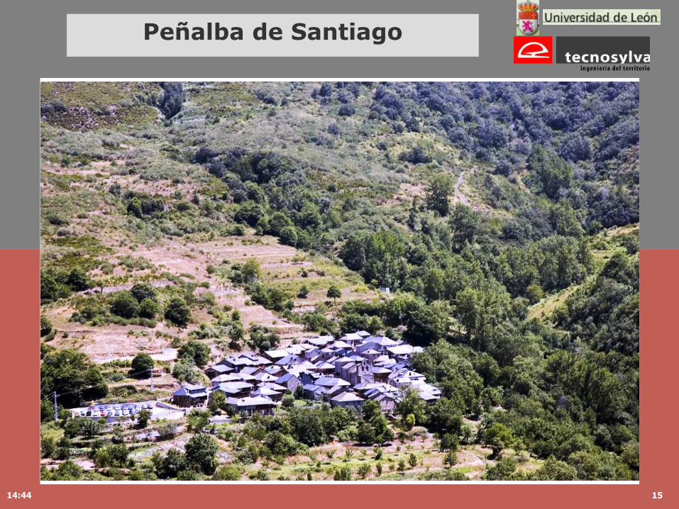
Peñalba de Santiago

TOURIST
Virtual Tourits Active Tourits
WEB-MAPPING MOBILE MAPPING
Travel on Internet:www.lamiradacircular.com
Territory,Activities-hobbies
context awareness
Rural Development
www.lamiradacircular.com

14:44 17
Mobile Cartography
1. Introduction
2. La Mirada Circular
3. Mobile Mountain Cartography

14:44 18
Printed – Digital – MobileCartography
Printed Cartography
Mobility
Location independent
Digital Cartography
QueriesSeamless Coverage
Interactive CommunicationsEasy maintenance
Information System with connection with a DB
Mobile Cartography
Positionable

14:44 19
Mobile Cartography
14:44 20
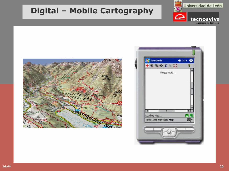
Digital – Mobile Cartography

14:44 21
Digital – Mobile Cartography
Generalisation is more objective: characteristics of map elements: takes into account scale and map purpose.
Adaptation is more subjective: relevant elements for the user: takes into account the context of the map usage (location, time, activities, and goals).
small display of cartography matter of map generalisation
with special constraints.
new display of cartography generalisation and adaptation are both process necessaries.
Reichenbacher, T (2004) Mobile Cartography – Adaptive Visualisation of Geographic Information on Mobile Devices. PhD Thesis.

Paper
Printed Cartography
CD-rom –Webmapping
Digital Cartography
PDA, GPS
Movile Cartography
Digital – Mobile Cartography
CARTOGRAPHYSEVER
Printed solutions
Web solutions
Mobile solutions
CD-ROM solutions

14:44 23
Mobile Mountain Devices
Video Triton
Printed Cartography
Digital Cartography
Mobile Cartography
Size 700 x 1000 mm 228 x 304 mm (15 inch)
1024 x 768 pixels
60 x 80 mm240x320 pixeles
Legend Limited Interactive Limited
Scale Fixed Scalable Scalable
Coverage Limited Seamless Seamless
Queries Unable Available Available
Processing / Battery
Independent Great capacity of processing / Electrical Energy.
Lack of processing power memory / Battery lifetime

14:44 24
Mobile Mountain scenarios
Scenario 1: Alpinist:Reinhold and Alex have just reached the summit of the Mont Blanc. They are really tired and, although in the morning it was a sunny, the evening has brought some clouds and it has started to rain. They can not see more than ten meters and from the top they can only feel themselves surrounded by precipices. Fortunately, they rent a GPS device with mobile cartography from the tourist information in Chamonix.
Scenario 2: FamilySusan and John have decided to spend a fortnight in Spain with their kids, Alice and the naughty Robert. They like very much walking and visiting rural areas. They fortunately meet a web page x , and since then they have been visiting and planning their vacations from home. They also bought the brand-new mobile phone with GPS and Windons CE to install all the digital cartography and store all the cultural, historical and events information about the region.
Scenario 3: OrganizationBirdlife Spain (conservation organisations that strives to conserve birds) has organized a meeting in the Pyrenees. They want to make and inventory of the night birds. Hundreds of volunteers will walk at night around the region in order to find as much birds as possible.
14:44 25
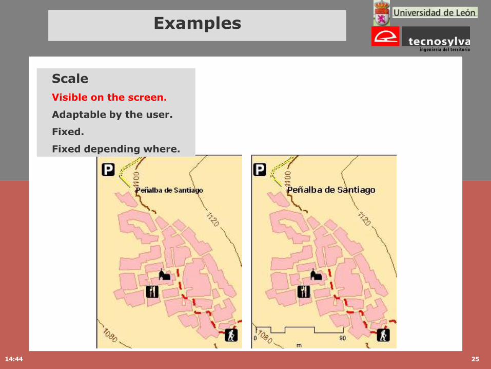
Examples
Scale
Visible on the screen.
Adaptable by the user.
Fixed.
Fixed depending where.

14:44 26
Examples
Scale
Visible on the screen.
Adaptable by the user.
Fixed.
Fixed depending where.

14:44 27
Examples
Hill shading for relief perception
Goals and direction

14:44 28
Examples
Contour lines
Label/without Label

14:44 29
Examples
Vegetation and level of generalisation

14:44 30
Examples
POI (Points of Interest)
Sounds, musics.
Animations.

Juan Ignacio Galera
Thank you all
for your attention